PDS logoPlanetary Data System
PDS Information
Find a Node - Use these links to navigate to any of the 8 publicly accessible PDS Nodes.

This bar indicates that you are within the PDS enterprise which includes 6 science discipline nodes and 2 support nodes which are overseen by the Project Management Office at NASA's Goddard Space Flight Center (GSFC). Each node is led by an expert in the subject discipline, supported by an advisory group of other practitioners of that discipline, and subject to selection and approval under a regular NASA Research Announcement.
Click here to return to the Photojournal Home Page Click here to view a list of Photojournal Image Galleries Photojournal_inner_header
Latest Images  |  Spacecraft & Technology  |  Animations  |  Space Images App  |  Feedback  |  Photojournal Search  
My Favorite Images from the Planetary Photojoural
I have 8 images in my list


The first time you select an image to My List, a separate browser window will open. This page will list the set of images you have selected as favorites from the Photojournal. This list is kept for a short period of time, approximately 60 days. The way we associate you with your list is through a persistent cookie left on your computer. This cookie is nothing more than a unique key that allows the Photojournal to make this association. Once created, this list is only modifiable from the same computer. Information stored in the cookie on your computer is used by the Photojournal server only during your session. If you configure your Web browser not to use cookies, you will not be able to create and refer back to a personal list of favorite images. To view your current list, click on a marked entry for your list from the catalog page, or add another favorite. For more information, see JPL's Privacy Policy.
My
List
Catalog # Target Mission Instrument Addition Date Size
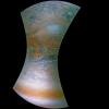
Remove Image from Favorite List PIA22420 Jupiter Juno
JunoCam
2018-05-09 1600x1600x3
This image NASA's Juno spacecraft captures the dynamic nature of Jupiter's northern temperate belt. The view reveals a white, oval-shaped anticyclonic storm called WS-4.
Title:
Jupiter's Dynamic Atmosphere
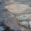
Remove Image from Favorite List PIA16445 Mars Mars Exploration Rover (MER)
Panoramic Camera
2012-11-12 1024x1024x3
A rind that appears bluish in this false-color view covers portions of the surface of a rock called 'Whitewater Lake' in the top half of the view from NASA's Mars Exploration Rover Opportunity.
Title:
'Whitewater Lake' Rock Viewed by Opportunity
Remove Image from Favorite List PIA06672 Earth Shuttle Radar Topography Mission (SRTM)
C-Band Imaging Radar
X-Band Radar
2005-03-16 6587x8336x3
The island of Ireland comprises a large central lowland of limestone with a relief of hills surrounded by a discontinuous border of coastal mountains which vary greatly in geological structure as seen by NASA's Shuttle Radar Topography Mission.
Title:
Ireland, Shaded Relief and Colored Height
Remove Image from Favorite List PIA26422 Europa Europa Clipper
2024-10-14 8272x6200x3
Mission members celebrate during the successful launch of NASA's Europa Clipper spacecraft on Oct. 14, 2024, in the Mission Support Area at NASA's Jet Propulsion Laboratory in Southern California.
Title:
Europa Clipper Launch Team at JPL's Mission Control
Remove Image from Favorite List PIA05608 Mars 2001 Mars Odyssey
THEMIS
2004-03-10 320x3600x1
This image from NASA's 2001 Mars Odyssey was collected October 19, 2002 during the northern spring season on Mars. In this image Korolev Crater and its surroundings are still frost covered.
Title:
Korolev Crater in Infrared
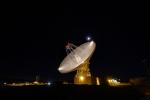
Remove Image from Favorite List PIA17792 Earth Goldstone Deep Space Network (DSN)
Goldstone Solar System Radar
2013-12-18 5184x3456x3
Goldstone's 230-foot (70-m) antenna tracks under a full moon. The Goldstone Deep Space Communications Complex is located in the Mojave Desert in California, USA.
Title:
Goldstone 70-m Antenna
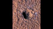
Remove Image from Favorite List PIA25583 Mars Mars Reconnaissance Orbiter (MRO)
HiRISE
2022-10-27 1920x1080x3
Boulder-size blocks of water ice can be seen around the rim of an impact crater on Mars. The crater was formed Dec. 24, 2021, by a meteoroid strike in the Amazonis Planitia region.
Title:
HiRISE Views a Mars Impact Crater Surrounded by Water Ice
Remove Image from Favorite List PIA22448 GRACE
2018-04-30 5562x3329x3
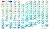
NASA's GRACE mission produced maps of anomalies in Earth's gravity field almost every month from April 2002 to June 2017.
Title:
Monthly GRACE Gravity Anomaly Maps