PDS logoPlanetary Data System
PDS Information
Find a Node - Use these links to navigate to any of the 8 publicly accessible PDS Nodes.

This bar indicates that you are within the PDS enterprise which includes 6 science discipline nodes and 2 support nodes which are overseen by the Project Management Office at NASA's Goddard Space Flight Center (GSFC). Each node is led by an expert in the subject discipline, supported by an advisory group of other practitioners of that discipline, and subject to selection and approval under a regular NASA Research Announcement.
Click here to return to the Photojournal Home Page Click here to view a list of Photojournal Image Galleries Photojournal_inner_header
Latest Images  |  Spacecraft & Technology  |  Animations  |  Space Images App  |  Feedback  |  Photojournal Search  
My Favorite Images from the Planetary Photojoural
I have 6 images in my list


The first time you select an image to My List, a separate browser window will open. This page will list the set of images you have selected as favorites from the Photojournal. This list is kept for a short period of time, approximately 60 days. The way we associate you with your list is through a persistent cookie left on your computer. This cookie is nothing more than a unique key that allows the Photojournal to make this association. Once created, this list is only modifiable from the same computer. Information stored in the cookie on your computer is used by the Photojournal server only during your session. If you configure your Web browser not to use cookies, you will not be able to create and refer back to a personal list of favorite images. To view your current list, click on a marked entry for your list from the catalog page, or add another favorite. For more information, see JPL's Privacy Policy.
My
List
Catalog # Target Mission Instrument Addition Date Size
Remove Image from Favorite List PIA00558 Earth 2001 Mars Odyssey
THEMIS
2001-04-26 3000x1681x3
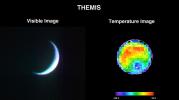
NASA's 2001 Mars Odyssey's Thermal Emission Imaging System (THEMIS) acquired these images of the Earth using its visible and infrared cameras as it left the Earth.
Title:
2001 Mars Odyssey Images Earth (Visible and Infrared)
Remove Image from Favorite List PIA04846 Mars 2001 Mars Odyssey
THEMIS
2003-11-05 1240x3043x1
This region of the cratered highlands looks very ancient. A degraded channel snakes its way across the scene and enters what may be an older crater. This image was captured by NASA's Mars Odyssey spacecraft in November 2003.
Title:
Battered Terrain of Amenthes
Remove Image from Favorite List PIA10112 Earth Terra
ASTER
2007-11-08 3000x5002x3
The October 2007 wildfires, including the Witch Wildland fire, plagued southern California and were some of the worst on record. Image from NASA's Terra satellite.
Title:
Witch Wildland Fire, California
Remove Image from Favorite List PIA08050 Mars Mars Reconnaissance Orbiter (MRO)
HiRISE
2006-04-07 6045x23024x1
Sample of Mid-latitude Southern Highlands
Title:
Sample of Mid-latitude Southern Highlands
Remove Image from Favorite List PIA04304 Mars Viking
Visual Imaging Subsystem - Camera A
2003-02-05 2024x1919x3
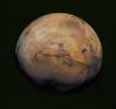
This mosaic of Mars is a compilation of images captured by NASA's Viking Orbiter 1. The center of the scene shows the entire Valles Marineris canyon system, over 3,000 km long and up to 8 km deep, extending from Noctis Labyrinthus.
Title:
The Target
Remove Image from Favorite List PIA22360 Sol (our sun) SDO
Atmosphere Imaging Assembly
2018-04-02 1800x1800x3
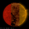
NASA's Solar Dynamics Observatory ran together three sequences of the sun taken in three different extreme ultraviolet wavelengths to show how different features appearing in one sequence are difficult to see in the others (Mar. 20-21, 2018).
Title:
Wavelength Comparisons Animation Icon