
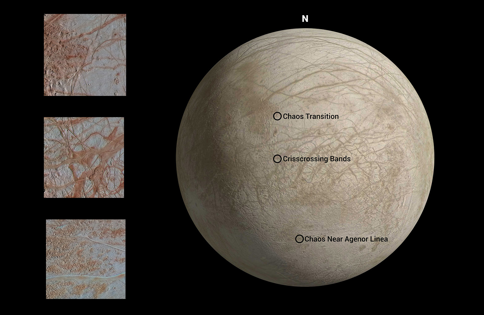
Figure 1The surface of Jupiter's moon Europa features a widely varied landscape, including ridges, bands, small rounded domes and disrupted spaces that geologists called "chaos terrain." This newly reprocessed image, along with two others along the same longitude (see PIA23871 and PIA23872), were taken by NASA's Galileo spacecraft on Sept. 26, 1998, and reveal details of diverse surface features on Europa.
All three images were captured along the same longitude of Europa as Galileo flew by on Sept. 26, 1998, in the spacecraft's 17th orbit of Jupiter (orbit E17). It was the eighth of Galileo's 11 targeted flybys of Europa. High-resolution images were taken through a clear filter in grayscale (black and white). Using lower-resolution, color images of the same region from a different flyby (orbit E14), technicians recently mapped color onto the higher-resolution images.
(Orbit E14 resulted in this global view of Europa (see PIA19048). The color information gathered on that flyby was used to reprocess these new images.)
Enhanced-color images like these allow scientists to highlight geologic features with different colors, which are related to chemical compositions of the surface. Areas that appear light blue or white are made up of relatively pure water ice, and reddish areas have more non-ice materials.
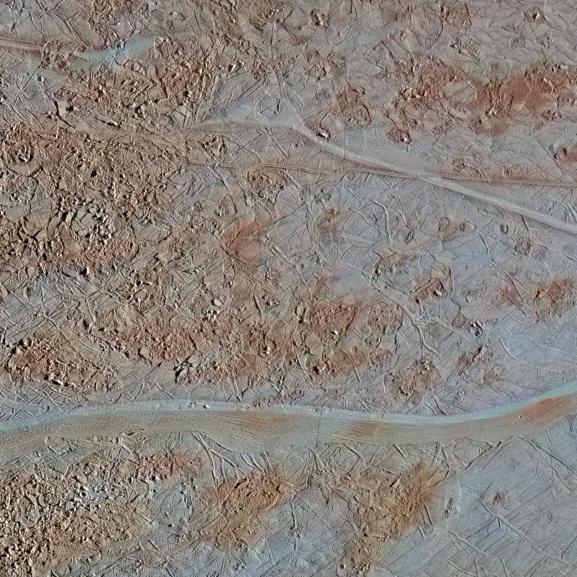
This image shows a region of blocky chaos terrain, where the surface has broken apart into many smaller chaos blocks that are surrounded by featureless matrix material. Many of the chaos blocks have moved sideways, rotated, or tilted before being refrozen into their new locations, and some larger blocks preserve features of the pre-existing terrain before it was broken up. Using these features as clues, scientists have been able to reconstruct some chaos regions like jjgsaw puzzles to track the motion of blocks.
Cutting through the chaos terrain near the bottom, from left to right, is a broad flat band. Called Agenor Linea, it is one of the longest bands on Europa and is distinctive for its two-color appearance, with a bright region at the top and a darker region below. Another rare bright band, Katreus Linea, cuts across the top portion of this image.
The image resolution is 243 yards (222 meters) per pixel, and this image depicts an area about 170 miles (280 kilometers) across.
This image was produced by Mario Valenti at the SETI Institute in Mountain View, Calif.
Figure 1 indicates the locations on Europa depicted in the newly processed images, with Chaos Near Agenor Linea shown at bottom. This image is centered approximately at -40.7 degrees south latitude, and 142.4 degrees east positive longitude.
The Galileo mission was managed by NASA's Jet Propulsion Laboratory, a division of Caltech in Pasadena, California, for NASA's Science Mission Directorate in Washington. Additional information about Galileo and its discoveries is available on the Galileo mission home page at http://solarsystem.nasa.gov/galileo/.
More information about Europa and Europa Clipper is available at europa.nasa.gov.
 Planetary Data System


