
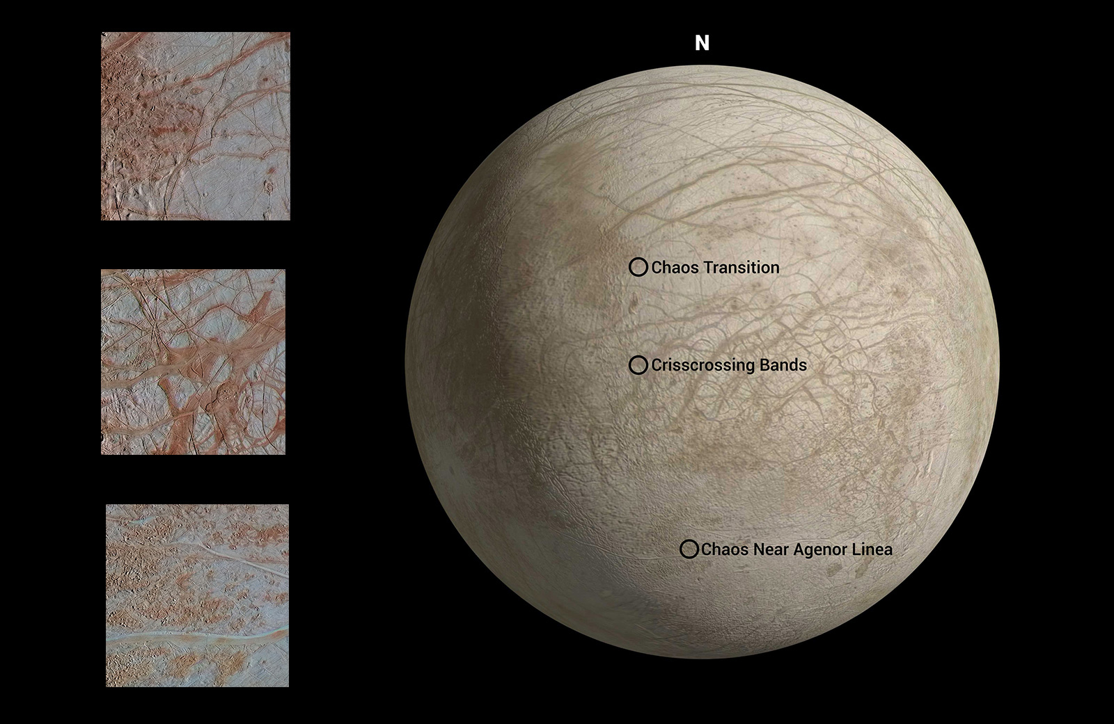
Figure 1The surface of Jupiter's moon Europa features a widely varied landscape, including ridges, bands, small rounded domes and disrupted spaces that geologists called "chaos terrain." This newly reprocessed image, along with two others along the same longitude (see PIA23872 and PIA23873), were taken by NASA's Galileo spacecraft on Sept. 26, 1998, and reveal details of diverse surface features on Europa.
All three images were captured along the same longitude of Europa as Galileo flew by on Sept. 26, 1998, in the spacecraft's 17th orbit of Jupiter (orbit E17). It was the eighth of Galileo's 11 targeted flybys of Europa. High-resolution images were taken through a clear filter in grayscale (black and white). Using lower-resolution, color images of the same region from a different flyby (orbit E14), technicians recently mapped color onto the higher-resolution images.
(Orbit E14 resulted in this global view of Europa (see PIA19048). The color information gathered on that flyby was used to reprocess these new images.)
Enhanced-color images like these allow scientists to highlight geologic features with different colors, which are related to chemical compositions of the surface. Areas that appear light blue or white are made up of relatively pure water ice, and reddish areas have more non-ice materials.
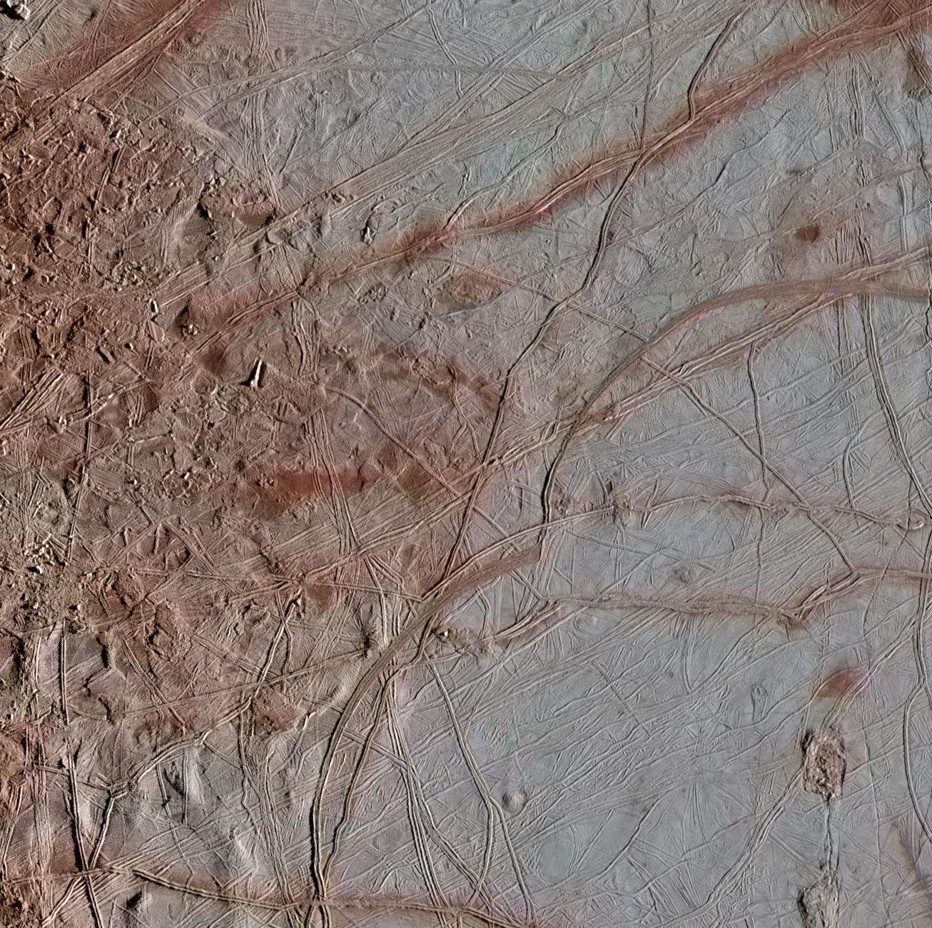
This image shows a transitional location between blocky chaos terrain, on the left, and ridged plains on the right. A few chaos blocks are visible on the left as individually broken and rotated pieces of preexisting surface material; their shadows indicate that some of these blocks have tilted as well. A ridge passes through the center of this image. These ridges, which contain arc-shaped segments joined together by a series of cusps, may be related to how the icy surface crust of Europa fractures when subjected to stresses from Jupiter's strong gravity. The right side of this image shows a few lenticulae, which are small rounded surface features, commonly domed in appearance.
The image resolution is 247 yards (226 meters per pixel, and this image depicts an area about 180 miles (300 kilometers) across.
The image was produced by Mario Valenti at the SETI Institute in Mountain View, Calif.
Figure 1 indicates the locations on Europa depicted in the newly processed images, with Chaos Transition at top. This image is centered approximately at 6.4 degrees north latitude, and 135.3 degrees east positive longitude.
The Galileo mission was managed by NASA's Jet Propulsion Laboratory, a division of Caltech in Pasadena, California, for NASA's Science Mission Directorate in Washington. Additional information about Galileo and its discoveries is available on the Galileo mission home page at http://solarsystem.nasa.gov/galileo/.
More information about Europa and Europa Clipper is available at europa.nasa.gov.
 Planetary Data System


