Your search criteria found
26
images
Target is Mars (and available satellites)
Go to PIAxxxxx:
Refine this list of images by:
Instrument:
High Resolution Imaging Science Experiment (HiRISE)
Mars Hand Lens Imager (MAHLI)
Mastcam
Navigation Camera (MSL)
Click on an image for detailed information
Click on a column heading to sort in ascending or descending order
My
List
Addition Date
Target
Mission
Instrument
Size
2016-12-13
Mars
Mars Science Laboratory (MSL)
ChemCam
Mastcam
2399x974x3
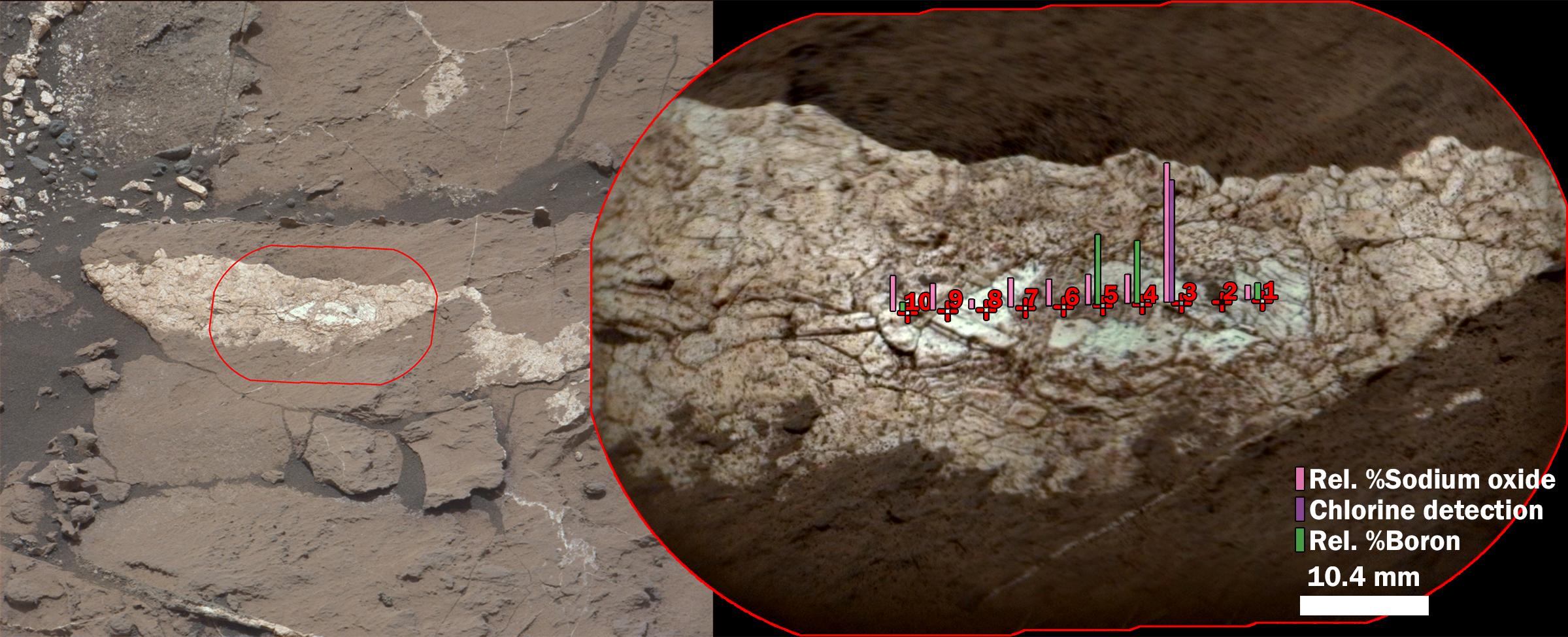
PIA21252:
Boron, Sodium and Chlorine in Mineral Vein 'Diyogha,' Mars
Full Resolution:
TIFF
(6.453 MB)
JPEG
(339.6 kB)
2016-12-13
Mars
Mars Science Laboratory (MSL)
ChemCam
Mastcam
1996x1758x3
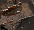
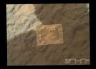
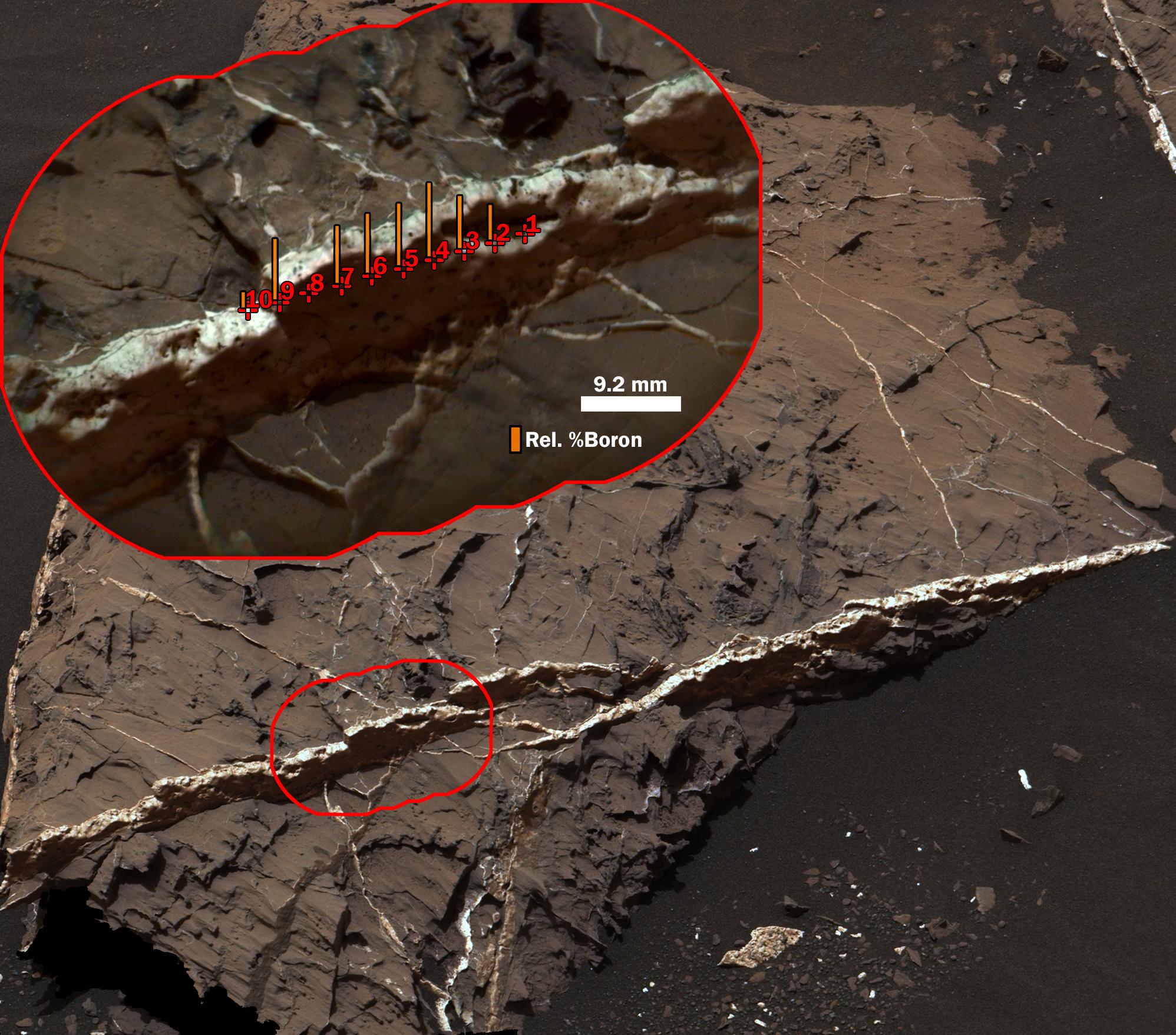
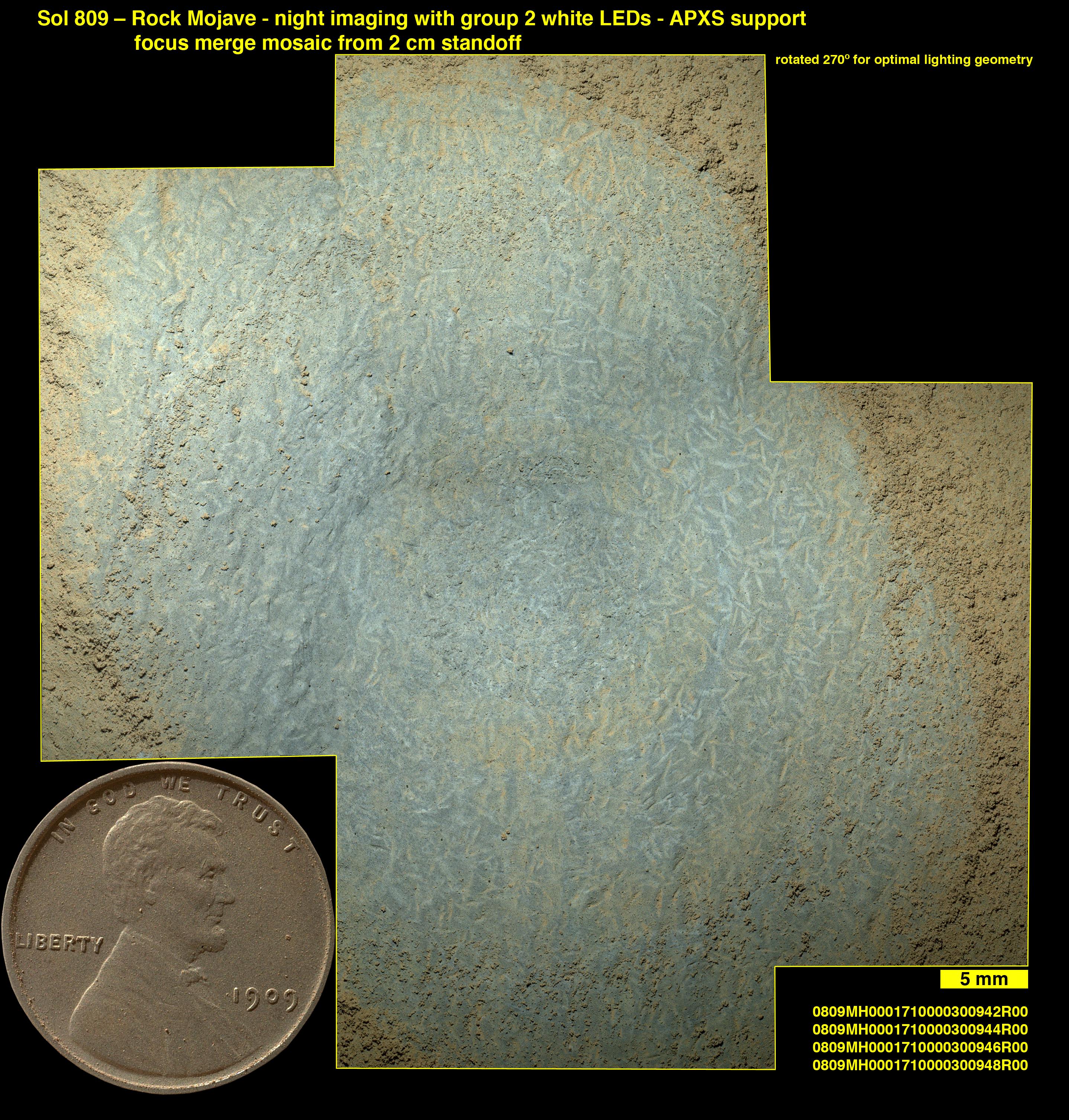
PIA21251:
Boron in Calcium Sulfate Vein at 'Catabola,' Mars
Full Resolution:
TIFF
(9.623 MB)
JPEG
(465.6 kB)
2016-12-13
Mars
Mars Reconnaissance Orbiter (MRO)
Mars Science Laboratory (MSL)
ChemCam
HiRISE
2809x2025x3
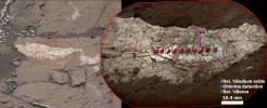
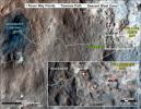
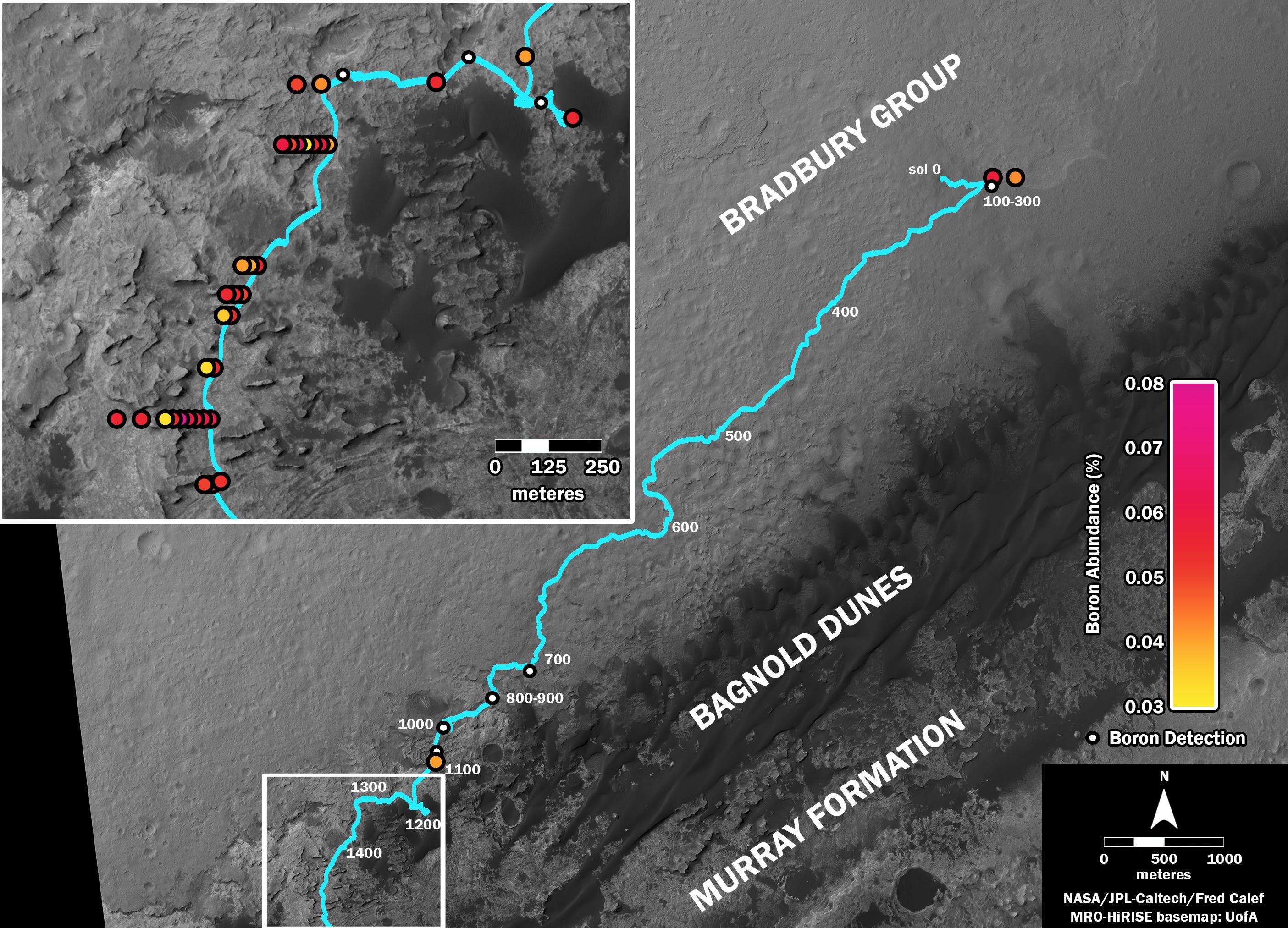
PIA21150:
Where's Boron? Mars Rover Detects It
Full Resolution:
TIFF
(7.738 MB)
JPEG
(838.4 kB)
2016-12-13
Mars
Mars Reconnaissance Orbiter (MRO)
Mars Science Laboratory (MSL)
HiRISE
1456x1125x3
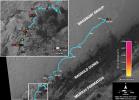
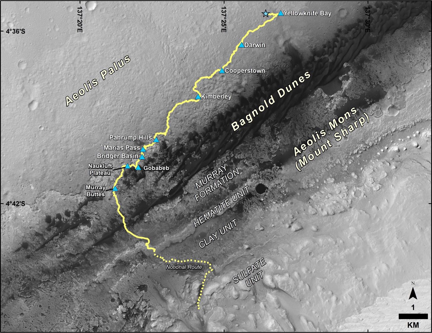
PIA21144:
Late 2016 Map of NASA's Curiosity Mars Rover Mission
Full Resolution:
TIFF
(2.946 MB)
JPEG
(288 kB)
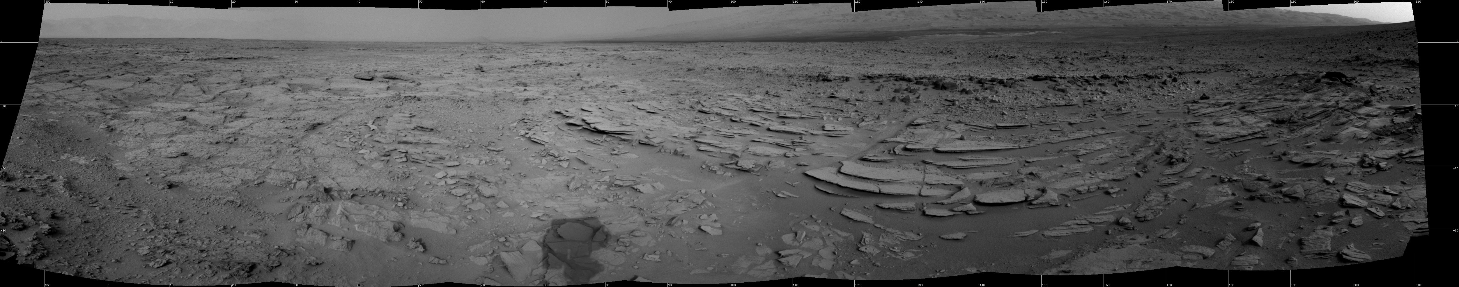
2015-07-01
Mars
Mars Science Laboratory (MSL)
Navcam (MSL)
7729x2563x1
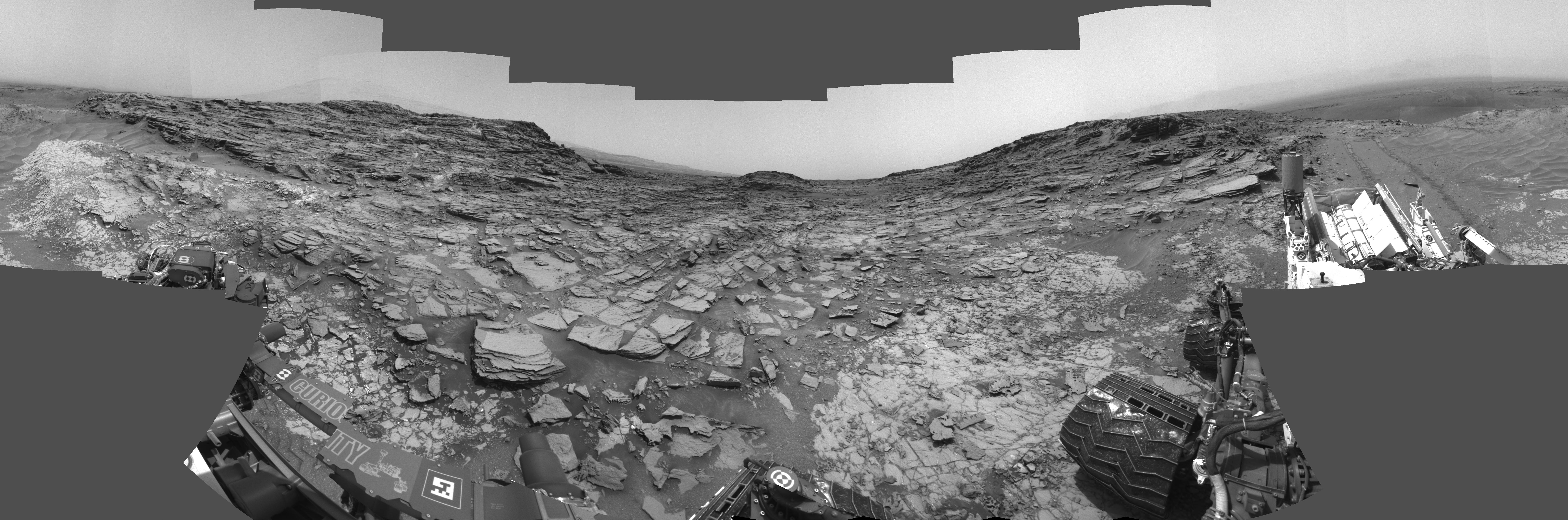
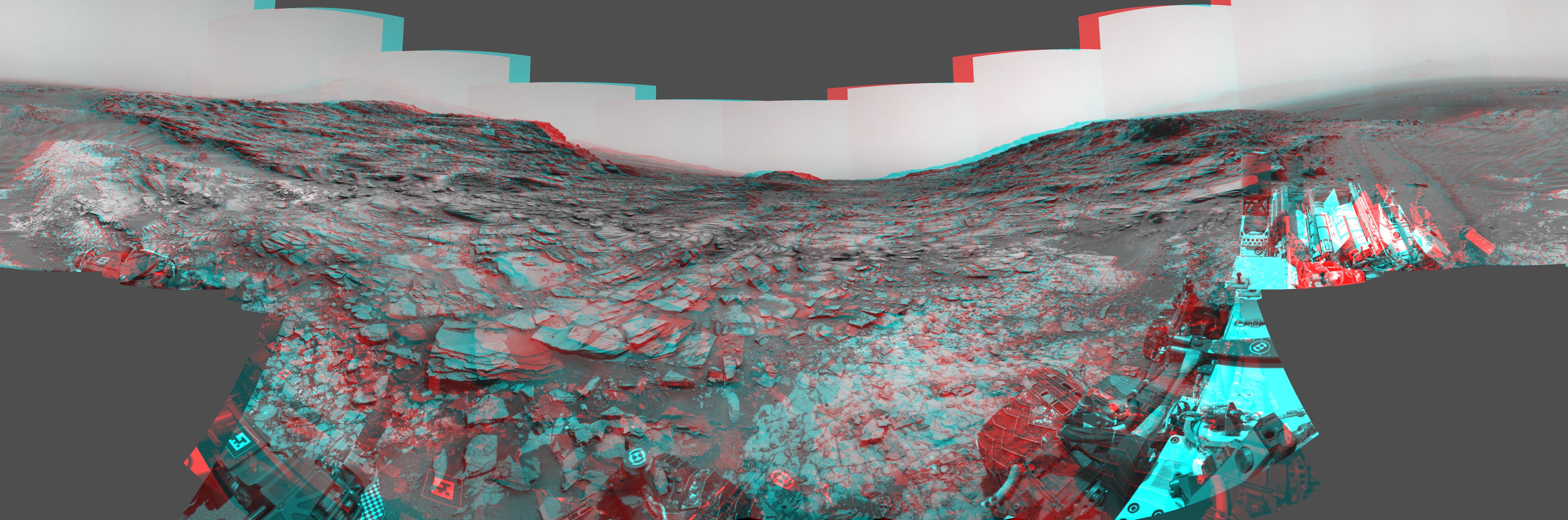
PIA19679:
Panorama from Curiosity's Sol 1000 Location
Full Resolution:
TIFF
(19.83 MB)
JPEG
(2.221 MB)
2015-07-01
Mars
Mars Science Laboratory (MSL)
Navcam (MSL)
7729x2563x3
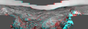
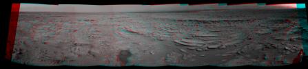
PIA19678:
Panorama from Curiosity's Sol 1000 Location (Stereo)
Full Resolution:
TIFF
(59.45 MB)
JPEG
(2.315 MB)
2015-07-01
Mars
Mars Science Laboratory (MSL)
MAHLI
1584x1184x3
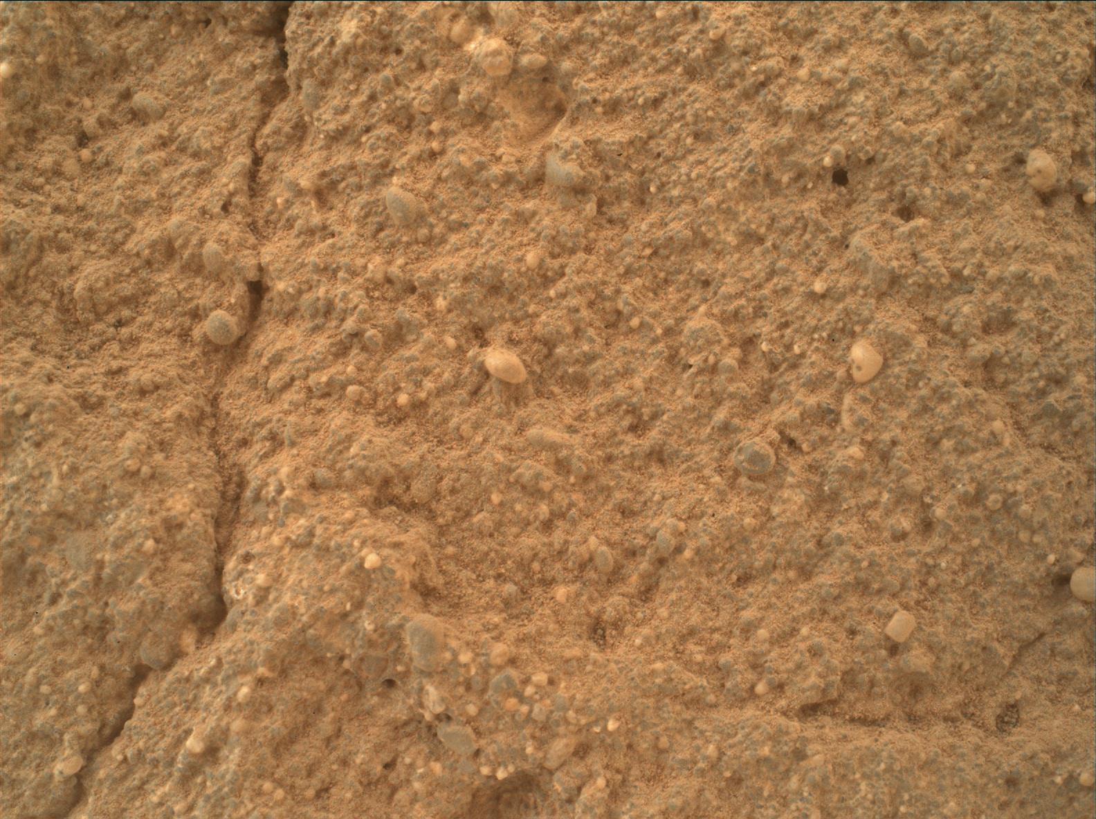
PIA19677:
Diverse Grains in Mars Sandstone Target 'Big Arm'
Full Resolution:
TIFF
(5.628 MB)
JPEG
(332.3 kB)
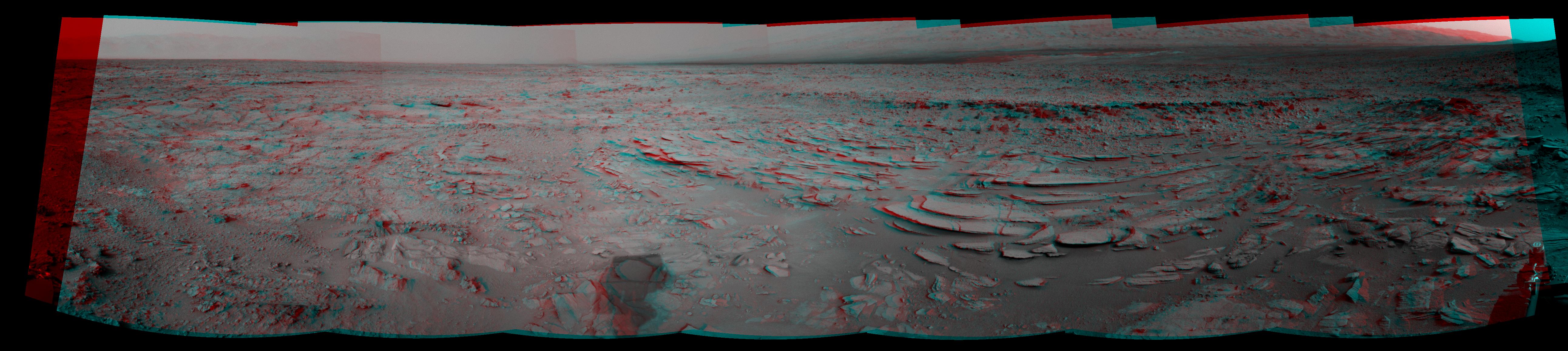
2015-07-01
Mars
Mars Science Laboratory (MSL)
Mastcam
3946x2455x3
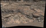
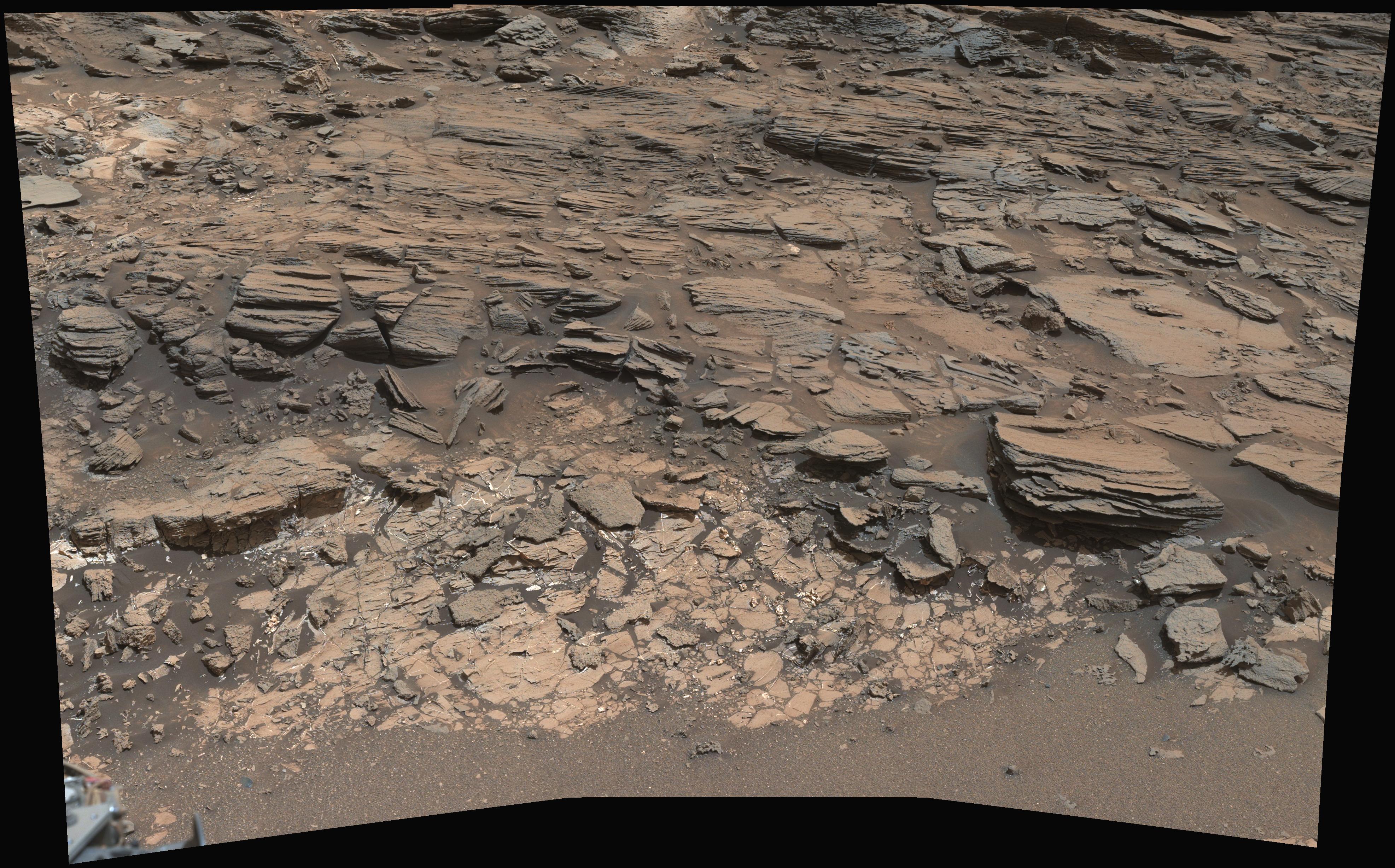
PIA19676:
Geological Contact Zone Near 'Marias Pass' on Mars
Full Resolution:
TIFF
(29.07 MB)
JPEG
(1.592 MB)
2015-03-12
Mars
Mars Science Laboratory (MSL)
HiRISE
1138x711x3
PIA19148:
Curiosity Heading Away from 'Pahrump Hills'
Full Resolution:
TIFF
(2.428 MB)
JPEG
(125.3 kB)
2014-12-08
Mars
Mars Science Laboratory (MSL)
Mastcam
2350x1026x3
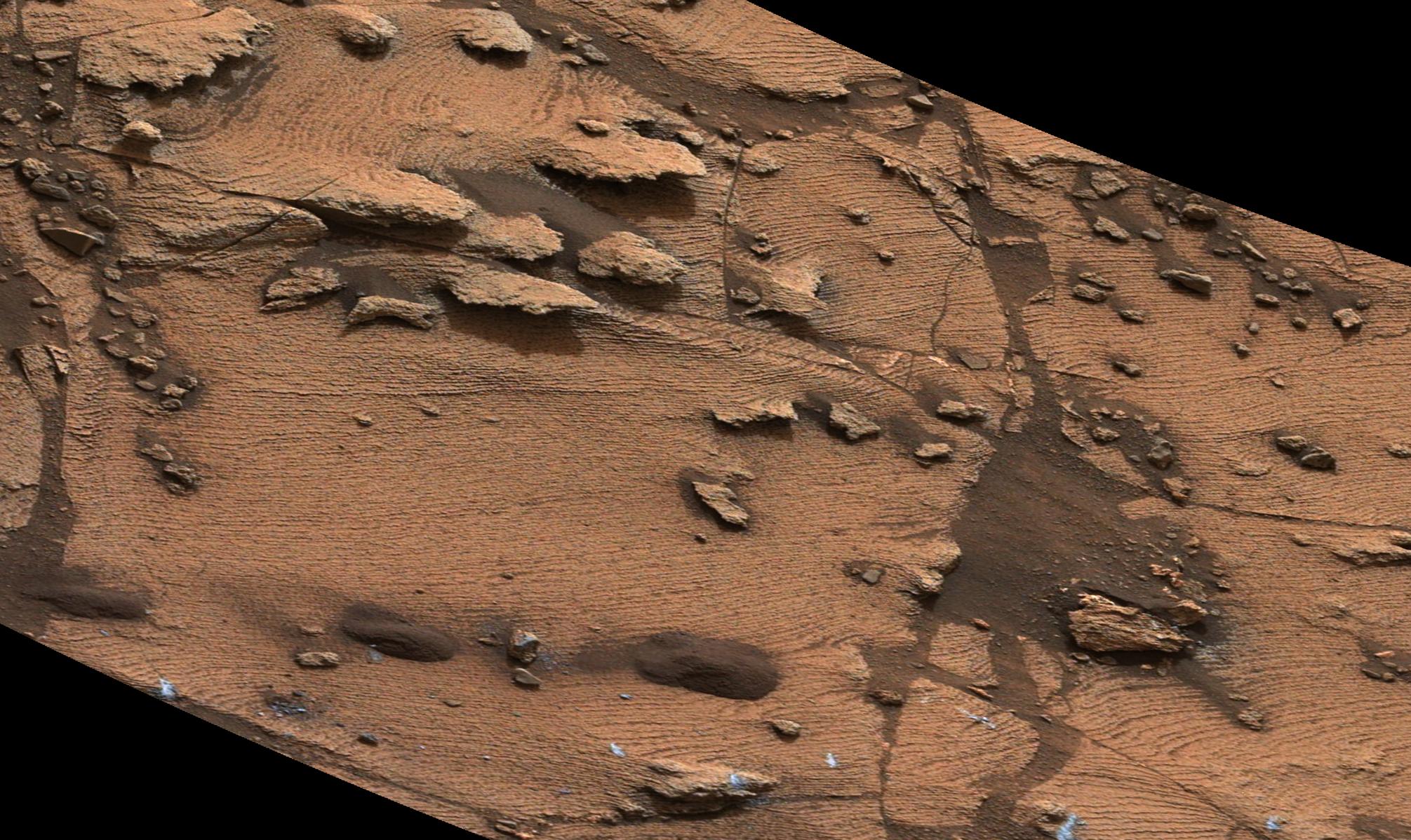
PIA19081:
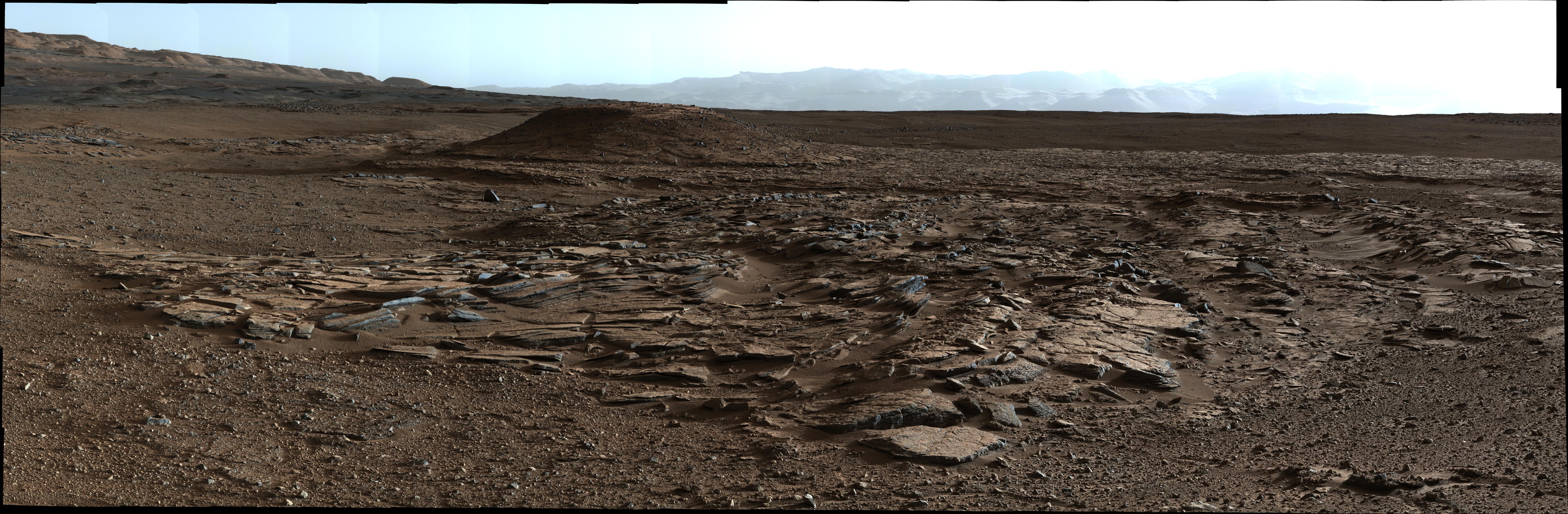
Martian Rock's Evidence of Lake Currents
Full Resolution:
TIFF
(7.236 MB)
JPEG
(399.7 kB)
2014-12-08
Mars
Mars Science Laboratory (MSL)
MAHLI
2876x3014x3
PIA19077:
Crystals May Have Formed in Drying Martian Lake
Full Resolution:
TIFF
(26.02 MB)
JPEG
(1.59 MB)
2014-12-08
Mars
Mars Science Laboratory (MSL)
Mastcam
4006x1929x3
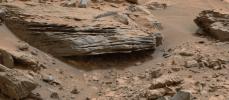
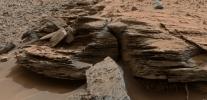
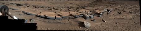
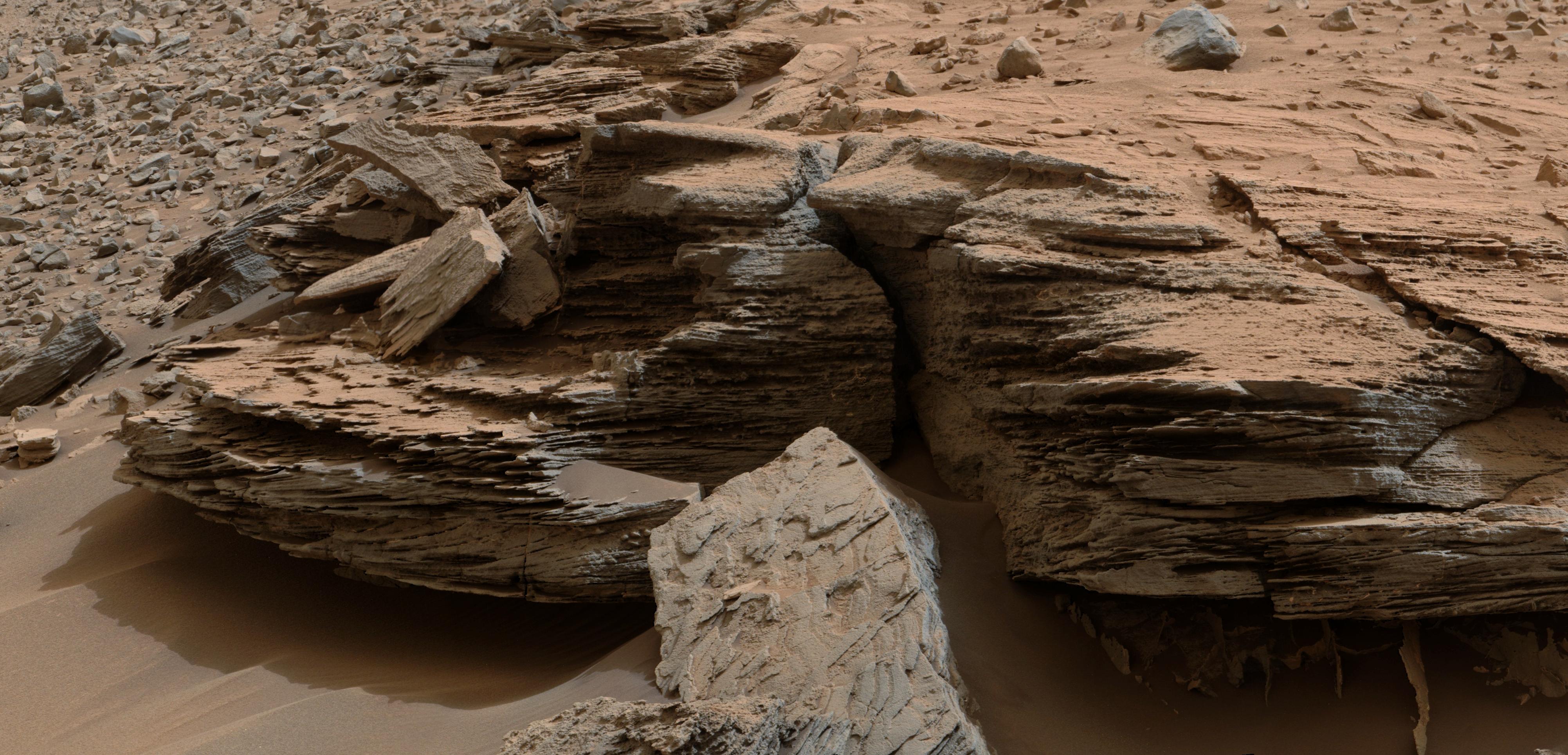
PIA19076:
Cross-Bedding at 'Whale Rock'
Full Resolution:
TIFF
(23.19 MB)
JPEG
(1.06 MB)
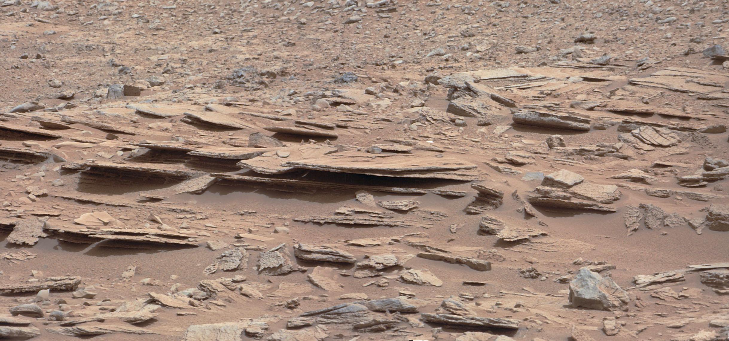
2014-12-08
Mars
Mars Science Laboratory (MSL)
Mastcam
2011x1198x3
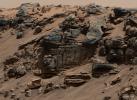
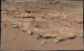
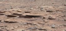
PIA19075:
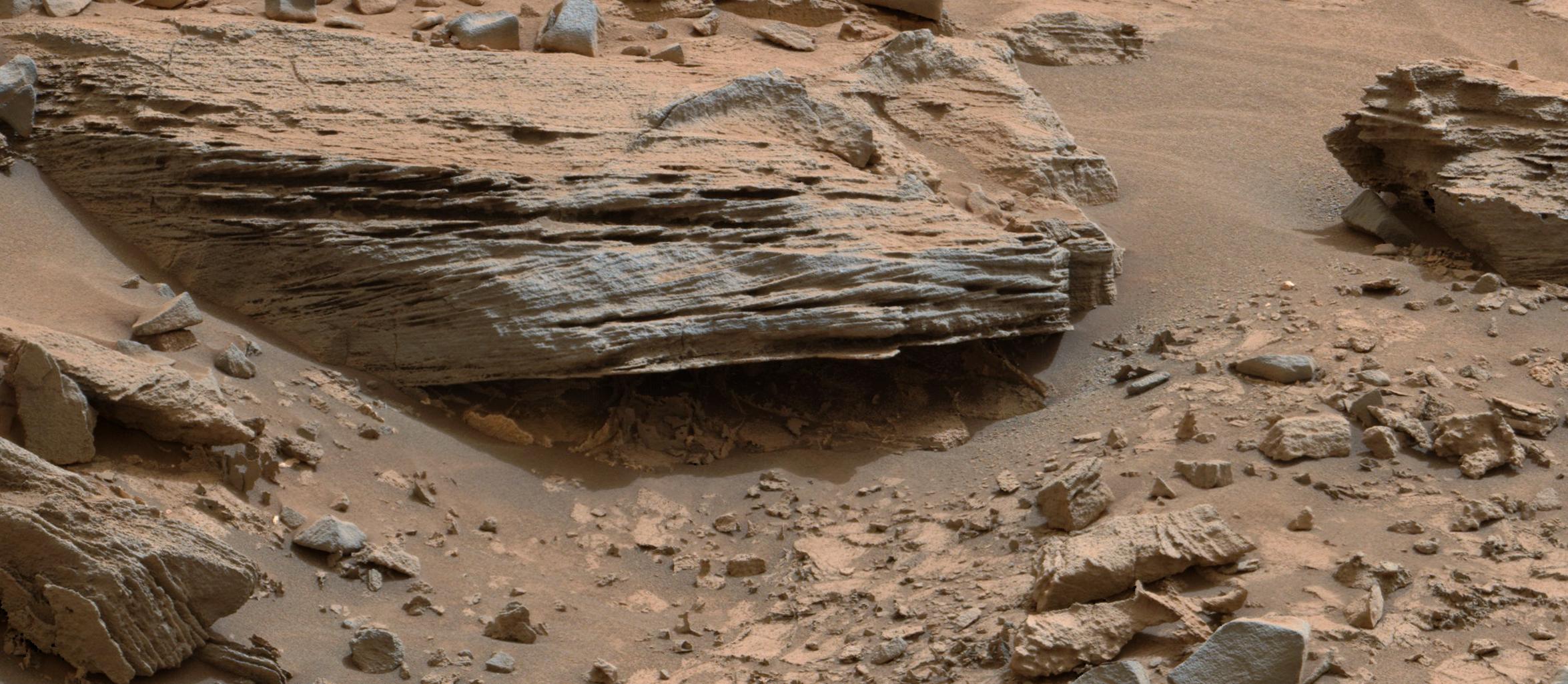
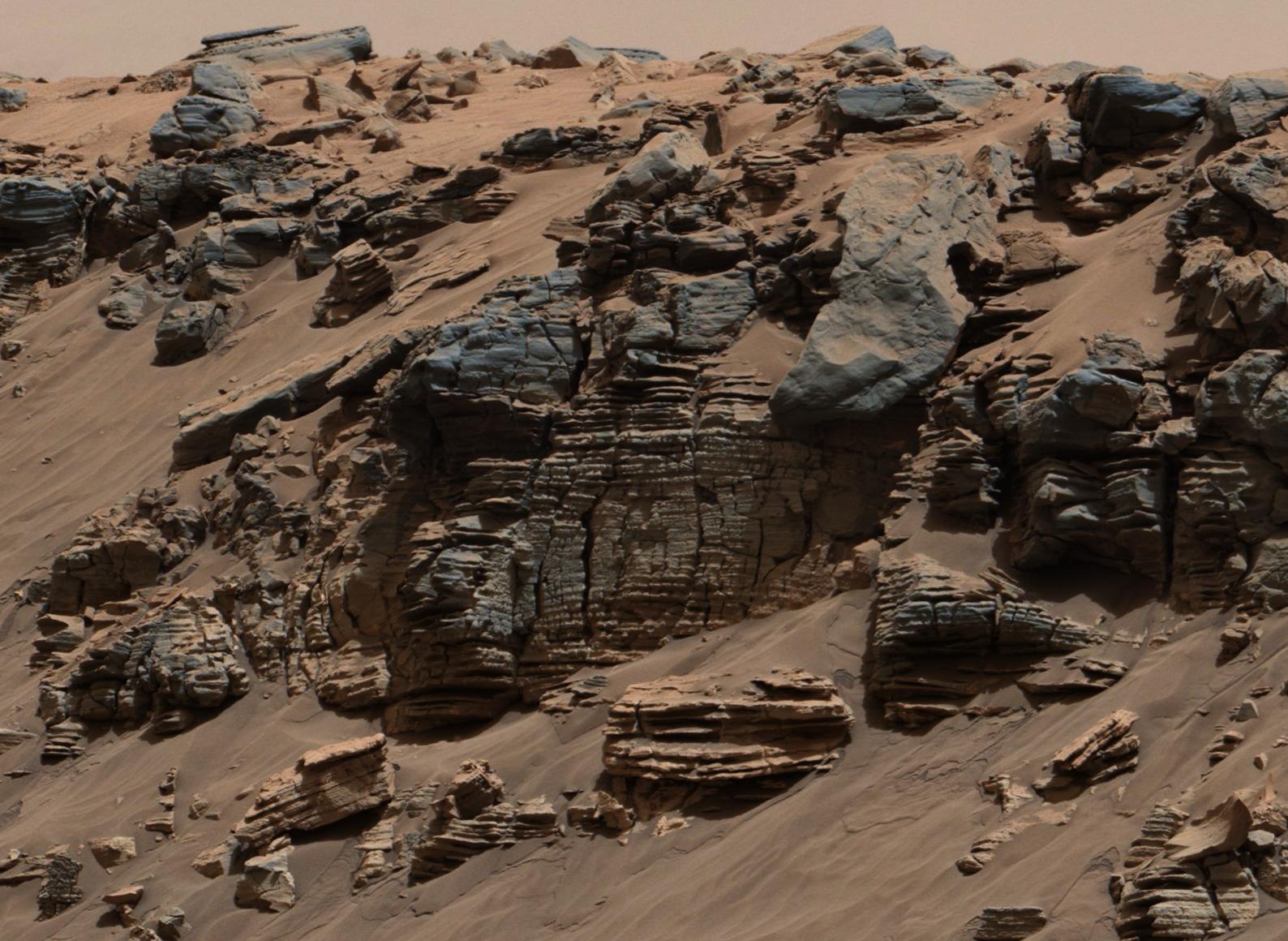
Thin-Laminated Rock in 'Pahrump Hills' Outcrop
Full Resolution:
TIFF
(7.23 MB)
JPEG
(448.2 kB)
2014-12-08
Mars
Mars Science Laboratory (MSL)
Mastcam
1588x1160x3
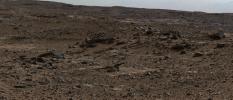
PIA19074:
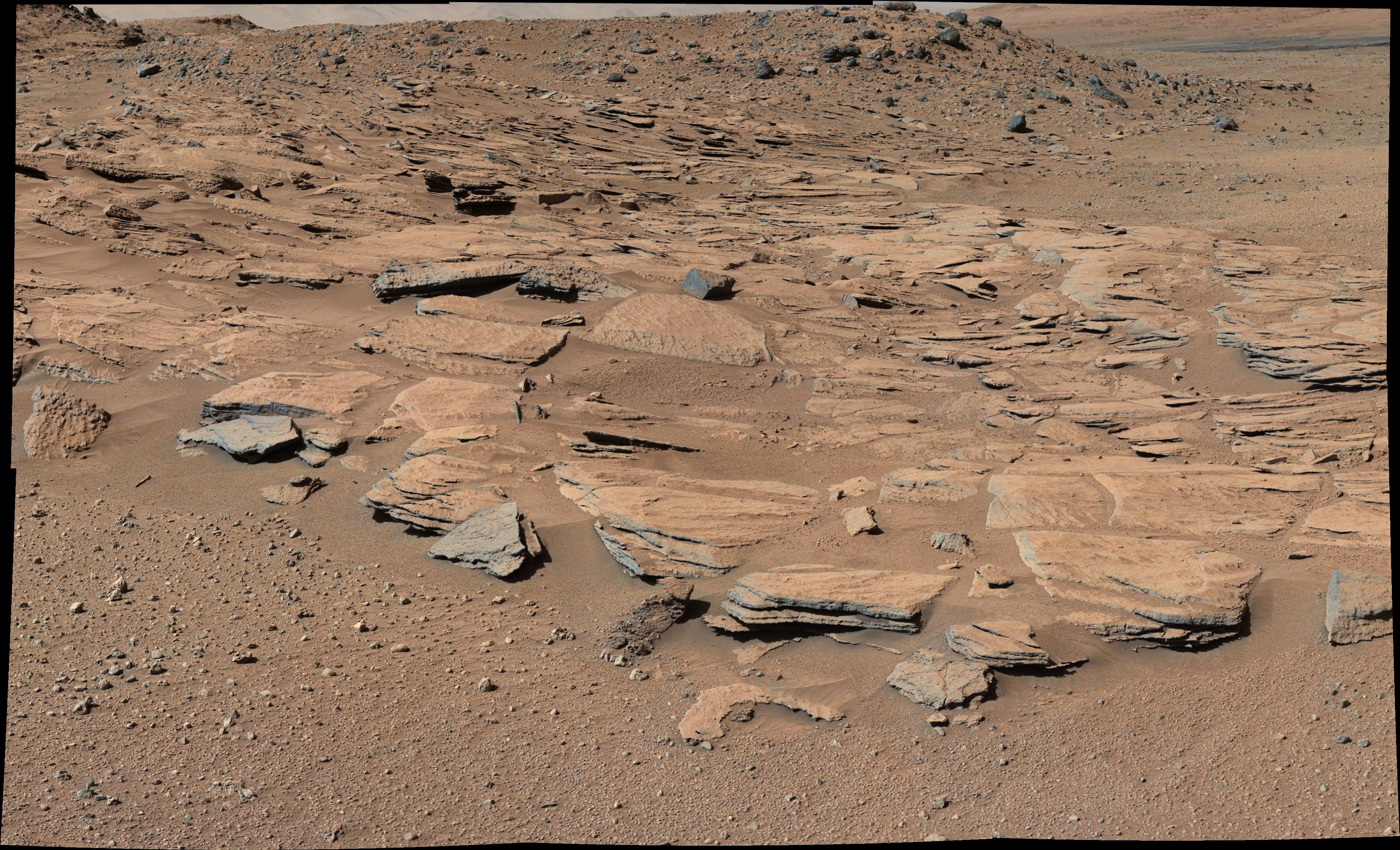
Sedimentary Signs of a Martian Lakebed
Full Resolution:
TIFF
(5.528 MB)
JPEG
(276.3 kB)
2014-12-08
Mars
Mars Science Laboratory (MSL)
Mastcam
2440x1049x3
PIA19072:
Sol 696 (July 22, 2014), Left
Full Resolution:
TIFF
(7.682 MB)
JPEG
(515.2 kB)
2014-12-08
Mars
Mars Science Laboratory (MSL)
Mastcam
6246x2048x3
PIA19070:
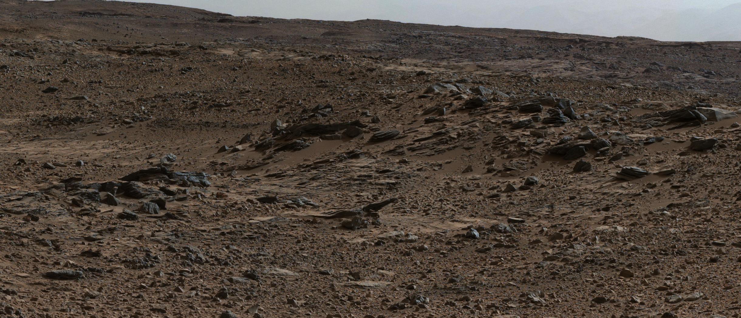
Sets of Beds Inclined Toward Mount Sharp
Full Resolution:
TIFF
(38.39 MB)
JPEG
(2.709 MB)
2014-12-08
Mars
Mars Science Laboratory (MSL)
Mastcam
4657x1024x3
PIA19069:
Bedding Pattern Interpreted as Martian Delta Deposition
Full Resolution:
TIFF
(14.31 MB)
JPEG
(1.16 MB)
2014-12-08
Mars
Mars Science Laboratory (MSL)
Mastcam
3619x2196x3
PIA19068:
Inclined Martian Sandstone Beds Near 'Kimberley'
Full Resolution:
TIFF
(23.85 MB)
JPEG
(1.665 MB)
2014-12-08
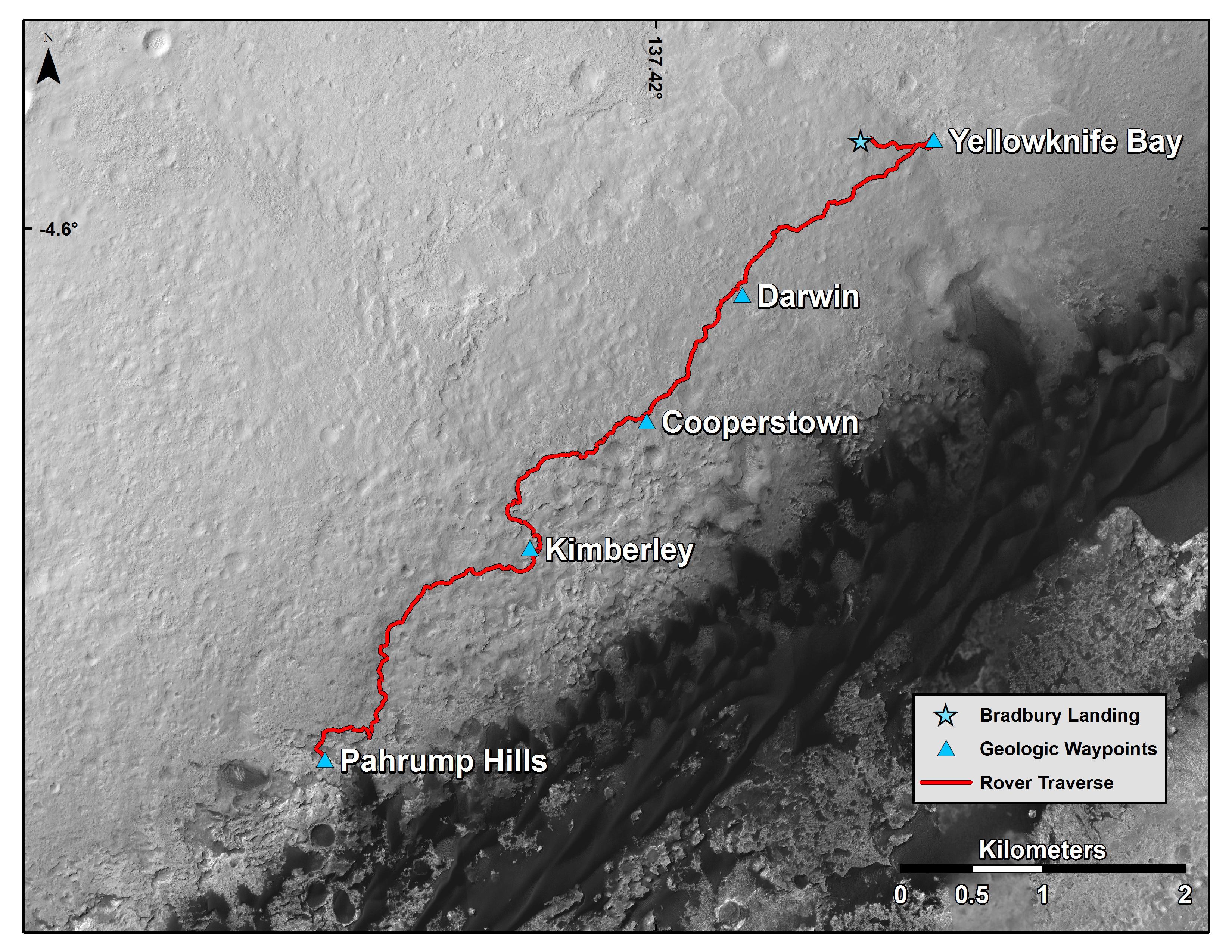
Mars
Mars Reconnaissance Orbiter (MRO)
Mars Science Laboratory (MSL)
HiRISE
3300x2550x3
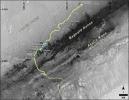
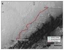
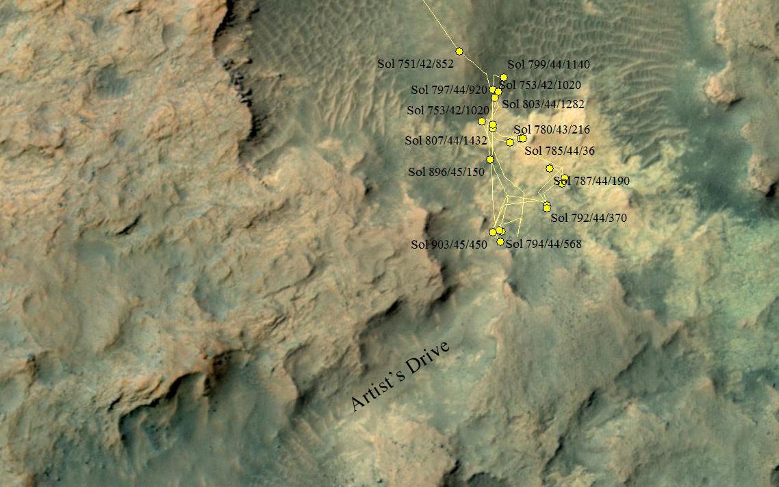
PIA19067:
Curiosity Mars Rover's Route from Landing to Base of Mount Sharp
Full Resolution:
TIFF
(25.26 MB)
JPEG
(1.381 MB)
2012-12-11
Mars
Mars Science Laboratory (MSL)
Navcam (MSL)
5168x1157x3
PIA16552:
Sol 120 Panorama from Curiosity, near 'Shaler' (Stereo)
Full Resolution:
TIFF
(17.95 MB)
JPEG
(728.3 kB)
2012-12-11
Mars
Mars Science Laboratory (MSL)
Navcam (MSL)
5012x988x1
PIA16551:
Sol 120 Panorama from Curiosity, near 'Shaler'
Full Resolution:
TIFF
(4.96 MB)
JPEG
(606.5 kB)
2012-12-11
Mars
Mars Science Laboratory (MSL)
Mastcam
2438x1141x3
PIA16550:
Layered Martian Outcrop 'Shaler' in 'Glenelg' Area
Full Resolution:
TIFF
(8.349 MB)
JPEG
(481.8 kB)
2012-12-11
Mars
Mars Reconnaissance Orbiter (MRO)
Mars Science Laboratory (MSL)
HiRISE
3300x2550x3
PIA16459:
Curiosity Traverse Map, Sol 123
Full Resolution:
TIFF
(25.26 MB)
JPEG
(1.748 MB)
2012-12-11
Mars
Mars Science Laboratory (MSL)
MAHLI
6710x4500x3
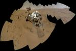
PIA16457:
Curiosity Self-Portrait, Wide View
Full Resolution:
TIFF
(90.62 MB)
JPEG
(2.278 MB)
2012-09-24
Mars
Mars Science Laboratory (MSL)
MAHLI
2700x1950x3
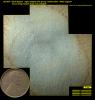
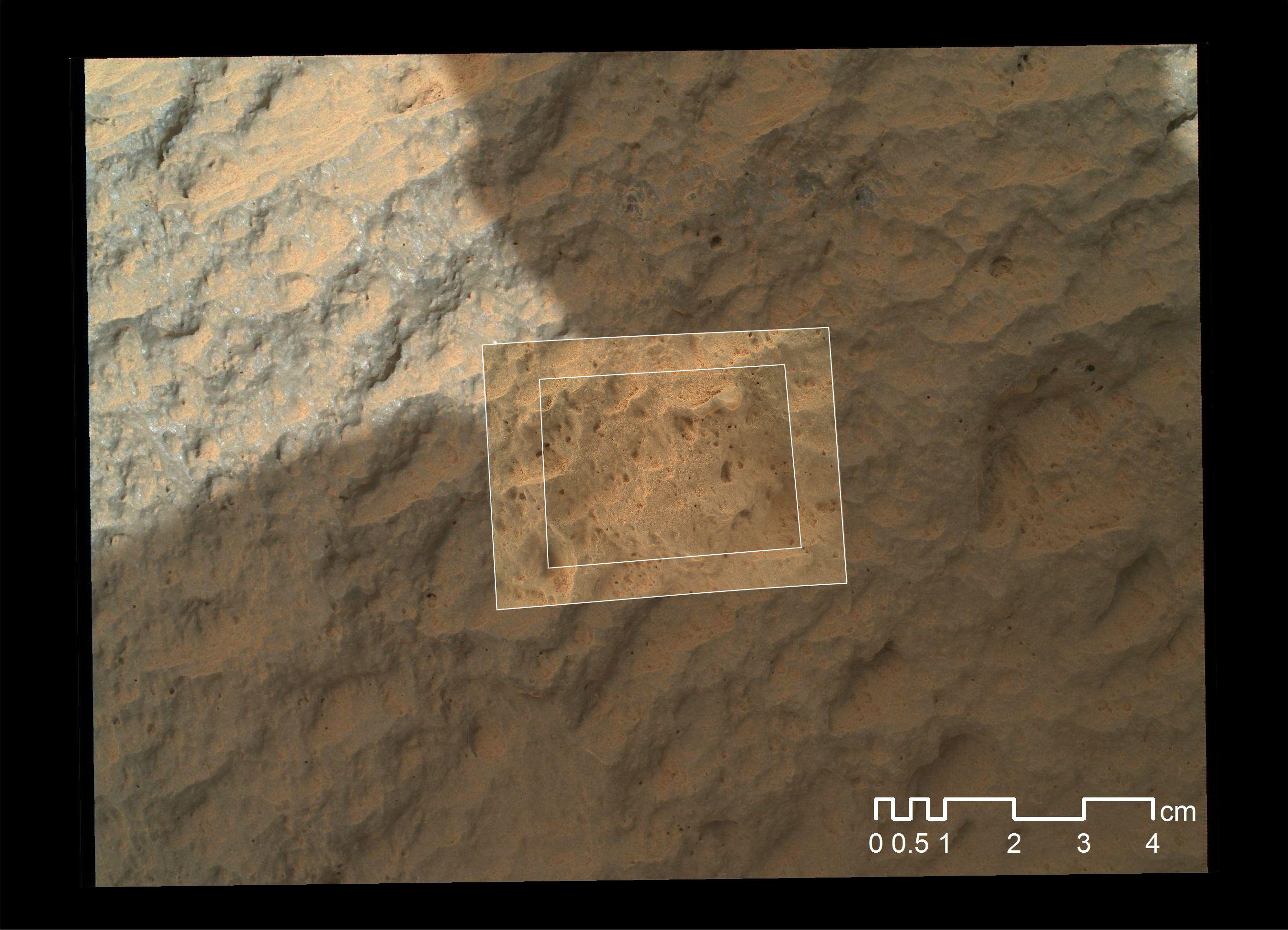
PIA16221:
Mars Hand Lens Imager Nested Close-Ups of Rock 'Jake Matijevic'
Full Resolution:
TIFF
(15.8 MB)
JPEG
(525.3 kB)
2012-09-24
Mars
Mars Science Laboratory (MSL)
Navcam (MSL)
Robotic Arm (MSL)
1024x1024x1
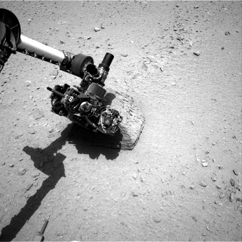
PIA16220:
Curiosity's Rock-Contact Science Begins
Full Resolution:
TIFF
(1.05 MB)
JPEG
(226.7 kB)
Currently displaying images:
1 - 26
of 26


