Click on an image for detailed information
Click on a column heading to sort in ascending or descending order

My
List |
Addition Date
|
Target
|
Mission
|
Instrument
|
Size
|

|
2010-03-31 |
Mars
|
Mars Reconnaissance Orbiter (MRO)
|
HiRISE
|
800x600x3 |
|
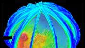
-
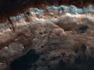
PIA12997:
-
Icy Layers and Climate Fluctuations near the Martian North Pole
Full Resolution:
TIFF
(1.442 MB)
JPEG
(110.2 kB)
|
|
|
2010-04-29 |
Mars
|
Mars Reconnaissance Orbiter (MRO)
|
HiRISE
|
2560x1920x3 |
|
-
PIA13072:
-
Reading the Geologic Record
Full Resolution:
TIFF
(14.76 MB)
JPEG
(476.9 kB)
|
|
|
2010-04-29 |
Mars
|
Mars Reconnaissance Orbiter (MRO)
|
HiRISE
|
2560x1920x3 |
|
-
PIA13073:
-
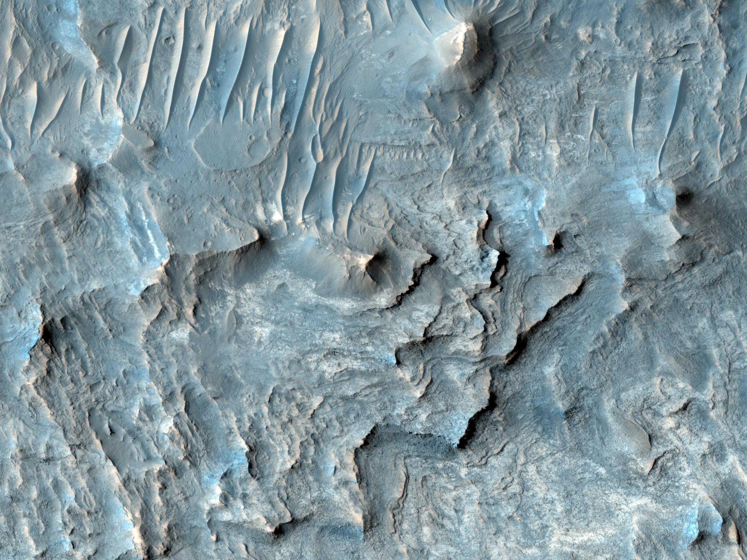
Yardangs within a Large Crater
Full Resolution:
TIFF
(14.76 MB)
JPEG
(604.5 kB)
|
|
|
2010-04-29 |
Mars
|
Mars Reconnaissance Orbiter (MRO)
|
HiRISE
|
2560x1920x3 |

|
-
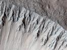
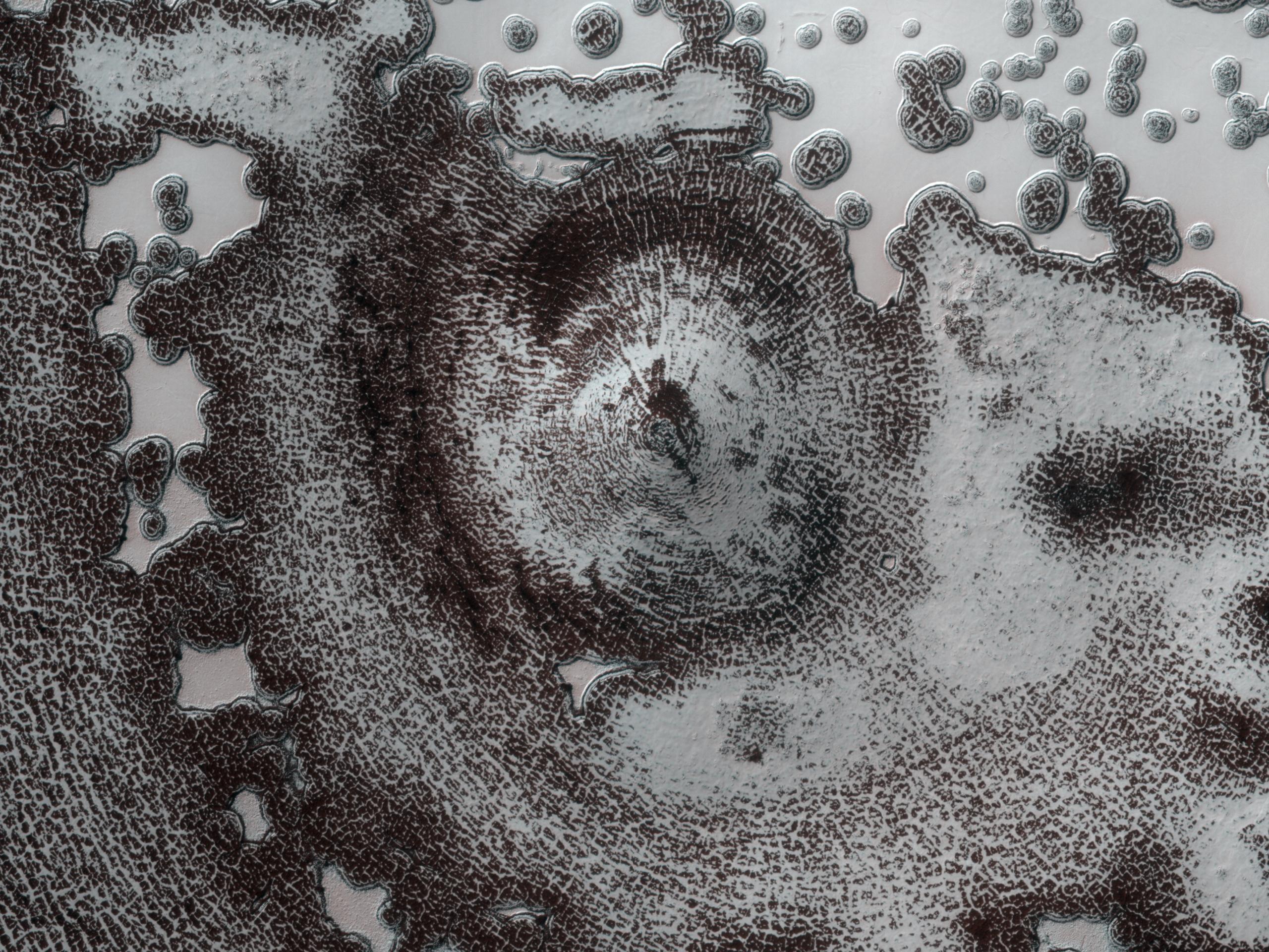
PIA13074:
-
Gullied Trough in Noachis Terra
Full Resolution:
TIFF
(14.76 MB)
JPEG
(1.183 MB)
|
|
|
2010-04-29 |
Mars
|
Mars Reconnaissance Orbiter (MRO)
|
HiRISE
|
2560x1920x3 |
|
-
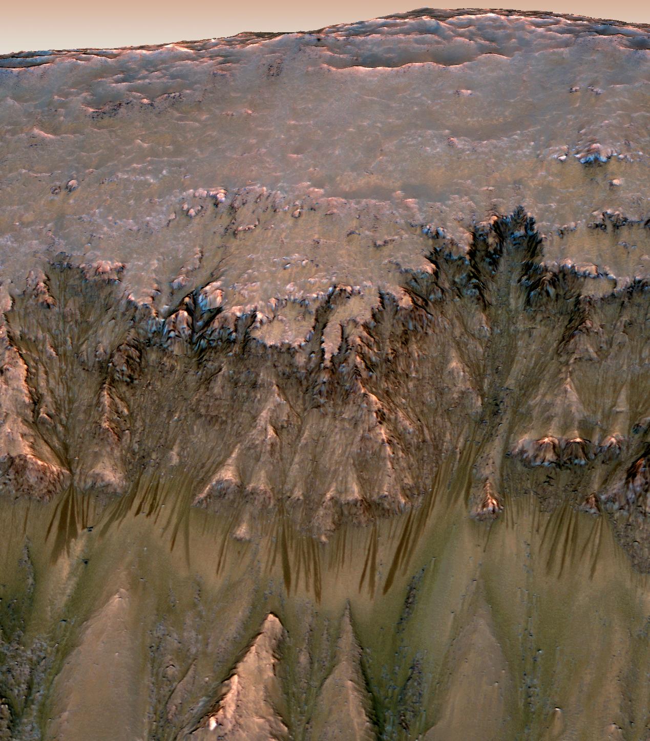
PIA13075:
-
Newly-Formed Slope Streaks
Full Resolution:
TIFF
(14.76 MB)
JPEG
(811.8 kB)
|
|
|
2010-04-29 |
Mars
|
Mars Reconnaissance Orbiter (MRO)
|
HiRISE
|
2560x1920x3 |
|
-
PIA13076:
-
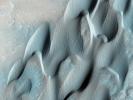
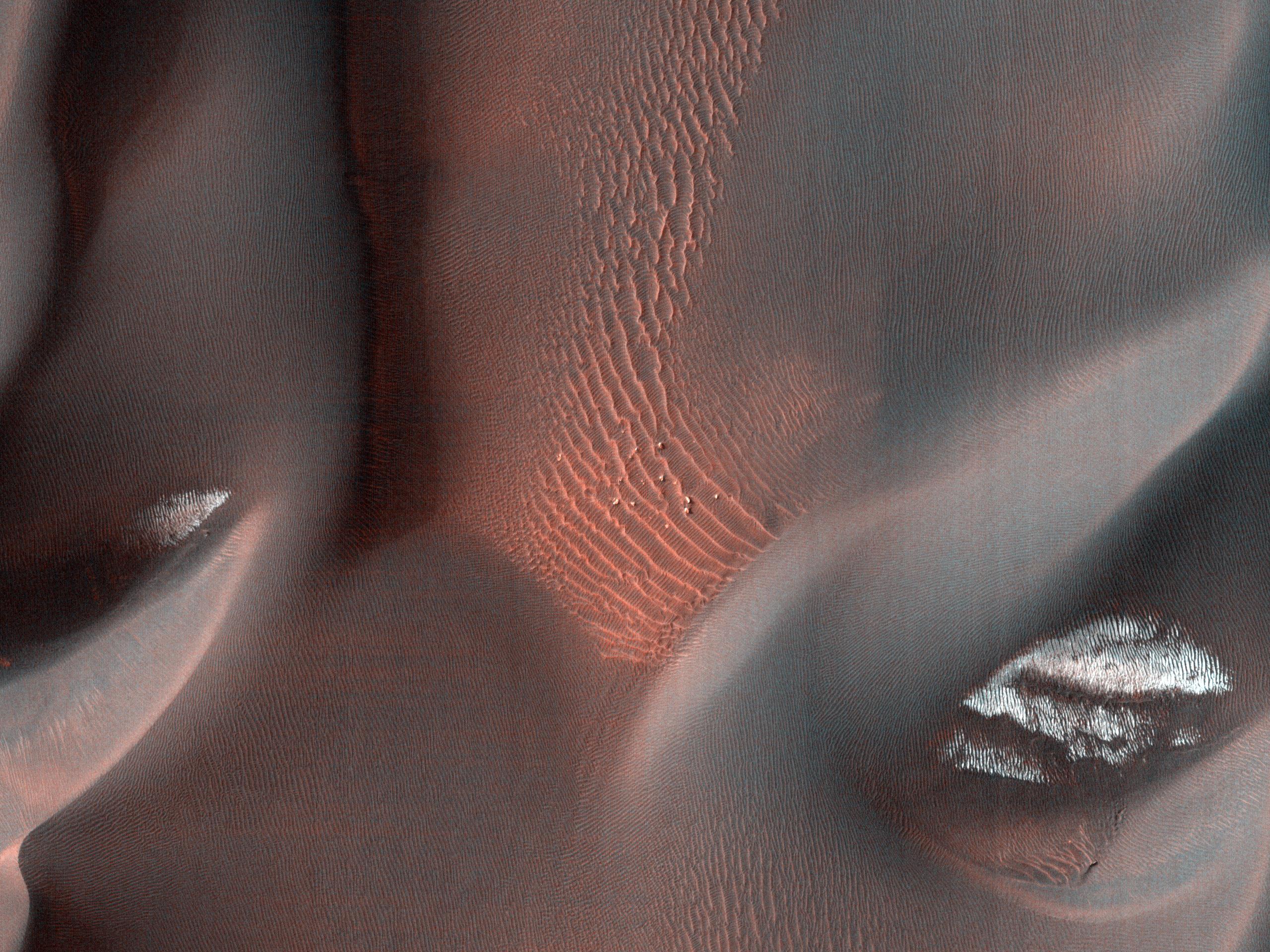
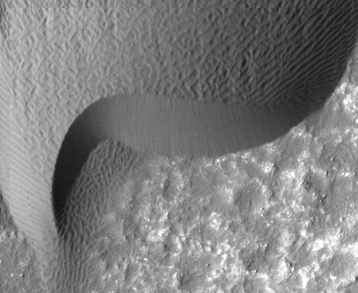
Proctor Crater Dune Field
Full Resolution:
TIFF
(14.76 MB)
JPEG
(978.5 kB)
|
|
|
2010-04-29 |
Mars
|
Mars Reconnaissance Orbiter (MRO)
|
HiRISE
|
2560x1920x3 |
|
-
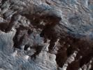
PIA13077:
-
Floor of Ius Chasma
Full Resolution:
TIFF
(14.76 MB)
JPEG
(862.9 kB)
|
|
|
2010-05-05 |
Mars
|
Mars Reconnaissance Orbiter (MRO)
|
HiRISE
|
1456x1805x1 |

|
-
PIA13097:
-
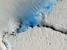
Intra-Crater Structure in NW Hellas Basin, Mars
Full Resolution:
TIFF
(2.631 MB)
JPEG
(371.1 kB)
|
|
|
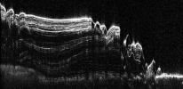
2010-05-26 |
Mars
|
Mars Reconnaissance Orbiter (MRO)
|
Shallow Subsurface Radar (SHARAD)
|
1936x939x1 |
|
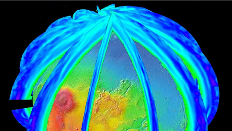
-
PIA13164:
-
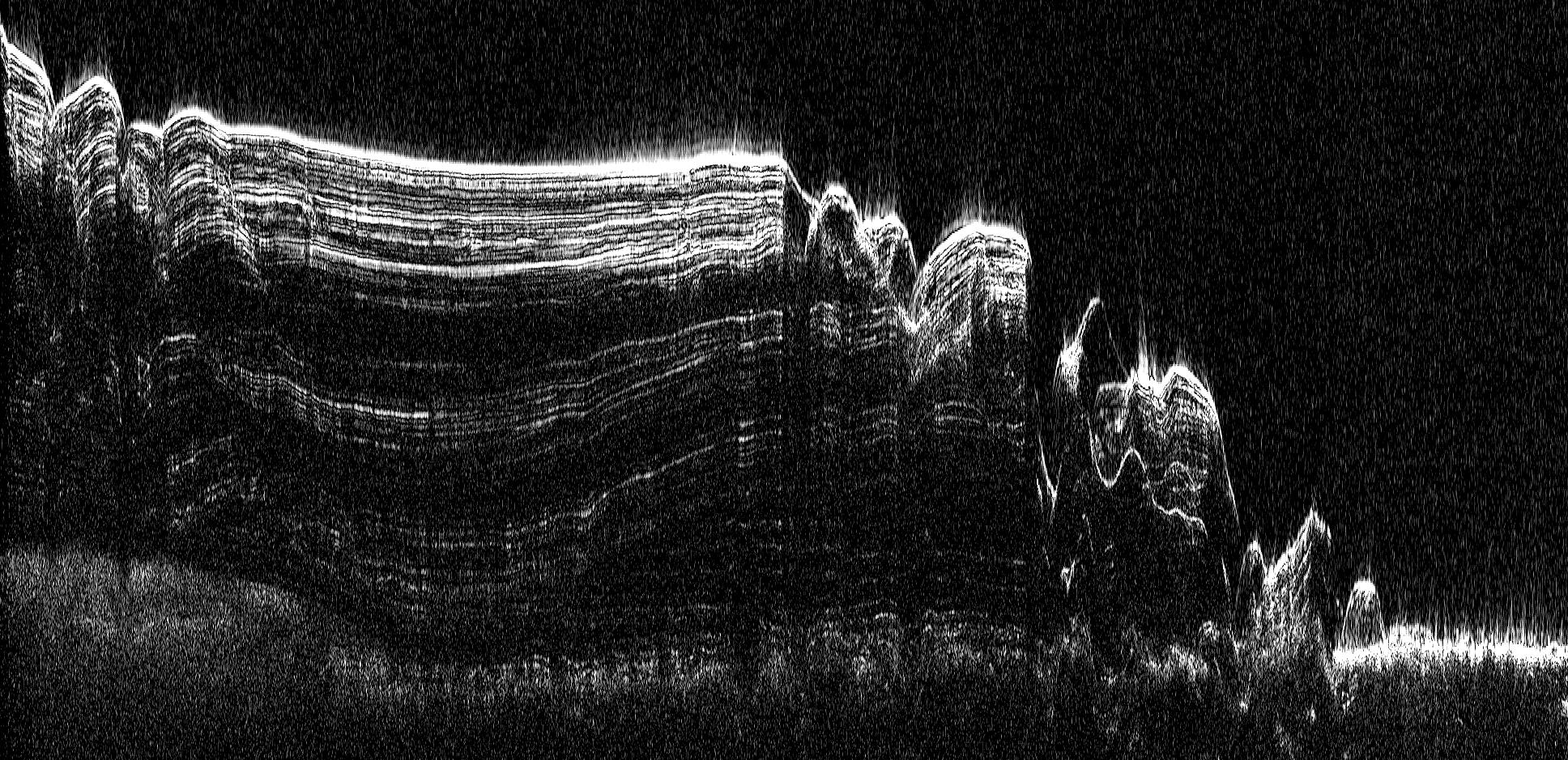
North Polar Cap Cross Section
Full Resolution:
TIFF
(1.82 MB)
JPEG
(575.5 kB)
|
|
|
2010-06-09 |
Mars
|
Mars Reconnaissance Orbiter (MRO)
|
HiRISE
|
2560x1920x3 |
|
-
PIA13185:
-
Polygonal Ridge in Gordii Dorsum Region, Mars
Full Resolution:
TIFF
(14.76 MB)
JPEG
(622.3 kB)
|
|
|
2010-06-09 |
Mars
|
Mars Reconnaissance Orbiter (MRO)
|
HiRISE
|
2560x1920x3 |
|
-
PIA13186:
-
Northern Hemisphere Gullies on West-Facing Crater Slope, Mars
Full Resolution:
TIFF
(14.76 MB)
JPEG
(726.1 kB)
|
|
|
2010-06-24 |
Mars
|
Mars Express (MEX)
Mars Reconnaissance Orbiter (MRO)
|
Context Camera
High Resolution Stereo Camera
|
617x543x3 |
|
-
PIA13214:
-
Hydrated Minerals Exposed at Stokes, Northern Mars
Full Resolution:
TIFF
(1.006 MB)
JPEG
(45.72 kB)
|
|
|
2010-07-07 |
Mars
|
Mars Reconnaissance Orbiter (MRO)
|
HiRISE
|
2560x1920x3 |
|
-
PIA13264:
-
Bouldery Deposit on Crater Floor
Full Resolution:
TIFF
(14.76 MB)
JPEG
(1.131 MB)
|
|
|
2010-07-13 |
Mars
|
Mars Reconnaissance Orbiter (MRO)
|
HiRISE
|
2560x1920x3 |

|
-
PIA13265:
-
(Almost) Silent Rolling Stones in Kasei Valles
Full Resolution:
TIFF
(14.76 MB)
JPEG
(952.1 kB)
|
|
|
2010-07-13 |
Mars
|
Mars Reconnaissance Orbiter (MRO)
|
HiRISE
|
2560x1920x3 |
|
-
PIA13266:
-
Light Outcrop on Crater Floor
Full Resolution:
TIFF
(14.76 MB)
JPEG
(649.9 kB)
|
|
|
2010-07-07 |
Mars
|
Mars Reconnaissance Orbiter (MRO)
|
HiRISE
|
2560x1920x3 |
|
-
PIA13267:
-
Gullies on Gorgonum Chaos Mesas
Full Resolution:
TIFF
(14.76 MB)
JPEG
(1.36 MB)
|
|
|
2010-07-13 |
Mars
|
Mars Reconnaissance Orbiter (MRO)
|
HiRISE
|
2560x1920x3 |
|
-
PIA13268:
-
Sand Dune Field in Richardson Crater
Full Resolution:
TIFF
(14.76 MB)
JPEG
(773.4 kB)
|
|
|
2010-07-13 |
Mars
|
Mars Reconnaissance Orbiter (MRO)
|
HiRISE
|
2560x1920x3 |
|
-
PIA13269:
-
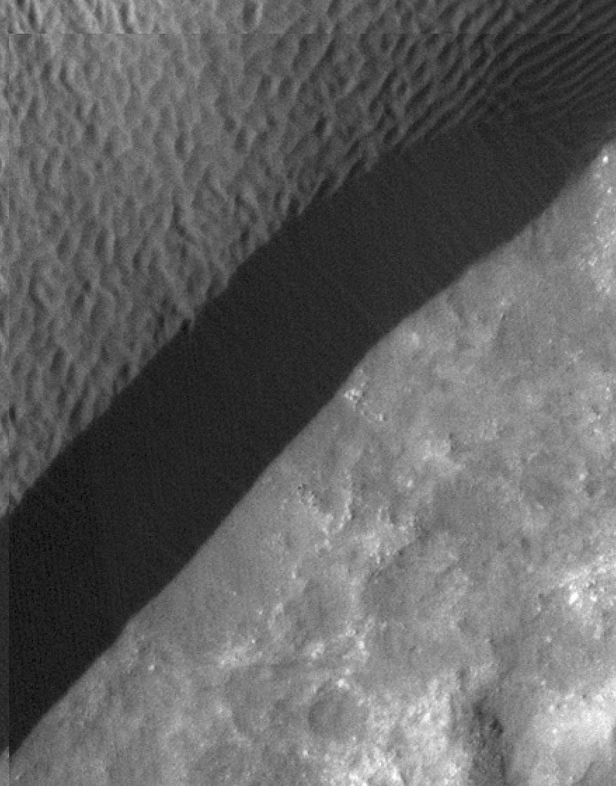
South Polar Layered Deposits and Residual Cap
Full Resolution:
TIFF
(14.76 MB)
JPEG
(454.2 kB)
|
|
|
2010-08-04 |
Mars
|
Mars Reconnaissance Orbiter (MRO)
|
HiRISE
|
774x565x3 |
|
-
PIA13315:
-
Exposed Ice in a Fresh Crater
Full Resolution:
TIFF
(1.314 MB)
JPEG
(78.91 kB)
|
|
|
2010-08-26 |
Mars
|
Mars Reconnaissance Orbiter (MRO)
|
MCS
|
962x545x3 |
|
-
PIA13353:
-
Martian Atmosphere Profiles
Full Resolution:
TIFF
(1.575 MB)
JPEG
(68.18 kB)
|
|
|
2010-10-25 |
Mars
|
Mars Reconnaissance Orbiter (MRO)
|
HiRISE
|
2560x1920x3 |
|
-
PIA13538:
-
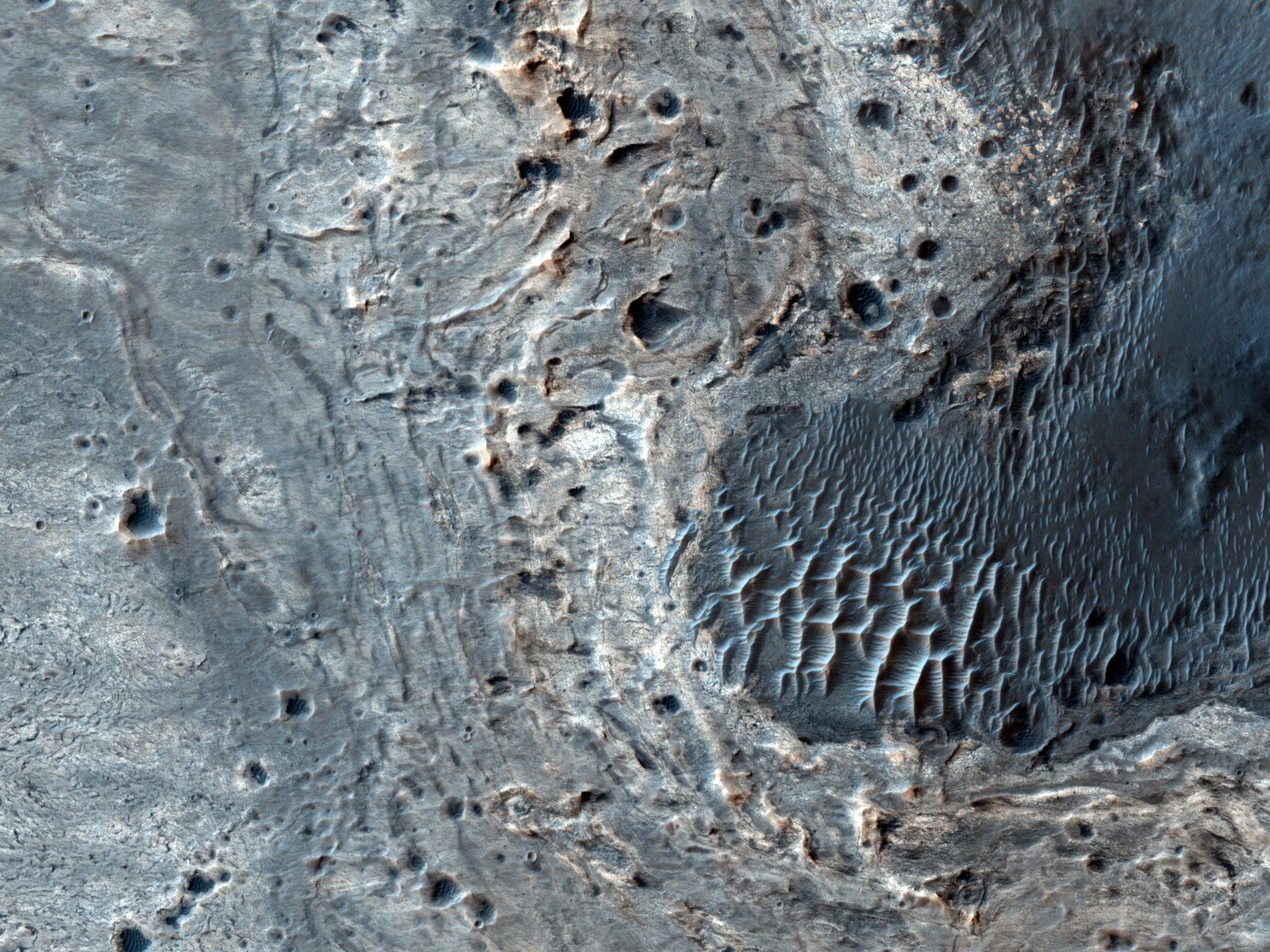
Southern Hemisphere Crater with Dune Field
Full Resolution:
TIFF
(14.76 MB)
JPEG
(1.1 MB)
|
|
|
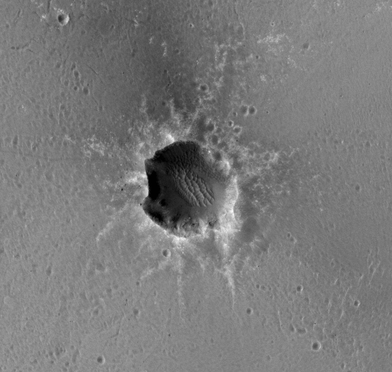
2010-10-12 |
Mars
|
Mars Reconnaissance Orbiter (MRO)
|
HiRISE
|
2560x1920x3 |
|
-
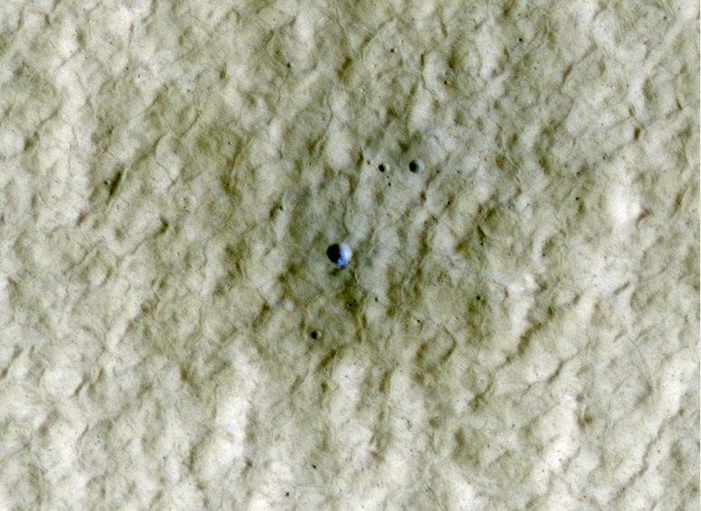
PIA13479:
-
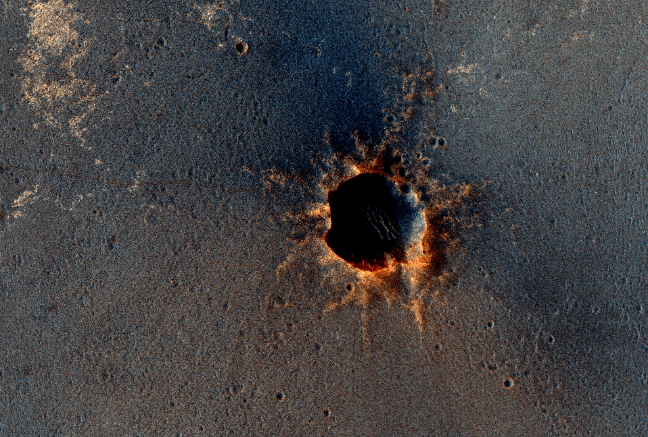
New Impact Crater
Full Resolution:
TIFF
(14.76 MB)
JPEG
(1.291 MB)
|
|
|
2010-10-13 |
Mars
|
Mars Reconnaissance Orbiter (MRO)
|
HiRISE
|
2560x1920x3 |
|
-
PIA13480:
-
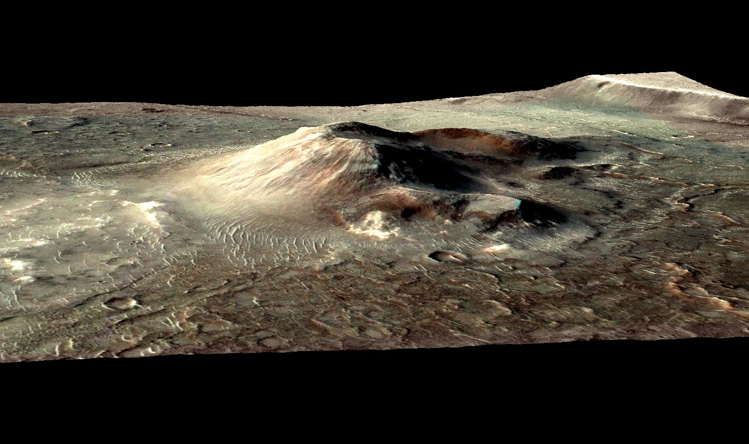
Possible Cinder Cone on the Southern Flank of Pavonis Mons
Full Resolution:
TIFF
(14.76 MB)
JPEG
(929 kB)
|
|
|
2010-10-14 |
Mars
|
Mars Reconnaissance Orbiter (MRO)
|
HiRISE
|
2560x1920x3 |
|
-
PIA13481:
-
Dunes in Herschel Crater
Full Resolution:
TIFF
(14.76 MB)
JPEG
(947.3 kB)
|
|
|
2010-10-15 |
Mars
|
Mars Reconnaissance Orbiter (MRO)
|
HiRISE
|
2560x1920x3 |
|
-
PIA13482:
-
Fractured Mounds in Elysium Planitia
Full Resolution:
TIFF
(14.76 MB)
JPEG
(1.177 MB)
|
|
|
2010-10-18 |
Mars
|
Mars Reconnaissance Orbiter (MRO)
|
HiRISE
|
2560x1920x3 |
|
-
PIA13483:
-
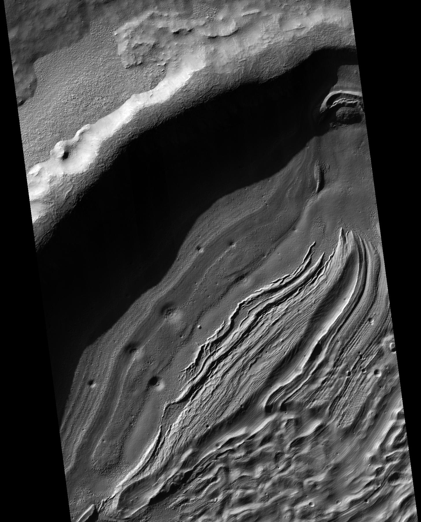
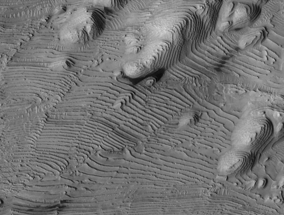
Lots of Layering in Becquerel Crater
Full Resolution:
TIFF
(14.76 MB)
JPEG
(1.026 MB)
|
|
|
2010-10-19 |
Mars
|
Mars Reconnaissance Orbiter (MRO)
|
HiRISE
|
2560x1920x3 |
|
-
PIA13484:
-
Flow Obstructions and Wakes Southeast of Elysium Planitia
Full Resolution:
TIFF
(14.76 MB)
JPEG
(1.413 MB)
|
|
|
2010-10-21 |
Mars
|
Mars Reconnaissance Orbiter (MRO)
|
HiRISE
|
2560x1920x3 |

|
-
PIA13533:
-
Flood-Emplaced Blocks in Holden Crater
Full Resolution:
TIFF
(14.76 MB)
JPEG
(886.2 kB)
|
|
|
2010-10-22 |
Mars
|
Mars Reconnaissance Orbiter (MRO)
|
HiRISE
|
2560x1920x3 |
|
-
PIA13536:
-
Light-Toned Gully Materials on Hale Crater Wall
Full Resolution:
TIFF
(14.76 MB)
JPEG
(1.078 MB)
|
|
|
2010-10-23 |
Mars
|
Mars Reconnaissance Orbiter (MRO)
|
HiRISE
|
2560x1920x3 |
|
-
PIA13537:
-
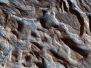
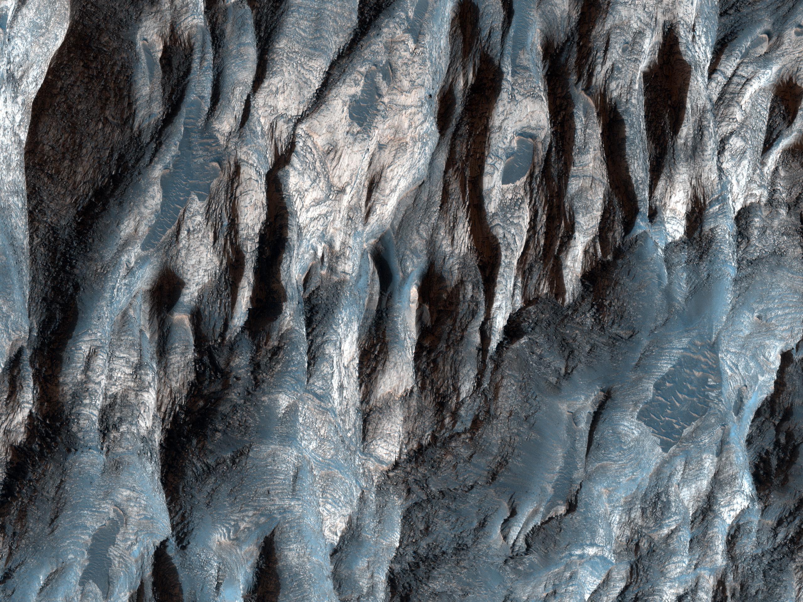
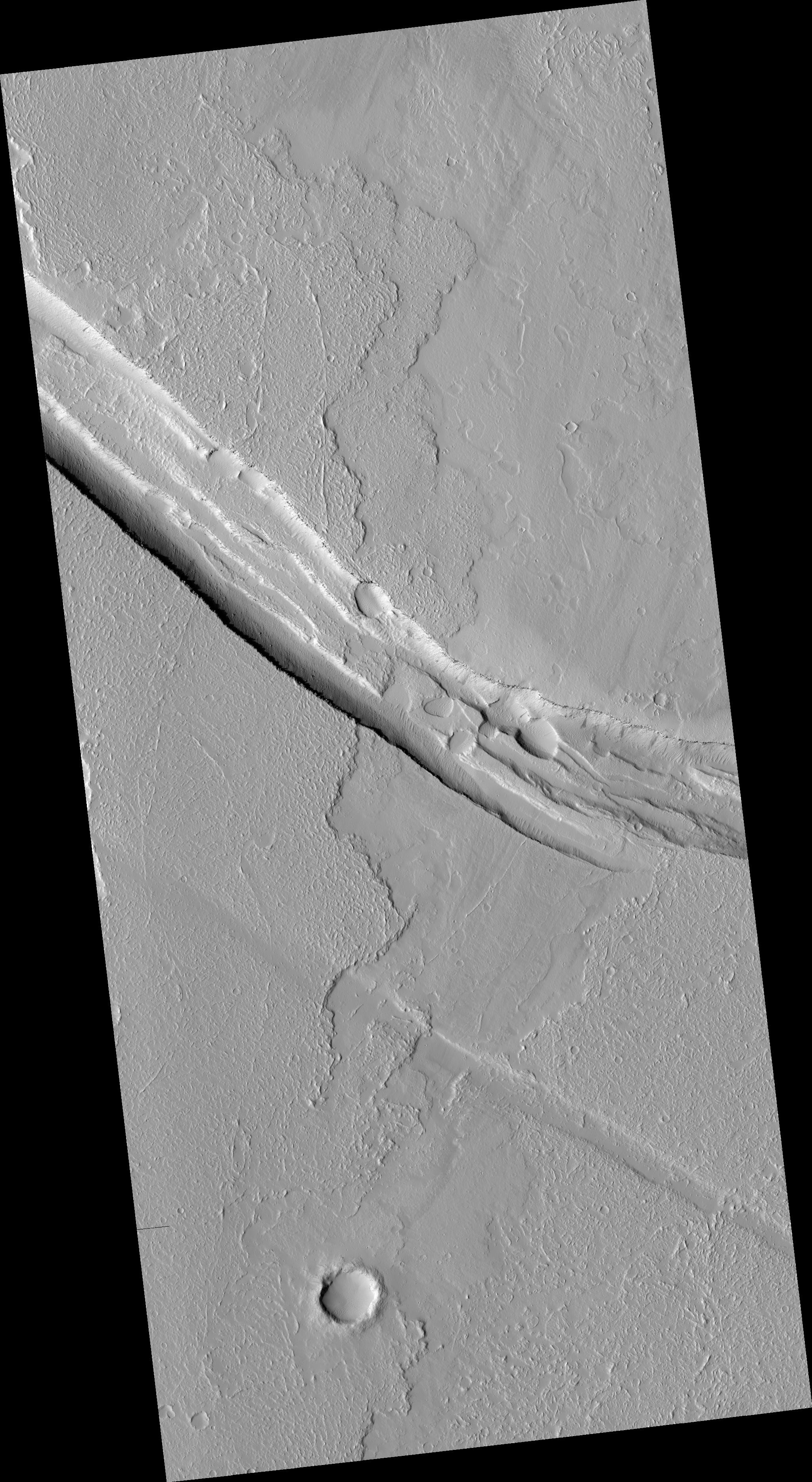
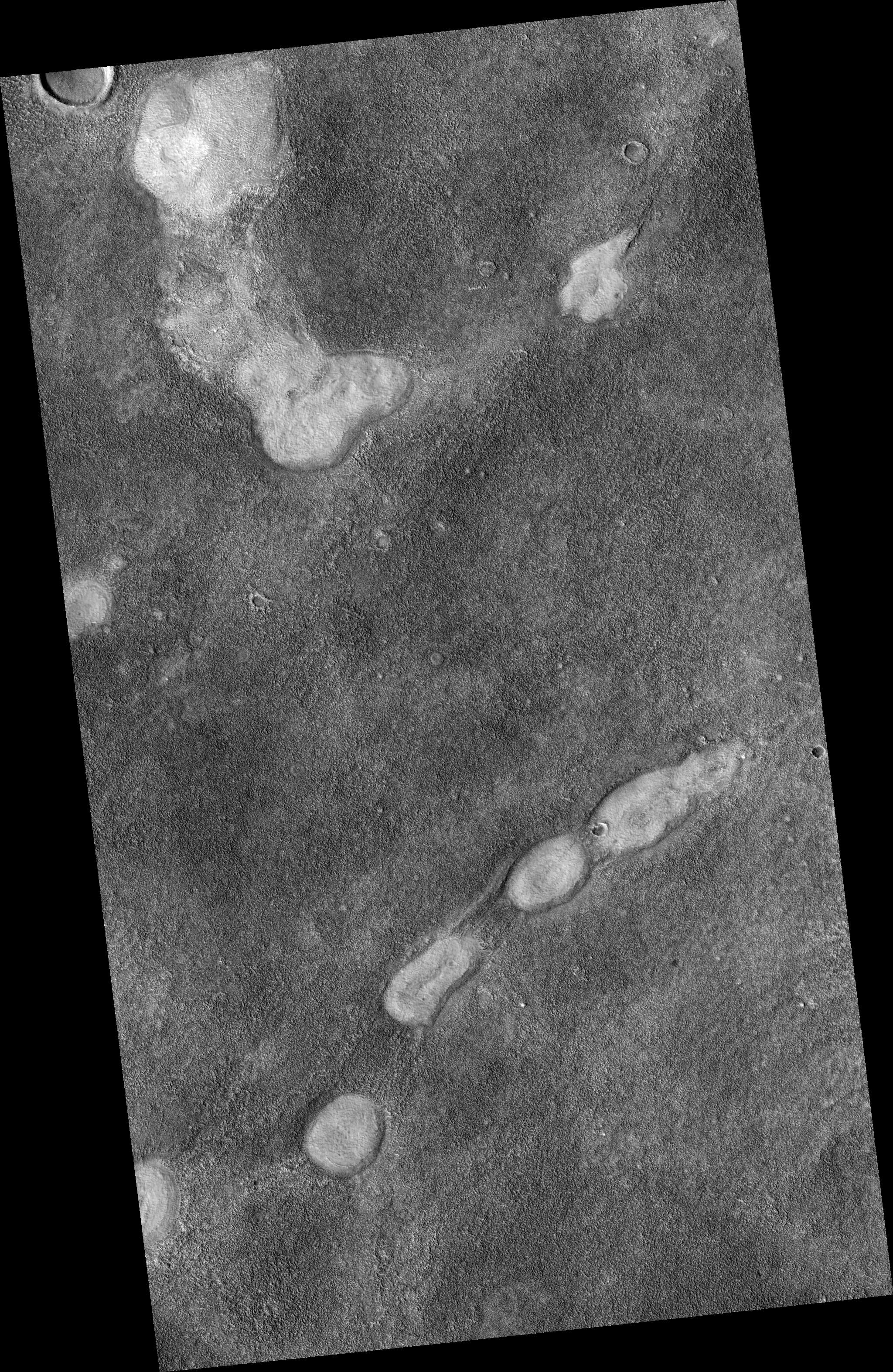
Strengths of Materials in Ganges Mensa
Full Resolution:
TIFF
(14.76 MB)
JPEG
(1.115 MB)
|
|
|
2010-10-27 |
Mars
|
Mars Reconnaissance Orbiter (MRO)
|
HiRISE
|
2560x1920x3 |
|
-
PIA13539:
-
Russell Crater Dunes, Defrosted
Full Resolution:
TIFF
(14.76 MB)
JPEG
(1.303 MB)
|
|
|
2010-10-28 |
Mars
|
Mars Reconnaissance Orbiter (MRO)
|
HiRISE
|
2560x1920x3 |
|
-
PIA13540:
-
Layers in Arsia Mons Volcano
Full Resolution:
TIFF
(14.76 MB)
JPEG
(1.504 MB)
|
|
|
2010-10-29 |
Mars
|
Mars Reconnaissance Orbiter (MRO)
|
HiRISE
|
724x945x1 |

|
-
PIA13544:
-
Gully Changes on Martian Sand Dune
Full Resolution:
TIFF
(685.1 kB)
JPEG
(132.2 kB)
|
|
|
2010-10-31 |
Mars
|
Mars Reconnaissance Orbiter (MRO)
|
CRISM
CTX
|
1472x874x3 |
|
-
PIA13556:
-
Mars Volcanic Cone with Hydrothermal Deposits
Full Resolution:
TIFF
(3.867 MB)
JPEG
(193.8 kB)
|
|
|
2010-11-10 |
Mars
|
Mars Reconnaissance Orbiter (MRO)
|
HiRISE
|
2560x1920x3 |

|
-
PIA13608:
-
Concentric Structures in Meridiani Planum
Full Resolution:
TIFF
(14.76 MB)
JPEG
(925.2 kB)
|
|
|
2010-11-11 |
Mars
|
Mars Reconnaissance Orbiter (MRO)
|
HiRISE
|
2560x1920x3 |
|
-
PIA13610:
-
Light-Toned Outcrop in Aureum Chaos
Full Resolution:
TIFF
(14.76 MB)
JPEG
(663.9 kB)
|
|
|
2010-11-12 |
Mars
|
Mars Reconnaissance Orbiter (MRO)
|
HiRISE
|
2560x1920x3 |
|
-
PIA13611:
-
Fresh Crater with Gullies
Full Resolution:
TIFF
(14.76 MB)
JPEG
(768.3 kB)
|
|
|
2010-11-15 |
Mars
|
Mars Reconnaissance Orbiter (MRO)
|
HiRISE
|
2560x1920x3 |
|
-
PIA13612:
-
End of Lethe Vallis
Full Resolution:
TIFF
(14.76 MB)
JPEG
(944.5 kB)
|
|
|
2010-11-16 |
Mars
|
Mars Reconnaissance Orbiter (MRO)
|
HiRISE
|
2560x1920x3 |
|
-
PIA13613:
-
Proctor Crater Dune Field
Full Resolution:
TIFF
(14.76 MB)
JPEG
(685.5 kB)
|
|
|
2010-11-17 |
Mars
|
Mars Reconnaissance Orbiter (MRO)
|
HiRISE
|
2560x1920x3 |
|
-
PIA13614:
-
Curvilinear Ridge in Terra Meridiani
Full Resolution:
TIFF
(14.76 MB)
JPEG
(708.1 kB)
|
|
|
2010-12-01 |
Mars
|
Mars Reconnaissance Orbiter (MRO)
|
HiRISE
|
2048x3086x1 |

|
-
PIA13650:
-
Dark Rimless Pits in the Tharsis Region
Full Resolution:
TIFF
(6.327 MB)
JPEG
(508.2 kB)
|
|
|
2010-12-01 |
Mars
|
Mars Reconnaissance Orbiter (MRO)
|
HiRISE
|
2048x3737x1 |

|
-
PIA13651:
-
Graben Cutting Lava Flow in Tharsis
Full Resolution:
TIFF
(7.661 MB)
JPEG
(938.6 kB)
|
|
|
2010-12-01 |
Mars
|
Mars Reconnaissance Orbiter (MRO)
|
HiRISE
|
2048x3145x1 |

|
-
PIA13652:
-
Proposed Future Mars Landing Site: Acidalia Planitia Mud Volcanoes
Full Resolution:
TIFF
(6.447 MB)
JPEG
(1.617 MB)
|
|
|
2010-12-16 |
Mars
|
Mars Express (MEX)
Mars Global Surveyor (MGS)
Mars Reconnaissance Orbiter (MRO)
|
Altimeter
CRISM
Visible and Infrared Mineralogical Mapping Spectrometer
|
2999x1515x3 |
|
-
PIA13703:
-
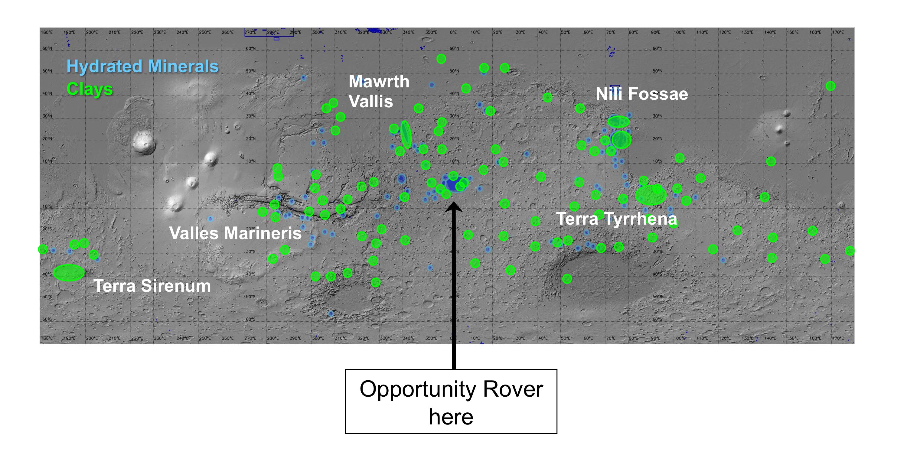
Regions of Mars with Clays and Hydrated Minerals Identified from Orbit
Full Resolution:
TIFF
(13.63 MB)
JPEG
(581.5 kB)
|
|
|
2010-12-16 |
Mars
|
Mars Reconnaissance Orbiter (MRO)
|
CRISM
|
2736x2250x3 |
|
-
PIA13704:
-
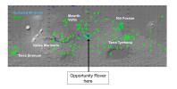
Geologic Setting of Opportunity Traverse and Meridiani Planum
Full Resolution:
TIFF
(18.47 MB)
JPEG
(486.1 kB)
|
|
|
2010-12-16 |
Mars
|
Mars Reconnaissance Orbiter (MRO)
|
CTX
|
4664x7746x3 |

|
-
PIA13705:
-
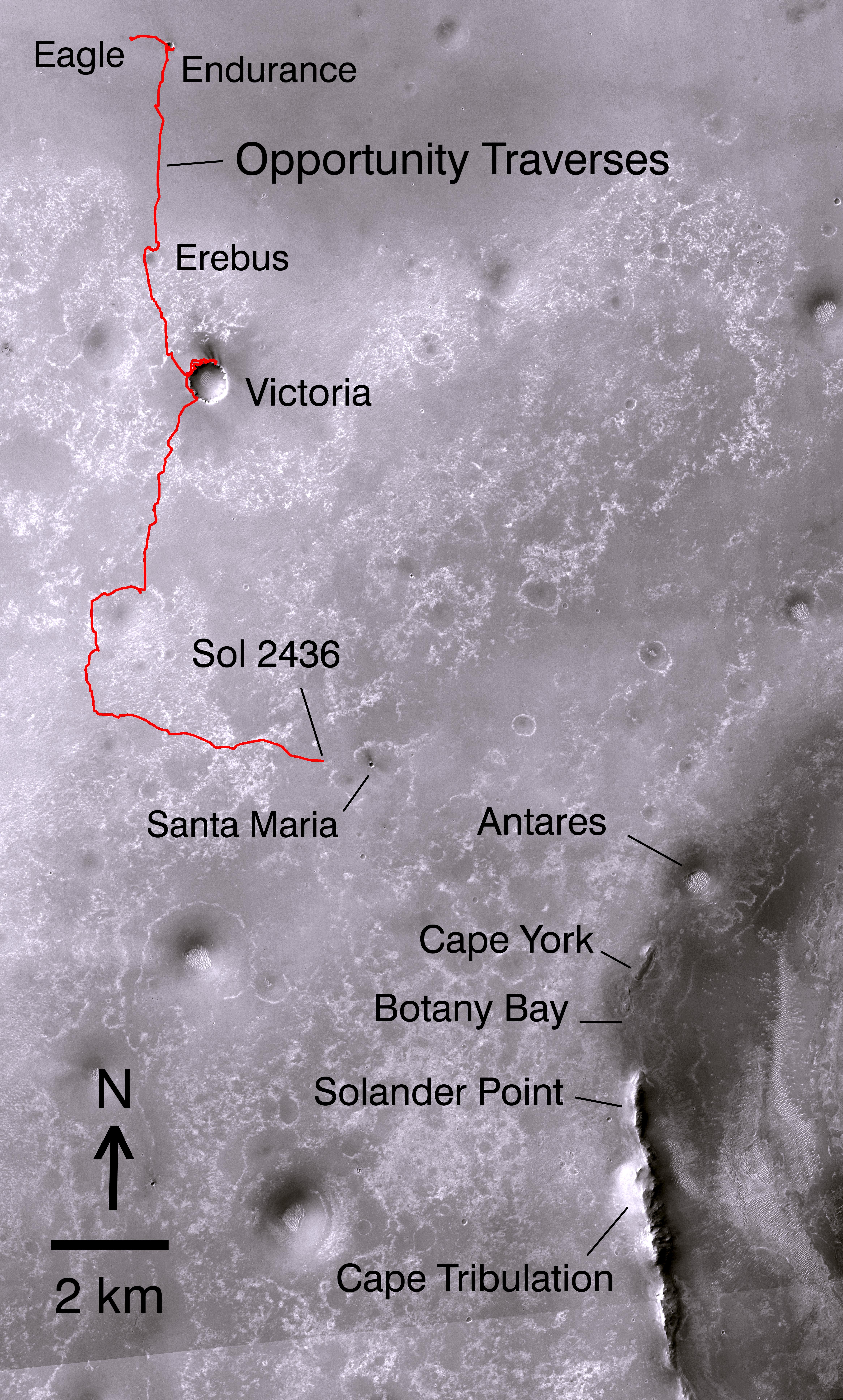
Opportunity's Path on Mars Through Sol 2436
Full Resolution:
TIFF
(108.4 MB)
JPEG
(5.199 MB)
|
|
|
2010-12-16 |
Mars
|
Mars Reconnaissance Orbiter (MRO)
|
HiRISE
|
8192x7051x1 |

|
-
PIA13706:
-
Orbital Observations of Crater on Mars Rover's Route
Full Resolution:
TIFF
(57.82 MB)
JPEG
(2.181 MB)
|
|
|
2010-12-16 |
Mars
|
Mars Reconnaissance Orbiter (MRO)
|
CRISM
|
4023x7854x3 |

|
-
PIA13708:
-
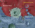
Geologic Map, West Rim of Endeavour Crater, Mars
Full Resolution:
TIFF
(94.79 MB)
JPEG
(4.431 MB)
|
|
|
2010-12-17 |
Mars
|
Mars Reconnaissance Orbiter (MRO)
|
HiRISE
|
2560x1920x3 |
|
-
PIA13723:
-
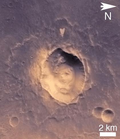
A Fresh, Lunar-Like Crater on Mars
Full Resolution:
TIFF
(14.76 MB)
JPEG
(855.5 kB)
|
|
|
2010-12-20 |
Mars
|
Mars Reconnaissance Orbiter (MRO)
|
HiRISE
|
2560x1920x3 |

|
-
PIA13724:
-
Nili Fossae Trough, Candidate MSL Landing Site
Full Resolution:
TIFF
(14.76 MB)
JPEG
(844 kB)
|
|
|
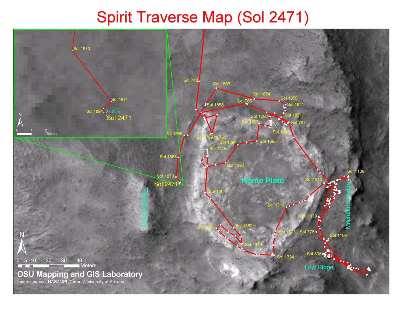
2010-12-17 |
Mars
|
Mars Exploration Rover (MER)
Mars Reconnaissance Orbiter (MRO)
|
CTX
|
1392x1080x3 |
|
-
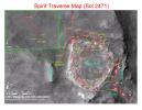
PIA13730:
-
Spirit Traverse Map, Sol 2471
Full Resolution:
TIFF
(4.519 MB)
JPEG
(176.5 kB)
|
|
|
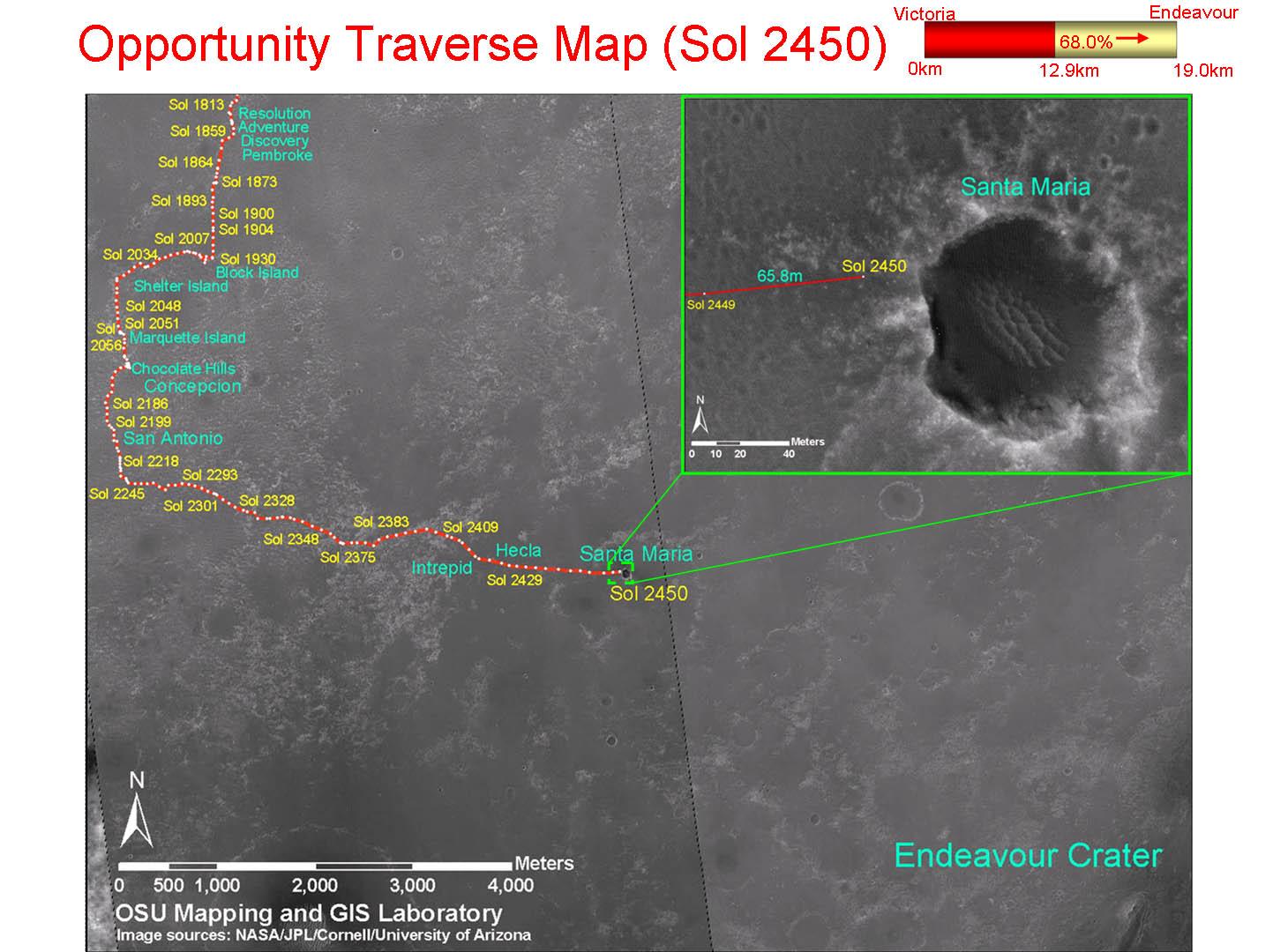
2010-12-17 |
Mars
|
Mars Exploration Rover (MER)
Mars Reconnaissance Orbiter (MRO)
|
CTX
|
1460x1080x3 |
|
-
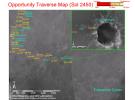
PIA13731:
-
Opportunity Traverse Map, Sol 2450
Full Resolution:
TIFF
(4.739 MB)
JPEG
(178 kB)
|
|
|
2011-01-04 |
Mars
|
Mars Exploration Rover (MER)
Mars Reconnaissance Orbiter (MRO)
|
HiRISE
|
1347x1277x1 |

|
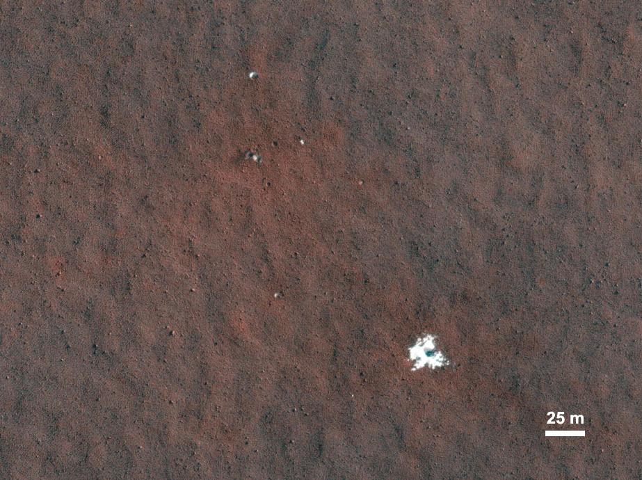
-
PIA13754:
-
Mars Orbiter Sees Rover Opportunity at Crater Edge
Full Resolution:
TIFF
(1.722 MB)
JPEG
(195 kB)
|
|
|
2011-01-05 |
Mars
|
Mars Reconnaissance Orbiter (MRO)
|
HiRISE
|
2560x1920x3 |
|
-
PIA13725:
-
Layered Bedrock in Candor Chasma
Full Resolution:
TIFF
(14.76 MB)
JPEG
(831.1 kB)
|
|
|
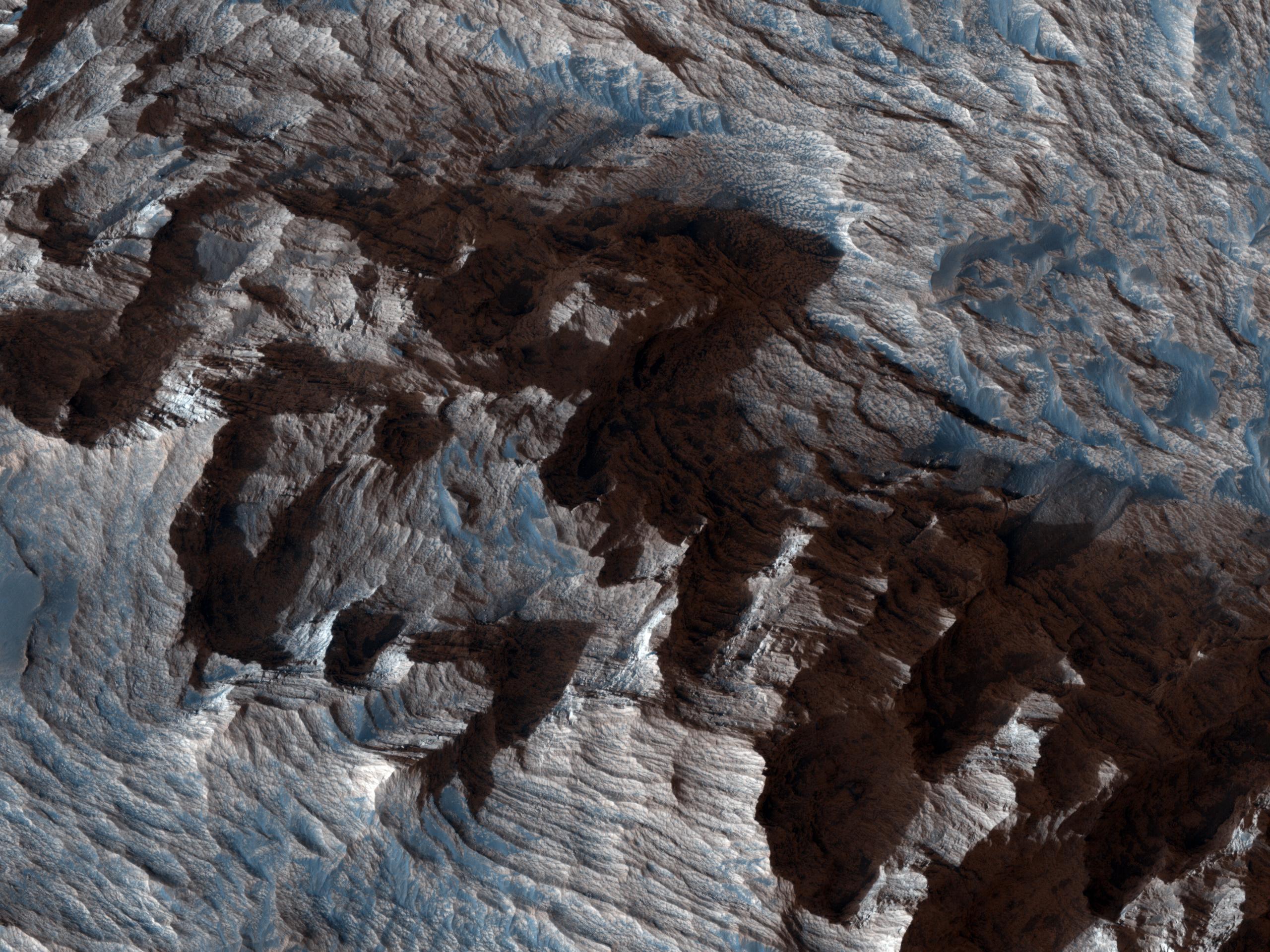
2011-01-12 |
Mars
|
Mars Reconnaissance Orbiter (MRO)
|
HiRISE
|
2560x1920x3 |
|
-
PIA13726:
-
Layers Exposed in Crater Near Mawrth Vallis
Full Resolution:
TIFF
(14.76 MB)
JPEG
(650.8 kB)
|
|
|
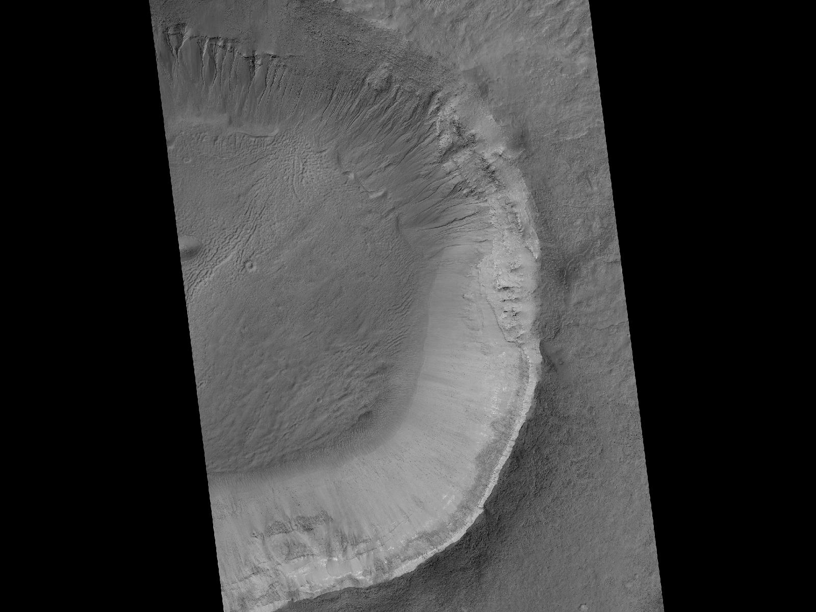
2011-01-21 |
Mars
|
Mars Reconnaissance Orbiter (MRO)
|
HiRISE
|
2560x1920x3 |
|
-
PIA13727:
-
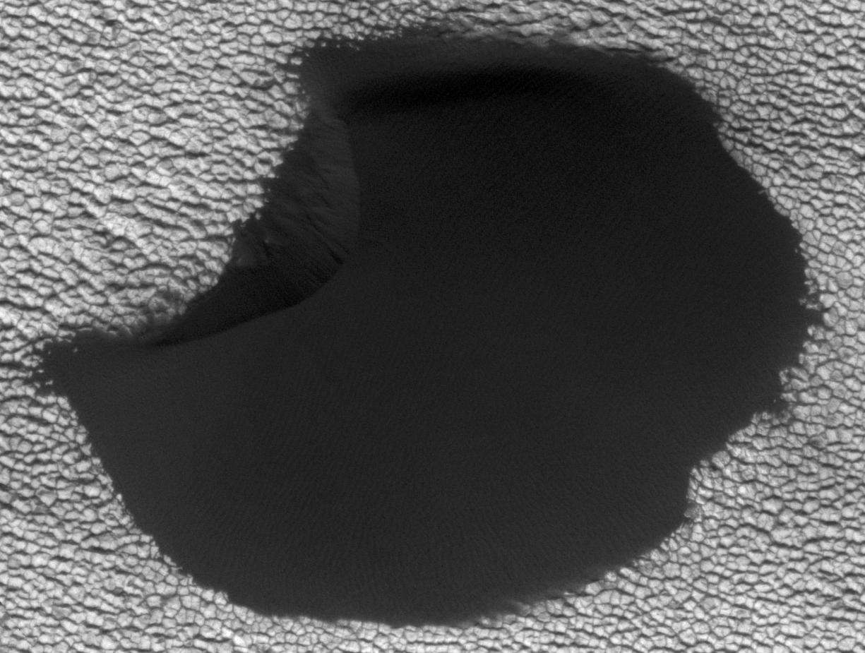
Circular Feature in South Polar Residual Cap
Full Resolution:
TIFF
(14.76 MB)
JPEG
(937.3 kB)
|
|
|
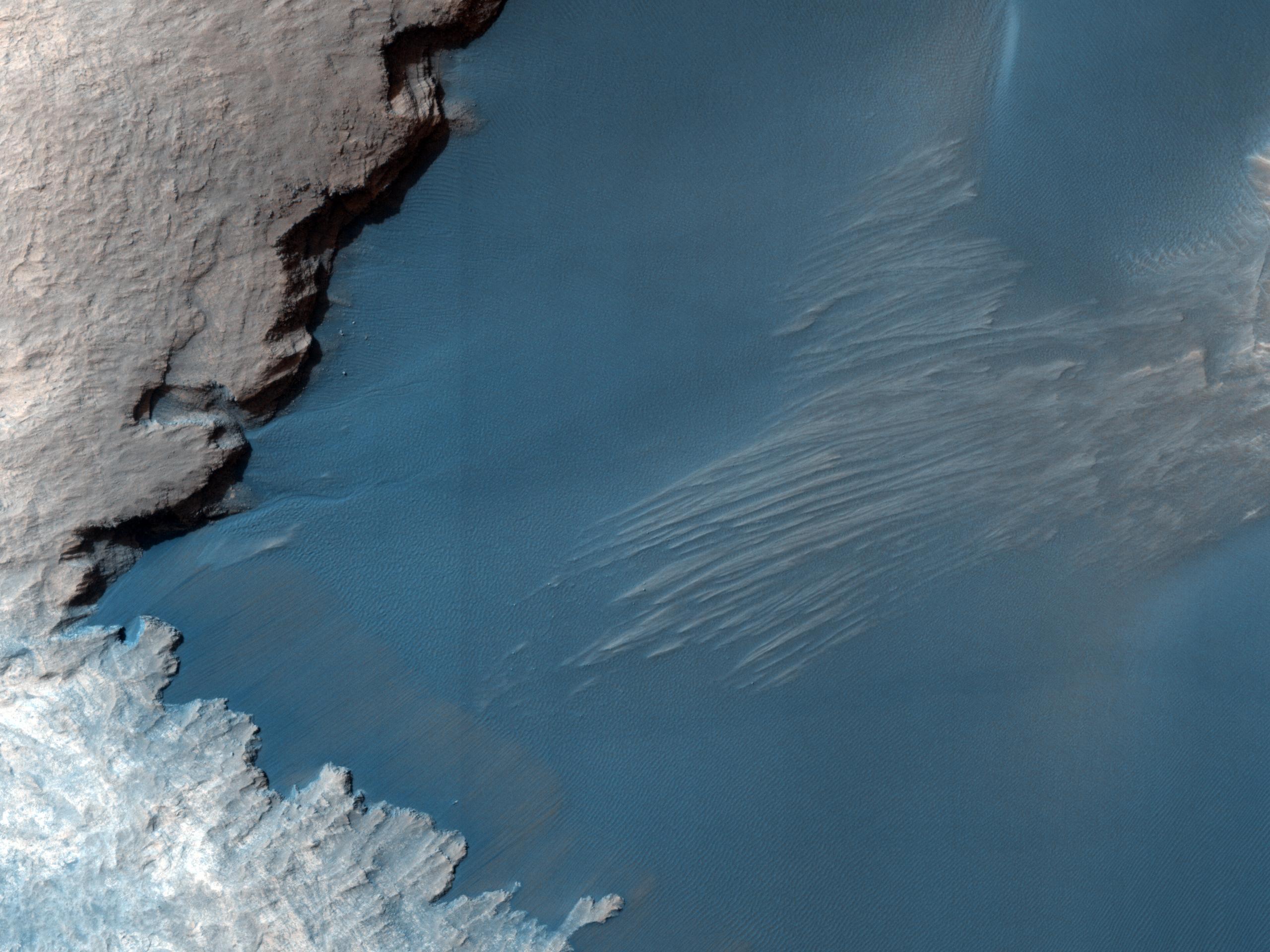
2011-02-03 |
Mars
|
Mars Reconnaissance Orbiter (MRO)
|
HiRISE
|
934x1412x3 |
|
-
PIA13797:
-
Seasonal Changes in Northern Mars Dune Field
Full Resolution:
TIFF
(3.962 MB)
JPEG
(221.3 kB)
|
|
|
2011-02-02 |
Mars
|
Mars Reconnaissance Orbiter (MRO)
|
HiRISE
|
2560x1920x3 |

|
-
PIA13728:
-
Thumbprint Texture on Dark Dunes in Rabe Crater
Full Resolution:
TIFF
(14.76 MB)
JPEG
(553.7 kB)
|
|
|
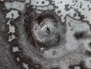
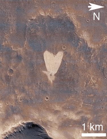
2011-02-14 |
Mars
|
Mars Reconnaissance Orbiter (MRO)
|
CTX
|
377x487x3 |
|
-
PIA13798:
-
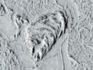
Heart-Shaped Feature in Arabia Terra
Full Resolution:
TIFF
(185.6 kB)
JPEG
(41.39 kB)
|
|
|
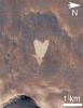
2011-02-14 |
Mars
|
Mars Reconnaissance Orbiter (MRO)
|
CTX
|
420x487x3 |

|
-
PIA13799:
-
Heart-Shaped Feature in Arabia Terra (Wide View)
Full Resolution:
TIFF
(206.5 kB)
JPEG
(25.93 kB)
|
|
|
2011-03-08 |
Mars
|
Mars Reconnaissance Orbiter (MRO)
|
CRISM
HiRISE
|
995x599x3 |
|
-
PIA13800:
-
Fractures in Carbonate-Bearing Rocks at Mars' Huygens Basin
Full Resolution:
TIFF
(1.791 MB)
JPEG
(139 kB)
|
|
|
2011-03-09 |
Mars
|
Mars Exploration Rover (MER)
Mars Reconnaissance Orbiter (MRO)
|
HiRISE
|
2254x1522x3 |
|
-
PIA13803:
-
Opportunity is Still Smiling
Full Resolution:
TIFF
(10.3 MB)
JPEG
(1.155 MB)
|
|
|
2011-03-09 |
Mars
|
Mars Reconnaissance Orbiter (MRO)
|
HiRISE
|
2560x1920x3 |
|
-
PIA13802:
-
True Gullies on Mars
Full Resolution:
TIFF
(14.76 MB)
JPEG
(1.255 MB)
|
|
|
2011-04-21 |
Mars
|
Mars Reconnaissance Orbiter (MRO)
|
Shallow Subsurface Radar (SHARAD)
|
1775x380x1 |
|
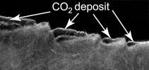
-
PIA13985:
-
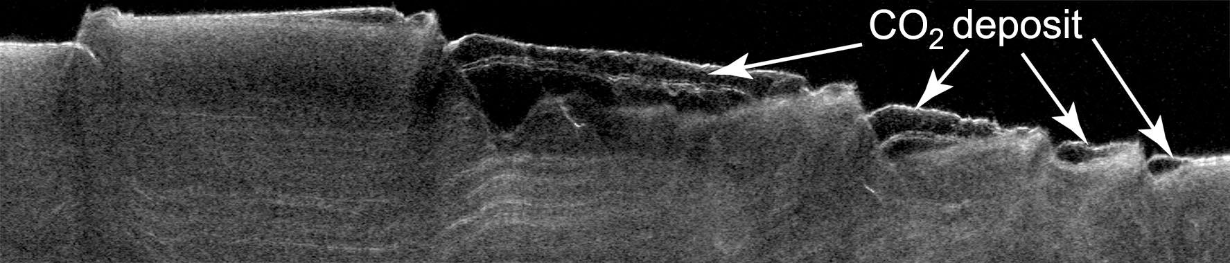
Cross Section of Buried Carbon-Dioxide Ice on Mars
Full Resolution:
TIFF
(675.5 kB)
JPEG
(116.5 kB)
|
|
|
2011-04-21 |
Mars
|
Mars Reconnaissance Orbiter (MRO)
|
Shallow Subsurface Radar (SHARAD)
|
9380x8299x3 |

|
-
PIA13986:
-
Thickness Map of Buried Carbon-Dioxide Deposit
Full Resolution:
TIFF
(233.5 MB)
JPEG
(4.87 MB)
|
|
|
2011-04-21 |
Mars
|
Mars Reconnaissance Orbiter (MRO)
|
HiRISE
|
2497x2054x1 |
|
-
PIA13987:
-
Pitting from Sublimation of Underlying Dry-Ice Layer
Full Resolution:
TIFF
(5.135 MB)
JPEG
(856.6 kB)
|
|
|
2011-06-08 |
Mars
|
Mars Exploration Rover (MER)
Mars Reconnaissance Orbiter (MRO)
|
HiRISE
|
8192x5789x3 |
|
-
PIA14134:
-
Opportunity's First Goal at Endeavour Crater: 'Spirit Point'
Full Resolution:
TIFF
(47.47 MB)
JPEG
(3.48 MB)
|
|
|
2011-06-08 |
Mars
|
Mars Exploration Rover (MER)
Mars Reconnaissance Orbiter (MRO)
|
CTX
|
2948x2193x3 |
|
-
PIA14135:
-
Eagle to Endeavour: Opportunity's Path, Sol 2609
Full Resolution:
TIFF
(19.4 MB)
JPEG
(1.319 MB)
|
|
|
2011-07-15 |
Mars
|
Mars Reconnaissance Orbiter (MRO)
|
HiRISE
|
2560x1920x3 |
|
-
PIA14459:
-
Erosion Features near the South Pole of Mars
Full Resolution:
TIFF
(14.76 MB)
JPEG
(1.003 MB)
|
|
|
2011-07-15 |
Mars
|
Mars Reconnaissance Orbiter (MRO)
|
HiRISE
|
840x333x3 |
|
-
PIA14460:
-
Erosion Features near the South Pole of Mars (Anaglyph)
Full Resolution:
TIFF
(840.3 kB)
JPEG
(78.15 kB)
|
|
|
2011-07-15 |
Mars
|
Mars Reconnaissance Orbiter (MRO)
|
HiRISE
|
2560x1920x3 |

|
-
PIA14461:
-
Faults in Claritas Fossae
Full Resolution:
TIFF
(14.76 MB)
JPEG
(655.1 kB)
|
|
|
2011-07-15 |
Mars
|
Mars Reconnaissance Orbiter (MRO)
|
HiRISE
|
2560x1920x3 |
|
-
PIA14462:
-
Small Mounds in Chryse Planitia
Full Resolution:
TIFF
(14.76 MB)
JPEG
(818.8 kB)
|
|
|
2012-03-28 |
Mars
|
Mars Reconnaissance Orbiter (MRO)
|
HiRISE
|
2560x1920x1 |

|
-
PIA14431:
-
Lava Lamp Terrain on the Floor of Hellas Basin
Full Resolution:
TIFF
(4.921 MB)
JPEG
(862.1 kB)
|
|
|
2012-03-29 |
Mars
|
Mars Reconnaissance Orbiter (MRO)
|
HiRISE
|
2560x1920x3 |
|
-
PIA14432:
-
Cratered Dune Forms
Full Resolution:
TIFF
(14.76 MB)
JPEG
(645.6 kB)
|
|
|
2012-03-30 |
Mars
|
Mars Reconnaissance Orbiter (MRO)
|
HiRISE
|
2560x1920x3 |
|
-
PIA14433:
-
Summer is on Its Way
Full Resolution:
TIFF
(14.76 MB)
JPEG
(1.028 MB)
|
|
|
2012-04-02 |
Mars
|
Mars Reconnaissance Orbiter (MRO)
|
HiRISE
|
2560x1920x3 |
|
-
PIA14434:
-
A Wild Assortment of Jumbled Rocks
Full Resolution:
TIFF
(14.76 MB)
JPEG
(1.005 MB)
|
|
|
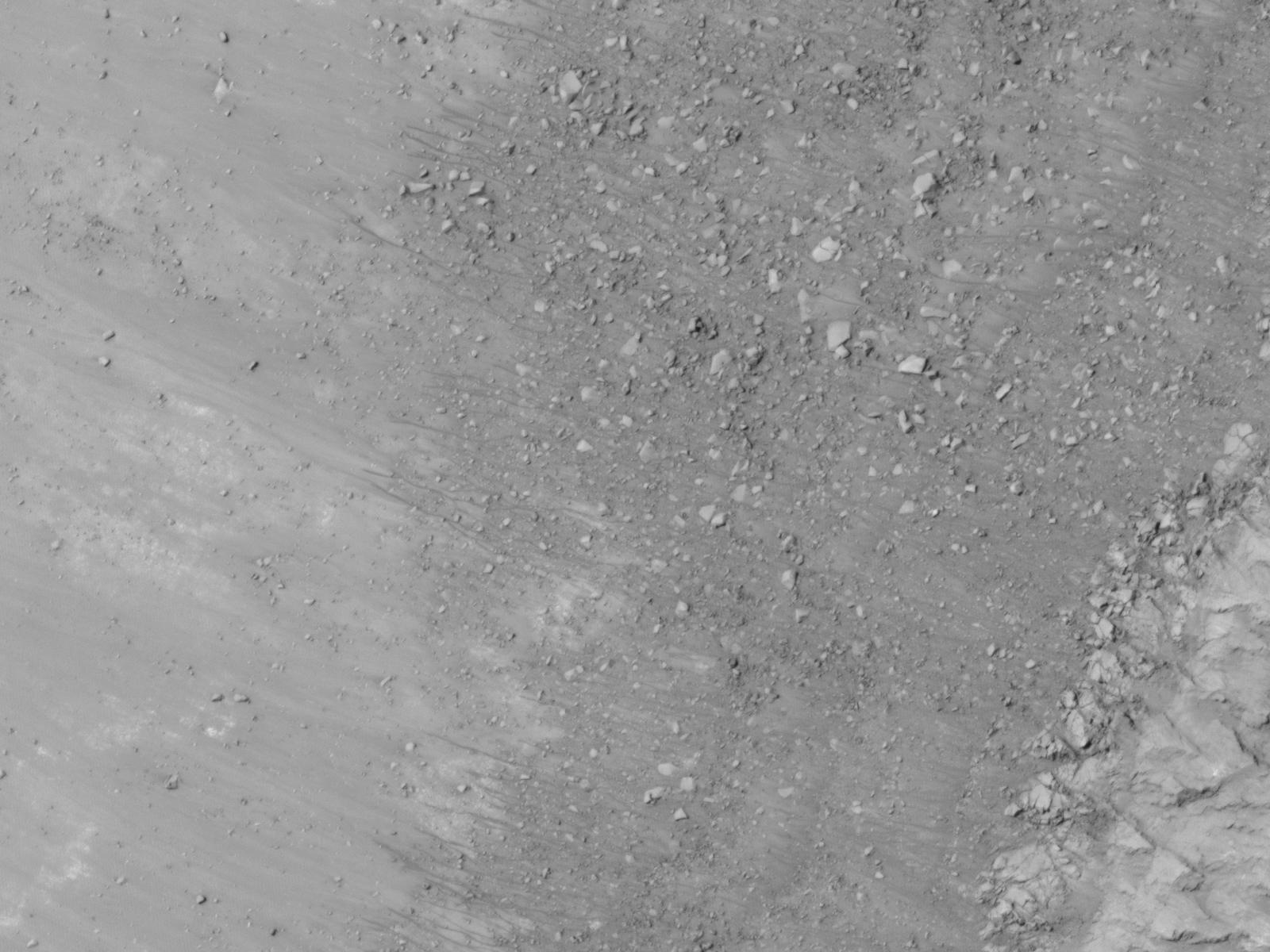
2011-08-04 |
Mars
|
Mars Reconnaissance Orbiter (MRO)
|
HiRISE
|
1839x1518x3 |
|
-
PIA14472:
-
Warm-Season Flows on Slope in Newton Crater (Six-Image Sequence)
Full Resolution:
TIFF
(2.796 MB)
JPEG
(373.5 kB)
|
|
|
2011-08-04 |
Mars
|
Mars Reconnaissance Orbiter (MRO)
|
HiRISE
|
1917x1528x3 |
|
-
PIA14473:
-
Warm-Season Flows on Slope in Newton Crater (Five-Image Sequence)
Full Resolution:
TIFF
(2.934 MB)
JPEG
(471.7 kB)
|
|
|
2011-08-04 |
Mars
|
Mars Reconnaissance Orbiter (MRO)
|
HiRISE
|
1642x1534x3 |

|
-
PIA14474:
-
Dark Flows in Newton Crater Extending During Summer (Six-Image Sequence)
Full Resolution:
TIFF
(2.524 MB)
JPEG
(394.1 kB)
|
|
|
2011-08-04 |
Mars
|
Mars Reconnaissance Orbiter (MRO)
|
HiRISE
|
2453x2033x3 |
|
-
PIA14476:
-
Warm-Season Flows on Slope in Horowitz Crater (Nine-Image Sequence)
Full Resolution:
TIFF
(4.994 MB)
JPEG
(594.9 kB)
|
|
|
2011-08-04 |
Mars
|
Mars Reconnaissance Orbiter (MRO)
|
HiRISE
|
2147x1319x3 |
|
-
PIA14477:
-
Warm-Season Flows on Steep Slope in Slope in Terra Cimmeria (Eight-Image Sequence)
Full Resolution:
TIFF
(2.837 MB)
JPEG
(404.1 kB)
|
|
|
2011-08-04 |
Mars
|
Mars Reconnaissance Orbiter (MRO)
|
HiRISE
|
2515x1530x3 |
|
-
PIA14478:
-
Warm-Season Flows in Well-Preserved Crater in Terra Sirenum (Six-Image Sequence)
Full Resolution:
TIFF
(3.854 MB)
JPEG
(597.1 kB)
|
|
|
2011-08-04 |
Mars
|
Mars Reconnaissance Orbiter (MRO)
|
HiRISE
|
1269x1448x3 |
|
-
PIA14479:
-
Oblique View of Warm Season Flows in Newton Crater
Full Resolution:
TIFF
(5.519 MB)
JPEG
(285.1 kB)
|
|
|
2011-08-04 |
Mars
|
Mars Reconnaissance Orbiter (MRO)
|
HiRISE
|
1600x1200x1 |
|
-
PIA14501:
-
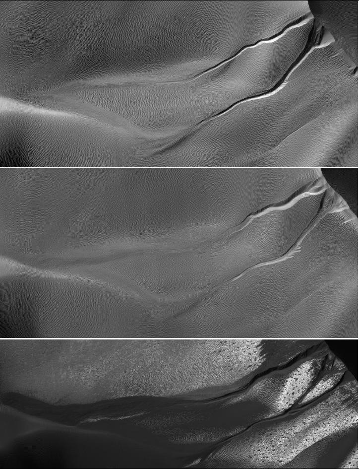
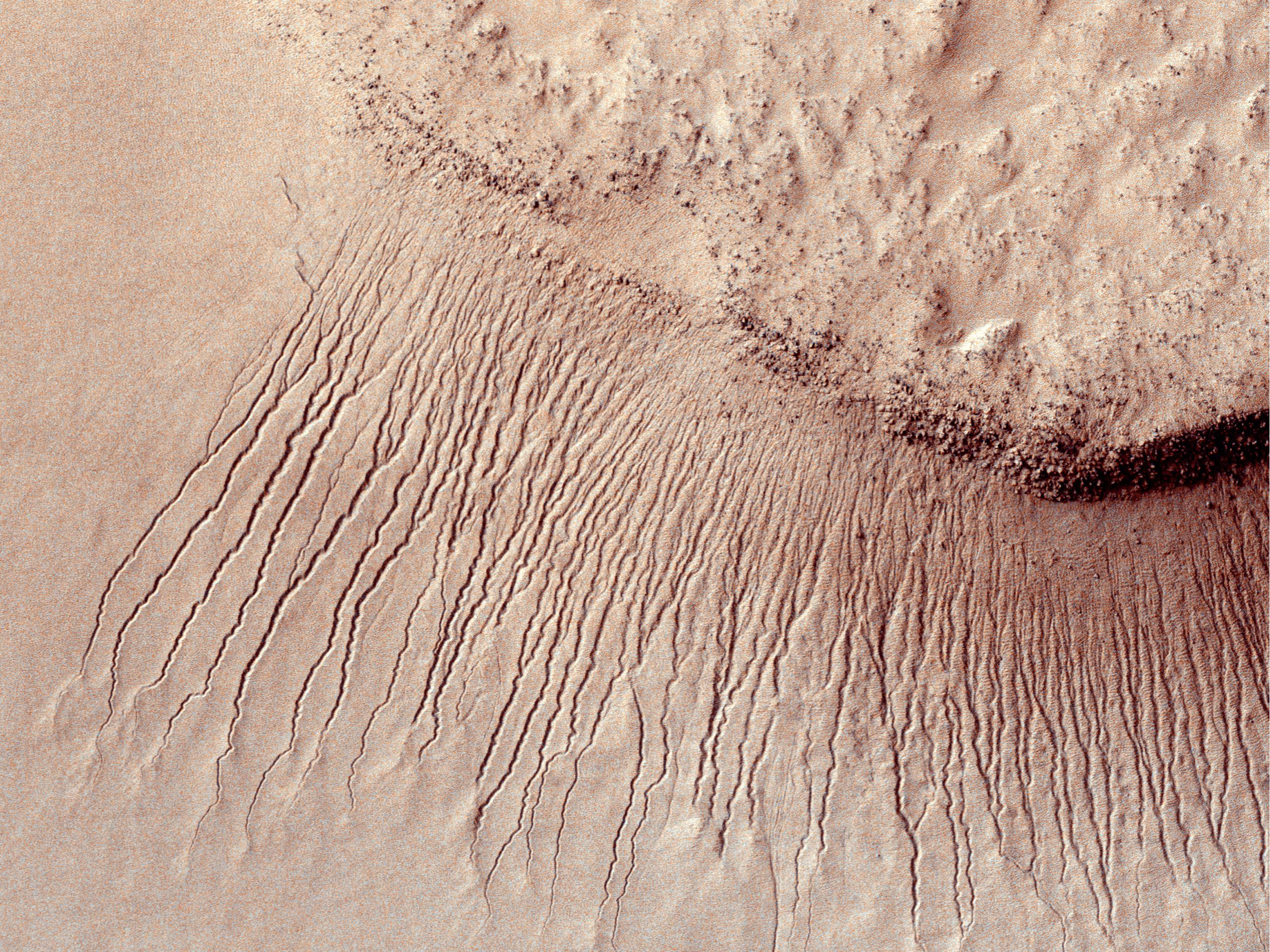
Gullies and Newly Identified Flow Features in Same Mars Crater
Full Resolution:
TIFF
(1.922 MB)
JPEG
(196.2 kB)
|
|
|
2011-08-04 |
Mars
|
Mars Reconnaissance Orbiter (MRO)
|
HiRISE
|
1600x1200x1 |
|
-
PIA14502:
-
Site of Warm Season Flows in Mars Crater
Full Resolution:
TIFF
(1.922 MB)
JPEG
(209.1 kB)
|
|
|
2011-08-04 |
Mars
|
Mars Reconnaissance Orbiter (MRO)
|
HiRISE
|
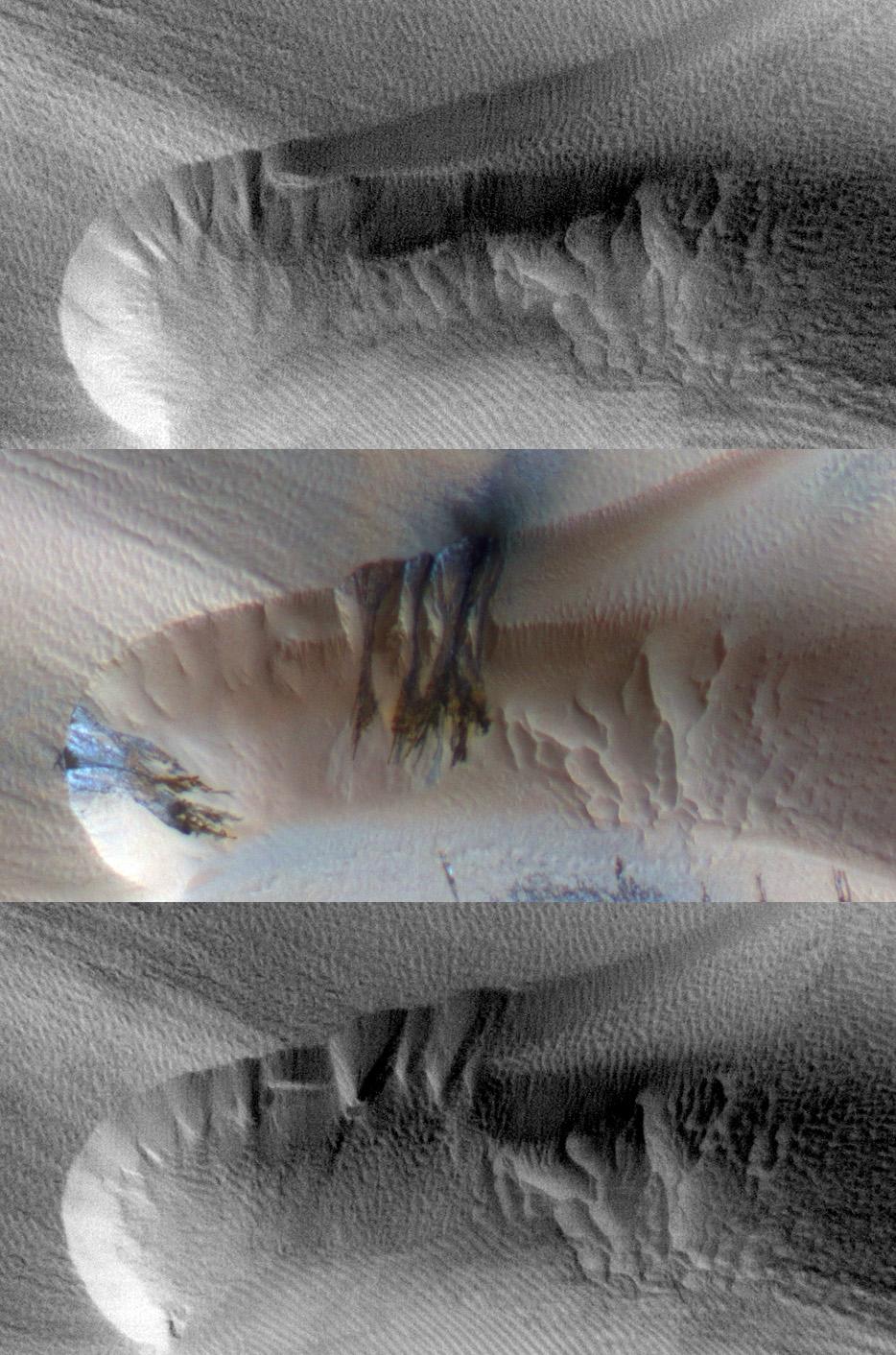
1600x1200x1 |
|
-
PIA14503:
-
Changes in a Gully in a Mars Crater (Two-Image Comparison)
Full Resolution:
TIFF
(1.922 MB)
JPEG
(136.2 kB)
|
|
|
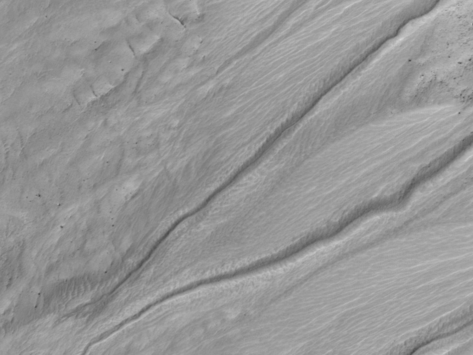
2011-09-01 |
Mars
|
Mars Exploration Rover (MER)
Mars Reconnaissance Orbiter (MRO)
|
CTX
|
5664x7979x3 |
|
-
PIA14536:
-
Opportunity Traverses Through 2,700 Martian Days
Full Resolution:
TIFF
(45.26 MB)
JPEG
(6.766 MB)
|
|
|
2011-09-01 |
Mars
|
Mars Exploration Rover (MER)
Mars Reconnaissance Orbiter (MRO)
|
HiRISE
|
8192x5786x3 |
|
-
PIA14537:
-
Opportunity's First Neighborhood on Rim of Endeavour
Full Resolution:
TIFF
(142.2 MB)
JPEG
(5.631 MB)
|
|
|
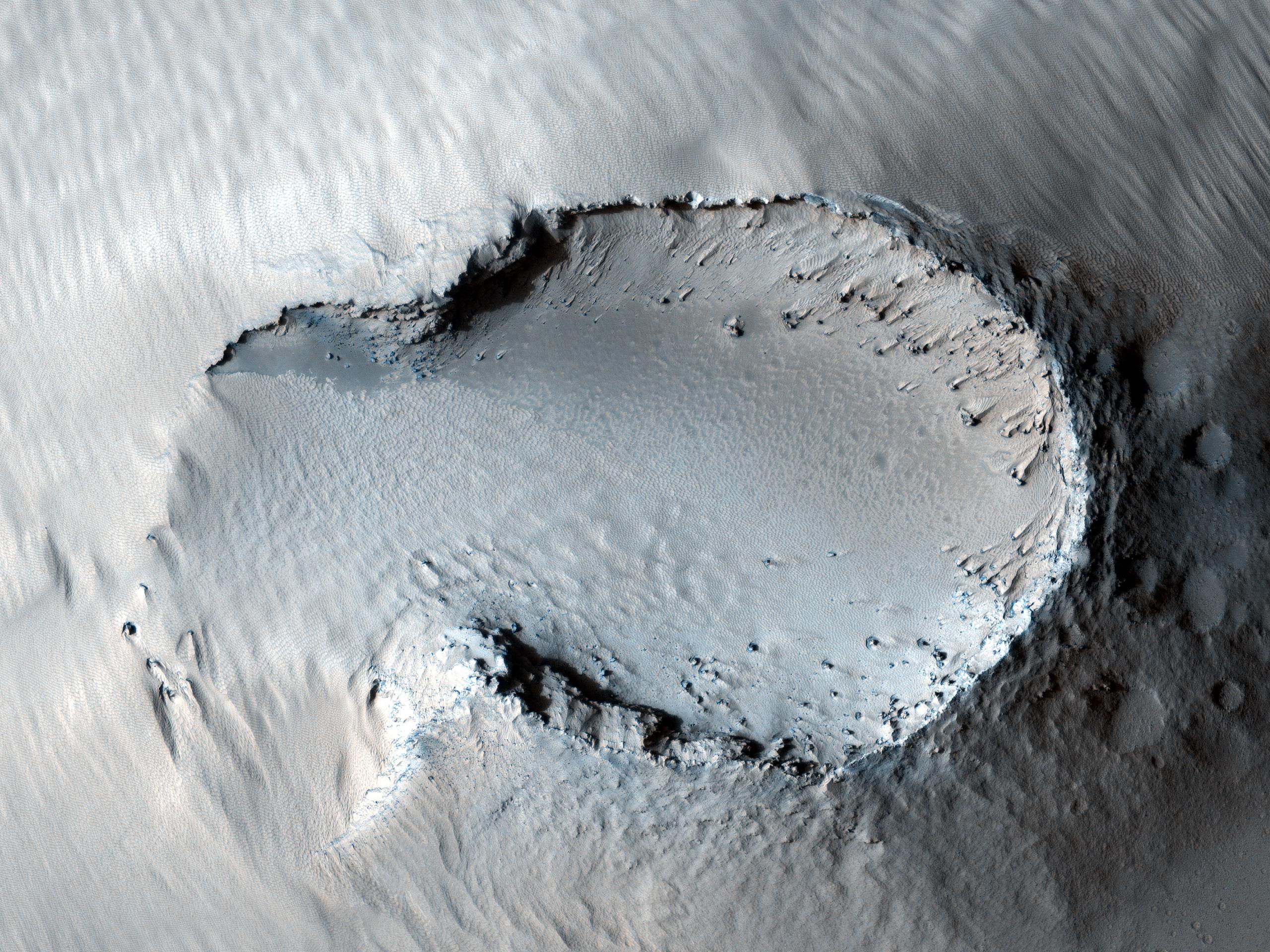
2011-10-05 |
Mars
|
Mars Reconnaissance Orbiter (MRO)
|
HiRISE
|
2560x1920x3 |
|
-
PIA14890:
-
Colorful Central Peak in an Unnamed Crater
Full Resolution:
TIFF
(14.76 MB)
JPEG
(581.1 kB)
|
|
|
2011-11-02 |
Mars
|
Mars Reconnaissance Orbiter (MRO)
|
CRISM
|
2000x2000x3 |
|
-
PIA14764:
-
Clay Minerals in Craters and Escarpments on Mars
Full Resolution:
TIFF
(12.02 MB)
JPEG
(262.6 kB)
|
|
|
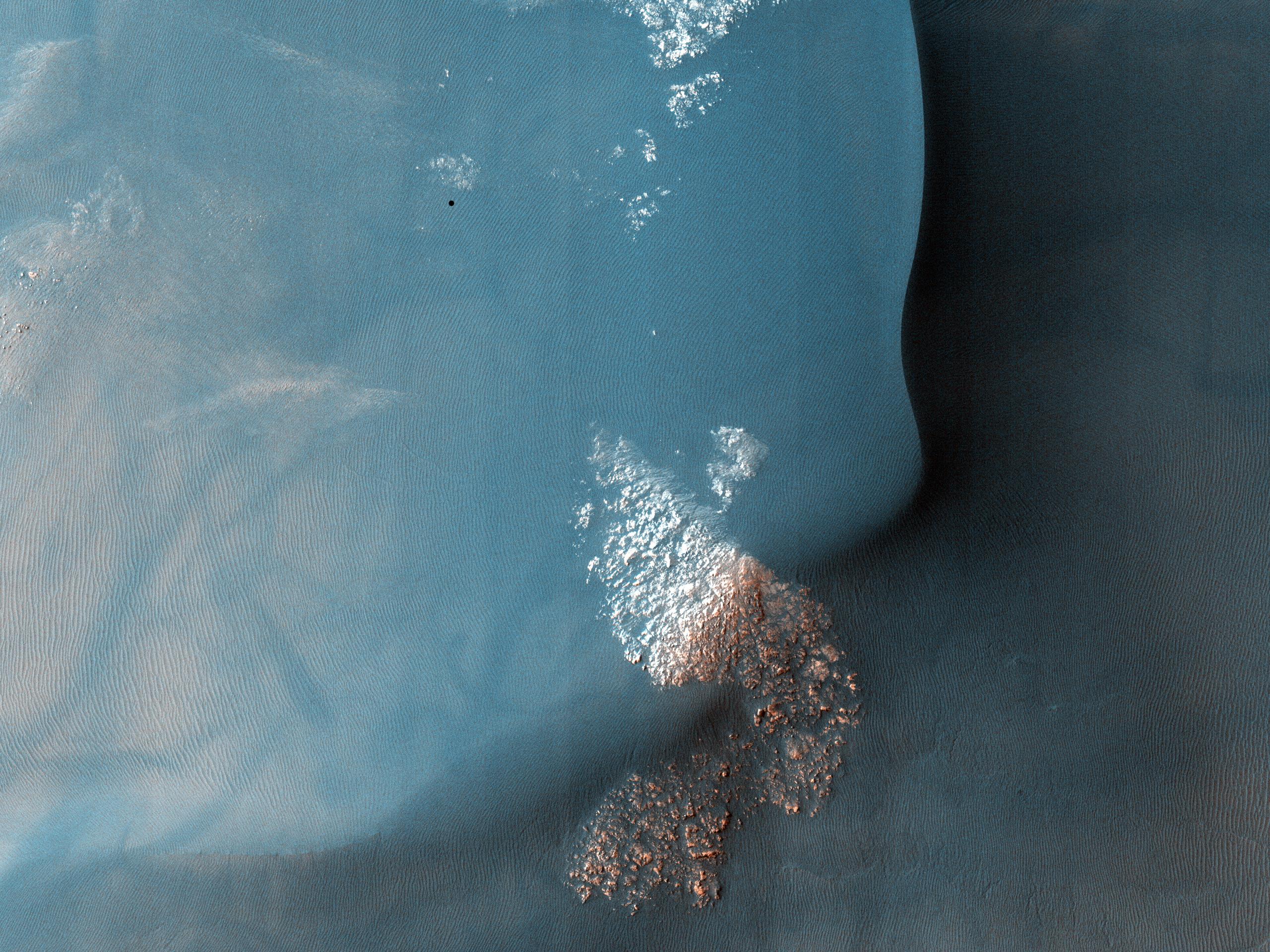
2011-11-17 |
Mars
|
Mars Reconnaissance Orbiter (MRO)
|
HiRISE
|
920x1016x1 |
|
-
PIA14876:
-
Blowing in the Martian Wind

Full Resolution:
TIFF
(936 kB)
JPEG
(106.7 kB)
|
|
|
2011-11-17 |
Mars
|
Mars Reconnaissance Orbiter (MRO)
|
HiRISE
|
781x1019x1 |
|
-
PIA14877:
-
Shifting Sand in Herschel Crater
Full Resolution:
TIFF
(796.9 kB)
JPEG
(171.2 kB)
|
|
|
2011-11-17 |
Mars
|
Mars Reconnaissance Orbiter (MRO)
|
HiRISE
|
738x604x1 |
|
-
PIA14878:
-
Rippling Dune Front in Herschel Crater on Mars
Full Resolution:
TIFF
(446.4 kB)
JPEG
(72.31 kB)
|
|
|
2011-11-17 |
Mars
|
Mars Reconnaissance Orbiter (MRO)
|
HiRISE
|
878x1120x1 |
|
-
PIA14879:
-
Rippling Dune Front in Herschel Crater on Mars
Full Resolution:
TIFF
(984.6 kB)
JPEG
(119.5 kB)
|
|
|
2011-11-17 |
Mars
|
Mars Reconnaissance Orbiter (MRO)
|
HiRISE
|
1225x925x1 |
|
-
PIA14880:
-
Movement in Martian Dune Field
Full Resolution:
TIFF
(1.135 MB)
JPEG
(144.5 kB)
|
|
|
2011-11-21 |
Mars
|
Mars Reconnaissance Orbiter (MRO)
|
HiRISE
|
950x720x1 |
|
-
PIA15092:
-
Rhythmic Layering in Danielson Crater on Mars
Full Resolution:
TIFF
(685 kB)
JPEG
(113.5 kB)
|
|
|
2011-11-21 |
Mars
|
Mars Reconnaissance Orbiter (MRO)
|
HiRISE
|
923x690x3 |
|
-
PIA15096:
-
Fresh Crater Revealing Buried Ice
Full Resolution:
TIFF
(1.914 MB)
JPEG
(132.1 kB)
|
|
|
2011-11-21 |
Mars
|
Mars Reconnaissance Orbiter (MRO)
|
CRISM
CTX
|
935x720x3 |
|
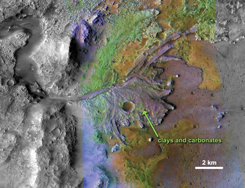
-
PIA15097:
-
Chemical Alteration by Water, Jezero Crater Delta
Full Resolution:
TIFF
(2.023 MB)
JPEG
(132 kB)
|
|
|
2011-11-21 |
Mars
|
Mars Reconnaissance Orbiter (MRO)
|
HiRISE
|
860x647x3 |
|
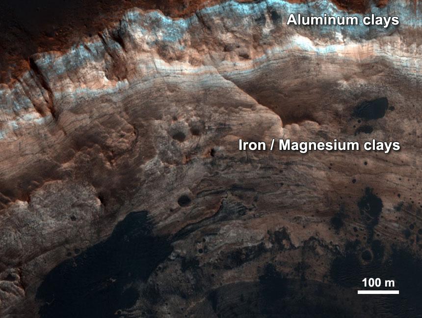
-
PIA15098:
-
Chemical Alteration by Water, Mawrth Vallis
Full Resolution:
TIFF
(1.671 MB)
JPEG
(95.97 kB)
|
|
|
2011-11-21 |
Mars
|
Mars Reconnaissance Orbiter (MRO)
|
CRISM
CTX
|
857x517x3 |

|
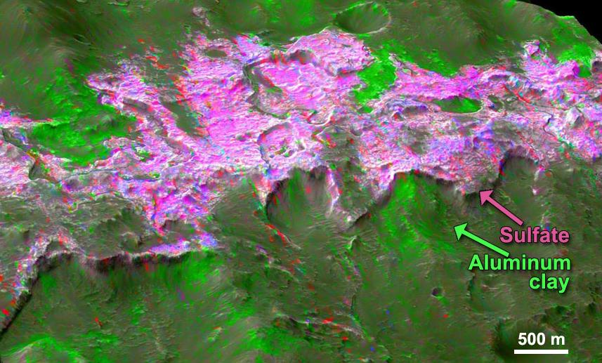
-
PIA15099:
-
Sulfates and Clays in Columbus Crater, Mars
Full Resolution:
TIFF
(1.331 MB)
JPEG
(97.63 kB)
|


