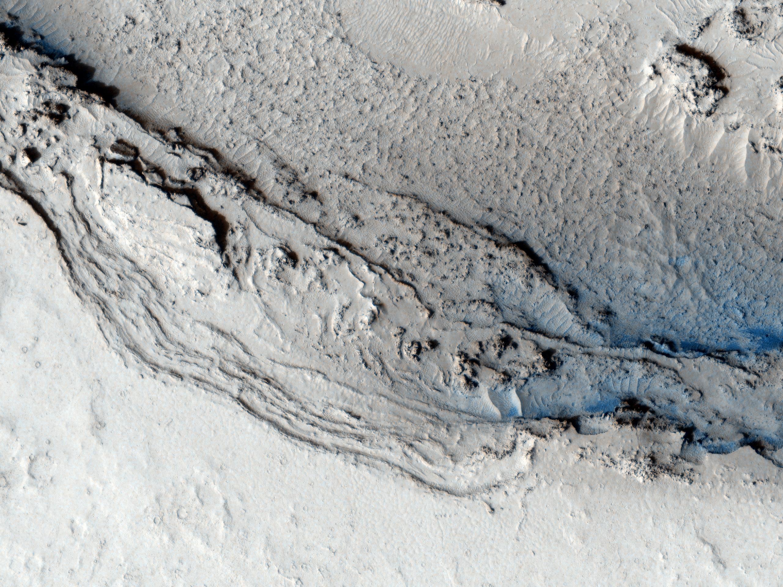
This image hows the funnel-shaped terminus of Lethe Vallis, a winding channel in the Elysium Planitia region of Mars.
Lethe Vallis flows from southwest to northeast between two basins, Cerberus Palus and eastern Elysium Plantia. Where it empties into the latter, the channel abruptly widens. On the west side of this HiRISE image, Lethe Vallis is approximately 800 meters (0.5 miles) wide; on the east side, it is more than 7 kilometers (4.3 miles) in width. As the fluid that carved the channel spread out, its erosive power diminished. Thus, where the channel is wider, it contains numerous high-standing mesas that are primarily composed of pre-existing material that was not fully eroded away.
The floor of Lethe Vallis is covered in solidified lava and blanketed by a thin layer of light-toned dust. The lava has a rough, ridged appearance where its surface buckled as it cooled, and a smoother polygonal texture where it was not significantly deformed. Interestingly, lava textures are visible high on the banks and terraces of the Lethe Vallis. Farther away from the channel, the terrain is older and more heavily cratered.
NASA's Jet Propulsion Laboratory, a division of the California Institute of Technology in Pasadena, manages the Mars Reconnaissance Orbiter for NASA's Science Mission Directorate, Washington. Lockheed Martin Space Systems, Denver, built the spacecraft. The High Resolution Imaging Science Experiment is operated by the University of Arizona, Tucson, and the instrument was built by Ball Aerospace & Technologies Corp., Boulder, Colo.
Originally released June 20, 2007
