Click on an image for detailed information
Click on a column heading to sort in ascending or descending order

My
List |
Addition Date
|
Target
|
Mission
|
Instrument
|
Size
|

|
2012-08-08 |
Mars
|
Mars Reconnaissance Orbiter (MRO)
Mars Science Laboratory (MSL)
|
CTX
|
758x511x1 |
|
-
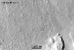
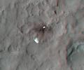
PIA16015:
-
Ballasts Hitting the Surface, Close-Up (with arrows)

Full Resolution:
TIFF
(388 kB)
JPEG
(58.05 kB)
|
|
|
2012-08-08 |
Mars
|
Mars Reconnaissance Orbiter (MRO)
Mars Science Laboratory (MSL)
|
HiRISE
MARDI
|
1665x1174x3 |
|
-
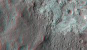
PIA16019:
-
A Better Look of the Martian Surface
Full Resolution:
TIFF
(5.867 MB)
JPEG
(153.7 kB)
|
|
|
2012-08-09 |
Mars
|
Mars Reconnaissance Orbiter (MRO)
Mars Science Laboratory (MSL)
|
HiRISE
|
724x720x1 |
|
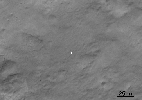
-
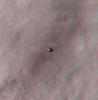
PIA16030:
-
Curiosity's Quad
Full Resolution:
TIFF
(522 kB)
JPEG
(63.57 kB)
|
|
|
2012-08-09 |
Mars
|
Mars Reconnaissance Orbiter (MRO)
Mars Science Laboratory (MSL)
|
HiRISE
|
862x650x3 |
|
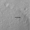
-
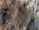
PIA16031:
-
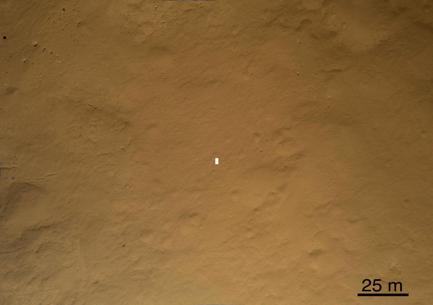
Staking out Curiosity's Landing Site
Full Resolution:
TIFF
(1.682 MB)
JPEG
(99.91 kB)
|
|
|
2012-08-10 |
Mars
|
Mars Reconnaissance Orbiter (MRO)
Mars Science Laboratory (MSL)
|
MARCI
|
1449x1087x3 |
|
-
PIA16037:
-
Mars Weather Map, Aug. 5
Full Resolution:
TIFF
(4.727 MB)
JPEG
(123.9 kB)
|
|
|
2012-08-14 |
Mars
|
Mars Reconnaissance Orbiter (MRO)
Mars Science Laboratory (MSL)
|
HiRISE
|
1511x13401x3 |
|
-
PIA16056:
-
A Whole New World for Curiosity
Full Resolution:
TIFF
(60.77 MB)
JPEG
(2.358 MB)
|
|
|
2012-08-14 |
Mars
|
Mars Reconnaissance Orbiter (MRO)
Mars Science Laboratory (MSL)
|
HiRISE
|
3022x2515x3 |
|
-
PIA16057:
-
Curiosity in Exaggerated Color
Full Resolution:
TIFF
(22.81 MB)
JPEG
(1.151 MB)
|
|
|
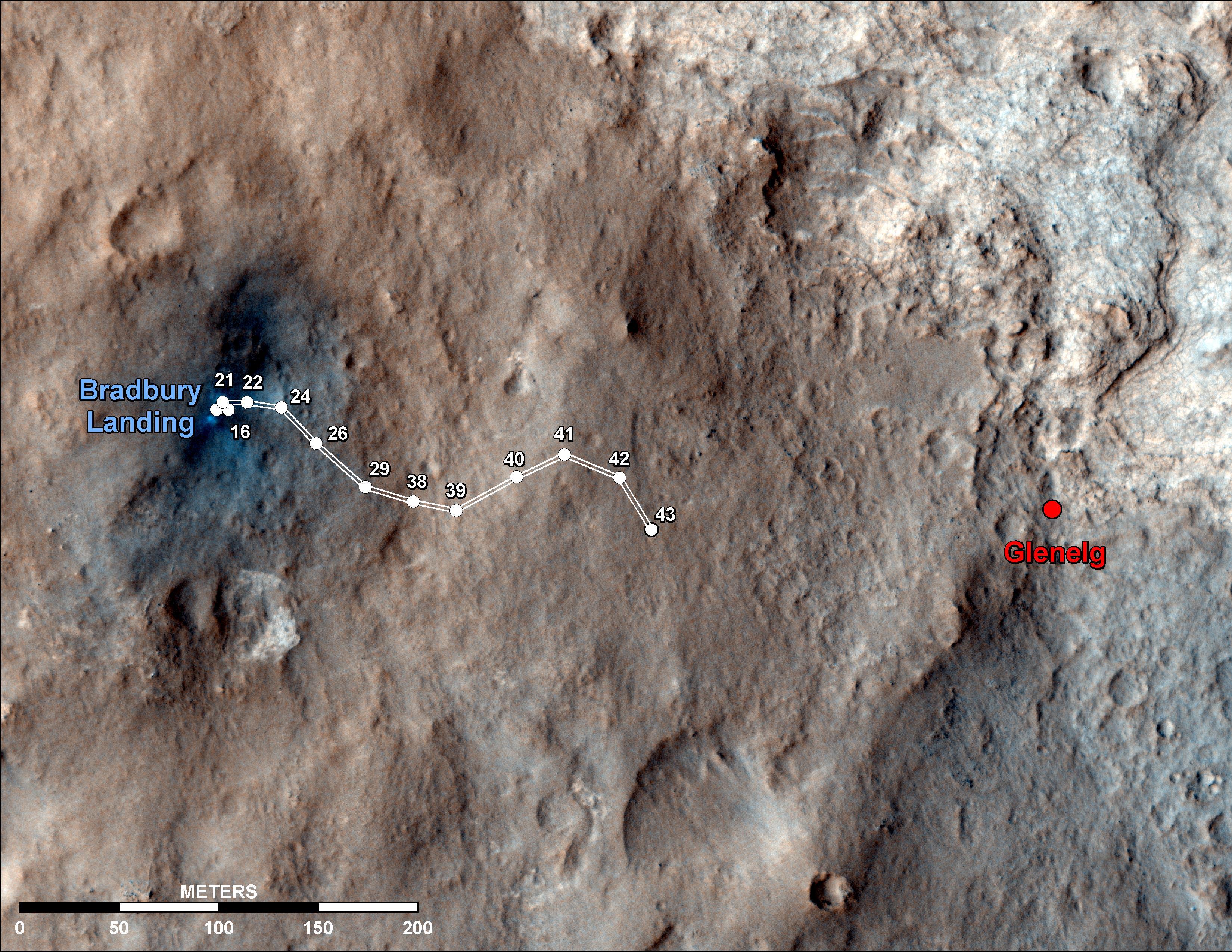
2012-09-19 |
Mars
|
Mars Reconnaissance Orbiter (MRO)
Mars Science Laboratory (MSL)
|
HiRISE
|
3300x2550x3 |
|
-
PIA16153:
-
Curiosity Traverse Map Through Sol 43
Full Resolution:
TIFF
(25.26 MB)
JPEG
(1.57 MB)
|
|
|
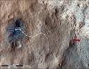
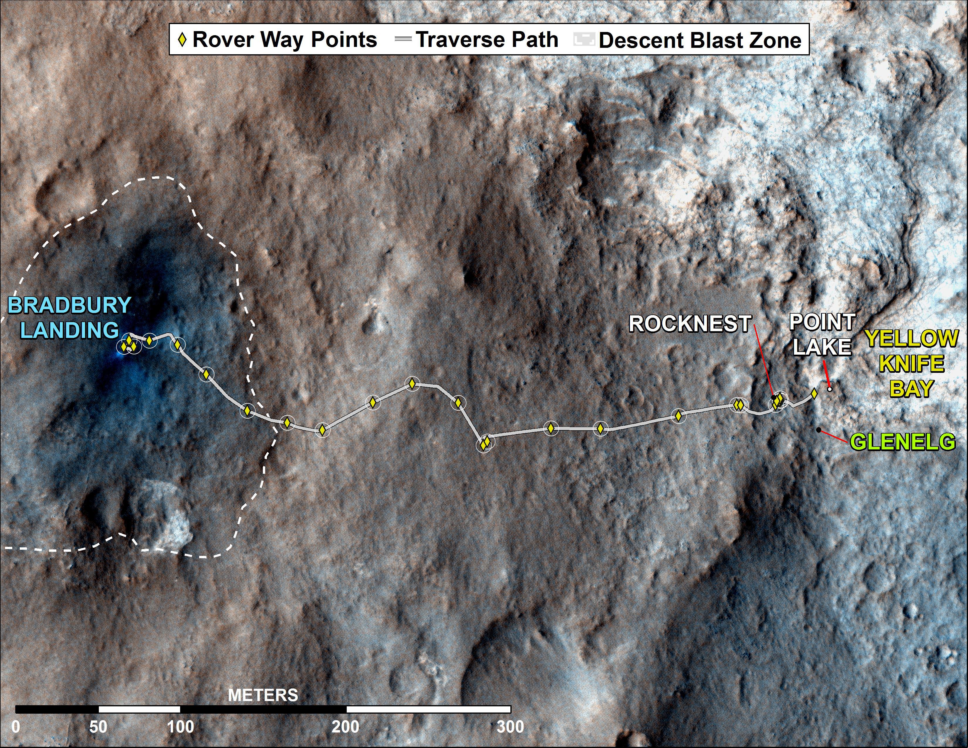
2012-09-27 |
Mars
|
Mars Reconnaissance Orbiter (MRO)
Mars Science Laboratory (MSL)
|
HiRISE
|
932x720x3 |
|
-
PIA16157:
-
Curiosity's Roadside Discoveries
Full Resolution:
TIFF
(2.014 MB)
JPEG
(132.4 kB)
|
|
|
2012-09-27 |
Mars
|
Mars Reconnaissance Orbiter (MRO)
Mars Science Laboratory (MSL)
|
HiRISE
|
3339x2580x3 |

|
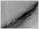
-
PIA16158:
-
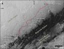
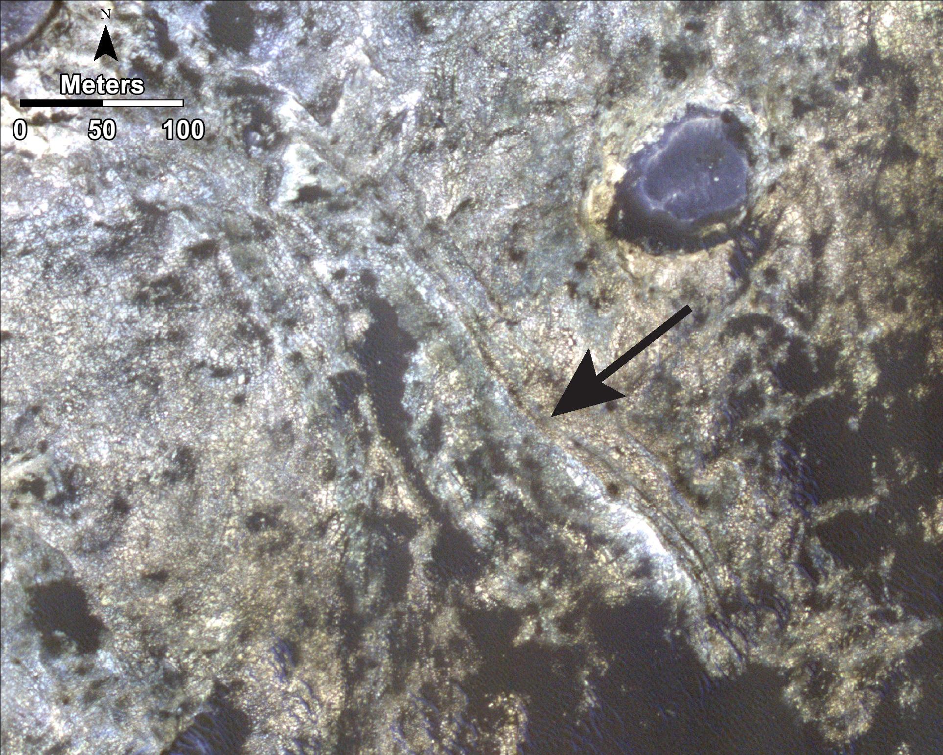
Where Water Flowed Downslope
Full Resolution:
TIFF
(25.85 MB)
JPEG
(1.87 MB)
|
|
|
2012-10-10 |
Mars
|
Mars Reconnaissance Orbiter (MRO)
Mars Science Laboratory (MSL)
|
HiRISE
|
398x408x3 |
|
-
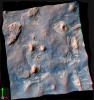
PIA16208:
-
Curiosity at Bradbury Landing Site in 3-D
Full Resolution:
TIFF
(487.5 kB)
JPEG
(17.84 kB)
|
|
|
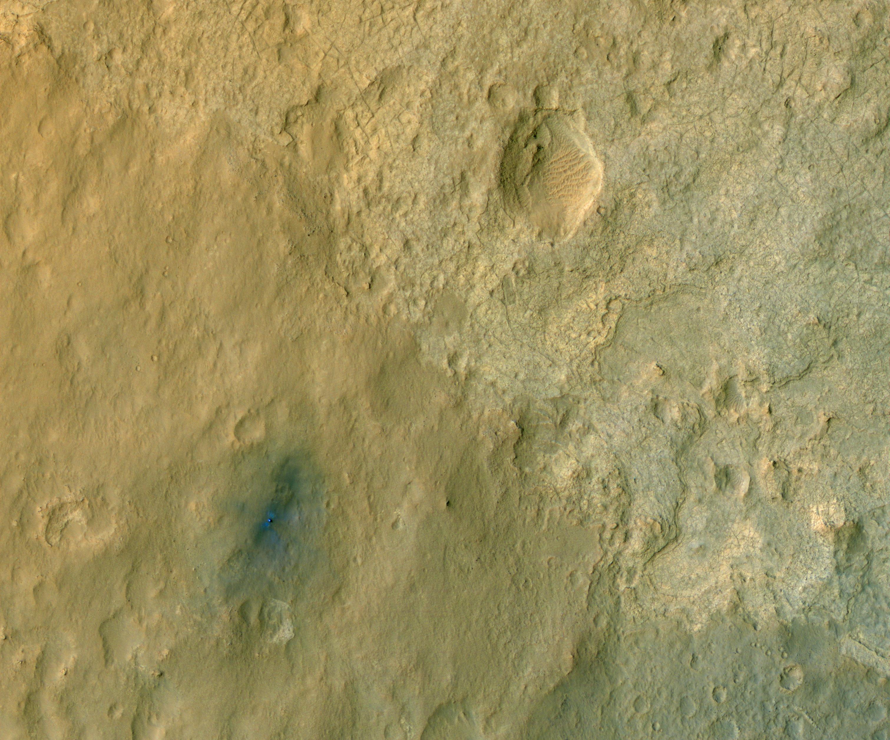
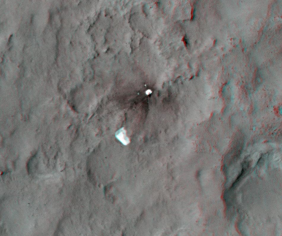
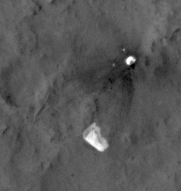
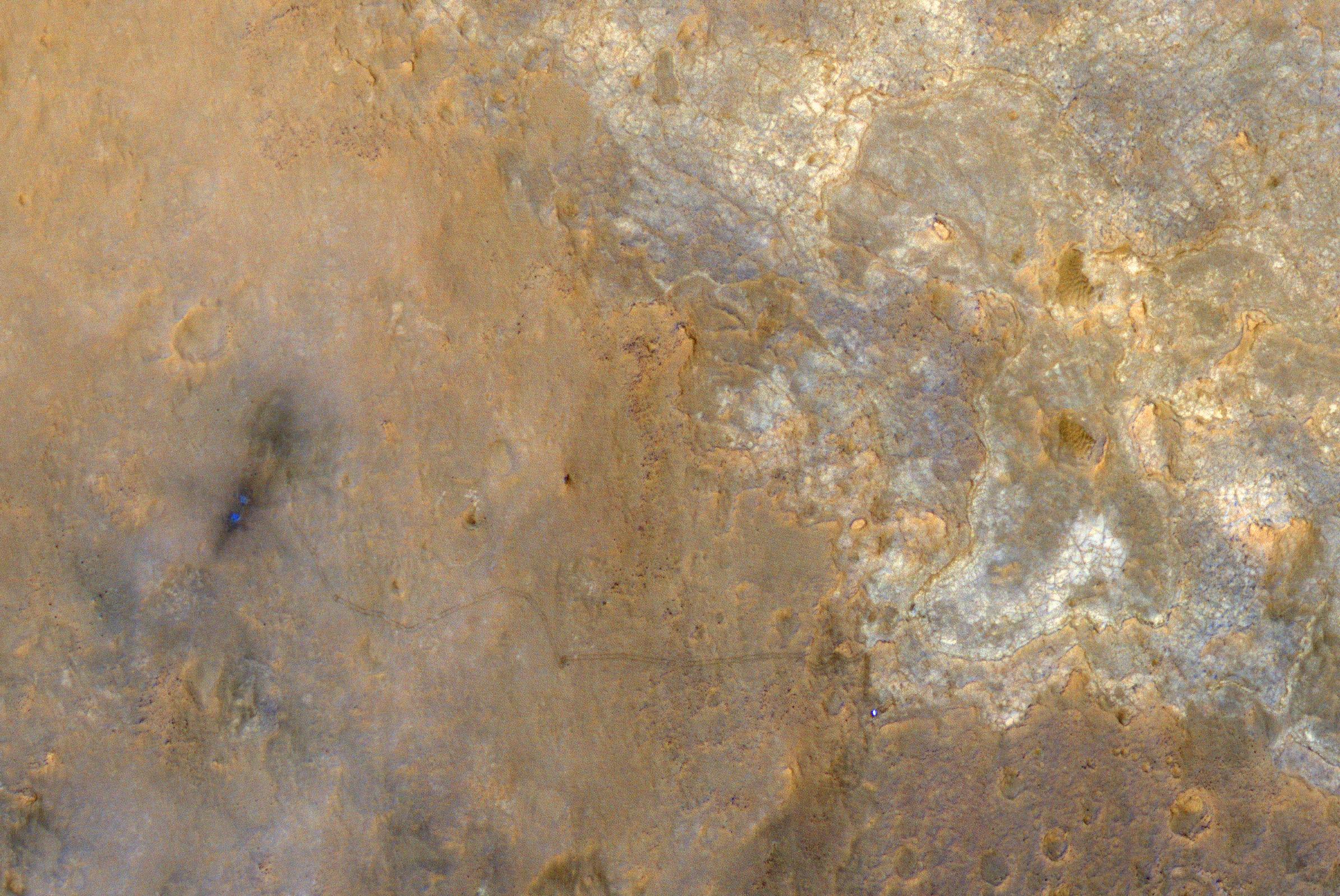
2012-10-10 |
Mars
|
Mars Reconnaissance Orbiter (MRO)
Mars Science Laboratory (MSL)
|
HiRISE
|
950x795x3 |
|
-
PIA16209:
-
Parachute and Back Shell in 3-D
Full Resolution:
TIFF
(2.267 MB)
JPEG
(87.85 kB)
|
|
|
2012-10-10 |
Mars
|
Mars Reconnaissance Orbiter (MRO)
Mars Science Laboratory (MSL)
|
HiRISE
|
2414x1387x3 |
|
-
PIA16210:
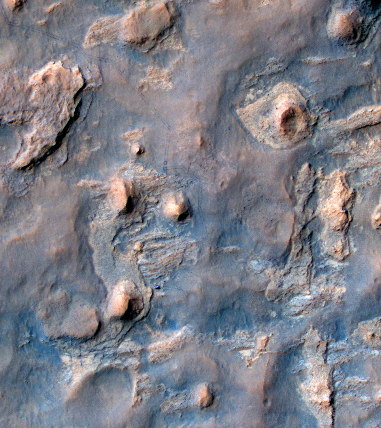
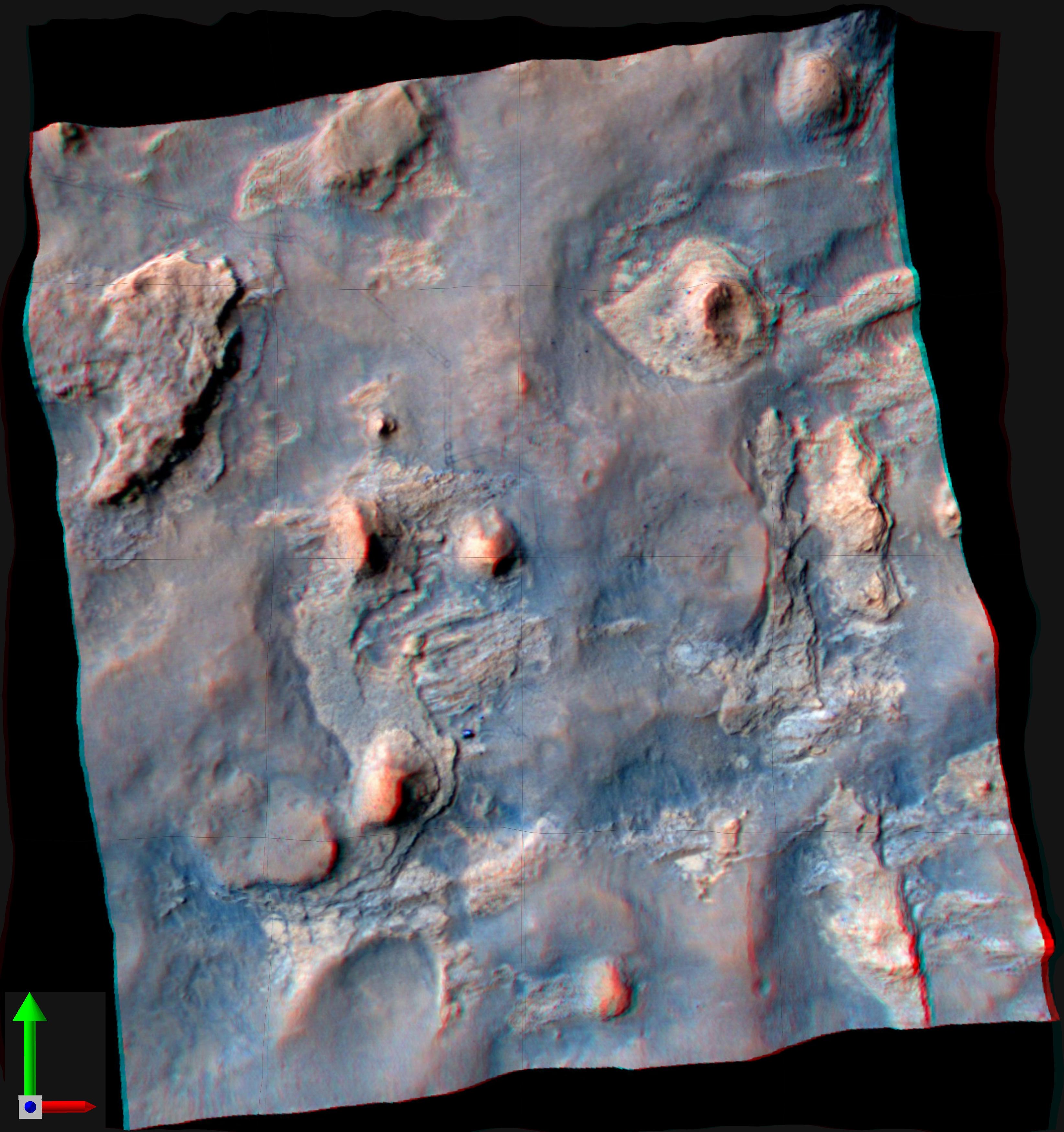
-
'Glenelg' in 3-D
Full Resolution:
TIFF
(10.05 MB)
JPEG
(554.1 kB)
|
|
|
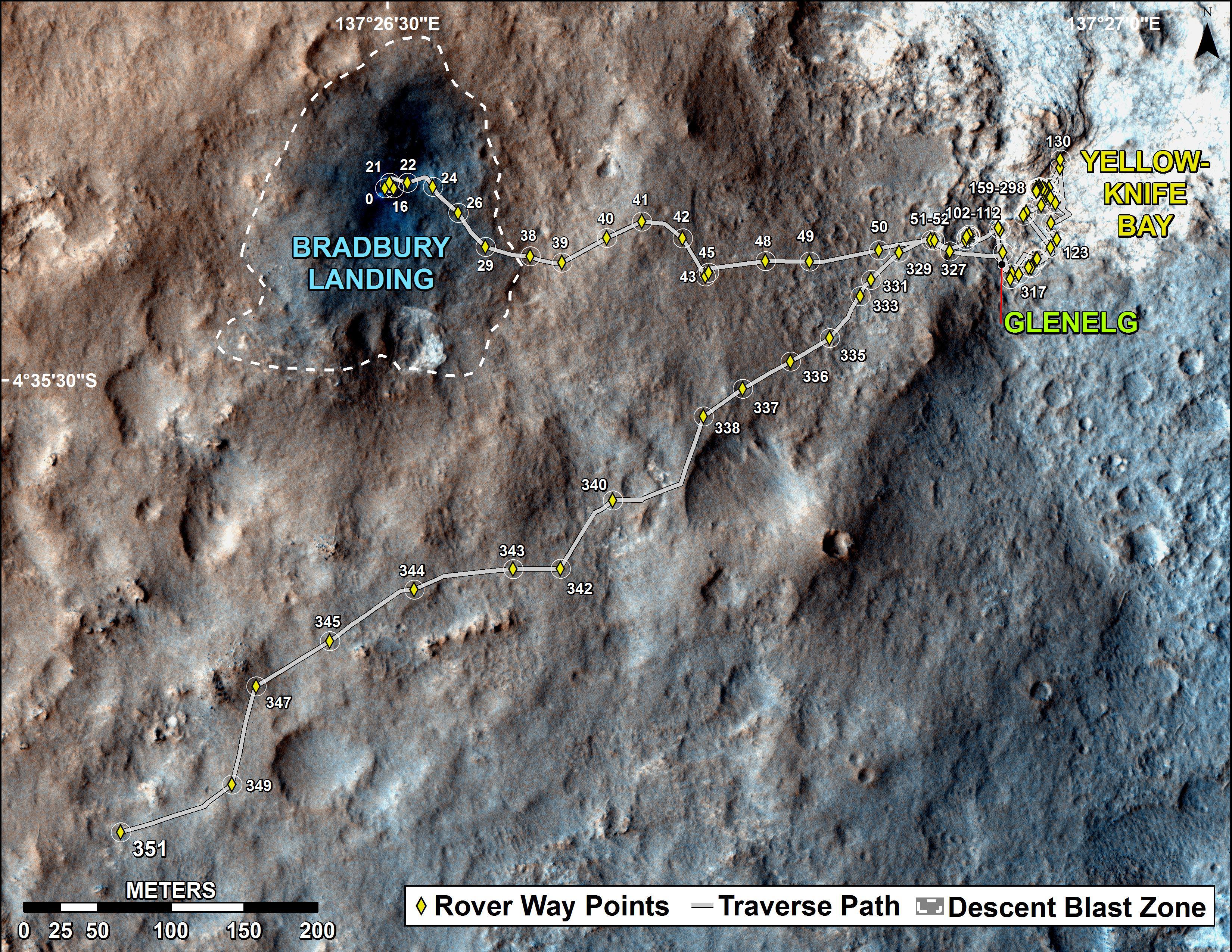
2012-12-03 |
Mars
|
Mars Reconnaissance Orbiter (MRO)
Mars Science Laboratory (MSL)
|
HiRISE
|
3300x2550x3 |
|
-
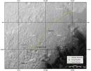
PIA16577:
-
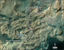
Curiosity Rover's Traverse, August through November 2012
Full Resolution:
TIFF
(25.26 MB)
JPEG
(1.893 MB)
|
|
|
2012-12-18 |
Mars
|
Mars Reconnaissance Orbiter (MRO)
Mars Science Laboratory (MSL)
|
HiRISE
|
3300x2550x3 |

|
-
PIA16554:
-
Curiosity Traverse Map, Sol 130
Full Resolution:
TIFF
(25.26 MB)
JPEG
(1.761 MB)
|
|
|
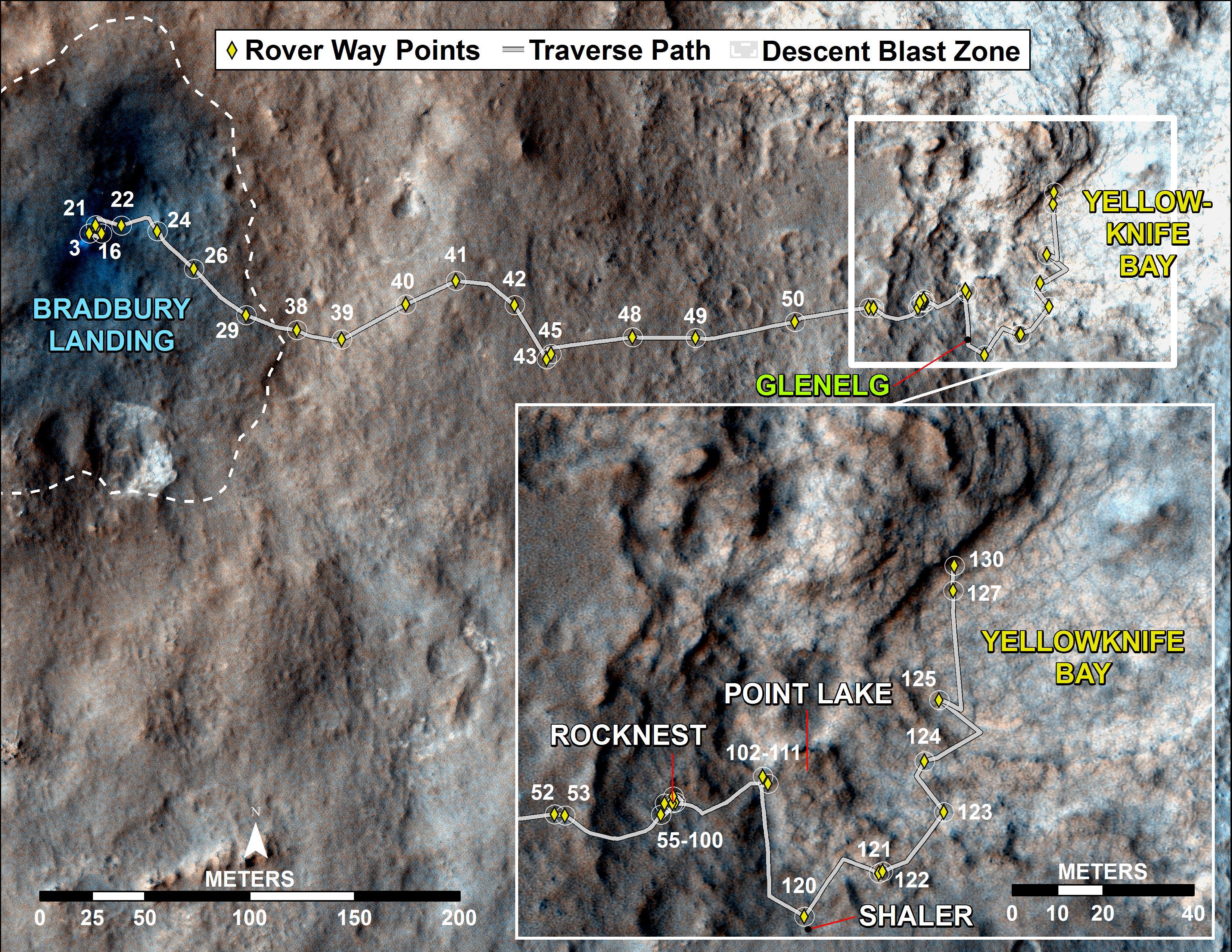
2013-04-03 |
Mars
|
Mars Reconnaissance Orbiter (MRO)
Mars Science Laboratory (MSL)
|
HiRISE
|
369x390x1 |
|
-
PIA16813:
-
MSL's Parachute Flapping in the Wind
Full Resolution:
TIFF
(144.3 kB)
JPEG
(15.5 kB)
|
|
|
2013-07-24 |
Mars
|
Mars Reconnaissance Orbiter (MRO)
Mars Science Laboratory (MSL)
|
HiRISE
|
2389x1598x3 |
|
-
PIA17080:
-
View From Mars Orbiter Showing Curiosity Rover at 'Shaler'
Full Resolution:
TIFF
(11.46 MB)
JPEG
(879.4 kB)
|
|
|
2013-08-02 |
Mars
|
Mars Reconnaissance Orbiter (MRO)
Mars Science Laboratory (MSL)
|
HiRISE
|
3300x2550x3 |

|
-
PIA17085:
-
Full Curiosity Traverse Passes One-Mile Mark
Full Resolution:
TIFF
(25.26 MB)
JPEG
(2.249 MB)
|
|
|
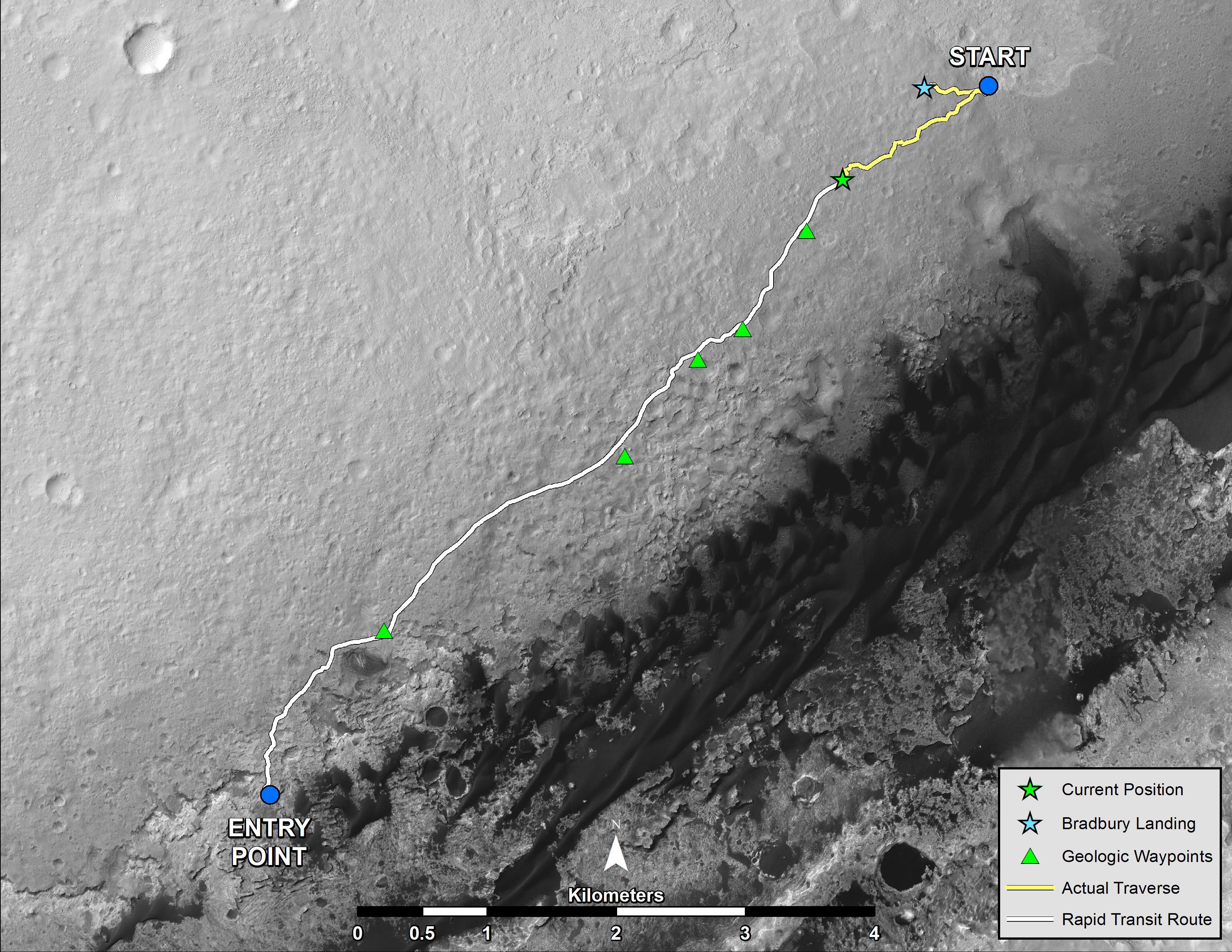
2013-08-27 |
Mars
|
Mars Reconnaissance Orbiter (MRO)
Mars Science Laboratory (MSL)
|
HiRISE
|
3300x2550x3 |
|
-
PIA17355:
-
Curiosity's Progress on Route from 'Glenelg' to Mount Sharp
Full Resolution:
TIFF
(25.26 MB)
JPEG
(1.493 MB)
|
|
|
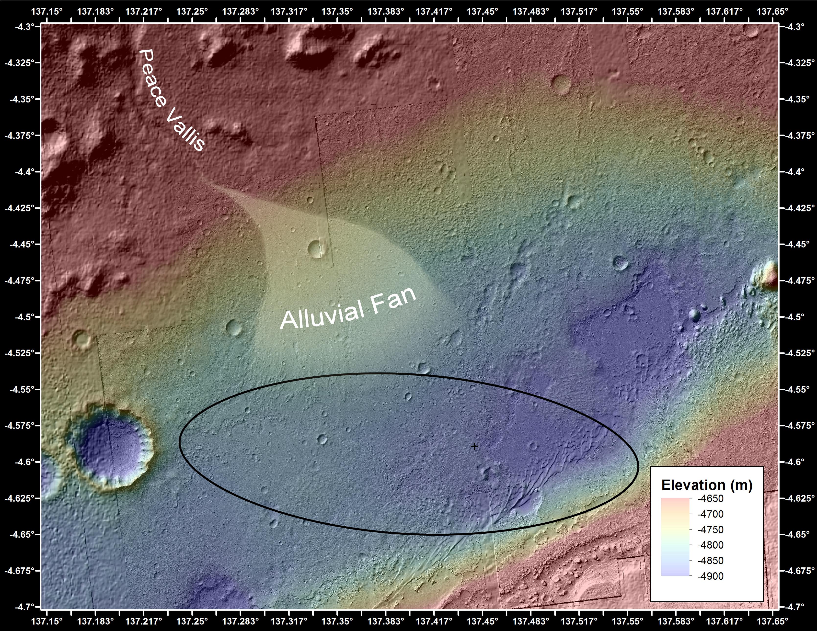
2013-12-09 |
Mars
|
Mars Reconnaissance Orbiter (MRO)
Mars Science Laboratory (MSL)
|
CTX
|
3300x2550x3 |
|
-
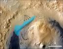
PIA17596:
-
Possible Extent of Ancient Lake in Gale Crater, Mars
Full Resolution:
TIFF
(25.26 MB)
JPEG
(1.34 MB)
|
|
|
2014-01-29 |
Mars
|
Mars Reconnaissance Orbiter (MRO)
Mars Science Laboratory (MSL)
|
HiRISE
|
3300x2550x3 |
|
-
PIA17765:
-
Traverse Map for Mars Rover Curiosity as of Jan. 26, 2014
Full Resolution:
TIFF
(25.26 MB)
JPEG
(1.211 MB)
|
|
|
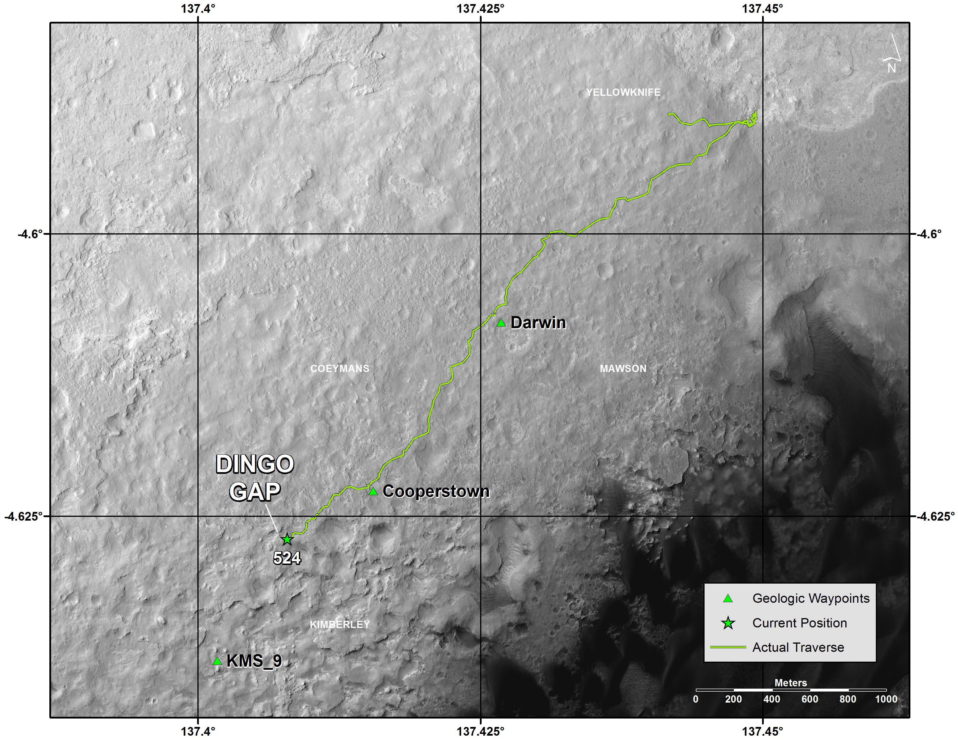
2014-04-16 |
Mars
|
Mars Reconnaissance Orbiter (MRO)
Mars Science Laboratory (MSL)
|
HiRISE
|
1322x1482x3 |
|
-
PIA18081:
-
Curiosity and Rover Tracks at 'the Kimberley,' April 2014
Full Resolution:
TIFF
(5.88 MB)
JPEG
(347.6 kB)
|
|
|
2014-04-16 |
Mars
|
Mars Reconnaissance Orbiter (MRO)
Mars Science Laboratory (MSL)
|
HiRISE
|
3287x3497x3 |
|
-
PIA18082:
-
Stereo View of Curiosity and Rover Tracks at 'the Kimberley,' April 2014
Full Resolution:
TIFF
(34.5 MB)
JPEG
(791.9 kB)
|
|
|
2014-08-01 |
Mars
|
Mars Reconnaissance Orbiter (MRO)
Mars Science Laboratory (MSL)
|
HiRISE
|
3300x2550x3 |
|
-
PIA18408:
-
Sandy Martian Valleys in Curiosity's Near Future
Full Resolution:
TIFF
(25.26 MB)
JPEG
(1.213 MB)
|
|
|
2014-09-11 |
Mars
|
Mars Reconnaissance Orbiter (MRO)
Mars Science Laboratory (MSL)
|
HiRISE
|
2550x3300x3 |
|
-
PIA18475:
-
Curiosity's Next Steps
Full Resolution:
TIFF
(25.25 MB)
JPEG
(1.735 MB)
|
|
|
2014-09-11 |
Mars
|
Mars Reconnaissance Orbiter (MRO)
Mars Science Laboratory (MSL)
|
HiRISE
|
3300x2550x3 |

|
-
PIA18474:
-
Slopes of Mount Sharp
Full Resolution:
TIFF
(25.26 MB)
JPEG
(1.023 MB)
|
|
|
2014-09-11 |
Mars
|
Mars Reconnaissance Orbiter (MRO)
Mars Science Laboratory (MSL)
|
HiRISE
|
4890x3912x3 |
|
-
PIA18780:
-
Curiosity Rover Planned Route
Full Resolution:
TIFF
(57.42 MB)
JPEG
(3.739 MB)
|
|
|
2014-09-11 |
Mars
|
Mars Reconnaissance Orbiter (MRO)
Mars Science Laboratory (MSL)
|
HiRISE
|
4173x3008x3 |
|
-
PIA18781:
-
Map of Lower Mount Sharp
Full Resolution:
TIFF
(37.68 MB)
JPEG
(1.64 MB)
|
|
|
2014-09-11 |
Mars
|
Mars Reconnaissance Orbiter (MRO)
Mars Science Laboratory (MSL)
|
HiRISE
|
1927x1542x3 |
|
-
PIA18783:
-
'Murray Buttes' Mesa
Full Resolution:
TIFF
(8.918 MB)
JPEG
(471.3 kB)
|
|
|
2014-09-11 |
Mars
|
Mars Reconnaissance Orbiter (MRO)
Mars Science Laboratory (MSL)
|
HiRISE
|
1927x1542x3 |

|
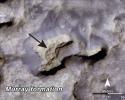
-
PIA18784:
-
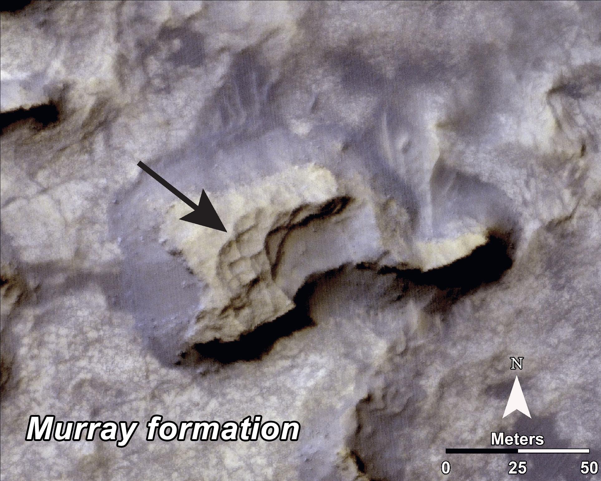
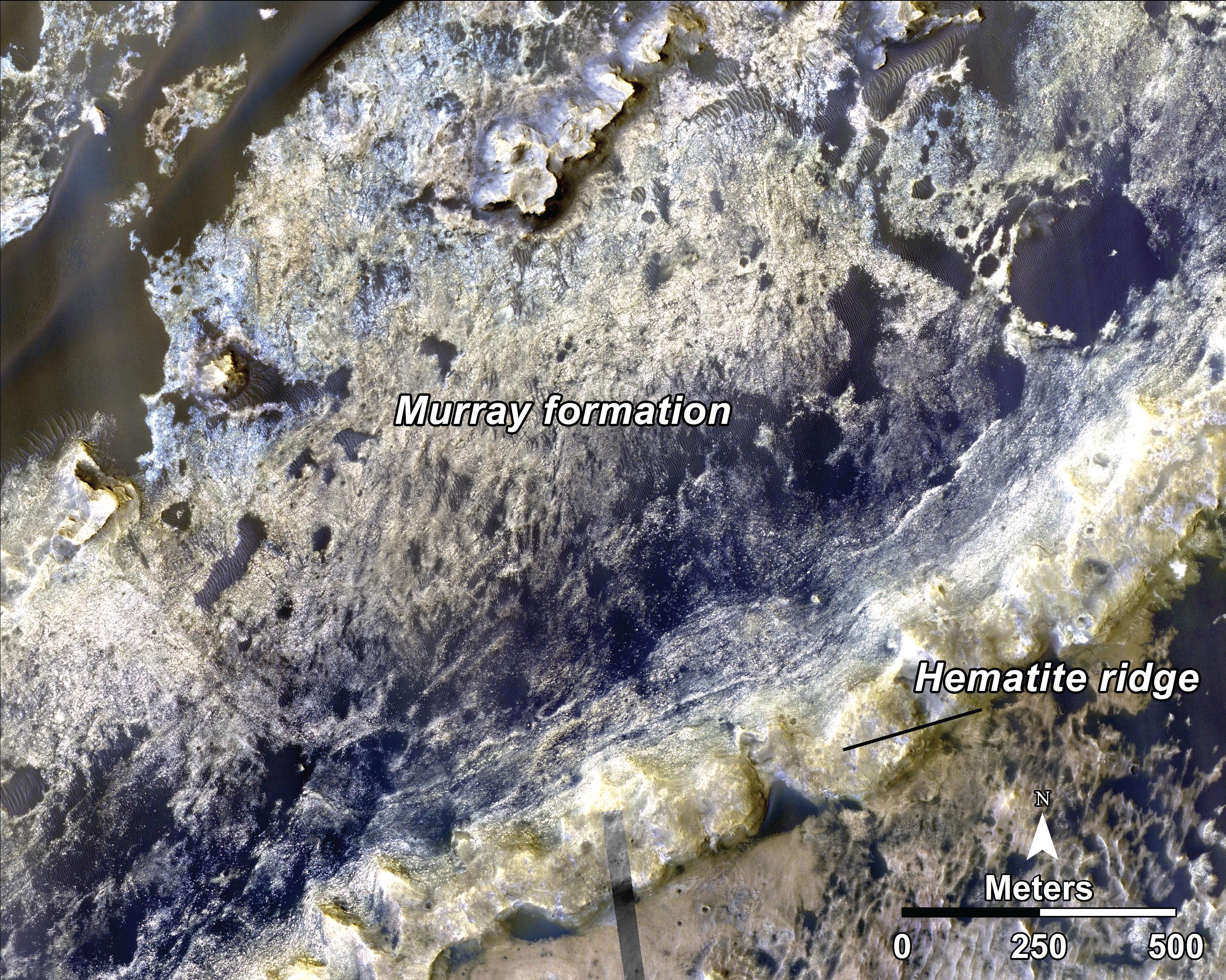
Bands on the 'Murray Formation'
Full Resolution:
TIFF
(8.918 MB)
JPEG
(563 kB)
|
|
|
2014-09-11 |
Mars
|
Mars Reconnaissance Orbiter (MRO)
Mars Science Laboratory (MSL)
|
HiRISE
|
3000x2400x3 |
|
-
PIA18785:
-
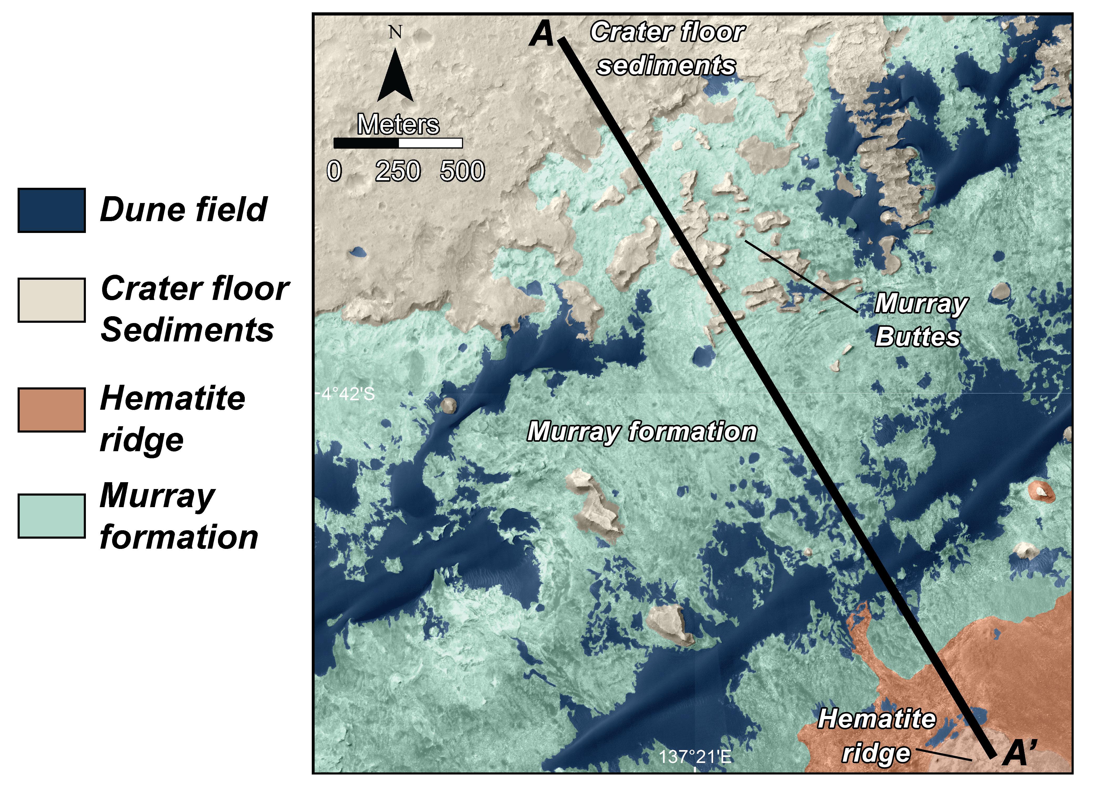
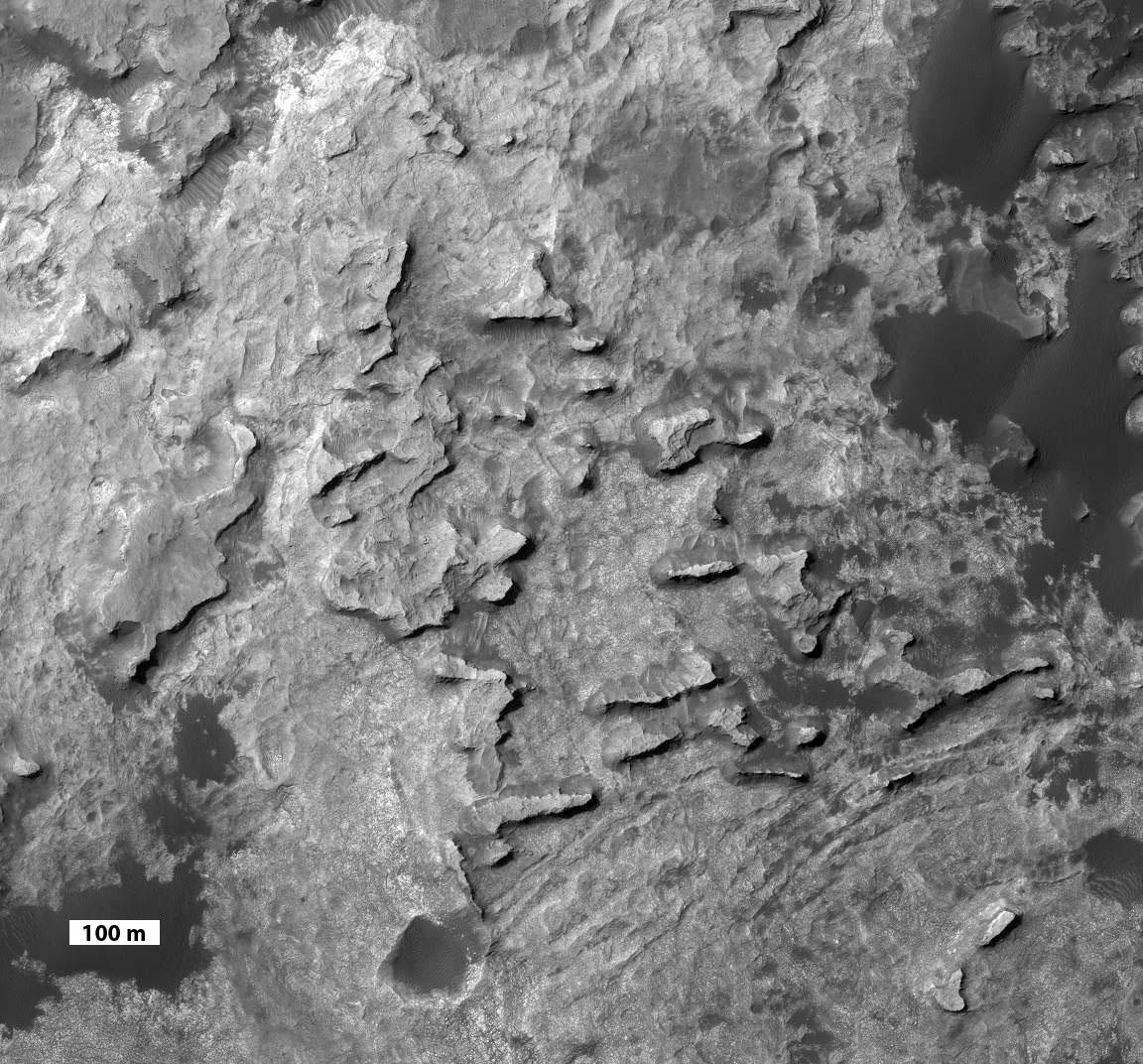
Geological Transition
Full Resolution:
TIFF
(21.61 MB)
JPEG
(2.032 MB)
|
|
|
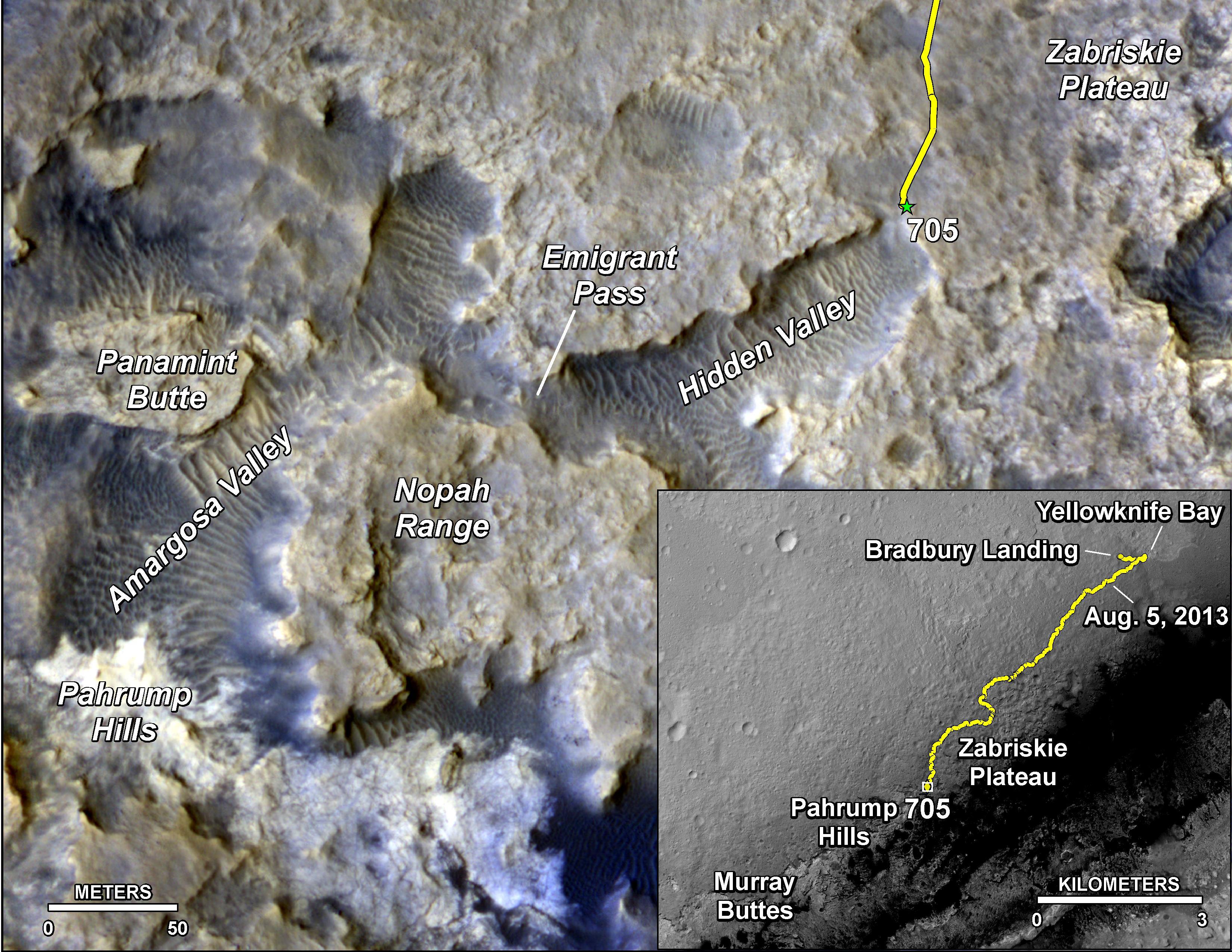
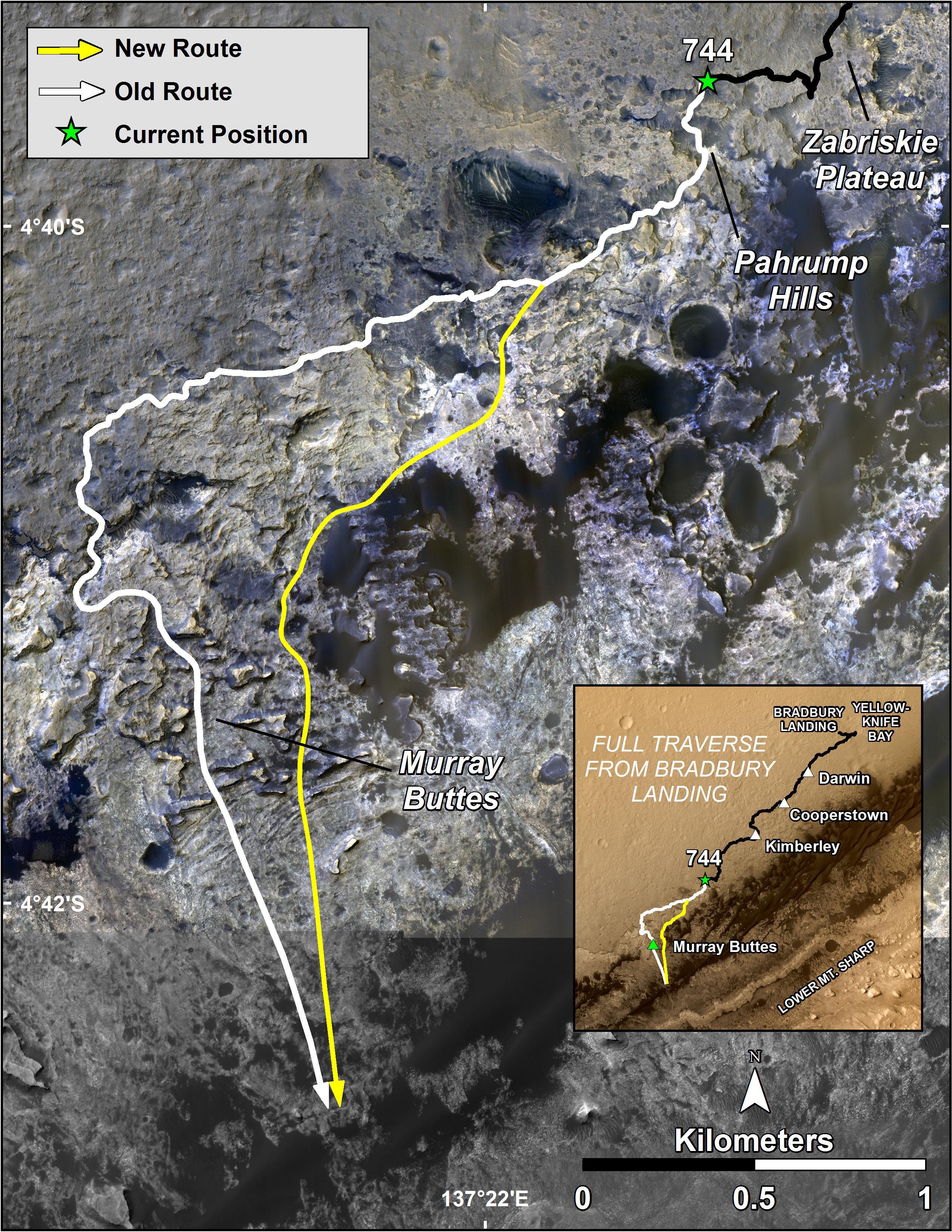
2014-09-25 |
Mars
|
Mars Reconnaissance Orbiter (MRO)
Mars Science Laboratory (MSL)
|
HiRISE
|
3300x2550x3 |
|
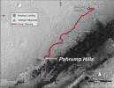
-
PIA18607:
-
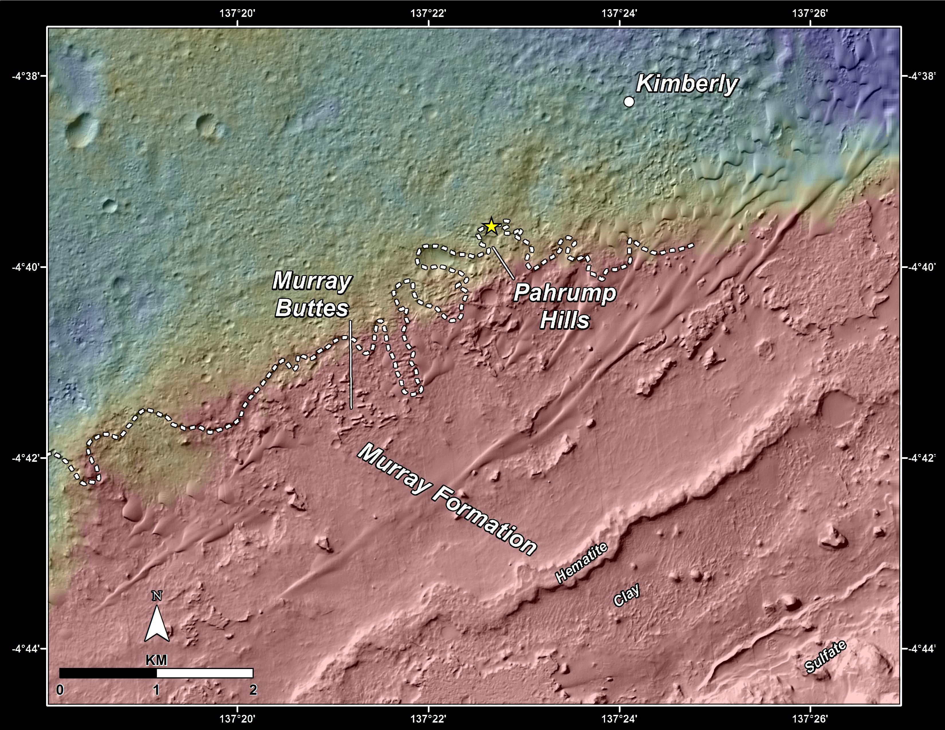
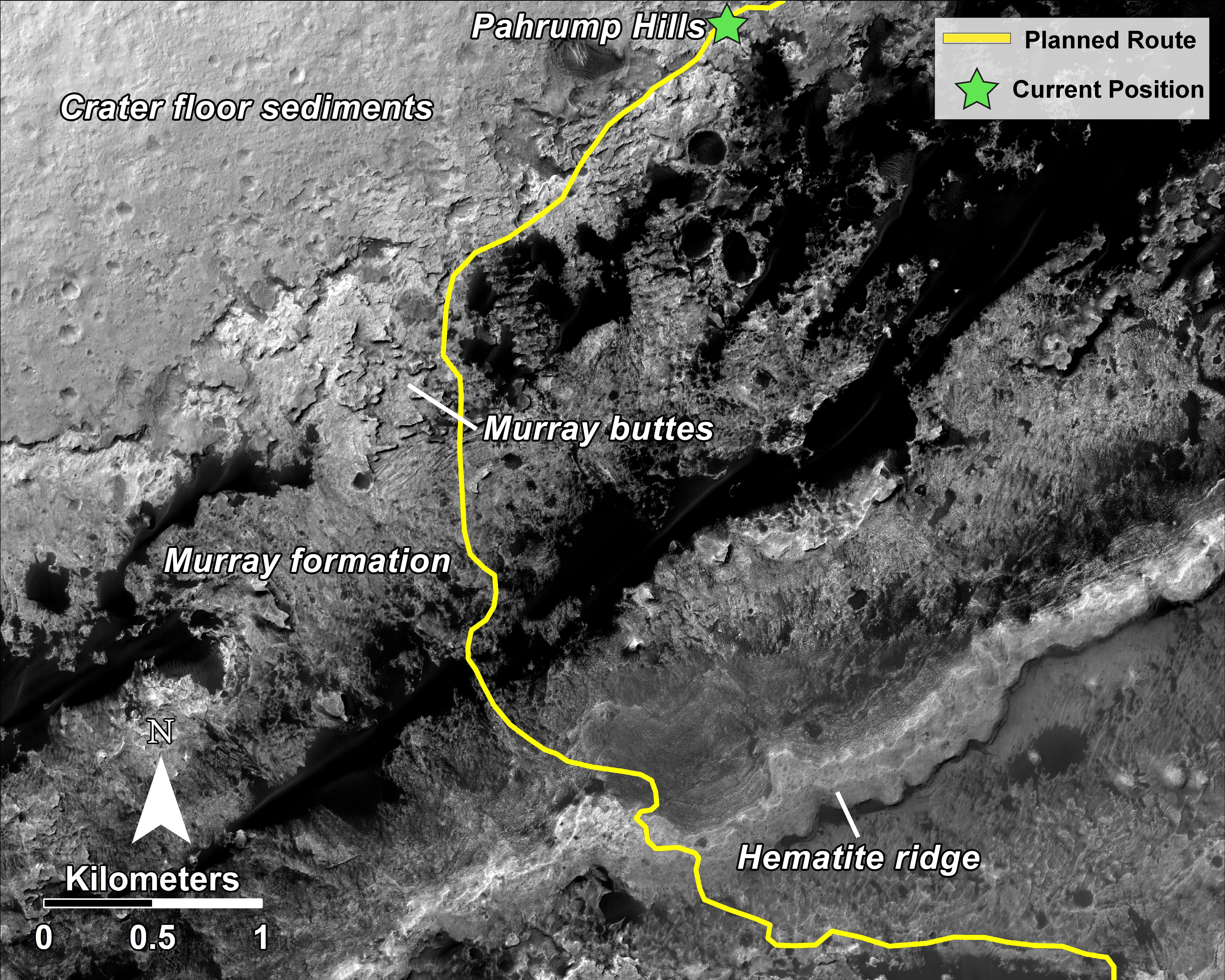
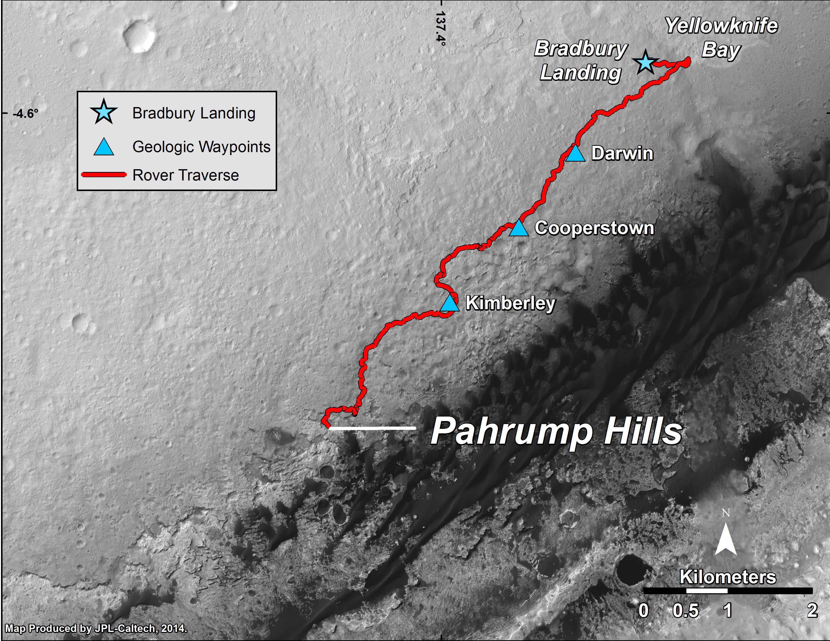
Curiosity Mars Rover's Route from Landing to 'Pahrump Hills'
Full Resolution:
TIFF
(25.26 MB)
JPEG
(1.571 MB)
|
|
|
2015-04-22 |
Mars
|
Mars Reconnaissance Orbiter (MRO)
Mars Science Laboratory (MSL)
|
HiRISE
|
2286x1510x3 |
|
-
PIA19392:
-
Mars Orbiter Sees Curiosity Rover in 'Artist's Drive'
Full Resolution:
TIFF
(10.36 MB)
JPEG
(527.1 kB)
|
|
|
2015-12-17 |
Mars
|
Mars Reconnaissance Orbiter (MRO)
Mars Science Laboratory (MSL)
|
HiRISE
|
3300x2550x3 |
|
-
PIA20172:
-
Curiosity Rover's Traverse, First 1,185 Sols on Mars
Full Resolution:
TIFF
(13.35 MB)
JPEG
(1.533 MB)
|
|
|
2015-12-17 |
Mars
|
Mars Reconnaissance Orbiter (MRO)
Mars Science Laboratory (MSL)
|
HiRISE
|
3300x2550x3 |
|
-
PIA20173:
-
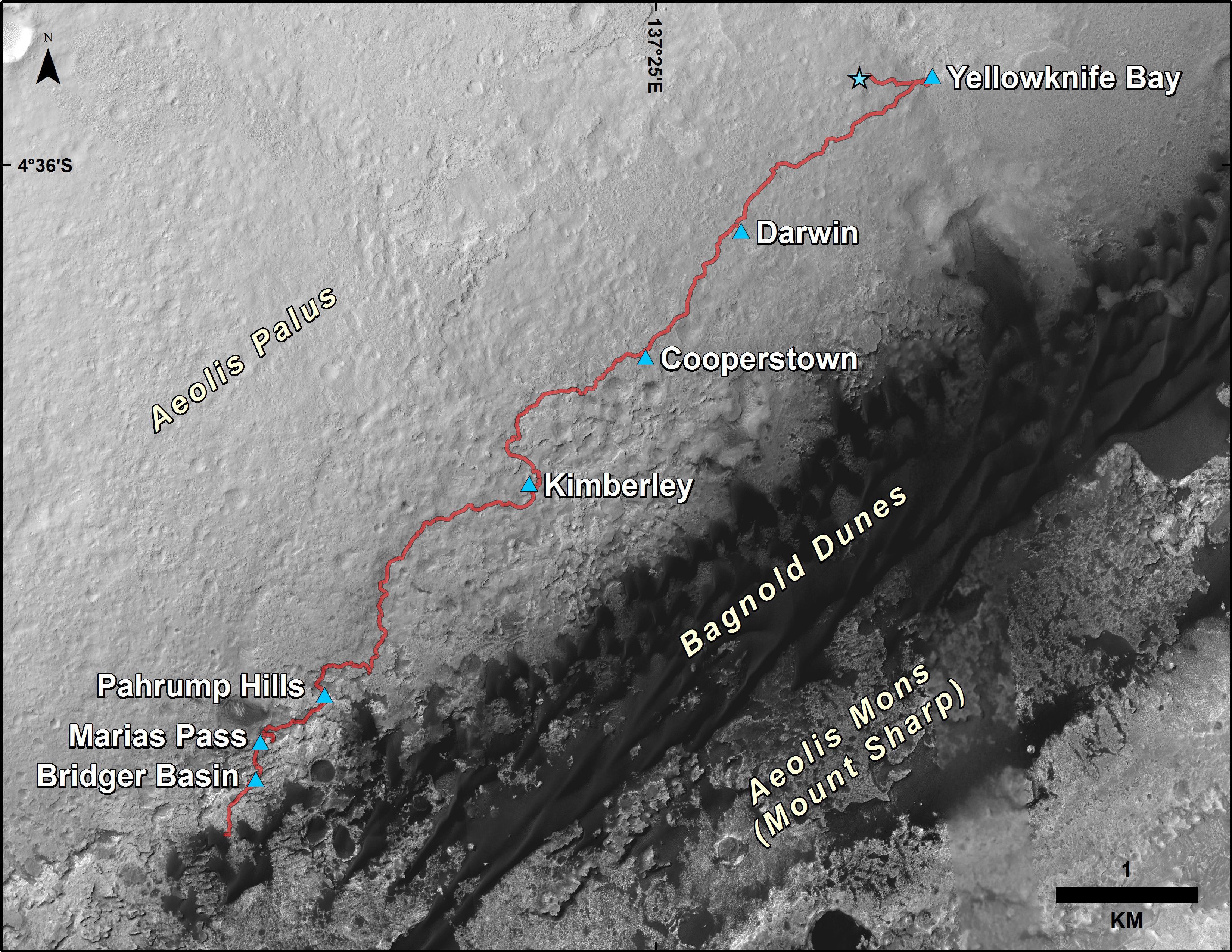
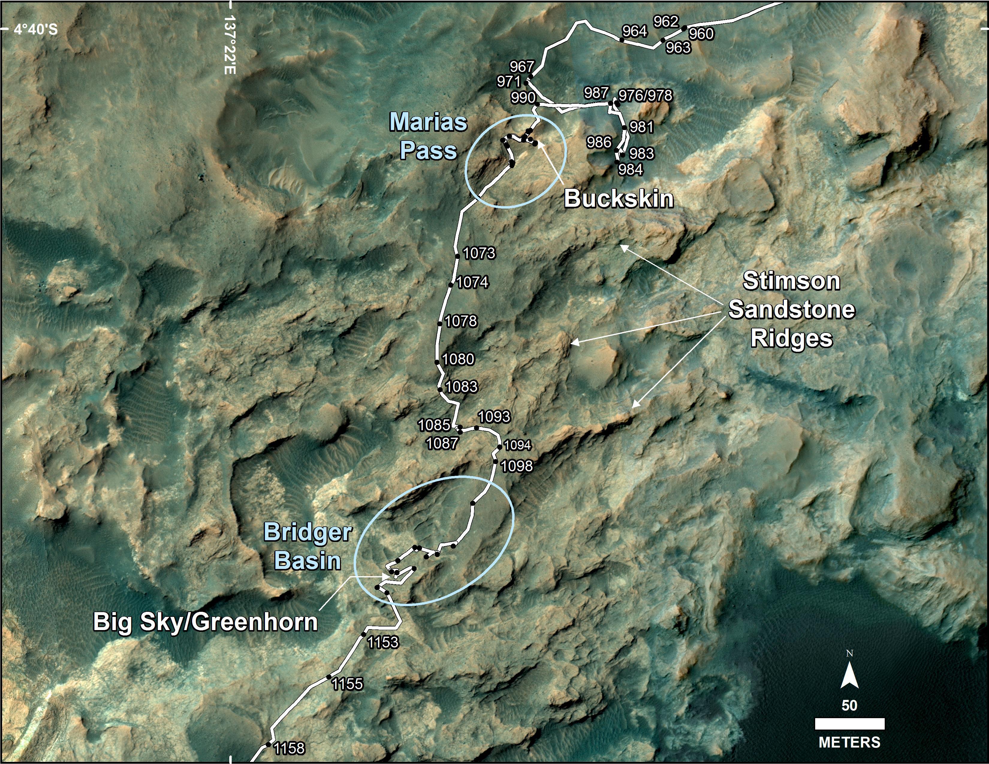
Curiosity's Path During 2015 Studies of Silica-Rich Rocks
Full Resolution:
TIFF
(25.26 MB)
JPEG
(1.372 MB)
|
|
|
2016-12-13 |
Mars
|
Mars Reconnaissance Orbiter (MRO)
Mars Science Laboratory (MSL)
|
HiRISE
MAHLI
|
3300x2550x3 |
|
-
PIA21254:
-
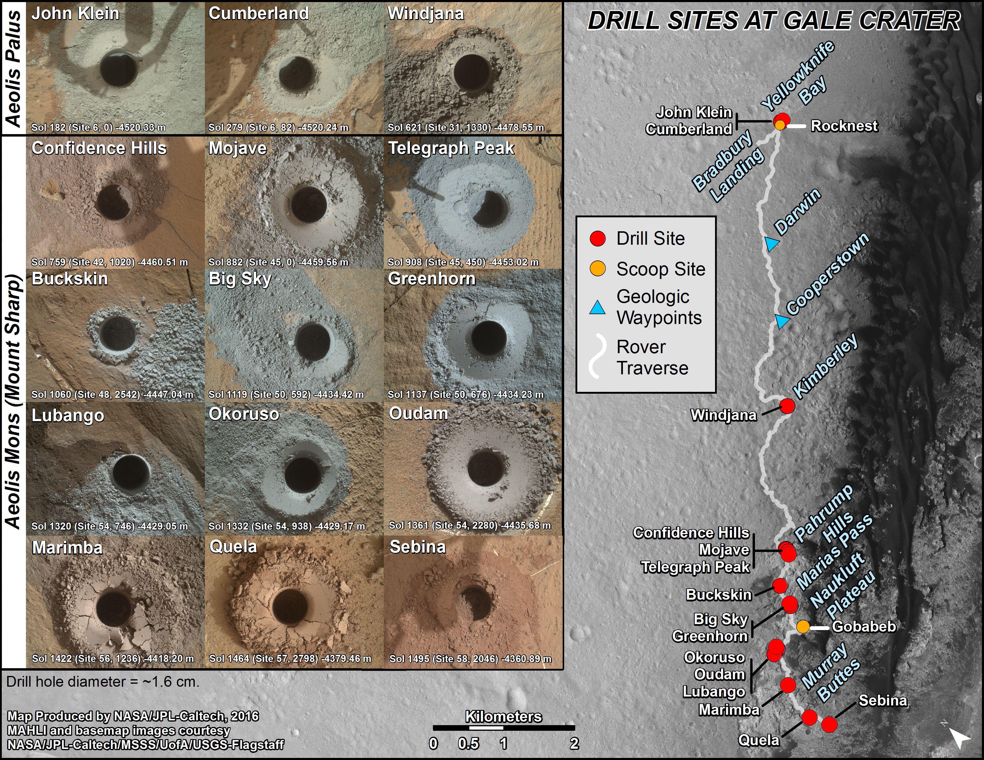
Curiosity's Rock or Soil Sampling Sites on Mars, Through November 2016
Full Resolution:
TIFF
(21.14 MB)
JPEG
(2.213 MB)
|
|
|
2017-02-27 |
Mars
|
Mars Reconnaissance Orbiter (MRO)
Mars Science Laboratory (MSL)
|
HiRISE
|
825x1118x3 |
|
-
PIA21269:
-
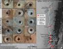
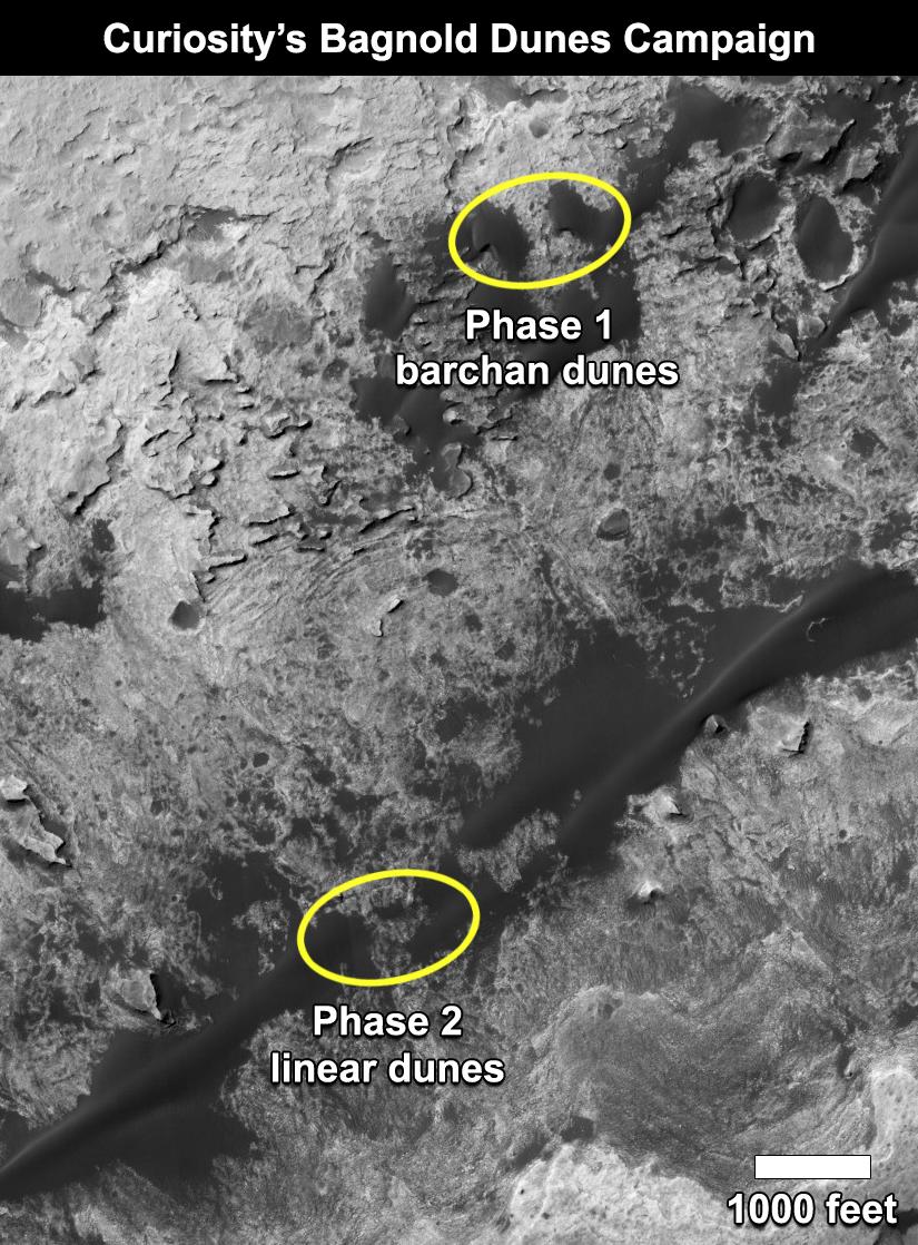
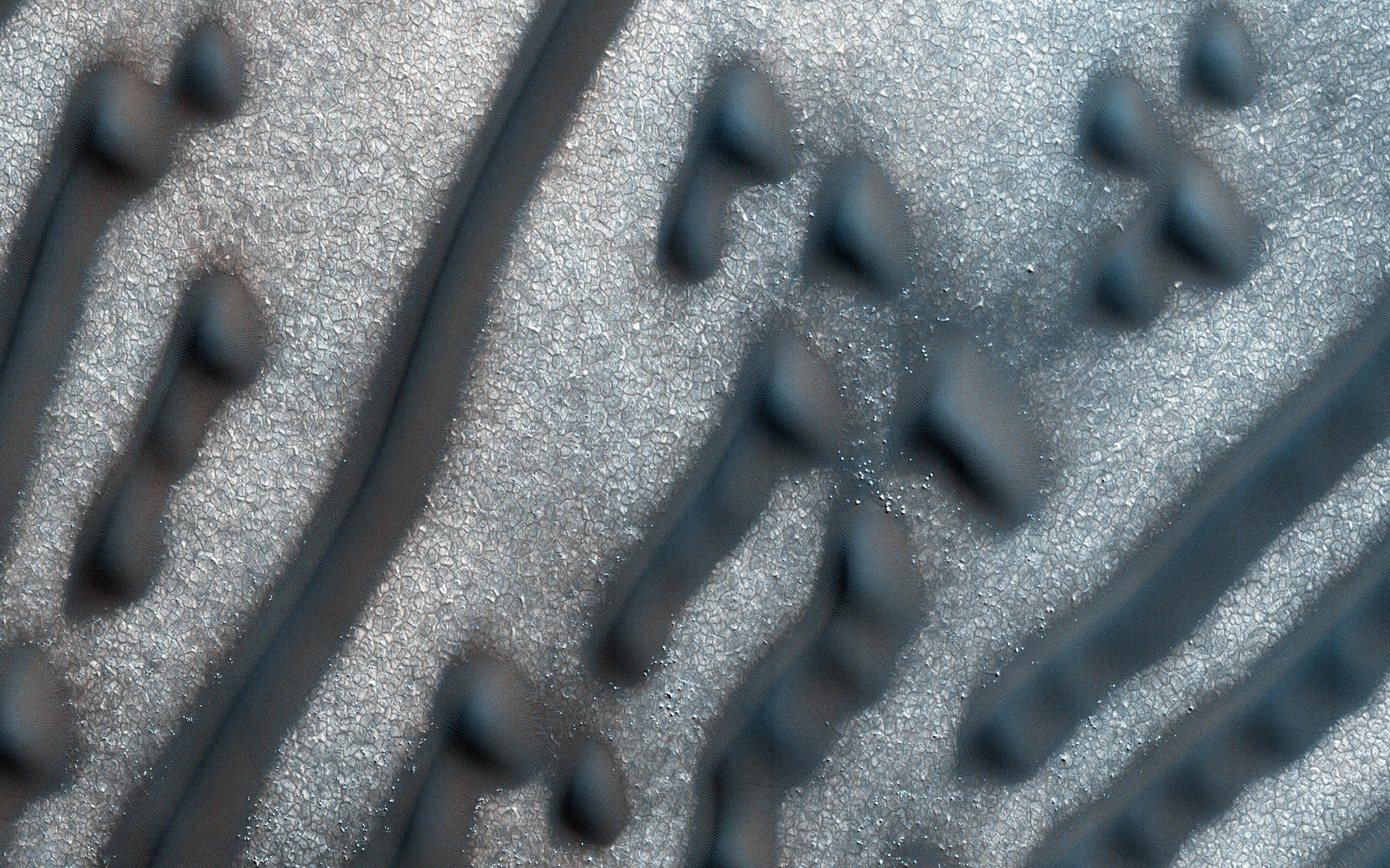
Curiosity's Bagnold Dunes Campaign: Two Types of Dunes
Full Resolution:
TIFF
(1.475 MB)
JPEG
(200.6 kB)
|
|
|
2017-06-20 |
Mars
|
Mars Reconnaissance Orbiter (MRO)
Mars Science Laboratory (MSL)
|
HiRISE
|
1403x789x3 |

|
-
PIA21710:
-
Curiosity Rover on Mount Sharp, Seen from Mars Orbit
Full Resolution:
TIFF
(3.322 MB)
JPEG
(215.9 kB)
|
|
|
2013-11-13 |
Mars
|
Mars Reconnaissance Orbiter (MRO)
|
HiRISE
|
1152x1072x1 |

|
-
PIA17587:
-
'Murray Buttes' at Foot of Mount Sharp on Mars
Full Resolution:
TIFF
(1.236 MB)
JPEG
(248 kB)
|
|
|
2016-06-29 |
Mars
|
Mars Reconnaissance Orbiter (MRO)
|
HiRISE
|
2880x1800x3 |
|
-
PIA20735:
-
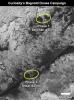
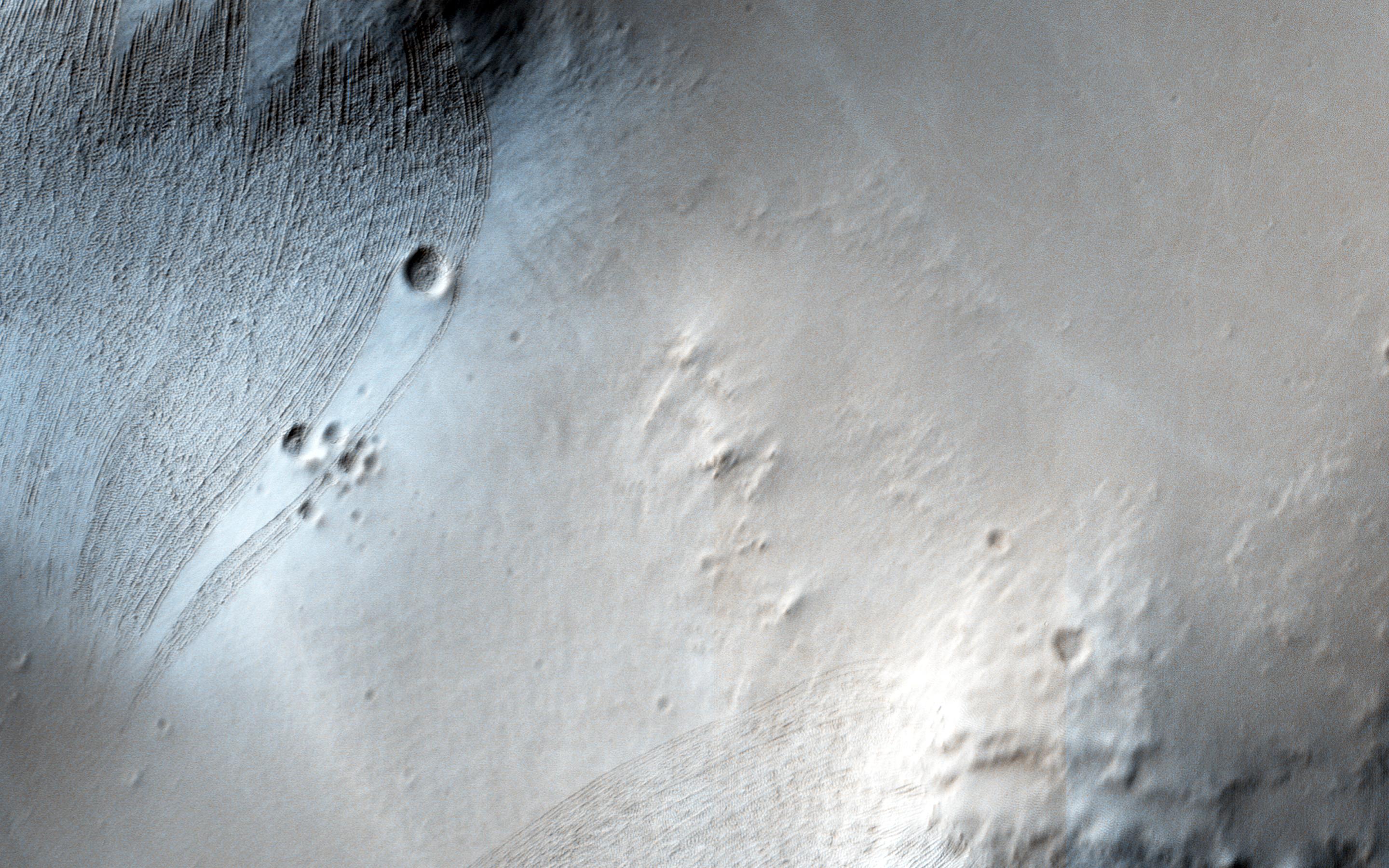
Martian Morse Code
Full Resolution:
TIFF
(15.56 MB)
JPEG
(1.195 MB)
|
|
|
2016-06-29 |
Mars
|
Mars Reconnaissance Orbiter (MRO)
|
HiRISE
|
2880x1800x3 |
|
-
PIA20737:
-
Bedrock North of Terby Crater
Full Resolution:
TIFF
(15.56 MB)
JPEG
(775.2 kB)
|
|
|
2016-06-29 |
Mars
|
Mars Reconnaissance Orbiter (MRO)
|
HiRISE
|
2880x1800x3 |
|
-
PIA20740:
-
Dreaming of Graben in the Labyrinth of the Night
Full Resolution:
TIFF
(15.56 MB)
JPEG
(765.6 kB)
|
|
|
2016-06-29 |
Mars
|
Mars Reconnaissance Orbiter (MRO)
|
HiRISE
|
2880x1800x3 |
|
-
PIA20736:
-
Glowing Gullies in Kaiser Crater Dunes
Full Resolution:
TIFF
(15.11 MB)
JPEG
(766.1 kB)
|
|
|
2013-02-20 |
Mars
|
Mars Exploration Rover (MER)
Mars Science Laboratory (MSL)
Phoenix
|
MAHLI
Panoramic Camera
|
1585x598x3 |

|
-
PIA16731:
-
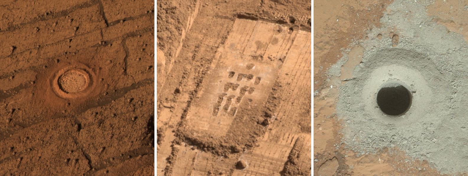
Different Tools for Different Purposes on Mars
Full Resolution:
TIFF
(2.845 MB)
JPEG
(172 kB)
|
|
|
2013-03-12 |
Mars
|
Mars Exploration Rover (MER)
Mars Science Laboratory (MSL)
|
Mastcam
Panoramic Camera
|
2660x1179x3 |
|
-
PIA16833:
-
Two Different Aqueous Environments
Full Resolution:
TIFF
(9.412 MB)
JPEG
(605.8 kB)
|
|
|
2013-03-12 |
Mars
|
Mars Exploration Rover (MER)
Mars Science Laboratory (MSL)
|
MAHLI
Panoramic Camera
|
1054x598x3 |
|
-
PIA16834:
-
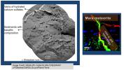
Studying Habitability in Ancient Martian Environments
Full Resolution:
TIFF
(1.892 MB)
JPEG
(117.8 kB)
|
|
|
2013-11-13 |
Mars
|
Mars Exploration Rover (MER)
Mars Reconnaissance Orbiter (MRO)
|
HiRISE
|
8192x4298x3 |
|
-
PIA17586:
-
A New Perspective on Murray Ridge
Full Resolution:
TIFF
(105.7 MB)
JPEG
(2.803 MB)
|
|
|
2014-11-10 |
Mars
|
Mars Exploration Rover (MER)
MAVEN
|
Navigation Camera
|
1024x1024x1 |

|
-
PIA18866:
-
Image Relayed by MAVEN Mars Orbiter from Curiosity Mars Rover
Full Resolution:
TIFF
(1.05 MB)
JPEG
(255.2 kB)
|
|
|
2013-07-09 |
Mars
|
Mars 2020 Rover
Mars Science Laboratory (MSL)
|
Mastcam
|
2460x1824x3 |
|
-
PIA17275:
-
The Importance of Nested Scales of Observations, Large Scales
Full Resolution:
TIFF
(13.47 MB)
JPEG
(624.1 kB)
|
|
|
2013-07-09 |
Mars
|
Mars 2020 Rover
Mars Science Laboratory (MSL)
|
ChemCam
|
2880x1624x3 |
|
-
PIA17276:
-
The Importance of Nested Scales of Observations, Fine Scales
Full Resolution:
TIFF
(14.04 MB)
JPEG
(354 kB)
|
|
|
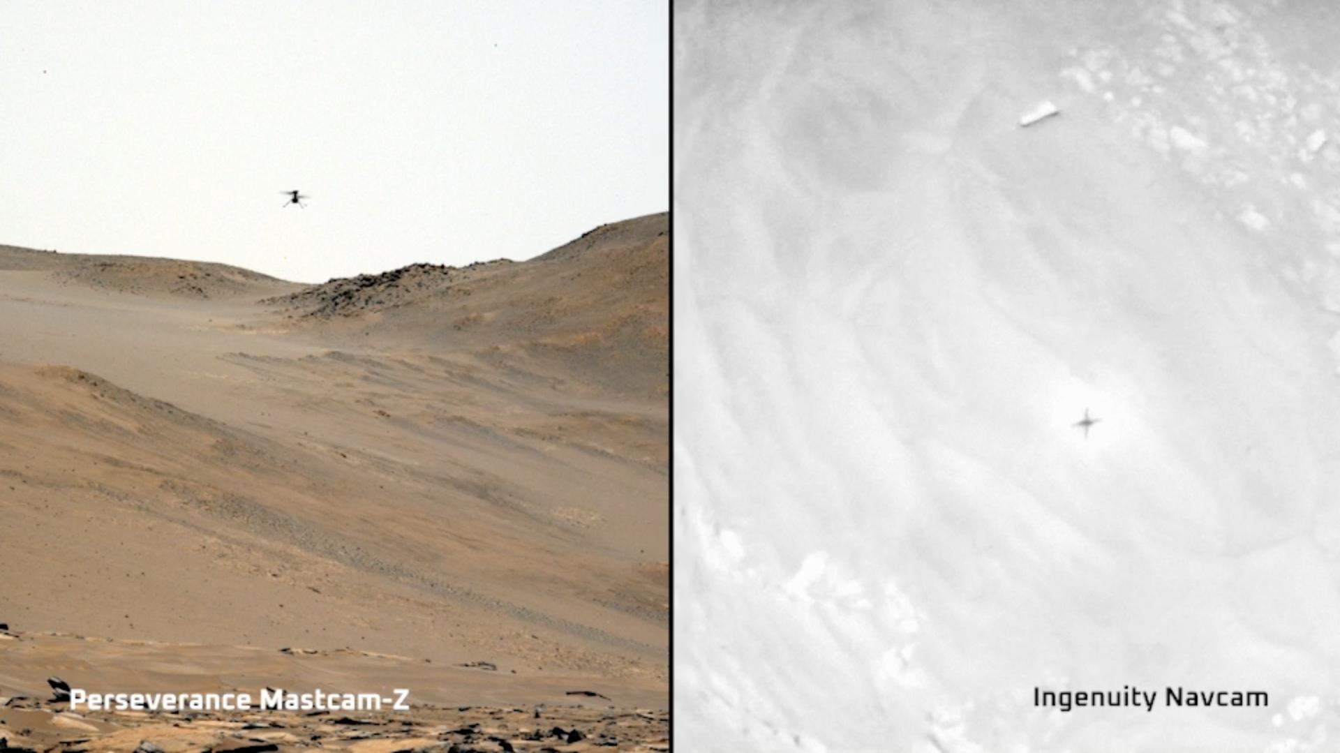
2023-11-22 |
Mars
|
Mars 2020 Rover
Mars Helicopter
|
Mastcam-Z
|
1920x1079x3 |
|
-
PIA26078:
-
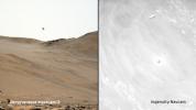
Two Views of Ingenuity's 59th Flight
Full Resolution:
TIFF
(3.377 MB)
JPEG
(124.2 kB)
|
|
|
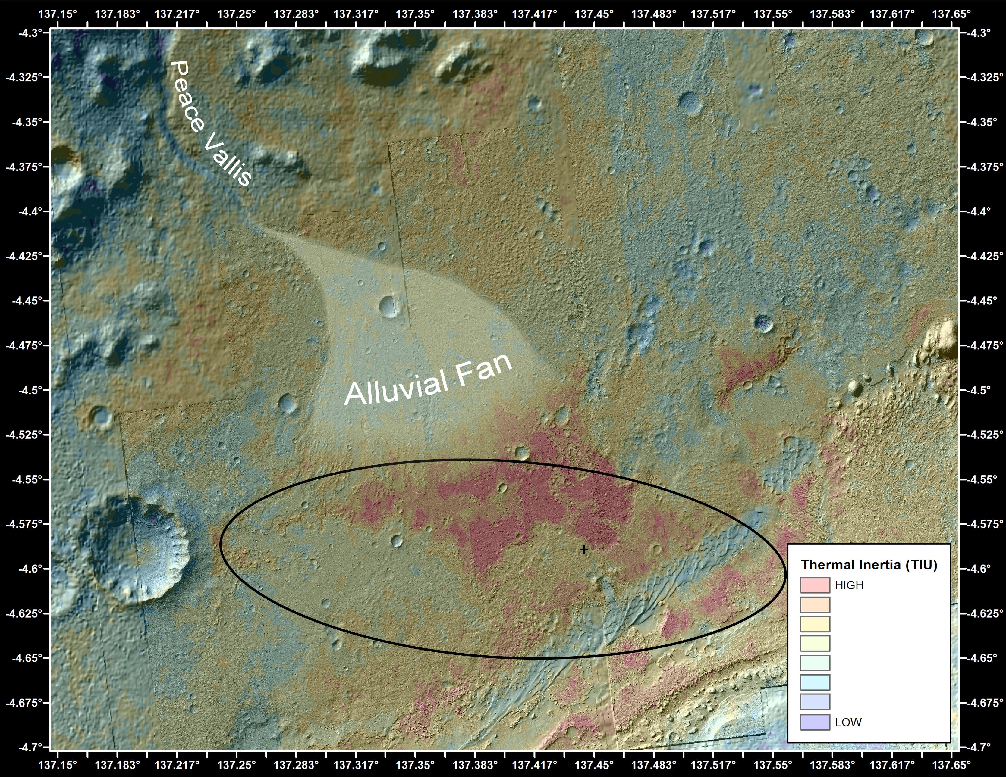
2012-09-27 |
Mars
|
2001 Mars Odyssey
Mars Science Laboratory (MSL)
|
THEMIS
|
3338x2580x3 |

|
-
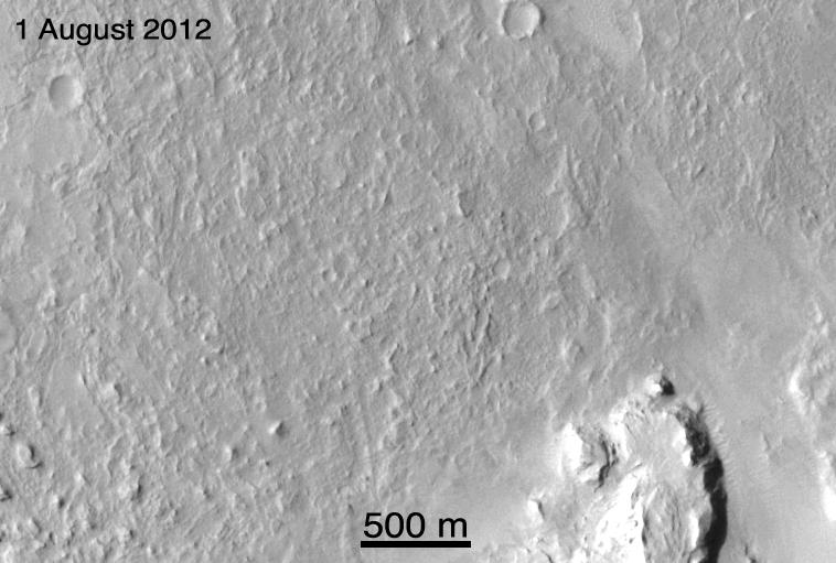
PIA16159:
-
Downslope of the Fan
Full Resolution:
TIFF
(25.85 MB)
JPEG
(1.89 MB)
|


