Your search criteria found
927
images
Spacecraft
Go to PIAxxxxx:
Refine this list of images by:
Target:
Ceres
Deimos
Earth
Mars
Mercury
Phobos
Sun
Mission:
Mars Reconnaissance Orbiter (MRO)
Mars Science Laboratory (MSL)
Instrument:
Alpha Particle X-ray Spectrometer
Alpha Particle X-ray Spectrometer (MSL)
CHIMRA
Chemistry & Mineralogy (CheMin)
Chemistry and Camera (ChemCam)
Context Camera (CTX)
Dynamic Albedo of Neutrons
Dynamic Albedo of Neutrons (DAN)
Hazard Avoidance Camera (MSL)
High Resolution Imaging Science Experiment (HiRISE)
Mars Color Imager (MARCI)
Mars Descent Imager
Mars Hand Lens Imager (MAHLI)
Mars Orbiter Laser Altimeter
Mastcam
Mastcam-Z
Navigation Camera
Navigation Camera (M2020)
Navigation Camera (MSL)
Panoramic Camera
Radiation Assessment Detector (RAD)
Robotic Arm (MSL)
Rover Environmental Monitoring Station (REMS)
Sample Analysis at Mars (SAM)
Thermal Emission Imaging System
Click on an image for detailed information
Click on a column heading to sort in ascending or descending order
My
List
Addition Date
Target
Mission
Instrument
Size
2014-09-11
Mars
Mars Reconnaissance Orbiter (MRO)
Mars Science Laboratory (MSL)
HiRISE
4890x3912x3
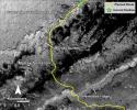
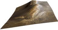
PIA18780:
Curiosity Rover Planned Route
Full Resolution:
TIFF
(57.42 MB)
JPEG
(3.739 MB)
2014-09-11
Mars
Mars Reconnaissance Orbiter (MRO)
Mars Science Laboratory (MSL)
HiRISE
4173x3008x3
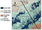
PIA18781:
Map of Lower Mount Sharp
Full Resolution:
TIFF
(37.68 MB)
JPEG
(1.64 MB)
2014-09-11
Mars
Mars Reconnaissance Orbiter (MRO)
Mars Science Laboratory (MSL)
HiRISE
1927x1542x3
PIA18783:
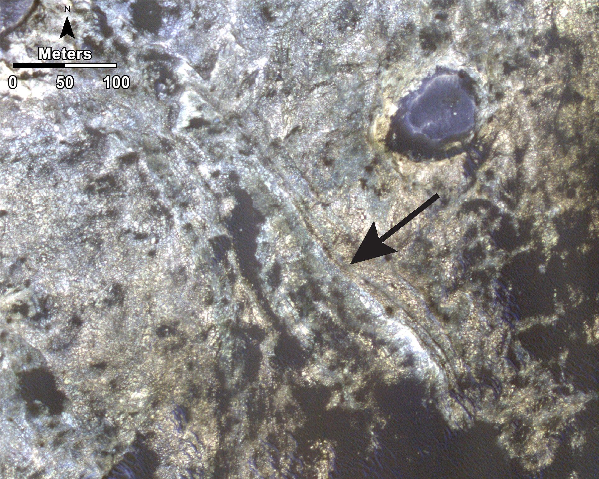
'Murray Buttes' Mesa
Full Resolution:
TIFF
(8.918 MB)
JPEG
(471.3 kB)
2014-09-11
Mars
Mars Reconnaissance Orbiter (MRO)
Mars Science Laboratory (MSL)
HiRISE
1927x1542x3
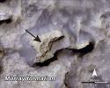
PIA18784:
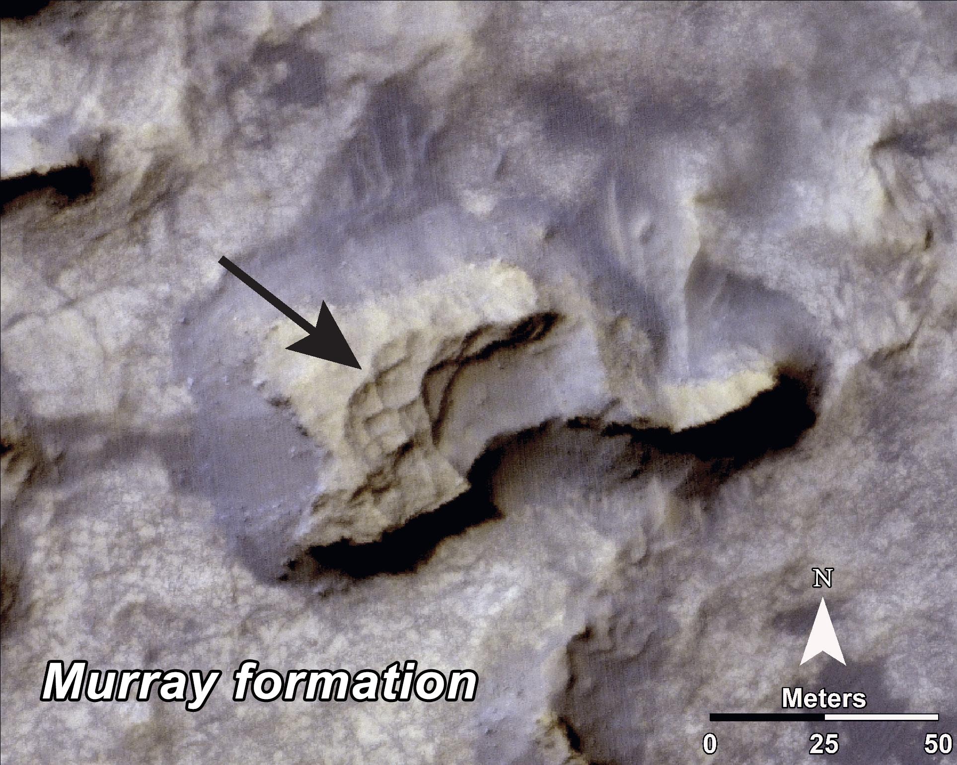
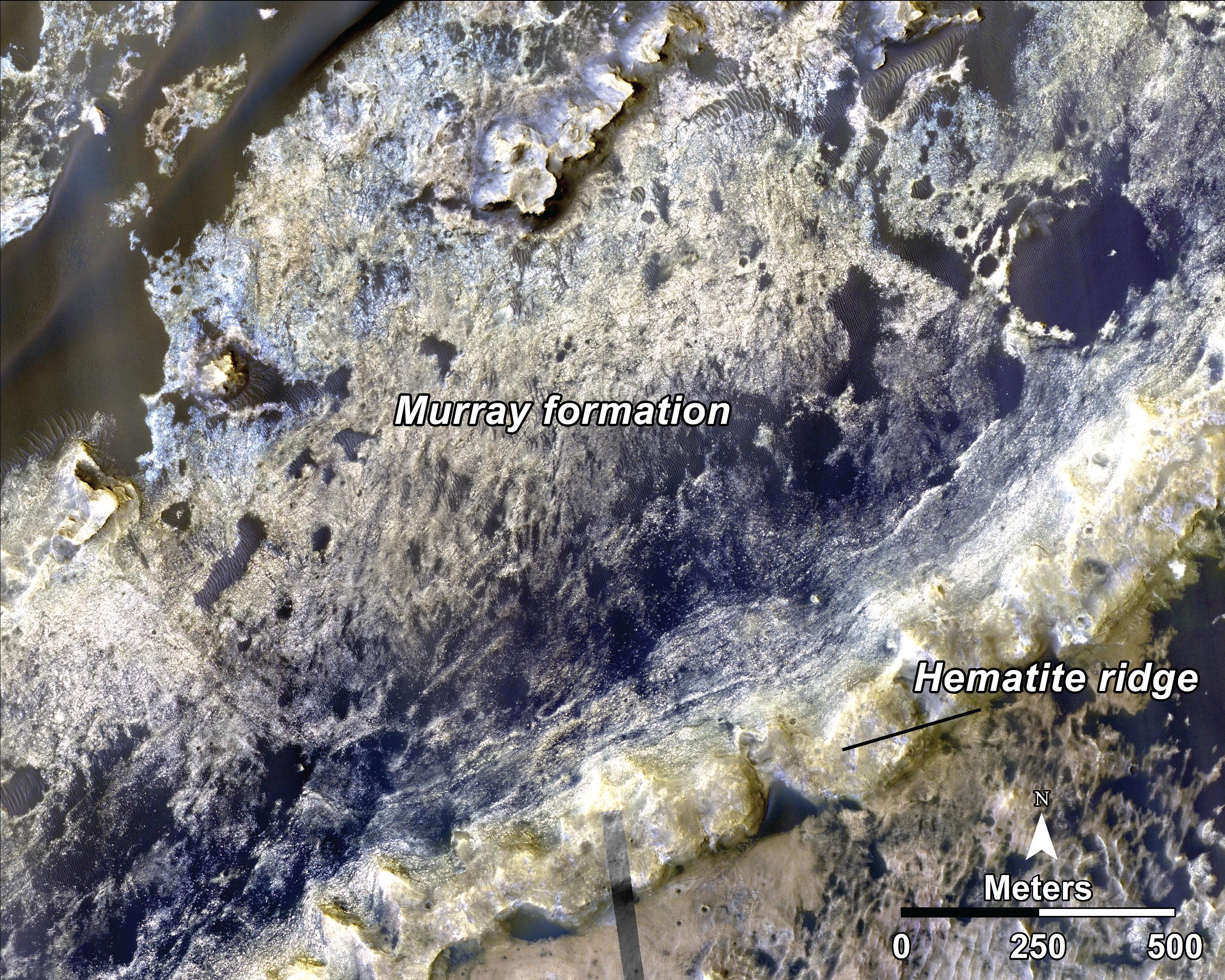
Bands on the 'Murray Formation'
Full Resolution:
TIFF
(8.918 MB)
JPEG
(563 kB)
2014-09-11
Mars
Mars Reconnaissance Orbiter (MRO)
Mars Science Laboratory (MSL)
HiRISE
3000x2400x3
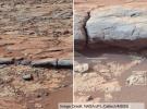
PIA18785:
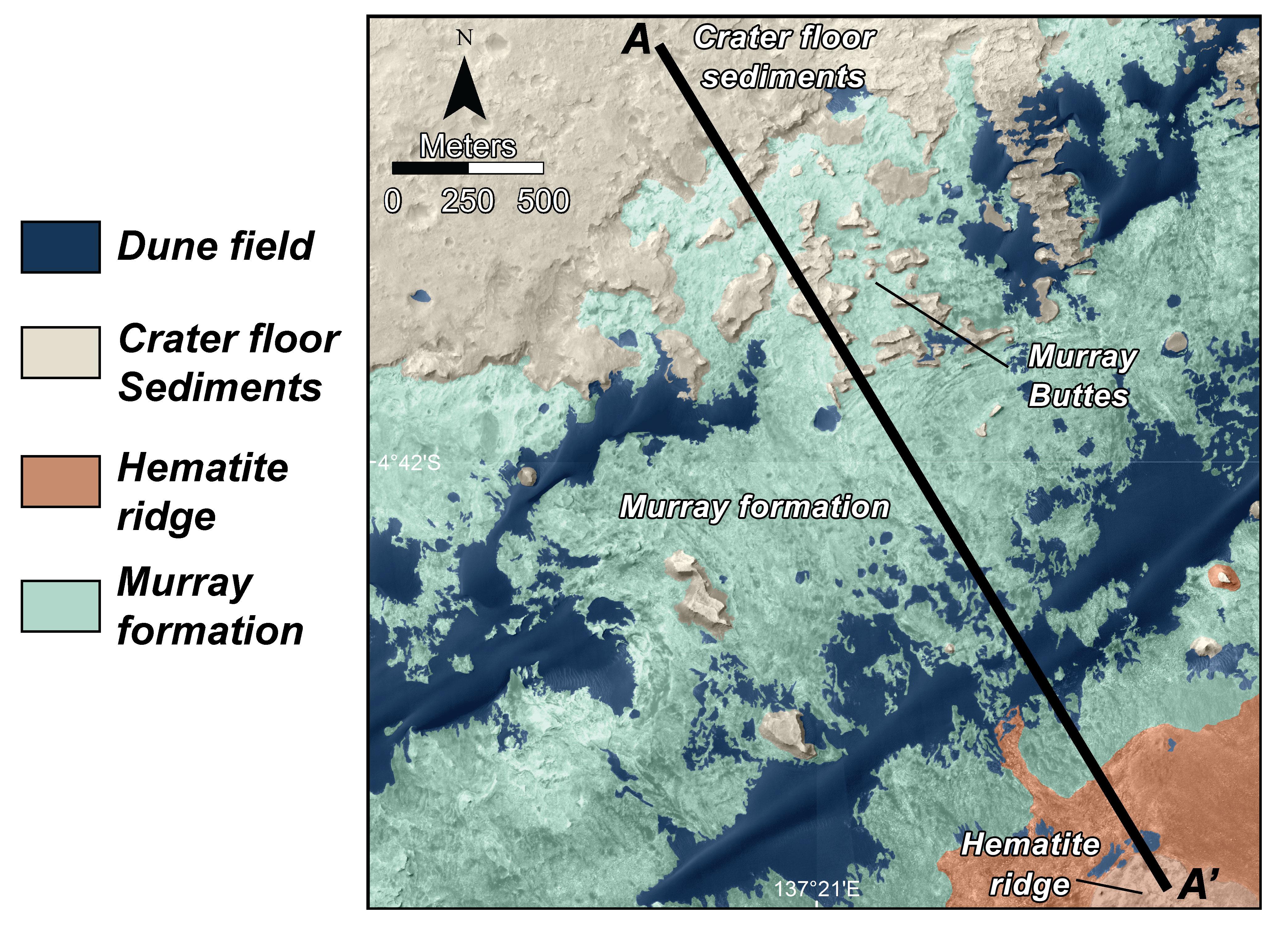
Geological Transition
Full Resolution:
TIFF
(21.61 MB)
JPEG
(2.032 MB)
2014-09-25
Mars
Mars Reconnaissance Orbiter (MRO)
Mars Science Laboratory (MSL)
HiRISE
3300x2550x3
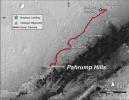
PIA18607:
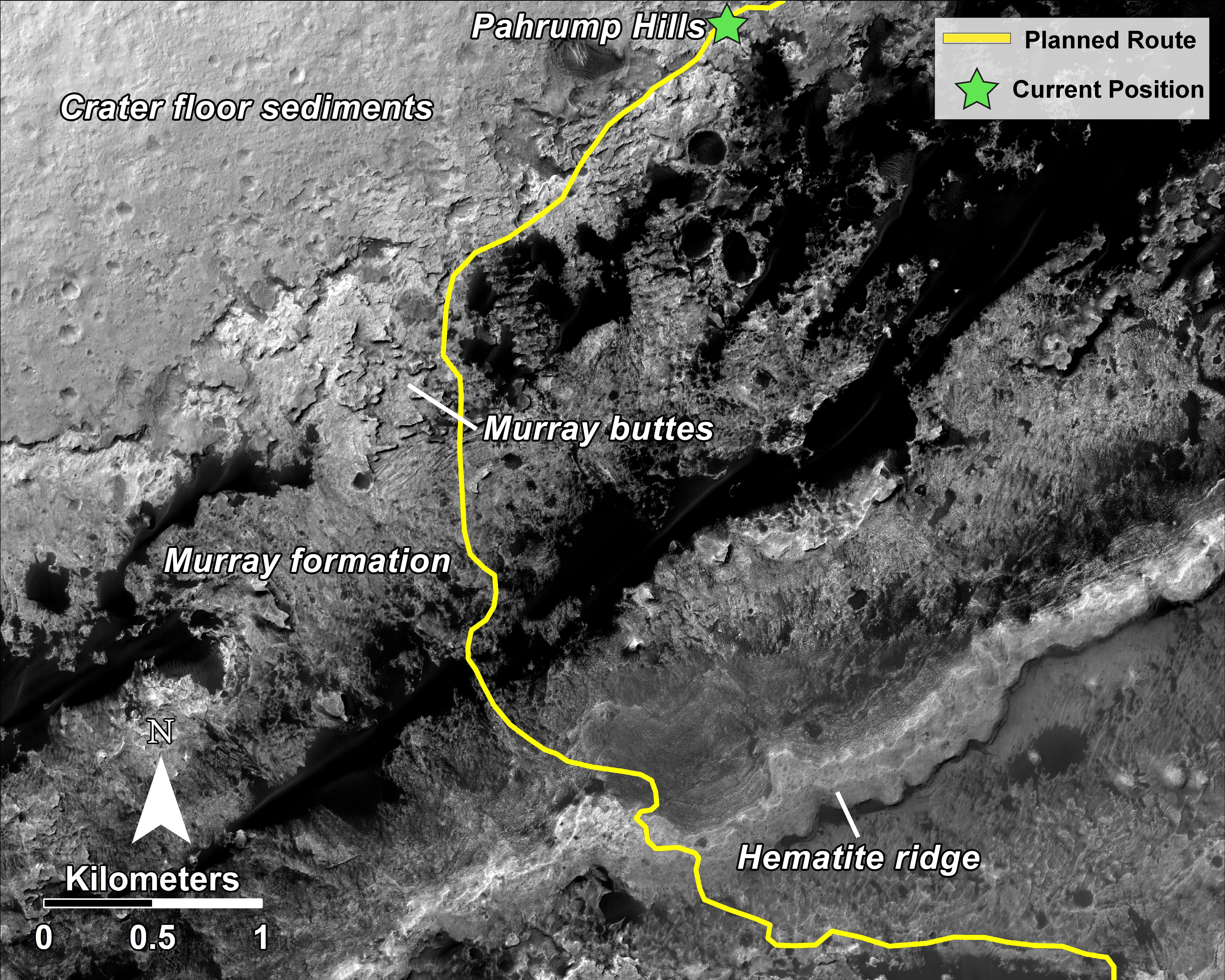
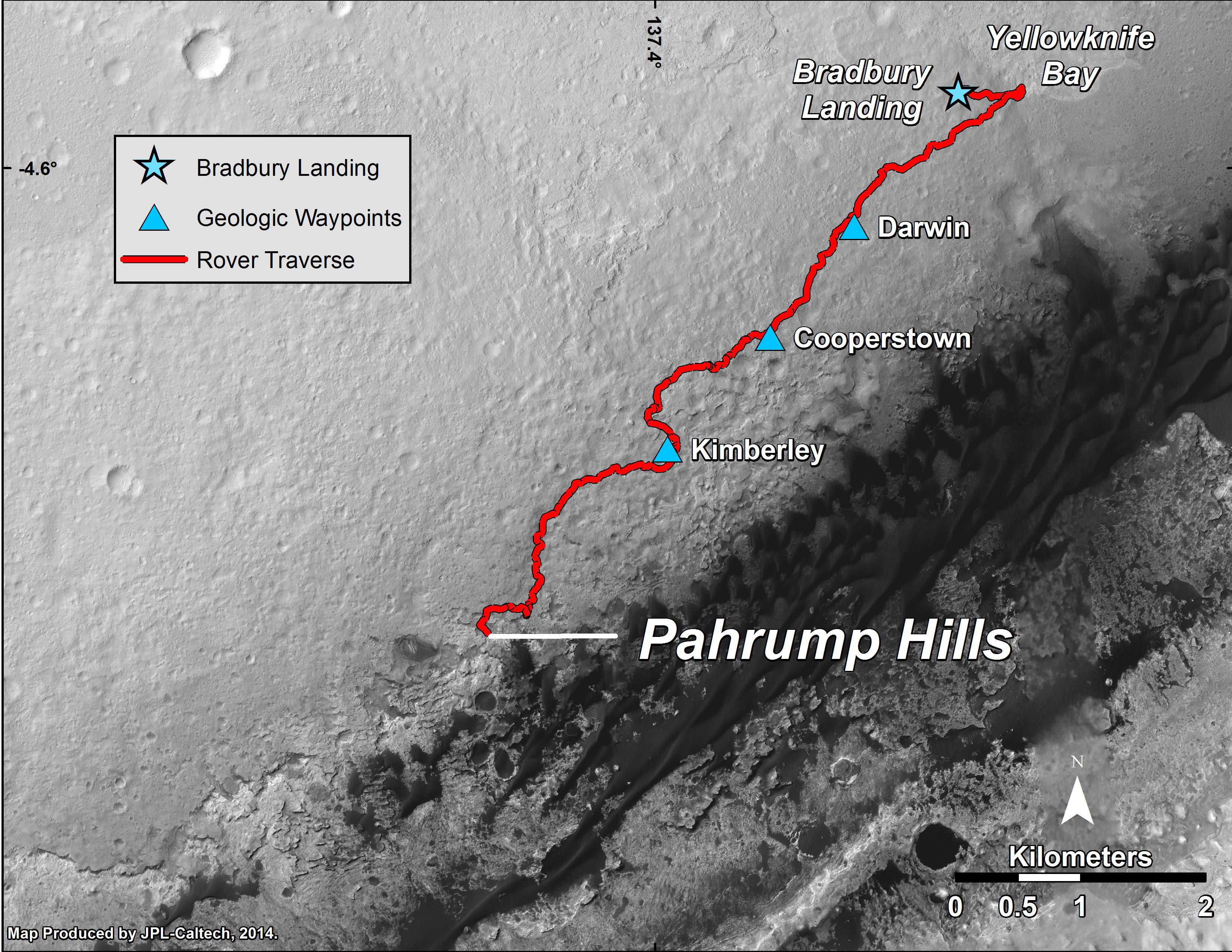
Curiosity Mars Rover's Route from Landing to 'Pahrump Hills'
Full Resolution:
TIFF
(25.26 MB)
JPEG
(1.571 MB)
2015-04-22
Mars
Mars Reconnaissance Orbiter (MRO)
Mars Science Laboratory (MSL)
HiRISE
2286x1510x3
PIA19392:
Mars Orbiter Sees Curiosity Rover in 'Artist's Drive'
Full Resolution:
TIFF
(10.36 MB)
JPEG
(527.1 kB)
2015-12-17
Mars
Mars Reconnaissance Orbiter (MRO)
Mars Science Laboratory (MSL)
HiRISE
3300x2550x3
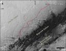
PIA20172:
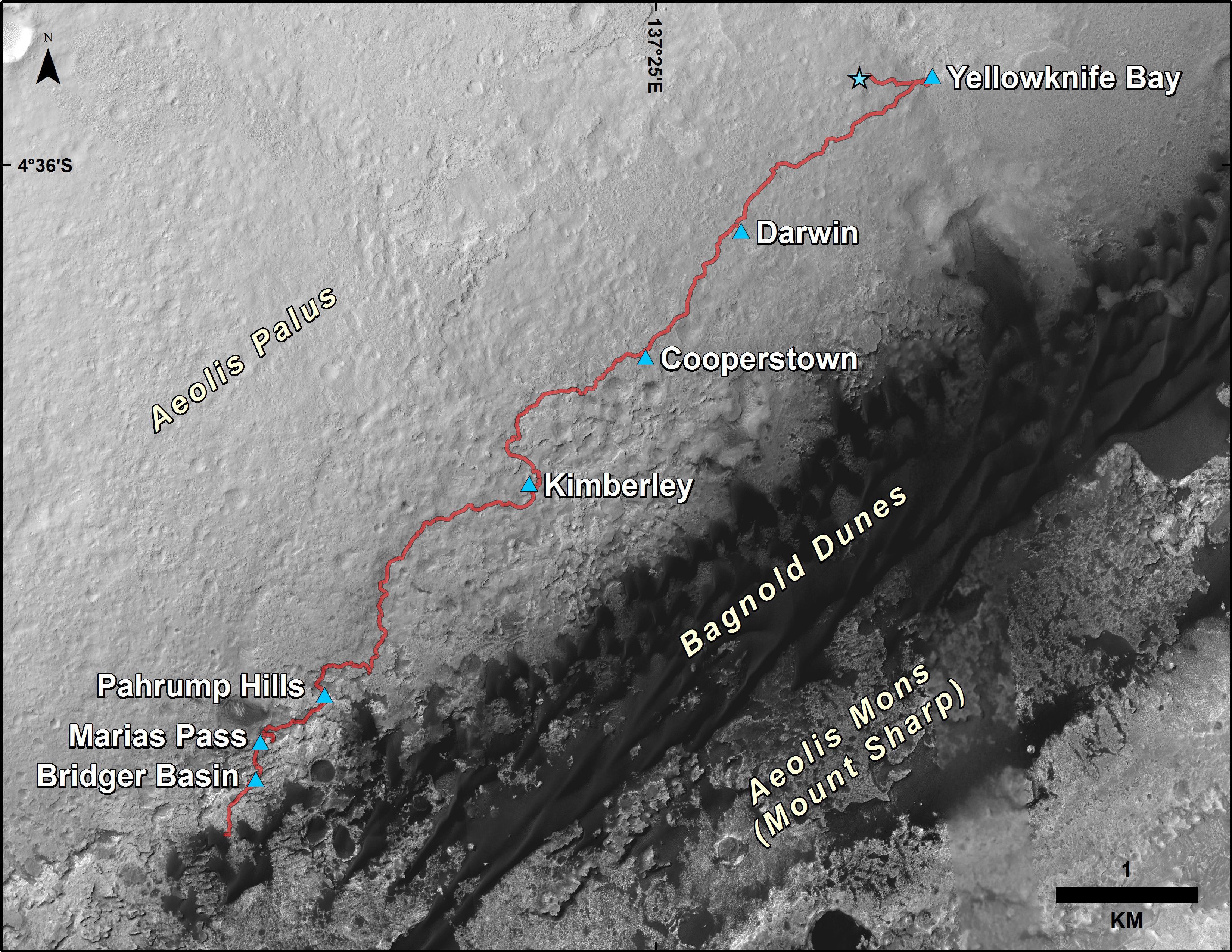
Curiosity Rover's Traverse, First 1,185 Sols on Mars
Full Resolution:
TIFF
(13.35 MB)
JPEG
(1.533 MB)
2015-12-17
Mars
Mars Reconnaissance Orbiter (MRO)
Mars Science Laboratory (MSL)
HiRISE
3300x2550x3
PIA20173:
Curiosity's Path During 2015 Studies of Silica-Rich Rocks
Full Resolution:
TIFF
(25.26 MB)
JPEG
(1.372 MB)
2016-12-13
Mars
Mars Reconnaissance Orbiter (MRO)
Mars Science Laboratory (MSL)
HiRISE
MAHLI
3300x2550x3
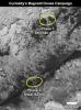
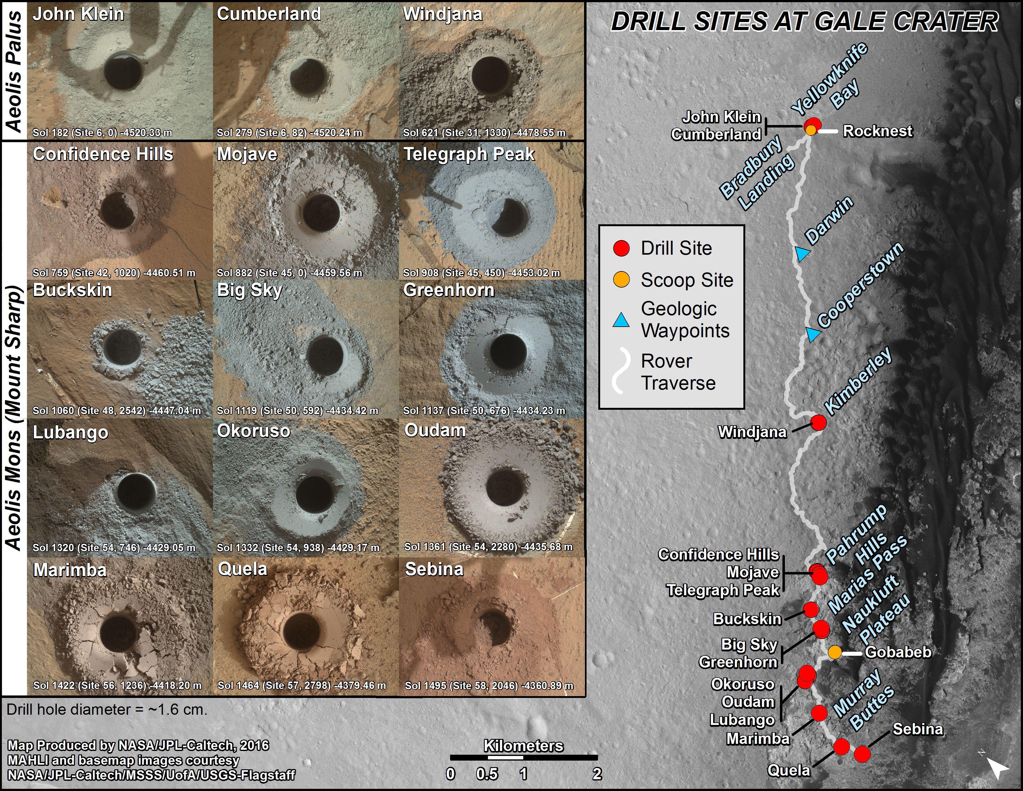
PIA21254:
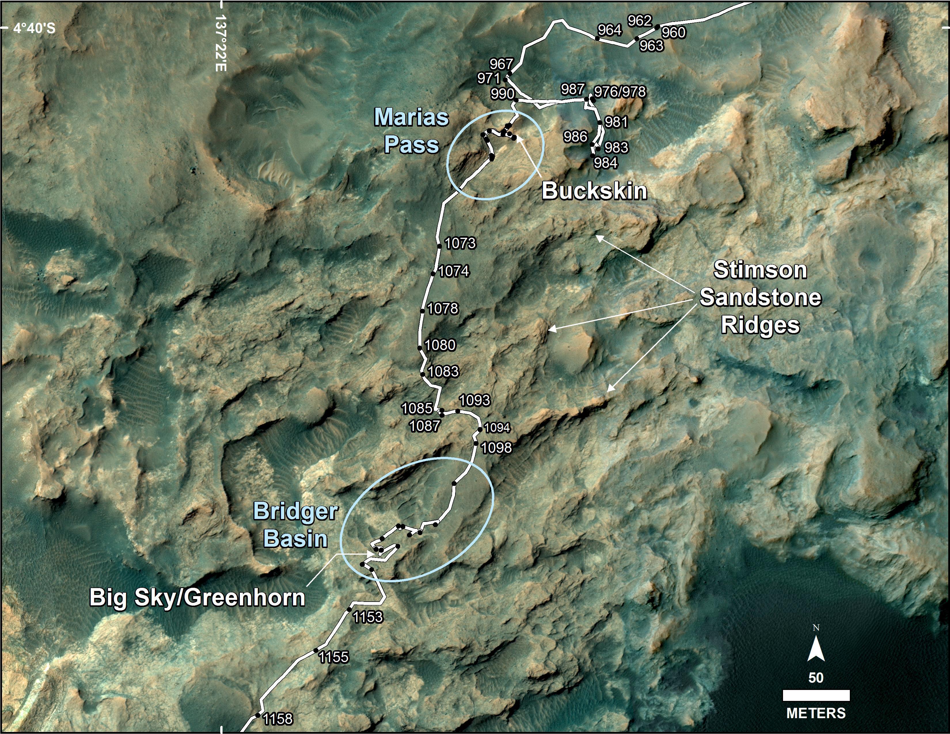
Curiosity's Rock or Soil Sampling Sites on Mars, Through November 2016
Full Resolution:
TIFF
(21.14 MB)
JPEG
(2.213 MB)
2017-02-27
Mars
Mars Reconnaissance Orbiter (MRO)
Mars Science Laboratory (MSL)
HiRISE
825x1118x3
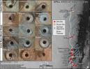
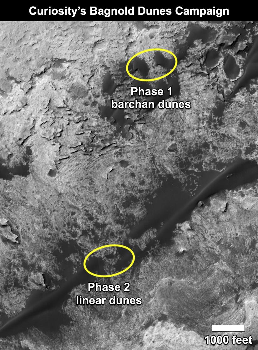
PIA21269:
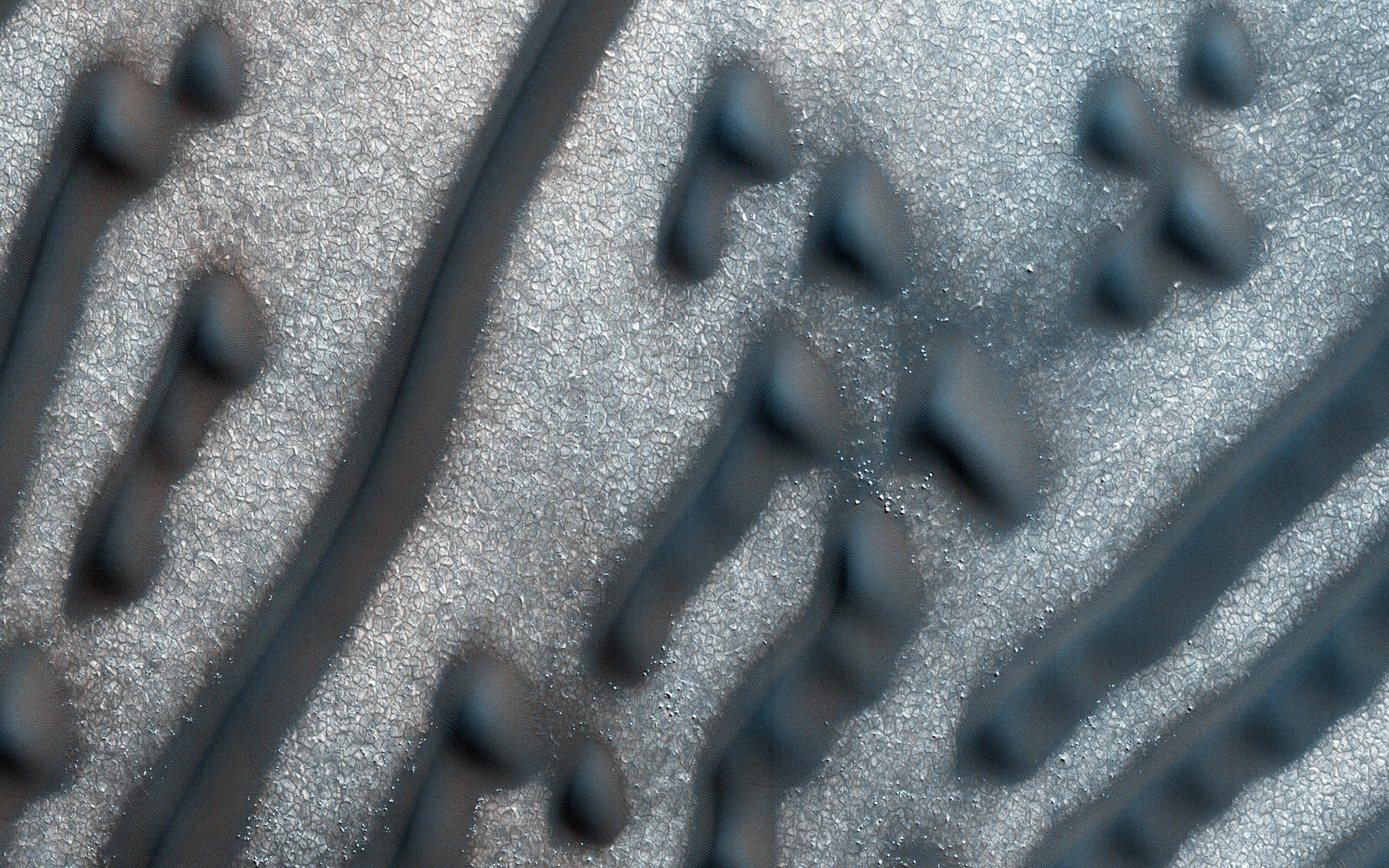
Curiosity's Bagnold Dunes Campaign: Two Types of Dunes
Full Resolution:
TIFF
(1.475 MB)
JPEG
(200.6 kB)
2017-06-20
Mars
Mars Reconnaissance Orbiter (MRO)
Mars Science Laboratory (MSL)
HiRISE
1403x789x3
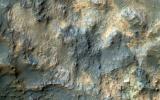
PIA21710:
Curiosity Rover on Mount Sharp, Seen from Mars Orbit
Full Resolution:
TIFF
(3.322 MB)
JPEG
(215.9 kB)
2013-11-13
Mars
Mars Reconnaissance Orbiter (MRO)
HiRISE
1152x1072x1
PIA17587:
'Murray Buttes' at Foot of Mount Sharp on Mars
Full Resolution:
TIFF
(1.236 MB)
JPEG
(248 kB)
2016-06-29
Mars
Mars Reconnaissance Orbiter (MRO)
HiRISE
2880x1800x3
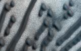
PIA20735:
Martian Morse Code
Full Resolution:
TIFF
(15.56 MB)
JPEG
(1.195 MB)
2016-06-29
Mars
Mars Reconnaissance Orbiter (MRO)
HiRISE
2880x1800x3
PIA20737:
Bedrock North of Terby Crater
Full Resolution:
TIFF
(15.56 MB)
JPEG
(775.2 kB)
2016-06-29
Mars
Mars Reconnaissance Orbiter (MRO)
HiRISE
2880x1800x3
PIA20740:
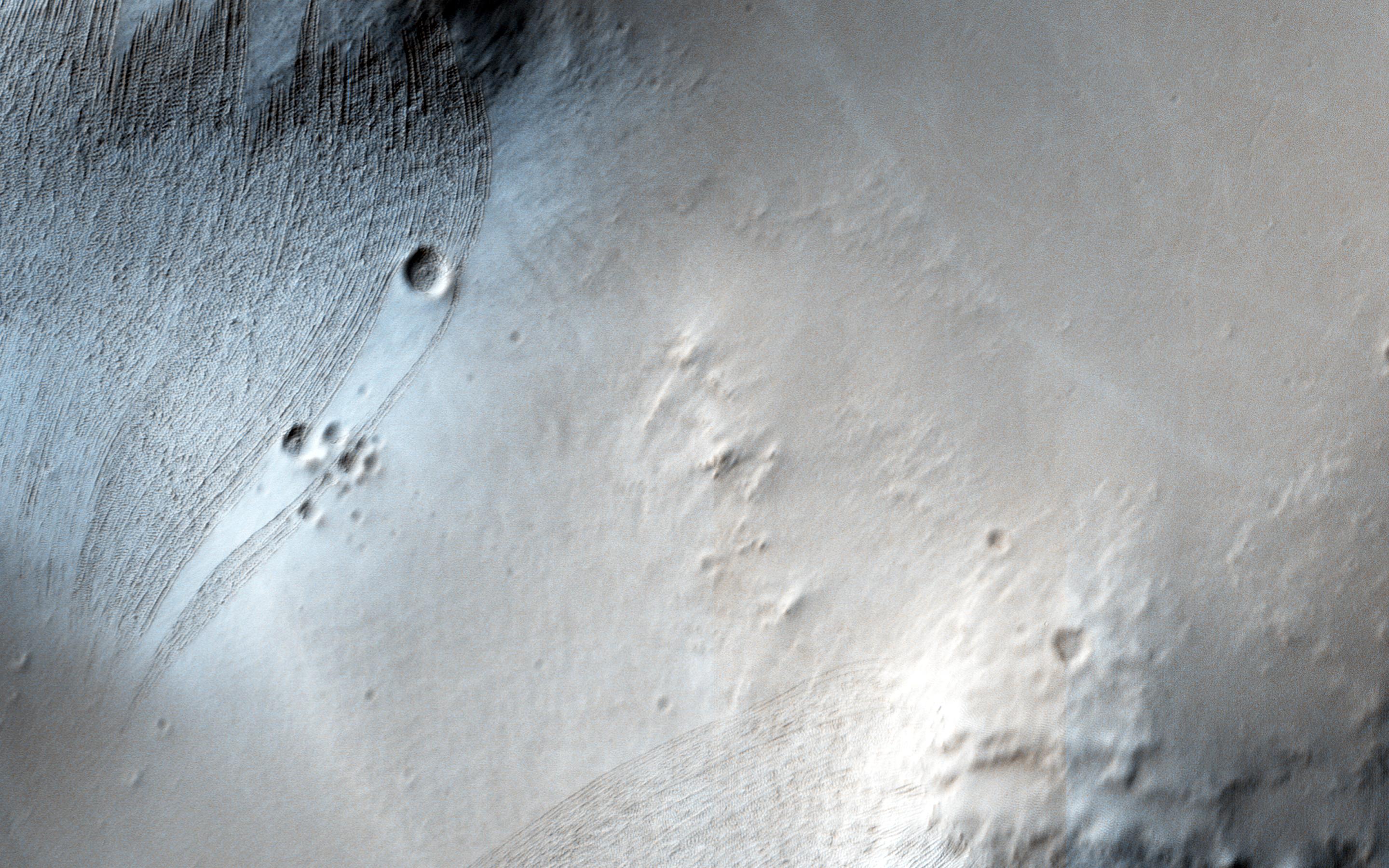
Dreaming of Graben in the Labyrinth of the Night
Full Resolution:
TIFF
(15.56 MB)
JPEG
(765.6 kB)
2016-06-29
Mars
Mars Reconnaissance Orbiter (MRO)
HiRISE
2880x1800x3
PIA20736:
Glowing Gullies in Kaiser Crater Dunes
Full Resolution:
TIFF
(15.11 MB)
JPEG
(766.1 kB)
2013-02-20
Mars
Mars Exploration Rover (MER)
Mars Science Laboratory (MSL)
Phoenix
MAHLI
Panoramic Camera
1585x598x3
PIA16731:
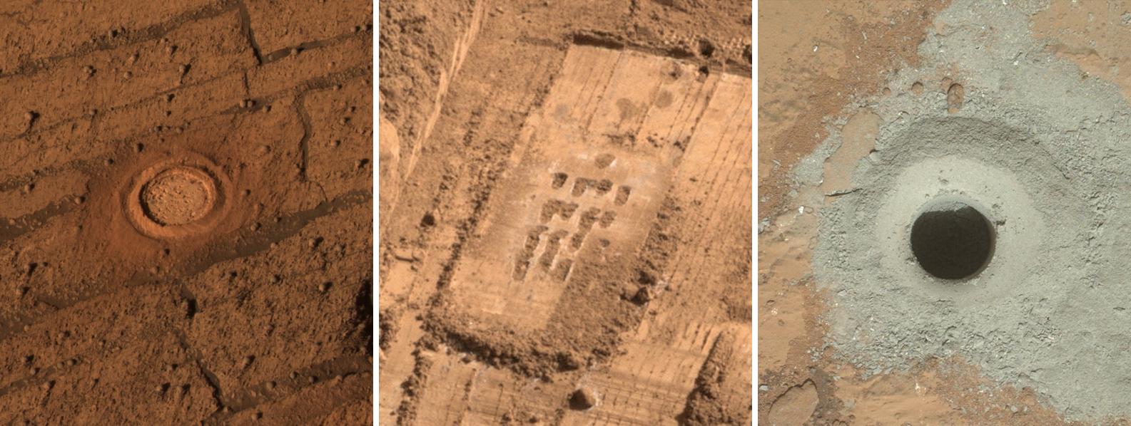
Different Tools for Different Purposes on Mars
Full Resolution:
TIFF
(2.845 MB)
JPEG
(172 kB)
2006-05-25
Mars Exploration Rover (MER)
Mars Science Laboratory (MSL)
640x481x3
PIA08488:
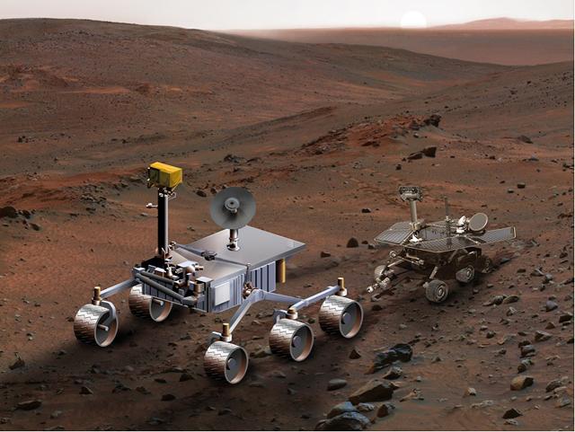
Size Comparison, Mars Science Laboratory and Mars Exploration Rover (Artist's Concept)
Full Resolution:
TIFF
(924.7 kB)
JPEG
(52.79 kB)
2013-03-12
Mars
Mars Exploration Rover (MER)
Mars Science Laboratory (MSL)
Mastcam
Panoramic Camera
2660x1179x3
PIA16833:
Two Different Aqueous Environments
Full Resolution:
TIFF
(9.412 MB)
JPEG
(605.8 kB)
2013-03-12
Mars
Mars Exploration Rover (MER)
Mars Science Laboratory (MSL)
MAHLI
Panoramic Camera
1054x598x3
PIA16834:
Studying Habitability in Ancient Martian Environments
Full Resolution:
TIFF
(1.892 MB)
JPEG
(117.8 kB)
2013-11-13
Mars
Mars Exploration Rover (MER)
Mars Reconnaissance Orbiter (MRO)
HiRISE
8192x4298x3
PIA17586:
A New Perspective on Murray Ridge
Full Resolution:
TIFF
(105.7 MB)
JPEG
(2.803 MB)
2014-11-10
Mars
Mars Exploration Rover (MER)
MAVEN
Navigation Camera
1024x1024x1
PIA18866:
Image Relayed by MAVEN Mars Orbiter from Curiosity Mars Rover
Full Resolution:
TIFF
(1.05 MB)
JPEG
(255.2 kB)
2013-07-09
Mars
Mars 2020 Rover
Mars Science Laboratory (MSL)
Mastcam
2460x1824x3
PIA17275:
The Importance of Nested Scales of Observations, Large Scales
Full Resolution:
TIFF
(13.47 MB)
JPEG
(624.1 kB)
2013-07-09
Mars
Mars 2020 Rover
Mars Science Laboratory (MSL)
ChemCam
2880x1624x3
PIA17276:
The Importance of Nested Scales of Observations, Fine Scales
Full Resolution:
TIFF
(14.04 MB)
JPEG
(354 kB)
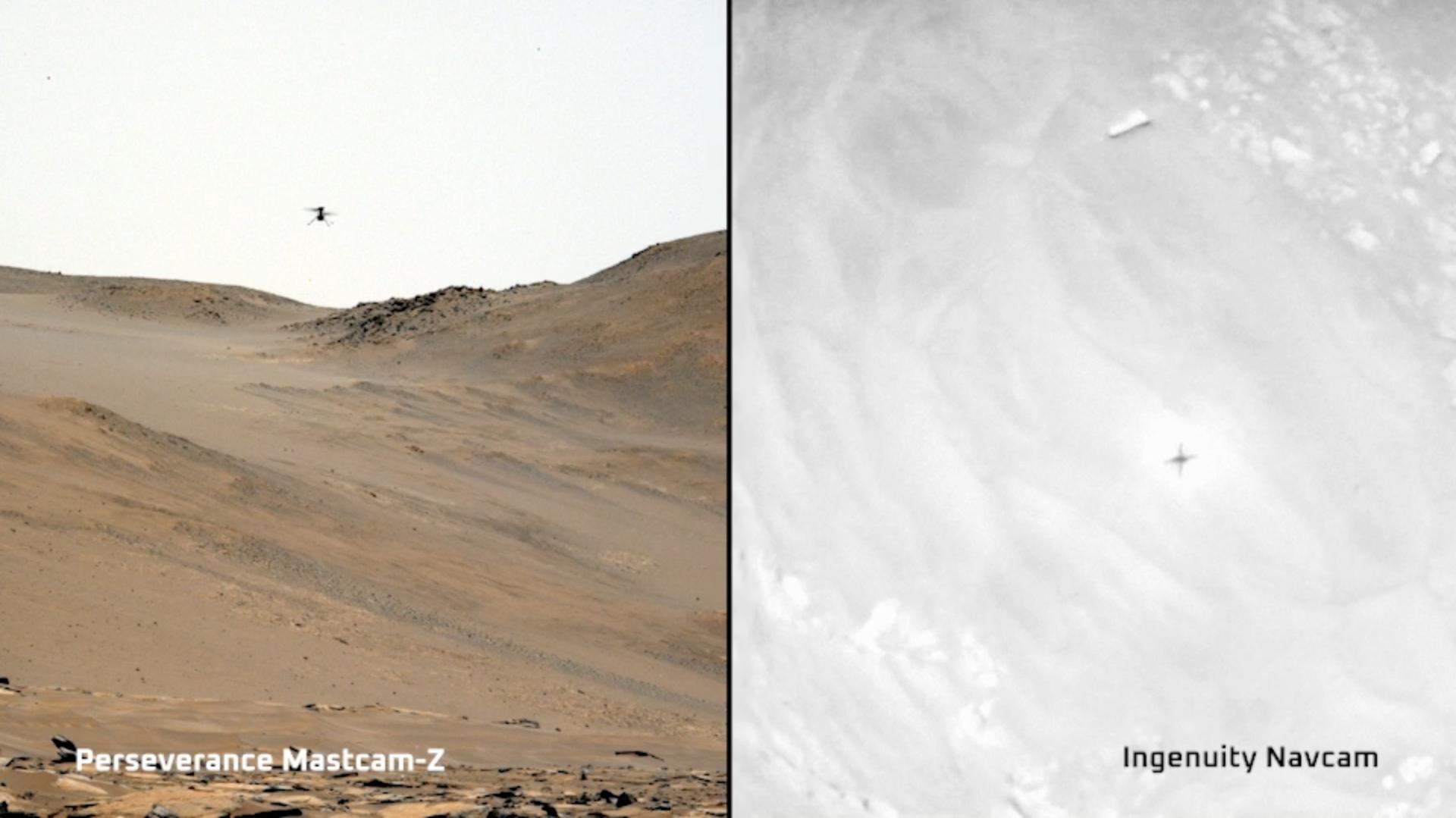
2023-11-22
Mars
Mars 2020 Rover
Mars Helicopter
Mastcam-Z
1920x1079x3
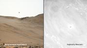
PIA26078:
Two Views of Ingenuity's 59th Flight
Full Resolution:
TIFF
(3.377 MB)
JPEG
(124.2 kB)
2012-09-27
Mars
2001 Mars Odyssey
Mars Science Laboratory (MSL)
THEMIS
3338x2580x3
PIA16159:
Downslope of the Fan
Full Resolution:
TIFF
(25.85 MB)
JPEG
(1.89 MB)
1-100
101-200
201-300
301-400
401-500
501-600
601-700
701-800
801-900
901-1000
Currently displaying images:
901 - 927
of 927


