Your search criteria found
12735
images
Target is mars (and available satellites)
Go to PIAxxxxx:
Refine this list of images by:
Target:
Deimos
Mars
Phobos
Mission:
2001 Mars Odyssey
Antarctic Meteorite Location and Mapping Project (AMLAMP)
Dawn
ExoMars
Hubble Space Telescope
InSight
MAVEN
Mariner Mars 1964 (Mariner 4)
Mariner Mars 1969 (Mariner 7)
Mariner Mars 1971 (Mariner 9)
Mars 2020
Mars 2020 Rover
Mars Atmosphere and Volatile Evolution MissioN (MAVEN)
Mars Climate Orbiter
Mars Cube One (MarCO)
Mars Exploration Rover (MER)
Mars Express (MEX)
Mars Global Surveyor (MGS)
Mars Helicopter
Mars Pathfinder (MPF)
Mars Reconnaissance Orbiter (MRO)
Mars Sample Return
Mars Sample Return (MSR)
Mars Science Laboratory (MSL)
Phoenix
Rosetta
Viking
Spacecraft:
2001 Mars Odyssey
Curiosity
Dawn
InSight Mars Lander
Ingenuity
MAVEN
MarCO-B
Mariner 4
Mariner 7
Mariner 9
Mars Climate Orbiter
Mars Express (MEX)
Mars Express (MEX) Orbiter
Mars Global Surveyor Orbiter
Mars Pathfinder Lander
Mars Pathfinder Rover
Mars Reconnaissance Orbiter (MRO)
Mars Sample Return
Mars Science Laboratory (MSL)
NASA's Mars Pathfinder Lander
Opportunity
Perseverance
Philae Lander
Phoenix Lander
Phoenix Mars Lander
Spirit
Viking Lander 1
Viking Lander 2
Viking Orbiter 1
Viking Orbiter 2
Instrument:
Alpha Particle X-ray Spectrometer
Alpha Particle X-ray Spectrometer (MSL)
Atmospheric Structure / Meteorology Instrument
CHIMRA
Camera 1
Camera 2
Chemistry & Mineralogy (CheMin)
Chemistry and Camera (ChemCam)
Comet Infrared and Visible Analyser (CIVA
Compact Reconnaissance Imaging Spectrometer for Mars (CRISM)
Context Camera (CTX)
Deep Space Network
Descent Image Motion Estimation System (DIMES)
Dynamic Albedo of Neutrons
Dynamic Albedo of Neutrons (DAN)
Gamma Ray Spectrometer - Neutron Spectrometer
Gamma Ray Spectrometer Suite
Hazard Avoidance Camera
Hazard Avoidance Camera (M2020)
Hazard Avoidance Camera (MSL)
Heat and Physical Properties Package (HP3)
High Resolution Imaging Science Experiment (HiRISE)
High Resolution Instrument (HRI)
High Resolution Stereo Camera
Imager for Mars Pathfinder
Imaging Ultraviolet Spectrograph
Imaging Ultraviolet Spectrograph (IUVS)
Instrument Context Camera (ICC)
Instrument Deployment Camera (IDC)
Lander Vision System Camera (LCAM)
Magnetometer
Mars Advanced Radar for Subsurface and Ionosphere Sounding (MARSIS)
Mars Advanced Radar for Subsurface and Ionospheric Sounding (MARSIS)
Mars Climate Sounder (MCS)
Mars Color Imager (MARCI)
Mars Descent Imager
Mars Environmental Dynamics Analyzer (MEDA)
Mars Hand Lens Imager (MAHLI)
Mars Horizon Sensor Assembly
Mars Orbiter Camera (MOC)
Mars Orbiter Laser Altimeter
Mars Radiation Experiment
Mastcam
Mastcam-Z
Microscopic Imager
Microscopy Electrochemistry and Conductivity Analyzer (MECA)
Miniature Thermal Emission Spectrometer
Moessbauer Spectrometer
Navigation Camera
Navigation Camera (M2020)
Navigation Camera (MSL)
Neutral Gas and Ion Mass Spectrometer
Neutron Spectrometer
Optical Microscope
Optical Navigation Camera
Panoramic Camera
Planetary Instrument for X-ray Lithochemistry (PIXL)
Radar System
Radiation Assessment Detector (RAD)
Radio Science Subsystem
Robotic Arm
Robotic Arm (MSL)
Robotic Arm Camera (RAC)
Rock Abrasion Tool (RAT)
Rover Cameras
Rover Environmental Monitoring Station (REMS)
Sample Analysis at Mars (SAM)
Scanning Habitable Environments with Raman & Luminescence for Organics and Chemicals (SHERLOC)
Seismic Experiment for Interior Structure (SEIS)
Shallow Subsurface Radar (SHARAD)
Stereo Imager (SSI)
SuperCam
Surface Stereo Imager (SSI)
Thermal Emission Imaging System
Thermal Emission Spectrometer
Thermal and Electrical Conductivity Probe
Thermal and Evolved Gas Analyzer
Trace Gas Orbiter
Visual Imaging Subsystem
Visual Imaging Subsystem - Camera A
Visual Imaging Subsystem - Camera B
Wide Field Planetary Camera 2
Click on an image for detailed information
Click on a column heading to sort in ascending or descending order
My
List
Addition Date
Target
Mission
Instrument
Size
2003-07-07
Mars
Mars Global Surveyor (MGS)
Mars Orbiter Camera (MOC)
540x810x1
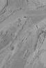
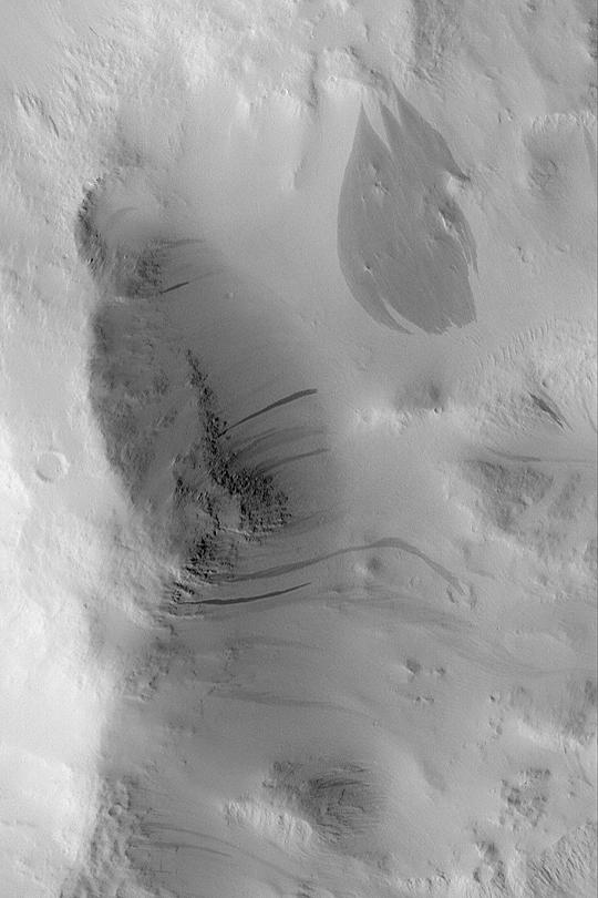
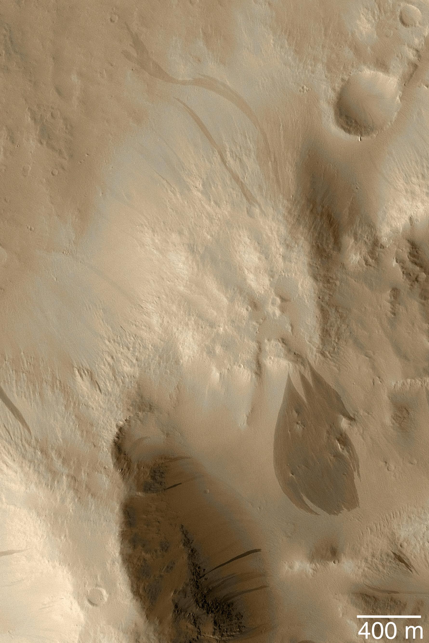
PIA04613:
Dark Slope Streaks
Full Resolution:
TIFF
(438.1 kB)
JPEG
(52.64 kB)
2003-07-07
Mars
Mars Global Surveyor (MGS)
Mars Orbiter Camera (MOC)
540x810x1
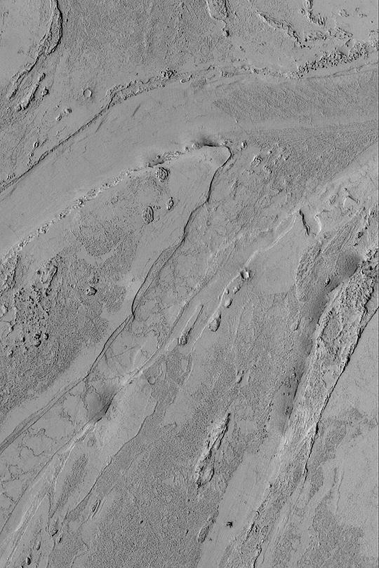
PIA04614:
Valley South of Cerberus
Full Resolution:
TIFF
(438.1 kB)
JPEG
(106.8 kB)
2003-07-07
Mars
Mars Global Surveyor (MGS)
Mars Orbiter Camera (MOC)
540x810x3
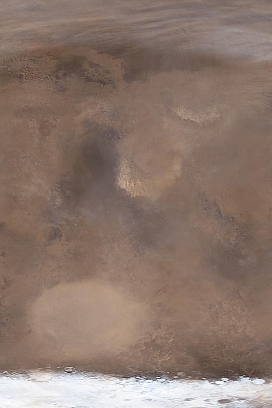
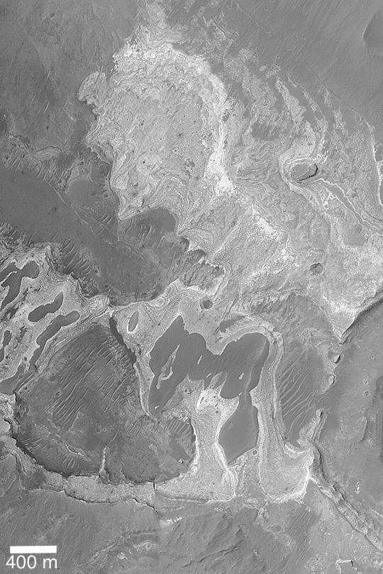
PIA04615:
Time for Dust Storms
Full Resolution:
TIFF
(1.089 MB)
JPEG
(43.86 kB)
2003-07-09
Mars
Mars Global Surveyor (MGS)
Mars Orbiter Camera (MOC)
540x810x1
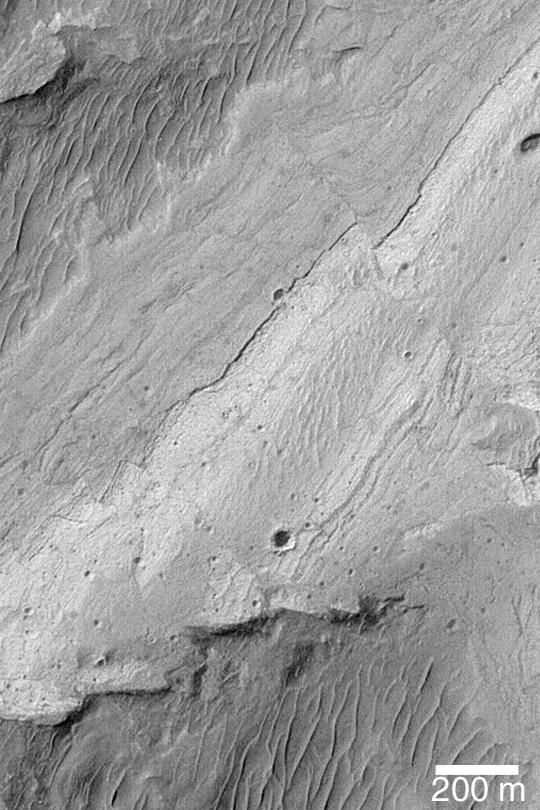
PIA04616:
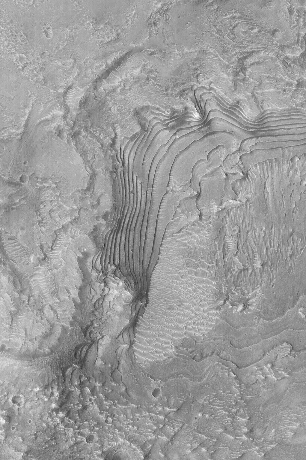
Ius Chasma Fault
Full Resolution:
TIFF
(438.1 kB)
JPEG
(90.64 kB)
2003-07-09
Mars
2001 Mars Odyssey
THEMIS
1239x3043x1
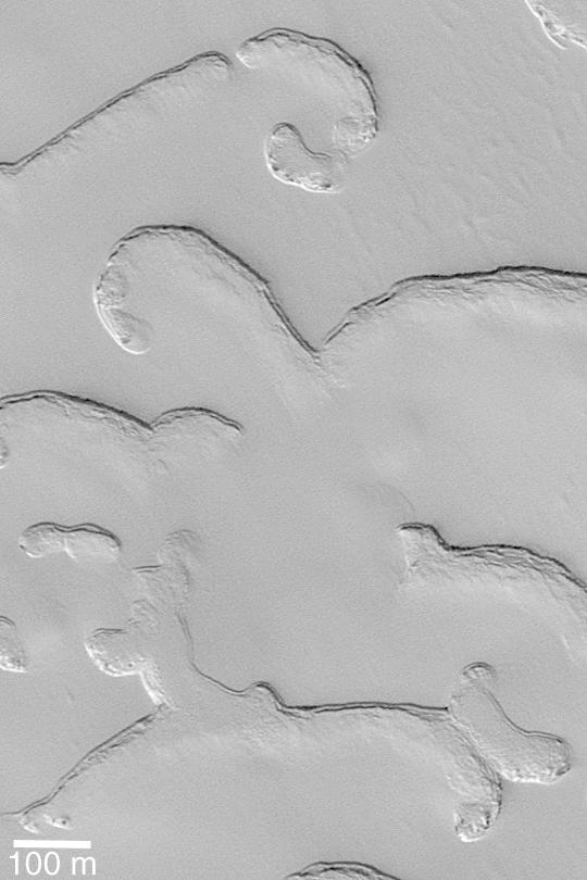
PIA04617:
Platy Flows
Full Resolution:
TIFF
(3.412 MB)
JPEG
(673.3 kB)
2003-07-09
Mars
2001 Mars Odyssey
THEMIS
1431x3291x1
PIA04618:
Destination: Meridiani
Full Resolution:
TIFF
(3.221 MB)
JPEG
(489.9 kB)
2003-07-10
Mars
Mars Global Surveyor (MGS)
Mars Orbiter Camera (MOC)
540x810x1
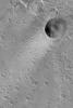
PIA04619:
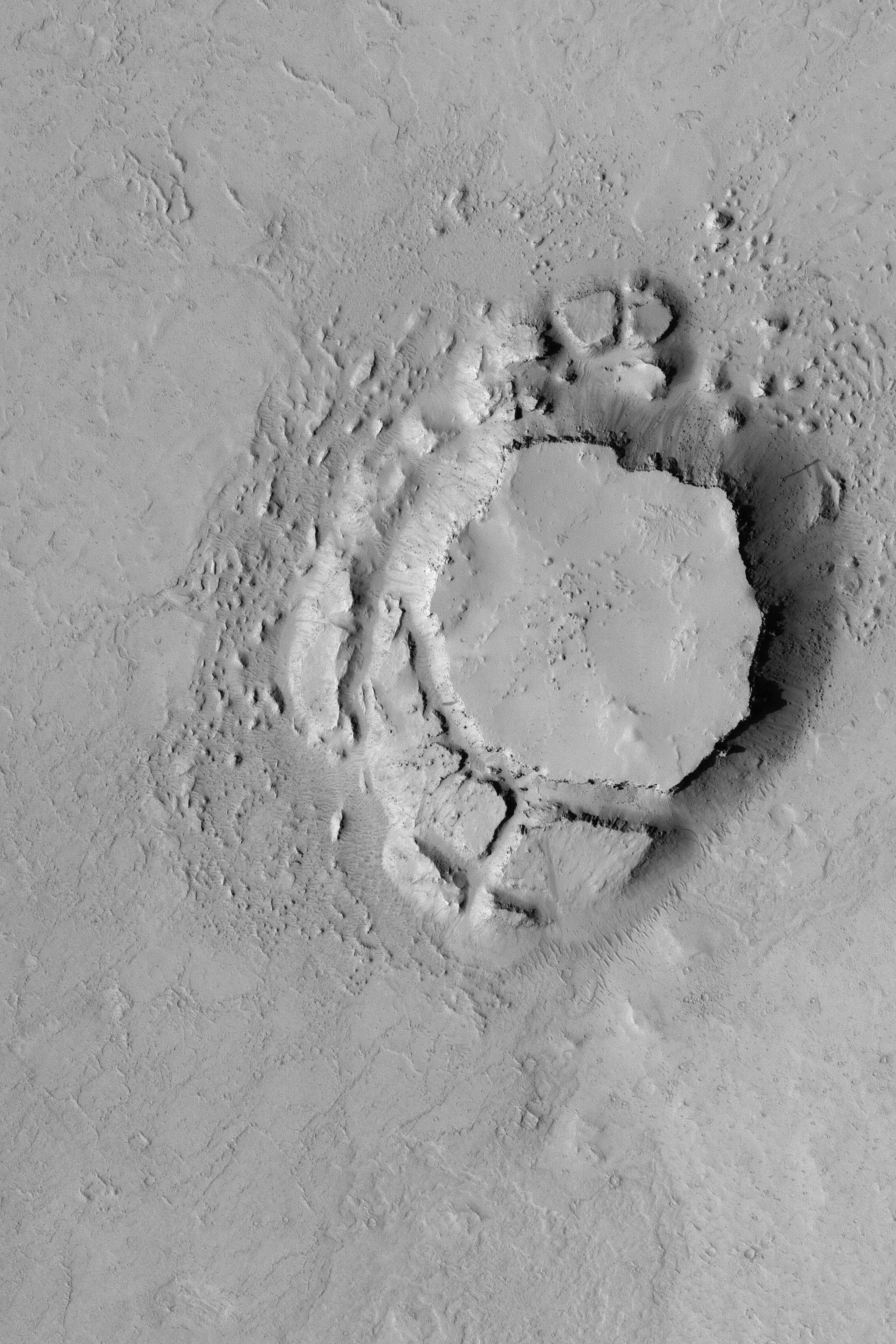
Fresh, Rayed Impact Crater
Full Resolution:
TIFF
(438.1 kB)
JPEG
(57.09 kB)
2003-07-10
Mars
Mars Global Surveyor (MGS)
Mars Orbiter Camera (MOC)
540x810x1
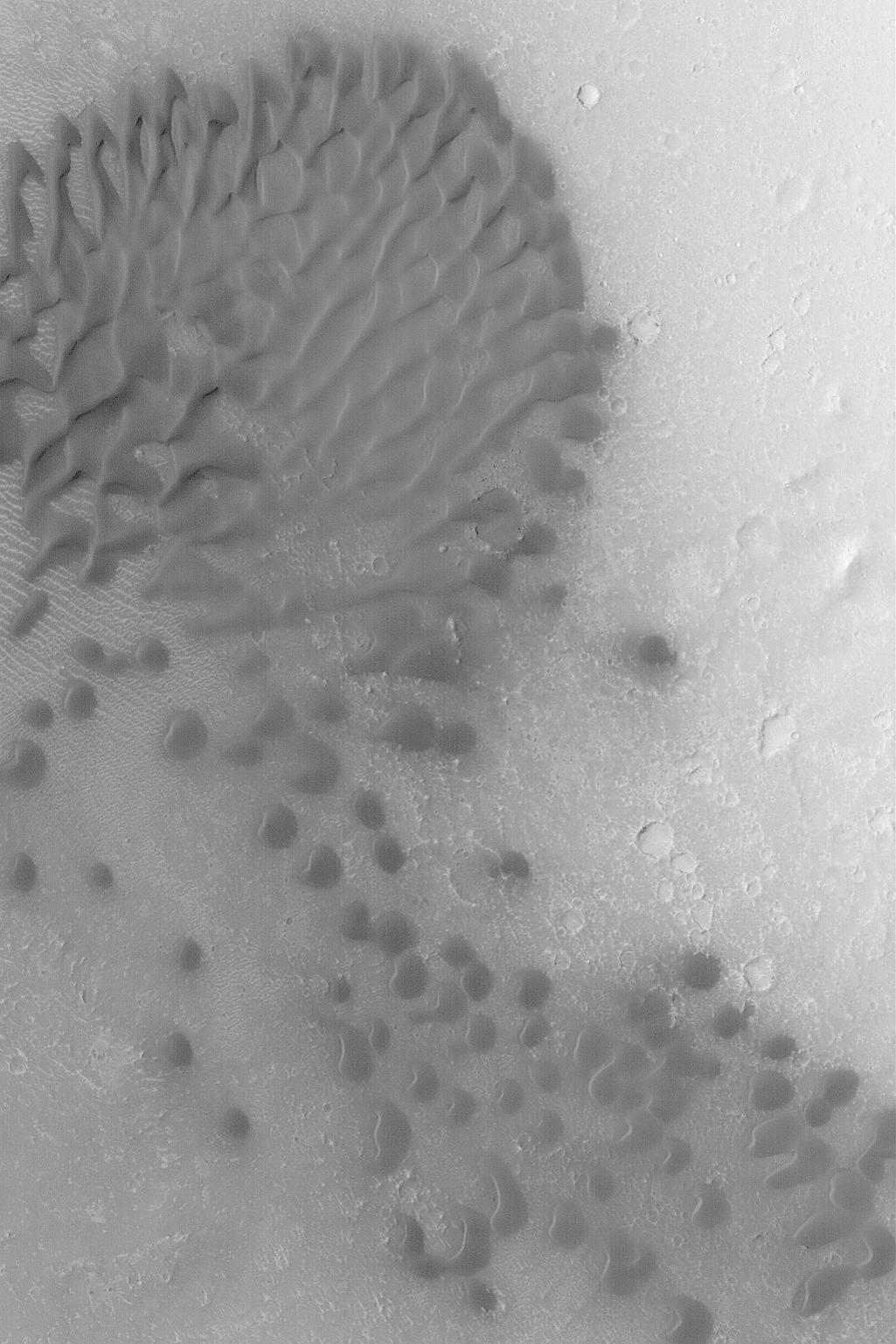
PIA04620:
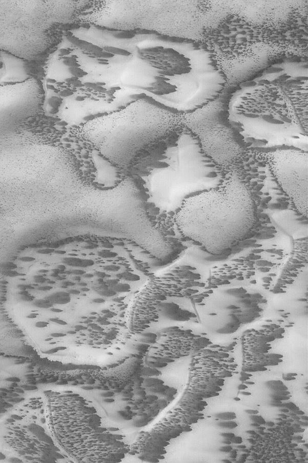
North Polar Sand Dunes
Full Resolution:
TIFF
(438.1 kB)
JPEG
(66.37 kB)
2003-07-11
Mars
Mars Global Surveyor (MGS)
Mars Orbiter Camera (MOC)
540x810x1
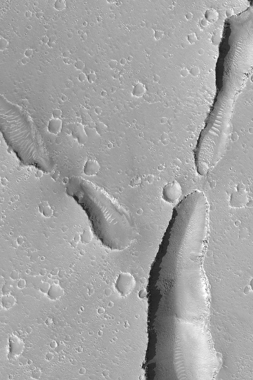
PIA04621:
Dark Valley in Newton Crater
Full Resolution:
TIFF
(438.1 kB)
JPEG
(133.8 kB)
2003-07-17
Mars
Mars Global Surveyor (MGS)
Mars Orbiter Camera (MOC)
540x810x1
PIA04636:
Tractus Fossae Collapse Pit
Full Resolution:
TIFF
(423.9 kB)
JPEG
(46.92 kB)
2003-07-17
Mars
Mars Global Surveyor (MGS)
Mars Orbiter Camera (MOC)
540x810x1
PIA04637:
Sedimentary Rock Near Coprates
Full Resolution:
TIFF
(438.1 kB)
JPEG
(96.62 kB)
2003-07-17
Mars
Mars Global Surveyor (MGS)
Mars Orbiter Camera (MOC)
540x810x1
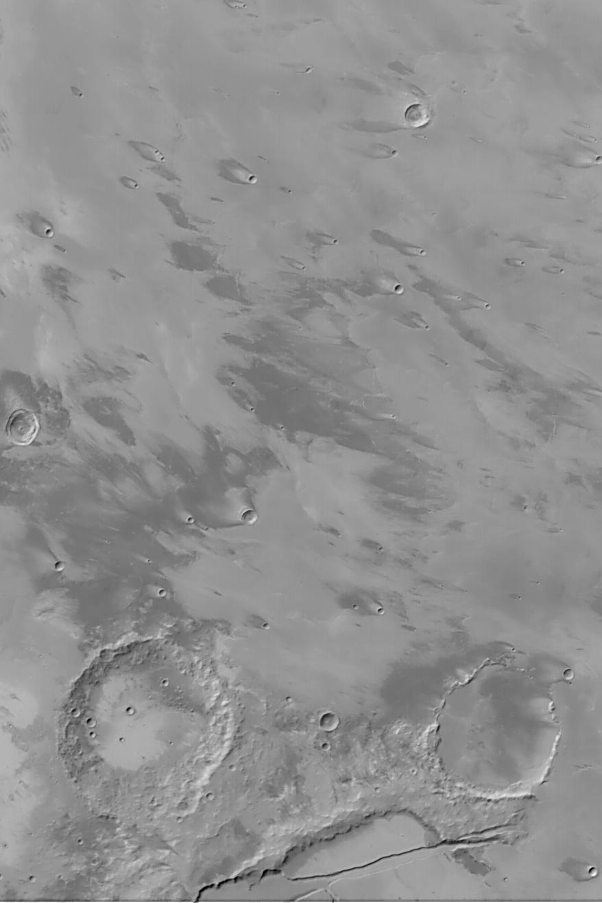
PIA04638:
Southern Auqakuh Vallis
Full Resolution:
TIFF
(438.1 kB)
JPEG
(69.39 kB)
2003-07-17
Mars
Mars Global Surveyor (MGS)
Mars Orbiter Camera (MOC)
540x810x1
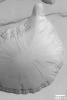
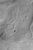
PIA04639:
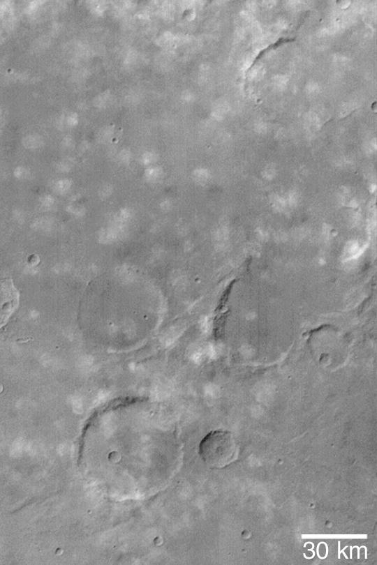
South Polar "Poodle"
Full Resolution:
TIFF
(388.8 kB)
JPEG
(49.99 kB)
2003-07-17
Mars
Mars Global Surveyor (MGS)
Mars Orbiter Camera (MOC)
540x810x3
PIA04640:
Eastern Cerberus
Full Resolution:
TIFF
(1.314 MB)
JPEG
(51.45 kB)
2003-07-17
Mars
Mars Global Surveyor (MGS)
Mars Orbiter Camera (MOC)
540x810x1
PIA04641:
Crater with Wavy Fog
Full Resolution:
TIFF
(268.9 kB)
JPEG
(21.03 kB)
2004-03-06
Mars
Mars Exploration Rover (MER)
Panoramic Camera
Rock Abrasion Tool (RAT)
799x565x3
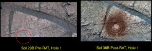
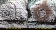
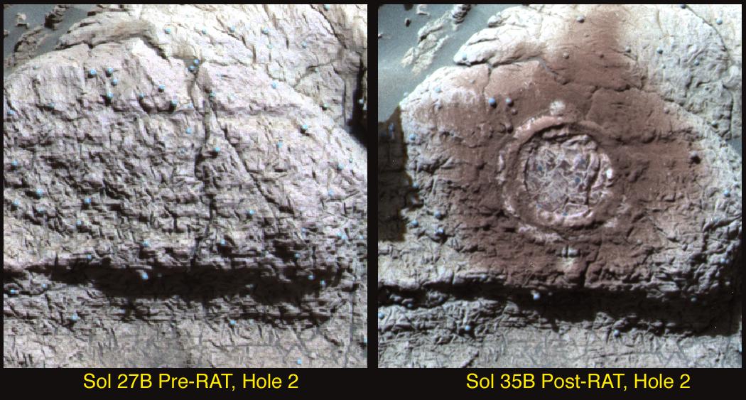
PIA05513:
"Hole" Lotta Grindin' Going On
Full Resolution:
TIFF
(727.2 kB)
JPEG
(120.1 kB)
2003-07-18
Mars
2001 Mars Odyssey
THEMIS
1235x3025x1
PIA04642:
Gigas Meets Ulysses
Full Resolution:
TIFF
(3.334 MB)
JPEG
(648.5 kB)
2003-07-18
Mars
2001 Mars Odyssey
THEMIS
1239x3043x1
PIA04643:
Crater Interior
Full Resolution:
TIFF
(3.603 MB)
JPEG
(791.9 kB)
2003-07-18
Mars
2001 Mars Odyssey
THEMIS
1223x3061x1
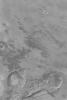
PIA04644:
Lava Flows
Full Resolution:
TIFF
(3.095 MB)
JPEG
(611.6 kB)
2003-07-18
Mars
2001 Mars Odyssey
THEMIS
1443x3357x1
PIA04645:
Fractures and Collapse
Full Resolution:
TIFF
(3.35 MB)
JPEG
(457 kB)
2003-07-18
Mars
2001 Mars Odyssey
THEMIS
1230x3061x1
PIA04646:
Huygens Crater
Full Resolution:
TIFF
(3.547 MB)
JPEG
(801.2 kB)
2003-07-18
Mars
2001 Mars Odyssey
THEMIS
1198x3061x1
PIA04647:
Processes of Geology
Full Resolution:
TIFF
(3.478 MB)
JPEG
(664.3 kB)
2003-07-18
Mars
2001 Mars Odyssey
THEMIS
2225x3549x1
PIA04648:
South Polar Layered Deposits
Full Resolution:
TIFF
(3.349 MB)
JPEG
(501.3 kB)
2003-07-18
Mars
2001 Mars Odyssey
THEMIS
1156x3079x1
PIA04649:
Tader Valles
Full Resolution:
TIFF
(3.563 MB)
JPEG
(1.072 MB)
2003-07-18
Mars
Mars Global Surveyor (MGS)
Mars Orbiter Camera (MOC)
540x810x1
PIA04650:
Small Volcano
Full Resolution:
TIFF
(435.1 kB)
JPEG
(69.43 kB)
2003-07-23
Mars
2001 Mars Odyssey
THEMIS
1429x3231x1
PIA04651:
Eroded Mesas
Full Resolution:
TIFF
(3.521 MB)
JPEG
(660.1 kB)
2003-07-23
Mars
Mars Global Surveyor (MGS)
Mars Orbiter Camera (MOC)
540x810x1
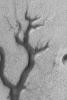
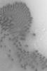
PIA04653:
Spiders from Mars?
Full Resolution:
TIFF
(438.1 kB)
JPEG
(119 kB)
2003-07-24
Mars
Mars Global Surveyor (MGS)
Mars Orbiter Camera (MOC)
540x810x1
PIA04654:
North Mid-latitude Crater
Full Resolution:
TIFF
(438.1 kB)
JPEG
(116.4 kB)
2003-07-24
Mars
Mars Global Surveyor (MGS)
Mars Orbiter Camera (MOC)
540x810x1
PIA04655:
Polygons in Martian Frost
Full Resolution:
TIFF
(438.1 kB)
JPEG
(108.8 kB)
2003-07-24
Mars
Mars Global Surveyor (MGS)
Mars Orbiter Camera (MOC)
540x810x1
PIA04656:
Stair-stepped Mound
Full Resolution:
TIFF
(425.7 kB)
JPEG
(56.73 kB)
2003-07-24
Mars
Mars Global Surveyor (MGS)
Mars Orbiter Camera (MOC)
540x810x1
PIA04657:
Clouds Near Icaria Planum
Full Resolution:
TIFF
(408.1 kB)
JPEG
(52.36 kB)
2003-07-24
Mars
Mars Global Surveyor (MGS)
Mars Orbiter Camera (MOC)
540x810x1
PIA04658:
Layers in Crater Cluster
Full Resolution:
TIFF
(438.1 kB)
JPEG
(77.89 kB)
2003-07-24
Mars
2001 Mars Odyssey
THEMIS
1239x3043x1
PIA04659:
Wind Effects in Tharsis
Full Resolution:
TIFF
(3.524 MB)
JPEG
(730.9 kB)
2004-03-06
Mars
Mars Exploration Rover (MER)
Panoramic Camera
4159x3028x3
PIA05512:
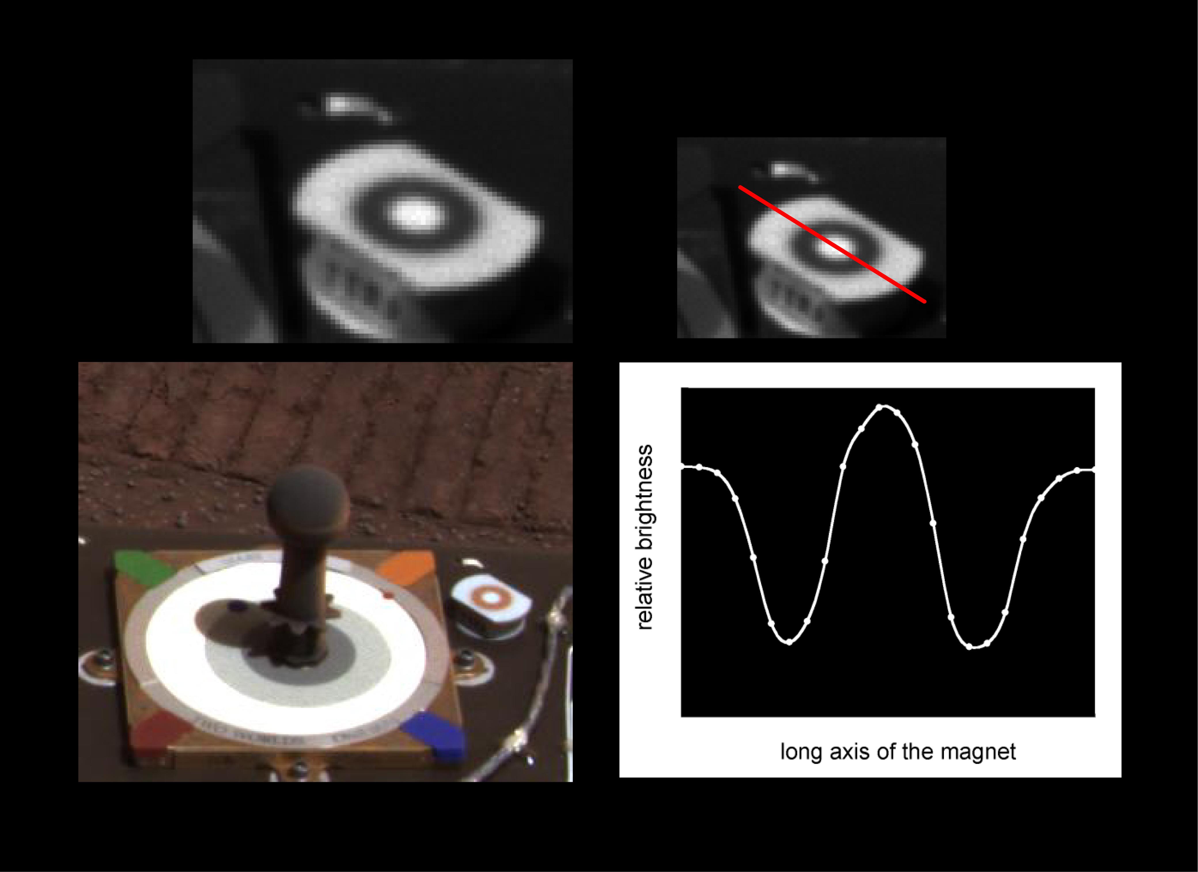
Martian Dust Mostly Magnetic
Full Resolution:
TIFF
(7.605 MB)
JPEG
(464.4 kB)
2003-07-26
Mars
Mars Global Surveyor (MGS)
Mars Orbiter Camera (MOC)
540x810x1
PIA04660:
Fortune Cookie Sand Dunes
Full Resolution:
TIFF
(438.1 kB)
JPEG
(76.67 kB)
2003-07-29
Mars
Mars Global Surveyor (MGS)
Mars Orbiter Camera (MOC)
540x810x1
PIA04662:
Outcrop In Juventae Chasma
Full Resolution:
TIFF
(438.1 kB)
JPEG
(65.94 kB)
2003-07-29
Mars
Mars Global Surveyor (MGS)
Mars Orbiter Camera (MOC)
540x810x1
PIA04663:
Defrosting Sand Dunes
Full Resolution:
TIFF
(438.1 kB)
JPEG
(82.21 kB)
2003-07-29
Mars
Mars Global Surveyor (MGS)
Mars Orbiter Camera (MOC)
540x810x1
PIA04664:
Textured Memnonia Plain
Full Resolution:
TIFF
(438.1 kB)
JPEG
(112.6 kB)
2003-07-29
Mars
Mars Global Surveyor (MGS)
Mars Orbiter Camera (MOC)
540x810x1
PIA04665:
Cliff in Terby Crater
Full Resolution:
TIFF
(438.1 kB)
JPEG
(67.22 kB)
2003-07-29
Mars
2001 Mars Odyssey
THEMIS
1233x3061x1
PIA04661:
Gusev Crater
Full Resolution:
TIFF
(3.208 MB)
JPEG
(640.2 kB)
2003-07-30
Mars
2001 Mars Odyssey
THEMIS
1239x3043x1
PIA04666:
Remnants of MFF
Full Resolution:
TIFF
(3.685 MB)
JPEG
(1.013 MB)
2003-07-30
Mars
2001 Mars Odyssey
THEMIS
1182x3061x1
PIA04667:
Valley Networks
Full Resolution:
TIFF
(3.458 MB)
JPEG
(574.8 kB)
2003-07-30
Mars
Mars Global Surveyor (MGS)
Mars Orbiter Camera (MOC)
540x810x1
PIA04669:
Olympus Mons Lava Flows
Full Resolution:
TIFF
(438.1 kB)
JPEG
(83.81 kB)
2003-07-31
Mars
Mars Global Surveyor (MGS)
Mars Orbiter Camera (MOC)
540x810x1
PIA04670:
South Polar Scarps
Full Resolution:
TIFF
(433.7 kB)
JPEG
(69.98 kB)
2003-07-31
Mars
2001 Mars Odyssey
THEMIS
1319x3079x1
PIA04671:
Lava Flows
Full Resolution:
TIFF
(3.208 MB)
JPEG
(898.2 kB)
2003-08-01
Mars
Mars Global Surveyor (MGS)
Mars Orbiter Camera (MOC)
540x810x1
PIA04672:
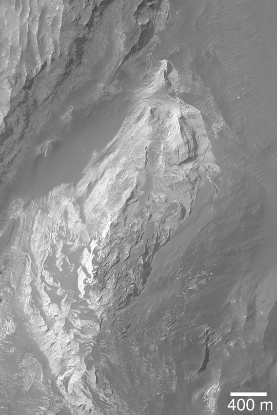
Gale Sedimentary Rocks
Full Resolution:
TIFF
(438.1 kB)
JPEG
(96.6 kB)
2004-03-06
Mars
Mars Exploration Rover (MER)
Rock Abrasion Tool (RAT)
4004x3002x3
PIA05511:
Rover Magnets All Around
Full Resolution:
TIFF
(18.96 MB)
JPEG
(854.9 kB)
2003-08-01
Mars
2001 Mars Odyssey
THEMIS
1191x3061x1
PIA04673:
Crenulated Lava Flows of Daedalia Planum
Full Resolution:
TIFF
(3.615 MB)
JPEG
(900.1 kB)
2003-08-20
Mars
Mars Global Surveyor (MGS)
Mars Orbiter Camera (MOC)
540x810x1
PIA04674:
Warrego Valles
Full Resolution:
TIFF
(438.1 kB)
JPEG
(85.23 kB)
2003-08-20
Mars
Mars Global Surveyor (MGS)
Mars Orbiter Camera (MOC)
540x810x1
PIA04675:
Labou Vallis
Full Resolution:
TIFF
(438.1 kB)
JPEG
(88.98 kB)
2003-08-20
Mars
Mars Global Surveyor (MGS)
Mars Orbiter Camera (MOC)
540x810x1
PIA04676:
Marte Vallis Platy Flows
Full Resolution:
TIFF
(438.1 kB)
JPEG
(100.2 kB)
2003-08-20
Mars
Mars Global Surveyor (MGS)
Mars Orbiter Camera (MOC)
540x810x1
PIA04677:
Aeolis Yardangs
Full Resolution:
TIFF
(438.1 kB)
JPEG
(108 kB)
2003-08-20
Mars
Mars Global Surveyor (MGS)
Mars Orbiter Camera (MOC)
540x810x1
PIA04678:
Pedestal Crater and Yardangs
Full Resolution:
TIFF
(438.1 kB)
JPEG
(88.35 kB)
2003-08-20
Mars
Mars Global Surveyor (MGS)
Mars Orbiter Camera (MOC)
540x810x1
PIA04679:
Layers in Tithonium Chasma
Full Resolution:
TIFF
(438.1 kB)
JPEG
(74.48 kB)
2003-08-20
Mars
Mars Global Surveyor (MGS)
Mars Orbiter Camera (MOC)
540x810x1
PIA04680:
Northeast Hellas Landscape
Full Resolution:
TIFF
(438.1 kB)
JPEG
(99.04 kB)
2003-08-20
Mars
Mars Global Surveyor (MGS)
Mars Orbiter Camera (MOC)
540x810x1
PIA04681:
Large, Windblown Ripples
Full Resolution:
TIFF
(438.1 kB)
JPEG
(91.81 kB)
2003-08-20
Mars
Mars Global Surveyor (MGS)
Mars Orbiter Camera (MOC)
540x810x1
PIA04682:
Scamander Vallis
Full Resolution:
TIFF
(390.7 kB)
JPEG
(30.01 kB)
2003-08-20
Mars
Mars Global Surveyor (MGS)
Mars Orbiter Camera (MOC)
540x810x1
PIA04683:
Bouldery Surface
Full Resolution:
TIFF
(438.1 kB)
JPEG
(86.77 kB)
2003-08-20
Mars
Mars Global Surveyor (MGS)
Mars Orbiter Camera (MOC)
540x810x1
PIA04684:
Peridier Crater
Full Resolution:
TIFF
(382.8 kB)
JPEG
(32.63 kB)
2003-08-20
Mars
Mars Global Surveyor (MGS)
Mars Orbiter Camera (MOC)
1025x1537x1
PIA04685:
South Polar Mesas
Full Resolution:
TIFF
(1.577 MB)
JPEG
(326.8 kB)
2003-08-20
Mars
Mars Global Surveyor (MGS)
Mars Orbiter Camera (MOC)
1021x1532x1
PIA04686:
Dust-Raising Event in Noachis
Full Resolution:
TIFF
(1.163 MB)
JPEG
(101.6 kB)
2003-08-20
Mars
Mars Global Surveyor (MGS)
Mars Orbiter Camera (MOC)
2048x3072x1
PIA04687:
Southeast Olympus Mons
Full Resolution:
TIFF
(6.298 MB)
JPEG
(1.121 MB)
2003-08-20
Mars
Mars Global Surveyor (MGS)
Mars Orbiter Camera (MOC)
625x937x1
PIA04688:
Peridier Dune Field
Full Resolution:
TIFF
(392 kB)
JPEG
(71.06 kB)
2003-08-20
Mars
Mars Global Surveyor (MGS)
Mars Orbiter Camera (MOC)
1537x2305x1
PIA04689:
Top of Olympus Mons
Full Resolution:
TIFF
(3.278 MB)
JPEG
(470.2 kB)
2003-08-20
Mars
Mars Global Surveyor (MGS)
Mars Orbiter Camera (MOC)
837x1256x1
PIA04690:
South Polar Artwork
Full Resolution:
TIFF
(996.3 kB)
JPEG
(185.3 kB)
2003-08-20
Mars
Mars Global Surveyor (MGS)
Mars Orbiter Camera (MOC)
1781x2671x3
PIA04691:
Dark Slope Streaks
Full Resolution:
TIFF
(4.764 MB)
JPEG
(695.6 kB)
2003-08-20
Mars
Mars Global Surveyor (MGS)
Mars Orbiter Camera (MOC)
1025x1537x1
PIA04692:
Intracrater Dune Field
Full Resolution:
TIFF
(1.577 MB)
JPEG
(194.4 kB)
2003-08-27
Mars
Mars Global Surveyor (MGS)
Mars Orbiter Camera (MOC)
832x1248x1
PIA04696:
Hephaestus Fossae
Full Resolution:
TIFF
(1.04 MB)
JPEG
(178.2 kB)
2003-08-27
Mars
Mars Global Surveyor (MGS)
Mars Orbiter Camera (MOC)
878x1317x1
PIA04693:
Daedalia Planum Wind Streaks
Full Resolution:
TIFF
(764.2 kB)
JPEG
(76.38 kB)
2003-08-27
Mars
Mars Global Surveyor (MGS)
Mars Orbiter Camera (MOC)
1020x1530x1
PIA04694:
Banded Terrain in East Hellas
Full Resolution:
TIFF
(1.562 MB)
JPEG
(436.7 kB)
2003-08-27
Mars
Mars Global Surveyor (MGS)
Mars Orbiter Camera (MOC)
1021x1532x1
PIA04695:
Crater and Wind Streak
Full Resolution:
TIFF
(1.566 MB)
JPEG
(326.9 kB)
2003-08-27
Mars
Mars Global Surveyor (MGS)
Mars Orbiter Camera (MOC)
2047x3071x1
PIA04697:
Crumbled Mesa
Full Resolution:
TIFF
(6.293 MB)
JPEG
(1.444 MB)
2003-08-27
Mars
Mars Global Surveyor (MGS)
Mars Orbiter Camera (MOC)
600x900x1
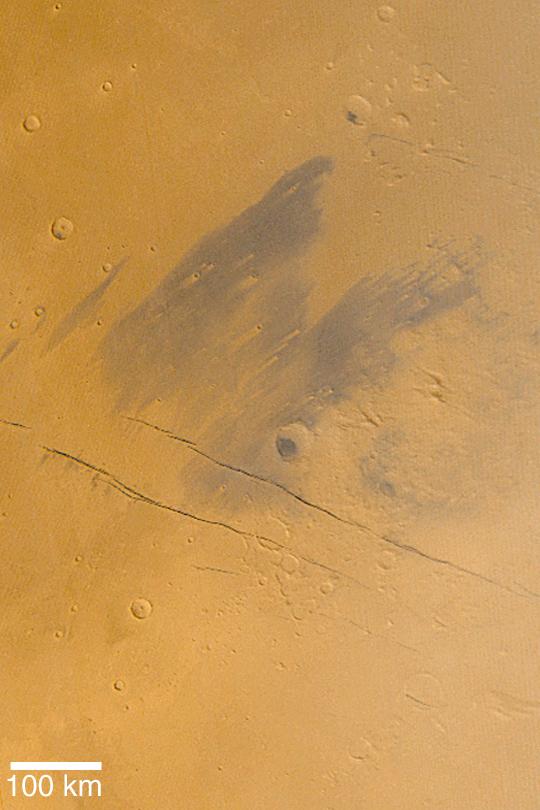
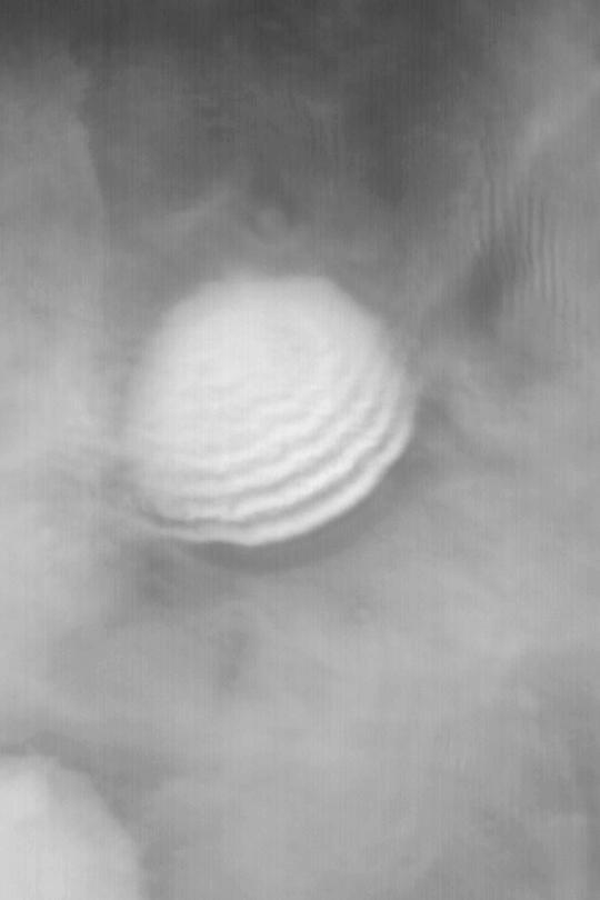
PIA04698:
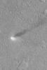
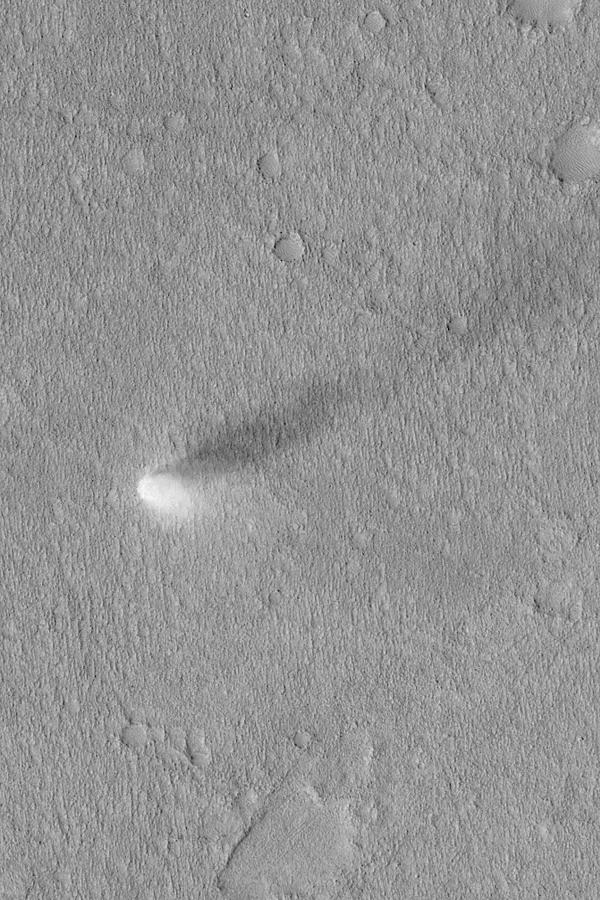
Summertime Dust Devil
Full Resolution:
TIFF
(540.8 kB)
JPEG
(129.1 kB)
2003-08-27
Mars
Mars Global Surveyor (MGS)
Mars Orbiter Camera (MOC)
2047x3070x1
PIA04699:
Cerberus Fossae Trough
Full Resolution:
TIFF
(6.291 MB)
JPEG
(1.101 MB)
2003-08-28
Mars
Mars Global Surveyor (MGS)
Mars Orbiter Camera (MOC)
835x1253x1
PIA04700:
Northeast Arabia Terra
Full Resolution:
TIFF
(1.048 MB)
JPEG
(185.7 kB)
2003-08-28
Mars
2001 Mars Odyssey
THEMIS
1315x3094x1
PIA04701:
Knobby Terrain Down Under
Full Resolution:
TIFF
(3.145 MB)
JPEG
(724.1 kB)
2003-08-28
Mars
2001 Mars Odyssey
THEMIS
1234x3043x1
PIA04702:
Wind-sculpted Rocks
Full Resolution:
TIFF
(3.628 MB)
JPEG
(833.8 kB)
2003-08-28
Mars
2001 Mars Odyssey
THEMIS
1194x3061x1
PIA04703:
Dunes in a Crater Floor
Full Resolution:
TIFF
(3.659 MB)
JPEG
(1.022 MB)
2004-03-06
Mars
Mars Exploration Rover (MER)
Panoramic Camera
Rock Abrasion Tool (RAT)
1439x486x3
PIA05510:
Messy Grind
Full Resolution:
TIFF
(1.742 MB)
JPEG
(145.1 kB)
2003-08-28
Mars
2001 Mars Odyssey
THEMIS
1182x3061x1
PIA04704:
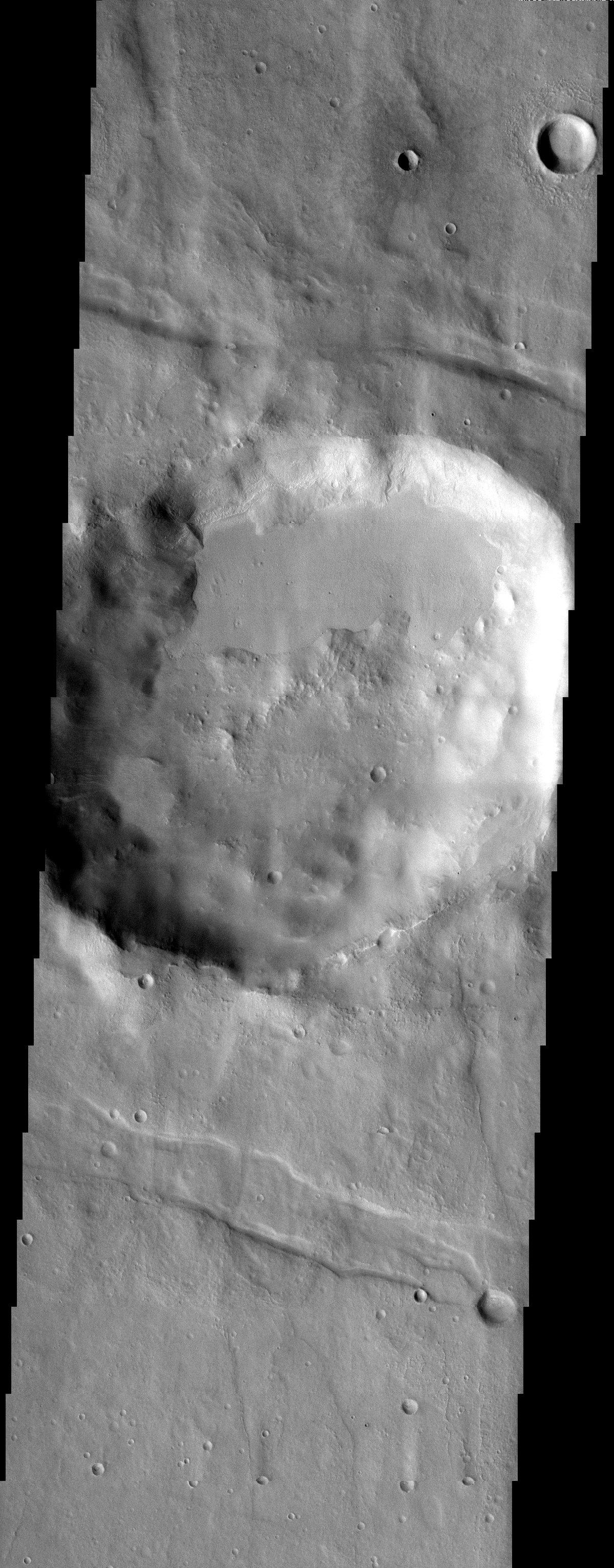
Craters and Grabens: Circles and Lines
Full Resolution:
TIFF
(3.364 MB)
JPEG
(572.5 kB)
2003-08-28
Mars
2001 Mars Odyssey
THEMIS
1233x3061x1
PIA04705:
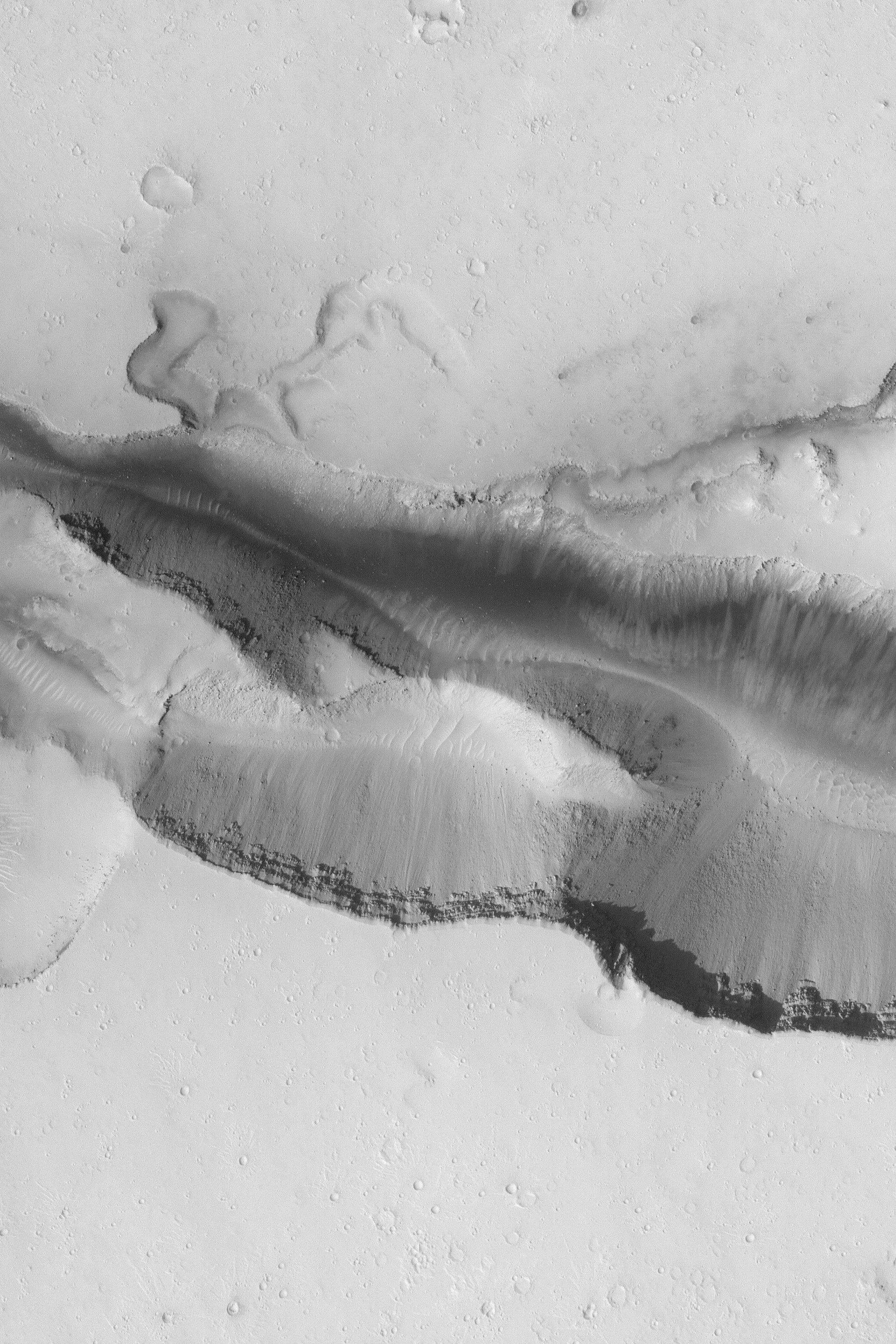
Outflow Channel
Full Resolution:
TIFF
(3.696 MB)
JPEG
(1.031 MB)
2003-08-28
Mars
2001 Mars Odyssey
THEMIS
1604x3409x1
PIA04706:
Charlier Crater Dunes
Full Resolution:
TIFF
(3.261 MB)
JPEG
(496.1 kB)
2003-08-28
Mars
2001 Mars Odyssey
THEMIS
1130x3061x1
PIA04707:
Peneus Patera
Full Resolution:
TIFF
(3.217 MB)
JPEG
(595.1 kB)
2003-08-28
Mars
2001 Mars Odyssey
THEMIS
1327x3066x1
PIA04708:
Three Terrains
Full Resolution:
TIFF
(3.185 MB)
JPEG
(706.9 kB)
2003-09-02
Mars
2001 Mars Odyssey
THEMIS
1319x3085x1
PIA04709:
Koga Crater
Full Resolution:
TIFF
(2.97 MB)
JPEG
(520.8 kB)
2003-09-02
Mars
2001 Mars Odyssey
THEMIS
1239x3043x1
PIA04710:
Eroded Surfaces
Full Resolution:
TIFF
(3.564 MB)
JPEG
(734 kB)
2003-09-02
Mars
2001 Mars Odyssey
THEMIS
1333x3067x1
PIA04711:
Valles Marineris Landforms
Full Resolution:
TIFF
(2.425 MB)
JPEG
(305 kB)
2003-09-02
Mars
2001 Mars Odyssey
THEMIS
1339x3063x1
PIA04712:
A Suite of Features
Full Resolution:
TIFF
(2.898 MB)
JPEG
(452.7 kB)
2003-09-02
Mars
2001 Mars Odyssey
THEMIS
1359x3058x1
PIA04713:
Cross-Cutting Relationships
Full Resolution:
TIFF
(3.22 MB)
JPEG
(575.3 kB)
2003-09-03
Mars
2001 Mars Odyssey
THEMIS
1313x3095x1
PIA04714:
Sirenum Fossae
Full Resolution:
TIFF
(2.688 MB)
JPEG
(500.3 kB)
2003-09-03
Mars
2001 Mars Odyssey
THEMIS
1333x3066x1
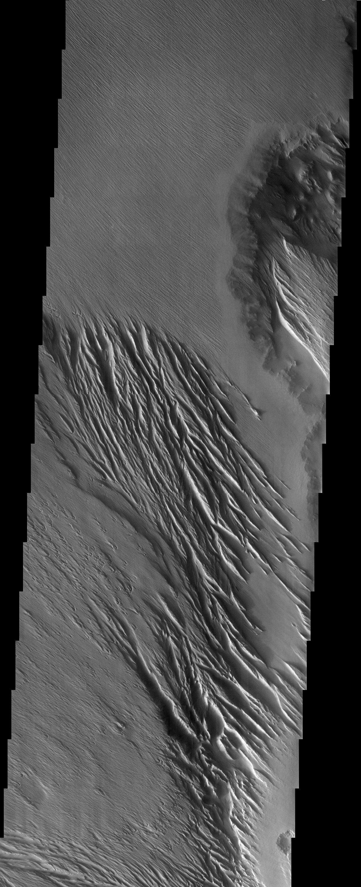
PIA04715:
Alpine Glaciers
Full Resolution:
TIFF
(2.861 MB)
JPEG
(483.4 kB)
2003-09-03
Mars
2001 Mars Odyssey
THEMIS
1211x3061x1
PIA04716:
Upside Down Craters
Full Resolution:
TIFF
(3.493 MB)
JPEG
(799.2 kB)
2003-09-03
Mars
2001 Mars Odyssey
THEMIS
1199x3061x1
PIA04717:
Thaumasia Crater
Full Resolution:
TIFF
(3.378 MB)
JPEG
(658.4 kB)
2003-09-03
Mars
2001 Mars Odyssey
THEMIS
1197x3061x1
PIA04718:
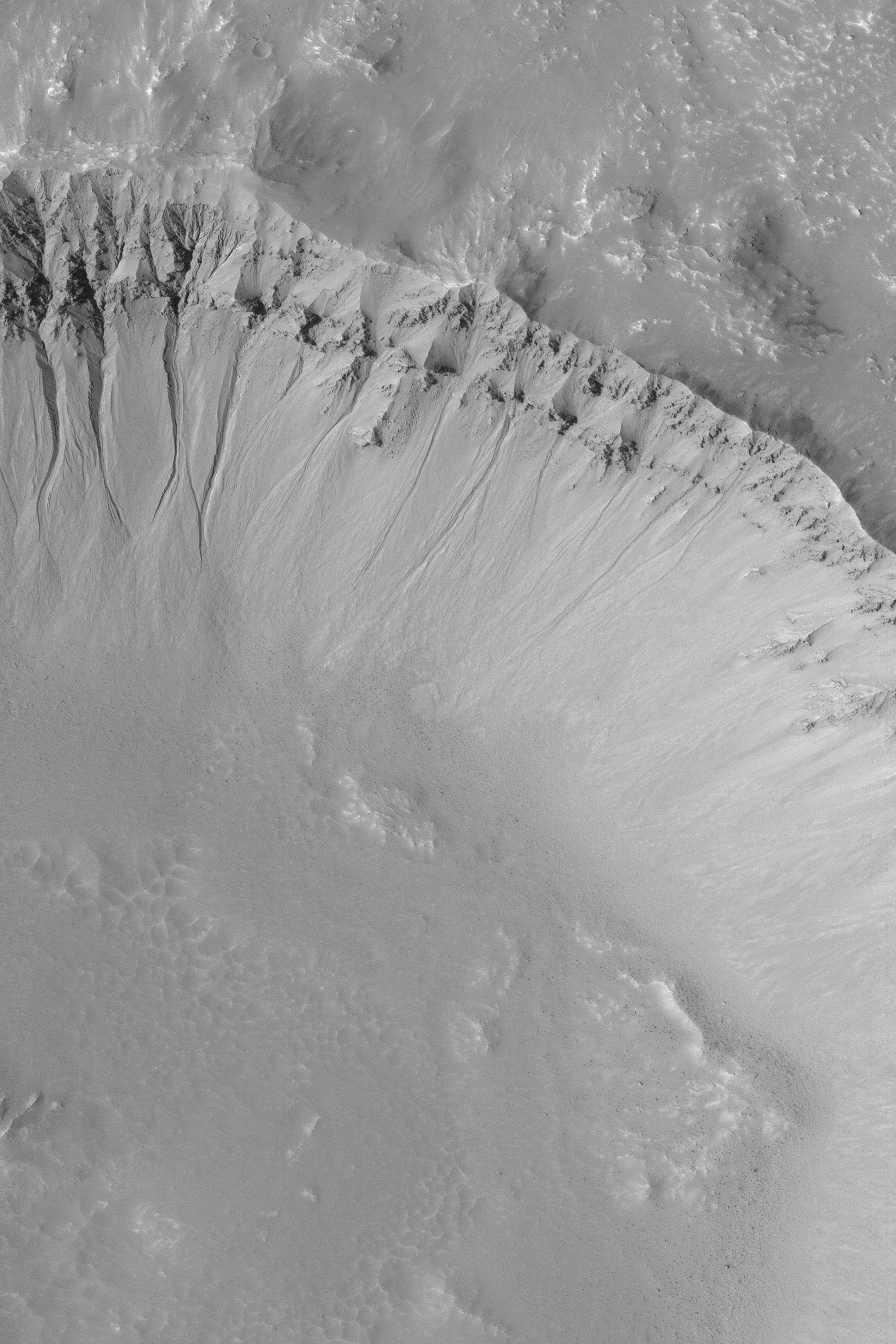
Gullies Galore!
Full Resolution:
TIFF
(3.427 MB)
JPEG
(687.2 kB)
2004-03-06
Mars
Mars Exploration Rover (MER)
Panoramic Camera
Rock Abrasion Tool (RAT)
1050x563x3
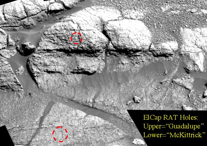
PIA05509:
Seeing Red at Guadalupe
Full Resolution:
TIFF
(1.776 MB)
JPEG
(132.3 kB)
2003-09-05
Mars
Mars Global Surveyor (MGS)
Mars Orbiter Camera (MOC)
851x1277x1
PIA04719:
Defrosting South Polar Slope
Full Resolution:
TIFF
(1.077 MB)
JPEG
(180.9 kB)
2003-09-05
Mars
Mars Global Surveyor (MGS)
Mars Orbiter Camera (MOC)
601x902x1
PIA04720:
Defrosting Sand
Full Resolution:
TIFF
(542.9 kB)
JPEG
(91.99 kB)
2003-09-05
Mars
Mars Global Surveyor (MGS)
Mars Orbiter Camera (MOC)
1021x1532x1
PIA04721:
Ancient Sedimentary Rocks
Full Resolution:
TIFF
(1.566 MB)
JPEG
(288.3 kB)
2003-09-05
Mars
Mars Global Surveyor (MGS)
Mars Orbiter Camera (MOC)
2025x3038x1
PIA04722:
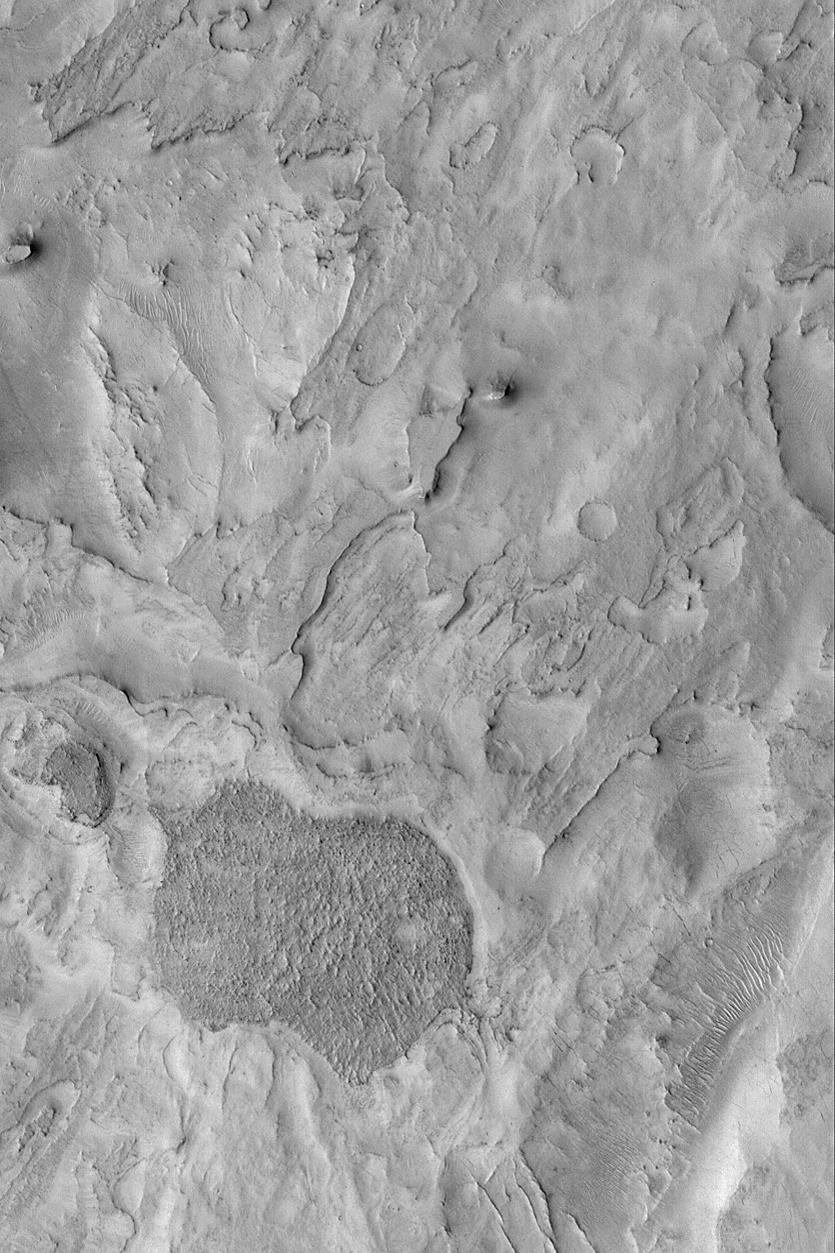
Martian Gullies
Full Resolution:
TIFF
(6.06 MB)
JPEG
(844.1 kB)
2003-09-05
Mars
Mars Global Surveyor (MGS)
Mars Orbiter Camera (MOC)
1187x1780x1
PIA04723:
Hellas Planitia
Full Resolution:
TIFF
(1.951 MB)
JPEG
(214.7 kB)
1-100
101-200
201-300
301-400
401-500
501-600
601-700
701-800
801-900
901-1000
Currently displaying images:
1401 - 1500
of 12735


