Your search criteria found
12731
images
Target is mars (and available satellites)
Go to PIAxxxxx:
Refine this list of images by:
Target:
Deimos
Mars
Phobos
Mission:
2001 Mars Odyssey
Antarctic Meteorite Location and Mapping Project (AMLAMP)
Dawn
ExoMars
Hubble Space Telescope
InSight
MAVEN
Mariner Mars 1964 (Mariner 4)
Mariner Mars 1969 (Mariner 7)
Mariner Mars 1971 (Mariner 9)
Mars 2020
Mars 2020 Rover
Mars Atmosphere and Volatile Evolution MissioN (MAVEN)
Mars Climate Orbiter
Mars Cube One (MarCO)
Mars Exploration Rover (MER)
Mars Express (MEX)
Mars Global Surveyor (MGS)
Mars Helicopter
Mars Pathfinder (MPF)
Mars Reconnaissance Orbiter (MRO)
Mars Sample Return
Mars Sample Return (MSR)
Mars Science Laboratory (MSL)
Phoenix
Rosetta
Viking
Spacecraft:
2001 Mars Odyssey
Curiosity
Dawn
InSight Mars Lander
Ingenuity
MAVEN
MarCO-B
Mariner 4
Mariner 7
Mariner 9
Mars Climate Orbiter
Mars Express (MEX)
Mars Express (MEX) Orbiter
Mars Global Surveyor Orbiter
Mars Pathfinder Lander
Mars Pathfinder Rover
Mars Reconnaissance Orbiter (MRO)
Mars Sample Return
Mars Science Laboratory (MSL)
NASA's Mars Pathfinder Lander
Opportunity
Perseverance
Philae Lander
Phoenix Lander
Phoenix Mars Lander
Spirit
Viking Lander 1
Viking Lander 2
Viking Orbiter 1
Viking Orbiter 2
Instrument:
Alpha Particle X-ray Spectrometer
Alpha Particle X-ray Spectrometer (MSL)
Atmospheric Structure / Meteorology Instrument
CHIMRA
Camera 1
Camera 2
Chemistry & Mineralogy (CheMin)
Chemistry and Camera (ChemCam)
Comet Infrared and Visible Analyser (CIVA
Compact Reconnaissance Imaging Spectrometer for Mars (CRISM)
Context Camera (CTX)
Deep Space Network
Descent Image Motion Estimation System (DIMES)
Dynamic Albedo of Neutrons
Dynamic Albedo of Neutrons (DAN)
Gamma Ray Spectrometer - Neutron Spectrometer
Gamma Ray Spectrometer Suite
Hazard Avoidance Camera
Hazard Avoidance Camera (M2020)
Hazard Avoidance Camera (MSL)
Heat and Physical Properties Package (HP3)
High Resolution Imaging Science Experiment (HiRISE)
High Resolution Instrument (HRI)
High Resolution Stereo Camera
Imager for Mars Pathfinder
Imaging Ultraviolet Spectrograph
Imaging Ultraviolet Spectrograph (IUVS)
Instrument Context Camera (ICC)
Instrument Deployment Camera (IDC)
Lander Vision System Camera (LCAM)
Magnetometer
Mars Advanced Radar for Subsurface and Ionosphere Sounding (MARSIS)
Mars Advanced Radar for Subsurface and Ionospheric Sounding (MARSIS)
Mars Climate Sounder (MCS)
Mars Color Imager (MARCI)
Mars Descent Imager
Mars Environmental Dynamics Analyzer (MEDA)
Mars Hand Lens Imager (MAHLI)
Mars Horizon Sensor Assembly
Mars Orbiter Camera (MOC)
Mars Orbiter Laser Altimeter
Mars Radiation Experiment
Mastcam
Mastcam-Z
Microscopic Imager
Microscopy Electrochemistry and Conductivity Analyzer (MECA)
Miniature Thermal Emission Spectrometer
Moessbauer Spectrometer
Navigation Camera
Navigation Camera (M2020)
Navigation Camera (MSL)
Neutral Gas and Ion Mass Spectrometer
Neutron Spectrometer
Optical Microscope
Optical Navigation Camera
Panoramic Camera
Planetary Instrument for X-ray Lithochemistry (PIXL)
Radar System
Radiation Assessment Detector (RAD)
Radio Science Subsystem
Robotic Arm
Robotic Arm (MSL)
Robotic Arm Camera (RAC)
Rock Abrasion Tool (RAT)
Rover Cameras
Rover Environmental Monitoring Station (REMS)
Sample Analysis at Mars (SAM)
Scanning Habitable Environments with Raman & Luminescence for Organics and Chemicals (SHERLOC)
Seismic Experiment for Interior Structure (SEIS)
Shallow Subsurface Radar (SHARAD)
Stereo Imager (SSI)
SuperCam
Surface Stereo Imager (SSI)
Thermal Emission Imaging System
Thermal Emission Spectrometer
Thermal and Electrical Conductivity Probe
Thermal and Evolved Gas Analyzer
Trace Gas Orbiter
Visual Imaging Subsystem
Visual Imaging Subsystem - Camera A
Visual Imaging Subsystem - Camera B
Wide Field Planetary Camera 2
Click on an image for detailed information
Click on a column heading to sort in ascending or descending order
My
List
Addition Date
Target
Mission
Instrument
Size
2003-06-26
Mars
Mars Global Surveyor (MGS)
Mars Orbiter Camera (MOC)
540x810x1
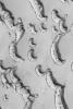
PIA04592:
Schiaparelli Sedimentary Rocks
Full Resolution:
TIFF
(438.1 kB)
JPEG
(115.6 kB)
2003-02-26
Mars
2001 Mars Odyssey
THEMIS
1205x3007x1
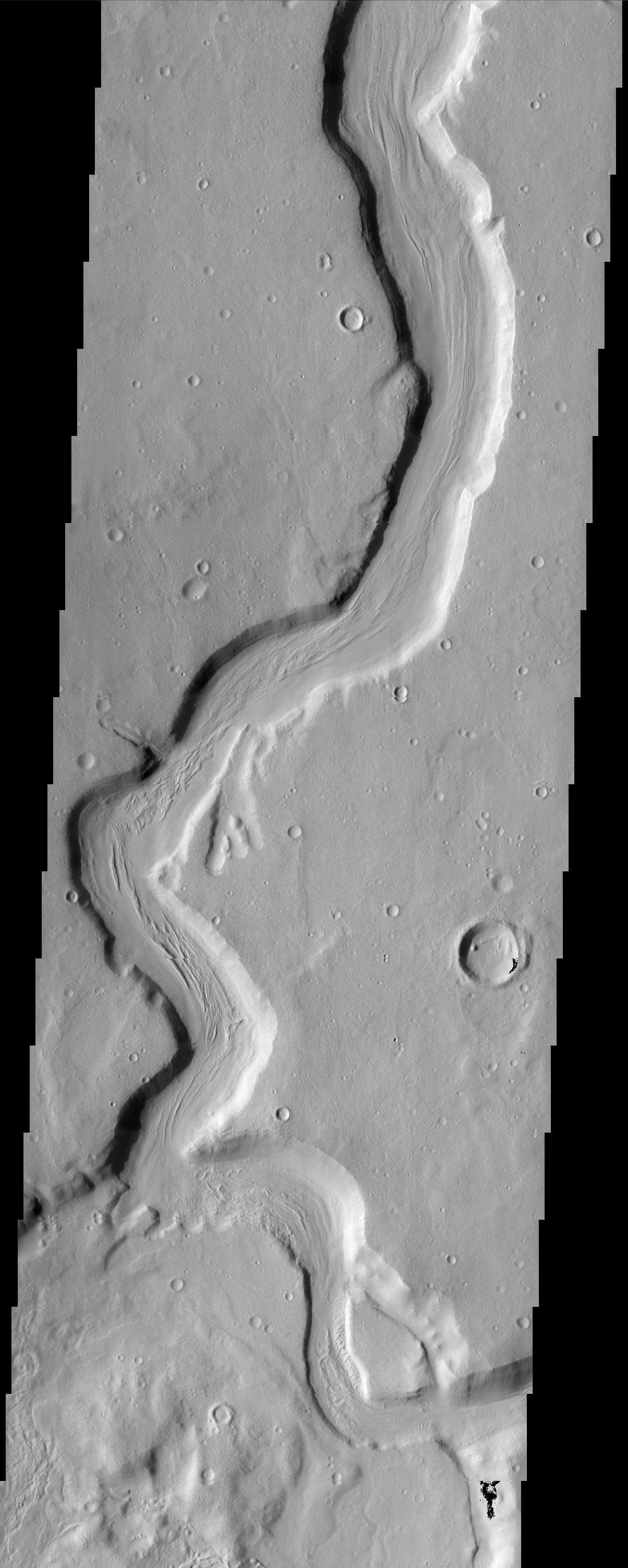
PIA04428:
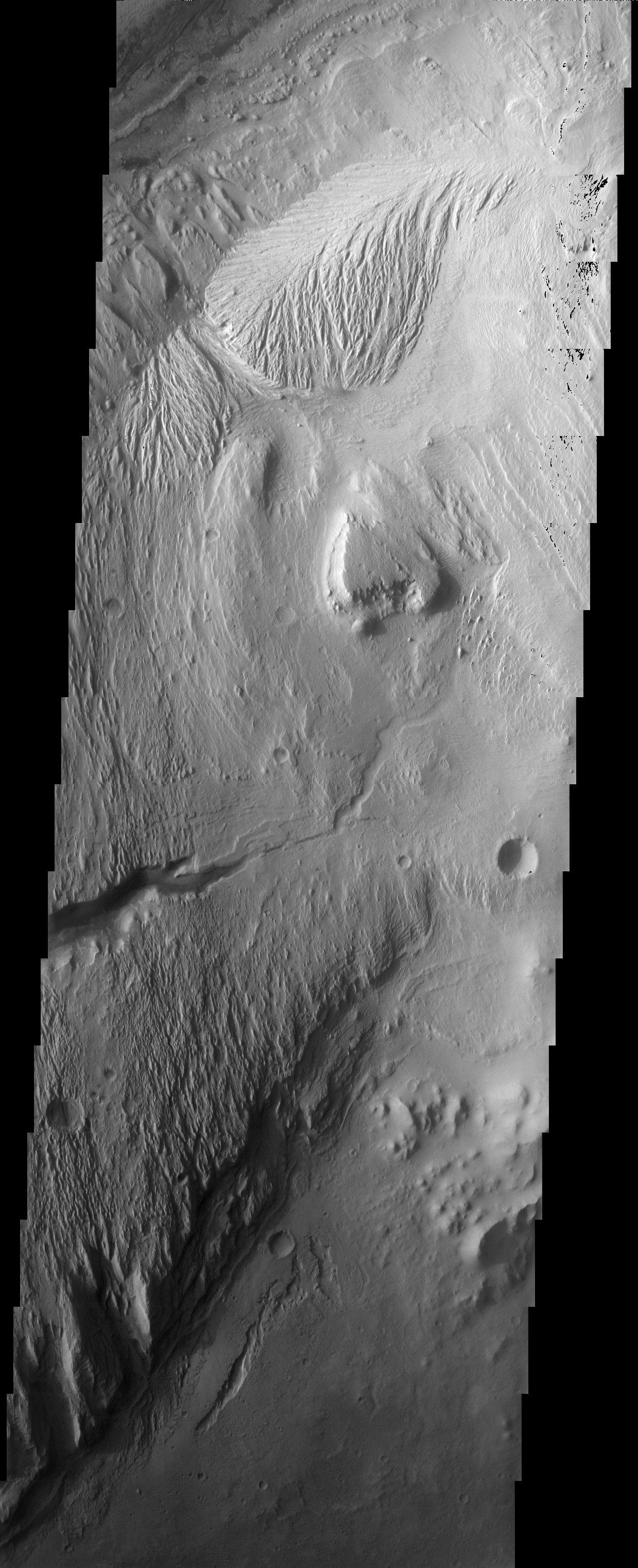
Mamers Vallis
Full Resolution:
TIFF
(2.998 MB)
JPEG
(451.9 kB)
2003-02-26
Mars
2001 Mars Odyssey
THEMIS
1238x3043x1
PIA04429:
Arsinoes Chaos
Full Resolution:
TIFF
(3.421 MB)
JPEG
(581.1 kB)
2003-02-26
Mars
2001 Mars Odyssey
THEMIS
1238x3043x1
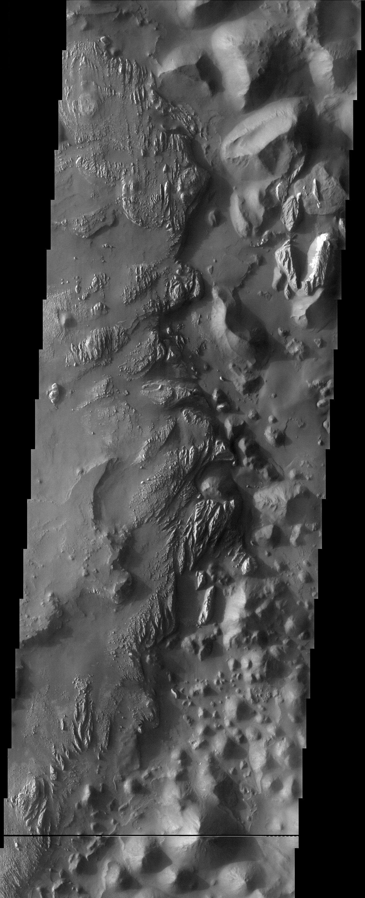
PIA04430:
Valles Marineris - with 3-D
Full Resolution:
TIFF
(3.357 MB)
JPEG
(713.5 kB)
2003-02-26
Mars
2001 Mars Odyssey
THEMIS
1196x3007x1
PIA04431:
Lycus Sulci
Full Resolution:
TIFF
(3.601 MB)
JPEG
(1.021 MB)
2003-03-06
Mars
2001 Mars Odyssey
THEMIS
1231x3025x1
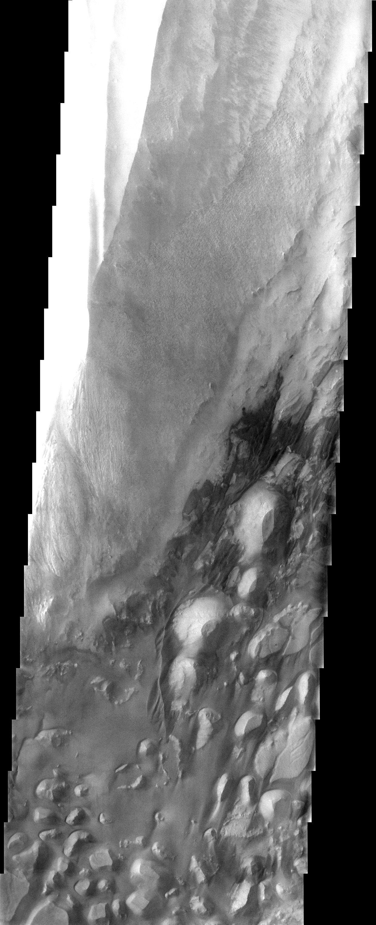
PIA04434:
Kasei Vallis
Full Resolution:
TIFF
(2.885 MB)
JPEG
(399.7 kB)
2003-03-06
Mars
2001 Mars Odyssey
THEMIS
1239x3043x1
PIA04435:
Memnonia Sulci
Full Resolution:
TIFF
(3.632 MB)
JPEG
(743 kB)
2003-03-06
Mars
2001 Mars Odyssey
THEMIS
1227x3025x1
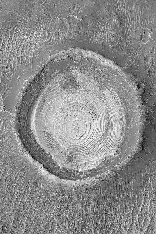
PIA04436:
Crater Chains
Full Resolution:
TIFF
(3.097 MB)
JPEG
(464.6 kB)
2003-03-06
Mars
2001 Mars Odyssey
THEMIS
1237x3025x1
PIA04437:
Stop Sign Crater
Full Resolution:
TIFF
(3.102 MB)
JPEG
(561.3 kB)
2003-03-11
Mars
Mars Pathfinder (MPF)
Imager for Mars Pathfinder
768x300x1
PIA04316:
Sol 8
Full Resolution:
TIFF
(227.8 kB)
JPEG
(28.01 kB)
2003-03-07
Mars
2001 Mars Odyssey
THEMIS
1169x3007x1
PIA04438:
Textures in Arcadia Planitia
Full Resolution:
TIFF
(3.519 MB)
JPEG
(822 kB)
2003-03-07
Mars
2001 Mars Odyssey
THEMIS
1201x3007x1
PIA04439:
Hrad Vallis
Full Resolution:
TIFF
(2.897 MB)
JPEG
(440.3 kB)
2003-03-11
Mars
Mars Pathfinder (MPF)
Imager for Mars Pathfinder
256x248x1
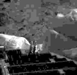
PIA04309:
The First IMP Image from Mars
Full Resolution:
TIFF
(18.83 kB)
JPEG
(7.326 kB)
2003-03-11
Mars
Mars Pathfinder (MPF)
Imager for Mars Pathfinder
256x248x1
PIA04310:
First IMP Image
Full Resolution:
TIFF
(22.09 kB)
JPEG
(9.093 kB)
2003-03-11
Mars
Mars Pathfinder (MPF)
Imager for Mars Pathfinder
256x248x1
PIA04311:
First IMP Image Showing Something That Looks Like Mars
Full Resolution:
TIFF
(23.08 kB)
JPEG
(10.43 kB)
2003-03-11
Mars
Mars Pathfinder (MPF)
Imager for Mars Pathfinder
788x410x1
PIA04312:
Sojourner's First Images From Mars
Full Resolution:
TIFF
(192.3 kB)
JPEG
(48.43 kB)
2003-03-11
Mars
Mars Pathfinder (MPF)
Imager for Mars Pathfinder
527x1270x1
PIA04314:
Six Wheels on the Soil
Full Resolution:
TIFF
(225.7 kB)
JPEG
(147.9 kB)
2003-03-11
Mars
Mars Pathfinder (MPF)
Imager for Mars Pathfinder
768x480x1
PIA04315:
The Second Rover Image
Full Resolution:
TIFF
(358.2 kB)
JPEG
(53.05 kB)
2003-03-11
Mars
Mars Pathfinder (MPF)
Imager for Mars Pathfinder
230x380x1
PIA04317:
Rover Does a Wheelie
Full Resolution:
TIFF
(87.28 kB)
JPEG
(12.48 kB)
2003-03-13
Mars
Mars Pathfinder (MPF)
Imager for Mars Pathfinder
158x124x1
PIA04313:
Sojourner Latch Spring Deployed
Full Resolution:
TIFF
(10.85 kB)
JPEG
(5.628 kB)
2003-03-13
Mars
2001 Mars Odyssey
Gamma Ray Spectrometer Suite
2068x1009x3
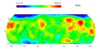
PIA04253:
Map of Martian Iron at Mid-Latitudes
Full Resolution:
TIFF
(2.495 MB)
JPEG
(180.7 kB)
2003-03-13
Mars
2001 Mars Odyssey
Gamma Ray Spectrometer Suite
1163x1579x3
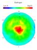
PIA04254:
Map of Martian Polar Hydrogen
Full Resolution:
TIFF
(2.15 MB)
JPEG
(117 kB)
2003-03-13
Mars
2001 Mars Odyssey
Gamma Ray Spectrometer Suite
2072x1013x3
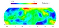
PIA04255:
Map of Martian Potassium at Mid-Latitudes
Full Resolution:
TIFF
(2.463 MB)
JPEG
(179.9 kB)
2003-03-13
Mars
2001 Mars Odyssey
Gamma Ray Spectrometer Suite
2065x929x3
PIA04256:
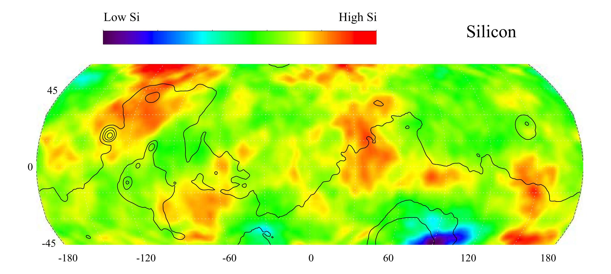
Map of Martian Silicon at Mid-Latitudes
Full Resolution:
TIFF
(2.631 MB)
JPEG
(173.6 kB)
2003-03-13
Mars
2001 Mars Odyssey
Gamma Ray Spectrometer Suite
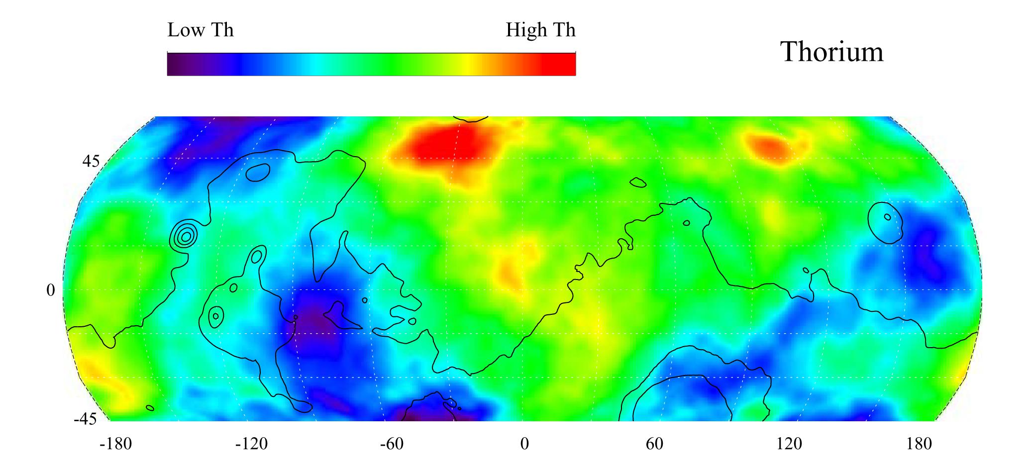
2068x947x3
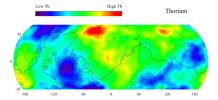
PIA04257:
Map of Martian Thorium at Mid-Latitudes
Full Resolution:
TIFF
(2.505 MB)
JPEG
(174.9 kB)
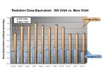
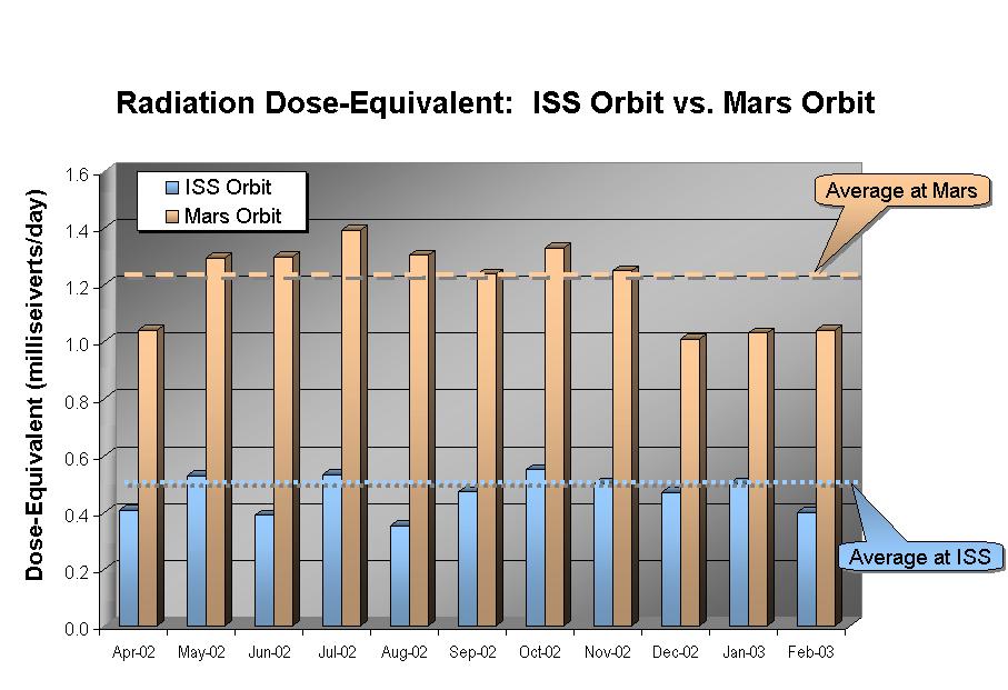
2003-03-13
Mars
2001 Mars Odyssey
Mars Radiation Experiment
907x621x3
PIA04258:
Comparison of Martian Radiation Environment with International Space Station
Full Resolution:
TIFF
(315 kB)
JPEG
(79.39 kB)
2003-03-13
Mars
2001 Mars Odyssey
THEMIS
2995x1953x1
PIA04260:
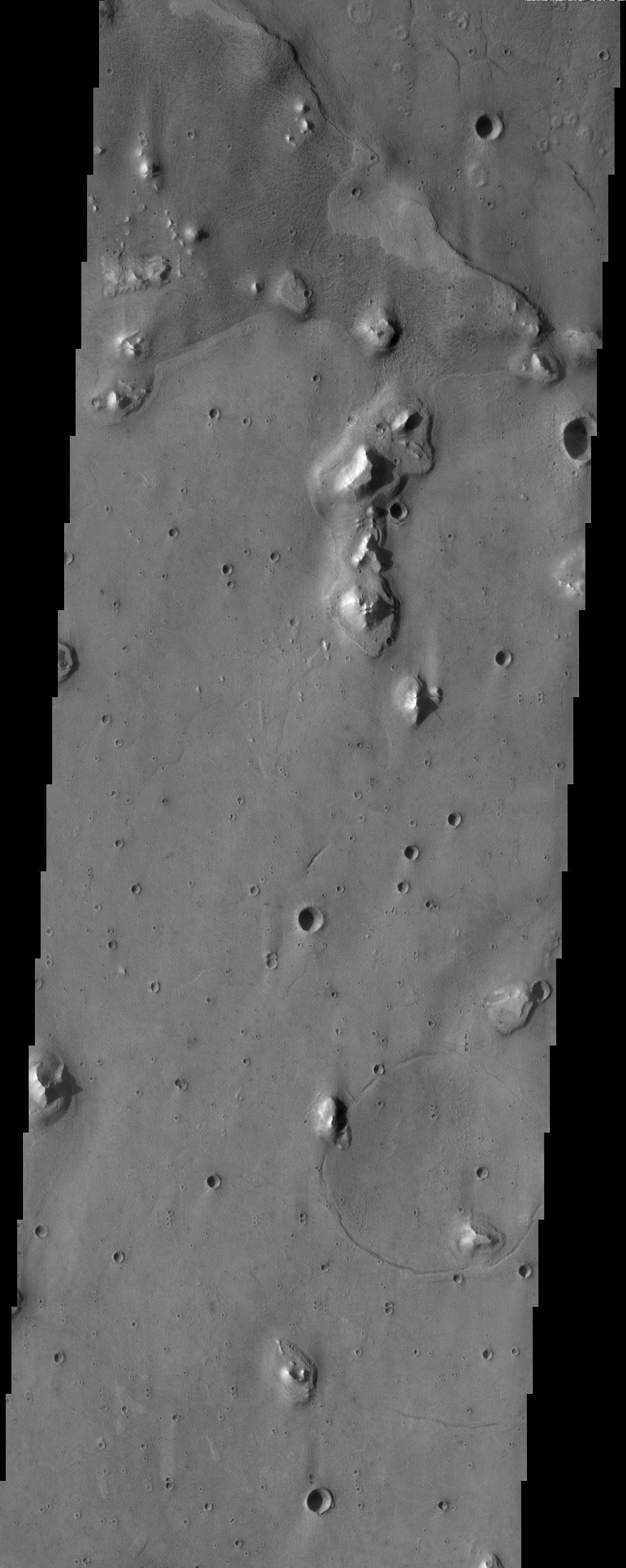
Gusev Crater
Full Resolution:
TIFF
(3.41 MB)
JPEG
(544.5 kB)
2003-03-13
Mars
2001 Mars Odyssey
THEMIS
2995x1953x1
PIA04261:
Gusev Crater
Full Resolution:
TIFF
(2.942 MB)
JPEG
(812.8 kB)
2003-03-13
Mars
2001 Mars Odyssey
THEMIS
1463x1203x3
PIA04262:
Ganges Chasma
Full Resolution:
TIFF
(4.195 MB)
JPEG
(365.6 kB)
2003-03-13
Mars
2001 Mars Odyssey
THEMIS
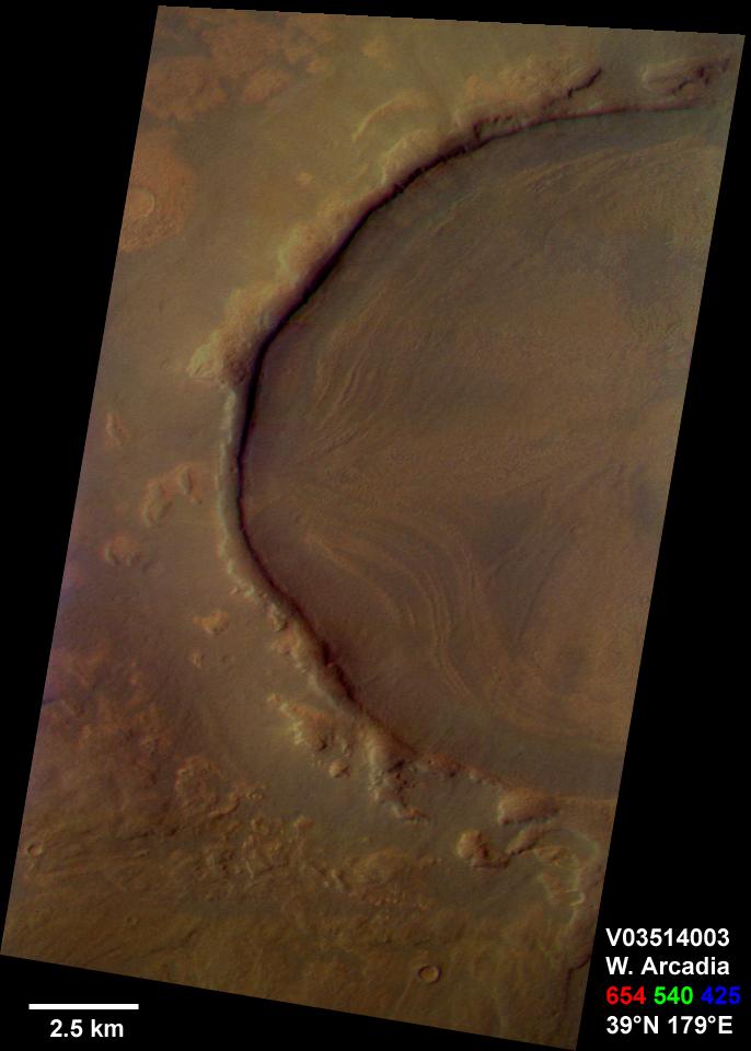
686x960x3
PIA04263:
Western Arcadia Planitia
Full Resolution:
TIFF
(1.554 MB)
JPEG
(55.23 kB)
2003-03-14
Mars
2001 Mars Odyssey
THEMIS
1233x3025x1
PIA04440:
Gordii Fossae
Full Resolution:
TIFF
(3.296 MB)
JPEG
(706.9 kB)
2003-03-14
Mars
2001 Mars Odyssey
THEMIS
1240x3043x1
PIA04441:
Highland/Lowland contact
Full Resolution:
TIFF
(3.271 MB)
JPEG
(569.2 kB)
2003-03-14
Mars
2001 Mars Odyssey
THEMIS
1213x3025x1
PIA04442:
Lycus Sulci
Full Resolution:
TIFF
(3.42 MB)
JPEG
(481.6 kB)
2003-03-19
Mars
2001 Mars Odyssey
THEMIS
1054x3151x1
PIA04443:
Polar Dunes
Full Resolution:
TIFF
(2.943 MB)
JPEG
(366.5 kB)
2003-03-19
Mars
2001 Mars Odyssey
THEMIS
1240x3043x1
PIA04444:
Martian Braille
Full Resolution:
TIFF
(3.258 MB)
JPEG
(598.9 kB)
2003-03-19
Mars
2001 Mars Odyssey
THEMIS
1240x3043x1
PIA04445:
Pavonis Mons Caldera
Full Resolution:
TIFF
(3.041 MB)
JPEG
(404 kB)
2003-03-22
Mars
2001 Mars Odyssey
THEMIS
1233x3025x1
PIA04446:
Impact Craters
Full Resolution:
TIFF
(2.798 MB)
JPEG
(404.5 kB)
2003-03-22
Mars
2001 Mars Odyssey
THEMIS
1237x3043x1
PIA04447:
Flooded Crater in Terra Sirenum
Full Resolution:
TIFF
(3.31 MB)
JPEG
(586.4 kB)
2003-03-22
Mars
2001 Mars Odyssey
THEMIS
1411x3103x1
PIA04448:
Cydonia Craters
Full Resolution:
TIFF
(2.835 MB)
JPEG
(431.4 kB)
2003-03-27
Mars
2001 Mars Odyssey
THEMIS
1239x3043x1
PIA04449:
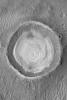
Gale Crater Mound
Full Resolution:
TIFF
(3.352 MB)
JPEG
(532.7 kB)
2003-03-27
Mars
2001 Mars Odyssey
THEMIS
1201x3007x1
PIA04450:
Acidalia Planitia
Full Resolution:
TIFF
(2.655 MB)
JPEG
(399 kB)
2003-04-02
Mars
2001 Mars Odyssey
THEMIS
1419x3170x1
PIA04451:
Hebrus Valles
Full Resolution:
TIFF
(3.114 MB)
JPEG
(551.3 kB)
2003-04-02
Mars
2001 Mars Odyssey
THEMIS
1847x3049x1
PIA04452:
Dunes
Full Resolution:
TIFF
(3.568 MB)
JPEG
(734.9 kB)
2003-04-02
Mars
2001 Mars Odyssey
THEMIS
1413x3065x1
PIA04453:
Landslides
Full Resolution:
TIFF
(3.302 MB)
JPEG
(540.7 kB)
2003-04-04
Mars
Mars Global Surveyor (MGS)
Mars Orbiter Camera (MOC)
2000x1350x3
PIA04268:
A Mid-Northern Summer/Southern Winter's Mars
Full Resolution:
TIFF
(4.815 MB)
JPEG
(240.5 kB)
2003-04-04
Mars
Mars Global Surveyor (MGS)
Mars Orbiter Camera (MOC)
1832x2748x1
PIA04269:
Landslide in Kasei Valles
Full Resolution:
TIFF
(5.04 MB)
JPEG
(1.108 MB)
2003-04-04
Mars
Mars Global Surveyor (MGS)
Mars Orbiter Camera (MOC)
1182x826x1
PIA04270:
Spring Defrosting of Mass-Movement Material at South High Latitudes
Full Resolution:
TIFF
(822.2 kB)
JPEG
(131.3 kB)
2003-04-04
Mars
Mars Global Surveyor (MGS)
Mars Orbiter Camera (MOC)
810x540x1
PIA04271:
The Martian Limb
Full Resolution:
TIFF
(196.1 kB)
JPEG
(35.28 kB)
2003-04-04
Mars
Mars Global Surveyor (MGS)
Mars Orbiter Camera (MOC)
686x684x3
PIA04272:
Mars in Early Northern Spring
Full Resolution:
TIFF
(946.3 kB)
JPEG
(29.64 kB)
2003-04-04
Mars
Mars Global Surveyor (MGS)
Mars Orbiter Camera (MOC)
540x810x1
PIA04273:
Wirtz Crater Dune Field
Full Resolution:
TIFF
(438.1 kB)
JPEG
(56.22 kB)
2003-04-04
Mars
2001 Mars Odyssey
THEMIS
1413x3134x1
PIA04454:
Flooded Crater
Full Resolution:
TIFF
(3.469 MB)
JPEG
(875 kB)
2003-04-04
Mars
2001 Mars Odyssey
THEMIS
1227x3061x1
PIA04455:
Daedalia Planum
Full Resolution:
TIFF
(3.583 MB)
JPEG
(855.6 kB)
2003-04-04
Mars
2001 Mars Odyssey
THEMIS
1409x3064x1
PIA04456:
Acidalia Planitia
Full Resolution:
TIFF
(3.576 MB)
JPEG
(704 kB)
2003-04-09
Mars
2001 Mars Odyssey
THEMIS
1419x3058x1
PIA04457:
Surface Erosion and Flow
Full Resolution:
TIFF
(2.986 MB)
JPEG
(472.3 kB)
2003-04-09
Mars
2001 Mars Odyssey
THEMIS
1217x3025x1
PIA04458:
Olympica Fossae
Full Resolution:
TIFF
(2.496 MB)
JPEG
(389.3 kB)
2003-04-09
Mars
2001 Mars Odyssey
THEMIS
1489x3012x1
PIA04459:
Chipped Paint Crater
Full Resolution:
TIFF
(2.974 MB)
JPEG
(438 kB)
2003-04-11
Mars
Viking
Visual Imaging Subsystem
5334x4267x3
PIA04274:
Gusev Crater
Full Resolution:
TIFF
(30.59 MB)
JPEG
(2.162 MB)
2003-04-11
Mars
Viking
Visual Imaging Subsystem
8530x4267x3
PIA04275:
Meridiani Planum
Full Resolution:
TIFF
(49.08 MB)
JPEG
(3.939 MB)
2003-04-15
Mars
Mars Global Surveyor (MGS)
Mars Orbiter Camera (MOC)
540x810x1
PIA04460:
Defrosting North Polar Dune Field
Full Resolution:
TIFF
(438.1 kB)
JPEG
(76.96 kB)
2003-04-15
Mars
2001 Mars Odyssey
THEMIS
1186x3007x1
PIA04461:
Ismenia Fossae: Craters or Pits?
Full Resolution:
TIFF
(3.147 MB)
JPEG
(548.8 kB)
2003-04-15
Mars
2001 Mars Odyssey
THEMIS
1212x3007x1
PIA04462:
Ridges
Full Resolution:
TIFF
(2.951 MB)
JPEG
(433.4 kB)
2003-04-15
Mars
2001 Mars Odyssey
THEMIS
1238x3043x1
PIA04463:
Textured Terrain
Full Resolution:
TIFF
(3.605 MB)
JPEG
(866 kB)
2003-04-15
Mars
2001 Mars Odyssey
THEMIS
1239x3043x1
PIA04464:
Medusae Fossae Yardangs
Full Resolution:
TIFF
(3.427 MB)
JPEG
(638.4 kB)
2003-04-16
Mars
Mars Global Surveyor (MGS)
Mars Orbiter Camera (MOC)
540x810x1
PIA04465:
Daedalia Planum Wind Streak
Full Resolution:
TIFF
(438.1 kB)
JPEG
(83.85 kB)
2003-04-16
Mars
2001 Mars Odyssey
THEMIS
1235x3025x1
PIA04466:
Ascraeus Mons
Full Resolution:
TIFF
(3.654 MB)
JPEG
(794.3 kB)
2003-04-17
Mars
Mars Global Surveyor (MGS)
Mars Orbiter Camera (MOC)
540x810x1
PIA04467:
Lava Flow and Impact Crater
Full Resolution:
TIFF
(438.1 kB)
JPEG
(68.9 kB)
2003-04-18
Mars
Mars Global Surveyor (MGS)
Mars Orbiter Camera (MOC)
540x810x3
PIA04468:
North Polar Dust Storm
Full Resolution:
TIFF
(1.225 MB)
JPEG
(51.32 kB)
2003-04-18
Mars
2001 Mars Odyssey
THEMIS
1239x3043x1
PIA04469:
Northeastern Meridiani
Full Resolution:
TIFF
(3.507 MB)
JPEG
(743.5 kB)
2003-04-18
Mars
2001 Mars Odyssey
THEMIS
1240x3043x1
PIA04470:
Lucus Planum
Full Resolution:
TIFF
(3.509 MB)
JPEG
(787.6 kB)
2003-04-21
Mars
2001 Mars Odyssey
THEMIS
1175x3007x1
PIA04471:
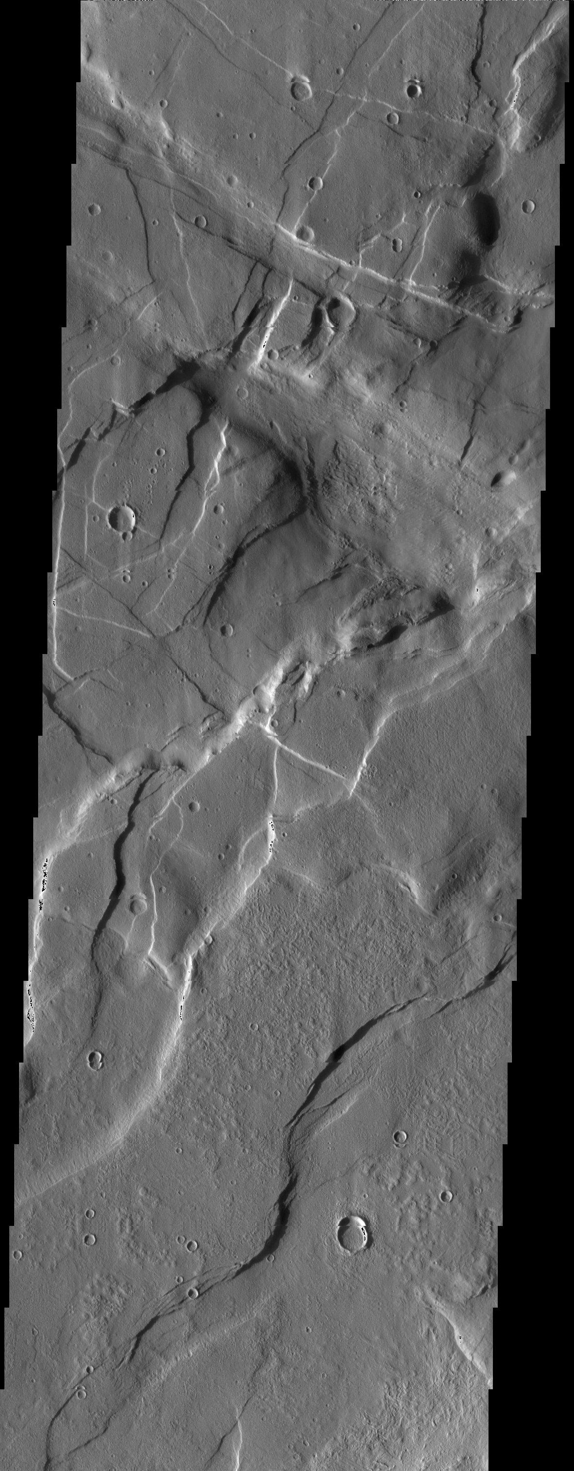
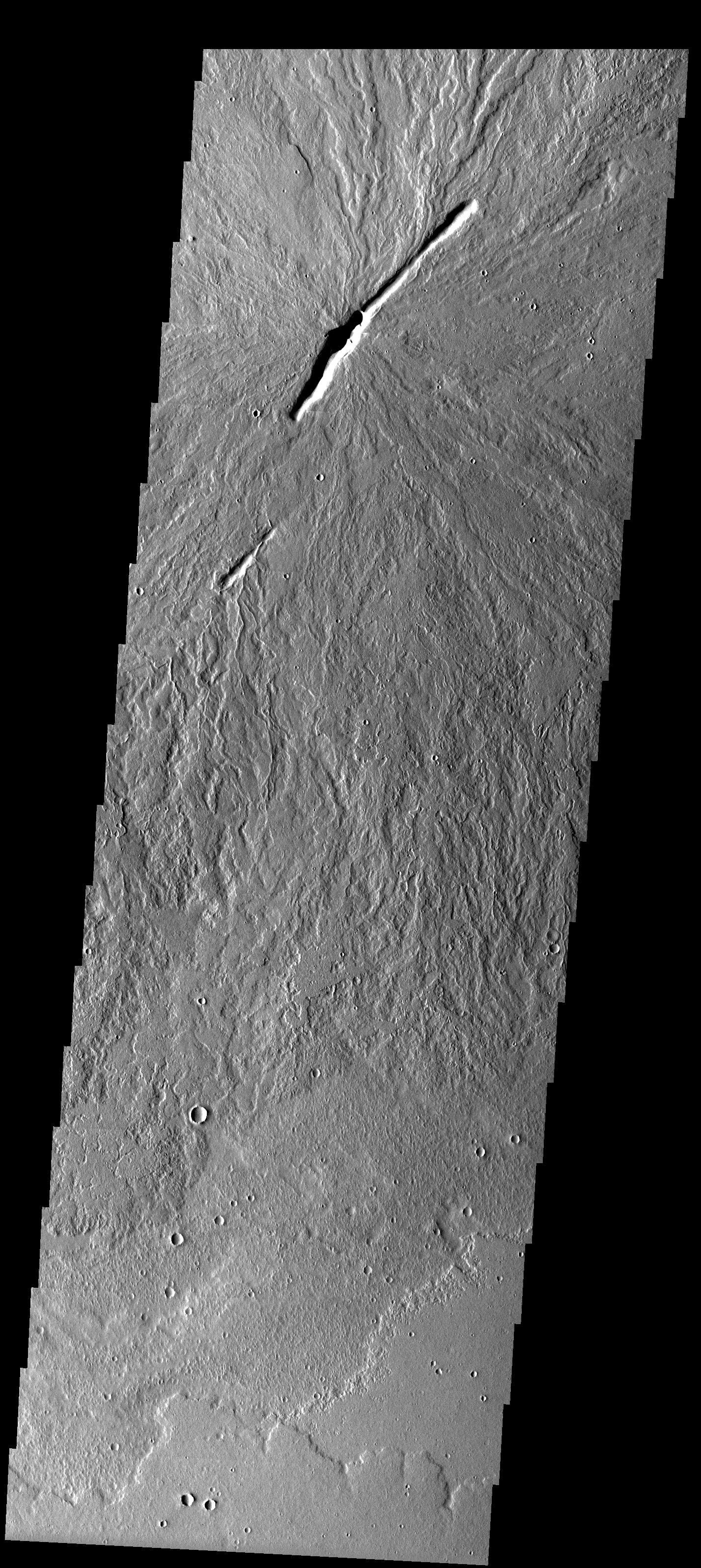
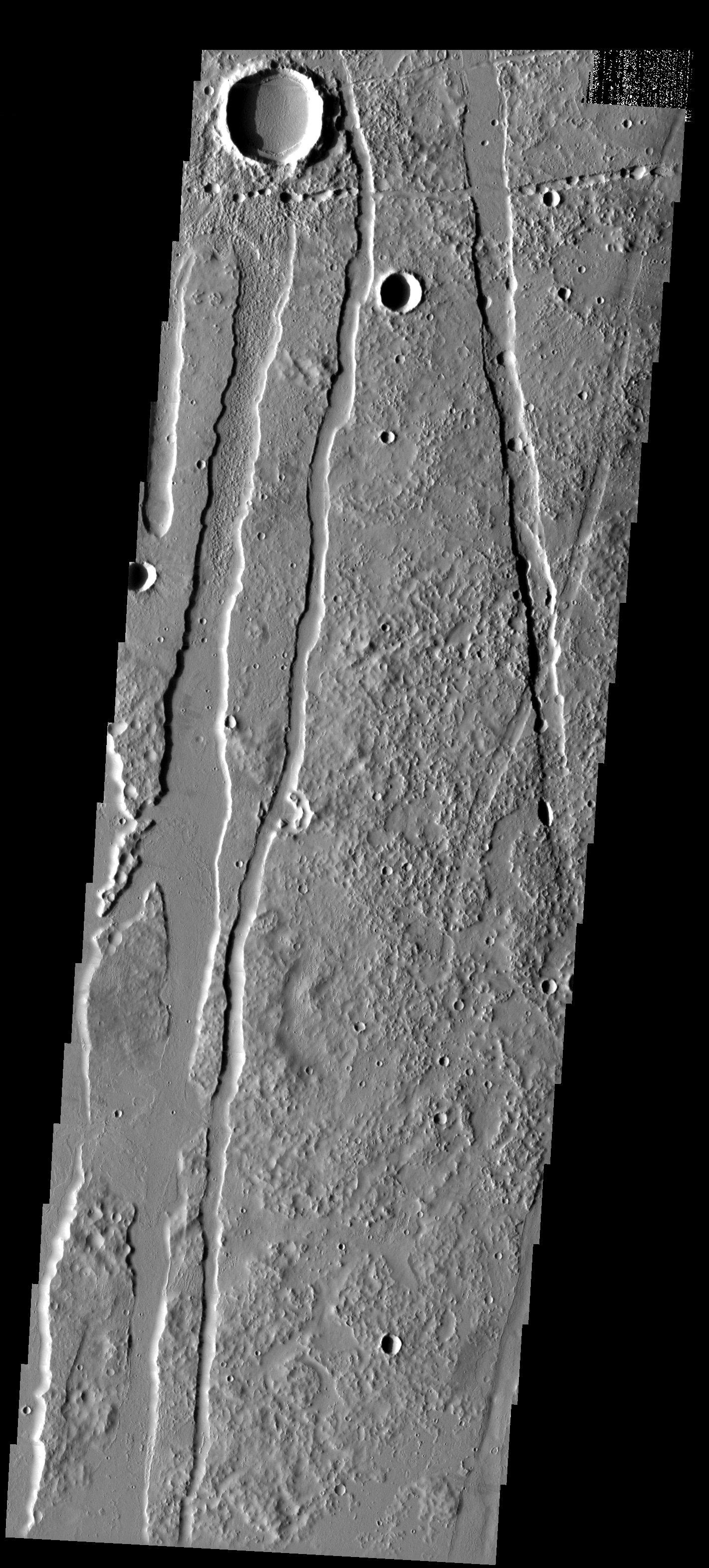
Crosscutting Grabens
Full Resolution:
TIFF
(3.238 MB)
JPEG
(578 kB)
2003-04-21
Mars
Mars Global Surveyor (MGS)
Mars Orbiter Camera (MOC)
540x810x1
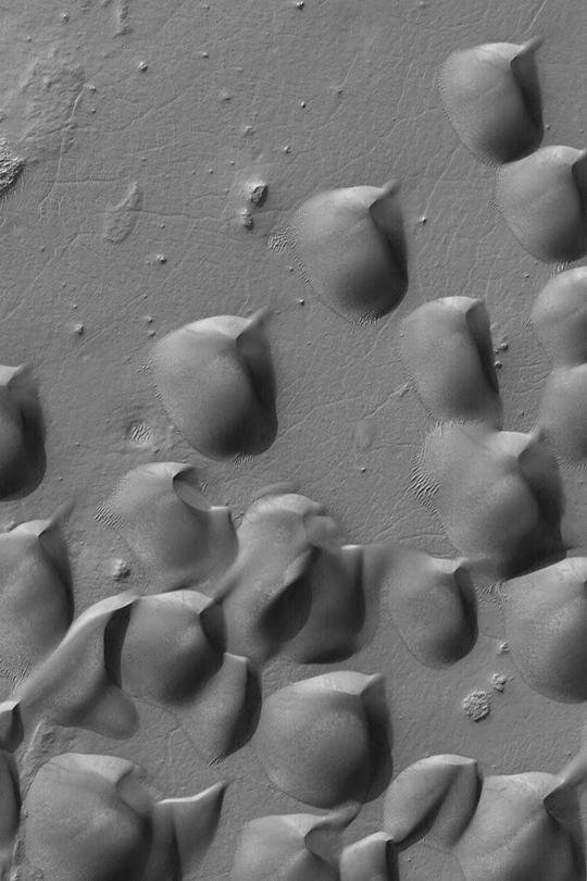
PIA04472:
Grooved Herschel Dunes
Full Resolution:
TIFF
(438.1 kB)
JPEG
(80.06 kB)
2003-04-21
Mars
Mars Global Surveyor (MGS)
Mars Orbiter Camera (MOC)
541x810x1
PIA04473:
Buttes in Melas Chasma
Full Resolution:
TIFF
(438.9 kB)
JPEG
(79.09 kB)
2003-04-21
Mars
Mars Global Surveyor (MGS)
Mars Orbiter Camera (MOC)
540x810x1
PIA04474:
South Polar Ice Cap
Full Resolution:
TIFF
(415.7 kB)
JPEG
(56.69 kB)
2003-04-22
Mars
Mars Global Surveyor (MGS)
Mars Orbiter Camera (MOC)
540x810x1
PIA04475:
Polar Polygon Patterns
Full Resolution:
TIFF
(438.1 kB)
JPEG
(116.3 kB)
2004-03-09
Mars
Mars Exploration Rover (MER)
Panoramic Camera
Rock Abrasion Tool (RAT)
320x338x1
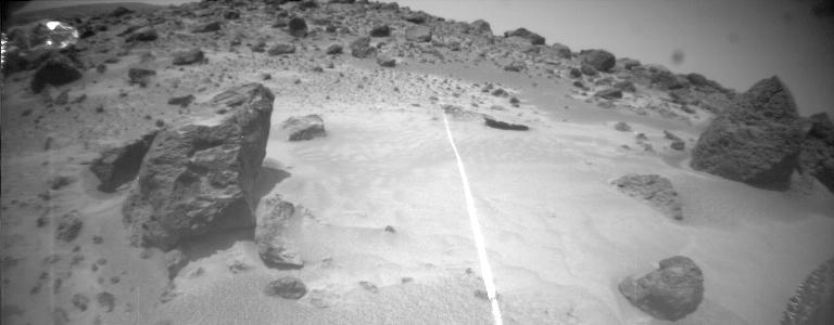
PIA05521:
Focus on "Flatrock"
Full Resolution:
TIFF
(102.3 kB)
JPEG
(12 kB)
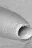
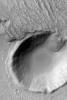
2003-04-30
Mars
Mars Global Surveyor (MGS)
Mars Orbiter Camera (MOC)
540x810x1
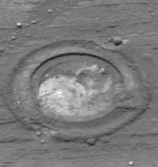
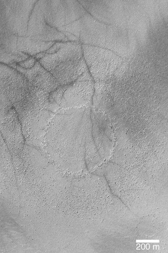
PIA04486:
Boulder Ring
Full Resolution:
TIFF
(438.1 kB)
JPEG
(104.8 kB)
2003-04-24
Mars
Mars Global Surveyor (MGS)
Mars Orbiter Camera (MOC)
540x810x1
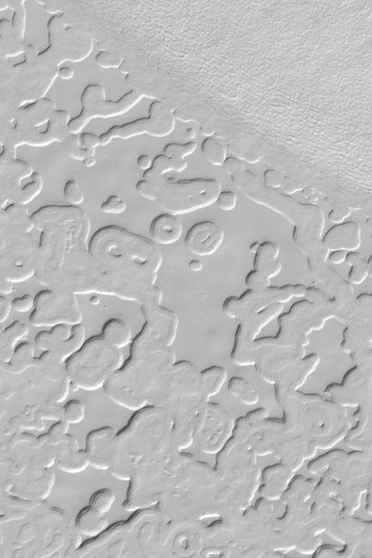
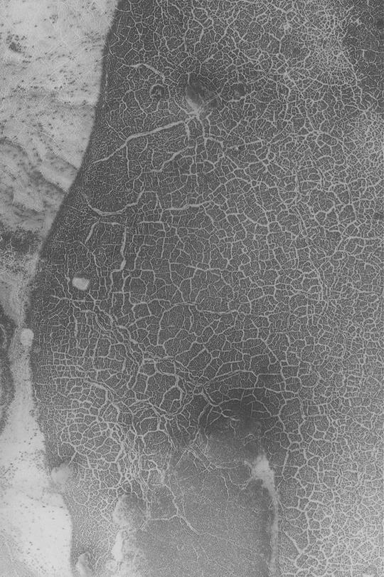
PIA04476:
Utopia Cracks and Polygons
Full Resolution:
TIFF
(438.1 kB)
JPEG
(99.11 kB)
2003-04-24
Mars
Mars Global Surveyor (MGS)
Mars Orbiter Camera (MOC)
540x810x1
PIA04477:
Buttes South of Cerberus
Full Resolution:
TIFF
(438.1 kB)
JPEG
(62.21 kB)
2003-04-25
Mars
2001 Mars Odyssey
THEMIS
1239x3025x1
PIA04478:
Erosion and Wind Deposition
Full Resolution:
TIFF
(3.389 MB)
JPEG
(593.9 kB)
2003-04-25
Mars
2001 Mars Odyssey
THEMIS
1169x2989x1
PIA04479:
Embayment
Full Resolution:
TIFF
(3.246 MB)
JPEG
(648.2 kB)
2003-04-25
Mars
2001 Mars Odyssey
THEMIS
1144x2989x1
PIA04480:
Is It Snow?
Full Resolution:
TIFF
(3.304 MB)
JPEG
(544.8 kB)
2003-04-25
Mars
Mars Global Surveyor (MGS)
Mars Orbiter Camera (MOC)
540x810x3
PIA04481:
Northern Sinus Meridiani Stereo
Full Resolution:
TIFF
(1.234 MB)
JPEG
(41.56 kB)
2003-04-28
Mars
2001 Mars Odyssey
THEMIS
1215x3025x1
PIA04482:
Lycus Sulci
Full Resolution:
TIFF
(3.164 MB)
JPEG
(647.1 kB)
2003-04-28
Mars
Mars Global Surveyor (MGS)
Mars Orbiter Camera (MOC)
540x810x1
PIA04483:
Layers in 8�N, 7�W Crater
Full Resolution:
TIFF
(438.1 kB)
JPEG
(85.43 kB)
2003-04-28
Mars
Mars Global Surveyor (MGS)
Mars Orbiter Camera (MOC)
540x810x1
PIA04484:
Russell Dune Gullies
Full Resolution:
TIFF
(438.1 kB)
JPEG
(83.72 kB)
2003-04-28
Mars
Mars Global Surveyor (MGS)
Mars Orbiter Camera (MOC)
540x810x1
PIA04485:
Aram and Iani Chaos
Full Resolution:
TIFF
(438.1 kB)
JPEG
(82.16 kB)
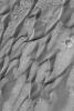
2003-04-30
Mars
Mars Global Surveyor (MGS)
Mars Orbiter Camera (MOC)
540x810x1
PIA04487:
Layers Near Juventae Chasma
Full Resolution:
TIFF
(438.1 kB)
JPEG
(84.65 kB)
2003-05-02
Mars
Mars Global Surveyor (MGS)
Mars Orbiter Camera (MOC)
540x810x1
PIA04488:
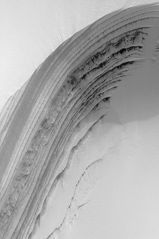
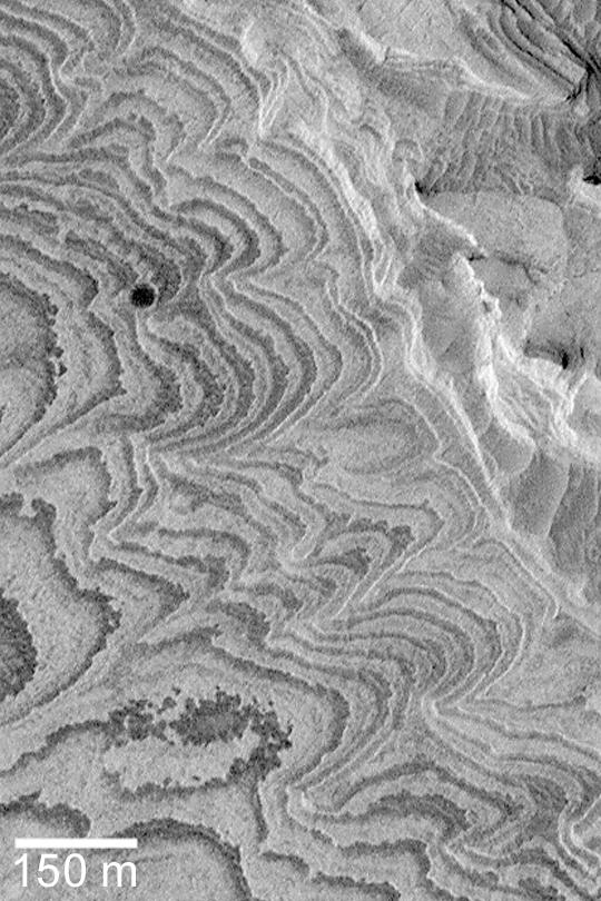
Sedimentary Rock Layers
Full Resolution:
TIFF
(438.1 kB)
JPEG
(98.22 kB)
2003-05-02
Mars
2001 Mars Odyssey
THEMIS
1213x3007x1
PIA04489:
Western Amazonis Flow Features and Crater Interaction
Full Resolution:
TIFF
(3.143 MB)
JPEG
(528.4 kB)
2003-05-02
Mars
2001 Mars Odyssey
THEMIS
1237x3025x1
PIA04490:
Eroded Ejecta
Full Resolution:
TIFF
(3.496 MB)
JPEG
(680.6 kB)
2003-05-02
Mars
2001 Mars Odyssey
THEMIS
1429x3218x1
PIA04491:
Martian Kanji
Full Resolution:
TIFF
(3.406 MB)
JPEG
(646.1 kB)
2003-05-02
Mars
Mars Global Surveyor (MGS)
Mars Orbiter Camera (MOC)
540x810x1
PIA04492:
Meridiani Cliffs and Buttes
Full Resolution:
TIFF
(438.1 kB)
JPEG
(86.56 kB)
2003-05-05
Mars
Mars Global Surveyor (MGS)
Mars Orbiter Camera (MOC)
540x810x1
PIA04500:
Frosty North Polar Layers
Full Resolution:
TIFF
(438.1 kB)
JPEG
(65.32 kB)
2003-05-05
Mars
Mars Global Surveyor (MGS)
Mars Orbiter Camera (MOC)
540x810x1
PIA04501:
Becquerel Layers
Full Resolution:
TIFF
(438.1 kB)
JPEG
(98.36 kB)
2003-05-05
Mars
Mars Global Surveyor (MGS)
Mars Orbiter Camera (MOC)
540x810x1
PIA04502:
Martian Dust Devil Tracks
Full Resolution:
TIFF
(438.1 kB)
JPEG
(108.1 kB)
2003-05-05
Mars
2001 Mars Odyssey
THEMIS
1427x3195x1
PIA04503:
Volcano Vents
Full Resolution:
TIFF
(3.732 MB)
JPEG
(899 kB)
2003-05-08
Mars
2001 Mars Odyssey
THEMIS
1421x3142x1
PIA04504:
Craters, Pit Chains, and Graben, Oh My!
Full Resolution:
TIFF
(3.412 MB)
JPEG
(617.3 kB)
2003-05-08
Mars
2001 Mars Odyssey
THEMIS
1433x3292x1
PIA04505:
Deposition + Erosion = Textures
Full Resolution:
TIFF
(3.816 MB)
JPEG
(765.3 kB)
2003-05-08
Mars
2001 Mars Odyssey
THEMIS
1413x3086x1
PIA04506:
Surface Textures
Full Resolution:
TIFF
(3.247 MB)
JPEG
(515.2 kB)
2003-05-08
Mars
Mars Global Surveyor (MGS)
Mars Orbiter Camera (MOC)
540x810x1
PIA04507:
Dunes and Dust Devil Tracks
Full Resolution:
TIFF
(438.1 kB)
JPEG
(63.29 kB)
1-100
101-200
201-300
301-400
401-500
501-600
601-700
701-800
801-900
901-1000
Currently displaying images:
1201 - 1300
of 12731


