Your search criteria found 153 images
Target is Venus
Go to PIAxxxxx:
Refine this list of images by:
Mission:
Spacecraft:
Instrument:
Click on an image for detailed information
Click on a column heading to sort in ascending or descending order
My
List
Addition Date Target Mission Instrument SizeSort Descending
Add Image to Favorite List 1996-11-07 Venus Magellan
Imaging Radar
1000x1000x1
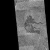
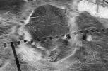
This image from NASA's Magellan spacecraft shows an area of dark volcanic lava flows overlying the brighter surrounding plains which are thought to have been formed from older flows.
PIA00482:
Venus - Dark Volcanic Lava Flows
Full Resolution:     TIFF (540.1 kB)     JPEG (278.4 kB)
Add Image to Favorite List 1996-11-12 Venus Magellan
Imaging Radar
5000x4000x3
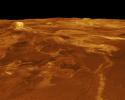
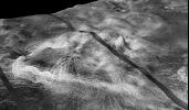
A portion of western Eistla Regio is displayed in this three-dimensional perspective view from NASA's Magellan spacecraft of the surface of Venus.
PIA00102:
Venus - 3-D Perspective View of Estla Regio
Full Resolution:     TIFF (8.759 MB)     JPEG (1.965 MB)
Add Image to Favorite List 1996-11-12 Venus Magellan
Imaging Radar
5000x4000x3
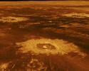
Three impact craters are displayed in this three-dimensional perspective view from NASA's Magellan spacecraft of the surface of Venus. The center of the image is located in the northwestern portion of Lavinia Planitia.
PIA00103:
Venus - 3-D Perspective View of Lavinia Planitia
Full Resolution:     TIFF (10.28 MB)     JPEG (2.193 MB)
Add Image to Favorite List 1996-11-12 Venus Magellan
Imaging Radar
4096x4096x3
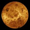
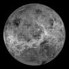
This global view from NASA's Magellan spacecraft is of the surface of Venus is centered at 180 degrees east longitude.
PIA00104:
Venus - Computer Simulated Global View Centered at 180 Degrees East Longitude
Full Resolution:     TIFF (8.169 MB)     JPEG (1.681 MB)
Add Image to Favorite List 1996-11-12 Venus Magellan
Imaging Radar
2930x3664x3
This false color image from NASA's Magellan spacecraft shows a portion of Leda Planitia (plains) in the northern hemisphere of Venus, centered at 41 degrees north latitude, 52 degrees east longitude.
PIA00105:
Venus - Simulated Color of Leda Planitia
Full Resolution:     TIFF (10.15 MB)     JPEG (2.634 MB)
Add Image to Favorite List 1996-11-12 Venus Magellan
Imaging Radar
4000x3000x3
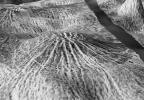
Sapas Mons is displayed in the center of this computer-generated three-dimensional perspective view from NASA's Magellan spacecraft of the surface of Venus.
PIA00107:
Venus - 3-D Perspective View of Sapas Mons
Full Resolution:     TIFF (6.277 MB)     JPEG (1.445 MB)
Add Image to Favorite List 1996-11-14 Venus Magellan
Imaging Radar
2560x1024x1
This image from NASA's Magellan spacecraft is from the southern portion of Navka. In the center of this image are two bright deposits running north to south.
PIA00483:
Venus - Outflow Channel in South Navka
Full Resolution:     TIFF (2.171 MB)     JPEG (825.6 kB)
Add Image to Favorite List 1996-11-14 Venus Magellan
Imaging Radar
2510x3072x1
This radar image mosaic of Venus from NASA's Magellan spacecraft, is in the Lada region. The mosaic shows a system of east-trending radar-bright and dark lava flows encountering and breaching a north-trending ridge belt (left of center).
PIA00486:
Venus - System of Lava Flows and Ridge Belt
Full Resolution:     TIFF (6.288 MB)     JPEG (2.243 MB)
Add Image to Favorite List 1996-11-14 Venus Magellan
Imaging Radar
1880x1504x1
This image from NASA's Magellan spacecraft reveals Sacajawea Patera, a large, elongate caldera located in Western Ishtar Terra on the smooth plateau of Lakshmi Planum.
PIA00485:
Venus - A Large Elongated Caldera 'Sacajawea Patera
Full Resolution:     TIFF (2.22 MB)     JPEG (712.6 kB)
Add Image to Favorite List 1996-11-14 Venus Magellan
Imaging Radar
1126x1015x1
This image from NASA's Magellan spacecraft is from the eastern Ovda region of Venus. The image shows some small volcanic domes on the flank of the volcano Maat.
PIA00487:
Venus - Volcanic Domes on Flank of Volcanic Maat in East Ovda Region
Full Resolution:     TIFF (1.139 MB)     JPEG (398.8 kB)
Add Image to Favorite List 1996-11-20 Venus Magellan
Imaging Radar
975x1024x1
This full-resolution image from NASA's Magellan spacecraft shows an impact crater named Jeanne. The distinctive triangular shape of the ejecta indicates that the impacting body probably hit obliquely, traveling from southwest to northeast.
PIA00472:
Venus - Impact Crater 'Jeanne
Full Resolution:     TIFF (682.4 kB)     JPEG (398.1 kB)
Add Image to Favorite List 1996-11-20 Venus Magellan
Imaging Radar
480x591x1
This image from NASA's Magellan spacecraft is of Sachs Patera on Venus. Defined as a sag-caldera, Sachs is an elliptical depression 130 meters (81 feet) in depth, spanning 40 kilometers (25 miles) in width along its longest axis.
PIA00473:
Venus - Sag Caldera 'Sachs Patera
Full Resolution:     TIFF (208 kB)     JPEG (116.5 kB)
Add Image to Favorite List 1996-11-20 Venus Magellan
Imaging Radar
530x572x1
This image from NASA's Magellan spacecraft is of the eastern Navka Region of Venus. The crater, which is approximately 8 kilometers (5 miles) in diameter, displays a butterfly symmetry pattern.
PIA00474:
Venus - Impact Crater in Eastern Navka Region
Full Resolution:     TIFF (274.6 kB)     JPEG (118.9 kB)
Add Image to Favorite List 1996-11-20 Venus Magellan
Imaging Radar
880x850x1
This image from NASA's Magellan spacecraft is of Crater Stephania in northern Sedna Planitia on Venus. It is one of the smaller craters on Venus.
PIA00475:
Venus - Crater 'Stefania' in N. Sedna Planitia
Full Resolution:     TIFF (539 kB)     JPEG (265.2 kB)
Add Image to Favorite List 1996-11-22 Venus Magellan
Imaging Radar
517x592x1
This image from NASA's Magellan spacecraft shows an irregular crater of approximately 14- kilometer (8.7-mile) mean diameter. The crater is actually a cluster of four separate craters that are in rim contact.
PIA00476:
Venus - Multi-Floor Irregular Crater
Full Resolution:     TIFF (294.2 kB)     JPEG (109.8 kB)
Add Image to Favorite List 1996-11-26 Venus Magellan
Imaging Radar
1633x1392x1
This full resolution mosaiced image from NASA's Magellan spacecraft is located in the Lakshmi region of Venus at 47 degrees north latitude and 334 east longitude.
PIA00477:
Venus - Possible Remnants of a Meteoroid in Lakshmi Region
Full Resolution:     TIFF (1.833 MB)     JPEG (1.037 MB)
Add Image to Favorite List 1996-11-26 Venus Magellan
Imaging Radar
10240x10240x1
This synthetic aperture radar mosaic from NASA's Magellan spacecraft is a global view of the surface of Venus.
PIA00478:
Venus - Global View Centered at 180 degrees
Full Resolution:     TIFF (44.9 MB)     JPEG (8.515 MB)
Add Image to Favorite List 1996-11-26 Venus Magellan
Imaging Radar
2500x2950x1
This image from NASA's Magellan spacecraft is from the northeastern Atalanta Region of Venus. The image shows the complex impact crater, Dickinson, characterized by a partial central ring and a floor flooded by radar-dark and radar-bright materials.
PIA00479:
Venus - Complex Crater 'Dickinson' in NE Atalanta Region
Full Resolution:     TIFF (6.043 MB)     JPEG (1.881 MB)
Add Image to Favorite List 1996-11-26 Venus Magellan
Imaging Radar
5475x5341x1
Crater Isabella is seen in this radar image from NASA's Magellan spacecraft. The second largest impact crater on Venus, the crater is named in honor of the 15th Century queen of Spain, Isabella of Castile.
PIA00480:
Venus - Impact Crater 'Isabella
Full Resolution:     TIFF (24.35 MB)     JPEG (7.659 MB)
Add Image to Favorite List 1996-12-02 Venus Magellan
Imaging Radar
5000x4000x3
A portion of Alpha Regio is displayed in this three-dimensional perspective view of the surface of Venus from NASA's Magellan spacecraft. In 1963, Alpha Regio was the first feature on Venus to be identified from Earth-based radar.
PIA00481:
Venus - Three-Dimensional Perspective View of Alpha Region
Full Resolution:     TIFF (18.02 MB)     JPEG (4.56 MB)
Add Image to Favorite List 1997-01-16 Venus Magellan
Imaging Radar
8131x7169x1
This composite image was created by inserting approximately 70 orbits of NASA's Magellan data into an image obtained at the Arecibo, Puerto Rico radiotelescope and shows a geologically complex region in the southern hemisphere of Venus.
PIA00217:
Arecibo/Magellan Composite of Quetzalpetlatl Corona
Full Resolution:     TIFF (34.49 MB)     JPEG (9.458 MB)
Add Image to Favorite List 1998-06-03 Venus Pioneer Venus
Imaging Radar
500x568x3
This perspective view of Ishtar Terra was derived from data obtained by NASA's Pioneer Venus spacecraft's altimetry radar instrument.
PIA00093:
Perspective View of Ishtar Terra
Full Resolution:     TIFF (372.1 kB)     JPEG (49.56 kB)
Add Image to Favorite List 1998-06-03 Venus Magellan
Imaging Radar
647x425x1
The view from NASA's Magellan spacecraft shows part of Galindo (V40) quadrangle looking north; Nagavonyi Corona is in the foreground. Coronae are roughly circular, volcanic features believed to form over hot upwellings of magma within the Venusian mantle.
PIA00095:
Three-dimensional perspective views of Venusian Terrains composed of reduced resolution left-looking synthetic-aperture radar images merged with altimetry data from the Magellan spacecraft.
Full Resolution:     TIFF (268.7 kB)     JPEG (68.45 kB)
Add Image to Favorite List 1998-06-03 Venus Magellan
Imaging Radar
723x425x1
The view from NASA's Magellan spacecraft shows most of Galindo (V-40) quadrangle looking east; Atete Corona, in the foreground, is a 600-km-long and about 450-km-wide, circular volcano-tectonic feature.
PIA00096:
Three-dimensional perspective views of Venusian Terrains composed of reduced resolution left-looking synthetic-aperture radar images merged with altimetry data from the Magellan spacecraft.
Full Resolution:     TIFF (225.6 kB)     JPEG (63.99 kB)
Add Image to Favorite List 1998-06-03 Venus Magellan
Imaging Radar
647x425x1
This view from NASA's Magellan spacecraft is a close-up of Atete Corona, a 600-km-long and 450-km-wide feature at latitude 16 degrees S., longitude 244 degrees; looking north.
PIA00097:
Close-up View of Atete Corona
Full Resolution:     TIFF (324.3 kB)     JPEG (86.92 kB)
Add Image to Favorite List 1998-06-03 Venus Magellan
Imaging Radar
723x425x1
The view from NASA's Magellan spacecraft shows Yavine Corona, looking northeast. Coronae are roughly circular, volcanic features believed to form over hot upwellings of magma within the Venusian mantle.
PIA00098:
Close-up View of Yavine Corona
Full Resolution:     TIFF (325.3 kB)     JPEG (83.16 kB)
Add Image to Favorite List 1998-06-04 Venus Magellan
Imaging Radar
576x400x1
The view from NASA's Magellan spacecraft shows a 100-km-wide nova superposed on Yavine Corona. Coronae are roughly circular, volcanic features believed to form over hot upwellings of magma within the Venusian mantle.
PIA00150:
Nova Superposed on Yavine Corona
Full Resolution:     TIFF (260.4 kB)     JPEG (62.85 kB)
Add Image to Favorite List 1998-06-04 Venus Magellan
Imaging Radar
4064x4064x3
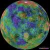
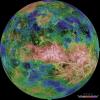
The hemispheric view of Venus, as revealed by more than a decade of radar investigations culminating in NASA's 1990-1994 Magellan mission, is centered at 0 degrees east longitude.
PIA00157:
Hemispheric View of Venus Centered at 0 Degrees East Longitude
Full Resolution:     TIFF (39.63 MB)     JPEG (4.282 MB)
Add Image to Favorite List 1998-06-04 Venus Magellan
Imaging Radar
4064x4064x3
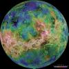
The hemispheric view of Venus, as revealed by more than a decade of radar investigations culminating in NASA's 1990-1994 Magellan mission, is centered at 90 degrees east longitude.
PIA00158:
Hemispheric View of Venus Centered at 90 Degrees East Longitude
Full Resolution:     TIFF (41.14 MB)     JPEG (4.713 MB)
Add Image to Favorite List 1998-06-04 Venus Magellan
Imaging Radar
4064x4064x3
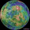
The view of Venus, after more than a decade of radar investigations culminating in the 1990-1994 NASA Magellan mission, is centered at 180 degrees east longitude.
PIA00159:
Hemispheric View of Venus Centered at 180° East Longitude
Full Resolution:     TIFF (41.1 MB)     JPEG (4.518 MB)
Add Image to Favorite List 1998-06-04 Venus Magellan
Imaging Radar
4064x4064x3
The view of Venus, after more than a decade of radar investigations culminating in the 1990-1994 NASA Magellan mission, is centered at 270 degrees east longitude.
PIA00160:
Hemispheric View of Venus Centered at 270° East Longitude
Full Resolution:     TIFF (40.74 MB)     JPEG (4.371 MB)
Add Image to Favorite List 1998-06-04 Venus Magellan
Imaging Radar
2000x940x3
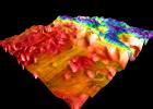
This perspective view of Venus, generated by computer from NASA's Magellan data and color-coded with emissivity, shows part of Sedna Planitia and illustrates a common phenomenon of the lowland plains of Venus.
PIA00306:
Magellan's Perspective View of Sedna Planitia, 45° N, 350° E
Full Resolution:     TIFF (2 MB)     JPEG (294.6 kB)
Add Image to Favorite List 1998-06-04 Venus Magellan
Imaging Radar
2000x1600x3
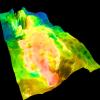
This perspective view of Venus, generated by computer from NASA's Magellan data and color-coded with emissivity, shows part of the lowland plains in Sedna Planitia.
PIA00307:
Magellan's Perspective View of Sedna Planitia, 45° N, 11° E
Full Resolution:     TIFF (4.943 MB)     JPEG (693.5 kB)
Add Image to Favorite List 1998-06-04 Venus Magellan
Imaging Radar
1500x1500x3
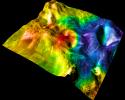
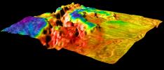
This perspective view of Venus, generated by computer from NASA's Magellan data and color-coded with emissivity, shows part of the lowlands to the north of Ovda Regio. The prominent topographic feature is a shield volcano.
PIA00308:
Magellan's Perspective View of Ovda Regio, 15° N, 77° E
Full Resolution:     TIFF (3.113 MB)     JPEG (469.6 kB)
Add Image to Favorite List 1998-06-04 Venus Magellan
Imaging Radar
1500x1500x3
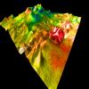
This perspective view of Venus, generated by computer from NASA's Magellan data and color-coded with emissivity, shows the boundary between the lowland plains and characteristic Venusian highland terrain in Ovda Regio.
PIA00309:
Magellan's Perspective View of Ovda Regio, 0° N, 77° E
Full Resolution:     TIFF (5.144 MB)     JPEG (581.7 kB)
Add Image to Favorite List 1998-06-04 Venus Magellan
Imaging Radar
2100x1500x3
This perspective view of Venus, generated by computer from NASA's Magellan data and color-coded with emissivity, shows the boundary between the lowland plains and characteristic Venusian highland terrain in Ovda Regio.
PIA00310:
Magellan's Perspective View of Ovda Regio, 0° N, 129° E
Full Resolution:     TIFF (4.734 MB)     JPEG (606.2 kB)
Add Image to Favorite List 1998-06-04 Venus Magellan
Imaging Radar
2100x900x3
This perspective view of Venus, generated by computer from NASA's Magellan data and color-coded with emissivity, shows the boundary between the lowland plains and characteristic Venusian highland terrain in Ovda Region.
PIA00311:
Magellan's Perspective View of Ovda Regio, 0° S, 129° E
Full Resolution:     TIFF (2.63 MB)     JPEG (343.7 kB)
Add Image to Favorite List 1998-06-04 Venus Magellan
Imaging Radar
1500x1500x3
This perspective view of Venus, generated by computer from NASA's Magellan data and color-coded with emissivity, shows the impact crater Markham, named after the English aviator Beryl Markham.
PIA00312:
Magellan's View of Crater Markham, 0° N, 163° E
Full Resolution:     TIFF (3.378 MB)     JPEG (348.9 kB)
Add Image to Favorite List 1998-06-04 Venus Magellan
Imaging Radar
700x1400x3
This perspective view of Venus, generated by computer from NASA's Magellan data and color-coded with emissivity, shows part of the lowland plains in Sedna Planitia. Circular depressions with associated fracture patterns, called 'coronae.'
PIA00313:
Sedna Planitia (Left Member of a Synthetic Stereo Pair)
Full Resolution:     TIFF (2.568 MB)     JPEG (270.1 kB)
Add Image to Favorite List 1998-06-04 Venus Magellan
Imaging Radar
700x1400x3
This perspective view of Venus, generated by computer from NASA's Magellan data and color-coded with emissivity, shows part of the lowland plains in Sedna Planitia.
PIA00314:
Sedna Planitia (Right Member of a Synthetic Stereo Pair)
Full Resolution:     TIFF (2.571 MB)     JPEG (265.6 kB)
Add Image to Favorite List 1998-06-04 Venus Magellan
Imaging Radar
700x1400x3
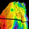
This perspective view of Venus, generated by computer from NASA's Magellan data and color-coded with emissivity, is a look westward across the Fortuna Tessera toward the slopes of Maxwell Montes.
PIA00315:
Looking Westward Across the Fortuna Tessera (Left Member of a Synthetic Stereo Pair)
Full Resolution:     TIFF (2.643 MB)     JPEG (283.3 kB)
Add Image to Favorite List 1998-06-04 Venus Magellan
Imaging Radar
700x1400x3
This perspective view of Venus, generated by computer from NASA's Magellan data and color-coded with emissivity, is a look westward across the Fortuna Tessera toward the slopes of Maxwell Montes.
PIA00316:
Looking Westward Across the Fortuna Tessera (Right Member of a Synthetic Stereo Pair)
Full Resolution:     TIFF (2.614 MB)     JPEG (283.7 kB)
Add Image to Favorite List 1999-05-18 Venus Hubble Space Telescope
WFPC2
170x248x3
Venus Cloud Tops Viewed by Hubble. This is a NASA Hubble Space Telescope ultraviolet-light image of the planet Venus, taken on January 24 1995, when Venus was at a distance of 70.6 million miles (113.6 million kilometers) from Earth.
PIA01544:
Venus Cloud Tops Viewed by Hubble
Full Resolution:     TIFF (48.41 kB)     JPEG (3.494 kB)
Add Image to Favorite List 2001-03-15 Venus Magellan
Arecibo Radar Data
Radar System
13966x8887x3
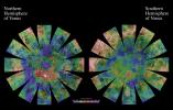
The images used for the base of this globe show the northern and southern hemispheres of Venus as revealed by more than a decade of radar investigations culminating in the 1990-1994 NASA Magellan mission.
PIA03151:
Venus Hemispherical Globes
Full Resolution:     TIFF (196.7 MB)     JPEG (17.89 MB)
Add Image to Favorite List 2001-08-27 Venus Magellan
Arecibo Radar Data
Radar System
15464x9249x3
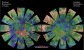
The images used for the base of this globe show the northern and southern hemispheres of Venus as revealed by more than a decade of radar investigations culminating in the 1990-1994 NASA Magellan mission.
PIA03167:
Venus Hemispherical Globes (with place names)
Full Resolution:     TIFF (229.5 MB)     JPEG (26.36 MB)
Add Image to Favorite List 2003-06-27 Venus Mariner 2
1515x1218x3
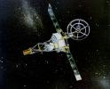
NASA's Mariner 2 was the world's first successful interplanetary spacecraft. Launched August 27, 1962, on an Atlas-Agena rocket, Mariner 2 passed within about 34,000 kilometers (21,000 miles) of Venus.
PIA04594:
Mariner 2 (Artist's Concept)
Full Resolution:     TIFF (3.492 MB)     JPEG (330.3 kB)
Add Image to Favorite List 2006-11-24 Venus MESSENGER
MDIS - Wide Angle
1048x528x1
On Oct. 24, 2006, NASA's MESSENGER spacecraft came within 2,990 kilometers (1,860 miles) of Venus during its second planetary encounter.
PIA10123:
Approaching Venus
Full Resolution:     TIFF (554.2 kB)     JPEG (8.344 kB)
Add Image to Favorite List 2007-06-05 Venus MESSENGER
MDIS - Wide Angle
1024x1024x1
NASA's MESSENGER spacecraft snapped a series of images as it approached Venus on June 5. The planet is enshrouded by a global layer of clouds that obscures its surface to the MESSENGER Dual Imaging System (MDIS) cameras.
PIA10124:
Approaching Venus Image #2
Full Resolution:     TIFF (1.05 MB)     JPEG (28.2 kB)
Add Image to Favorite List 2007-06-05 Venus MESSENGER
MDIS - Wide Angle
608x919x1
After acquiring hundreds of high-resolution images during close approach to Venus, NASA's MESSENGER turned its wide-angle camera back to the planet and acquired a departure sequence.
PIA10125:
MESSENGER Bids Farewell to Venus Animation Icon
Full Resolution:     TIFF (559.6 kB)     JPEG (20.92 kB)
Add Image to Favorite List 2010-02-02 Venus MESSENGER
MDIS - Wide Angle
1024x1024x1
This image from NASA's MESSENGER is one of many from the latest vulcanoid search are currently being transmitted to Earth. Vulcanoids are small rocky bodies that have been postulated to exist but not yet been detected.
PIA12443:
A View of Venus while Searching for Vulcanoids
Full Resolution:     TIFF (1.05 MB)     JPEG (52.42 kB)
Add Image to Favorite List 2010-04-08 Venus Magellan
Venus Express
VIRTIS
1920x1080x3
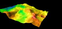
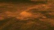
This figure shows the volcanic peak Idunn Mons in the Imdr Regio area of Venus. The topographic backbone (brown color) was derived from data obtained by NASA's Magellan spacecraft and the overlay was derived from data from ESA's Venus Express Spacecraft.
PIA13001:
Surface Warmth on a Venus Volcano
Full Resolution:     TIFF (6.23 MB)     JPEG (185.9 kB)
Add Image to Favorite List 2012-06-15 Venus ACRIMSAT
ACRIM3
4800x3600x1
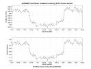
Observations of the total solar irradiance made with the ACRIM3 instrument on NASA's ACRIMSAT satellite on June 5 and 6, 2012, tracked the effect of the transit of Venus, which lasted about six hours.
PIA15820:
NASA's ACRIMSAT Observes Venus Transit
Full Resolution:     TIFF (17.31 MB)     JPEG (993.2 kB)
Add Image to Favorite List 2020-06-08 Venus Mariner
2245x1096x3
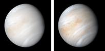
As it sped away from Venus, NASA's Mariner 10 spacecraft captured this seemingly peaceful view of a planet the size of Earth, wrapped in a dense, global cloud layer.
PIA23791:
Venus from Mariner 10
Full Resolution:     TIFF (3.457 MB)     JPEG (94.32 kB)
Retrieve Previous Set  Jump to a Previous Set   Current Set 
 1-100   101-200 
Currently displaying images: 101 - 153 of 153