|
Your search criteria found 19634 images Target is Sun |
| My List |
Addition Date | Target |
Mission
|
Instrument | Size |

|
1997-02-28 | Mars |
Viking |
Camera 2 |
457x350x3 |
|
|||||
|
|
1997-02-28 | Mars |
Viking |
Camera 1 |
478x512x3 |
|
|||||
|
|
1997-02-28 | Mars |
Viking |
Camera 1 |
500x512x3 |

|
|||||
|
|
1997-02-28 | Mars |
Viking |
Camera 2 |
206x512x3 |
|
|
|||||
|
|
1997-02-28 | Mars |
Viking |
Camera 2 |
745x330x3 |

|
|||||
|
|
1998-04-02 | Mars |
Viking |
Visual Imaging Subsystem - Camera A |
640x472x1 |

|
|||||
|
|
2000-05-02 | Mars |
Viking |
Camera 1 |
2818x2224x3 |
|
|||||
|
|
2000-11-04 | Mars |
Viking |
1124x1040x3 | |
|
|||||
|
|
2000-11-04 | Mars |
Viking |
595x742x3 | |
|
|||||
|
|
2000-11-04 | Mars |
Viking |
1169x1055x1 | |
|
|||||
|
|
2000-11-07 | Mars |
Viking |
600x600x3 | |

|
|||||
|
|
2000-11-10 | Mars |
Viking |
Visual Imaging Subsystem - Camera A |
11649x5721x3 |
|
|||||
|
|
2001-07-30 | Mars |
Viking |
Camera 1 |
8550x1852x1 |
|
|||||
|
|
2001-07-30 | Mars |
Viking |
Camera 1 |
8550x1852x1 |
|
|||||
|
|
2001-07-30 | Mars |
Viking |
Camera 1 |
8550x1852x1 |

|
|||||
|
|
2001-07-30 | Mars |
Viking |
Camera 1 |
8550x1852x1 |
|
|||||
|
|
2001-02-21 | Mars |
Viking |
Visual Imaging Subsystem |
5072x4499x3 |

|
|||||
|
|
2003-02-05 | Mars |
Viking |
Visual Imaging Subsystem - Camera A |
2024x1919x3 |
|
|||||
|
|
2003-04-11 | Mars |
Viking |
Visual Imaging Subsystem |
5334x4267x3 |
|
|||||
|
|
2003-04-11 | Mars |
Viking |
Visual Imaging Subsystem |
8530x4267x3 |
|
|||||
|
|
2008-05-30 | Mars |
Viking |
Camera 2 |
1744x512x1 |
|
|||||
|
|
2014-02-12 | Mars |
Viking |
669x650x1 | |
|
|||||
|
|
2009-06-18 | Earth |
UAVSAR |
L-Band UAVSAR |
2984x2737x3 |

|
|||||
|
|
2010-02-02 | Earth |
UAVSAR |
L-Band UAVSAR |
6662x5139x3 |
|
|||||
|
|
2009-09-01 | Earth |
UAVSAR |
L-Band UAVSAR |
3544x2458x3 |
|
|||||
|
|
2010-07-01 | Earth |
UAVSAR |
L-Band UAVSAR |
1280x720x3 |
|
|||||
|
|
2010-08-04 | Earth |
UAVSAR |
L-Band UAVSAR |
2256x1464x3 |

|
|||||
|
|
2010-06-23 | Earth |
UAVSAR |
L-Band UAVSAR |
3864x2640x3 |
|
|||||
|
|
2011-03-04 | Earth |
UAVSAR |
L-Band UAVSAR |
20528x6304x3 |
|
|||||
|
|
2012-08-15 | Earth |
UAVSAR |
L-Band UAVSAR |
732x652x3 |
|
|||||
|
|
2013-04-03 | Earth |
UAVSAR |
L-Band UAVSAR |
2806x1314x3 |
|
|||||
|
|
2013-04-03 | Earth |
UAVSAR |
L-Band UAVSAR |
1079x863x3 |
|
|||||
|
|
2014-01-28 | Earth |
UAVSAR |
5184x3456x3 | |
|
|||||
|
|
2014-03-06 | Earth |
UAVSAR |
L-Band UAVSAR |
1107x981x3 |
|
|||||
|
|
2014-03-31 | Earth |
UAVSAR |
L-Band UAVSAR |
1400x950x3 |

|
|||||
|
|
2014-05-27 | Earth |
UAVSAR |
L-Band UAVSAR |
3238x3244x3 |

|
|||||
|
|
2014-09-04 | Earth |
UAVSAR |
L-Band UAVSAR |
1573x1181x3 |
|
|||||
|
|
2016-01-27 | Earth |
UAVSAR |
L-Band UAVSAR |
1800x2721x1 |
|
|||||
|
|
2016-02-05 | Earth |
UAVSAR |
L-Band UAVSAR |
1041x1043x1 |
|
|||||
|
|
2016-02-05 | Earth |
UAVSAR |
L-Band UAVSAR |
1800x882x1 |
|
|||||
|
|
2016-02-05 | Earth |
UAVSAR |
L-Band UAVSAR |
1800x2344x1 |
|
|||||
|
|
2018-02-12 | Earth |
UAVSAR |
L-Band UAVSAR |
1738x1853x3 |
|
|||||
|
|
2024-03-21 | Earth |
TOPEX/Poseidon Sentinel-6 Michael Freilich |
3300x2550x3 | |
|
|||||
|
|
1999-06-21 | Earth |
TOPEX/Poseidon |
Altimeter |
901x900x3 |
|
|||||
|
|
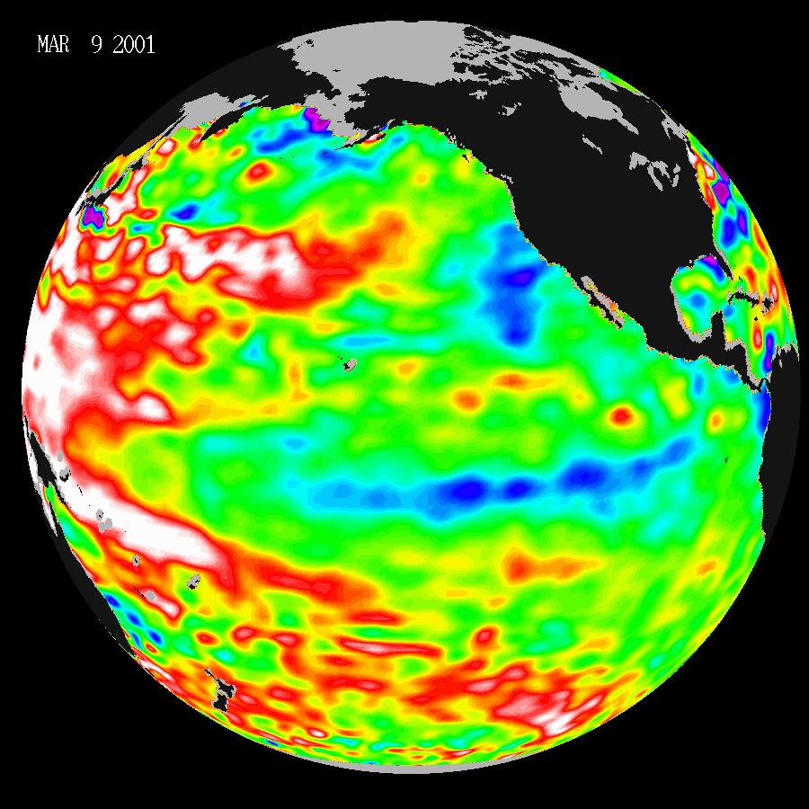
2001-03-28 | Earth |
TOPEX/Poseidon |
Altimeter |
900x900x3 |
|
|||||
|
|
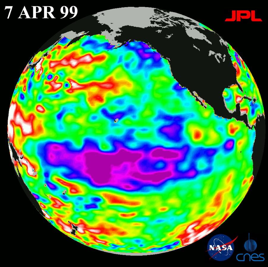
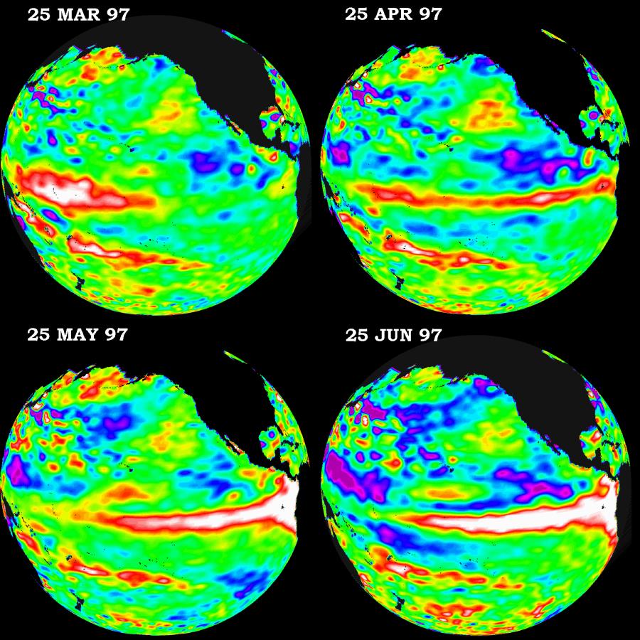
1997-10-14 | Earth |
TOPEX/Poseidon |
Altimeter |
900x900x3 |
|
|||||
|
|
1997-10-14 | Earth |
TOPEX/Poseidon |
Altimeter |
900x900x3 |
|
|||||
|
|
1997-10-14 | Earth |
TOPEX/Poseidon |
Altimeter |
900x900x3 |
|
|||||
|
|
1997-10-14 | Earth |
TOPEX/Poseidon |
Altimeter |
2000x2000x3 |
|
|||||
|
|
1997-10-14 | Earth |
TOPEX/Poseidon |
Altimeter |
2154x1036x3 |
|
|||||
|
|
1998-04-02 | Earth |
TOPEX/Poseidon |
Altimeter |
2550x2545x3 |
|
|||||
|
|
1997-10-30 | Earth |
TOPEX/Poseidon |
Altimeter |
2550x2545x3 |
|
|||||
|
|
1997-11-20 | Earth |
TOPEX/Poseidon |
Altimeter |
2550x2544x3 |
|
|||||
|
|
1997-12-08 | Earth |
TOPEX/Poseidon |
Altimeter |
2550x2548x3 |
|
|||||
|
|
1997-12-19 | Earth |
TOPEX/Poseidon |
Altimeter |
2550x2550x3 |

|
|||||
|
|
1998-11-04 | Earth |
TOPEX/Poseidon |
Altimeter |
1908x1908x3 |
|
|||||
|
|
1998-07-03 | Earth |
TOPEX/Poseidon |
Altimeter |
901x900x3 |
|
|||||
|
|
1998-11-04 | Earth |
TOPEX/Poseidon |
Altimeter |
1912x1908x3 |
|
|||||
|
|
1998-07-03 | Earth |
TOPEX/Poseidon |
Altimeter |
695x900x3 |
|
|||||
|
|
1998-07-03 | Earth |
TOPEX/Poseidon |
Altimeter |
923x900x3 |
|
|||||
|
|
1998-07-03 | Earth |
TOPEX/Poseidon |
Altimeter |
900x900x3 |
|
|||||
|
|
1998-07-21 | Earth |
TOPEX/Poseidon |
Altimeter |
902x900x3 |
|
|||||
|
|
1998-09-26 | Earth |
TOPEX/Poseidon |
Altimeter |
900x900x3 |
|
|||||
|
|
1998-09-26 | Earth |
TOPEX/Poseidon |
Altimeter |
902x900x3 |
|
|||||
|
|
1998-12-05 | Earth |
TOPEX/Poseidon |
Altimeter |
902x900x3 |
|
|||||
|
|
1998-12-05 | Earth |
TOPEX/Poseidon |
Altimeter |
902x900x3 |
|
|||||
|
|
1999-04-15 | Earth |
TOPEX/Poseidon |
Altimeter |
900x900x3 |
|
|||||
|
|
1999-04-15 | Earth |
TOPEX/Poseidon |
Altimeter |
902x900x3 |
|
|||||
|
|
1999-06-21 | Earth |
TOPEX/Poseidon |
Altimeter |
900x900x3 |
|
|||||
|
|
1999-08-23 | Earth |
TOPEX/Poseidon |
Altimeter |
902x900x3 |
|
|||||
|
|
1999-08-23 | Earth |
TOPEX/Poseidon |
Altimeter |
902x900x3 |
|
|||||
|
|
1999-11-18 | Earth |
TOPEX/Poseidon |
Altimeter |
902x900x3 |
|
|||||
|
|
1999-12-01 | Earth |
TOPEX/Poseidon |
Altimeter |
900x900x3 |
|
|||||
|
|
2000-01-21 | Earth |
TOPEX/Poseidon |
Altimeter |
902x900x3 |
|
|||||
|
|
2000-05-07 | Earth |
TOPEX/Poseidon |
Altimeter |
900x900x3 |
|
|||||
|
|
2000-07-06 | Earth |
TOPEX/Poseidon |
Altimeter |
900x900x3 |
|
|||||
|
|
2000-08-30 | Earth |
TOPEX/Poseidon |
Altimeter |
900x900x3 |
|
|||||
|
|
2001-08-27 | Earth |
TOPEX/Poseidon |
Altimeter |
900x900x3 |
|
|||||
|
|
2001-11-07 | Earth |
TOPEX/Poseidon |
Altimeter |
900x900x3 |
|
|||||
|
|
2002-07-03 | Earth |
TOPEX/Poseidon |
Altimeter |
900x900x3 |
|
|||||
|
|
2002-08-22 | Earth |
TOPEX/Poseidon |
Altimeter |
900x900x3 |
|
|||||
|
|
2014-03-27 | Earth |
Terra Landsat |
ASTER |
1610x1454x3 |
|
|||||
|
|
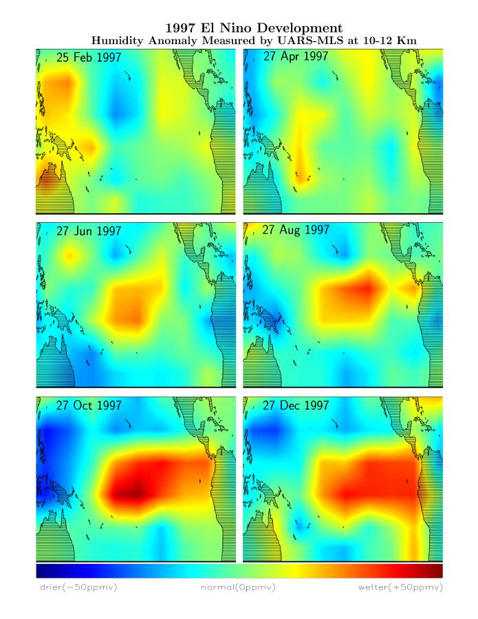
1998-03-16 | Earth |
Terra |
MLS |
2550x3009x3 |
|
|||||
|
|
1998-03-26 | Earth |
Terra |
MLS |
2550x3300x3 |
|
|||||
|
|
1997-10-30 | Earth |
Terra |
MLS |
1517x1645x3 |
|
|||||
|
|
1998-03-14 | Earth |
Terra |
MLS |
1152x900x3 |
|
|||||
|
|
1998-03-14 | Earth |
Terra |
MLS |
695x900x3 |
|
|||||
|
|
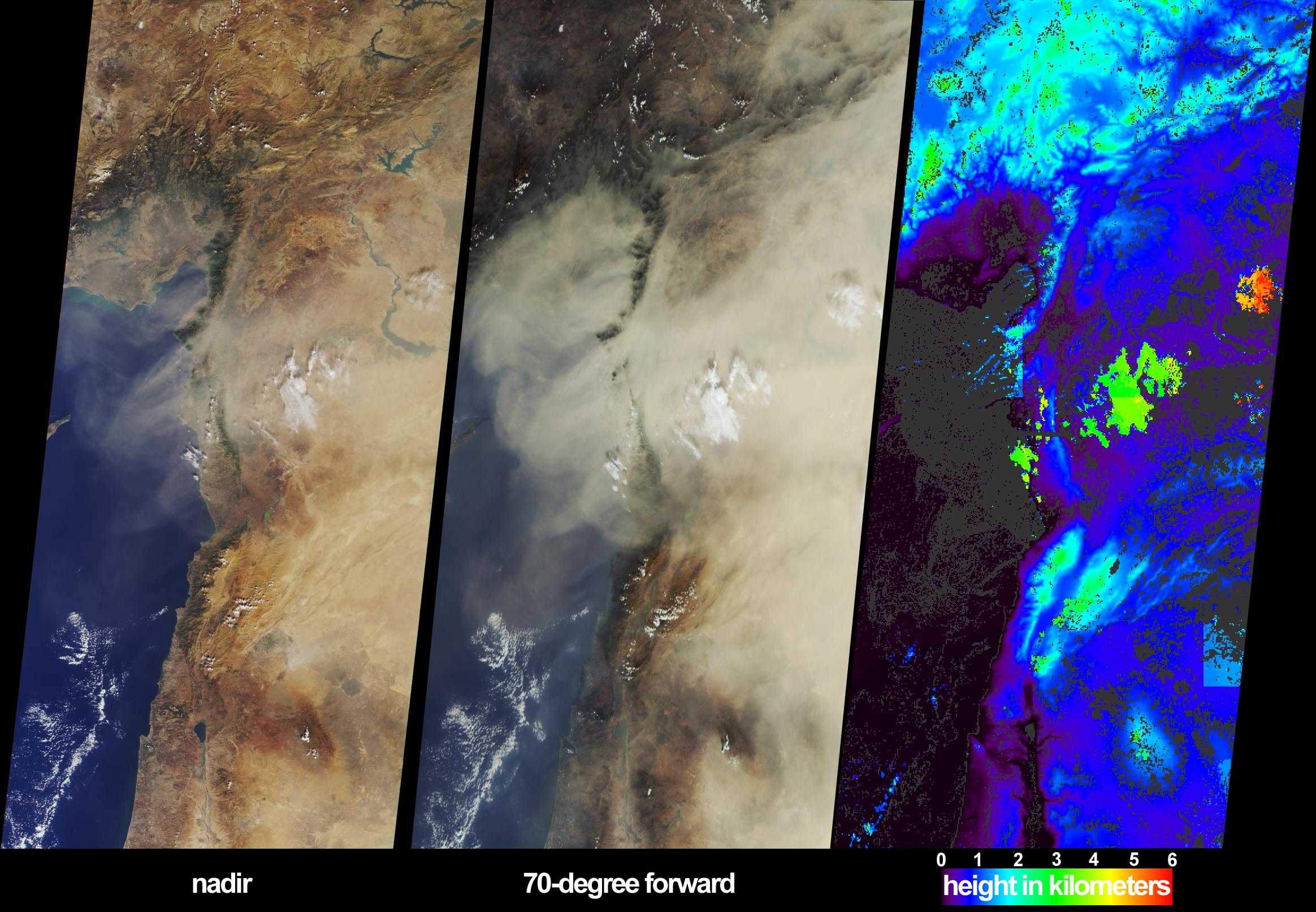
2002-10-30 | Earth |
Terra |
MISR |
2328x1614x3 |
|
|||||
|
|
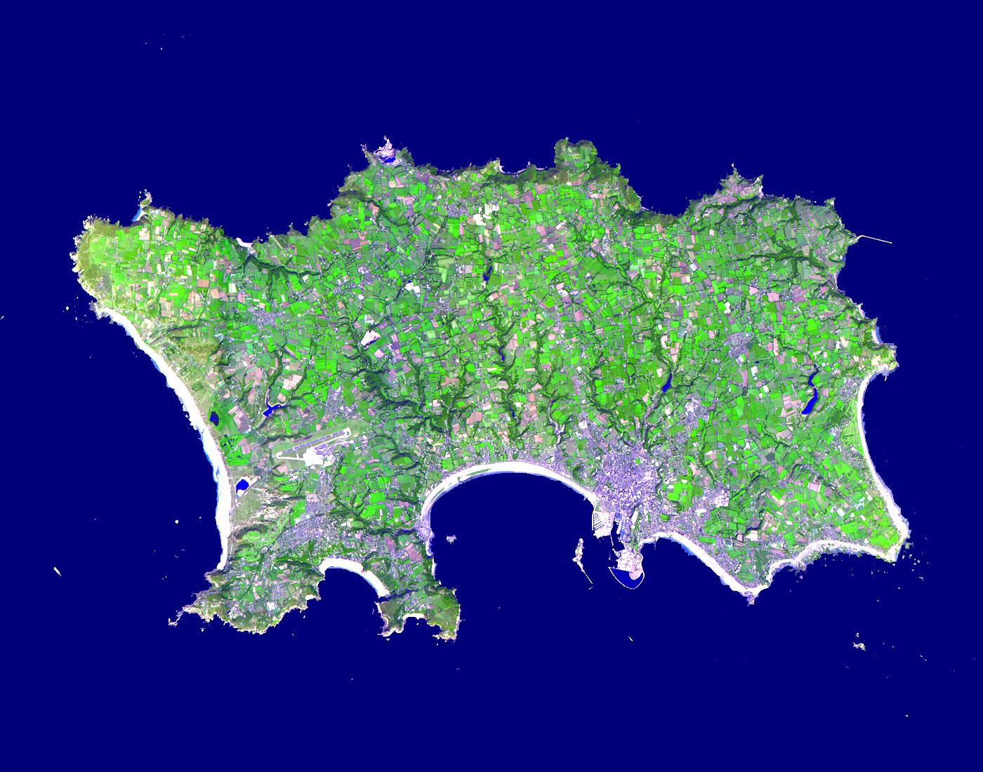
2015-02-19 | Earth |
Terra |
ASTER |
3300x2000x3 |
|
|||||
|
|
2002-10-29 | Earth |
Terra |
ASTER |
1400x1100x3 |
|
|||||
|
|
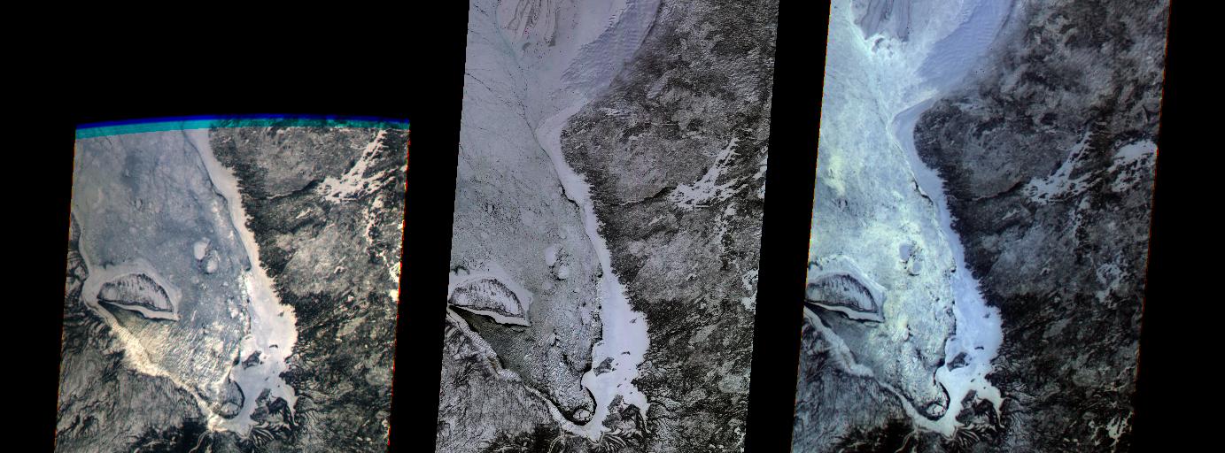
2000-03-11 | Earth |
Terra |
MISR |
1383x512x3 |
|
|||||
|
|
2000-03-11 | Earth |
Terra |
ASTER |
2263x2027x1 |
|
|||||
|
|
2000-03-11 | Earth |
Terra |
ASTER |
2160x2251x1 |
|
|||||
|
|
2000-03-11 | Earth |
Terra |
ASTER |
2288x2288x3 |
|
|||||
|
|
2011-11-10 | Earth |
Terra |
ASTER |
4032x7962x3 |
|
|||||
|
|
2000-04-19 | Earth |
Terra |
MISR |
1906x981x3 |
|
|||||
|
|
2000-04-19 | Earth |
Terra |
MISR |
1920x1079x3 |
|
|||||
|
|
2000-04-19 | Earth |
Terra |
MISR |
2536x800x3 |
|
|||||
|
|
2000-04-19 | Earth |
Terra |
MISR |
1520x1264x3 |
|
|||||
|
|
2000-04-26 | Earth |
Terra |
ASTER |
2100x1445x3 |
|
|||||

|
 |
|
|
 |
 |
|
|
|
|
|

|
| 1-100 | 101-200 | 201-300 | 301-400 | 401-500 | 501-600 | 601-700 | 701-800 | 801-900 | 901-1000 |
| Currently displaying images: 301 - 400 of 19634 |