|
Your search criteria found 3243 images Target is Saturn (and available satellites) |
| My List |
Addition Date | Target | Mission |
Instrument
|
Size |

|
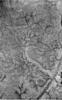
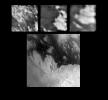
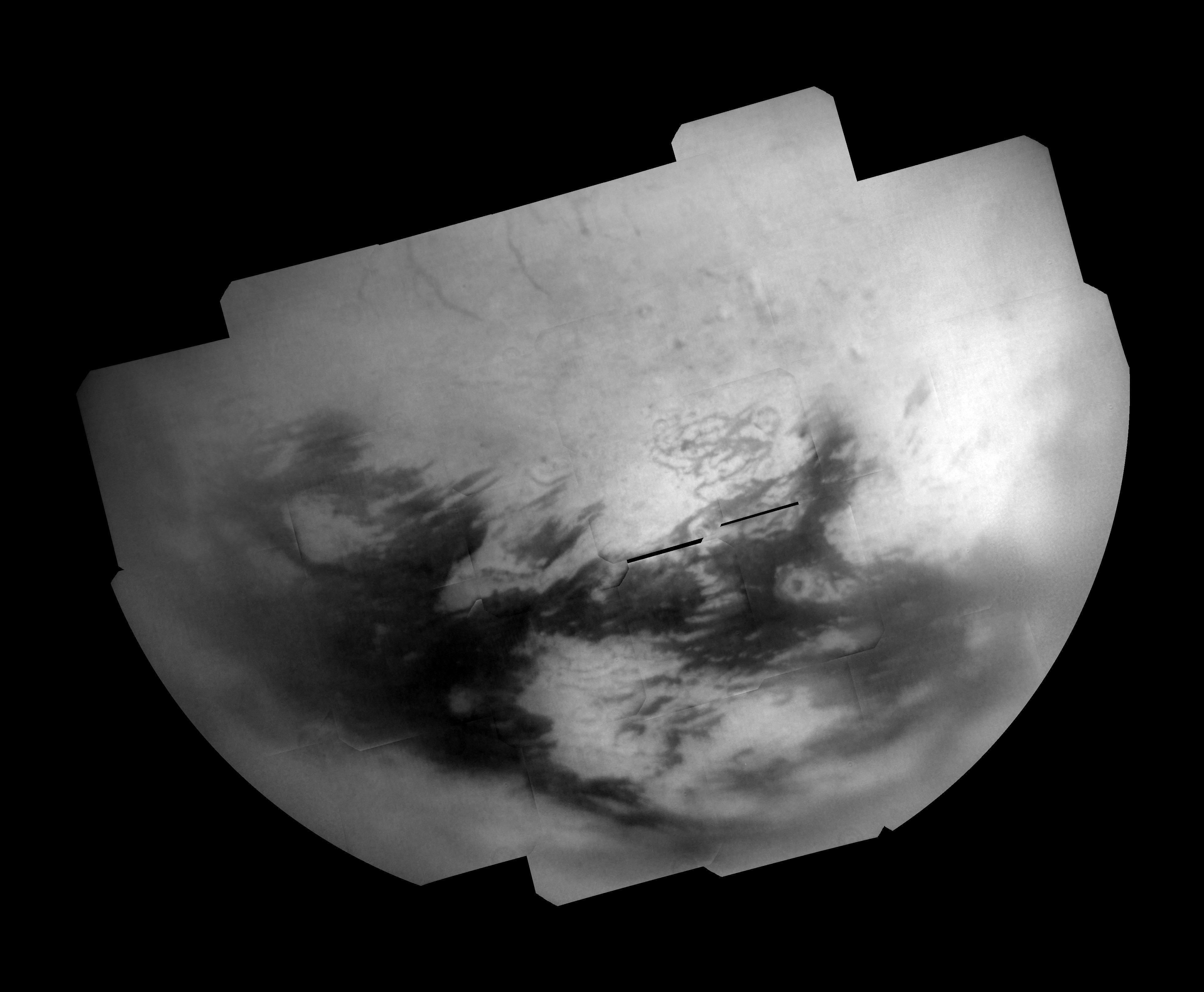
2005-01-21 | Titan |
Cassini-Huygens |
Descent Imager/Spectral Radiometer |
315x508x1 |
|
|||||
|
|
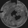
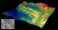
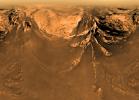
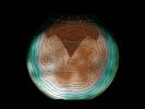
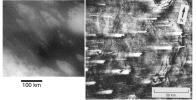
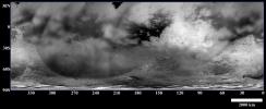
2005-05-13 | Titan |
Cassini-Huygens |
Descent Imager/Spectral Radiometer |
2400x2400x1 |
|
|||||
|
|
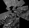
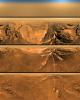
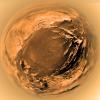
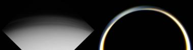
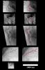
2005-05-13 | Titan |
Cassini-Huygens |
Descent Imager/Spectral Radiometer |
1563x1497x1 |
|
|||||
|
|
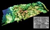
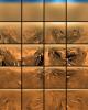
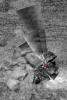
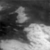
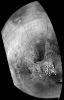
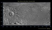
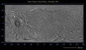
2005-11-30 | Titan |
Cassini-Huygens |
Descent Imager/Spectral Radiometer |
1541x1571x1 |

|
|||||
|
|
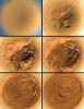
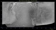
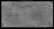
2005-11-30 | Titan |
Cassini-Huygens |
Descent Imager/Spectral Radiometer |
990x989x1 |

|
|||||
|
|
2005-11-30 | Titan |
Cassini-Huygens |
Descent Imager/Spectral Radiometer |
504x718x1 |

|
|||||
|
|
2005-12-02 | Titan |
Cassini-Huygens |
Descent Imager/Spectral Radiometer |
1310x778x3 |
|
|||||
|
|
2005-12-02 | Titan |
Cassini-Huygens |
Descent Imager/Spectral Radiometer |
1329x692x3 |
|
|||||
|
|
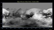
2006-05-04 | Titan |
Cassini-Huygens |
Descent Imager/Spectral Radiometer |
11370x14266x3 |
|
|||||
|
|
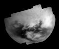
2006-05-04 | Titan |
Cassini-Huygens |
Descent Imager/Spectral Radiometer |
11374x14250x3 |
|
|||||
|
|
2006-05-04 | Titan |
Cassini-Huygens |
Descent Imager/Spectral Radiometer |
10932x14268x3 |
|
|||||
|
|
2006-05-04 | Titan |
Cassini-Huygens |
Descent Imager/Spectral Radiometer |
14997x10830x3 |
|
|||||
|
|
2006-05-04 | Titan |
Cassini-Huygens |
Descent Imager/Spectral Radiometer |
11664x11663x3 |
|
|||||
|
|
2006-05-04 | Titan |
Cassini-Huygens |
Descent Imager/Spectral Radiometer |
2583x6583x3 |
|
|
|||||
|
|
2006-05-04 | Titan |
Cassini-Huygens |
Descent Imager/Spectral Radiometer |
1667x2167x3 |

|
|||||
|
|
2006-05-04 | Titan |
Cassini-Huygens |
Descent Imager/Spectral Radiometer |
516x387x3 |

|
|||||
|
|
2006-05-04 | Titan |
Cassini-Huygens |
Descent Imager/Spectral Radiometer |
516x387x3 |
|
|||||
|
|
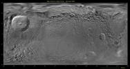
2005-11-30 | Titan |
Cassini-Huygens |
Descent Imager/Spectral Radiometer Radar Mapper |
488x732x3 |
|
|||||
|
|
2005-01-21 | Titan |
Cassini-Huygens |
Descent Imager/Spectral Radiometer Visual and Infrared Mapping Spectrometer |
1079x896x3 |
|
|||||
|
|
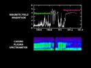
2004-07-01 | Saturn |
Cassini-Huygens |
Dual Technique Magnetometer Plasma Spectrometer |
720x540x3 |
|
|||||
|
|
2014-02-11 | Saturn |
Cassini-Huygens Hubble Space Telescope |
Hubble Space Telescope Visual and Infrared Mapping Spectrometer |
878x720x3 |
|
|||||
|
|
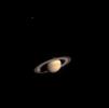
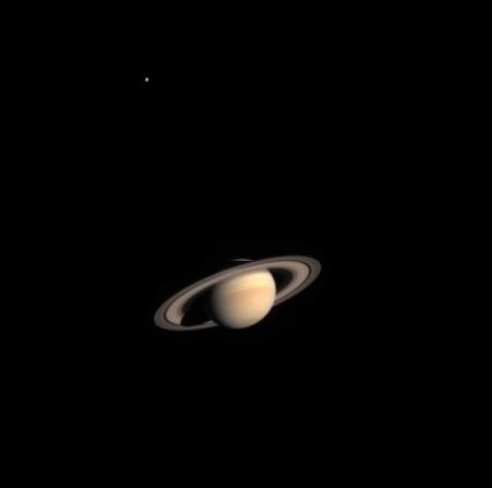
2002-11-01 | Saturn |
Cassini-Huygens |
Imaging Science Subsystem |
451x447x3 |
|
|||||
|
|
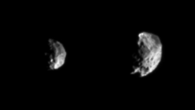
2004-06-10 | Phoebe |
Cassini-Huygens |
Imaging Science Subsystem |
679x382x1 |

|
|||||
|
|
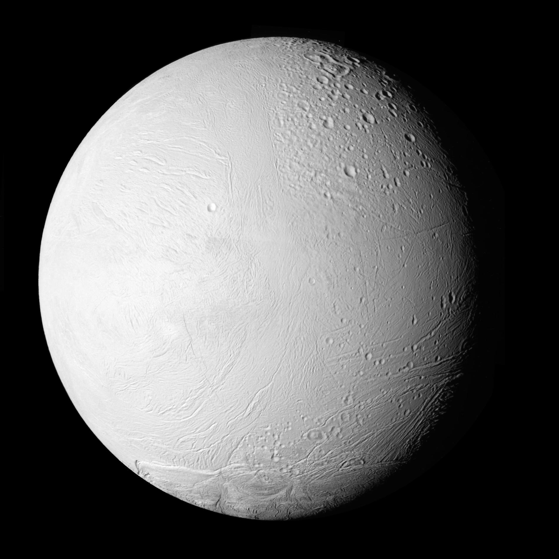
2010-02-23 | Enceladus |
Cassini-Huygens |
Imaging Science Subsystem |
1900x1900x1 |
|
|||||
|
|
2004-08-16 | Saturn |
Cassini-Huygens |
Imaging Science Subsystem |
786x776x27 |
|
|
||||
|
|
2004-08-16 | Saturn |
Cassini-Huygens |
Imaging Science Subsystem |
786x776x28 |
|
|
||||
|
|
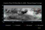
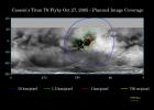
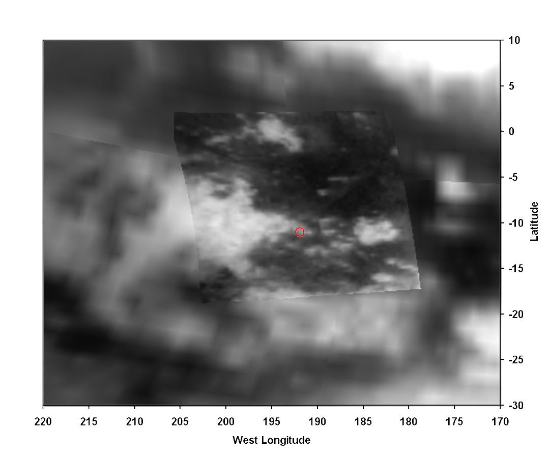
2004-10-27 | Titan |
Cassini-Huygens |
Imaging Science Subsystem |
3161x1078x1 |

|
|||||
|
|
2004-10-27 | Titan |
Cassini-Huygens |
Imaging Science Subsystem |
786x776x44 |
|
|
||||
|
|
2004-10-27 | Titan |
Cassini-Huygens |
Imaging Science Subsystem |
576x583x3 |

|
|||||
|
|
2004-10-27 | Titan |
Cassini-Huygens |
Imaging Science Subsystem |
2072x1924x1 |
|
|||||
|
|
2004-10-27 | Titan |
Cassini-Huygens |
Imaging Science Subsystem |
778x776x83 |
|
|
||||
|
|
2004-10-28 | Titan |
Cassini-Huygens |
Imaging Science Subsystem |
720x540x3 |
|
|||||
|
|
2004-10-28 | Titan |
Cassini-Huygens |
Imaging Science Subsystem |
2990x789x3 |
|
|||||
|
|
2004-10-28 | Titan |
Cassini-Huygens |
Imaging Science Subsystem |
2202x1122x1 |
|
|||||
|
|
2004-10-28 | Titan |
Cassini-Huygens |
Imaging Science Subsystem |
1024x1024x1 |
|
|||||
|
|
2005-02-24 | Phoebe |
Cassini-Huygens |
Imaging Science Subsystem |
2750x1501x1 |

|
|||||
|
|
2005-02-24 | Phoebe |
Cassini-Huygens |
Imaging Science Subsystem |
1303x1850x1 |

|
|||||
|
|
2005-02-24 | Saturn |
Cassini-Huygens |
Imaging Science Subsystem |
8888x4544x3 |

|
|||||
|
|
2005-02-24 | Saturn |
Cassini-Huygens |
Imaging Science Subsystem |
800x400x1 |

|
|||||
|
|
2005-02-24 | Saturn |
Cassini-Huygens |
Imaging Science Subsystem |
1028x697x1 |

|
|||||
|
|
2005-02-24 | Saturn |
Cassini-Huygens |
Imaging Science Subsystem |
1778x1826x1 |
|
|||||
|
|
2005-02-24 | Saturn |
Cassini-Huygens |
Imaging Science Subsystem |
1006x1006x3 |

|
|||||
|
|
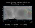
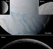
2005-03-08 | Enceladus |
Cassini-Huygens Voyager |
Imaging Science Subsystem |
1245x1004x3 |
|
|||||
|
|
2005-03-09 | Titan |
Cassini-Huygens |
Imaging Science Subsystem |
4256x1744x3 |
|
|||||
|
|
2005-03-09 | Titan |
Cassini-Huygens |
Imaging Science Subsystem |
1510x2328x3 |
|
|||||
|
|
2005-03-09 | Titan |
Cassini-Huygens |
Imaging Science Subsystem |
736x1148x1 |
|
|||||
|
|
2005-03-09 | Titan |
Cassini-Huygens |
Imaging Science Subsystem |
2660x2859x1 |

|
|||||
|
|
2005-03-30 | Titan |
Cassini-Huygens |
Imaging Science Subsystem |
1707x1148x3 |
|
|||||
|
|
2010-02-23 | Enceladus |
Cassini-Huygens |
Imaging Science Subsystem |
1145x1001x3 |
|
|||||
|
|
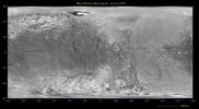
2005-08-30 | Enceladus |
Cassini-Huygens Voyager |
Imaging Science Subsystem |
2488x2448x3 |
|
|||||
|
|
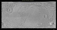
2005-08-30 | Enceladus |
Cassini-Huygens Voyager |
Imaging Science Subsystem |
2488x2448x3 |
|
|||||
|
|
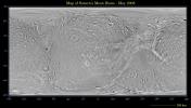
2005-08-30 | Enceladus |
Cassini-Huygens Voyager |
Imaging Science Subsystem |
2488x2448x3 |
|
|||||
|
|
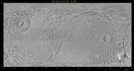
2005-08-30 | Enceladus |
Cassini-Huygens Voyager |
Imaging Science Subsystem |
2488x2448x3 |
|
|||||
|
|
2005-08-30 | Enceladus |
Cassini-Huygens |
Imaging Science Subsystem |
960x720x3 |
|
|||||
|
|
2005-08-30 | Enceladus |
Cassini-Huygens |
Imaging Science Subsystem |
960x720x3 |

|
|||||
|
|
2005-08-30 | Enceladus |
Cassini-Huygens |
Imaging Science Subsystem |
960x720x3 |

|
|||||
|
|
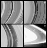
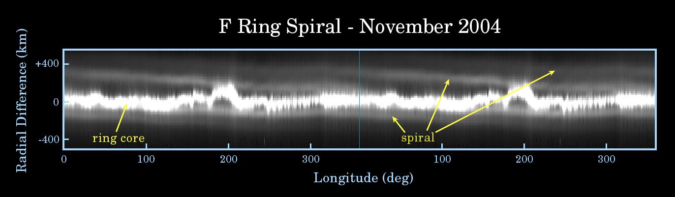
2005-09-05 | S Rings |
Cassini-Huygens |
Imaging Science Subsystem |
1372x401x3 |
|
|||||
|
|
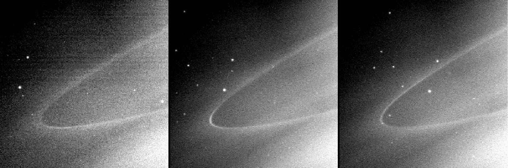
2005-09-05 | S Rings |
Cassini-Huygens |
Imaging Science Subsystem |
1716x568x1 |
|
|||||
|
|
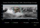
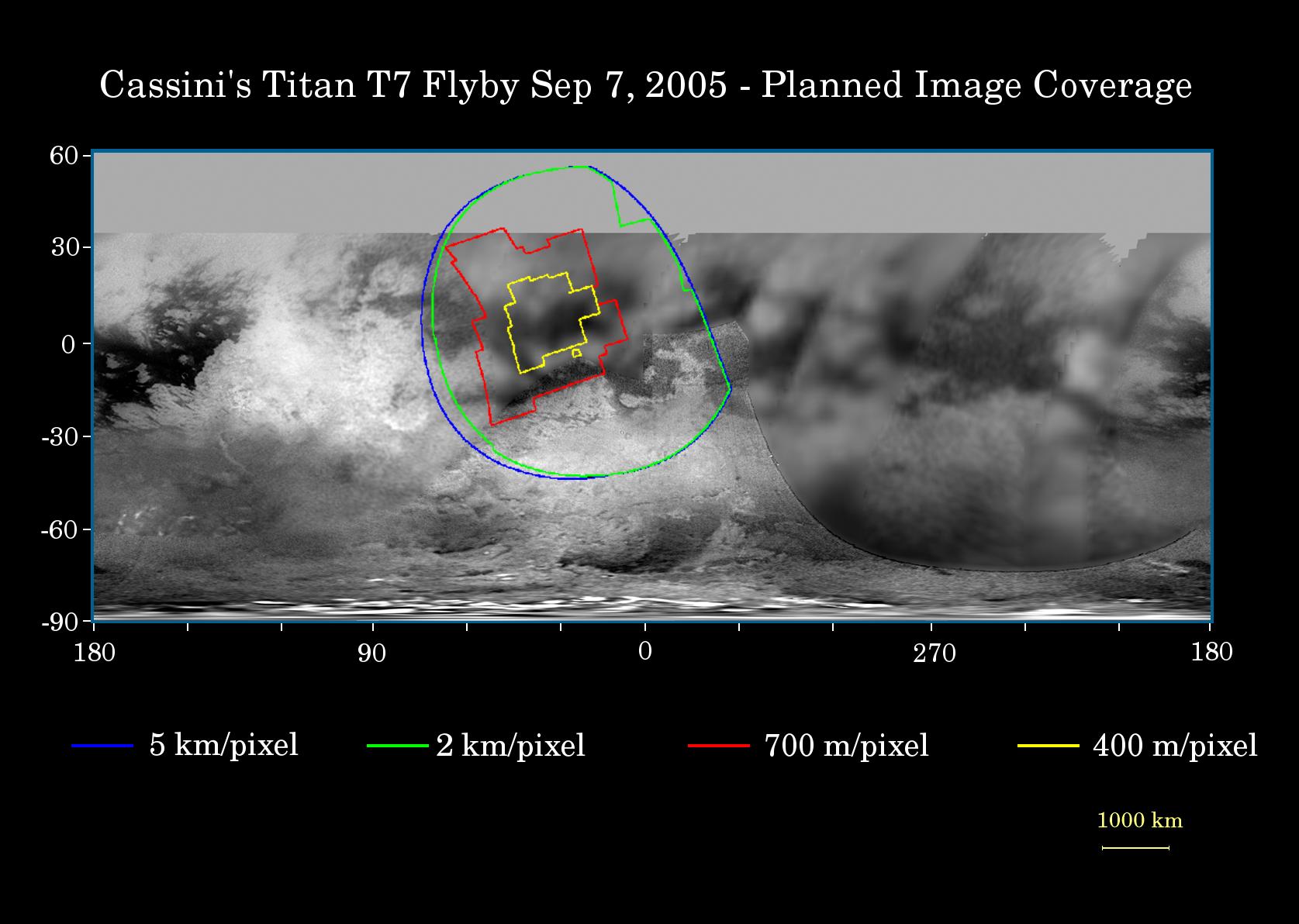
2005-09-07 | Titan |
Cassini-Huygens |
Imaging Science Subsystem |
1675x1192x3 |
|
|||||
|
|
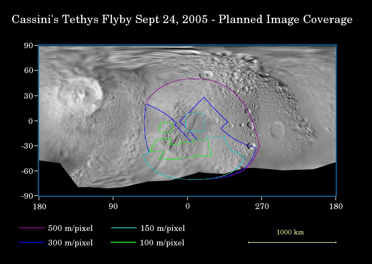
2005-09-20 | Tethys |
Cassini-Huygens Voyager |
Imaging Science Subsystem |
1260x893x3 |
|
|||||
|
|
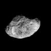
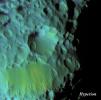
2005-12-06 | Hyperion |
Cassini-Huygens |
Imaging Science Subsystem |
647x648x1 |
|
|||||
|
|
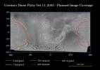
2005-10-07 | Dione |
Cassini-Huygens |
Imaging Science Subsystem |
1263x892x3 |
|
|||||
|
|
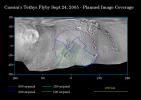
2005-10-25 | Titan |
Cassini-Huygens |
Imaging Science Subsystem |
1675x1192x3 |
|
|||||
|
|
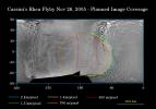
2005-11-17 | Rhea |
Cassini-Huygens |
Imaging Science Subsystem |
1239x868x3 |
|
|||||
|
|
2005-12-06 | Hyperion |
Cassini-Huygens |
Imaging Science Subsystem |
1016x1010x3 |
|
|||||
|
|
2005-12-06 | Saturn |
Cassini-Huygens |
Imaging Science Subsystem |
1899x1740x3 |
|
|||||
|
|
2005-12-06 | Dione |
Cassini-Huygens |
Imaging Science Subsystem |
1686x1578x3 |

|
|||||
|
|
2005-12-22 | Phoebe |
Cassini-Huygens |
Imaging Science Subsystem |
3228x1900x3 |
|
|||||
|
|
2005-12-22 | Dione |
Cassini-Huygens |
Imaging Science Subsystem |
5750x3244x3 |
|
|||||
|
|
2005-12-22 | Enceladus |
Cassini-Huygens |
Imaging Science Subsystem |
14960x7860x3 |
|
|||||
|
|
2005-12-22 | Iapetus |
Cassini-Huygens |
Imaging Science Subsystem |
7748x4250x3 |
|
|||||
|
|
2005-12-22 | Mimas |
Cassini-Huygens |
Imaging Science Subsystem |
3165x1878x3 |
|
|||||
|
|
2005-12-22 | Rhea |
Cassini-Huygens |
Imaging Science Subsystem |
7700x4200x3 |
|
|||||
|
|
2005-12-22 | Tethys |
Cassini-Huygens |
Imaging Science Subsystem |
12068x6408x3 |
|
|||||
|
|
2006-03-09 | Enceladus |
Cassini-Huygens |
Imaging Science Subsystem |
960x720x3 |
|
|||||
|
|
2006-03-27 | Phoebe |
Cassini-Huygens |
Imaging Science Subsystem |
2057x851x1 |
|
|||||
|
|
2006-03-27 | Phoebe |
Cassini-Huygens |
Imaging Science Subsystem |
720x692x1 |
|
|||||
|
|
2006-03-27 | Phoebe |
Cassini-Huygens |
Imaging Science Subsystem |
720x692x1 |
|
|||||
|
|
2006-03-29 | S Rings |
Cassini-Huygens |
Imaging Science Subsystem |
3168x1288x1 |
|
|||||
|
|
2006-07-05 | S Rings |
Cassini-Huygens |
Imaging Science Subsystem |
1007x275x3 |
|
|||||
|
|
2006-12-29 | Dione |
Cassini-Huygens |
Imaging Science Subsystem |
7944x4601x3 |
|
|||||
|
|
2006-12-29 | Enceladus |
Cassini-Huygens |
Imaging Science Subsystem |
4195x2211x3 |
|
|||||
|
|
2006-12-29 | Rhea |
Cassini-Huygens |
Imaging Science Subsystem |
7700x4200x3 |
|
|||||
|
|
2006-12-29 | Mimas |
Cassini-Huygens |
Imaging Science Subsystem |
3165x1878x3 |
|
|||||
|
|
2006-12-29 | Tethys |
Cassini-Huygens |
Imaging Science Subsystem |
12068x6408x3 |
|
|||||
|
|
2006-12-29 | Titan |
Cassini-Huygens |
Imaging Science Subsystem |
8748x4860x3 |
|
|||||
|
|
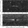
2007-05-22 | Titan |
Cassini-Huygens |
Imaging Science Subsystem |
3914x3225x1 |
|
|||||
|
|
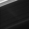
2007-05-23 | S Rings |
Cassini-Huygens |
Imaging Science Subsystem |
1018x970x1 |

|
|||||
|
|
2007-10-24 | S Rings |
Cassini-Huygens |
Imaging Science Subsystem |
1024x573x1 |

|
|||||
|
|
2007-07-24 | S Rings |
Cassini-Huygens |
Imaging Science Subsystem |
1024x1024x1 |
|
|||||
|
|
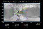
2007-09-05 | Iapetus |
Cassini-Huygens |
Imaging Science Subsystem |
1180x809x3 |
|
|||||
|
|
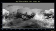
2007-10-15 | Titan |
Cassini-Huygens |
Imaging Science Subsystem |
4374x2430x3 |
|
|||||
|
|
2007-10-24 | S Rings |
Cassini-Huygens |
Imaging Science Subsystem |
878x878x1 |
|
|||||
|
|
2008-01-31 | Iapetus |
Cassini-Huygens |
Imaging Science Subsystem |
7748x4250x3 |
|
|||||
|
|
2008-02-20 | Tethys |
Cassini-Huygens |
Imaging Science Subsystem |
12068x6408x3 |
|
|||||
|
|
2008-05-20 | Dione |
Cassini-Huygens |
Imaging Science Subsystem |
6204x3522x3 |
|
|||||
|
|
2008-08-06 | Tethys |
Cassini-Huygens |
Imaging Science Subsystem |
12068x6408x3 |
|
|||||
|
|
2008-08-06 | Enceladus |
Cassini-Huygens |
Imaging Science Subsystem |
3793x2002x3 |
|
|||||
|
|
2008-08-06 | Enceladus |
Cassini-Huygens |
Imaging Science Subsystem |
1969x1182x1 |
|
|||||
|
|
2008-12-15 | Enceladus |
Cassini-Huygens |
Imaging Science Subsystem |
9159x9159x1 |
|
|||||

|
 |
 |
 |
|
|
|
|
|
|
|

|
| 1-100 | 101-200 | 201-300 | 301-400 | 401-500 | 501-600 | 601-700 | 701-800 | 801-900 | 901-1000 |
| Currently displaying images: 101 - 200 of 3243 |