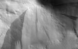
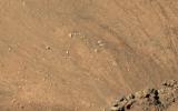
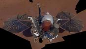
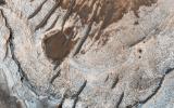
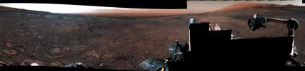
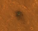
Your search criteria found 12760 images
Target is Mars (and available satellites)
Go to PIAxxxxx:
Refine this list of images by:
Target:
Mission:
Spacecraft:
Instrument:
Click on an image for detailed information
Click on a column heading to sort in ascending or descending order
My
List
Addition DateSort Ascending Target Mission Instrument Size
Add Image to Favorite List 2018-12-01 Mars InSight
Instrument Context Camera (ICC)
1024x1024x3
NASA's InSight spacecraft flipped open the lens cover on its Instrument Context Camera (ICC) on Nov. 30, 2018, and captured this view of Mars.
PIA22893:
InSight's First View of Mars with the Cover Off
Full Resolution:     TIFF (2.344 MB)     JPEG (129.4 kB)
Add Image to Favorite List 2018-12-03 Mars 2001 Mars Odyssey
THEMIS
1319x2677x1
This image from NASA's Mars Odyssey shows an unnamed crater located in Aonia Terra. Numerous gullies dissect the inner crater rim.
PIA22882:
Crater Gullies
Full Resolution:     TIFF (2.546 MB)     JPEG (258.1 kB)
Add Image to Favorite List 2018-12-04 Mars 2001 Mars Odyssey
THEMIS
1323x2647x1
This image from NASA's Mars Odyssey shows a linear depression in Syria Planum. Volcanic activity created this region of the Tharsis system south of Noctis Labyrinthus.
PIA22883:
Syria Planum
Full Resolution:     TIFF (2.342 MB)     JPEG (276.3 kB)
Add Image to Favorite List 2018-12-05 Mars 2001 Mars Odyssey
THEMIS
1328x2687x1
This image from NASA's Mars Odyssey shows a small portion of the floor of Galle Crater. This large crater is located on the eastern side of Argyre Planitia.
PIA22884:
Galle Crater
Full Resolution:     TIFF (2.407 MB)     JPEG (268.3 kB)
Add Image to Favorite List 2018-12-06 Mars 2001 Mars Odyssey
THEMIS
1322x2676x1
This image from NASA's Mars Odyssey shows Halley Crater, located on the western side of Argyre Planitia. Sand dunes cover part of the crater floor.
PIA22885:
Halley Crater Dunes
Full Resolution:     TIFF (2.27 MB)     JPEG (221.7 kB)
Add Image to Favorite List 2018-12-06 Mars InSight
Instrument Deployment Camera (IDC)
1024x1024x3
This image from InSight's robotic-arm mounted Instrument Deployment Camera shows the instruments on the spacecraft's deck, with the Martian surface of Elysium Planitia in the background.
PIA22871:
Full View of InSight's Deck and Two Science Instruments
Full Resolution:     TIFF (3.139 MB)     JPEG (133 kB)
Add Image to Favorite List 2018-12-06 Mars InSight
Instrument Deployment Camera (IDC)
1024x1024x3
This image shows InSight's robotic arm, with its scoop and stowed grapple, poised above the Martian soil.
PIA22872:
Insight's Robotic Arm Over Martian Soil
Full Resolution:     TIFF (3.147 MB)     JPEG (159.8 kB)
Add Image to Favorite List 2018-12-06 Mars InSight
Instrument Deployment Camera (IDC)
1024x1024x3
This image shows a partial view of the deck of NASA's InSight lander, where it stands on the Martian plains Elysium Planitia.
PIA22873:
Partial View of Insight's Robotic Arm and Deck
Full Resolution:     TIFF (3.147 MB)     JPEG (160.4 kB)
Add Image to Favorite List 2018-12-07 Mars 2001 Mars Odyssey
THEMIS
1313x2669x1
This image from NASA's Mars Odyssey shows an unnamed crater, located on the northern margin of Aonia Terra, interacting with one of the fossa, also called a graben.
PIA22886:
Claritas Fossae
Full Resolution:     TIFF (2.506 MB)     JPEG (323.5 kB)
Add Image to Favorite List 2018-12-07 Mars InSight
1500x495x3
This image shows the spectrogram of vibrations (frequency spectrum over time) recorded by two of the three sensors of the short period seismometer on NASA's InSight lander on Mars.
PIA22925:
Vibrations from InSight's First 20 Minutes on Mars
Full Resolution:     TIFF (872.1 kB)     JPEG (129.1 kB)
Add Image to Favorite List 2018-12-07 Mars InSight
457x586x3
This image shows a copy of one of the sensors on NASA InSight's seismometer, compared to a 2-euro coin (about 1 inch wide).
PIA22926:
Small Seismic Sensor on InSight
Full Resolution:     TIFF (746.1 kB)     JPEG (34.64 kB)
Add Image to Favorite List 2018-12-07 Mars Mars Reconnaissance Orbiter (MRO)
HiRISE
1204x595x3
This image shows the surface of Mars, taken by the HiRISE camera on NASA's Mars Reconnaissance Orbiter (MRO) on May 30, 2014. The contrast has been enhanced in this image to better show the region where InSight landed on Nov. 26, 2018.
PIA22927:
Of Wind and Dust Devils on Mars
Full Resolution:     TIFF (1.201 MB)     JPEG (197 kB)
Add Image to Favorite List 2018-12-07 Mars InSight
Instrument Deployment Camera (IDC)
1024x1024x3
This image shows one of NASA InSight's 7-foot (2.2 meter) wide solar panels as captured by the lander's Instrument Deployment Camera, which is fixed to the elbow of its robotic arm.
PIA22736:
InSight Images a Solar Panel
Full Resolution:     TIFF (3.147 MB)     JPEG (158.7 kB)
Add Image to Favorite List 2018-12-07 Mars MarCO
752x480x3
MarCO-B, one of the experimental Mars Cube One (MarCO) CubeSats, took these images as it approached Mars, just before NASA's InSight spacecraft landed on the planet.
PIA22655:
MarCO-B (Wall-E) approaches Mars
Full Resolution:     TIFF (1.088 MB)     JPEG (190 kB)
Add Image to Favorite List 2018-12-10 Mars 2001 Mars Odyssey
THEMIS
1322x2676x1
This image from NASA's Mars Odyssey shows numerous channels, also called gullies, dissecting the rim of this unnamed crater in Noachis Terra.
PIA22887:
Crater Gullies
Full Resolution:     TIFF (2.411 MB)     JPEG (282.1 kB)
Add Image to Favorite List 2018-12-11 Mars 2001 Mars Odyssey
THEMIS
1322x2665x1
This image from NASA's Mars Odyssey shows a crater rim, which is shared by two craters.
PIA22888:
A Rim of Two Craters
Full Resolution:     TIFF (2.313 MB)     JPEG (232 kB)
Add Image to Favorite List 2018-12-11 Mars Mars Reconnaissance Orbiter (MRO)
HiRISE
2880x1800x3
This image acquired on August 1, 2018 by NASA's Mars Reconnaissance Orbiter, shows the Martian south polar cap full of pits that make it look like Swiss cheese.
PIA22895:
Swiss Cheese on a Red Planet
Full Resolution:     TIFF (15.56 MB)     JPEG (1.158 MB)
Add Image to Favorite List 2018-12-11 Mars Mars Reconnaissance Orbiter (MRO)
HiRISE
2880x1800x3
This image acquired on September 18, 2018 by NASA's Mars Reconnaissance Orbiter, shows araneiform terrain (colloquially: spider-like terrain) located in the south polar region of Mars.
PIA22896:
The Enduring Charm of Martian Spiders
Full Resolution:     TIFF (15.56 MB)     JPEG (1.197 MB)
Add Image to Favorite List 2018-12-11 Mars Mars Reconnaissance Orbiter (MRO)
HiRISE
2880x1800x3
This image acquired on September 30, 2018 by NASA's Mars Reconnaissance Orbiter, shows slope streaks which are small avalanches of dust and sand from the hillsides.
PIA22897:
Slope Streaking
Full Resolution:     TIFF (5.191 MB)     JPEG (859.4 kB)
Add Image to Favorite List 2018-12-11 Mars Mars Reconnaissance Orbiter (MRO)
HiRISE
2880x1800x3
This image acquired on November 3, 2018 by NASA's Mars Reconnaissance Orbiter, shows Asimov Crater, located in the southern ancient highlands of Mars.
PIA22898:
The Eastern Slope of Asimov Crater's Central Pit
Full Resolution:     TIFF (15.56 MB)     JPEG (1.327 MB)
Add Image to Favorite List 2018-12-11 Mars InSight
Instrument Deployment Camera (IDC)
3346x2179x3
This mosaic, composed of 52 individual images from NASA's InSight lander, shows the workspace where the spacecraft will eventually set its science instruments.
PIA22874:
Mosaic of InSight's Workspace
Full Resolution:     TIFF (12.67 MB)     JPEG (856.9 kB)
Add Image to Favorite List 2018-12-11 Mars InSight
Instrument Deployment Camera (IDC)
4391x2504x3
This is NASA InSight's first selfie on Mars. It displays the lander's solar panels and deck. On top of the deck are its science instruments, weather sensor booms and UHF antenna.
PIA22876:
InSight's First Selfie
Full Resolution:     TIFF (23.3 MB)     JPEG (835.3 kB)
Add Image to Favorite List 2018-12-12 Mars 2001 Mars Odyssey
THEMIS
1326x2685x1
This image from NASA's Mars Odyssey shows Asimov Crater, located in Noachis Terra, has an unusual crater floor morphology.
PIA22889:
Asimov Crater
Full Resolution:     TIFF (2.379 MB)     JPEG (283.8 kB)
Add Image to Favorite List 2018-12-13 Mars 2001 Mars Odyssey
THEMIS
1343x2698x1
This image from NASA's Mars Odyssey shows sand dunes on the floor of an unnamed crater in Noachis Terra.
PIA22890:
Crater Dunes
Full Resolution:     TIFF (2.355 MB)     JPEG (226.9 kB)
Add Image to Favorite List 2018-12-13 Mars InSight
HiRISE
1600x900x3
NASA's InSight spacecraft, its heat shield and its parachute were imaged on Dec. 6 and 11 by the HiRISE camera onboard NASA's Mars Reconnaissance Orbiter.
PIA22875:
InSight on Mars, As Seen by HiRISE
Full Resolution:     TIFF (3.344 MB)     JPEG (159.7 kB)
Add Image to Favorite List 2018-12-13 Mars InSight
HiRISE
1650x1275x3
An annotated image of the surface of Mars, taken by the HiRISE camera on NASA's Mars Reconnaissance Orbiter (MRO) on May 30, 2014. The annotations display the locations of NASA's InSight lander, its heat shield and parachute.
PIA22877:
Locations of InSight, its Heat Shield and its Parachute
Full Resolution:     TIFF (3.294 MB)     JPEG (507.6 kB)
Add Image to Favorite List 2018-12-13 Mars InSight
HiRISE
1650x1275x3
This image shows the final landing location of NASA's InSight lander in this annotated image of the surface of Mars, taken by the THEMIS camera on NASA's 2001 Mars Odyssey orbiter in 2015.
PIA22878:
InSight's Final Location on Mars
Full Resolution:     TIFF (3.388 MB)     JPEG (429 kB)
Add Image to Favorite List 2018-12-13 Mars Mars 2020
HiRISE
1038x706x3
This animation, constructed using data from the High Resolution Imaging Science Experiment (HiRISE) camera on NASA's Mars Reconnaissance Orbiter, provides an airborne perspective of the Mars 2020 landing site and its exploration area at Jezero Crater.
PIA22905:
Jezero Crater Flyover
Full Resolution:     TIFF (1.084 MB)     JPEG (69.43 kB)
Add Image to Favorite List 2018-12-13 Mars Mars 2020
1920x1080x3
This artist's concept depicts an aerial view of what the Jezero Crater area of Mars may have looked like billions of years ago.
PIA22907:
Lake Jezero (Artist's Concept)
Full Resolution:     TIFF (3.262 MB)     JPEG (218.2 kB)
Add Image to Favorite List 2018-12-14 Mars 2001 Mars Odyssey
THEMIS
1327x2686x1
This image from NASA's Mars Odyssey shows part of the extensive dune field on the floor of Proctor Crater. Proctor Crater is located in Noachis Terra.
PIA22891:
Proctor Crater Dunes
Full Resolution:     TIFF (2.498 MB)     JPEG (256.7 kB)
Add Image to Favorite List 2018-12-17 Mars 2001 Mars Odyssey
THEMIS
496x2727x1
This image from NASA's Mars Odyssey shows a layer of clouds over the South polar cap.
PIA22901:
Cloudy Day
Full Resolution:     TIFF (1.276 MB)     JPEG (117.9 kB)
Add Image to Favorite List 2018-12-18 Mars 2001 Mars Odyssey
THEMIS
984x2622x1
This image from NASA's Mars Odyssey shows clouds are a common occurrence over the south polar cap during southern summer.
PIA22900:
Another Cloudy Day
Full Resolution:     TIFF (2.56 MB)     JPEG (365.3 kB)
Add Image to Favorite List 2018-12-18 Mars InSight
6000x4000x3
Engineers practice deploying InSight's instruments in a lab at NASA's Jet Propulsion Laboratory in Pasadena, California.
PIA22744:
Practicing InSight Instrument Deployment
Full Resolution:     TIFF (72.03 MB)     JPEG (3.986 MB)
Add Image to Favorite List 2018-12-18 Mars InSight
6000x4000x3
Engineers in Pasadena, California, sculpt a gravel-like material to mimic the terrain in front of NASA's InSight lander on Mars.
PIA22879:
Marsforming for InSight
Full Resolution:     TIFF (71.97 MB)     JPEG (3.562 MB)
Add Image to Favorite List 2018-12-18 Mars InSight
6000x4000x3
Engineers measure their test lander's 'workspace' -- the terrain where scientists want to set InSight's instruments -- at NASA's Jet Propulsion Laboratory in Pasadena, California.
PIA22880:
Measuring the Workspace
Full Resolution:     TIFF (67.29 MB)     JPEG (3.08 MB)
Add Image to Favorite List 2018-12-18 Mars InSight
3638x5457x3
The InSight Project Manager (standing) and an engineer wear Microsoft HoloLens augmented reality headsets, which project digital terrain models of InSight's landing location on Mars over a lab space.
PIA22951:
Marsforming With HoloLens
Full Resolution:     TIFF (50.39 MB)     JPEG (1.525 MB)
Add Image to Favorite List 2018-12-18 Mars InSight
6000x4000x3
An engineer watches as a test version of NASA's Mars InSight lander grasps a model of the spacecraft's seismometer. This work was done at NASA's Jet Propulsion Laboratory in Pasadena, California.
PIA22952:
Inspecting Instrument Deployment
Full Resolution:     TIFF (67.01 MB)     JPEG (3.938 MB)
Add Image to Favorite List 2018-12-18 Mars InSight
6000x4000x3
ForeSight, a fully functional, full-size model of NASA's InSight lander, sits in a lab space that has been sculpted to match terrain in front of the real lander on Mars. This work was done at NASA's Jet Propulsion Laboratory in Pasadena, California.
PIA22953:
ForeSight's Workspace
Full Resolution:     TIFF (59.59 MB)     JPEG (3.773 MB)
Add Image to Favorite List 2018-12-18 Mars InSight
4000x6000x3
ForeSight, a fully functional, full-size model of NASA's InSight lander, grasps a model of the lander's Wind and Thermal Shield. This testing was done at NASA's Jet Propulsion Laboratory in Pasadena, California.
PIA22954:
ForeSight's Grapple
Full Resolution:     TIFF (54.02 MB)     JPEG (1.298 MB)
Add Image to Favorite List 2018-12-18 Mars InSight
6000x4000x3
ForeSight, a fully functional, full-size model of NASA's InSight lander, practices deploying a model of the lander's Wind and Thermal Shield. This testing was done at NASA's Jet Propulsion Laboratory in Pasadena, California.
PIA22955:
Setting the Wind and Thermal Shield
Full Resolution:     TIFF (57.17 MB)     JPEG (2.024 MB)
Add Image to Favorite List 2018-12-19 Mars 2001 Mars Odyssey
THEMIS
671x1419x1
This image from NASA's Mars Odyssey shows linear depressions, called graben, are part of Sirenum Fossae.
PIA22902:
Sirenum Fossae
Full Resolution:     TIFF (683.2 kB)     JPEG (81.98 kB)
Add Image to Favorite List 2018-12-19 Mars InSight
Instrument Deployment Camera (IDC)
1024x1024x3
NASA's InSight lander placed its seismometer on Mars on Dec. 19, 2018. This was the first time a spacecraft robotically placed a seismometer onto the surface of another planet.
PIA22956:
SEIS Deployed on Mars
Full Resolution:     TIFF (1.253 MB)     JPEG (188.7 kB)
Add Image to Favorite List 2018-12-20 Mars 2001 Mars Odyssey
THEMIS
1046x2702x1
This image from NASA's Mars Odyssey shows the layered edge of the south polar cap.
PIA22903:
On the Edge
Full Resolution:     TIFF (2.12 MB)     JPEG (222.4 kB)
Add Image to Favorite List 2018-12-20 Mars InSight
Instrument Deployment Camera (IDC)
1780x1804x3
This set of images from the Instrument Deployment Camera shows NASA's InSight lander placing its first instrument onto the surface of Mars, completing a major mission milestone.
PIA22977:
Putting SEIS on the Ground
Full Resolution:     TIFF (9.637 MB)     JPEG (487.9 kB)
Add Image to Favorite List 2018-12-20 Mars InSight
Instrument Context Camera (ICC)
1800x1800x3
A fish-eye view of NASA's InSight lander deploying its first instrument onto the surface of Mars, taken by the spacecraft's Instrument Context Camera (ICC) on Dec. 19, 2018.
PIA22978:
InSight Seismometer in Motion
Full Resolution:     TIFF (6.665 MB)     JPEG (198.4 kB)
Add Image to Favorite List 2018-12-21 Mars 2001 Mars Odyssey
THEMIS
675x1426x1
This image from NASA's Mars Odyssey shows a section of Her Desher Vallis. This channel is located in Noachis Terra.
PIA22904:
Her Desher Vallis
Full Resolution:     TIFF (703.9 kB)     JPEG (93.75 kB)
Add Image to Favorite List 2018-12-24 Mars 2001 Mars Odyssey
THEMIS
1329x2686x1
This image from NASA's Mars Odyssey shows part of the dune field on the floor of Halley Crater.
PIA22971:
Halley Crater Dunes
Full Resolution:     TIFF (2.125 MB)     JPEG (173.4 kB)
Add Image to Favorite List 2018-12-25 Mars 2001 Mars Odyssey
THEMIS
986x2622x1
This image from NASA's Mars Odyssey shows a line of clouds located over the ice of the south polar cap.
PIA22972:
More Clouds
Full Resolution:     TIFF (2.512 MB)     JPEG (327.7 kB)
Add Image to Favorite List 2018-12-26 Mars 2001 Mars Odyssey
THEMIS
1328x2644x1
This image from NASA's Mars Odyssey shows a small portion of the immense lava flows that originated from Arsia Mons.
PIA22973:
Daedalia Planum
Full Resolution:     TIFF (2.724 MB)     JPEG (429 kB)
Add Image to Favorite List 2018-12-27 Mars 2001 Mars Odyssey
THEMIS
1322x2649x1
This image from NASA's Mars Odyssey shows Claritas Fossae, a graben filled highland, located between the lava plains of Daedalia Planum and Solis Planum.
PIA22974:
Claritas Fossae
Full Resolution:     TIFF (2.424 MB)     JPEG (210.5 kB)
Add Image to Favorite List 2018-12-28 Mars 2001 Mars Odyssey
THEMIS
1332x2680x1
This image from NASA's Mars Odyssey shows a group of sand dunes.
PIA22975:
Dunes on the Move
Full Resolution:     TIFF (2.282 MB)     JPEG (215.1 kB)
Add Image to Favorite List 2018-12-31 Mars 2001 Mars Odyssey
THEMIS
1006x2640x1
This image from NASA's Mars Odyssey shows the edge of the south polar cap.
PIA22976:
Polar Layers
Full Resolution:     TIFF (2.487 MB)     JPEG (340.8 kB)
Add Image to Favorite List 2019-01-01 Mars 2001 Mars Odyssey
THEMIS
1319x2642x1
This image from NASA's Mars Odyssey shows a small portion of Daedalia Planum. The lava flows the comprise this large lava plain originated at Arsia Mons, one of the large Tharsis volcanoes.
PIA22986:
Daedalia Planum
Full Resolution:     TIFF (2.874 MB)     JPEG (482.1 kB)
Add Image to Favorite List 2019-01-02 Mars 2001 Mars Odyssey
THEMIS
1340x2690x1
This image from NASA's Mars Odyssey shows a a region dense with dust devil tracks. Located in Promethei Terra, these tracks run parallel to the nearby southeastern margin of Hellas Planitia.
PIA22987:
Dust Devil Tracks
Full Resolution:     TIFF (2.921 MB)     JPEG (514.2 kB)
Add Image to Favorite List 2019-01-03 Mars 2001 Mars Odyssey
THEMIS
1330x2685x1
This image from NASA's Mars Odyssey shows dark dunes filling part of the floor of this unnamed crater in Terra Sirenum. There are numerous gullies on the rim of the crater.
PIA22988:
Crater Dunes
Full Resolution:     TIFF (2.324 MB)     JPEG (224.2 kB)
Add Image to Favorite List 2019-01-04 Mars 2001 Mars Odyssey
THEMIS
1410x3256x1
This image from NASA's Mars Odyssey shows linear features called graben. Graben are formed when blocks of material move downward between parallel faults.
PIA22989:
Sirenum Fossae
Full Resolution:     TIFF (3.425 MB)     JPEG (460.9 kB)
Add Image to Favorite List 2019-01-07 Mars 2001 Mars Odyssey
THEMIS
986x2623x1
This image from NASA's Mars Odyssey shows a small part of the south polar cap. The layers record the seasonal deposition of dust and ice over the course of 1000's of years.
PIA22990:
Polar Ice
Full Resolution:     TIFF (2.589 MB)     JPEG (440.3 kB)
Add Image to Favorite List 2019-01-08 Mars 2001 Mars Odyssey
THEMIS
837x2751x1
This image from NASA's Mars Odyssey shows part of the eastern side of Maunder Crater.
PIA22991:
Maunder Crater Gullies
Full Resolution:     TIFF (1.4 MB)     JPEG (128.9 kB)
Add Image to Favorite List 2019-01-09 Mars 2001 Mars Odyssey
THEMIS
1321x2667x1
This image from NASA's Mars Odyssey shows a portion of Noachis Terra to the northeast of Argyre Planitia.
PIA22992:
There's Something Odd Here
Full Resolution:     TIFF (2.691 MB)     JPEG (452.4 kB)
Add Image to Favorite List 2019-01-10 Mars 2001 Mars Odyssey
THEMIS
841x2730x1
This image from NASA's Mars Odyssey shows part of Claritas Fossae. The linear features (fossae) are flaults.
PIA22993:
Claritas Fossae
Full Resolution:     TIFF (1.449 MB)     JPEG (165.9 kB)
Add Image to Favorite List 2019-01-11 Mars 2001 Mars Odyssey
THEMIS
842x2736x1
This image from NASA's Mars Odyssey shows part of the floor of Hale Crater and the elongate axis of the central peak mountains.
PIA22994:
Hale Crater
Full Resolution:     TIFF (1.438 MB)     JPEG (182.7 kB)
Add Image to Favorite List 2019-01-14 Mars 2001 Mars Odyssey
THEMIS
1318x2669x1
This image from NASA's Mars Odyssey shows part of the inner rim of Kaiser Crater. The rim has been dissected by numerous gullies. Kaiser Crater is located in Noachis Terra.
PIA22995:
Kaiser Crater Gullies
Full Resolution:     TIFF (2.895 MB)     JPEG (516.2 kB)
Add Image to Favorite List 2019-01-15 Mars 2001 Mars Odyssey
THEMIS
537x1453x1
This image from NASA's Mars Odyssey shows a ring of gullies encircling the top of the depression in this crater. This unnamed crater is located in southern Noachis Terra.
PIA22996:
Southern Crater
Full Resolution:     TIFF (661.5 kB)     JPEG (65.48 kB)
Add Image to Favorite List 2019-01-16 Mars 2001 Mars Odyssey
THEMIS
1320x2682x1
This image from NASA's Mars Odyssey shows part of an unnamed crater in Aonia Terra. The rim of this crater contains many deep gullies.
PIA22997:
Gullies
Full Resolution:     TIFF (2.581 MB)     JPEG (356.6 kB)
Add Image to Favorite List 2019-01-17 Mars 2001 Mars Odyssey
THEMIS
1324x2675x1
This image from NASA's Mars Odyssey shows many large gullies dissecting the rim of this unnamed crater in Aonia Terra.
PIA22998:
More Gullies
Full Resolution:     TIFF (2.458 MB)     JPEG (267.5 kB)
Add Image to Favorite List 2019-01-18 Mars 2001 Mars Odyssey
THEMIS
668x1426x1
This image from NASA's Mars Odyssey shows an isolated mountain east of Hellas Planitia. Erosion is moving material down hill towards the lower elevations.
PIA22999:
Moving Downhill
Full Resolution:     TIFF (622.4 kB)     JPEG (53.15 kB)
Add Image to Favorite List 2019-01-21 Mars 2001 Mars Odyssey
THEMIS
674x1421x1
This image from NASA's Mars Odyssey shows a group of craters in Terra Sirenum. The apparent youngest one is the center crater with the scalloped rim.
PIA23011:
Out of Round
Full Resolution:     TIFF (727.3 kB)     JPEG (106.6 kB)
Add Image to Favorite List 2019-01-22 Mars 2001 Mars Odyssey
THEMIS
682x1421x1
This image from NASA's Mars Odyssey shows part of the eastern end of Candor Chasma. The edge of the canyon is at the bottom of the image.
PIA23012:
Candor Chasma
Full Resolution:     TIFF (688.5 kB)     JPEG (82.69 kB)
Add Image to Favorite List 2019-01-23 Mars 2001 Mars Odyssey
THEMIS
719x1676x1
This image from NASA's Mars Odyssey shows a small section of Ma'adim Valles. Ma'adim Valles is located in Terra Cimmeria and empties into Gusev Crater, the home of the MER Spirit rover.
PIA23013:
Ma'adim Vallis
Full Resolution:     TIFF (805.6 kB)     JPEG (81 kB)
Add Image to Favorite List 2019-01-23 Mars Mars Reconnaissance Orbiter (MRO)
HiRISE
2880x1800x3
This image acquired on October 5, 2018 by NASA's Mars Reconnaissance Orbiter, shows a new impact crater that formed between July and September 2018.
PIA23019:
Impact Near the South Pole
Full Resolution:     TIFF (14.66 MB)     JPEG (795 kB)
Add Image to Favorite List 2019-01-23 Mars Mars Reconnaissance Orbiter (MRO)
HiRISE
2880x1800x3
This image acquired on October 28, 2018 by NASA's Mars Reconnaissance Orbiter, shows that gullies probably formed along the bouldery layers in the upper slopes of this unnamed crater.
PIA23020:
Multi-Elevation Gullies
Full Resolution:     TIFF (15.56 MB)     JPEG (1.298 MB)
Add Image to Favorite List 2019-01-23 Mars Mars Reconnaissance Orbiter (MRO)
HiRISE
2880x1800x3
This image acquired on December 3, 2018 by NASA's Mars Reconnaissance Orbiter, shows a cross-section of a dune field. Dune shape depends on several factors, including the amount of sand present and the local wind directions.
PIA23021:
A First Look at Dunes
Full Resolution:     TIFF (15.56 MB)     JPEG (750 kB)
Add Image to Favorite List 2019-01-23 Mars Mars Reconnaissance Orbiter (MRO)
HiRISE
2880x1800x3
This image acquired on December 15, 2018 by NASA's Mars Reconnaissance Orbiter, shows a cross-section of a complex crater in Terra Cimmeria.
PIA23022:
Cross-Section of a Complex Crater
Full Resolution:     TIFF (5.191 MB)     JPEG (801.2 kB)
Add Image to Favorite List 2019-01-24 Mars 2001 Mars Odyssey
THEMIS
988x3236x1
This image from NASA's Mars Odyssey shows the south polar cap during the middle of southern hemisphere summer. The surface is free of frost and the layering that makes up the cap is visible.
PIA23014:
Summer at the Pole
Full Resolution:     TIFF (3.008 MB)     JPEG (422.6 kB)
Add Image to Favorite List 2019-01-25 Mars 2001 Mars Odyssey
THEMIS
1403x3291x1
This image from NASA's Mars Odyssey shows multiple gullies dissecting the rim of an unnamed crater located in Terra Sirenum.
PIA23015:
Gullies
Full Resolution:     TIFF (2.931 MB)     JPEG (319.4 kB)
Add Image to Favorite List 2019-01-28 Mars 2001 Mars Odyssey
THEMIS
1410x3258x1
This image from NASA's Mars Odyssey shows a small portion of the immense lava plains of Daedalia Planum. These flows originated from Arsia Mons, one of the three large Tharsis volcanoes.
PIA23016:
Daedalia Planum
Full Resolution:     TIFF (3.353 MB)     JPEG (598.1 kB)
Add Image to Favorite List 2019-01-28 Mars Mars Science Laboratory (MSL)
MAHLI
10758x10008x3
This image shows a selfie taken by NASA's Curiosity Mars rover on Sol 2291 (January 15) at the 'Rock Hall' drill site, located on Vera Rubin Ridge.
PIA22960:
Curiosity's Selfie at Rock Hall
Full Resolution:     TIFF (268.3 MB)     JPEG (11.55 MB)
Add Image to Favorite List 2019-01-29 Mars 2001 Mars Odyssey
THEMIS
1399x3291x1
This image from NASA's Mars Odyssey shows a field of sand dunes, visible on the floor of this unnamed crater. The crater is located in Terra Sirenum.
PIA23023:
Crater Dunes
Full Resolution:     TIFF (2.972 MB)     JPEG (332 kB)
Add Image to Favorite List 2019-01-30 Mars 2001 Mars Odyssey
THEMIS
1440x3300x1
This image from NASA's Mars Odyssey shows an unnamed crater in Terra Cimmeria has both a sand sheet with dune forms and a multitude of dust devil tracks.
PIA23024:
Dunes and Dust Devils
Full Resolution:     TIFF (2.692 MB)     JPEG (249.5 kB)
Add Image to Favorite List 2019-01-31 Mars 2001 Mars Odyssey
THEMIS
1444x3304x1
This image from NASA's Mars Odyssey shows part of the floor of Spallanzani Crater. At some point after the crater was created the floor was covered by a fill material.
PIA23025:
Spallanzani Crater
Full Resolution:     TIFF (3.02 MB)     JPEG (349.4 kB)
Add Image to Favorite List 2019-02-01 Mars 2001 Mars Odyssey
THEMIS
718x1665x1
This image from NASA's Mars Odyssey shows a small portion of the extensive volcanic plains of Daedalia Planum.
PIA23026:
Daedalia Planum
Full Resolution:     TIFF (901.6 kB)     JPEG (173.6 kB)
Add Image to Favorite List 2019-02-04 Mars 2001 Mars Odyssey
THEMIS
1013x3278x1
This image from NASA's Mars Odyssey shows a location along the margin of Ultima Lingula, where the polar cap meets the surrounding plains.
PIA23027:
Polar Layers
Full Resolution:     TIFF (3.281 MB)     JPEG (563.1 kB)
Add Image to Favorite List 2019-02-04 Mars InSight
Instrument Deployment Camera (IDC)
1024x1024x3
NASA's InSight lander deployed its Wind and Thermal Shield on Feb. 2, 2019 (sol 66). The shield covers InSight's seismometer, which was set down onto the Martian surface on Dec. 19, 2018.
PIA22959:
InSight Deploys its Wind and Thermal Shield
Full Resolution:     TIFF (2.248 MB)     JPEG (101.4 kB)
Add Image to Favorite List 2019-02-05 Mars 2001 Mars Odyssey
THEMIS
834x2746x1
This image from NASA's Mars Odyssey shows part of the floor of Rabe Crater. The floor of Rabe Crater has undergone several surface changing events.
PIA23028:
Rabe Crater
Full Resolution:     TIFF (1.245 MB)     JPEG (104.1 kB)
Add Image to Favorite List 2019-02-05 Mars Mars Reconnaissance Orbiter (MRO)
HiRISE
2880x1800x3
This image acquired on September 29, 2018 by NASA's Mars Reconnaissance Orbiter, shows many sand dunes are visible. They have an elongated crescent form and are called 'barchan dunes.'
PIA23056:
A Dune Field Near Nili Patera
Full Resolution:     TIFF (15.56 MB)     JPEG (1.162 MB)
Add Image to Favorite List 2019-02-05 Mars Mars Reconnaissance Orbiter (MRO)
HiRISE
2880x1800x3
This image acquired on November 30, 2018 by NASA's Mars Reconnaissance Orbiter, shows a complex crater, where we see bedrock in several locations from different depths in the crust.
PIA23057:
Exposing the Rock in Impact Craters
Full Resolution:     TIFF (15.56 MB)     JPEG (873.6 kB)
Add Image to Favorite List 2019-02-05 Mars Mars Reconnaissance Orbiter (MRO)
HiRISE
2880x1800x3
This image acquired on December 5, 2018 by NASA's Mars Reconnaissance Orbiter, shows ripples in the sand which tell us which way the wind was moving and how it was diverted around these rock formations.
PIA23058:
Wind Flow
Full Resolution:     TIFF (15.56 MB)     JPEG (1.055 MB)
Add Image to Favorite List 2019-02-05 Mars Mars Reconnaissance Orbiter (MRO)
HiRISE
2880x1800x3
This image acquired on December 8, 2018 by NASA's Mars Reconnaissance Orbiter, shows erosion of the surface revealing several shades of light toned layers, likely sedimentary deposits.
PIA23059:
Layered History
Full Resolution:     TIFF (15.56 MB)     JPEG (2.159 MB)
Add Image to Favorite List 2019-02-06 Mars 2001 Mars Odyssey
THEMIS
1346x2693x1
This image from NASA's Mars Odyssey shows sand dunes covering part of the floor of this unnamed crater in Terra Cimmeria.
PIA23029:
Crater Dunes
Full Resolution:     TIFF (2.126 MB)     JPEG (179.5 kB)
Add Image to Favorite List 2019-02-07 Mars 2001 Mars Odyssey
THEMIS
1314x2662x1
This image from NASA's Mars Odyssey shows a section of an unnamed channel. This channel starts within Claritas Fossae and empties down hill into Icaria Planum.
PIA23030:
Claritas Fossae Channel
Full Resolution:     TIFF (2.463 MB)     JPEG (277.8 kB)
Add Image to Favorite List 2019-02-08 Mars 2001 Mars Odyssey
THEMIS
1321x2695x1
This image from NASA's Mars Odyssey shows sand dunes covering part of the floor of this unnamed crater in Noachis Terra.
PIA23031:
Crater Dunes
Full Resolution:     TIFF (2.022 MB)     JPEG (159.3 kB)
Add Image to Favorite List 2019-02-08 Mars Mars Science Laboratory (MSL)
Mastcam
2000x466x3
This panorama from the Mast Camera (Mastcam) on NASA's Curiosity Mars rover was taken on Dec. 19, 2018 (Sol 2265).
PIA23042:
Curiosity's 360 Panorama of Rock Hall
Full Resolution:     TIFF (1.967 MB)     JPEG (163.3 kB)
Add Image to Favorite List 2019-02-11 Mars 2001 Mars Odyssey
THEMIS
672x1411x1
This image from NASA's Mars Odyssey shows part of the extensive volcanic flows that make up Daedalia Planum.
PIA23032:
Daedalia Planum
Full Resolution:     TIFF (749.7 kB)     JPEG (154.4 kB)
Add Image to Favorite List 2019-02-11 Mars Mars Reconnaissance Orbiter (MRO)
HiRISE
969x777x3
NASA's InSight spacecraft and its recently deployed Wind and Thermal Shield were imaged on Feb. 4, 2019, by the HiRISE camera aboard NASA's Mars Reconnaissance Orbiter.
PIA23043:
InSight Seismometer's Wind and Thermal Shield Seen from Space
Full Resolution:     TIFF (2.26 MB)     JPEG (190.4 kB)
Add Image to Favorite List 2019-02-12 Mars 2001 Mars Odyssey
THEMIS
538x1459x1
This image from NASA's Mars Odyssey shows part of an unnamed crater in Noachis Terra. Several craters in the southern hemisphere contain floor fill that has subsequently been eroded to form depressions in the fill material.
PIA23033:
Crater Gullies
Full Resolution:     TIFF (663.2 kB)     JPEG (61.56 kB)
Add Image to Favorite List 2019-02-13 Mars InSight
Heat and Physical Properties Package (HP3)
1024x1024x3
NASA's InSight lander set its heat probe, called the Heat and Physical Properties Package (HP3), on the Martian surface on Feb. 12, 2019.
PIA23046:
HP3 on the Martian Surface
Full Resolution:     TIFF (3.147 MB)     JPEG (189.3 kB)
Add Image to Favorite List 2019-02-13 Mars 2001 Mars Odyssey
THEMIS
668x1430x1
This image from NASA's Mars Odyssey shows the sand deposit on the floor of Matara Crater. The deposit is thick enough to hide the underlying crater floor creating a sheet of sand.
PIA23034:
Matara Crater Dunes
Full Resolution:     TIFF (645.6 kB)     JPEG (62.36 kB)
Add Image to Favorite List 2019-02-13 Mars Mars Exploration Rover (MER)
Navigation Camera
1024x1024x1
In this navigation camera raw image, NASA's Opportunity Rover looks back over its own tracks on Aug. 4, 2010.
PIA22928:
Looking Back on a Golden Opportunity
Full Resolution:     TIFF (1.022 MB)     JPEG (159.8 kB)
Add Image to Favorite List 2019-02-14 Mars 2001 Mars Odyssey
THEMIS
1045x2722x1
This image from NASA's Mars Odyssey shows a dune field on a crater floor in Terra Cimmeria. Dunes at high latitudes - near the polar caps - are affected by seasonal frost and ice.
PIA23035:
High Latitude Dunes
Full Resolution:     TIFF (2.14 MB)     JPEG (167.5 kB)
Add Image to Favorite List 2019-02-15 Mars 2001 Mars Odyssey
THEMIS
1319x2675x1
This image from NASA's Mars Odyssey shows several individual dunes located in Kaiser Crater. With continued winds sand dunes will move across the surface.
PIA23036:
Kaiser Crater Dunes
Full Resolution:     TIFF (2.215 MB)     JPEG (195.7 kB)
Retrieve Previous Set  Jump to a Previous Set   Jump to a Previous Set   Jump to a Previous Set   Jump to a Previous Set   Jump to a Previous Set   Jump to a Previous Set   Jump to a Previous Set   Jump to a Previous Set   Jump to a Previous Set   Jump to a Previous Set   Retrieve Next Set 
 1-100   101-200   201-300   301-400   401-500   501-600   601-700   701-800   801-900   901-1000 
Currently displaying images: 10601 - 10700 of 12760