Your search criteria found
12731
images
Target is Mars (and available satellites)
Go to PIAxxxxx:
Refine this list of images by:
Target:
Deimos
Mars
Phobos
Mission:
2001 Mars Odyssey
Antarctic Meteorite Location and Mapping Project (AMLAMP)
Dawn
ExoMars
Hubble Space Telescope
InSight
MAVEN
Mariner Mars 1964 (Mariner 4)
Mariner Mars 1969 (Mariner 7)
Mariner Mars 1971 (Mariner 9)
Mars 2020
Mars 2020 Rover
Mars Atmosphere and Volatile Evolution MissioN (MAVEN)
Mars Climate Orbiter
Mars Cube One (MarCO)
Mars Exploration Rover (MER)
Mars Express (MEX)
Mars Global Surveyor (MGS)
Mars Helicopter
Mars Pathfinder (MPF)
Mars Reconnaissance Orbiter (MRO)
Mars Sample Return
Mars Sample Return (MSR)
Mars Science Laboratory (MSL)
Phoenix
Rosetta
Viking
Spacecraft:
2001 Mars Odyssey
Curiosity
Dawn
InSight Mars Lander
Ingenuity
MAVEN
MarCO-B
Mariner 4
Mariner 7
Mariner 9
Mars Climate Orbiter
Mars Express (MEX)
Mars Express (MEX) Orbiter
Mars Global Surveyor Orbiter
Mars Pathfinder Lander
Mars Pathfinder Rover
Mars Reconnaissance Orbiter (MRO)
Mars Sample Return
Mars Science Laboratory (MSL)
NASA's Mars Pathfinder Lander
Opportunity
Perseverance
Philae Lander
Phoenix Lander
Phoenix Mars Lander
Spirit
Viking Lander 1
Viking Lander 2
Viking Orbiter 1
Viking Orbiter 2
Instrument:
Alpha Particle X-ray Spectrometer
Alpha Particle X-ray Spectrometer (MSL)
Atmospheric Structure / Meteorology Instrument
CHIMRA
Camera 1
Camera 2
Chemistry & Mineralogy (CheMin)
Chemistry and Camera (ChemCam)
Comet Infrared and Visible Analyser (CIVA
Compact Reconnaissance Imaging Spectrometer for Mars (CRISM)
Context Camera (CTX)
Deep Space Network
Descent Image Motion Estimation System (DIMES)
Dynamic Albedo of Neutrons
Dynamic Albedo of Neutrons (DAN)
Gamma Ray Spectrometer - Neutron Spectrometer
Gamma Ray Spectrometer Suite
Hazard Avoidance Camera
Hazard Avoidance Camera (M2020)
Hazard Avoidance Camera (MSL)
Heat and Physical Properties Package (HP3)
High Resolution Imaging Science Experiment (HiRISE)
High Resolution Instrument (HRI)
High Resolution Stereo Camera
Imager for Mars Pathfinder
Imaging Ultraviolet Spectrograph
Imaging Ultraviolet Spectrograph (IUVS)
Instrument Context Camera (ICC)
Instrument Deployment Camera (IDC)
Lander Vision System Camera (LCAM)
Magnetometer
Mars Advanced Radar for Subsurface and Ionosphere Sounding (MARSIS)
Mars Advanced Radar for Subsurface and Ionospheric Sounding (MARSIS)
Mars Climate Sounder (MCS)
Mars Color Imager (MARCI)
Mars Descent Imager
Mars Environmental Dynamics Analyzer (MEDA)
Mars Hand Lens Imager (MAHLI)
Mars Horizon Sensor Assembly
Mars Orbiter Camera (MOC)
Mars Orbiter Laser Altimeter
Mars Radiation Experiment
Mastcam
Mastcam-Z
Microscopic Imager
Microscopy Electrochemistry and Conductivity Analyzer (MECA)
Miniature Thermal Emission Spectrometer
Moessbauer Spectrometer
Navigation Camera
Navigation Camera (M2020)
Navigation Camera (MSL)
Neutral Gas and Ion Mass Spectrometer
Neutron Spectrometer
Optical Microscope
Optical Navigation Camera
Panoramic Camera
Planetary Instrument for X-ray Lithochemistry (PIXL)
Radar System
Radiation Assessment Detector (RAD)
Radio Science Subsystem
Robotic Arm
Robotic Arm (MSL)
Robotic Arm Camera (RAC)
Rock Abrasion Tool (RAT)
Rover Cameras
Rover Environmental Monitoring Station (REMS)
Sample Analysis at Mars (SAM)
Scanning Habitable Environments with Raman & Luminescence for Organics and Chemicals (SHERLOC)
Seismic Experiment for Interior Structure (SEIS)
Shallow Subsurface Radar (SHARAD)
Stereo Imager (SSI)
SuperCam
Surface Stereo Imager (SSI)
Thermal Emission Imaging System
Thermal Emission Spectrometer
Thermal and Electrical Conductivity Probe
Thermal and Evolved Gas Analyzer
Trace Gas Orbiter
Visual Imaging Subsystem
Visual Imaging Subsystem - Camera A
Visual Imaging Subsystem - Camera B
Wide Field Planetary Camera 2
Click on an image for detailed information
Click on a column heading to sort in ascending or descending order
My
List
Addition Date
Target
Mission
Instrument
Size
2001-02-08
Mars
Mars Global Surveyor (MGS)
Mars Orbiter Camera (MOC)
768x2048x1
PIA03203:
Mid-Latitude Sedimentary Rock: Spallanzani Crater
Full Resolution:
TIFF
(1.025 MB)
JPEG
(161.8 kB)
2001-02-08
Mars
Mars Global Surveyor (MGS)
Mars Orbiter Camera (MOC)
1409x561x3
PIA03204:
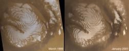
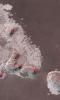
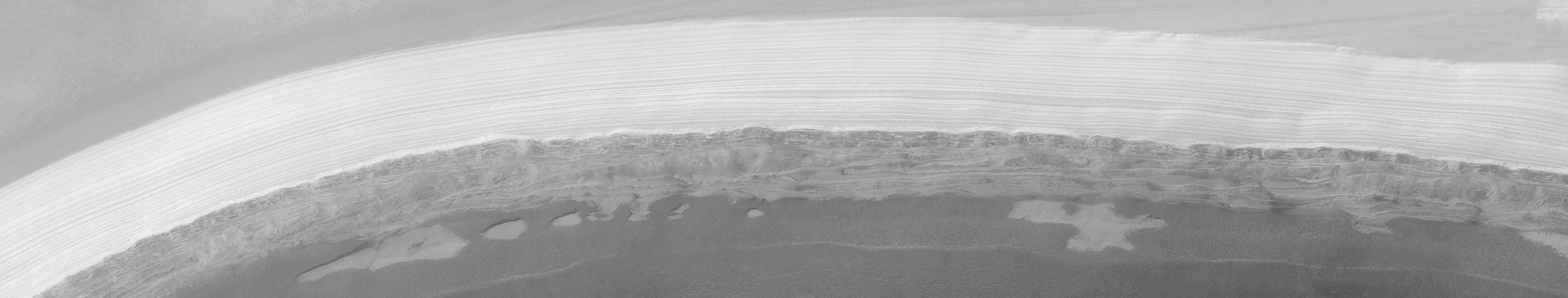
The Martian North Polar Cap in Summer - One Year Later
Full Resolution:
TIFF
(2.124 MB)
JPEG
(80.98 kB)
2001-02-08
Mars
Mars Global Surveyor (MGS)
Mars Orbiter Camera (MOC)
1970x1010x1
PIA03205:
Secrets of the Noachian Highlands: Pit Craters
Full Resolution:
TIFF
(2.092 MB)
JPEG
(399 kB)
2001-02-08
Mars
Mars Global Surveyor (MGS)
Mars Orbiter Camera (MOC)
1469x1327x3
PIA03206:
Winter Frosted Dunes in Kaiser Crater
Full Resolution:
TIFF
(4.536 MB)
JPEG
(245.8 kB)
2001-02-08
Mars
Mars Global Surveyor (MGS)
Mars Orbiter Camera (MOC)
1029x909x1
PIA03207:
The Martian Prime Meridian -- Longitude "Zero"
Full Resolution:
TIFF
(876.3 kB)
JPEG
(181.6 kB)
2001-02-08
Mars
Mars Global Surveyor (MGS)
Mars Orbiter Camera (MOC)
836x2021x1
PIA03208:
"Sharks Teeth" -- Sand Dunes in Proctor Crater
Full Resolution:
TIFF
(1.747 MB)
JPEG
(314.3 kB)
2001-02-08
Mars
Mars Global Surveyor (MGS)
Mars Orbiter Camera (MOC)
1752x3553x3
PIA03209:
Lyot Crater and Northern Deuteronilus Mensae
Full Resolution:
TIFF
(10.9 MB)
JPEG
(512.9 kB)
2001-02-08
Mars
Mars Global Surveyor (MGS)
Mars Orbiter Camera (MOC)
640x917x1
PIA03210:
Strange Surfaces of Hellas Planitia
Full Resolution:
TIFF
(664.2 kB)
JPEG
(171.8 kB)
2001-02-08
Mars
Mars Global Surveyor (MGS)
Mars Orbiter Camera (MOC)
3124x512x1
PIA03211:
Spectacular Layers Exposed in Becquerel Crater
Full Resolution:
TIFF
(1.678 MB)
JPEG
(369.5 kB)
2001-02-21
Mars
Viking
Visual Imaging Subsystem
5072x4499x3
PIA03213:
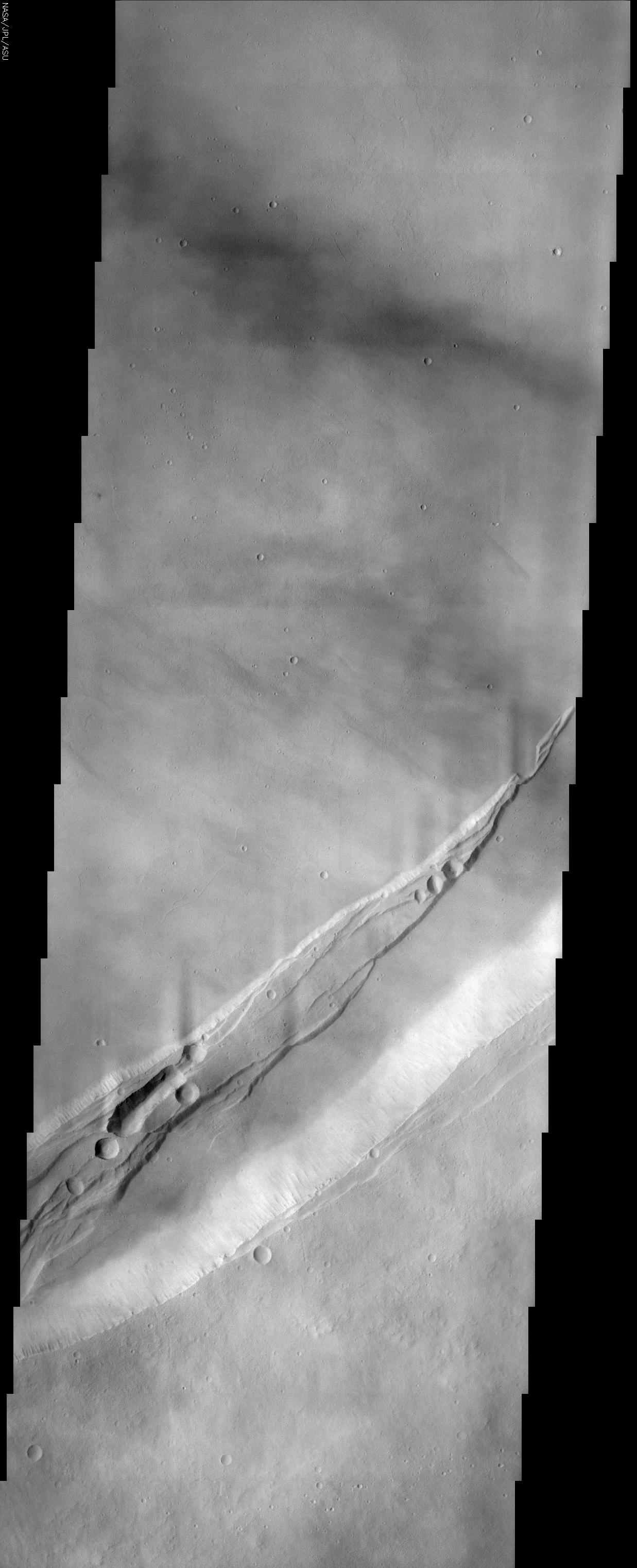
Noctis Labyrinthus
Full Resolution:
TIFF
(81.9 MB)
JPEG
(4.397 MB)
2001-03-27
Mars
2001 Mars Odyssey
Mars Orbiter Camera (MOC)
THEMIS
1440x1080x3
PIA03219:
Still From Odyssey Clip 1
Full Resolution:
TIFF
(997.2 kB)
JPEG
(53.55 kB)
2001-03-27
Mars
2001 Mars Odyssey
Mars Orbiter Camera (MOC)
THEMIS
1440x1080x3
PIA03220:
Still From Odyssey Clip 2
Full Resolution:
TIFF
(1.256 MB)
JPEG
(77.47 kB)
2001-03-27
Mars
2001 Mars Odyssey
Mars Orbiter Camera (MOC)
THEMIS
1440x1080x3
PIA03221:
Still From Odyssey Clip 3
Full Resolution:
TIFF
(977.6 kB)
JPEG
(61.99 kB)
2001-05-24
Mars
Mars Global Surveyor (MGS)
Mars Orbiter Camera (MOC)
1460x1000x3
PIA03222:
Mid-Winter Dust Storms Near Hellas Planitia
Full Resolution:
TIFF
(2.467 MB)
JPEG
(106.9 kB)
2001-05-24
Mars
Mars Global Surveyor (MGS)
Mars Orbiter Camera (MOC)
512x703x1
PIA03223:
A Mid-Summer's Dust Devil
Full Resolution:
TIFF
(386.1 kB)
JPEG
(97.34 kB)
2001-05-24
Mars
Mars Global Surveyor (MGS)
Mars Orbiter Camera (MOC)
907x2547x3
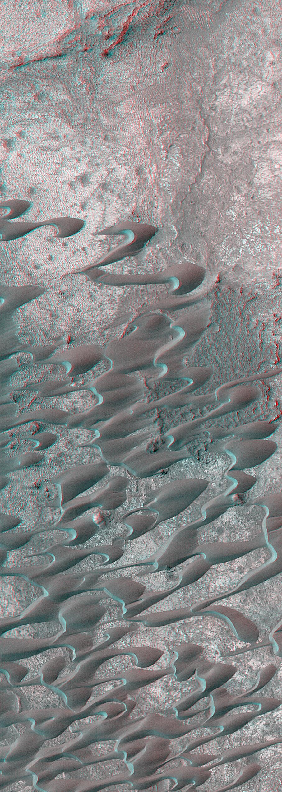
PIA03224:
Sand Dunes of Nili Patera in 3-D
Full Resolution:
TIFF
(7.497 MB)
JPEG
(540.1 kB)
2001-05-24
Mars
Mars Global Surveyor (MGS)
Mars Orbiter Camera (MOC)
2400x2400x1
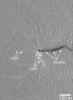
PIA03225:
Highest-Resolution View of "Face on Mars"
Full Resolution:
TIFF
(5.586 MB)
JPEG
(902 kB)
2001-05-24
Mars
Mars Global Surveyor (MGS)
Mars Orbiter Camera (MOC)
1044x1506x1
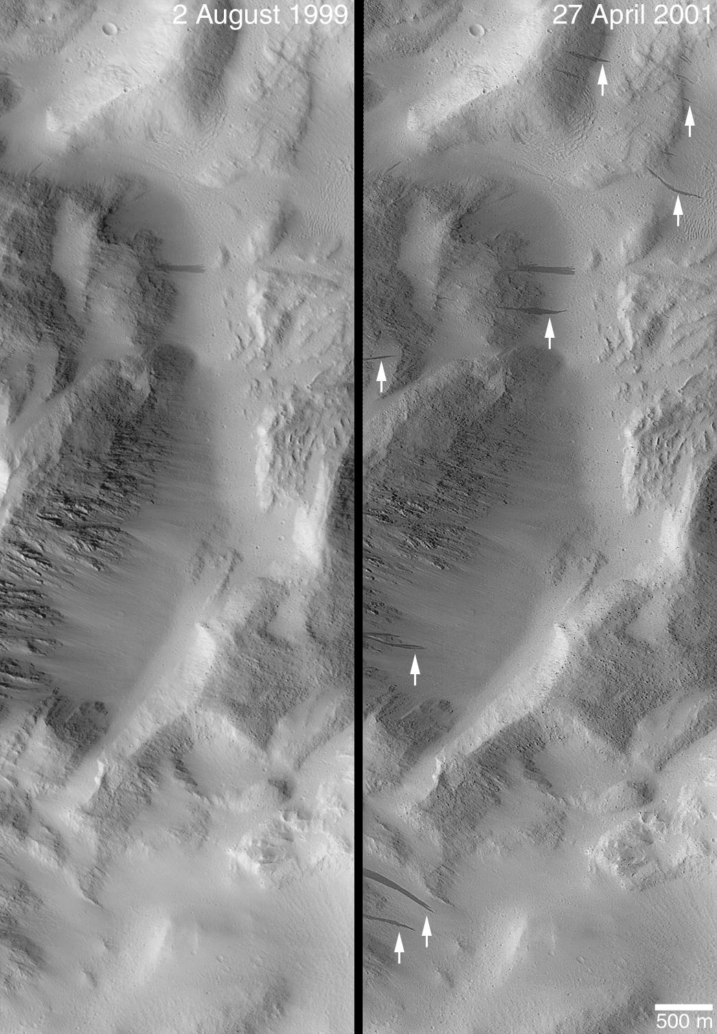
PIA03226:
Changes Over a Martian Year -- New Dark Slope Streaks in Lycus Sucli
Full Resolution:
TIFF
(1.586 MB)
JPEG
(256.2 kB)
2001-06-18
Mars
Mars Global Surveyor (MGS)
Mars Orbiter Camera (MOC)
1505x5404x1
PIA03227:
Defrosting Sand Dunes in Late Southern Winter
Full Resolution:
TIFF
(3.104 MB)
JPEG
(513.9 kB)
2001-06-18
Mars
Mars Global Surveyor (MGS)
Mars Orbiter Camera (MOC)
1537x4156x3
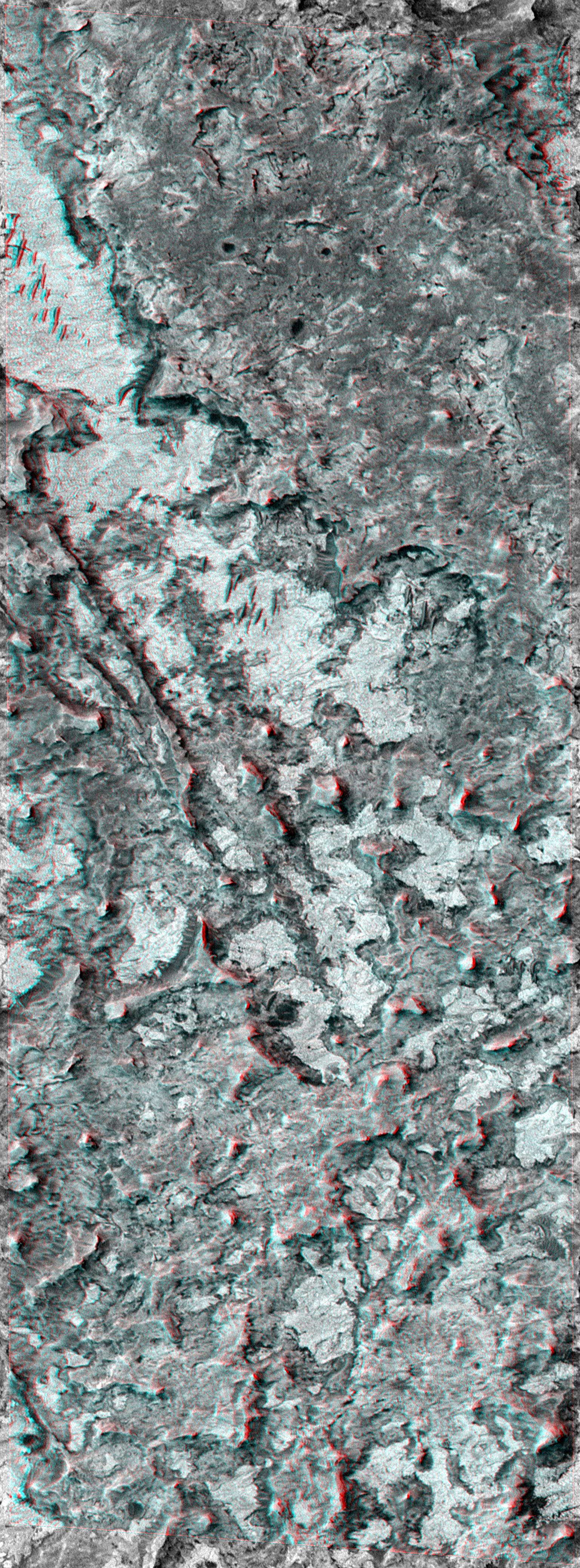
PIA03228:
Northern Terra Meridiani Rocks and Cliffs in 3-D
Full Resolution:
TIFF
(22.26 MB)
JPEG
(1.427 MB)
2001-06-18
Mars
Mars Global Surveyor (MGS)
Mars Orbiter Camera (MOC)
1280x1024x3
PIA03229:
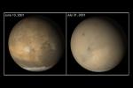
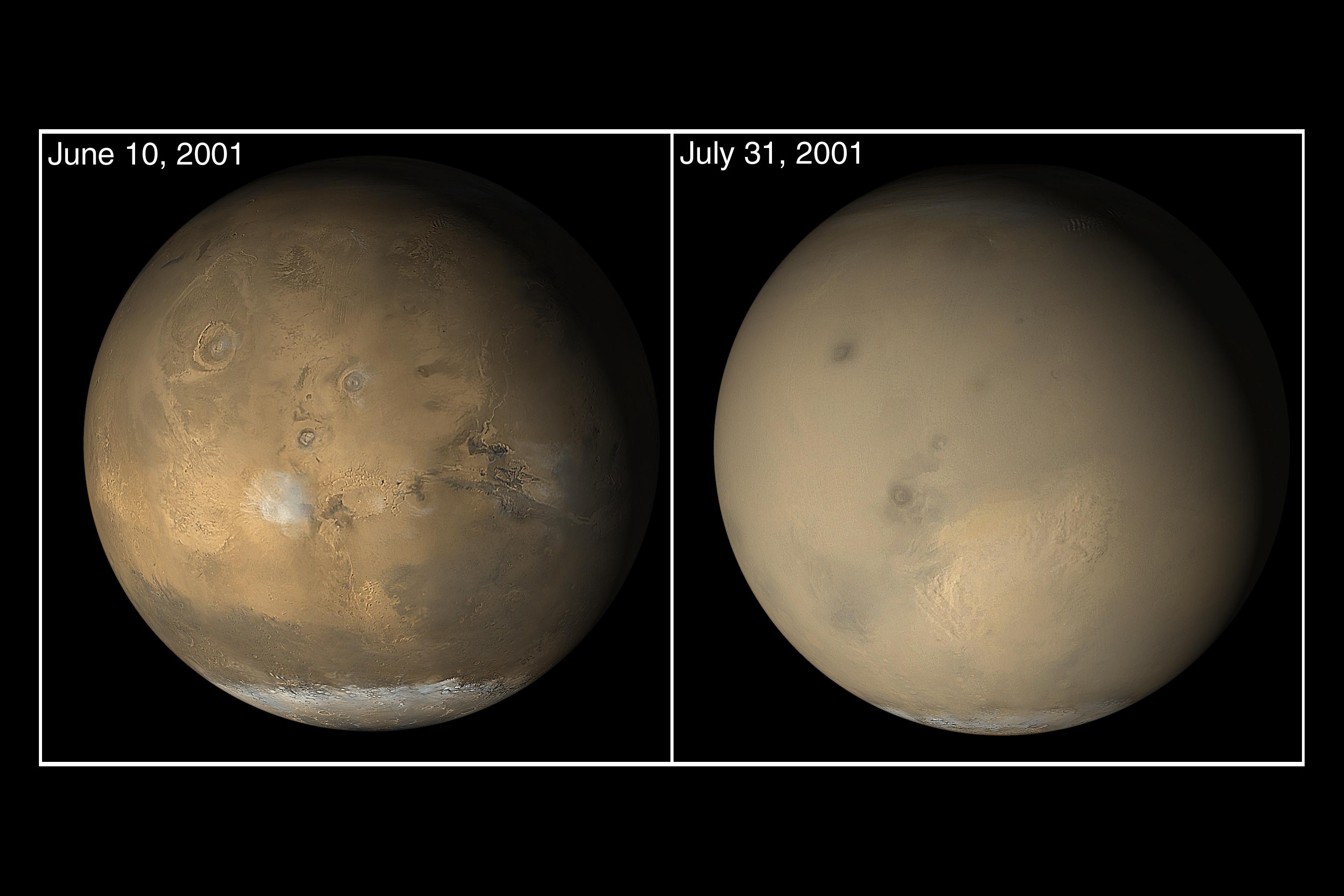
Mars Opposition and Equinox
Full Resolution:
TIFF
(1.553 MB)
JPEG
(73.6 kB)
2022-08-25
Mars
2001 Mars Odyssey
THEMIS
670x1419x1
PIA25479:
Daedalia Planum
Full Resolution:
TIFF
(758.4 kB)
JPEG
(180 kB)
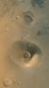
2001-11-09
Mars
2001 Mars Odyssey
THEMIS
1990x2192x3
PIA03459:
First THEMIS Image of Mars
Full Resolution:
TIFF
(3.93 MB)
JPEG
(262.9 kB)
2001-11-13
Mars
2001 Mars Odyssey
THEMIS
3658x2671x3
PIA03461:
First THEMIS Infrared and Visible Images of Mars
Full Resolution:
TIFF
(4.385 MB)
JPEG
(645.9 kB)
2002-02-16
Mars
Mars Global Surveyor (MGS)
Mars Orbiter Camera (MOC)
2000x1288x1
PIA03467:
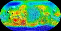
The MGS MOC Wide Angle Map of Mars
Full Resolution:
TIFF
(1.242 MB)
JPEG
(216.9 kB)
2002-02-16
Mars
Mars Global Surveyor (MGS)
Mars Orbiter Camera (MOC)
3911x744x1
PIA03468:
MGS MOC Extended Mission View of North Polar Layers
Full Resolution:
TIFF
(2.44 MB)
JPEG
(343.1 kB)
2002-02-16
Mars
Mars Global Surveyor (MGS)
Mars Orbiter Camera (MOC)
3889x2958x1
PIA03469:
Fresh Impact Crater and Rays in Tharsis
Full Resolution:
TIFF
(7.301 MB)
JPEG
(828.3 kB)
2002-02-16
Mars
Mars Global Surveyor (MGS)
Mars Orbiter Camera (MOC)
838x838x3
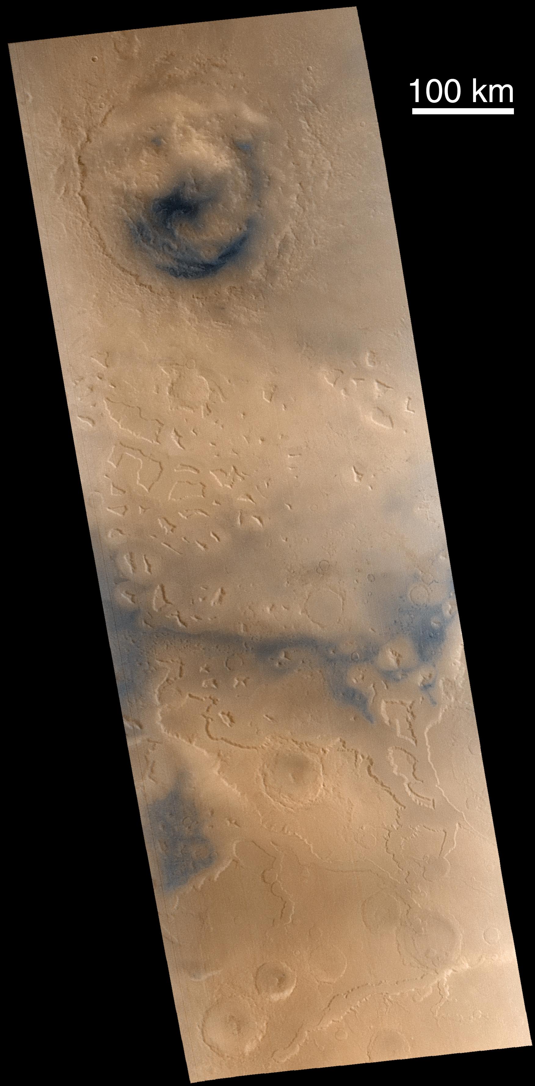
PIA03470:
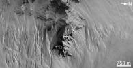
Arsia Mons Spiral Cloud
Full Resolution:
TIFF
(1.393 MB)
JPEG
(36.53 kB)
2002-02-16
Mars
Mars Global Surveyor (MGS)
Mars Orbiter Camera (MOC)
1200x1868x1
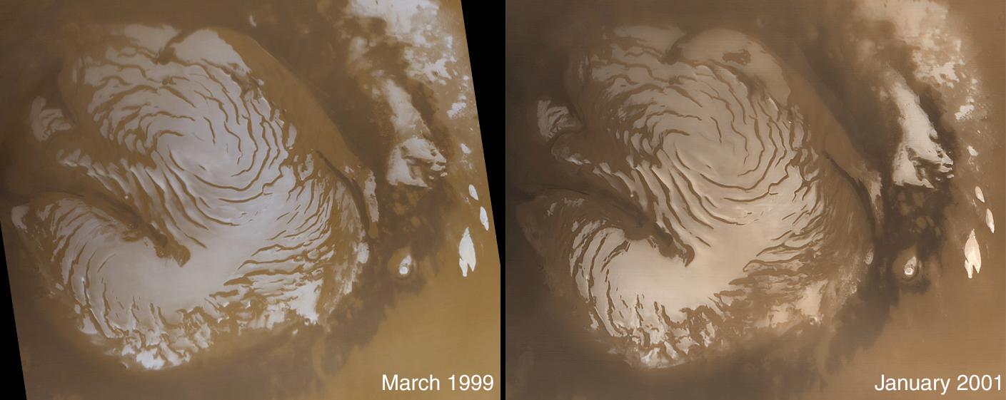
PIA03471:
Changes in South Polar Carbon Dioxide Ice Cap
Full Resolution:
TIFF
(1.796 MB)
JPEG
(306 kB)
2002-02-16
Mars
Mars Global Surveyor (MGS)
Mars Orbiter Camera (MOC)
4377x480x3
PIA03472:
Stereo View of Layer Outcrops in Iani Chaos
Full Resolution:
TIFF
(6.625 MB)
JPEG
(428.8 kB)
2002-03-01
Mars
2001 Mars Odyssey
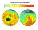
Mars Radiation Experiment
3000x2400x3
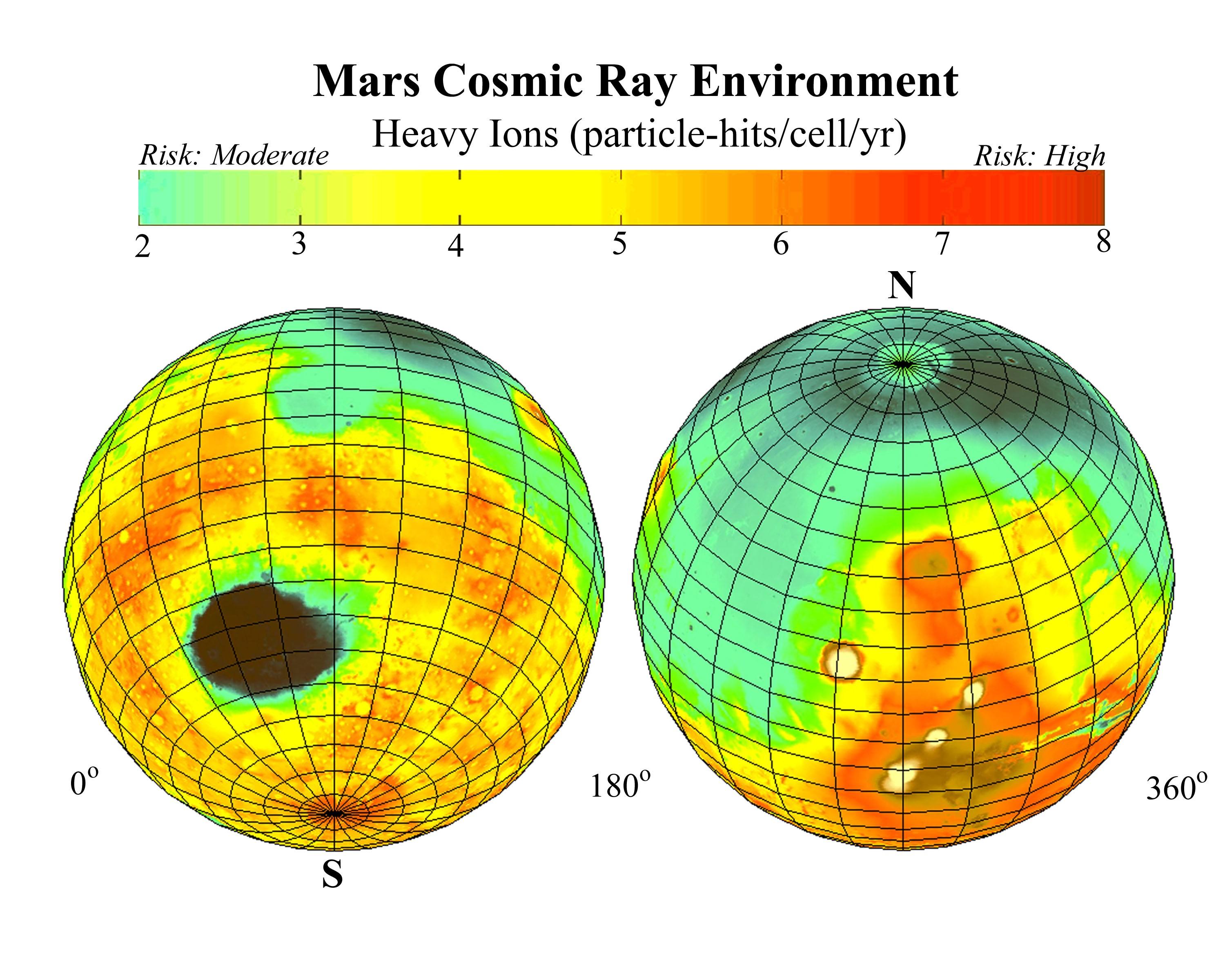
PIA03479:
Estimated Radiation on Mars, Hits per Cell Nucleus
Full Resolution:
TIFF
(9.078 MB)
JPEG
(628.5 kB)
2002-03-01
Mars
2001 Mars Odyssey
Mars Radiation Experiment
3000x2400x3
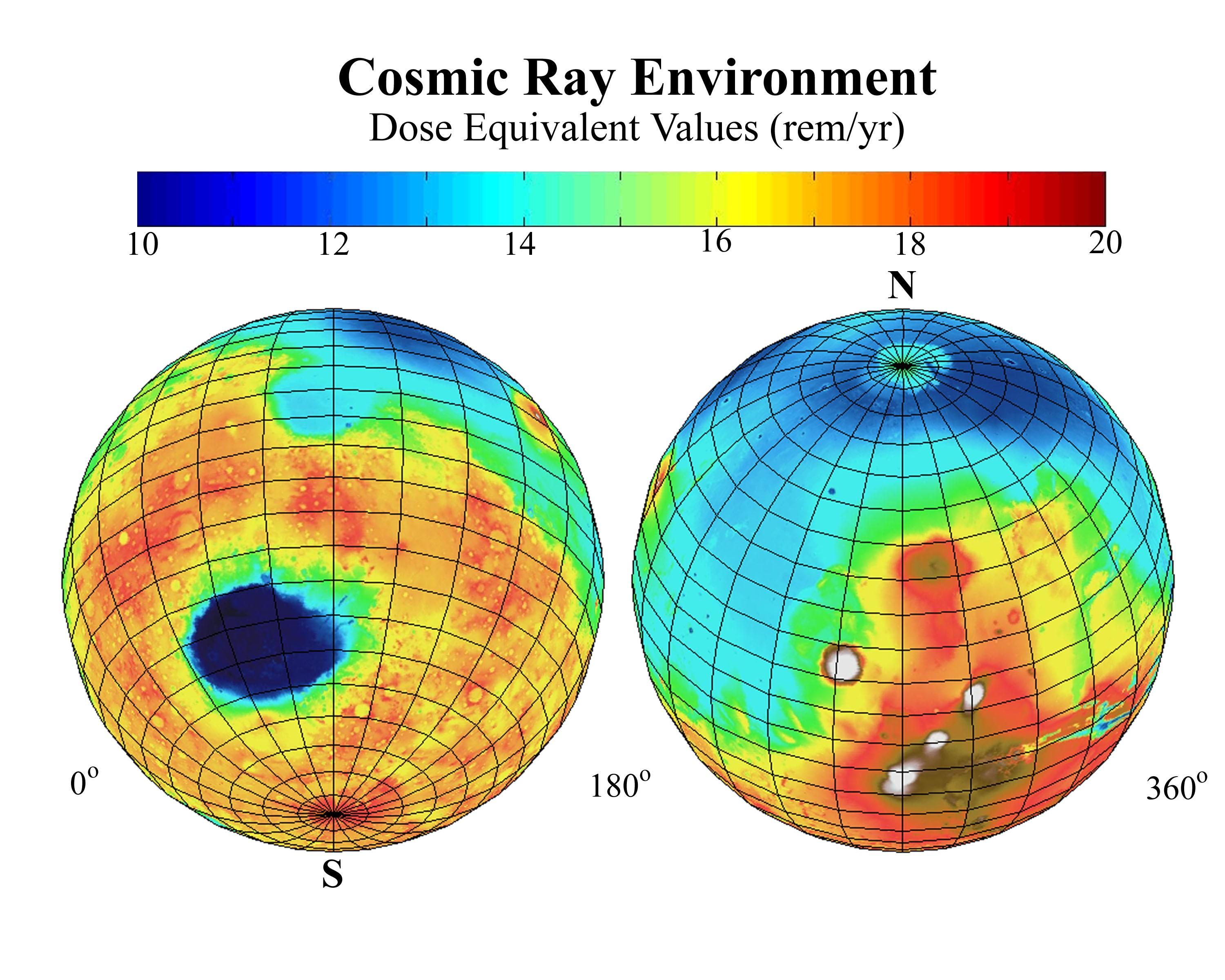
PIA03480:
Estimated Radiation Dosage on Mars
Full Resolution:
TIFF
(10.13 MB)
JPEG
(625.5 kB)
2002-03-05
Mars
2001 Mars Odyssey
THEMIS
952x474x1
PIA03481:
Acheron Fossae in Visible Light
Full Resolution:
TIFF
(391.5 kB)
JPEG
(62.4 kB)
2002-03-01
Mars
2001 Mars Odyssey
THEMIS
697x314x1
PIA03482:
Channel at Night in Thermal Infrared
Full Resolution:
TIFF
(223.6 kB)
JPEG
(54.94 kB)
2002-03-01
Mars
2001 Mars Odyssey
THEMIS
2920x600x1
PIA03483:
Daytime Infrared, Terra Sirenum
Full Resolution:
TIFF
(527.2 kB)
JPEG
(165.6 kB)
2002-03-01
Mars
2001 Mars Odyssey
THEMIS
665x302x3
PIA03484:
Color Infrared, Terra Sirenum
Full Resolution:
TIFF
(780.3 kB)
JPEG
(60.56 kB)
2002-03-01
Mars
2001 Mars Odyssey
THEMIS
1063x320x1
PIA03485:
Hydaspis Chaos in Nighttime Infrared
Full Resolution:
TIFF
(375.6 kB)
JPEG
(65.8 kB)
2002-03-01
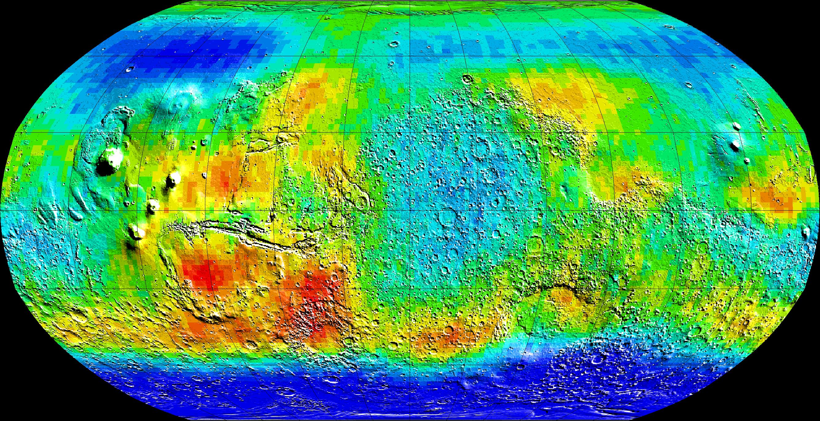
Mars
2001 Mars Odyssey
Gamma Ray Spectrometer Suite
842x595x3
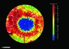
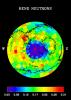
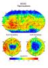
PIA03486:
Global Neutron View
Full Resolution:
TIFF
(579.3 kB)
JPEG
(80.85 kB)
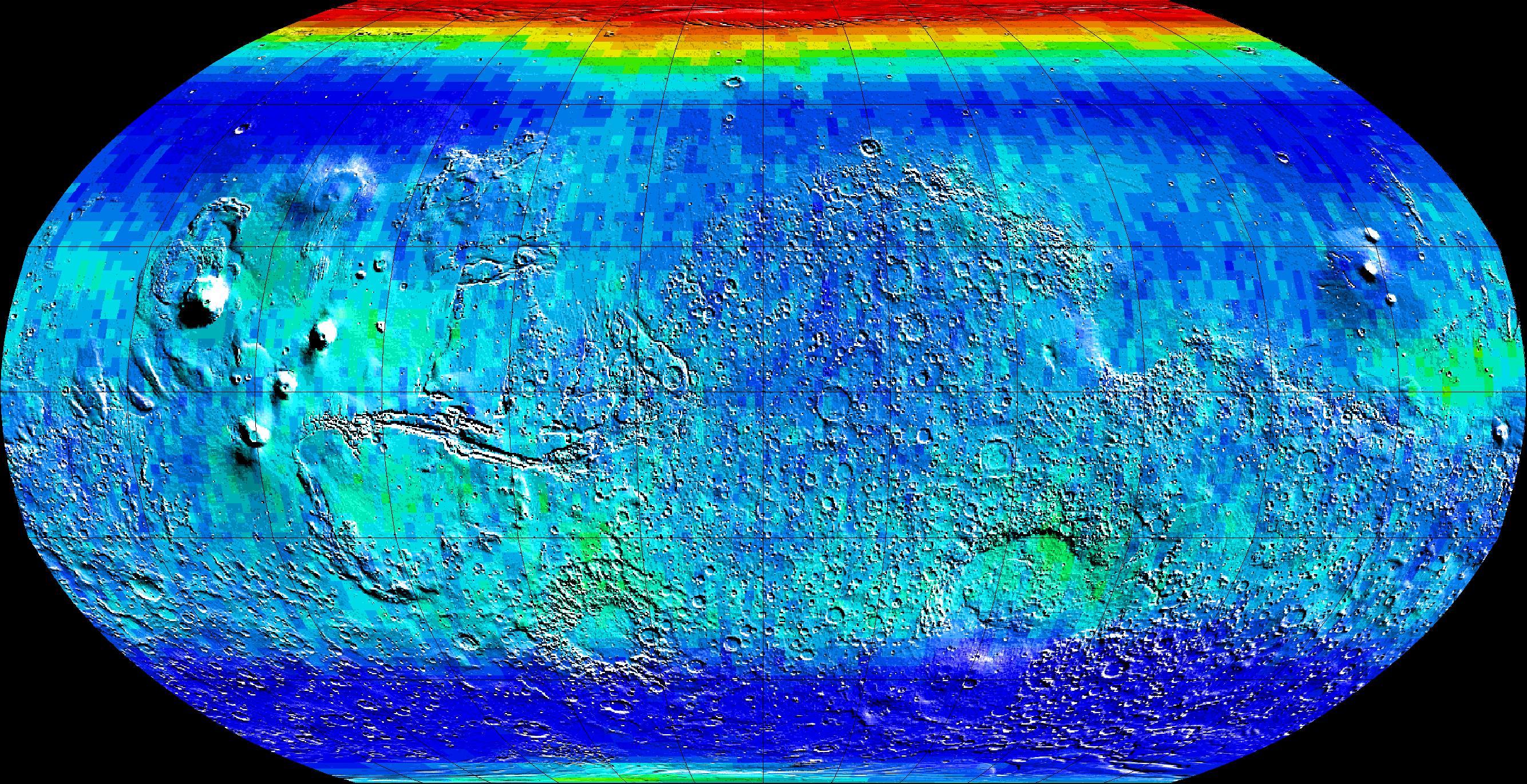
2002-03-01
Mars
2001 Mars Odyssey
Gamma Ray Spectrometer Suite
842x595x3
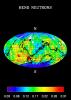
PIA03487:
South Pole Neutron View
Full Resolution:
TIFF
(581.8 kB)
JPEG
(80.74 kB)
2002-03-01
Mars
2001 Mars Odyssey
Gamma Ray Spectrometer Suite
793x1123x3
PIA03488:
Southern Hemisphere Neutron Map
Full Resolution:
TIFF
(90.83 kB)
JPEG
(131.3 kB)
2002-03-06
Mars
2001 Mars Odyssey
Gamma Ray Spectrometer Suite
793x1123x3
PIA03489:
Global Map, High-Energy Neutrons
Full Resolution:
TIFF
(88.48 kB)
JPEG
(141.2 kB)
2002-06-07
Mars
Mars Global Surveyor (MGS)
Mars Orbiter Camera (MOC)
2235x1298x1
PIA03496:
Southern Hemisphere Polygonal Patterned Ground
Full Resolution:
TIFF
(2.906 MB)
JPEG
(915.9 kB)
2003-01-13
Mars
2001 Mars Odyssey
THEMIS
320x1404x1
PIA04085:
IR view of lava flows
Full Resolution:
TIFF
(430.1 kB)
JPEG
(67.28 kB)
2002-04-23
Mars
Mars Global Surveyor (MGS)
Mars Orbiter Camera (MOC)
933x1689x3
PIA03750:
Volcanoes Ceraunius Tholus and Uranius Tholus
Full Resolution:
TIFF
(5.031 MB)
JPEG
(269.5 kB)
2002-04-23
Mars
Mars Global Surveyor (MGS)
Mars Orbiter Camera (MOC)
836x1051x1
PIA03751:
Sand Dunes in Kaiser Crater
Full Resolution:
TIFF
(796.8 kB)
JPEG
(130.2 kB)
2002-04-23
Mars
Mars Global Surveyor (MGS)
Mars Orbiter Camera (MOC)
768x2476x1
PIA03752:
Mesas and troughs in Nilosyrtis region, Mars
Full Resolution:
TIFF
(1.979 MB)
JPEG
(346.3 kB)
2002-04-23
Mars
Mars Global Surveyor (MGS)
Mars Orbiter Camera (MOC)
836x878x1
PIA03753:
Gullies and Streaks on Crater wall Kaiser
Full Resolution:
TIFF
(730.2 kB)
JPEG
(133 kB)
2002-04-23
Mars
Mars Global Surveyor (MGS)
Mars Orbiter Camera (MOC)
1024x1070x1
PIA03754:
Gullies and Layers in Crater Wall in Newton
Full Resolution:
TIFF
(1.134 MB)
JPEG
(227.8 kB)
2002-04-23
Mars
Mars Global Surveyor (MGS)
Mars Orbiter Camera (MOC)
2560x1024x3
PIA03755:
Global Views of Mars in late Northern Summer
Full Resolution:
TIFF
(2.993 MB)
JPEG
(129.4 kB)
2002-04-25
Mars
2001 Mars Odyssey
THEMIS
1212x3061x1
PIA03756:
Nirgal Vallis (Released 27 March 2002)
Full Resolution:
TIFF
(1.766 MB)
JPEG
(501.7 kB)
2002-05-21
Mars
2001 Mars Odyssey
THEMIS
1183x3061x1
PIA03757:
Gullied Craters 41�S
Full Resolution:
TIFF
(1.722 MB)
JPEG
(400.2 kB)
2002-05-21
Mars
2001 Mars Odyssey
THEMIS
1238x3043x1
PIA03758:
Layered Deposits on the floor of Ganges Chasma
Full Resolution:
TIFF
(1.774 MB)
JPEG
(456.8 kB)
2002-05-21
Mars
2001 Mars Odyssey
THEMIS
1237x3043x1
PIA03759:
Ganges Chasma Landslide
Full Resolution:
TIFF
(1.716 MB)
JPEG
(465.6 kB)
2002-05-21
Mars
2001 Mars Odyssey
THEMIS
1235x3025x1
PIA03760:
Rim of Henry Crater
Full Resolution:
TIFF
(1.495 MB)
JPEG
(322.6 kB)
2002-05-21
Mars
2001 Mars Odyssey
THEMIS
1236x3025x1
PIA03761:
Isidis Rim
Full Resolution:
TIFF
(2.351 MB)
JPEG
(567.3 kB)
2002-05-21
Mars
2001 Mars Odyssey
THEMIS
1240x3043x1
PIA03762:
Naktong Valles
Full Resolution:
TIFF
(1.8 MB)
JPEG
(496.3 kB)
2002-05-21
Mars
2001 Mars Odyssey
THEMIS
1228x3025x1
PIA03763:
Olympus Mons Lava Flows
Full Resolution:
TIFF
(1.84 MB)
JPEG
(623.5 kB)
2002-05-21
Mars
2001 Mars Odyssey
THEMIS
1189x3061x1
PIA03764:
Gorgonum Chaos
Full Resolution:
TIFF
(1.874 MB)
JPEG
(519.7 kB)
2002-05-21
Mars
2001 Mars Odyssey
THEMIS
1210x3061x1
PIA03765:
Uzboi Vallis, Nirgal Vallis, and Luki Crater
Full Resolution:
TIFF
(1.812 MB)
JPEG
(449.6 kB)
2002-05-21
Mars
2001 Mars Odyssey
THEMIS
1238x3043x1
PIA03766:
Medusae Fossae Formation
Full Resolution:
TIFF
(1.771 MB)
JPEG
(473.2 kB)
2002-05-21
Mars
2001 Mars Odyssey
THEMIS
1239x3043x1
PIA03767:
Southern rim of Isidis Planitia basin
Full Resolution:
TIFF
(1.499 MB)
JPEG
(306.7 kB)
2002-05-21
Mars
2001 Mars Odyssey
THEMIS
967x2738x1
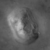
PIA03768:
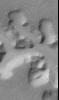
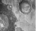
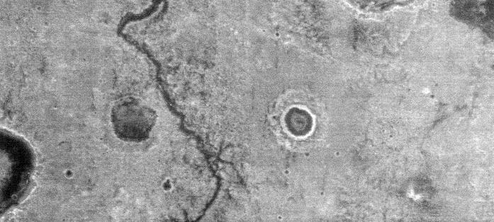
The So-Called "Face on Mars"
Full Resolution:
TIFF
(2.651 MB)
JPEG
(266.6 kB)
2002-05-21
Mars
2001 Mars Odyssey
THEMIS
1217x3061x1
PIA03769:
Eastern Floor of Holden Crater
Full Resolution:
TIFF
(1.993 MB)
JPEG
(482.5 kB)
2002-05-21
Mars
2001 Mars Odyssey
THEMIS
1235x3079x1
PIA03770:
Medusae Fossae Formation
Full Resolution:
TIFF
(2.158 MB)
JPEG
(725.6 kB)
2002-05-21
Mars
2001 Mars Odyssey
THEMIS
1215x3061x1
PIA03771:
Holden Crater/Uzboi Valles
Full Resolution:
TIFF
(1.853 MB)
JPEG
(472.2 kB)
2002-05-21
Mars
2001 Mars Odyssey
THEMIS
1201x3043x1
PIA03772:
Bosporus Planum
Full Resolution:
TIFF
(1.78 MB)
JPEG
(526.2 kB)
2002-05-21
Mars
2001 Mars Odyssey
THEMIS
1238x3133x1
PIA03773:
White Rock
Full Resolution:
TIFF
(1.416 MB)
JPEG
(326.6 kB)
2002-05-21
Mars
2001 Mars Odyssey
THEMIS
1163x2809x1
PIA03774:
Alba Patera
Full Resolution:
TIFF
(1.249 MB)
JPEG
(390.9 kB)
2002-05-21
Mars
2001 Mars Odyssey
THEMIS
1154x2989x1
PIA03775:
A Cloudy Day on Mars
Full Resolution:
TIFF
(1.825 MB)
JPEG
(591.9 kB)
2002-05-21
Mars
2001 Mars Odyssey
THEMIS
1233x3025x1
PIA03776:
Cerberus
Full Resolution:
TIFF
(1.795 MB)
JPEG
(503.7 kB)
2002-05-07
Mars
Mars Global Surveyor (MGS)
Mars Orbiter Camera (MOC)
549x2174x1
PIA03777:
Erosion of North Polar Layers and Genesis of nearby Sand Dunes
Full Resolution:
TIFF
(996.6 kB)
JPEG
(135.8 kB)
2002-05-07
Mars
Mars Global Surveyor (MGS)
Mars Orbiter Camera (MOC)
1359x2266x3
PIA03778:
Northern Terra Meridiani's "Monument Valley"
Full Resolution:
TIFF
(8.969 MB)
JPEG
(467.3 kB)
2002-05-07
Mars
Mars Global Surveyor (MGS)
Mars Orbiter Camera (MOC)
836x1441x1
PIA03779:
Nirgal Vallis and its Windblown Dunes
Full Resolution:
TIFF
(1.199 MB)
JPEG
(215.2 kB)
2002-05-07
Mars
Mars Global Surveyor (MGS)
Mars Orbiter Camera (MOC)
3005x2004x3
PIA03780:
Nirgal Vallis and its Windblown Dunes
Full Resolution:
TIFF
(8.546 MB)
JPEG
(373.6 kB)
2002-05-23
Mars
2001 Mars Odyssey
THEMIS
1172x2791x1
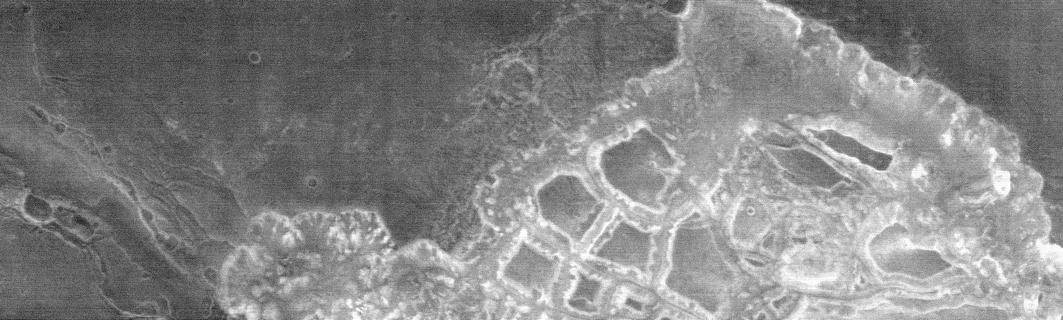
PIA03782:
Knobby Terrain in Northern Arabia Terra
Full Resolution:
TIFF
(1.532 MB)
JPEG
(451.6 kB)
2002-05-23
Mars
2001 Mars Odyssey
THEMIS
1238x3043x1
PIA03783:
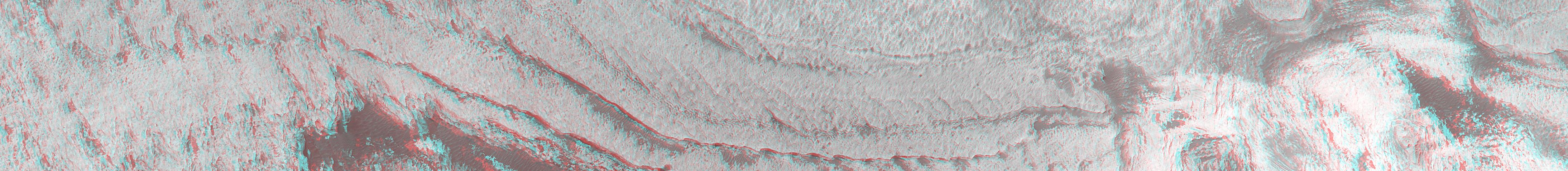
Noctis Labyrinthus
Full Resolution:
TIFF
(1.263 MB)
JPEG
(270.1 kB)
2002-05-23
Mars
2001 Mars Odyssey
THEMIS
1237x3151x1
PIA03784:
Crustal Fractures of Ophir Planum
Full Resolution:
TIFF
(1.52 MB)
JPEG
(298.5 kB)
2002-05-23
Mars
2001 Mars Odyssey
THEMIS
1235x3043x1
PIA03785:
Cratered terrain in Terra Meridiani
Full Resolution:
TIFF
(1.725 MB)
JPEG
(384.2 kB)
2002-05-23
Mars
2001 Mars Odyssey
THEMIS
1235x3025x1
PIA03786:
Syrtis Major
Full Resolution:
TIFF
(1.73 MB)
JPEG
(469.6 kB)
2002-05-23
Mars
2001 Mars Odyssey
THEMIS
1160x2989x1
PIA03787:
Clouds in the Northern Tempe Terra
Full Resolution:
TIFF
(1.407 MB)
JPEG
(329.4 kB)
2002-05-23
Mars
2001 Mars Odyssey
THEMIS
1236x3025x1
PIA03788:
Degraded Crater Rim
Full Resolution:
TIFF
(1.696 MB)
JPEG
(380.5 kB)
2002-05-23
Mars
2001 Mars Odyssey
THEMIS
1231x2935x1
PIA03789:
Cerberus Wind Streaks
Full Resolution:
TIFF
(1.711 MB)
JPEG
(420.1 kB)
2002-05-23
Mars
2001 Mars Odyssey
THEMIS
1240x3169x1
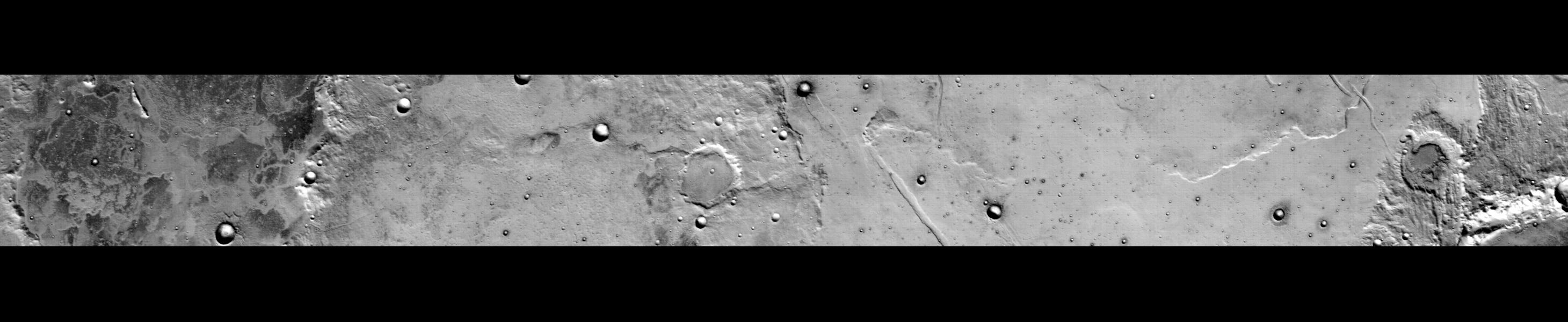
PIA03790:
Pavonis Mons
Full Resolution:
TIFF
(1.237 MB)
JPEG
(269 kB)
2002-05-24
Mars
2001 Mars Odyssey
THEMIS
1157x3079x1
PIA03791:
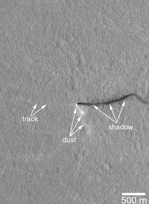
Dust Devil Tracks
Full Resolution:
TIFF
(1.943 MB)
JPEG
(627.8 kB)
2002-06-05
Mars
2001 Mars Odyssey
THEMIS
1205x3007x1
PIA03792:
Kasei Valles
Full Resolution:
TIFF
(1.239 MB)
JPEG
(294.5 kB)
2002-06-04
Mars
2001 Mars Odyssey
THEMIS
1233x2989x1
PIA03793:
Wrinkle Ridges and Young Fresh Crater
Full Resolution:
TIFF
(1.237 MB)
JPEG
(351.4 kB)
2002-06-04
Mars
2001 Mars Odyssey
THEMIS
1237x3043x1
PIA03794:
Reuyl Crater Dust Avalanches
Full Resolution:
TIFF
(1.696 MB)
JPEG
(346.3 kB)
2002-06-04
Mars
2001 Mars Odyssey
THEMIS
1157x2989x1
PIA03795:
Water Ice Clouds over the Northern Plains
Full Resolution:
TIFF
(1.835 MB)
JPEG
(580.7 kB)
2002-06-04
Mars
2001 Mars Odyssey
THEMIS
1189x3007x1
PIA03796:
Utopia Planitia
Full Resolution:
TIFF
(1.833 MB)
JPEG
(534.5 kB)
2002-06-04
Mars
2001 Mars Odyssey
THEMIS
1236x3097x1
PIA03797:
Hesperia Planum
Full Resolution:
TIFF
(2.142 MB)
JPEG
(678.1 kB)
2002-06-04
Mars
2001 Mars Odyssey
THEMIS
1207x3061x1
PIA03798:
Hadriaca Patera
Full Resolution:
TIFF
(1.952 MB)
JPEG
(582 kB)
2002-06-04
Mars
2001 Mars Odyssey
THEMIS
1237x3043x1
PIA03799:
Arsia Mons
Full Resolution:
TIFF
(1.591 MB)
JPEG
(345.1 kB)
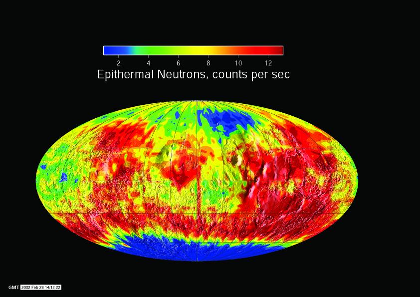
2002-05-28
Mars
2001 Mars Odyssey
Gamma Ray Spectrometer Suite
2668x1371x3
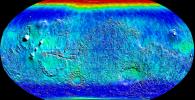
PIA03800:
Global Map of Epithermal Neutrons
Full Resolution:
TIFF
(1.268 MB)
JPEG
(1.292 MB)
2002-05-28
Mars
2001 Mars Odyssey
Gamma Ray Spectrometer Suite
2668x1371x3
PIA03801:
Global Map of Thermal Neutrons
Full Resolution:
TIFF
(1.161 MB)
JPEG
(1.242 MB)
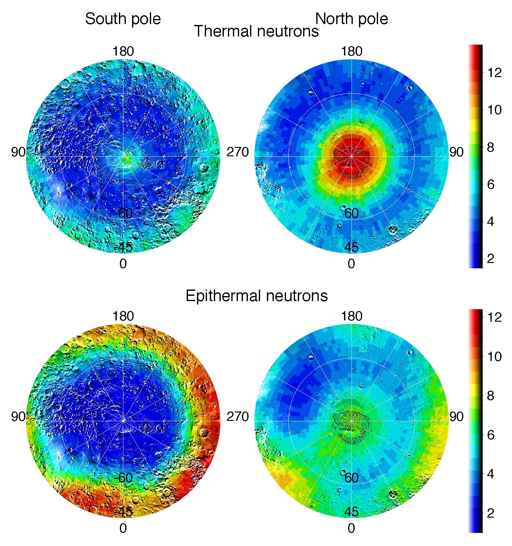
2002-05-28
Mars
2001 Mars Odyssey
Gamma Ray Spectrometer Suite
1640x1750x3
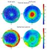
PIA03802:
Polar Maps of Thermal and Epithermal Neutrons
Full Resolution:
TIFF
(633.3 kB)
JPEG
(586 kB)
2002-05-28
Mars
2001 Mars Odyssey
Gamma Ray Spectrometer Suite
1764x1068x3
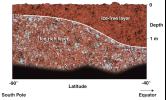
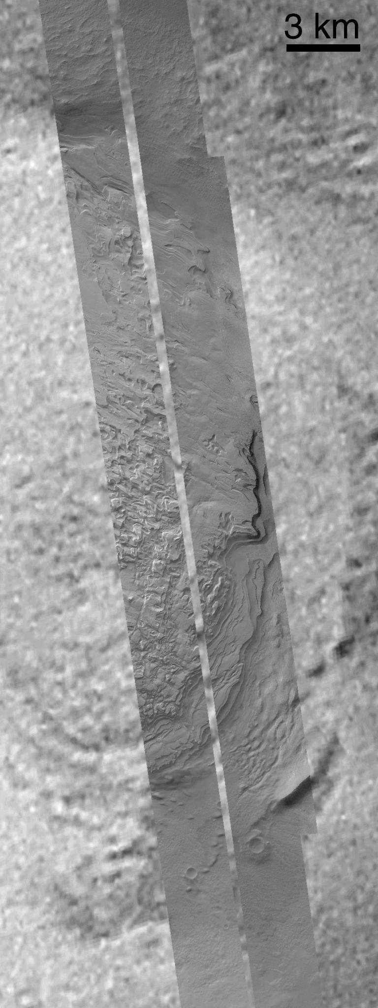
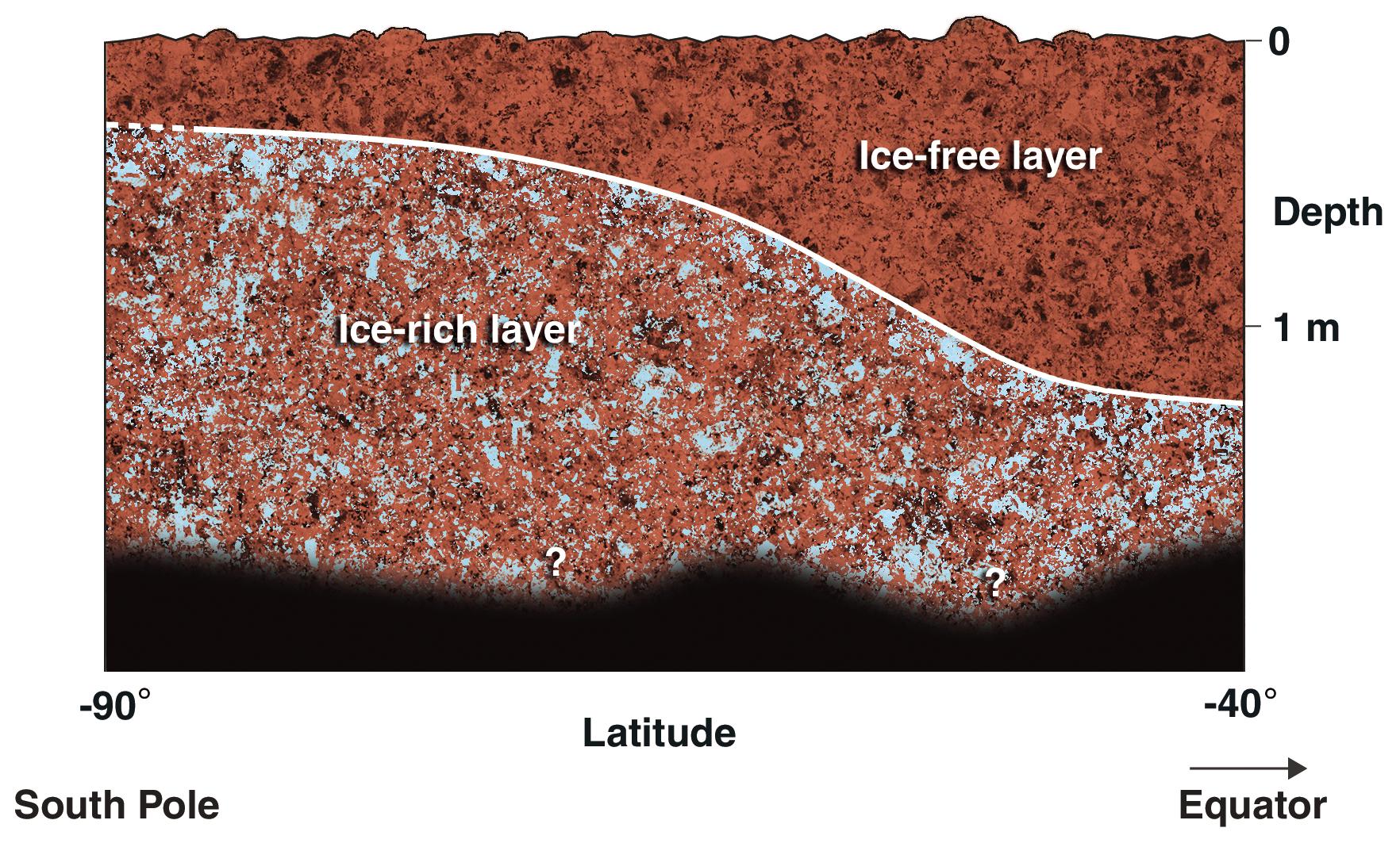
PIA03803:
Cross-Section of Icy Soil
Full Resolution:
TIFF
(2.723 MB)
JPEG
(421.9 kB)
2002-05-28
Mars
2001 Mars Odyssey
Gamma Ray Spectrometer Suite
5300x6450x3
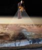
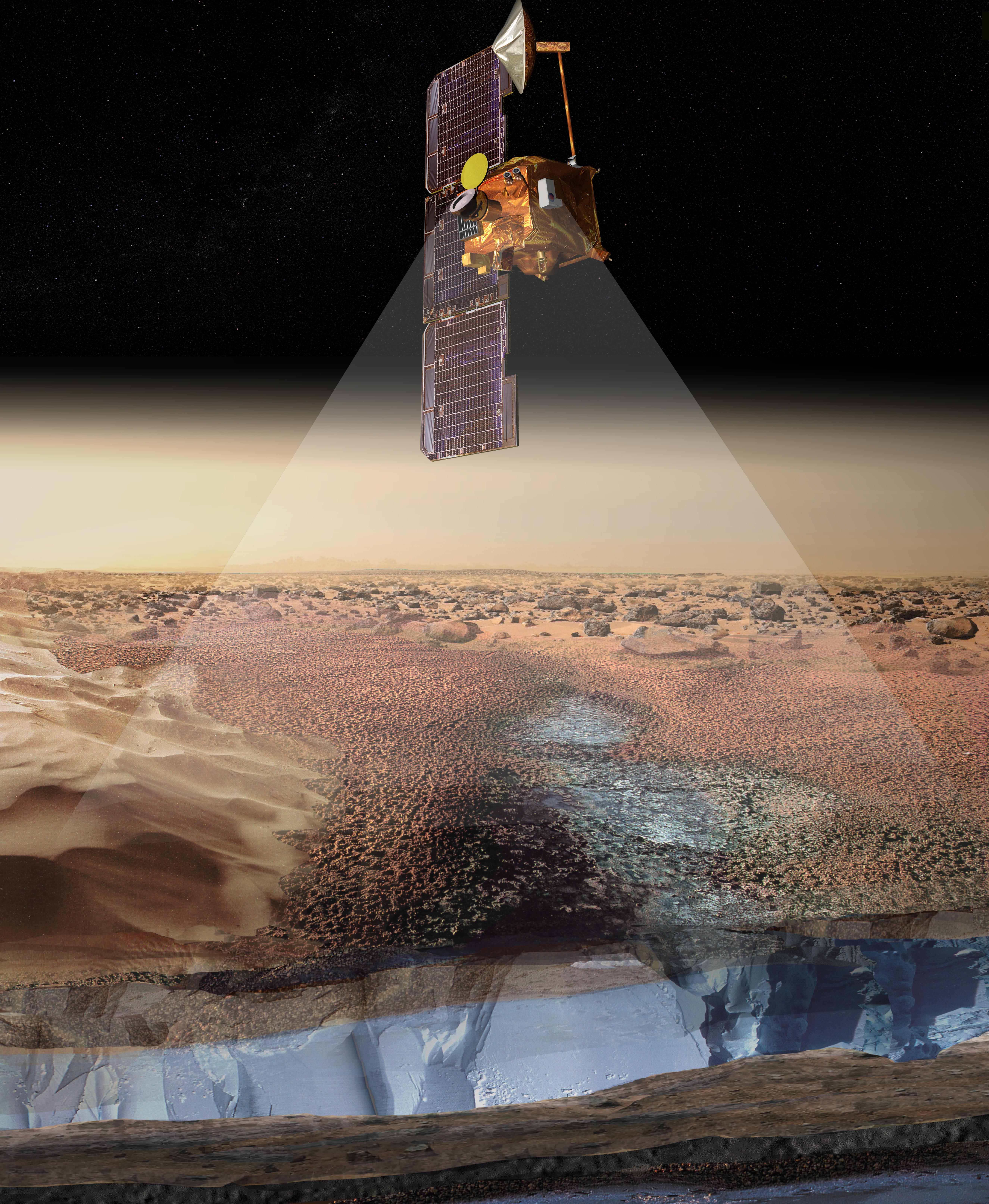
PIA03804:
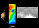
Artist's View of Odyssey Detecting Ice (Artist Concept)
Full Resolution:
TIFF
(72.28 MB)
JPEG
(3.86 MB)
2002-05-29
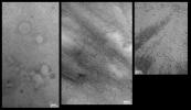
Mars
2001 Mars Odyssey
THEMIS
289x1751x3
PIA03805:
Surface Composition Differences in Martian Canyon
Full Resolution:
TIFF
(1.88 MB)
JPEG
(130.1 kB)
2002-05-29
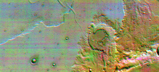
Mars
2001 Mars Odyssey
THEMIS
1611x1384x1
PIA03806:
Mars Surface Layers in Infrared
Full Resolution:
TIFF
(1.667 MB)
JPEG
(285.5 kB)
2002-05-30
Mars
2001 Mars Odyssey
Gamma Ray Spectrometer Suite
1785x2532x3
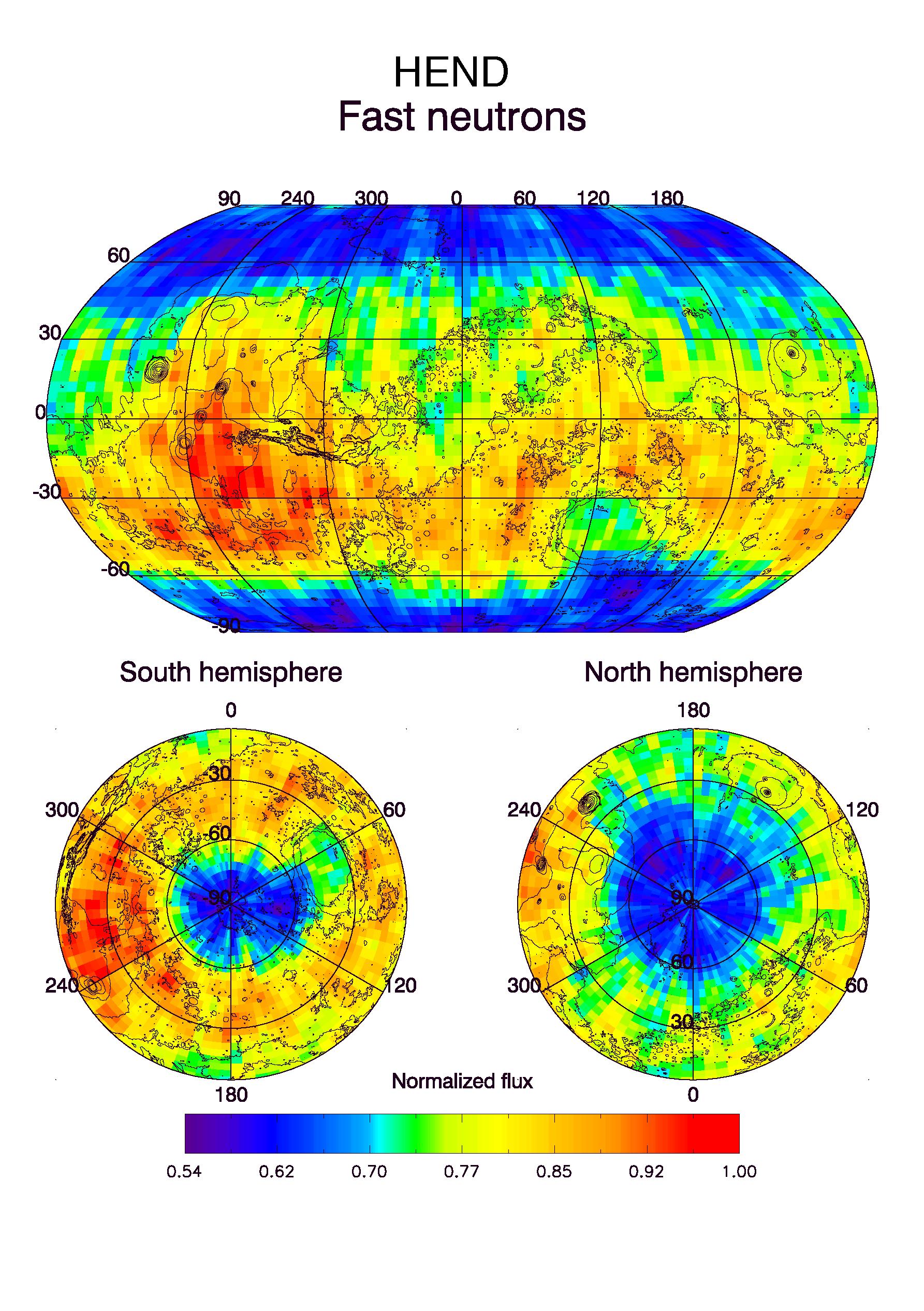
PIA03807:
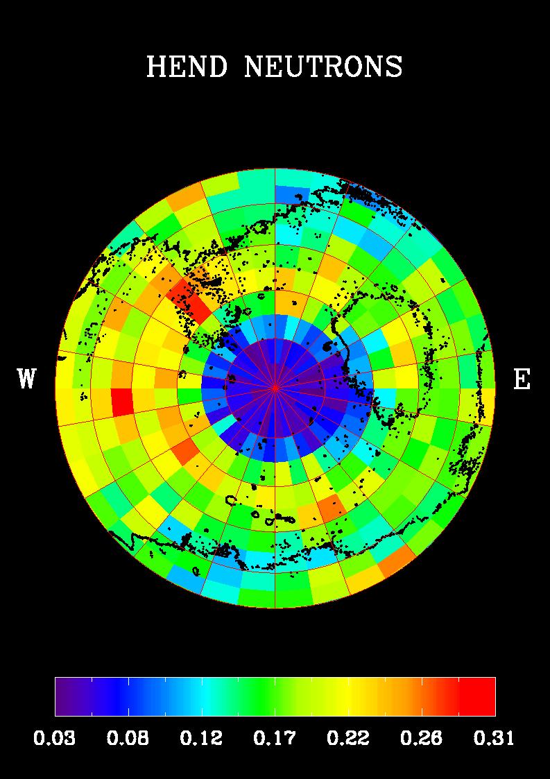
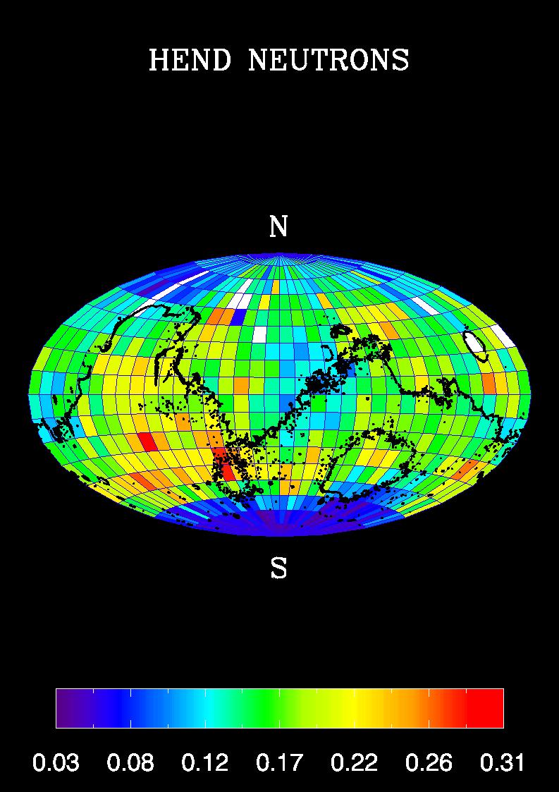
HEND Maps of Fast Neutrons
Full Resolution:
TIFF
(600.3 kB)
JPEG
(770.9 kB)
1-100
101-200
201-300
301-400
401-500
501-600
601-700
701-800
801-900
901-1000
Currently displaying images:
901 - 1000
of 12731


