Your search criteria found
752
images
Target is Mars (and available satellites)
Go to PIAxxxxx:
Refine this list of images by:
Target:
Deimos
Mars
Phobos
Mission:
Mars Reconnaissance Orbiter (MRO)
Mars Science Laboratory (MSL)
Instrument:
Alpha Particle X-ray Spectrometer
Alpha Particle X-ray Spectrometer (MSL)
CHIMRA
Chemistry & Mineralogy (CheMin)
Chemistry and Camera (ChemCam)
Context Camera (CTX)
Dynamic Albedo of Neutrons
Dynamic Albedo of Neutrons (DAN)
Hazard Avoidance Camera (MSL)
High Resolution Imaging Science Experiment (HiRISE)
Mars Color Imager (MARCI)
Mars Descent Imager
Mars Hand Lens Imager (MAHLI)
Mars Orbiter Laser Altimeter
Mastcam
Mastcam-Z
Navigation Camera
Navigation Camera (M2020)
Navigation Camera (MSL)
Panoramic Camera
Radiation Assessment Detector (RAD)
Robotic Arm (MSL)
Rover Environmental Monitoring Station (REMS)
Sample Analysis at Mars (SAM)
Thermal Emission Imaging System
Click on an image for detailed information
Click on a column heading to sort in ascending or descending order
My
List
Addition Date
Target
Mission
Instrument
Size
2012-08-07
Mars
Mars Science Laboratory (MSL)
1022x767x1
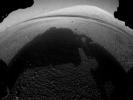
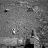
PIA15994:
Curiosity's Early Views of Mars
Full Resolution:
TIFF
(784.9 kB)
JPEG
(93.72 kB)
2012-08-08
Mars
Mars Science Laboratory (MSL)
1024x1024x1
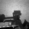
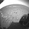
PIA16010:
Curiosity Looks Away from the Sun
Full Resolution:
TIFF
(1.05 MB)
JPEG
(178.1 kB)
2012-08-08
Mars
Mars Science Laboratory (MSL)
7703x983x1
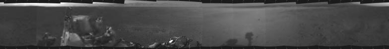
PIA16011:
Curiosity Takes It All In
Full Resolution:
TIFF
(7.58 MB)
JPEG
(299 kB)
2012-08-08
Mars
Mars Science Laboratory (MSL)
4131x4131x1
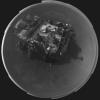
PIA16012:
Rover's Self Portrait
Full Resolution:
TIFF
(17.1 MB)
JPEG
(525.4 kB)
2012-08-08
Mars
Mars Science Laboratory (MSL)
1775x983x1
PIA16013:
Curiosity's New Home
Full Resolution:
TIFF
(1.747 MB)
JPEG
(249.5 kB)
2012-08-08
Mars
Mars Science Laboratory (MSL)
1280x720x1
PIA16025:
Rocket Thrusters Expose Bedrock
Full Resolution:
TIFF
(922.8 kB)
JPEG
(111.5 kB)
2012-08-09
Mars
Mars Science Laboratory (MSL)
7703x1671x1
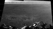
PIA16026:
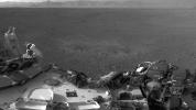
Crisp View from Inside Gale Crater
Full Resolution:
TIFF
(12.89 MB)
JPEG
(1.196 MB)
2012-08-09
Mars
Mars Science Laboratory (MSL)
1024x1024x1
PIA16028:
A Clear Look at the Rover Deck
Full Resolution:
TIFF
(1.05 MB)
JPEG
(114.9 kB)
2012-08-10
Mars
Mars Science Laboratory (MSL)
1280x720x1
PIA16040:
Traces of Landing
Full Resolution:
TIFF
(922.8 kB)
JPEG
(115.5 kB)
2012-08-10
Mars
Mars Science Laboratory (MSL)
963x720x1
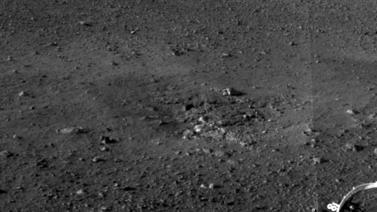
PIA16023:
Inspecting Curiosity's Descent Stage Crash Site
Full Resolution:
TIFF
(694.3 kB)
JPEG
(57.85 kB)
2012-08-10
Mars
Mars Science Laboratory (MSL)
876x718x3
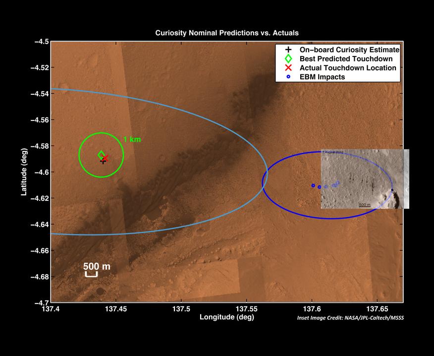
PIA16038:
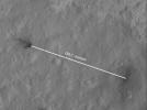
Zeroing in on Rover's Landing Site
Full Resolution:
TIFF
(1.888 MB)
JPEG
(72.4 kB)
2012-08-10
Mars
Mars Science Laboratory (MSL)
1861x1024x1
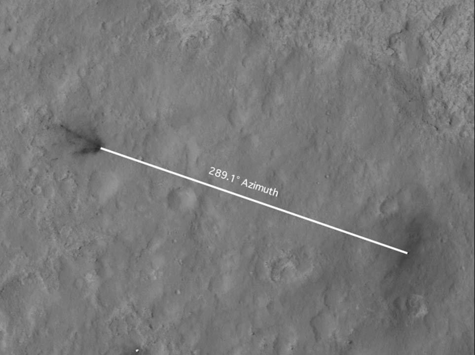
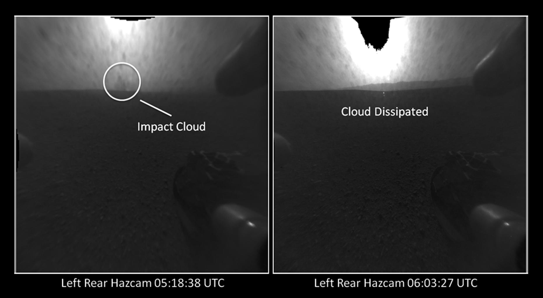
PIA16042:
Witnessing the Descent Stage Crash?
Full Resolution:
TIFF
(1.908 MB)
JPEG
(88.74 kB)
2012-08-17
Mars
Mars Science Laboratory (MSL)
4061x4061x1
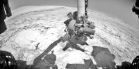
PIA16062:
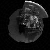
Bird's Eye View of Curiosity
Full Resolution:
TIFF
(16.51 MB)
JPEG
(1.219 MB)
2012-08-17
Mars
Mars Science Laboratory (MSL)
2000x720x3
PIA16066:
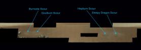
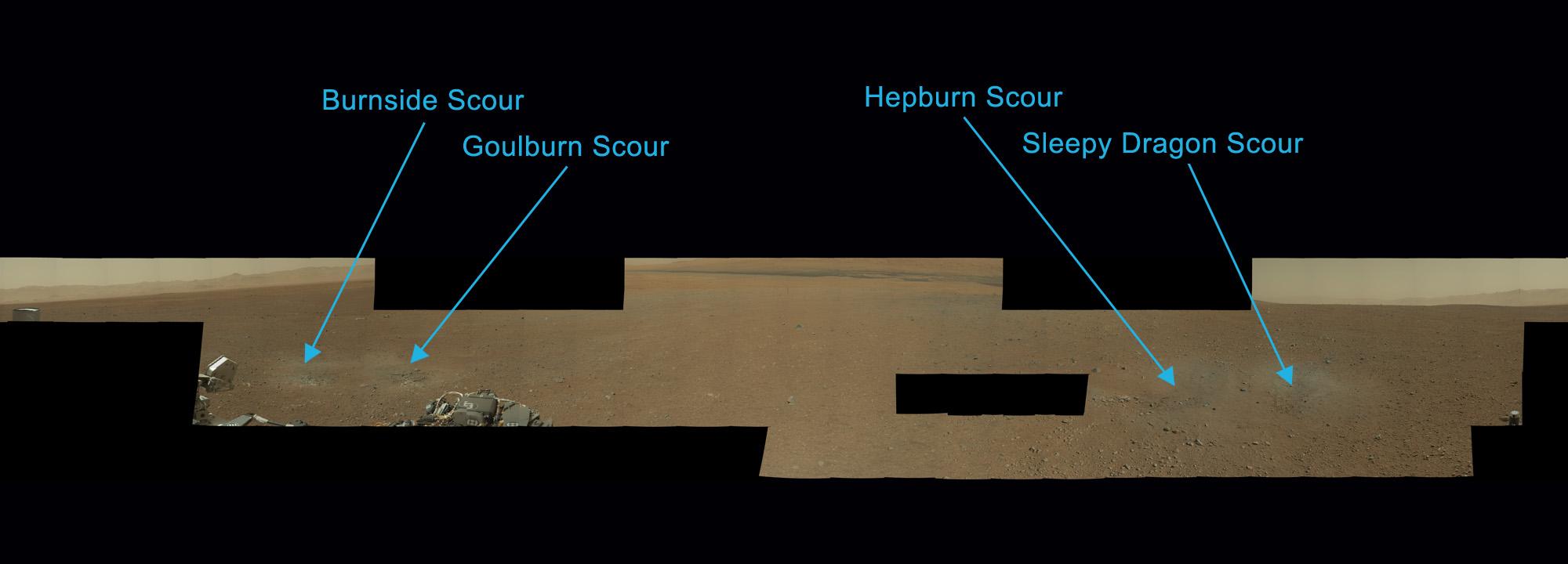
Naming the Scour Marks
Full Resolution:
TIFF
(4.322 MB)
JPEG
(84.68 kB)
2012-08-17
Mars
Mars Science Laboratory (MSL)
1536x1028x3
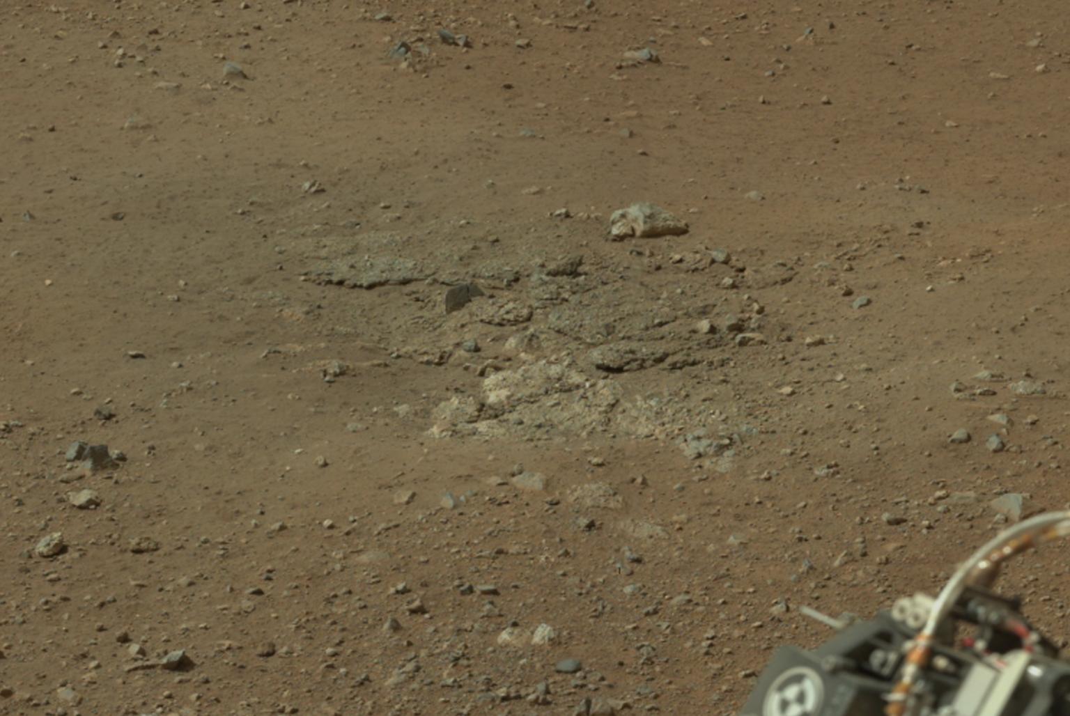
PIA16067:
Goulburn Scour Mark
Full Resolution:
TIFF
(4.739 MB)
JPEG
(171.3 kB)
2012-08-17
Mars
Mars Science Laboratory (MSL)
3294x1568x3
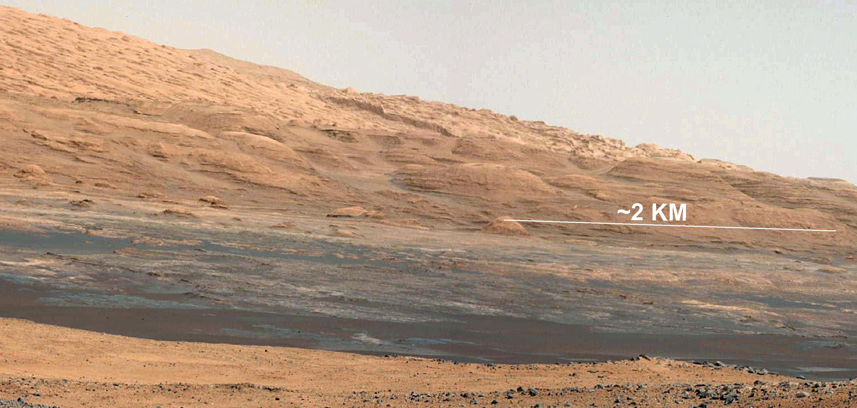
PIA16068:
The Promised Land
Full Resolution:
TIFF
(15.5 MB)
JPEG
(597 kB)
2012-08-17
Mars
Mars Science Laboratory (MSL)
10400x2415x3
PIA16072:
Curiosity's First Rock Star
Full Resolution:
TIFF
(75.37 MB)
JPEG
(3.518 MB)
2012-08-17
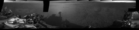
Mars
Mars Science Laboratory (MSL)
7703x1678x1
PIA16074:
All Around Curiosity
Full Resolution:
TIFF
(12.94 MB)
JPEG
(1.173 MB)
2012-08-21
Mars
Mars Science Laboratory (MSL)
1367x798x3
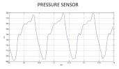
PIA16080:
First Pressure Readings on Mars
Full Resolution:
TIFF
(3.274 MB)
JPEG
(98.91 kB)
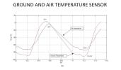
2012-08-21
Mars
Mars Science Laboratory (MSL)
1367x798x3
PIA16081:
Taking Mars' Temperature
Full Resolution:
TIFF
(3.274 MB)
JPEG
(89.58 kB)
2012-08-21
Mars
Mars Science Laboratory (MSL)
1024x1024x1
PIA16087:
Wiggle in the Gravel
Full Resolution:
TIFF
(1.05 MB)
JPEG
(156.9 kB)
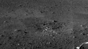
2012-08-22
Mars
Mars Science Laboratory (MSL)
1732x1486x3
PIA16090:
Zapping Rocks Exposed by the Sky Crane's Thrusters
Full Resolution:
TIFF
(7.724 MB)
JPEG
(280.9 kB)
2012-08-22
Mars
Mars Science Laboratory (MSL)
7703x1997x1
PIA16092:
Curiosity's First Track Marks on Mars
Full Resolution:
TIFF
(15.4 MB)
JPEG
(1.667 MB)
2012-08-22
Mars
Mars Science Laboratory (MSL)
1600x1600x1
PIA16094:
Rover Takes Its First 'Steps'
Full Resolution:
TIFF
(2.563 MB)
JPEG
(378.2 kB)
2012-08-22
Mars
Mars Science Laboratory (MSL)
1024x1024x1
PIA16091:
After the Laser Shots
Full Resolution:
TIFF
(1.05 MB)
JPEG
(107.4 kB)
2012-08-22
Mars
Mars Science Laboratory (MSL)
1024x1024x1
PIA16095:
Making Tracks on Mars
Full Resolution:
TIFF
(1.05 MB)
JPEG
(131.4 kB)
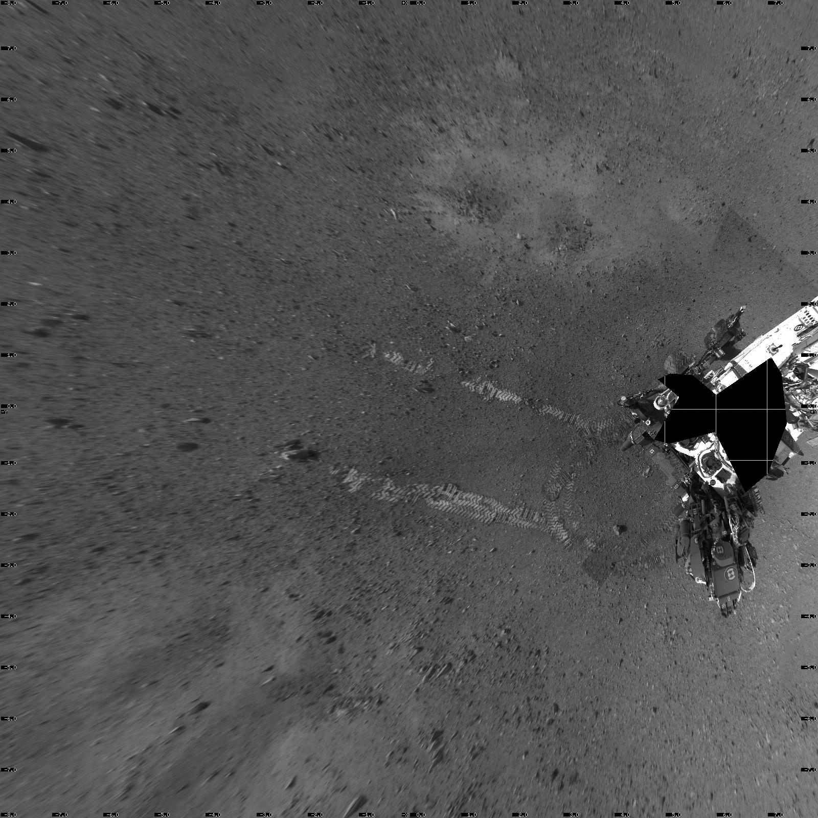
2012-08-27
Mars
Mars Science Laboratory (MSL)
1024x1024x1
PIA16108:
Evidence of Curiosity's Second Drive
Full Resolution:
TIFF
(1.05 MB)
JPEG
(89.13 kB)
2012-08-27
Mars
Mars Science Laboratory (MSL)
1024x1024x1
PIA16109:
Big Wheels Keep on Rollin'
Full Resolution:
TIFF
(1.05 MB)
JPEG
(133.4 kB)
2012-08-27
Mars
Mars Science Laboratory (MSL)
4024x1282x1
PIA16110:
From Infinity and Beyond
Full Resolution:
TIFF
(5.164 MB)
JPEG
(628.4 kB)
2012-08-29
Mars
Mars Science Laboratory (MSL)
1024x1024x1
PIA16093:
Curiosity Leaves Its Mark
Full Resolution:
TIFF
(1.05 MB)
JPEG
(245.6 kB)
2012-08-29
Mars
Mars Science Laboratory (MSL)
1024x1024x1
PIA16111:
Reading the Rover's Tracks
Full Resolution:
TIFF
(1.05 MB)
JPEG
(274.3 kB)
2012-08-29
Mars
Mars Science Laboratory (MSL)
1024x1024x1
PIA16112:
Curiosity Tracks Its Tracks
Full Resolution:
TIFF
(1.05 MB)
JPEG
(174.8 kB)
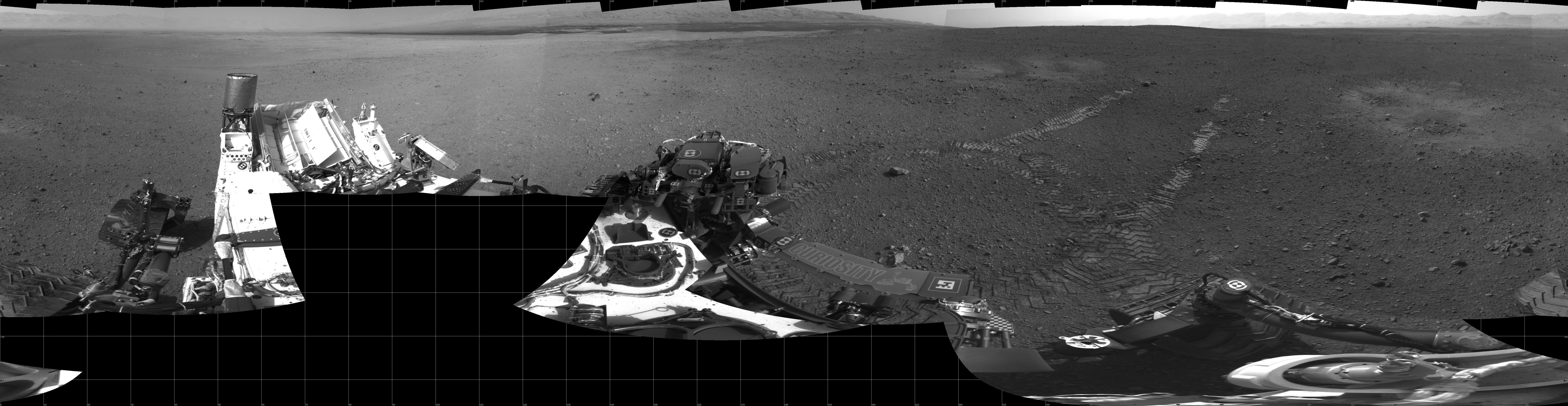
2012-09-04
Mars
Mars Science Laboratory (MSL)
7824x3337x3
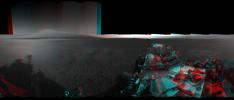
PIA16140:
3-D View from Bradbury Landing Site
Full Resolution:
TIFF
(78.35 MB)
JPEG
(1.916 MB)
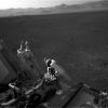
2012-09-06
Mars
Mars Science Laboratory (MSL)
1438x933x3
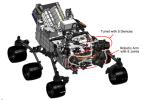
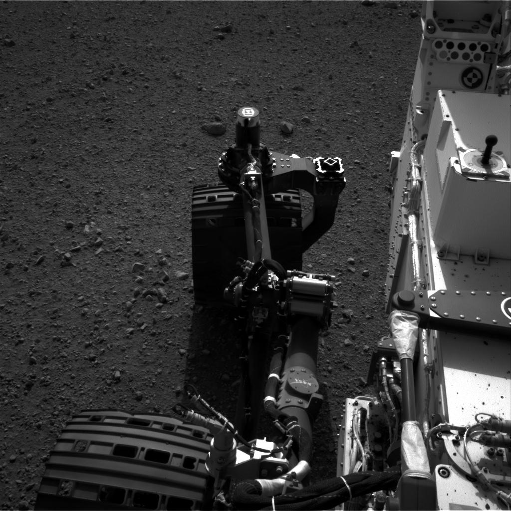
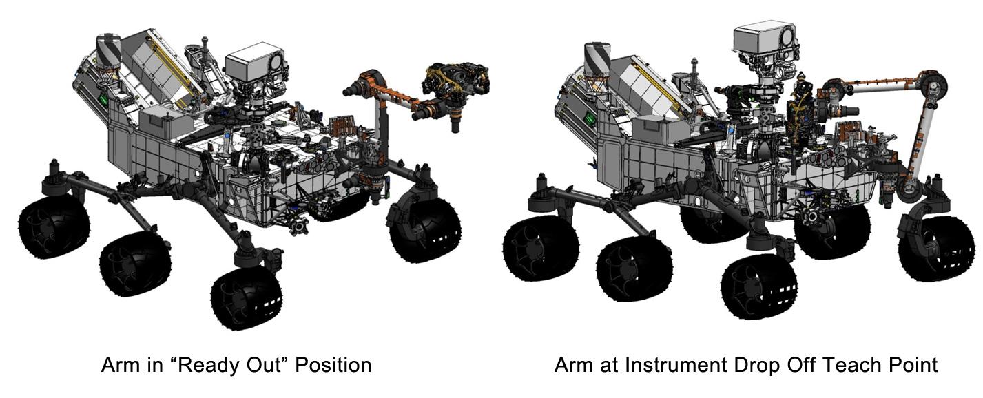
PIA16144:
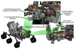
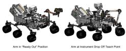
Curiosity's Robotic Arm
Full Resolution:
TIFF
(4.027 MB)
JPEG
(169 kB)
2012-09-06
Mars
Mars Science Laboratory (MSL)
1438x933x3
PIA16145:
Tools at Curiosity's 'Fingertips'
Full Resolution:
TIFF
(4.027 MB)
JPEG
(192.1 kB)
2012-09-06
Mars
Mars Science Laboratory (MSL)
1438x933x3
PIA16146:
Curiosity's Work Bench
Full Resolution:
TIFF
(4.027 MB)
JPEG
(223.4 kB)
2012-09-06
Mars
Mars Science Laboratory (MSL)
1427x578x3
PIA16147:
Flexing Curiosity's Arm
Full Resolution:
TIFF
(2.476 MB)
JPEG
(116.9 kB)
2012-11-15
Mars
Mars Science Laboratory (MSL)
1286x994x3
PIA16478:
Thermal Tides at Mars
Full Resolution:
TIFF
(3.836 MB)
JPEG
(97.88 kB)
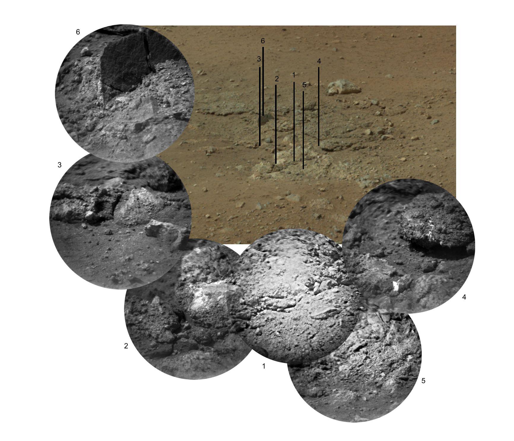
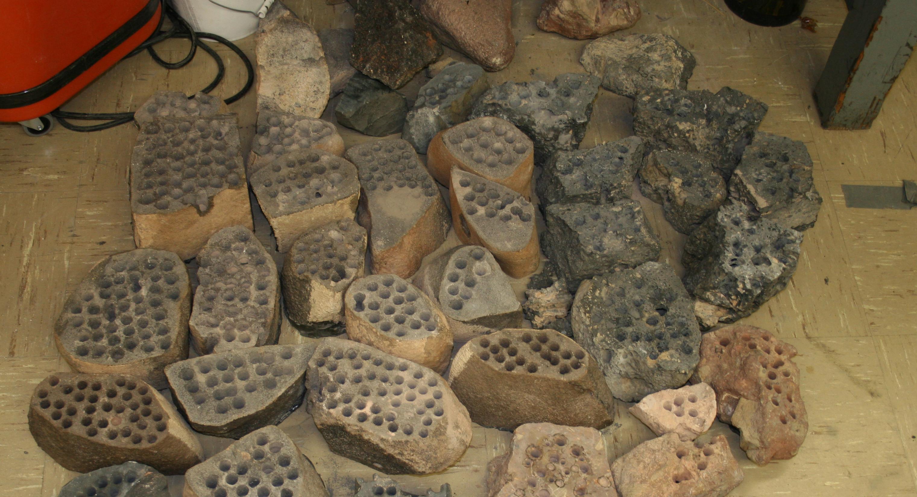
2012-12-03
Mars
Mars Science Laboratory (MSL)
1809x1332x3
PIA16571:
A Sampling of Martian Soils
Full Resolution:
TIFF
(7.232 MB)
JPEG
(328.1 kB)
2013-02-20
Mars
Mars Science Laboratory (MSL)
3042x1648x3
PIA16732:
Preparation on Earth for Drilling on Mars
Full Resolution:
TIFF
(15.05 MB)
JPEG
(616.5 kB)
2013-12-09
Mars
Mars Science Laboratory (MSL)
960x720x3
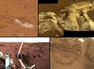
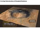
PIA17602:
Measuring the Age of a Rock on Mars
Full Resolution:
TIFF
(2.075 MB)
JPEG
(97.66 kB)
2013-12-09
Mars
Mars Science Laboratory (MSL)
960x720x3
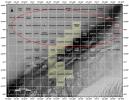
PIA17604:
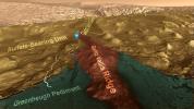
Scarp Retreat Model and Exposure History of 'Yellowknife Bay'
Full Resolution:
TIFF
(2.075 MB)
JPEG
(64.41 kB)
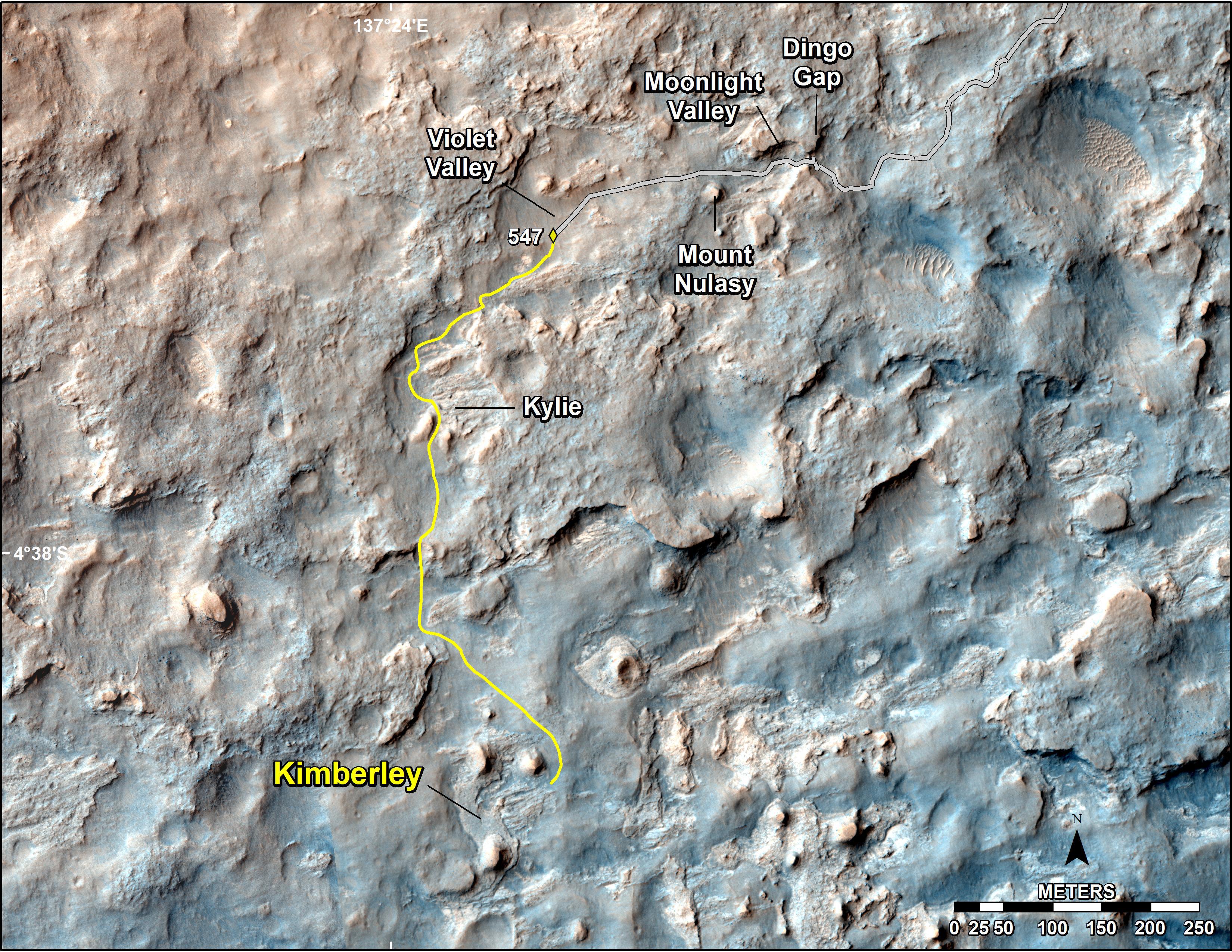
2014-02-19
Mars
Mars Science Laboratory (MSL)
3300x2550x3
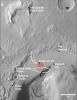
PIA17946:
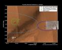
Map of Recent and Planned Driving by Curiosity as of Feb. 18, 2014
Full Resolution:
TIFF
(25.26 MB)
JPEG
(1.704 MB)
2013-08-27
Mars
Mars Science Laboratory (MSL)
1024x576x3
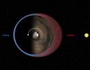
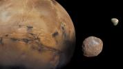
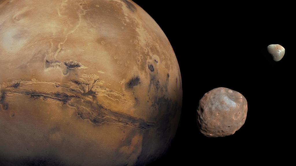
PIA17305:
The Moons of Mars
Full Resolution:
TIFF
(1.77 MB)
JPEG
(50.88 kB)
2014-09-11
Mars
Mars Science Laboratory (MSL)
4200x1759x3
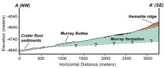
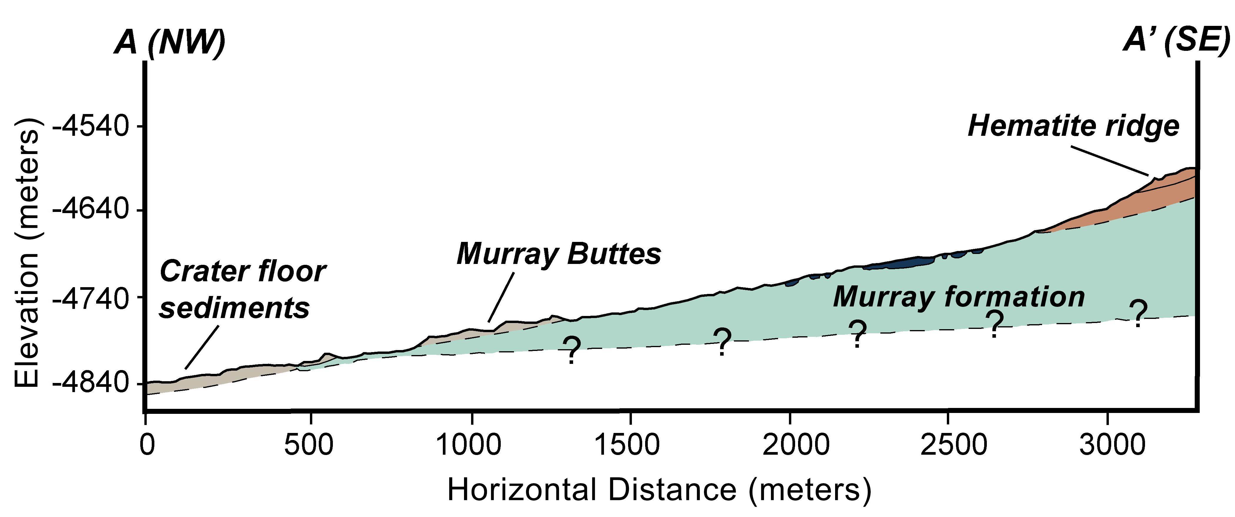
PIA18782:
Geologic Cross-Section
Full Resolution:
TIFF
(22.18 MB)
JPEG
(366.6 kB)
2016-12-13
Mars
Mars Science Laboratory (MSL)
1920x1080x3
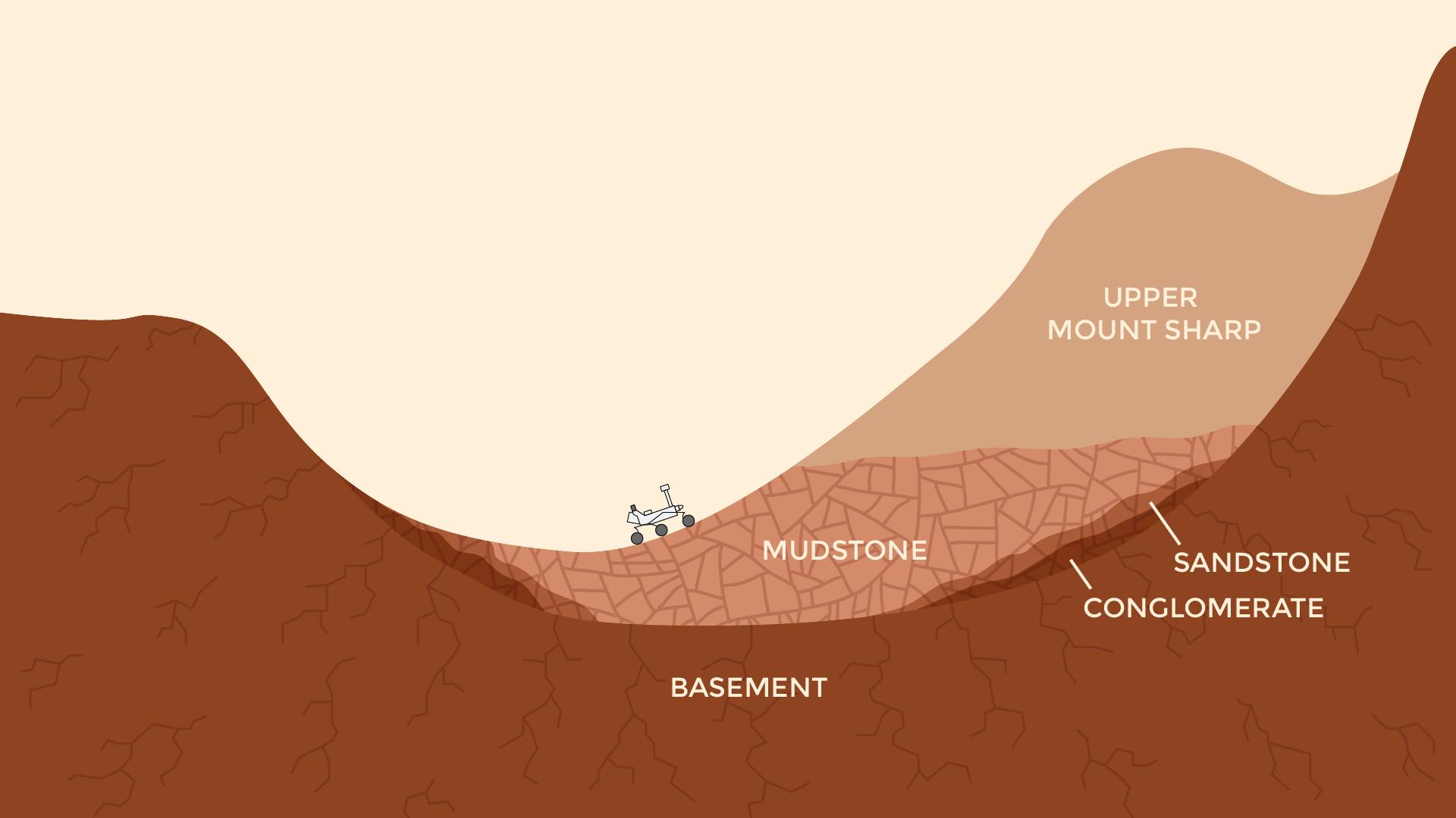
PIA21255:
Now and Long Ago at Gale Crater, Mars (Illustration)
Full Resolution:
TIFF
(491.6 kB)
JPEG
(77.52 kB)
2017-10-23
Mars
Mars Science Laboratory (MSL)
1024x512x1
PIA22063:
Mars Rover Step Toward Possible Resumption of Drilling
Full Resolution:
TIFF
(525 kB)
JPEG
(84.28 kB)
2018-01-30
Mars
Mars Science Laboratory (MSL)
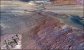
2550x3300x3
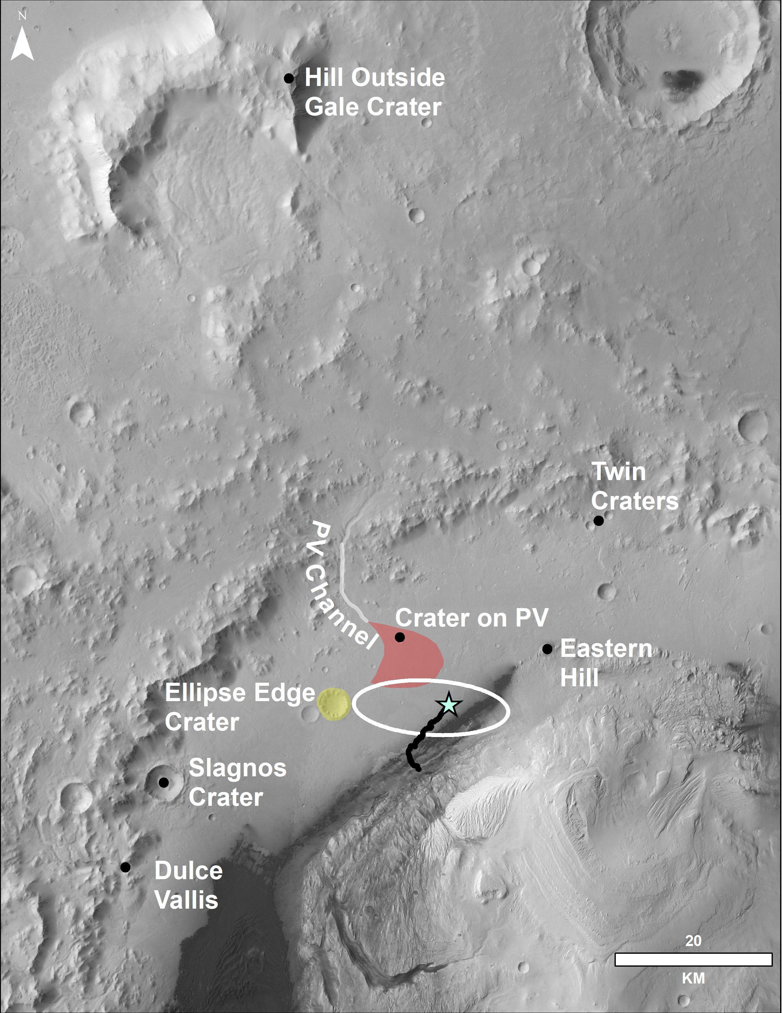
PIA22208:
Locator Map for Features in Curiosity Panorama
Full Resolution:
TIFF
(11.68 MB)
JPEG
(916.2 kB)
2020-04-14
Mars
Mars Science Laboratory (MSL)
2883x1633x3
PIA23773:
Curiosity's Team Teleworks
Full Resolution:
TIFF
(14.02 MB)
JPEG
(630.3 kB)
2023-06-08
Mars
Mars Science Laboratory (MSL)
13200x10200x3
PIA25914:
Curiosity's Quadrant Themes
Full Resolution:
TIFF
(147.4 MB)
JPEG
(15.53 MB)
2023-09-18
Mars
Mars Science Laboratory (MSL)
3006x1813x3
PIA26020:
Rendering Depicts Curiosity at Gediz Vallis Ridge
Full Resolution:
TIFF
(16.36 MB)
JPEG
(960.6 kB)
2023-09-18
Mars
Mars Science Laboratory (MSL)
1280x720x3
PIA26042:
Curiosity's Path to Gediz Vallis Ridge and Beyond
Full Resolution:
TIFF
(2.571 MB)
JPEG
(183.2 kB)
1-100
101-200
201-300
301-400
401-500
501-600
601-700
701-800
Currently displaying images:
701 - 752
of 752


