Your search criteria found 821 images
Target is Mars (and available satellites)
Go to PIAxxxxx:
Refine this list of images by:
Target:
Spacecraft:
Instrument:
Click on an image for detailed information
Click on a column heading to sort in ascending or descending order
My
List
Addition Date Target Mission InstrumentSort Descending Size
Add Image to Favorite List 2011-07-22 Mars Mars Science Laboratory (MSL)
1280x720x3
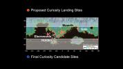
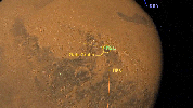
More Than 60 Sites Considered for Next Mars Rover Landing
PIA14299:
More Than 60 Sites Considered for Next Mars Rover Landing
Full Resolution:     TIFF (2.768 MB)     JPEG (87.84 kB)
Add Image to Favorite List 2011-07-22 Mars Mars Science Laboratory (MSL)
892x647x3
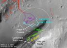
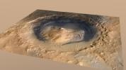
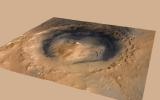
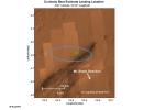
The area in and near the landing site selected for landing of NASA's Mars Science Laboratory offers a diversity of possible targets for examination by the mission's rover, Curiosity.
PIA14305:
Attractions for Study in and near Curiosity's Selected Landing Site
Full Resolution:     TIFF (1.733 MB)     JPEG (87.89 kB)
Add Image to Favorite List 2011-07-22 Mars Mars Science Laboratory (MSL)
818x720x3
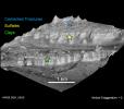
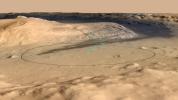
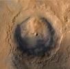
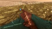
The lower portion of a mountain inside Gale crater on Mars contains layers that may be examined by NASA's Mars Science Laboratory. A landing site in Gale, close to the foot of the mountain, has been selected for the mission.
PIA14306:
Attractions in Layers of Mountain Inside Gale Crater
Full Resolution:     TIFF (1.769 MB)     JPEG (76.68 kB)
Add Image to Favorite List 2011-11-21 Mars Mars Science Laboratory (MSL)
788x720x3
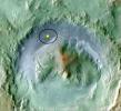
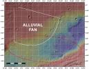
Color coding in this image of Gale Crater on Mars represents differences in elevation. The vertical difference from a low point inside the landing ellipse for NASA's Mars Science Laboratory (yellow dot) to a high point on the mountain inside the crater.
PIA15093:
Topography of Gale Crater
Full Resolution:     TIFF (1.704 MB)     JPEG (87.11 kB)
Add Image to Favorite List 2011-11-21 Mars Mars Science Laboratory (MSL)
1048x684x3
Modern-day Mars experiences cyclical changes in climate and, consequently, ice distribution. Unlike Earth, the obliquity (or tilt) of Mars changes substantially on timescales of hundreds of thousands to millions of years.
PIA15095:
Changes in Tilt of Mars' Axis
Full Resolution:     TIFF (2.153 MB)     JPEG (27.73 kB)
Add Image to Favorite List 2012-03-28 Mars Mars Science Laboratory (MSL)
2560x1440x3
Curiosity, the big rover of NASA's Mars Science Laboratory mission, will land in August 2012 near the foot of a mountain inside Gale Crater. The mission's project science group is calling the mountain Mount Sharp.
PIA15292:
'Mount Sharp' Inside Gale Crater, Mars
Full Resolution:     TIFF (11.07 MB)     JPEG (297.4 kB)
Add Image to Favorite List 2012-03-28 Mars Mars Science Laboratory (MSL)
2560x1440x3
This image shows the target landing area for Curiosity, the rover of NASA's Mars Science Laboratory mission. The target, called 'Mount Sharp,' is near the foot of a mountain inside Gale Crater.
PIA15293:
Destination for Mars Rover Curiosity
Full Resolution:     TIFF (11.07 MB)     JPEG (309.4 kB)
Add Image to Favorite List 2012-06-11 Mars Mars Science Laboratory (MSL)
2560x1600x3
This image shows changes in the target landing area for Curiosity, NASA's Mars Science Laboratory rover. The larger ellipse for the target area has been revised to the smaller ellipse centered nearer to the foot of Mount Sharp, inside Gale Crater.
PIA15685:
Revised Landing Target for Mars Rover Curiosity
Full Resolution:     TIFF (12.3 MB)     JPEG (356.8 kB)
Add Image to Favorite List 2012-06-11 Mars Mars Science Laboratory (MSL)
2560x1600x3
The landing target area for Curiosity, the big rover of NASA's Mars Science Laboratory mission, has been revised, reducing the area's size. It also puts the center of the landing area closer to Mount Sharp.
PIA15686:
Altered Landing Target in Gale Crater, Mars
Full Resolution:     TIFF (12.3 MB)     JPEG (274.4 kB)
Add Image to Favorite List 2012-06-11 Mars Mars Science Laboratory (MSL)
1564x1528x3
As of June 2012, the target landing area for NASA's Mars Science Laboratory mission is the ellipse marked on this image of Gale Crater. The ellipse is about 12 miles long and 4 miles wide (20 kilometers by 7 kilometers).
PIA15687:
Destination Gale Crater in August 2012
Full Resolution:     TIFF (7.182 MB)     JPEG (264.8 kB)
Add Image to Favorite List 2012-06-11 Mars Mars Science Laboratory (MSL)
2560x1600x3
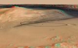
The site for NASA's Curiosity rover is near the northern flank of Mount Sharp, inside Gale Crater on Mars. You need 3D glasses to view this image.
PIA15688:
Landing Target for Mars Rover Curiosity, in Stereo
Full Resolution:     TIFF (12.3 MB)     JPEG (341.3 kB)
Add Image to Favorite List 2012-08-02 Mars Mars Science Laboratory (MSL)
3300x2550x3
This image shows the topography, with shading added, around the area where NASA's Curiosity rover is slated to land on Aug. 5 PDT (Aug. 6 EDT). The red oval indicates the targeted landing area for the rover known as the 'landing ellipse.'
PIA15956:
Topographic Map of Curiosity Landing Area
Full Resolution:     TIFF (25.26 MB)     JPEG (2.232 MB)
Add Image to Favorite List 2012-08-04 Mars Mars Reconnaissance Orbiter (MRO)
Mars Science Laboratory (MSL)
1051x727x3
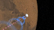
This frame from an animation shows NASA's Mars Reconnaissance Orbiter flying over NASA's Curiosity (shown in pink) as the rover lands on the Red Planet.
PIA15964:
Mars Reconnaissance Orbiter Flying Over Mars Animation Icon
Full Resolution:     TIFF (2.293 MB)     JPEG (68.13 kB)
Add Image to Favorite List 2012-08-04 Mars Mars Science Laboratory (MSL)
1279x719x3
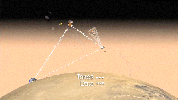
This artist's concept shows how NASA's Curiosity rover will communicate with Earth via two of NASA's Mars orbiters, Mars Reconnaissance Orbiter and Odyssey.
PIA15965:
Communicating with Curiosity (Artist's Concept) Animation Icon
Full Resolution:     TIFF (2.76 MB)     JPEG (83.23 kB)
Add Image to Favorite List 2012-08-04 Mars Mars Science Laboratory (MSL)
1278x718x3
This artist's concept shows how NASA how orbiters over Mars will monitor the landing of NASA's Curiosity rover as it speeds towards its Martian landing site in Gale Crater.
PIA15966:
Great Convergence of Spacecraft around Mars Animation Icon
Full Resolution:     TIFF (2.754 MB)     JPEG (94.02 kB)
Add Image to Favorite List 2012-08-04 Mars Mars Science Laboratory (MSL)
1276x716x3
This artist's concept depicts how NASA's Curiosity rover will communicate with Earth during landing. As the rover descends to Mars, it will send out basic radio-frequency tones that go directly to Earth.
PIA15967:
Curiosity Speaks (Artist's Concept) Animation Icon
Full Resolution:     TIFF (2.742 MB)     JPEG (66.63 kB)
Add Image to Favorite List 2012-08-06 Mars Mars Science Laboratory (MSL)
256x256x1
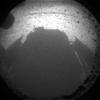
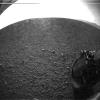
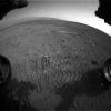
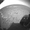
This is the first image taken by NASA's Curiosity rover, which landed on Mars the evening of Aug. 5 PDT (morning of Aug. 6 EDT). It was taken through a 'fisheye' wide-angle lens on one of the rover's front left Hazard-Avoidance cameras.
PIA15969:
Curiosity Snaps Picture of Its Shadow
Full Resolution:     TIFF (65.82 kB)     JPEG (6.73 kB)
Add Image to Favorite List 2012-08-06 Mars Mars Science Laboratory (MSL)
256x256x1
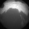
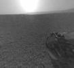
This is the first image taken by NASA's Curiosity rover, which landed on Mars the evening of Aug. 5 PDT (morning of Aug. 6 EDT). It was taken through a 'fisheye' wide-angle lens on one of the rover's front right Hazard-Avoidance cameras.
PIA15970:
Curiosity Snaps Picture of Its Shadow
Full Resolution:     TIFF (65.82 kB)     JPEG (10.03 kB)
Add Image to Favorite List 2012-08-06 Mars Mars Science Laboratory (MSL)
256x256x1
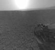
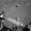
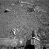
This is the first image taken by NASA's Curiosity rover, which landed on Mars the evening of Aug. 5 PDT (morning of Aug. 6 EDT). It was taken through a 'fisheye' wide-angle lens on one of the rover's rear left Hazard-Avoidance cameras.
PIA15971:
What Lies Behind Curiosity
Full Resolution:     TIFF (65.82 kB)     JPEG (5.204 kB)
Add Image to Favorite List 2012-08-06 Mars Mars Science Laboratory (MSL)
256x256x1
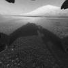
This is the first image taken by NASA's Curiosity rover, which landed on Mars the evening of Aug. 5 PDT (morning of Aug. 6 EDT). It was taken through a 'fisheye' wide-angle lens on one of the rover's rear right Hazard-Avoidance cameras.
PIA15972:
What Lies Behind Curiosity
Full Resolution:     TIFF (65.82 kB)     JPEG (5.105 kB)
Add Image to Favorite List 2012-08-06 Mars Mars Science Laboratory (MSL)
512x512x1
This is one of the first images taken by NASA's Curiosity rover, which landed on Mars the evening of Aug. 5 PDT (morning of Aug. 6 EDT). The clear dust cover that protected the camera during landing has been sprung open.
PIA15973:
Curiosity's Surroundings
Full Resolution:     TIFF (262.6 kB)     JPEG (42.74 kB)
Add Image to Favorite List 2012-08-06 Mars Mars Science Laboratory (MSL)
506x463x1
This is a version of one of the first images taken by a rear Hazard-Avoidance camera on NASA's Curiosity rover and shows part of the rim of Gale Crater, which is a feature the size of Connecticut and Rhode Island combined.
PIA15974:
Curiosity's Rear View, Linearized
Full Resolution:     TIFF (234.7 kB)     JPEG (21.97 kB)
Add Image to Favorite List 2012-08-06 Mars Mars Science Laboratory (MSL)
506x463x1
This is a version of one of the first images taken by a rear Hazard-Avoidance camera on NASA's Curiosity rover and shows part of the rim of Gale Crater, which is a feature the size of Connecticut and Rhode Island combined.
PIA15975:
Curiosity's Rear View, Linearized
Full Resolution:     TIFF (234.7 kB)     JPEG (21.96 kB)
Add Image to Favorite List 2012-08-06 Mars Mars Science Laboratory (MSL)
247x253x1
This is a version of one of the first images taken by a front Hazard-Avoidance camera on NASA's Curiosity rover. It was taken through a 'fisheye' wide-angle lens but has been 'linearized' so that the horizon looks flat rather than curved.
PIA15976:
Curiosity's Front View, Linearized
Full Resolution:     TIFF (62.77 kB)     JPEG (6.989 kB)
Add Image to Favorite List 2012-08-06 Mars Mars Science Laboratory (MSL)
247x253x1
This is a version of one of the first images taken by a front Hazard-Avoidance camera on NASA's Curiosity rover. It was taken through a 'fisheye' wide-angle lens but has been 'linearized' so that the horizon looks flat rather than curved.
PIA15977:
Curiosity's Front View, Linearized
Full Resolution:     TIFF (62.77 kB)     JPEG (6.967 kB)
Add Image to Favorite List 2012-08-06 Mars Mars Science Laboratory (MSL)
1024x1024x1
This image taken by NASA's Curiosity shows what lies ahead for the rover -- its main science target, informally called Mount Sharp. The rover's shadow can be seen in the foreground, and the dark bands beyond are dunes.
PIA15986:
Behold Mount Sharp!
Full Resolution:     TIFF (1.05 MB)     JPEG (101.8 kB)
Add Image to Favorite List 2012-08-06 Mars Mars Science Laboratory (MSL)
1024x930x1
This is the full-resolution version of one of the first images taken by a rear Hazard-Avoidance camera on NASA's Curiosity rover, which landed on Mars the evening of Aug. 5 PDT (morning of Aug. 6 EDT). The image has also been cropped.
PIA15987:
Looking Back at the Crater Rim
Full Resolution:     TIFF (953.5 kB)     JPEG (65.5 kB)
Add Image to Favorite List 2012-08-07 Mars Mars Science Laboratory (MSL)
717x546x3
shows the 15-foot (4.5-meter) diameter heat shield when it was about 50 feet (16 meters) from the spacecraft.
PIA15988:
Curiosity's Heat Shield in View
Full Resolution:     TIFF (1.175 MB)     JPEG (17.46 kB)
Add Image to Favorite List 2012-08-07 Mars Mars Science Laboratory (MSL)
717x546x3
This color thumbnail image was obtained by NASA's Curiosity rover revealing surface features including relatively dark dunes, degraded impact craters and other geologic features including small escarpments.
PIA15989:
Martian Surface Below Curiosity
Full Resolution:     TIFF (1.175 MB)     JPEG (25.76 kB)
Add Image to Favorite List 2012-08-07 Mars Mars Science Laboratory (MSL)
717x546x3
This color thumbnail image was obtained by NASA's Curiosity rover. A dust cloud was generated when the Curiosity rover was being lowered to the surface while the sky crane hovered above.
PIA15990:
Curiosity Kicking up Dust
Full Resolution:     TIFF (1.175 MB)     JPEG (28.94 kB)
Add Image to Favorite List 2012-08-07 Mars Mars Science Laboratory (MSL)
717x546x3
This color thumbnail image was obtained by NASA's Curiosity rover and is representative of the images acquired once the Curiosity rover was resting on the surface of Mars after touchdown.
PIA15991:
Curiosity Color Close-Up upon Landing
Full Resolution:     TIFF (1.175 MB)     JPEG (28.42 kB)
Add Image to Favorite List 2012-08-07 Mars Mars Science Laboratory (MSL)
717x546x3
This color thumbnail image was obtained by NASA's Curiosity rover illustrating the first appearance of the left front wheel of the Curiosity rover after deployment of the suspension system as the vehicle was about to touch down on Mars.
PIA15992:
Curiosity's Wheel During Descent
Full Resolution:     TIFF (1.175 MB)     JPEG (22.67 kB)
Add Image to Favorite List 2012-08-07 Mars Mars Science Laboratory (MSL)
1024x925x3
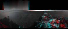
This image is a 3-D view behind NASA's Curiosity rover. The anaglyph was made from a stereo pair of Hazard-Avoidance Cameras on the rear of the rover. It has been cropped.
PIA16002:
3-D View from Behind Curiosity
Full Resolution:     TIFF (2.843 MB)     JPEG (94.86 kB)
Add Image to Favorite List 2012-08-07 Mars Mars Science Laboratory (MSL)
1024x847x3
This image is a 3-D view in front of NASA's Curiosity rover captured by the rover's front left Hazard-Avoidance camera. The image is cropped but part of Mount Sharp is still visible rising above the terrain.
PIA16003:
3-D View from the Front of Curiosity
Full Resolution:     TIFF (2.603 MB)     JPEG (97.37 kB)
Add Image to Favorite List 2012-08-07 Mars Mars Science Laboratory (MSL)
1024x1024x3
This image is a 3-D view in front of NASA's Curiosity rover. Mount Sharp is visible rising above the terrain, though in one 'eye' a box on the rover holding the drill bits obscures the view.
PIA16004:
3-D View from the Front of Curiosity
Full Resolution:     TIFF (3.147 MB)     JPEG (109.6 kB)
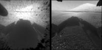
Add Image to Favorite List 2012-08-07 Mars Mars Science Laboratory (MSL)
873x429x1
This image comparison shows a view through a Hazard-Avoidance camera on NASA's Curiosity rover before and after the clear dust cover was removed. Both images were taken by a camera at the front of the rover. Mount Sharp, looms ahead.
PIA16005:
Clear Views on Mars
Full Resolution:     TIFF (375.1 kB)     JPEG (39.61 kB)
Add Image to Favorite List 2012-08-07 Mars Mars Science Laboratory (MSL)
1022x767x1
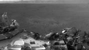
This full-resolution image shows one of the first views from NASA's Curiosity rover, which landed on Mars the evening of Aug. 5 PDT (early morning hours Aug. 6 EDT).
PIA15994:
Curiosity's Early Views of Mars
Full Resolution:     TIFF (784.9 kB)     JPEG (93.72 kB)
Add Image to Favorite List 2012-08-08 Mars Mars Science Laboratory (MSL)
1024x1024x1
This is the first image taken by the Navigation cameras on NASA's Curiosity rover. It shows the shadow of the rover's now-upright mast in the center, and the arm's shadow at left. The arm itself can be seen in the foreground.
PIA16010:
Curiosity Looks Away from the Sun
Full Resolution:     TIFF (1.05 MB)     JPEG (178.1 kB)
Add Image to Favorite List 2012-08-08 Mars Mars Science Laboratory (MSL)
7703x983x1
This is the first 360-degree panoramic view from NASA's Curiosity rover, taken with the Navigation cameras. Mount Sharp is to the right, and the north Gale Crater rim can be seen at center. The rover's body is in the foreground.
PIA16011:
Curiosity Takes It All In
Full Resolution:     TIFF (7.58 MB)     JPEG (299 kB)
Add Image to Favorite List 2012-08-08 Mars Mars Science Laboratory (MSL)
4131x4131x1
This Picasso-like self portrait of NASA's Curiosity rover was taken by its Navigation cameras, located on the now-upright mast. The camera snapped pictures 360-degrees around the rover, while pointing down at the rover deck, up and straight ahead.
PIA16012:
Rover's Self Portrait
Full Resolution:     TIFF (17.1 MB)     JPEG (525.4 kB)
Add Image to Favorite List 2012-08-08 Mars Mars Science Laboratory (MSL)
1775x983x1
These are the first two full-resolution images of the Martian surface from the Navigation cameras on NASA's Curiosity rover, which are located on the rover's 'head' or mast. The rim of Gale Crater can be seen in the distance beyond the pebbly ground.
PIA16013:
Curiosity's New Home
Full Resolution:     TIFF (1.747 MB)     JPEG (249.5 kB)
Add Image to Favorite List 2012-08-08 Mars Mars Science Laboratory (MSL)
1280x720x1
This is a close-up view of the zones where the soil at Curiosity's landing site was blown away by the thrusters on the rover's descent stage. The excavation of the soil reveals probable bedrock outcrop.
PIA16025:
Rocket Thrusters Expose Bedrock
Full Resolution:     TIFF (922.8 kB)     JPEG (111.5 kB)
Add Image to Favorite List 2012-08-09 Mars Mars Science Laboratory (MSL)
7703x1671x1
This 360-degree, full-resolution panorama from NASA's Curiosity rover shows the area all around the rover within Gale Crater on Mars. The rover's deck is to the left and far right.
PIA16026:
Crisp View from Inside Gale Crater
Full Resolution:     TIFF (12.89 MB)     JPEG (1.196 MB)
Add Image to Favorite List 2012-08-09 Mars Mars Science Laboratory (MSL)
1024x1024x1
This full-resolution image shows part of the deck of NASA's Curiosity rover taken from one of the rover's Navigation cameras looking toward the back left of the rover. On the left, part of the rover's power supply is visible.
PIA16028:
A Clear Look at the Rover Deck
Full Resolution:     TIFF (1.05 MB)     JPEG (114.9 kB)
Add Image to Favorite List 2012-08-10 Mars Mars Science Laboratory (MSL)
1280x720x1
This mosaic image shows part of the left side of NASA's Curiosity rover and two blast marks from the descent stage's rocket engines. The rim of Gale Crater is the lighter colored band across the horizon. The back of the rover is to the left.
PIA16040:
Traces of Landing
Full Resolution:     TIFF (922.8 kB)     JPEG (115.5 kB)
Add Image to Favorite List 2012-08-10 Mars Mars Science Laboratory (MSL)
963x720x1
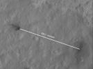
This portion of an image from NASA's Mars Reconnaissance Orbiter has been annotated to show the relative positions between NASA's Curiosity rover (right) and the impact site of its sky crane, or descent stage.
PIA16023:
Inspecting Curiosity's Descent Stage Crash Site
Full Resolution:     TIFF (694.3 kB)     JPEG (57.85 kB)
Add Image to Favorite List 2012-08-10 Mars Mars Science Laboratory (MSL)
876x718x3
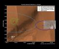
The red 'X' marks the spot where NASA's Curiosity rover landed on Mars. This is well within the targeted landing region, called the landing 

ellipse, marked by the light blue line.
PIA16038:
Zeroing in on Rover's Landing Site
Full Resolution:     TIFF (1.888 MB)     JPEG (72.4 kB)
Add Image to Favorite List 2012-08-10 Mars Mars Science Laboratory (MSL)
1861x1024x1
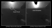
The distant blob seen in the view on left, taken by a Hazard-Avoidance camera on NASA's Curiosity rover, may be a cloud created during the crash of the rover's descent stage.
PIA16042:
Witnessing the Descent Stage Crash?
Full Resolution:     TIFF (1.908 MB)     JPEG (88.74 kB)
Add Image to Favorite List 2012-08-17 Mars Mars Science Laboratory (MSL)
4061x4061x1
This self-portrait shows the deck of NASA's Curiosity rover from the rover's Navigation camera. The rim of Gale Crater can be seen at upper right.
PIA16062:
Bird's Eye View of Curiosity
Full Resolution:     TIFF (16.51 MB)     JPEG (1.219 MB)
Add Image to Favorite List 2012-08-17 Mars Mars Science Laboratory (MSL)
2000x720x3
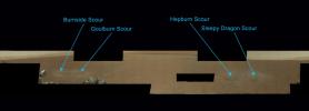
Scientists have now named the four marks near NASA's Curiosity rover where blasts from the descent stage rocket engines blew away some of the Martian surface material. Clockwise from the most north: Burnside, Goulburn, Hepburn and Sleepy Dragon.
PIA16066:
Naming the Scour Marks
Full Resolution:     TIFF (4.322 MB)     JPEG (84.68 kB)
Add Image to Favorite List 2012-08-17 Mars Mars Science Laboratory (MSL)
1536x1028x3
This cropped image from NASA's Curiosity rover shows one set of marks on the surface of Mars where blasts from the descent-stage rocket engines blew away some of the surface material.
PIA16067:
Goulburn Scour Mark
Full Resolution:     TIFF (4.739 MB)     JPEG (171.3 kB)
Add Image to Favorite List 2012-08-17 Mars Mars Science Laboratory (MSL)
3294x1568x3
This image (cut out from a mosaic) shows the view from the landing site of NASA's Curiosity rover toward the lower reaches of Mount Sharp, where Curiosity is likely to begin its ascent through hundreds of feet (meters) of layered deposits.
PIA16068:
The Promised Land
Full Resolution:     TIFF (15.5 MB)     JPEG (597 kB)
Add Image to Favorite List 2012-08-17 Mars Mars Science Laboratory (MSL)
10400x2415x3
This mosaic image shows the first target NASA's Curiosity rover aims to zap ChemCam instrument. ChemCam will be firing a laser at this rock, provisionally named N165, and analyzing the glowing, ionized gas, called plasma, that the laser excites.
PIA16072:
Curiosity's First Rock Star
Full Resolution:     TIFF (75.37 MB)     JPEG (3.518 MB)
Add Image to Favorite List 2012-08-17 Mars Mars Science Laboratory (MSL)
7703x1678x1
This 360-degree image shows a complete, full-resolution panorama around NASA's Curiosity rover. The pointy rim of Gale Crater can be seen as a lighter strip along top right of the image. The base of Mount Sharp can be seen along top left.
PIA16074:
All Around Curiosity
Full Resolution:     TIFF (12.94 MB)     JPEG (1.173 MB)
Add Image to Favorite List 2012-08-21 Mars Mars Science Laboratory (MSL)
1367x798x3
This graph shows readings for atmospheric pressure at the landing site of NASA's Curiosity rover. The data were obtained by Curiosity's Rover Environmental Monitoring Station from Aug. 15 to Aug. 18, 2012.
PIA16080:
First Pressure Readings on Mars
Full Resolution:     TIFF (3.274 MB)     JPEG (98.91 kB)
Add Image to Favorite List 2012-08-21 Mars Mars Science Laboratory (MSL)
1367x798x3
This graph shows the rise and fall of air and ground temperatures on Mars obtained by NASA's Curiosity rover.
PIA16081:
Taking Mars' Temperature
Full Resolution:     TIFF (3.274 MB)     JPEG (89.58 kB)
Add Image to Favorite List 2012-08-21 Mars Mars Science Laboratory (MSL)
1024x1024x1
This image from an animated gif shows the movement of the rear right wheel of NASA's Curiosity as rover drivers turned the wheels in place at the landing site on Mars.
PIA16087:
Wiggle in the Gravel Animation Icon
Full Resolution:     TIFF (1.05 MB)     JPEG (156.9 kB)
Add Image to Favorite List 2012-08-22 Mars Mars Science Laboratory (MSL)
1732x1486x3
This photo mosaic shows the scour mark, dubbed 'Goulburn,' left by the thrusters on the sky crane that helped lower NASA's Curiosity rover to the Red Planet.
PIA16090:
Zapping Rocks Exposed by the Sky Crane's Thrusters
Full Resolution:     TIFF (7.724 MB)     JPEG (280.9 kB)
Add Image to Favorite List 2012-08-22 Mars Mars Science Laboratory (MSL)
7703x1997x1
This 360-degree panorama shows evidence of a successful first test drive for NASA's Curiosity rover; the rover made its first move, going forward about 15 feet (4.5 meters), rotating 120 degrees and then reversing about 8 feet (2.5 meters).
PIA16092:
Curiosity's First Track Marks on Mars
Full Resolution:     TIFF (15.4 MB)     JPEG (1.667 MB)
Add Image to Favorite List 2012-08-22 Mars Mars Science Laboratory (MSL)
1600x1600x1
This imagery is being released in association with NASA's Mars Science Laboratory mission. This is a temporary caption to be replaced as soon as more information is available.
PIA16094:
Rover Takes Its First 'Steps'
Full Resolution:     TIFF (2.563 MB)     JPEG (378.2 kB)
Add Image to Favorite List 2012-08-22 Mars Mars Science Laboratory (MSL)
1024x1024x1
NASA's Curiosity rover shot its laser 50 times at rocks exposed by thrusters on the rover's sky crane at the scour mark called 'Goulburn.'
PIA16091:
After the Laser Shots Animation Icon
Full Resolution:     TIFF (1.05 MB)     JPEG (107.4 kB)
Add Image to Favorite List 2012-08-22 Mars Mars Science Laboratory (MSL)
1024x1024x1
This image shows the tracks left by NASA's Curiosity rover on Aug. 22, 2012, as it completed its first test drive on Mars. This image was taken by a front Hazard-Avoidance camera, which has a fisheye lens.
PIA16095:
Making Tracks on Mars
Full Resolution:     TIFF (1.05 MB)     JPEG (131.4 kB)
Add Image to Favorite List 2012-08-27 Mars Mars Science Laboratory (MSL)
1024x1024x1
This image taken by NASA's Curiosity rover shows track marks from a successful drive to the scour mark known as Goulburn, an area of bedrock exposed by thrusters on the rover's descent stage.
PIA16108:
Evidence of Curiosity's Second Drive
Full Resolution:     TIFF (1.05 MB)     JPEG (89.13 kB)
Add Image to Favorite List 2012-08-27 Mars Mars Science Laboratory (MSL)
1024x1024x1
This image taken by a front Hazard-Avoidance camera on NASA's Curiosity shows track marks from the rover's first Martian drives.
PIA16109:
Big Wheels Keep on Rollin'
Full Resolution:     TIFF (1.05 MB)     JPEG (133.4 kB)
Add Image to Favorite List 2012-08-27 Mars Mars Science Laboratory (MSL)
4024x1282x1
Two donut-shaped tracks make an infinity symbol, and mark the first two drives of NASA's Curiosity rover. The landing site is at the far right.
PIA16110:
From Infinity and Beyond
Full Resolution:     TIFF (5.164 MB)     JPEG (628.4 kB)
Add Image to Favorite List 2012-08-29 Mars Mars Science Laboratory (MSL)
1024x1024x1
This image shows a close-up of track marks from the first test drive of NASA's Curiosity rover. The rover's arm is visible in the foreground. A close inspection of the tracks reveals a unique, repeating pattern: Morse code for JPL.
PIA16093:
Curiosity Leaves Its Mark
Full Resolution:     TIFF (1.05 MB)     JPEG (245.6 kB)
Add Image to Favorite List 2012-08-29 Mars Mars Science Laboratory (MSL)
1024x1024x1
The straight lines in Curiosity's zigzag track marks are Morse code for JPL. The 'footprint' is an important reference mark that the rover can use to drive more precisely via a system called visual odometry.
PIA16111:
Reading the Rover's Tracks
Full Resolution:     TIFF (1.05 MB)     JPEG (274.3 kB)
Add Image to Favorite List 2012-08-29 Mars Mars Science Laboratory (MSL)
1024x1024x1
This image shows a close-up of track marks left by NASA's Curiosity rover. Holes in the rover's wheels, seen here in this view, leave imprints in the tracks that can be used to help the rover drive more accurately. The imprint is Morse code for JPL.
PIA16112:
Curiosity Tracks Its Tracks
Full Resolution:     TIFF (1.05 MB)     JPEG (174.8 kB)
Add Image to Favorite List 2012-09-04 Mars Mars Science Laboratory (MSL)
7824x3337x3
This 3D image from NASA's Curiosity was taken from the rover's Bradbury Landing site inside Gale Crater, Mars. Between the rover on the right, and its shadow on the left, looms the rover's eventual target: Mount Sharp.
PIA16140:
3-D View from Bradbury Landing Site
Full Resolution:     TIFF (78.35 MB)     JPEG (1.916 MB)
Add Image to Favorite List 2012-09-06 Mars Mars Science Laboratory (MSL)
1438x933x3
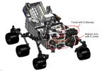
This engineering drawing shows the location of the arm on NASA's Curiosity rover, in addition to the arm's turret, which holds two instruments and three tools. The arm places and holds turret-mounted tools on rock and soil targets.
PIA16144:
Curiosity's Robotic Arm
Full Resolution:     TIFF (4.027 MB)     JPEG (169 kB)
Add Image to Favorite List 2012-09-06 Mars Mars Science Laboratory (MSL)
1438x933x3
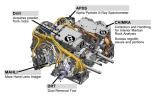
This engineering drawing shows the five devices that make up the turret at the end of the arm on NASA's Curiosity rover. These include: the drill for acquiring powdered samples from interiors of rocks.
PIA16145:
Tools at Curiosity's 'Fingertips'
Full Resolution:     TIFF (4.027 MB)     JPEG (192.1 kB)
Add Image to Favorite List 2012-09-06 Mars Mars Science Laboratory (MSL)
1438x933x3
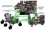
This engineering drawing shows various components needed to support tools at the end of the arm on NASA's Curiosity rover, including: calibration targets for helping instruments set their baseline levels.
PIA16146:
Curiosity's Work Bench
Full Resolution:     TIFF (4.027 MB)     JPEG (223.4 kB)
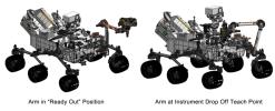
Add Image to Favorite List 2012-09-06 Mars Mars Science Laboratory (MSL)
1427x578x3
This engineering drawing shows the arm on NASA's Curiosity's rover in its 'ready-for-action' position, or 'ready out' as engineers say, in addition to the position it assumes to drop off samples.
PIA16147:
Flexing Curiosity's Arm
Full Resolution:     TIFF (2.476 MB)     JPEG (116.9 kB)
Add Image to Favorite List 2012-11-15 Mars Mars Science Laboratory (MSL)
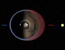
1286x994x3
This diagram illustrates Mars' 'thermal tides,' a weather phenomenon responsible for large, daily variations in pressure at the Martian surface.
PIA16478:
Thermal Tides at Mars
Full Resolution:     TIFF (3.836 MB)     JPEG (97.88 kB)
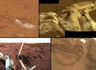
Add Image to Favorite List 2012-12-03 Mars Mars Science Laboratory (MSL)
1809x1332x3
This collage shows the variety of soils found at landing sites on Mars. The elemental composition of the typical, reddish soils were investigated by NASA's Viking, Pathfinder and Mars Exploration Rover missions, and now with the Curiosity rover.
PIA16571:
A Sampling of Martian Soils
Full Resolution:     TIFF (7.232 MB)     JPEG (328.1 kB)
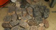
Add Image to Favorite List 2013-02-20 Mars Mars Science Laboratory (MSL)
3042x1648x3
The development of the Mars rover Curiosity's capabilities for drilling into a rock on Mars required years of development work. Seen here are some of the rocks used in bit development testing and lifespan testing at JPL in 2007.
PIA16732:
Preparation on Earth for Drilling on Mars
Full Resolution:     TIFF (15.05 MB)     JPEG (616.5 kB)
Add Image to Favorite List 2013-02-20 Mars Mars Science Laboratory (MSL)
1278x718x3
This frame from a video clip shows moments during a demonstration of drilling into a rock at NASA's JPL, Pasadena, Calif., with a test double of the Mars rover Curiosity. The drill combines hammering and rotation motions of the bit.
PIA16733:
Video Clip of a Rover Rock-Drilling Demonstration at JPL Animation Icon
Full Resolution:     TIFF (2.754 MB)     JPEG (165.9 kB)
Add Image to Favorite List 2013-12-09 Mars Mars Science Laboratory (MSL)
960x720x3
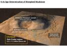
A rock in the Sheepbed mudstone deposit in the Yellowknife Bay area inside Gale Crater is the first rock on Mars ever to be dated by laboratory analysis of its ingredients.
PIA17602:
Measuring the Age of a Rock on Mars
Full Resolution:     TIFF (2.075 MB)     JPEG (97.66 kB)
Add Image to Favorite List 2013-12-09 Mars Mars Science Laboratory (MSL)
960x720x3
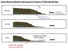
NASA's Curiosity Mars rover has made measurements indicating that the Cumberland rock target the rover drilled in May 2013 has been exposed at the surface for about 80 million years.
PIA17604:
Scarp Retreat Model and Exposure History of 'Yellowknife Bay'
Full Resolution:     TIFF (2.075 MB)     JPEG (64.41 kB)
Add Image to Favorite List 2014-02-19 Mars Mars Science Laboratory (MSL)
3300x2550x3
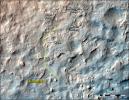
This map shows the route driven and route planned for NASA's Curiosity Mars rover from before reaching 'Dingo Gap' in upper right, to the mission's next science waypoint, 'Kimberley' (formerly referred to as 'KMS-9'), lower left.
PIA17946:
Map of Recent and Planned Driving by Curiosity as of Feb. 18, 2014
Full Resolution:     TIFF (25.26 MB)     JPEG (1.704 MB)
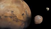
Add Image to Favorite List 2013-08-27 Mars Mars Science Laboratory (MSL)
1024x576x3
Mars is kept company by two cratered moons -- an inner moon named Phobos and an outer moon named Deimos.
PIA17305:
The Moons of Mars
Full Resolution:     TIFF (1.77 MB)     JPEG (50.88 kB)
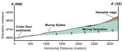
Add Image to Favorite List 2014-09-11 Mars Mars Science Laboratory (MSL)
4200x1759x3
This cross-section graphic provides an interpretation of the geologic relationship between the 'Murray Formation,' the crater floor sediments, and the hematite ridge.
PIA18782:
Geologic Cross-Section
Full Resolution:     TIFF (22.18 MB)     JPEG (366.6 kB)
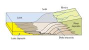
Add Image to Favorite List 2014-12-08 Mars Mars Science Laboratory (MSL)
1931x1078x3
This diagram depicts rivers entering a lake. Where the water's flow decelerates, sediments drop out, and a delta forms, depositing a prism of sediment that tapers out toward the lake's interior.
PIA19071:
How a Delta Forms Where River Meets Lake
Full Resolution:     TIFF (6.247 MB)     JPEG (112.7 kB)
Add Image to Favorite List 2014-12-08 Mars Mars Science Laboratory (MSL)
4030x1275x3
This image depicts how a mountain inside a Mars' Gale Crater might have formed. At left, the crater fills with layers of sediment. Yellow is for deposits in alluvial fans, deltas, and drifts during both wet and dry periods.
PIA19079:
Sedimentation and Erosion in Gale Crater, Mars
Full Resolution:     TIFF (15.42 MB)     JPEG (190.5 kB)
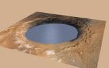
Add Image to Favorite List 2014-12-08 Mars Mars Science Laboratory (MSL)
2560x1600x3
This simulation depicts a lake partially filling Mars' Gale Crater, receiving runoff from snow melting on the crater's rim, showing evidence that NASA's Curiosity rover has found ancient streams, deltas and lakes.
PIA19080:
Simulated View of Gale Crater Lake on Mars
Full Resolution:     TIFF (12.29 MB)     JPEG (271.9 kB)
Add Image to Favorite List 2015-11-24 Mars Mars Science Laboratory (MSL)
1000x1650x3
This graphic depicts paths by which carbon has been exchanged among Martian interior, surface rocks, polar caps, waters and atmosphere, and also depicts a mechanism by which it is lost from the atmosphere with a strong effect on isotope ratio.
PIA20163:
Carbon Exchange and Loss Processes on Mars
Full Resolution:     TIFF (387.2 kB)     JPEG (116.4 kB)
Add Image to Favorite List 2016-12-13 Mars Mars Science Laboratory (MSL)
1490x804x3
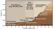
This graphic depicts aspects of the driving distance, elevation, geological units and time intervals of NASA's Curiosity Mars rover mission, as of late 2016.
PIA21145:
Curiosity Rover's Martian Mission, Exaggerated Cross Section
Full Resolution:     TIFF (994.6 kB)     JPEG (101.3 kB)
Add Image to Favorite List 2016-12-13 Mars Mars Science Laboratory (MSL)
2969x1612x3
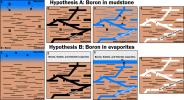
This graphic portrays two hypotheses about how the element boron ended up in calcium sulfate veins found within mudstone layers of the Murray formation on Mars' lower Mount Sharp.
PIA21253:
Two Possible Ways Boron Got into Veins on Mount Sharp
Full Resolution:     TIFF (1.52 MB)     JPEG (540.5 kB)
Add Image to Favorite List 2016-12-13 Mars Mars Science Laboratory (MSL)
1920x1080x3
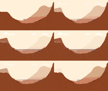
This graphic illustration shows NASA's Curiosity Mars rover in Gale Crater, near the Red Planet's equator.
PIA21255:
Now and Long Ago at Gale Crater, Mars (Illustration) Animation Icon
Full Resolution:     TIFF (491.6 kB)     JPEG (77.52 kB)
Add Image to Favorite List 2017-06-01 Mars Mars Science Laboratory (MSL)
2858x1213x3
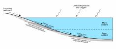
This diagram presents some of the processes and clues related to a long-ago lake on Mars that became stratified, with the shallow water richer in oxidants than deeper water was.
PIA21500:
Diagram of Lake Stratification on Mars
Full Resolution:     TIFF (469.2 kB)     JPEG (191.1 kB)
Add Image to Favorite List 2017-10-23 Mars Mars Science Laboratory (MSL)
1024x512x1
NASA's Curiosity Mars rover conducted a test on Oct. 17, 2017, as part of the rover team's development of a new way to use the rover's drill.
PIA22063:
Mars Rover Step Toward Possible Resumption of Drilling
Full Resolution:     TIFF (525 kB)     JPEG (84.28 kB)
Add Image to Favorite List 2018-01-30 Mars Mars Science Laboratory (MSL)
2550x3300x3
This image of the northwestern portion of Mars' Gale Crater and terrain north of it, from the ESA's Mars Express orbiter, provides a locator map for some features visible in an October 2017 panorama from NASA's Curiosity Mars rover.
PIA22208:
Locator Map for Features in Curiosity Panorama
Full Resolution:     TIFF (11.68 MB)     JPEG (916.2 kB)
Add Image to Favorite List 2020-04-14 Mars Mars Science Laboratory (MSL)
2883x1633x3
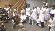
Members of NASA's Curiosity Mars rover mission team photographed themselves on March 20, 2020, the first day the entire mission team worked remotely from home.
PIA23773:
Curiosity's Team Teleworks
Full Resolution:     TIFF (14.02 MB)     JPEG (630.3 kB)
Add Image to Favorite List 2023-06-08 Mars Mars Science Laboratory (MSL)
13200x10200x3
This map shows all the quadrant themes for NASA's Curiosity Mars rover, which is currently in the Roraima quadrant. The red oval indicates the landing ellipse where the rover was targeted to touch down in 2012.
PIA25914:
Curiosity's Quadrant Themes
Full Resolution:     TIFF (147.4 MB)     JPEG (15.53 MB)
Add Image to Favorite List 2023-09-18 Mars Mars Science Laboratory (MSL)
3006x1813x3
NASA's Curiosity Mars rover is depicted in this 3D rendering of Gediz Vallis Ridge that was created using science data and imagery captured from space by the agency's Mars Reconnaissance Orbiter.
PIA26020:
Rendering Depicts Curiosity at Gediz Vallis Ridge
Full Resolution:     TIFF (16.36 MB)     JPEG (960.6 kB)
Add Image to Favorite List 2023-09-18 Mars Mars Science Laboratory (MSL)
1280x720x3
The route NASA's Curiosity Mars rover has taken while driving through the lower part of Mount Sharp is shown as a pale line here. Different parts of the mountain are labeled by color.
PIA26042:
Curiosity's Path to Gediz Vallis Ridge and Beyond
Full Resolution:     TIFF (2.571 MB)     JPEG (183.2 kB)
Add Image to Favorite List 2012-08-06 Mars Mars Science Laboratory (MSL)
1575x1200x3
The green diamond shows approximately where NASA's Curiosity rover landed on Mars, a region about 2 kilometers northeast of its target in the center of the estimated landing region (blue ellipse).
PIA15981:
Where Curiosity Landed on Mars
Full Resolution:     TIFF (5.672 MB)     JPEG (148.8 kB)
Add Image to Favorite List 2012-08-06 Mars Mars Science Laboratory (MSL)
764x762x1
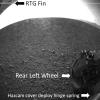
This labeled version of one of the first images taken by a rear Hazard-Avoidance camera on NASA's Curiosity rover shows a fin on the radioisotope thermoelectric generator, the rear left wheel and a spring that released the dust cover.
PIA15982:
Curiosity's Rear View, Annotated
Full Resolution:     TIFF (583 kB)     JPEG (80.5 kB)
Add Image to Favorite List 2014-09-11 Mars Mars Science Laboratory (MSL)
Alpha Particle X-ray Spectrometer
1530x1032x3
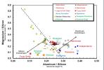
Data from the Alpha Particle X-ray Spectrometer (APXS) instrument on NASA's Mars rover Curiosity show an unusual enrichment of silicon in the rocks dubbed 'Wildrose' and 'Bonanza King,' relative to other rocks studied at Gale Crater on Mars.
PIA18479:
Martian Rocks Rich in Silicon
Full Resolution:     TIFF (4.739 MB)     JPEG (134.6 kB)
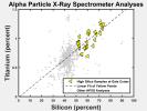
Add Image to Favorite List 2015-12-17 Mars Mars Science Laboratory (MSL)
Alpha Particle X-ray Spectrometer
1730x1300x3
The yellow triangles on this graph indicate concentrations of the elements titanium and silicon in selected rock targets with high silica content analyzed by the APXS instrument on NASA's Curiosity rover in Mars' Gale Crater.
PIA20274:
Silicon and Titanium Correlation in Selected Rocks at Gale Crater, Mars
Full Resolution:     TIFF (384 kB)     JPEG (163.3 kB)
 Current Set   Jump to a Following Set   Jump to a Following Set   Jump to a Following Set   Jump to a Following Set   Jump to a Following Set   Jump to a Following Set   Jump to a Following Set   Jump to a Following Set   Retrieve Next Set 
 1-100   101-200   201-300   301-400   401-500   501-600   601-700   701-800   801-900 
Currently displaying images: 1 - 100 of 821