Click on an image for detailed information
Click on a column heading to sort in ascending or descending order

My
List |
Addition Date
|
Target
|
Mission
|
Instrument
|
Size
|

|
2016-03-08 |
Earth
|
OMG
|
|
2160x2008x3 |
|
-
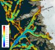
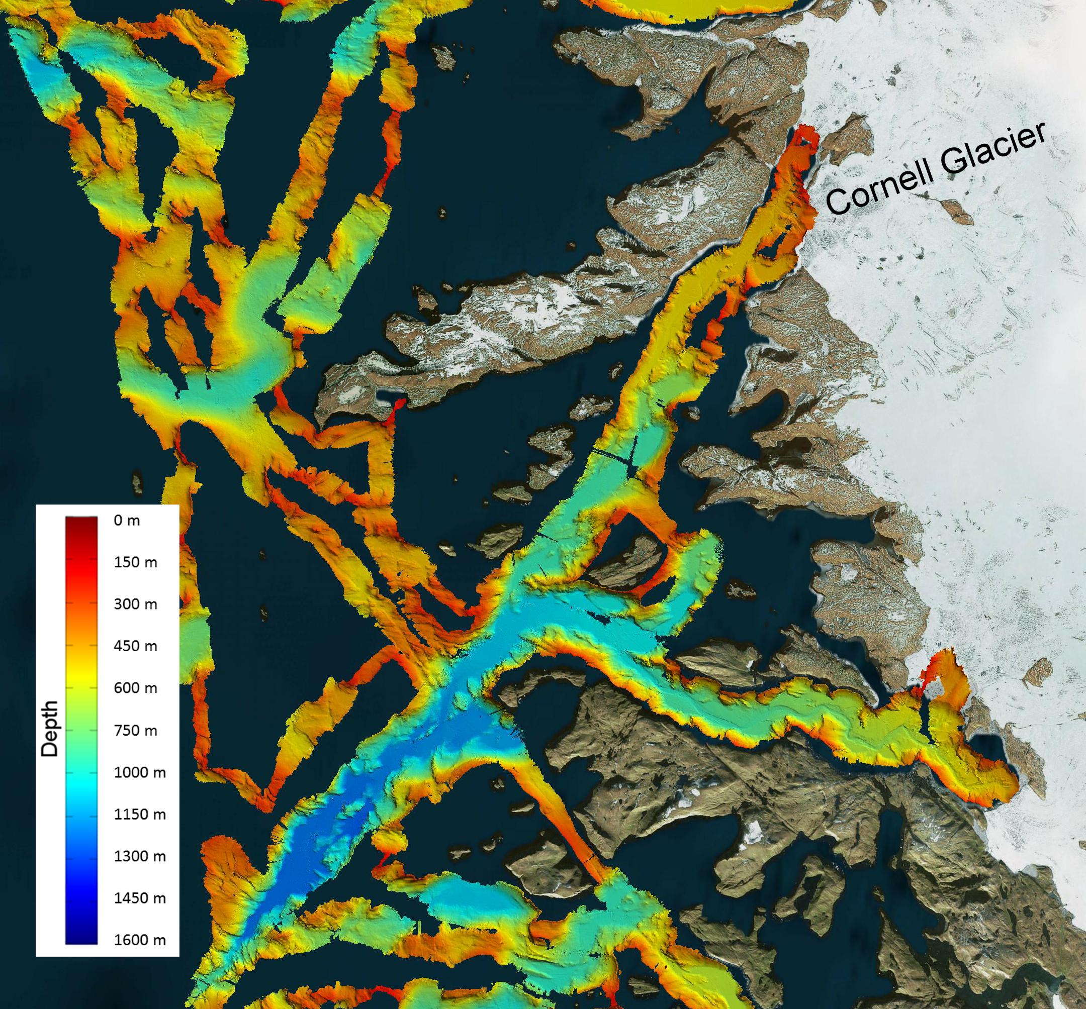
PIA20476:
-
NASA's OMG Mission Maps Sea Floor Depth off Greenland's Coast
Full Resolution:
TIFF
(11.12 MB)
JPEG
(733.1 kB)
|
|
|
2021-01-25 |
Earth
|
OMG
|
|
3792x2846x3 |
|
-
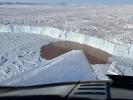
PIA24162:
-
Glacier Undercutting in Action
Full Resolution:
TIFF
(26.91 MB)
JPEG
(1.386 MB)
|
|
|
2022-01-26 |
Earth
|
OMG
|
|
4032x2471x3 |
|
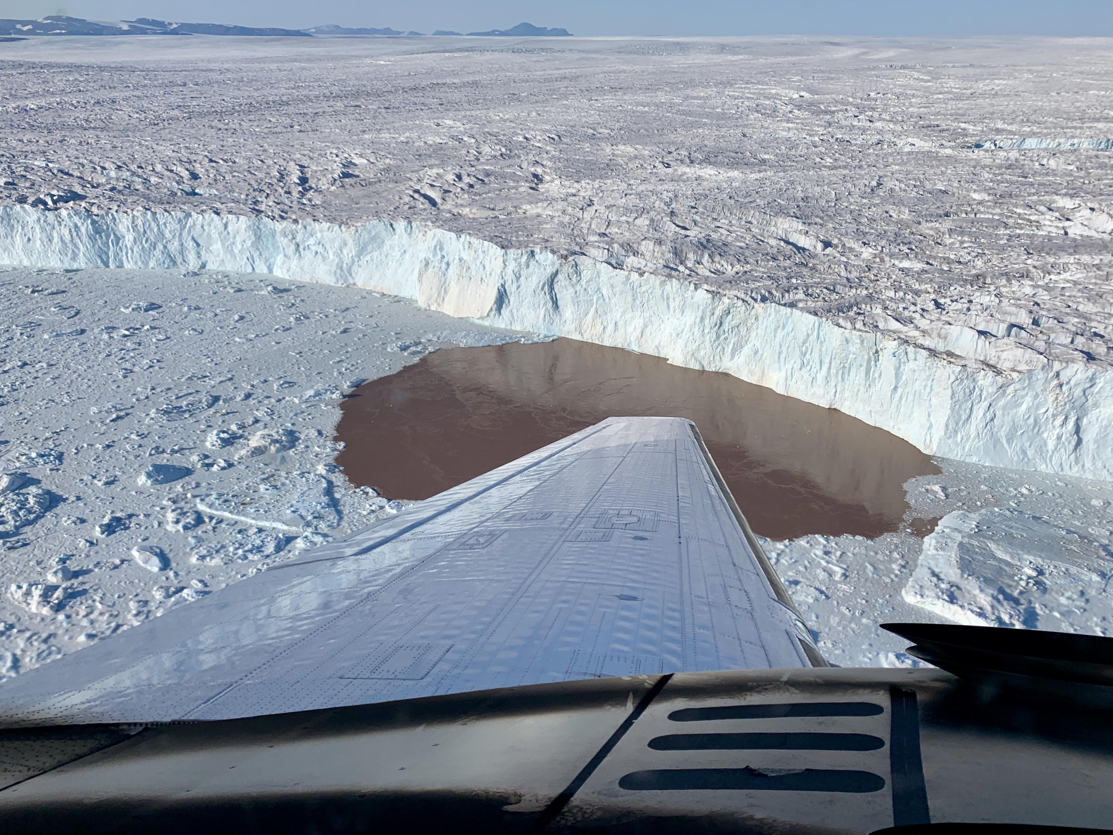
-
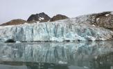
PIA24983:
-
Apusiaajik Glacier, Greenland
Full Resolution:
TIFF
(24.23 MB)
JPEG
(1.213 MB)
|
|
|
2022-01-26 |
Earth
|
OMG
|
|
3024x2697x3 |

|
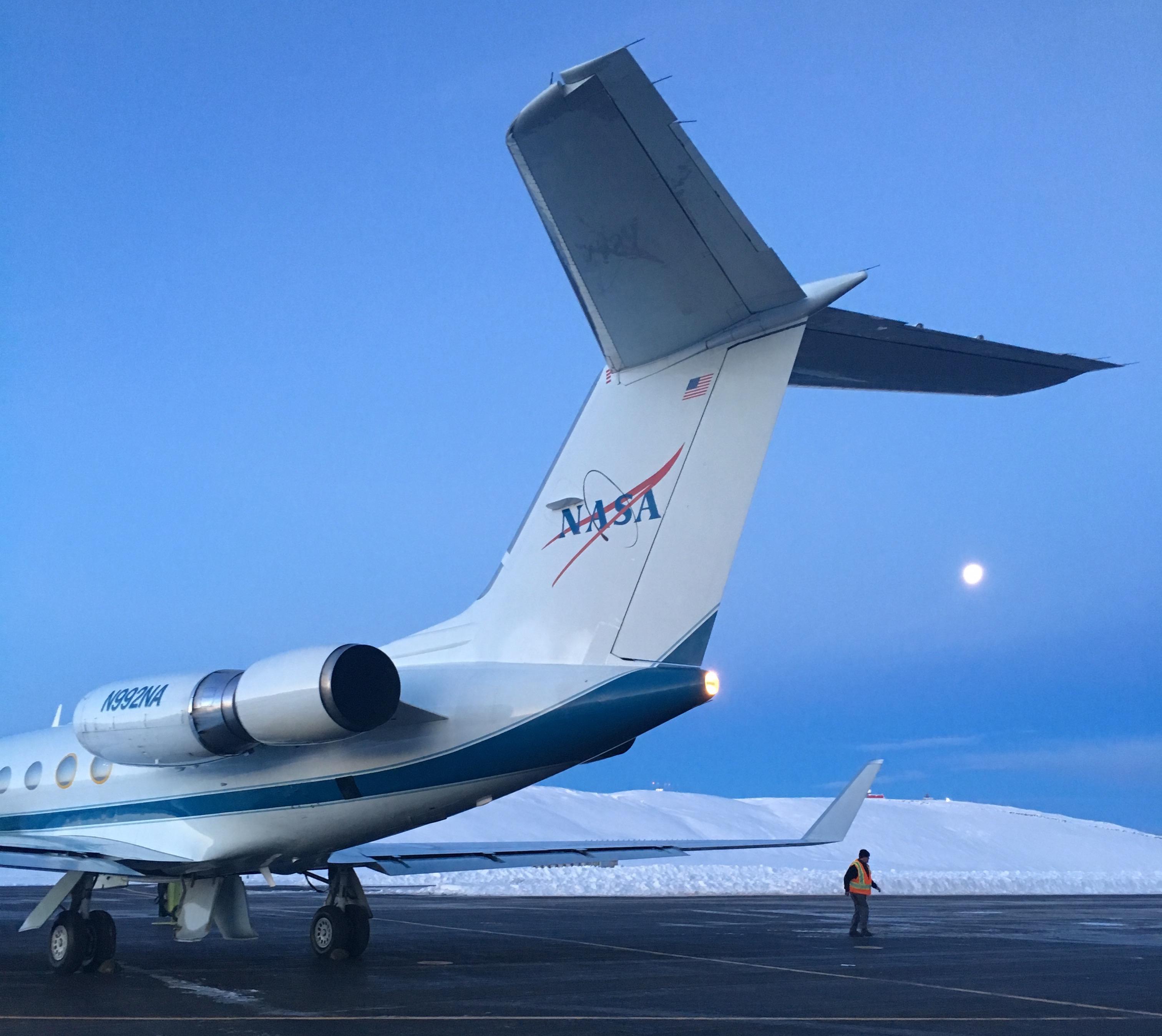
-
PIA24984:
-
NASA's OMG at Thule Air Base, Greenland
Full Resolution:
TIFF
(16.96 MB)
JPEG
(565.8 kB)
|
|