Click on an image for detailed information
Click on a column heading to sort in ascending or descending order

My
List |
Addition Date
|
Target
|
Mission
|
Instrument
|
Size
|

|
2010-03-25 |
Moon
|
Lunar Reconnaissance Orbiter (LRO)
|
Lunar Reconnaissance Orbiter Camera (NAC)
|
900x900x1 |
|
-
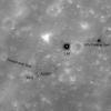
PIA12984:
-
Luna 16
Full Resolution:
TIFF
(811 kB)
JPEG
(55.01 kB)
|
|
|
2010-03-26 |
Moon
|
Lunar Reconnaissance Orbiter (LRO)
|
Lunar Reconnaissance Orbiter Camera (NAC)
|
1001x1001x1 |
|
-
PIA12987:
-
Two-toned Impact Crater in Balmer Basin: A Reflection of the Target?
Full Resolution:
TIFF
(1.003 MB)
JPEG
(185 kB)
|
|
|
2010-03-29 |
Moon
|
Lunar Reconnaissance Orbiter (LRO)
|
Lunar Reconnaissance Orbiter Camera (NAC)
|
1001x1001x1 |

|
-
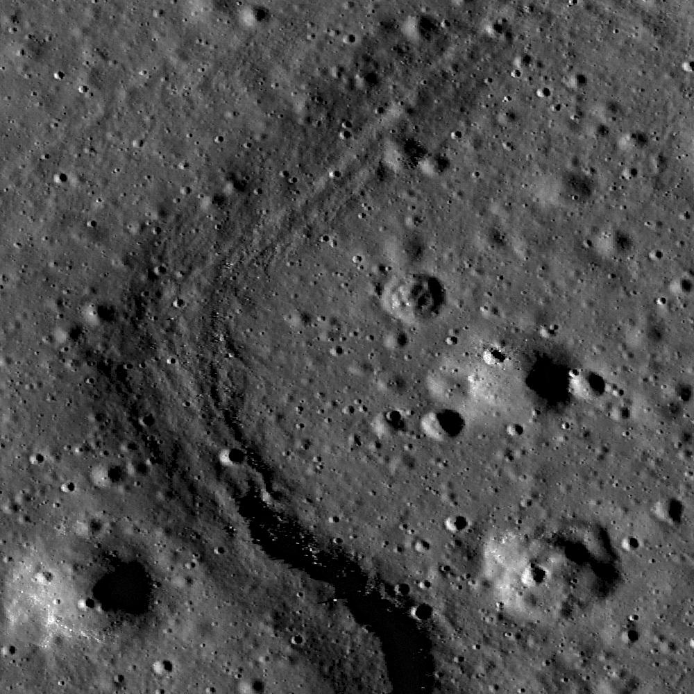
PIA12999:
-
Chain of Secondary Craters in Mare Orientale
Full Resolution:
TIFF
(1.003 MB)
JPEG
(130.8 kB)
|
|
|
2010-03-30 |
Moon
|
Lunar Reconnaissance Orbiter (LRO)
|
Lunar Reconnaissance Orbiter Camera (NAC)
|
1000x1000x1 |
|
-
PIA13002:
-
Apollo Basin: Mare in a Sea of Highlands
Full Resolution:
TIFF
(1.001 MB)
JPEG
(177.8 kB)
|
|
|
2010-04-01 |
Moon
|
Lunar Reconnaissance Orbiter (LRO)
|
Lunar Reconnaissance Orbiter Camera (NAC)
|
1000x1000x1 |
|
-
PIA13006:
-
Hortensius Dome Phi
Full Resolution:
TIFF
(1.001 MB)
JPEG
(151.6 kB)
|
|
|
2010-04-02 |
Moon
|
Lunar Reconnaissance Orbiter (LRO)
|
Lunar Reconnaissance Orbiter Camera (NAC)
|
1002x998x1 |
|
-
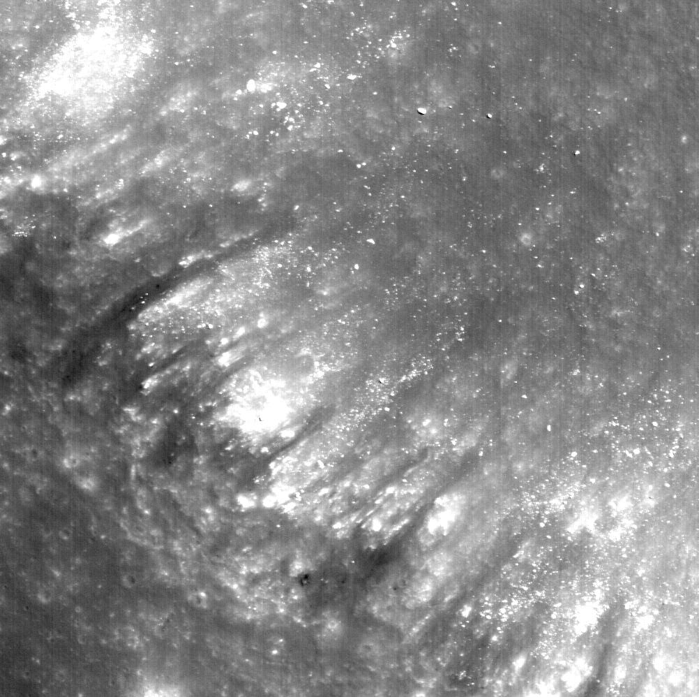
PIA13008:
-
Alphonsus Crater Mantled Floor Fracture
Full Resolution:
TIFF
(1.001 MB)
JPEG
(178 kB)
|
|
|
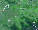
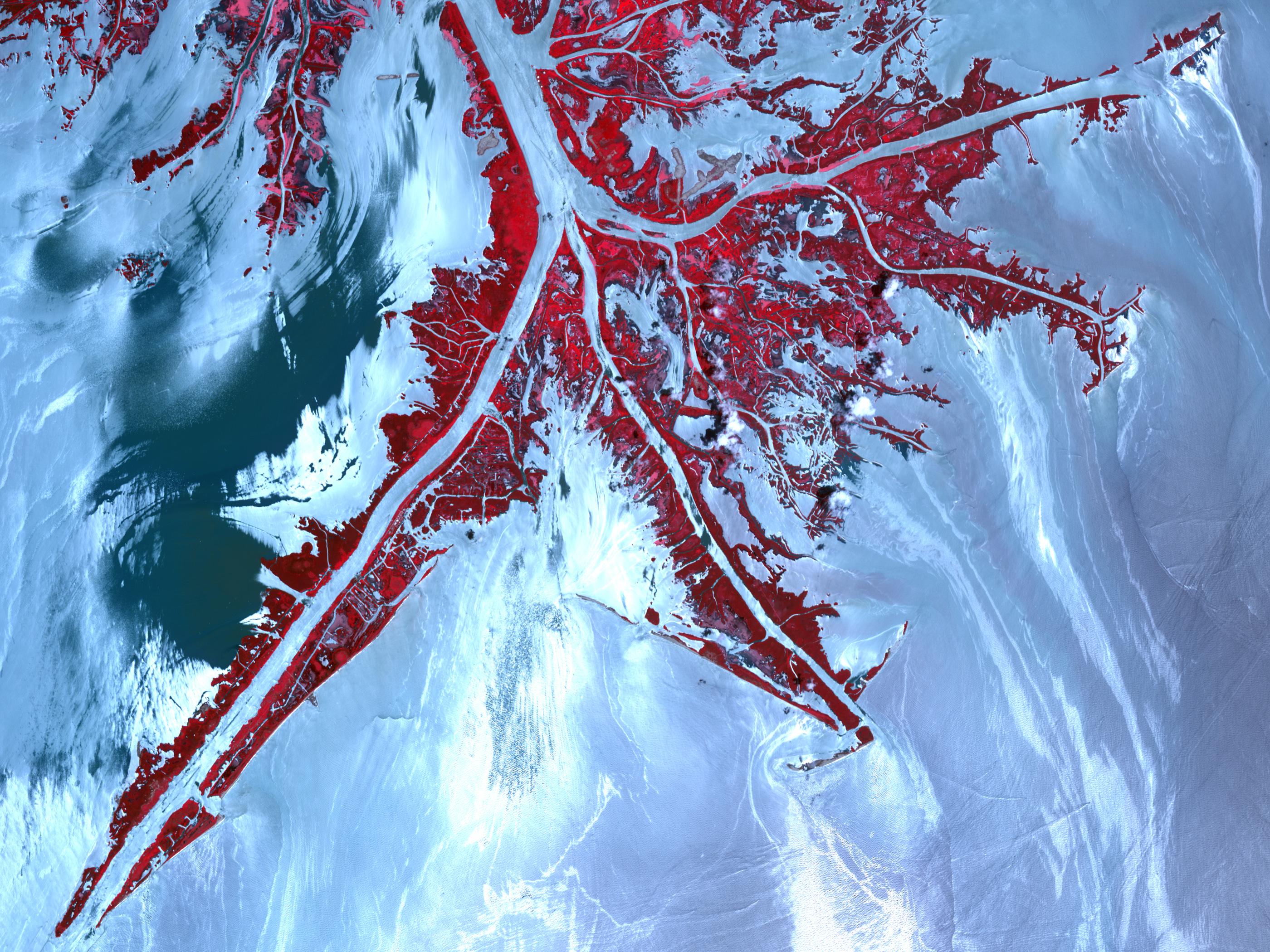
2010-04-05 |
Earth
|
Terra
|
ASTER
|
2500x3000x3 |
|
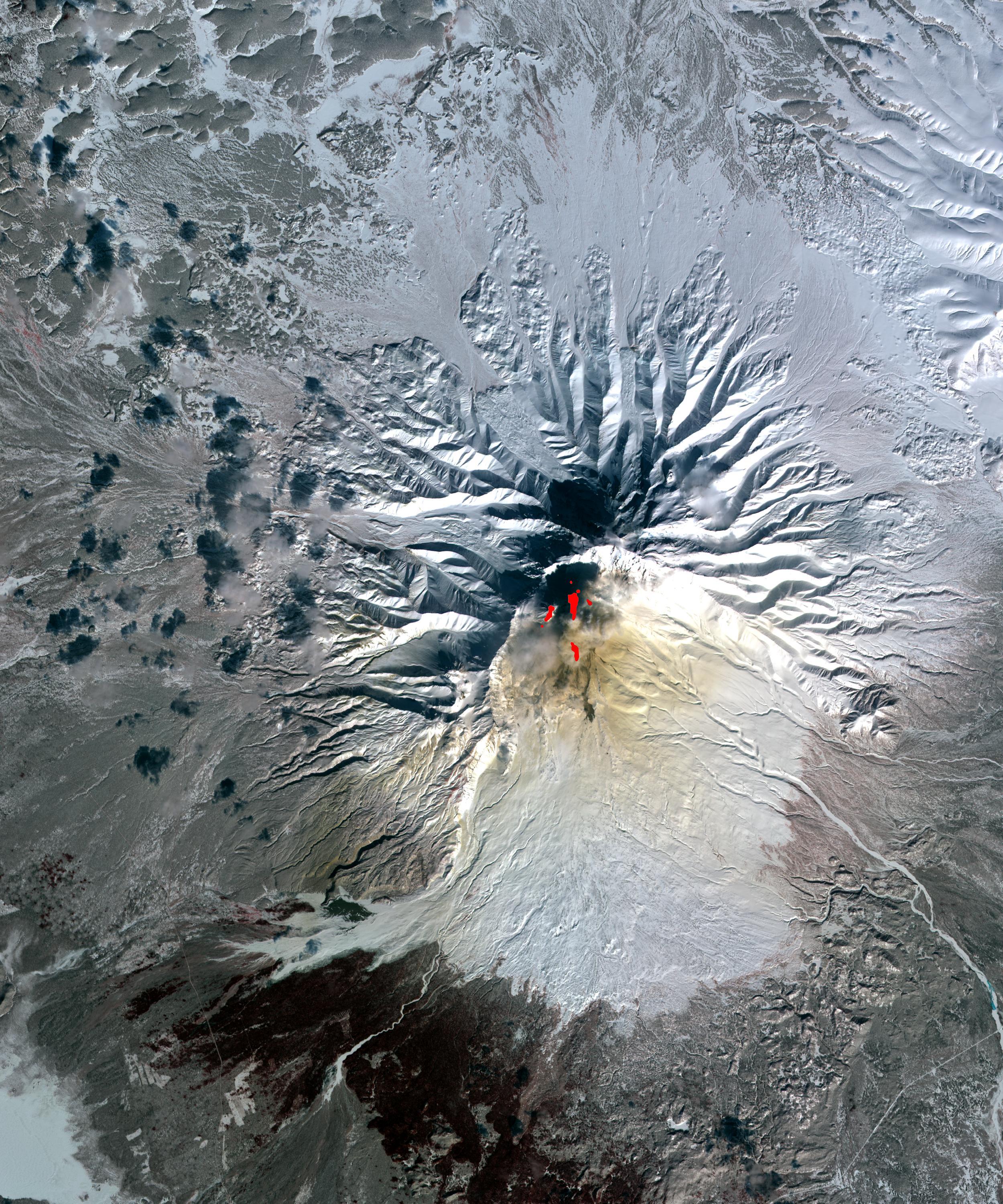
-
PIA13010:
-
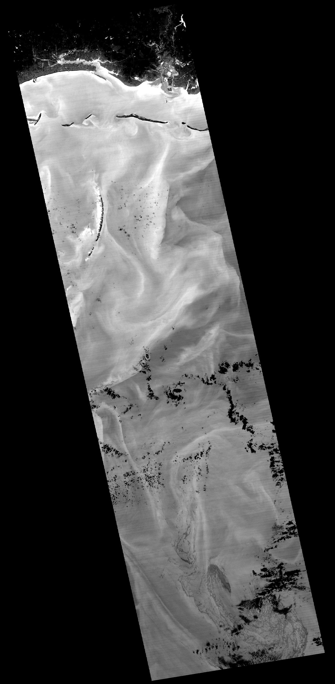
Sheveluch Volcano, Kamchatka, Russia
Full Resolution:
TIFF
(22.52 MB)
JPEG
(1.502 MB)
|
|
|
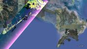
2010-04-05 |
Earth
|
Shuttle Radar Topography Mission (SRTM)
|
C-Band Radar
X-Band Radar
|
1152x792x3 |
|
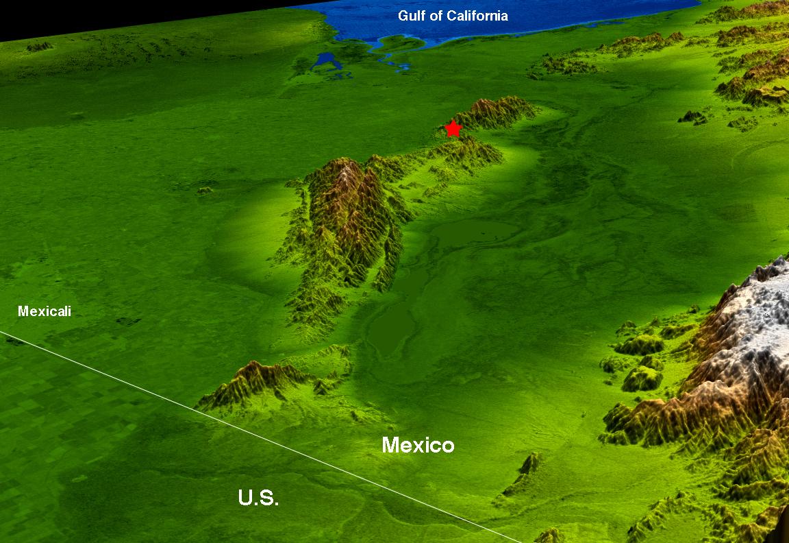
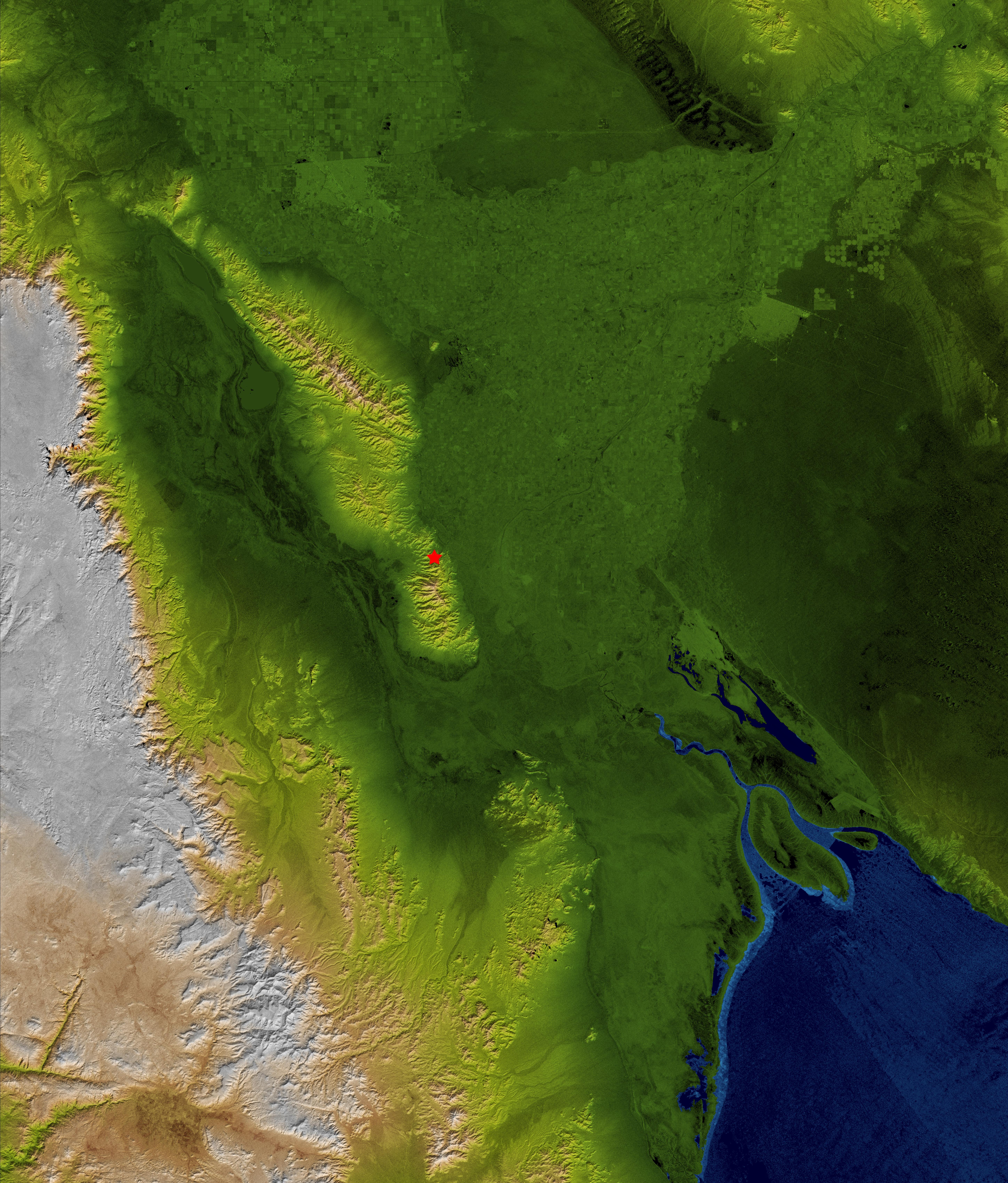
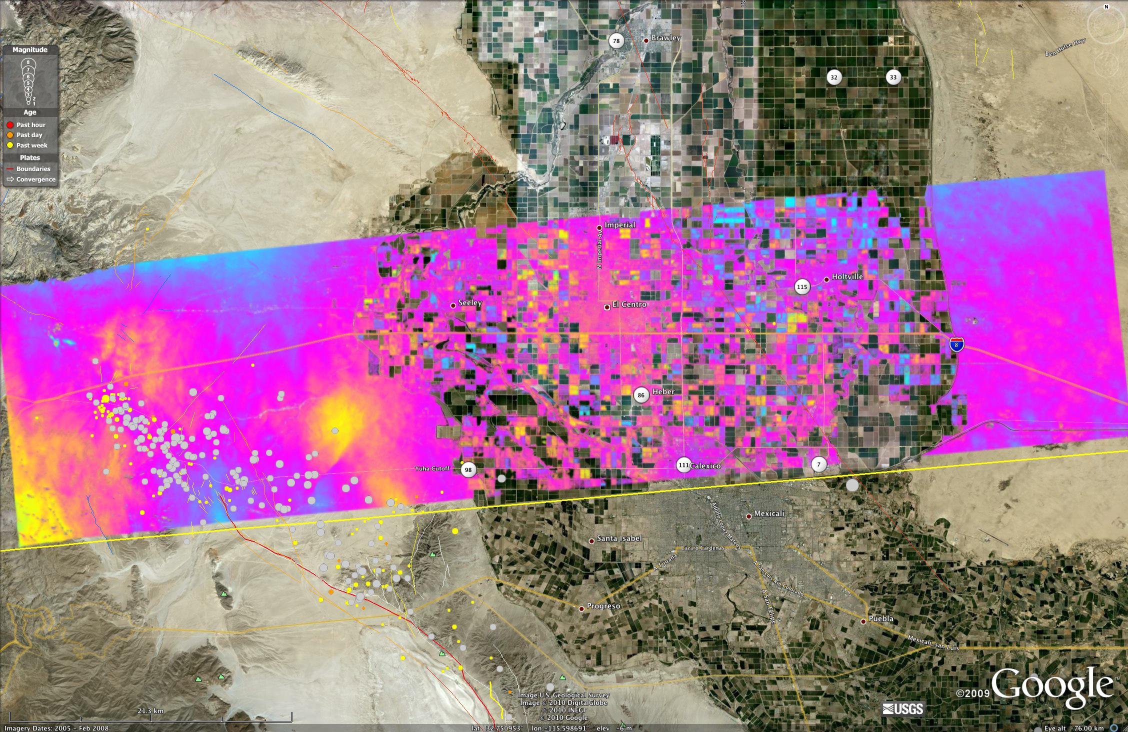
-
PIA13015:
-
Baja Earthquake Perspective View
Full Resolution:
TIFF
(2.741 MB)
JPEG
(154.3 kB)
|
|
|
2010-04-05 |
Earth
|
Shuttle Radar Topography Mission (SRTM)
|
C-Band Radar
X-Band Radar
|
5793x6796x3 |
|
-
PIA13016:
-
Baja Earthquake, Radar Image and Colored Height
Full Resolution:
TIFF
(118.1 MB)
JPEG
(5.532 MB)
|
|
|
2010-04-07 |
Moon
|
Lunar Reconnaissance Orbiter (LRO)
|
Lunar Reconnaissance Orbiter Camera (NAC)
|
1000x1000x1 |
|
-
PIA13023:
-
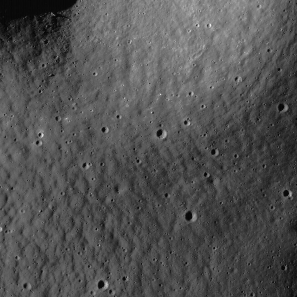
Each Crater Tells a Story
Full Resolution:
TIFF
(1.001 MB)
JPEG
(117.9 kB)
|
|
|
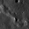
2010-04-09 |
Moon
|
Lunar Reconnaissance Orbiter (LRO)
|
Lunar Reconnaissance Orbiter Camera (NAC)
|
506x503x1 |
|
-
PIA13026:
-
Graben and Pyroclastics in SW Mare Humorum
Full Resolution:
TIFF
(255 kB)
JPEG
(57.49 kB)
|
|
|
2010-04-09 |
Earth
|
Terra
|
ASTER
|
4000x4200x3 |
|
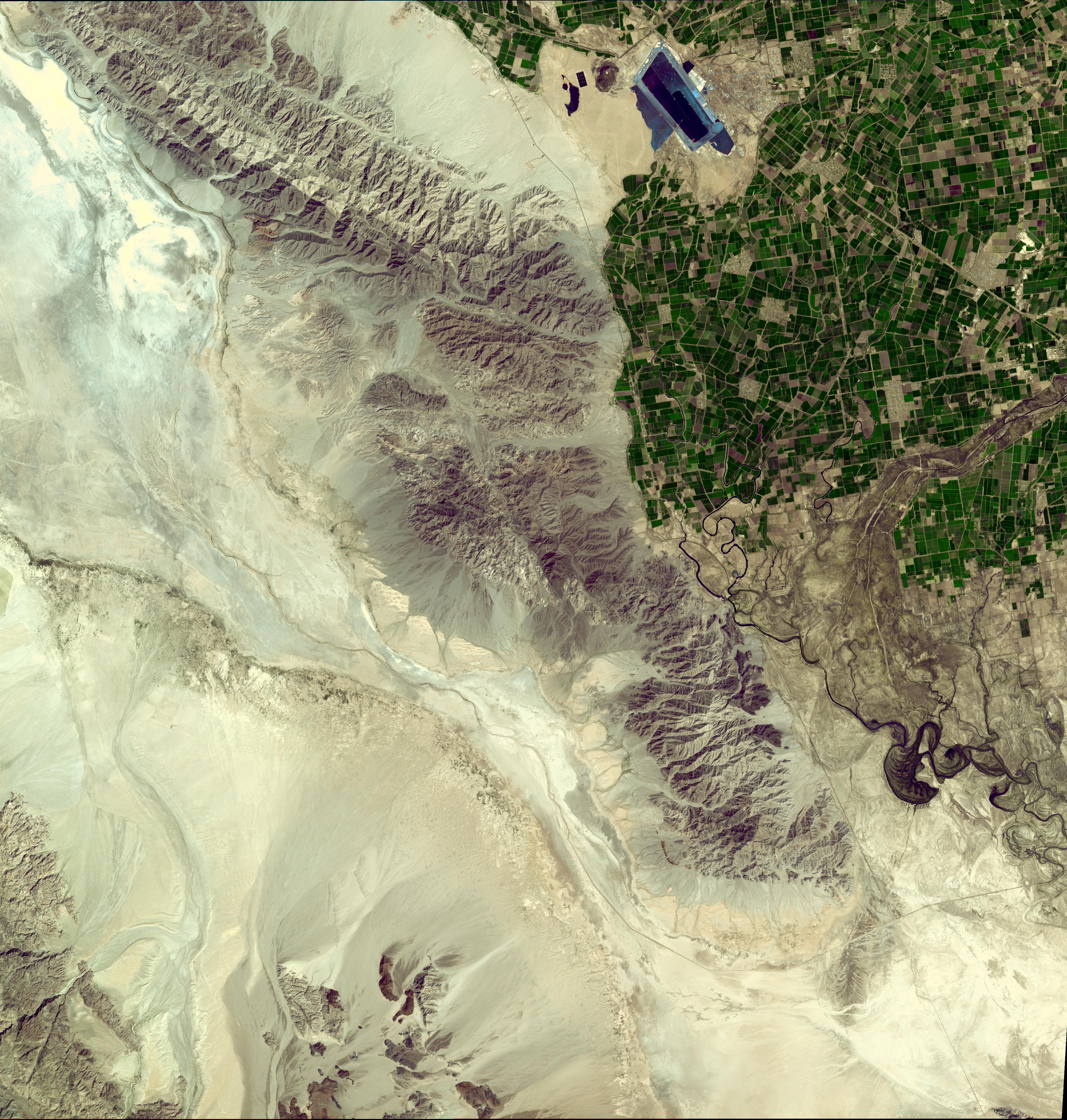
-
PIA13027:
-
NASA Satellite Imagery Shows Sparse Population of Region Near Baja, California Earthquake
Full Resolution:
TIFF
(50.4 MB)
JPEG
(2.788 MB)
|
|
|
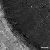
2010-04-13 |
Moon
|
Lunar Reconnaissance Orbiter (LRO)
|
Lunar Reconnaissance Orbiter Camera (NAC)
|
752x752x1 |

|
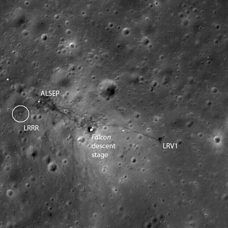
-
PIA13037:
-
The Apollo 15 Lunar Laser Ranging Retroreflector - A Fundamental Point on the Moon
Full Resolution:
TIFF
(566.3 kB)
JPEG
(71.55 kB)
|
|
|
2010-04-14 |
Moon
|
Lunar Reconnaissance Orbiter (LRO)
|
Lunar Reconnaissance Orbiter Camera (NAC)
|
1200x1200x1 |
|
-
PIA13038:
-
Exposed Fractured Bedrock in the Central Peak of the Anaxagoras Crater
Full Resolution:
TIFF
(1.442 MB)
JPEG
(135 kB)
|
|
|
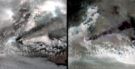
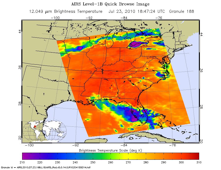
2010-04-15 |
Earth
|
Aqua
|
AIRS
|
900x695x3 |
|
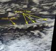
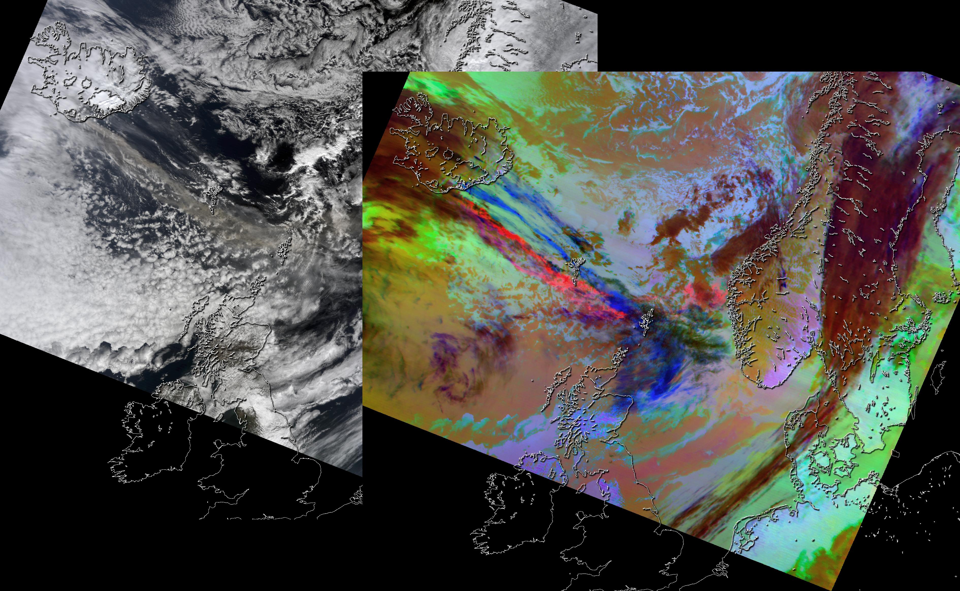
-
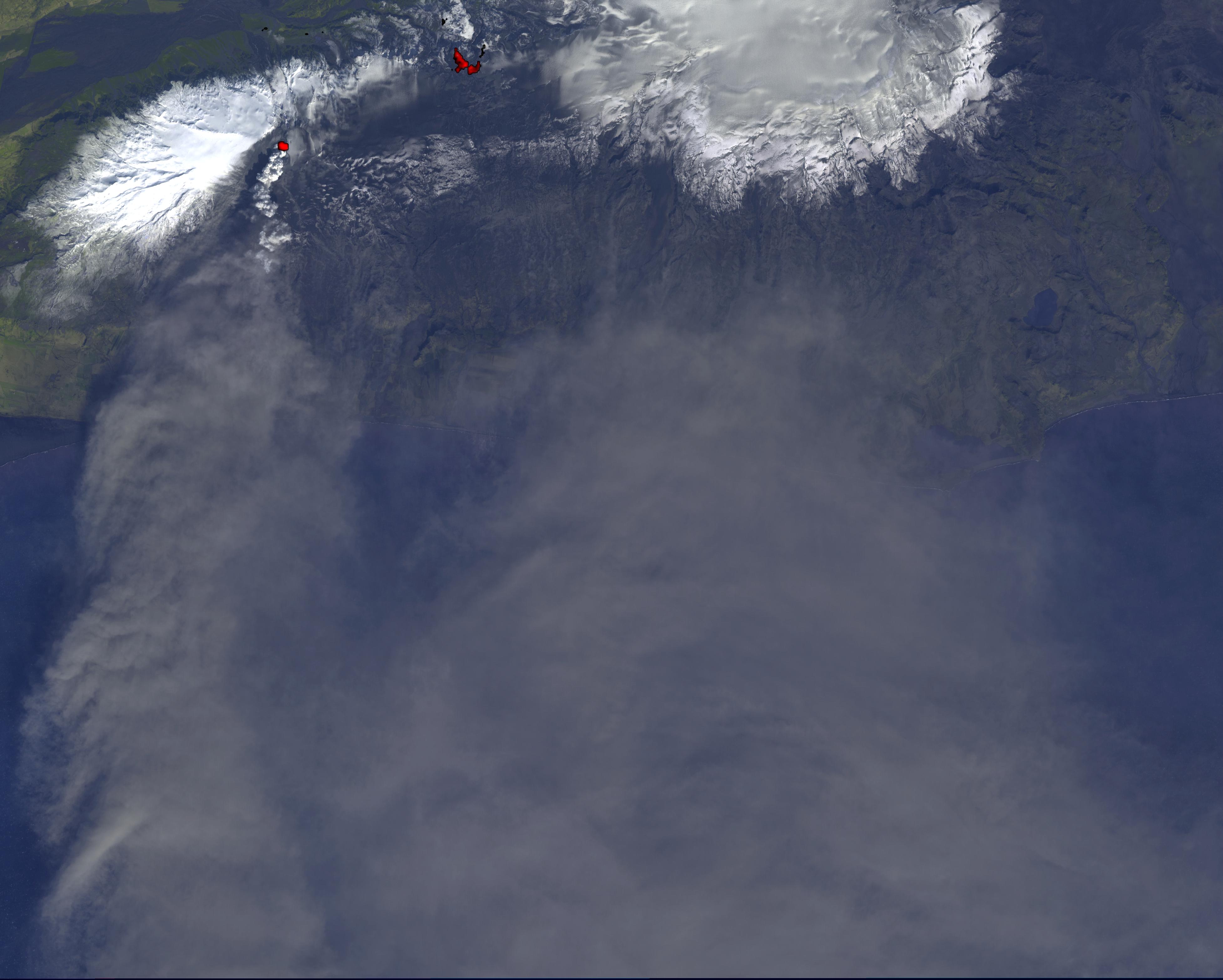
PIA13041:
-
NASA's AIRS Instrument Captures Ash Cloud from Icelandic Volcano
Full Resolution:
TIFF
(1.879 MB)
JPEG
(102.3 kB)
|
|
|
2010-04-15 |
Moon
|
Lunar Reconnaissance Orbiter (LRO)
|
Lunar Reconnaissance Orbiter Camera (NAC)
|
1000x1000x1 |
|
-
PIA13039:
-
Rimae Prinz Region - Constellation Region of Interest
Full Resolution:
TIFF
(1.001 MB)
JPEG
(106.2 kB)
|
|
|
2010-04-16 |
Moon
|
Lunar Reconnaissance Orbiter (LRO)
|
Lunar Reconnaissance Orbiter Camera (NAC)
|
1000x1000x1 |

|
-
PIA13058:
-
Retracing the Steps of Apollo 15
Full Resolution:
TIFF
(1.001 MB)
JPEG
(98.96 kB)
|
|
|
2010-04-16 |
Earth
|
Terra
|
ASTER
|
2066x1788x3 |
|
-
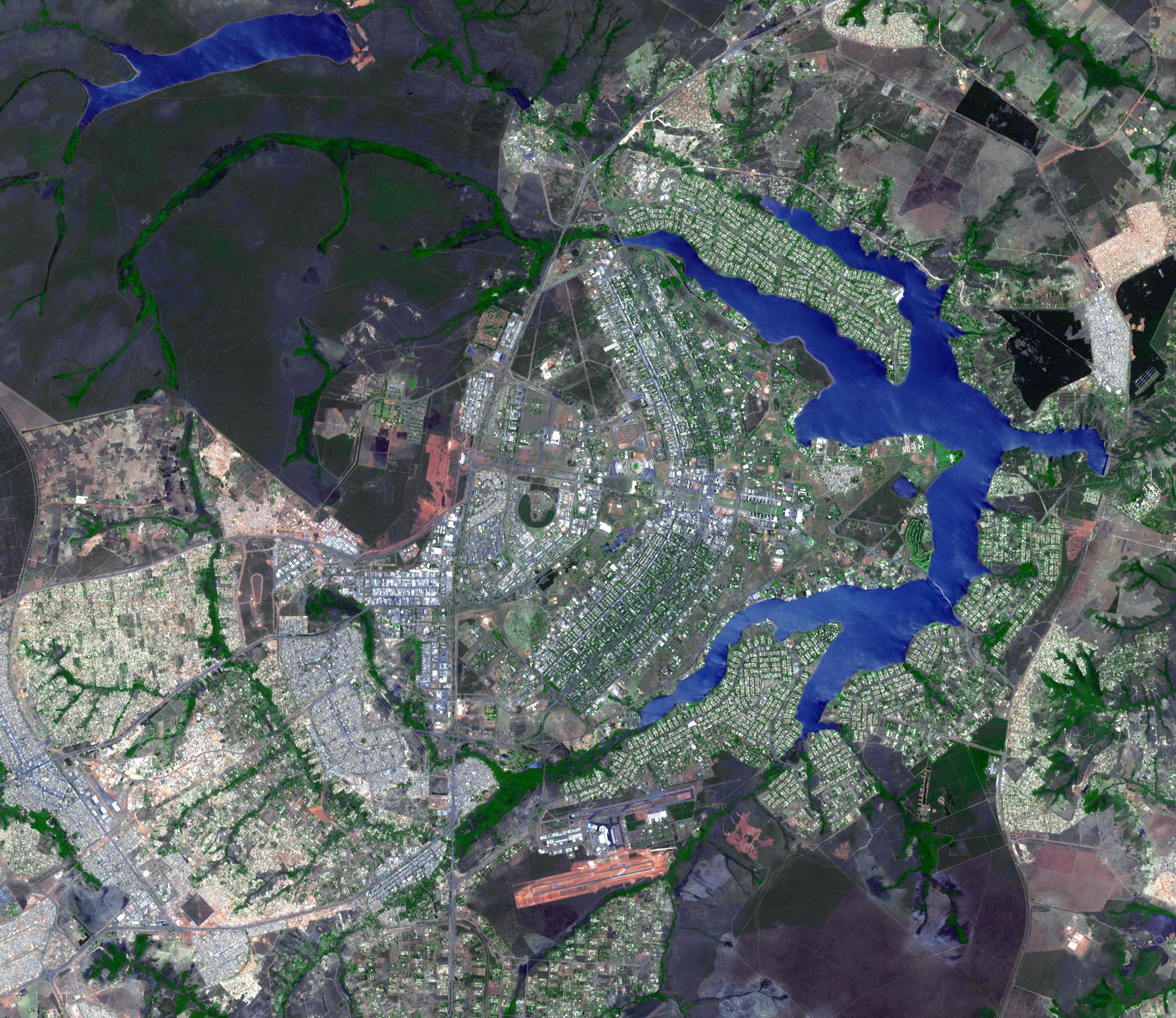
PIA13045:
-
Brasilia, Brazil
Full Resolution:
TIFF
(11.1 MB)
JPEG
(802.9 kB)
|
|
|
2010-04-16 |
Earth
|
Terra
|
MODIS
|
3780x2328x3 |
|
-
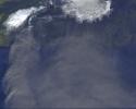
PIA13046:
-
NASA Satellite Images Provide Insights Into Iceland Volcanic Plume
Full Resolution:
TIFF
(26.4 MB)
JPEG
(1.262 MB)
|
|
|
2010-04-18 |
Earth
|
Terra
|
MISR
|
1126x1024x3 |
|
-
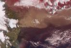
PIA13047:
-
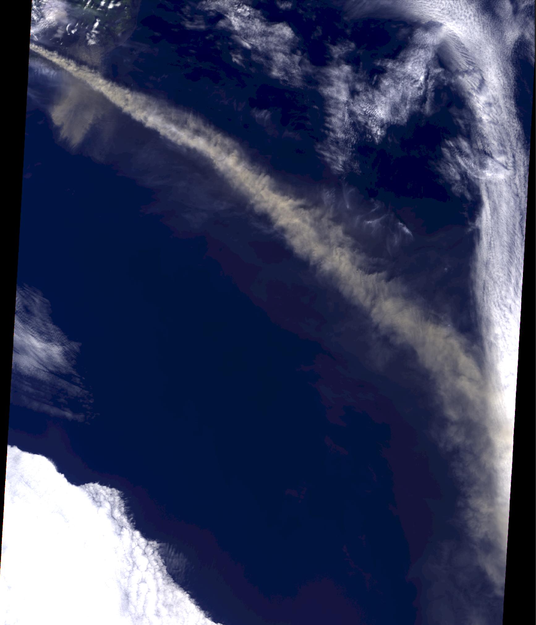
Ash from Eyjafjallaj�kull Volcano, Iceland Stretches over the North Atlantic
Full Resolution:
TIFF
(3.463 MB)
JPEG
(127.5 kB)
|
|
|
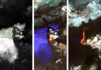
2010-04-18 |
Earth
|
Earth Observing-1 (EO-1)
|
Hyperion Hyperspectral Imager
|
525x646x3 |

|
-
PIA13048:
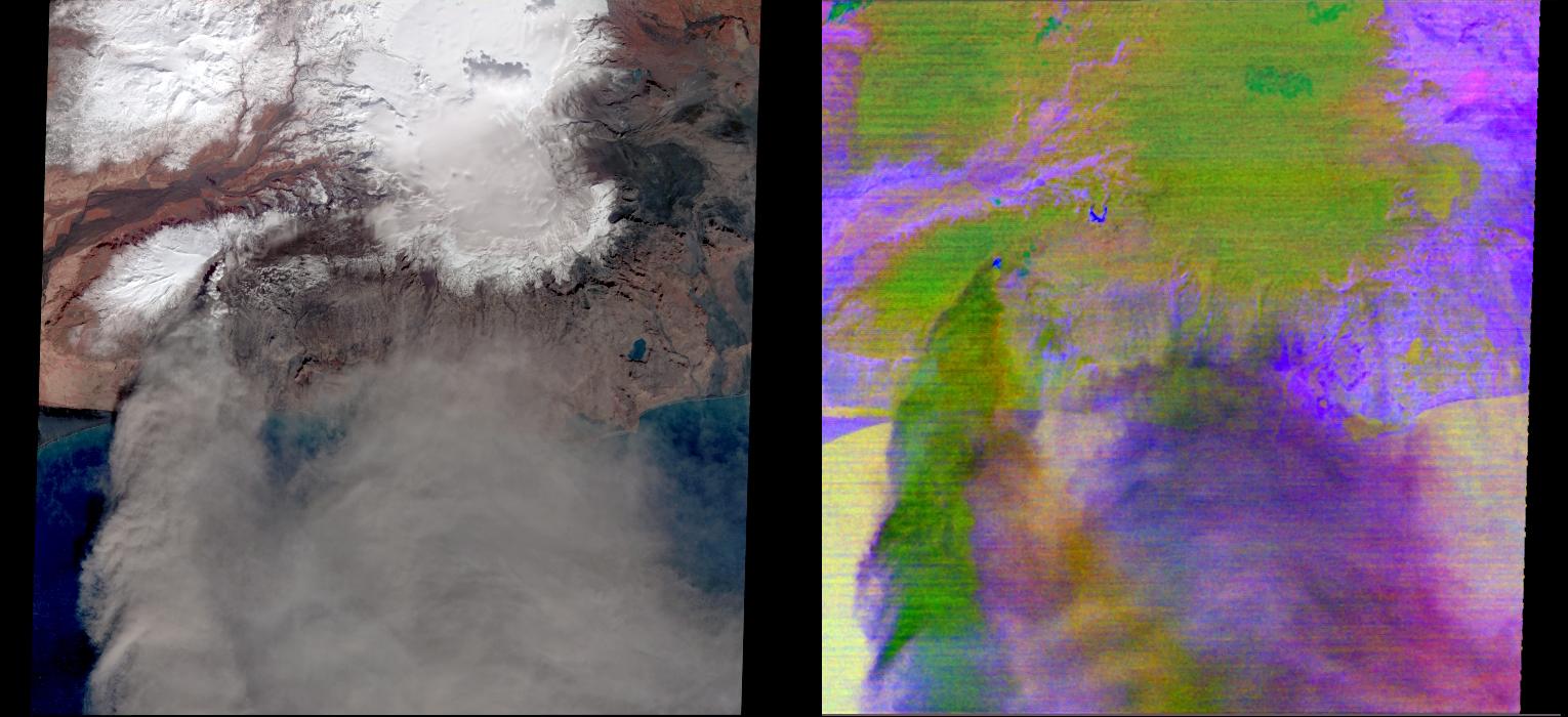
-
NASA Satellite Eyes Iceland Volcano Cauldron
Full Resolution:
TIFF
(1.019 MB)
JPEG
(56.94 kB)
|
|
|
2010-04-19 |
Earth
|
Terra
|
ASTER
|
3908x3132x3 |
|
-
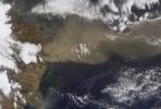
PIA13049:
-
NASA Satellite Tracks Continued Eruption of Iceland Volcano
Full Resolution:
TIFF
(17.84 MB)
JPEG
(669 kB)
|
|
|
2010-04-20 |
Earth
|
Terra
|
MISR
|
1500x1015x3 |
|
-
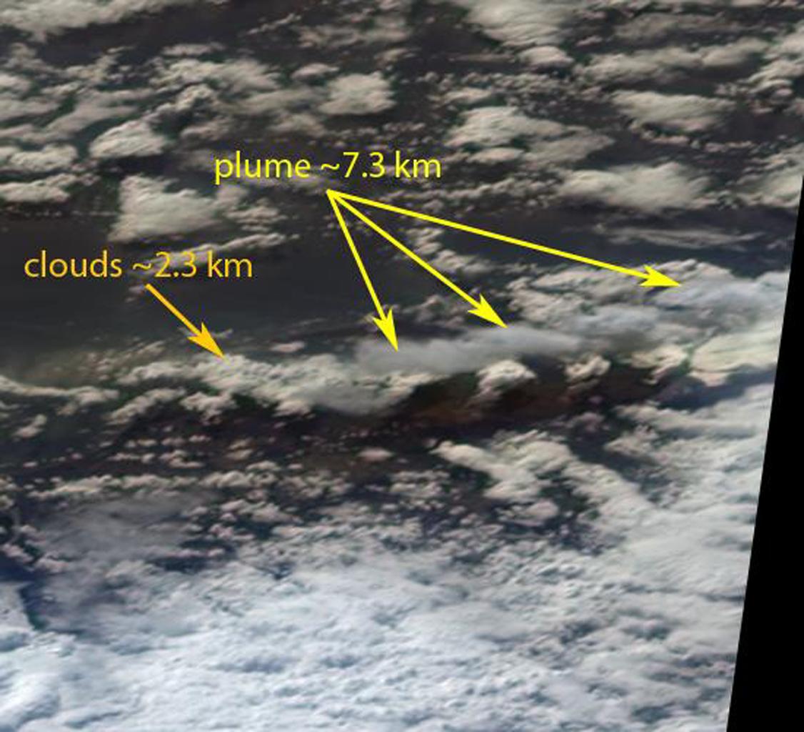
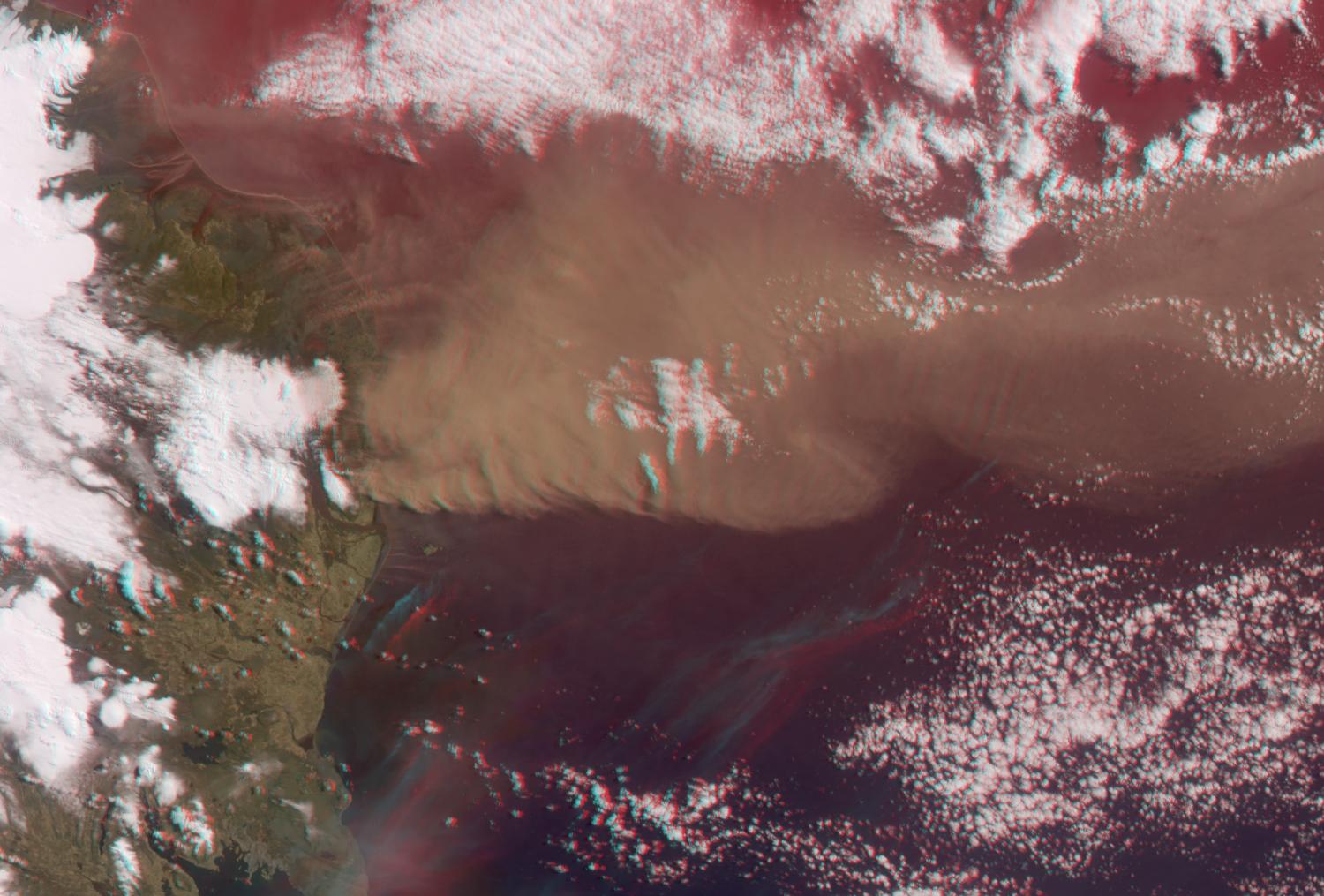
PIA13051:
-
Heights of the Eyjafjallaj�kull Eruption Plume - April 19, 2010 (Anaglyph)
Full Resolution:
TIFF
(4.576 MB)
JPEG
(188.7 kB)
|
|
|
2010-04-20 |
Earth
|
Terra
|
MISR
|
1500x1015x3 |
|
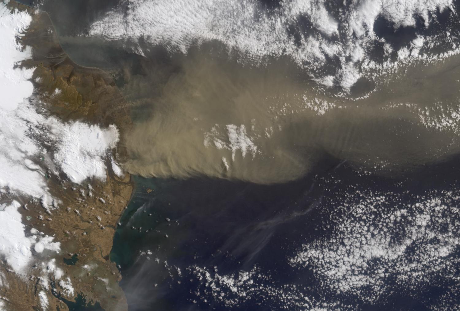
-
PIA13052:
-
Heights of the Eyjafjallaj�kull Eruption Plume - April 19, 2010
Full Resolution:
TIFF
(4.576 MB)
JPEG
(192.9 kB)
|
|
|
2010-04-21 |
Earth
|
Earth Observing-1 (EO-1)
|
Advanced Land Imager (ALI)
|
1248x1110x3 |

|
-
PIA13053:
-
NASA Satellite Observes Iceland's Eyjafjallaj�kull Volcano in Infrared
Full Resolution:
TIFF
(4.161 MB)
JPEG
(231.8 kB)
|
|
|
2010-04-21 |
Moon
|
Lunar Reconnaissance Orbiter (LRO)
|
Lunar Reconnaissance Orbiter Camera (NAC)
|
1000x1000x1 |

|
-
PIA13059:
-
Dante Crater Constellation Region of Interest
Full Resolution:
TIFF
(1.001 MB)
JPEG
(167.2 kB)
|
|
|
2010-04-21 |
Earth
|
Terra
|
MISR
|
5814x2778x3 |
|
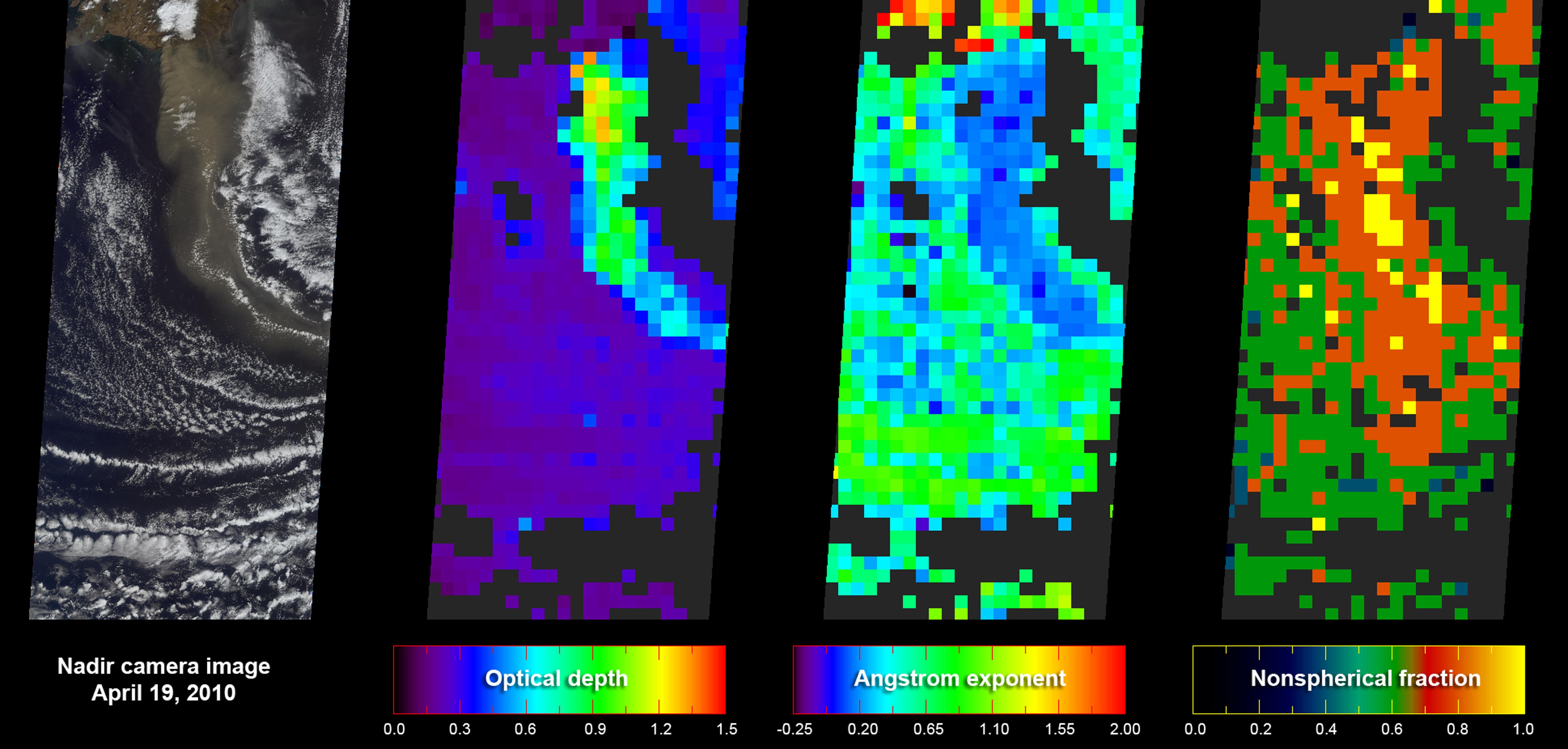
-
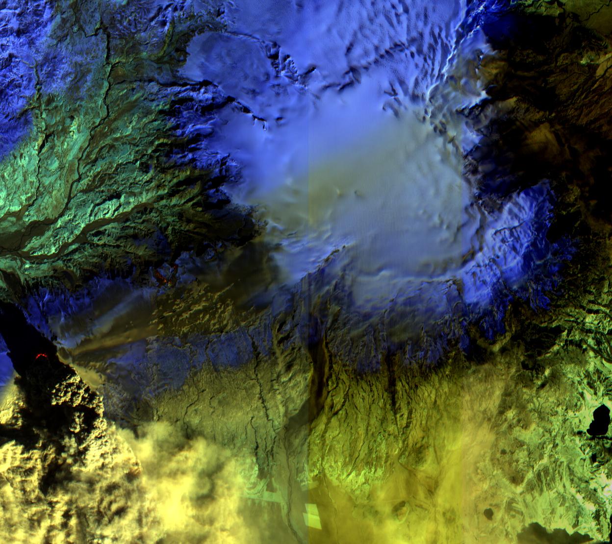
PIA13060:
-
Eyjafjallaj�kull Ash Plume Particle Properties
Full Resolution:
TIFF
(48.45 MB)
JPEG
(871.2 kB)
|
|
|
2010-04-23 |
Earth
|
Terra
|
ASTER
|
1530x700x3 |

|
-
PIA13062:
-
NASA's ASTER Instrument Analyzes Ash Plume of Iceland's Eyjafyallaj�kull Volcano
Full Resolution:
TIFF
(3.219 MB)
JPEG
(142.2 kB)
|
|
|
2010-04-27 |
Moon
|
Lunar Reconnaissance Orbiter (LRO)
|
Lunar Reconnaissance Orbiter Camera (NAC)
|
1000x1000x1 |
|
-
PIA13079:
-
Constellation Region of Interest at Mare Tranquillitatis
Full Resolution:
TIFF
(1.001 MB)
JPEG
(154.1 kB)
|
|
|
2010-05-03 |
Earth
|
Terra
|
ASTER
|
5275x6928x3 |
|
-
PIA13085:
-
ASTER Images Gulf of Mexico Oil Spill
Full Resolution:
TIFF
(109.6 MB)
JPEG
(7.882 MB)
|
|
|
2010-05-03 |
Moon
|
Lunar Reconnaissance Orbiter (LRO)
|
Lunar Reconnaissance Orbiter Camera (NAC)
|
1042x969x1 |
|
-
PIA13089:
-
Floor of Tsiolkovskiy -- Constellation Region of Interest
Full Resolution:
TIFF
(1.011 MB)
JPEG
(162.7 kB)
|
|
|
2010-05-03 |
Earth
|
Terra
|
ASTER
|
2664x2108x3 |
|
-
PIA13090:
-
Kuk, New Guinea
Full Resolution:
TIFF
(16.86 MB)
JPEG
(1.336 MB)
|
|
|
2010-05-04 |
Earth
|
Terra
|
ASTER
|
940x607x1 |

|
-
PIA13091:
-
ASTER Views the Gulf of Mexico Oil Spill in Infrared (May 1)
Full Resolution:
TIFF
(571.4 kB)
JPEG
(116.6 kB)
|
|
|
2010-05-05 |
Earth
|
Terra
|
ASTER
|
950x486x3 |
|
-
PIA13093:
-
ASTER Images Iceland's Eyjafyallaj�kull Volcano
Full Resolution:
TIFF
(1.387 MB)
JPEG
(69.67 kB)
|
|
|
2010-05-05 |
Moon
|
Lunar Reconnaissance Orbiter (LRO)
|
Lunar Reconnaissance Orbiter Camera (NAC)
|
1000x1000x3 |
|
-
PIA13094:
-
Central Peak of Copernicus Crater (Anaglyph)
Full Resolution:
TIFF
(3.004 MB)
JPEG
(107.4 kB)
|
|
|
2010-05-05 |
Moon
|
Lunar Reconnaissance Orbiter (LRO)
|
Lunar Reconnaissance Orbiter Camera (NAC)
|
1000x1000x1 |

|
-
PIA13095:
-
Central Peak of Copernicus Crater
Full Resolution:
TIFF
(1.001 MB)
JPEG
(134.7 kB)
|
|
|
2010-05-05 |
Earth
|
Earth Observing-1 (EO-1)
|
Hyperion Hyperspectral Imager
|
790x552x3 |
|
-
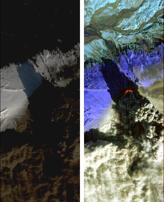
PIA13098:
-
Iceland Volcano Puffs Ash as Lava Flow Cuts Through Eyjafjallaj�kull Icecap
Full Resolution:
TIFF
(1.31 MB)
JPEG
(67.04 kB)
|
|
|
2010-05-06 |
Earth
|
Terra
|
MISR
|
947x754x1 |

|
-
PIA13099:
-
NASA's MISR Images Gulf of Mexico Oil Slick
Full Resolution:
TIFF
(715 kB)
JPEG
(39.16 kB)
|
|
|
2010-05-07 |
Moon
|
Lunar Reconnaissance Orbiter (LRO)
|
Lunar Reconnaissance Orbiter Camera (NAC)
|
1000x1000x1 |
|
-
PIA13106:
-
Mare Frigoris Constellation Region of Interest
Full Resolution:
TIFF
(1.001 MB)
JPEG
(175.9 kB)
|
|
|
2010-05-07 |
Earth
|
Terra
|
ASTER
|
1368x2791x1 |

|
-
PIA13107:
-
ASTER Views the Gulf of Mexico Oil Spill in Infrared (May 7)
Full Resolution:
TIFF
(3.823 MB)
JPEG
(292 kB)
|
|
|
2010-05-11 |
Moon
|
Lunar Reconnaissance Orbiter (LRO)
|
Lunar Reconnaissance Orbiter Camera (NAC)
|
1000x1000x1 |
|
-
PIA13132:
-
Central Peak of Bullialdus Crater
Full Resolution:
TIFF
(1.001 MB)
JPEG
(110.4 kB)
|
|
|
2010-05-12 |
Moon
|
Lunar Reconnaissance Orbiter (LRO)
|
Lunar Reconnaissance Orbiter Camera (NAC)
|
1340x1340x1 |
|
-
PIA13135:
-
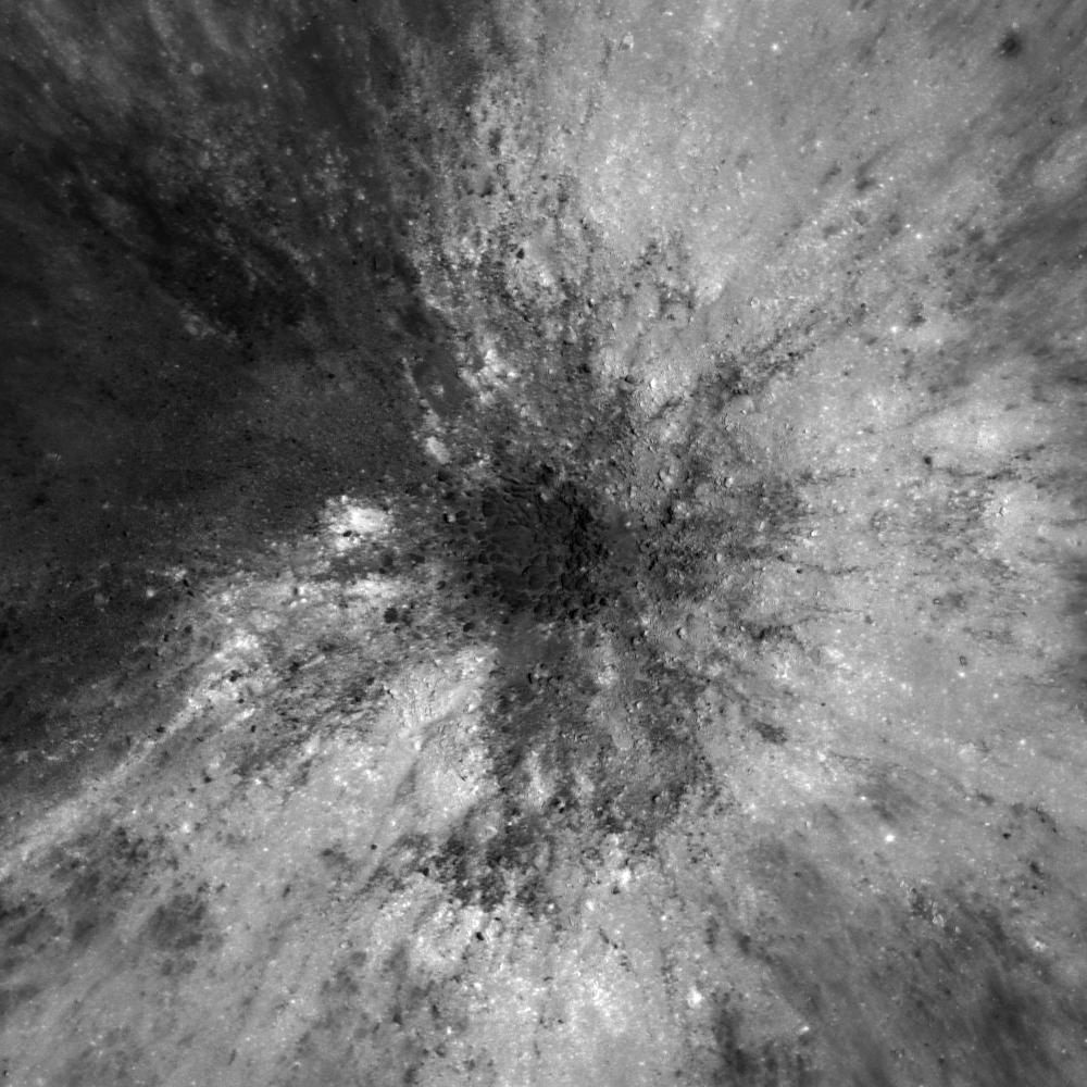
In an Instant!
Full Resolution:
TIFF
(1.798 MB)
JPEG
(385.1 kB)
|
|
|
2010-05-14 |
Earth
|
Terra
|
MISR
|
1734x2020x3 |

|
-
PIA13139:
-
NASA MISR Image Shows Eyjafjallaj�kull Volcano Plume Heights
Full Resolution:
TIFF
(10.52 MB)
JPEG
(213.9 kB)
|
|
|
2010-05-17 |
Moon
|
Lunar Reconnaissance Orbiter (LRO)
|
Lunar Reconnaissance Orbiter Camera (NAC)
|
1008x1008x1 |
|
-
PIA13140:
-
Regolith Patterns in Mendel-Rydberg
Full Resolution:
TIFF
(1.017 MB)
JPEG
(112.8 kB)
|
|
|
2010-05-17 |
Earth
|
Aqua
|
AIRS
|
2417x1887x3 |
|
-
PIA13142:
-
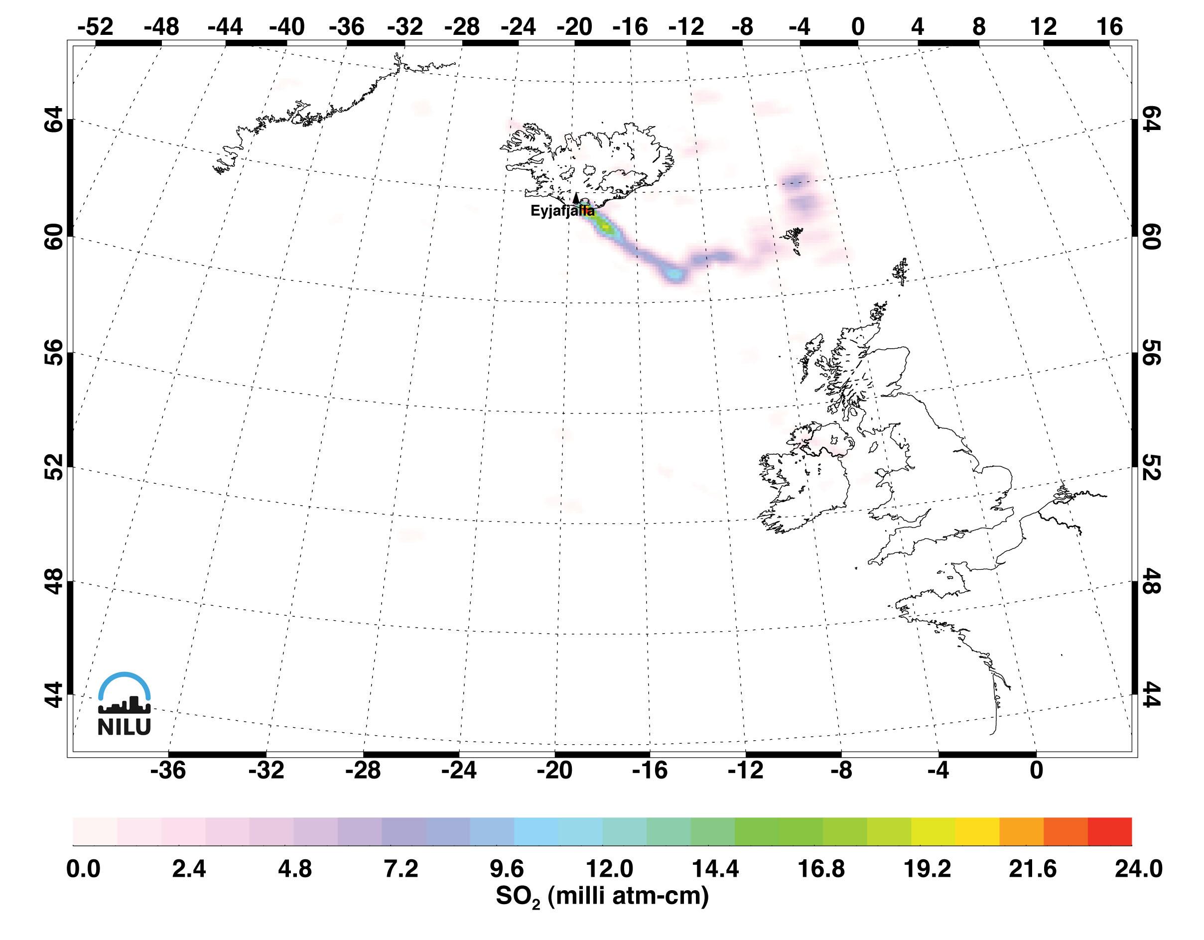
Sulfur Dioxide in Iceland's Eyjafjallaj�kull Volcanic Cloud as seen by AIRS
Full Resolution:
TIFF
(13.7 MB)
JPEG
(322.9 kB)
|
|
|
2010-05-18 |
Earth
|
Terra
|
MISR
|
2295x2673x3 |
|
-
PIA13143:
-
NASA's MISR Images Continued Spread of Gulf of Mexico Oil Slick
Full Resolution:
TIFF
(18.43 MB)
JPEG
(815.6 kB)
|
|
|
2010-05-18 |
Earth
|
Terra
|
MISR
|
1000x676x3 |

|
-
PIA13144:
-
Eyjafjallaj�kull Ash Continues to Disrupt Air Traffic
Full Resolution:
TIFF
(2.031 MB)
JPEG
(108.2 kB)
|
|
|
2010-05-19 |
Moon
|
Lunar Reconnaissance Orbiter (LRO)
|
Lunar Reconnaissance Orbiter Camera (NAC)
|
1600x1600x1 |
|
-
PIA13148:
-
Rima Bode
Full Resolution:
TIFF
(2.563 MB)
JPEG
(390.2 kB)
|
|
|
2010-05-20 |
Moon
|
Lunar Reconnaissance Orbiter (LRO)
|
Lunar Reconnaissance Orbiter Camera (NAC)
|
1000x1000x1 |
|
-
PIA13156:
-
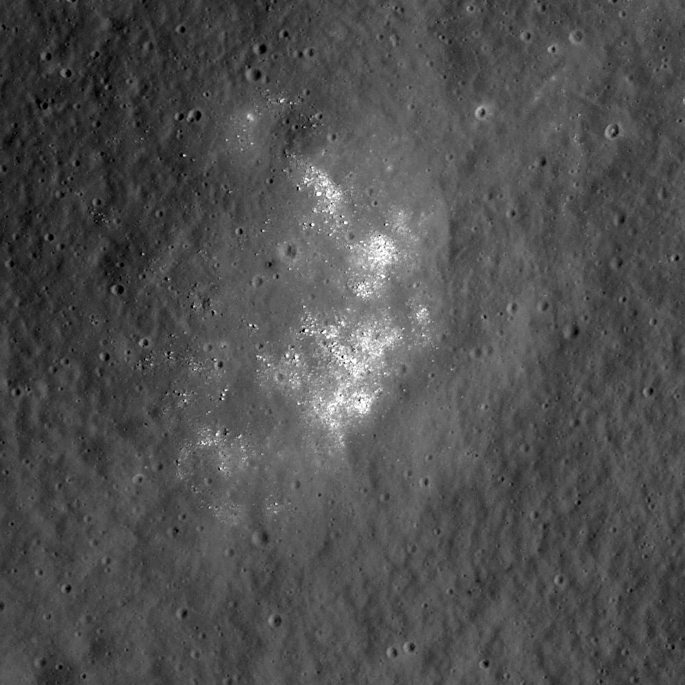
Hole in One
Full Resolution:
TIFF
(1.001 MB)
JPEG
(134.4 kB)
|
|
|
2010-05-20 |
Earth
|
Terra
|
MISR
|
1257x1406x3 |

|
-
PIA13150:
-
NASA's MISR Provides Unique Views of Gulf Oil Slick
Full Resolution:
TIFF
(5.308 MB)
JPEG
(193.2 kB)
|
|
|
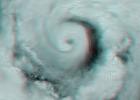
2010-05-24 |
Earth
|
OSTM/Jason-2
|
Altimeter
|
612x627x3 |

|
-
PIA13155:
-
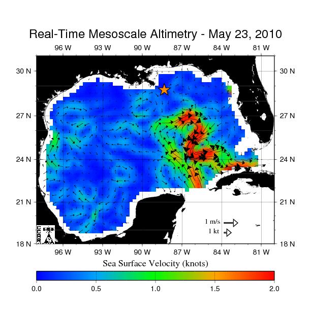
Birth of a Loop Current Eddy
Full Resolution:
TIFF
(385.9 kB)
JPEG
(69.75 kB)
|
|
|
2010-05-24 |
Moon
|
Lunar Reconnaissance Orbiter (LRO)
|
Lunar Reconnaissance Orbiter Camera (NAC)
|
1000x1000x1 |

|
-
PIA13157:
-
Splendors of Mare Smythii
Full Resolution:
TIFF
(1.001 MB)
JPEG
(153.6 kB)
|
|
|
2010-05-25 |
Moon
|
Lunar Reconnaissance Orbiter (LRO)
|
Lunar Reconnaissance Orbiter Camera (NAC)
|
1000x1000x1 |
|
-
PIA13178:
-
Hertzsprung Constellation Site
Full Resolution:
TIFF
(1.001 MB)
JPEG
(126.9 kB)
|
|
|
2010-05-26 |
Moon
|
Lunar Reconnaissance Orbiter (LRO)
|
Lunar Reconnaissance Orbiter Camera (NAC)
|
1000x1000x1 |
|
-
PIA13160:
-
Lunar Swirls at the Mare Ingenii
Full Resolution:
TIFF
(1.001 MB)
JPEG
(141.7 kB)
|
|
|
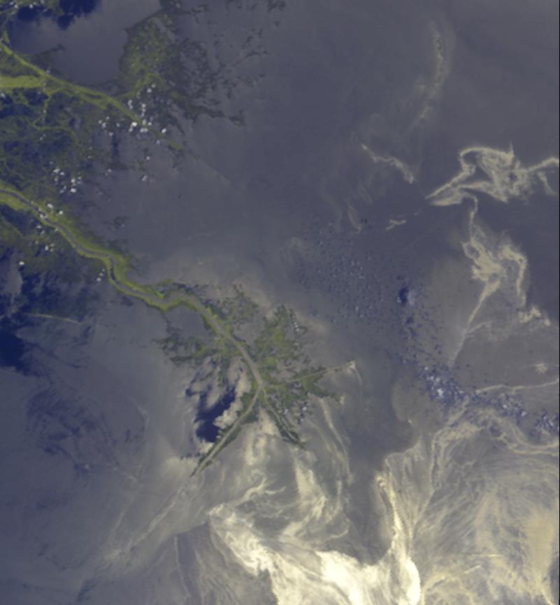
2010-05-26 |
Earth
|
Terra
|
ASTER
|
2800x2100x3 |
|
-
PIA13165:
-
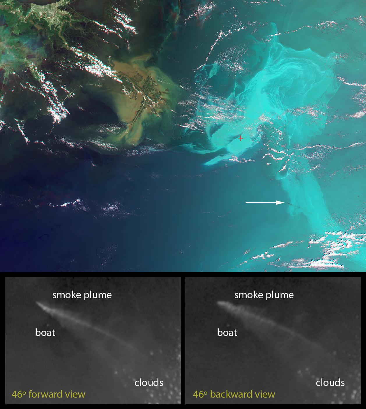
NASA Satellite Spots Oil at Mississippi Delta's Mouth
Full Resolution:
TIFF
(17.64 MB)
JPEG
(1.013 MB)
|
|
|
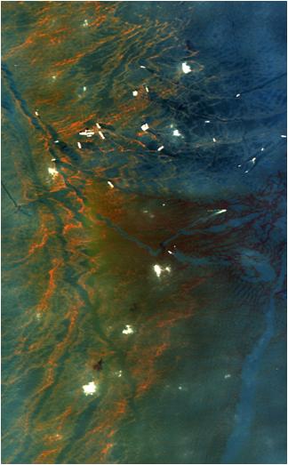
2010-05-27 |
Earth
|
|
AVIRIS
|
324x523x3 |

|
-
PIA13167:
-
NASA's AVIRIS Aids in Gulf Oil Spill Response
Full Resolution:
TIFF
(509.1 kB)
JPEG
(29.06 kB)
|
|
|
2010-06-01 |
Moon
|
Lunar Reconnaissance Orbiter (LRO)
|
Lunar Reconnaissance Orbiter Camera (NAC)
|
1000x1000x1 |
|
-
PIA13179:
-
Marius Hills Constellation Region of Interest
Full Resolution:
TIFF
(1.001 MB)
JPEG
(226.2 kB)
|
|
|
2010-06-02 |
Earth
|
Terra
|
MISR
|
801x866x3 |

|
-
PIA13174:
-
Leaking Oil Invades Louisiana Wildlife Habitats
Full Resolution:
TIFF
(2.084 MB)
JPEG
(54.74 kB)
|
|
|
2010-06-08 |
Moon
|
Lunar Reconnaissance Orbiter (LRO)
|
Lunar Reconnaissance Orbiter Camera (NAC)
|
1000x1000x1 |

|
-
PIA13193:
-
Gruithuisen Domes - Constellation Region of Interest
Full Resolution:
TIFF
(1.001 MB)
JPEG
(107.7 kB)
|
|
|
2010-06-09 |
Moon
|
Lunar Reconnaissance Orbiter (LRO)
|
Lunar Reconnaissance Orbiter Camera (WAC)
|
1024x853x3 |
|
-
PIA13194:
-
Hunting for Ancient Lunar Impact Basins
Full Resolution:
TIFF
(876.1 kB)
JPEG
(83.22 kB)
|
|
|
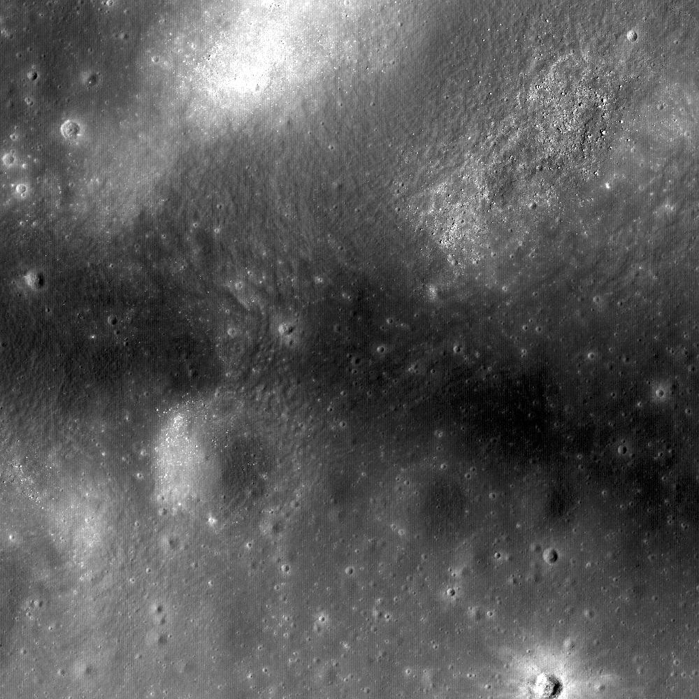
2010-06-10 |
Moon
|
Lunar Reconnaissance Orbiter (LRO)
|
Lunar Reconnaissance Orbiter Camera (NAC)
|
1000x1000x1 |
|
-
PIA13195:
-
Window to the Farside Mantle
Full Resolution:
TIFF
(1.001 MB)
JPEG
(81.49 kB)
|
|
|
2010-06-15 |
Moon
|
Lunar Reconnaissance Orbiter (LRO)
|
Lunar Reconnaissance Orbiter Camera (NAC)
|
1000x1000x1 |
|
-
PIA13223:
-
Lichtenberg Crater
Full Resolution:
TIFF
(1.001 MB)
JPEG
(133.4 kB)
|
|
|
2010-06-16 |
Moon
|
Lunar Reconnaissance Orbiter (LRO)
|
Lunar Reconnaissance Orbiter Camera (NAC)
|
1000x1000x1 |
|
-
PIA13224:
-
Depths of Mare Ingenii
Full Resolution:
TIFF
(1.001 MB)
JPEG
(112.1 kB)
|
|
|
2010-06-17 |
Moon
|
Lunar Reconnaissance Orbiter (LRO)
|
Lunar Reconnaissance Orbiter Camera (WAC)
|
1400x1400x1 |
|
-
PIA13225:
-
Orientale Basin
Full Resolution:
TIFF
(1.962 MB)
JPEG
(622.2 kB)
|
|
|
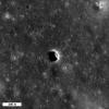
2010-06-22 |
Moon
|
Lunar Reconnaissance Orbiter (LRO)
|
Lunar Reconnaissance Orbiter Camera (NAC)
|
508x507x1 |

|
-
PIA13226:
-
Forked Impact Melt Flows at Farside Crater
Full Resolution:
TIFF
(258 kB)
JPEG
(26.53 kB)
|
|
|
2010-06-22 |
Earth
|
OSTM/Jason-2
|
Altimeter
|
1304x1268x3 |
|
-
PIA13211:
-
Adios El Ni�o, Hello La Ni�a?
Full Resolution:
TIFF
(4.966 MB)
JPEG
(158.7 kB)
|
|
|
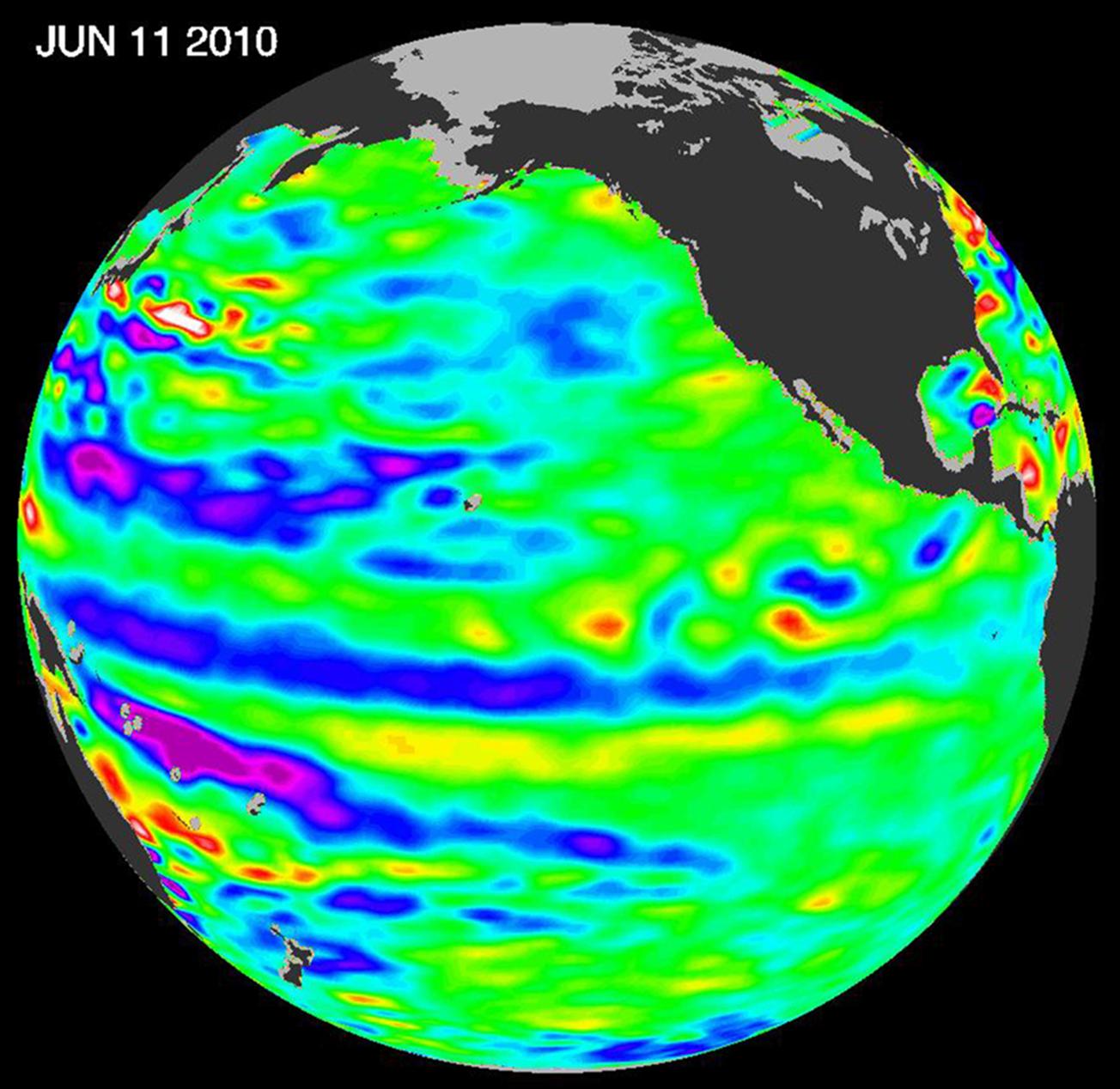
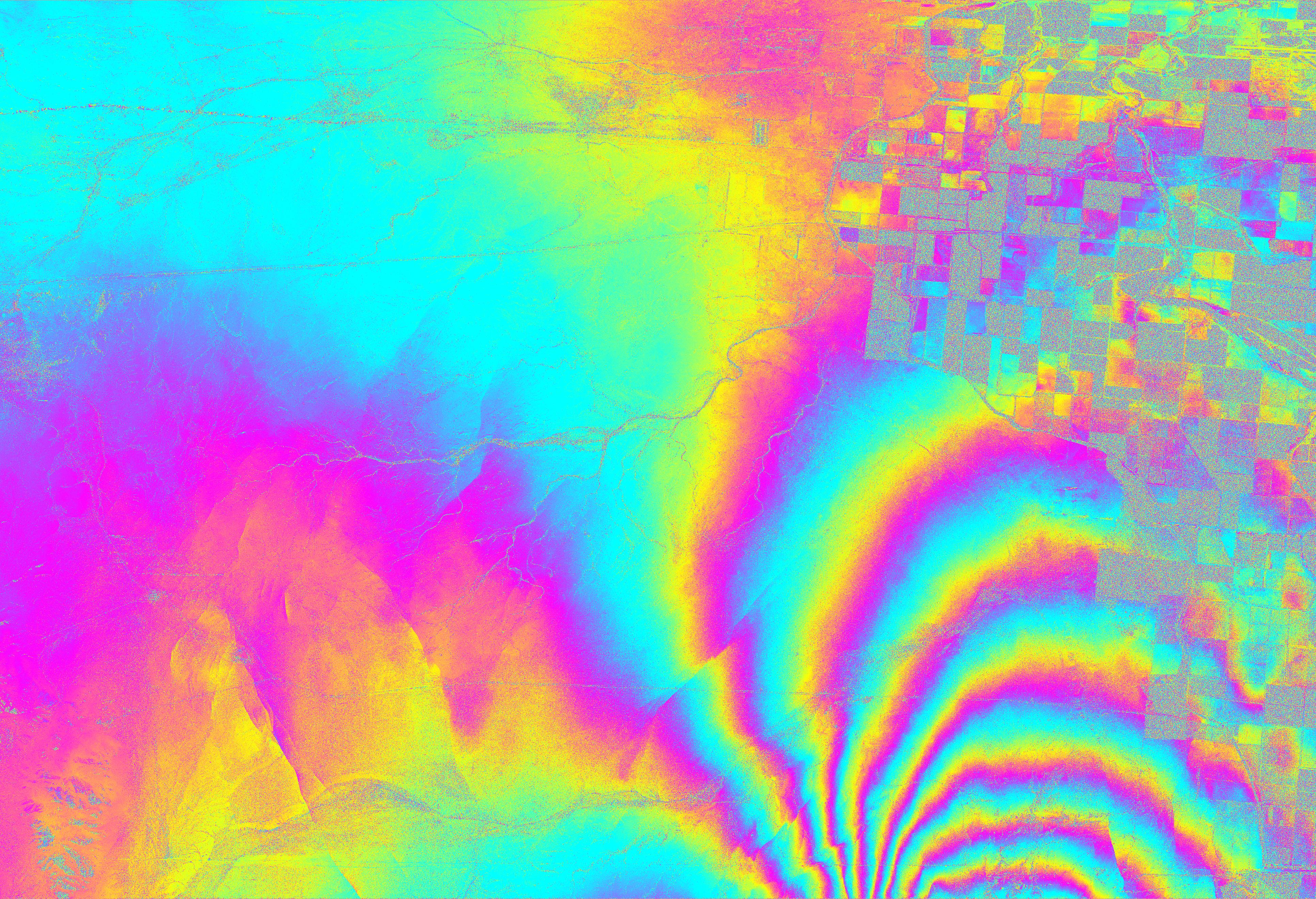
2010-06-23 |
Earth
|
UAVSAR
|
L-Band UAVSAR
|
3864x2640x3 |
|
-
PIA13380:
-
NASA Radar Images Show How Mexico Quake Deformed Earth
Full Resolution:
TIFF
(30.6 MB)
JPEG
(3.349 MB)
|
|
|
2010-06-24 |
Moon
|
Lunar Reconnaissance Orbiter (LRO)
|
Lunar Reconnaissance Orbiter Camera (NAC)
|
1200x992x1 |
|
-
PIA13227:
-
The Earth from the Moon
Full Resolution:
TIFF
(1.192 MB)
JPEG
(182.6 kB)
|
|
|
2010-06-29 |
Moon
|
Lunar Reconnaissance Orbiter (LRO)
|
Lunar Reconnaissance Orbiter Camera (NAC)
|
1000x1000x1 |

|
-
PIA13244:
-
Reiner Gamma
Full Resolution:
TIFF
(1.001 MB)
JPEG
(185.8 kB)
|
|
|
2010-07-01 |
Earth
|
UAVSAR
|
L-Band UAVSAR
|
1280x720x3 |
|
-
PIA13233:
-
UAVSAR Maps the Gulf Coast Oil Spill
Full Resolution:
TIFF
(2.768 MB)
JPEG
(116.7 kB)
|
|
|
2010-07-02 |
Moon
|
Lunar Reconnaissance Orbiter (LRO)
|
Lunar Reconnaissance Orbiter Camera (NAC)
|
1000x1000x1 |
|
-
PIA13245:
-
Wrinkle Ridge in Oceanus Procellarum
Full Resolution:
TIFF
(1.001 MB)
JPEG
(146.3 kB)
|
|
|
2010-07-06 |
Moon
|
Lunar Reconnaissance Orbiter (LRO)
|
Lunar Reconnaissance Orbiter Camera (NAC)
|
1400x1400x1 |
|
-
PIA13246:
-
Linné Crater
Full Resolution:
TIFF
(1.962 MB)
JPEG
(491.9 kB)
|
|
|
2010-07-07 |
Earth
|
Terra
|
MISR
|
1656x1182x3 |
|
-
PIA13242:
-
Hurricane Alex Disrupts Gulf Cleanup
Full Resolution:
TIFF
(5.882 MB)
JPEG
(120.5 kB)
|
|
|
2010-07-07 |
Earth
|
GRACE
|
K-Band Ranging System
|
777x745x3 |

|
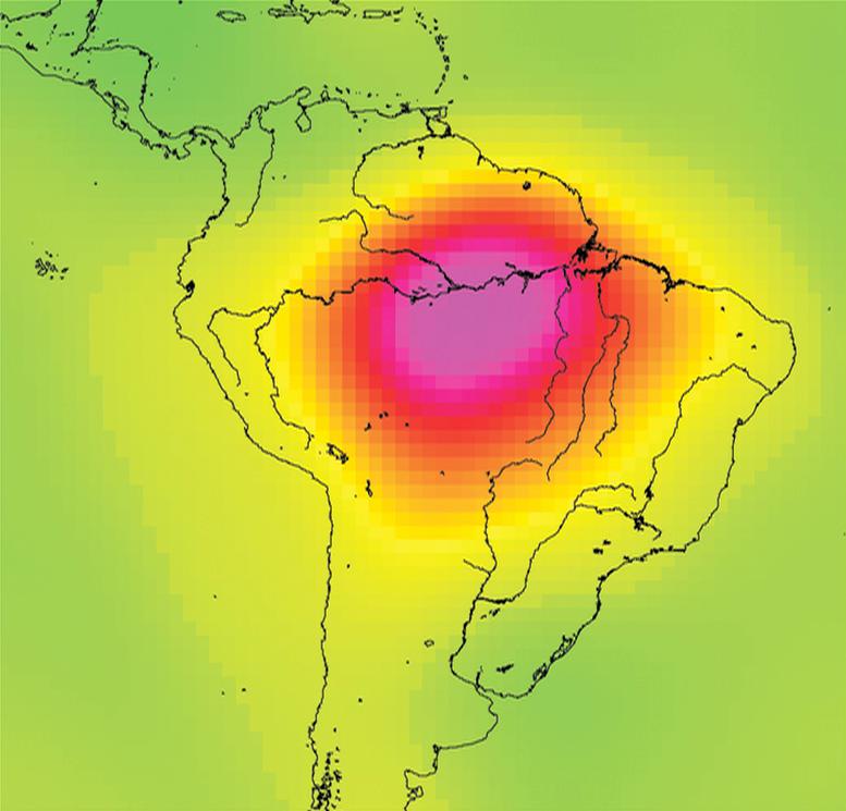
-
PIA13243:
-
Measuring Water Storage in the Amazon

Full Resolution:
TIFF
(1.739 MB)
JPEG
(51.9 kB)
|
|
|
2010-07-08 |
Moon
|
Lunar Reconnaissance Orbiter (LRO)
|
Lunar Reconnaissance Orbiter Camera (NAC)
|
570x570x1 |
|
-
PIA13247:
-
Apollo 16, Footsteps Under High Sun
Full Resolution:
TIFF
(325.5 kB)
JPEG
(36.1 kB)
|
|
|
2010-07-13 |
Moon
|
Lunar Reconnaissance Orbiter (LRO)
|
Lunar Reconnaissance Orbiter Camera (NAC)
|
1000x1000x1 |

|
-
PIA13496:
-
The Moon's Largest Impact Basin
Full Resolution:
TIFF
(1.001 MB)
JPEG
(104.1 kB)
|
|
|
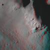
2010-07-14 |
Moon
|
Lunar Reconnaissance Orbiter (LRO)
|
Lunar Reconnaissance Orbiter Camera (NAC)
|
900x900x1 |
|
-
PIA13497:
-
How Common are Mare Pit Craters?
Full Resolution:
TIFF
(811 kB)
JPEG
(97.64 kB)
|
|
|
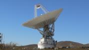
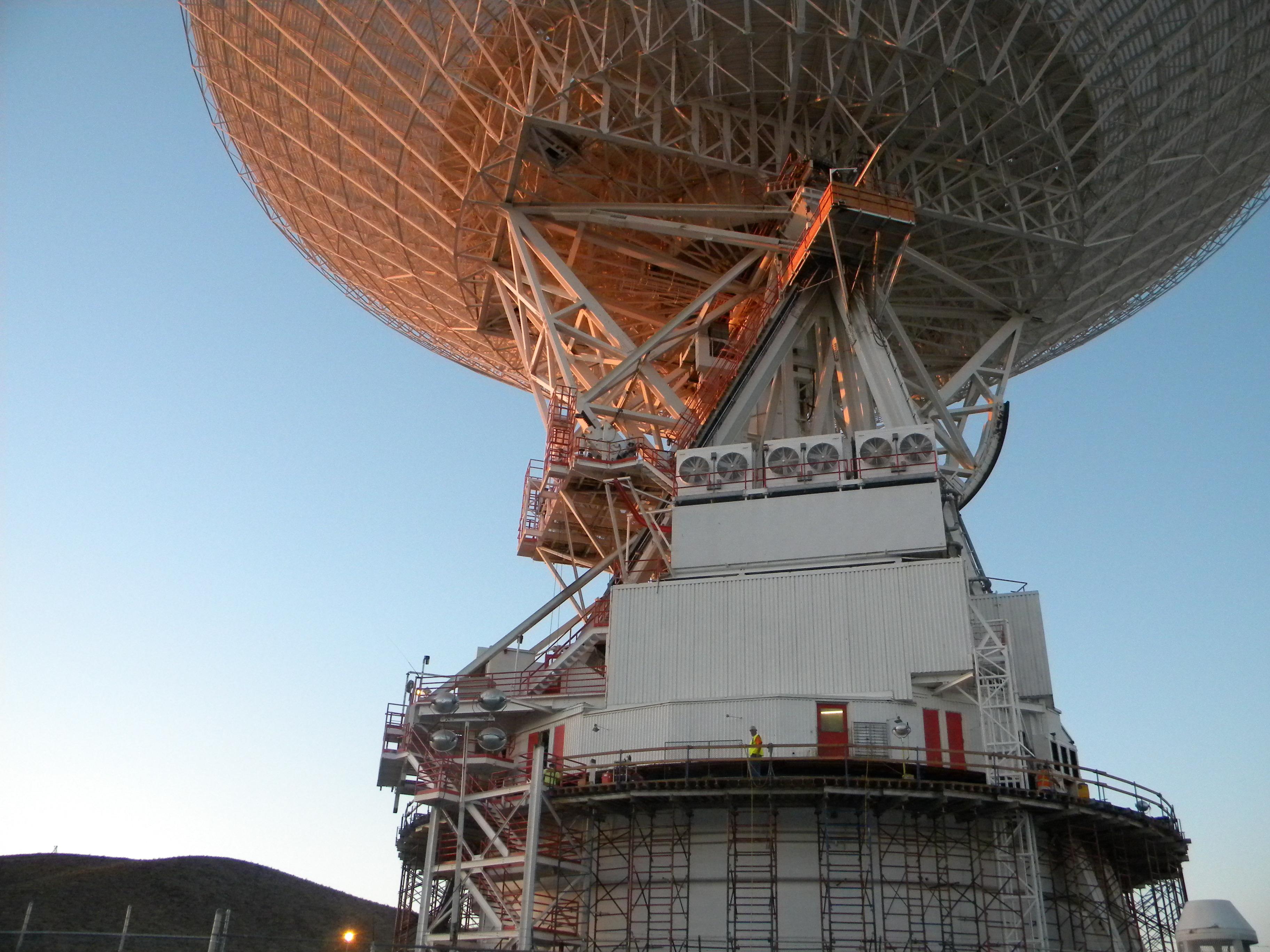
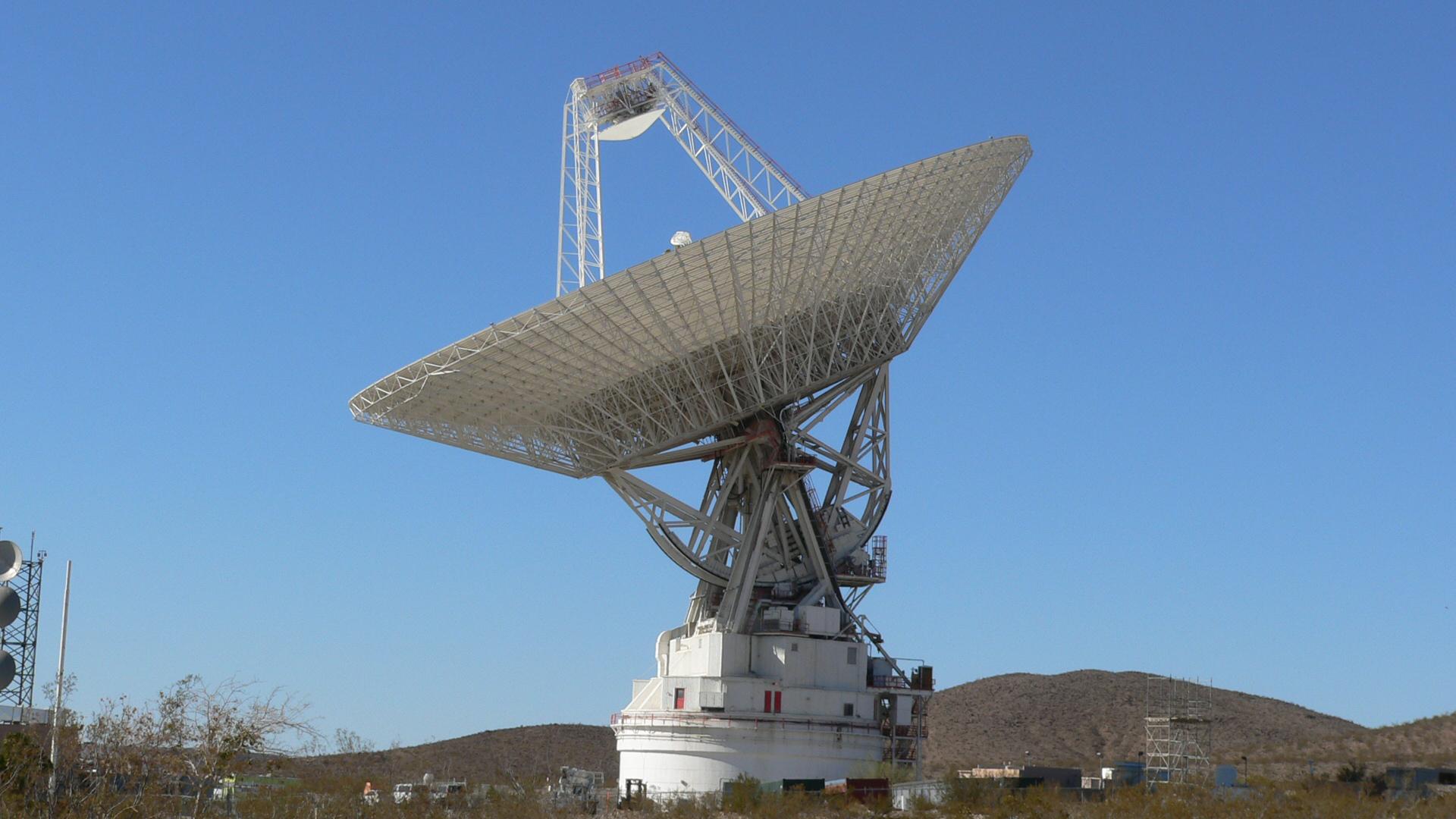
2010-07-15 |
Earth
|
Goldstone Deep Space Network (DSN)
|
Deep Space Network Antenna
|
3648x2736x3 |

|
-
PIA13270:
-
Mars Antenna Ready for Surgery
Full Resolution:
TIFF
(29.94 MB)
JPEG
(965.1 kB)
|
|
|
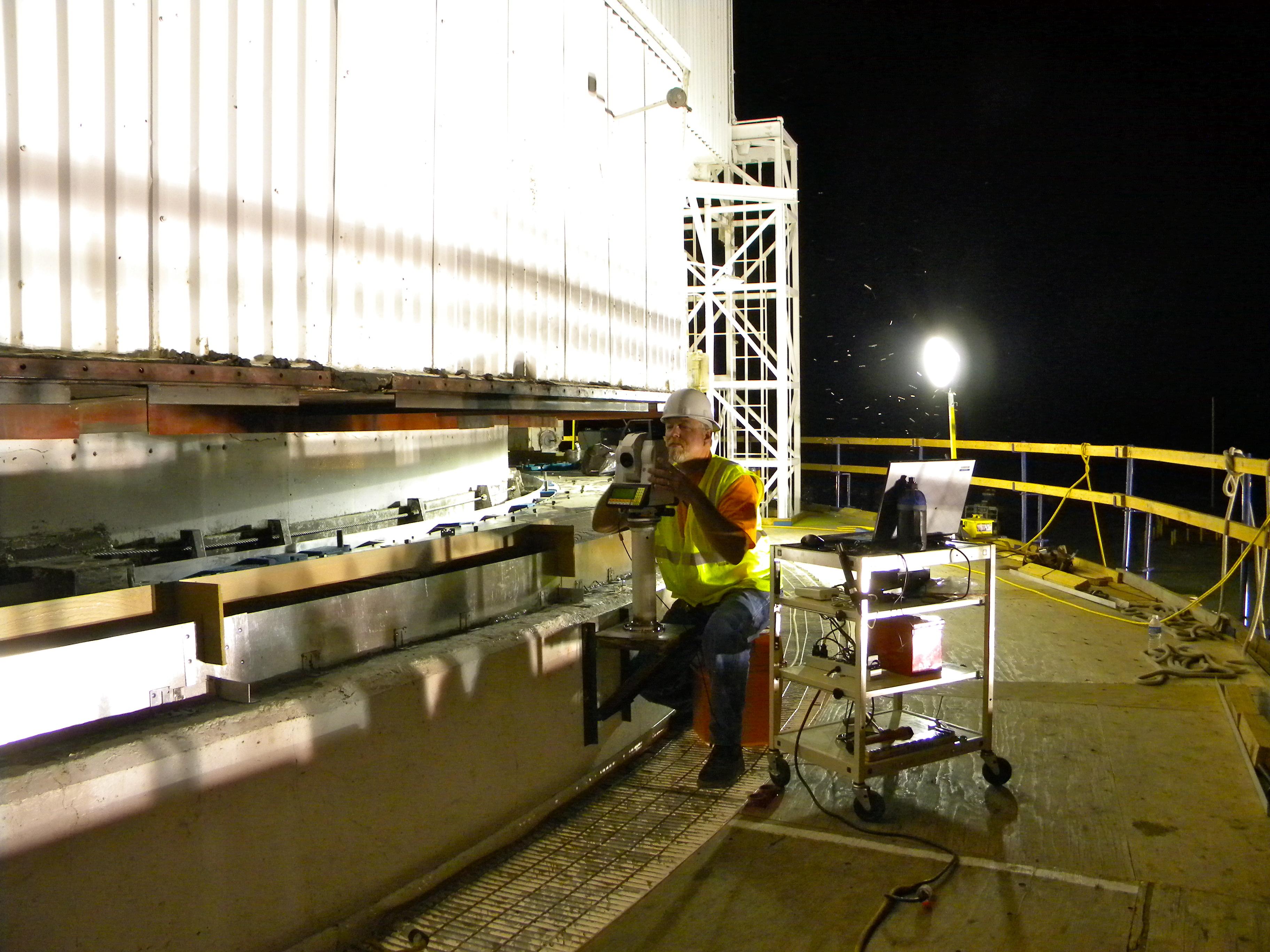
2010-07-15 |
Earth
|
Goldstone Deep Space Network (DSN)
|
Deep Space Network Antenna
|
3648x2736x3 |
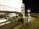
|
-
PIA13271:
-
Checking for Even Surfaces
Full Resolution:
TIFF
(29.94 MB)
JPEG
(946.6 kB)
|
|
|
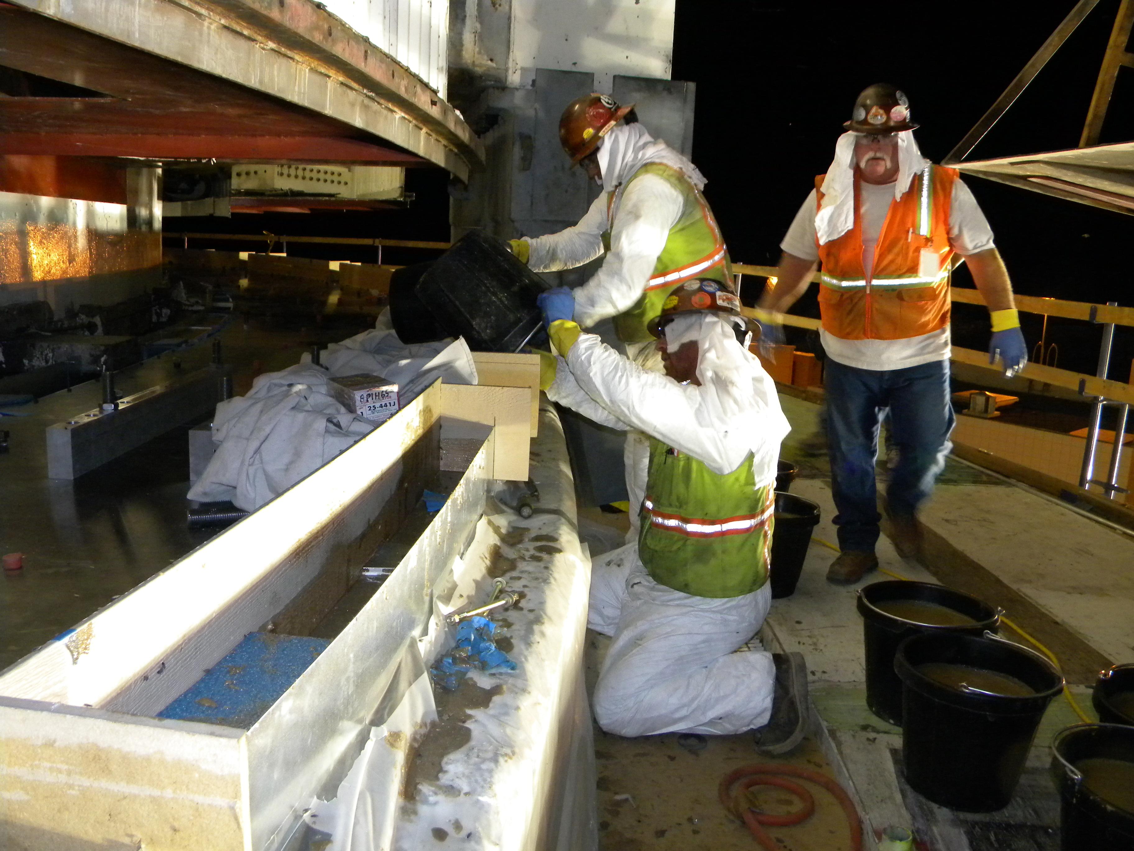
2010-07-15 |
Earth
|
Goldstone Deep Space Network (DSN)
|
Deep Space Network Antenna
|
3648x2736x3 |

|
-
PIA13272:
-
Pouring the New Grout
Full Resolution:
TIFF
(29.94 MB)
JPEG
(886.6 kB)
|
|
|
2010-07-20 |
Moon
|
Lunar Reconnaissance Orbiter (LRO)
|
Lunar Reconnaissance Orbiter Camera (NAC)
|
1400x1400x1 |

|
-
PIA13498:
-
Up from the Depths
Full Resolution:
TIFF
(1.962 MB)
JPEG
(417 kB)
|
|
|
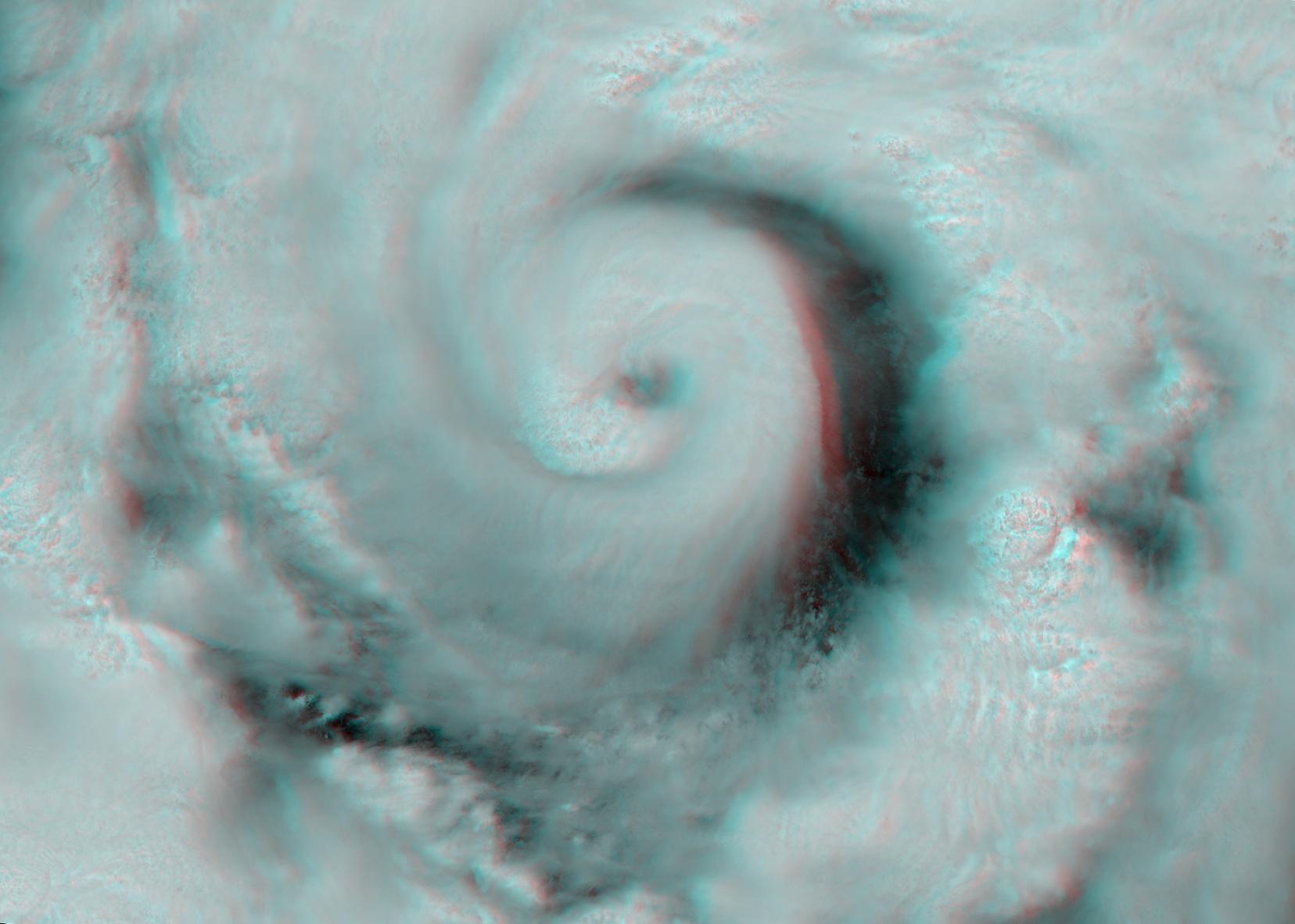
2010-07-24 |
Earth
|
Terra
|
AIRS
|
900x695x3 |
|
-
PIA13296:
-
Bonnie Takes Aim at an Oily Gulf
Full Resolution:
TIFF
(1.879 MB)
JPEG
(129.6 kB)
|
|
|
2010-07-28 |
Moon
|
Lunar Reconnaissance Orbiter (LRO)
|
Lunar Reconnaissance Orbiter Camera (NAC)
|
1000x1000x1 |

|
-
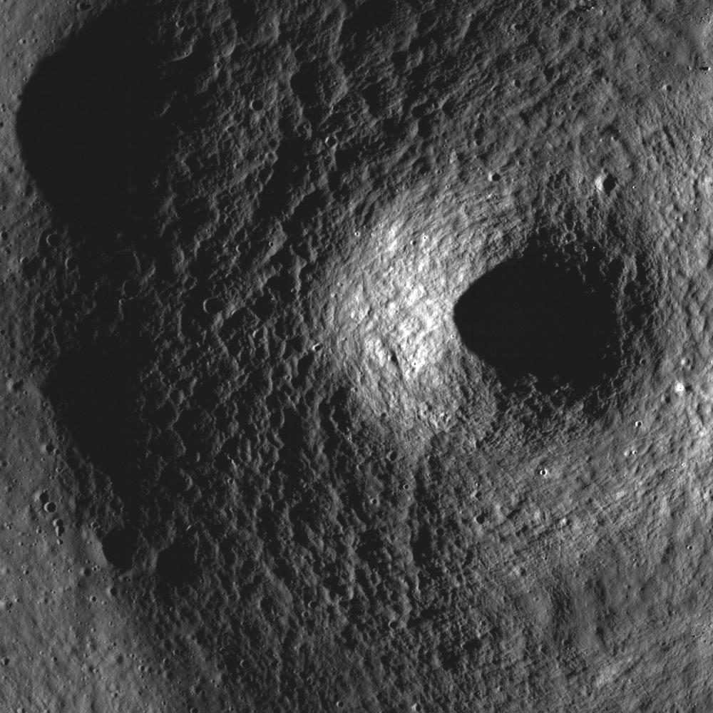
PIA13502:
-
Not your Average Complex Crater
Full Resolution:
TIFF
(1.001 MB)
JPEG
(187.8 kB)
|
|
|
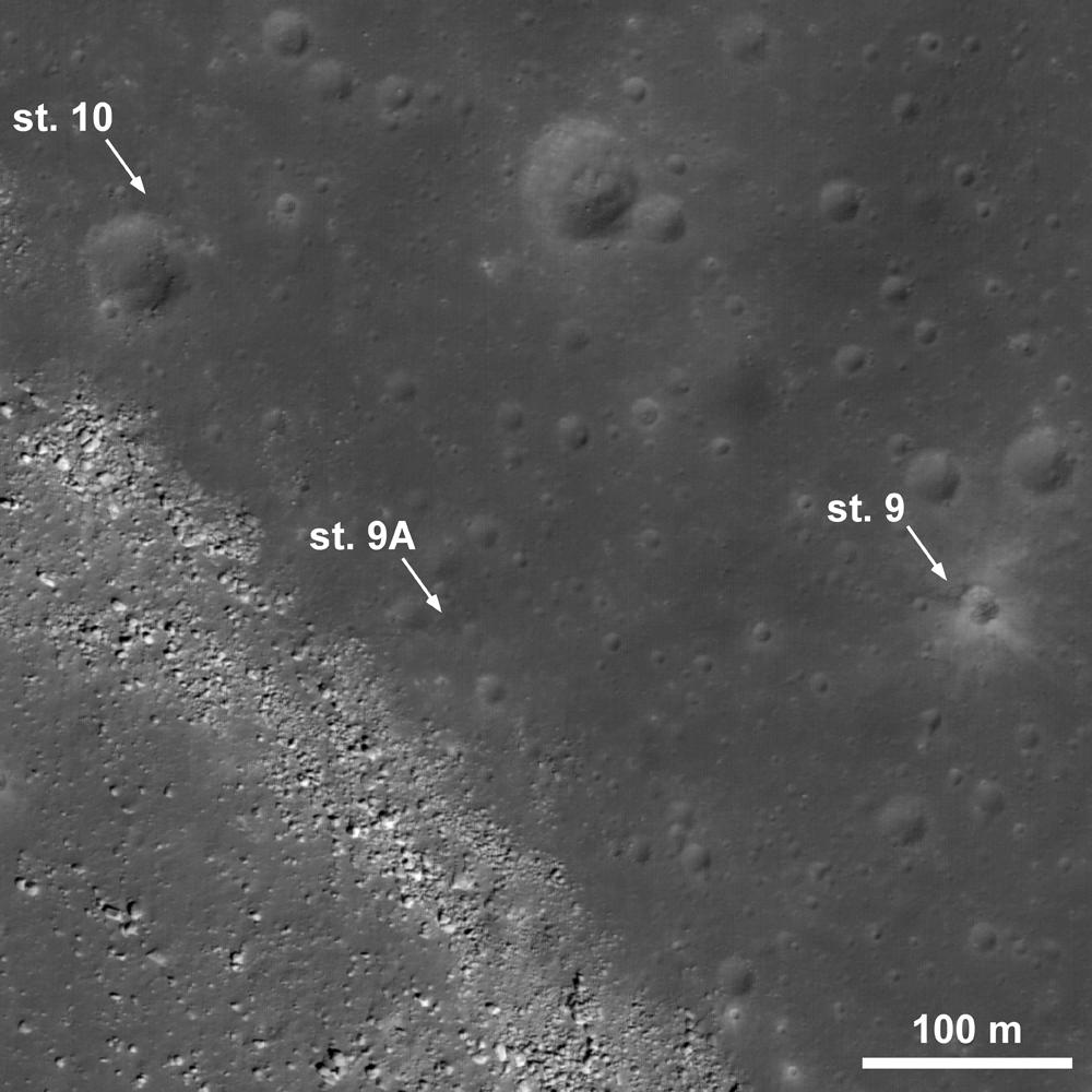
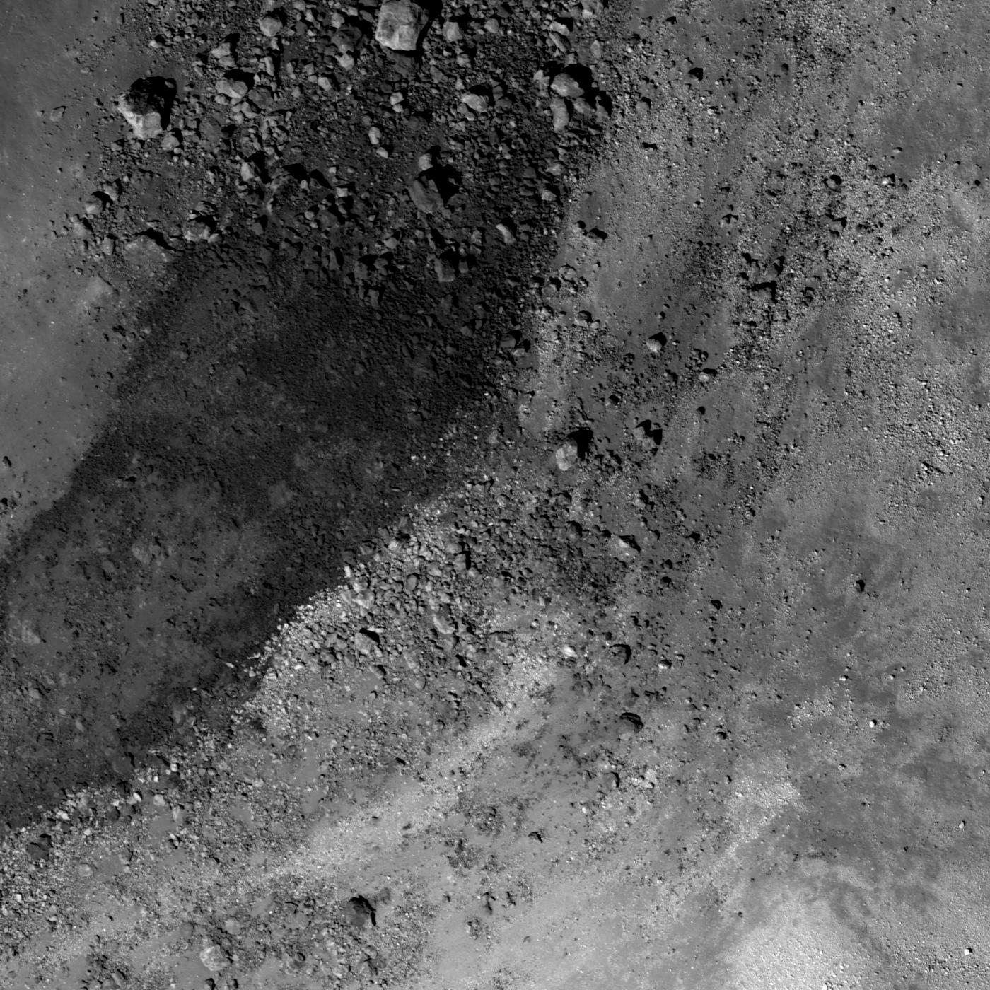
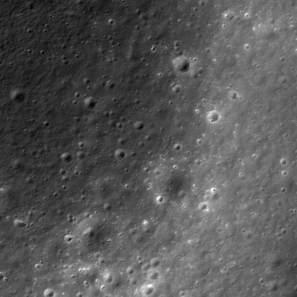
2010-07-29 |
Moon
|
Lunar Reconnaissance Orbiter (LRO)
|
Lunar Reconnaissance Orbiter Camera (NAC)
|
1000x1000x1 |
|
-
PIA13503:
-
A Molten Flood
Full Resolution:
TIFF
(1.001 MB)
JPEG
(167.1 kB)
|
|
|
2010-08-03 |
Earth
|
Terra
|
ASTER
|
1452x1200x3 |
|
-
PIA13312:
-
ASTER Views California's Crown Fire
Full Resolution:
TIFF
(5.237 MB)
JPEG
(470.4 kB)
|
|
|
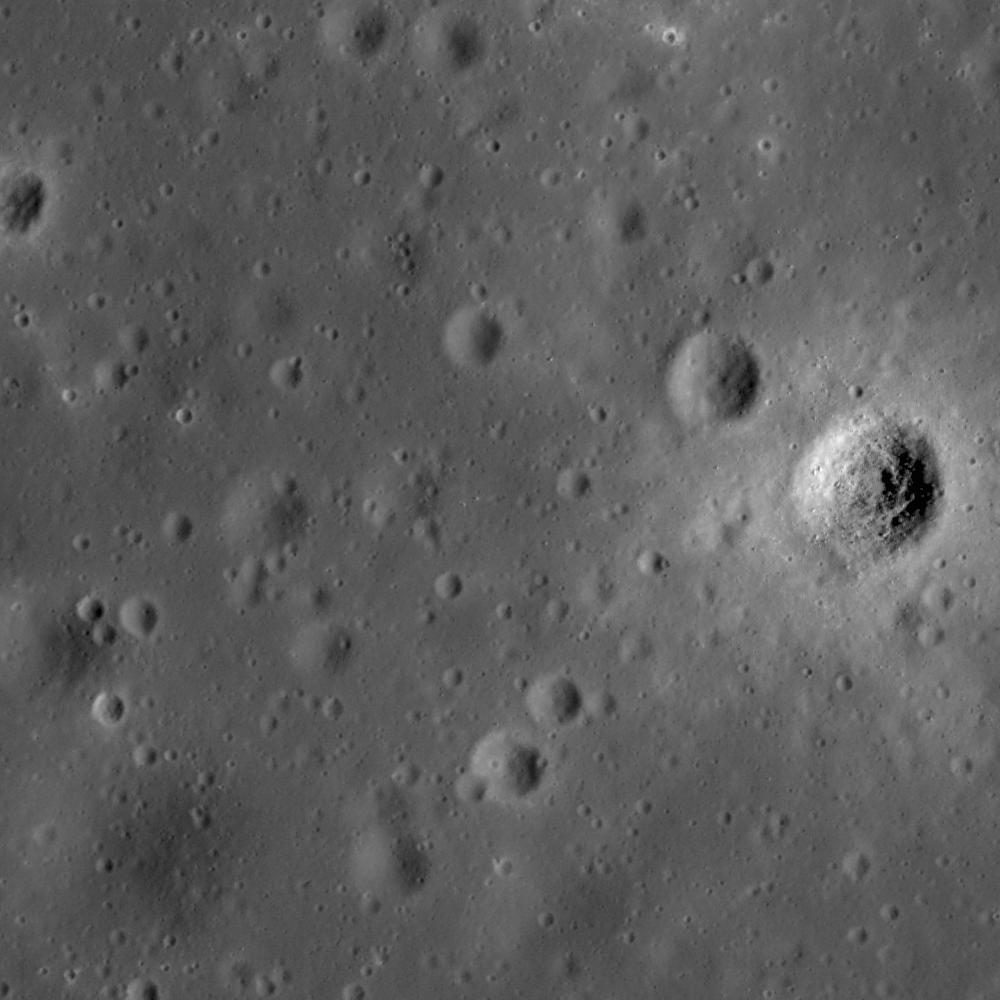
2010-08-03 |
Moon
|
Lunar Reconnaissance Orbiter (LRO)
|
Lunar Reconnaissance Orbiter Camera (NAC)
|
1000x1000x1 |
|
-
PIA13504:
-
Remnants of the Imbrium Impact
Full Resolution:
TIFF
(1.001 MB)
JPEG
(156.7 kB)
|
|
|
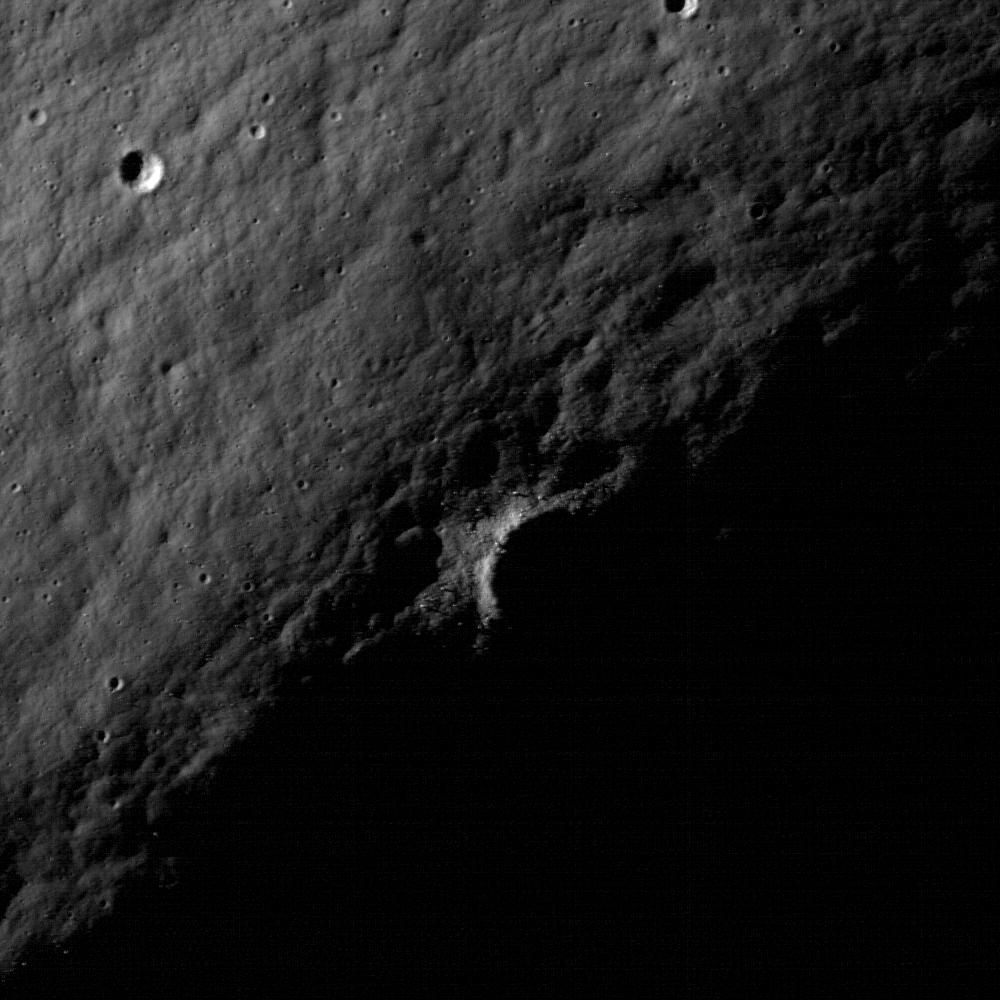
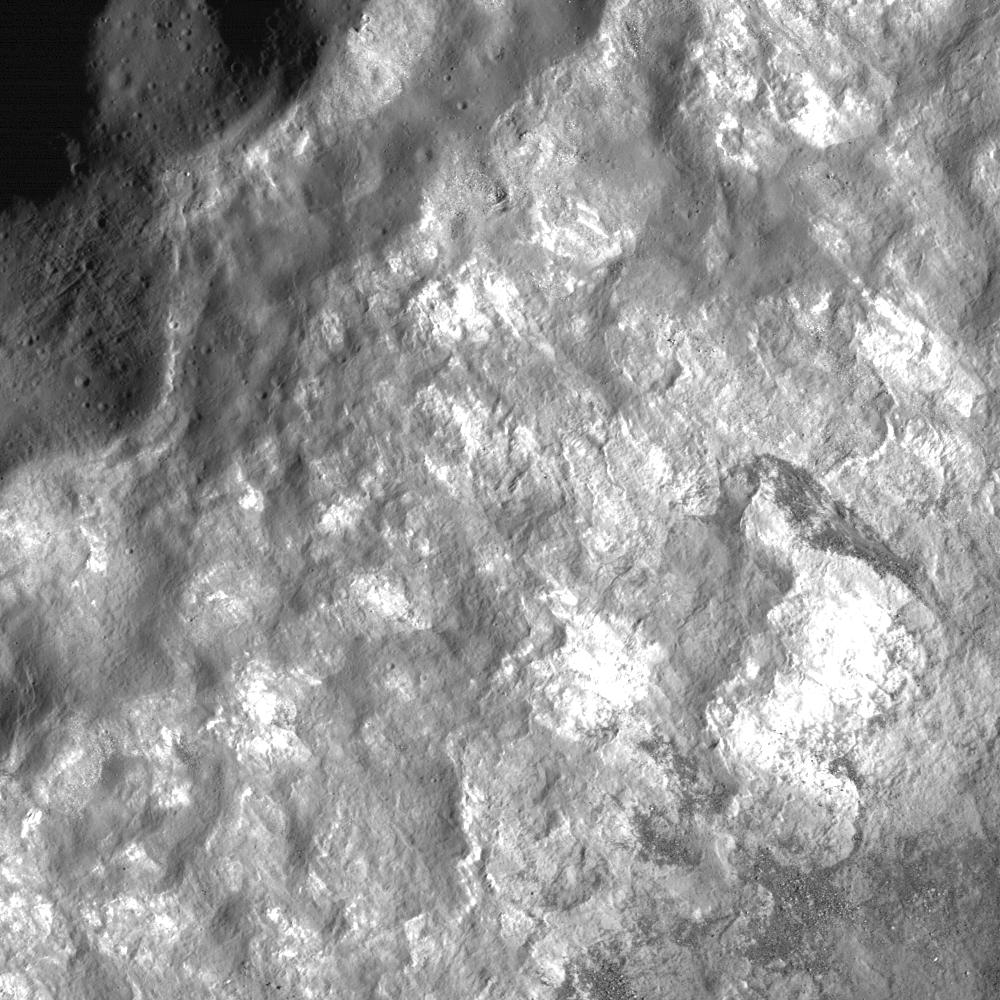
2010-08-04 |
Earth
|
UAVSAR
|
L-Band UAVSAR
|
2256x1464x3 |

|
-
PIA13314:
-
NASA Radar Images Show Continued Deformation from Mexico Quake
Full Resolution:
TIFF
(9.92 MB)
JPEG
(645.9 kB)
|
|
|
2010-08-04 |
Moon
|
Lunar Reconnaissance Orbiter (LRO)
|
Lunar Reconnaissance Orbiter Camera (NAC)
|
1000x1000x1 |
|
-
PIA13505:
-
Concentric Crater
Full Resolution:
TIFF
(1.001 MB)
JPEG
(141.1 kB)
|
|
|
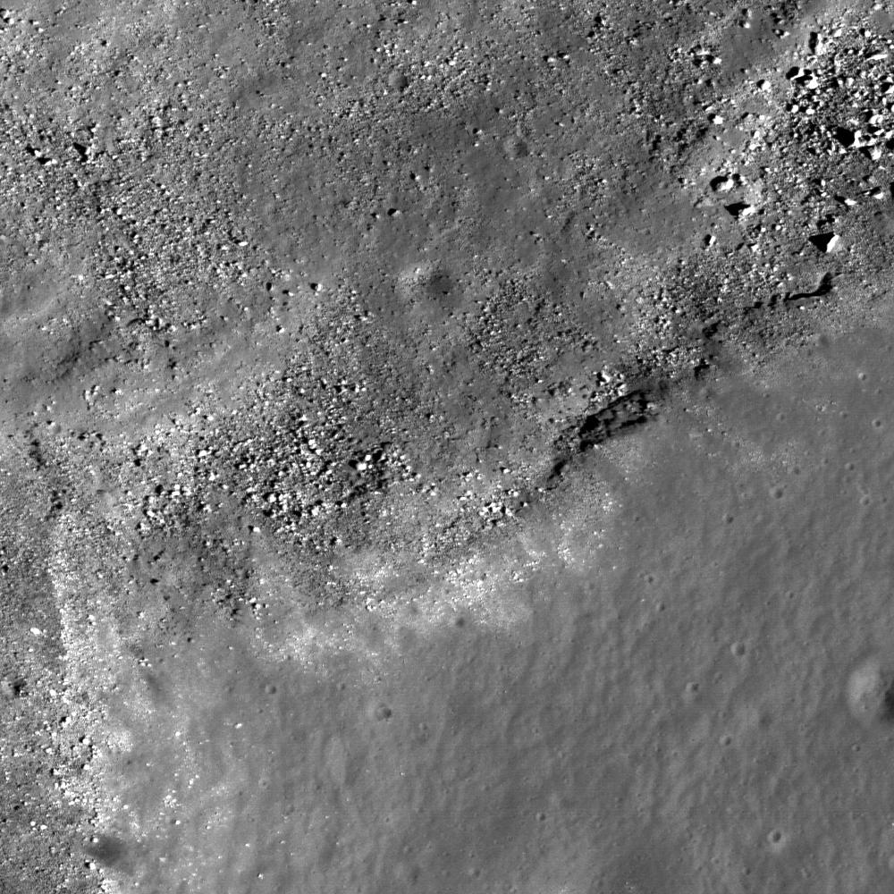
2010-08-05 |
Moon
|
Lunar Reconnaissance Orbiter (LRO)
|
Lunar Reconnaissance Orbiter Camera (NAC)
|
1000x1000x1 |

|
-
PIA13506:
-
A Path not Taken
Full Resolution:
TIFF
(1.001 MB)
JPEG
(84.81 kB)
|
|
|
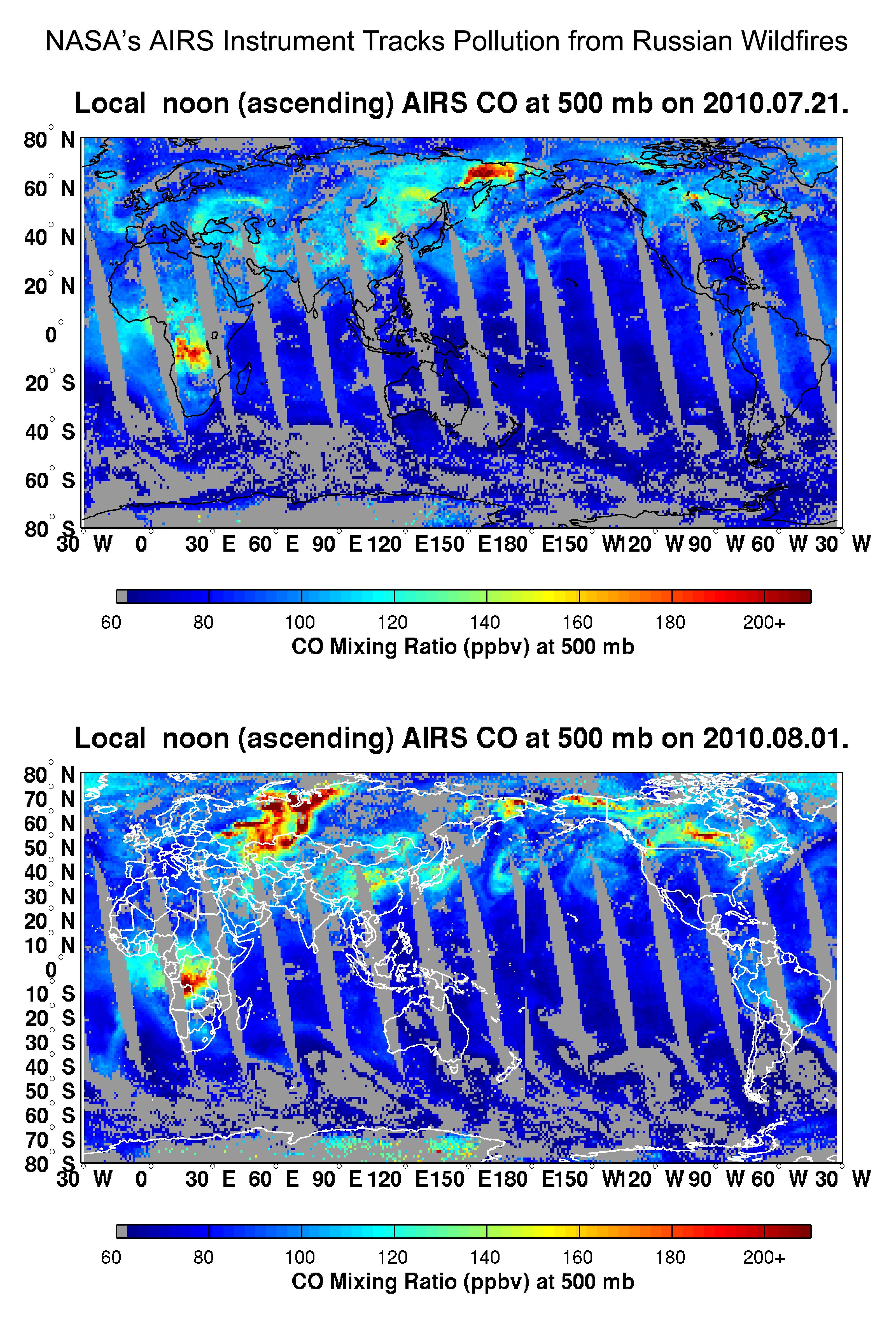
2010-08-07 |
Earth
|
Terra
|
AIRS
|
3200x4800x3 |
|
-
PIA13317:
-
NASA's AIRS Instrument Tracks Pollution from Russian Wildfires
Full Resolution:
TIFF
(46.08 MB)
JPEG
(2.118 MB)
|
|
|
2010-08-10 |
Moon
|
Lunar Reconnaissance Orbiter (LRO)
|
Lunar Reconnaissance Orbiter Camera (NAC)
|
1000x1000x1 |

|
-
PIA13507:
-
Volcanoes in Lacus Mortis
Full Resolution:
TIFF
(1.001 MB)
JPEG
(155.3 kB)
|
|
|
2010-08-12 |
Earth
|
Terra
|
ASTER
|
1548x1000x3 |

|
-
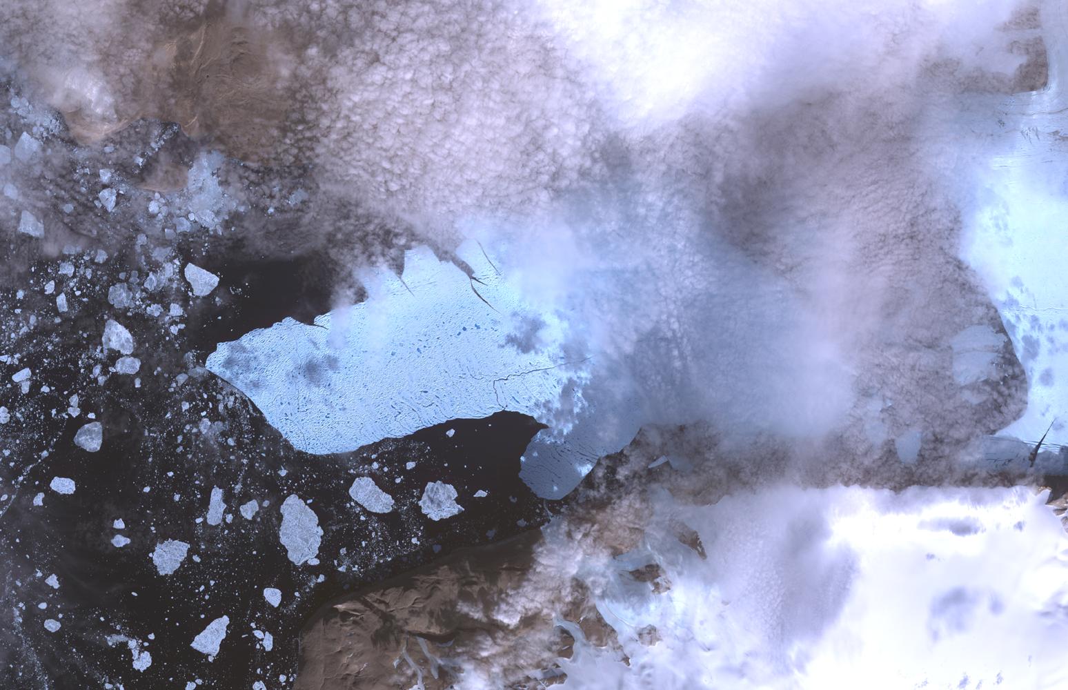
PIA13319:
-
ASTER Views Large Calving Event at Petermann Glacier, Greenland
Full Resolution:
TIFF
(4.652 MB)
JPEG
(216.1 kB)
|
|
|
2010-08-17 |
Earth
|
MESSENGER
|
MDIS - Wide Angle
|
1018x1024x1 |
|
-
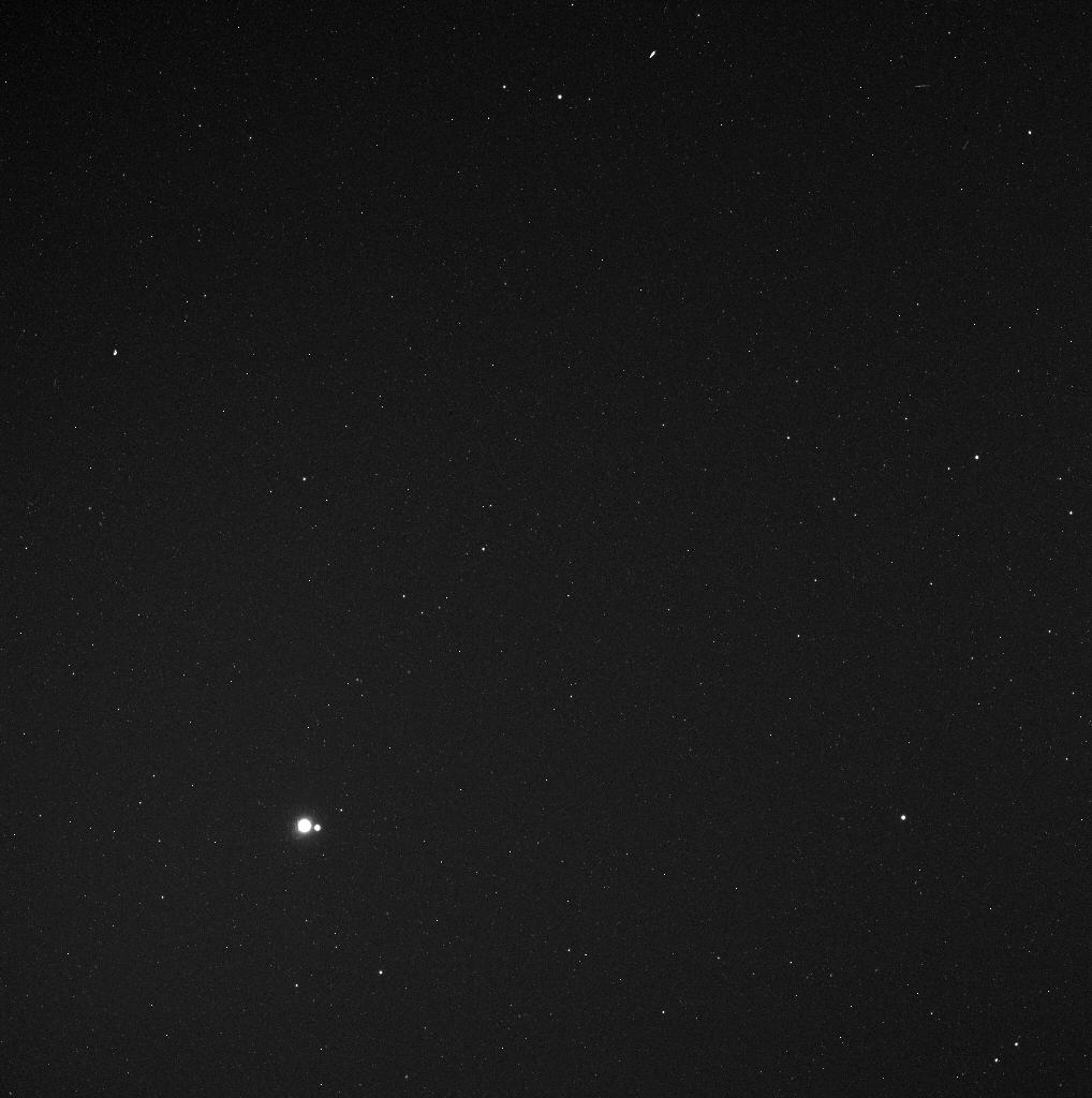
PIA13474:
-
Earth and Moon from 114 Million Miles
Full Resolution:
TIFF
(1.044 MB)
JPEG
(95.17 kB)
|
|
|
2010-08-18 |
Earth
|
Terra
|
MISR
|
2200x1544x3 |
|
-
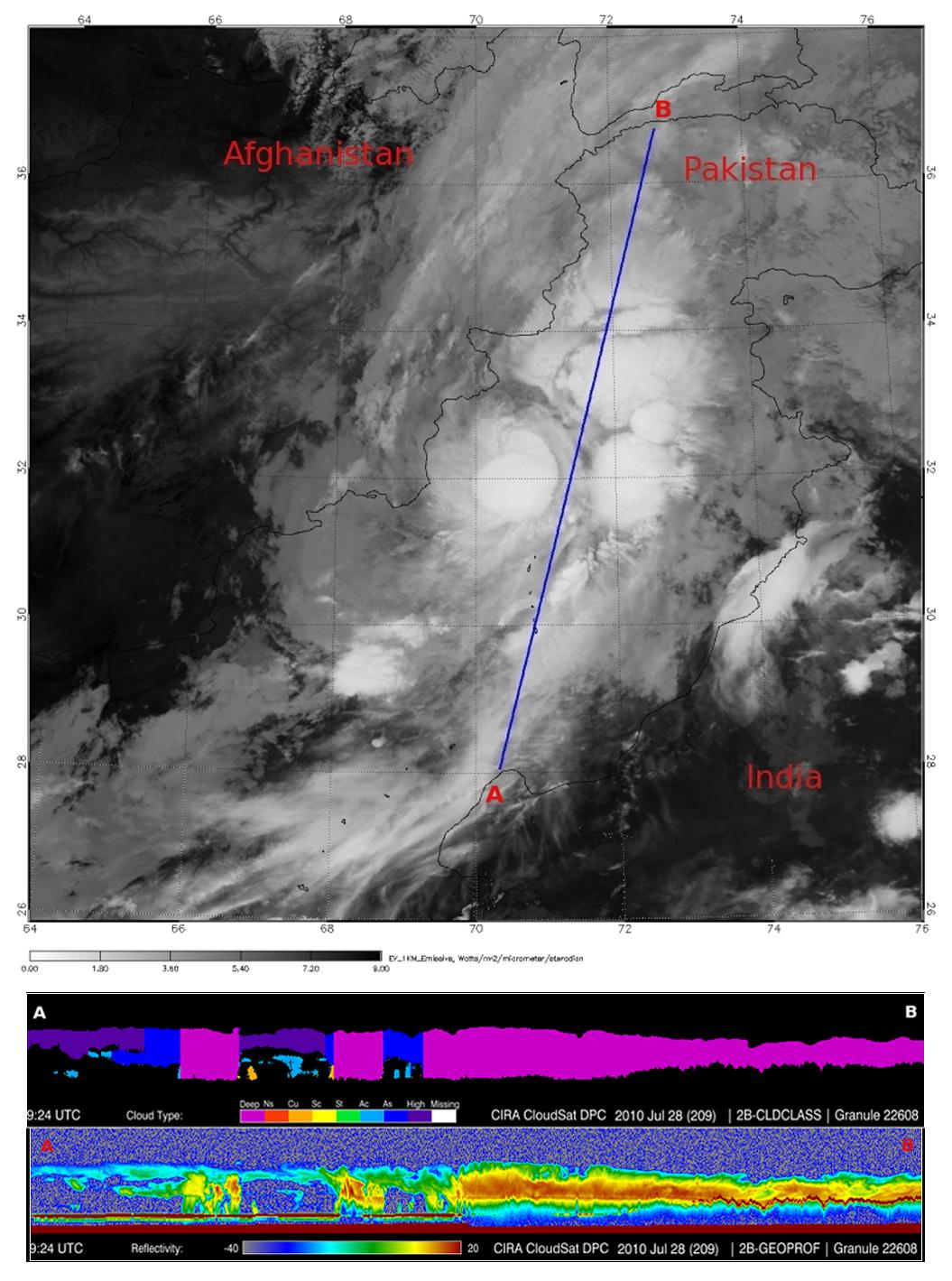
PIA13337:
-
NASA's MISR Tracks Massive Flooding in Pakistan
Full Resolution:
TIFF
(10.2 MB)
JPEG
(706.9 kB)
|
|
|
2010-08-19 |
Earth
|
CloudSat
|
Cloud Profiling Radar (CPR)
MODIS
|
1055x1419x3 |

|
-
PIA13340:
-
NASA's CloudSat Spots Beginning of Pakistan Floods
Full Resolution:
TIFF
(4.497 MB)
JPEG
(200.3 kB)
|
|
|
2010-08-19 |
Earth
|
Terra
|
AIRS
|
2000x987x3 |
|
-
PIA13341:
-
NASA's AIRS Instrument Captures Before/After Views of Pakistan Flooding
Full Resolution:
TIFF
(5.93 MB)
JPEG
(210.3 kB)
|
|
|
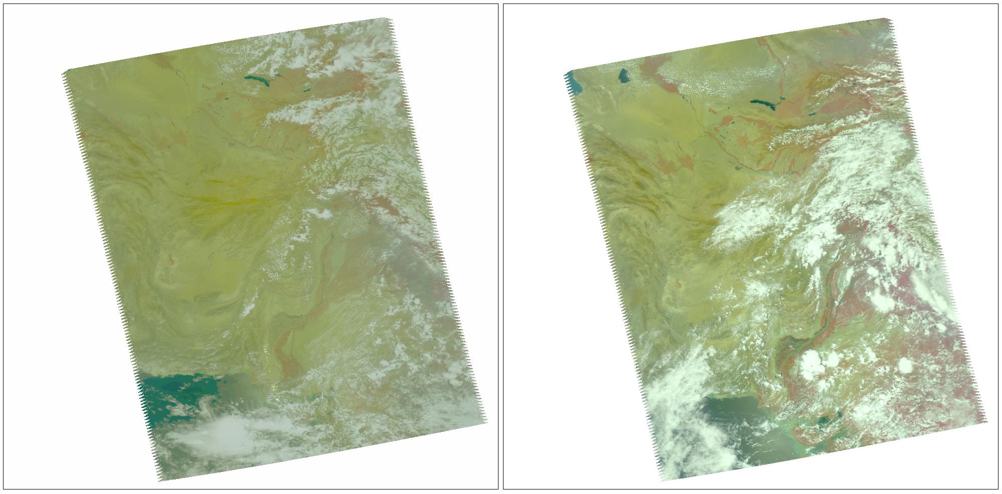
2010-08-19 |
Earth
|
Aqua
|
AIRS
|
1200x901x3 |

|
-
PIA13342:
-
NASA's AIRS Detects Extent of Pakistan Flooding
Full Resolution:
TIFF
(1.084 MB)
JPEG
(109.2 kB)
|
|
|
2010-08-20 |
Earth
|
Terra
|
ASTER
|
4159x5176x3 |
|
-
PIA13343:
-
ASTER Captures New Image of Pakistan Flooding
Full Resolution:
TIFF
(64.58 MB)
JPEG
(4.916 MB)
|
|
|
2010-08-24 |
Moon
|
Lunar Reconnaissance Orbiter (LRO)
|
Lunar Reconnaissance Orbiter Camera (NAC)
|
1000x1000x1 |
|
-
PIA13509:
-
Fractures in the mare of Tsiolkovskiy Crater
Full Resolution:
TIFF
(1.001 MB)
JPEG
(99.58 kB)
|
|
|
2010-08-25 |
Earth
|
Goldstone Deep Space Network (DSN)
|
Deep Space Network Antenna
|
1920x1080x3 |
|
-
PIA13277:
-
Tracks of a Giant
Full Resolution:
TIFF
(6.23 MB)
JPEG
(171.5 kB)
|


