|
Your search criteria found 2593 images Target is Earth (and available satellites) |
| My List |
Addition Date | Target |
Mission
|
Instrument | Size |

|
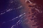
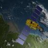
2014-07-24 | Earth |
ISS |
OPALS |
2501x2831x3 |

|
|||||
|
|
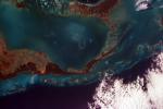
2014-08-06 | Earth |
ISS |
OPALS |
1261x945x3 |

|
|||||
|
|
2008-09-05 | Earth |
ISS EarthKam |
Electronic Still Camera |
3060x2036x3 |
|
|||||
|
|
2008-09-04 | Earth |
ISS EarthKam |
Electronic Still Camera |
3060x2036x3 |
|
|||||
|
|
2008-09-04 | Earth |
ISS EarthKam |
Electronic Still Camera |
3060x2036x3 |
|
|||||
|
|
2008-09-04 | Earth |
ISS EarthKam |
Electronic Still Camera |
3060x2036x3 |
|
|||||
|
|
2008-09-04 | Earth |
ISS EarthKam |
Electronic Still Camera |
3060x2036x3 |
|
|||||
|
|
2008-09-04 | Earth |
ISS EarthKam |
Electronic Still Camera |
3060x2036x3 |

|
|||||
|
|
2008-09-04 | Earth |
ISS EarthKam |
Electronic Still Camera |
3060x2036x3 |

|
|||||
|
|
2008-09-04 | Earth |
ISS EarthKam |
Electronic Still Camera |
3060x2036x3 |

|
|||||
|
|
2008-09-04 | Earth |
ISS EarthKam |
Electronic Still Camera |
3060x2036x3 |

|
|||||
|
|
2008-09-05 | Earth |
ISS EarthKam |
Electronic Still Camera |
3060x2036x3 |
|
|||||
|
|
2008-09-05 | Earth |
ISS EarthKam |
Electronic Still Camera |
3060x2036x3 |
|
|||||
|
|
2008-09-05 | Earth |
ISS EarthKam |
Electronic Still Camera |
3060x2036x3 |

|
|||||
|
|
2008-09-05 | Earth |
ISS EarthKam |
Electronic Still Camera |
3060x2036x3 |
|
|||||
|
|
2008-09-05 | Earth |
ISS EarthKam |
Electronic Still Camera |
3060x2036x3 |
|
|||||
|
|
2008-09-05 | Earth |
ISS EarthKam |
Electronic Still Camera |
3060x2036x3 |

|
|||||
|
|
2008-09-05 | Earth |
ISS EarthKam |
Electronic Still Camera |
3060x2036x3 |
|
|||||
|
|
2008-09-05 | Earth |
ISS EarthKam |
Electronic Still Camera |
3060x2036x3 |

|
|||||
|
|
2008-09-05 | Earth |
ISS EarthKam |
Electronic Still Camera |
3060x2036x3 |

|
|||||
|
|
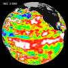
2002-12-12 | Earth |
Jason-1 |
Altimeter |
900x900x3 |
|
|||||
|
|
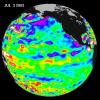
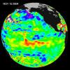
2003-07-14 | Earth |
Jason-1 |
Altimeter |
900x900x3 |
|
|||||
|
|
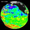
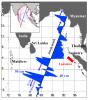
2003-11-18 | Earth |
Jason-1 |
Altimeter |
900x900x3 |
|
|||||
|
|
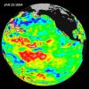
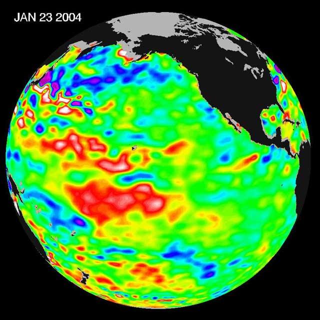
2004-01-30 | Earth |
Jason-1 |
Altimeter |
640x640x3 |
|
|||||
|
|
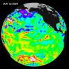
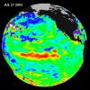
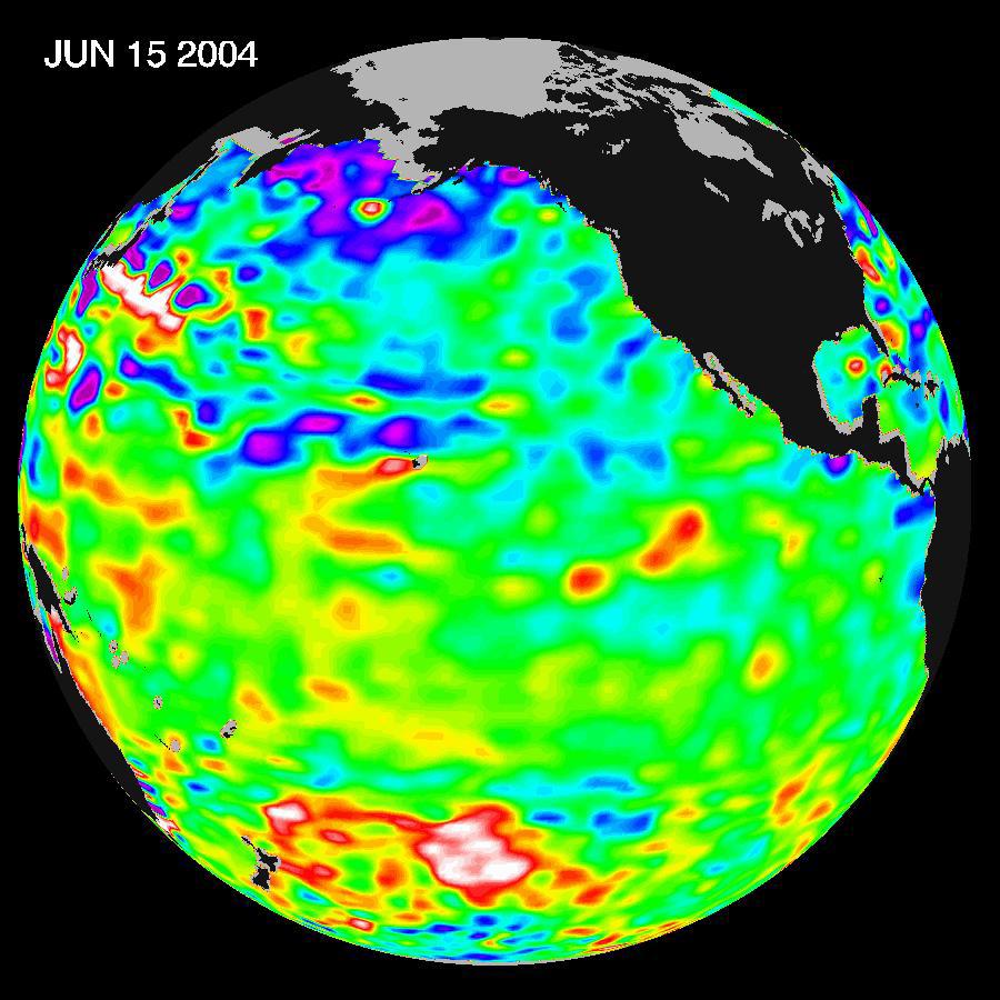
2004-07-13 | Earth |
Jason-1 |
Altimeter |
900x900x3 |
|
|||||
|
|
2004-07-13 | Earth |
Jason-1 |
Altimeter |
900x900x3 |
|
|||||
|
|
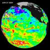
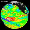
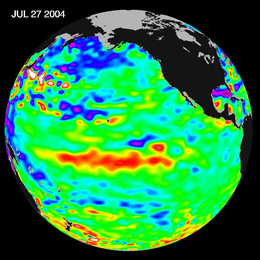
2004-08-04 | Earth |
Jason-1 |
Altimeter |
900x900x3 |
|
|||||
|
|
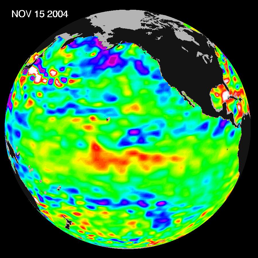
2004-11-16 | Earth |
Jason-1 |
Altimeter |
900x900x3 |
|
|||||
|
|
2005-01-12 | Earth |
Jason-1 |
Altimeter |
1590x1800x3 |
|
|||||
|
|
2005-03-14 | Earth |
Jason-1 |
Altimeter |
900x900x3 |
|
|||||
|
|
2005-09-21 | Earth |
Jason-1 |
Altimeter |
1650x1275x3 |

|
|||||
|
|
2005-09-22 | Earth |
Jason-1 |
Altimeter |
825x638x3 |
|
|||||
|
|
2005-09-26 | Earth |
Jason-1 |
Altimeter |
658x551x3 |
|
|||||
|
|
2005-10-21 | Earth |
Jason-1 |
Altimeter |
1650x1275x3 |
|
|||||
|
|
2006-01-13 | Earth |
Jason-1 |
Altimeter |
900x900x3 |
|
|||||
|
|
2006-05-30 | Earth |
Jason-1 |
Altimeter |
900x900x3 |
|
|||||
|
|
2006-10-10 | Earth |
Jason-1 |
Altimeter |
900x900x3 |
|
|||||
|
|
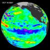
2006-12-07 | Earth |
Jason-1 |
Altimeter |
900x900x3 |
|
|||||
|
|
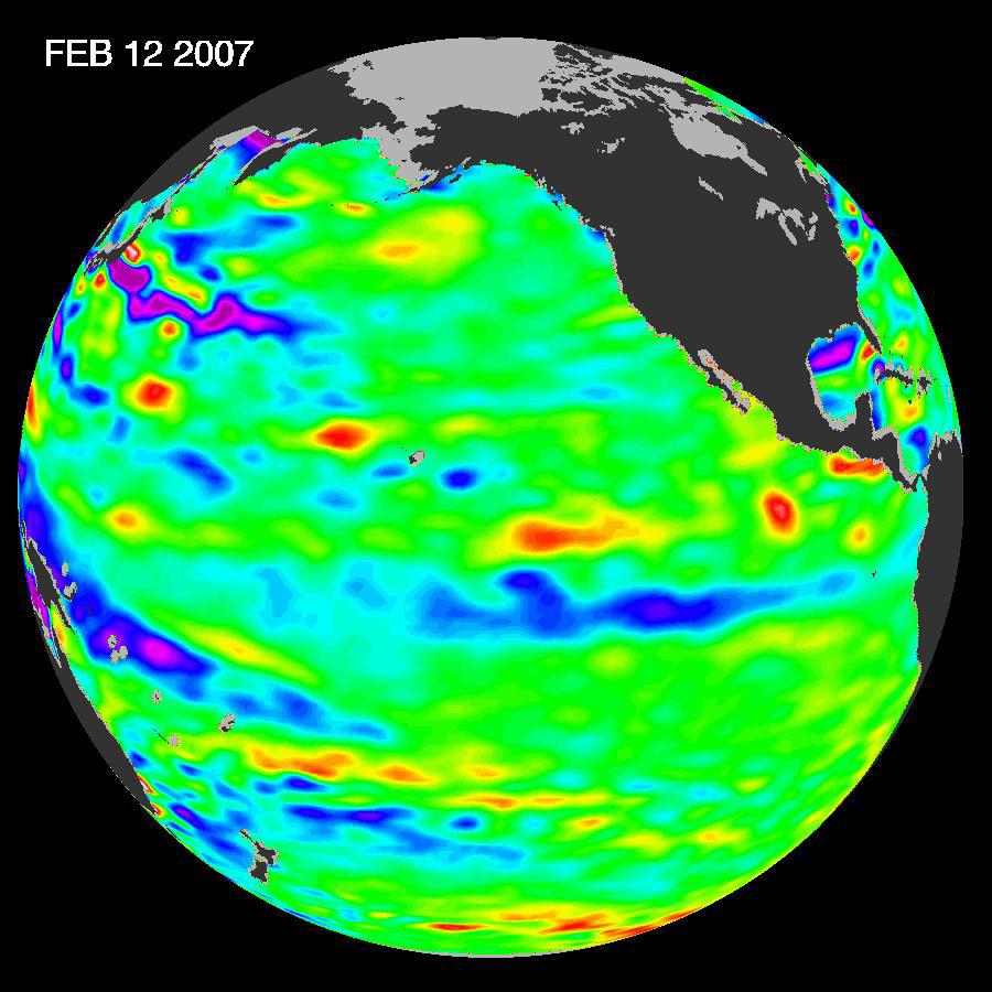
2007-03-02 | Earth |
Jason-1 |
Altimeter |
900x900x3 |

|
|||||
|
|
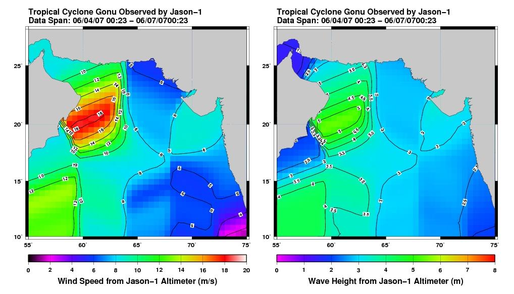
2007-06-08 | Earth |
Jason-1 |
Altimeter |
1018x583x3 |
|
|||||
|
|
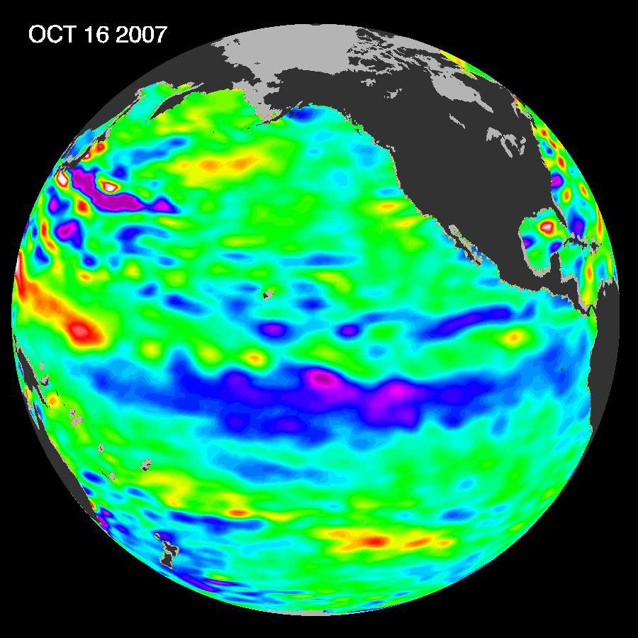
2007-11-07 | Earth |
Jason-1 |
Altimeter |
900x900x3 |
|
|||||
|
|
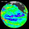
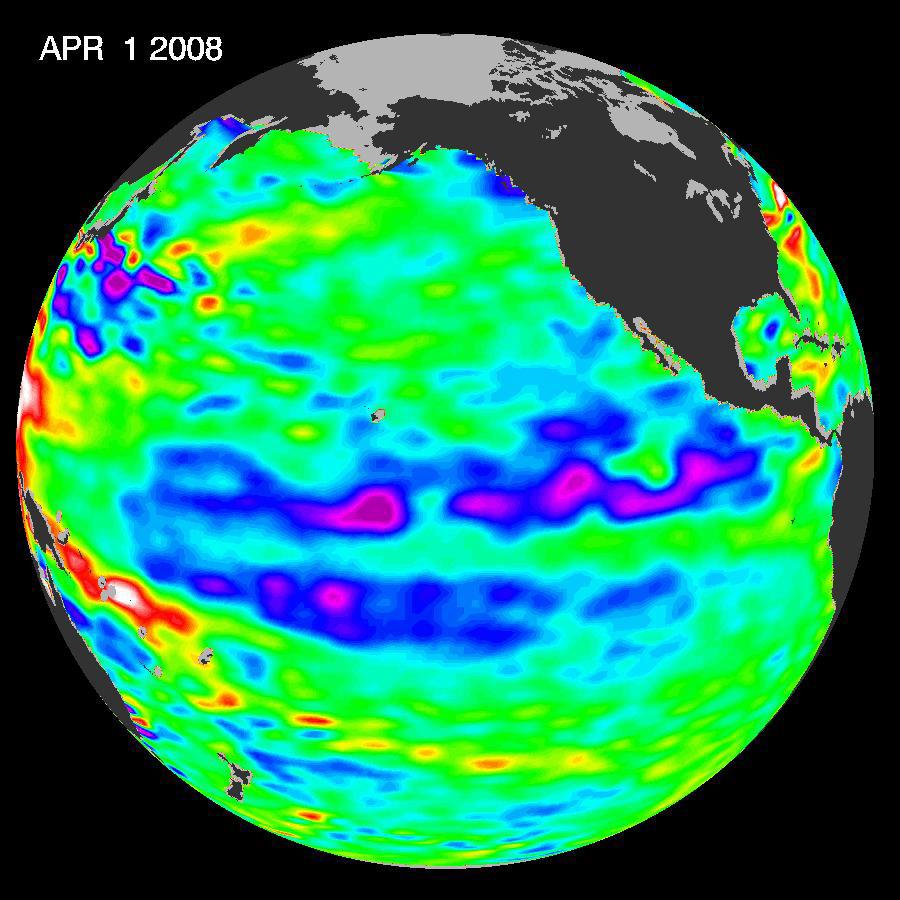
2008-04-22 | Earth |
Jason-1 |
Altimeter |
900x900x3 |
|
|||||
|
|
2008-07-31 | Earth |
Jason-1 |
Altimeter |
919x699x3 |
|
|||||
|
|
2008-12-13 | Earth |
Jason-1 |
Altimeter |
900x900x3 |
|
|||||
|
|
2012-10-17 | Earth |
Jason-1 (Topex/Poseidon) OSTM/Jason-2 |
Altimeter |
1384x858x3 |
|
|||||
|
|
2009-02-06 | Earth |
Jason-1 OSTM/Jason-2 |
Altimeter |
1074x1074x3 |

|
|||||
|
|
2009-03-26 | Earth |
Jason-1 OSTM/Jason-2 |
Altimeter |
3508x2479x3 |

|
|||||
|
|
2009-04-27 | Earth |
Jason-1 OSTM/Jason-2 |
Altimeter |
1010x654x3 |
|
|||||
|
|
2013-05-23 | Earth |
Jason-3 |
8192x8192x3 | |
|
|||||
|
|
2013-05-23 | Earth |
Jason-3 |
8192x8192x3 | |
|
|||||
|
|
2013-05-23 | Earth |
Jason-3 |
8192x8192x3 | |
|
|||||
|
|
2016-03-16 | Earth |
Jason-3 |
4769x5500x3 | |
|
|||||
|
|
2018-06-06 | Earth |
Jason-3 |
3300x1555x3 | |
|
|||||
|
|
2013-10-21 | Earth |
Juno |
JunoCam |
1406x1420x1 |
|
|||||
|
|
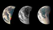
2013-12-10 | Earth |
Juno |
Waves |
1920x834x3 |

|
|||||
|
|
2013-12-10 | Earth |
Juno |
Star Tracker |
483x376x3 |

|
|||||
|
|
2013-10-09 | Earth |
Juno |
8500x4781x3 | |
|
|||||
|
|
2011-08-06 | Earth |
Juno |
JunoCam |
640x480x1 |
|
|||||
|
|
1997-01-22 | Earth |
KidSat |
Electronic Still Camera |
3060x2036x3 |
|
|||||
|
|
1997-01-22 | Earth |
KidSat |
Electronic Still Camera |
3060x2036x3 |
|
|||||
|
|
1997-10-03 | Earth |
KidSat |
Electronic Still Camera |
7019x2290x3 |
|
|||||
|
|
1997-10-03 | Earth |
KidSat |
Electronic Still Camera |
3060x2036x3 |
|
|||||
|
|
1997-10-03 | Earth |
KidSat |
Electronic Still Camera |
1024x1024x3 |
|
|||||
|
|
1997-10-03 | Earth |
KidSat |
Electronic Still Camera |
3060x2036x3 |

|
|||||
|
|
1997-10-03 | Earth |
KidSat |
Electronic Still Camera |
3060x2036x3 |

|
|||||
|
|
1997-10-03 | Earth |
KidSat |
Electronic Still Camera |
3060x2036x3 |
|
|||||
|
|
1997-10-03 | Earth |
KidSat |
Electronic Still Camera |
1024x1024x3 |
|
|||||
|
|
2000-11-04 | Earth |
Landsat |
3739x3795x3 | |
|
|||||
|
|
2001-02-09 | Earth |
Landsat |
439x593x3 | |
|
|||||
|
|
2005-10-13 | Earth |
Landsat |
Interferometric Synthetic Aperture Radar |
1793x1706x3 |

|
|||||
|
|
2013-08-29 | Earth |
Landsat |
2180x1453x3 | |
|
|||||
|
|
2021-12-17 | Earth |
Landsat |
1200x800x3 | |

|
|||||
|
|
2024-01-17 | Earth |
Landsat |
1440x960x3 | |
|
|||||
|
|
2024-01-17 | Earth |
Landsat |
1440x1100x3 | |
|
|||||
|
|
2002-10-25 | Earth |
Landsat Shuttle Radar Topography Mission (SRTM) |
C-Band Interferometric Radar Thematic Mapper |
1152x870x3 |
|
|||||
|
|
2002-10-25 | Earth |
Landsat Shuttle Radar Topography Mission (SRTM) |
C-Band Interferometric Radar Thematic Mapper |
1152x870x3 |
|
|||||
|
|
2000-02-14 | Earth |
Landsat Shuttle Radar Topography Mission (SRTM) |
C-Band Interferometric Radar Thematic Mapper |
3835x904x3 |
|
|||||
|
|
2000-02-16 | Earth |
Landsat Shuttle Radar Topography Mission (SRTM) |
C-Band Interferometric Radar Thematic Mapper |
1412x1588x3 |
|
|||||
|
|
2000-02-18 | Earth |
Landsat Shuttle Radar Topography Mission (SRTM) |
C-Band Interferometric Radar Thematic Mapper |
1363x2200x3 |

|
|||||
|
|
2000-02-18 | Earth |
Landsat Shuttle Radar Topography Mission (SRTM) |
C-Band Interferometric Radar Thematic Mapper |
1939x1999x3 |
|
|||||
|
|
2000-02-20 | Earth |
Landsat Shuttle Radar Topography Mission (SRTM) |
C-Band Interferometric Radar Thematic Mapper |
1430x1152x3 |

|
|||||
|
|
2002-10-25 | Earth |
Landsat Shuttle Radar Topography Mission (SRTM) |
C-Band Interferometric Radar Thematic Mapper |
1152x870x3 |
|
|||||
|
|
2000-02-20 | Earth |
Landsat Shuttle Radar Topography Mission (SRTM) |
C-Band Interferometric Radar Thematic Mapper |
940x658x3 |
|
|||||
|
|
2000-02-21 | Earth |
Landsat Shuttle Radar Topography Mission (SRTM) |
C-Band Interferometric Radar Thematic Mapper |
4000x3000x3 |
|
|||||
|
|
2000-02-21 | Earth |
Landsat Shuttle Radar Topography Mission (SRTM) |
C-Band Interferometric Radar Thematic Mapper |
4000x3000x3 |
|
|||||
|
|
2000-03-10 | Earth |
Landsat Shuttle Radar Topography Mission (SRTM) |
C-Band Interferometric Radar Thematic Mapper |
1218x1366x3 |
|
|||||
|
|
2000-03-10 | Earth |
Landsat Shuttle Radar Topography Mission (SRTM) |
C-Band Interferometric Radar Thematic Mapper |
2340x2069x3 |
|
|||||
|
|
2000-03-10 | Earth |
Landsat Shuttle Radar Topography Mission (SRTM) |
C-Band Interferometric Radar Thematic Mapper |
1591x2005x3 |
|
|||||
|
|
2000-03-16 | Earth |
Landsat Shuttle Radar Topography Mission (SRTM) |
C-Band Interferometric Radar Thematic Mapper |
4000x3000x3 |
|
|||||
|
|
2000-03-23 | Earth |
Landsat Shuttle Radar Topography Mission (SRTM) |
C-Band Interferometric Radar Thematic Mapper |
2220x994x3 |

|
|||||
|
|
2000-04-13 | Earth |
Landsat Shuttle Radar Topography Mission (SRTM) |
C-Band Interferometric Radar Thematic Mapper |
1428x2200x3 |
|
|||||
|
|
2000-04-13 | Earth |
Landsat Shuttle Radar Topography Mission (SRTM) |
C-Band Interferometric Radar Thematic Mapper |
839x651x3 |
|
|||||
|
|
2000-04-20 | Earth |
Landsat Shuttle Radar Topography Mission (SRTM) |
C-Band Interferometric Radar Thematic Mapper |
4000x3000x3 |
|
|||||
|
|
2000-04-20 | Earth |
Landsat Shuttle Radar Topography Mission (SRTM) |
C-Band Interferometric Radar Thematic Mapper |
4000x3000x3 |
|
|||||
|
|
2000-04-20 | Earth |
Landsat Shuttle Radar Topography Mission (SRTM) |
C-Band Interferometric Radar Thematic Mapper |
4000x3000x3 |
|
|||||
|
|
2000-04-27 | Earth |
Landsat Shuttle Radar Topography Mission (SRTM) |
C-Band Interferometric Radar Thematic Mapper |
1362x900x3 |

|
|||||
|
|
2000-05-11 | Earth |
Landsat Shuttle Radar Topography Mission (SRTM) |
C-Band Interferometric Radar Thematic Mapper |
1840x2320x3 |
|
|||||
|
|
2000-05-11 | Earth |
Landsat Shuttle Radar Topography Mission (SRTM) |
C-Band Interferometric Radar Thematic Mapper |
2158x1540x3 |
|
|||||
|
|
2000-06-22 | Earth |
Landsat Shuttle Radar Topography Mission (SRTM) |
C-Band Interferometric Radar Thematic Mapper |
2920x4236x3 |
|
|||||
|
|
2000-06-22 | Earth |
Landsat Shuttle Radar Topography Mission (SRTM) |
C-Band Interferometric Radar Thematic Mapper |
2995x3129x3 |
|
|||||

|
 |
|
|
|
|
|
 |
 |
|
|

|
| 1-100 | 101-200 | 201-300 | 301-400 | 401-500 | 501-600 | 601-700 | 701-800 | 801-900 | 901-1000 |
| Currently displaying images: 601 - 700 of 2593 |