|
Your search criteria found 2277 images Target is Earth |
| My List |
Addition Date |
Target
|
Mission | Instrument | Size |

|
2000-04-26 | Earth |
Terra |
ASTER |
2100x1445x3 |
|
|||||
|
|
2000-04-26 | Earth |
Terra |
ASTER |
4100x4980x3 |
|
|||||
|
|
2000-04-26 | Earth |
Terra |
ASTER |
4100x5400x3 |
|
|||||
|
|
2000-04-26 | Earth |
Terra |
ASTER |
4100x6177x3 |
|
|||||
|
|
2000-04-26 | Earth |
Terra |
ASTER |
1174x1447x3 |
|
|||||
|
|
2000-06-20 | Earth |
Terra |
MISR |
2220x2048x3 |
|
|||||
|
|
2000-06-20 | Earth |
Terra |
MISR |
2548x3800x3 |
|
|||||
|
|
2000-07-08 | Earth |
Terra |
MISR |
584x900x3 |
|
|||||
|
|
2000-07-19 | Earth |
Terra |
MISR |
1149x668x3 |
|
|||||
|
|
2000-07-26 | Earth |
Terra |
MISR |
950x801x3 |
|
|||||
|
|
2000-08-02 | Earth |
Terra |
MISR |
959x861x3 |
|
|||||
|
|
2000-08-09 | Earth |
Terra |
MISR |
1152x550x3 |
|
|||||
|
|
2000-08-16 | Earth |
Terra |
MISR |
938x790x3 |
|
|||||
|
|
2000-08-18 | Earth |
Terra |
MISR |
1436x1311x3 |

|
|||||
|
|
2000-08-23 | Earth |
Terra |
MISR |
1152x505x3 |

|
|||||
|
|
2000-08-30 | Earth |
Terra |
MISR |
1440x753x3 |

|
|||||
|
|
2000-09-06 | Earth |
Terra |
MISR |
1256x705x3 |
|
|||||
|
|
2000-09-13 | Earth |
Terra |
MISR |
500x549x3 |
|
|||||
|
|
2000-09-20 | Earth |
Terra |
MISR |
826x560x3 |

|
|||||
|
|
2000-09-27 | Earth |
Terra |
MISR |
1148x819x3 |
|
|||||
|
|
2000-10-04 | Earth |
Terra |
MISR |
1149x750x3 |
|
|||||
|
|
2000-10-11 | Earth |
Terra |
MISR |
2259x894x3 |
|
|||||
|
|
2000-10-18 | Earth |
Terra |
MISR |
1728x1043x3 |
|
|||||
|
|
2000-10-25 | Earth |
Terra |
MISR |
2094x1092x3 |

|
|||||
|
|
2000-11-03 | Earth |
Terra |
MISR |
1256x1097x3 |
|
|||||
|
|
2000-11-08 | Earth |
Terra |
MISR |
1606x1293x3 |
|
|||||
|
|
2000-11-15 | Earth |
Terra |
MISR |
1918x1424x3 |
|
|||||
|
|
2000-11-22 | Earth |
Terra |
MISR |
670x1005x3 |

|
|||||
|
|
2000-11-29 | Earth |
Terra |
MISR |
1591x1382x3 |

|
|||||
|
|
2000-12-06 | Earth |
Terra |
MISR |
1011x1422x3 |
|
|||||
|
|
2000-12-13 | Earth |
Terra |
MISR |
1600x1261x3 |
|
|||||
|
|
2000-12-20 | Earth |
Terra |
MISR |
1955x1248x3 |
|
|||||
|
|
2000-12-27 | Earth |
Terra |
MISR |
1488x1564x3 |
|
|||||
|
|
2001-01-03 | Earth |
Terra |
MISR |
1476x1681x3 |
|
|||||
|
|
2001-01-10 | Earth |
Terra |
MISR |
1149x1046x3 |

|
|||||
|
|
2001-01-17 | Earth |
Terra |
MISR |
1595x1000x3 |
|
|||||
|
|
2001-01-24 | Earth |
Terra |
MISR |
1567x1354x3 |
|
|||||
|
|
2001-02-07 | Earth |
Terra |
MISR |
1639x1810x3 |
|
|||||
|
|
2001-02-14 | Earth |
Terra |
MISR |
876x1056x3 |
|
|||||
|
|
2001-02-21 | Earth |
Terra |
MISR |
1500x867x3 |
|
|||||
|
|
2001-02-28 | Earth |
Terra |
MISR |
954x839x3 |
|
|||||
|
|
2001-03-07 | Earth |
Terra |
MISR |
1604x1745x3 |
|
|||||
|
|
2001-03-14 | Earth |
Terra |
MISR |
1349x1277x3 |
|
|||||
|
|
2001-03-21 | Earth |
Terra |
MISR |
1513x1590x3 |
|
|||||
|
|
2001-03-28 | Earth |
Terra |
MISR |
2000x1315x3 |
|
|||||
|
|
2000-08-17 | Earth |
European Remote Sensing Satellite Mission (ERS) |
2135x2386x3 | |
|
|||||
|
|
2000-10-06 | Earth |
Terra |
ASTER |
4980x4200x3 |

|
|||||
|
|
2000-10-06 | Earth |
Terra |
ASTER |
930x911x3 |

|
|||||
|
|
2000-10-06 | Earth |
Terra |
ASTER |
2470x1828x3 |
|
|||||
|
|
2000-10-06 | Earth |
Terra |
ASTER |
2280x3887x3 |

|
|||||
|
|
2000-10-06 | Earth |
Terra |
ASTER |
2645x1050x3 |

|
|||||
|
|
2000-10-06 | Earth |
Terra |
ASTER |
1595x1925x3 |
|
|||||
|
|
2000-10-06 | Earth |
Terra |
ASTER |
1528x1322x3 |
|
|||||
|
|
2000-10-06 | Earth |
Terra |
ASTER |
2412x4065x3 |

|
|||||
|
|
2000-10-06 | Earth |
Terra |
ASTER |
1211x911x3 |

|
|||||
|
|
2001-07-21 | Earth |
Terra |
ASTER |
1228x709x3 |
|
|||||
|
|
2001-07-21 | Earth |
Terra |
ASTER |
1282x1603x3 |

|
|||||
|
|
2001-07-21 | Earth |
Terra |
ASTER |
4368x4140x3 |
|
|||||
|
|
2000-10-20 | Earth |
Terra |
ASTER |
2138x2738x3 |
|
|||||
|
|
2001-07-21 | Earth |
Terra |
ASTER |
2000x1500x3 |
|
|||||
|
|
2001-07-21 | Earth |
Terra |
ASTER |
800x800x3 |
|
|||||
|
|
2001-07-21 | Earth |
Terra |
ASTER |
2412x1925x3 |
|
|||||
|
|
2001-07-21 | Earth |
Terra |
ASTER |
4048x3824x3 |
|
|||||
|
|
2001-07-21 | Earth |
Terra |
ASTER |
4200x3600x3 |
|
|||||
|
|
2001-07-21 | Earth |
Terra |
ASTER |
1191x1230x3 |
|
|||||
|
|
2001-07-21 | Earth |
Terra |
ASTER |
516x946x3 |
|
|||||
|
|
2001-07-26 | Earth |
Terra |
ASTER |
2000x2011x3 |
|
|||||
|
|
2001-08-01 | Earth |
Terra |
ASTER |
2000x2400x3 |
|
|||||
|
|
2001-08-03 | Earth |
Terra |
ASTER |
1600x2000x3 |
|
|||||
|
|
2001-08-03 | Earth |
Terra |
ASTER |
576x720x3 |
|
|||||
|
|
2001-08-27 | Earth |
Terra |
ASTER |
4376x4820x3 |
|
|||||
|
|
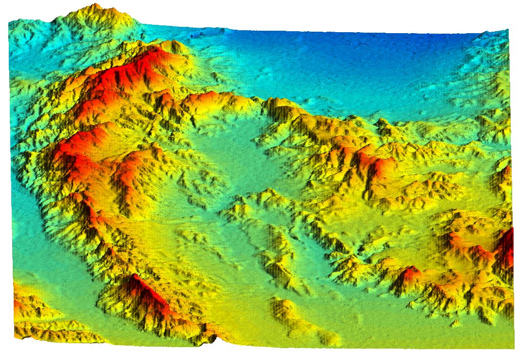
2000-02-14 | Earth |
Shuttle Radar Topography Mission (SRTM) |
C-Band Interferometric Radar |
2400x2781x3 |
|
|||||
|
|
2000-02-14 | Earth |
Shuttle Radar Topography Mission (SRTM) |
C-Band Interferometric Radar |
1890x2270x1 |
|
|||||
|
|
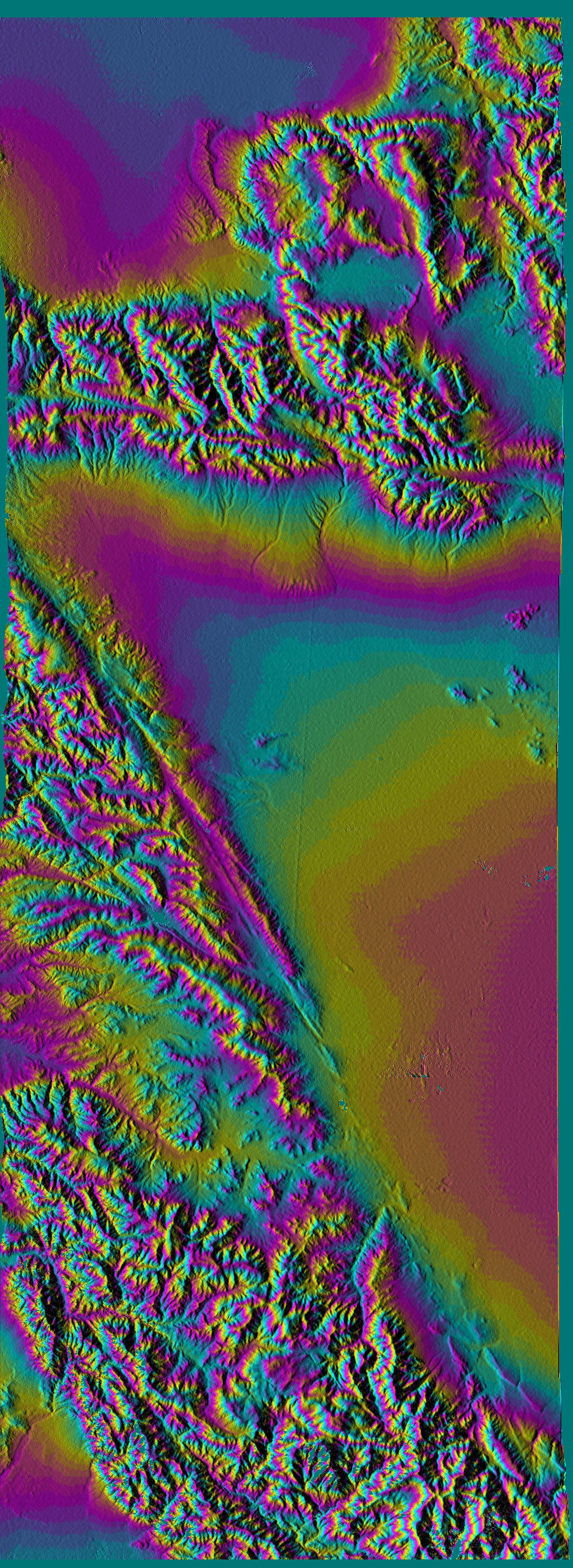
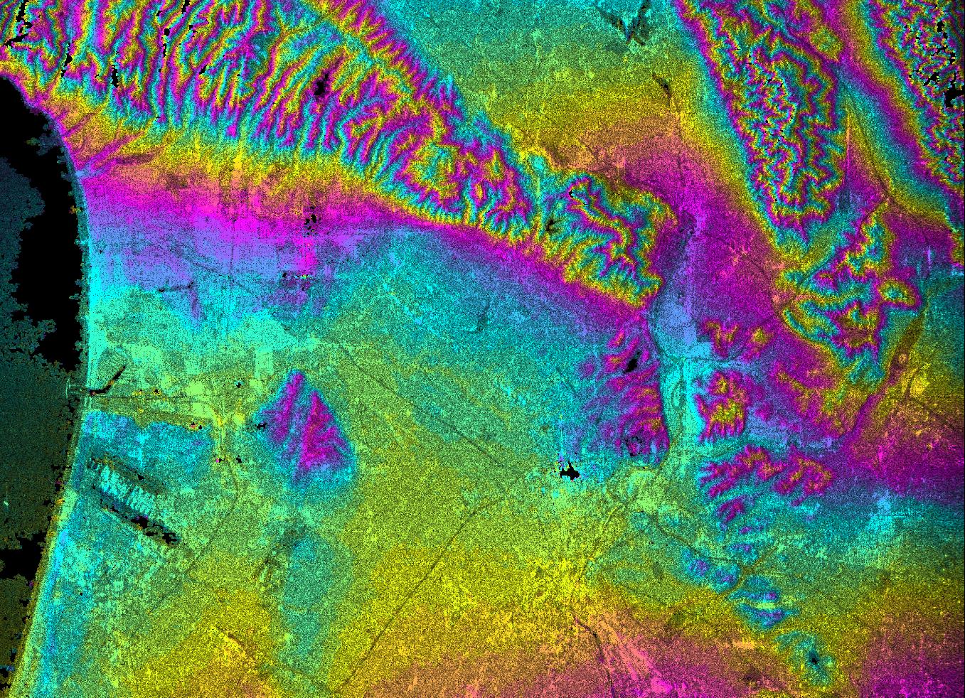
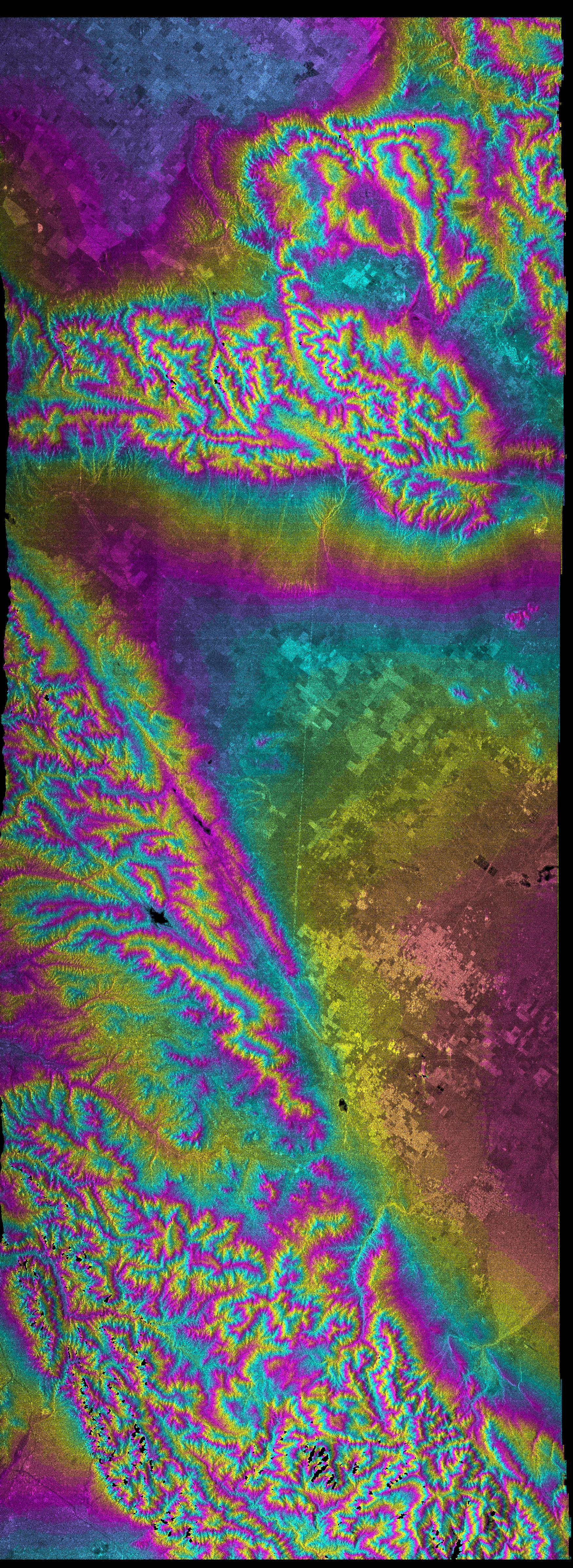
2000-02-14 | Earth |
Landsat Shuttle Radar Topography Mission (SRTM) |
C-Band Interferometric Radar Thematic Mapper |
3835x904x3 |
|
|||||
|
|
2000-02-14 | Earth |
Shuttle Radar Topography Mission (SRTM) |
C-Band Interferometric Radar |
2257x2887x1 |

|
|||||
|
|
2000-02-15 | Earth |
Shuttle Radar Topography Mission (SRTM) |
C-Band Interferometric Radar |
2056x1194x3 |
|
|||||
|
|
2000-02-15 | Earth |
Shuttle Radar Topography Mission (SRTM) |
C-Band Interferometric Radar |
2062x1194x3 |

|
|||||
|
|
2000-02-15 | Earth |
Shuttle Radar Topography Mission (SRTM) |
C-Band Interferometric Radar |
2400x2938x3 |

|
|||||
|
|
2000-02-16 | Earth |
Shuttle Radar Topography Mission (SRTM) |
C-Band Interferometric Radar |
1383x962x3 |
|
|||||
|
|
2000-02-16 | Earth |
Shuttle Radar Topography Mission (SRTM) |
C-Band Interferometric Radar |
2384x3021x3 |
|
|||||
|
|
2000-02-16 | Earth |
Landsat Shuttle Radar Topography Mission (SRTM) |
C-Band Interferometric Radar Thematic Mapper |
1412x1588x3 |
|
|||||
|
|
2000-02-16 | Earth |
Shuttle Radar Topography Mission (SRTM) |
C-Band Interferometric Radar |
1881x2650x3 |
|
|||||
|
|
2000-02-17 | Earth |
Shuttle Radar Topography Mission (SRTM) |
C-Band Interferometric Radar |
1059x722x3 |
|
|||||
|
|
2000-02-17 | Earth |
Shuttle Radar Topography Mission (SRTM) |
C-Band Interferometric Radar |
1749x4787x3 |
|
|
|||||
|
|
2000-02-17 | Earth |
Shuttle Radar Topography Mission (SRTM) |
C-Band Interferometric Radar |
1357x982x3 |
|
|||||
|
|
2000-02-17 | Earth |
Shuttle Radar Topography Mission (SRTM) |
C-Band Interferometric Radar |
1749x4787x3 |
|
|
|||||
|
|
2000-02-17 | Earth |
Shuttle Radar Topography Mission (SRTM) |
C-Band Interferometric Radar |
1228x1093x3 |

|
|||||
|
|
2000-02-17 | Earth |
Shuttle Radar Topography Mission (SRTM) |
C-Band Interferometric Radar |
1228x1093x3 |
|
|||||
|
|
2000-02-18 | Earth |
Landsat Shuttle Radar Topography Mission (SRTM) |
C-Band Interferometric Radar Thematic Mapper |
1363x2200x3 |

|
|||||
|
|
2000-02-18 | Earth |
Landsat Shuttle Radar Topography Mission (SRTM) |
C-Band Interferometric Radar Thematic Mapper |
1939x1999x3 |
|
|||||
|
|
2000-03-13 | Earth |
Shuttle Radar Topography Mission (SRTM) |
C-Band Interferometric Radar |
2496x2447x3 |
|
|||||
|
|
2000-02-18 | Earth |
Shuttle Radar Topography Mission (SRTM) |
C-Band Interferometric Radar |
1856x1852x3 |
|
|||||
|
|
2000-02-18 | Earth |
Shuttle Radar Topography Mission (SRTM) |
C-Band Interferometric Radar |
737x797x3 |
|
|||||
|
|
2000-02-19 | Earth |
Shuttle Radar Topography Mission (SRTM) |
C-Band Interferometric Radar |
1793x1314x1 |
|
|||||
|
|
2000-02-19 | Earth |
Shuttle Radar Topography Mission (SRTM) |
C-Band Interferometric Radar |
2273x1515x3 |
|
|||||
|
|
2000-02-19 | Earth |
Shuttle Radar Topography Mission (SRTM) |
C-Band Interferometric Radar |
1319x1062x3 |

|
|||||
|
|
2000-02-19 | Earth |
Shuttle Radar Topography Mission (SRTM) |
C-Band Interferometric Radar |
1877x1676x3 |
|
|||||
|
|
2000-02-20 | Earth |
Shuttle Radar Topography Mission (SRTM) |
C-Band Interferometric Radar |
1965x1347x3 |
|
|||||
|
|
2000-02-20 | Earth |
Landsat Shuttle Radar Topography Mission (SRTM) |
C-Band Interferometric Radar Thematic Mapper |
1430x1152x3 |

|
|||||
|
|
2002-10-25 | Earth |
Landsat Shuttle Radar Topography Mission (SRTM) |
C-Band Interferometric Radar Thematic Mapper |
1152x870x3 |
|
|||||

|
 |
|
|
 |
 |
|
|
|
|
|

|
| 1-100 | 101-200 | 201-300 | 301-400 | 401-500 | 501-600 | 601-700 | 701-800 | 801-900 | 901-1000 |
| Currently displaying images: 301 - 400 of 2277 |