PDS logoPlanetary Data System
PDS Information
Find a Node - Use these links to navigate to any of the 8 publicly accessible PDS Nodes.

This bar indicates that you are within the PDS enterprise which includes 6 science discipline nodes and 2 support nodes which are overseen by the Project Management Office at NASA's Goddard Space Flight Center (GSFC). Each node is led by an expert in the subject discipline, supported by an advisory group of other practitioners of that discipline, and subject to selection and approval under a regular NASA Research Announcement.
Click here to return to the Photojournal Home Page Click here to view a list of Photojournal Image Galleries Photojournal_inner_header
Latest Images  |  Spacecraft & Technology  |  Animations  |  Space Images App  |  Feedback  |  Photojournal Search  
Your search criteria found 5 images
Spacecraft
Go to PIAxxxxx:
Refine this list of images by:
Instrument:
Click on an image for detailed information
Click on a column heading to sort in ascending or descending order
My
List
Addition DateSort Ascending Target Mission Instrument Size
Add Image to Favorite List 2017-01-06 Earth Mars Reconnaissance Orbiter (MRO)
HiRISE
657x358x3
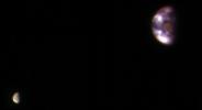
This composite image of Earth and its moon, as seen from Mars, combines the best Earth image with the best moon image from four sets of images acquired on Nov. 20, 2016, by NASA's Mars Reconnaissance Orbiter. Mars was about 127 million miles from Earth.
PIA21260:
Earth and Its Moon, as Seen From Mars
Full Resolution:     TIFF (213.9 kB)     JPEG (7.02 kB)
Add Image to Favorite List 2011-08-04 Earth Mars Reconnaissance Orbiter (MRO)
HiRISE
1578x1065x3
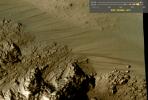
This image comes from observations of Horowitz crater by the HiRISE camera onboard NASA's Mars Reconnaissance Orbiter. The features that extend down the slope during warm seasons are called recurring slope lineae.
PIA14475:
Warm-Season Flows on Slope in Horowitz Crater (Eight-Image Sequence)
Full Resolution:     TIFF (1.684 MB)     JPEG (231.7 kB)
Add Image to Favorite List 2008-03-03 Earth Mars Reconnaissance Orbiter (MRO)
HiRISE
800x800x3
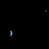
This is an image of Earth and the moon, acquired on October 3, 2007 by NASA's Mars Reconnaissance Orbiter from 88 million miles away.
PIA10244:
Earth and Moon as Seen from Mars
Full Resolution:     TIFF (1.922 MB)     JPEG (11.74 kB)
Add Image to Favorite List 2005-08-22 Earth Mars Reconnaissance Orbiter (MRO)
MARCI
700x80x1
Three days after NASA's Mars Reconnaissance Orbiter's Aug. 12, 2005, launch, the spacecraft was pointed toward Earth and the Mars Color Imager camera was powered up to acquire a suite of images of Earth and the Moon.
PIA04160:
Calibration View of Earth and the Moon by Mars Color Imager Animation Icon
Full Resolution:     TIFF (56.29 kB)     JPEG (1.314 kB)
Add Image to Favorite List 2005-08-22 Earth Mars Reconnaissance Orbiter (MRO)
MARCI
85x75x3
Three days after the Mars Reconnaissance Orbiter's Aug. 12, 2005, launch, the NASA spacecraft was pointed toward Earth and the Mars Color Imager camera was powered up to acquire a suite of color and ultraviolet images of Earth and the Moon.
PIA04159:
Calibration Image of Earth by Mars Color Imager
Full Resolution:     TIFF (19.39 kB)     JPEG (870)
Currently displaying images: 1 - 5 of 5