Click on an image for detailed information
Click on a column heading to sort in ascending or descending order

My
List |
Addition Date
|
Target
|
Mission
|
Instrument
|
Size
|

|
2013-11-20 |
Mars
|
Mars Reconnaissance Orbiter (MRO)
|
HiRISE
|
2880x1800x3 |
|
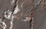
-
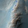
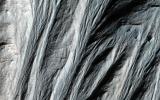
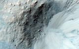
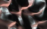
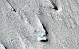
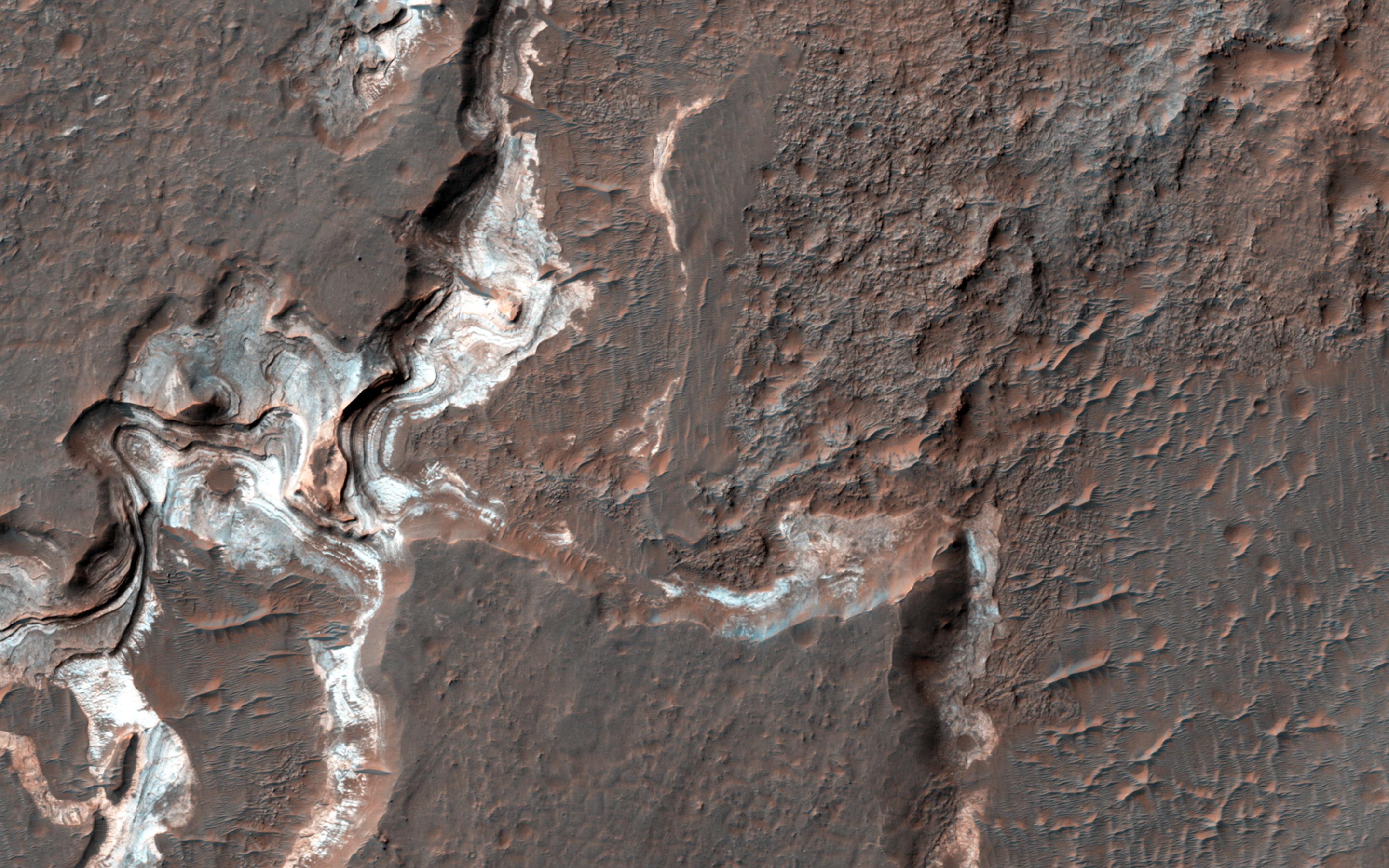
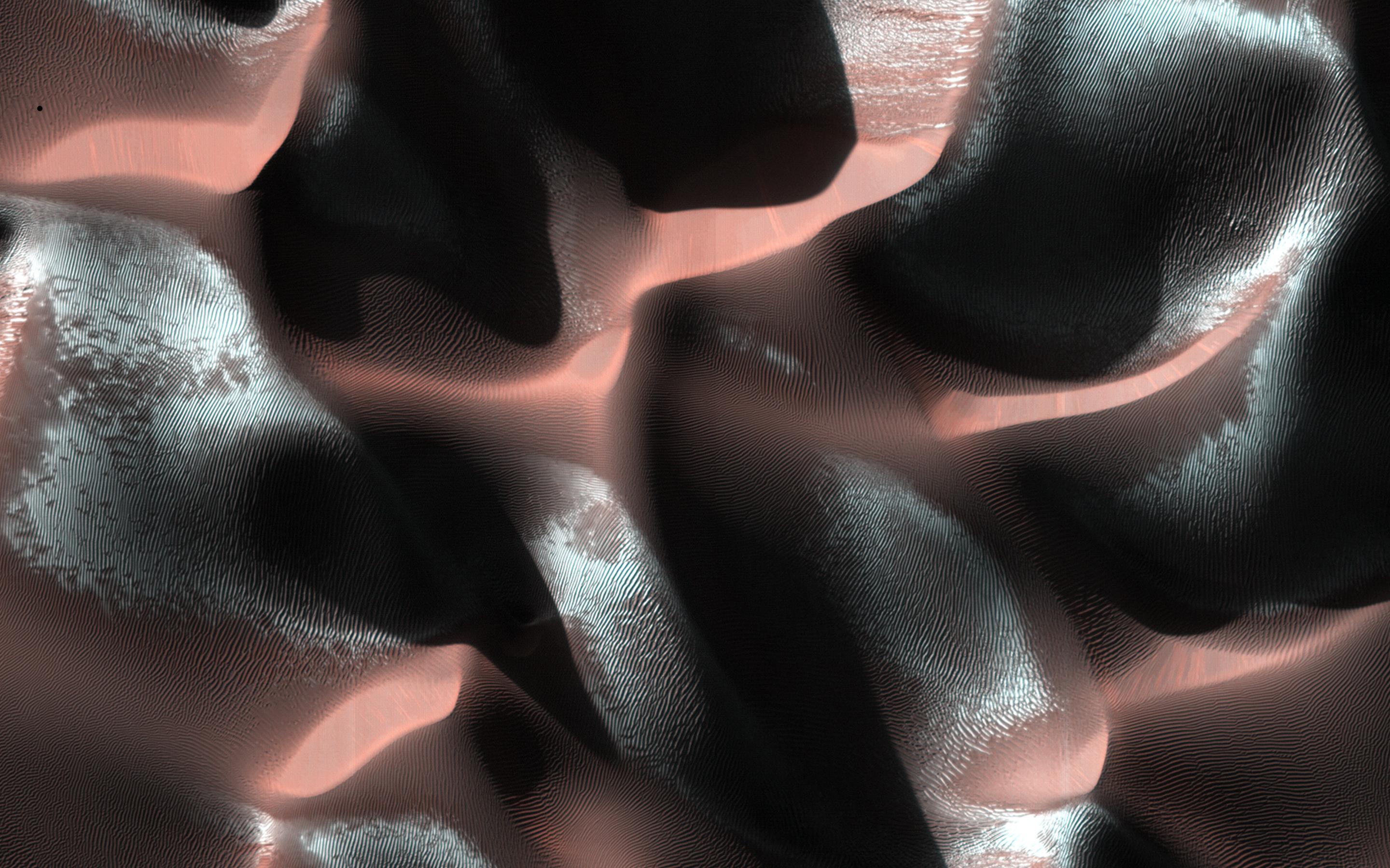
PIA17702:
-
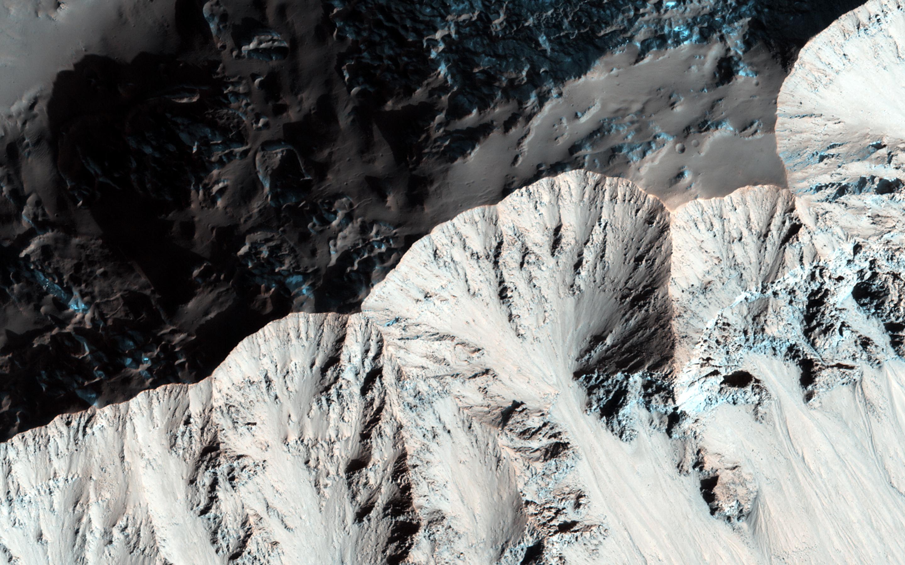
Hydrated Sulfate Landslides in Ophir Chasma
Full Resolution:
TIFF
(15.56 MB)
JPEG
(801 kB)
|
|
|
2013-11-20 |
Mars
|
Mars Reconnaissance Orbiter (MRO)
|
HiRISE
|
2880x1800x3 |
|
-
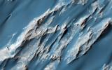
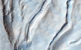
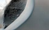
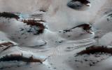
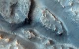
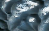
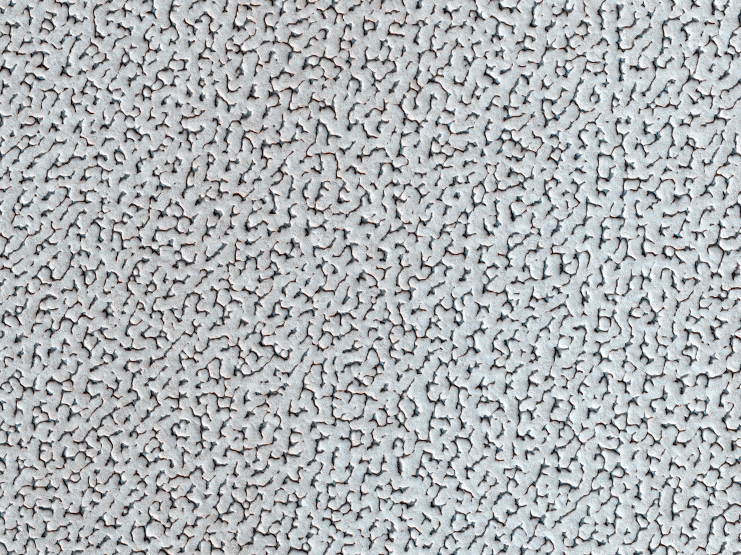
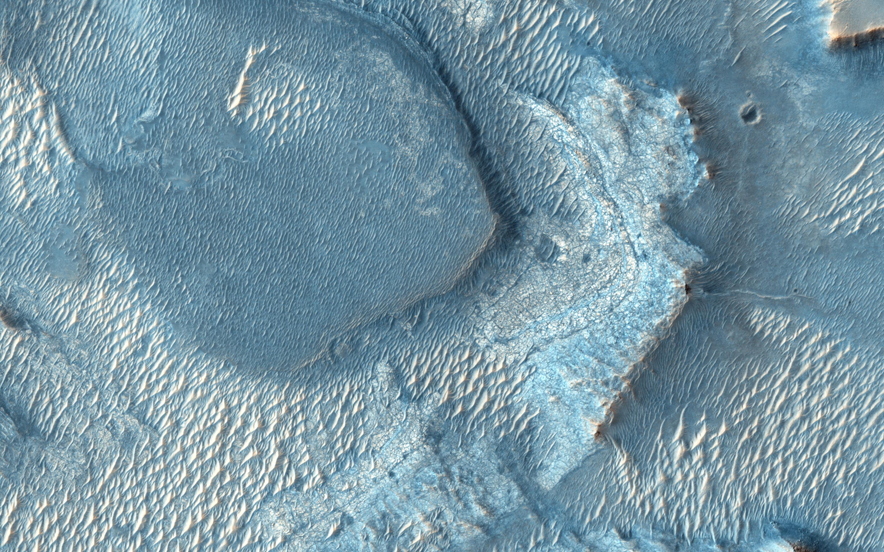
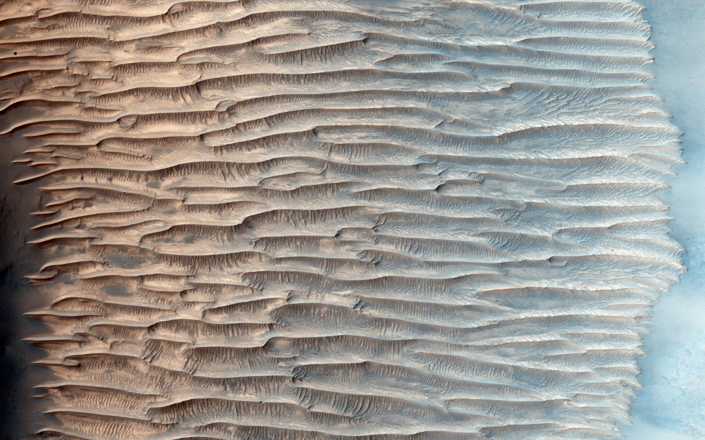
PIA17703:
-
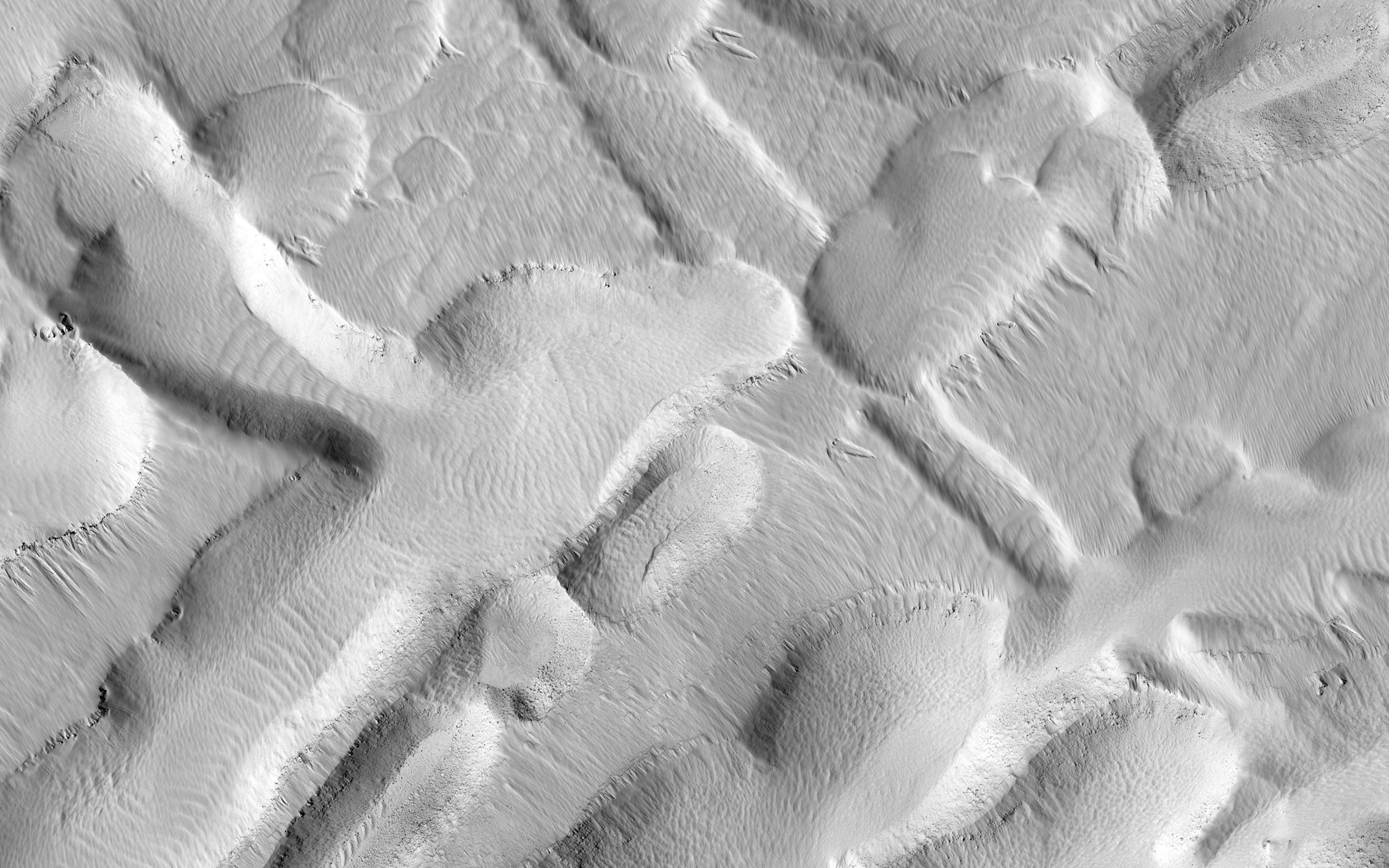
A Textured Mesa
Full Resolution:
TIFF
(15.56 MB)
JPEG
(751.1 kB)
|
|
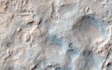
|
2013-11-20 |
Mars
|
Mars Reconnaissance Orbiter (MRO)
|
HiRISE
|
2880x1800x3 |

|
-
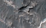
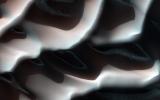
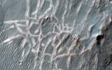
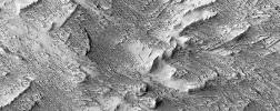
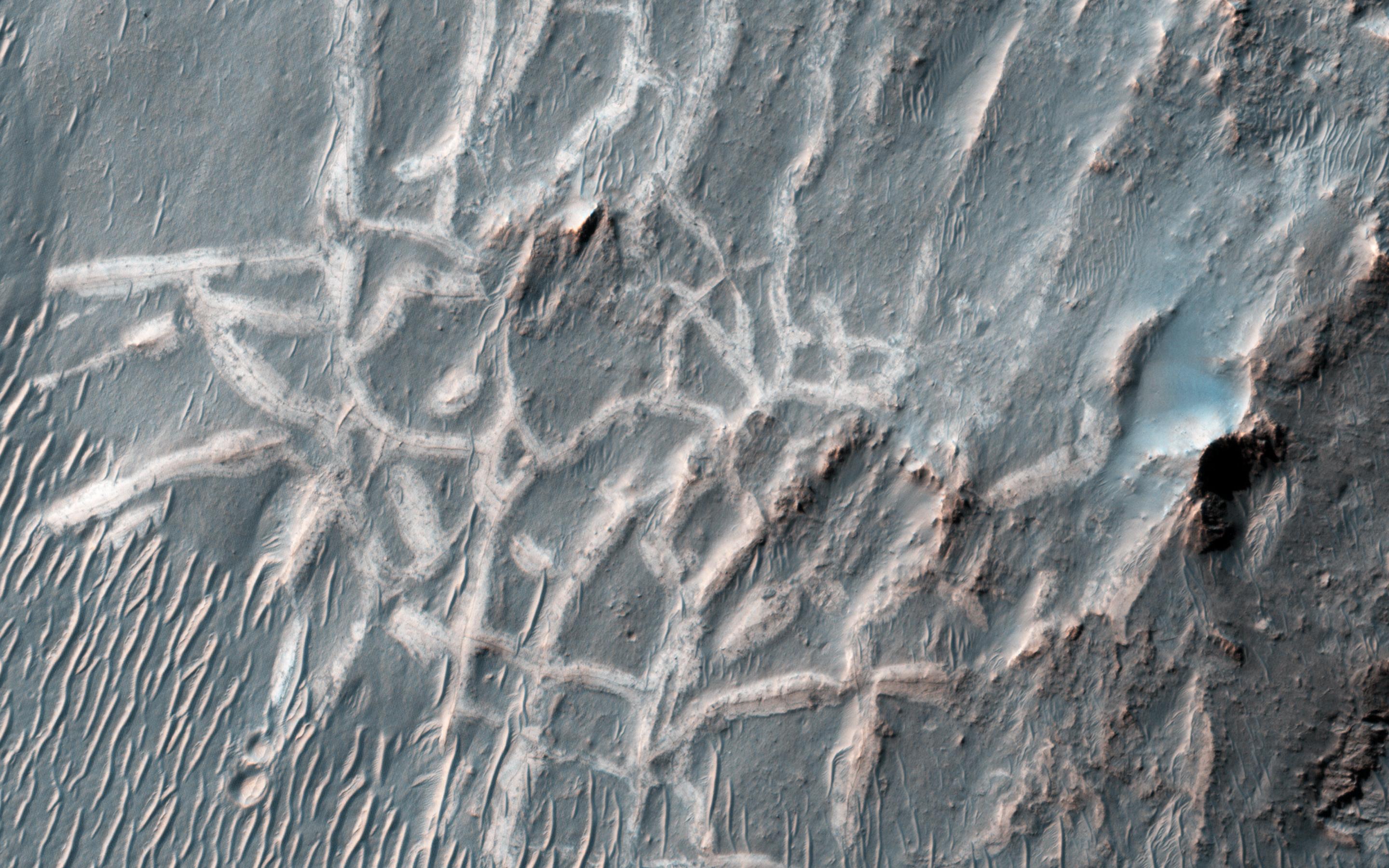
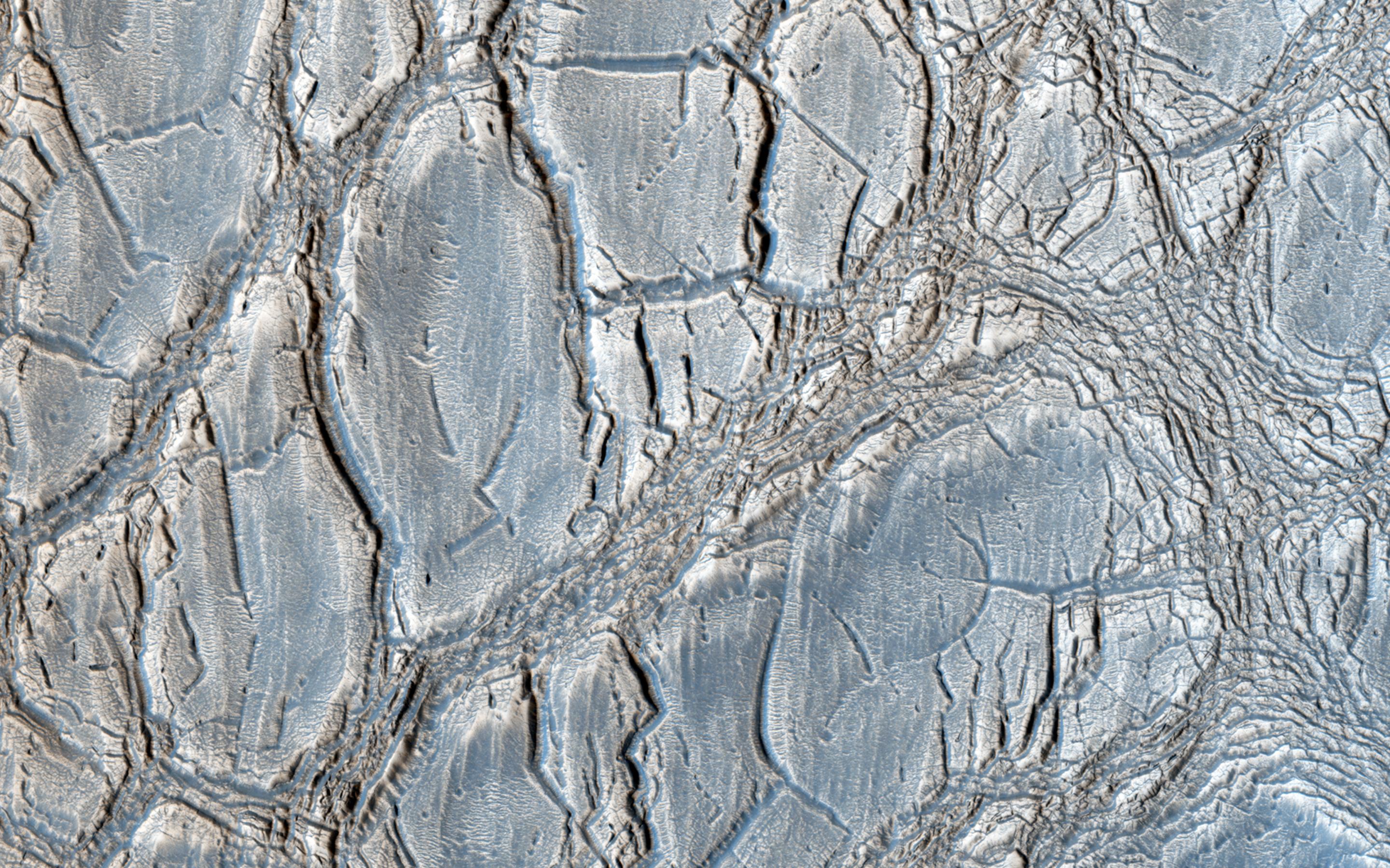
PIA17704:
-
Martian Intersection
Full Resolution:
TIFF
(15.56 MB)
JPEG
(703.6 kB)
|
|
|
2013-12-03 |
Mars
|
Mars Exploration Rover (MER)
Mars Reconnaissance Orbiter (MRO)
|
CTX
|
4731x3605x3 |
|
-
PIA17589:
-
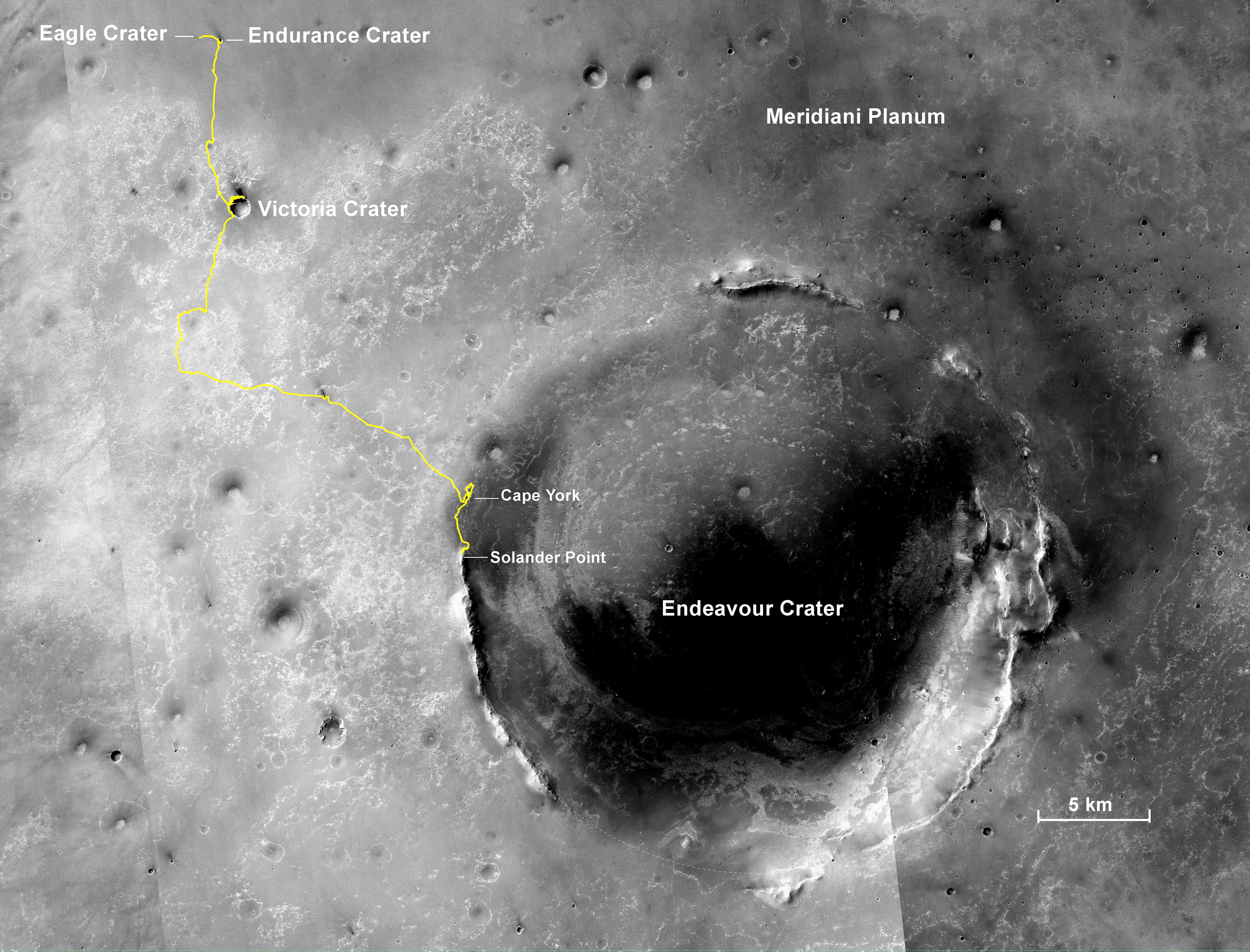
Opportunity's Journey, Approaching 10th Anniversary
Full Resolution:
TIFF
(51.19 MB)
JPEG
(3.199 MB)
|
|
|
2013-12-09 |
Mars
|
Mars Reconnaissance Orbiter (MRO)
Mars Science Laboratory (MSL)
|
CTX
|
3300x2550x3 |
|
-
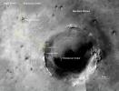
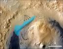
PIA17596:
-
Possible Extent of Ancient Lake in Gale Crater, Mars
Full Resolution:
TIFF
(25.26 MB)
JPEG
(1.34 MB)
|
|
|
2013-12-09 |
Mars
|
Mars Reconnaissance Orbiter (MRO)
Mars Science Laboratory (MSL)
|
HiRISE
|
960x720x3 |
|
-
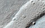
PIA17597:
-
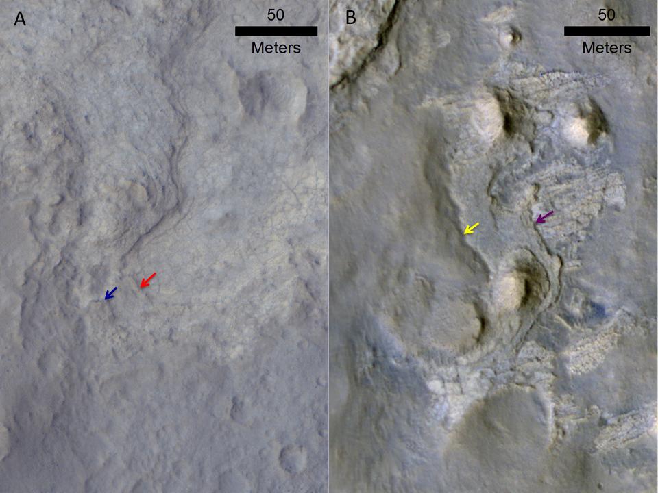
Erosion Patterns May Guide Mars Rover to Rocks Recently Exposed
Full Resolution:
TIFF
(2.075 MB)
JPEG
(87.76 kB)
|
|
|
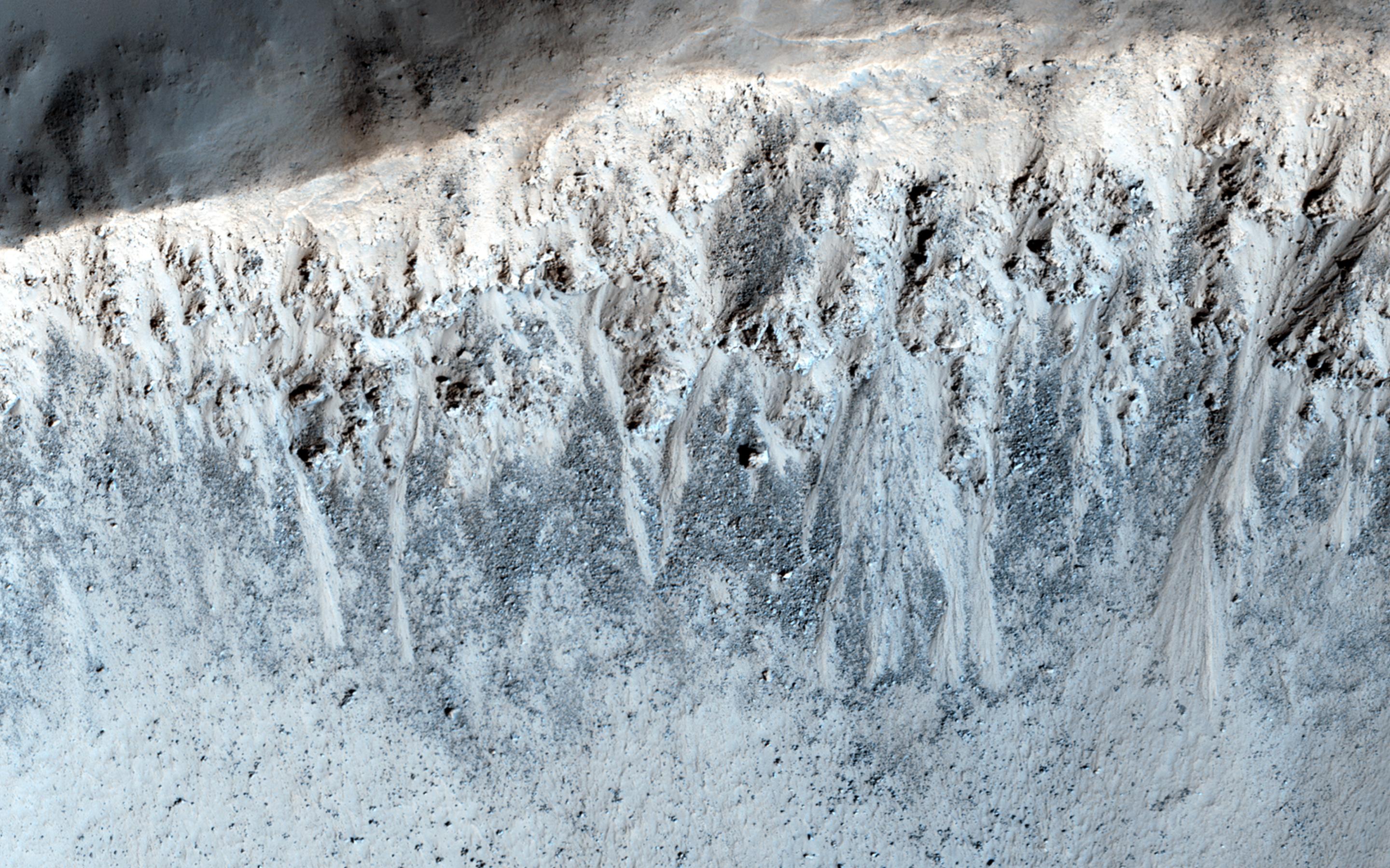
2013-12-10 |
Mars
|
Mars Reconnaissance Orbiter (MRO)
|
HiRISE
|
684x720x3 |
|
-
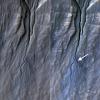
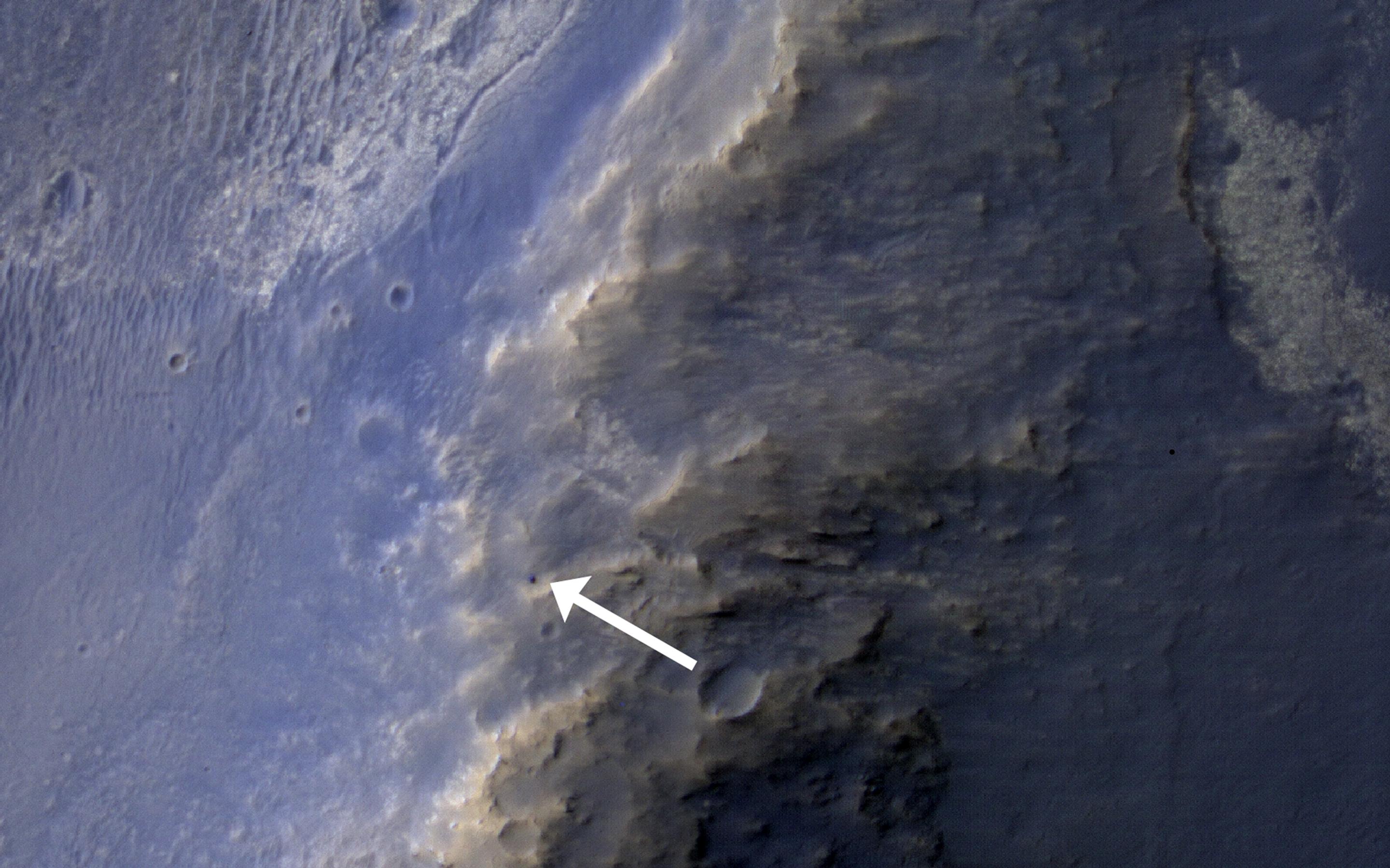
PIA17605:
-
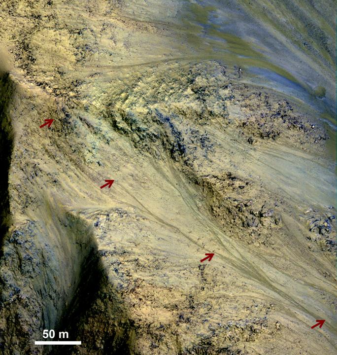
Long, Recurring Linear Marking on Martian Slope
Full Resolution:
TIFF
(1.478 MB)
JPEG
(128 kB)
|
|
|
2013-12-10 |
Mars
|
Mars Reconnaissance Orbiter (MRO)
|
HiRISE
|
1653x1352x3 |
|
-
PIA17606:
-
Seasonal Changes in Dark Marks on an Equatorial Martian Slope

Full Resolution:
TIFF
(2.239 MB)
JPEG
(426.6 kB)
|
|
|
2013-12-10 |
Mars
|
Mars Reconnaissance Orbiter (MRO)
|
HiRISE
|
751x564x3 |

|
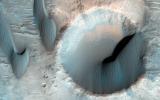
-
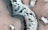
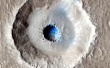
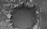
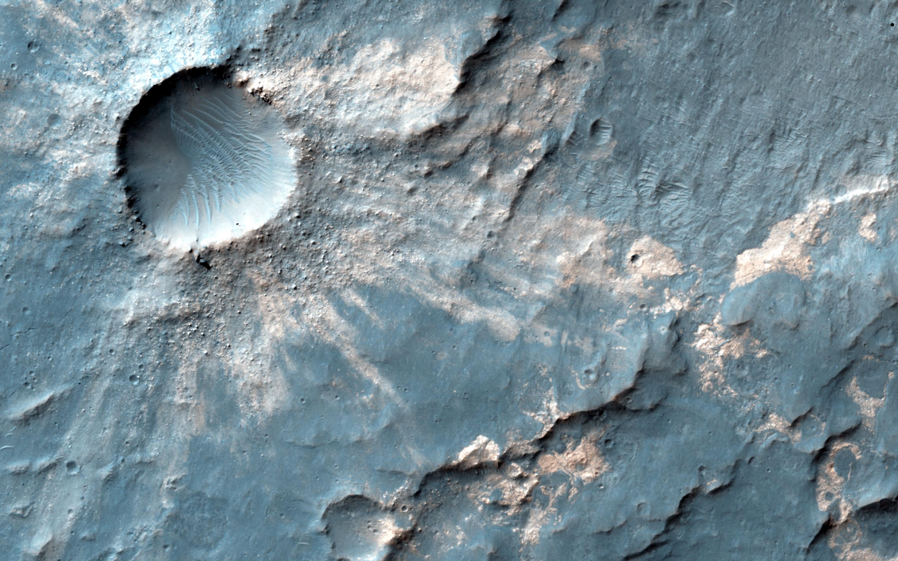
PIA17608:
-
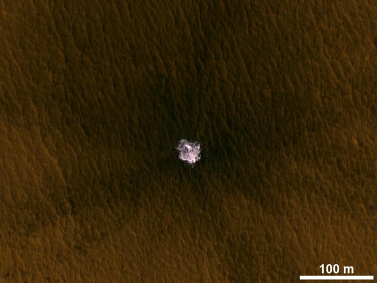
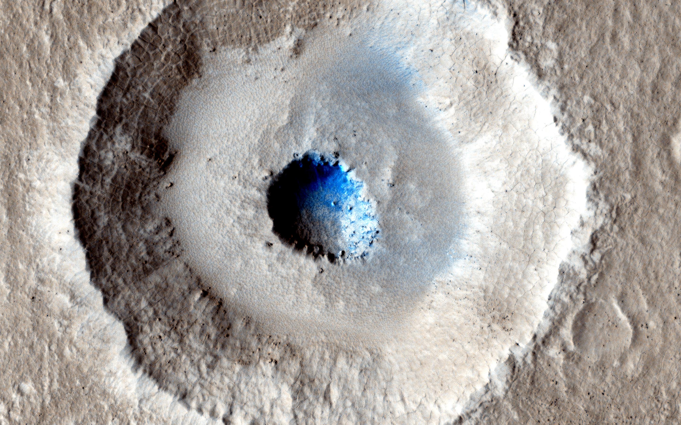
Fresh Crater Exposing Buried Ice on Mid-Latitude Mars
Full Resolution:
TIFF
(1.271 MB)
JPEG
(46.92 kB)
|
|
|
2013-12-10 |
Mars
|
Mars Reconnaissance Orbiter (MRO)
|
HiRISE
|
1020x765x3 |
|
-
PIA17750:
-
Mars Orbiter Laser Altimeter, Thermal Emission Imaging System
Full Resolution:
TIFF
(2.342 MB)
JPEG
(100.8 kB)
|
|
|
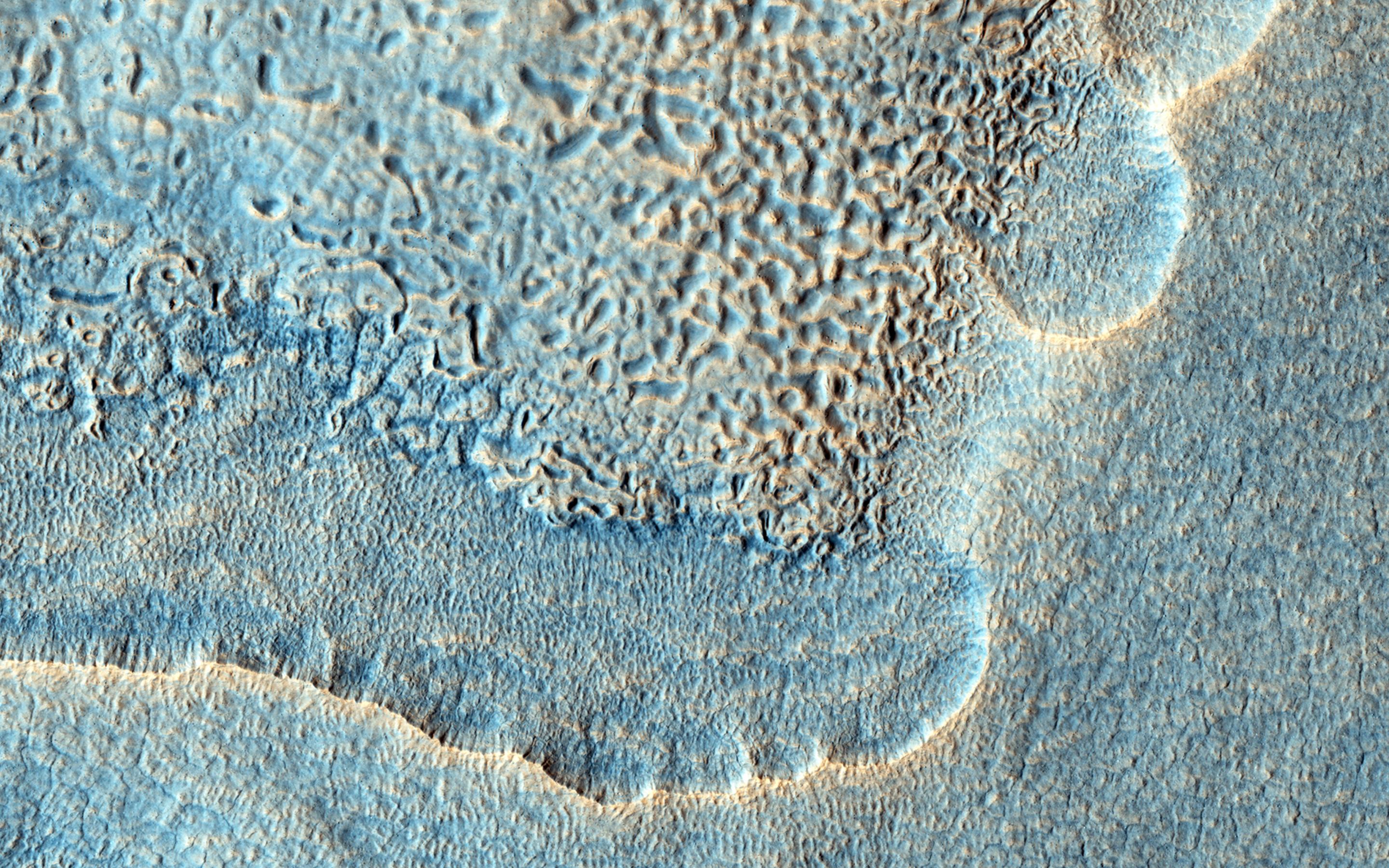
2014-01-09 |
Mars
|
Mars Reconnaissance Orbiter (MRO)
|
HiRISE
|
2560x1920x3 |
|
-
PIA17857:
-
Rippled Surfaces on a Slope in Coloe Fossae
Full Resolution:
TIFF
(14.75 MB)
JPEG
(799.1 kB)
|
|
|
2014-01-09 |
Mars
|
Mars Reconnaissance Orbiter (MRO)
|
HiRISE
|
2560x1920x3 |
|
-
PIA17858:
-
Banded Ridges in Hellas
Full Resolution:
TIFF
(14.75 MB)
JPEG
(1.041 MB)
|
|
|
2014-01-09 |
Mars
|
Mars Reconnaissance Orbiter (MRO)
|
HiRISE
|
2560x1920x3 |

|
-
PIA17859:
-
The Obliquity of Mars (Periodic Bedding in Tithonium Chasma)
Full Resolution:
TIFF
(14.75 MB)
JPEG
(749 kB)
|
|
|
2014-01-09 |
Mars
|
Mars Reconnaissance Orbiter (MRO)
|
HiRISE
|
2120x2419x3 |
|
-
PIA17754:
-
Curiosity Rover Tracks, Viewed from Orbit in December 2013
Full Resolution:
TIFF
(15.39 MB)
JPEG
(813.9 kB)
|
|
|
2014-01-09 |
Mars
|
Mars Reconnaissance Orbiter (MRO)
|
HiRISE
|
2016x1464x1 |
|
-
PIA17755:
-
Curiosity Trekking, Viewed from Orbit in December 2013
Full Resolution:
TIFF
(2.955 MB)
JPEG
(386.4 kB)
|
|
|
2014-01-15 |
Mars
|
Mars Reconnaissance Orbiter (MRO)
|
HiRISE
|
2560x1920x3 |
|
-
PIA17873:
-
Dunes on the Rim of the Hellas Impact Basin
Full Resolution:
TIFF
(14.75 MB)
JPEG
(1.248 MB)
|
|
|
2014-01-15 |
Mars
|
Mars Reconnaissance Orbiter (MRO)
|
HiRISE
|
2560x1920x3 |
|
-
PIA17874:
-
Recent Volcanism in Valles Marineris
Full Resolution:
TIFF
(14.75 MB)
JPEG
(836.7 kB)
|
|
|
2014-01-15 |
Mars
|
Mars Reconnaissance Orbiter (MRO)
|
HiRISE
|
2560x1920x3 |
|
-
PIA17875:
-
Looking for Salts on Mars
Full Resolution:
TIFF
(14.75 MB)
JPEG
(849.3 kB)
|
|
|
2014-01-15 |
Mars
|
Mars Reconnaissance Orbiter (MRO)
|
HiRISE
|
2560x1920x3 |

|
-
PIA17876:
-
Fissure near Cerberus Fossae with Tectonic Morphologies
Full Resolution:
TIFF
(14.75 MB)
JPEG
(741.1 kB)
|
|
|
2014-01-23 |
Mars
|
Mars Exploration Rover (MER)
Mars Reconnaissance Orbiter (MRO)
|
HiRISE
|
1064x1265x3 |
|
-
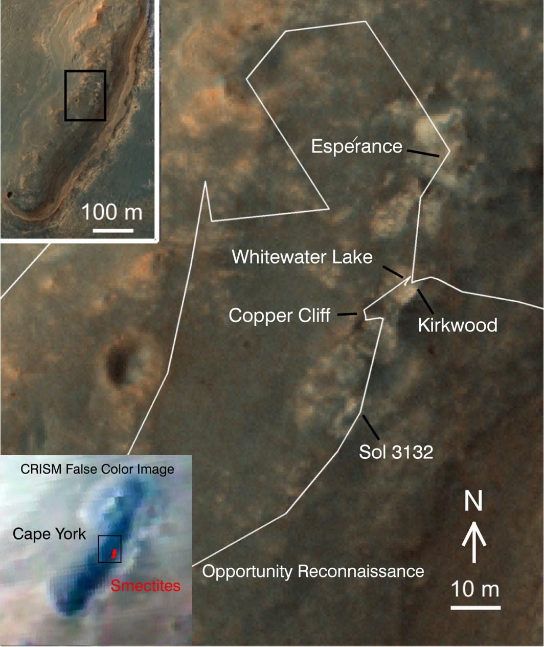
PIA17264:
-
'Cape York' Explored
Full Resolution:
TIFF
(4.04 MB)
JPEG
(138.1 kB)
|
|
|
2014-01-23 |
Mars
|
Mars Exploration Rover (MER)
Mars Reconnaissance Orbiter (MRO)
|
CTX
|
4853x3687x3 |
|
-
PIA17758:
-
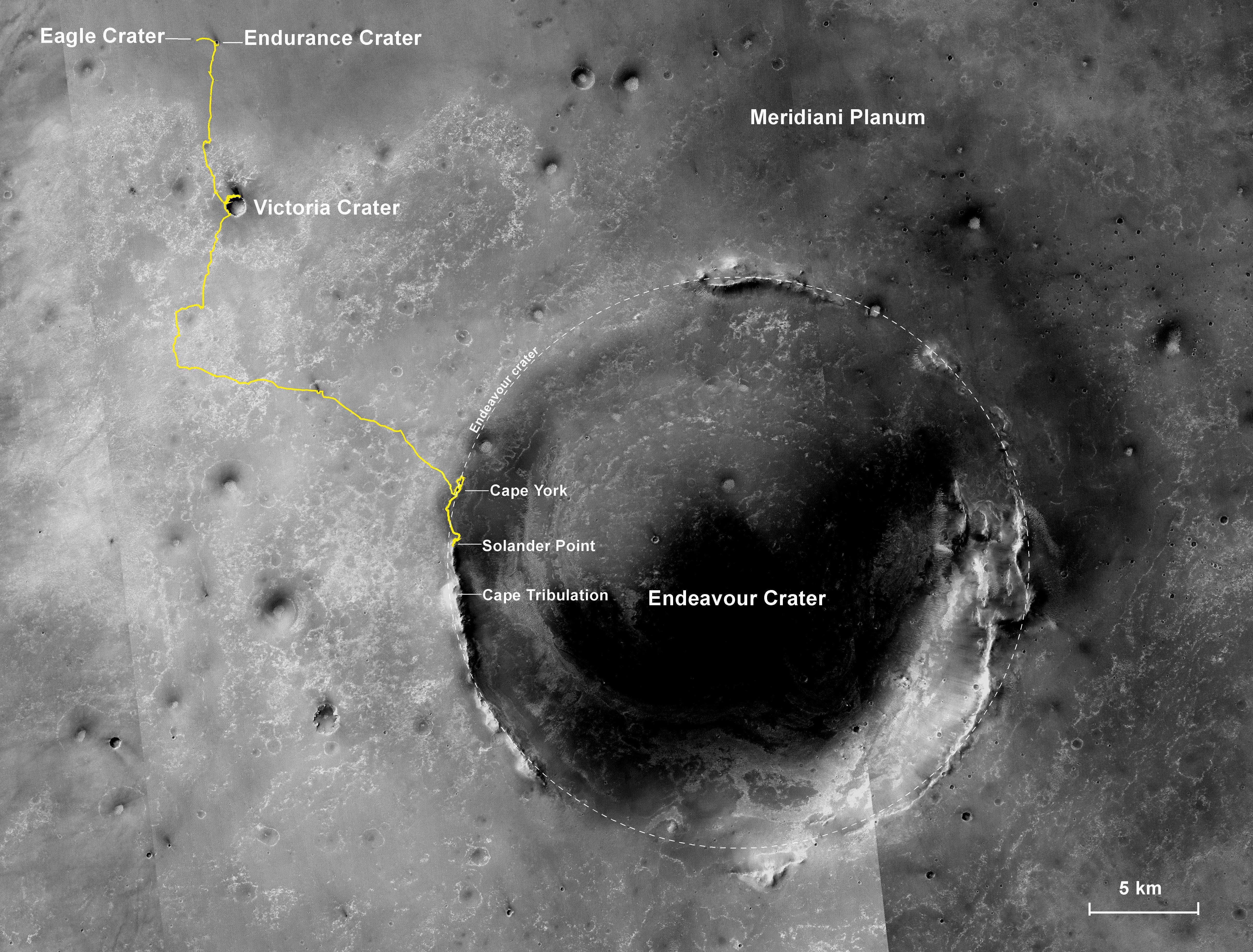
Opportunity's First Decade of Driving on Mars
Full Resolution:
TIFF
(53.71 MB)
JPEG
(3.168 MB)
|
|
|
2014-01-29 |
Mars
|
Mars Reconnaissance Orbiter (MRO)
Mars Science Laboratory (MSL)
|
HiRISE
|
3300x2550x3 |
|
-
PIA17765:
-
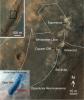
Traverse Map for Mars Rover Curiosity as of Jan. 26, 2014
Full Resolution:
TIFF
(25.26 MB)
JPEG
(1.211 MB)
|
|
|
2014-02-05 |
Mars
|
Mars Reconnaissance Orbiter (MRO)
|
HiRISE
|
2880x1800x3 |
|
-
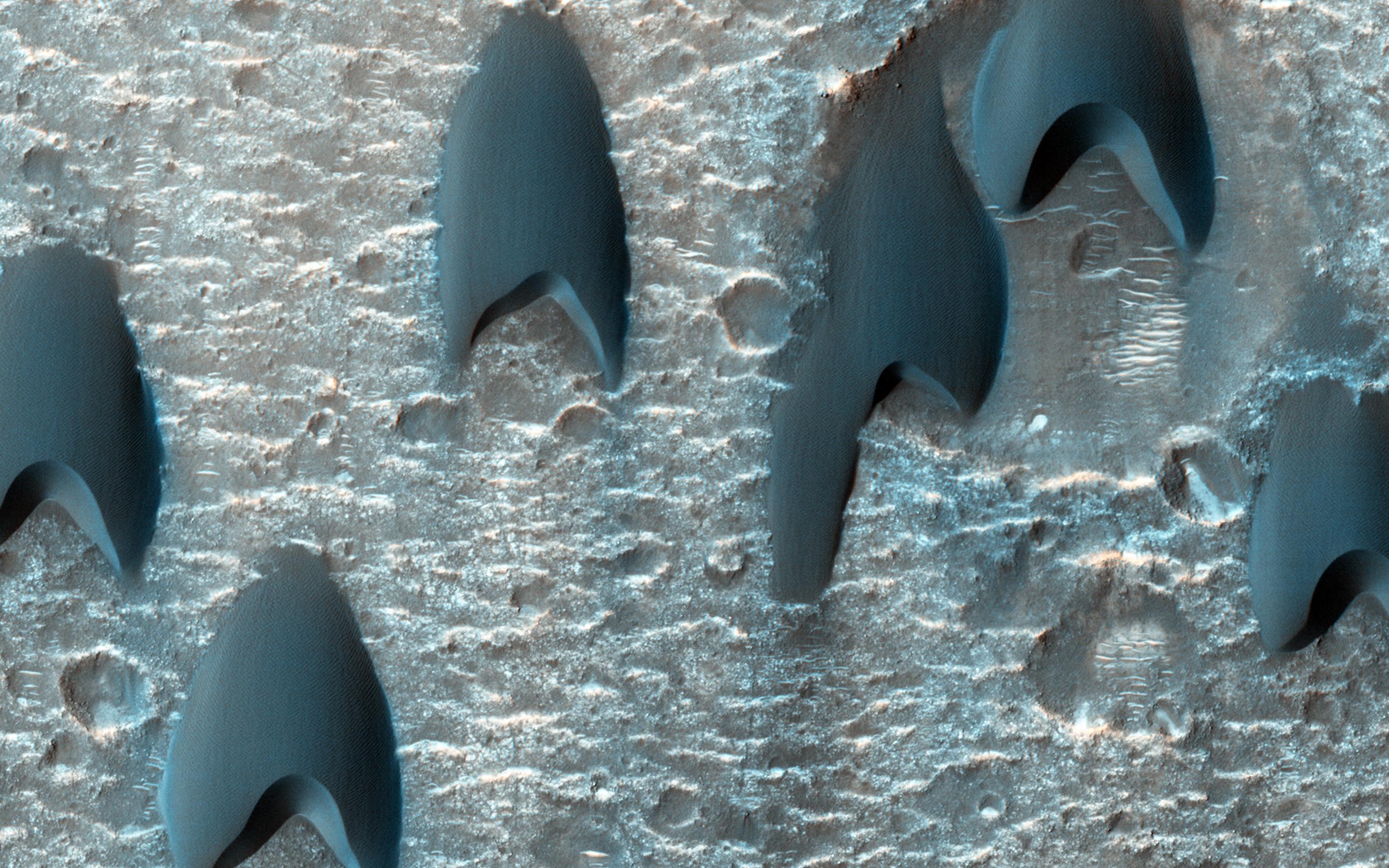
PIA17984:
-
Squiggly Sand Dunes
Full Resolution:
TIFF
(15.56 MB)
JPEG
(923.9 kB)
|
|
|
2014-02-05 |
Mars
|
Mars Reconnaissance Orbiter (MRO)
|
HiRISE
|
2880x1800x3 |
|
-
PIA17985:
-
Channels in Phlegra Montes
Full Resolution:
TIFF
(15.56 MB)
JPEG
(977.8 kB)
|
|
|
2014-02-05 |
Mars
|
Mars Reconnaissance Orbiter (MRO)
|
HiRISE
|
2880x1800x3 |
|
-
PIA17986:
-
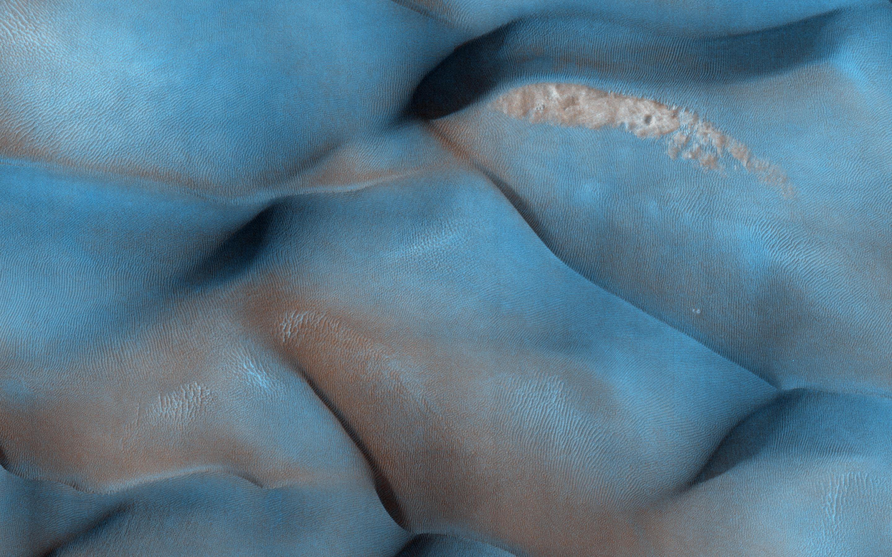
Fall Frost Accumulation on Russell Crater Dunes
Full Resolution:
TIFF
(15.56 MB)
JPEG
(962.1 kB)
|
|
|
2014-02-05 |
Mars
|
Mars Reconnaissance Orbiter (MRO)
|
HiRISE
|
1024x768x3 |
|
-
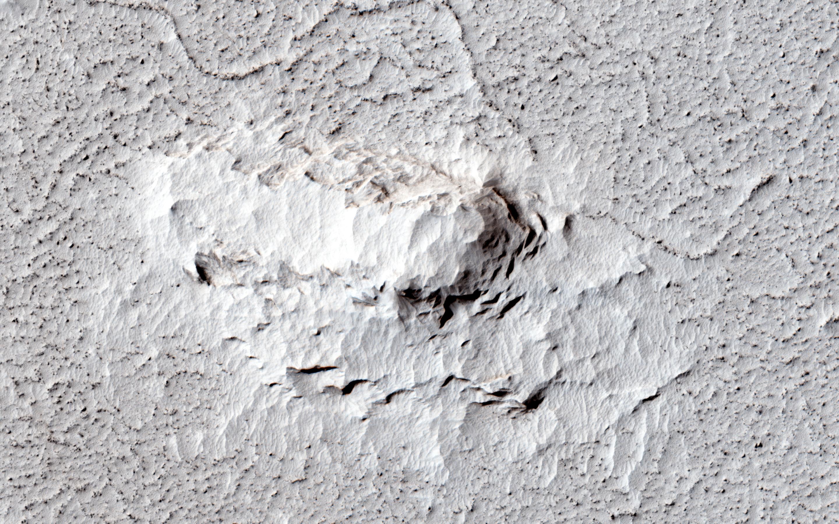
PIA17932:
-
A Spectacular New Martian Impact Crater
Full Resolution:
TIFF
(2.36 MB)
JPEG
(200.7 kB)
|
|
|
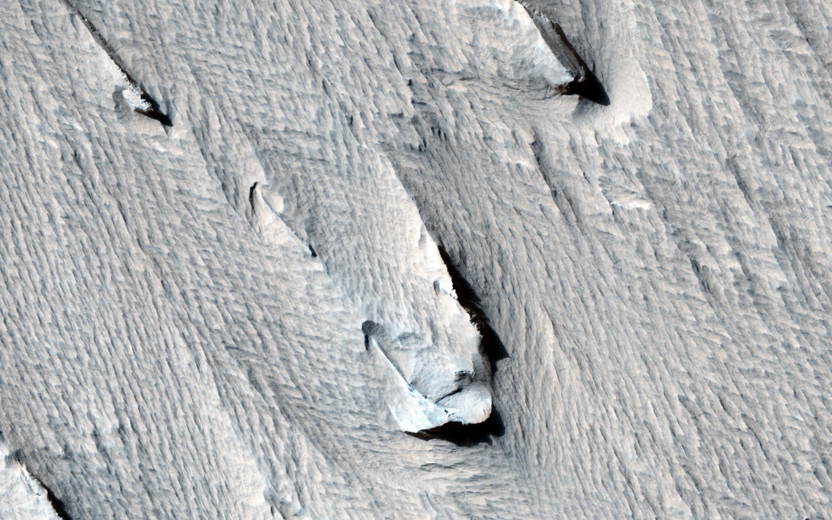
2014-02-10 |
Mars
|
Mars Reconnaissance Orbiter (MRO)
|
HiRISE
|
1943x2512x3 |
|
-
PIA17933:
-
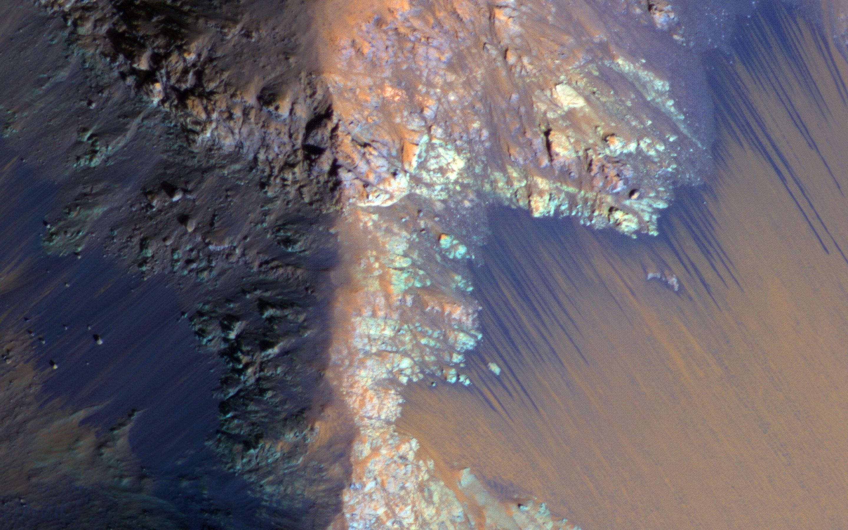
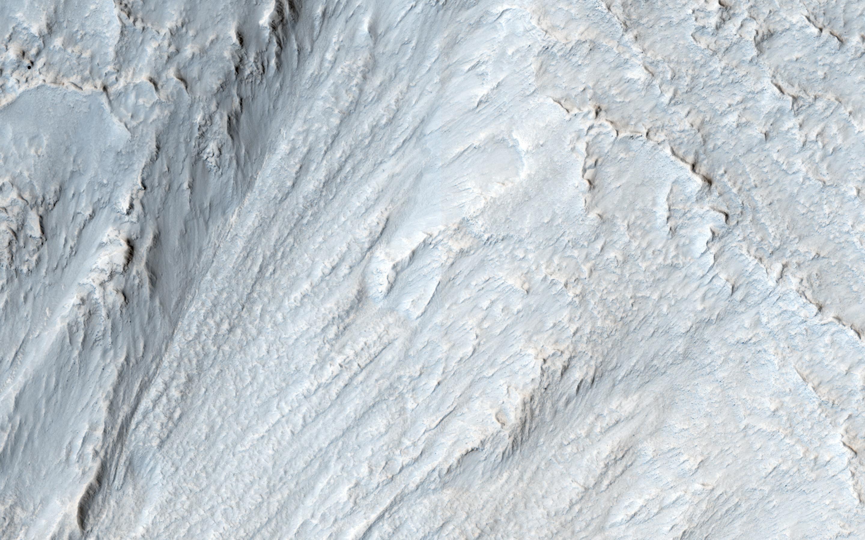
Warm-Season Flows on Martian Slope
Full Resolution:
TIFF
(14.65 MB)
JPEG
(614.7 kB)
|
|
|
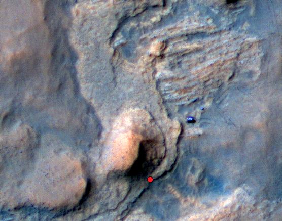
2014-02-10 |
Mars
|
Mars Reconnaissance Orbiter (MRO)
|
HiRISE
|
1942x1495x3 |
|
-
PIA17934:
-
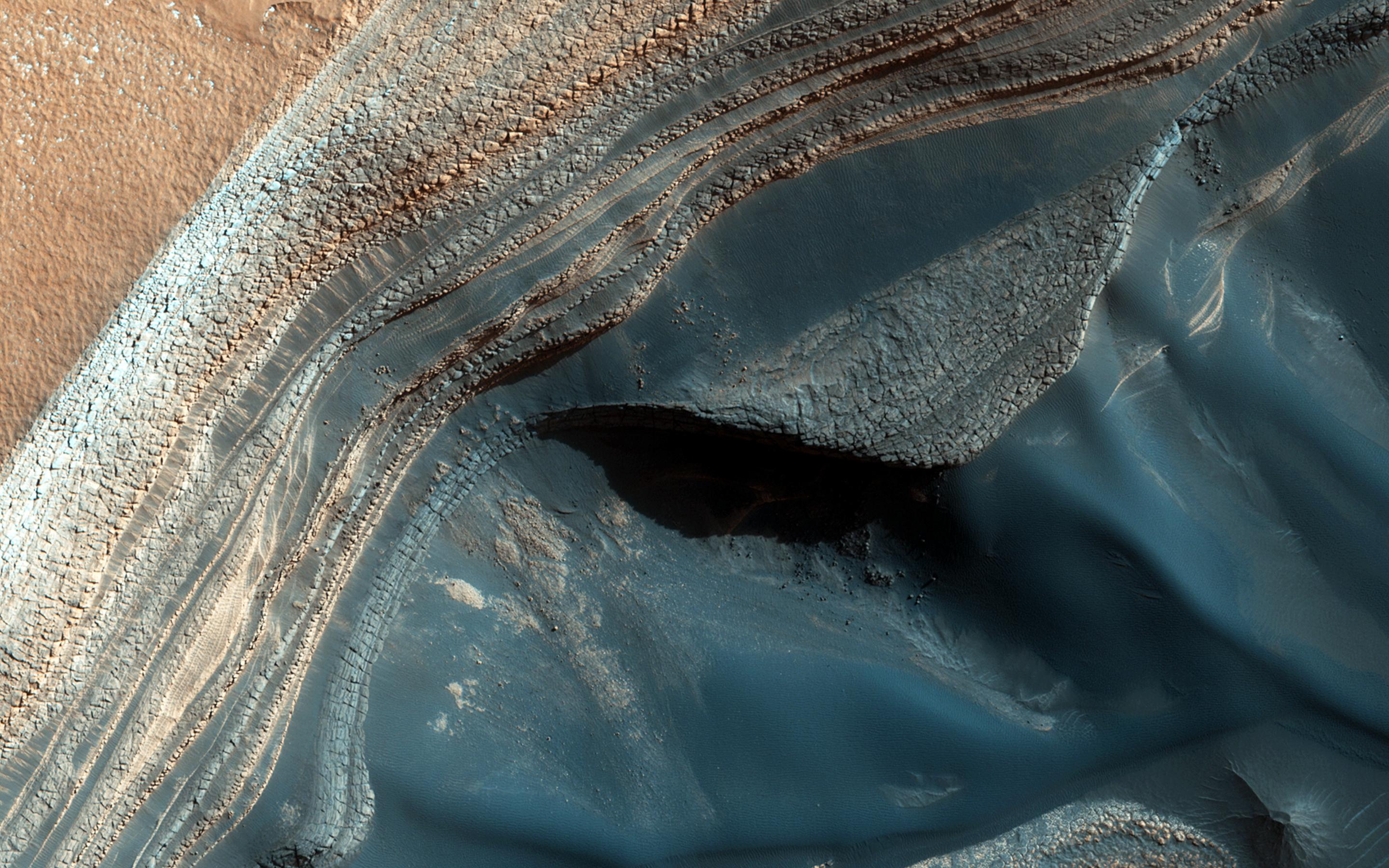
Color-Coded Clues to Composition Superimposed on Martian Seasonal-Flow Image
Full Resolution:
TIFF
(8.713 MB)
JPEG
(345.8 kB)
|
|
|
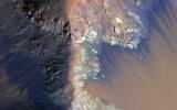
2014-02-13 |
Mars
|
Mars Reconnaissance Orbiter (MRO)
|
HiRISE
|
2880x1800x3 |
|
-
PIA17980:
-
Bright Sediments on the Floor of Ladon Basin
Full Resolution:
TIFF
(15.56 MB)
JPEG
(742.8 kB)
|
|
|
2014-02-13 |
Mars
|
Mars Reconnaissance Orbiter (MRO)
|
HiRISE
|
2880x1800x3 |
|
-
PIA17981:
-
Dunes Flying in Formation
Full Resolution:
TIFF
(15.56 MB)
JPEG
(797.8 kB)
|
|
|
2014-02-13 |
Mars
|
Mars Reconnaissance Orbiter (MRO)
|
HiRISE
|
2880x1800x3 |
|
-
PIA17982:
-
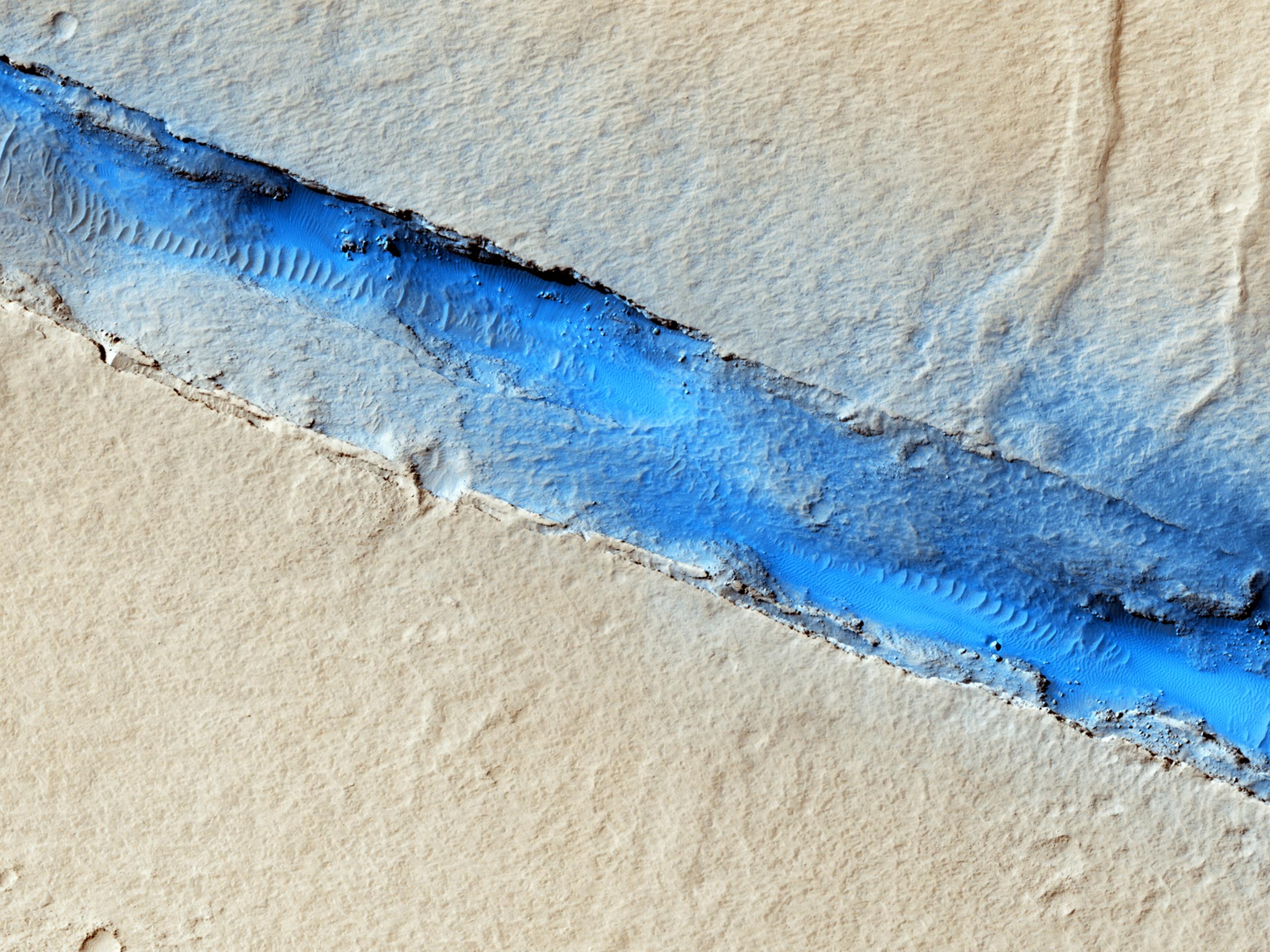
Which Came First, the Yardang or the Platy Flow?
Full Resolution:
TIFF
(15.56 MB)
JPEG
(895.9 kB)
|
|
|
2014-02-13 |
Mars
|
Mars Reconnaissance Orbiter (MRO)
|
HiRISE
|
2880x1800x3 |
|
-
PIA17983:
-
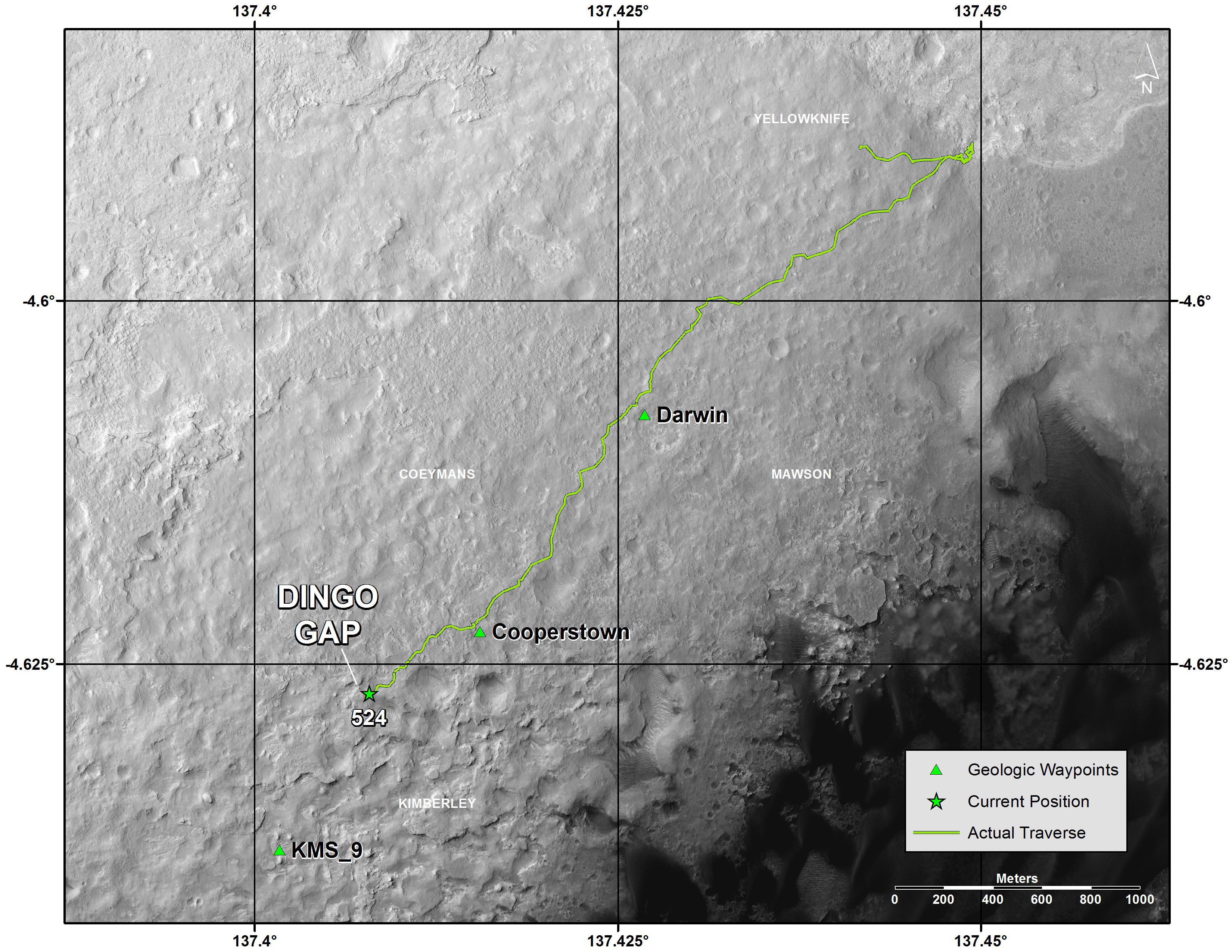
Viewing Dingo Gap
Full Resolution:
TIFF
(15.56 MB)
JPEG
(893.3 kB)
|
|
|
2014-02-19 |
Mars
|
Mars Exploration Rover (MER)
Mars Reconnaissance Orbiter (MRO)
|
HiRISE
|
1416x1441x3 |
|
-
PIA17941:
-
Opportunity Rover on 'Murray Ridge' Seen From Orbit
Full Resolution:
TIFF
(6.124 MB)
JPEG
(282.8 kB)
|
|
|
2014-02-22 |
Mars
|
Mars Reconnaissance Orbiter (MRO)
|
HiRISE
|
2880x1800x3 |
|
-
PIA17926:
-
Oxus Patera Collapse Feature
Full Resolution:
TIFF
(15.56 MB)
JPEG
(676.7 kB)
|
|
|
2014-02-22 |
Mars
|
Mars Reconnaissance Orbiter (MRO)
|
HiRISE
|
2880x1800x3 |
|
-
PIA17927:
-
Light-Toned Deposits along Coprates Chasma Slopes
Full Resolution:
TIFF
(15.56 MB)
JPEG
(607.3 kB)
|
|
|
2014-02-22 |
Mars
|
Mars Reconnaissance Orbiter (MRO)
|
HiRISE
|
2880x1800x3 |
|
-
PIA17928:
-
Shapes and Spots on a Polar Sand Dune
Full Resolution:
TIFF
(15.56 MB)
JPEG
(858 kB)
|
|
|
2014-02-22 |
Mars
|
Mars Reconnaissance Orbiter (MRO)
|
HiRISE
|
2880x1800x3 |
|
-
PIA17929:
-
Giant Gullies North of the Argyre Impact Basin
Full Resolution:
TIFF
(15.56 MB)
JPEG
(857.3 kB)
|
|
|
2014-02-26 |
Mars
|
Mars Reconnaissance Orbiter (MRO)
|
HiRISE
|
2880x1800x3 |
|
-
PIA18113:
-
Dunes Streaming through Hills
Full Resolution:
TIFF
(15.56 MB)
JPEG
(609.6 kB)
|
|
|
2014-02-26 |
Mars
|
Mars Reconnaissance Orbiter (MRO)
|
HiRISE
|
2880x1800x3 |
|
-
PIA18114:
-
Frost in Dune Shadows
Full Resolution:
TIFF
(15.56 MB)
JPEG
(675.7 kB)
|
|
|
2014-02-26 |
Mars
|
Mars Reconnaissance Orbiter (MRO)
|
HiRISE
|
2880x1800x3 |
|
-
PIA18115:
-
Craters in an Icy Surface
Full Resolution:
TIFF
(15.56 MB)
JPEG
(984.6 kB)
|
|
|
2014-02-26 |
Mars
|
Mars Reconnaissance Orbiter (MRO)
|
HiRISE
|
2880x1800x3 |
|
-
PIA18116:
-
Equatorial Gullies
Full Resolution:
TIFF
(15.56 MB)
JPEG
(685.4 kB)
|
|
|
2014-03-05 |
Mars
|
Mars Reconnaissance Orbiter (MRO)
|
HiRISE
|
2880x1800x3 |
|
-
PIA18109:
-
Sand Dunes in Spring
Full Resolution:
TIFF
(15.56 MB)
JPEG
(552 kB)
|
|
|
2014-03-05 |
Mars
|
Mars Reconnaissance Orbiter (MRO)
|
HiRISE
|
2880x1800x1 |
|
-
PIA18110:
-
A Crater Straddling Two Terrain Units
Full Resolution:
TIFF
(5.191 MB)
JPEG
(612.7 kB)
|
|
|
2014-03-05 |
Mars
|
Mars Reconnaissance Orbiter (MRO)
|
HiRISE
|
2560x1920x3 |
|
-
PIA18111:
-
Don't Get Lost in the North Polar Ice Cap
Full Resolution:
TIFF
(14.75 MB)
JPEG
(902.1 kB)
|
|
|
2014-03-05 |
Mars
|
Mars Reconnaissance Orbiter (MRO)
|
HiRISE
|
2880x1800x3 |
|
-
PIA18112:
-
Many Small Interesting Ridges in Erythraea Fossa
Full Resolution:
TIFF
(15.56 MB)
JPEG
(747.4 kB)
|
|
|
2014-03-12 |
Mars
|
Mars Reconnaissance Orbiter (MRO)
|
HiRISE
|
2880x1800x1 |

|
-
PIA17903:
-
Ejecta in Excess
Full Resolution:
TIFF
(5.191 MB)
JPEG
(877.3 kB)
|
|
|
2014-03-12 |
Mars
|
Mars Reconnaissance Orbiter (MRO)
|
HiRISE
|
2880x1800x3 |

|
-
PIA17904:
-
Craters within Craters
Full Resolution:
TIFF
(15.56 MB)
JPEG
(679.5 kB)
|
|
|
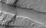
2014-03-12 |
Mars
|
Mars Reconnaissance Orbiter (MRO)
|
HiRISE
|
2880x1800x3 |
|
-
PIA17905:
-
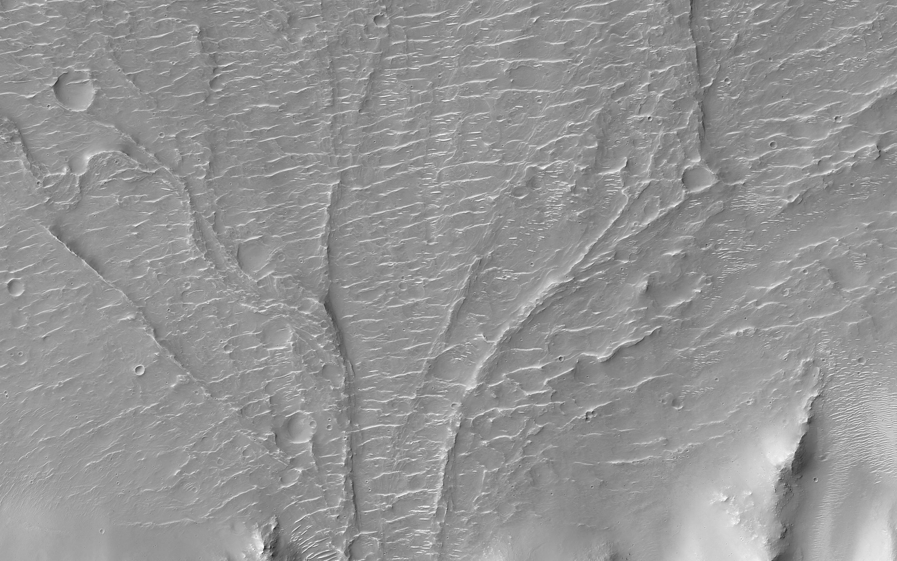
A Complex Valley Network Near Idaeus Fossae
Full Resolution:
TIFF
(15.56 MB)
JPEG
(840.2 kB)
|
|
|
2014-03-12 |
|
Mars Reconnaissance Orbiter (MRO)
|
HiRISE
|
2880x1800x3 |
|
-
PIA18118:
-
Dramatic Dune Destination
Full Resolution:
TIFF
(15.56 MB)
JPEG
(672.5 kB)
|
|
|
2014-03-19 |
Mars
|
Mars Reconnaissance Orbiter (MRO)
|
HiRISE
|
800x800x3 |
|
-
PIA17958:
-
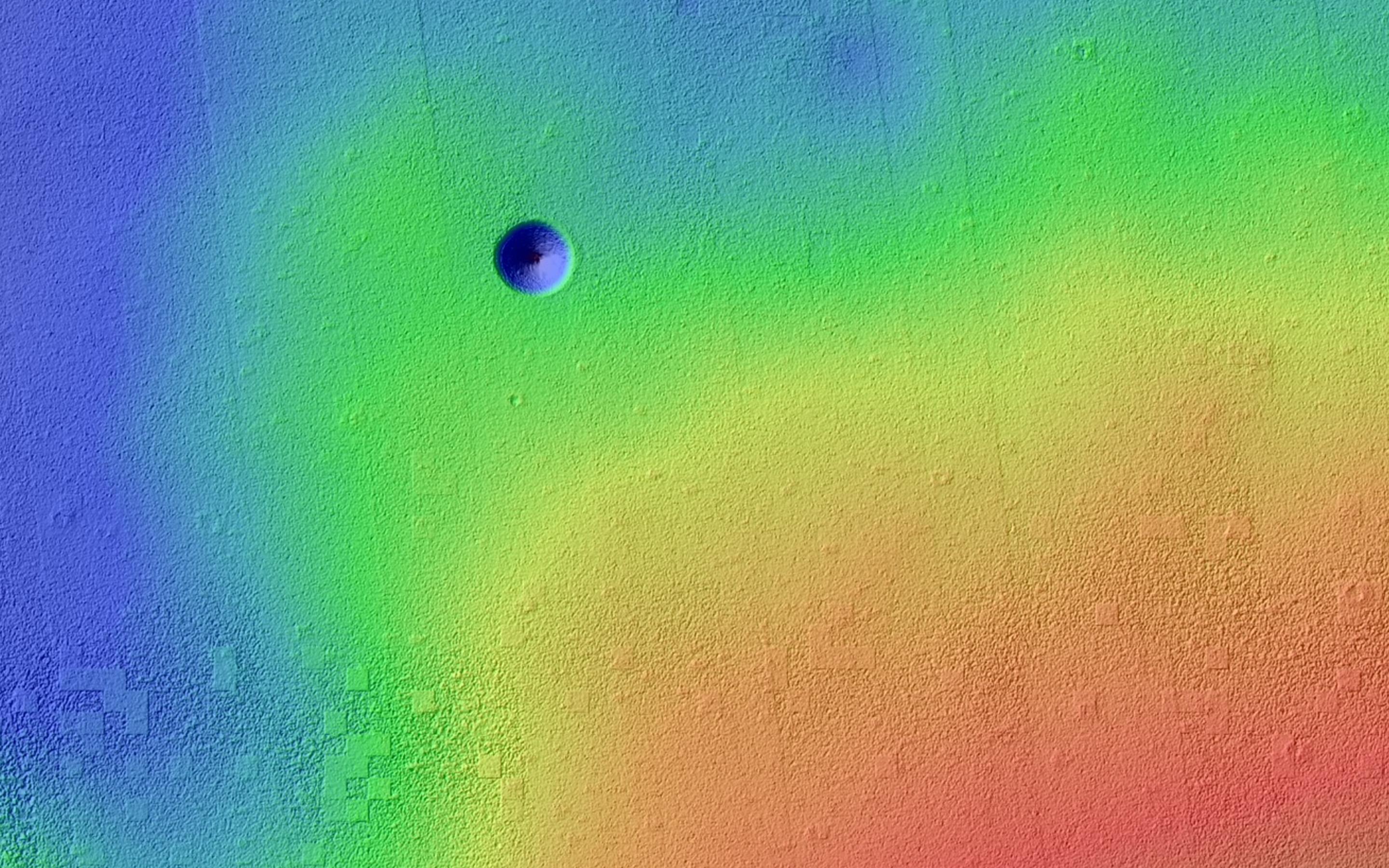
A New Gully Channel in Terra Sirenum, Mars
Full Resolution:
TIFF
(1.921 MB)
JPEG
(100.4 kB)
|
|
|
2014-03-19 |
Mars
|
Mars Reconnaissance Orbiter (MRO)
|
HiRISE
|
2880x1800x3 |
|
-
PIA17906:
-
A New Gully Channel in Terra Sirenum
Full Resolution:
TIFF
(15.56 MB)
JPEG
(754 kB)
|
|
|
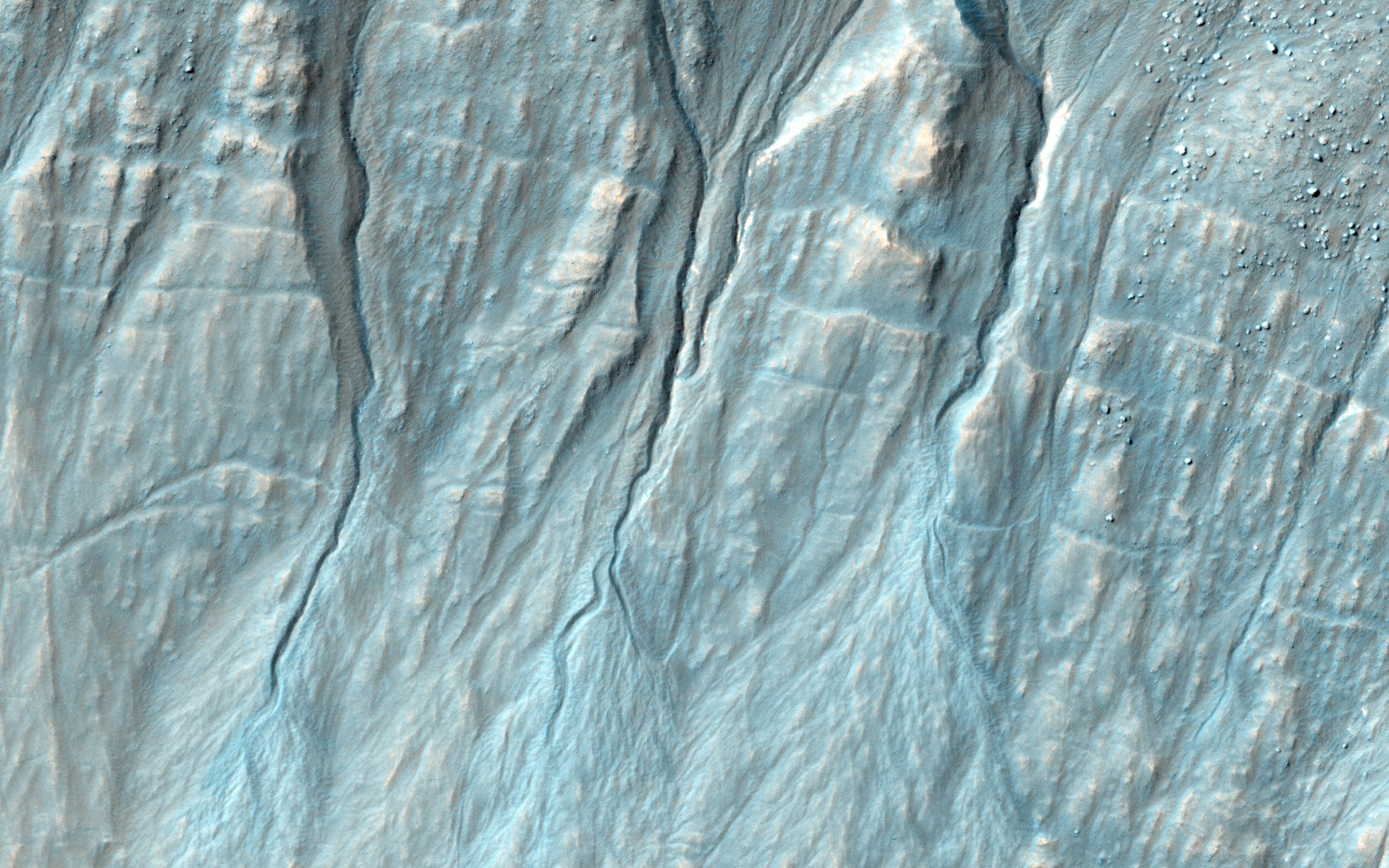
2014-03-26 |
Mars
|
Mars Reconnaissance Orbiter (MRO)
|
HiRISE
|
2880x1800x3 |
|
-
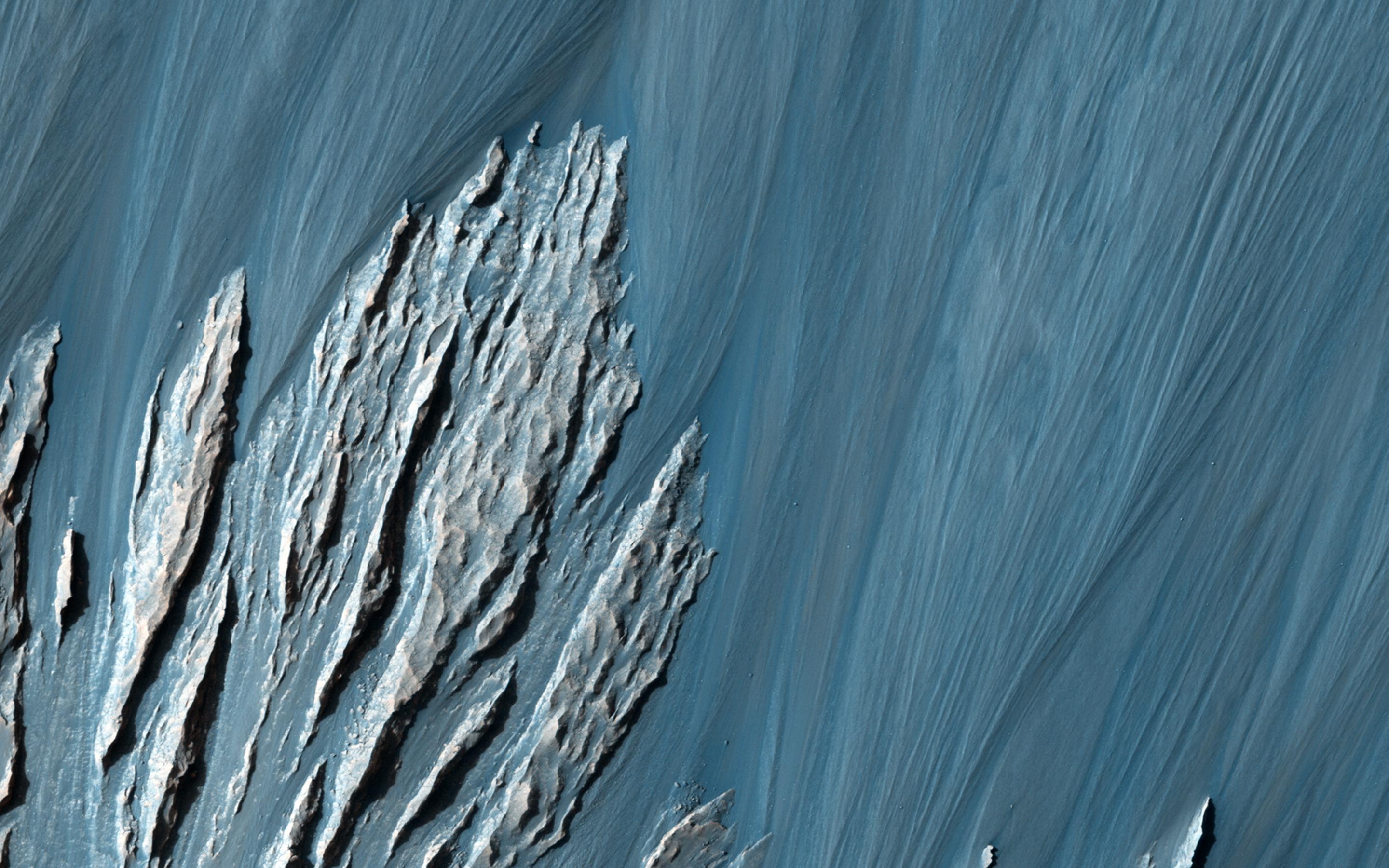
PIA17907:
-
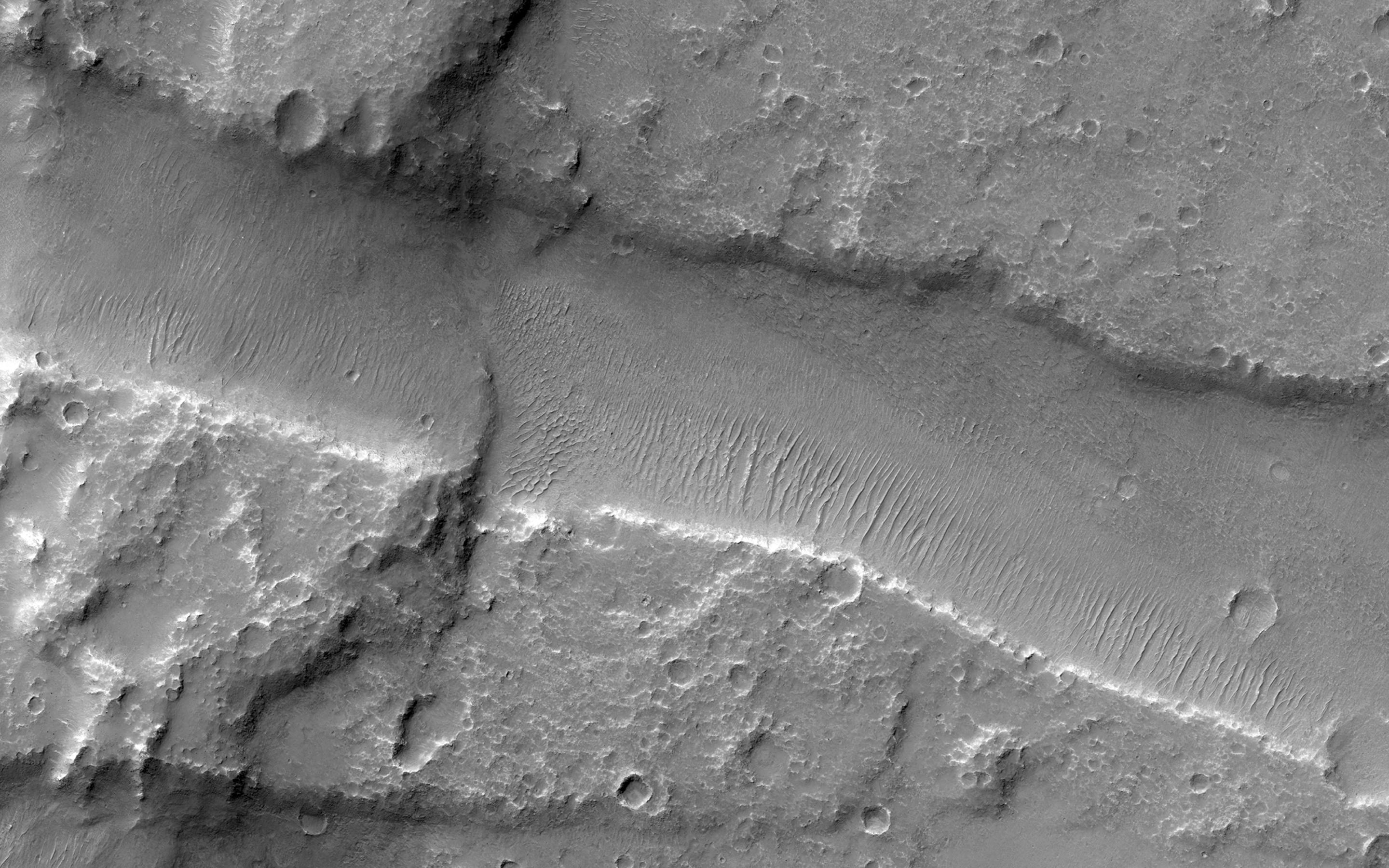
Bedrock in a Trough in Asimov Crater
Full Resolution:
TIFF
(15.56 MB)
JPEG
(914.3 kB)
|
|
|
2014-03-26 |
Mars
|
Mars Reconnaissance Orbiter (MRO)
|
HiRISE
|
2880x1800x3 |
|
-
PIA17908:
-
A Dark-Toned, Pitted Mound in a Crater in Northeast Arabia Terra
Full Resolution:
TIFF
(15.56 MB)
JPEG
(774.2 kB)
|
|
|
2014-03-26 |
Mars
|
Mars Reconnaissance Orbiter (MRO)
|
HiRISE
|
2880x1800x3 |

|
-
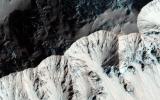
PIA17909:
-
A Large, Banded Angular Fragment in Nili Fossae
Full Resolution:
TIFF
(15.56 MB)
JPEG
(963.6 kB)
|
|
|
2014-03-26 |
Mars
|
Mars Reconnaissance Orbiter (MRO)
|
HiRISE
|
2880x1800x3 |
|
-
PIA17910:
-
An Unusual Mound
Full Resolution:
TIFF
(15.56 MB)
JPEG
(1.045 MB)
|
|
|
2014-04-03 |
Mars
|
Mars Science Laboratory (MSL)
|
HiRISE
|
3300x2550x3 |
|
-
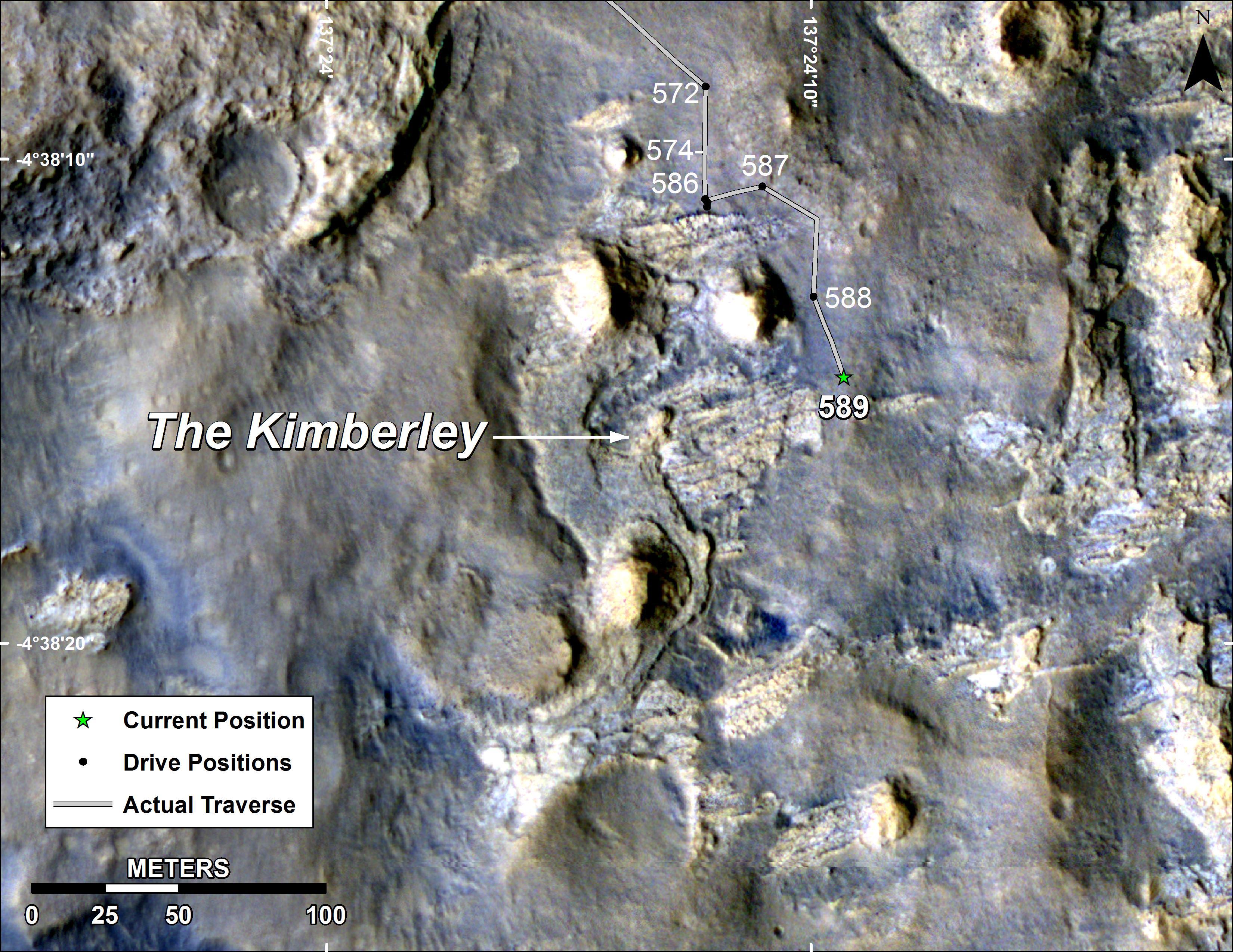
PIA18075:
-
Map of Curiosity Mars Rover's Drives to 'the Kimberley' Waypoint
Full Resolution:
TIFF
(25.26 MB)
JPEG
(1.265 MB)
|
|
|
2014-04-03 |
Mars
|
Mars Science Laboratory (MSL)
|
HiRISE
|
3300x2550x3 |
|
-
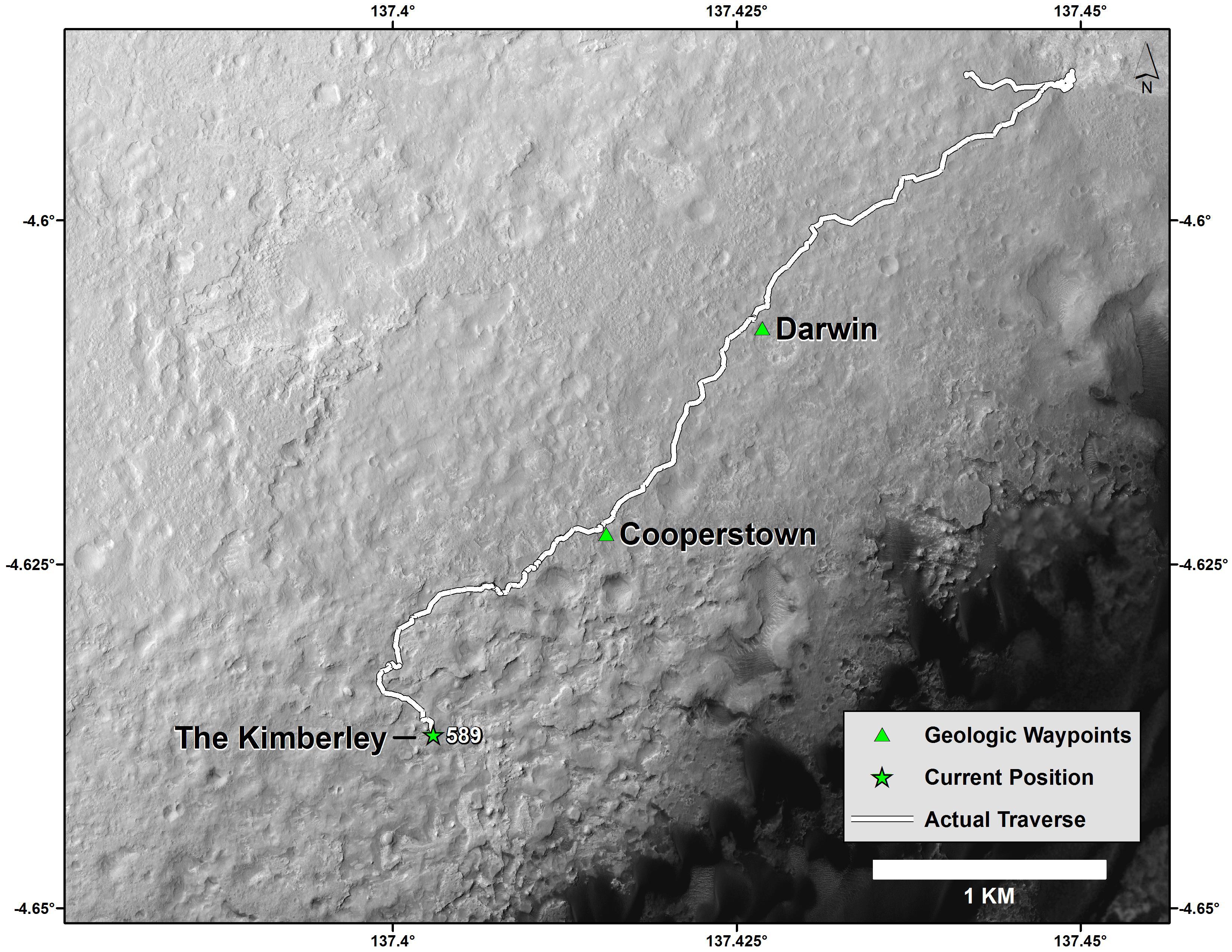
PIA18076:
-
Curiosity Mars Rover's Route from Landing to 'The Kimberley' Waypoint
Full Resolution:
TIFF
(25.26 MB)
JPEG
(1.23 MB)
|
|
|
2014-04-09 |
Mars
|
Mars Reconnaissance Orbiter (MRO)
|
HiRISE
|
2880x1800x3 |
|
-
PIA17916:
-
Opportunity Rover's Winter Work at Murray Ridge
Full Resolution:
TIFF
(15.56 MB)
JPEG
(576.8 kB)
|
|
|
2014-04-09 |
Mars
|
Mars Reconnaissance Orbiter (MRO)
|
HiRISE
|
2880x1800x1 |
|
-
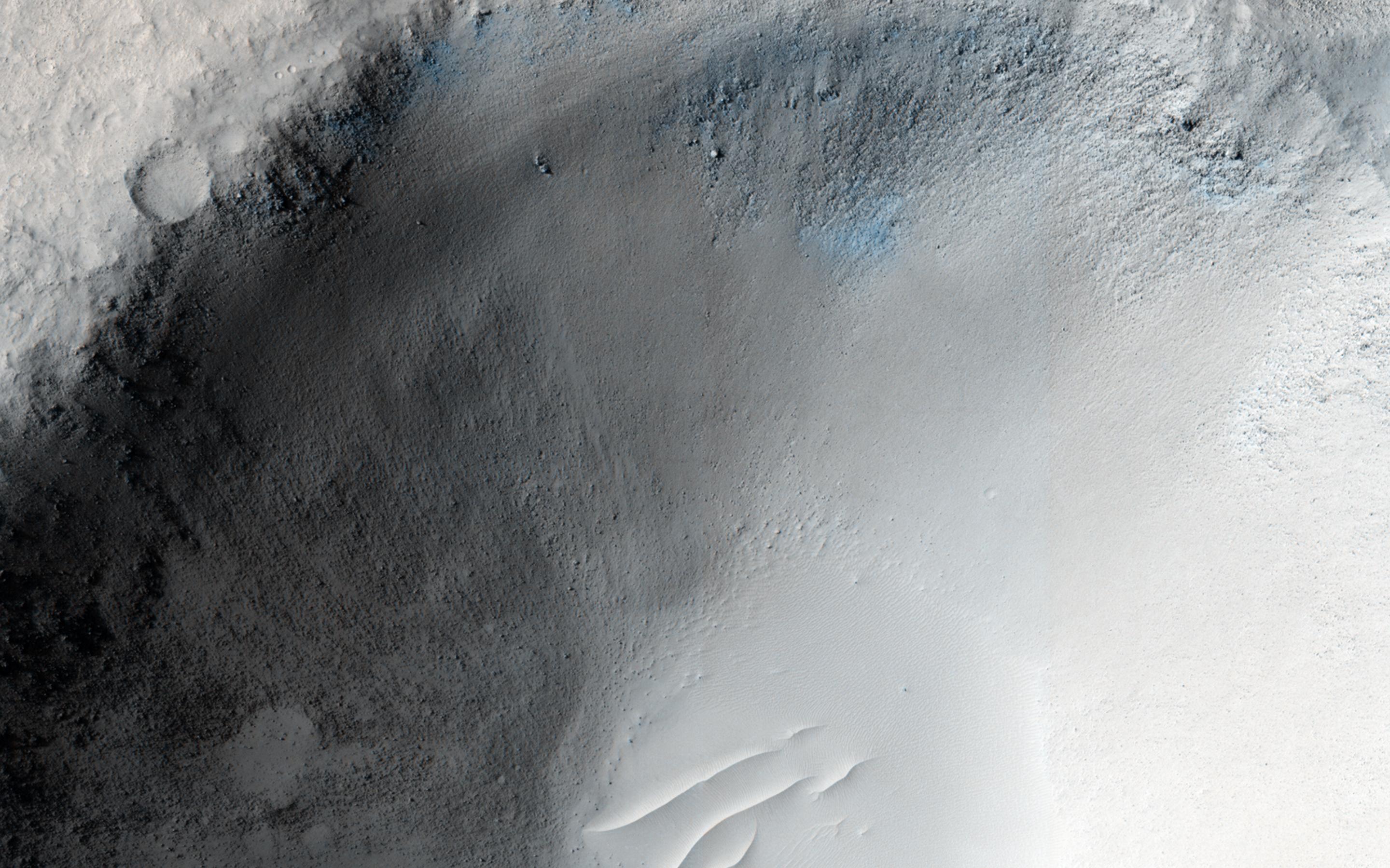
PIA17917:
-
Slumping Terraces on a Crater Wall
Full Resolution:
TIFF
(5.191 MB)
JPEG
(678 kB)
|
|
|
2014-04-09 |
Mars
|
Mars Reconnaissance Orbiter (MRO)
|
HiRISE
|
2880x1800x1 |
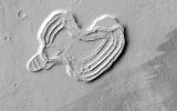
|
-
PIA17918:
-
A Heart in Ascraeus Mons
Full Resolution:
TIFF
(5.191 MB)
JPEG
(751.7 kB)
|
|
|
2014-04-09 |
Mars
|
Mars Reconnaissance Orbiter (MRO)
|
HiRISE
|
2880x1800x3 |
|
-
PIA17919:
-
Two-Color Dunes in Meridiani Terra
Full Resolution:
TIFF
(15.56 MB)
JPEG
(858.4 kB)
|
|
|
2014-04-09 |
Mars
|
Mars Reconnaissance Orbiter (MRO)
|
HiRISE
|
2880x1800x3 |
|
-
PIA18119:
-
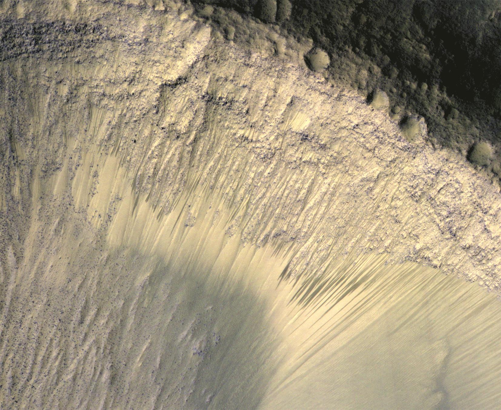
Recurring Slope Lineae in Coprates Chasma
Full Resolution:
TIFF
(15.56 MB)
JPEG
(572.3 kB)
|
|
|
2014-04-09 |
Mars
|
Mars Reconnaissance Orbiter (MRO)
|
HiRISE
|
2880x1800x1 |
|
-
PIA18120:
-
Finding Faults in Melas Chasma
Full Resolution:
TIFF
(5.191 MB)
JPEG
(747.3 kB)
|
|
|
2014-04-09 |
Mars
|
Mars Reconnaissance Orbiter (MRO)
|
HiRISE
|
2880x1800x3 |
|
-
PIA18121:
-
Chevrons on a Flow Surface in Marte Vallis
Full Resolution:
TIFF
(15.56 MB)
JPEG
(834.3 kB)
|
|
|
2014-04-09 |
Mars
|
Mars Reconnaissance Orbiter (MRO)
|
HiRISE
|
2880x1800x3 |
|
-
PIA18122:
-
Opportunity Rover on Valentine's Day 2014
Full Resolution:
TIFF
(15.56 MB)
JPEG
(565 kB)
|
|
|
2014-04-16 |
Mars
|
Mars Reconnaissance Orbiter (MRO)
Mars Science Laboratory (MSL)
|
HiRISE
|
1322x1482x3 |
|
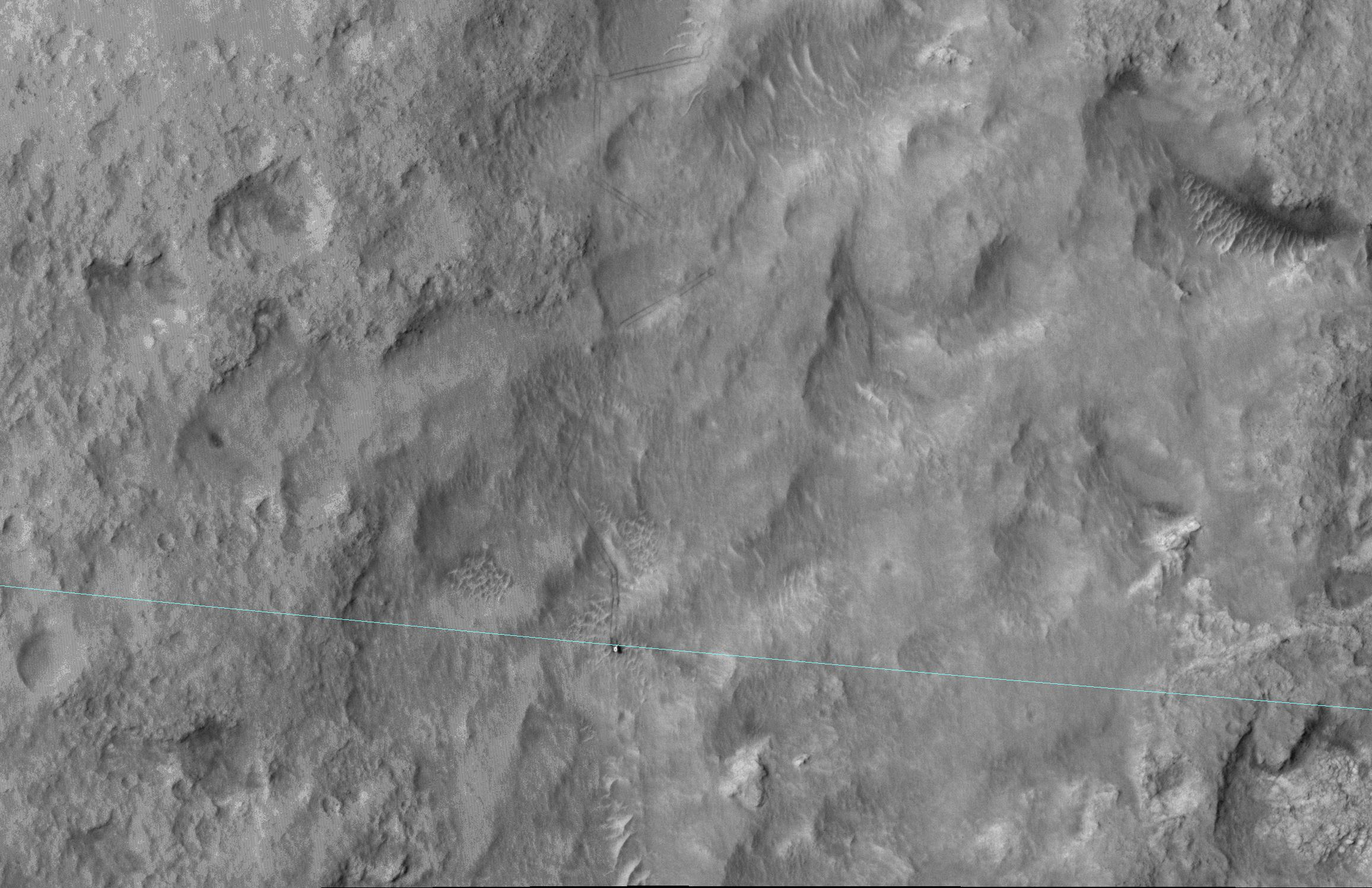
-
PIA18081:
-
Curiosity and Rover Tracks at 'the Kimberley,' April 2014
Full Resolution:
TIFF
(5.88 MB)
JPEG
(347.6 kB)
|
|
|
2014-04-16 |
Mars
|
Mars Reconnaissance Orbiter (MRO)
Mars Science Laboratory (MSL)
|
HiRISE
|
3287x3497x3 |
|
-
PIA18082:
-
Stereo View of Curiosity and Rover Tracks at 'the Kimberley,' April 2014
Full Resolution:
TIFF
(34.5 MB)
JPEG
(791.9 kB)
|
|
|
2014-04-16 |
Mars
|
Mars Reconnaissance Orbiter (MRO)
|
HiRISE
|
2880x1800x3 |
|
-
PIA18224:
-
A Surprise Landslump in Melas Chasma
Full Resolution:
TIFF
(15.56 MB)
JPEG
(662.5 kB)
|
|
|
2014-04-16 |
Mars
|
Mars Reconnaissance Orbiter (MRO)
|
HiRISE
|
2880x1800x3 |
|
-
PIA18225:
-
Equatorial Gullies on Mars
Full Resolution:
TIFF
(15.56 MB)
JPEG
(886.3 kB)
|
|
|
2014-04-16 |
Mars
|
Mars Reconnaissance Orbiter (MRO)
|
HiRISE
|
2880x1800x3 |
|
-
PIA18226:
-
A Big Block of Red Bedrock
Full Resolution:
TIFF
(15.56 MB)
JPEG
(570.4 kB)
|
|
|
2014-04-16 |
Mars
|
Mars Reconnaissance Orbiter (MRO)
|
HiRISE
|
2880x1800x3 |
|
-
PIA18227:
-
Curiosity Ready to Drill for Gold at the Kimberley
Full Resolution:
TIFF
(15.56 MB)
JPEG
(735.3 kB)
|
|
|
2014-04-25 |
Mars
|
Mars Reconnaissance Orbiter (MRO)
|
HiRISE
|
556x437x3 |

|
-
PIA18085:
-
Location of Mars Sandstone Target 'Windjana'
Full Resolution:
TIFF
(729.4 kB)
JPEG
(45.28 kB)
|
|
|
2014-04-30 |
Mars
|
Mars Reconnaissance Orbiter (MRO)
|
HiRISE
|
2880x1800x3 |
|
-
PIA18241:
-
Yardangs Forming Near Gordii Dorsum
Full Resolution:
TIFF
(15.56 MB)
JPEG
(734.8 kB)
|
|
|
2014-04-30 |
Mars
|
Mars Reconnaissance Orbiter (MRO)
|
HiRISE
|
2880x1800x3 |

|
-
PIA18242:
-
Sunken and Pitted Ejecta
Full Resolution:
TIFF
(15.56 MB)
JPEG
(1.028 MB)
|
|
|
2014-04-30 |
Mars
|
Mars Reconnaissance Orbiter (MRO)
|
HiRISE
|
2880x1800x3 |
|
-
PIA18243:
-
Changing Dunes and Ripples in Olympia Undae
Full Resolution:
TIFF
(15.56 MB)
JPEG
(700.2 kB)
|
|
|
2014-04-30 |
Mars
|
Mars Reconnaissance Orbiter (MRO)
|
HiRISE
|
2880x1800x3 |

|
-
PIA18244:
-
The Active Dunes of Nili Patera
Full Resolution:
TIFF
(15.56 MB)
JPEG
(786.7 kB)
|
|
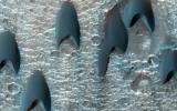
|
2014-05-21 |
Mars
|
Mars Reconnaissance Orbiter (MRO)
|
HiRISE
|
840x333x1 |
|
-
PIA17482:
-
New Impact Site
Full Resolution:
TIFF
(280.2 kB)
JPEG
(95.43 kB)
|
|
|
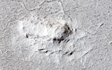
2014-05-22 |
Mars
|
Mars Reconnaissance Orbiter (MRO)
|
MARCI
|
1700x1700x3 |

|
-
PIA18380:
-
Impact Scar Detected in Mars Weathercam Image
Full Resolution:
TIFF
(8.674 MB)
JPEG
(222.2 kB)
|
|
|
2014-05-22 |
Mars
|
Mars Reconnaissance Orbiter (MRO)
|
HiRISE
|
2880x1800x3 |
|
-
PIA18648:
-
What Gullies Can Say
Full Resolution:
TIFF
(15.56 MB)
JPEG
(696.7 kB)
|
|
|
2014-05-22 |
Mars
|
Mars Reconnaissance Orbiter (MRO)
|
HiRISE
|
2880x1800x1 |
|
-
PIA18649:
-
The Busy Flank of Arsia Mons
Full Resolution:
TIFF
(5.191 MB)
JPEG
(682.4 kB)
|
|
|
2014-05-22 |
Mars
|
Mars Reconnaissance Orbiter (MRO)
|
MARCI
|
928x242x3 |
|
-
PIA18381:
Best-Ever Pinning Down When a Space Rock Hit Mars
Full Resolution:
TIFF
(674.2 kB)
JPEG
(28.52 kB)
|
|
|
2014-05-22 |
Mars
|
Mars Reconnaissance Orbiter (MRO)
|
CTX
|
1980x2176x1 |
|
-
PIA18382:
-
Fresh Mars Crater Confirmed Within Impact Scar
Full Resolution:
TIFF
(4.313 MB)
JPEG
(1.148 MB)
|
|
|
2014-05-22 |
Mars
|
Mars Reconnaissance Orbiter (MRO)
|
HiRISE
|
2880x1800x3 |
|
-
PIA18771:
-
At the Edge of a Polar Cap
Full Resolution:
TIFF
(15.56 MB)
JPEG
(796.4 kB)
|
|
|
2014-05-22 |
Mars
|
Mars Reconnaissance Orbiter (MRO)
|
CTX
|
1500x699x1 |

|
-
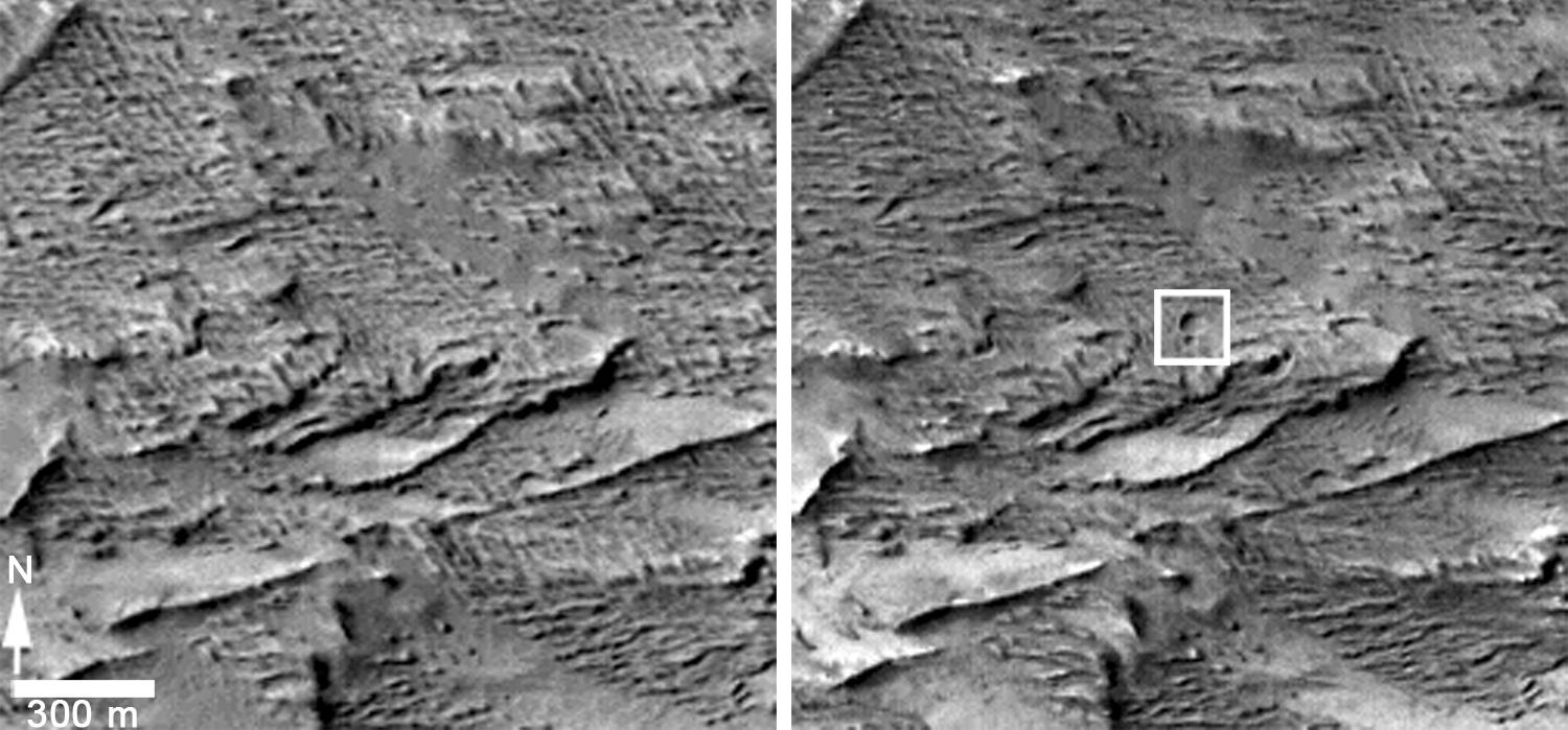
PIA18383:
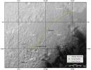
-
Before-and-After Views Confirm Fresh Craters
Full Resolution:
TIFF
(1.05 MB)
JPEG
(153.2 kB)
|
|
|
2014-05-22 |
Mars
|
Mars Reconnaissance Orbiter (MRO)
|
HiRISE
|
2880x1800x1 |

|
-
PIA18772:
-
Global Eyes on an Impact Prize
Full Resolution:
TIFF
(5.191 MB)
JPEG
(700.7 kB)
|
|
|
2014-05-22 |
Mars
|
Mars Reconnaissance Orbiter (MRO)
|
HiRISE
|
1413x951x3 |
|
-
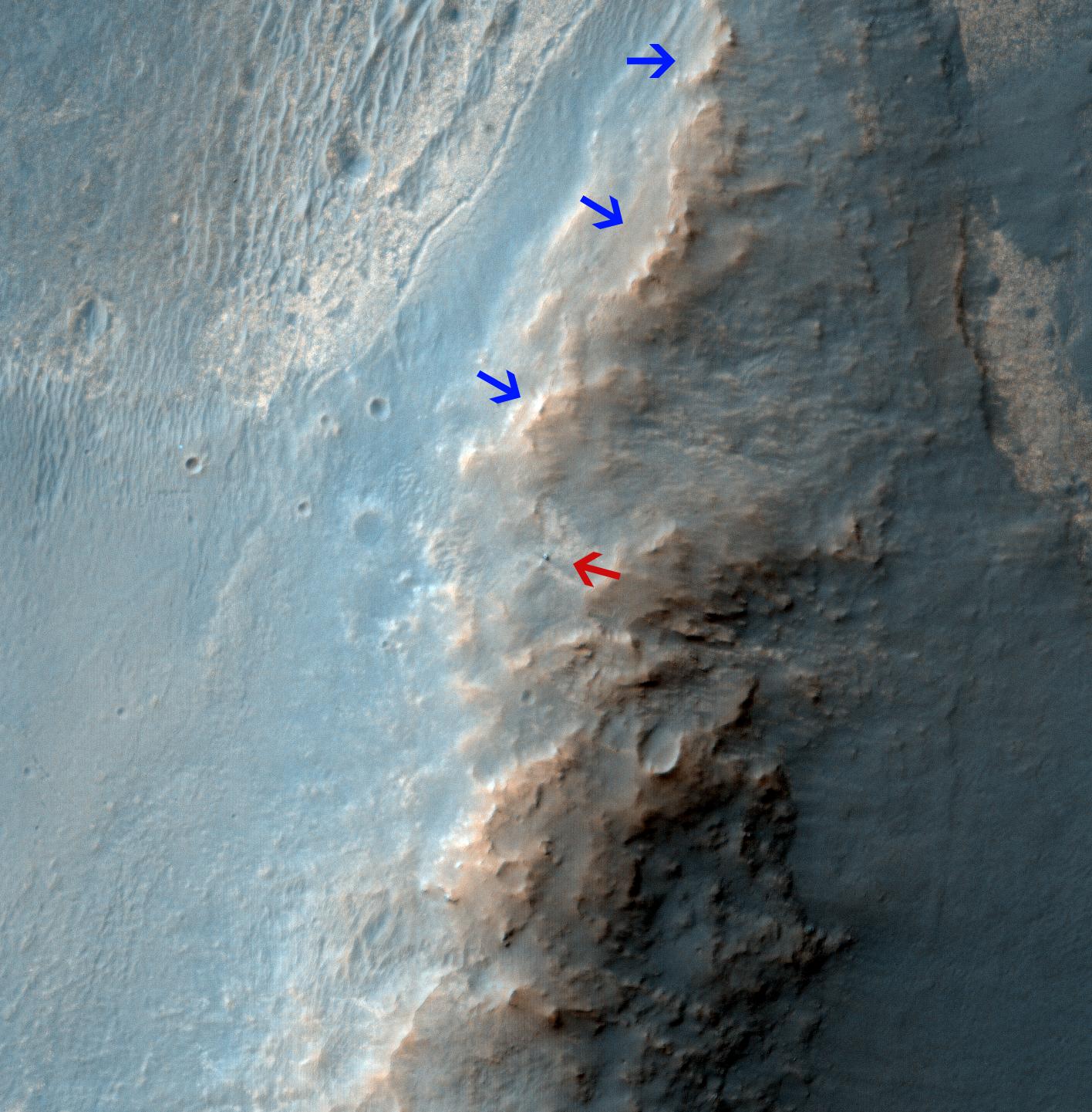
PIA18384:
-
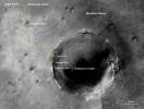
Large, Fresh Crater Surrounded by Smaller Craters
Full Resolution:
TIFF
(4.033 MB)
JPEG
(174.3 kB)
|
|
|
2014-05-22 |
Mars
|
Mars Reconnaissance Orbiter (MRO)
|
HiRISE
|
741x493x3 |
|
-
PIA18385:
-
Landslides Near Fresh Crater on Mars
Full Resolution:
TIFF
(1.097 MB)
JPEG
(56.47 kB)
|
|
|
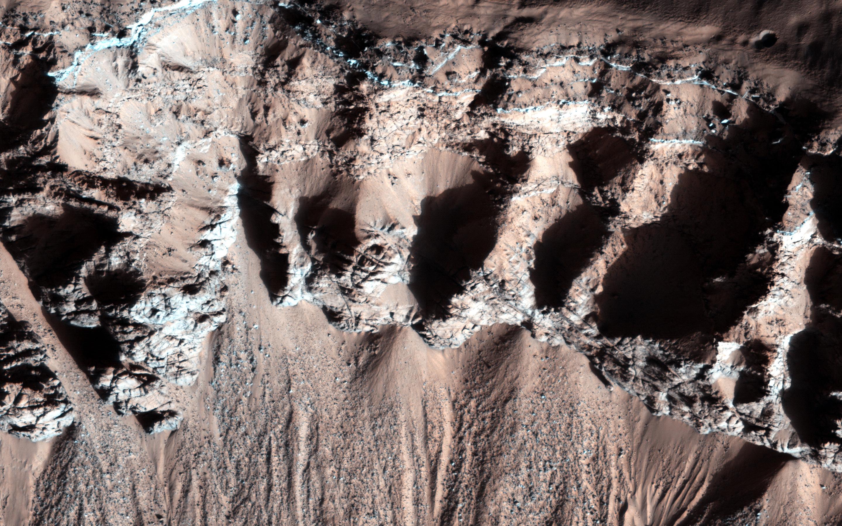
2014-06-04 |
|
Mars Reconnaissance Orbiter (MRO)
|
HiRISE
|
2880x1800x3 |

|
-
PIA18510:
-
The Draa of Mars
Full Resolution:
TIFF
(15.56 MB)
JPEG
(1.014 MB)
|
|
|
2014-06-04 |
Mars
|
Mars Reconnaissance Orbiter (MRO)
|
HiRISE
|
840x333x1 |
|
-
PIA18511:
-
A Large Crater in Meridiani Planum
Full Resolution:
TIFF
(280.2 kB)
JPEG
(73.14 kB)
|
|
|
2014-06-04 |
Mars
|
Mars Reconnaissance Orbiter (MRO)
|
HiRISE
|
2880x1800x3 |
|
-
PIA18512:
-
Touring a Dusty Region
Full Resolution:
TIFF
(15.56 MB)
JPEG
(623.1 kB)
|
|
|
2014-06-04 |
Mars
|
Mars Reconnaissance Orbiter (MRO)
|
HiRISE
|
2880x1800x1 |

|
-
PIA18513:
-
An Alluvial Fan in a Low-Latitude Crater
Full Resolution:
TIFF
(5.191 MB)
JPEG
(646.5 kB)
|
|
|
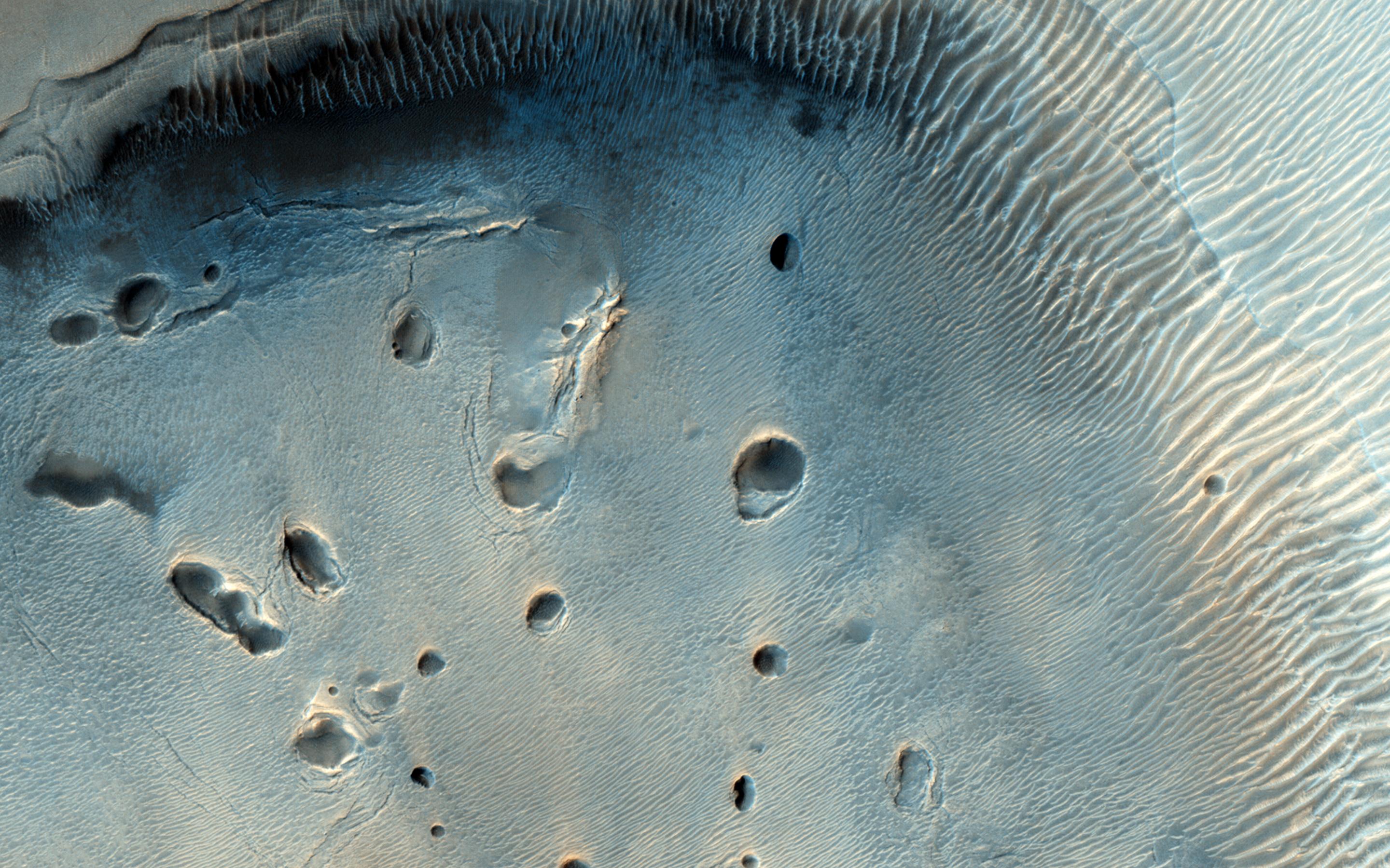
2014-06-18 |
Mars
|
Mars Reconnaissance Orbiter (MRO)
|
HiRISE
|
2880x1800x3 |
|
-
PIA18585:
-
Sand Dune Catch and Release
Full Resolution:
TIFF
(15.56 MB)
JPEG
(743.6 kB)
|
|
|
2014-06-18 |
Mars
|
Mars Reconnaissance Orbiter (MRO)
|
HiRISE
|
2880x1800x3 |

|
-
PIA18586:
-
Blockfall on the North Polar Layered Deposits
Full Resolution:
TIFF
(15.56 MB)
JPEG
(790.1 kB)
|
|
|
2014-06-18 |
Mars
|
Mars Reconnaissance Orbiter (MRO)
|
HiRISE
|
2880x1800x3 |
|
-
PIA18587:
-
Waiting for Dust Devils
Full Resolution:
TIFF
(5.191 MB)
JPEG
(1.172 MB)
|
|
|
2014-06-18 |
Mars
|
Mars Reconnaissance Orbiter (MRO)
|
HiRISE
|
2880x1800x3 |
|
-
PIA18588:
-
Moving Mass Material on a Mesa
Full Resolution:
TIFF
(15.56 MB)
JPEG
(650.1 kB)
|
|
|
2014-07-02 |
Mars
|
Mars Reconnaissance Orbiter (MRO)
|
HiRISE
|
2880x1800x3 |
|
-
PIA18589:
-
A Giant Cave on a Giant Volcano
Full Resolution:
TIFF
(15.56 MB)
JPEG
(824.1 kB)
|
|
|
2014-07-02 |
Mars
|
Mars Reconnaissance Orbiter (MRO)
|
HiRISE
|
2880x1800x3 |
|
-
PIA18620:
-
Feathery Ridges
Full Resolution:
TIFF
(15.56 MB)
JPEG
(822.4 kB)
|
|
|
2014-07-02 |
Mars
|
Mars Reconnaissance Orbiter (MRO)
|
HiRISE
|
2880x1800x3 |

|
-
PIA18621:
-
A Revealing Landslide in Hebes Chasma
Full Resolution:
TIFF
(15.56 MB)
JPEG
(599 kB)
|
|
|
2014-07-02 |
Mars
|
Mars Reconnaissance Orbiter (MRO)
|
HiRISE
|
2880x1800x3 |
|
-
PIA18622:
-
An Impact Crater in Isidis Planitia
Full Resolution:
TIFF
(15.56 MB)
JPEG
(682.5 kB)
|
|
|
2014-07-08 |
Mars
|
Mars Reconnaissance Orbiter (MRO)
|
HiRISE
|
2312x1497x3 |
|
-
PIA18399:
-
Curiosity Mars Rover Reaching Edge of Its Landing Ellipse
Full Resolution:
TIFF
(3.467 MB)
JPEG
(504.4 kB)
|


