Click on an image for detailed information
Click on a column heading to sort in ascending or descending order

My
List |
Addition Date
|
Target
|
Mission
|
Instrument
|
Size
|

|
2008-05-26 |
Mars
|
Phoenix
|
HiRISE
|
420x446x1 |

|
-
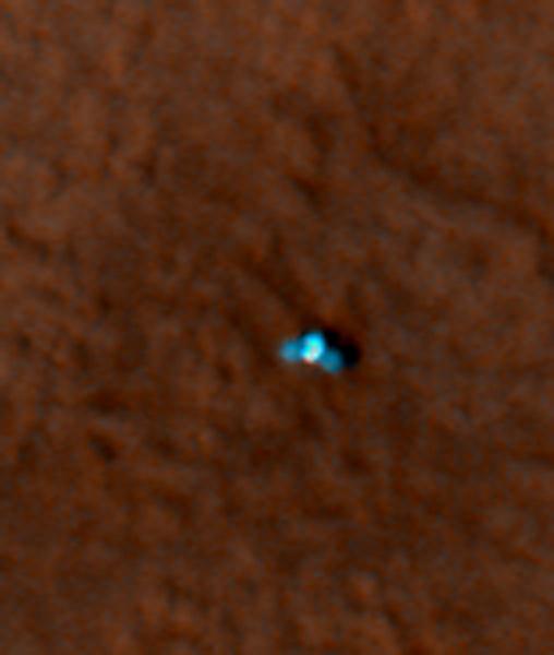
PIA10697:
-
Phoenix Makes a Grand Entrance
Full Resolution:
TIFF
(187.7 kB)
JPEG
(68.86 kB)
|
|
|
2008-05-26 |
Mars
|
Phoenix
|
HiRISE
|
420x446x1 |
|
-
PIA10698:
-
Phoenix Makes a Grand Entrance
Full Resolution:
TIFF
(187.7 kB)
JPEG
(26.18 kB)
|
|
|
2008-05-27 |
Mars
|
Phoenix
|
HiRISE
|
508x600x3 |
|
-
PIA10701:
-
Color Image of Phoenix Lander on Mars Surface
Full Resolution:
TIFF
(915.6 kB)
JPEG
(19.36 kB)
|
|
|
2008-05-27 |
Mars
|
Phoenix
|
HiRISE
|
404x449x3 |
|
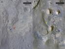
-
PIA10702:
-
Color Image of Phoenix Heat Shield and Bounce Mark
Full Resolution:
TIFF
(545 kB)
JPEG
(28.66 kB)
|
|
|
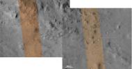
2008-05-27 |
Mars
|
Phoenix
|
HiRISE
|
443x670x3 |
|
-
PIA10703:
-
Color of Parachute on Ground
Full Resolution:
TIFF
(891.6 kB)
JPEG
(19.43 kB)
|
|
|
2008-05-27 |
Mars
|
Phoenix
|
HiRISE
|
1500x746x1 |
|
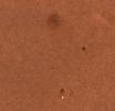
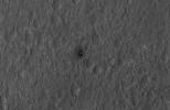
-
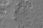
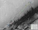
PIA10705:
-
Phoenix Descending with Crater in the Background
Full Resolution:
TIFF
(1.12 MB)
JPEG
(184.9 kB)
|
|
|
2008-05-27 |
Mars
|
Phoenix
|
HiRISE
|
2455x1830x3 |
|
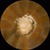
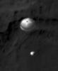
-
PIA10706:
-
Zeroing In on Phoenix's Final Destination
Full Resolution:
TIFF
(13.49 MB)
JPEG
(371.7 kB)
|
|
|
2011-07-22 |
Mars
|
Mars Science Laboratory (MSL)
|
HiRISE
|
1920x1080x3 |

|
-
PIA14296:
-
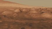
Lower Portion of Mound Inside Gale Crater
Full Resolution:
TIFF
(6.23 MB)
JPEG
(219.5 kB)
|
|
|
2011-07-22 |
Mars
|
Mars Science Laboratory (MSL)
|
HiRISE
|
1920x1080x3 |
|
-
PIA14297:
-
Rock Layers in Lower Mound in Gale Crater
Full Resolution:
TIFF
(6.23 MB)
JPEG
(157.1 kB)
|
|
|
2011-07-22 |
Mars
|
Mars Science Laboratory (MSL)
|
HiRISE
|
1920x1080x3 |
|
-
PIA14298:
-
Rock Types in Gale Crater
Full Resolution:
TIFF
(6.23 MB)
JPEG
(221.8 kB)
|
|
|
2011-07-22 |
Mars
|
Mars Science Laboratory (MSL)
|
HiRISE
|
1280x720x3 |

|
-
PIA14302:
-
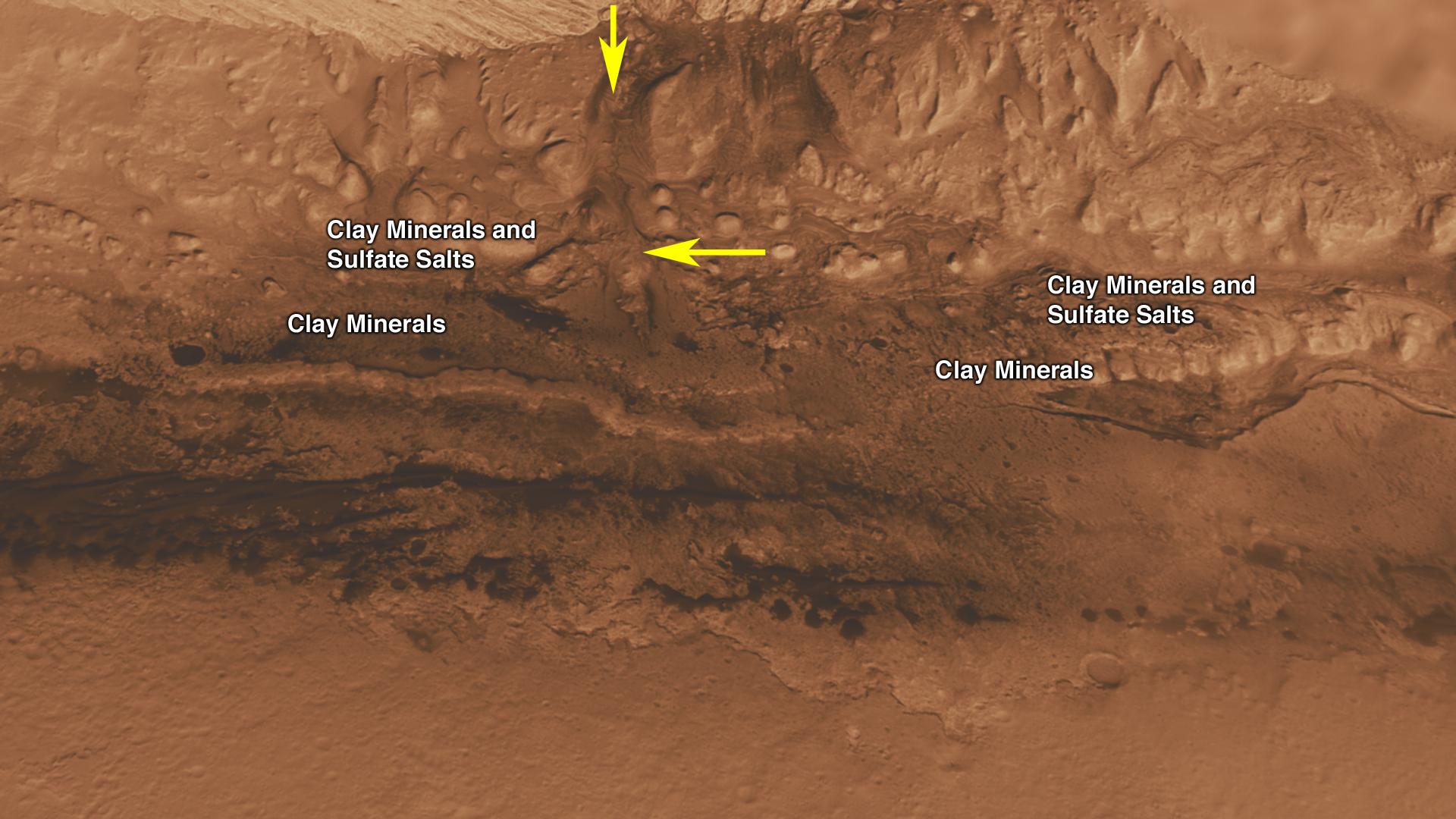
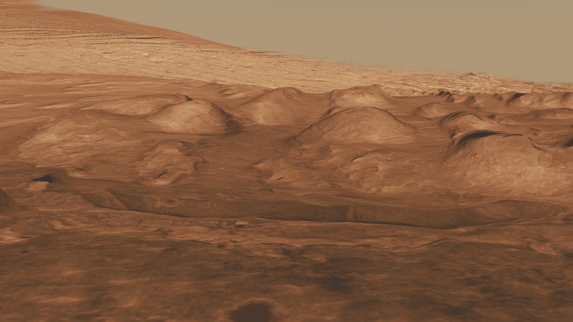
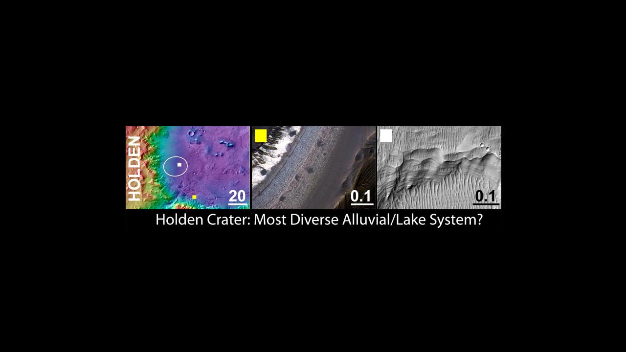
Holden Crater, a Finalist Not Selected as Landing Site for Curiosity
Full Resolution:
TIFF
(2.768 MB)
JPEG
(53.81 kB)
|
|
|
2011-07-22 |
Mars
|
Mars Science Laboratory (MSL)
|
HiRISE
|
1280x720x3 |
|
-
PIA14300:
-
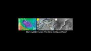
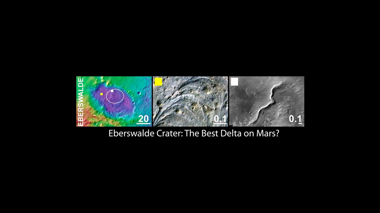
Eberswalde Crater, a Finalist Not Selected as Landing Site for Curiosity
Full Resolution:
TIFF
(2.768 MB)
JPEG
(53.99 kB)
|
|
|
2011-07-22 |
Mars
|
Mars Science Laboratory (MSL)
|
HiRISE
|
1280x720x3 |
|
-
PIA14301:
-
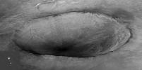
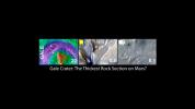
Gale Crater, the Selected Landing Site for Curiosity
Full Resolution:
TIFF
(2.768 MB)
JPEG
(50.68 kB)
|
|
|
2011-07-22 |
Mars
|
Mars Science Laboratory (MSL)
|
HiRISE
|
1280x720x3 |
|
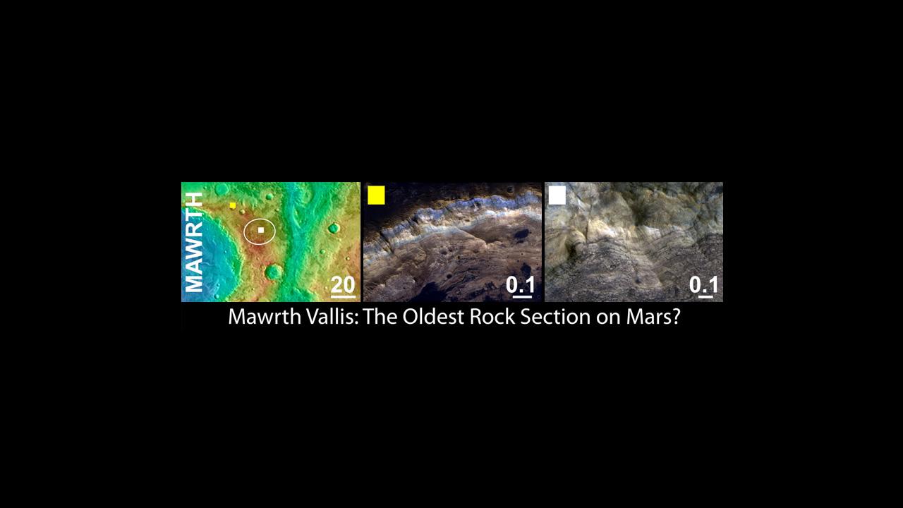
-
PIA14303:
-
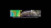
Mawrth Vallis, a Finalist Not Selected as a Landing Site for Curiosity
Full Resolution:
TIFF
(2.768 MB)
JPEG
(53.93 kB)
|
|
|
2011-07-22 |
Mars
|
Mars Science Laboratory (MSL)
|
HiRISE
|
868x655x3 |
|
-
PIA14307:
-
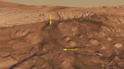
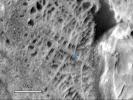
Cemented Fractures in Mountain Inside Gale Crater on Mars
Full Resolution:
TIFF
(1.708 MB)
JPEG
(100.7 kB)
|
|
|
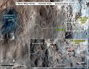
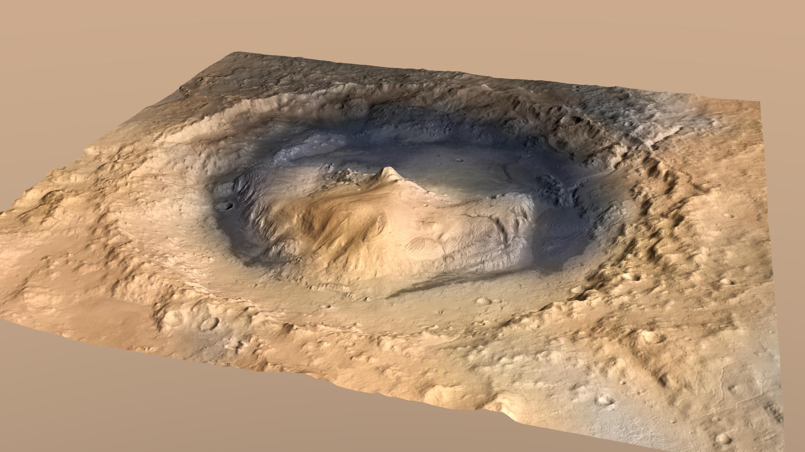
2011-11-28 |
Mars
|
Mars Science Laboratory (MSL)
|
Contact Camera (CTX)
High Resolution Stereo Camera
|
2560x1440x3 |

|
-
PIA15101:
-
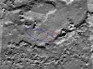
Oblique View of Gale Crater, Mars, with Vertical Exaggeration
Full Resolution:
TIFF
(11.07 MB)
JPEG
(338 kB)
|
|
|
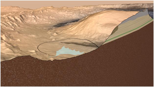
2011-11-28 |
Mars
|
Mars Science Laboratory (MSL)
|
Contact Camera (CTX)
High Resolution Stereo Camera
|
628x355x3 |
|
-
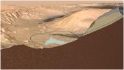
PIA15102:
-
Cross Section of Gale Crater, Mars (Artist's Concept)
Full Resolution:
TIFF
(669.8 kB)
JPEG
(35.94 kB)
|
|
|
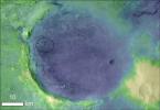
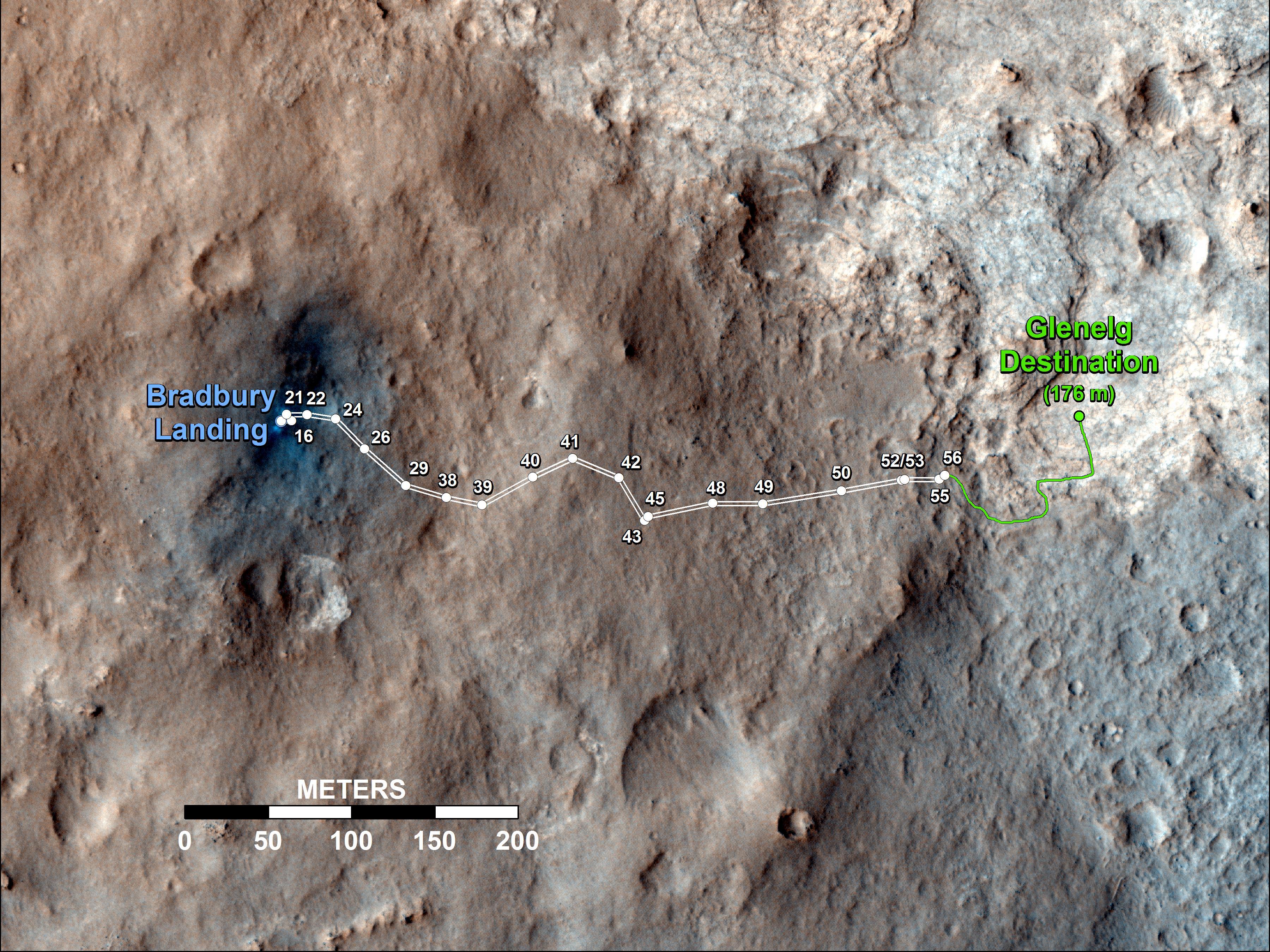
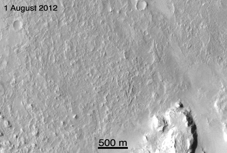
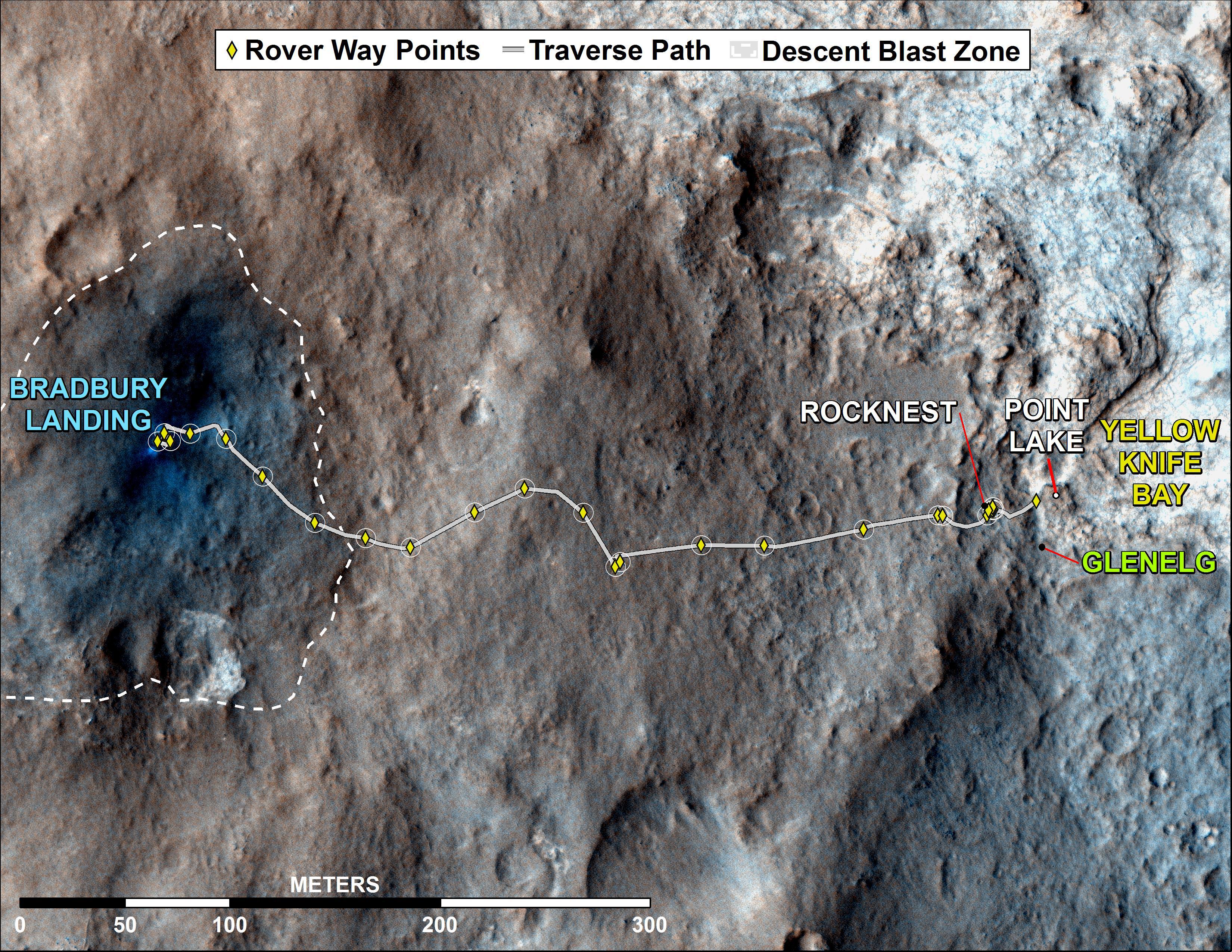
2012-10-04 |
Mars
|
Mars Science Laboratory (MSL)
|
HiRISE
|
3600x2700x3 |
|
-
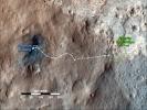
PIA16200:
-
Curiosity's Travels Through Sol 56
Full Resolution:
TIFF
(29.17 MB)
JPEG
(1.87 MB)
|
|
|
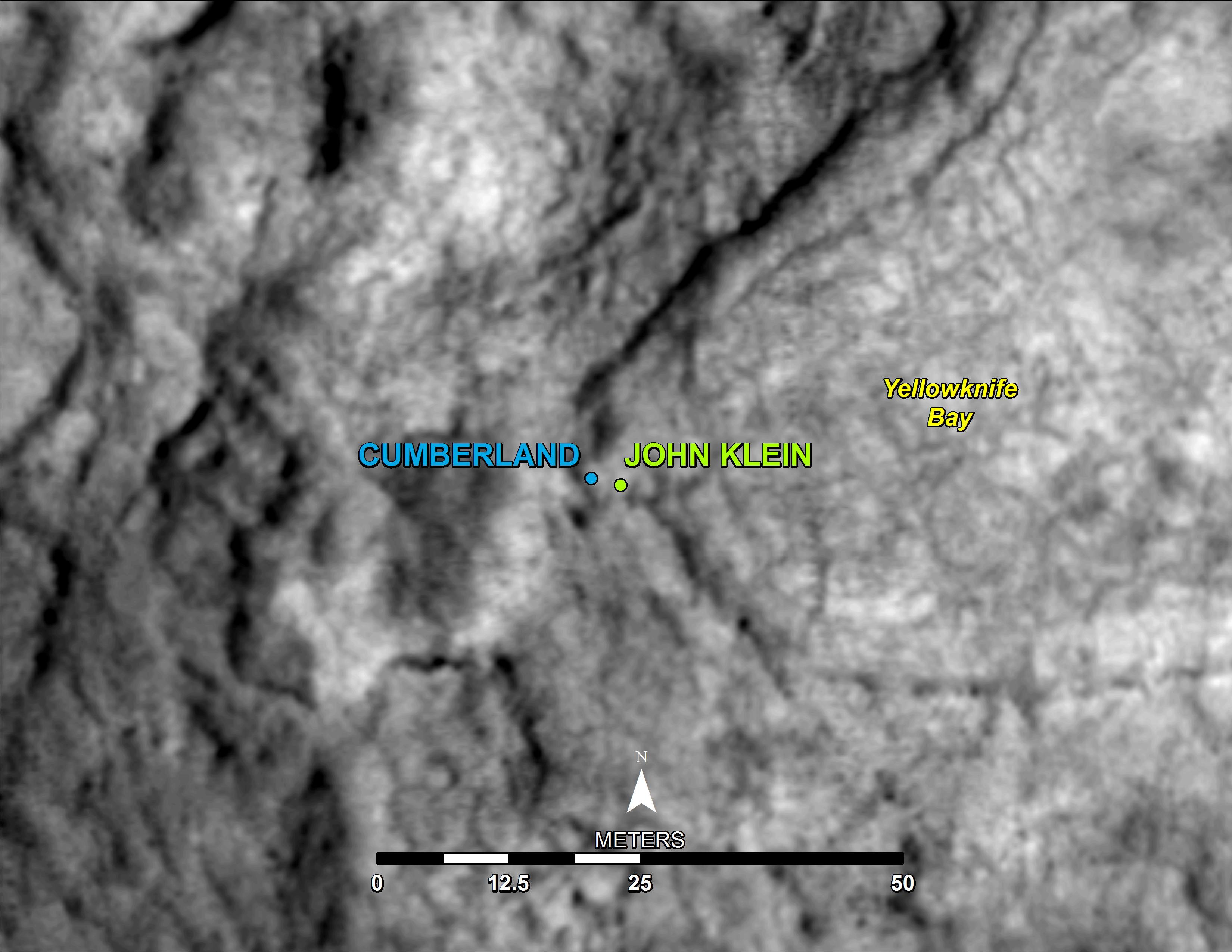
2013-05-09 |
Mars
|
Mars Science Laboratory (MSL)
|
HiRISE
|
3300x2550x3 |

|
-
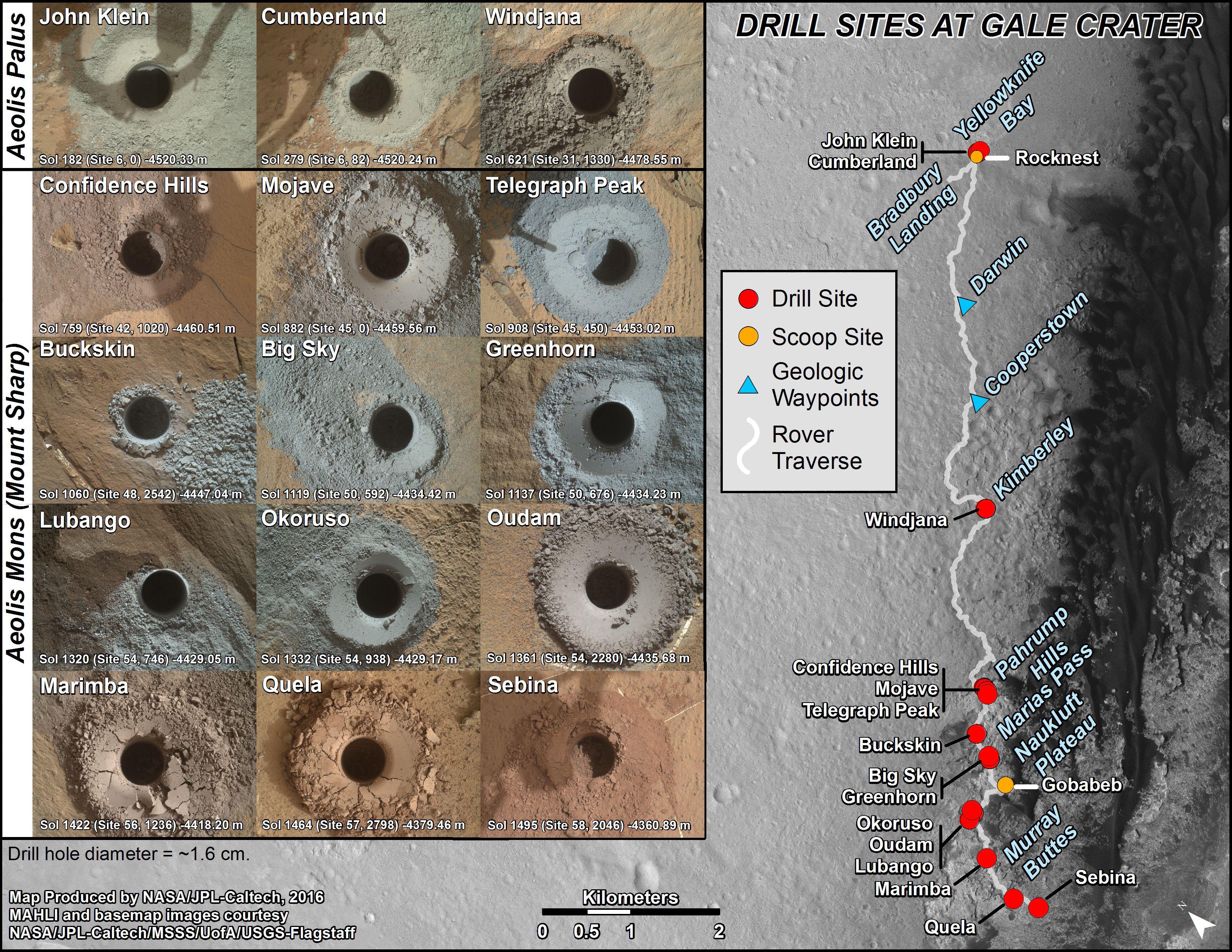
PIA16926:
-
'Cumberland' Selected as Curiosity's Second Drilling Target
Full Resolution:
TIFF
(25.26 MB)
JPEG
(495.3 kB)
|
|
|
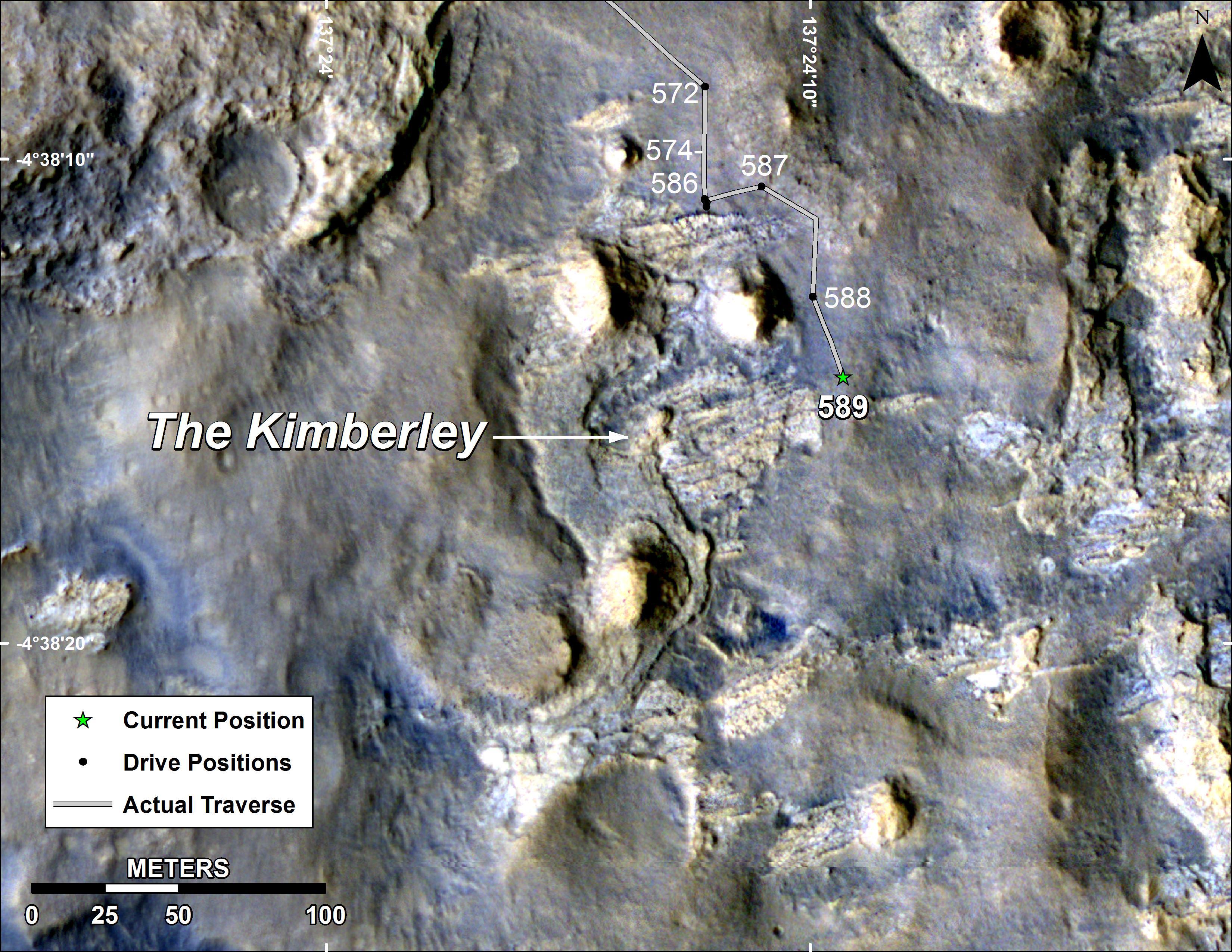
2014-04-03 |
Mars
|
Mars Science Laboratory (MSL)
|
HiRISE
|
3300x2550x3 |
|
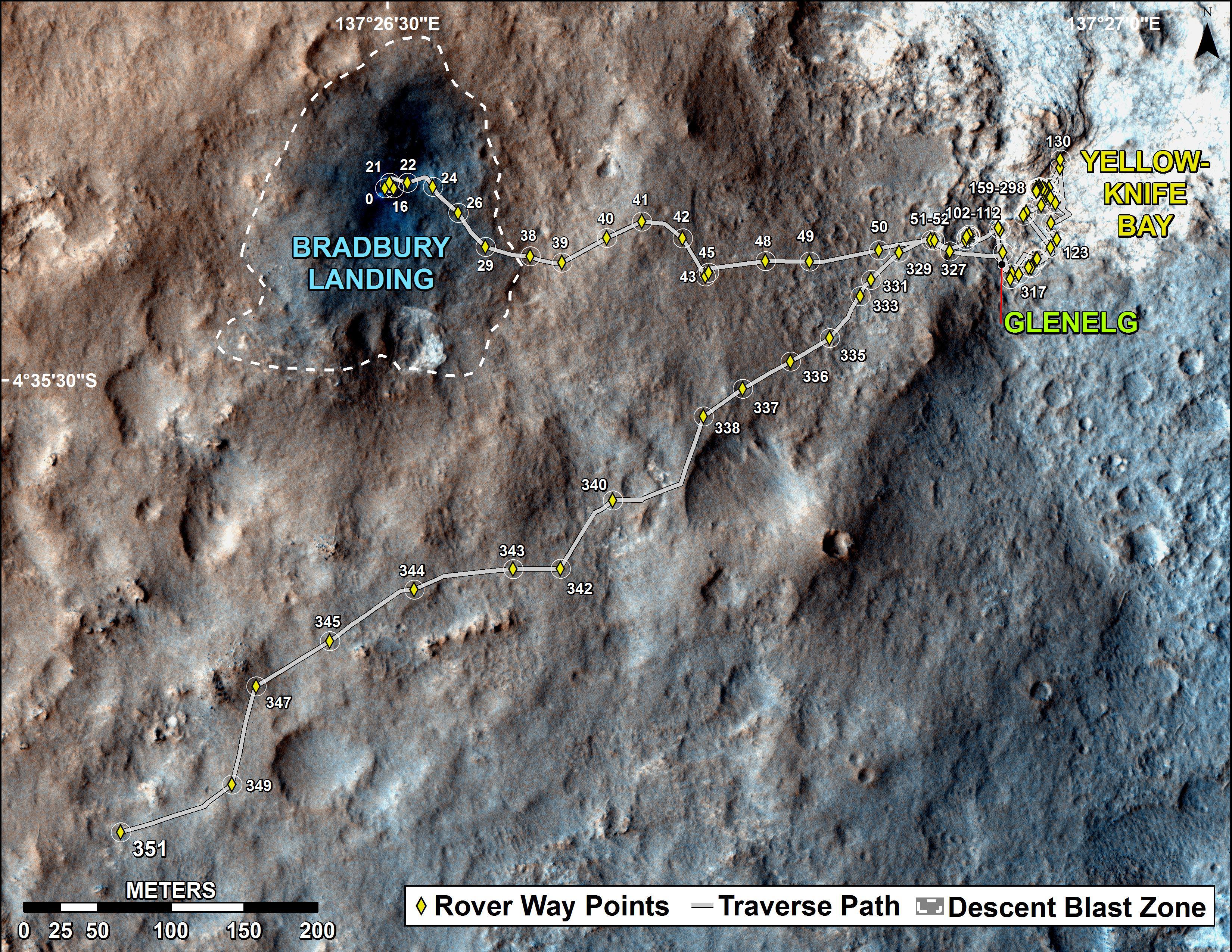
-
PIA18075:
-
Map of Curiosity Mars Rover's Drives to 'the Kimberley' Waypoint
Full Resolution:
TIFF
(25.26 MB)
JPEG
(1.265 MB)
|
|
|
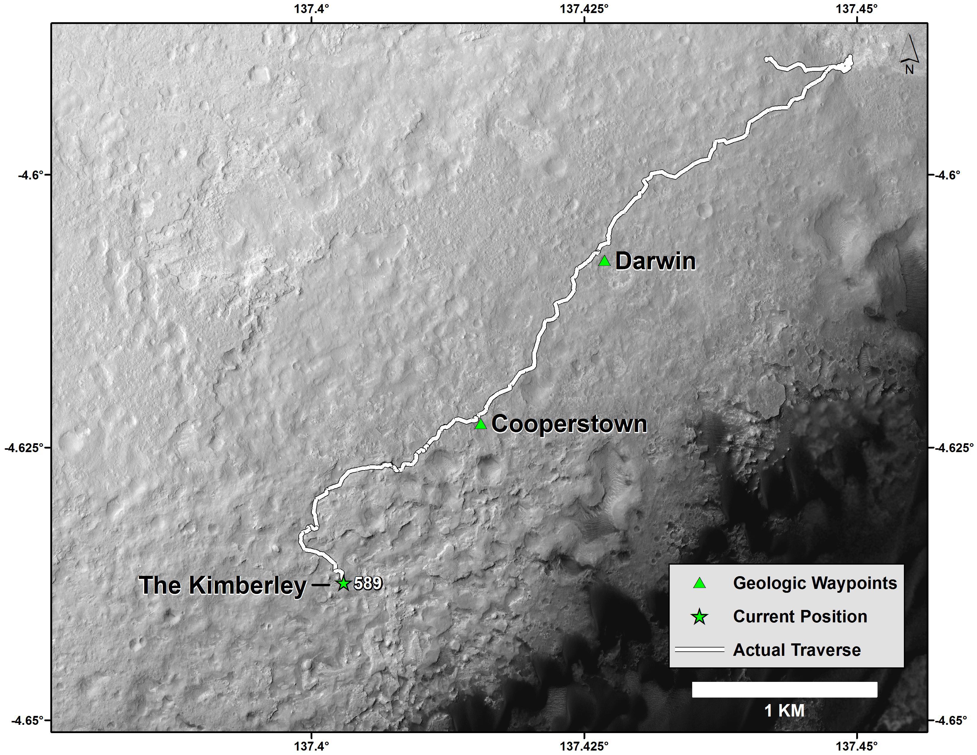
2014-04-03 |
Mars
|
Mars Science Laboratory (MSL)
|
HiRISE
|
3300x2550x3 |
|
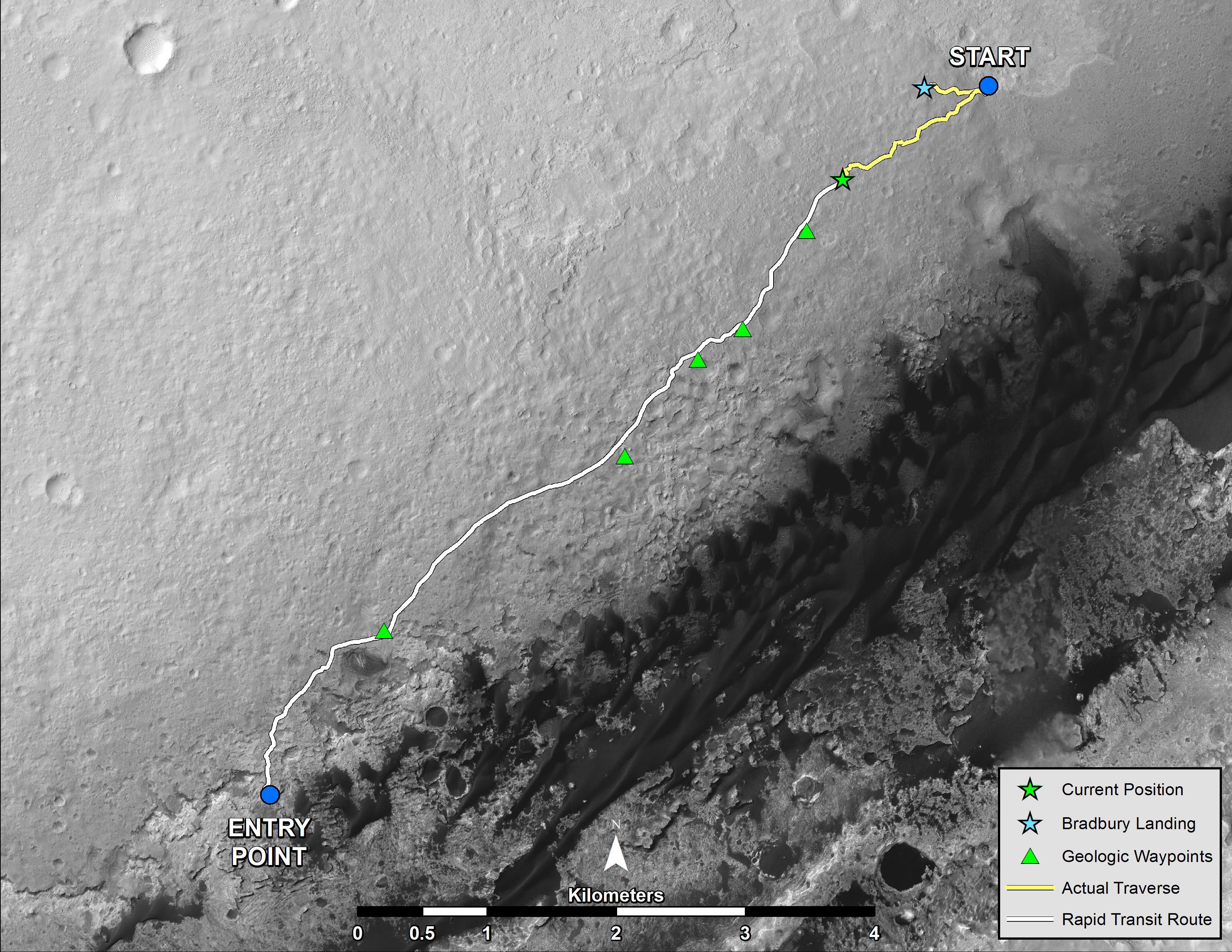
-
PIA18076:
-
Curiosity Mars Rover's Route from Landing to 'The Kimberley' Waypoint
Full Resolution:
TIFF
(25.26 MB)
JPEG
(1.23 MB)
|
|
|
2016-12-13 |
Mars
|
Mars Science Laboratory (MSL)
|
ChemCam
Mastcam
|
1996x1758x3 |
|
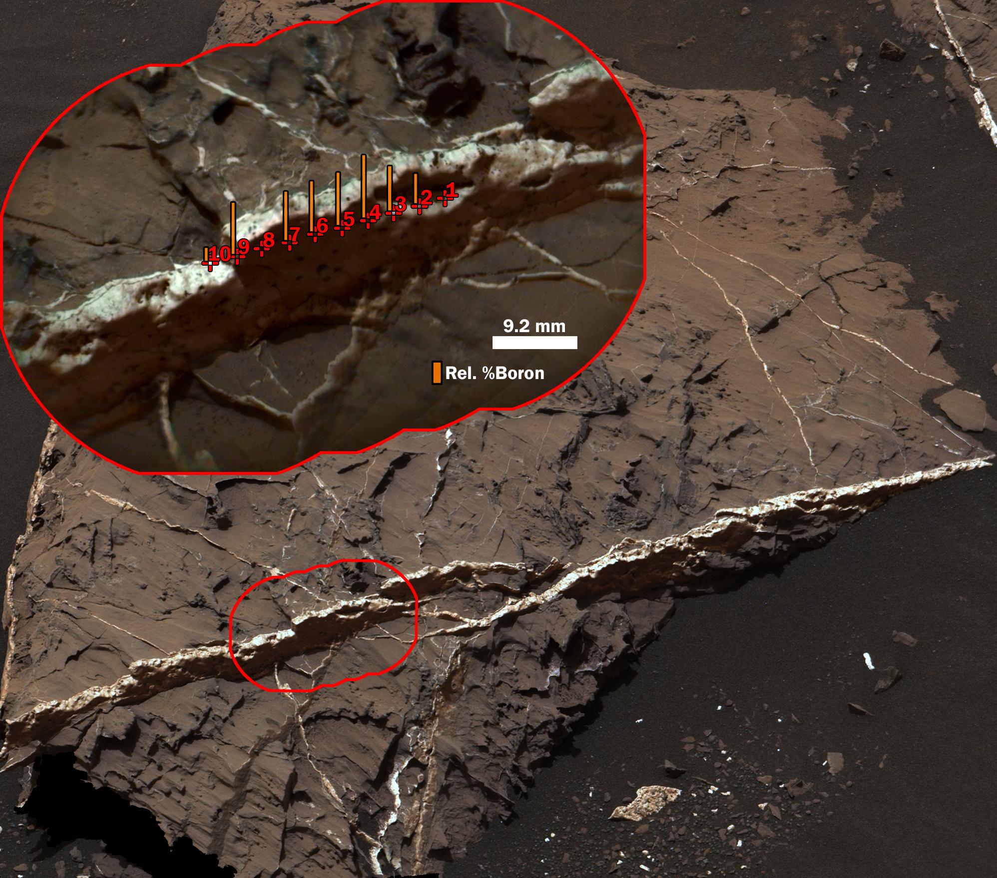
-
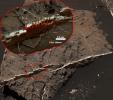
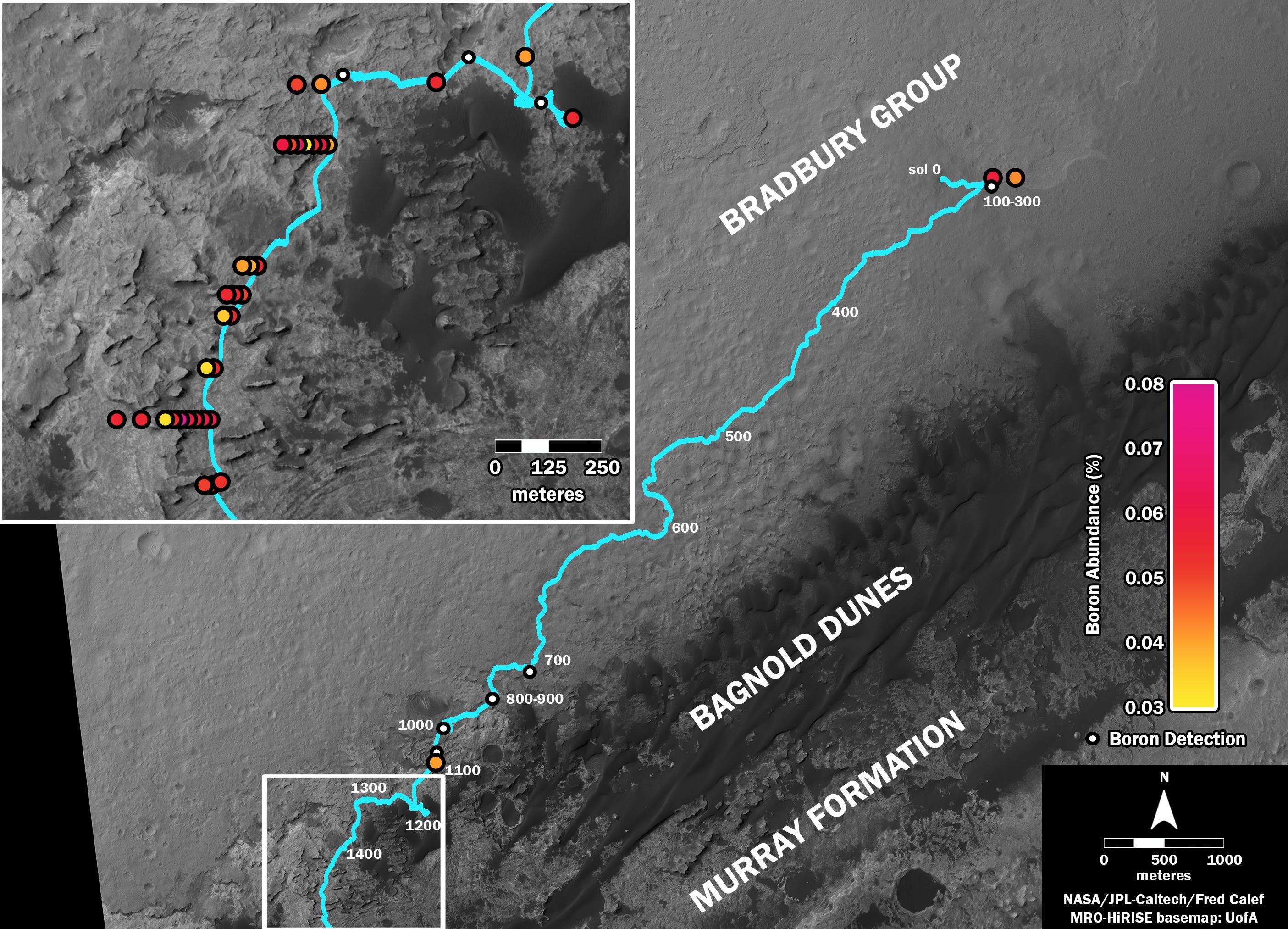
PIA21251:
-
Boron in Calcium Sulfate Vein at 'Catabola,' Mars
Full Resolution:
TIFF
(9.623 MB)
JPEG
(465.6 kB)
|
|
|
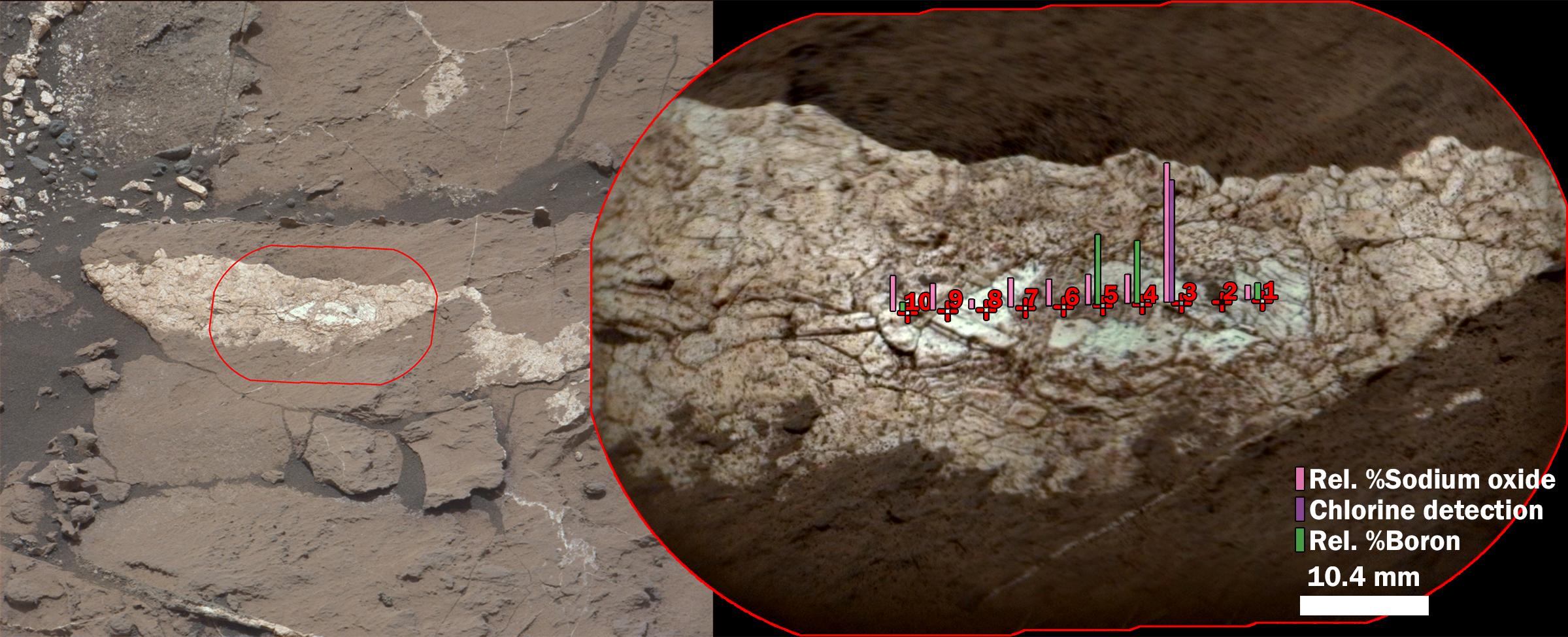
2016-12-13 |
Mars
|
Mars Science Laboratory (MSL)
|
ChemCam
Mastcam
|
2399x974x3 |
|
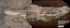
-
PIA21252:
-
Boron, Sodium and Chlorine in Mineral Vein 'Diyogha,' Mars
Full Resolution:
TIFF
(6.453 MB)
JPEG
(339.6 kB)
|
|
|
2006-12-05 |
Mars
|
Mars Reconnaissance Orbiter (MRO)
Viking
|
HiRISE
|
5000x4167x3 |
|
-
PIA01881:
-
Viking Lander 1 (Thomas A. Mutch Memorial Station) Imaged from Orbit
Full Resolution:
TIFF
(62.51 MB)
JPEG
(3.252 MB)
|
|
|
2006-12-05 |
Mars
|
Mars Reconnaissance Orbiter (MRO)
Viking
|
HiRISE
|
5039x4356x1 |
|
-
PIA01882:
-
Viking Lander 2 (Gerald A. Soffen Memorial Station) Imaged from Orbit
Full Resolution:
TIFF
(21.98 MB)
JPEG
(4.702 MB)
|
|
|
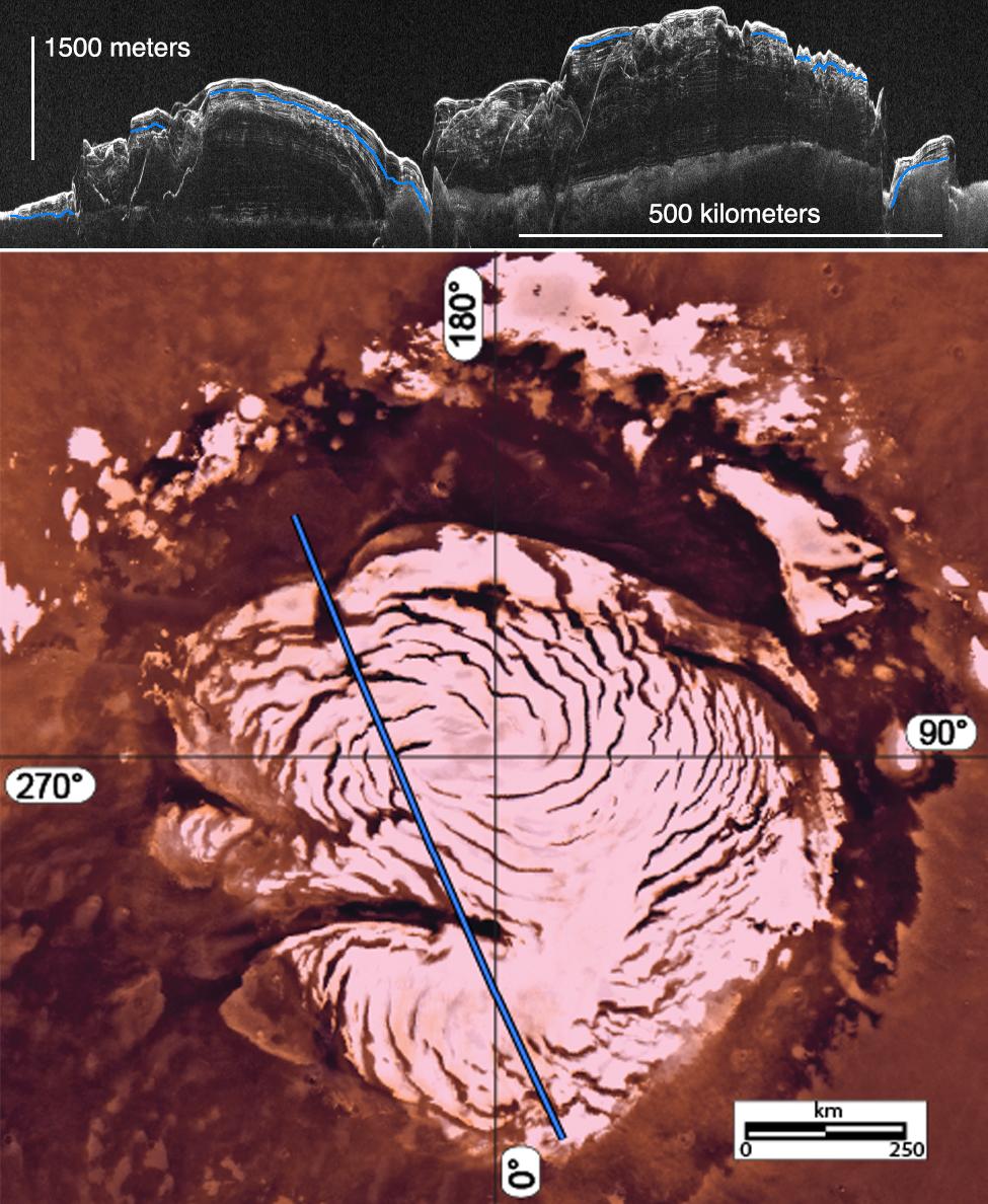
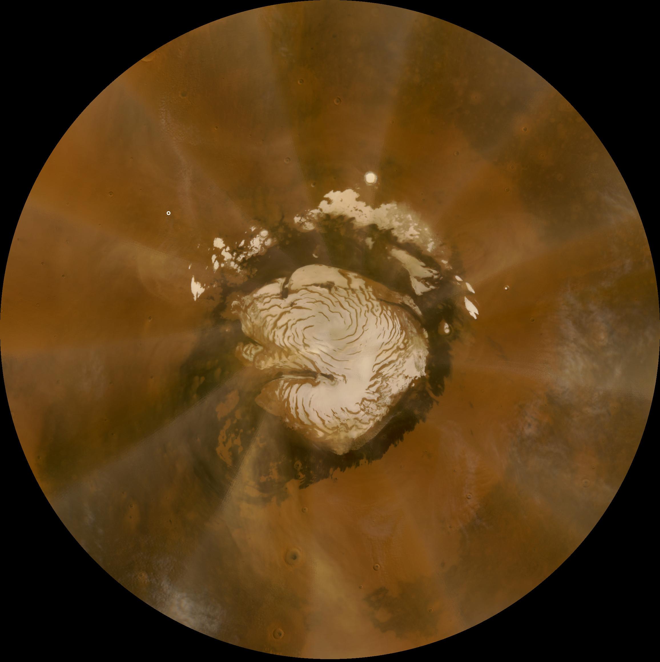
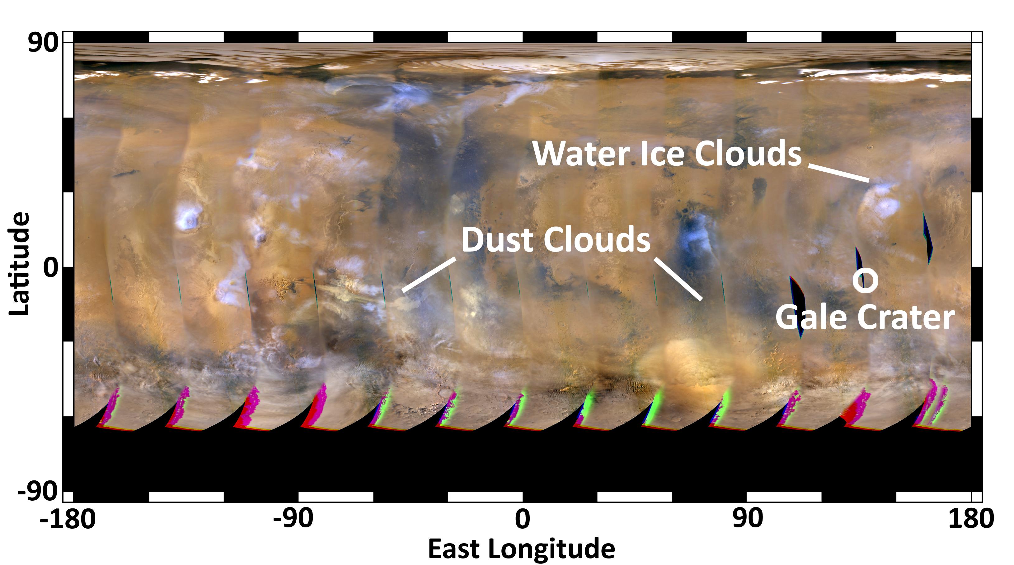
2016-05-26 |
Mars
|
Mars Reconnaissance Orbiter (MRO)
Viking
|
Shallow Subsurface Radar (SHARAD)
|
975x1188x3 |
|
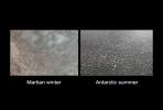
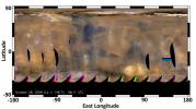
-
PIA20029:
-
Signs of a Martian Ice Age
Full Resolution:
TIFF
(2.95 MB)
JPEG
(190.7 kB)
|
|
|
2007-07-09 |
Mars
|
Mars Reconnaissance Orbiter (MRO)
Phoenix
|
HiRISE
|
720x415x1 |
|
-
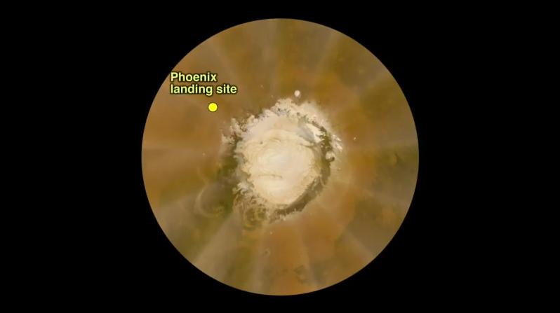
PIA09702:
-
Terrain Type for Phoenix Landing
Full Resolution:
TIFF
(299.3 kB)
JPEG
(73.26 kB)
|
|
|
2007-08-02 |
Mars
|
Mars Reconnaissance Orbiter (MRO)
Phoenix
|
CTX
|
1159x858x3 |
|
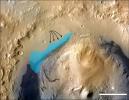
-
PIA09946:
-
Possible Landing Ellipses for Phoenix
Full Resolution:
TIFF
(2.987 MB)
JPEG
(191.5 kB)
|
|
|
2007-08-02 |
Mars
|
Mars Reconnaissance Orbiter (MRO)
Phoenix
|
CTX
|
1300x1300x1 |
|
-
PIA09947:
-
Context Image of Planned Landing Site
Full Resolution:
TIFF
(1.692 MB)
JPEG
(108.2 kB)
|
|
|
2007-08-02 |
Mars
|
Mars Reconnaissance Orbiter (MRO)
Phoenix
|
HiRISE
|
1003x1004x1 |
|
-
PIA09948:
-
Sweet Spot for Landing on Mars
Full Resolution:
TIFF
(1.008 MB)
JPEG
(227 kB)
|
|
|
2008-10-14 |
Mars
|
Mars Reconnaissance Orbiter (MRO)
Phoenix
|
MARCI
|
2312x2322x3 |

|
-
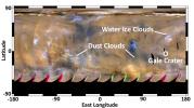
PIA11230:
-
Late-summer Martian Dust Storm
Full Resolution:
TIFF
(16.12 MB)
JPEG
(237.4 kB)
|
|
|
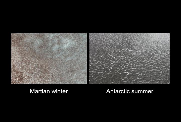
2008-05-22 |
Mars
|
Mars Reconnaissance Orbiter (MRO)
Phoenix
|
HiRISE
|
720x486x3 |
|
-
PIA10658:
-
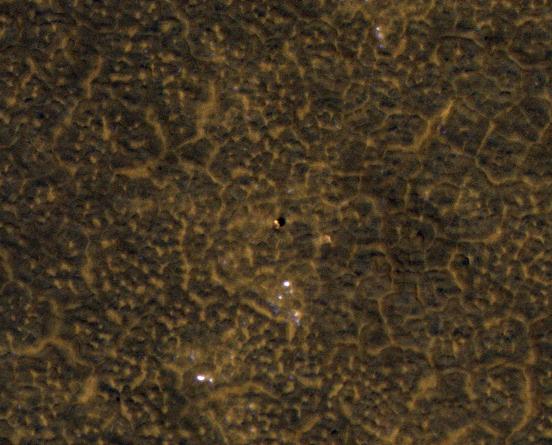
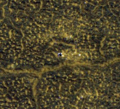
Polygon Patterned Ground on Mars and on Earth
Full Resolution:
TIFF
(1.051 MB)
JPEG
(44.26 kB)
|
|
|
2008-05-24 |
Mars
|
Mars Reconnaissance Orbiter (MRO)
Phoenix
|
MARCI
|
516x516x3 |
|
-
PIA10672:
-
Clear Skies Ahead
Full Resolution:
TIFF
(268.3 kB)
JPEG
(22.66 kB)
|
|
|
2008-05-27 |
Mars
|
Mars Reconnaissance Orbiter (MRO)
Phoenix
|
HiRISE
|
1437x1388x3 |
|
-
PIA10710:
-
Connecting the Dots: Lander, Heat Shield, Parachute
Full Resolution:
TIFF
(5.995 MB)
JPEG
(282.8 kB)
|
|
|
2008-06-13 |
Mars
|
Mars Reconnaissance Orbiter (MRO)
Phoenix
|
MARCI
|
798x447x3 |

|
-
PIA10788:
-
Martian Dust Storm on May 18, 2008

Full Resolution:
TIFF
(1.072 MB)
JPEG
(17.48 kB)
|
|
|
2009-11-04 |
Mars
|
Mars Reconnaissance Orbiter (MRO)
Phoenix
|
HiRISE
|
2238x826x3 |
|
-
PIA12338:
-
Phoenix in Winter
Full Resolution:
TIFF
(5.553 MB)
JPEG
(502.2 kB)
|
|
|
2010-01-11 |
Mars
|
Mars Reconnaissance Orbiter (MRO)
Phoenix
|
HiRISE
|
1194x1500x3 |
|
-
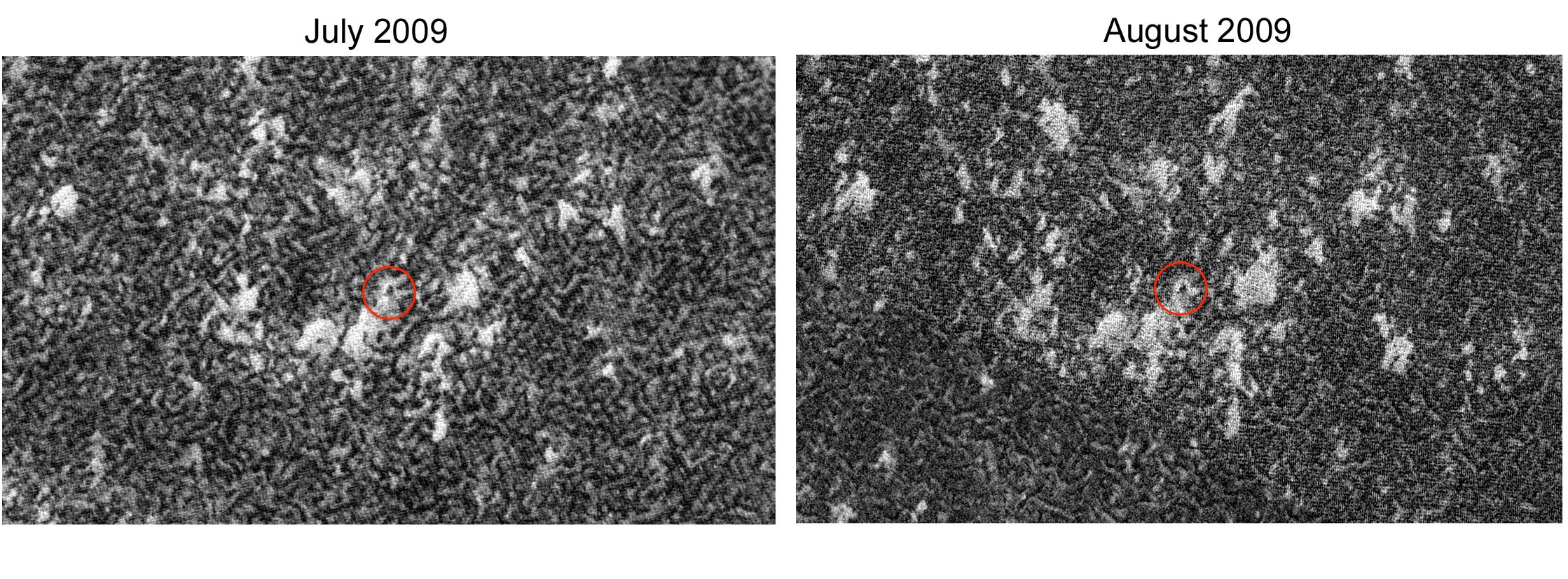
PIA12490:
-
Phoenix Lander Amid Disappearing Spring Ice
Full Resolution:
TIFF
(5.379 MB)
JPEG
(438.6 kB)
|
|
|
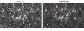
2010-02-26 |
Mars
|
Mars Reconnaissance Orbiter (MRO)
Phoenix
|
HiRISE
|
1020x442x3 |
|
-
PIA12853:
-
Ice Around Phoenix Lander Continues to Lessen in Spring
Full Resolution:
TIFF
(1.355 MB)
JPEG
(62.86 kB)
|
|
|
2012-02-08 |
Mars
|
Mars Reconnaissance Orbiter (MRO)
Phoenix
|
HiRISE
|
552x445x3 |
|
-
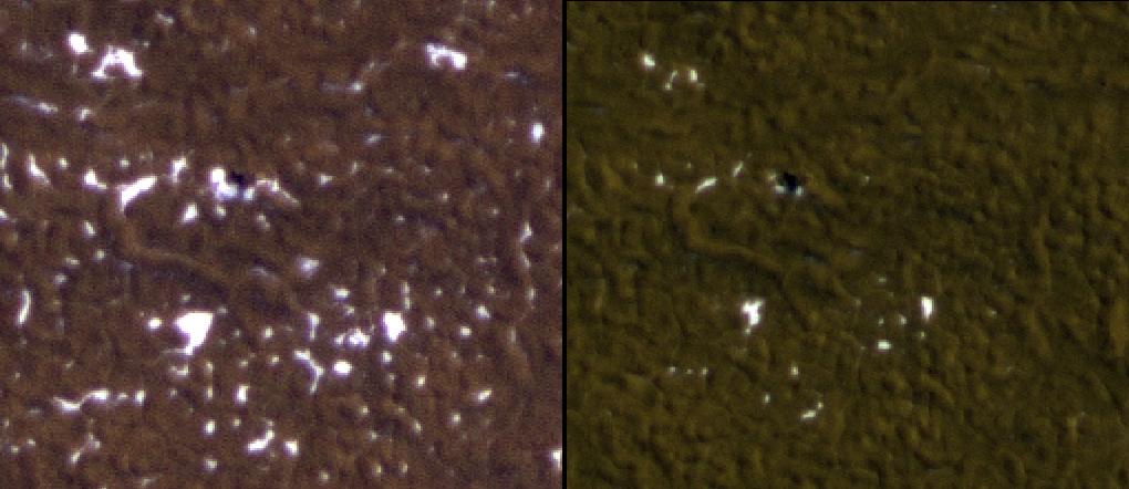
PIA15039:
-
Phoenix Back Shell After Second Martian Winter
Full Resolution:
TIFF
(738.1 kB)
JPEG
(44.71 kB)
|
|
|
2012-02-13 |
Mars
|
Mars Reconnaissance Orbiter (MRO)
Phoenix
|
HiRISE
|
411x372x3 |
|
-
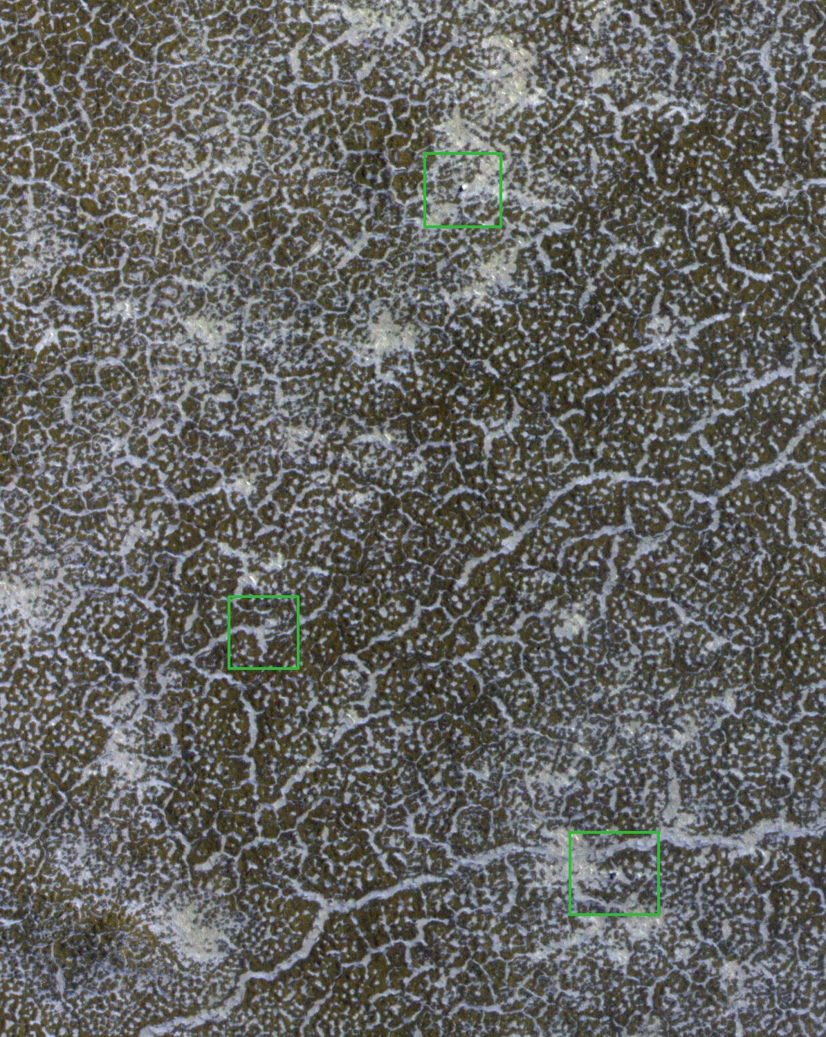
PIA15110:
-
Phoenix Lander After Second Martian Winter
Full Resolution:
TIFF
(459.4 kB)
JPEG
(38.67 kB)
|
|
|
2012-08-04 |
Mars
|
Mars Reconnaissance Orbiter (MRO)
Mars Science Laboratory (MSL)
|
MARCI
|
3258x1817x3 |

|
-
PIA15962:
-
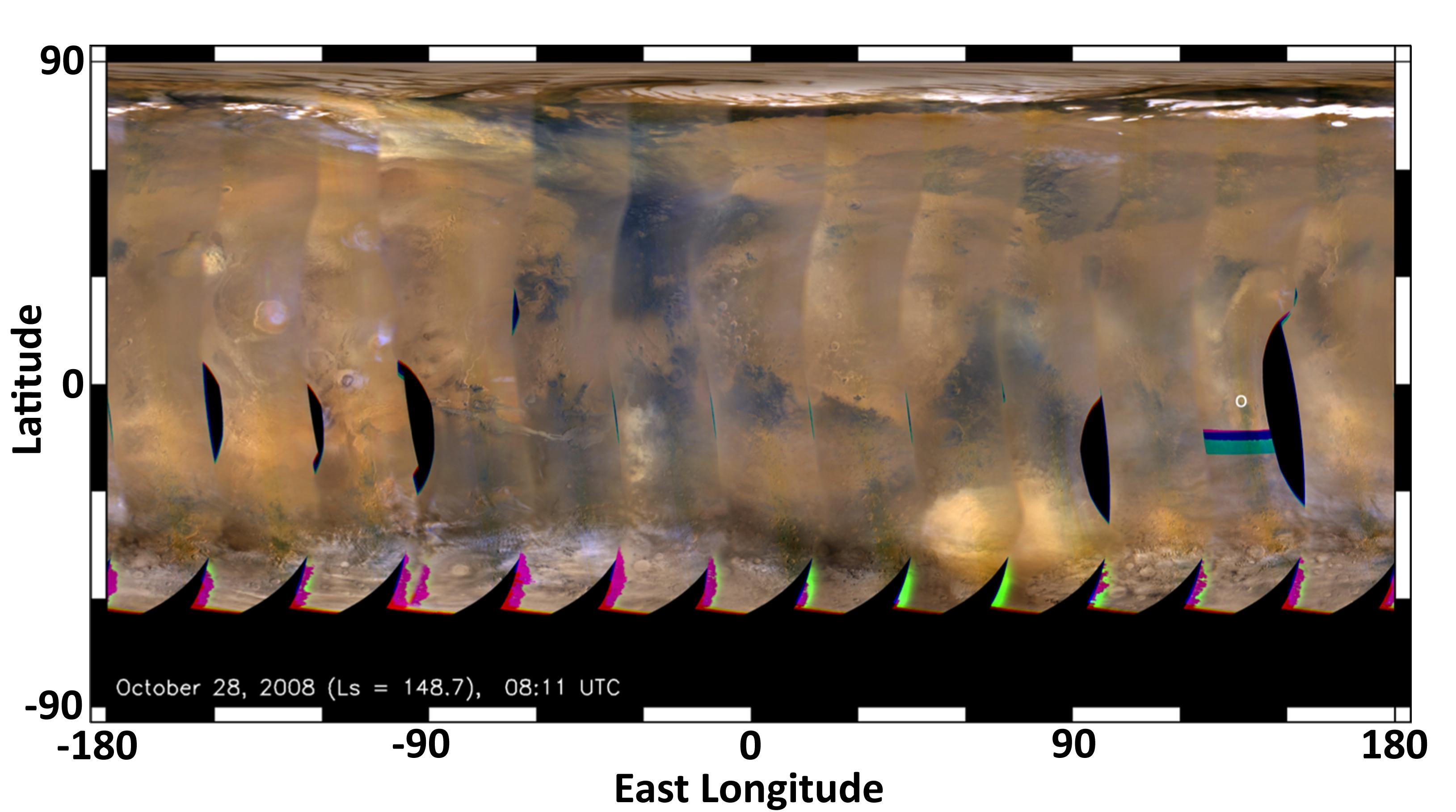
Mars Weather Map, Aug. 2, 2012
Full Resolution:
TIFF
(17.77 MB)
JPEG
(500.2 kB)
|
|
|
2012-08-04 |
Mars
|
Mars Reconnaissance Orbiter (MRO)
Mars Science Laboratory (MSL)
|
MARCI
|
3258x1817x3 |
|
-
PIA15963:
-
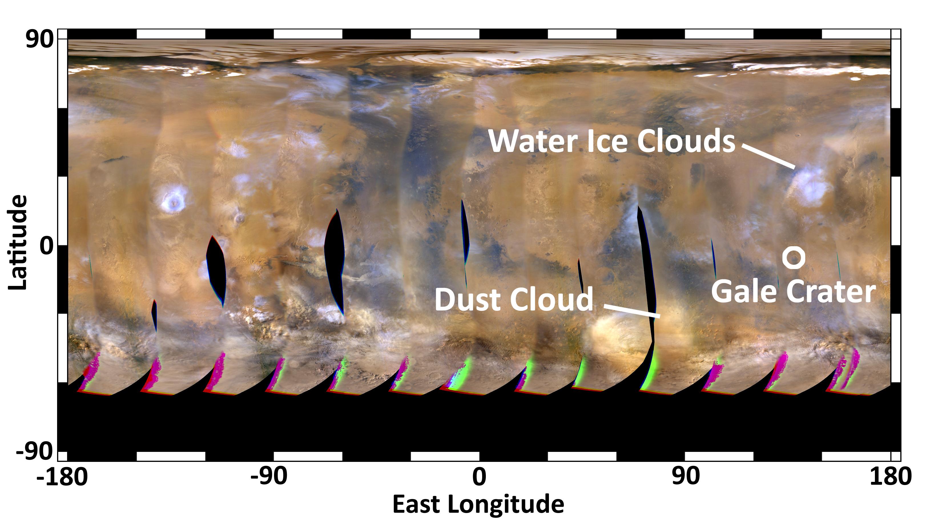
Mars Weather Map, 2008
Full Resolution:
TIFF
(17.77 MB)
JPEG
(354 kB)
|
|
|
2012-08-05 |
Mars
|
Mars Reconnaissance Orbiter (MRO)
Mars Science Laboratory (MSL)
|
MARCI
|
3258x1817x3 |
|
-
PIA15968:
-
Mars Weather Map, Aug. 4, 2012
Full Resolution:
TIFF
(17.77 MB)
JPEG
(485.6 kB)
|
|
|
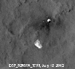
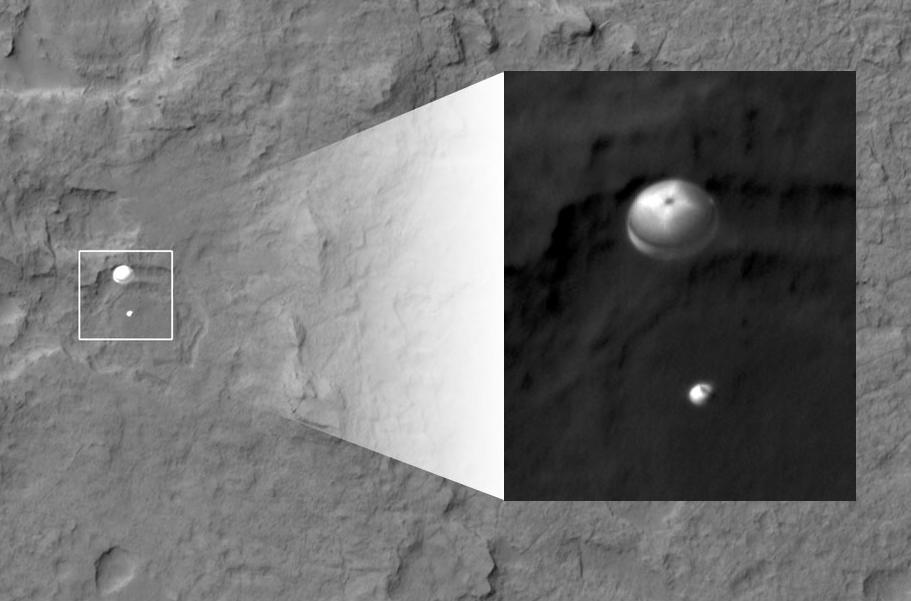
2012-08-06 |
Mars
|
Mars Reconnaissance Orbiter (MRO)
Mars Science Laboratory (MSL)
|
HiRISE
|
911x601x1 |
|
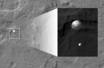
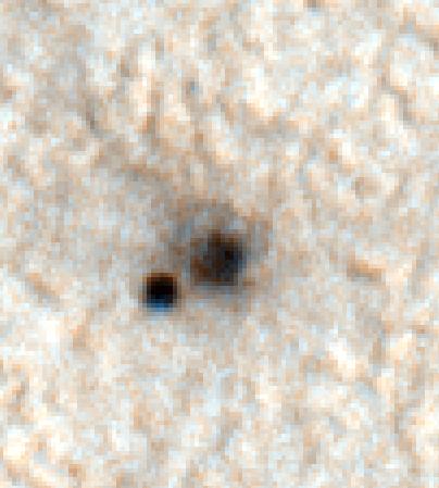
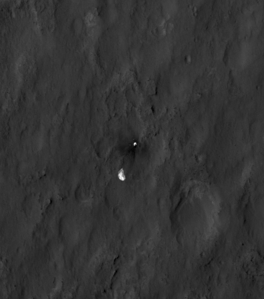
-
PIA15978:
-
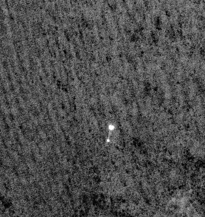
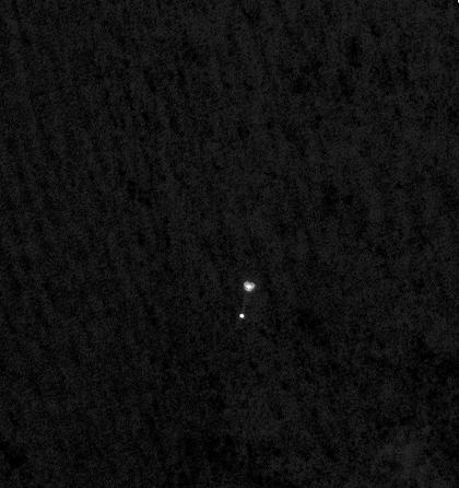
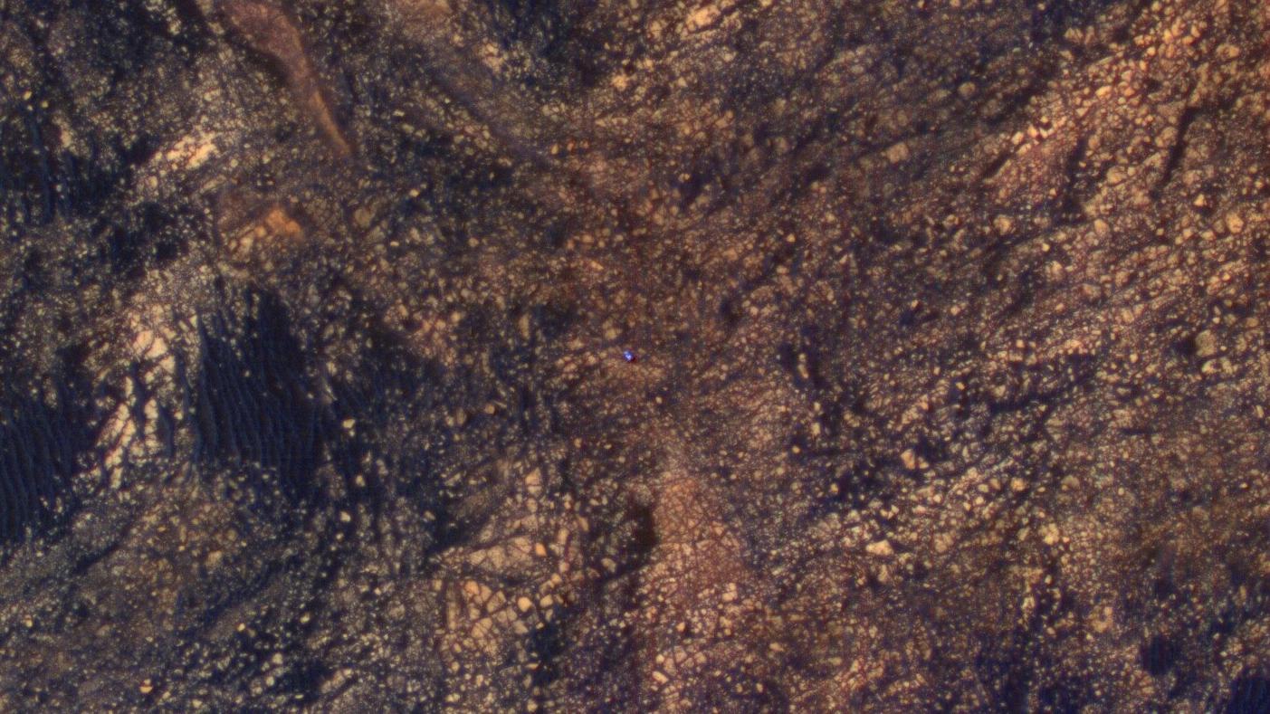
Curiosity Spotted on Parachute by Orbiter
Full Resolution:
TIFF
(548.3 kB)
JPEG
(51.73 kB)
|
|
|
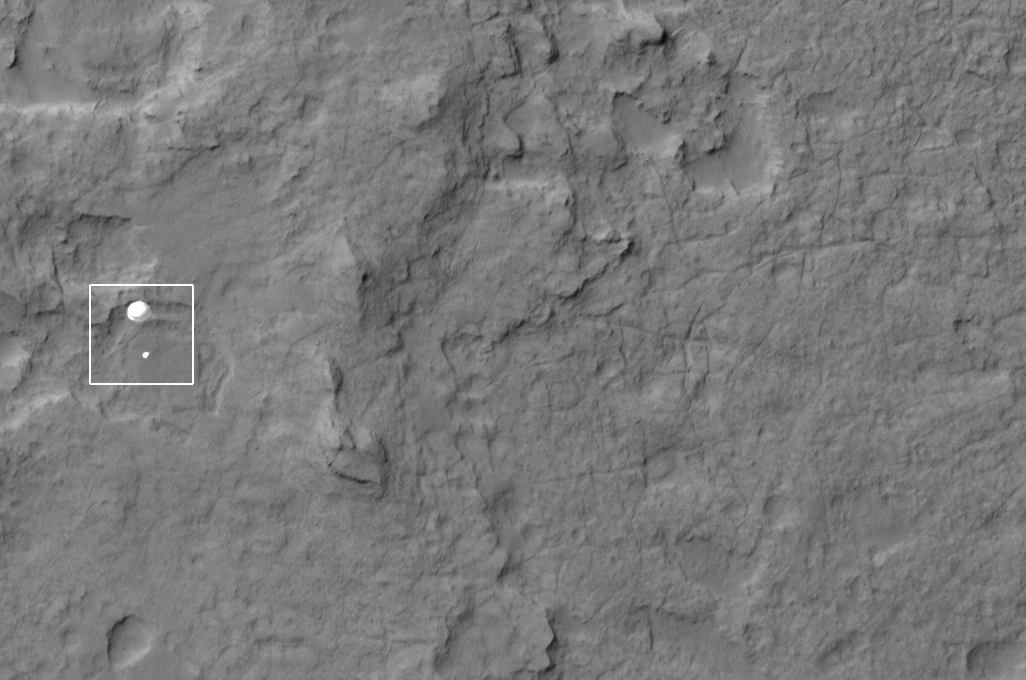
2012-08-06 |
Mars
|
Mars Reconnaissance Orbiter (MRO)
Mars Science Laboratory (MSL)
|
HiRISE
|
2047x1357x1 |
|
-
PIA15980:
-
Curiosity Spotted on Parachute by Orbiter
Full Resolution:
TIFF
(2.781 MB)
JPEG
(251.3 kB)
|
|
|
2012-08-06 |
Mars
|
Mars Reconnaissance Orbiter (MRO)
Mars Science Laboratory (MSL)
|
HiRISE
|
2048x9645x1 |
|
-
PIA15983:
-
Curiosity Flying Over Mars
Full Resolution:
TIFF
(19.77 MB)
JPEG
(2.527 MB)
|
|
|
2012-08-06 |
Mars
|
Mars Reconnaissance Orbiter (MRO)
Mars Science Laboratory (MSL)
|
HiRISE
|
176x215x1 |
|
-
PIA15979:
-
Curiosity Spotted on Parachute by Orbiter
Full Resolution:
TIFF
(38.1 kB)
JPEG
(2.85 kB)
|
|
|
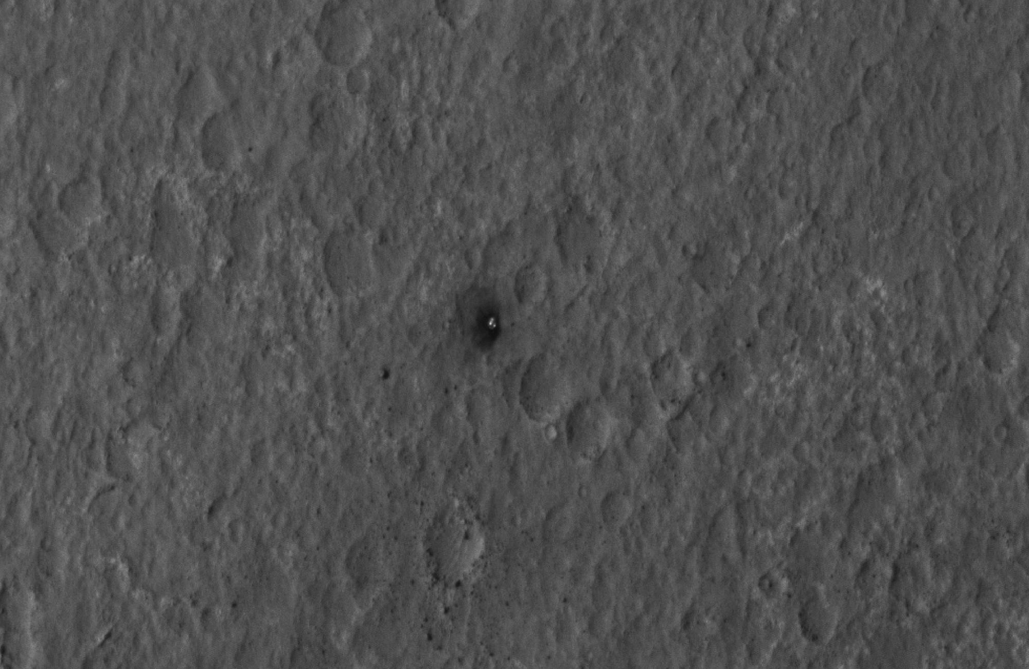
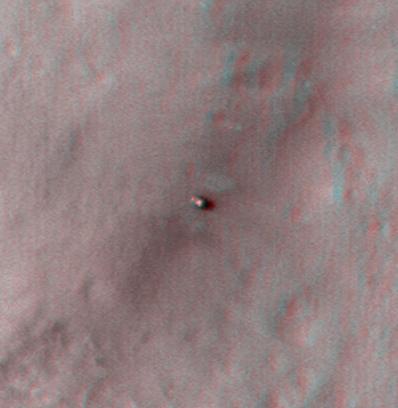
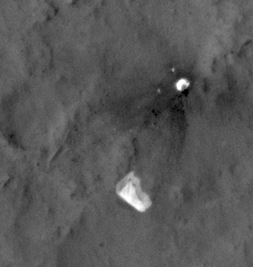
2012-08-07 |
Mars
|
Mars Reconnaissance Orbiter (MRO)
Mars Science Laboratory (MSL)
|
HiRISE
|
2000x1300x1 |
|
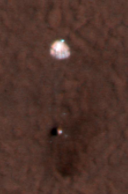
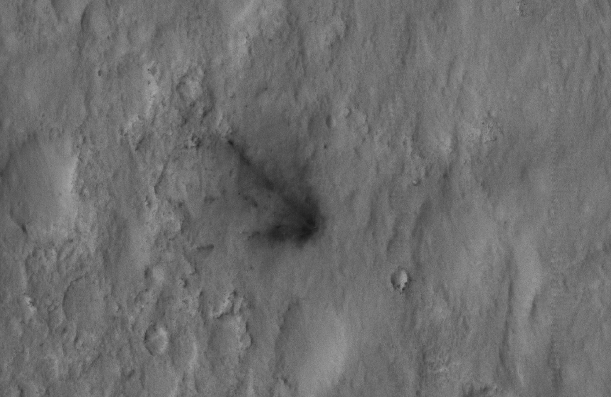
-
PIA15997:
-
Final Resting Spot for Curiosity's Heat Shield
Full Resolution:
TIFF
(2.603 MB)
JPEG
(270.9 kB)
|
|
|
2012-08-07 |
Mars
|
Mars Reconnaissance Orbiter (MRO)
Mars Science Laboratory (MSL)
|
HiRISE
|
882x996x1 |

|
-
PIA15998:
-
Evidence of a Job Well Done
Full Resolution:
TIFF
(879.6 kB)
JPEG
(59.95 kB)
|
|
|
2012-08-07 |
Mars
|
Mars Reconnaissance Orbiter (MRO)
Mars Science Laboratory (MSL)
|
HiRISE
|
2000x1300x1 |

|
-
PIA15999:
-
Signs of the Sky Crane's Impact
Full Resolution:
TIFF
(2.603 MB)
JPEG
(282.5 kB)
|
|
|
2012-08-07 |
Mars
|
Mars Reconnaissance Orbiter (MRO)
Mars Science Laboratory (MSL)
|
HiRISE
|
2000x1300x1 |
|
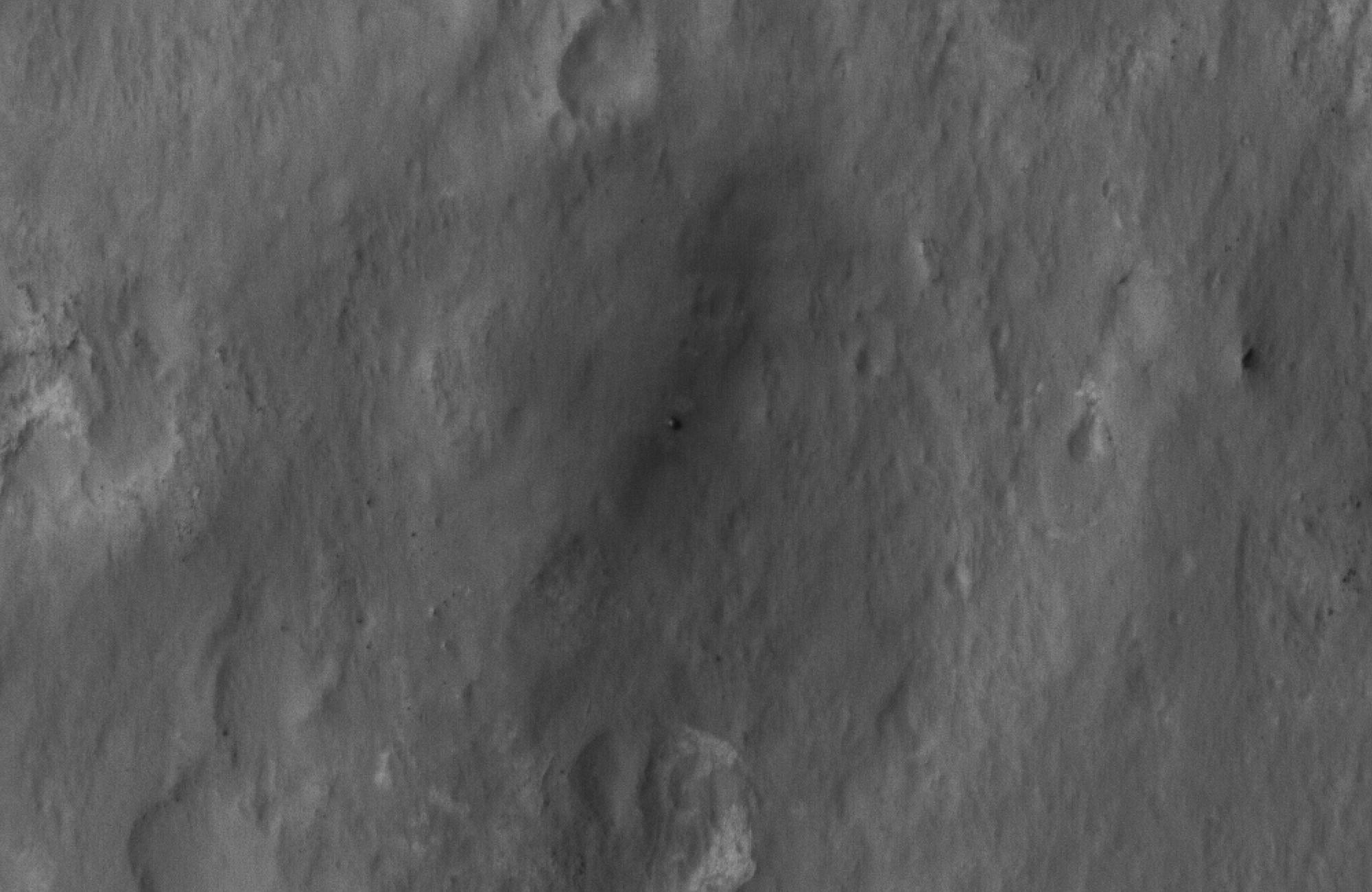
-
PIA16000:
-
Curiosity Spotted!
Full Resolution:
TIFF
(2.603 MB)
JPEG
(249.2 kB)
|
|
|
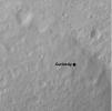
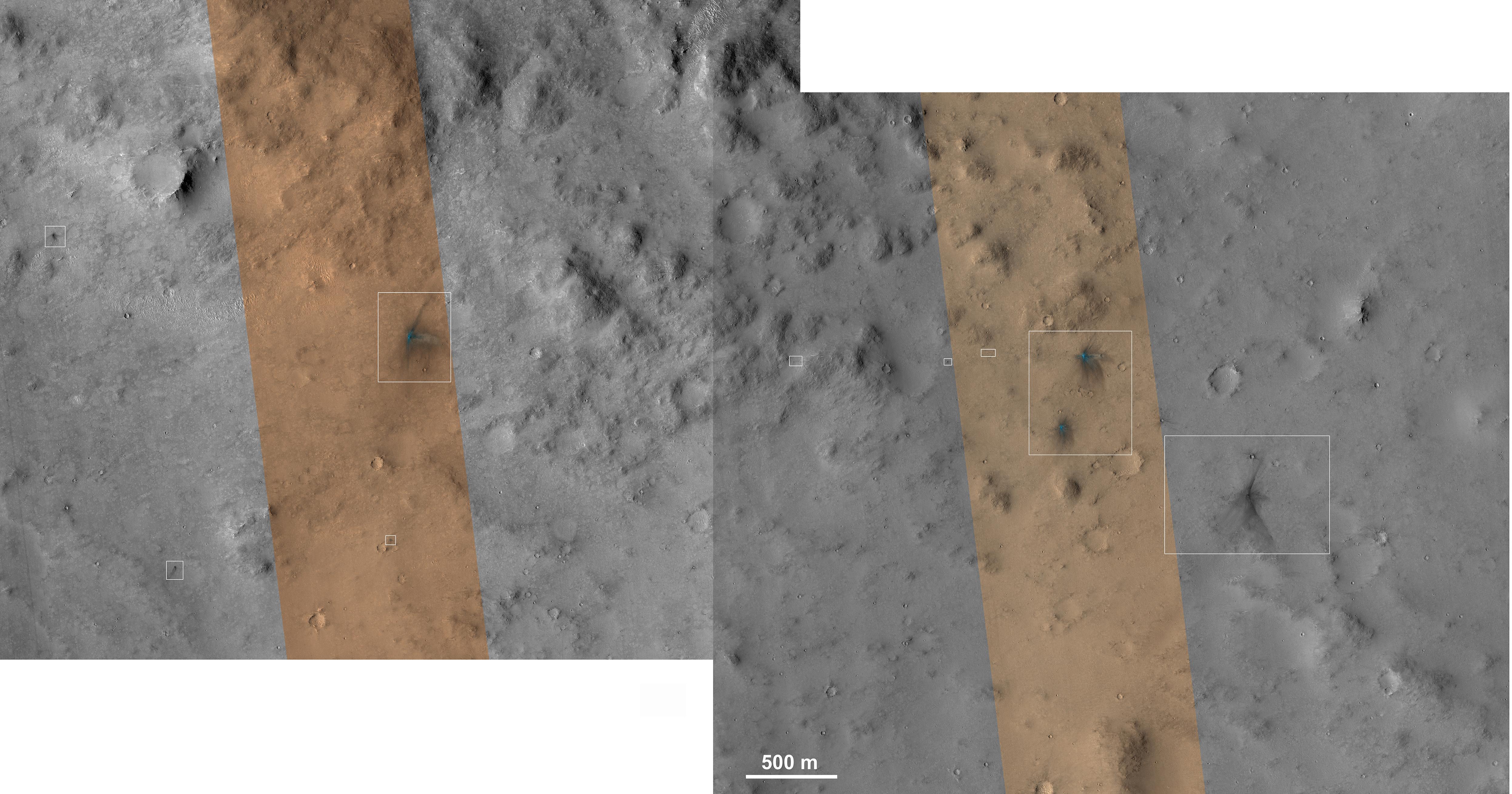
2012-08-08 |
Mars
|
Mars Reconnaissance Orbiter (MRO)
Mars Science Laboratory (MSL)
|
CTX
|
1709x1193x1 |
|
-
PIA16014:
-
Before and After Curiosity's Touchdown
Full Resolution:
TIFF
(2.041 MB)
JPEG
(305.4 kB)
|
|
|
2012-08-08 |
Mars
|
Mars Reconnaissance Orbiter (MRO)
Mars Science Laboratory (MSL)
|
CTX
|
758x511x1 |
|
-
PIA16016:
-
Ballasts Hitting the Surface, Close-Up
Full Resolution:
TIFF
(388 kB)
JPEG
(58 kB)
|
|
|
2012-08-08 |
Mars
|
Mars Reconnaissance Orbiter (MRO)
Mars Science Laboratory (MSL)
|
CTX
|
758x511x1 |

|
-
PIA16015:
-
Ballasts Hitting the Surface, Close-Up (with arrows)
Full Resolution:
TIFF
(388 kB)
JPEG
(58.05 kB)
|
|
|
2012-08-08 |
Mars
|
Mars Reconnaissance Orbiter (MRO)
Mars Science Laboratory (MSL)
|
HiRISE
MARDI
|
1665x1174x3 |
|
-
PIA16019:
-
A Better Look of the Martian Surface
Full Resolution:
TIFF
(5.867 MB)
JPEG
(153.7 kB)
|
|
|
2012-08-09 |
Mars
|
Mars Reconnaissance Orbiter (MRO)
Mars Science Laboratory (MSL)
|
HiRISE
|
724x720x1 |
|
-
PIA16030:
-
Curiosity's Quad
Full Resolution:
TIFF
(522 kB)
JPEG
(63.57 kB)
|
|
|
2012-08-09 |
Mars
|
Mars Reconnaissance Orbiter (MRO)
Mars Science Laboratory (MSL)
|
HiRISE
|
862x650x3 |
|
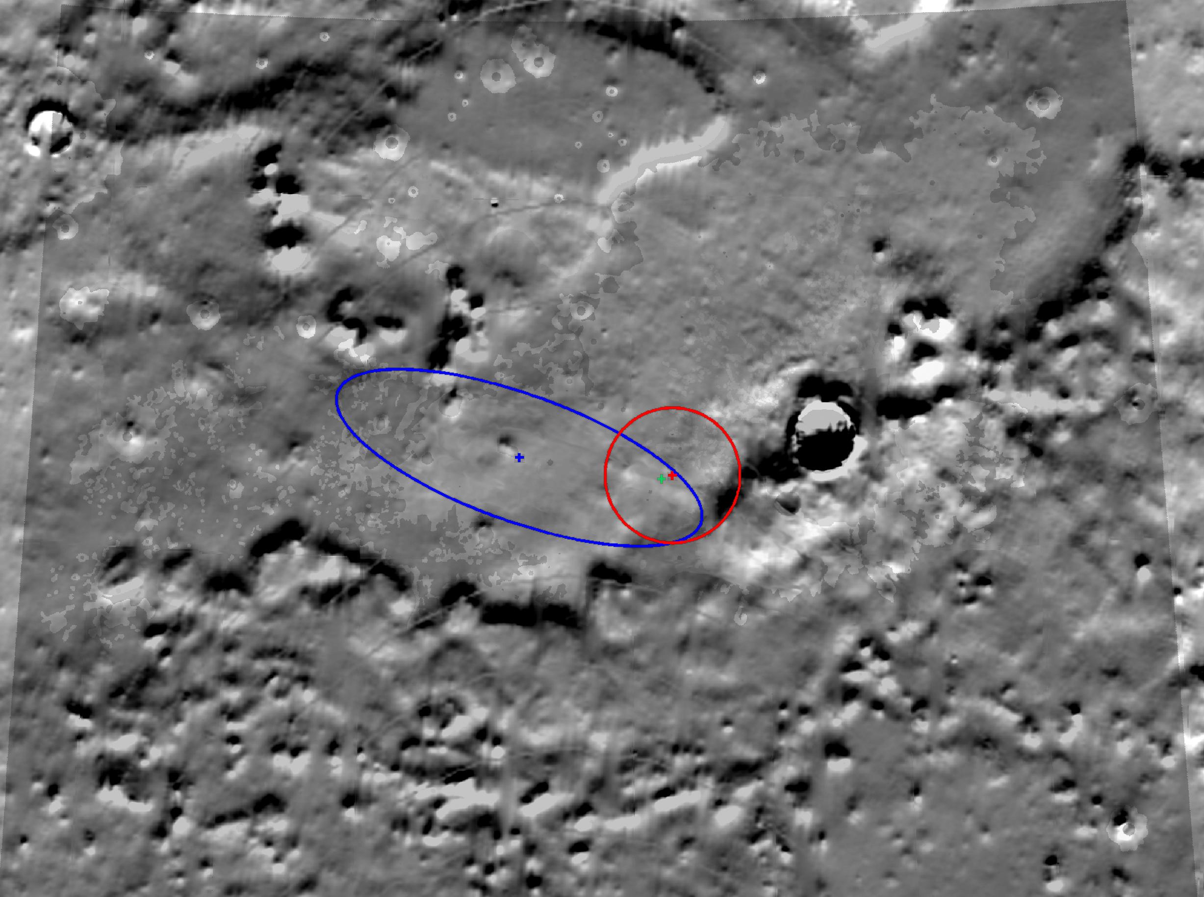
-
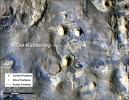
PIA16031:
-
Staking out Curiosity's Landing Site
Full Resolution:
TIFF
(1.682 MB)
JPEG
(99.91 kB)
|
|
|
2012-08-10 |
Mars
|
Mars Reconnaissance Orbiter (MRO)
Mars Science Laboratory (MSL)
|
MARCI
|
1449x1087x3 |
|
-
PIA16037:
-
Mars Weather Map, Aug. 5
Full Resolution:
TIFF
(4.727 MB)
JPEG
(123.9 kB)
|
|
|
2012-08-14 |
Mars
|
Mars Reconnaissance Orbiter (MRO)
Mars Science Laboratory (MSL)
|
HiRISE
|
1511x13401x3 |
|
-
PIA16056:
-
A Whole New World for Curiosity
Full Resolution:
TIFF
(60.77 MB)
JPEG
(2.358 MB)
|
|
|
2012-08-14 |
Mars
|
Mars Reconnaissance Orbiter (MRO)
Mars Science Laboratory (MSL)
|
HiRISE
|
3022x2515x3 |
|
-
PIA16057:
-
Curiosity in Exaggerated Color
Full Resolution:
TIFF
(22.81 MB)
JPEG
(1.151 MB)
|
|
|
2012-08-31 |
Mars
|
Mars Reconnaissance Orbiter (MRO)
Mars Science Laboratory (MSL)
|
HiRISE
|
2800x1800x1 |
|
-
PIA15696:
-
Orbiter View of Curiosity From Nearly Straight Overhead
Full Resolution:
TIFF
(5.047 MB)
JPEG
(578.1 kB)
|
|
|
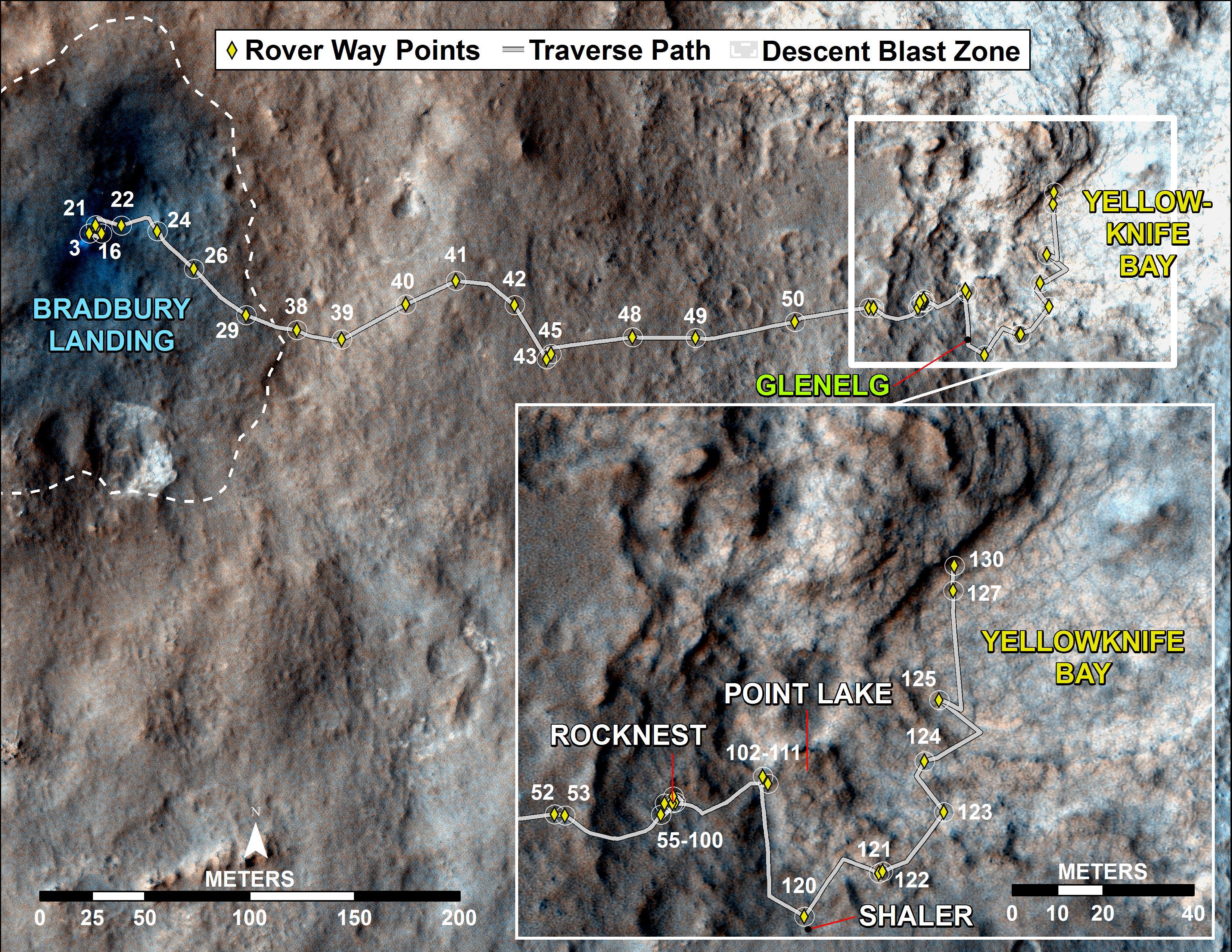
2012-09-19 |
Mars
|
Mars Reconnaissance Orbiter (MRO)
Mars Science Laboratory (MSL)
|
HiRISE
|
3300x2550x3 |
|
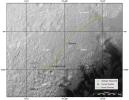
-
PIA16153:
-
Curiosity Traverse Map Through Sol 43
Full Resolution:
TIFF
(25.26 MB)
JPEG
(1.57 MB)
|
|
|
2012-09-27 |
Mars
|
Mars Reconnaissance Orbiter (MRO)
Mars Science Laboratory (MSL)
|
HiRISE
|
932x720x3 |
|
-
PIA16157:
-
Curiosity's Roadside Discoveries
Full Resolution:
TIFF
(2.014 MB)
JPEG
(132.4 kB)
|
|
|
2012-09-27 |
Mars
|
Mars Reconnaissance Orbiter (MRO)
Mars Science Laboratory (MSL)
|
HiRISE
|
3339x2580x3 |

|
-
PIA16158:
-
Where Water Flowed Downslope
Full Resolution:
TIFF
(25.85 MB)
JPEG
(1.87 MB)
|
|
|
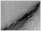
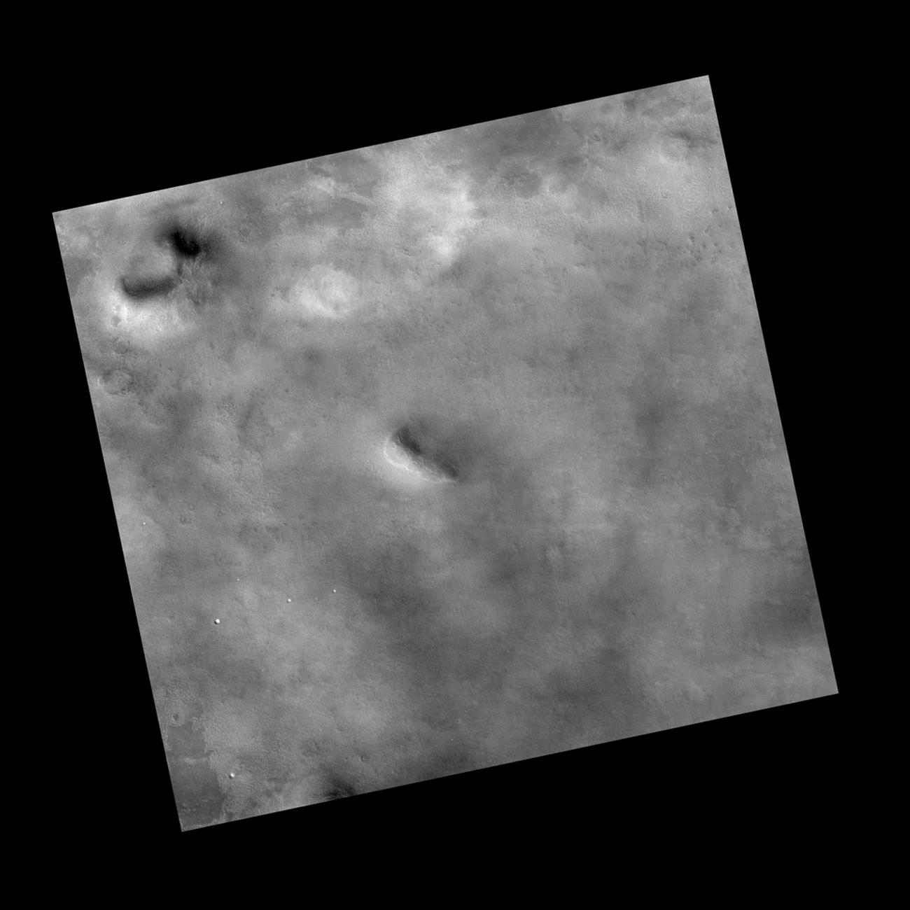
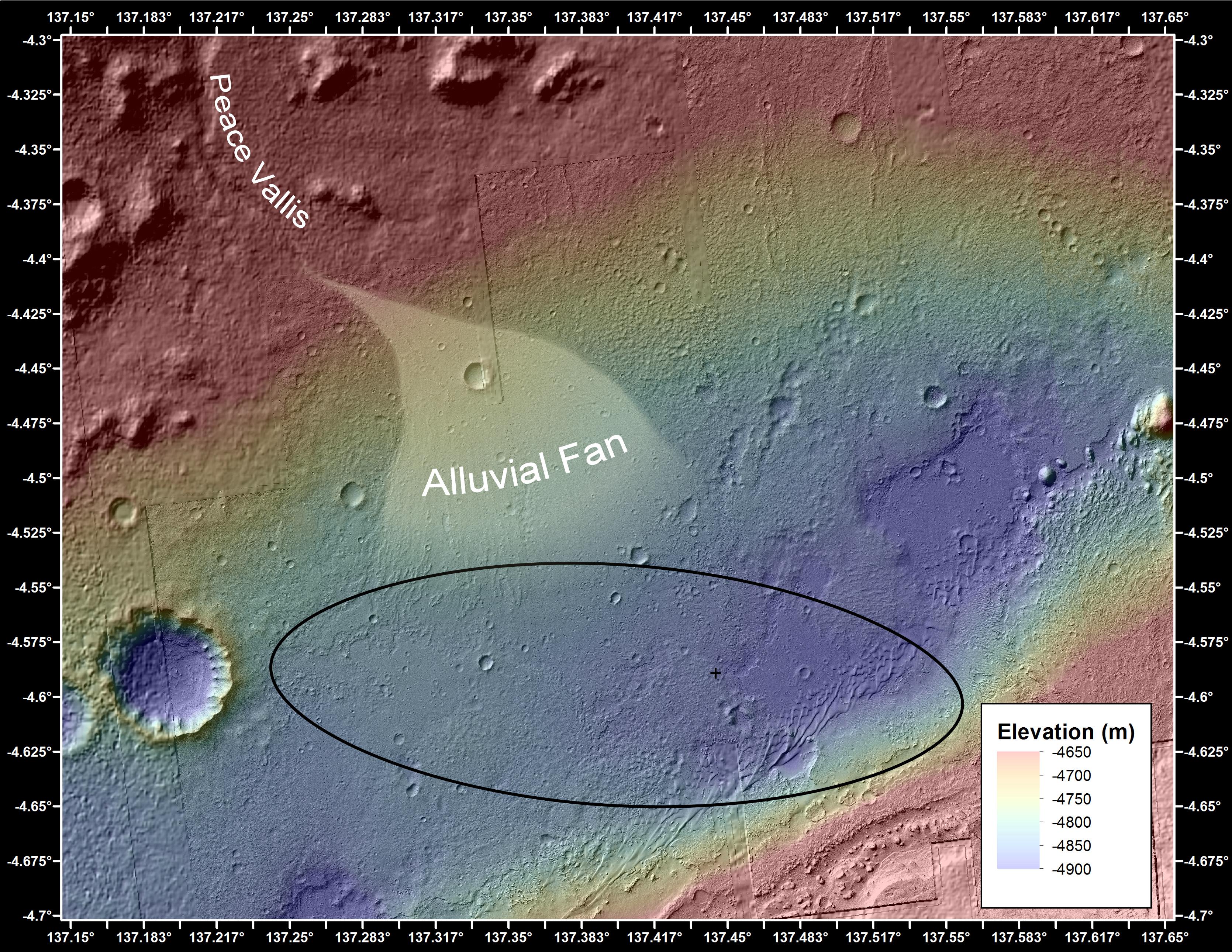
2012-10-10 |
Mars
|
Mars Reconnaissance Orbiter (MRO)
Mars Science Laboratory (MSL)
|
HiRISE
|
398x408x3 |
|
-
PIA16208:
-
Curiosity at Bradbury Landing Site in 3-D
Full Resolution:
TIFF
(487.5 kB)
JPEG
(17.84 kB)
|
|
|
2012-10-10 |
Mars
|
Mars Reconnaissance Orbiter (MRO)
Mars Science Laboratory (MSL)
|
HiRISE
|
950x795x3 |
|
-
PIA16209:
-
Parachute and Back Shell in 3-D
Full Resolution:
TIFF
(2.267 MB)
JPEG
(87.85 kB)
|
|
|
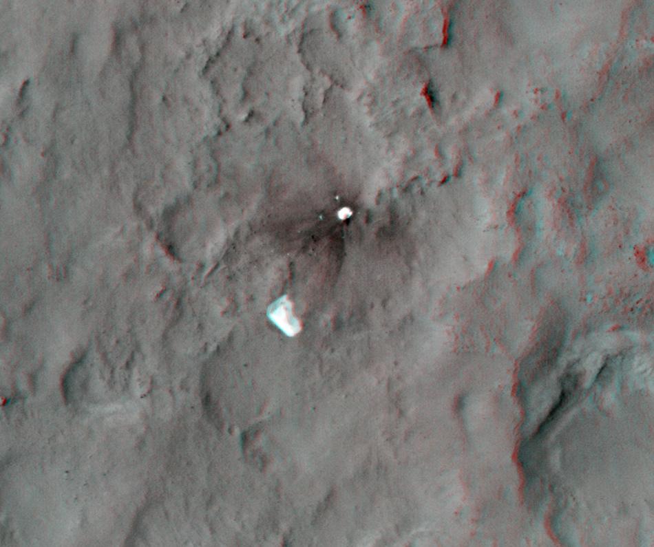
2012-10-10 |
Mars
|
Mars Reconnaissance Orbiter (MRO)
Mars Science Laboratory (MSL)
|
HiRISE
|
2414x1387x3 |
|
-
PIA16210:
-
'Glenelg' in 3-D
Full Resolution:
TIFF
(10.05 MB)
JPEG
(554.1 kB)
|
|
|
2012-12-03 |
Mars
|
Mars Reconnaissance Orbiter (MRO)
Mars Science Laboratory (MSL)
|
HiRISE
|
3300x2550x3 |
|
-
PIA16577:
-
Curiosity Rover's Traverse, August through November 2012
Full Resolution:
TIFF
(25.26 MB)
JPEG
(1.893 MB)
|
|
|
2012-12-05 |
Mars
|
Mars Reconnaissance Orbiter (MRO)
Mars Science Laboratory (MSL)
|
CTX
HiRISE
|
4985x2619x3 |
|
-
PIA16456:
-
Impact Scars from MSL Cruise Stage and Two Balance Weights
Full Resolution:
TIFF
(39.19 MB)
JPEG
(1.692 MB)
|
|
|
2012-12-11 |
Mars
|
Mars Reconnaissance Orbiter (MRO)
Mars Science Laboratory (MSL)
|
HiRISE
|
3300x2550x3 |
|
-
PIA16459:
-
Curiosity Traverse Map, Sol 123
Full Resolution:
TIFF
(25.26 MB)
JPEG
(1.748 MB)
|
|
|
2012-12-18 |
Mars
|
Mars Reconnaissance Orbiter (MRO)
Mars Science Laboratory (MSL)
|
HiRISE
|
3300x2550x3 |

|
-
PIA16554:
-
Curiosity Traverse Map, Sol 130
Full Resolution:
TIFF
(25.26 MB)
JPEG
(1.761 MB)
|
|
|
2013-04-03 |
Mars
|
Mars Reconnaissance Orbiter (MRO)
Mars Science Laboratory (MSL)
|
HiRISE
|
369x390x1 |
|
-
PIA16813:
-
MSL's Parachute Flapping in the Wind
Full Resolution:
TIFF
(144.3 kB)
JPEG
(15.5 kB)
|
|
|
2013-07-24 |
Mars
|
Mars Reconnaissance Orbiter (MRO)
Mars Science Laboratory (MSL)
|
HiRISE
|
2389x1598x3 |
|
-
PIA17080:
-
View From Mars Orbiter Showing Curiosity Rover at 'Shaler'
Full Resolution:
TIFF
(11.46 MB)
JPEG
(879.4 kB)
|
|
|
2013-08-02 |
Mars
|
Mars Reconnaissance Orbiter (MRO)
Mars Science Laboratory (MSL)
|
HiRISE
|
3300x2550x3 |

|
-
PIA17085:
-
Full Curiosity Traverse Passes One-Mile Mark
Full Resolution:
TIFF
(25.26 MB)
JPEG
(2.249 MB)
|
|
|
2013-08-27 |
Mars
|
Mars Reconnaissance Orbiter (MRO)
Mars Science Laboratory (MSL)
|
HiRISE
|
3300x2550x3 |
|
-
PIA17355:
-
Curiosity's Progress on Route from 'Glenelg' to Mount Sharp
Full Resolution:
TIFF
(25.26 MB)
JPEG
(1.493 MB)
|
|
|
2013-12-09 |
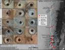
Mars
|
Mars Reconnaissance Orbiter (MRO)
Mars Science Laboratory (MSL)
|
HiRISE
|
960x720x3 |
|
-
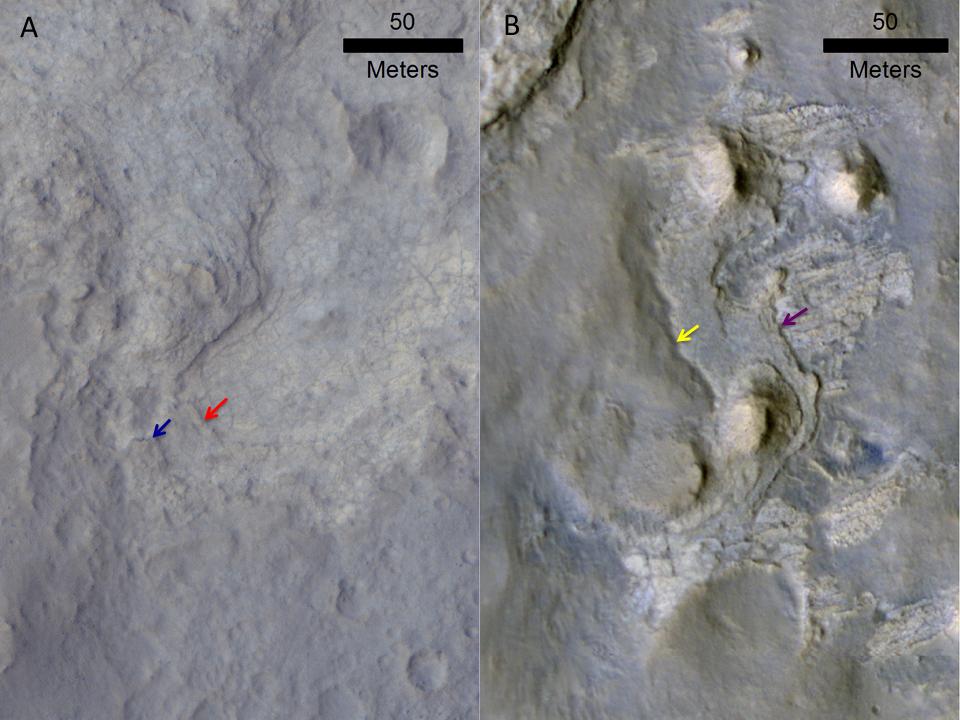
PIA17597:
-
Erosion Patterns May Guide Mars Rover to Rocks Recently Exposed
Full Resolution:
TIFF
(2.075 MB)
JPEG
(87.76 kB)
|
|
|
2013-12-09 |
Mars
|
Mars Reconnaissance Orbiter (MRO)
Mars Science Laboratory (MSL)
|
CTX
|
3300x2550x3 |
|
-
PIA17596:
-
Possible Extent of Ancient Lake in Gale Crater, Mars
Full Resolution:
TIFF
(25.26 MB)
JPEG
(1.34 MB)
|
|
|
2014-01-29 |
Mars
|
Mars Reconnaissance Orbiter (MRO)
Mars Science Laboratory (MSL)
|
HiRISE
|
3300x2550x3 |
|
-
PIA17765:
-
Traverse Map for Mars Rover Curiosity as of Jan. 26, 2014
Full Resolution:
TIFF
(25.26 MB)
JPEG
(1.211 MB)
|
|
|
2014-04-16 |
Mars
|
Mars Reconnaissance Orbiter (MRO)
Mars Science Laboratory (MSL)
|
HiRISE
|
1322x1482x3 |
|
-
PIA18081:
-
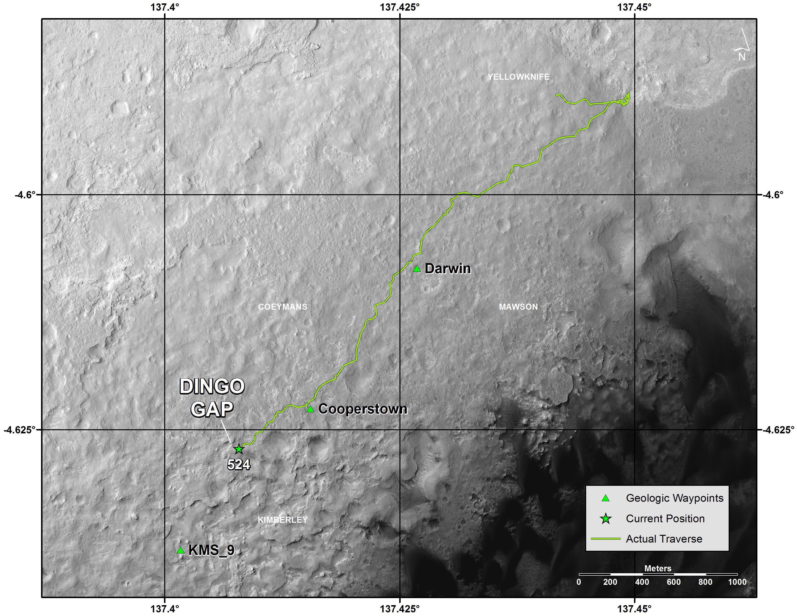
Curiosity and Rover Tracks at 'the Kimberley,' April 2014
Full Resolution:
TIFF
(5.88 MB)
JPEG
(347.6 kB)
|
|
|
2014-04-16 |
Mars
|
Mars Reconnaissance Orbiter (MRO)
Mars Science Laboratory (MSL)
|
HiRISE
|
3287x3497x3 |
|
-
PIA18082:
-
Stereo View of Curiosity and Rover Tracks at 'the Kimberley,' April 2014
Full Resolution:
TIFF
(34.5 MB)
JPEG
(791.9 kB)
|
|
|
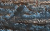
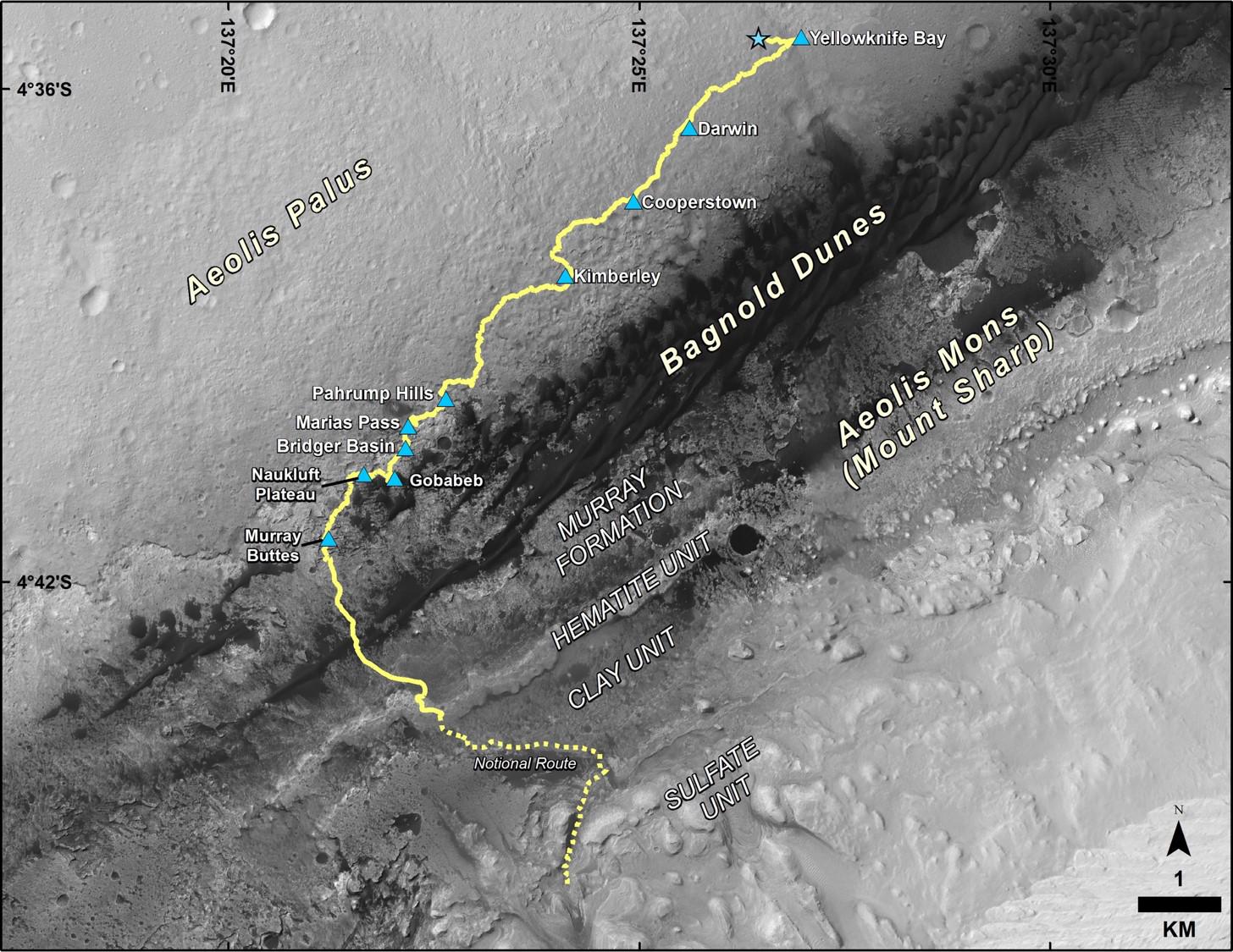
2014-09-11 |
Mars
|
Mars Reconnaissance Orbiter (MRO)
Mars Science Laboratory (MSL)
|
HiRISE
|
4173x3008x3 |
|
-
PIA18781:
-
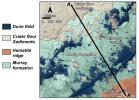
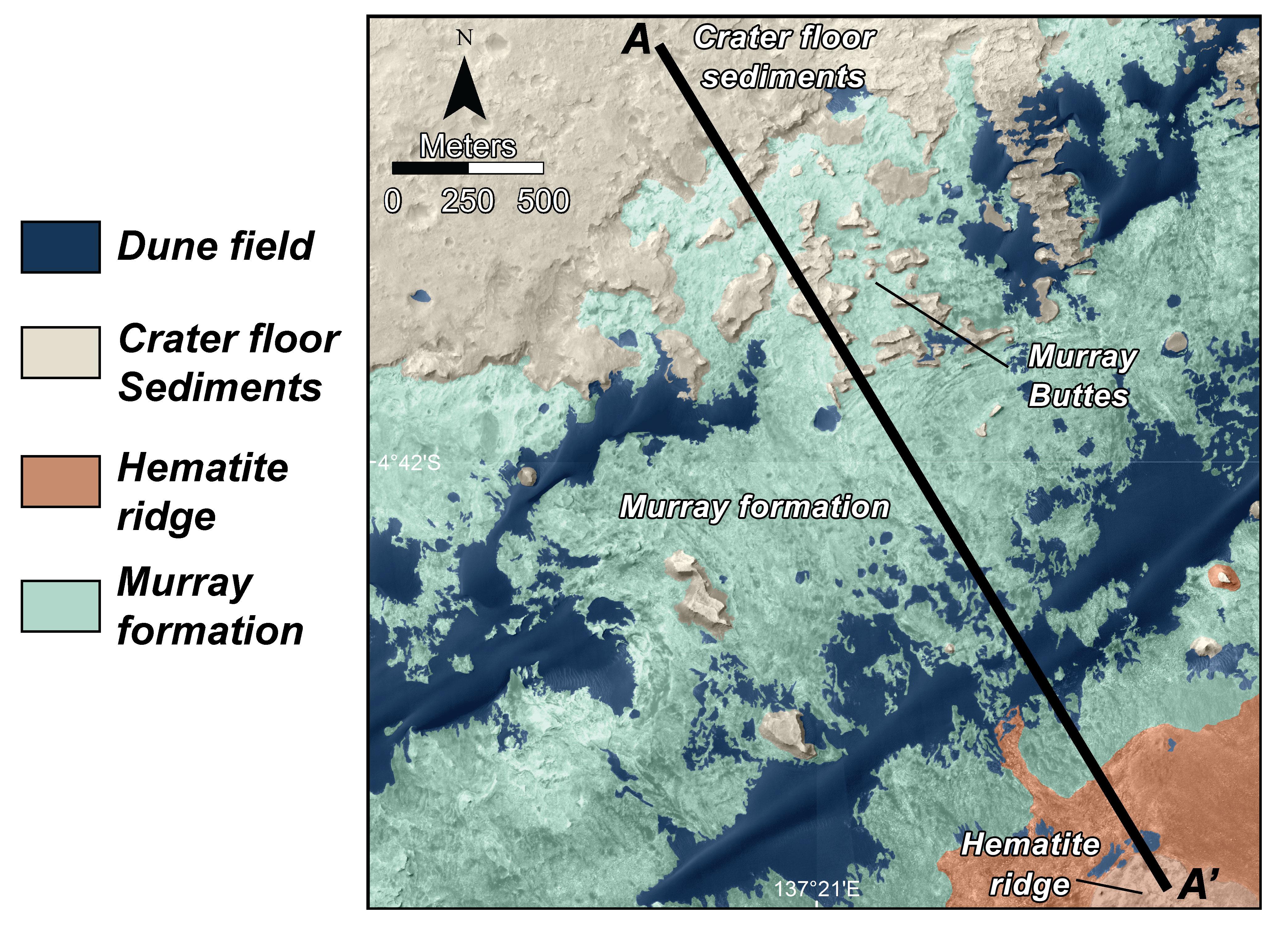
Map of Lower Mount Sharp
Full Resolution:
TIFF
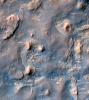
(37.68 MB)
JPEG
(1.64 MB)
|
|
|
2014-09-11 |
Mars
|
Mars Reconnaissance Orbiter (MRO)
Mars Science Laboratory (MSL)
|
HiRISE
|
1927x1542x3 |
|
-
PIA18783:
-
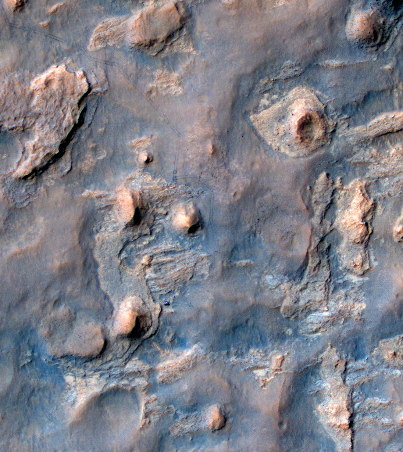
'Murray Buttes' Mesa
Full Resolution:
TIFF
(8.918 MB)
JPEG
(471.3 kB)
|
|
|
2014-09-11 |
Mars
|
Mars Reconnaissance Orbiter (MRO)
Mars Science Laboratory (MSL)
|
HiRISE
|
1927x1542x3 |

|
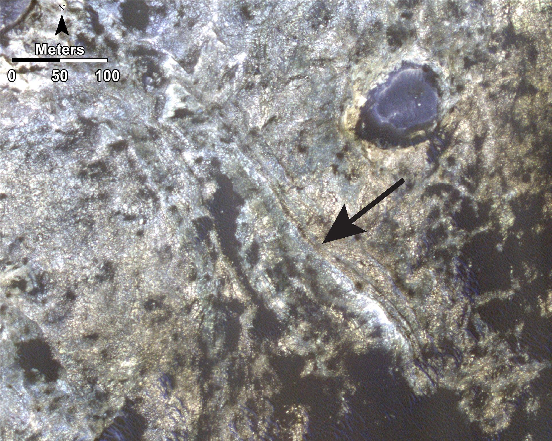
-
PIA18784:
-
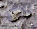
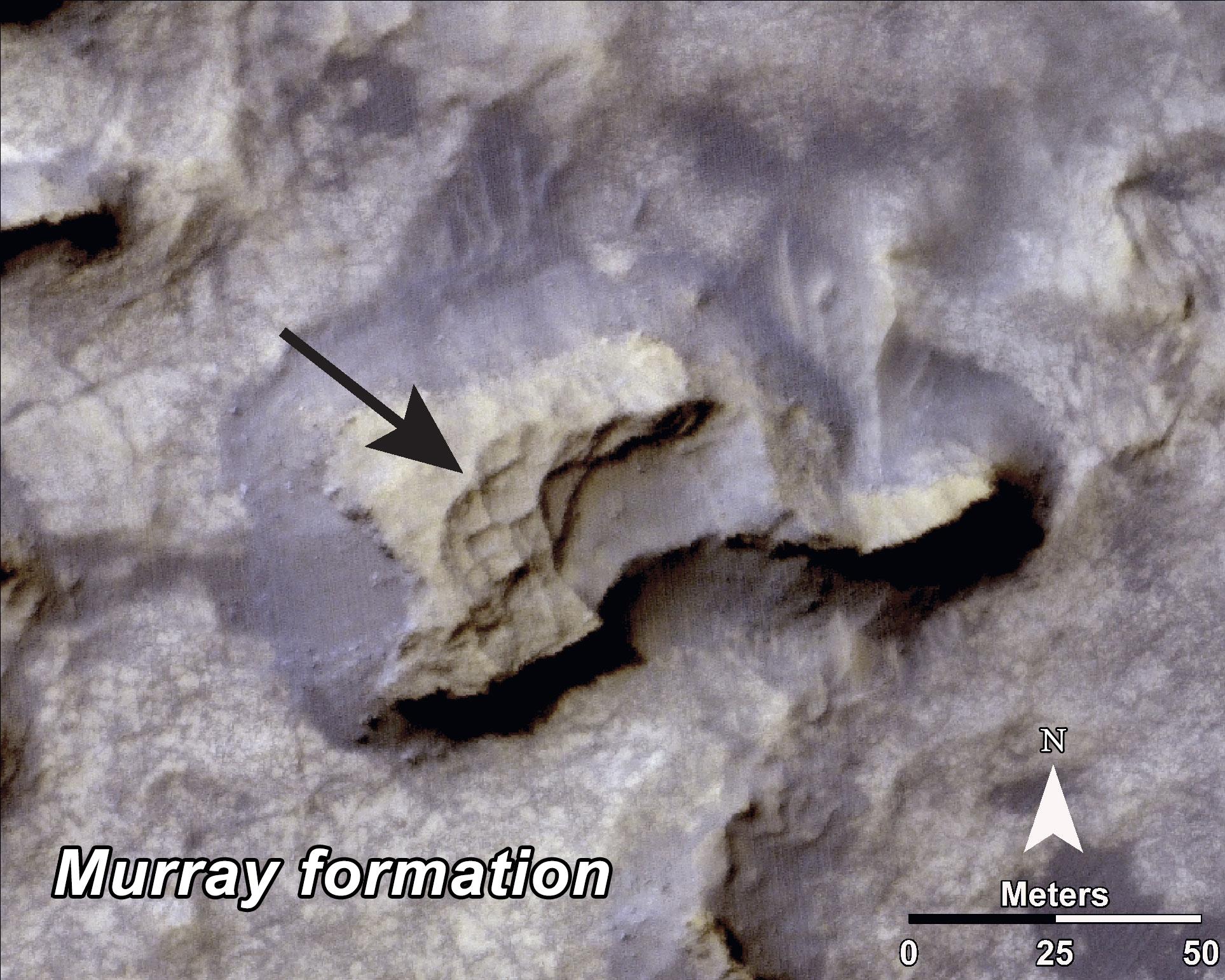
Bands on the 'Murray Formation'
Full Resolution:
TIFF
(8.918 MB)
JPEG
(563 kB)
|
|
|
2014-09-11 |
Mars
|
Mars Reconnaissance Orbiter (MRO)
Mars Science Laboratory (MSL)
|
HiRISE
|
3000x2400x3 |
|
-
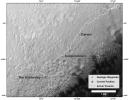
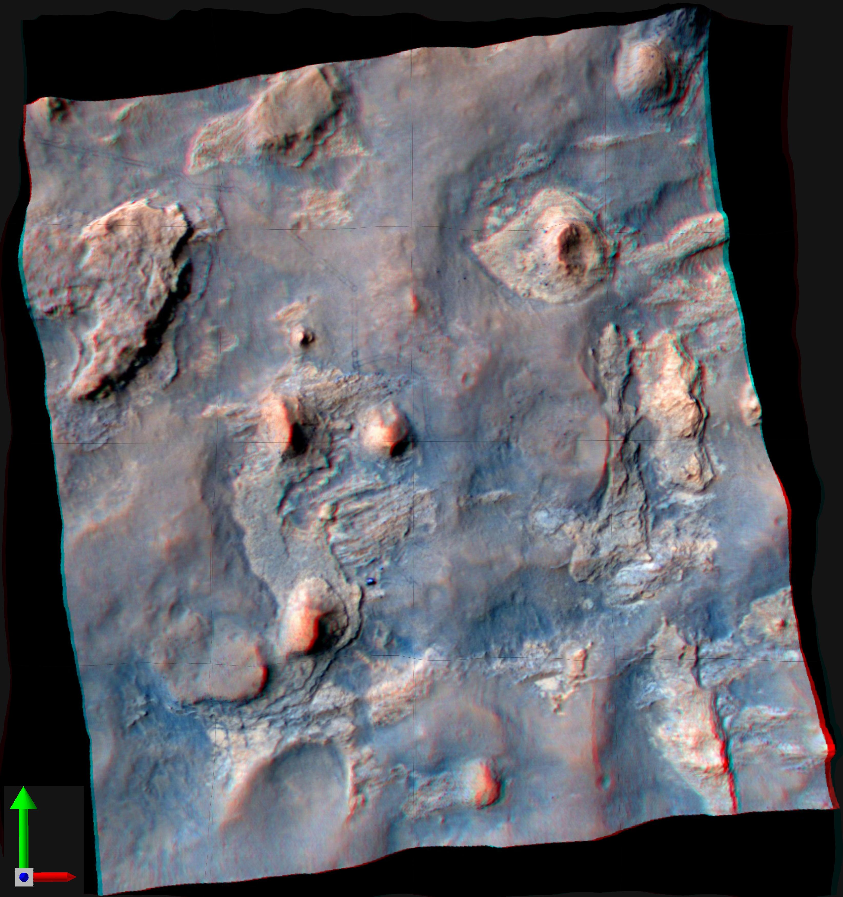
PIA18785:
-
Geological Transition
Full Resolution:
TIFF
(21.61 MB)
JPEG
(2.032 MB)
|
|
|
2015-03-27 |
Mars
|
Mars Reconnaissance Orbiter (MRO)
Mars Science Laboratory (MSL)
|
HiRISE
|
2072x1225x1 |

|
-
PIA19159:
-
Changes in Scars From 2012 Mars Landing
Full Resolution:
TIFF
(2.542 MB)
JPEG
(291.2 kB)
|
|
|
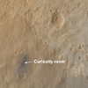
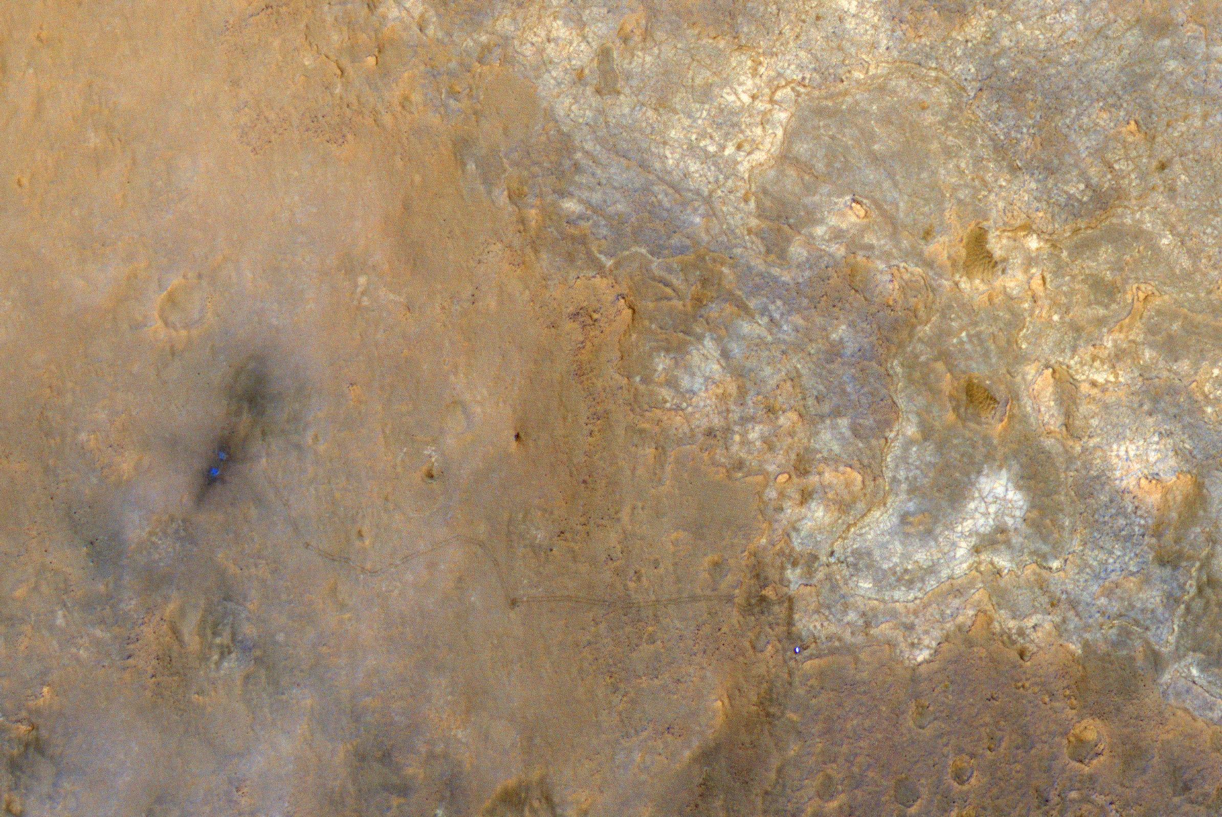
2015-04-22 |
Mars
|
Mars Reconnaissance Orbiter (MRO)
Mars Science Laboratory (MSL)
|
HiRISE
|
2286x1510x3 |
|
-
PIA19392:
-
Mars Orbiter Sees Curiosity Rover in 'Artist's Drive'
Full Resolution:
TIFF
(10.36 MB)
JPEG
(527.1 kB)
|
|
|
2016-12-13 |
Mars
|
Mars Reconnaissance Orbiter (MRO)
Mars Science Laboratory (MSL)
|
HiRISE
|
1456x1125x3 |
|
-
PIA21144:
-
Late 2016 Map of NASA's Curiosity Mars Rover Mission
Full Resolution:
TIFF
(2.946 MB)
JPEG
(288 kB)
|
|
|
2016-12-13 |
Mars
|
Mars Reconnaissance Orbiter (MRO)
Mars Science Laboratory (MSL)
|
ChemCam
HiRISE
|
2809x2025x3 |
|
-
PIA21150:
-
Where's Boron? Mars Rover Detects It
Full Resolution:
TIFF
(7.738 MB)
JPEG
(838.4 kB)
|
|
|
2016-12-13 |
Mars
|
Mars Reconnaissance Orbiter (MRO)
Mars Science Laboratory (MSL)
|
HiRISE
MAHLI
|
3300x2550x3 |
|
-
PIA21254:
-
Curiosity's Rock or Soil Sampling Sites on Mars, Through November 2016
Full Resolution:
TIFF
(21.14 MB)
JPEG
(2.213 MB)
|
|
|
2017-06-20 |
Mars
|
Mars Reconnaissance Orbiter (MRO)
Mars Science Laboratory (MSL)
|
HiRISE
|
1403x789x3 |

|
-
PIA21710:
-
Curiosity Rover on Mount Sharp, Seen from Mars Orbit
Full Resolution:
TIFF
(3.322 MB)
JPEG
(215.9 kB)
|
|
|
2019-11-12 |
Mars
|
Mars Reconnaissance Orbiter (MRO)
Mars Express (MEX)
Mars Global Surveyor (MGS)
|
CRISM
CTX
MOLA
High Resolution Stereo Camera
|
3663x2535x3 |
|
-
PIA23511:
-
Jezero Crater's Ancient Lakeshore
Full Resolution:
TIFF
(16.31 MB)
JPEG
(2.37 MB)
|
|
|
2018-04-02 |
Mars
|
Mars Reconnaissance Orbiter (MRO)
|
HiRISE
|
2880x1800x3 |
|
-
PIA22346:
-
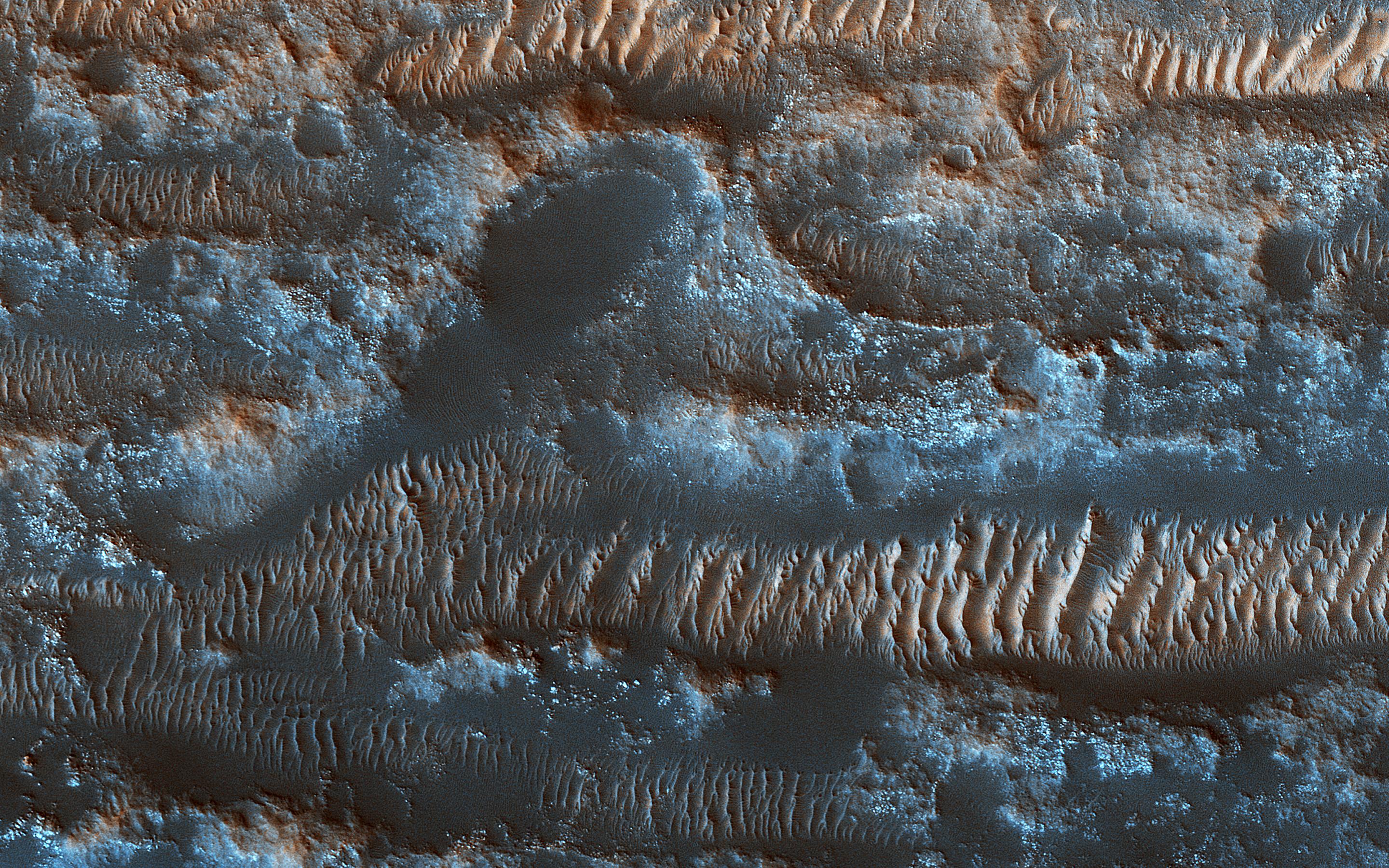
The Moving Sands of Lobo Vallis
Full Resolution:
TIFF
(15.56 MB)
JPEG
(1.261 MB)
|
|
|
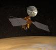
2002-12-21 |
|
Mars Reconnaissance Orbiter (MRO)
|
|
2000x2500x3 |
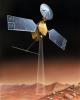
|
-
PIA04241:
-
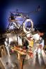
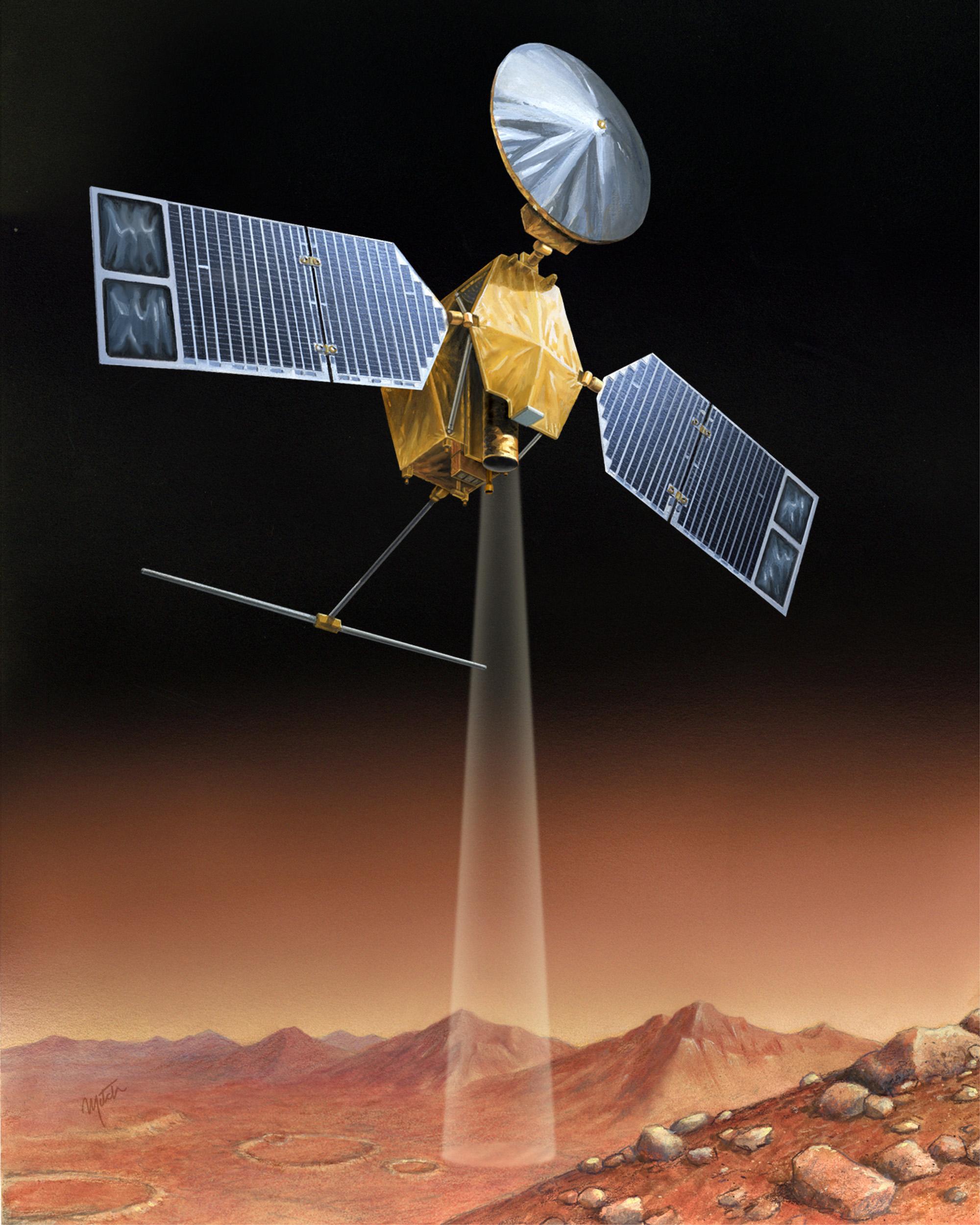
Artist's concept of Mars Reconnaissance Orbiter
Full Resolution:
TIFF
(12.56 MB)
JPEG
(504.6 kB)
|
|
|
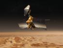
2003-09-25 |
Mars
|
Mars Reconnaissance Orbiter (MRO)
|
|
3201x2921x3 |
|
-
PIA04758:
-
Artist's Concept of Mars Reconnaissance Orbiter
Full Resolution:
TIFF
(15.99 MB)
JPEG
(856.5 kB)
|
|
|
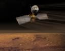
2003-12-10 |
|
Mars Reconnaissance Orbiter (MRO)
|
|
2825x2181x3 |
|
-
PIA04916:
-
Mars Reconnaissance Orbiter over Nilosyrtis (Artist's Concept)
Full Resolution:
TIFF
(9.027 MB)
JPEG
(522.2 kB)
|
|
|
2003-12-10 |
|
Mars Reconnaissance Orbiter (MRO)
|
|
7000x5444x3 |
|
-
PIA04917:
-
Mars Reconnaissance Orbiter Aerobraking (Artist's Concept)
Full Resolution:
TIFF
(56.56 MB)
JPEG
(2.327 MB)
|
|
|
2003-12-10 |
|
Mars Reconnaissance Orbiter (MRO)
|
|
6125x4850x3 |
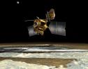
|
-
PIA04918:
-
Mars Reconnaissance Orbiter over Pole (Artist's Concept)
Full Resolution:
TIFF
(38.73 MB)
JPEG
(2.075 MB)
|
|
|
2004-03-03 |
|
Mars Reconnaissance Orbiter (MRO)
|
|
692x479x3 |

|
-
PIA05490:
-
Bird's Eye View of Mars
Full Resolution:
TIFF
(662.1 kB)
JPEG
(36.35 kB)
|
|
|
2004-08-09 |
|
Mars Reconnaissance Orbiter (MRO)
|
|
1992x3008x3 |
|
-
PIA06756:
-
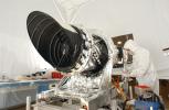
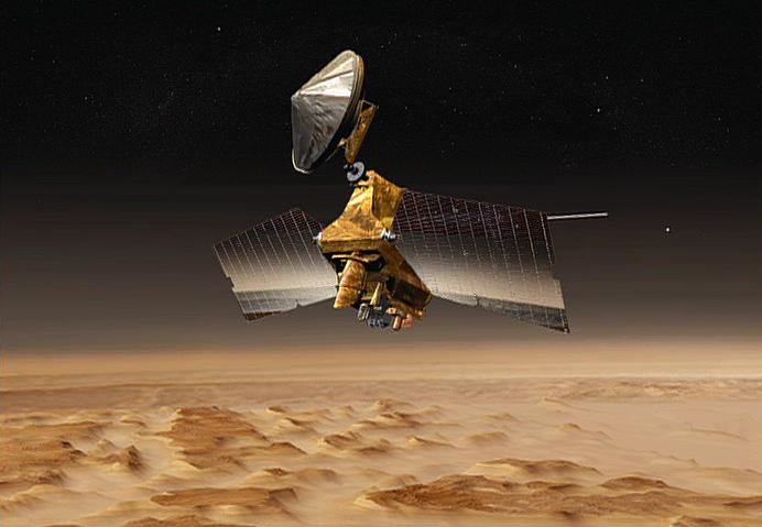
Mars Reconnaissance Orbiter Taking Shape
Full Resolution:
TIFF
(17.7 MB)
JPEG
(672.4 kB)
|
|
|
2004-12-21 |
|
Mars Reconnaissance Orbiter (MRO)
|
HiRISE
|
3008x1960x3 |
|
-
PIA07087:
-
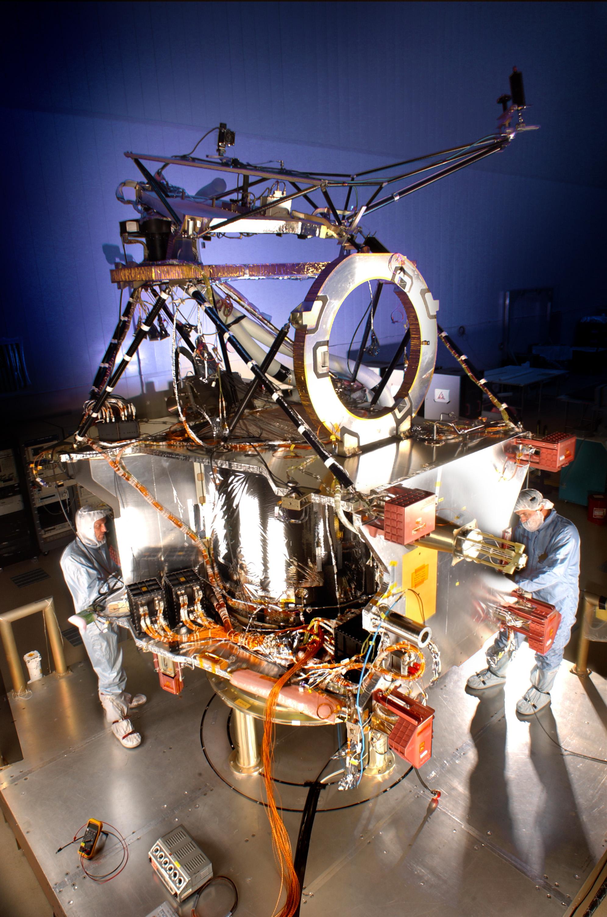
Telescopic Camera for Mars Reconnaissance Orbiter, Front End
Full Resolution:
TIFF
(15.22 MB)
JPEG
(527.9 kB)
|


