Click on an image for detailed information
Click on a column heading to sort in ascending or descending order

My
List |
Addition Date
|
Target
|
Mission
|
Instrument
|
Size
|

|
2010-12-01 |
Mars
|
Mars Reconnaissance Orbiter (MRO)
|
HiRISE
|
2048x3086x1 |

|
-
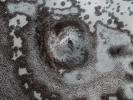
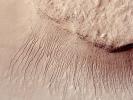
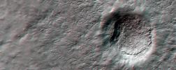
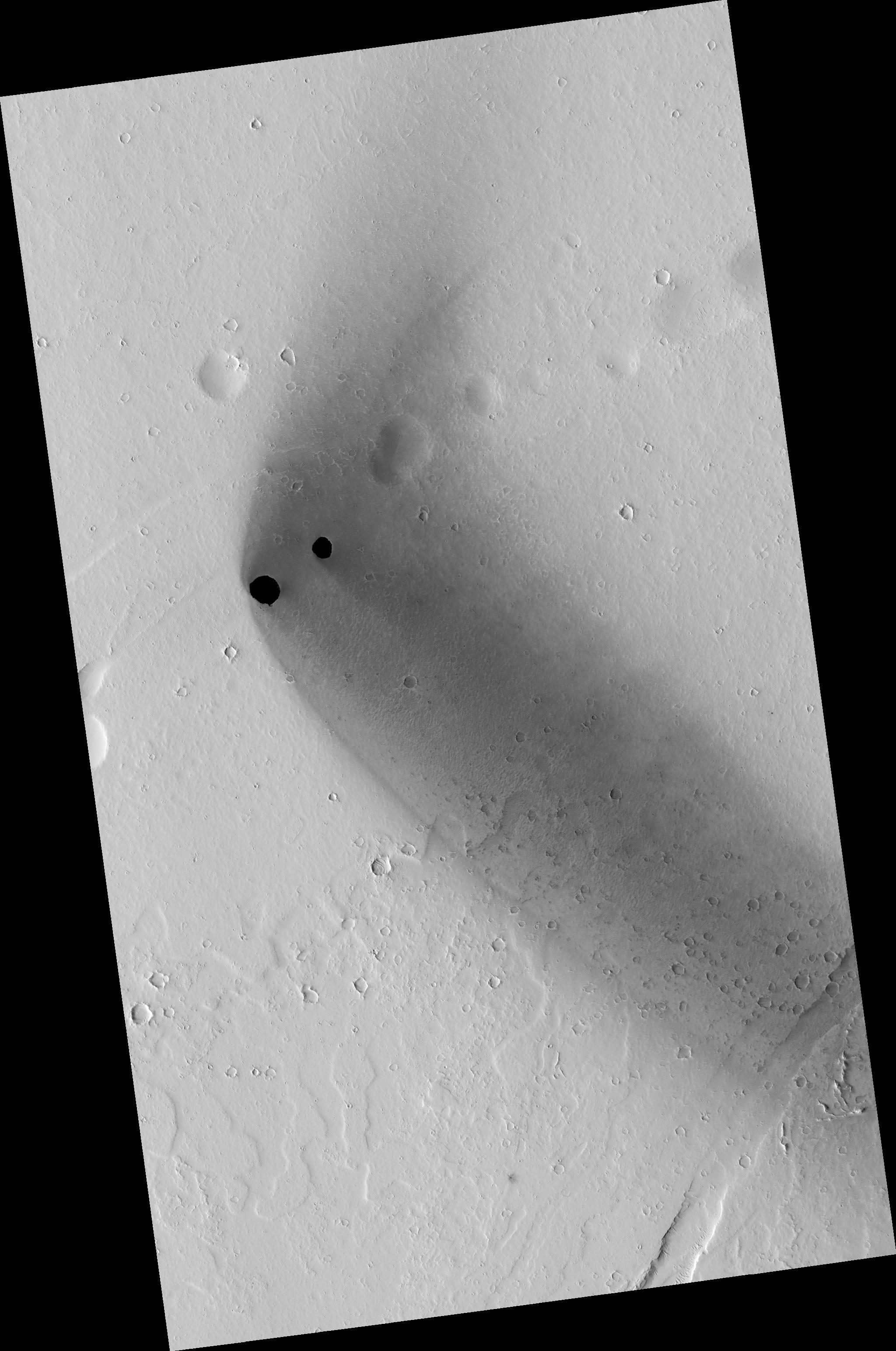
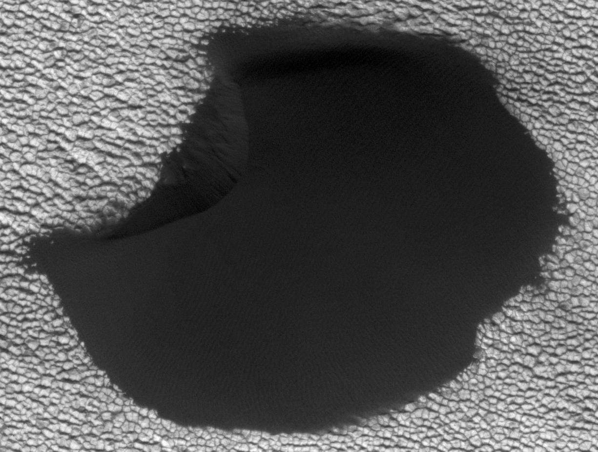
PIA13650:
-
Dark Rimless Pits in the Tharsis Region
Full Resolution:
TIFF
(6.327 MB)
JPEG
(508.2 kB)
|
|
|
2010-12-01 |
Mars
|
Mars Reconnaissance Orbiter (MRO)
|
HiRISE
|
2048x3737x1 |

|
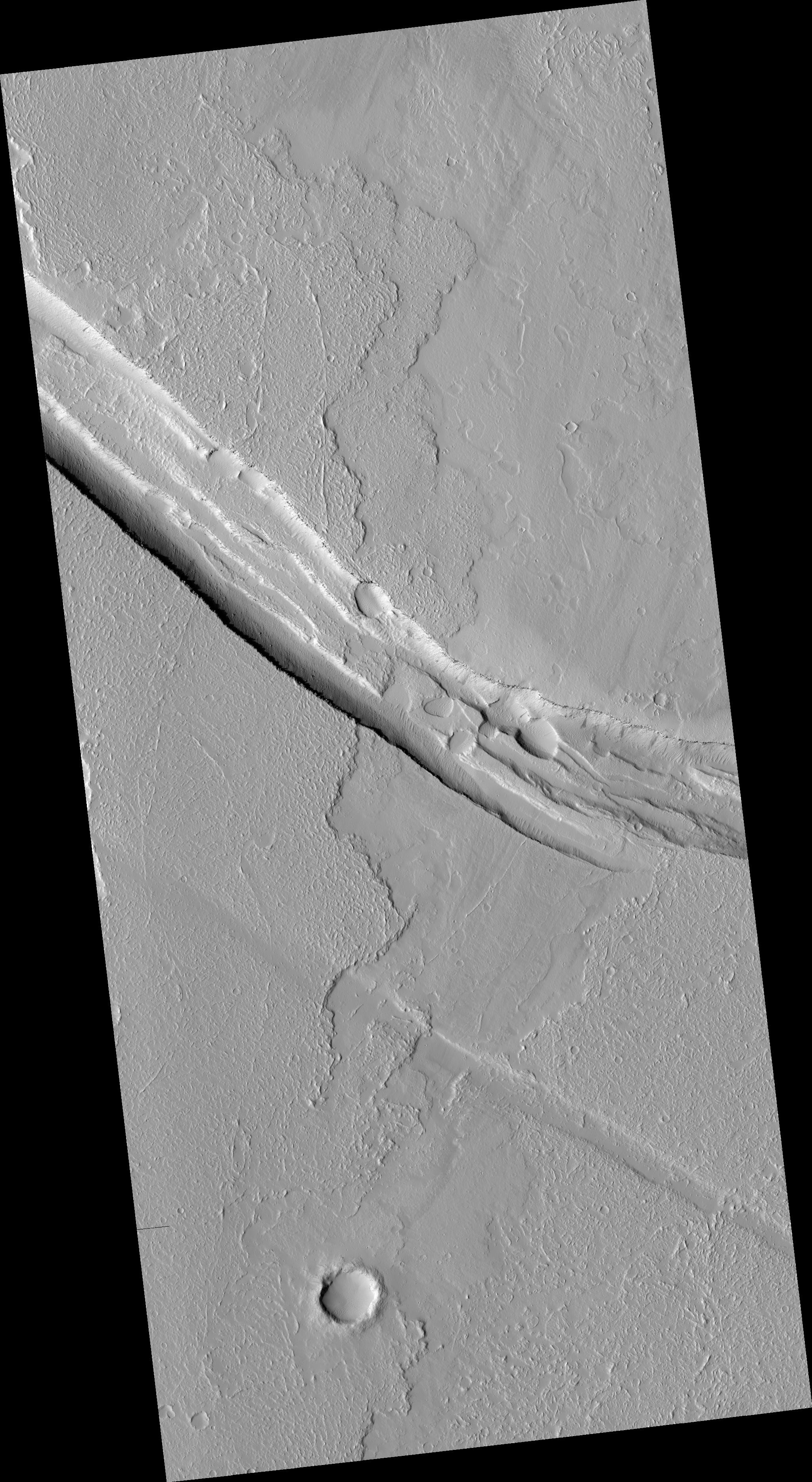
-
PIA13651:
-
Graben Cutting Lava Flow in Tharsis
Full Resolution:
TIFF
(7.661 MB)
JPEG
(938.6 kB)
|
|
|
2010-12-01 |
Mars
|
Mars Reconnaissance Orbiter (MRO)
|
HiRISE
|
2048x3145x1 |

|
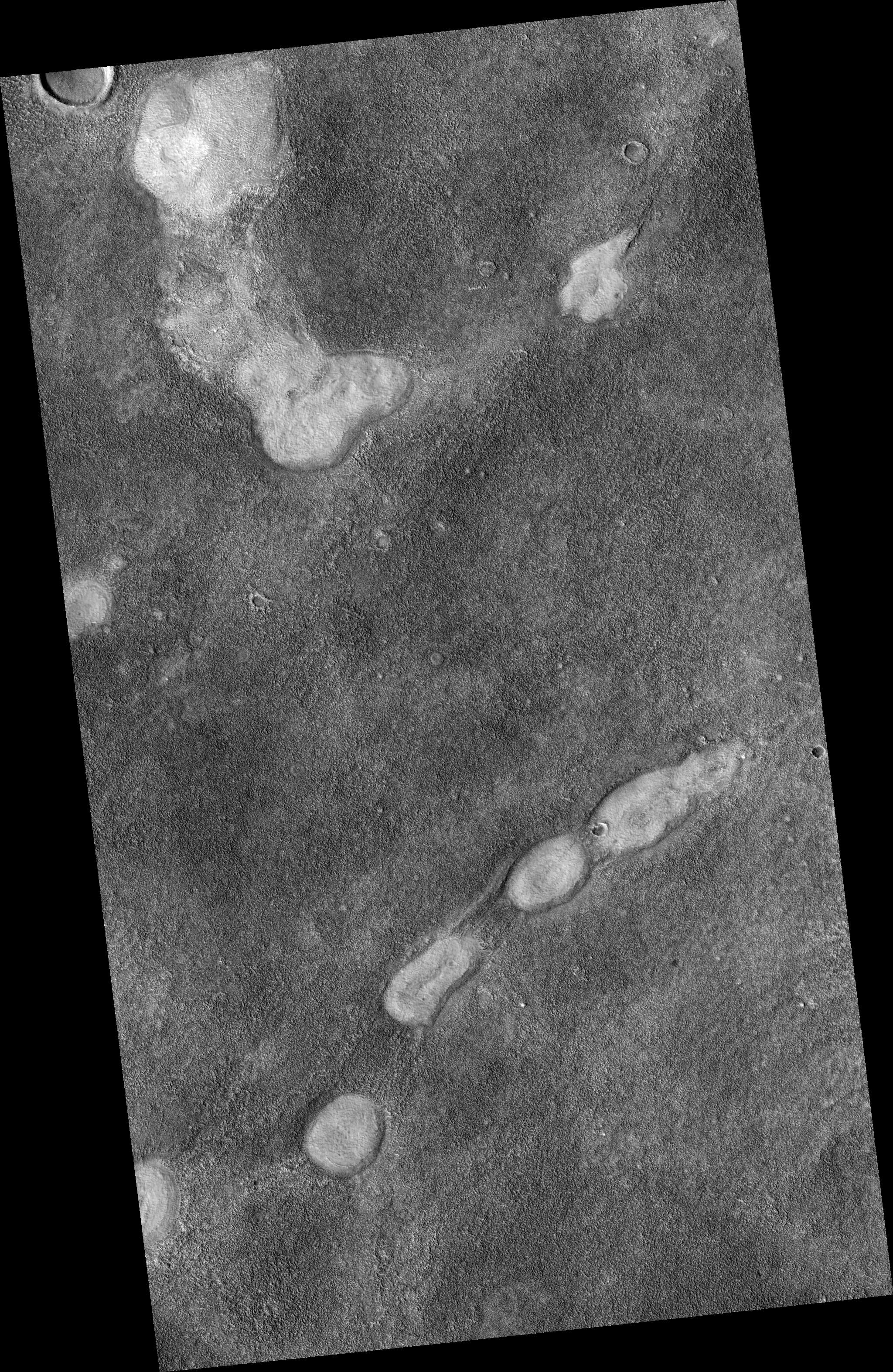
-
PIA13652:
-
Proposed Future Mars Landing Site: Acidalia Planitia Mud Volcanoes
Full Resolution:
TIFF
(6.447 MB)
JPEG
(1.617 MB)
|
|
|
2010-12-16 |
Mars
|
Mars Reconnaissance Orbiter (MRO)
|
CRISM
|
2736x2250x3 |
|
-
PIA13704:
-
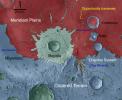
Geologic Setting of Opportunity Traverse and Meridiani Planum
Full Resolution:
TIFF
(18.47 MB)
JPEG
(486.1 kB)
|
|
|
2010-12-16 |
Mars
|
Mars Reconnaissance Orbiter (MRO)
|
CTX
|
4664x7746x3 |

|
-
PIA13705:
-
Opportunity's Path on Mars Through Sol 2436
Full Resolution:
TIFF
(108.4 MB)
JPEG
(5.199 MB)
|
|
|
2010-12-16 |
Mars
|
Mars Reconnaissance Orbiter (MRO)
|
HiRISE
|
8192x7051x1 |

|
-
PIA13706:
-
Orbital Observations of Crater on Mars Rover's Route
Full Resolution:
TIFF
(57.82 MB)
JPEG
(2.181 MB)
|
|
|
2010-12-16 |
Mars
|
Mars Reconnaissance Orbiter (MRO)
|
CRISM
|
4023x7854x3 |

|
-
PIA13708:
-
Geologic Map, West Rim of Endeavour Crater, Mars
Full Resolution:
TIFF
(94.79 MB)
JPEG
(4.431 MB)
|
|
|
2010-12-17 |
Mars
|
Mars Reconnaissance Orbiter (MRO)
|
HiRISE
|
2560x1920x3 |
|
-
PIA13723:
-
A Fresh, Lunar-Like Crater on Mars
Full Resolution:
TIFF
(14.76 MB)
JPEG
(855.5 kB)
|
|
|
2010-12-20 |
Mars
|
Mars Reconnaissance Orbiter (MRO)
|
HiRISE
|
2560x1920x3 |

|
-
PIA13724:
-
Nili Fossae Trough, Candidate MSL Landing Site
Full Resolution:
TIFF
(14.76 MB)
JPEG
(844 kB)
|
|
|
2011-01-05 |
Mars
|
Mars Reconnaissance Orbiter (MRO)
|
HiRISE
|
2560x1920x3 |
|
-
PIA13725:
-
Layered Bedrock in Candor Chasma
Full Resolution:
TIFF
(14.76 MB)
JPEG
(831.1 kB)
|
|
|
2011-01-12 |
Mars
|
Mars Reconnaissance Orbiter (MRO)
|
HiRISE
|
2560x1920x3 |
|
-
PIA13726:
-
Layers Exposed in Crater Near Mawrth Vallis
Full Resolution:
TIFF
(14.76 MB)
JPEG
(650.8 kB)
|
|
|
2011-01-21 |
Mars
|
Mars Reconnaissance Orbiter (MRO)
|
HiRISE
|
2560x1920x3 |
|
-
PIA13727:
-
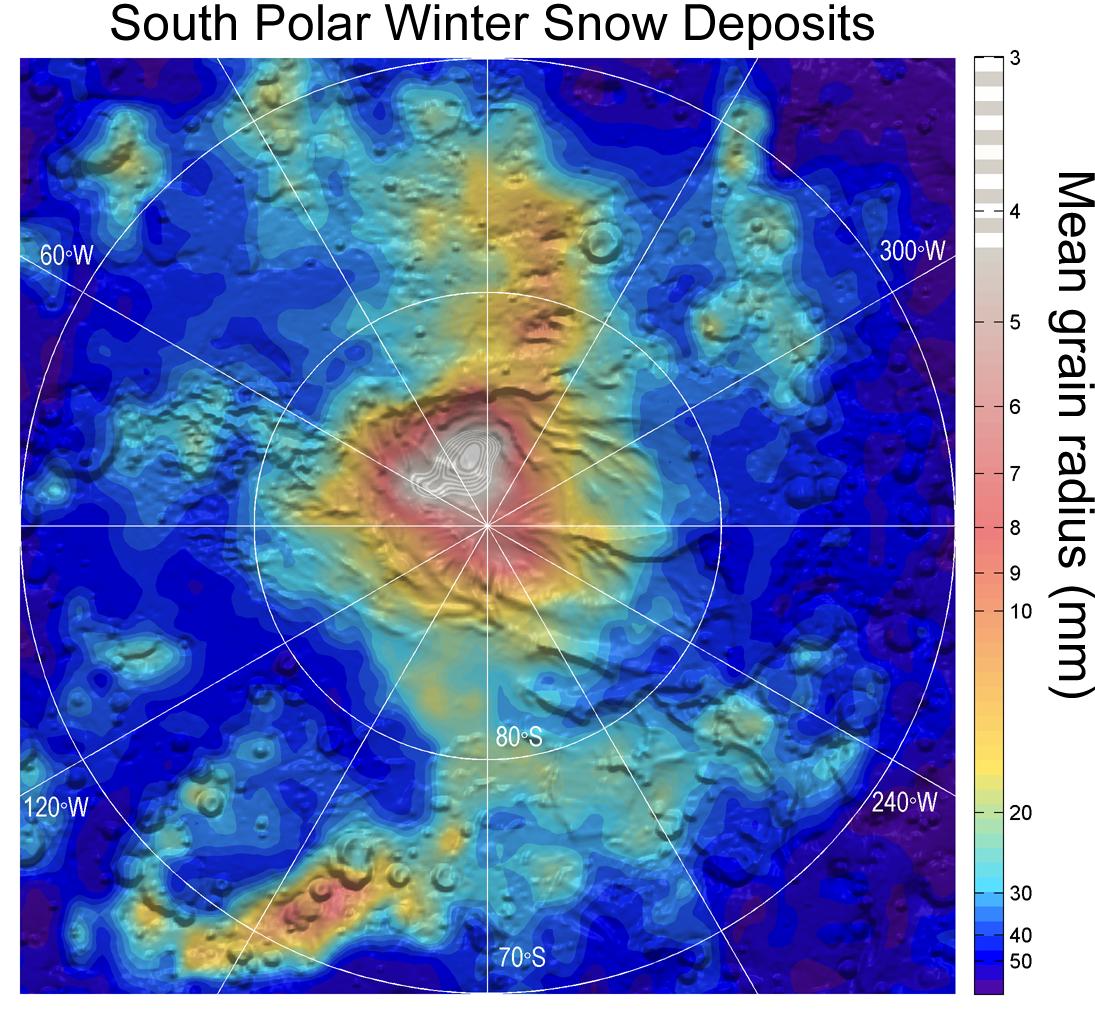
Circular Feature in South Polar Residual Cap
Full Resolution:
TIFF
(14.76 MB)
JPEG
(937.3 kB)
|
|
|
2011-02-03 |
Mars
|
Mars Reconnaissance Orbiter (MRO)
|
HiRISE
|
934x1412x3 |
|
-
PIA13797:
-
Seasonal Changes in Northern Mars Dune Field
Full Resolution:
TIFF
(3.962 MB)
JPEG
(221.3 kB)
|
|
|
2011-02-02 |
Mars
|
Mars Reconnaissance Orbiter (MRO)
|
HiRISE
|
2560x1920x3 |

|
-
PIA13728:
-
Thumbprint Texture on Dark Dunes in Rabe Crater
Full Resolution:
TIFF
(14.76 MB)
JPEG
(553.7 kB)
|
|
|
2011-02-14 |
Mars
|
Mars Reconnaissance Orbiter (MRO)
|
CTX
|
377x487x3 |
|
-
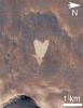
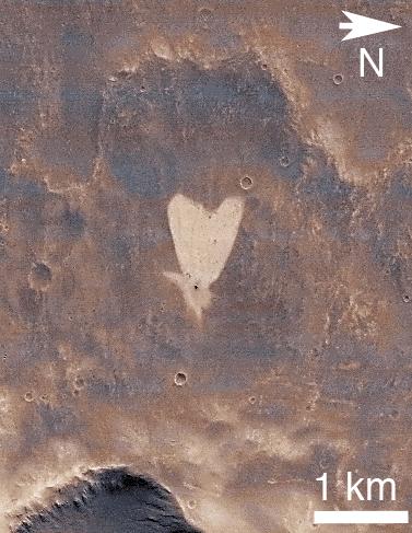
PIA13798:
-
Heart-Shaped Feature in Arabia Terra
Full Resolution:
TIFF
(185.6 kB)
JPEG
(41.39 kB)
|
|
|
2011-02-14 |
Mars
|
Mars Reconnaissance Orbiter (MRO)
|
CTX
|
420x487x3 |

|
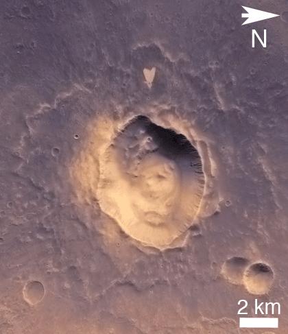
-
PIA13799:
-
Heart-Shaped Feature in Arabia Terra (Wide View)
Full Resolution:
TIFF
(206.5 kB)
JPEG
(25.93 kB)
|
|
|
2011-03-08 |
Mars
|
Mars Reconnaissance Orbiter (MRO)
|
CRISM
HiRISE
|
995x599x3 |
|
-
PIA13800:
-
Fractures in Carbonate-Bearing Rocks at Mars' Huygens Basin
Full Resolution:
TIFF
(1.791 MB)
JPEG
(139 kB)
|
|
|
2011-03-09 |
Mars
|
Mars Reconnaissance Orbiter (MRO)
|
HiRISE
|
2560x1920x3 |
|
-
PIA13802:
-
True Gullies on Mars
Full Resolution:
TIFF
(14.76 MB)
JPEG
(1.255 MB)
|
|
|
2011-04-21 |
Mars
|
Mars Reconnaissance Orbiter (MRO)
|
Shallow Subsurface Radar (SHARAD)
|
1775x380x1 |
|
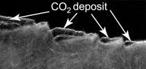
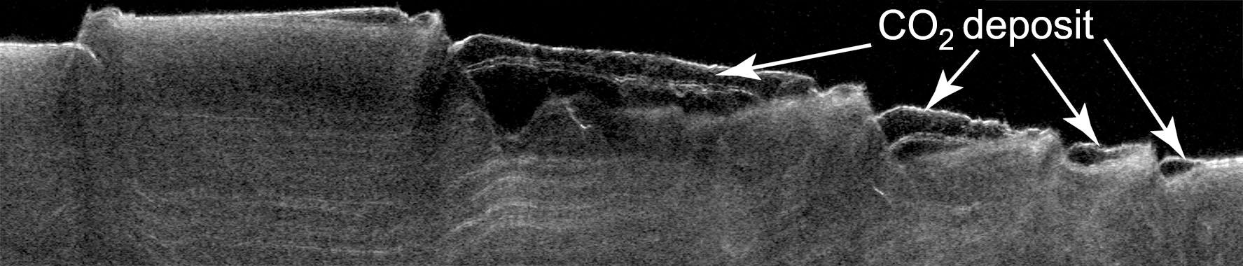
-
PIA13985:
-
Cross Section of Buried Carbon-Dioxide Ice on Mars
Full Resolution:
TIFF
(675.5 kB)
JPEG
(116.5 kB)
|
|
|
2011-04-21 |
Mars
|
Mars Reconnaissance Orbiter (MRO)
|
Shallow Subsurface Radar (SHARAD)
|
9380x8299x3 |

|
-
PIA13986:
-
Thickness Map of Buried Carbon-Dioxide Deposit
Full Resolution:
TIFF
(233.5 MB)
JPEG
(4.87 MB)
|
|
|
2011-04-21 |
Mars
|
Mars Reconnaissance Orbiter (MRO)
|
HiRISE
|
2497x2054x1 |
|
-
PIA13987:
-
Pitting from Sublimation of Underlying Dry-Ice Layer
Full Resolution:
TIFF
(5.135 MB)
JPEG
(856.6 kB)
|
|
|
2011-07-15 |
Mars
|
Mars Reconnaissance Orbiter (MRO)
|
HiRISE
|
2560x1920x3 |
|
-
PIA14459:
-
Erosion Features near the South Pole of Mars
Full Resolution:
TIFF
(14.76 MB)
JPEG
(1.003 MB)
|
|
|
2011-07-15 |
Mars
|
Mars Reconnaissance Orbiter (MRO)
|
HiRISE
|
840x333x3 |
|
-
PIA14460:
-
Erosion Features near the South Pole of Mars (Anaglyph)
Full Resolution:
TIFF
(840.3 kB)
JPEG
(78.15 kB)
|
|
|
2011-07-15 |
Mars
|
Mars Reconnaissance Orbiter (MRO)
|
HiRISE
|
2560x1920x3 |

|
-
PIA14461:
-
Faults in Claritas Fossae
Full Resolution:
TIFF
(14.76 MB)
JPEG
(655.1 kB)
|
|
|
2011-07-15 |
Mars
|
Mars Reconnaissance Orbiter (MRO)
|
HiRISE
|
2560x1920x3 |
|
-
PIA14462:
-
Small Mounds in Chryse Planitia
Full Resolution:
TIFF
(14.76 MB)
JPEG
(818.8 kB)
|
|
|
2012-03-28 |
Mars
|
Mars Reconnaissance Orbiter (MRO)
|
HiRISE
|
2560x1920x1 |

|
-
PIA14431:
-
Lava Lamp Terrain on the Floor of Hellas Basin
Full Resolution:
TIFF
(4.921 MB)
JPEG
(862.1 kB)
|
|
|
2012-03-29 |
Mars
|
Mars Reconnaissance Orbiter (MRO)
|
HiRISE
|
2560x1920x3 |
|
-
PIA14432:
-
Cratered Dune Forms
Full Resolution:
TIFF
(14.76 MB)
JPEG
(645.6 kB)
|
|
|
2012-03-30 |
Mars
|
Mars Reconnaissance Orbiter (MRO)
|
HiRISE
|
2560x1920x3 |
|
-
PIA14433:
-
Summer is on Its Way
Full Resolution:
TIFF
(14.76 MB)
JPEG
(1.028 MB)
|
|
|
2012-04-02 |
Mars
|
Mars Reconnaissance Orbiter (MRO)
|
HiRISE
|
2560x1920x3 |
|
-
PIA14434:
-
A Wild Assortment of Jumbled Rocks
Full Resolution:
TIFF
(14.76 MB)
JPEG
(1.005 MB)
|
|
|
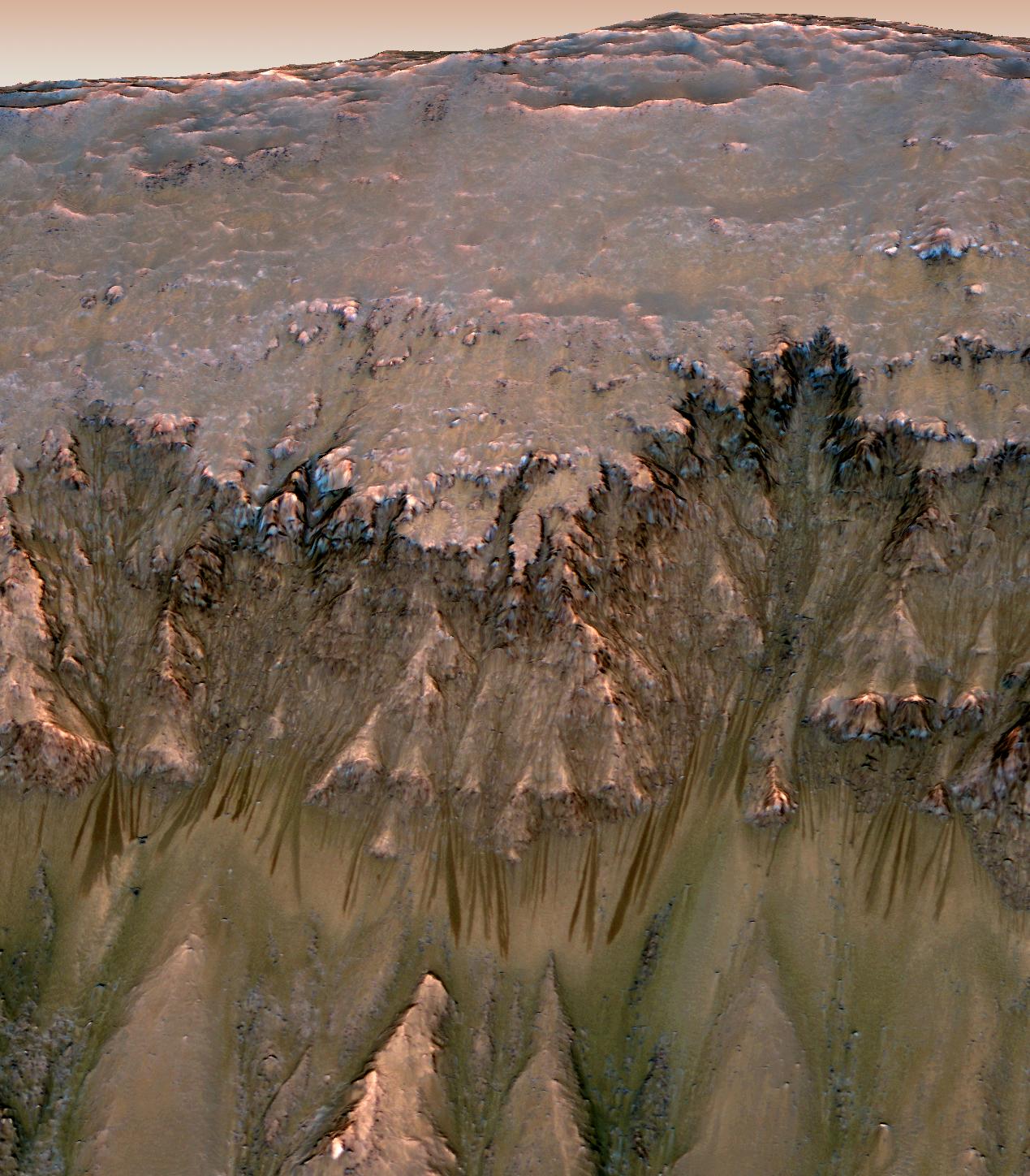
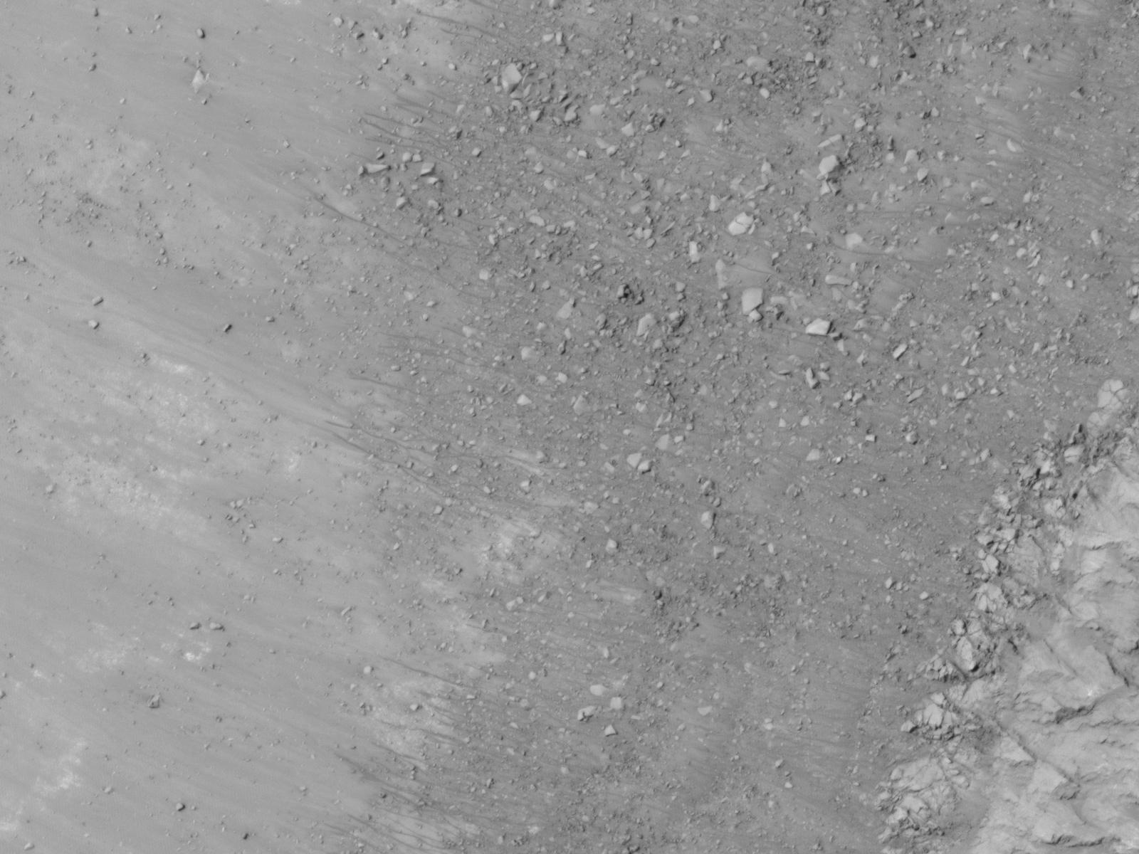
2011-08-04 |
Mars
|
Mars Reconnaissance Orbiter (MRO)
|
HiRISE
|
1839x1518x3 |
|
-
PIA14472:
-
Warm-Season Flows on Slope in Newton Crater (Six-Image Sequence)
Full Resolution:
TIFF
(2.796 MB)
JPEG
(373.5 kB)
|
|
|
2011-08-04 |
Mars
|
Mars Reconnaissance Orbiter (MRO)
|
HiRISE
|
1917x1528x3 |
|
-
PIA14473:
-
Warm-Season Flows on Slope in Newton Crater (Five-Image Sequence)
Full Resolution:
TIFF
(2.934 MB)
JPEG
(471.7 kB)
|
|
|
2011-08-04 |
Mars
|
Mars Reconnaissance Orbiter (MRO)
|
HiRISE
|
1642x1534x3 |

|
-
PIA14474:
-
Dark Flows in Newton Crater Extending During Summer (Six-Image Sequence)
Full Resolution:
TIFF
(2.524 MB)
JPEG
(394.1 kB)
|
|
|
2011-08-04 |
Earth
|
Mars Reconnaissance Orbiter (MRO)
|
HiRISE
|
1578x1065x3 |

|
-
PIA14475:
-
Warm-Season Flows on Slope in Horowitz Crater (Eight-Image Sequence)
Full Resolution:
TIFF
(1.684 MB)
JPEG
(231.7 kB)
|
|
|
2011-08-04 |
Mars
|
Mars Reconnaissance Orbiter (MRO)
|
HiRISE
|
2453x2033x3 |
|
-
PIA14476:
-
Warm-Season Flows on Slope in Horowitz Crater (Nine-Image Sequence)
Full Resolution:
TIFF
(4.994 MB)
JPEG
(594.9 kB)
|
|
|
2011-08-04 |
Mars
|
Mars Reconnaissance Orbiter (MRO)
|
HiRISE
|
2147x1319x3 |
|
-
PIA14477:
-
Warm-Season Flows on Steep Slope in Slope in Terra Cimmeria (Eight-Image Sequence)
Full Resolution:
TIFF
(2.837 MB)
JPEG
(404.1 kB)
|
|
|
2011-08-04 |
Mars
|
Mars Reconnaissance Orbiter (MRO)
|
HiRISE
|
2515x1530x3 |
|
-
PIA14478:
-
Warm-Season Flows in Well-Preserved Crater in Terra Sirenum (Six-Image Sequence)
Full Resolution:
TIFF
(3.854 MB)
JPEG
(597.1 kB)
|
|
|
2011-08-04 |
Mars
|
Mars Reconnaissance Orbiter (MRO)
|
HiRISE
|
1269x1448x3 |
|
-
PIA14479:
-
Oblique View of Warm Season Flows in Newton Crater
Full Resolution:
TIFF
(5.519 MB)
JPEG
(285.1 kB)
|
|
|
2011-08-04 |
Mars
|
Mars Reconnaissance Orbiter (MRO)
|
HiRISE
|
1600x1200x1 |
|
-
PIA14501:
-
Gullies and Newly Identified Flow Features in Same Mars Crater
Full Resolution:
TIFF
(1.922 MB)
JPEG
(196.2 kB)
|
|
|
2011-08-04 |
Mars
|
Mars Reconnaissance Orbiter (MRO)
|
HiRISE
|
1600x1200x1 |
|
-
PIA14502:
-
Site of Warm Season Flows in Mars Crater
Full Resolution:
TIFF
(1.922 MB)
JPEG
(209.1 kB)
|
|
|
2011-08-04 |
Mars
|
Mars Reconnaissance Orbiter (MRO)
|
HiRISE
|
1600x1200x1 |
|
-
PIA14503:
-
Changes in a Gully in a Mars Crater (Two-Image Comparison)
Full Resolution:
TIFF
(1.922 MB)
JPEG
(136.2 kB)
|
|
|
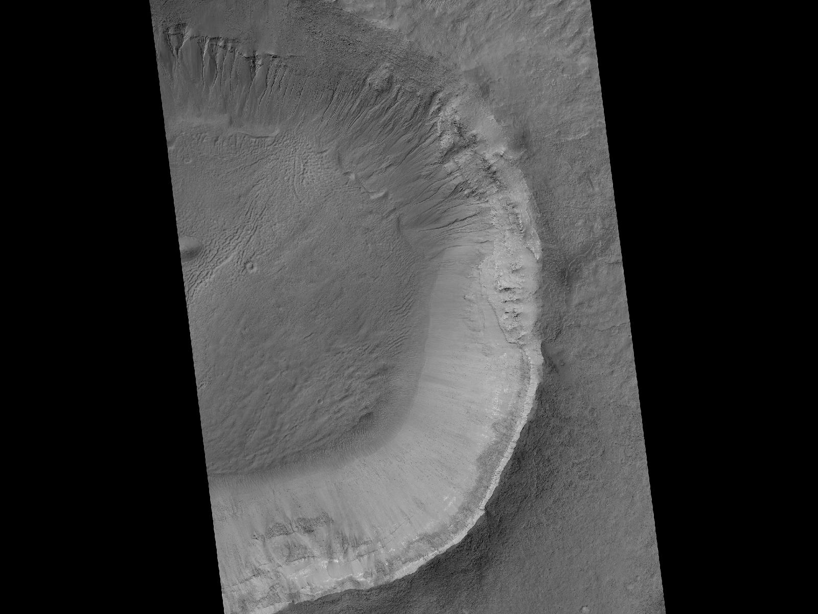
2011-10-05 |
Mars
|
Mars Reconnaissance Orbiter (MRO)
|
HiRISE
|
2560x1920x3 |
|
-
PIA14890:
-
Colorful Central Peak in an Unnamed Crater
Full Resolution:
TIFF
(14.76 MB)
JPEG
(581.1 kB)
|
|
|
2011-11-02 |
Mars
|
Mars Reconnaissance Orbiter (MRO)
|
CRISM
|
2000x2000x3 |
|
-
PIA14764:
-
Clay Minerals in Craters and Escarpments on Mars
Full Resolution:
TIFF
(12.02 MB)
JPEG
(262.6 kB)
|
|
|
2011-11-17 |
Mars
|
Mars Reconnaissance Orbiter (MRO)
|
HiRISE
|
920x1016x1 |
|
-
PIA14876:
-
Blowing in the Martian Wind

Full Resolution:
TIFF
(936 kB)
JPEG
(106.7 kB)
|
|
|
2011-11-17 |
Mars
|
Mars Reconnaissance Orbiter (MRO)
|
HiRISE
|
781x1019x1 |
|
-
PIA14877:
-
Shifting Sand in Herschel Crater
Full Resolution:
TIFF
(796.9 kB)
JPEG
(171.2 kB)
|
|
|
2011-11-17 |
Mars
|
Mars Reconnaissance Orbiter (MRO)
|
HiRISE
|
738x604x1 |
|
-
PIA14878:
-
Rippling Dune Front in Herschel Crater on Mars
Full Resolution:
TIFF
(446.4 kB)
JPEG
(72.31 kB)
|
|
|
2011-11-17 |
Mars
|
Mars Reconnaissance Orbiter (MRO)
|
HiRISE
|
878x1120x1 |
|
-
PIA14879:
-
Rippling Dune Front in Herschel Crater on Mars
Full Resolution:
TIFF
(984.6 kB)
JPEG
(119.5 kB)
|
|
|
2011-11-17 |
Mars
|
Mars Reconnaissance Orbiter (MRO)
|
HiRISE
|
1225x925x1 |
|
-
PIA14880:
-
Movement in Martian Dune Field
Full Resolution:
TIFF
(1.135 MB)
JPEG
(144.5 kB)
|
|
|
2011-11-21 |
Mars
|
Mars Reconnaissance Orbiter (MRO)
|
HiRISE
|
950x720x1 |
|
-
PIA15092:
-
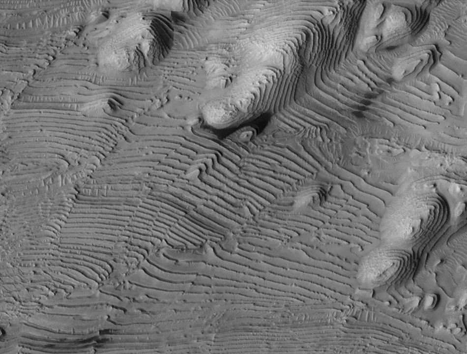
Rhythmic Layering in Danielson Crater on Mars
Full Resolution:
TIFF
(685 kB)
JPEG
(113.5 kB)
|
|
|
2011-11-21 |
Mars
|
Mars Reconnaissance Orbiter (MRO)
|
HiRISE
|
923x690x3 |
|
-
PIA15096:
-
Fresh Crater Revealing Buried Ice
Full Resolution:
TIFF
(1.914 MB)
JPEG
(132.1 kB)
|
|
|
2011-11-21 |
Mars
|
Mars Reconnaissance Orbiter (MRO)
|
CRISM
CTX
|
935x720x3 |
|
-
PIA15097:
-
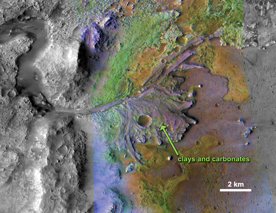
Chemical Alteration by Water, Jezero Crater Delta
Full Resolution:
TIFF
(2.023 MB)
JPEG
(132 kB)
|
|
|
2011-11-21 |
Mars
|
Mars Reconnaissance Orbiter (MRO)
|
HiRISE
|
860x647x3 |
|
-
PIA15098:
-
Chemical Alteration by Water, Mawrth Vallis
Full Resolution:
TIFF
(1.671 MB)
JPEG
(95.97 kB)
|
|
|
2011-11-21 |
Mars
|
Mars Reconnaissance Orbiter (MRO)
|
CRISM
CTX
|
857x517x3 |

|
-
PIA15099:
-
Sulfates and Clays in Columbus Crater, Mars
Full Resolution:
TIFF
(1.331 MB)
JPEG
(97.63 kB)
|
|
|
2011-12-07 |
Mars
|
Mars Reconnaissance Orbiter (MRO)
|
HiRISE
|
2560x1920x3 |
|
-
PIA14861:
-
Edge of North Polar Erg
Full Resolution:
TIFF
(14.76 MB)
JPEG
(1.041 MB)
|
|
|
2011-12-07 |
Mars
|
Mars Reconnaissance Orbiter (MRO)
|
HiRISE
|
8192x4774x3 |
|
-
PIA15111:
-
West Rim of Endeavour with Vertical Exaggeration
Full Resolution:
TIFF
(117.3 MB)
JPEG
(3.007 MB)
|
|
|
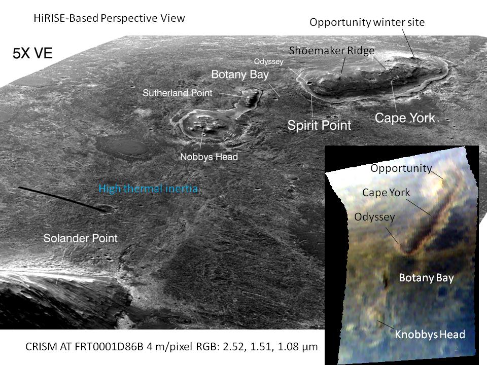
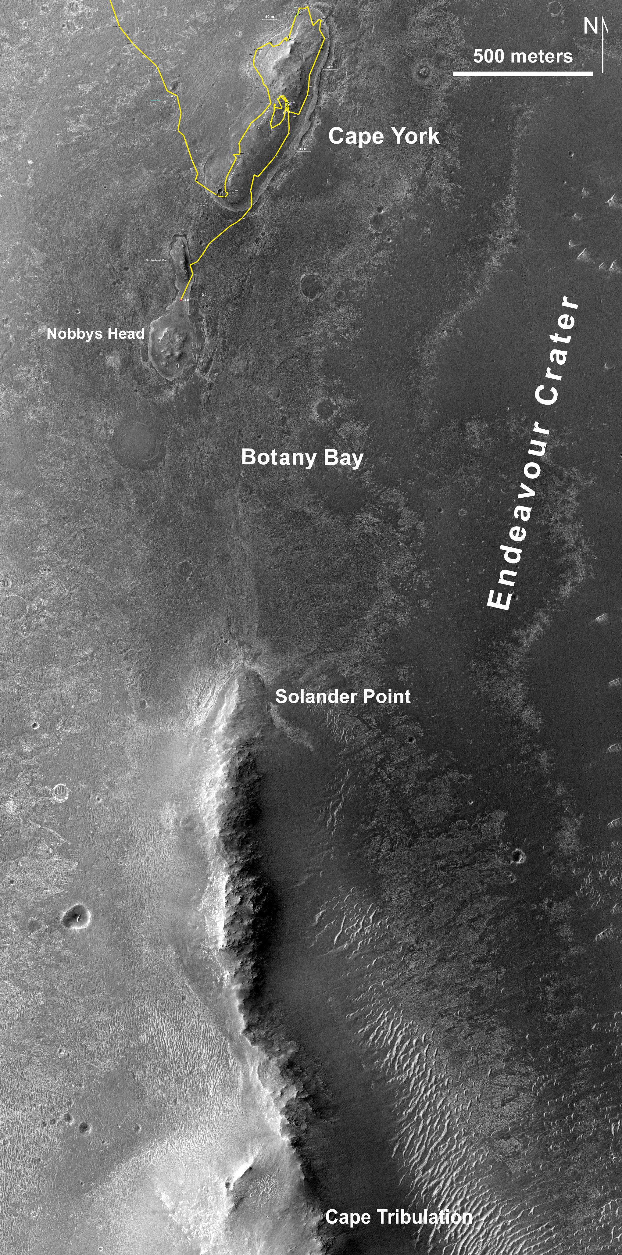
2011-12-07 |
Mars
|
Mars Reconnaissance Orbiter (MRO)
|
HiRISE
|
960x720x3 |
|
-
PIA15112:
-
'Botany Bay' and 'Cape York' with Vertical Exaggeration
Full Resolution:
TIFF
(2.077 MB)
JPEG
(144.3 kB)
|
|
|
2014-07-10 |
Mars
|
Mars Reconnaissance Orbiter (MRO)
|
HiRISE
|
2880x1800x3 |
|
-
PIA18538:
-
Activity in Martian Gully
Full Resolution:
TIFF
(15.56 MB)
JPEG
(1.044 MB)
|
|
|
2012-01-25 |
Mars
|
Mars Reconnaissance Orbiter (MRO)
|
HiRISE
|
2023x2008x3 |
|
-
PIA15283:
-
Dunes in Noachis Terra Region of Mars
Full Resolution:
TIFF
(12.2 MB)
JPEG
(593 kB)
|
|
|
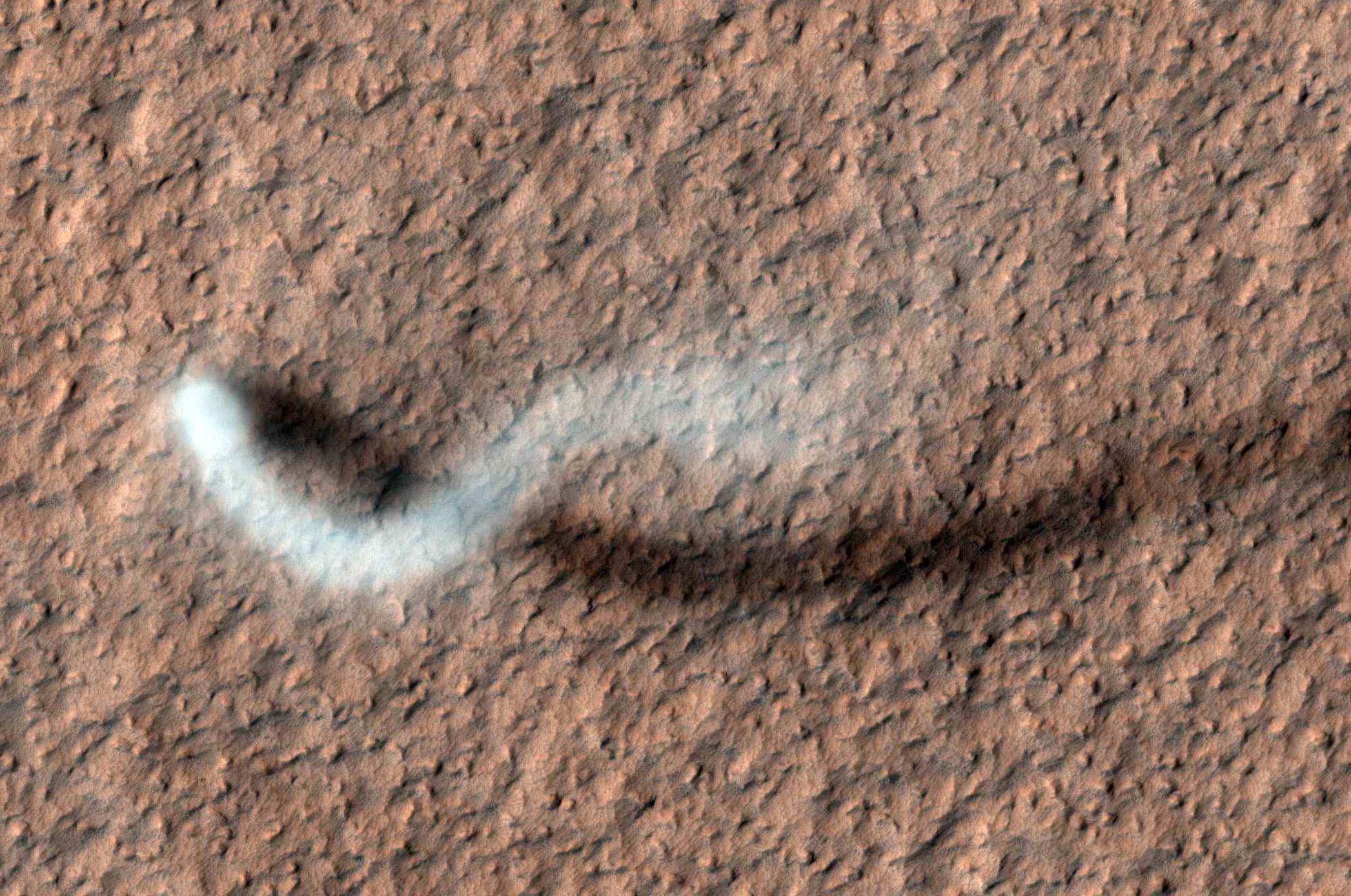
2012-03-07 |
Mars
|
Mars Reconnaissance Orbiter (MRO)
|
HiRISE
|
2093x1389x3 |
|
-
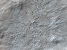
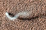
PIA15116:
-
The Serpent Dust Devil of Mars
Full Resolution:
TIFF
(8.733 MB)
JPEG
(520.7 kB)
|
|
|
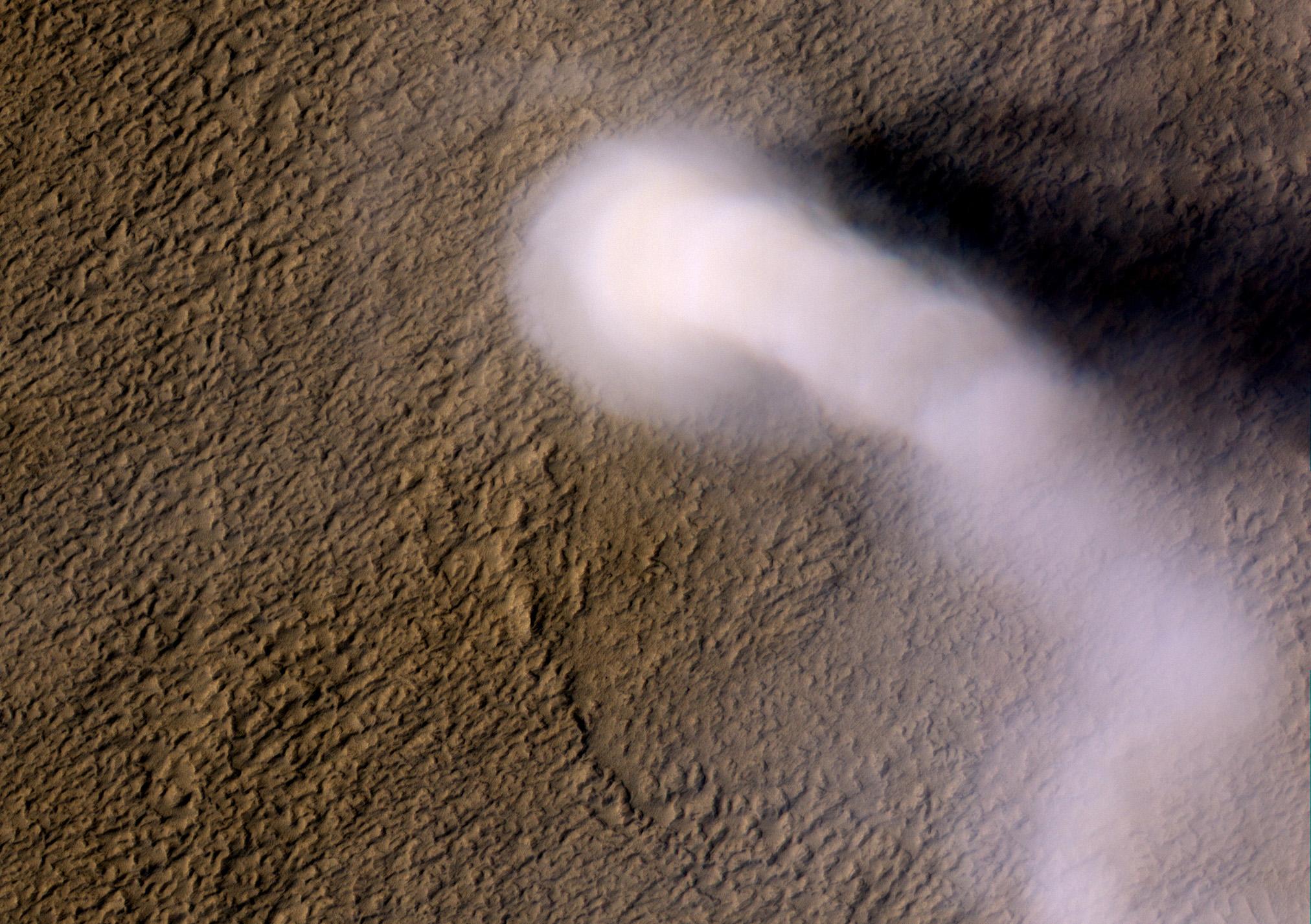
2012-04-04 |
Mars
|
Mars Reconnaissance Orbiter (MRO)
|
HiRISE
|
2024x1426x3 |
|
-
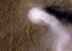
PIA15545:
-
Mars' Whirling Dust Devil
Full Resolution:
TIFF
(8.67 MB)
JPEG
(423.6 kB)
|
|
|
2017-01-26 |
Mars
|
Mars Reconnaissance Orbiter (MRO)
|
HiRISE
|
4500x3000x1 |
|
-
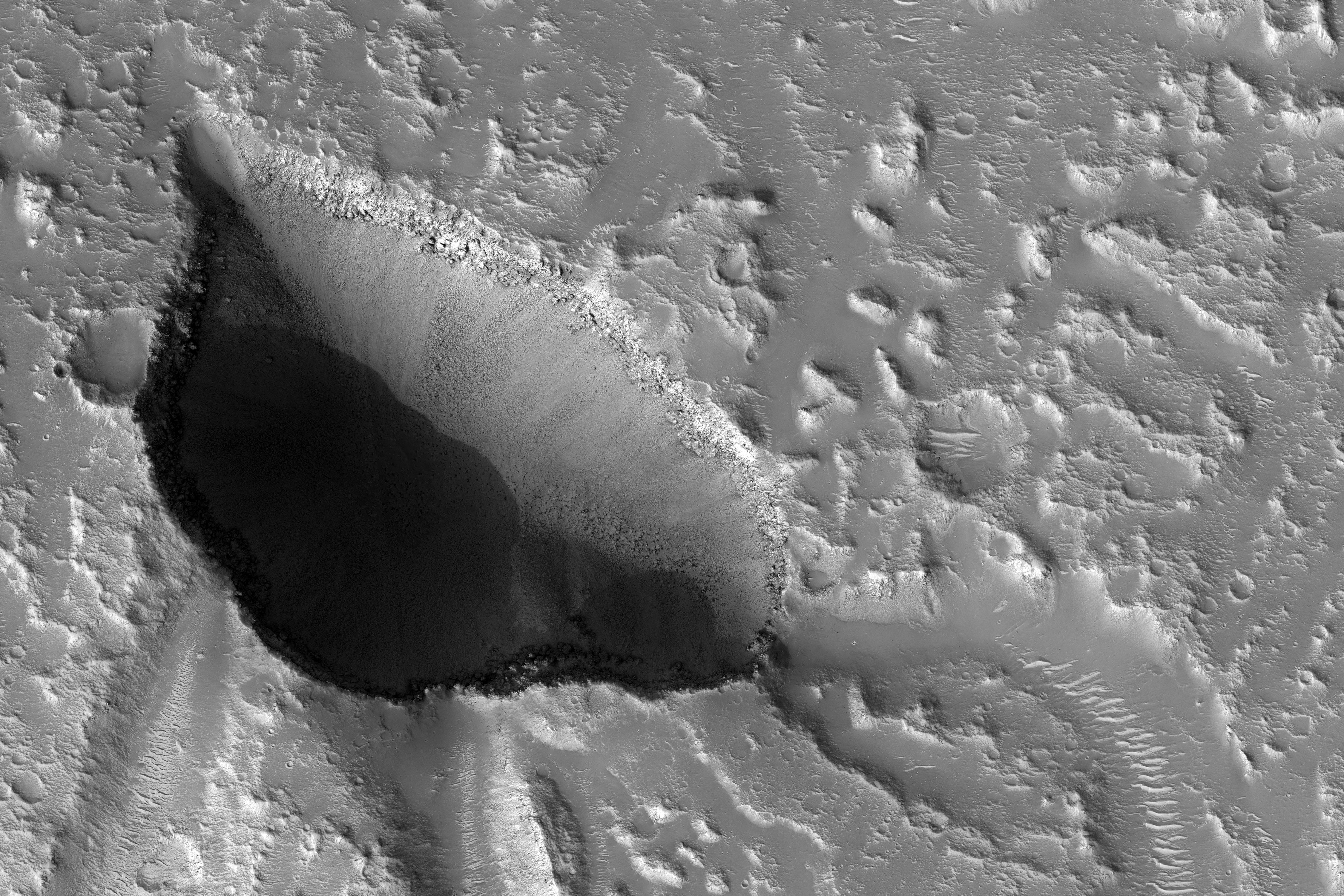
PIA11704:
-
Pits and Channels of Hebrus Valles
Full Resolution:
TIFF
(13.52 MB)
JPEG
(2.535 MB)
|
|
|
2012-05-09 |
Mars
|
Mars Reconnaissance Orbiter (MRO)
|
HiRISE
|
1115x776x1 |
|
-
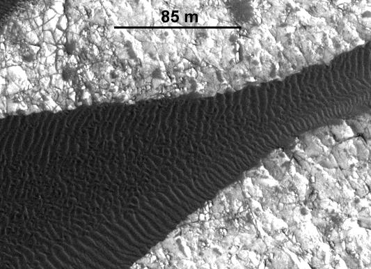
PIA15295:
-
Advancing Dune in Nili Patera, Mars
Full Resolution:
TIFF
(866.4 kB)
JPEG
(143.5 kB)
|
|
|
2012-05-09 |
Mars
|
Mars Reconnaissance Orbiter (MRO)
|
HiRISE
|
533x386x1 |
|
-
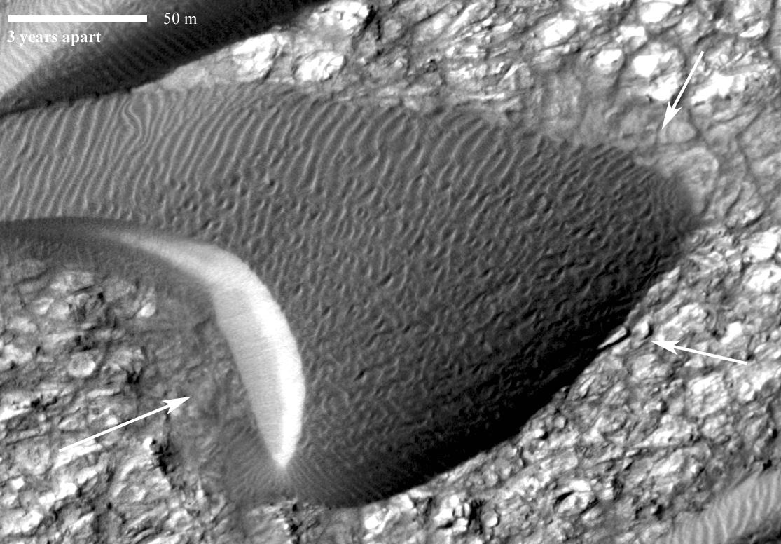
PIA15680:
-
Ripple Movement on Sand Dune in Nili Patera, Mars
Full Resolution:
TIFF
(206.2 kB)
JPEG
(50.09 kB)
|
|
|
2012-08-02 |
Mars
|
Mars Reconnaissance Orbiter (MRO)
|
MARCI
|
1300x1400x3 |
|
-
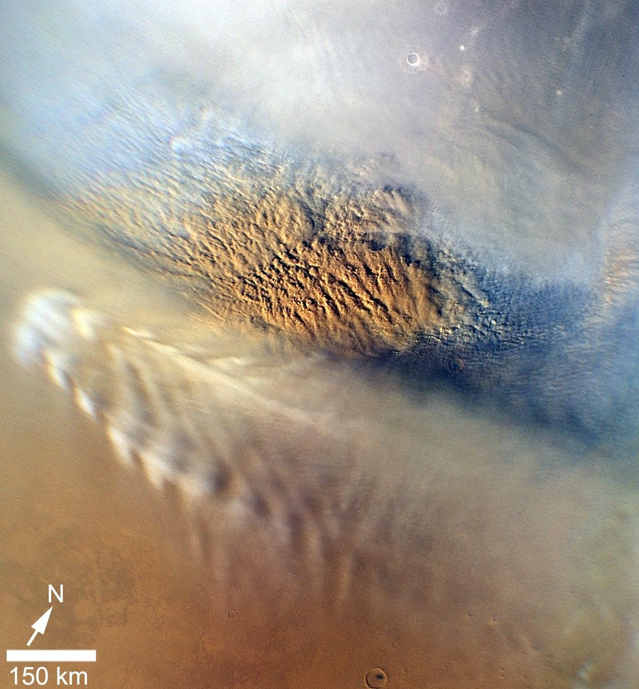
PIA15959:
-
Martian Dust Storm
Full Resolution:
TIFF
(5.462 MB)
JPEG
(402.9 kB)
|
|
|
2012-09-11 |
Mars
|
Mars Reconnaissance Orbiter (MRO)
|
MCS
|
1095x1018x3 |

|
-
PIA16138:
-
Carbon-Dioxide Snowfall on Mars
Full Resolution:
TIFF
(3.346 MB)
JPEG
(184.6 kB)
|
|
|
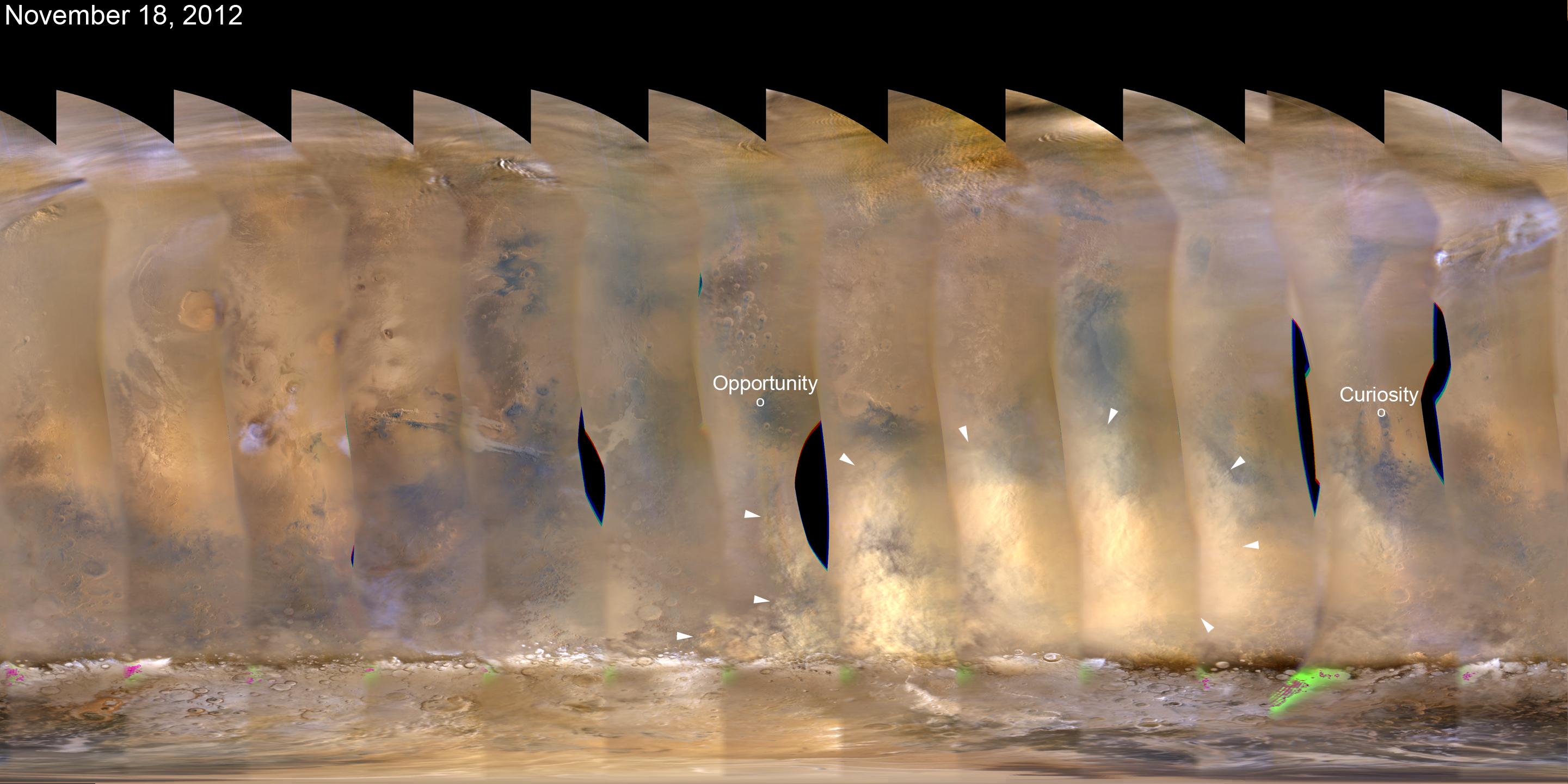
2012-11-21 |
Mars
|
Mars Reconnaissance Orbiter (MRO)
|
MARCI
|
2881x1441x3 |
|
-
PIA16450:
-
Martian Dust Storm, Nov. 18, 2012
Full Resolution:
TIFF
(12.46 MB)
JPEG
(314.4 kB)
|
|
|
2012-11-27 |
Mars
|
Mars Reconnaissance Orbiter (MRO)
|
MARCI
|
2881x1441x3 |
|
-
PIA16454:
-
Regional Dust Storm Weakening, Nov. 25, 2012
Full Resolution:
TIFF
(12.46 MB)
JPEG
(266 kB)
|
|
|
2013-01-20 |
Mars
|
Mars Reconnaissance Orbiter (MRO)
|
HiRISE
|
612x431x3 |
|
-
PIA16710:
-
Layers with Carbonate Content Inside McLaughlin Crater on Mars
Full Resolution:
TIFF
(791.8 kB)
JPEG
(45.18 kB)
|
|
|
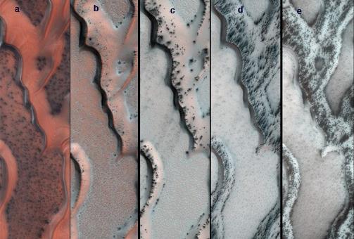
2013-01-24 |
Mars
|
Mars Reconnaissance Orbiter (MRO)
|
HiRISE
|
503x340x3 |
|
-
PIA16715:
-
Seasonal Changes on Far-Northern Mars
Full Resolution:
TIFF
(513.5 kB)
JPEG
(35.91 kB)
|
|
|
2013-03-07 |
Mars
|
Mars Reconnaissance Orbiter (MRO)
|
Shallow Subsurface Radar (SHARAD)
|
1000x692x3 |
|
-
PIA16767:
-
Visualization of Buried Marte Vallis Channels
Full Resolution:
TIFF
(2.077 MB)
JPEG
(74.88 kB)
|
|
|
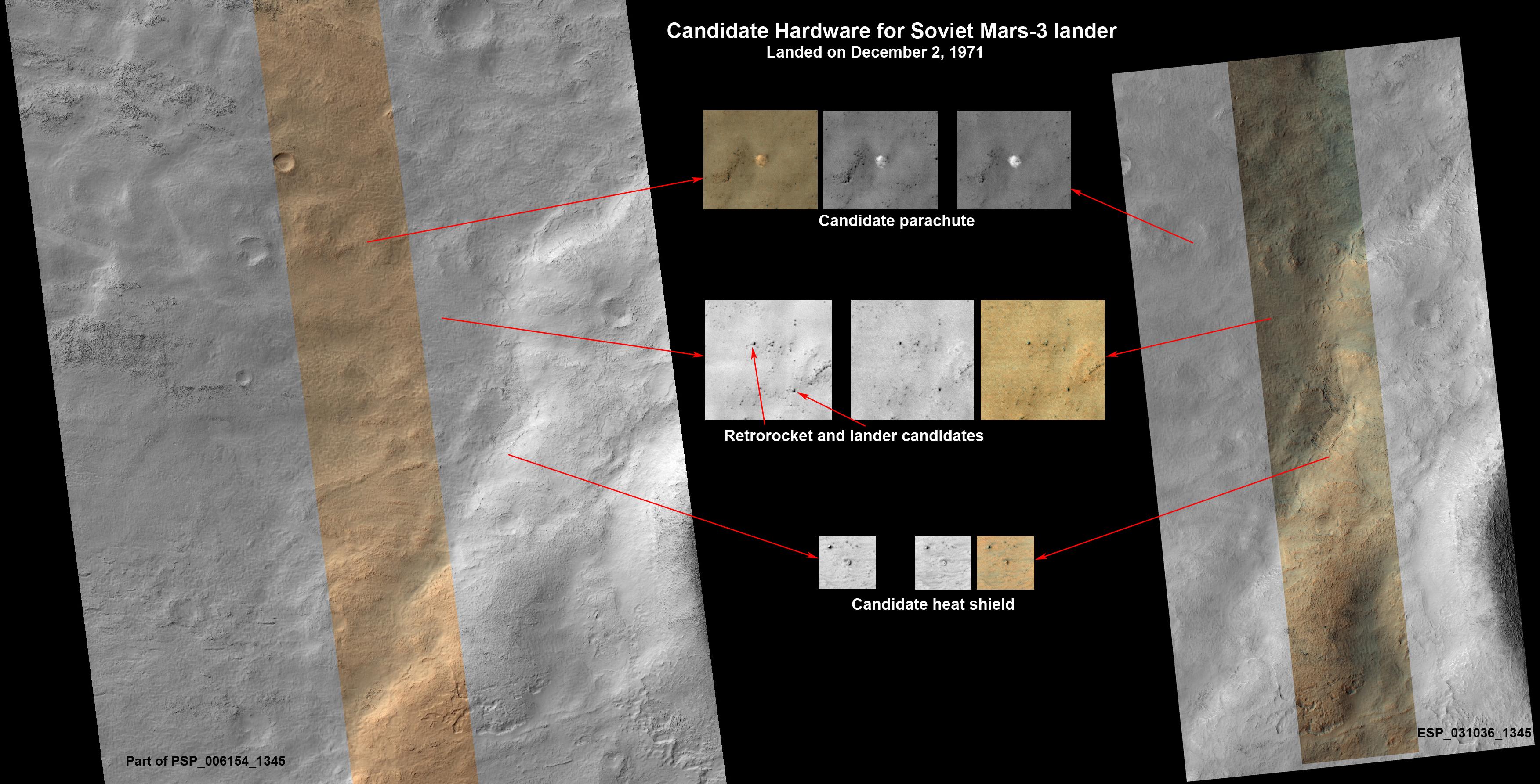
2013-04-11 |
Mars
|
Mars Reconnaissance Orbiter (MRO)
|
HiRISE
|
3505x1786x3 |
|
-
PIA16920:
-
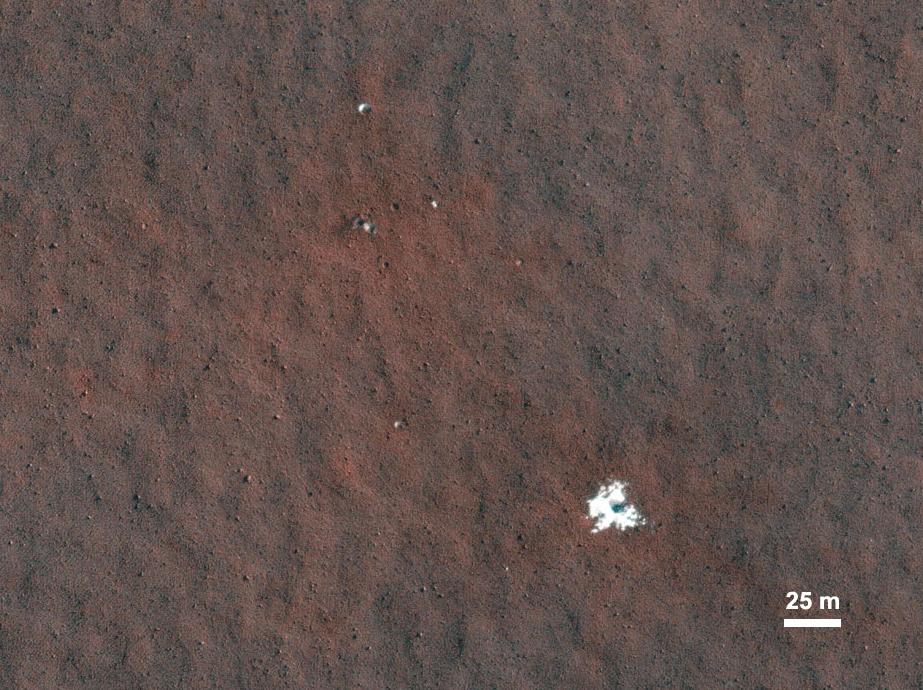
Could This Be the Mars Soviet 3 Lander?
Full Resolution:
TIFF
(18.79 MB)
JPEG
(727.8 kB)
|
|
|
2013-05-15 |
Mars
|
Mars Reconnaissance Orbiter (MRO)
|
CTX
HiRISE
|
1253x1822x3 |
|
-
PIA16928:
-
Fresh Cluster of Impact Craters on Mars
Full Resolution:
TIFF
(6.852 MB)
JPEG
(311.5 kB)
|
|
|
2013-06-07 |
Mars
|
Mars Reconnaissance Orbiter (MRO)
|
HiRISE
|
2040x4116x3 |
|
-
PIA17072:
-
Southbound Opportunity, June 2013
Full Resolution:
TIFF
(25.2 MB)
JPEG
(2.025 MB)
|
|
|
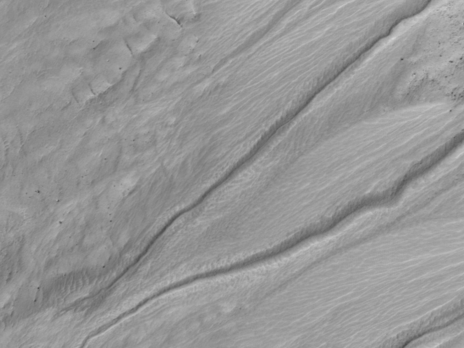
2013-06-11 |
Mars
|
Mars Reconnaissance Orbiter (MRO)
|
HiRISE
|
1457x835x1 |
|
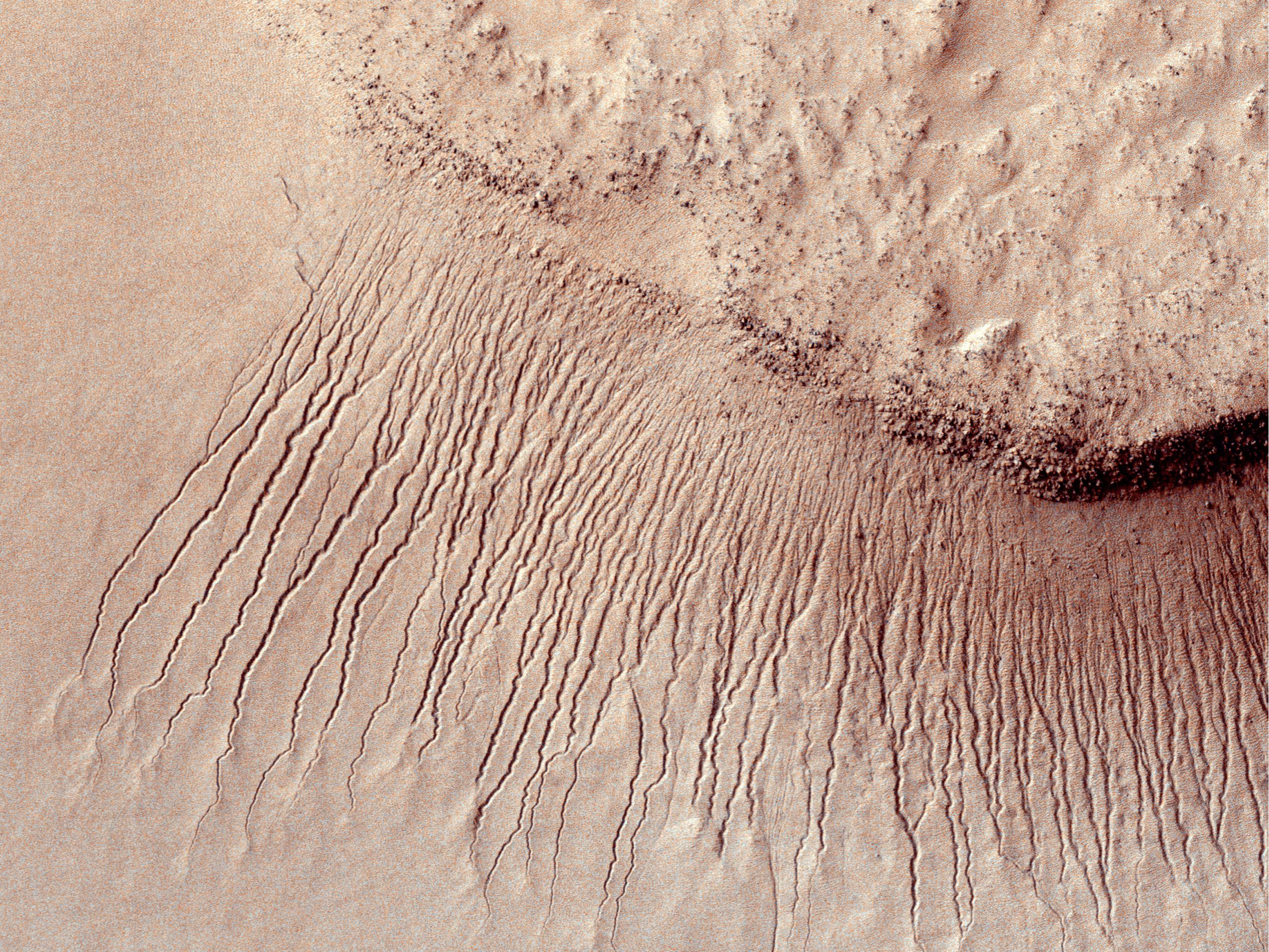
-
PIA17260:
-
Linear Gullies Inside Russell Crater, Mars
Full Resolution:
TIFF
(1.218 MB)
JPEG
(238 kB)
|
|
|
2013-06-11 |
Mars
|
Mars Reconnaissance Orbiter (MRO)
|
HiRISE
|
1439x1993x1 |
|
-
PIA17261:
-
Some Gullies on Mars Could Be Tracks of Sliding Dry Ice
Full Resolution:
TIFF
(2.871 MB)
JPEG
(568.4 kB)
|
|
|
2013-06-12 |
Mars
|
Mars Reconnaissance Orbiter (MRO)
|
MCS
|
1883x2437x3 |
|
-
PIA17263:
-
Scanning Martian Atmospheric Temperatures (Graphic)
Full Resolution:
TIFF
(13.77 MB)
JPEG
(337.9 kB)
|
|
|
2014-05-22 |
Mars
|
Mars Reconnaissance Orbiter (MRO)
|
HiRISE
|
2880x1800x1 |
|
-
PIA18649:
-
The Busy Flank of Arsia Mons
Full Resolution:
TIFF
(5.191 MB)
JPEG
(682.4 kB)
|
|
|
2013-10-17 |
Mars
|
Mars Reconnaissance Orbiter (MRO)
|
HiRISE
|
1920x1080x3 |

|
-
PIA17447:
-
Mountainous Crater Rim on Mars
Full Resolution:
TIFF
(6.223 MB)
JPEG
(169.6 kB)
|
|
|
2013-10-16 |
Mars
|
Mars Reconnaissance Orbiter (MRO)
|
HiRISE
|
2880x1800x3 |
|
-
PIA17548:
-
Fall Frosting
Full Resolution:
TIFF
(15.56 MB)
JPEG
(887.8 kB)
|
|
|
2013-10-16 |
Mars
|
Mars Reconnaissance Orbiter (MRO)
|
HiRISE
|
2880x1800x3 |
|
-
PIA17549:
-
Possible Impacts from MSL Hardware
Full Resolution:
TIFF
(15.56 MB)
JPEG
(1.513 MB)
|
|
|
2013-10-16 |
Mars
|
Mars Reconnaissance Orbiter (MRO)
|
HiRISE
|
2880x1800x3 |
|
-
PIA17570:
-
Bedding Details in Layered Rock
Full Resolution:
TIFF
(15.56 MB)
JPEG
(600.1 kB)
|
|
|
2013-10-16 |
Mars
|
Mars Reconnaissance Orbiter (MRO)
|
HiRISE
|
2880x1800x3 |
|
-
PIA17571:
-
Fretted Terrains and Ground Deformation
Full Resolution:
TIFF
(15.56 MB)
JPEG
(1.05 MB)
|
|
|
2013-10-02 |
Mars
|
Mars Reconnaissance Orbiter (MRO)
|
HiRISE
|
2880x1800x3 |
|
-
PIA17572:
-
Aligned Scallops
Full Resolution:
TIFF
(15.56 MB)
JPEG
(1.475 MB)
|
|
|
2013-10-02 |
Mars
|
Mars Reconnaissance Orbiter (MRO)
|
HiRISE
|
1898x1007x3 |
|
-
PIA17573:
-
Colorful Dunes
Full Resolution:
TIFF
(5.736 MB)
JPEG
(301.4 kB)
|
|
|
2013-10-18 |
Mars
|
Mars Reconnaissance Orbiter (MRO)
|
HiRISE
|
2880x1800x1 |
|
-
PIA17574:
-
Sinuous Ridge Cutting Across Geologic Units of the Medusae Fossae Formation
Full Resolution:
TIFF
(5.191 MB)
JPEG
(1.039 MB)
|
|
|
2013-10-02 |
Mars
|
Mars Reconnaissance Orbiter (MRO)
|
HiRISE
|
2880x1800x1 |

|
-
PIA17575:
-
Differential Compaction around a Crater Peak
Full Resolution:
TIFF
(5.191 MB)
JPEG
(915.7 kB)
|
|
|
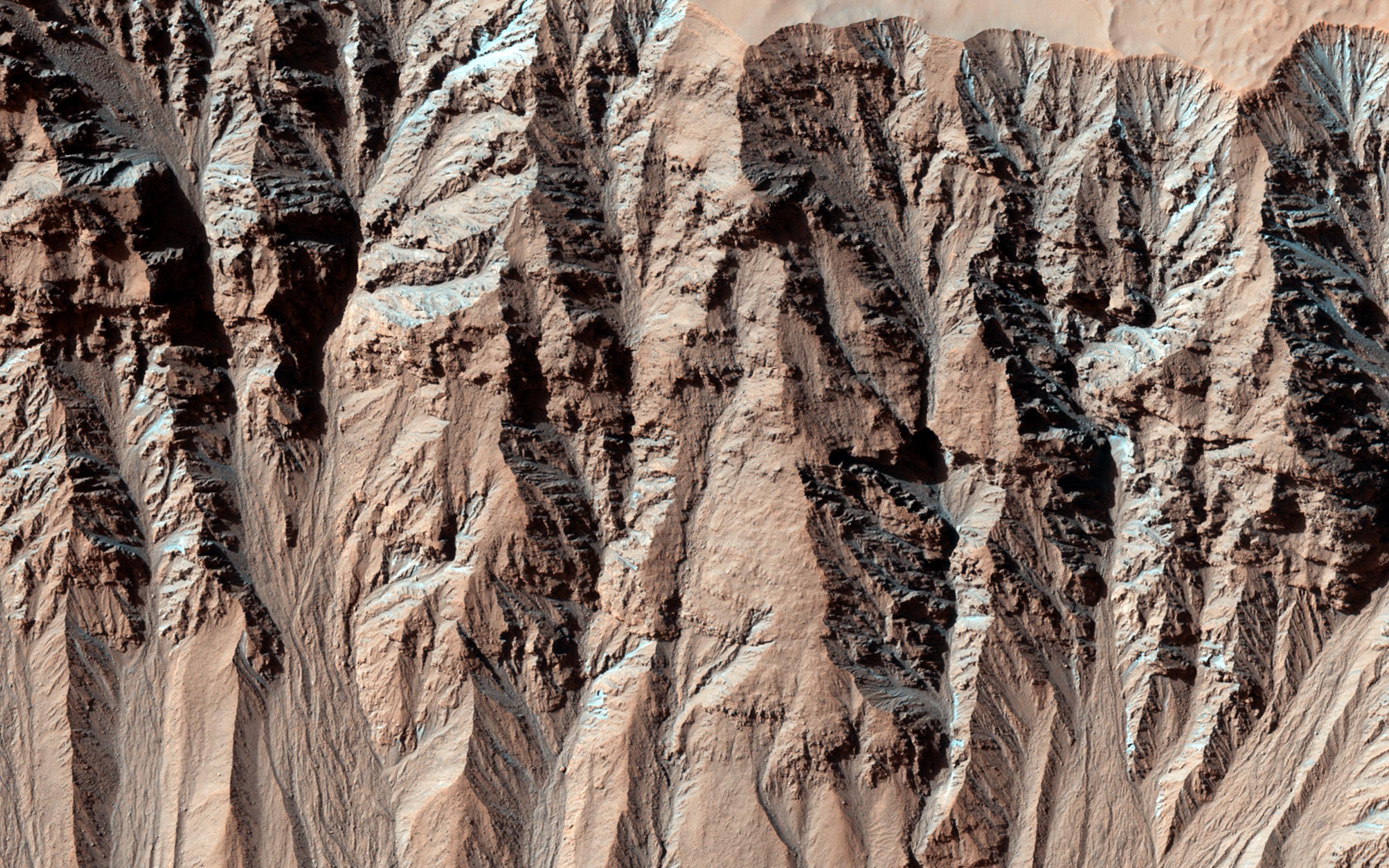
2013-10-30 |
Mars
|
Mars Reconnaissance Orbiter (MRO)
|
HiRISE
|
2880x1800x3 |
|
-
PIA17623:
-
Spring Slide
Full Resolution:
TIFF
(15.56 MB)
JPEG
(659.6 kB)
|
|
|
2013-10-30 |
Mars
|
Mars Reconnaissance Orbiter (MRO)
|
HiRISE
|
2880x1800x3 |
|
-
PIA17624:
-
Beautiful Layers in the Central Uplift of Mazamba Crater
Full Resolution:
TIFF
(15.56 MB)
JPEG
(935.8 kB)
|
|
|
2013-10-30 |
Mars
|
Mars Reconnaissance Orbiter (MRO)
|
HiRISE
|
2880x1800x3 |
|
-
PIA17625:
-
Enigmatic Channels on the Floor of Mangala Valles
Full Resolution:
TIFF
(15.56 MB)
JPEG
(1.052 MB)
|
|
|
2013-10-30 |
Mars
|
Mars Reconnaissance Orbiter (MRO)
|
HiRISE
|
2880x1800x3 |

|
-
PIA17626:
-
Martian Thunderbird
Full Resolution:
TIFF
(5.191 MB)
JPEG
(1.13 MB)
|
|
|
2013-09-18 |
Mars
|
Mars Reconnaissance Orbiter (MRO)
|
HiRISE
|
2880x1800x3 |
|
-
PIA17628:
-
Two Generations of Windblown Sediments
Full Resolution:
TIFF
(15.56 MB)
JPEG
(641.7 kB)
|
|
|
2013-09-18 |
Mars
|
Mars Reconnaissance Orbiter (MRO)
|
HiRISE
|
2880x1800x3 |
|
-
PIA17629:
-
Martian Glaciers and Brain Terrain
Full Resolution:
TIFF
(15.56 MB)
JPEG
(1.045 MB)
|
|
|
2013-09-12 |
Mars
|
Mars Reconnaissance Orbiter (MRO)
|
HiRISE
|
2880x1800x3 |
|
-
PIA17630:
-
Layers, Bedrock Ridges, and Dark Sand in Schiaparelli Crater
Full Resolution:
TIFF
(15.56 MB)
JPEG
(908.3 kB)
|
|
|
2013-09-12 |
Mars
|
Mars Reconnaissance Orbiter (MRO)
|
HiRISE
|
2880x1800x3 |
|
-
PIA17631:
-
Terraced Craters and Layered Targets
Full Resolution:
TIFF
(15.56 MB)
JPEG
(1.341 MB)
|
|
|
2013-11-06 |
Mars
|
Mars Reconnaissance Orbiter (MRO)
|
HiRISE
|
2880x1800x3 |
|
-
PIA17670:
-
Dust Covered Channels on Tharsis Tholus
Full Resolution:
TIFF
(15.56 MB)
JPEG
(747.6 kB)
|
|
|
2013-11-06 |
Mars
|
Mars Reconnaissance Orbiter (MRO)
|
HiRISE
|
2880x1800x3 |
|
-
PIA17671:
-
Hints of an Ancient Shoreline in Southern Isidis Planitia
Full Resolution:
TIFF
(15.56 MB)
JPEG
(1.058 MB)
|
|
|
2013-11-06 |
Mars
|
Mars Reconnaissance Orbiter (MRO)
|
HiRISE
|
2880x1800x3 |
|
-
PIA17672:
-
Breached Rim of a Circular Depression
Full Resolution:
TIFF
(15.56 MB)
JPEG
(617.4 kB)
|
|
|
2013-11-06 |
Mars
|
Mars Reconnaissance Orbiter (MRO)
|
HiRISE
|
2880x1800x3 |
|
-
PIA17673:
-
Cratered Cones in Tartarus Montes
Full Resolution:
TIFF
(15.56 MB)
JPEG
(783.3 kB)
|
|
|
2013-08-08 |
Mars
|
Mars Reconnaissance Orbiter (MRO)
|
HiRISE
|
2880x1800x3 |

|
-
PIA17635:
-
Possible Cyclic Bedding within a Crater in Arabia Terra
Full Resolution:
TIFF
(15.56 MB)
JPEG
(749.6 kB)
|
|
|
2013-07-24 |
Mars
|
Mars Reconnaissance Orbiter (MRO)
|
HiRISE
|
2880x1800x3 |
|
-
PIA17634:
-
Ice Deposition and Loss in an Impact Crater in Utopia Basin
Full Resolution:
TIFF
(15.56 MB)
JPEG
(1.03 MB)
|
|
|
2013-11-08 |
Mars
|
Mars Reconnaissance Orbiter (MRO)
|
HiRISE
|
1280x960x3 |
|
-
PIA17675:
-
Dunes on the Rim of the Hellas Impact Basin
Full Resolution:
TIFF
(3.688 MB)
JPEG
(290.9 kB)
|


