Click on an image for detailed information
Click on a column heading to sort in ascending or descending order

My
List |
Addition Date
|
Target
|
Mission
|
Instrument
|
Size
|

|
2006-12-13 |
Mars
|
Mars Reconnaissance Orbiter (MRO)
|
Shallow Subsurface Radar (SHARAD)
|
3194x591x3 |
|
-
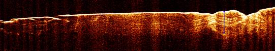
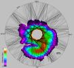
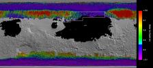
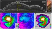
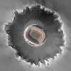
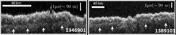
PIA09095:
Radar View of Layering near Mars' South Pole, Orbit 1360
Full Resolution:
TIFF
(5.663 MB)
JPEG
(722.7 kB)
|
|
|
2006-12-13 |
Mars
|
Mars Reconnaissance Orbiter (MRO)
|
Shallow Subsurface Radar (SHARAD)
|
3253x2415x3 |
|
-
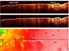
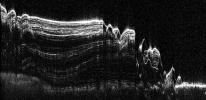
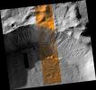
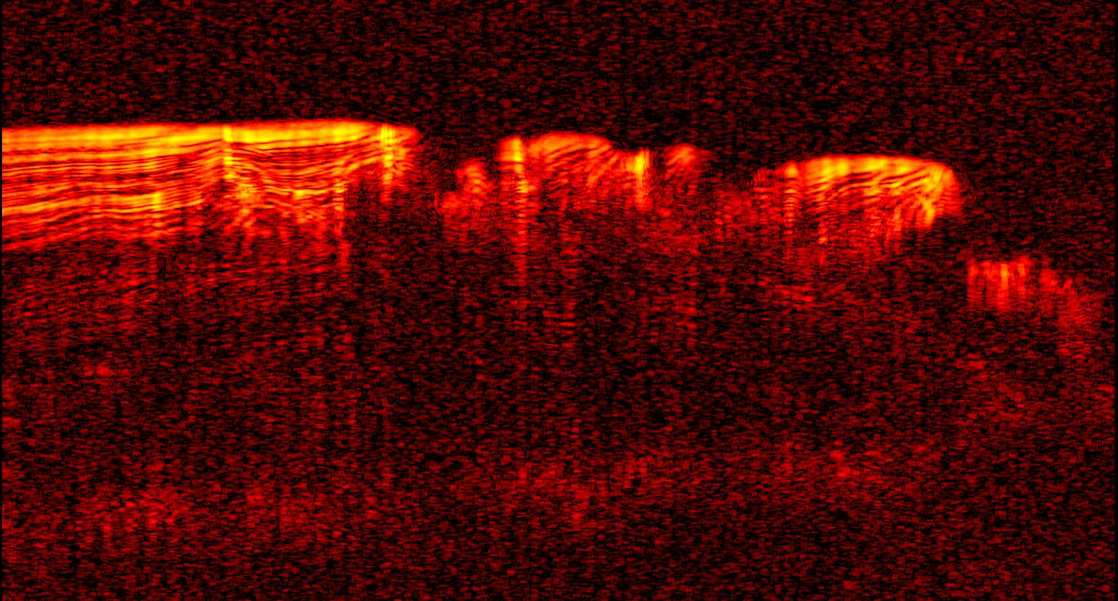
PIA09076:
-
Interpreting Radar View near Mars' South Pole, Orbit 1334
Full Resolution:
TIFF
(23.57 MB)
JPEG
(1.764 MB)
|
|
|
2006-12-13 |
Mars
|
Mars Reconnaissance Orbiter (MRO)
|
Shallow Subsurface Radar (SHARAD)
|
3192x460x3 |
|
-
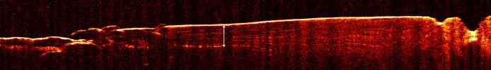
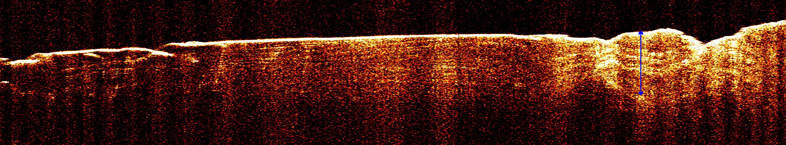
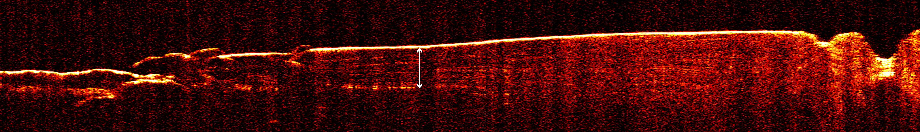
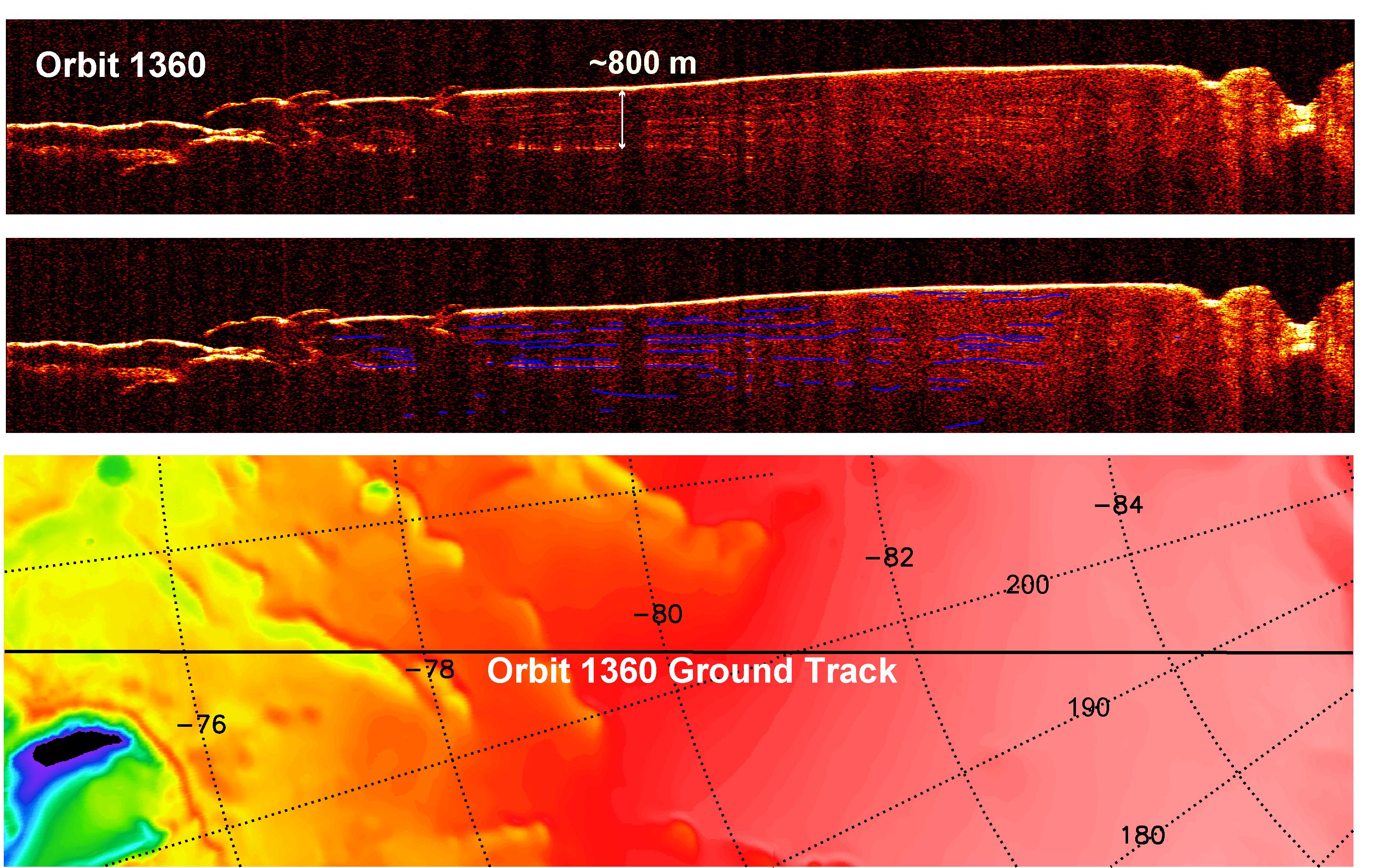
PIA09073:
Radar View of Layering near Mars' South Pole, Orbit 1360
Full Resolution:
TIFF
(4.405 MB)
JPEG
(446.8 kB)
|
|
|
2006-12-13 |
Mars
|
Mars Reconnaissance Orbiter (MRO)
|
Shallow Subsurface Radar (SHARAD)
|
3275x2065x3 |

|
-
PIA09075:
-
Interpreting Radar View near Mars' South Pole, Orbit 1360
Full Resolution:
TIFF
(20.29 MB)
JPEG
(1.198 MB)
|
|
|
2006-12-13 |
Mars
|
Mars Reconnaissance Orbiter (MRO)
|
Shallow Subsurface Radar (SHARAD)
|
1617x870x3 |

|
-
PIA09096:
-
Interpreting Radar View near Mars' South Pole, Orbit 1334
Full Resolution:
TIFF
(1.41 MB)
JPEG
(299.9 kB)
|
|
|
2006-12-13 |
Mars
|
Mars Reconnaissance Orbiter (MRO)
|
Shallow Subsurface Radar (SHARAD)
|
2634x1934x3 |
|
-
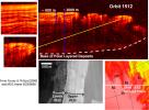
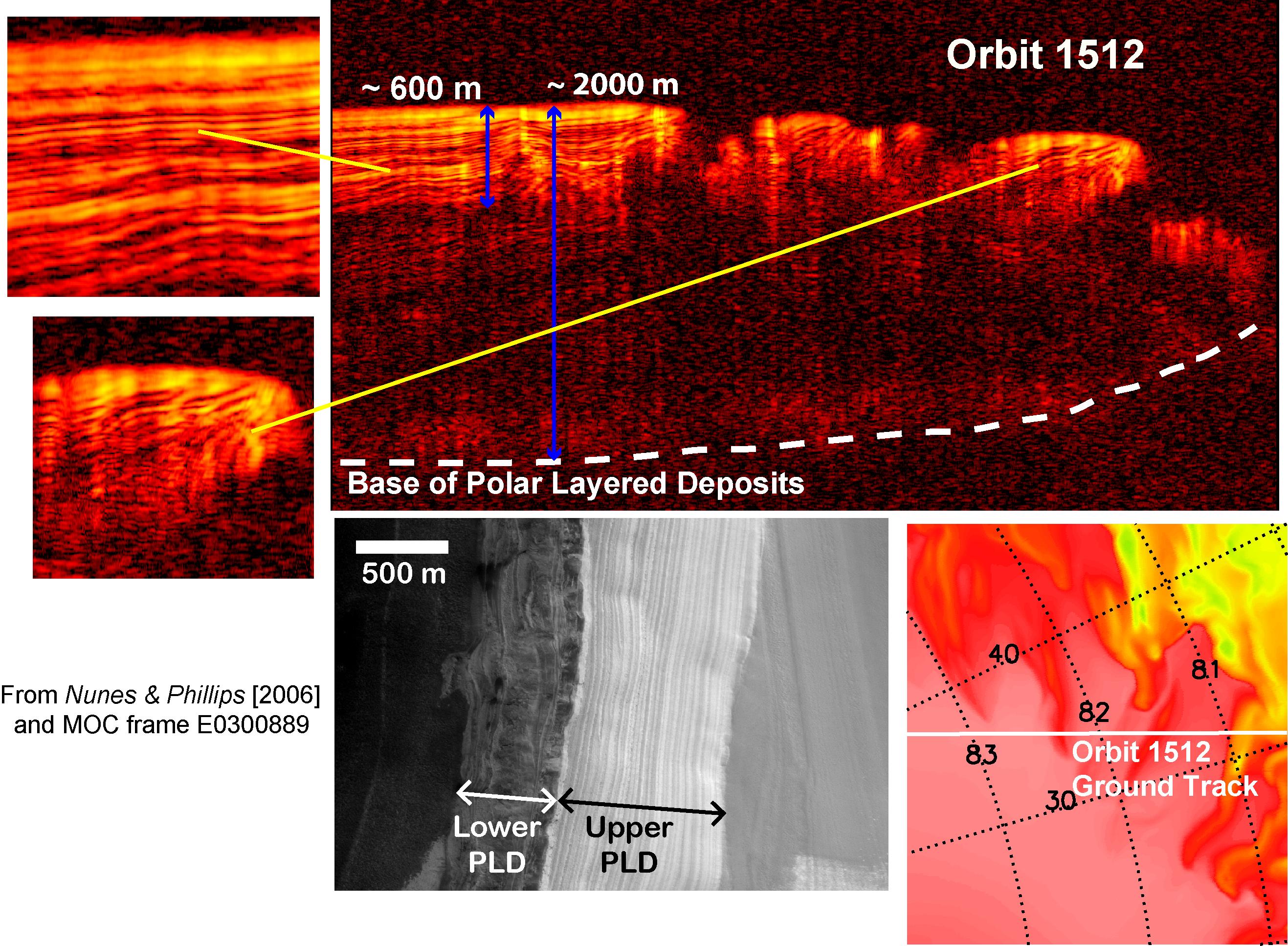
PIA09074:
-
Interpreting Radar View near Mars' North Pole, Orbit 1512
Full Resolution:
TIFF
(15.3 MB)
JPEG
(808.7 kB)
|
|
|
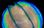
2008-05-15 |
Mars
|
Mars Reconnaissance Orbiter (MRO)
|
Shallow Subsurface Radar (SHARAD)
|
1152x1056x3 |
|
-
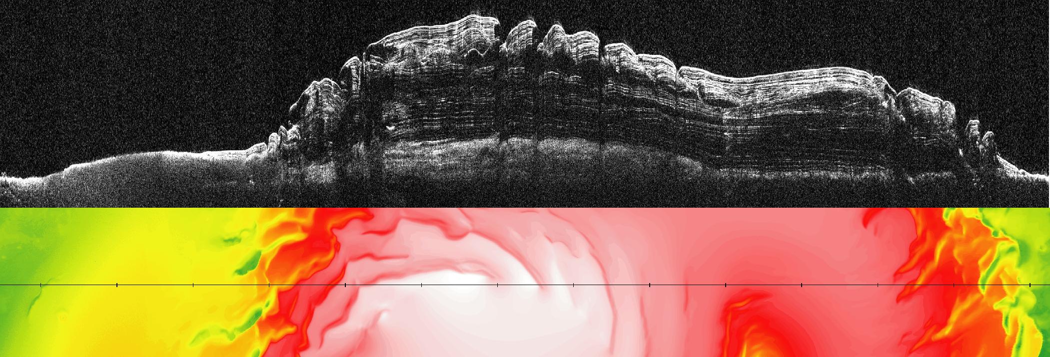
PIA10651:
-
How Thick is the North Polar Ice Cap on Mars?
Full Resolution:
TIFF
(3.654 MB)
JPEG
(319.4 kB)
|
|
|
2008-05-15 |
Mars
|
Mars Reconnaissance Orbiter (MRO)
|
Shallow Subsurface Radar (SHARAD)
|
2101x715x3 |

|
-
PIA10652:
-
What Lies Below a Martian Ice Cap
Full Resolution:
TIFF
(4.513 MB)
JPEG
(351.7 kB)
|
|
|
2008-05-15 |
|
Mars Reconnaissance Orbiter (MRO)
|
Shallow Subsurface Radar (SHARAD)
|
1281x721x3 |
|
-
PIA10653:
-
Peeling Back Layers of a Martian Polar Ice Cap (Artist Concept)

Full Resolution:
TIFF
(2.774 MB)
JPEG
(33.77 kB)
|
|
|
2010-03-02 |
Mars
|
Mars Reconnaissance Orbiter (MRO)
|
Shallow Subsurface Radar (SHARAD)
|
1098x818x3 |

|
-
PIA12861:
-
Glacial Ice Deposits in Mid-Latitudes of Mars
Full Resolution:
TIFF
(2.698 MB)
JPEG
(237.4 kB)
|
|
|
2010-05-26 |
Mars
|
Mars Reconnaissance Orbiter (MRO)
|
Shallow Subsurface Radar (SHARAD)
|
1936x939x1 |
|
-
PIA13164:
-
North Polar Cap Cross Section
Full Resolution:
TIFF
(1.82 MB)
JPEG
(575.5 kB)
|
|
|
2011-04-21 |
Mars
|
Mars Reconnaissance Orbiter (MRO)
|
Shallow Subsurface Radar (SHARAD)
|
1775x380x1 |
|
-
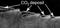
PIA13985:
-
Cross Section of Buried Carbon-Dioxide Ice on Mars
Full Resolution:
TIFF
(675.5 kB)
JPEG
(116.5 kB)
|
|
|
2011-04-21 |
Mars
|
Mars Reconnaissance Orbiter (MRO)
|
Shallow Subsurface Radar (SHARAD)
|
9380x8299x3 |

|
-
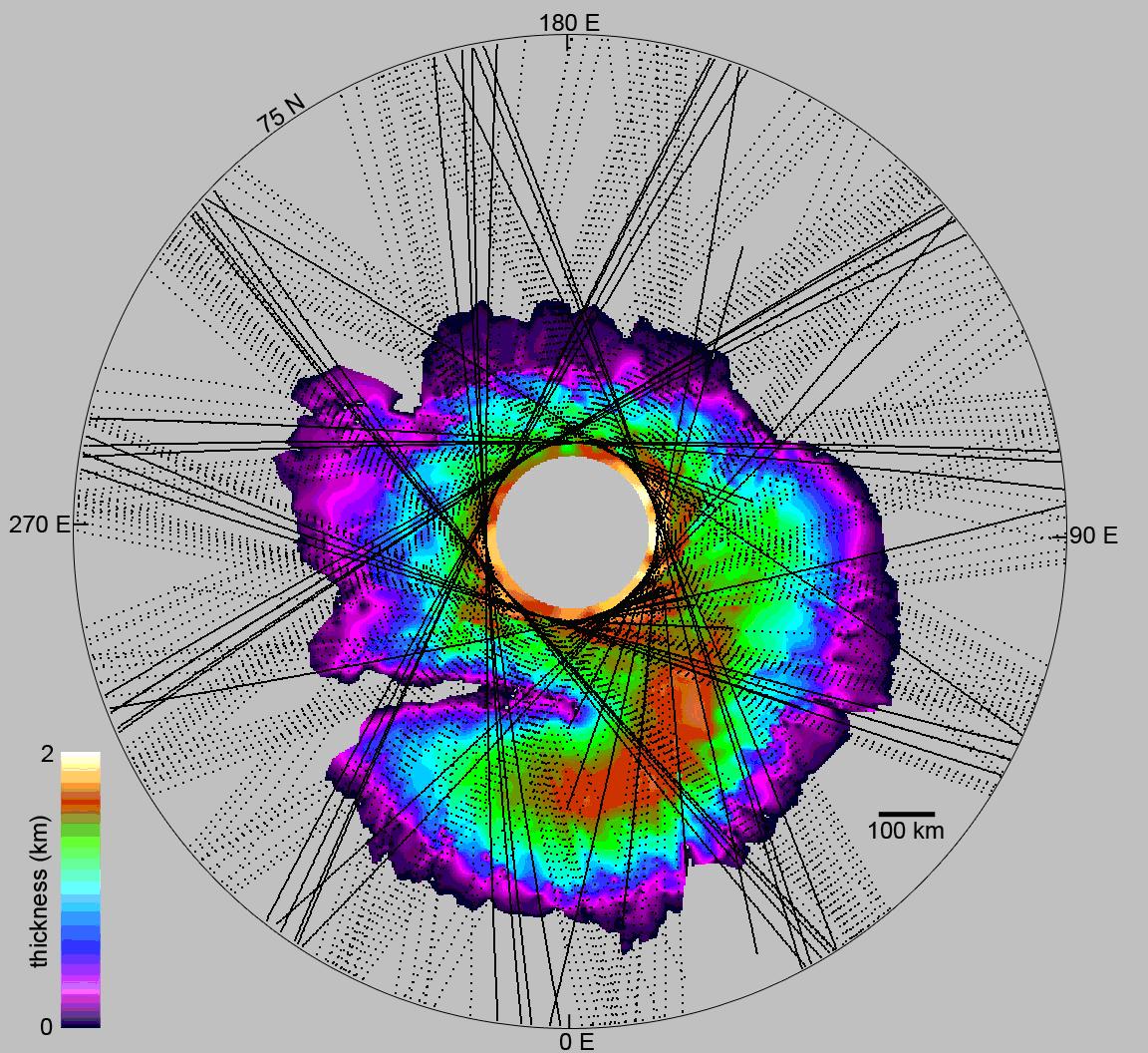
PIA13986:
-
Thickness Map of Buried Carbon-Dioxide Deposit
Full Resolution:
TIFF
(233.5 MB)
JPEG
(4.87 MB)
|
|
|
2013-03-07 |
Mars
|
Mars Reconnaissance Orbiter (MRO)
|
Shallow Subsurface Radar (SHARAD)
|
1000x692x3 |
|
-
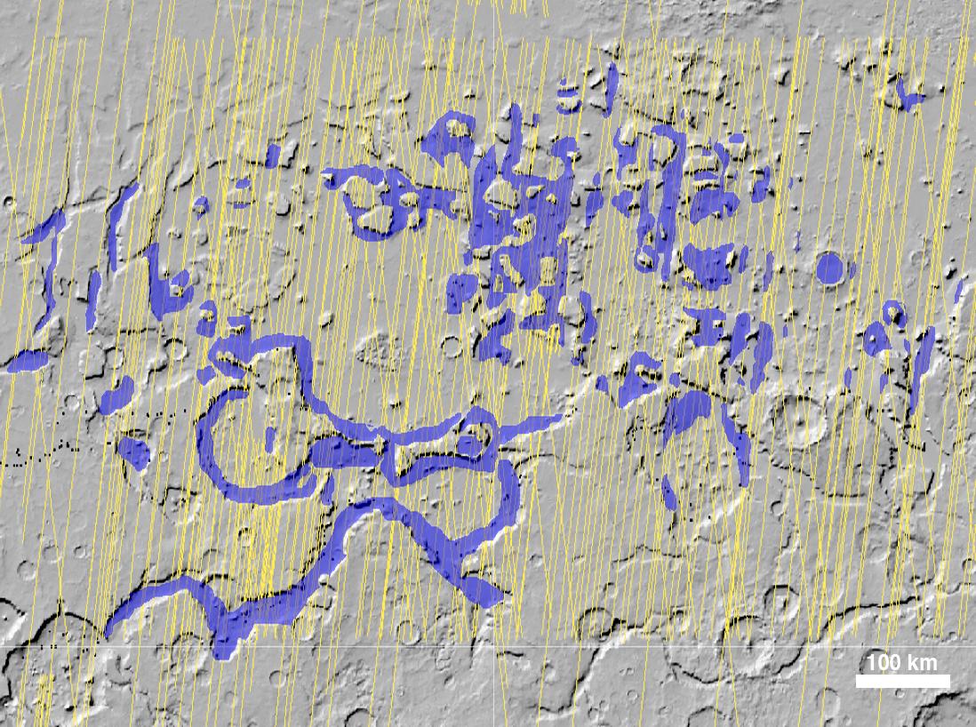
PIA16767:
-
Visualization of Buried Marte Vallis Channels
Full Resolution:
TIFF
(2.077 MB)
JPEG
(74.88 kB)
|
|
|
2016-05-26 |
Mars
|
Mars Reconnaissance Orbiter (MRO)
Viking
|
Shallow Subsurface Radar (SHARAD)
|
975x1188x3 |
|
-
PIA20029:
-
Signs of a Martian Ice Age
Full Resolution:
TIFF
(2.95 MB)
JPEG
(190.7 kB)
|
|
|
2016-11-22 |
Mars
|
Mars Reconnaissance Orbiter (MRO)
|
Shallow Subsurface Radar (SHARAD)
|
602x122x1 |

|
-
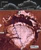
PIA21137:
Radargrams Indicating Ice-Rich Subsurface Deposit
Full Resolution:
TIFF
(73.74 kB)
JPEG
(21.33 kB)
|
|
|
2016-11-22 |
Mars
|
Mars Reconnaissance Orbiter (MRO)
|
Shallow Subsurface Radar (SHARAD)
|
596x286x3 |
|
-
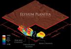
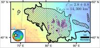
PIA21138:
-
Location of Large Subsurface Water-Ice Deposit in Utopia Planitia, Mars
Full Resolution:
TIFF
(322.1 kB)
JPEG
(44.46 kB)
|
|
|
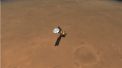
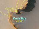
2007-06-28 |
Mars
|
Mars Exploration Rover (MER)
Mars Reconnaissance Orbiter (MRO)
|
Panoramic Camera
High Resolution Imaging Science Experiment (HiRISE)
|
639x361x3 |
|
-
PIA09687:
-
Surveying the Scene Above Opportunity (Simulation)
Full Resolution:
TIFF
(693 kB)
JPEG
(21.41 kB)
|
|
|
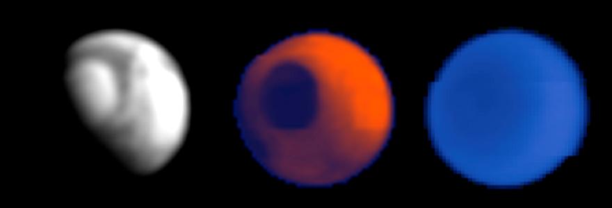
2006-03-10 |
Deimos
|
Mars Reconnaissance Orbiter (MRO)
|
Optical Navigation Camera
|
791x700x3 |
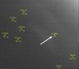
|
-
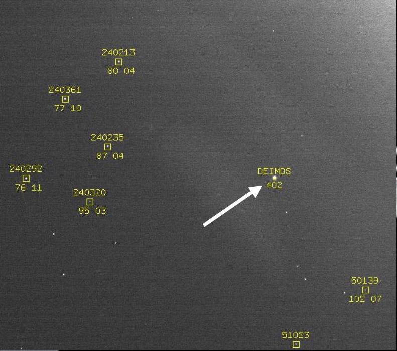
PIA02699:
-
Optical Navigation Demonstration Near Mars
Full Resolution:
TIFF
(1.663 MB)
JPEG
(71.03 kB)
|
|
|
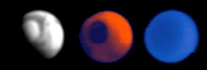
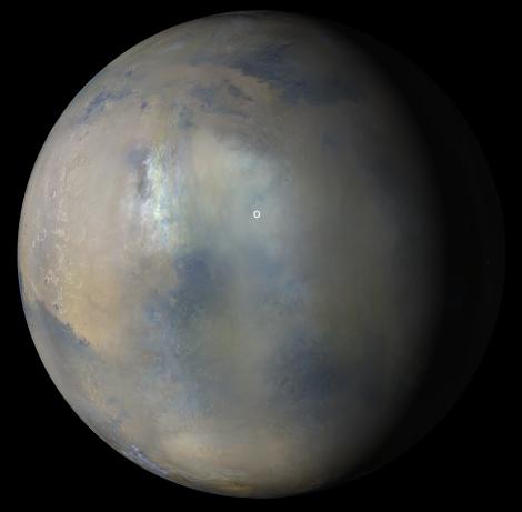
2006-10-16 |
Mars
|
Mars Global Surveyor (MGS)
Mars Reconnaissance Orbiter (MRO)
|
MARCI
Mars Orbiter Camera
|
2219x2219x3 |
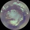
|
-
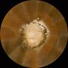
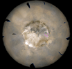
PIA01928:
-
Mars Polar Cap During Transition Phase Instrument Checkout
Full Resolution:
TIFF
(14.79 MB)
JPEG
(323.7 kB)
|
|
|
2006-04-13 |
Mars
|
Mars Global Surveyor (MGS)
Mars Reconnaissance Orbiter (MRO)
|
MARCI
Mars Orbiter Camer
|
1409x1056x3 |
|
-
PIA08067:
-
View of Argyre Basin from Test of Mars Color Image
Full Resolution:
TIFF
(4.472 MB)
JPEG
(60.47 kB)
|
|
|
2005-08-22 |
Earth
|
Mars Reconnaissance Orbiter (MRO)
|
MARCI
|
85x75x3 |
|
-
PIA04159:
-
Calibration Image of Earth by Mars Color Imager
Full Resolution:
TIFF
(19.39 kB)
JPEG
(870)
|
|
|
2005-08-22 |
Earth
|
Mars Reconnaissance Orbiter (MRO)
|
MARCI
|
700x80x1 |

|
-
PIA04160:
Calibration View of Earth and the Moon by Mars Color Imager
Full Resolution:
TIFF
(56.29 kB)
JPEG
(1.314 kB)
|
|
|
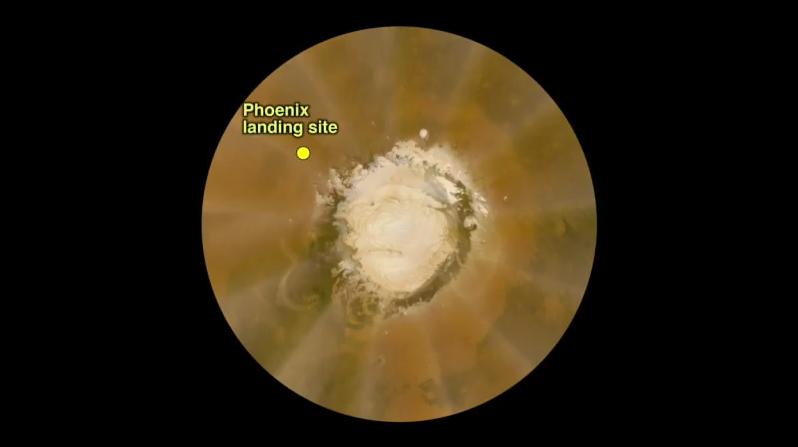
2008-10-14 |
Mars
|
Mars Reconnaissance Orbiter (MRO)
Phoenix
|
MARCI
|
2312x2322x3 |

|
-
PIA11230:
-
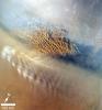
Late-summer Martian Dust Storm
Full Resolution:
TIFF
(16.12 MB)
JPEG
(237.4 kB)
|
|
|
2008-05-06 |
Mars
|
Mars Reconnaissance Orbiter (MRO)
|
MARCI
|
1083x844x3 |

|
-
PIA10634:
-
Phoenix Landing Area Viewed by Mars Color Imager
Full Resolution:
TIFF
(2.746 MB)
JPEG
(40.7 kB)
|
|
|
2008-05-24 |
Mars
|
Mars Reconnaissance Orbiter (MRO)
Phoenix
|
MARCI
|
516x516x3 |
|
-
PIA10672:
-
Clear Skies Ahead
Full Resolution:
TIFF
(268.3 kB)
JPEG
(22.66 kB)
|
|
|
2008-06-13 |
Mars
|
Mars Reconnaissance Orbiter (MRO)
Phoenix
|
MARCI
|
798x447x3 |

|
-
PIA10788:
-
Martian Dust Storm on May 18, 2008
Full Resolution:
TIFF
(1.072 MB)
JPEG
(17.48 kB)
|
|
|
2008-11-12 |
Mars
|
Mars Reconnaissance Orbiter (MRO)
|
MARCI
|
512x512x3 |

|
-
PIA11418:
-
MRO MARCI Weather Report for the week of 3 November 2008 � 9 November 2008
Full Resolution:
TIFF
(787.5 kB)
JPEG
(13.55 kB)
|
|
|
2009-04-16 |
Mars
|
Mars Reconnaissance Orbiter (MRO)
|
MARCI
|
1800x900x3 |
|
-
PIA11982:
-
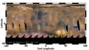
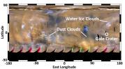
Martian Dust Storm near South Polar Cap
Full Resolution:
TIFF
(4.867 MB)
JPEG
(150.9 kB)
|
|
|
2009-04-16 |
Mars
|
Mars Reconnaissance Orbiter (MRO)
|
MARCI
|
1052x1019x3 |
|
-
PIA11988:
-
Weather Movie, Mars South Polar Region, March-April 2009 (Close-up View)
Full Resolution:
TIFF
(3.22 MB)
JPEG
(97.49 kB)
|
|
|
2009-04-16 |
Mars
|
Mars Reconnaissance Orbiter (MRO)
|
MARCI
|
1056x1016x3 |
|
-
PIA11987:
-
Weather Movie, Mars South Polar Region, March-April 2009
Full Resolution:
TIFF
(3.223 MB)
JPEG
(67.98 kB)
|
|
|
2012-08-02 |
Mars
|
Mars Reconnaissance Orbiter (MRO)
|
MARCI
|
1300x1400x3 |
|
-
PIA15959:
-
Martian Dust Storm
Full Resolution:
TIFF
(5.462 MB)
JPEG
(402.9 kB)
|
|
|
2012-08-04 |
Mars
|
Mars Reconnaissance Orbiter (MRO)
Mars Science Laboratory (MSL)
|
MARCI
|
3258x1817x3 |

|
-
PIA15962:
-
Mars Weather Map, Aug. 2, 2012
Full Resolution:
TIFF
(17.77 MB)
JPEG
(500.2 kB)
|
|
|
2012-08-04 |
Mars
|
Mars Reconnaissance Orbiter (MRO)
Mars Science Laboratory (MSL)
|
MARCI
|
3258x1817x3 |
|
-
PIA15963:
-
Mars Weather Map, 2008
Full Resolution:
TIFF
(17.77 MB)
JPEG
(354 kB)
|
|
|
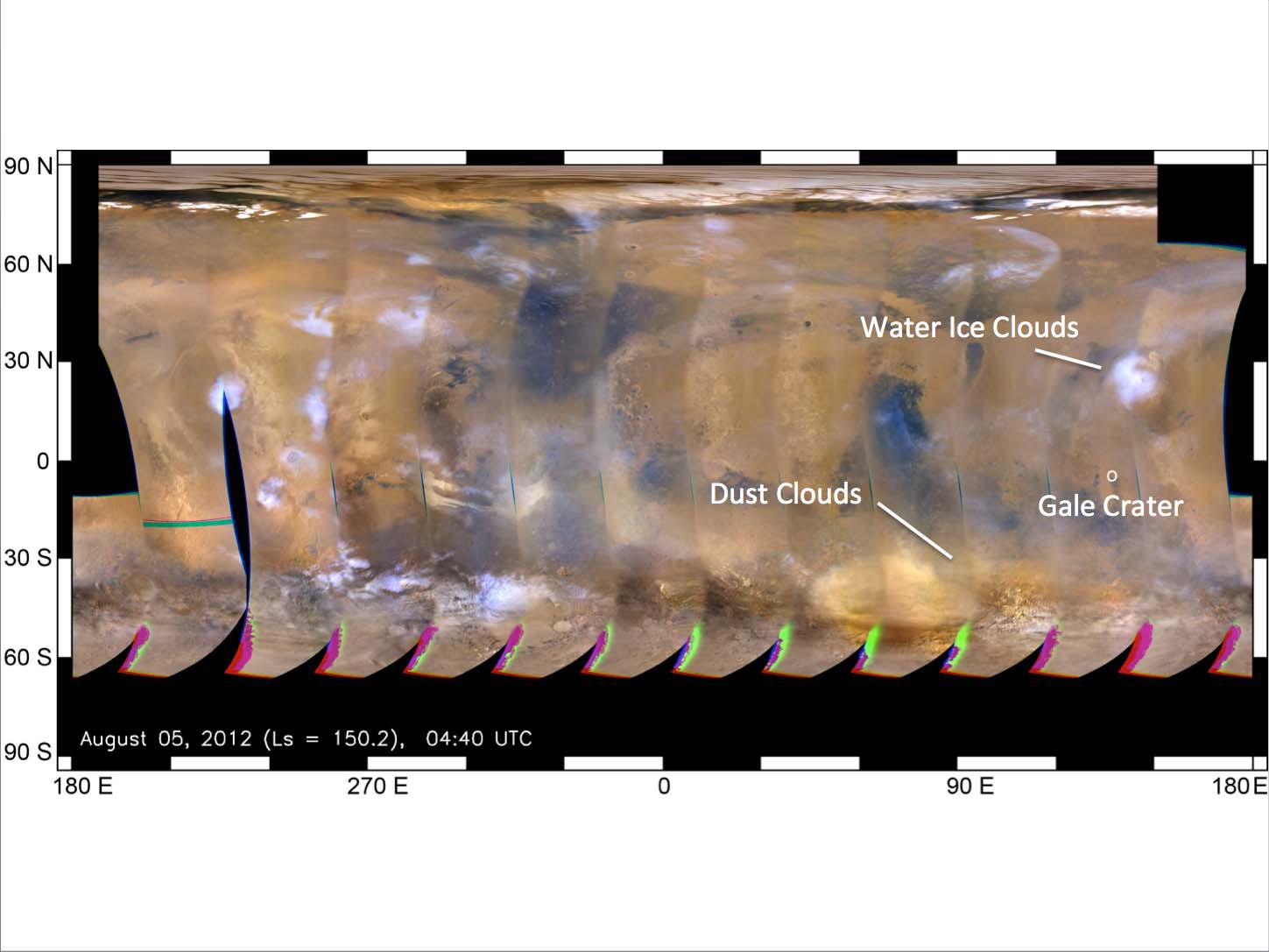
2012-08-05 |
Mars
|
Mars Reconnaissance Orbiter (MRO)
Mars Science Laboratory (MSL)
|
MARCI
|
3258x1817x3 |
|
-
PIA15968:
-
Mars Weather Map, Aug. 4, 2012
Full Resolution:
TIFF
(17.77 MB)
JPEG
(485.6 kB)
|
|
|
2012-08-10 |
Mars
|
Mars Reconnaissance Orbiter (MRO)
Mars Science Laboratory (MSL)
|
MARCI
|
1449x1087x3 |
|
-
PIA16037:
-
Mars Weather Map, Aug. 5
Full Resolution:
TIFF
(4.727 MB)
JPEG
(123.9 kB)
|
|
|
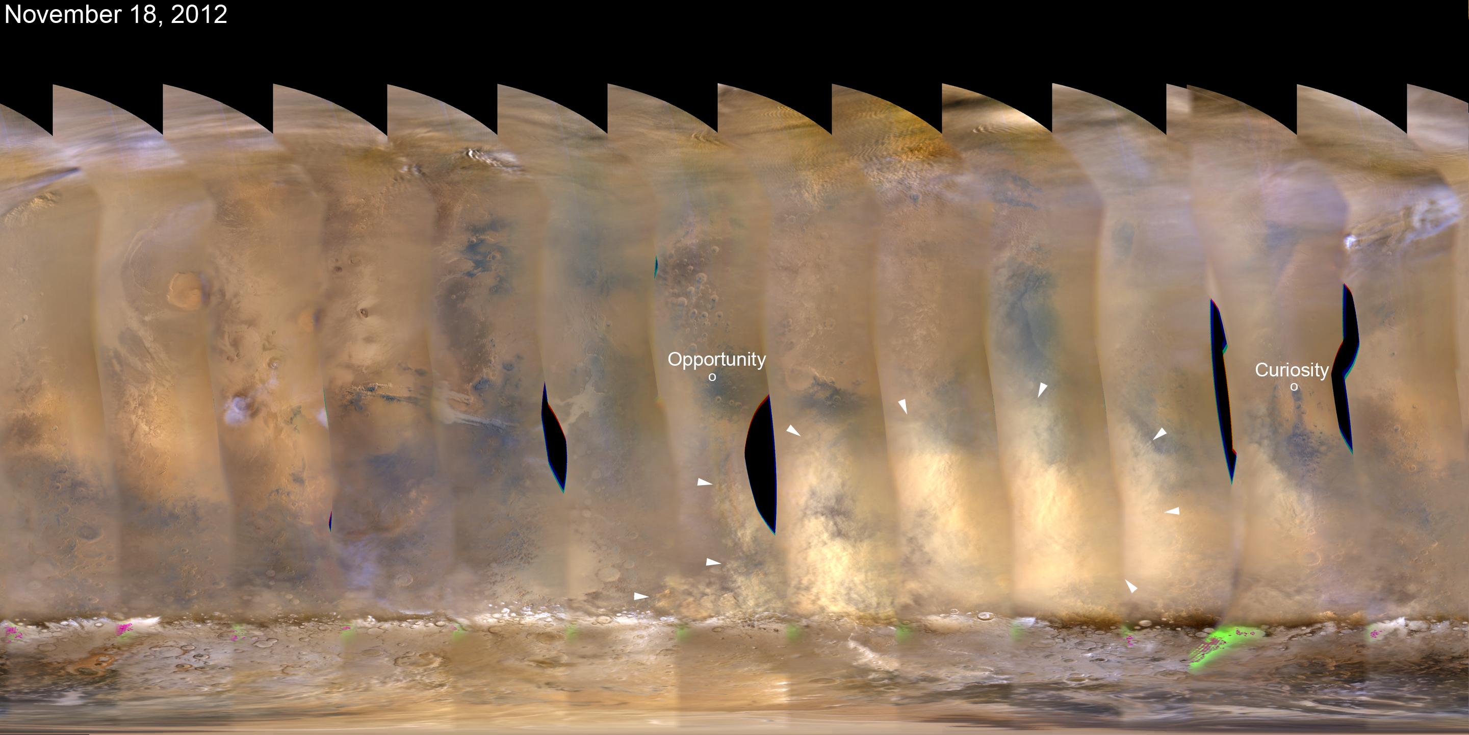
2012-11-21 |
Mars
|
Mars Reconnaissance Orbiter (MRO)
|
MARCI
|
2881x1441x3 |
|
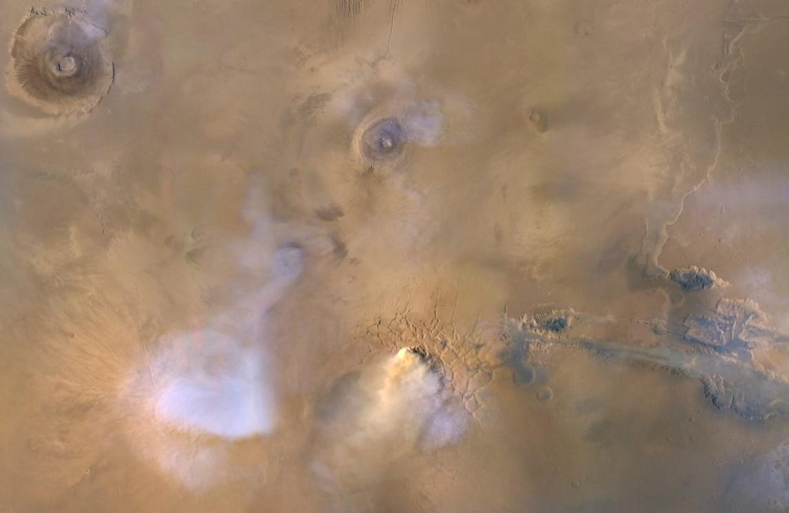
-
PIA16450:
-
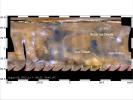
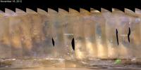
Martian Dust Storm, Nov. 18, 2012
Full Resolution:
TIFF
(12.46 MB)
JPEG
(314.4 kB)
|
|
|
2012-11-27 |
Mars
|
Mars Reconnaissance Orbiter (MRO)
|
MARCI
|
2881x1441x3 |
|
-
PIA16454:
-
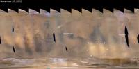
Regional Dust Storm Weakening, Nov. 25, 2012
Full Resolution:
TIFF
(12.46 MB)
JPEG
(266 kB)
|
|
|
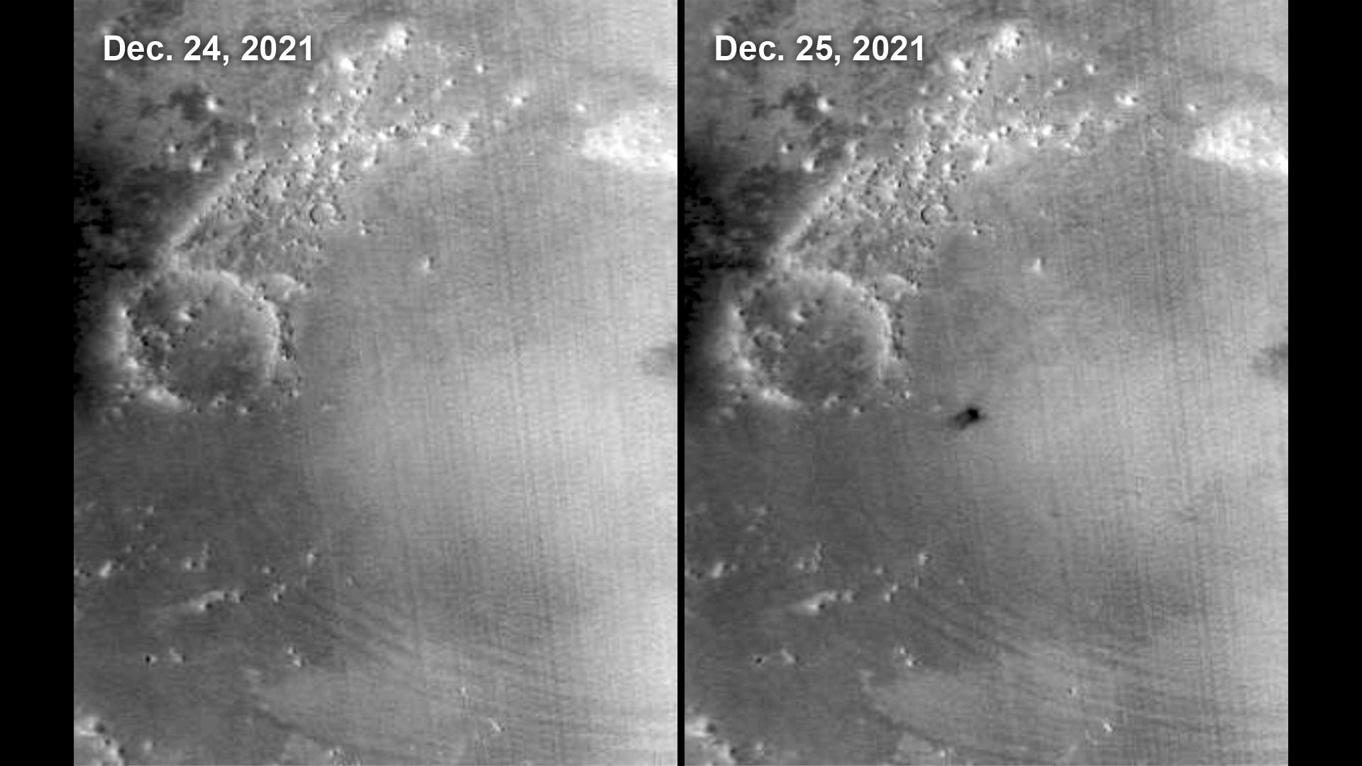
2014-05-22 |
Mars
|
Mars Reconnaissance Orbiter (MRO)
|
MARCI
|
1700x1700x3 |

|
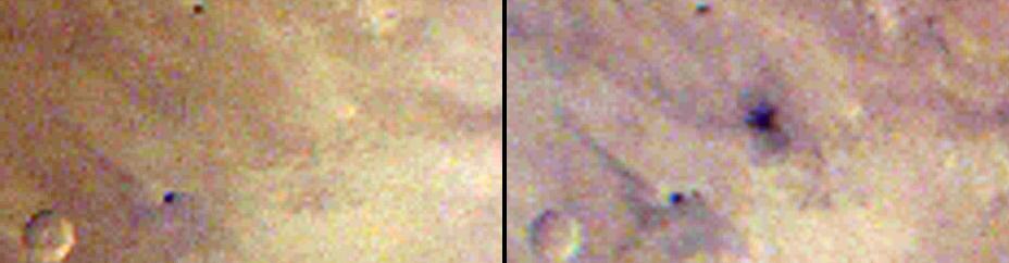
-
PIA18380:
-
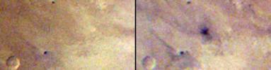
Impact Scar Detected in Mars Weathercam Image
Full Resolution:
TIFF
(8.674 MB)
JPEG
(222.2 kB)
|
|
|
2014-05-22 |
Mars
|
Mars Reconnaissance Orbiter (MRO)
|
MARCI
|
928x242x3 |
|
-
PIA18381:
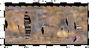
Best-Ever Pinning Down When a Space Rock Hit Mars
Full Resolution:
TIFF
(674.2 kB)
JPEG
(28.52 kB)
|
|
|
2017-03-09 |
Mars
|
Mars Reconnaissance Orbiter (MRO)
|
MARCI
|
1400x787x3 |

|
-
PIA21484:
-
Back-to-Back Martian Dust Storms
Full Resolution:
TIFF
(1.112 MB)
JPEG
(997.3 kB)
|
|
|
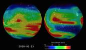
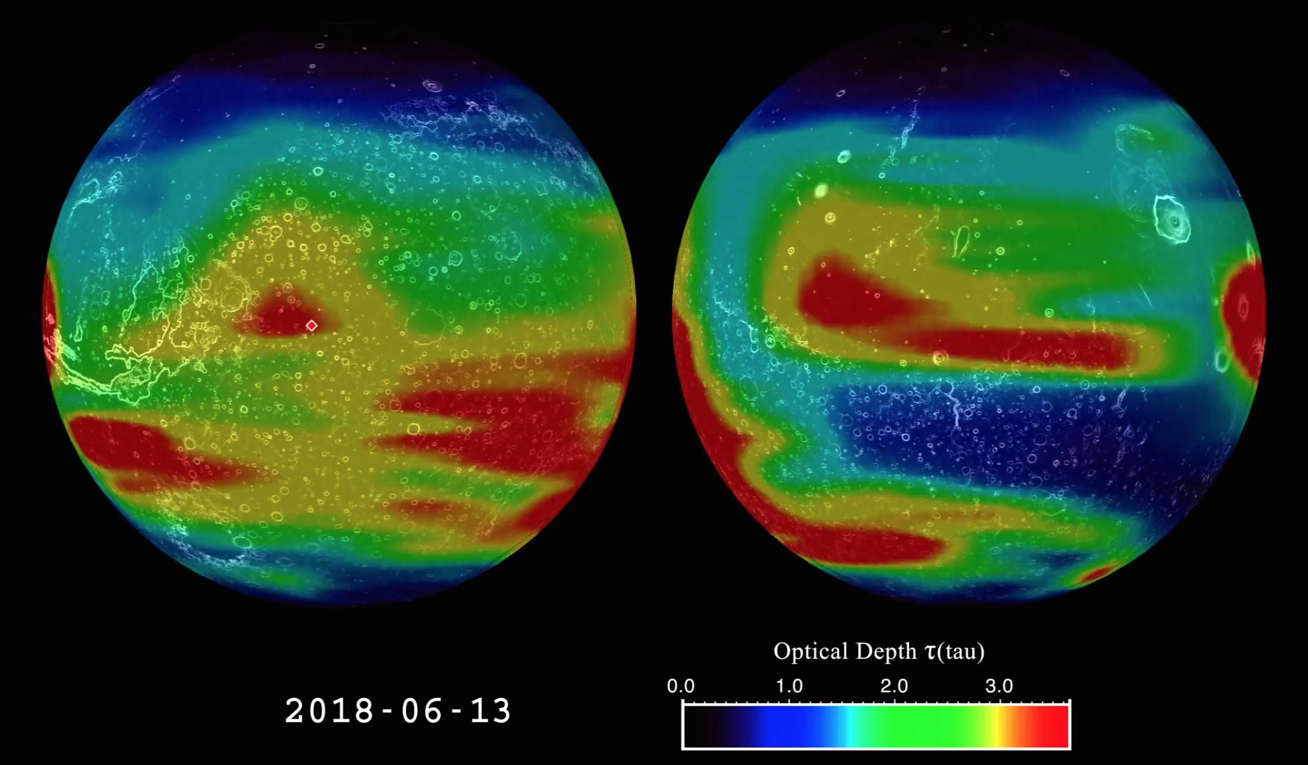
2018-06-13 |
Mars
|
Mars Reconnaissance Orbiter (MRO)
|
MARCI
|
1438x709x3 |
|
-
PIA22519:
-
2018 Giant Dust Storm on Mars
Full Resolution:
TIFF
(806.9 kB)
JPEG
(1.339 MB)
|
|
|
2018-07-19 |
Mars
|
Mars Reconnaissance Orbiter (MRO)
|
MARCI
|
1816x1024x3 |
|
-
PIA22487:
-
Mars Before and After Dust Storm
Full Resolution:
TIFF
(1.12 MB)
JPEG
(48.31 kB)
|
|
|
2019-11-26 |
Mars
|
Mars Reconnaissance Orbiter (MRO)
|
MARCI
|
1144x744x3 |
|
-
PIA23513:
-
A Mars Dust Tower Stands Out
Full Resolution:
TIFF
(2.209 MB)
JPEG
(55.16 kB)
|
|
|
2022-01-19 |
Mars
|
Mars Reconnaissance Orbiter (MRO)
|
MARCI
|
470x461x3 |
|
-
PIA25068:
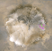
-
Dust Storm and Jezero Crater
Full Resolution:
TIFF
(452.4 kB)
JPEG
(13.22 kB)
|
|
|
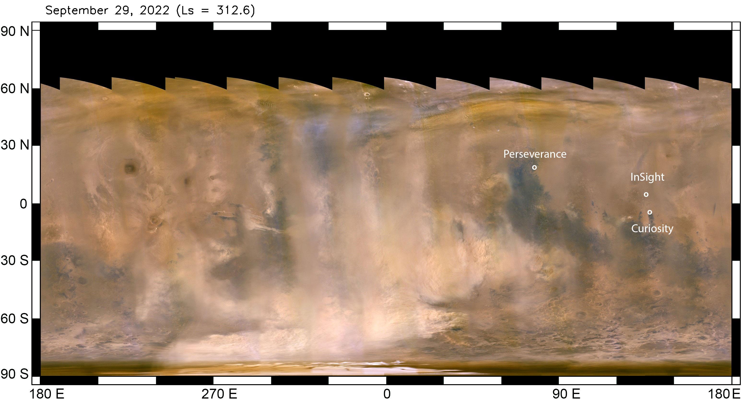
2022-10-07 |
Mars
|
Mars Reconnaissance Orbiter (MRO)
|
MARCI
|
3094x1669x3 |
|
-
PIA25412:
-
Mars Dust Storm in Relation to InSight, Curiosity and Perseverance
Full Resolution:
TIFF
(9.951 MB)
JPEG
(452.4 kB)
|
|
|
2022-10-27 |
Mars
|
Mars Reconnaissance Orbiter (MRO)
|
MARCI
|
1920x1080x1 |

|
-
PIA25585:
-
MARCI Views a Mars Impact Crater in Amazonis Planitia
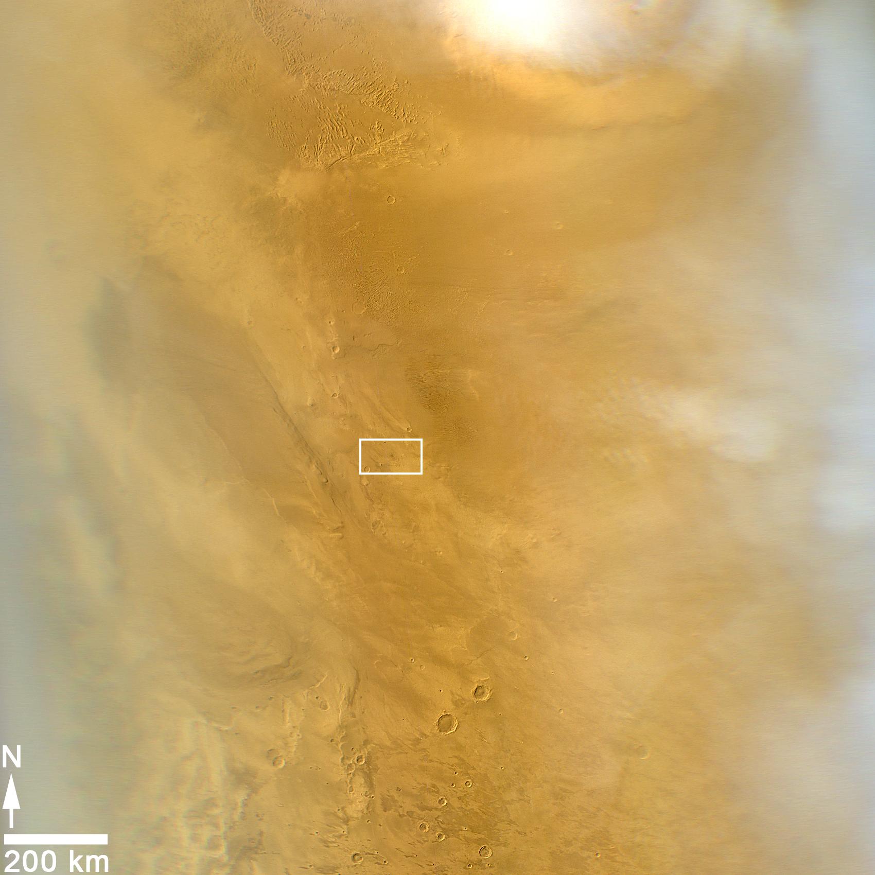
Full Resolution:
TIFF
(1.693 MB)
JPEG
(156.5 kB)
|
|
|
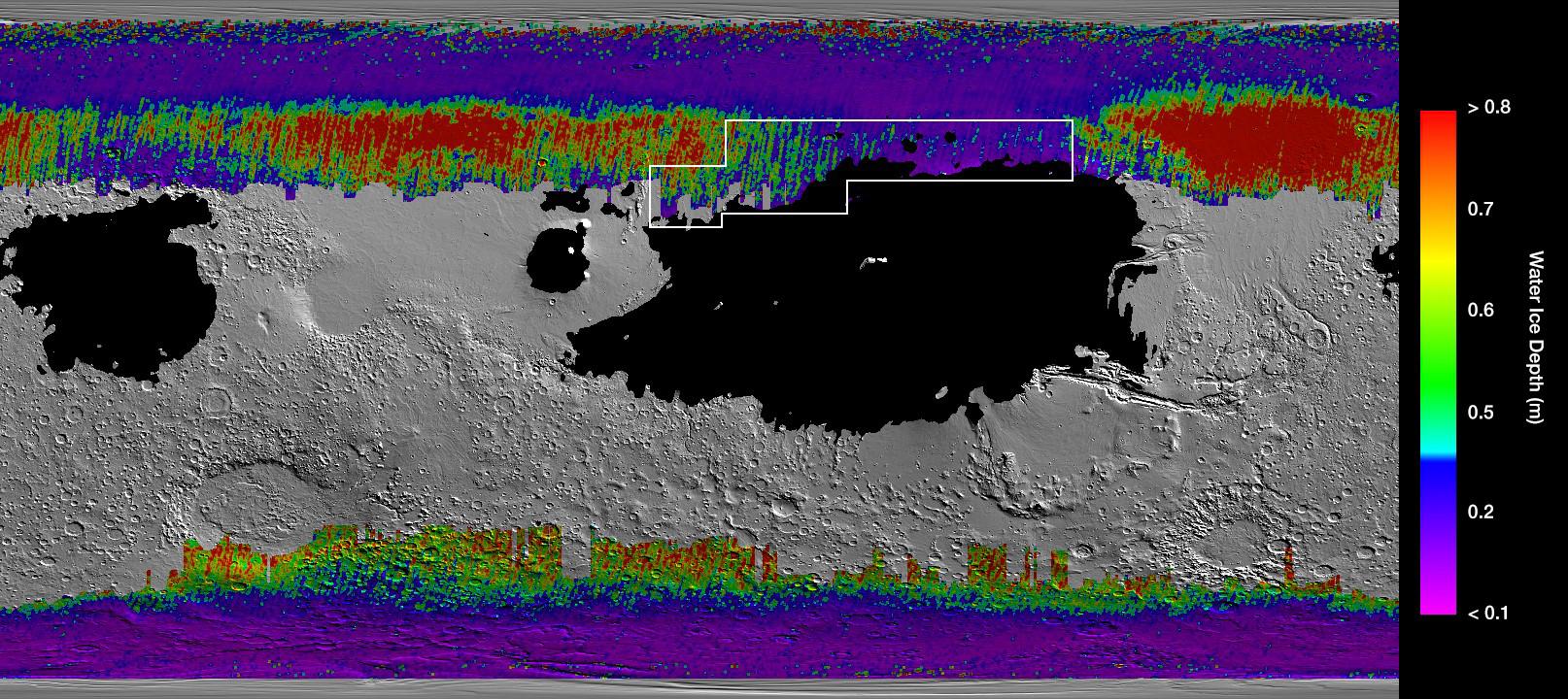
2019-12-10 |
Mars
|
2001 Mars Odyssey
Mars Reconnaissance Orbiter (MRO)
Mars Global Surveyor (MGS)
|
MCS
THEMIS
|
1614x720x3 |
|
-
PIA23514:
-
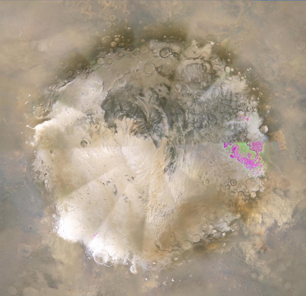
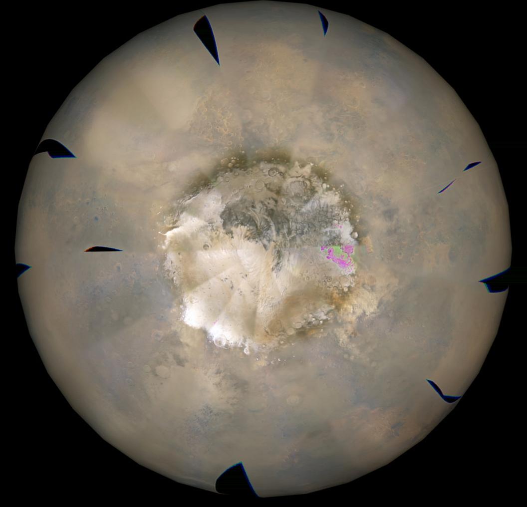
A Water Ice Map for Mars
Full Resolution:
TIFF
(2.369 MB)
JPEG
(311.5 kB)
|
|
|
2016-06-09 |
Mars
|
Mars Reconnaissance Orbiter (MRO)
|
MCS
MARCI
|
4800x3142x3 |
|
-
PIA20747:
-
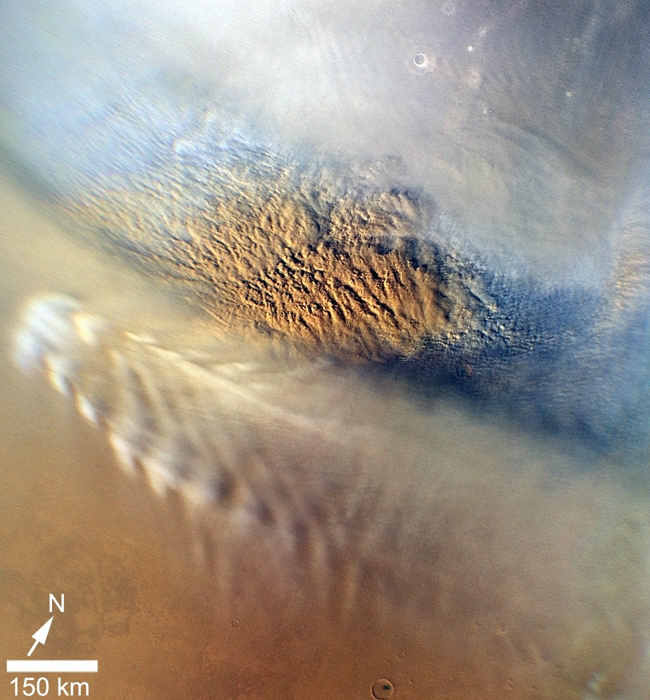
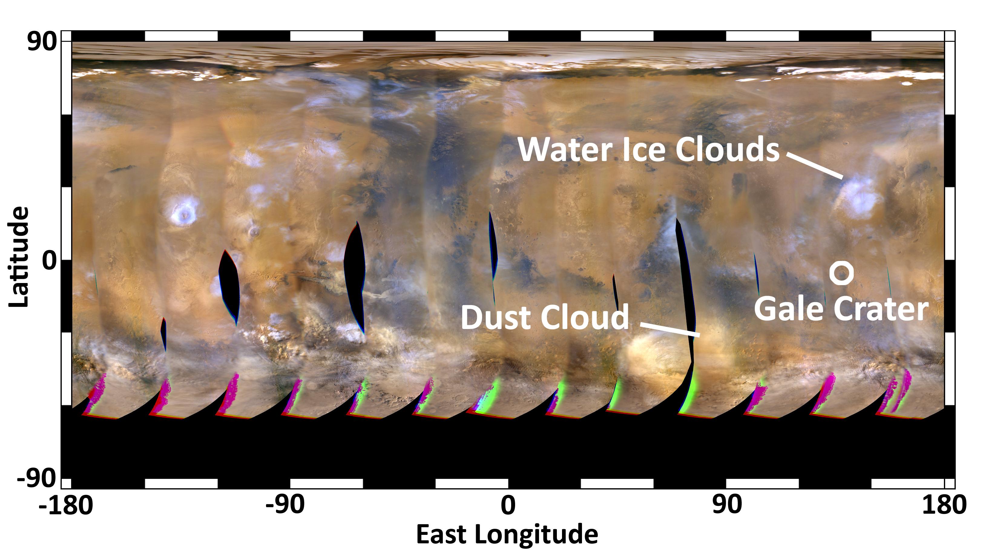
Mars Atmospheric Temperature and Dust Storm Tracking
Full Resolution:
TIFF
(29.8 MB)
JPEG
(632.6 kB)
|
|
|
2006-03-31 |
Mars
|
Mars Reconnaissance Orbiter (MRO)
|
MCS
|
880x300x3 |
|
-
PIA08030:
-
First Data from Mars Climate Sounder
Full Resolution:
TIFF
(793 kB)
JPEG
(12.12 kB)
|
|
|
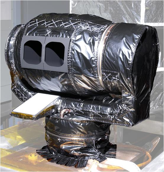
2010-08-26 |
|
Mars Reconnaissance Orbiter (MRO)
|
MCS
|
555x582x3 |
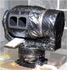
|
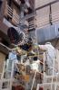
-
PIA13352:
-
Climate Sounder Instrument for Mars Reconnaissance Orbiter
Full Resolution:
TIFF
(970.4 kB)
JPEG
(72.69 kB)
|
|
|
2010-08-26 |
Mars
|
Mars Reconnaissance Orbiter (MRO)
|
MCS
|
962x545x3 |
|
-
PIA13353:
-
Martian Atmosphere Profiles
Full Resolution:
TIFF
(1.575 MB)
JPEG
(68.18 kB)
|
|
|
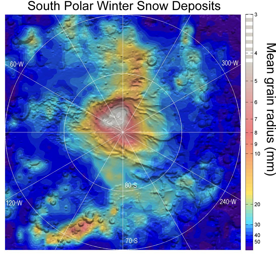
2012-09-11 |
Mars
|
Mars Reconnaissance Orbiter (MRO)
|
MCS
|
1095x1018x3 |

|
-
PIA16138:
-
Carbon-Dioxide Snowfall on Mars
Full Resolution:
TIFF
(3.346 MB)
JPEG
(184.6 kB)
|
|
|
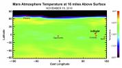
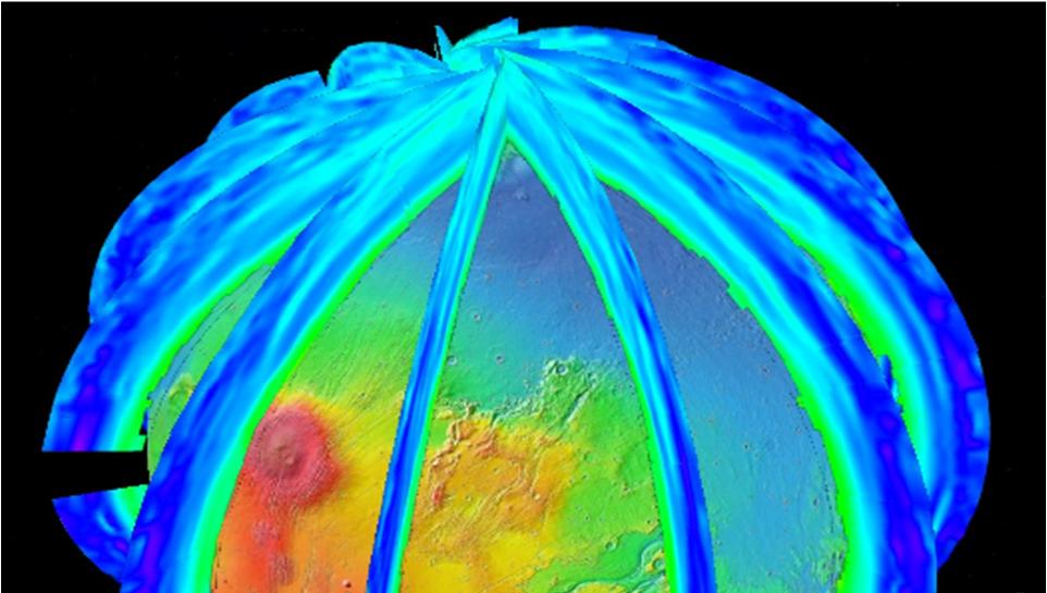
2013-06-12 |
Mars
|
Mars Reconnaissance Orbiter (MRO)
|
MCS
|
1883x2437x3 |
|
-
PIA17263:
-
Scanning Martian Atmospheric Temperatures (Graphic)
Full Resolution:
TIFF
(13.77 MB)
JPEG
(337.9 kB)
|
|
|
2016-06-09 |
Mars
|
Mars Reconnaissance Orbiter (MRO)
|
MCS
|
1006x505x3 |
|
-
PIA20746:
-
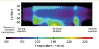
Seasonal Temperature Pattern Indicating Martian Dust Storms
Full Resolution:
TIFF
(432.2 kB)
JPEG
(55.66 kB)
|
|
|
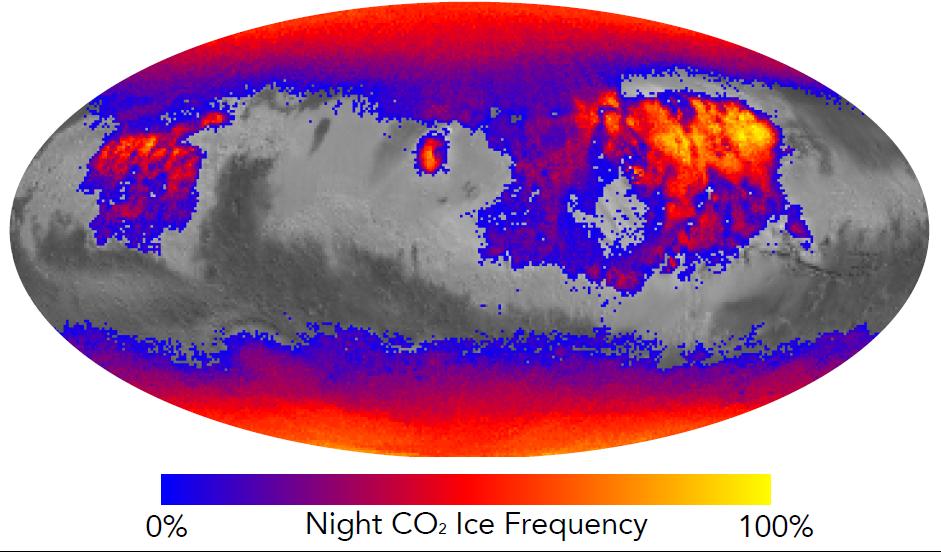
2016-07-08 |
Mars
|
Mars Reconnaissance Orbiter (MRO)
|
MCS
|
941x552x3 |

|
-
PIA20758:
-
Where on Mars Does Carbon Dioxide Frost Form Often?
Full Resolution:
TIFF
(620.9 kB)
JPEG
(77.94 kB)
|
|
|
2018-01-23 |
Mars
|
Mars Reconnaissance Orbiter (MRO)
|
MCS
|
1595x1055x3 |
|
-
PIA22080:
-
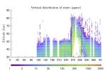
Water Vapor Reaches Mars' Middle Atmosphere During Global Dust Storm
Full Resolution:
TIFF
(1.133 MB)
JPEG
(197.6 kB)
|
|
|
2018-10-30 |
Mars
|
Mars Reconnaissance Orbiter (MRO)
|
MCS
|
1833x1073x3 |
|
-
PIA22737:
-
Mars Climate Sounder Studies 2018 Dust Storm
Full Resolution:
TIFF
(3.204 MB)
JPEG
(155.8 kB)
|
|
|
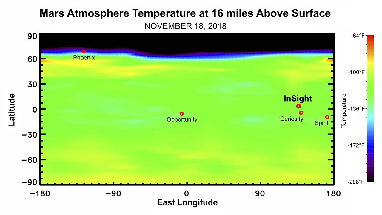
2018-11-21 |
Mars
|
Mars Reconnaissance Orbiter (MRO)
|
MCS
|
1280x720x3 |
|
-
PIA22570:
-
Martian Weather Forecast for InSight Landing
Full Resolution:
TIFF
(739 kB)
JPEG
(75.77 kB)
|
|
|
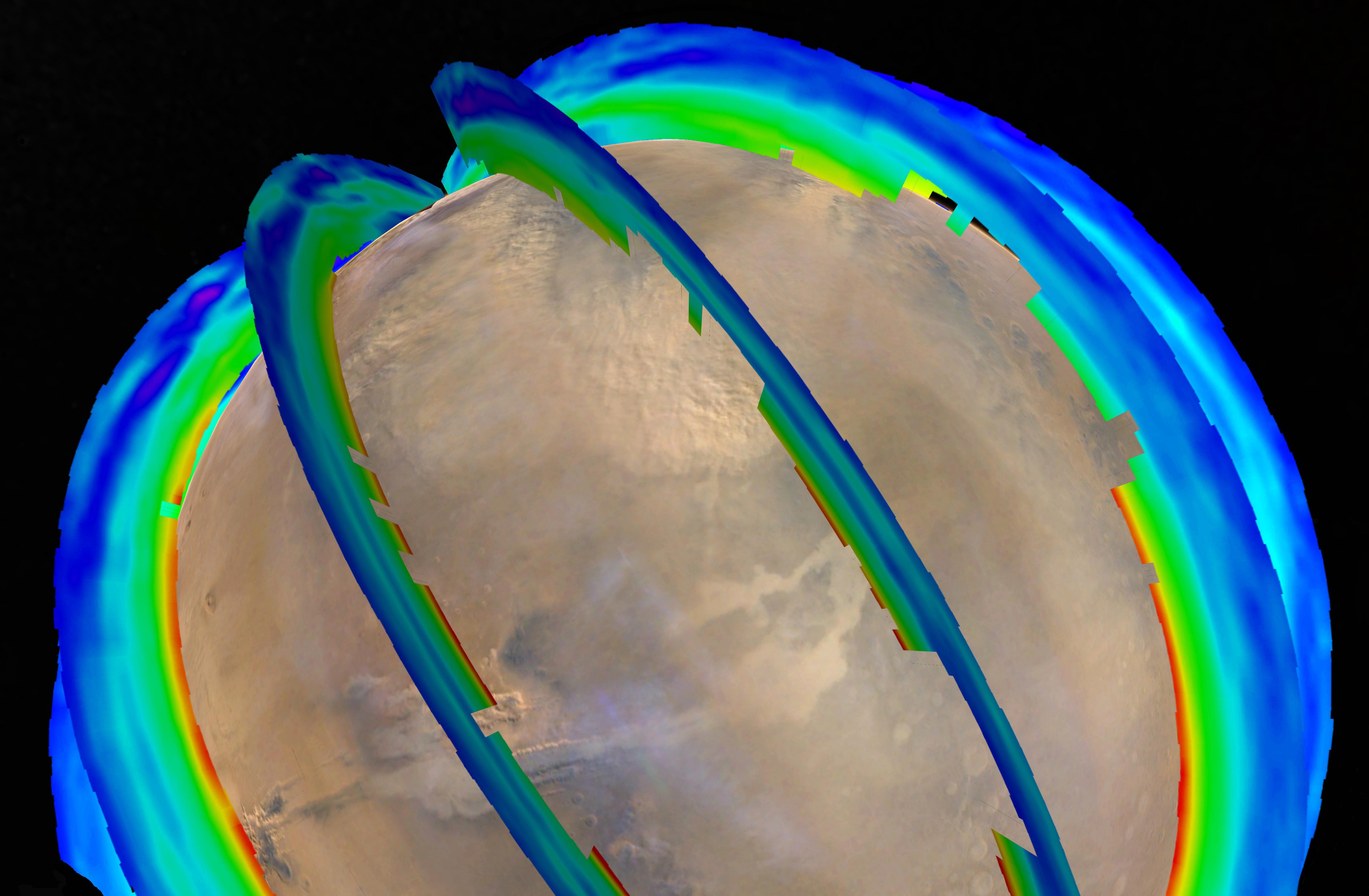
2008-04-17 |
Mars
|
Mars Express (MEX)
Mars Reconnaissance Orbiter (MRO)
|
MARSIS
Shallow Subsurface Radar (SHARAD)
|
1265x723x3 |
|
-
PIA10375:
-
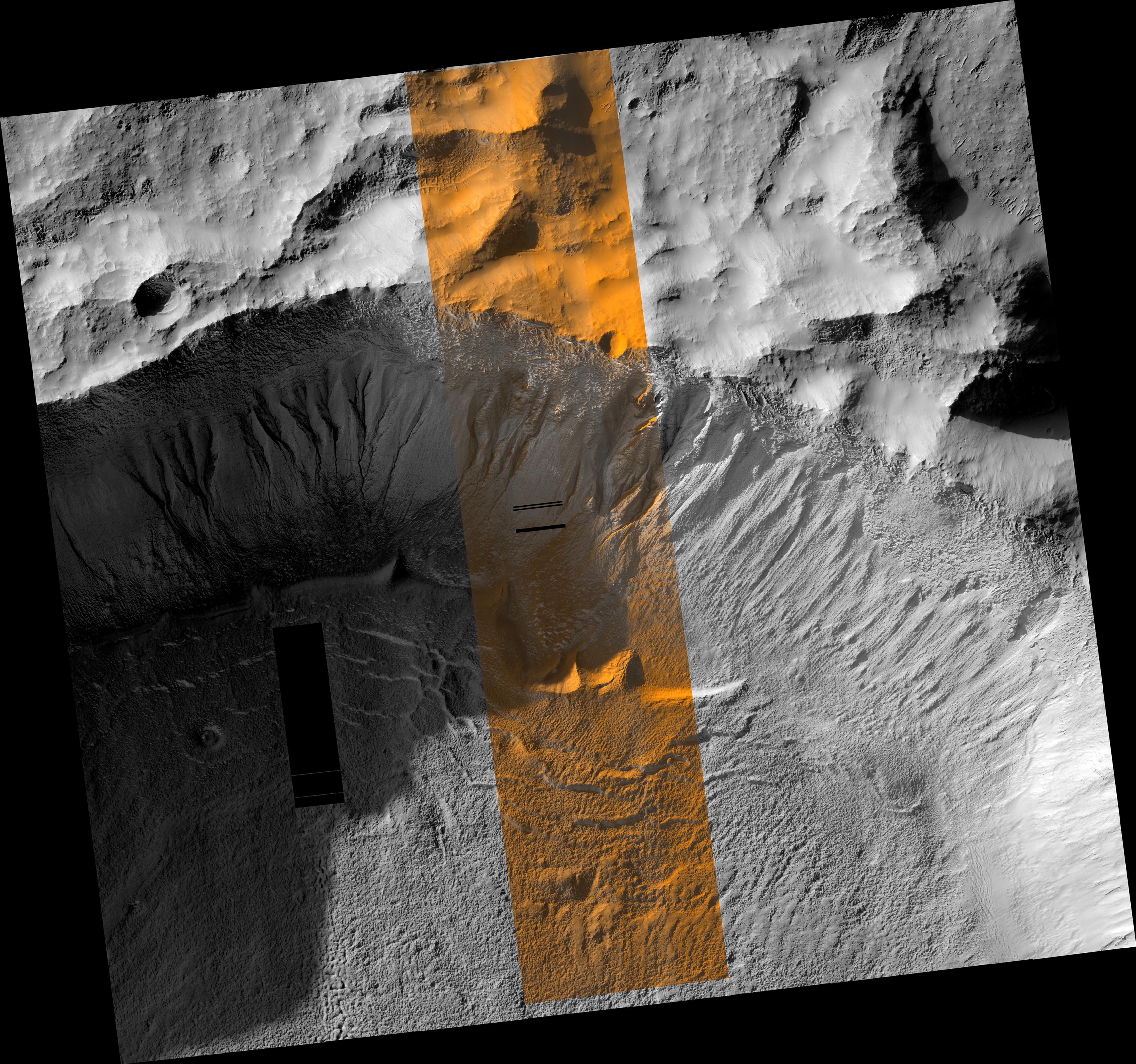
Two Radar Sounders Examine South Polar Layered Deposits on Mars
Full Resolution:
TIFF
(2.747 MB)
JPEG
(134.7 kB)
|
|
|
2008-04-17 |
Mars
|
Mars Express (MEX)
Mars Reconnaissance Orbiter (MRO)
|
MARSIS
Shallow Subsurface Radar (SHARAD)
|
516x387x1 |
|
-
PIA10376:
-
Mars Radar Opens a Planet's Third Dimension
Full Resolution:
TIFF
(307.4 kB)
JPEG
(20.51 kB)
|
|
|
2009-09-22 |
Mars
|
Mars Reconnaissance Orbiter (MRO)
|
HiRISE
Shallow Subsurface Radar (SHARAD)
|
1043x583x3 |
|
-
PIA12200:
-
Radar Mapping of Icy Layers Under Mars' North Pole
Full Resolution:
TIFF
(1.827 MB)
JPEG
(157.3 kB)
|
|
|
2013-06-11 |
Mars
|
2001 Mars Odyssey
Mars Reconnaissance Orbiter (MRO)
Mars Global Surveyor (MGS)
|
HiRISE
Mars Orbiter Camera (MOC)
THEMIS
|
960x608x3 |
|
-
PIA17079:
-
Martian Features Formed When Material Moves Downslope
Full Resolution:
TIFF
(1.752 MB)
JPEG
(100.9 kB)
|
|
|
2016-12-13 |
Mars
|
Mars Reconnaissance Orbiter (MRO)
Mars Science Laboratory (MSL)
|
HiRISE
MAHLI
|
3300x2550x3 |
|
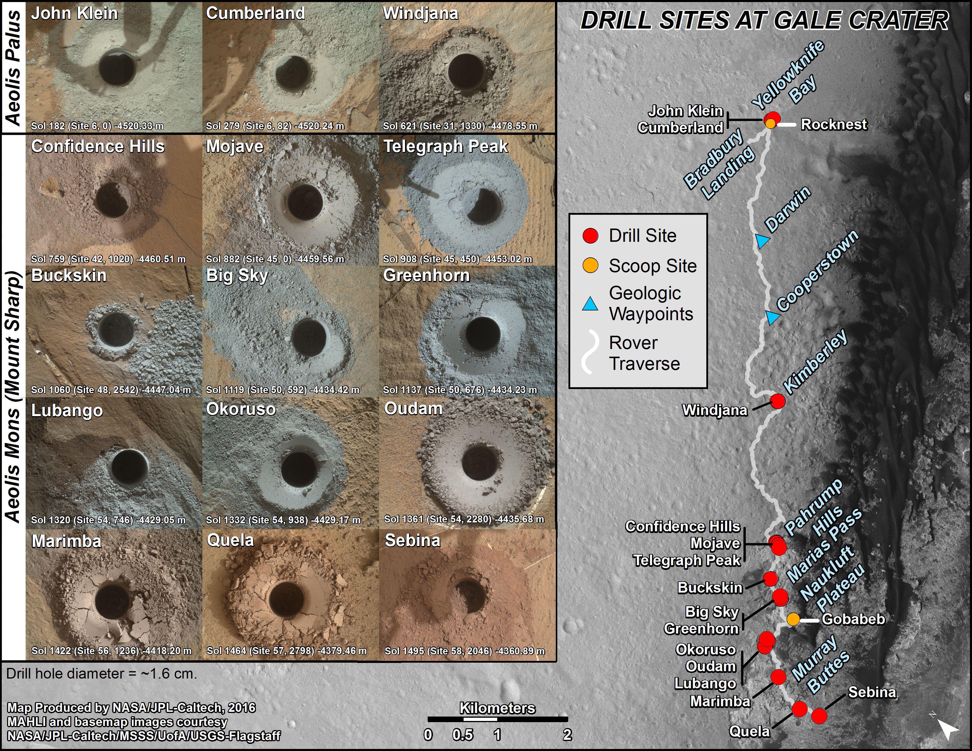
-
PIA21254:
-
Curiosity's Rock or Soil Sampling Sites on Mars, Through November 2016
Full Resolution:
TIFF
(21.14 MB)
JPEG
(2.213 MB)
|
|
|
2012-08-08 |
Mars
|
Mars Reconnaissance Orbiter (MRO)
Mars Science Laboratory (MSL)
|
HiRISE
MARDI
|
1665x1174x3 |
|
-
PIA16019:
-
A Better Look of the Martian Surface
Full Resolution:
TIFF
(5.867 MB)
JPEG
(153.7 kB)
|
|
|
2007-06-28 |
Mars
|
Mars Global Surveyor (MGS)
Mars Exploration Rover (MER)
Mars Reconnaissance Orbiter (MRO)
|
HiRISE
Mars Orbiter Camera (MOC)
|
636x479x3 |
|
-
PIA09689:
-
Opportunity's Long Road to Victoria (Animation)
Full Resolution:
TIFF
(915.1 kB)
JPEG
(31.22 kB)
|
|
|
2018-04-02 |
Mars
|
Mars Reconnaissance Orbiter (MRO)
|
HiRISE
|
2880x1800x3 |
|
-
PIA22346:
-
The Moving Sands of Lobo Vallis
Full Resolution:
TIFF
(15.56 MB)
JPEG
(1.261 MB)
|
|
|
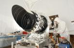
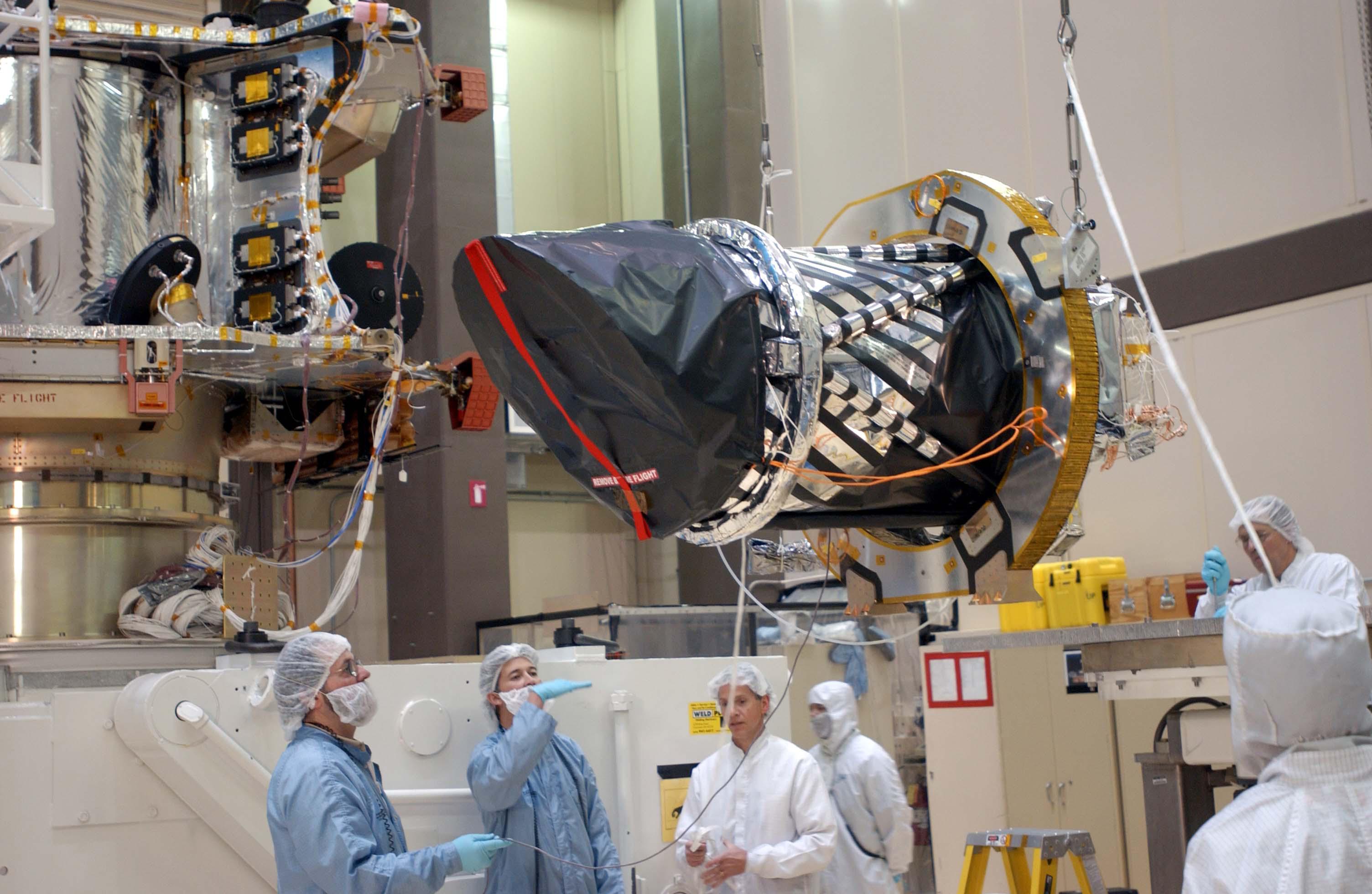
2004-12-21 |
|
Mars Reconnaissance Orbiter (MRO)
|
HiRISE
|
3008x1960x3 |
|
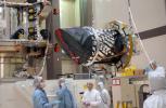
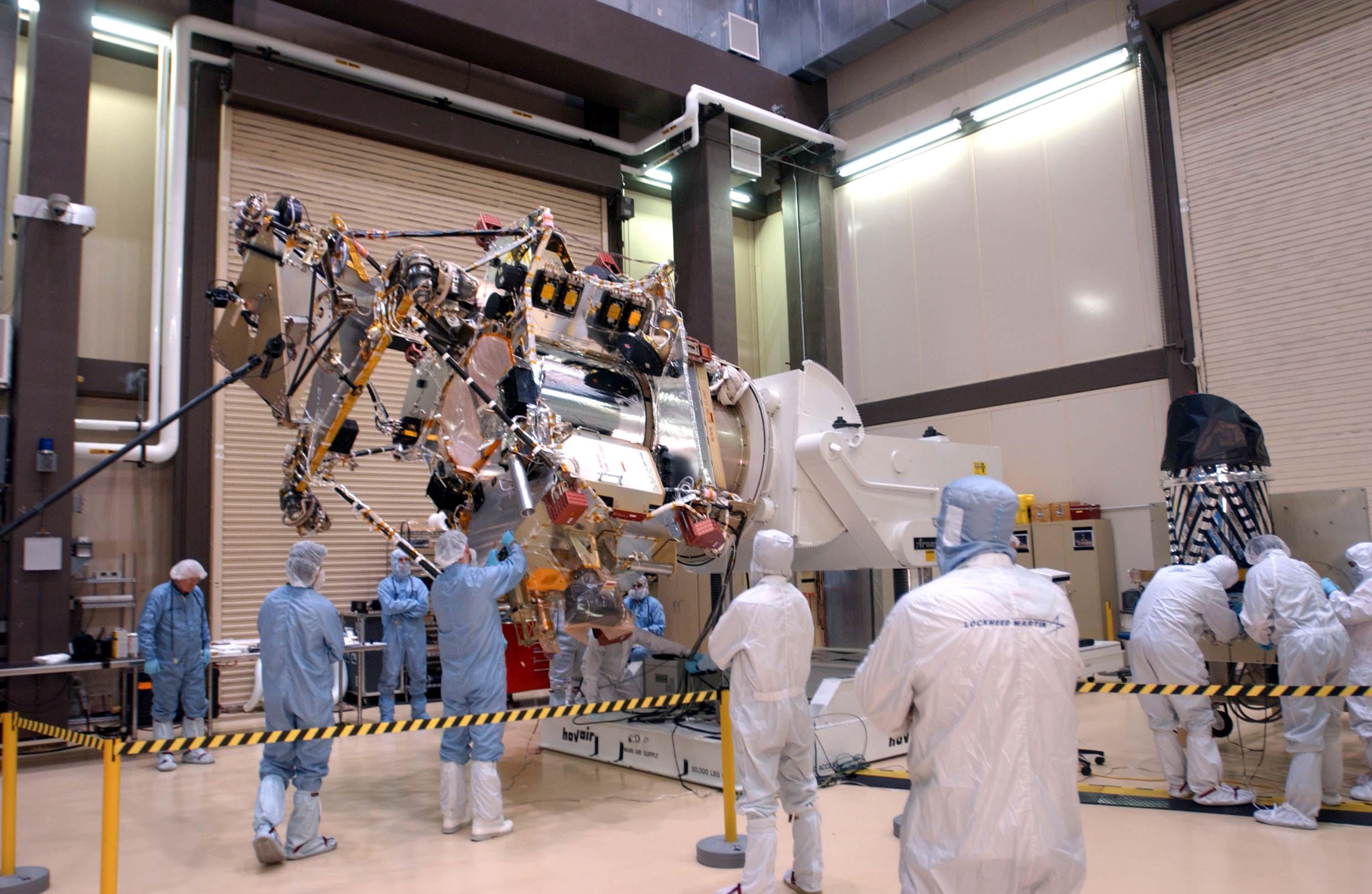
-
PIA07087:
-
Telescopic Camera for Mars Reconnaissance Orbiter, Front End
Full Resolution:
TIFF
(15.22 MB)
JPEG
(527.9 kB)
|
|
|
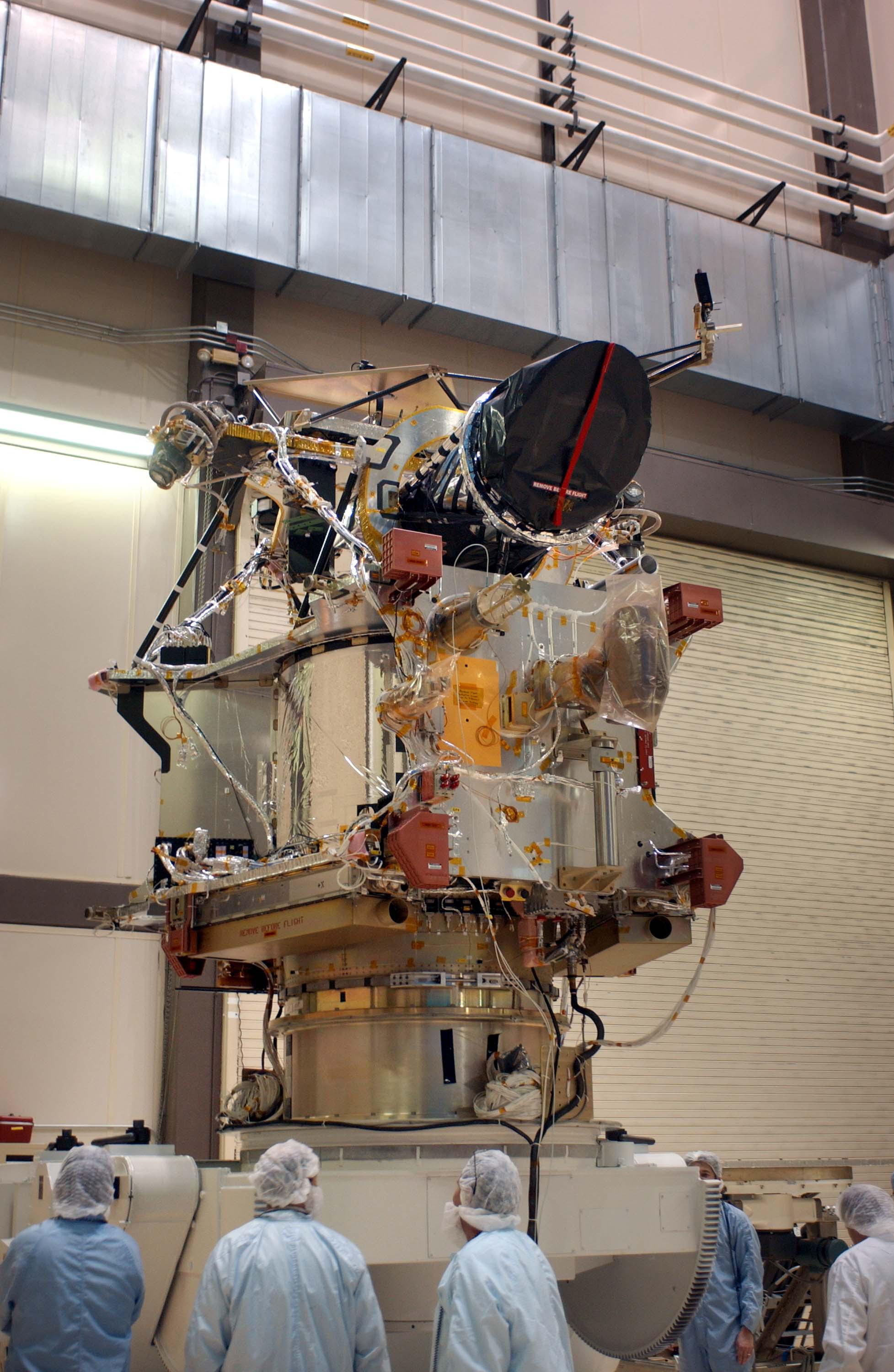
2005-01-07 |
|
Mars Reconnaissance Orbiter (MRO)
|
HiRISE
|
3008x1960x3 |
|
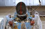
-
PIA07206:
-
Camera Ready to Install on Mars Reconnaissance Orbiter
Full Resolution:
TIFF
(16.14 MB)
JPEG
(499.7 kB)
|
|
|
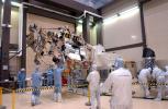
2005-01-07 |
|
Mars Reconnaissance Orbiter (MRO)
|
HiRISE
|
3008x1960x3 |
|
-
PIA07207:
-
Hoisting a Camera for Mars Reconnaissance Orbiter
Full Resolution:
TIFF
(15.35 MB)
JPEG
(446 kB)
|
|
|
2005-01-07 |
|
Mars Reconnaissance Orbiter (MRO)
|
HiRISE
|
1955x3000x3 |
|
-
PIA07208:
-
Positioning a Camera for Mars Reconnaissance Orbiter
Full Resolution:
TIFF
(16.92 MB)
JPEG
(532.9 kB)
|
|
|
2005-01-07 |
|
Mars Reconnaissance Orbiter (MRO)
|
HiRISE
|
3008x1960x3 |
|
-
PIA07209:
-
Installing a Camera on Mars Reconnaissance Orbiter
Full Resolution:
TIFF
(15.33 MB)
JPEG
(460.6 kB)
|
|
|
2005-01-07 |
|
Mars Reconnaissance Orbiter (MRO)
|
HiRISE
|
1955x3000x3 |

|
-
PIA07210:
-
Mars Reconnaissance Orbiter After Camera Installation
Full Resolution:
TIFF
(15.72 MB)
JPEG
(539.3 kB)
|
|
|
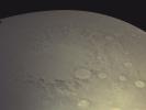
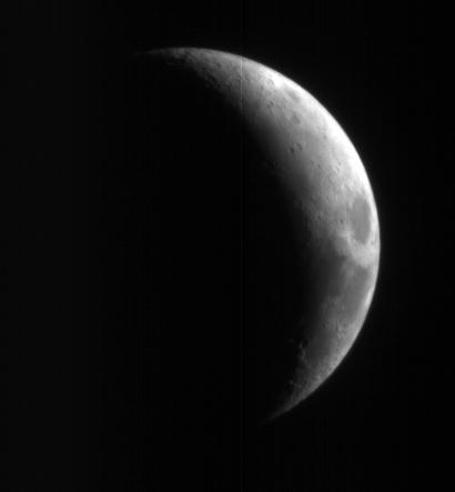
2005-09-10 |
Moon
|
Mars Reconnaissance Orbiter (MRO)
|
HiRISE
|
410x443x1 |
|
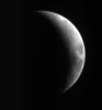
-
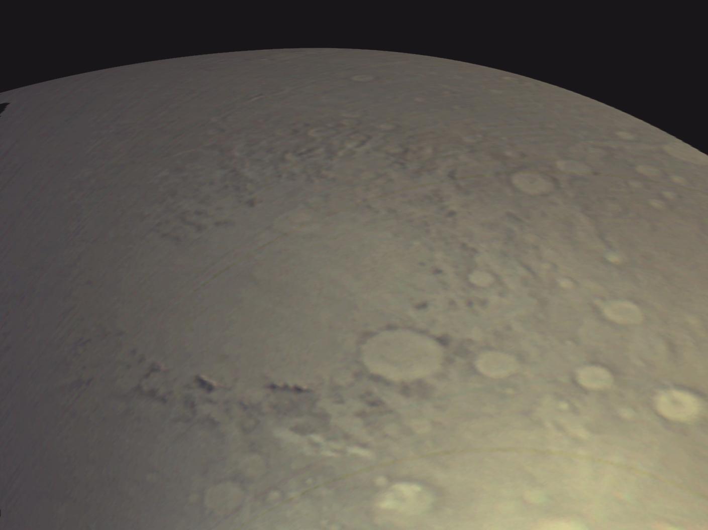
PIA08002:
-
High-Resolution Mars Camera Test Image of Moon
Full Resolution:
TIFF
(182.1 kB)
JPEG
(6.301 kB)
|
|
|
2010-02-17 |
Mars
|
Mars Reconnaissance Orbiter (MRO)
|
HiRISE
|
1676x1519x1 |
|
-
PIA12840:
-
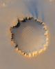
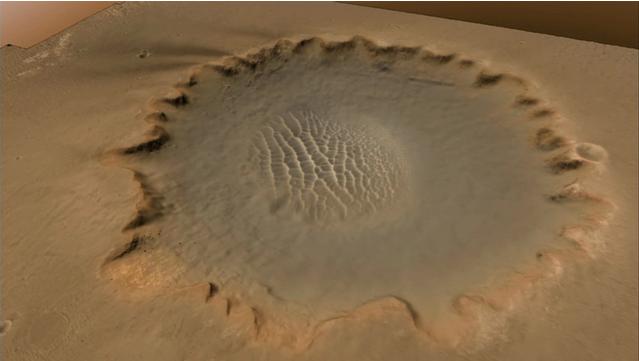
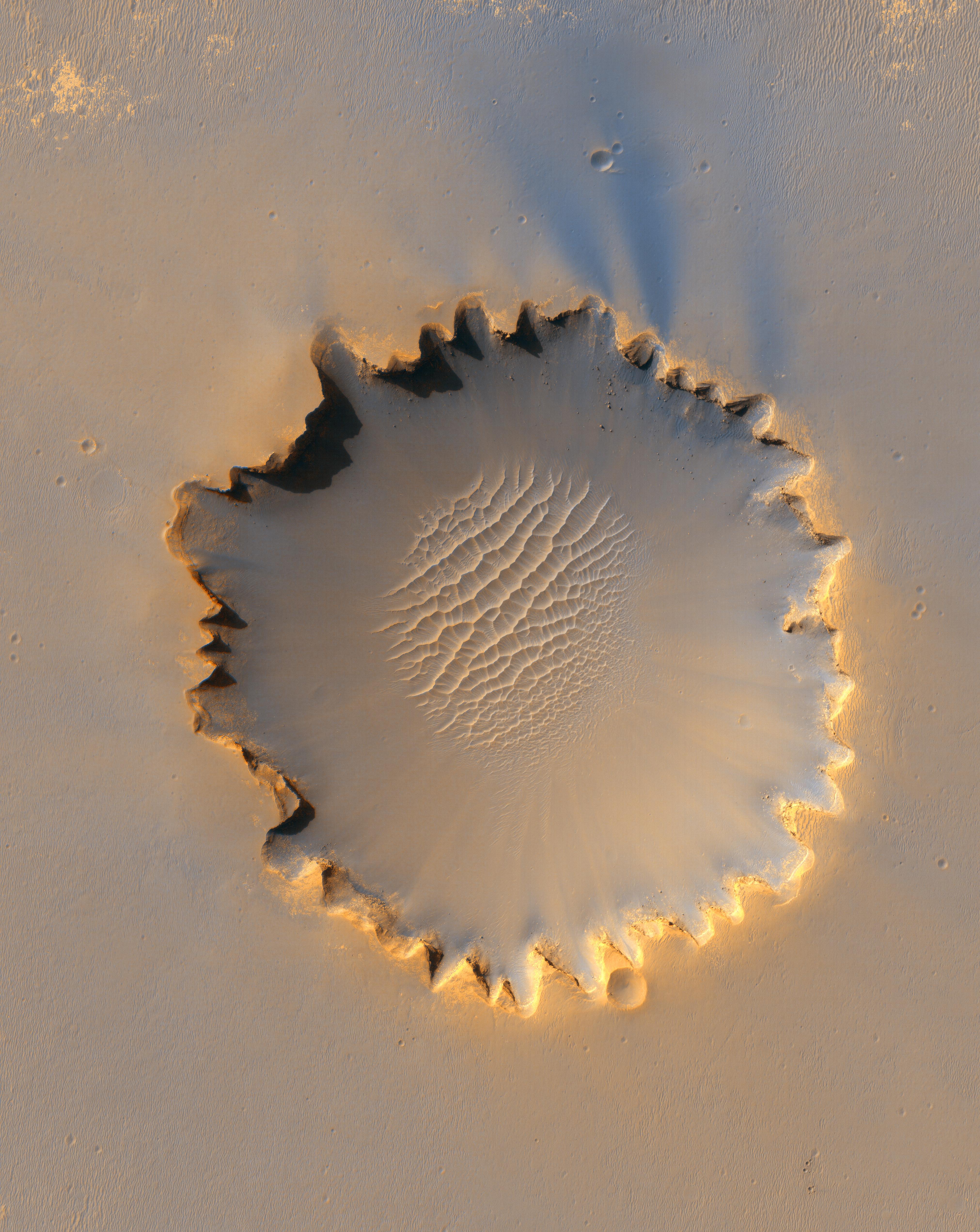
Terrain Model of Mars' Mojave Crater
Full Resolution:
TIFF
(2.549 MB)
JPEG
(380.7 kB)
|
|
|
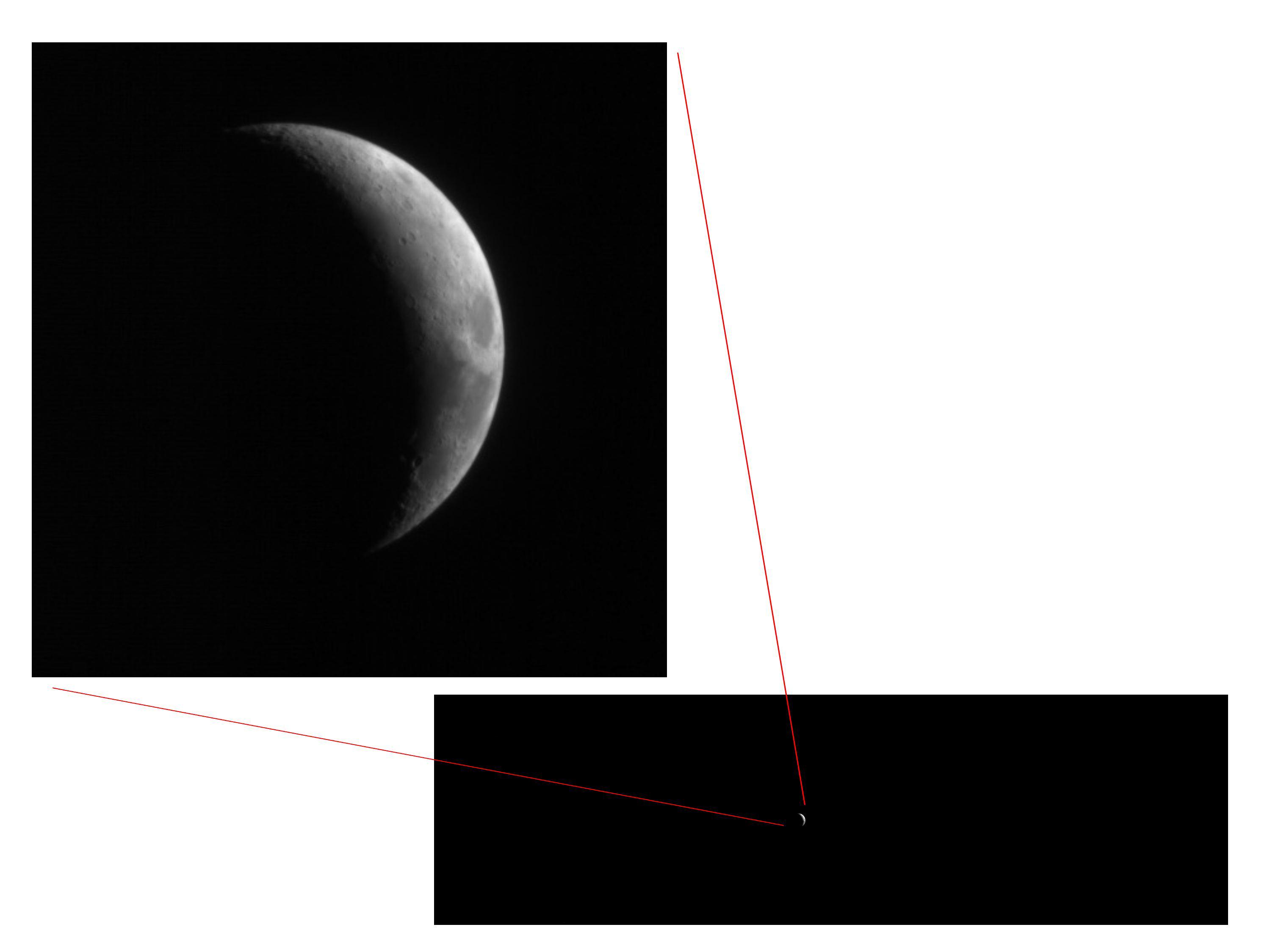
2005-09-10 |
Moon
|
Mars Reconnaissance Orbiter (MRO)
|
HiRISE
|
2999x2249x3 |
|
-
PIA08005:
-
Full-Frame Reference for Test Photo of Moon
Full Resolution:
TIFF
(20.23 MB)
JPEG
(167.9 kB)
|
|
|
2005-09-13 |
Moon
|
Mars Reconnaissance Orbiter (MRO)
|
HiRISE
|
532x663x3 |

|
-
PIA08004:
-
High-Resolution Mars Camera Test Image of Moon (Infrared)
Full Resolution:
TIFF
(1.059 MB)
JPEG
(16.63 kB)
|
|
|
2006-03-24 |
Mars
|
Mars Reconnaissance Orbiter (MRO)
|
HiRISE
|
1092x851x1 |

|
-
PIA08013:
-
First Mars Image from Newly Arrived Camera
Full Resolution:
TIFF
(930.5 kB)
JPEG
(146.1 kB)
|
|
|
2006-03-24 |
Mars
|
Mars Reconnaissance Orbiter (MRO)
|
HiRISE
|
20048x9500x1 |
|
-
PIA08014:
-
Detail of First Mars Image from Newly Arrived Camera
Full Resolution:
TIFF
(190.5 MB)
JPEG
(19.19 MB)
|
|
|
2006-04-07 |
Mars
|
Mars Reconnaissance Orbiter (MRO)
|
HiRISE
|
3048x9280x3 |

|
-
PIA08061:
-
First Color HiRISE Image of Mars
Full Resolution:
TIFF
(84.86 MB)
JPEG
(4.953 MB)
|
|
|
2006-04-07 |
Mars
|
Mars Reconnaissance Orbiter (MRO)
|
HiRISE
|
3000x2299x3 |
|
-
PIA08054:
-
Perspective View of HiRISE First Image
Full Resolution:
TIFF
(20.69 MB)
JPEG
(998.3 kB)
|
|
|
2006-04-07 |
Mars
|
Mars Reconnaissance Orbiter (MRO)
|
HiRISE
|
10040x26011x1 |
|
-
PIA08049:
-
Sample of the Argyre Impact Basin Rim
Full Resolution:
TIFF
(261.2 MB)
JPEG
(39.48 MB)
|
|
|
2006-04-07 |
Mars
|
Mars Reconnaissance Orbiter (MRO)
|
HiRISE
|
20081x5523x1 |
|
-
PIA08047:
Landscape West of Bosporos Rupes
Full Resolution:
TIFF
(110.9 MB)
JPEG
(17.23 MB)
|
|
|
2006-04-07 |
Mars
|
Mars Reconnaissance Orbiter (MRO)
|
HiRISE
|
20081x5164x1 |
|
-
PIA08048:
Landscape Northeast of Halley Crater
Full Resolution:
TIFF
(103.7 MB)
JPEG
(21.2 MB)
|
|
|
2006-04-07 |
Mars
|
Mars Reconnaissance Orbiter (MRO)
|
HiRISE
|
6045x23024x1 |
|
-
PIA08050:
-
Sample of Mid-latitude Southern Highlands
Full Resolution:
TIFF
(139.4 MB)
JPEG
(18.22 MB)
|
|
|
2006-04-07 |
Mars
|
Mars Reconnaissance Orbiter (MRO)
|
HiRISE
|
6045x17003x1 |
|
-
PIA08051:
-
A Myriad of Geologic Processes in Terra Cimmeria
Full Resolution:
TIFF
(102.9 MB)
JPEG
(16.25 MB)
|
|
|
2006-04-07 |
Mars
|
Mars Reconnaissance Orbiter (MRO)
|
HiRISE
|
5017x5634x1 |
|
-
PIA08052:
-
Twilight Imaging of Kepler Crater Floor
Full Resolution:
TIFF
(28.31 MB)
JPEG
(6.127 MB)
|
|
|
2006-04-07 |
Mars
|
Mars Reconnaissance Orbiter (MRO)
|
HiRISE
|
3212x1600x3 |

|
-
PIA08053:
-
First HiRISE Image of Mars: Topographic Model from Photoclinometry
Full Resolution:
TIFF
(15.42 MB)
JPEG
(1.482 MB)
|
|
|
2006-04-07 |
Mars
|
Mars Reconnaissance Orbiter (MRO)
|
HiRISE
|
20081x9523x1 |
|
-
PIA08060:
-
First HiRISE Image of Mars
Full Resolution:
TIFF
(191.2 MB)
JPEG
(16.72 MB)
|
|
|
2006-09-29 |
Mars
|
Mars Reconnaissance Orbiter (MRO)
|
HiRISE
|
2001x1485x1 |

|
-
PIA08789:
-
New Mars Camera's First Image of Mars from Mapping Orbit
Full Resolution:
TIFF
(2.975 MB)
JPEG
(512.6 kB)
|
|
|
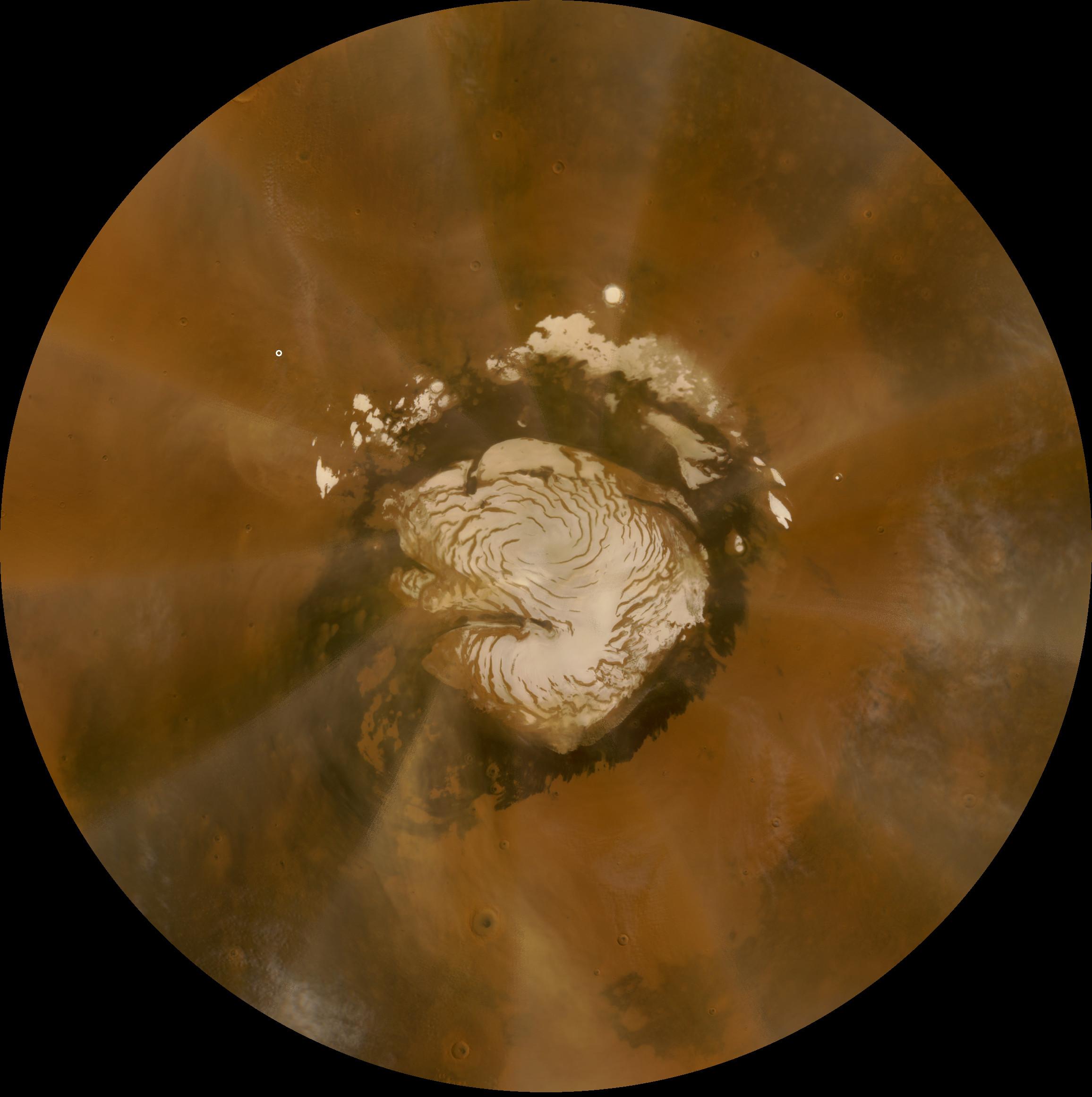
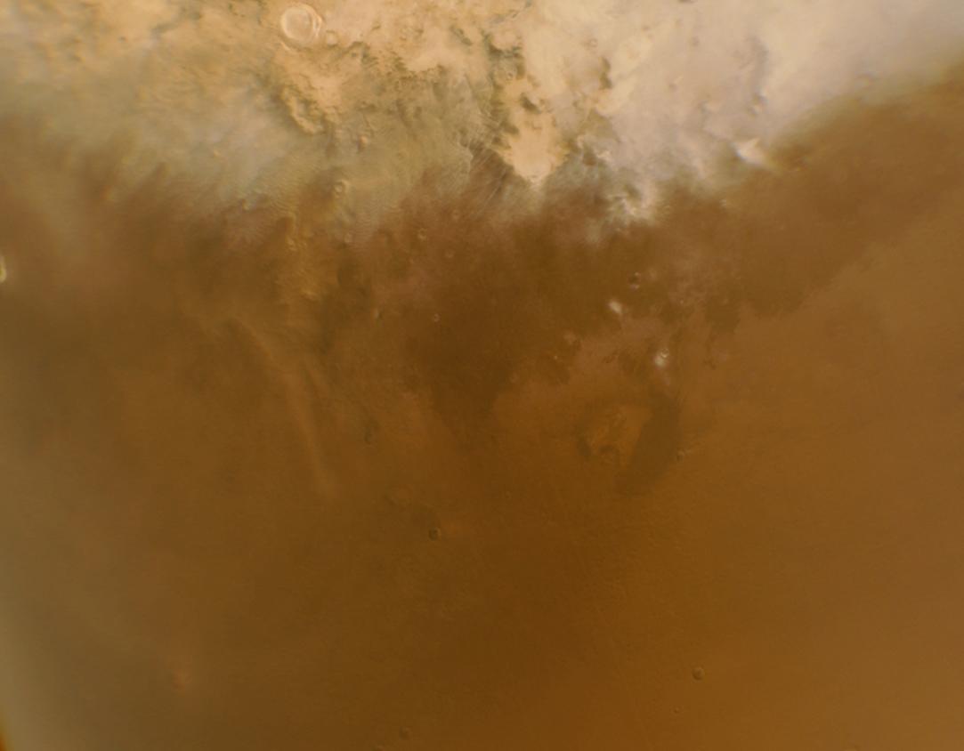
2006-09-30 |
Mars
|
Mars Reconnaissance Orbiter (MRO)
|
HiRISE
|
13469x13491x1 |
|
-
PIA08791:
-
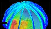
North Polar Layered Deposits in Summer
Full Resolution:
TIFF
(181.7 MB)
JPEG
(8.903 MB)
|
|
|
2006-10-01 |
Mars
|
Mars Reconnaissance Orbiter (MRO)
|
HiRISE
|
23444x23377x1 |
|
-
PIA08792:
-
New Mars Camera's First Image of Mars from Mapping Orbit (Full Frame)
Full Resolution:
TIFF
(548.1 MB)
JPEG
(47.26 MB)
|
|
|
2006-10-06 |
Mars
|
Mars Exploration Rover (MER)
Mars Reconnaissance Orbiter (MRO)
|
HiRISE
|
1176x942x3 |

|
-
PIA08812:
-
The Opportunity Rover at 'Victoria Crater'
Full Resolution:
TIFF
(3.327 MB)
JPEG
(159.1 kB)
|
|
|
2006-10-06 |
Mars
|
Mars Exploration Rover (MER)
Mars Reconnaissance Orbiter (MRO)
|
HiRISE
|
1941x1230x3 |
|
-
PIA08816:
-
Opportunity at Crater's 'Cape Verde'
Full Resolution:
TIFF
(7.172 MB)
JPEG
(264.8 kB)
|
|
|
2006-10-06 |
Mars
|
Mars Exploration Rover (MER)
Mars Reconnaissance Orbiter (MRO)
|
HiRISE
|
4045x5085x3 |
|
-
PIA08813:
-
'Victoria Crater' at Meridiani Planum
Full Resolution:
TIFF
(61.71 MB)
JPEG
(3.174 MB)
|
|
|
2006-10-06 |
Mars
|
Mars Exploration Rover (MER)
Mars Reconnaissance Orbiter (MRO)
|
HiRISE
|
1373x1049x1 |
|
-
PIA08817:
-
Opportunity at Crater's 'Cape Verde' (Red Filter)
Full Resolution:
TIFF
(1.442 MB)
JPEG
(130.9 kB)
|
|
|
2006-10-06 |
|
Mars Reconnaissance Orbiter (MRO)
|
HiRISE
|
1800x1800x3 |
|
-
PIA08815:
-
Getting a Sense of Scale
Full Resolution:
TIFF
(9.735 MB)
JPEG
(218.7 kB)
|
|
|
2006-10-16 |
Mars
|
Mars Reconnaissance Orbiter (MRO)
|
HiRISE
|
4613x4320x3 |
|
-
PIA01920:
-
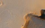
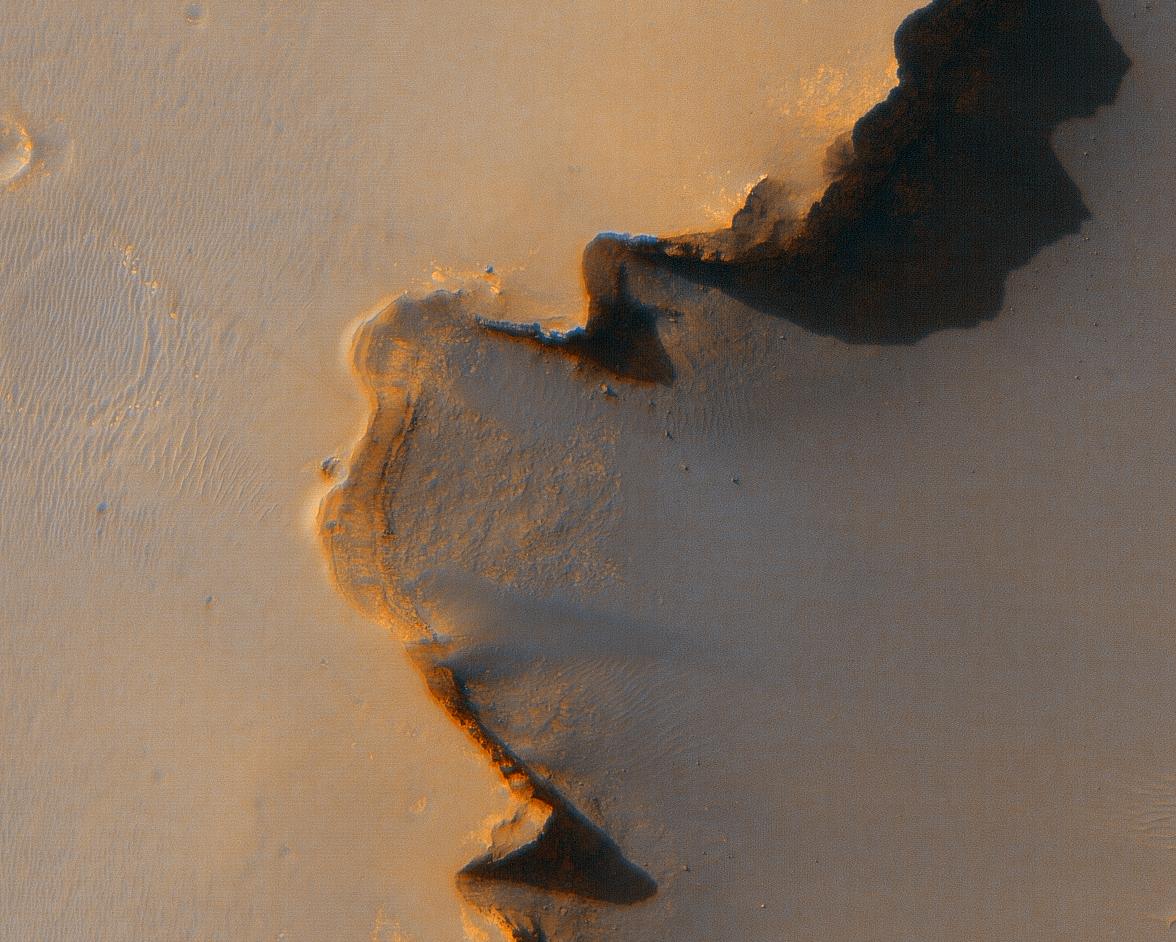
Crater Edge in Terra Sirenum
Full Resolution:
TIFF
(59.78 MB)
JPEG
(2.617 MB)
|
|
|
2006-10-16 |
Mars
|
Mars Reconnaissance Orbiter (MRO)
|
HiRISE
|
7365x4320x3 |

|
-
PIA01921:
-
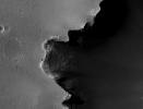
Part of Mawrth Vallis
Full Resolution:
TIFF
(95.45 MB)
JPEG
(3.572 MB)
|
|
|
2006-10-16 |
Mars
|
Mars Reconnaissance Orbiter (MRO)
|
HiRISE
|
1016x996x3 |
|
-
PIA01923:
-
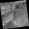
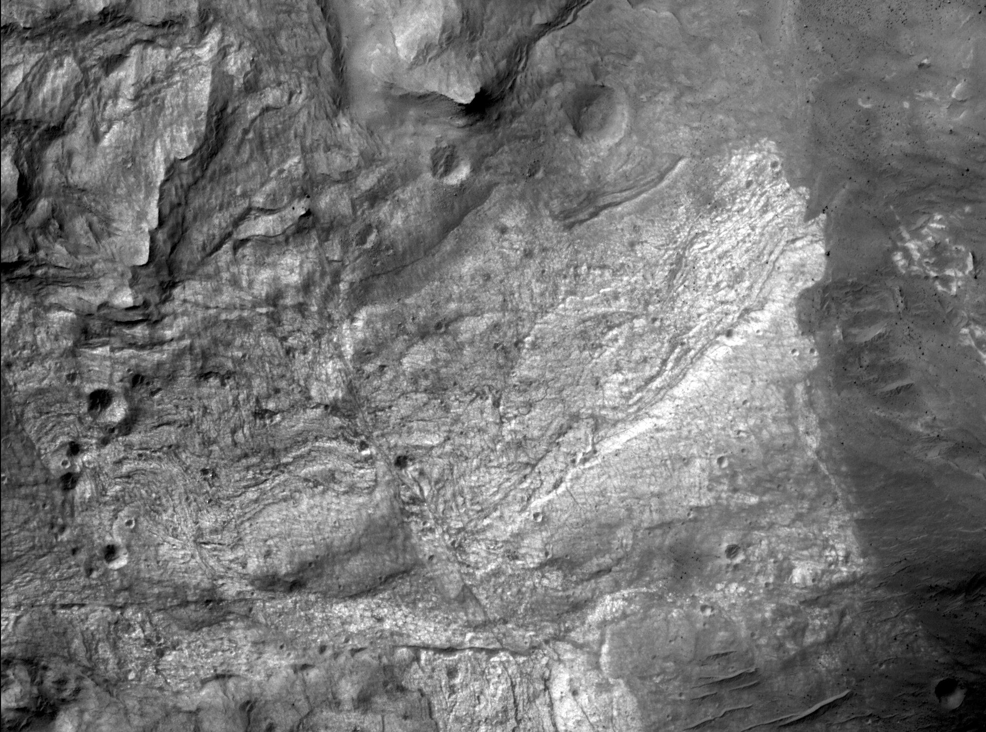
Gullies in Sirenum Terra, Mars
Full Resolution:
TIFF
(3.04 MB)
JPEG
(144.3 kB)
|


