Click on an image for detailed information
Click on a column heading to sort in ascending or descending order

My
List |
Addition Date
|
Target
|
Mission
|
Instrument
|
Size
|

|
2012-08-31 |
Mars
|
Mars Science Laboratory (MSL)
|
Hazcam (MSL)
|
7703x977x1 |

|
-
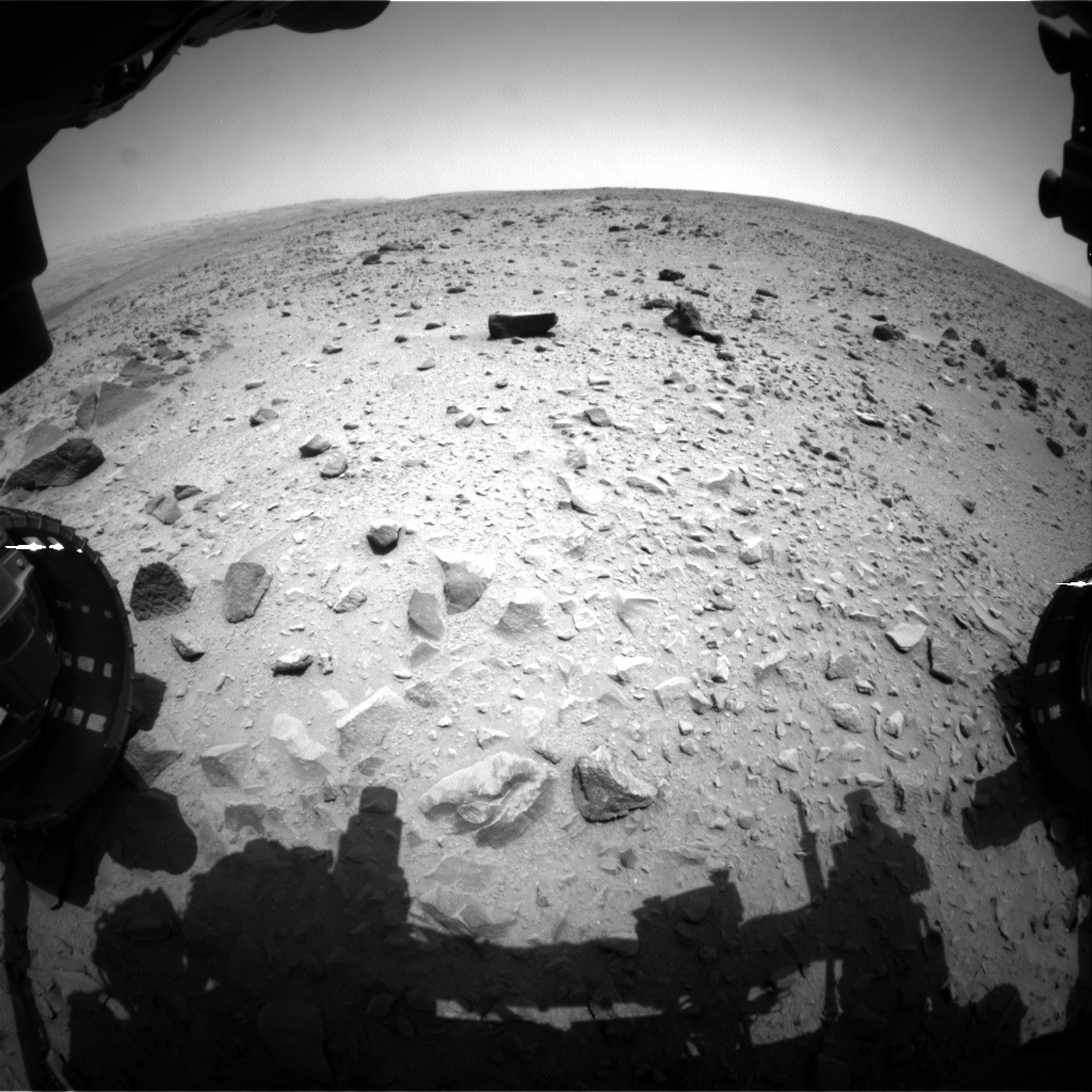
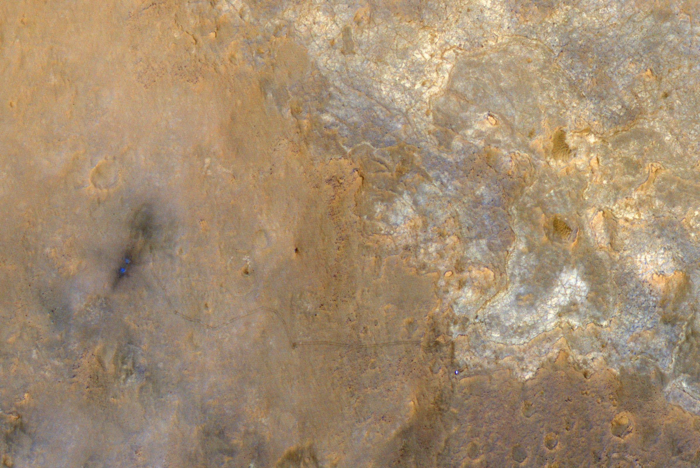
PIA15697:
Looking Back at Tracks from Sol 24 Drive
Full Resolution:
TIFF
(7.534 MB)
JPEG
(1.005 MB)
|
|
|
2013-01-28 |
Mars
|
Mars Science Laboratory (MSL)
|
Hazcam (MSL)
|
1024x1024x1 |

|
-
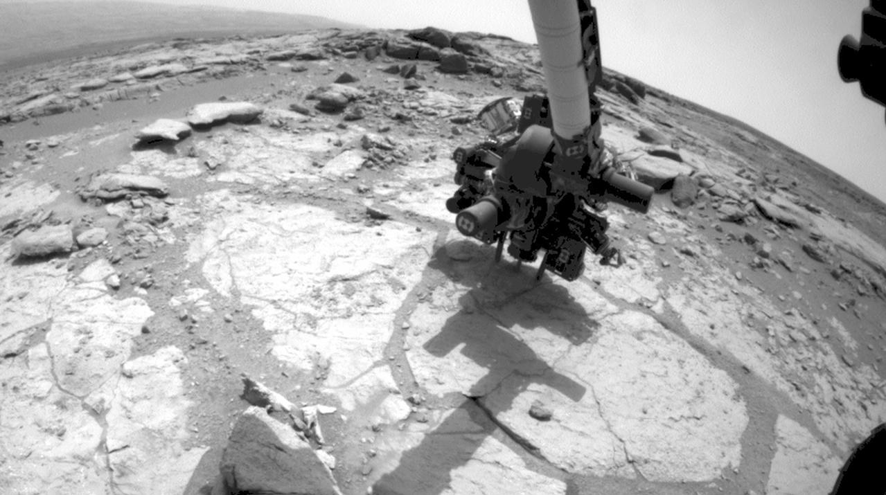
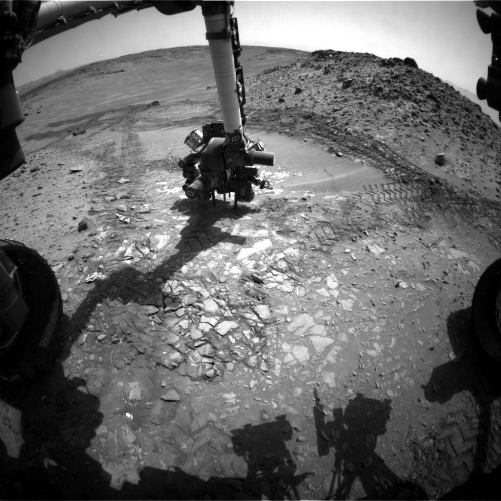
PIA16716:
-
Curiosity's Drill in Place for Load Testing Before Drilling
Full Resolution:
TIFF
(1.05 MB)
JPEG
(162.2 kB)
|
|
|
2013-02-09 |
Mars
|
Mars Science Laboratory (MSL)
|
Hazcam (MSL)
|
930x930x1 |
|
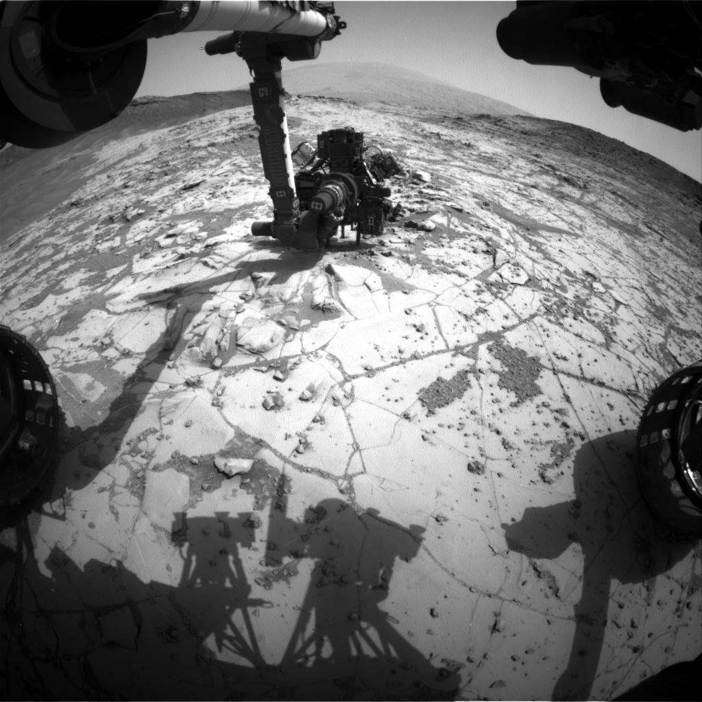
-
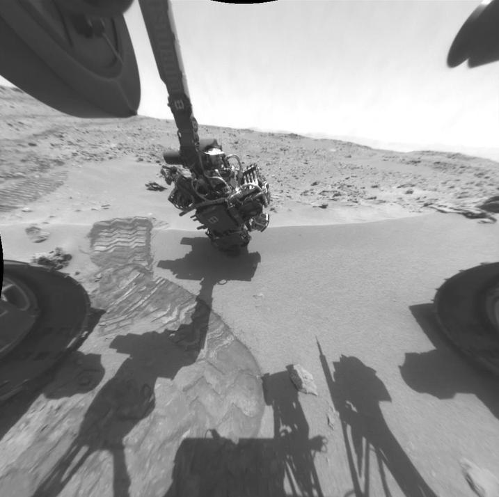
PIA16728:
-
Ready, Set, Drill

Full Resolution:
TIFF
(866.1 kB)
JPEG
(129.1 kB)
|
|
|
2013-05-16 |
Mars
|
Mars Science Laboratory (MSL)
|
Hazcam (MSL)
|
1024x1024x1 |

|
-
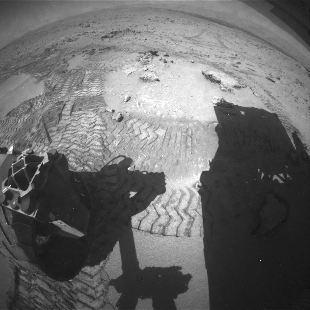
PIA16932:
-
Curiosity at 'Cumberland'
Full Resolution:
TIFF
(1.05 MB)
JPEG
(140.1 kB)
|
|
|
2013-06-05 |
Mars
|
Mars Science Laboratory (MSL)
|
Hazcam (MSL)
|
1279x715x1 |
|
-
PIA17068:
-
Curiosity Mars Rover Drilling Into Its Second Rock
Full Resolution:
TIFF
(915.7 kB)
JPEG
(127.9 kB)
|
|
|
2013-07-17 |
Mars
|
Mars Science Laboratory (MSL)
|
Hazcam (MSL)
|
4267x4267x1 |

|
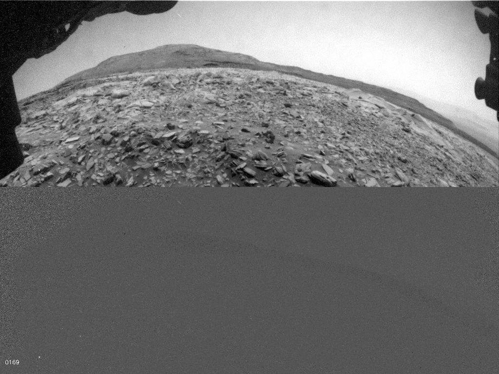
-
PIA17279:
-
One Down, Many Kilometers to Go
Full Resolution:
TIFF
(18.24 MB)
JPEG
(1.174 MB)
|
|
|
2013-08-01 |
Mars
|
Mars Science Laboratory (MSL)
|
Hazcam (MSL)
|
717x714x1 |
|
-
PIA17084:
-
Twelve Months in Two Minutes; Curiosity's First Year on Mars
Full Resolution:
TIFF
(512.7 kB)
JPEG
(50.05 kB)
|
|
|
2013-09-23 |
Mars
|
Mars Science Laboratory (MSL)
|
Hazcam (MSL)
|
1024x1024x1 |
|
-
PIA17363:
-
Curiosity Uses X-ray Instrument's Data for Proximity Placement
Full Resolution:
TIFF
(1.05 MB)
JPEG
(115.4 kB)
|
|
|
2014-02-11 |
Mars
|
Mars Science Laboratory (MSL)
|
Hazcam (MSL)
|
1024x1024x1 |

|
-
PIA17938:
-
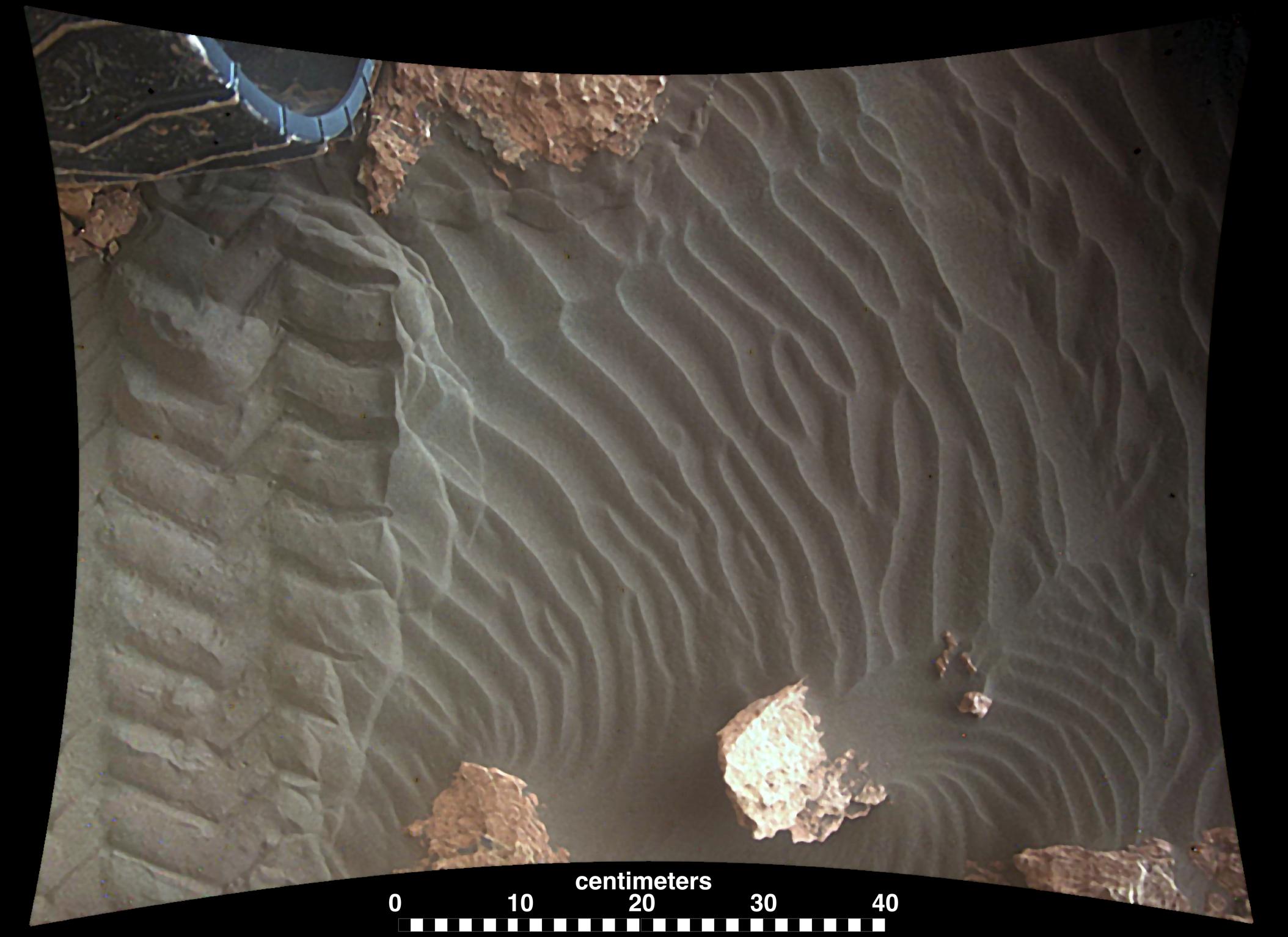
Movie of Curiosity's View Backwards While Crossing Dune
Full Resolution:
TIFF
(1.05 MB)
JPEG
(122 kB)
|
|
|
2014-02-11 |
Mars
|
Mars Science Laboratory (MSL)
|
Hazcam (MSL)
|
1024x1024x1 |

|
-
PIA17939:
-
Curiosity Making Headway West of 'Dingo Gap'
Full Resolution:
TIFF
(1.05 MB)
JPEG
(165.9 kB)
|
|
|
2014-08-22 |
Mars
|
Mars Science Laboratory (MSL)
|
Hazcam (MSL)
|
1024x1024x1 |
|
-
PIA18603:
-
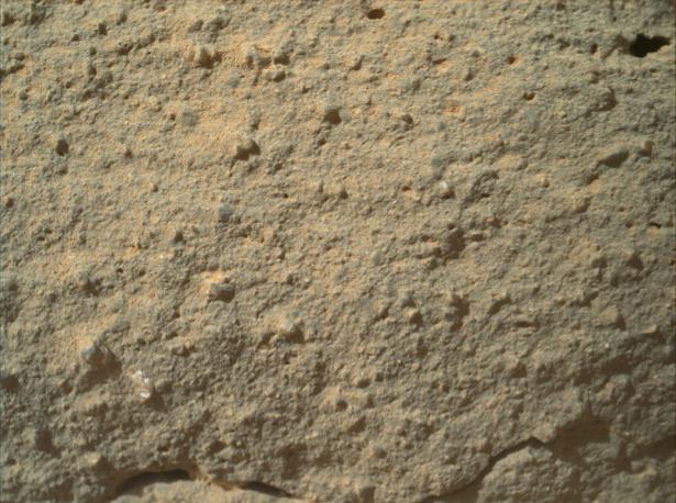
Candidate Drilling Target on Mars Doesn't Pass Exam
Full Resolution:
TIFF
(1.05 MB)
JPEG
(156.7 kB)
|
|
|
2015-01-14 |
Mars
|
Mars Science Laboratory (MSL)
|
Hazcam (MSL)
|
1024x1024x1 |

|
-
PIA19104:
-
Curiosity Conducting Mini-Drill Test at 'Mojave'
Full Resolution:
TIFF
(1.05 MB)
JPEG
(145.5 kB)
|
|
|
2022-04-06 |
Mars
|
Mars Science Laboratory (MSL)
|
Hazcam (MSL)
|
1024x768x1 |
|
-
PIA25177:
-
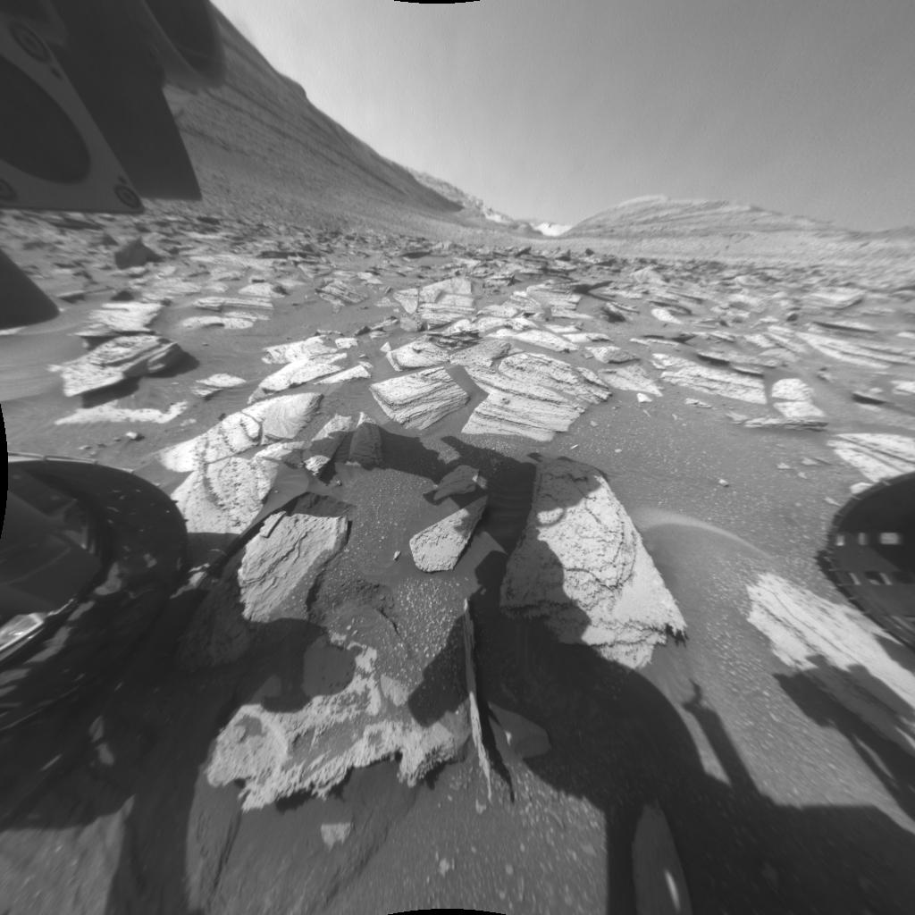
Curiosity's Hazcam Catches a Dusty Wind Gust
Full Resolution:
TIFF
(770.5 kB)
JPEG
(123.6 kB)
|
|
|
2024-01-08 |
Mars
|
Mars Science Laboratory (MSL)
|
Hazcam (MSL)
|
1024x1024x1 |

|
-
PIA26209:
-
Curiosity's Hazcams Capture a Day on Mars
Full Resolution:
TIFF
(979 kB)
JPEG
(106.3 kB)
|
|
|
2012-09-10 |
Mars
|
Mars Science Laboratory (MSL)
|
Hazcam (MSL)
MAHLI
|
-1x-1x3 |
|
-
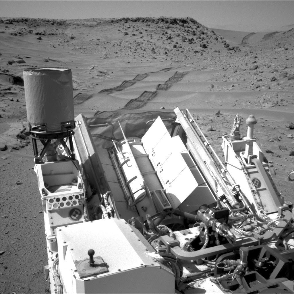
PIA16133:
-
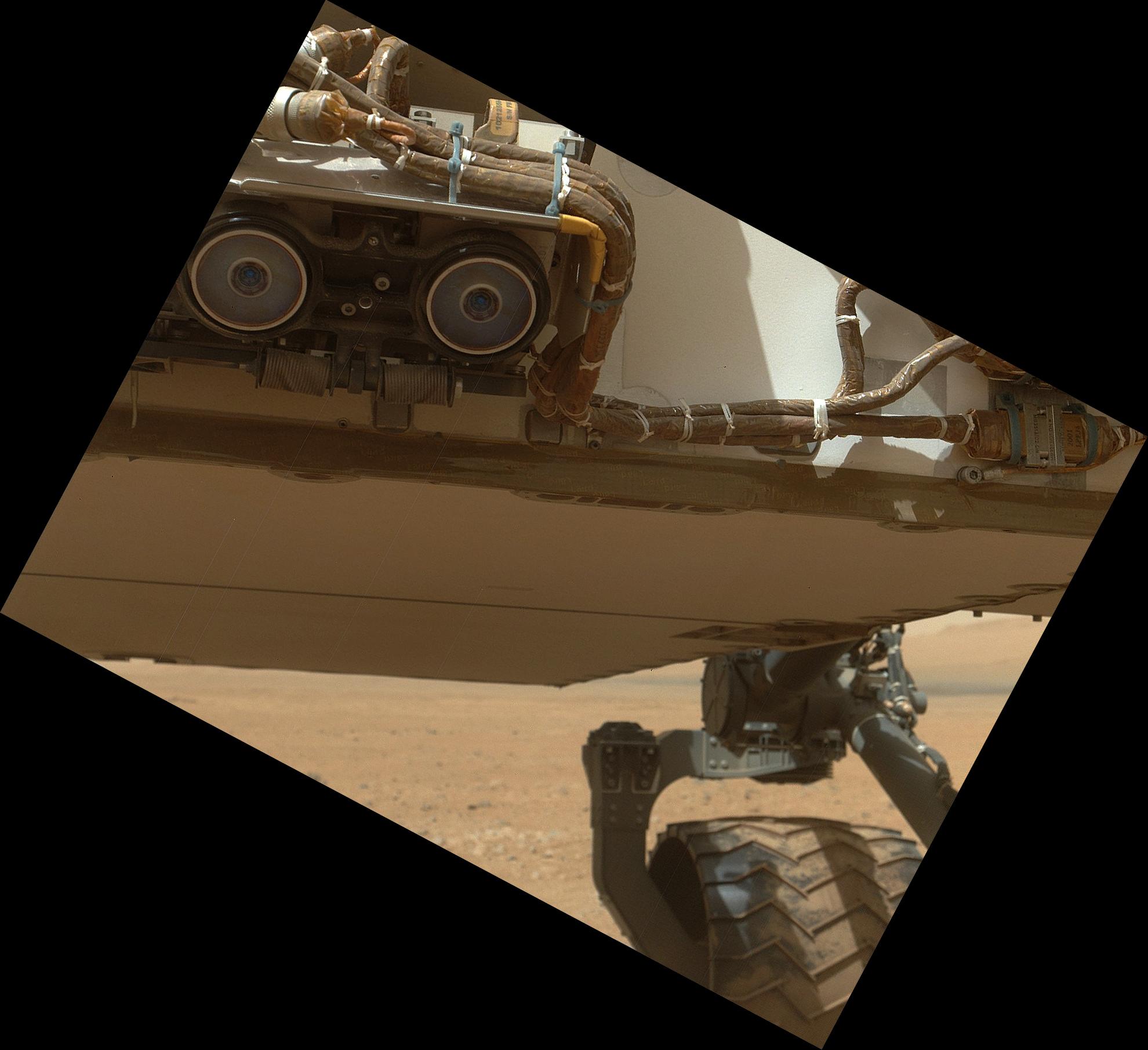
Belly Check for Curiosity
Full Resolution:
TIFF
(10.76 MB)
JPEG
(237.4 kB)
|
|
|
2012-08-02 |
Mars
|
Mars Science Laboratory (MSL)
|
HiRISE
|
9000x6750x3 |
|
-
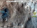
PIA15957:
-
Close-up of Curiosity's Landing Region
Full Resolution:
TIFF
(182.3 MB)
JPEG
(7.397 MB)
|
|
|
2012-08-06 |
Mars
|
Mars Reconnaissance Orbiter (MRO)
Mars Science Laboratory (MSL)
|
HiRISE
|
911x601x1 |
|
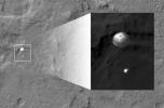
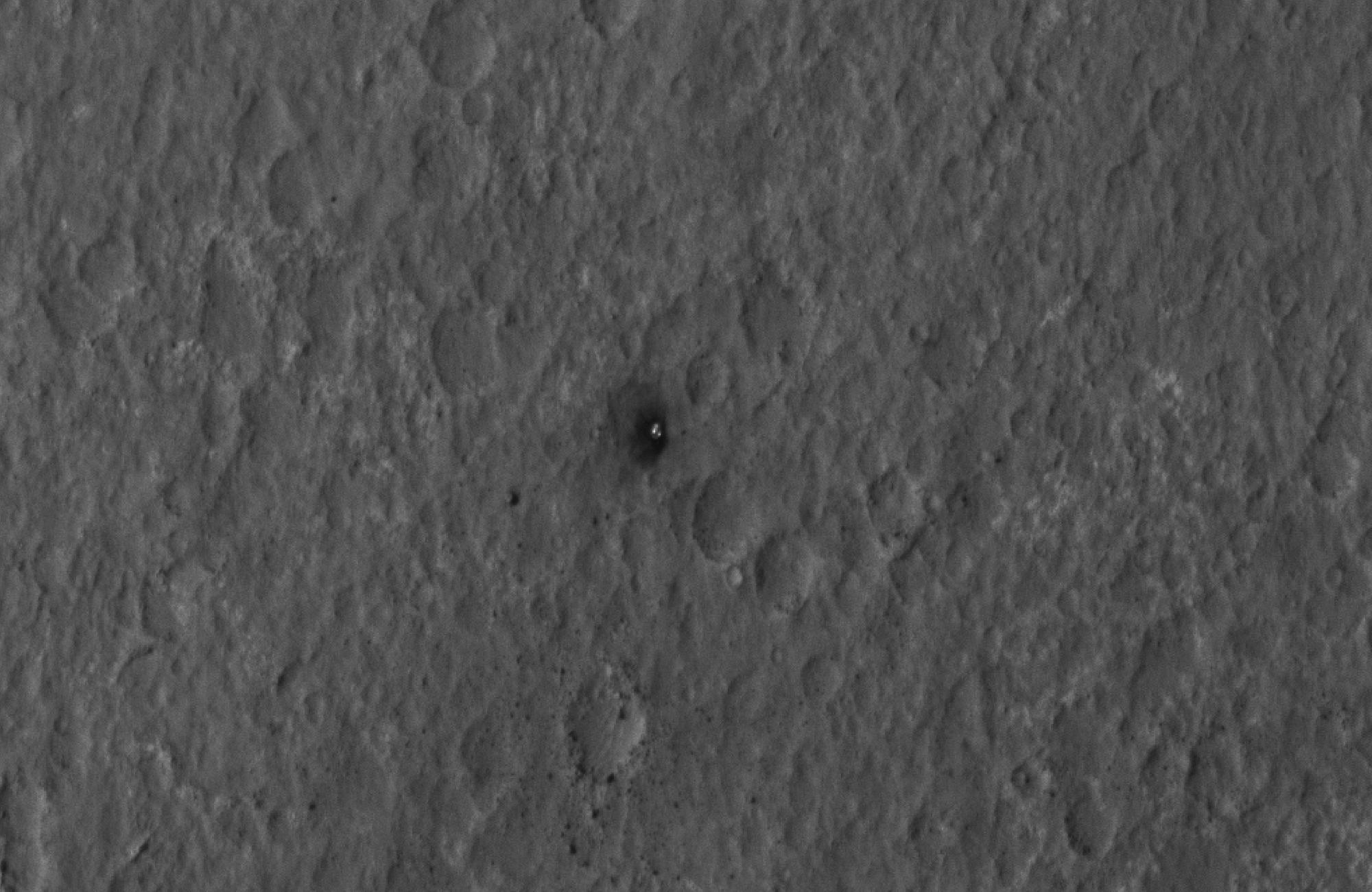
-
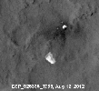
PIA15978:
-
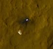
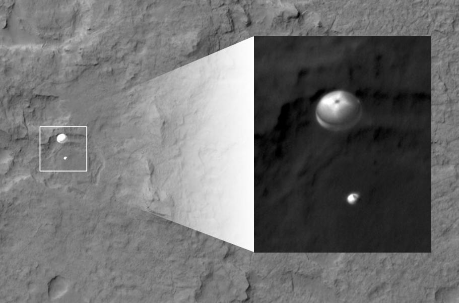
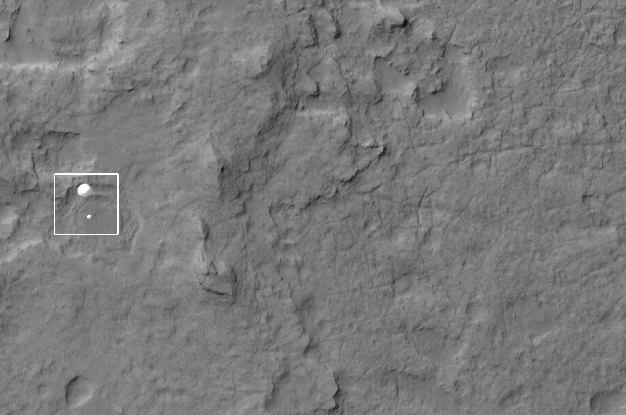
Curiosity Spotted on Parachute by Orbiter
Full Resolution:
TIFF
(548.3 kB)
JPEG
(51.73 kB)
|
|
|
2012-08-06 |
Mars
|
Mars Reconnaissance Orbiter (MRO)
Mars Science Laboratory (MSL)
|
HiRISE
|
2047x1357x1 |
|
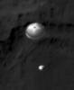
-
PIA15980:
-
Curiosity Spotted on Parachute by Orbiter
Full Resolution:
TIFF
(2.781 MB)
JPEG
(251.3 kB)
|
|
|
2012-08-06 |
Mars
|
Mars Reconnaissance Orbiter (MRO)
Mars Science Laboratory (MSL)
|
HiRISE
|
2048x9645x1 |
|
-
PIA15983:
-
Curiosity Flying Over Mars
Full Resolution:
TIFF
(19.77 MB)
JPEG
(2.527 MB)
|
|
|
2012-08-06 |
Mars
|
Mars Reconnaissance Orbiter (MRO)
Mars Science Laboratory (MSL)
|
HiRISE
|
176x215x1 |
|
-
PIA15979:
-
Curiosity Spotted on Parachute by Orbiter
Full Resolution:
TIFF
(38.1 kB)
JPEG
(2.85 kB)
|
|
|
2012-08-07 |
Mars
|
Mars Reconnaissance Orbiter (MRO)
Mars Science Laboratory (MSL)
|
HiRISE
|
931x1213x1 |
|
-
PIA15993:
-
Curiosity Sails to Mars as Heat Shield Falls Away
Full Resolution:
TIFF
(1.131 MB)
JPEG
(103.8 kB)
|
|
|
2012-08-07 |
Mars
|
Mars Reconnaissance Orbiter (MRO)
Mars Science Laboratory (MSL)
|
HiRISE
|
2000x1300x1 |
|
-
PIA15997:
-
Final Resting Spot for Curiosity's Heat Shield
Full Resolution:
TIFF
(2.603 MB)
JPEG
(270.9 kB)
|
|
|
2012-08-07 |
Mars
|
Mars Reconnaissance Orbiter (MRO)
Mars Science Laboratory (MSL)
|
HiRISE
|
882x996x1 |

|
-
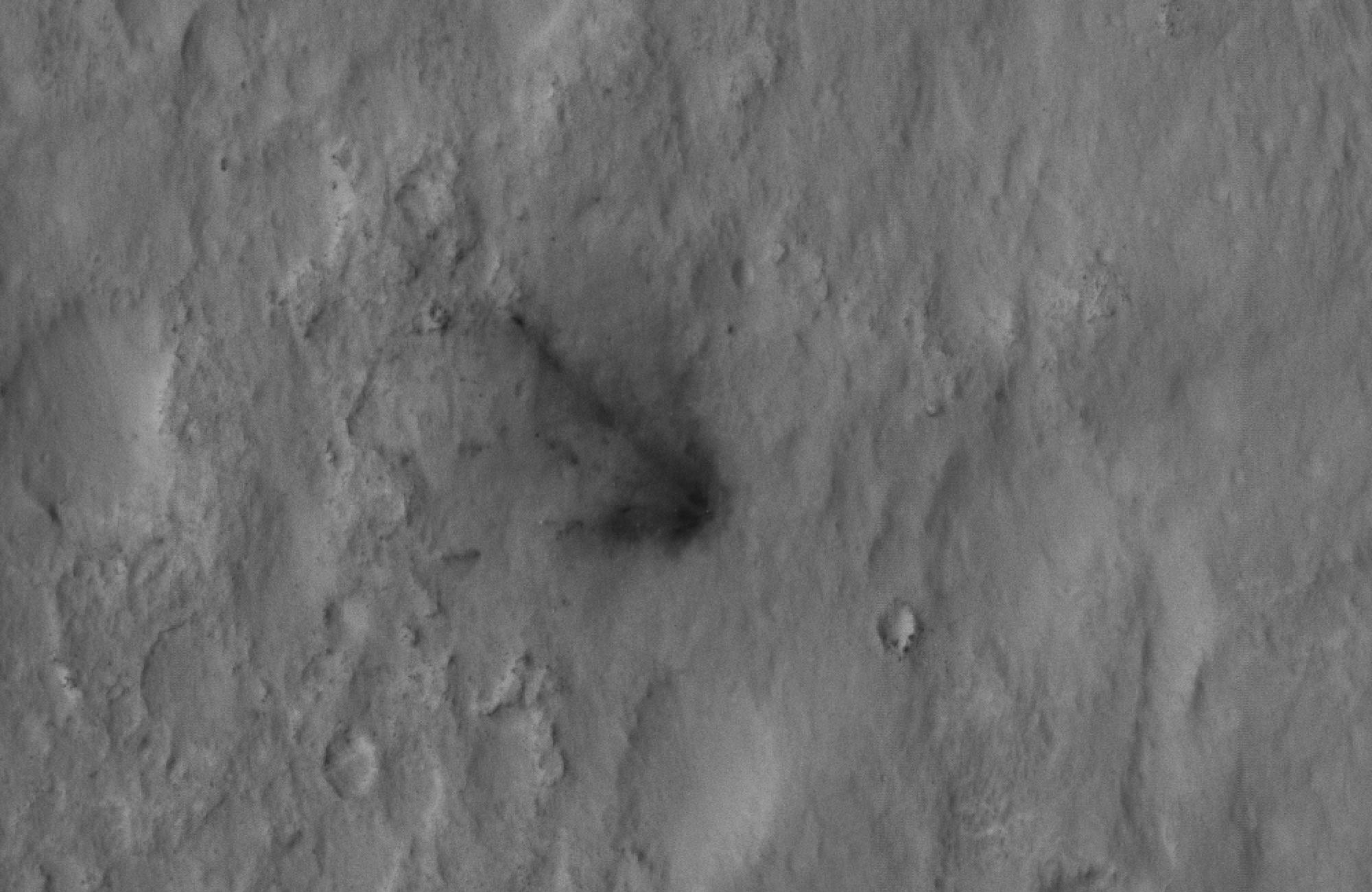
PIA15998:
-
Evidence of a Job Well Done
Full Resolution:
TIFF
(879.6 kB)
JPEG
(59.95 kB)
|
|
|
2012-08-07 |
Mars
|
Mars Reconnaissance Orbiter (MRO)
Mars Science Laboratory (MSL)
|
HiRISE
|
2000x1300x1 |

|
-
PIA15999:
-
Signs of the Sky Crane's Impact
Full Resolution:
TIFF
(2.603 MB)
JPEG
(282.5 kB)
|
|
|
2012-08-07 |
Mars
|
Mars Reconnaissance Orbiter (MRO)
Mars Science Laboratory (MSL)
|
HiRISE
|
2000x1300x1 |
|
-
PIA16000:
-
Curiosity Spotted!
Full Resolution:
TIFF
(2.603 MB)
JPEG
(249.2 kB)
|
|
|
2012-08-07 |
Mars
|
Mars Reconnaissance Orbiter (MRO)
Mars Science Laboratory (MSL)
|
HiRISE
|
946x710x1 |
|
-
PIA16001:
-
Scene of a Martian Landing
Full Resolution:
TIFF
(672.6 kB)
JPEG
(94.16 kB)
|
|
|
2012-08-09 |
Mars
|
Mars Reconnaissance Orbiter (MRO)
Mars Science Laboratory (MSL)
|
HiRISE
|
724x720x1 |
|
-
PIA16030:
-
Curiosity's Quad
Full Resolution:
TIFF
(522 kB)
JPEG
(63.57 kB)
|
|
|
2012-08-09 |
Mars
|
Mars Reconnaissance Orbiter (MRO)
Mars Science Laboratory (MSL)
|
HiRISE
|
862x650x3 |
|
-
PIA16031:
-
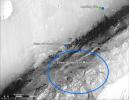
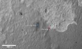
Staking out Curiosity's Landing Site
Full Resolution:
TIFF
(1.682 MB)
JPEG
(99.91 kB)
|
|
|
2012-08-14 |
Mars
|
Mars Reconnaissance Orbiter (MRO)
Mars Science Laboratory (MSL)
|
HiRISE
|
1511x13401x3 |
|
-
PIA16056:
-
A Whole New World for Curiosity
Full Resolution:
TIFF
(60.77 MB)
JPEG
(2.358 MB)
|
|
|
2012-08-14 |
Mars
|
Mars Reconnaissance Orbiter (MRO)
Mars Science Laboratory (MSL)
|
HiRISE
|
3022x2515x3 |
|
-
PIA16057:
-
Curiosity in Exaggerated Color
Full Resolution:
TIFF
(22.81 MB)
JPEG
(1.151 MB)
|
|
|
2012-08-17 |
Mars
|
Mars Science Laboratory (MSL)
|
HiRISE
|
3300x2550x3 |
|
-
PIA16064:
-
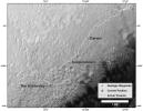
Martian Treasure Map
Full Resolution:
TIFF
(25.26 MB)
JPEG
(1.713 MB)
|
|
|
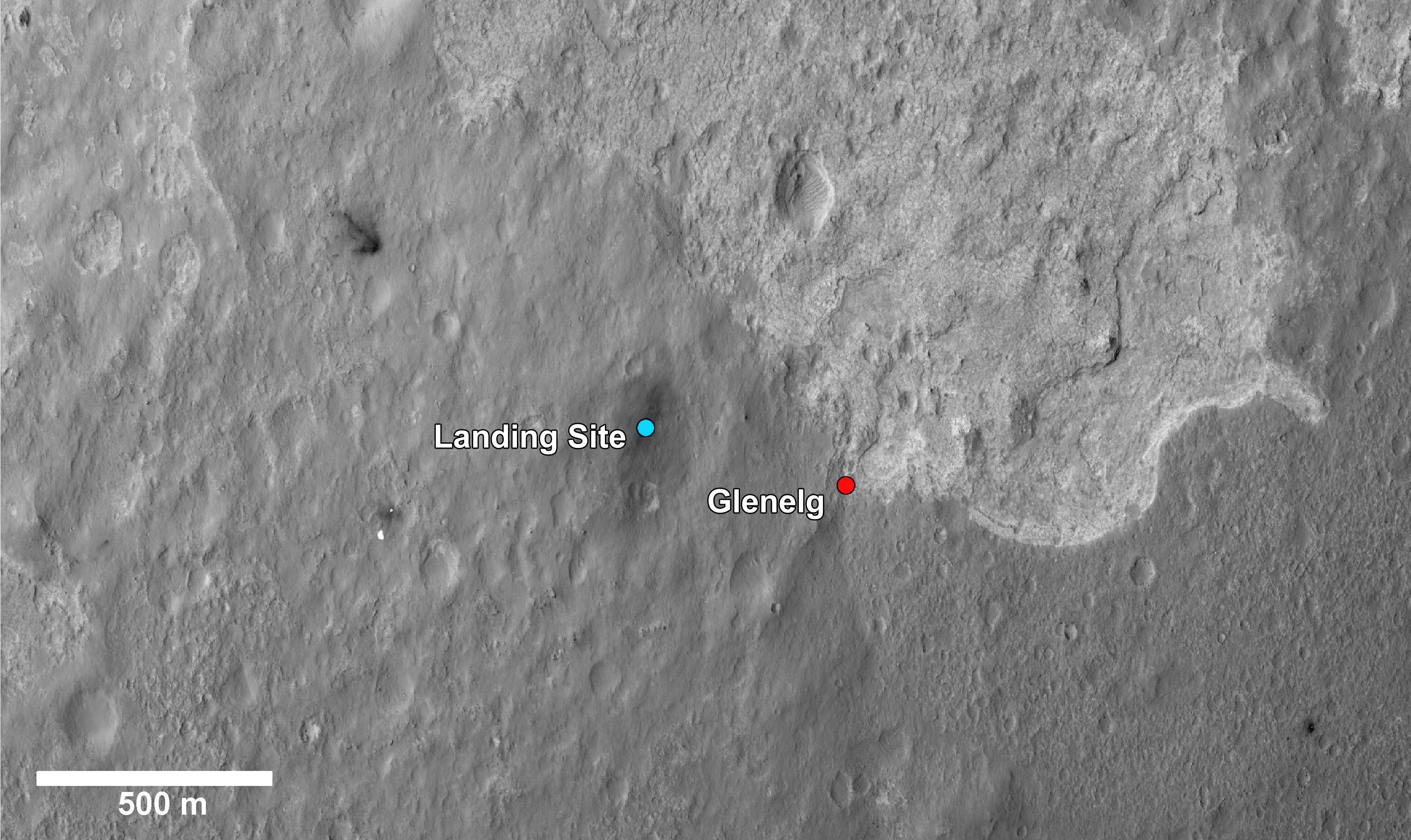
2012-08-17 |
Mars
|
Mars Science Laboratory (MSL)
|
HiRISE
|
3289x1958x3 |
|
-
PIA16065:
-
Glenelg Intrigue
Full Resolution:
TIFF
(19.33 MB)
JPEG
(943.7 kB)
|
|
|
2012-09-06 |
Mars
|
Mars Science Laboratory (MSL)
|
HiRISE
|
574x643x3 |
|
-
PIA16141:
-
A Rover's Journey Begins
Full Resolution:
TIFF
(1.108 MB)
JPEG
(51.17 kB)
|
|
|
2012-09-06 |
Mars
|
Mars Science Laboratory (MSL)
|
HiRISE
|
579x538x3 |
|
-
PIA16142:
-
Relics of Rover's Landing
Full Resolution:
TIFF
(935 kB)
JPEG
(34.81 kB)
|
|
|
2012-09-06 |
Mars
|
Mars Science Laboratory (MSL)
|
HiRISE
|
2055x1437x3 |
|
-
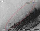
PIA16143:
-
Dissecting the Scene of Sky Crane Crash
Full Resolution:
TIFF
(8.863 MB)
JPEG
(454.9 kB)
|
|
|
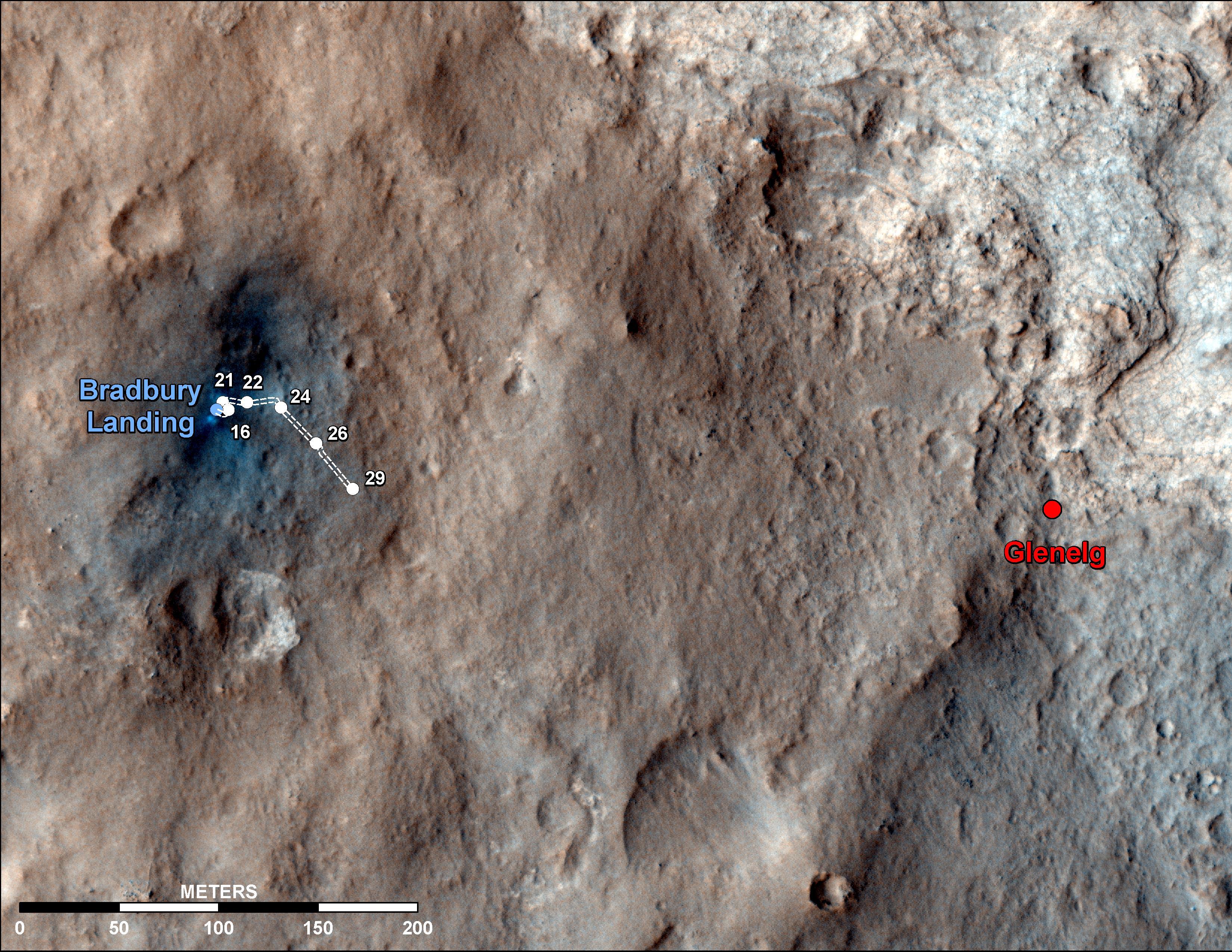
2012-09-06 |
Mars
|
Mars Science Laboratory (MSL)
|
HiRISE
|
3300x2550x3 |
|
-
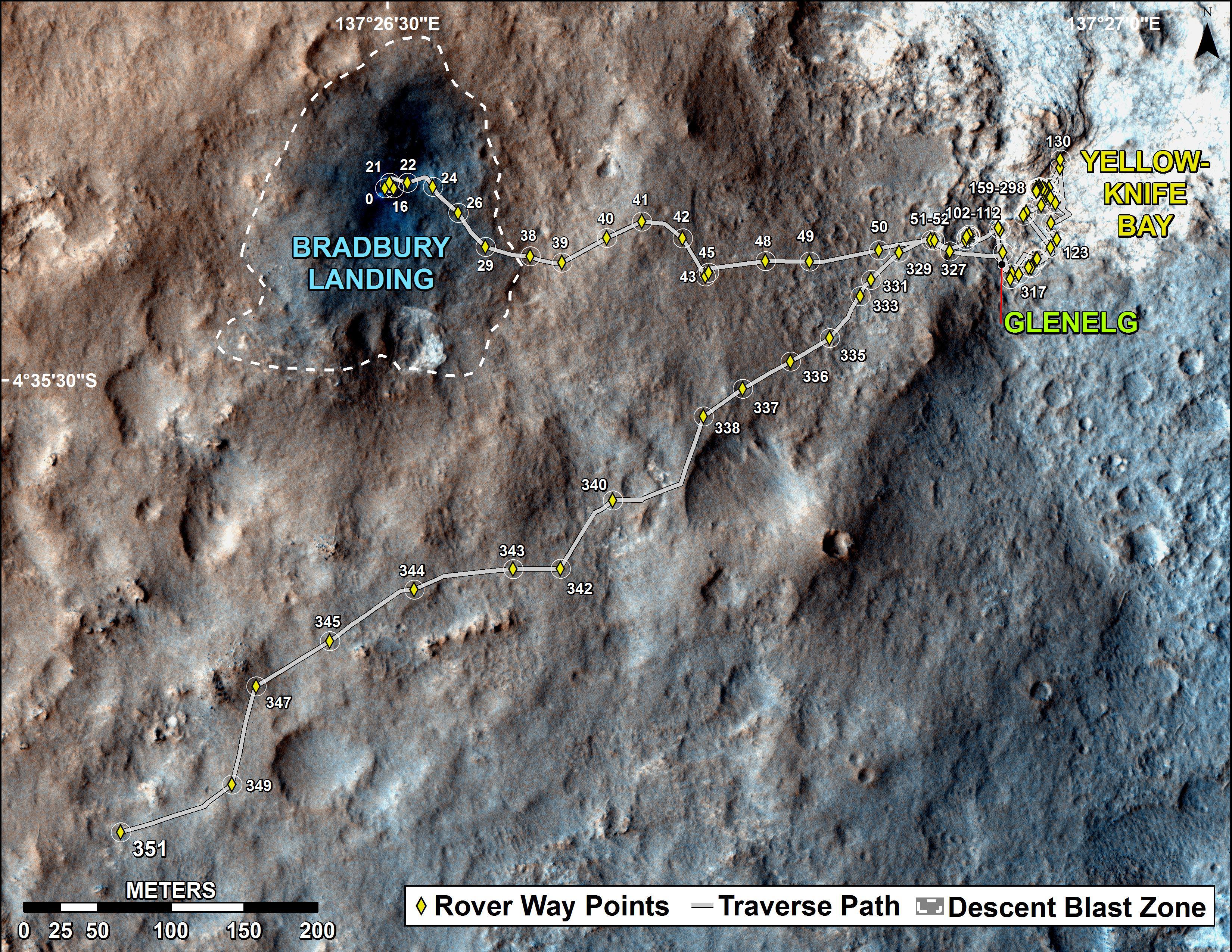
PIA16148:
-
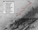
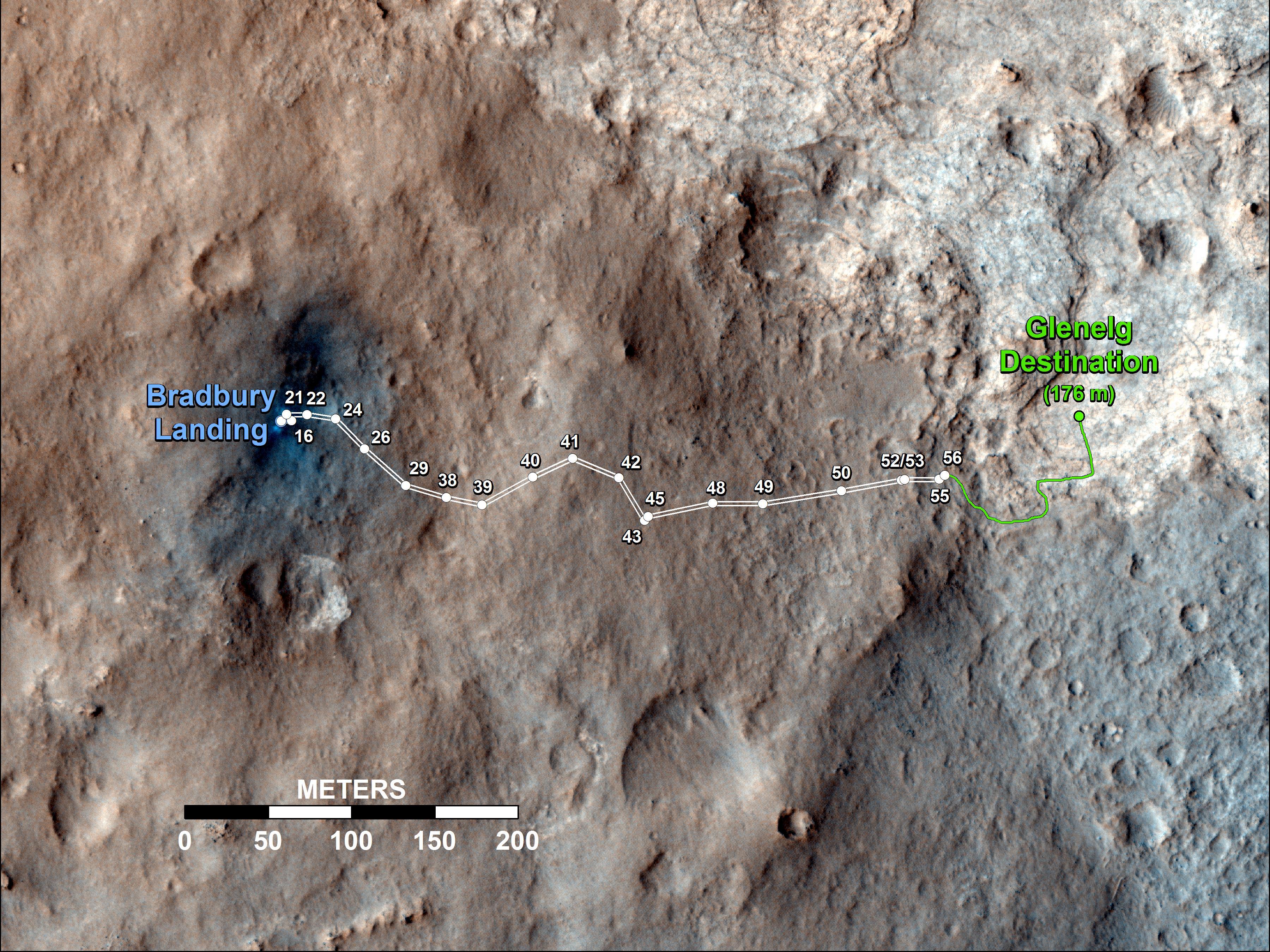
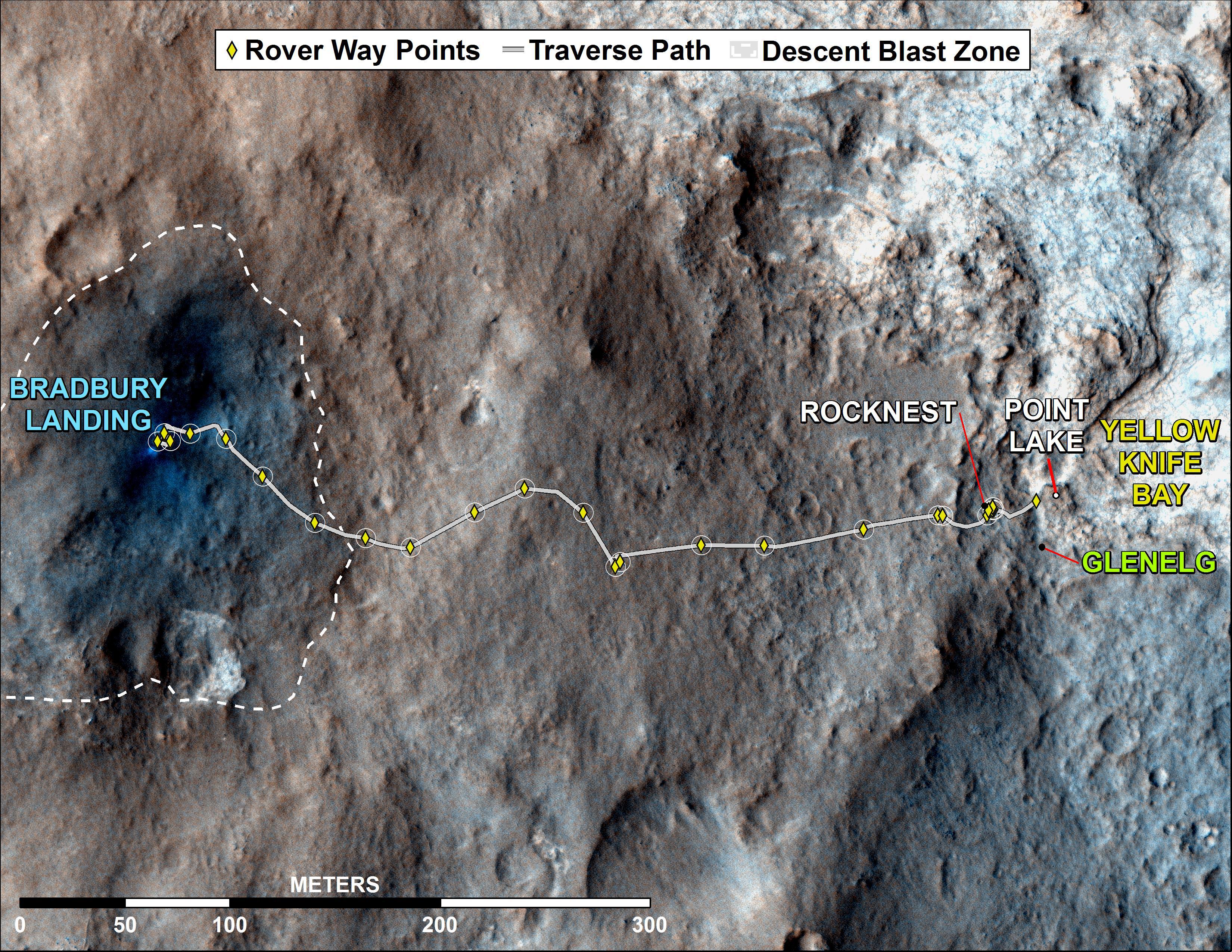
Curiosity Traverse Map Through Sol 29
Full Resolution:
TIFF
(25.26 MB)
JPEG
(1.558 MB)
|
|
|
2012-09-19 |
Mars
|
Mars Reconnaissance Orbiter (MRO)
Mars Science Laboratory (MSL)
|
HiRISE
|
3300x2550x3 |
|
-
PIA16153:
-
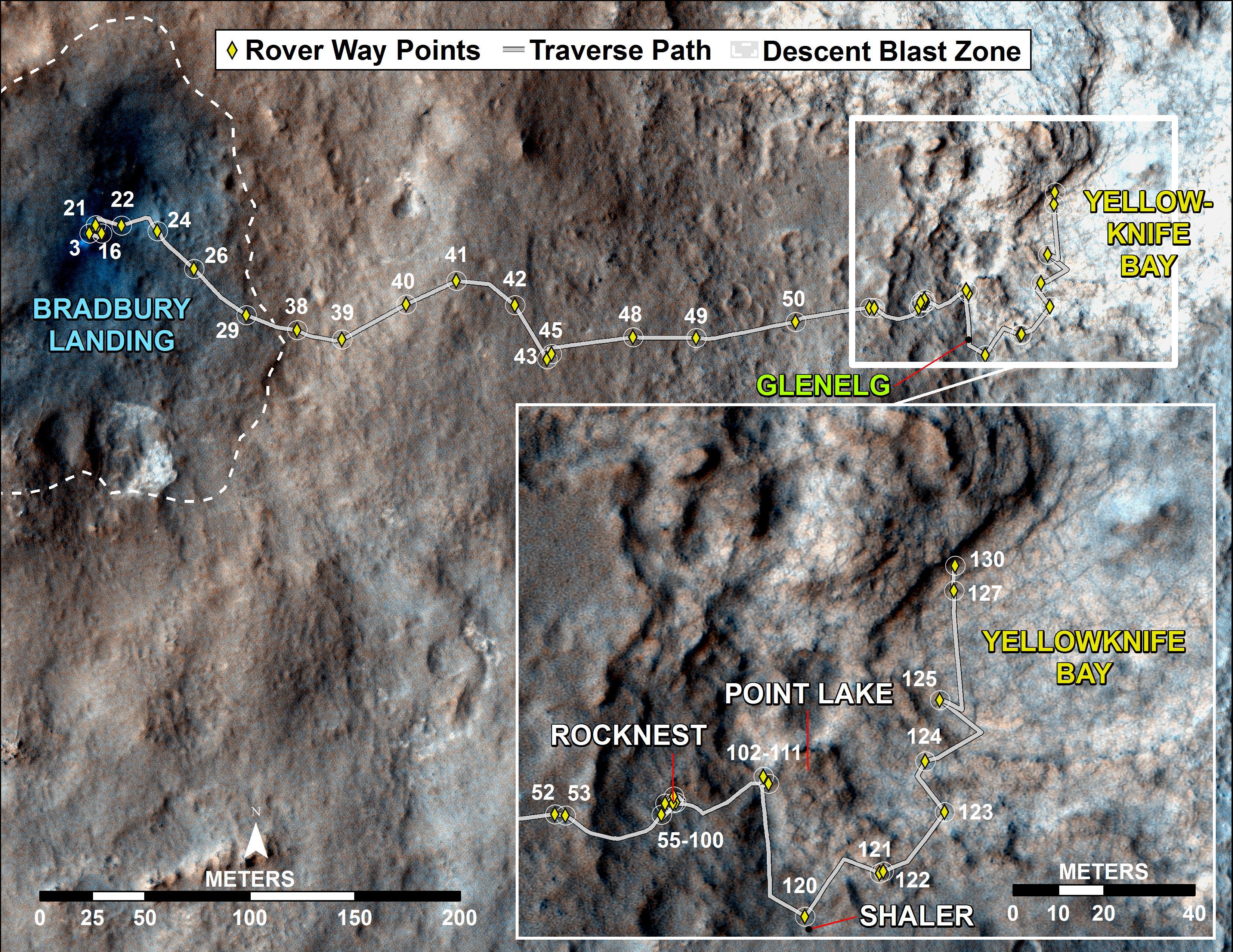
Curiosity Traverse Map Through Sol 43
Full Resolution:
TIFF
(25.26 MB)
JPEG
(1.57 MB)
|
|
|
2012-09-27 |
Mars
|
Mars Reconnaissance Orbiter (MRO)
Mars Science Laboratory (MSL)
|
HiRISE
|
932x720x3 |
|
-
PIA16157:
-
Curiosity's Roadside Discoveries
Full Resolution:
TIFF
(2.014 MB)
JPEG
(132.4 kB)
|
|
|
2012-09-27 |
Mars
|
Mars Reconnaissance Orbiter (MRO)
Mars Science Laboratory (MSL)
|
HiRISE
|
3339x2580x3 |

|
-
PIA16158:
-
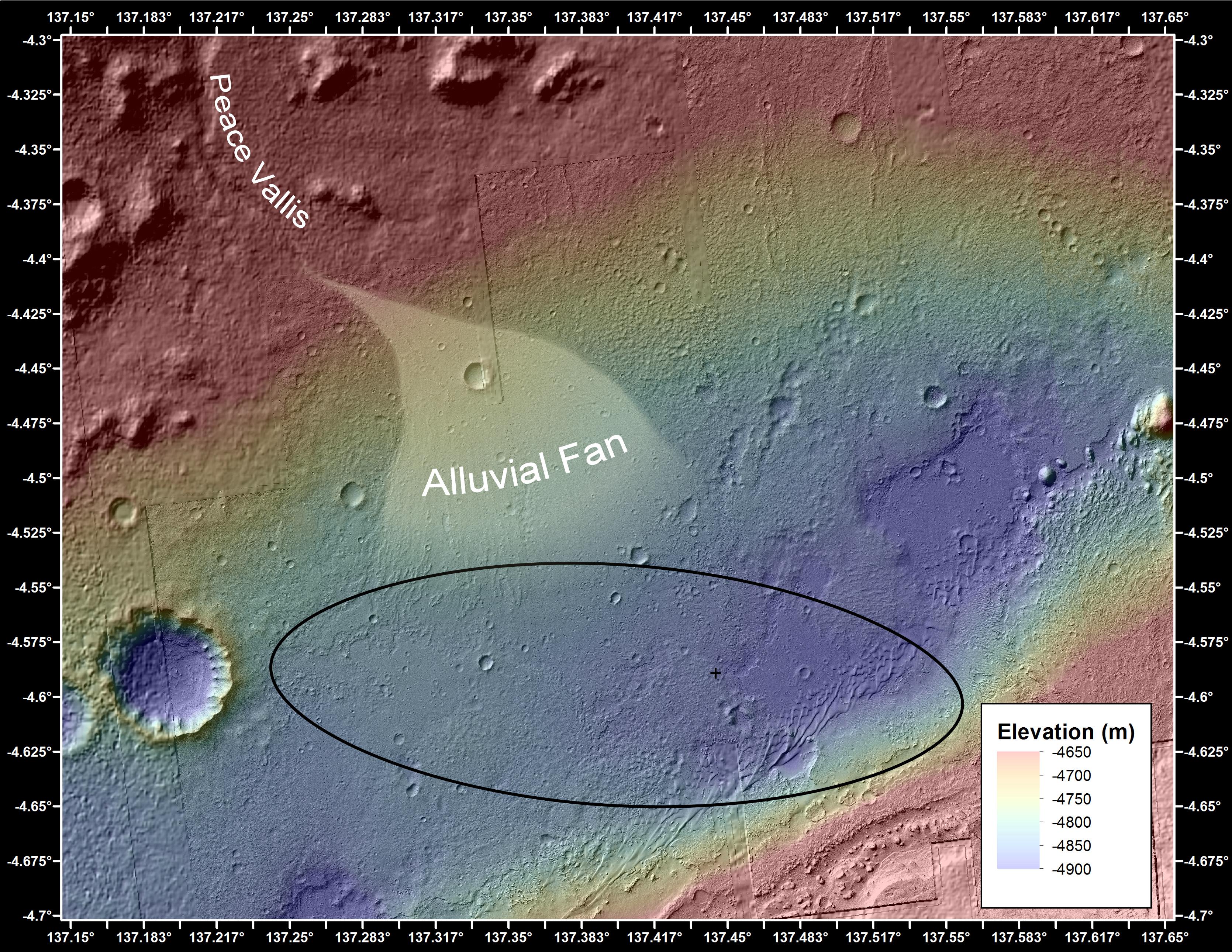
Where Water Flowed Downslope
Full Resolution:
TIFF
(25.85 MB)
JPEG
(1.87 MB)
|
|
|
2012-10-04 |
Mars
|
Mars Science Laboratory (MSL)
|
HiRISE
|
3600x2700x3 |
|
-
PIA16200:
-
Curiosity's Travels Through Sol 56
Full Resolution:
TIFF
(29.17 MB)
JPEG
(1.87 MB)
|
|
|
2012-10-10 |
Mars
|
Mars Reconnaissance Orbiter (MRO)
Mars Science Laboratory (MSL)
|
HiRISE
|
398x408x3 |
|
-
PIA16208:
-
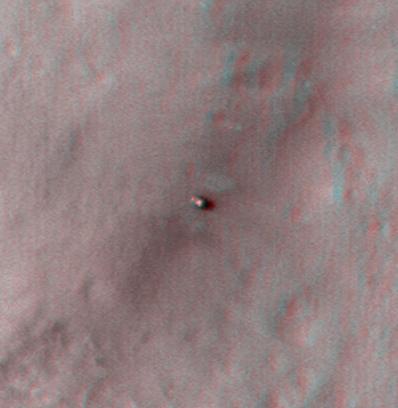
Curiosity at Bradbury Landing Site in 3-D
Full Resolution:
TIFF
(487.5 kB)
JPEG
(17.84 kB)
|
|
|
2012-10-10 |
Mars
|
Mars Reconnaissance Orbiter (MRO)
Mars Science Laboratory (MSL)
|
HiRISE
|
950x795x3 |
|
-
PIA16209:
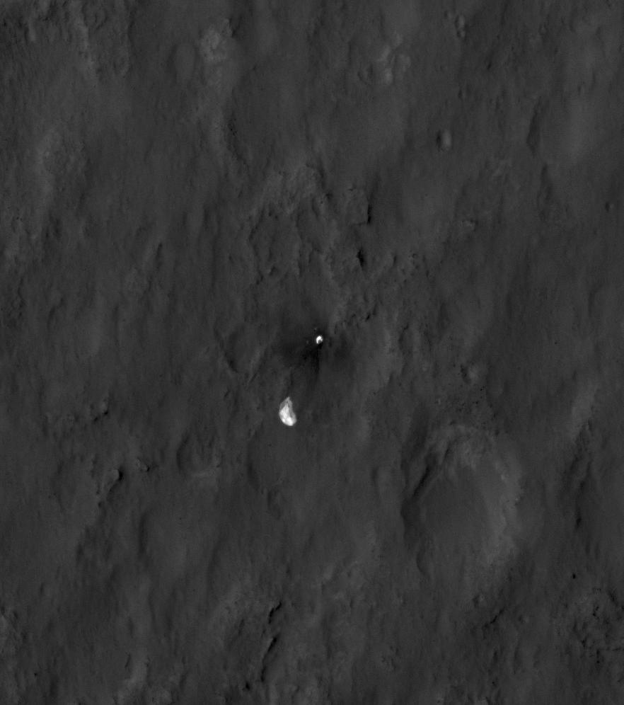
-
Parachute and Back Shell in 3-D
Full Resolution:
TIFF
(2.267 MB)
JPEG
(87.85 kB)
|
|
|
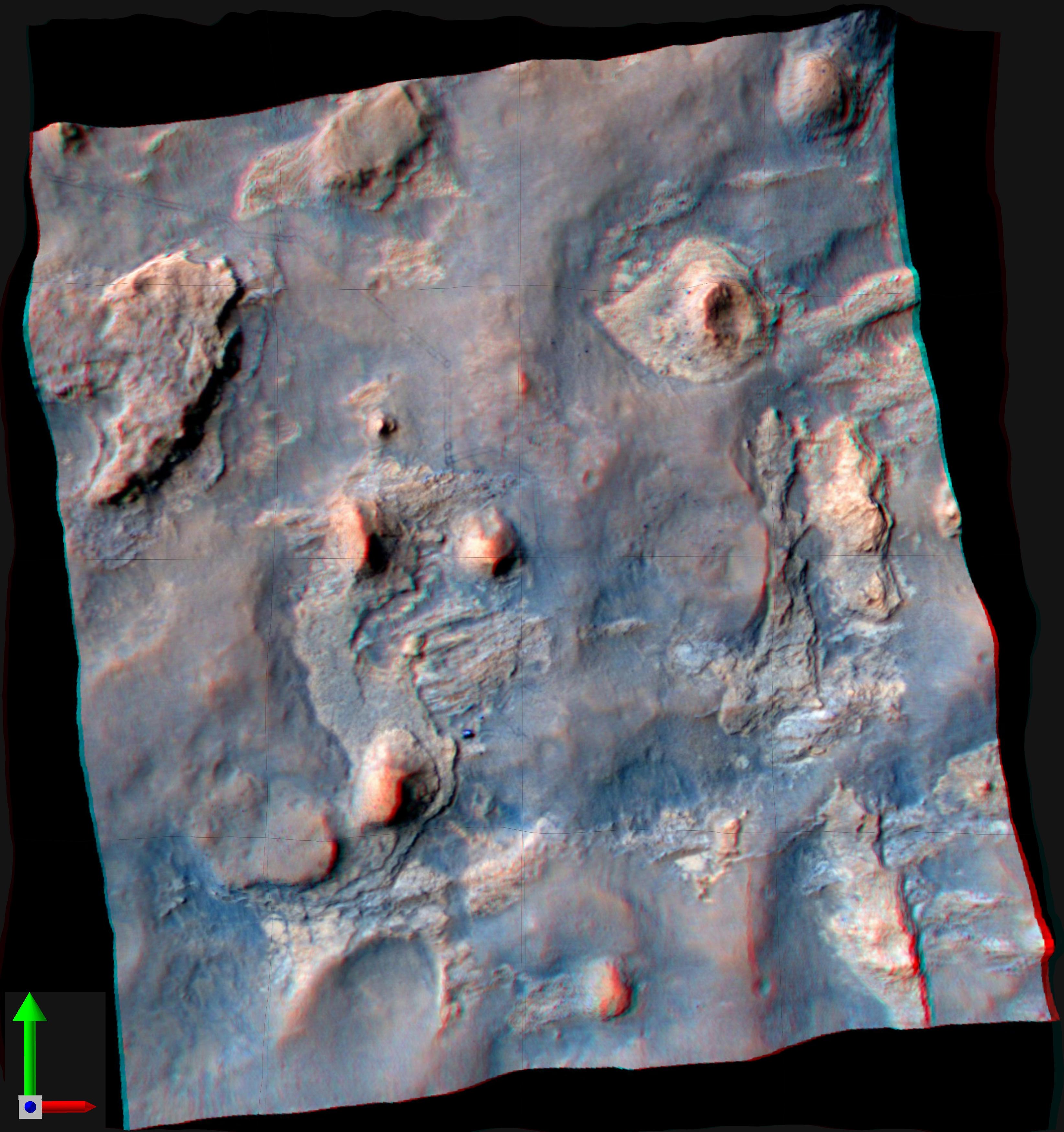
2012-10-10 |
Mars
|
Mars Reconnaissance Orbiter (MRO)
Mars Science Laboratory (MSL)
|
HiRISE
|
2414x1387x3 |
|
-
PIA16210:
-
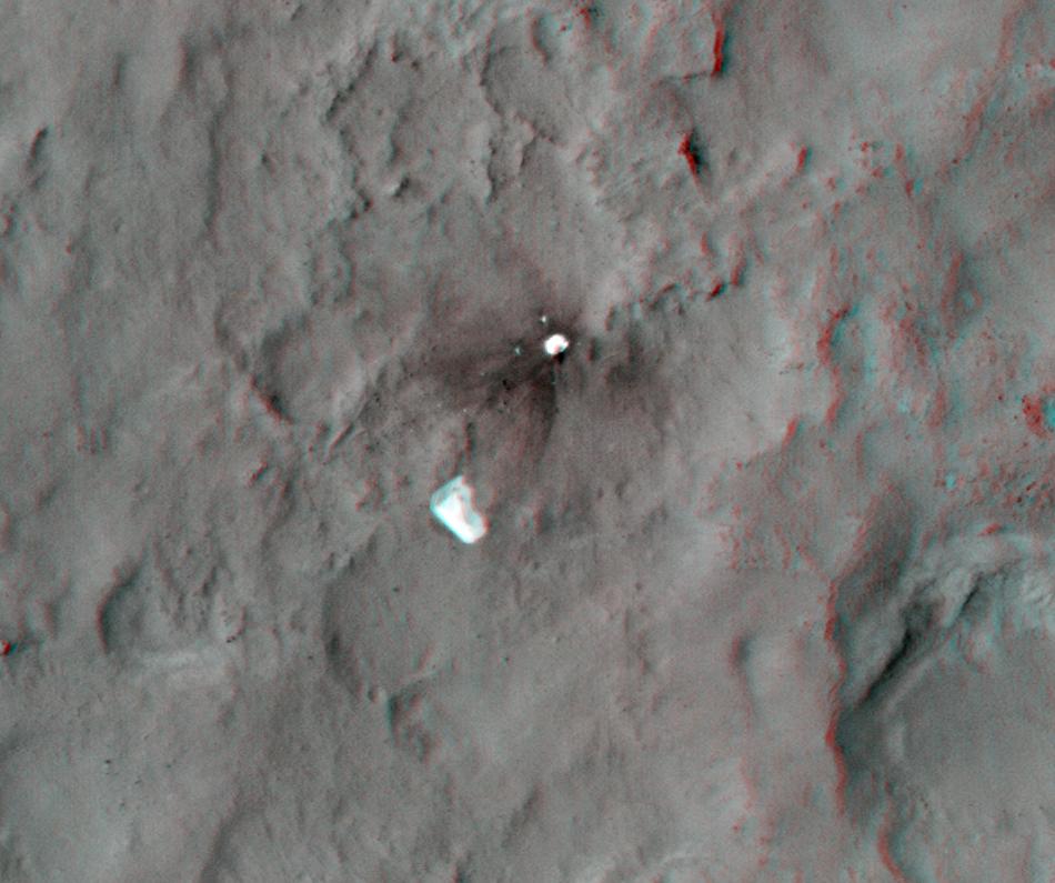
'Glenelg' in 3-D
Full Resolution:
TIFF
(10.05 MB)
JPEG
(554.1 kB)
|
|
|
2012-12-03 |
Mars
|
Mars Reconnaissance Orbiter (MRO)
Mars Science Laboratory (MSL)
|
HiRISE
|
3300x2550x3 |
|
-
PIA16577:
-
Curiosity Rover's Traverse, August through November 2012
Full Resolution:
TIFF
(25.26 MB)
JPEG
(1.893 MB)
|
|
|
2012-12-18 |
Mars
|
Mars Reconnaissance Orbiter (MRO)
Mars Science Laboratory (MSL)
|
HiRISE
|
3300x2550x3 |

|
-
PIA16554:
-
Curiosity Traverse Map, Sol 130
Full Resolution:
TIFF
(25.26 MB)
JPEG
(1.761 MB)
|
|
|
2013-04-03 |
Mars
|
Mars Reconnaissance Orbiter (MRO)
Mars Science Laboratory (MSL)
|
HiRISE
|
369x390x1 |
|
-
PIA16813:
-
MSL's Parachute Flapping in the Wind
Full Resolution:
TIFF
(144.3 kB)
JPEG
(15.5 kB)
|
|
|
2013-06-05 |
Mars
|
Mars Science Laboratory (MSL)
|
HiRISE
|
3300x2550x3 |
|
-
PIA17064:
-
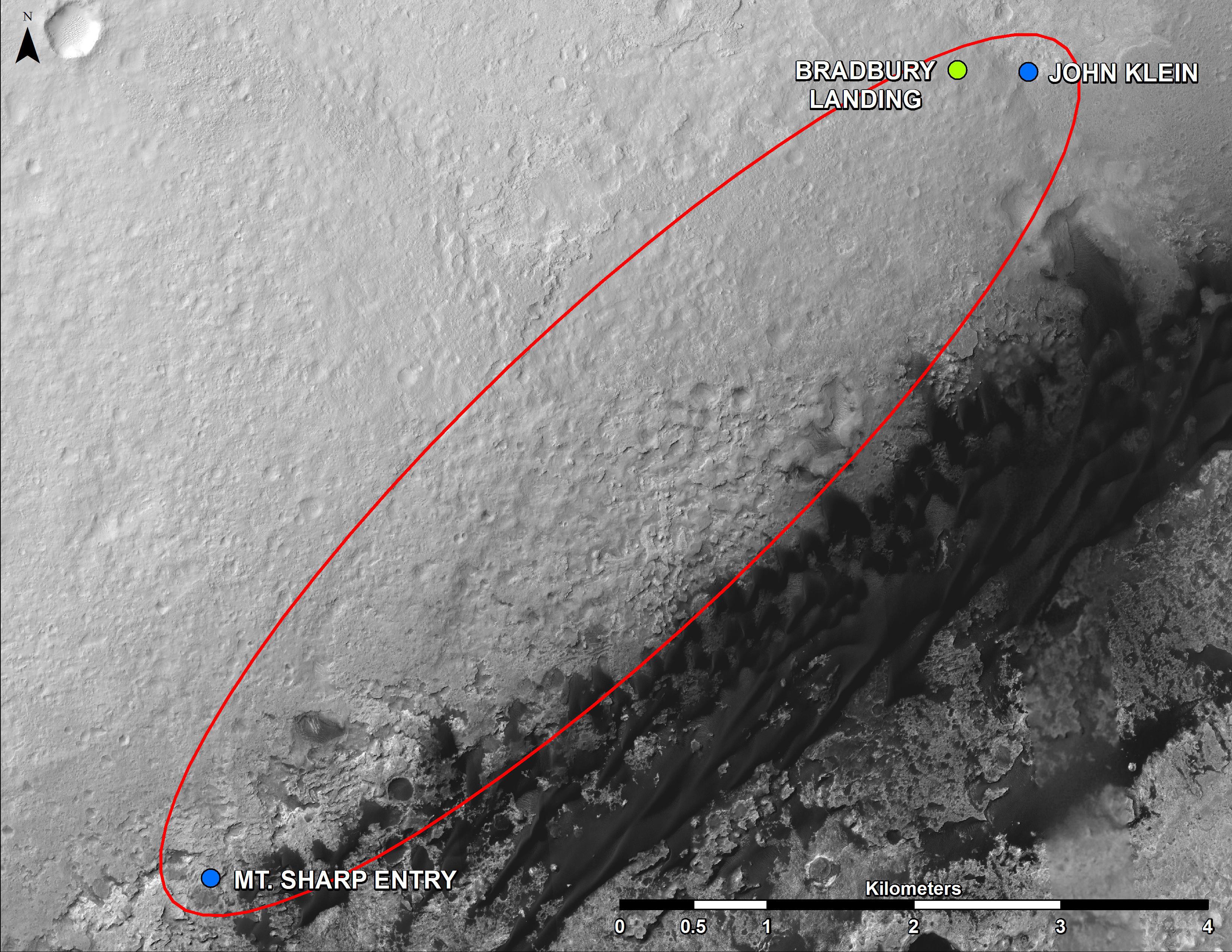
From 'Glenelg' to Mount Sharp
Full Resolution:
TIFF
(25.26 MB)
JPEG
(1.462 MB)
|
|
|
2013-07-24 |
Mars
|
Mars Reconnaissance Orbiter (MRO)
Mars Science Laboratory (MSL)
|
HiRISE
|
2389x1598x3 |
|
-
PIA17080:
-
View From Mars Orbiter Showing Curiosity Rover at 'Shaler'
Full Resolution:
TIFF
(11.46 MB)
JPEG
(879.4 kB)
|
|
|
2013-08-02 |
Mars
|
Mars Reconnaissance Orbiter (MRO)
Mars Science Laboratory (MSL)
|
HiRISE
|
3300x2550x3 |

|
-
PIA17085:
-
Full Curiosity Traverse Passes One-Mile Mark
Full Resolution:
TIFF
(25.26 MB)
JPEG
(2.249 MB)
|
|
|
2013-08-27 |
Mars
|
Mars Reconnaissance Orbiter (MRO)
Mars Science Laboratory (MSL)
|
HiRISE
|
3300x2550x3 |
|
-
PIA17355:
-
Curiosity's Progress on Route from 'Glenelg' to Mount Sharp
Full Resolution:
TIFF
(25.26 MB)
JPEG
(1.493 MB)
|
|
|
2013-11-13 |
Mars
|
Mars Reconnaissance Orbiter (MRO)
|
HiRISE
|
1152x1072x1 |

|
-
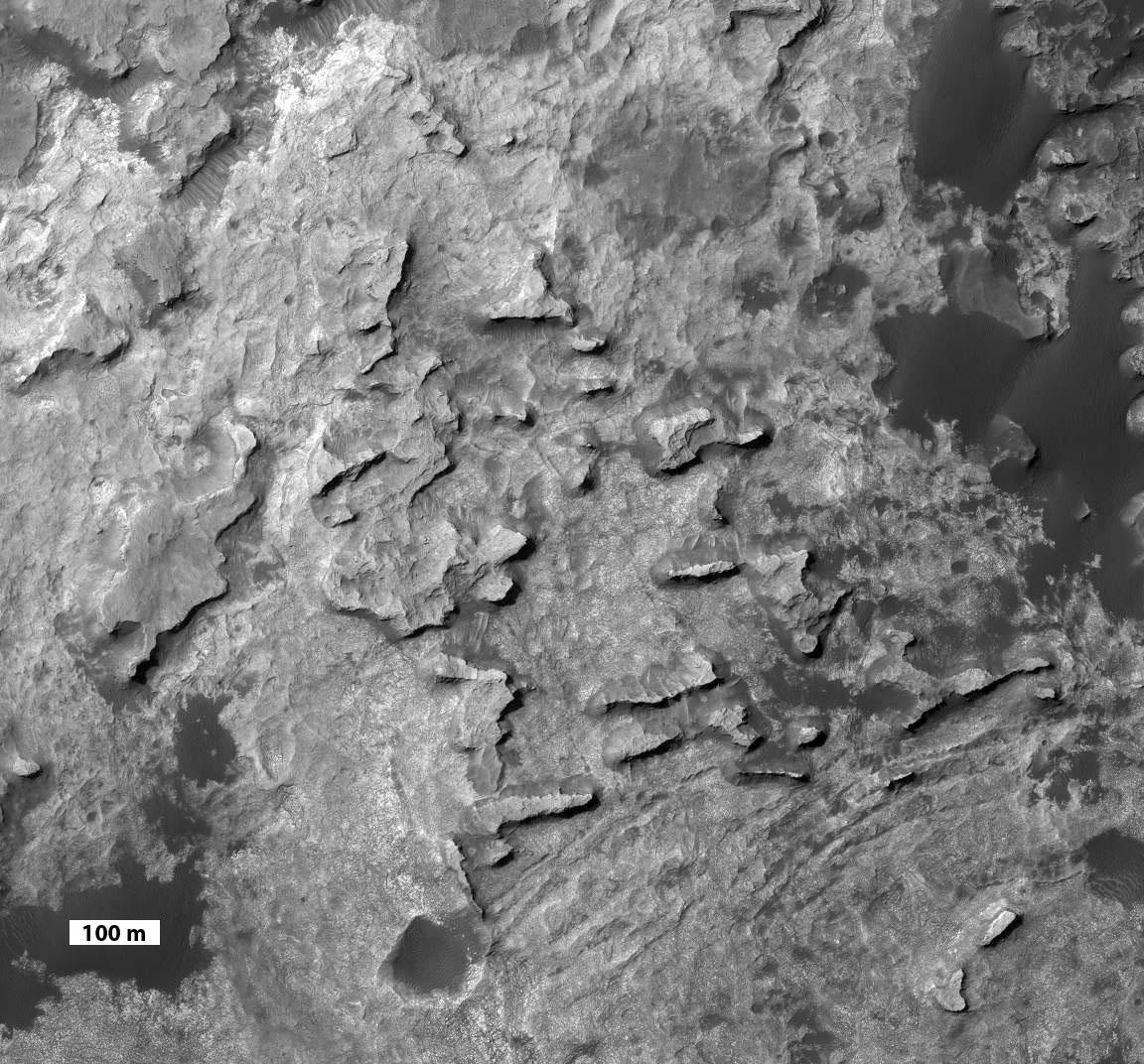
PIA17587:
-
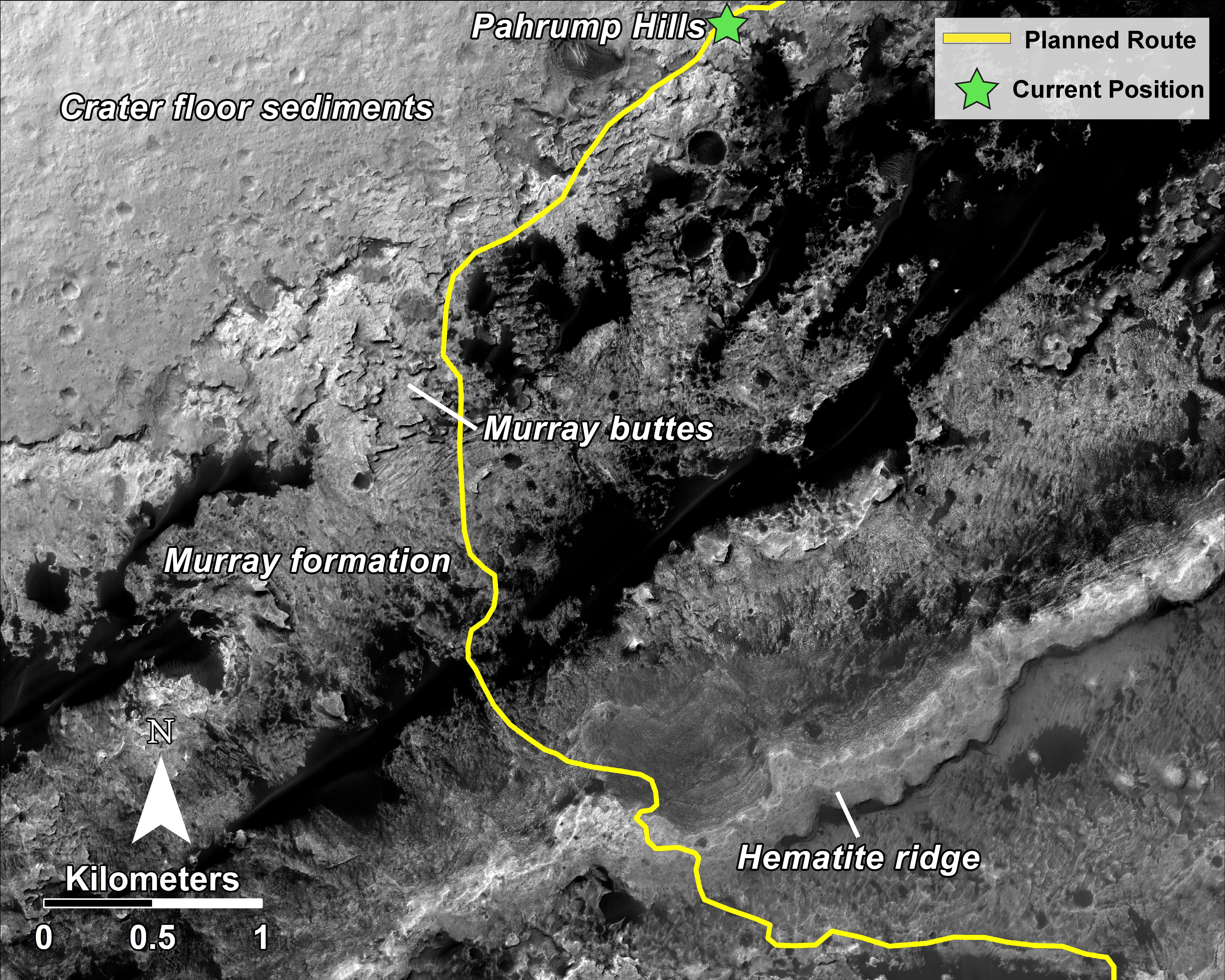
'Murray Buttes' at Foot of Mount Sharp on Mars
Full Resolution:
TIFF
(1.236 MB)
JPEG
(248 kB)
|
|
|
2013-11-13 |
Mars
|
Mars Exploration Rover (MER)
Mars Reconnaissance Orbiter (MRO)
|
HiRISE
|
8192x4298x3 |
|
-
PIA17586:
-
A New Perspective on Murray Ridge
Full Resolution:
TIFF
(105.7 MB)
JPEG
(2.803 MB)
|
|
|
2014-01-29 |
Mars
|
Mars Reconnaissance Orbiter (MRO)
Mars Science Laboratory (MSL)
|
HiRISE
|
3300x2550x3 |
|
-
PIA17765:
-
Traverse Map for Mars Rover Curiosity as of Jan. 26, 2014
Full Resolution:
TIFF
(25.26 MB)
JPEG
(1.211 MB)
|
|
|
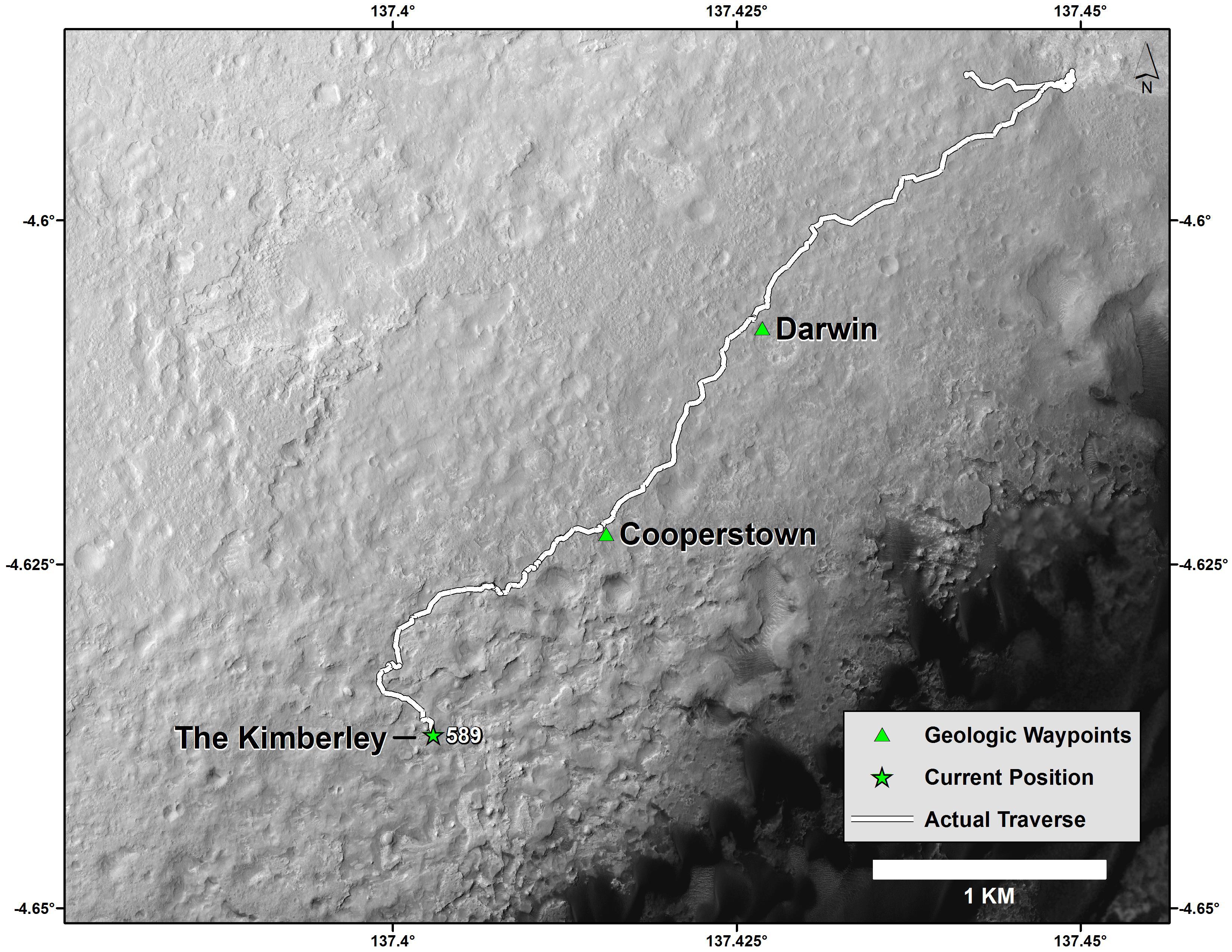
2014-04-03 |
Mars
|
Mars Science Laboratory (MSL)
|
HiRISE
|
3300x2550x3 |
|
-
PIA18075:
-
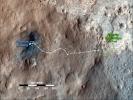
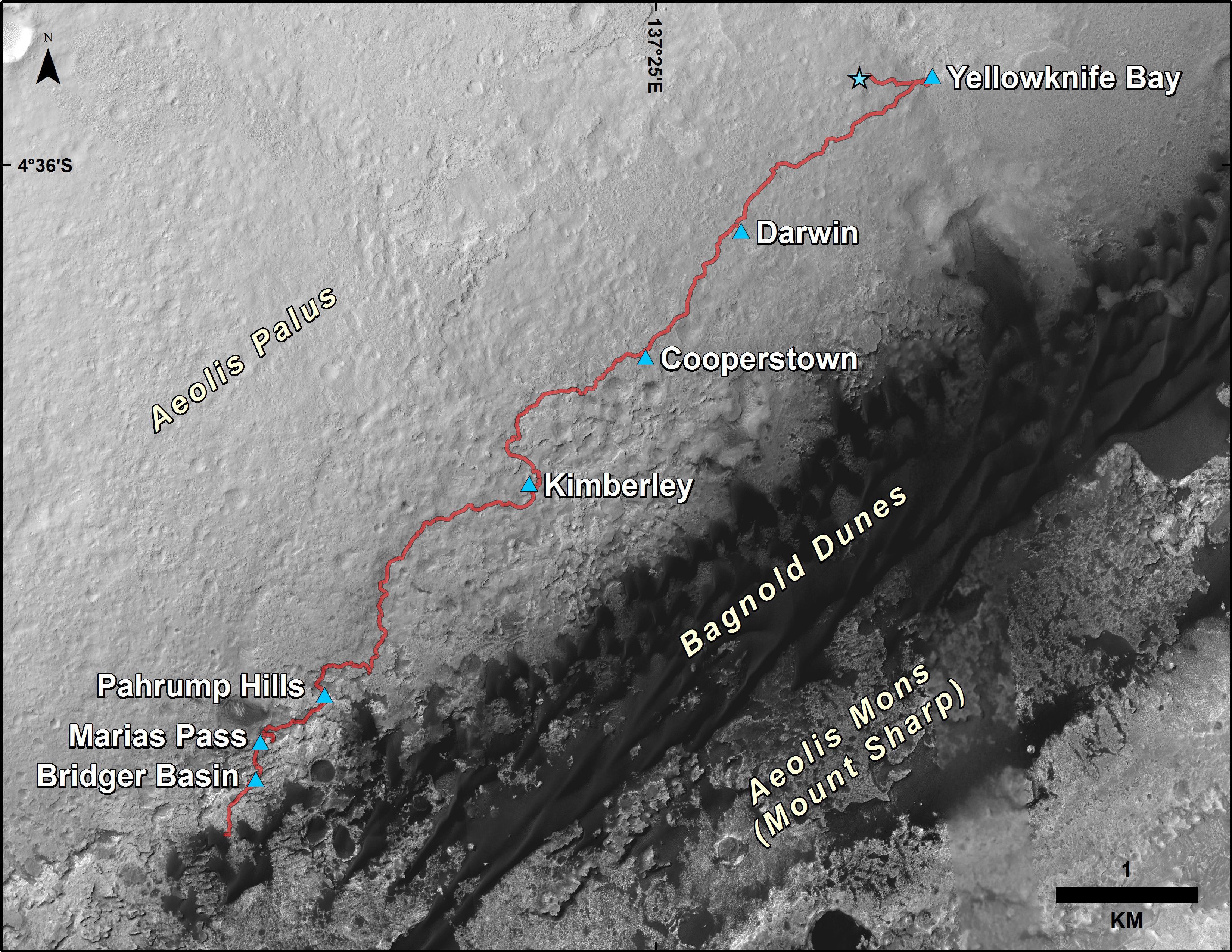
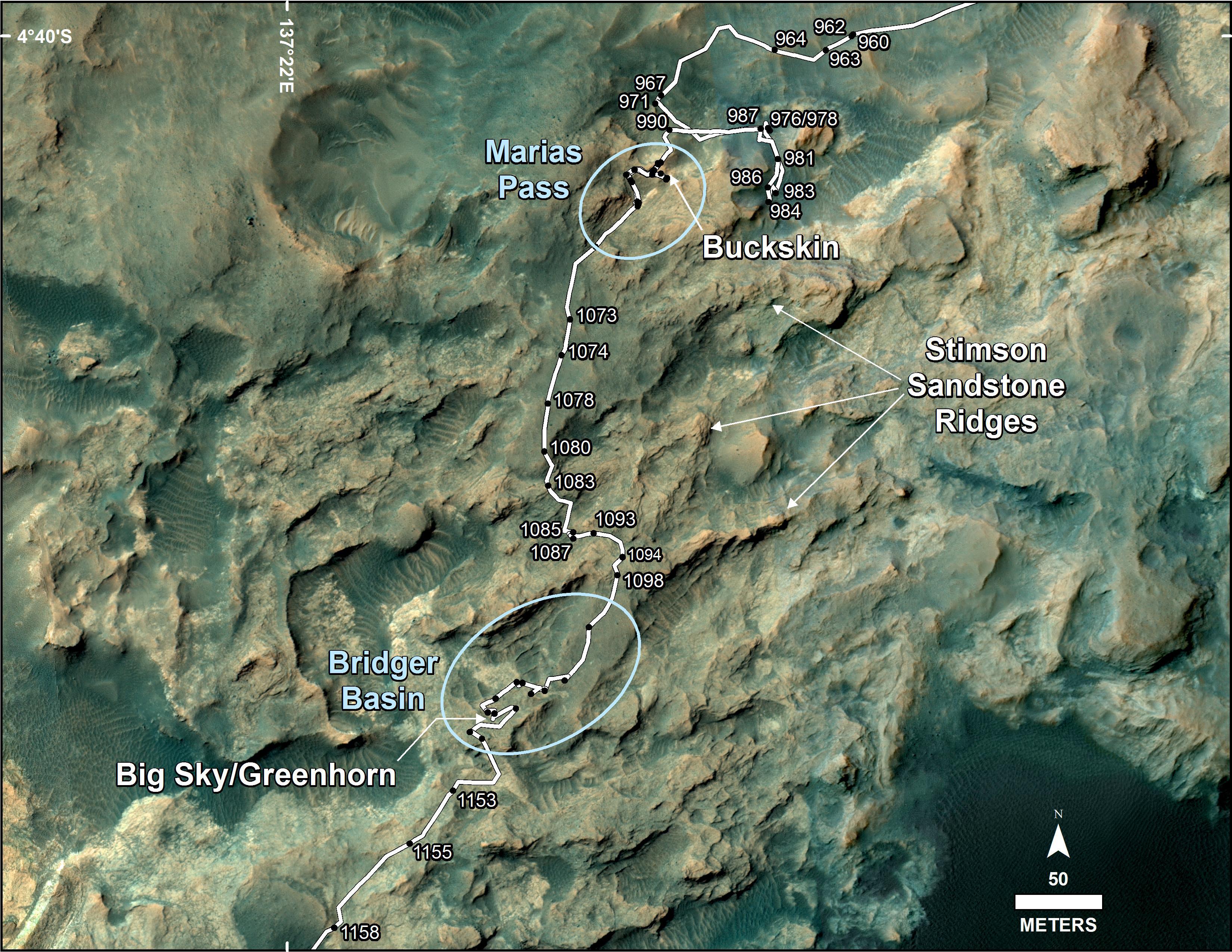
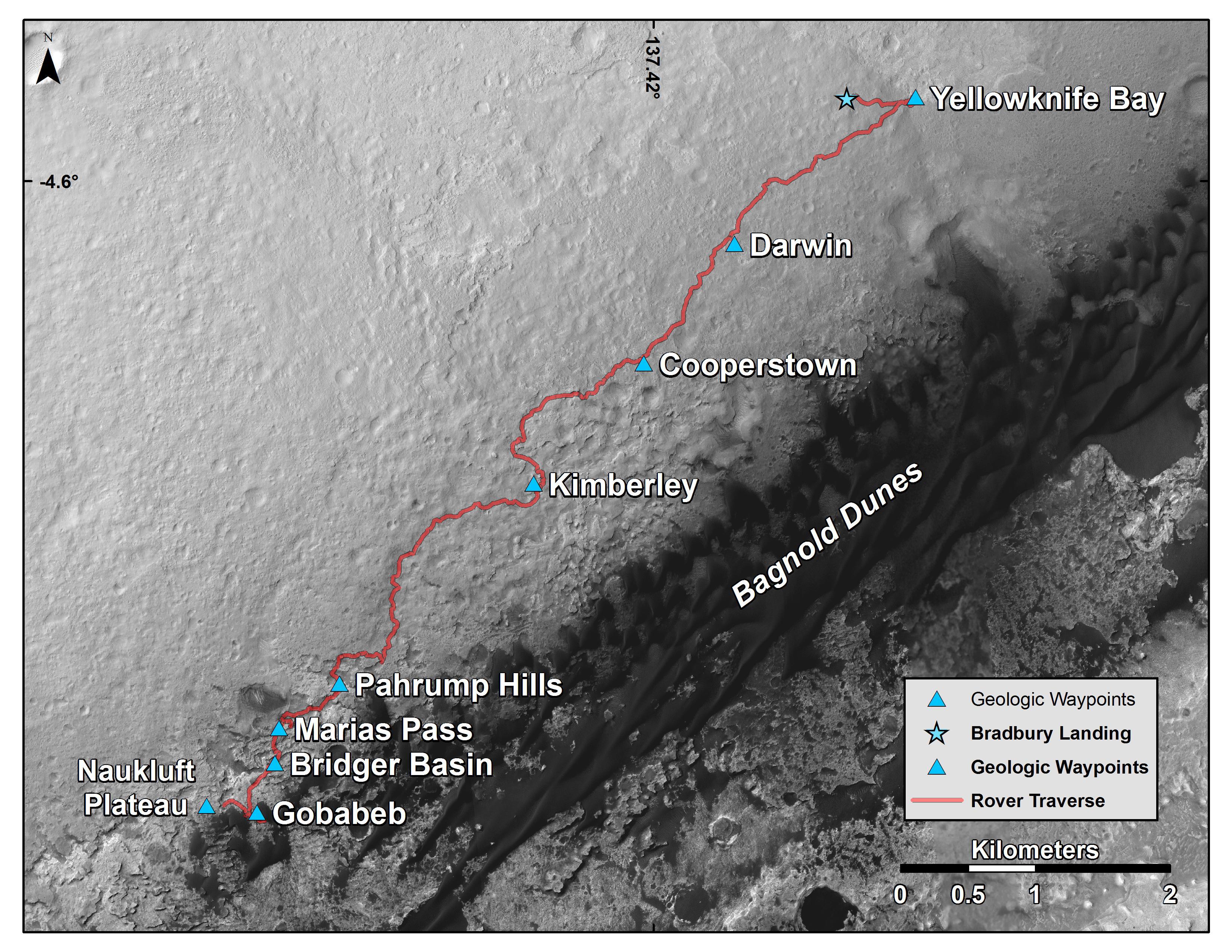
Map of Curiosity Mars Rover's Drives to 'the Kimberley' Waypoint
Full Resolution:
TIFF
(25.26 MB)
JPEG
(1.265 MB)
|
|
|
2014-04-03 |
Mars
|
Mars Science Laboratory (MSL)
|
HiRISE
|
3300x2550x3 |
|
-
PIA18076:
-
Curiosity Mars Rover's Route from Landing to 'The Kimberley' Waypoint
Full Resolution:
TIFF
(25.26 MB)
JPEG
(1.23 MB)
|
|
|
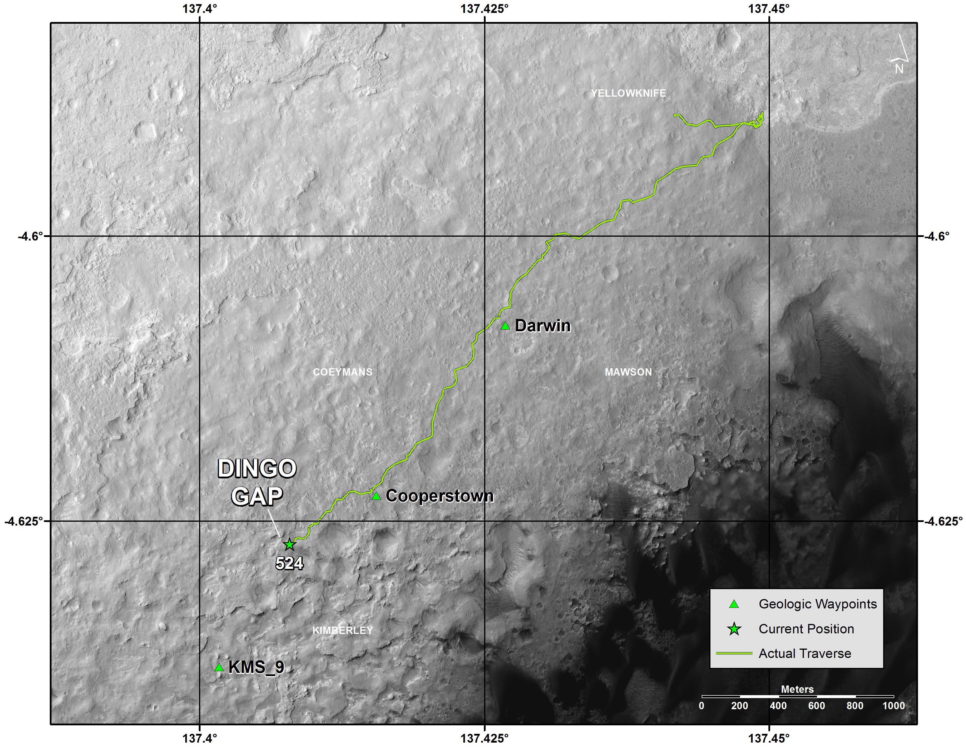
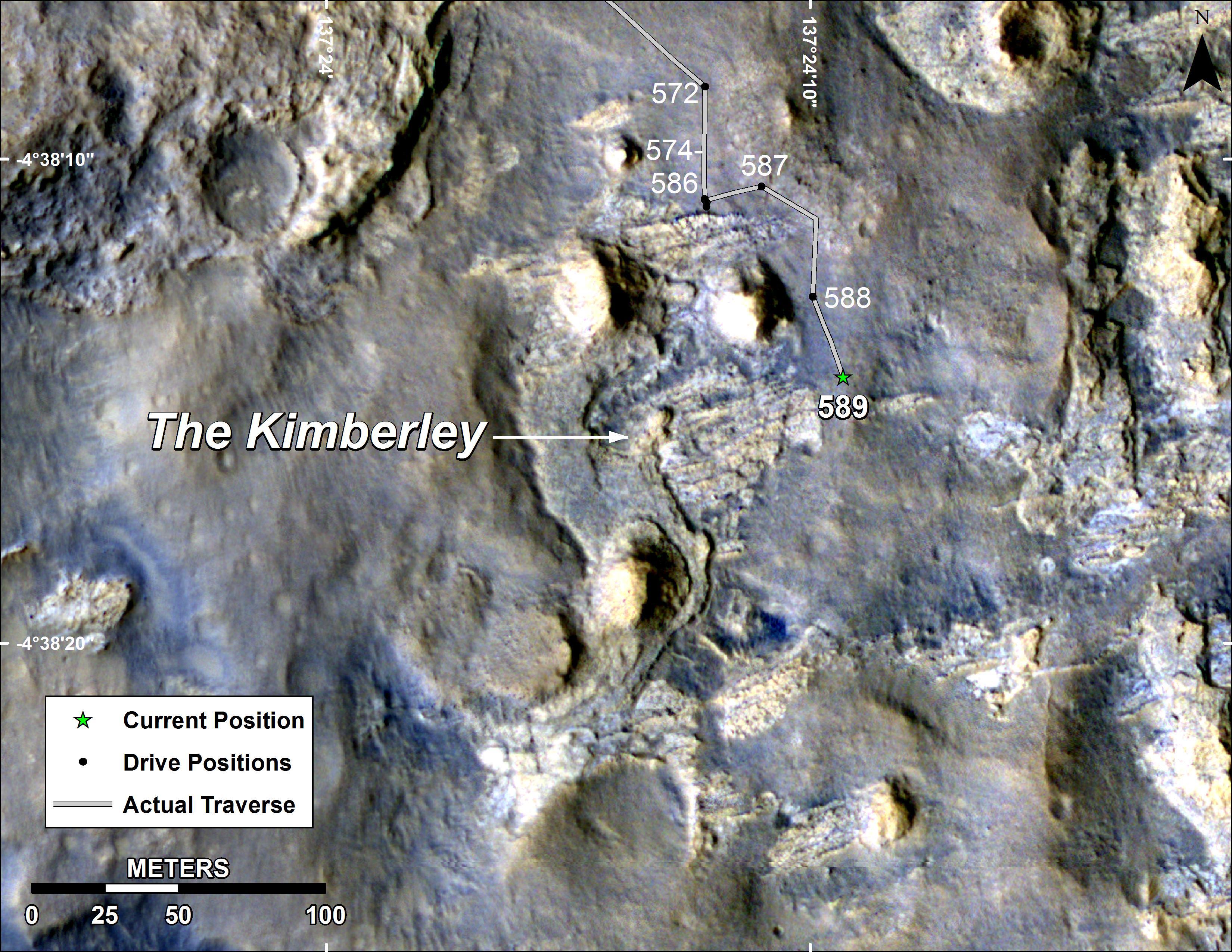
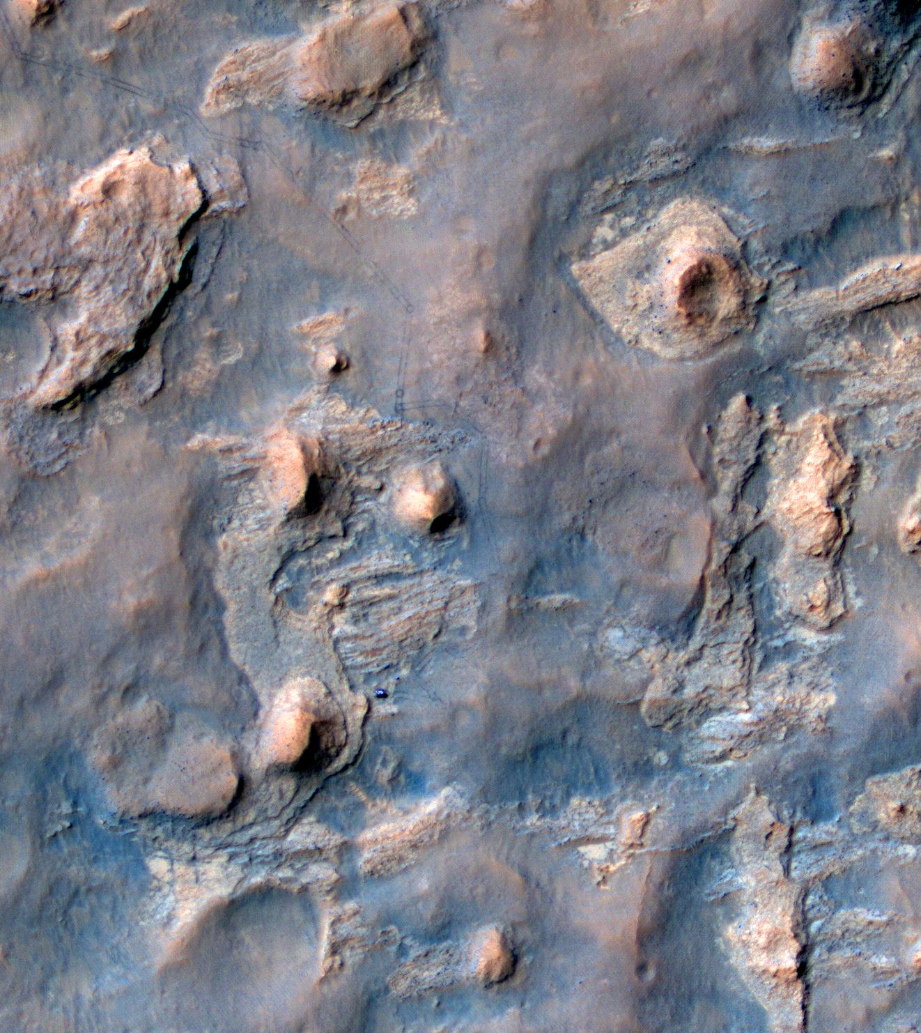
2014-04-16 |
Mars
|
Mars Reconnaissance Orbiter (MRO)
Mars Science Laboratory (MSL)
|
HiRISE
|
1322x1482x3 |
|
-
PIA18081:
-
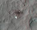
Curiosity and Rover Tracks at 'the Kimberley,' April 2014
Full Resolution:
TIFF
(5.88 MB)
JPEG
(347.6 kB)
|
|
|
2014-04-16 |
Mars
|
Mars Reconnaissance Orbiter (MRO)
Mars Science Laboratory (MSL)
|
HiRISE
|
3287x3497x3 |
|
-
PIA18082:
-
Stereo View of Curiosity and Rover Tracks at 'the Kimberley,' April 2014
Full Resolution:
TIFF
(34.5 MB)
JPEG
(791.9 kB)
|
|
|
2014-06-23 |
Mars
|
Mars Science Laboratory (MSL)
|
HiRISE
|
3300x2550x3 |

|
-
PIA18391:
-
Curiosity's Progress on Route to Mount Sharp
Full Resolution:
TIFF
(25.26 MB)
JPEG
(1.565 MB)
|
|
|
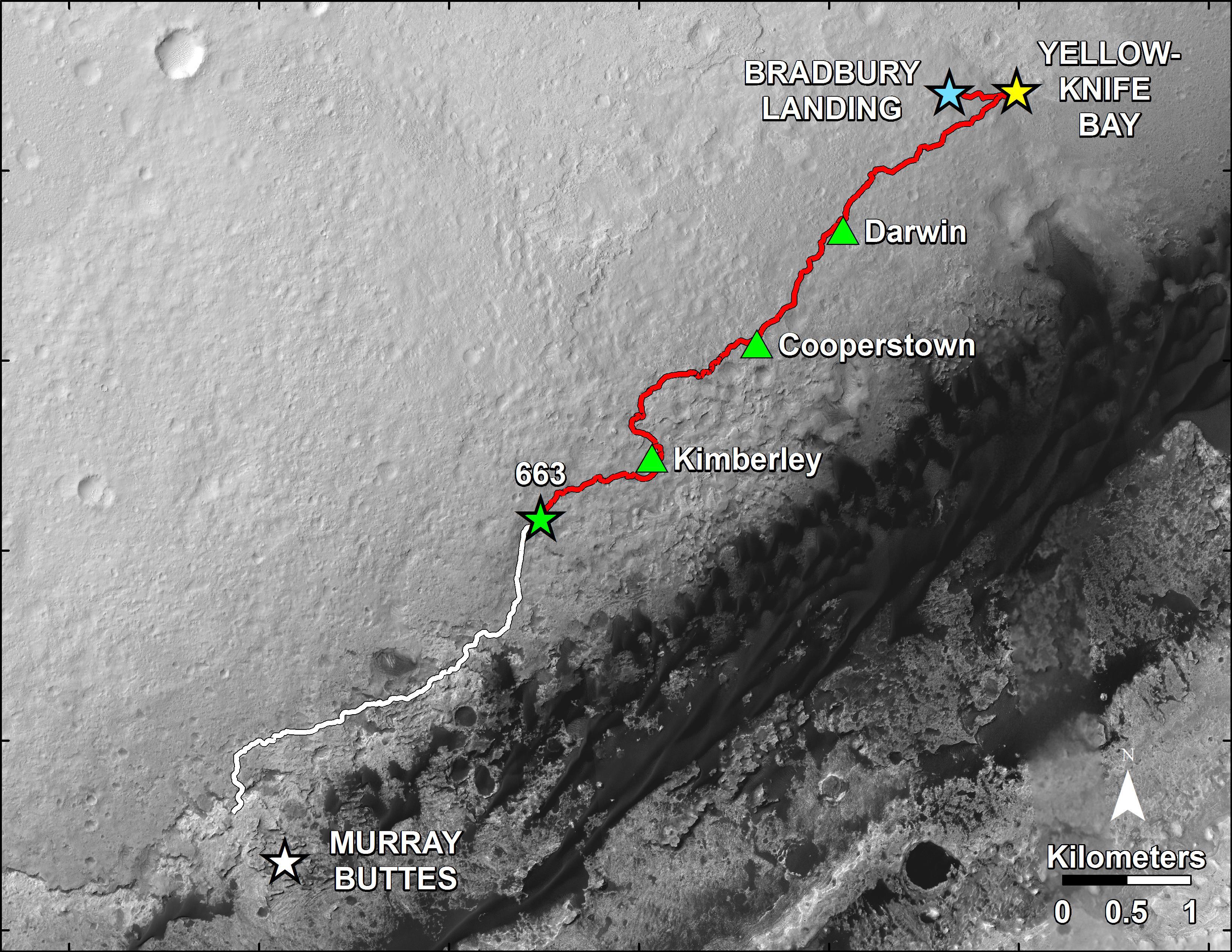
2014-06-23 |
Mars
|
Mars Science Laboratory (MSL)
|
HiRISE
|
3300x2550x3 |
|
-
PIA18392:
-
Curiosity Rover's Traverse, First 663 Sols on Mars
Full Resolution:
TIFF
(25.26 MB)
JPEG
(1.455 MB)
|
|
|
2014-08-01 |
Mars
|
Mars Reconnaissance Orbiter (MRO)
Mars Science Laboratory (MSL)
|
HiRISE
|
3300x2550x3 |
|
-
PIA18408:
-
Sandy Martian Valleys in Curiosity's Near Future
Full Resolution:
TIFF
(25.26 MB)
JPEG
(1.213 MB)
|
|
|
2014-09-11 |
Mars
|
Mars Reconnaissance Orbiter (MRO)
Mars Science Laboratory (MSL)
|
HiRISE
|
2550x3300x3 |
|
-
PIA18475:
-
Curiosity's Next Steps
Full Resolution:
TIFF
(25.25 MB)
JPEG
(1.735 MB)
|
|
|
2014-09-11 |
Mars
|
Mars Reconnaissance Orbiter (MRO)
Mars Science Laboratory (MSL)
|
HiRISE
|
3300x2550x3 |

|
-
PIA18474:
-
Slopes of Mount Sharp
Full Resolution:
TIFF
(25.26 MB)
JPEG
(1.023 MB)
|
|
|
2014-09-11 |
Mars
|
Mars Reconnaissance Orbiter (MRO)
Mars Science Laboratory (MSL)
|
HiRISE
|
4890x3912x3 |
|
-
PIA18780:
-
Curiosity Rover Planned Route
Full Resolution:
TIFF
(57.42 MB)
JPEG
(3.739 MB)
|
|
|
2014-09-11 |
Mars
|
Mars Reconnaissance Orbiter (MRO)
Mars Science Laboratory (MSL)
|
HiRISE
|
4173x3008x3 |
|
-
PIA18781:
-
Map of Lower Mount Sharp
Full Resolution:
TIFF
(37.68 MB)
JPEG
(1.64 MB)
|
|
|
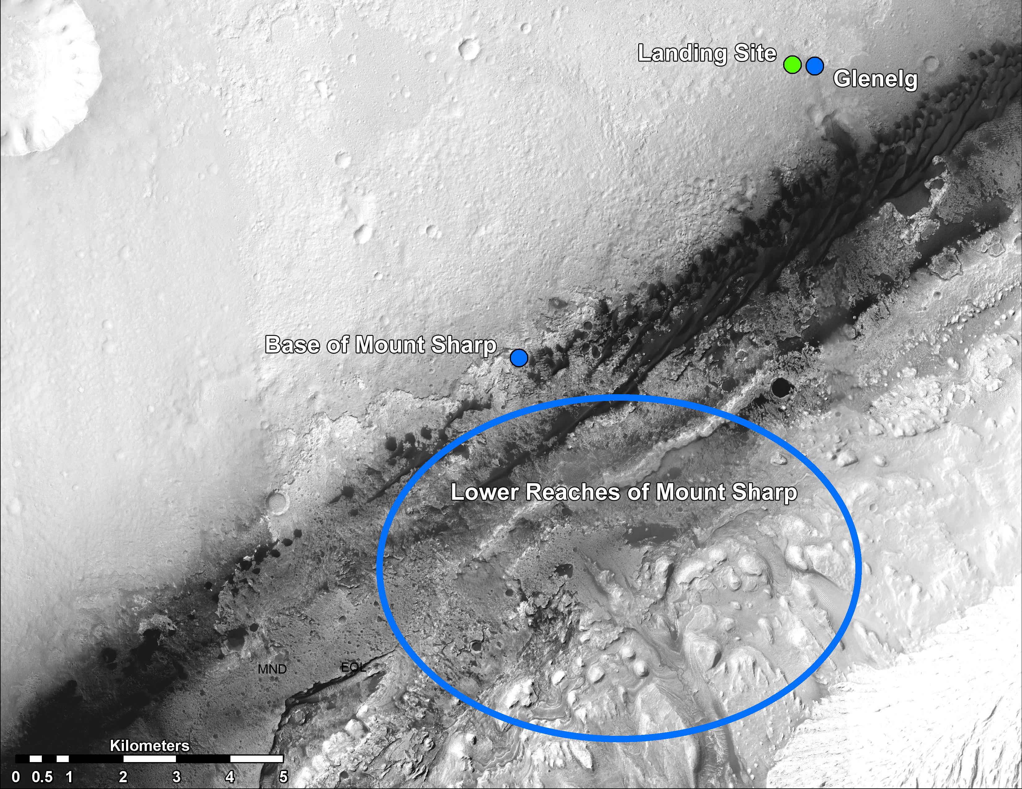
2014-09-11 |
Mars
|
Mars Reconnaissance Orbiter (MRO)
Mars Science Laboratory (MSL)
|
HiRISE
|
1927x1542x3 |
|
-
PIA18783:
-
'Murray Buttes' Mesa
Full Resolution:
TIFF
(8.918 MB)
JPEG
(471.3 kB)
|
|
|
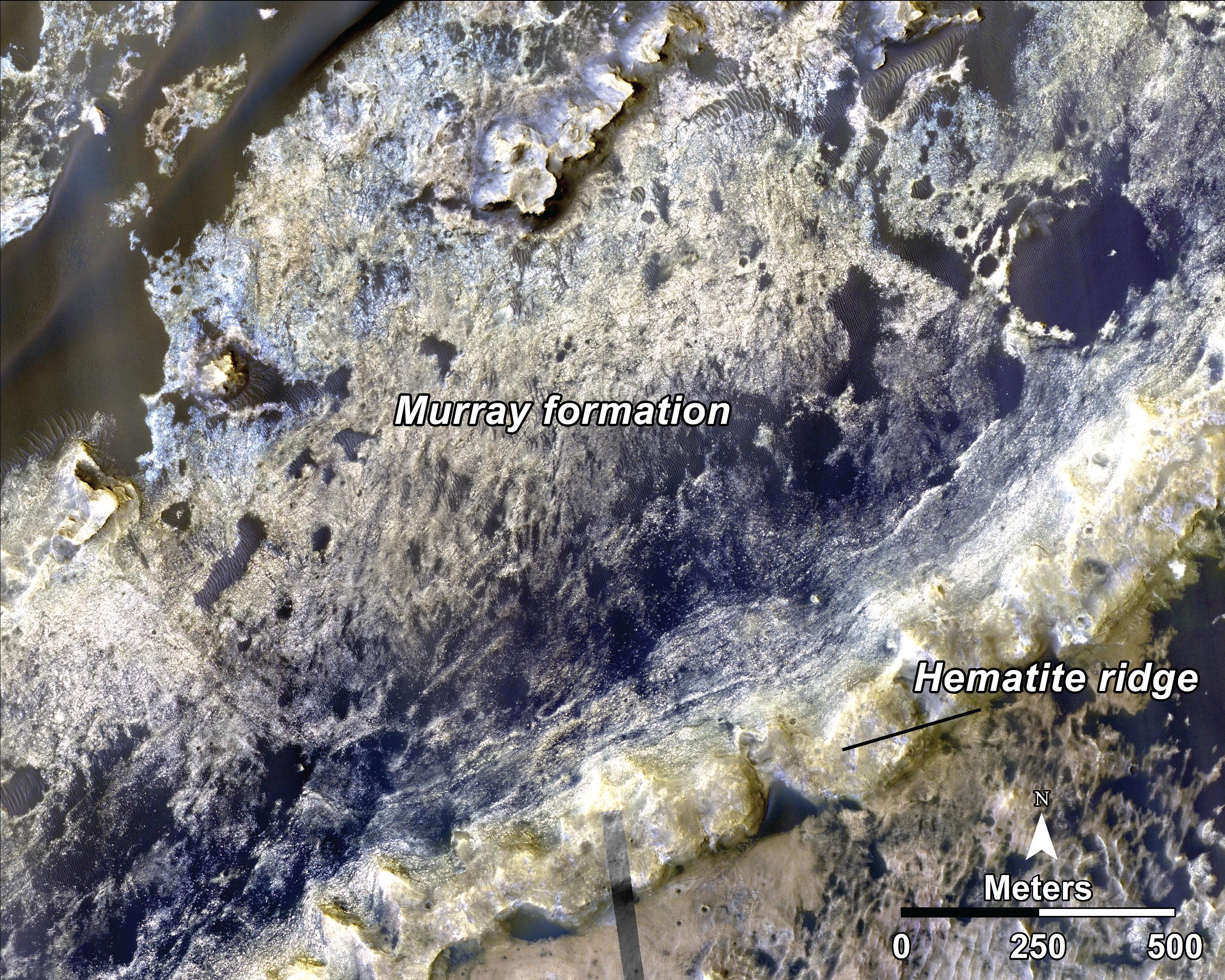
2014-09-11 |
Mars
|
Mars Reconnaissance Orbiter (MRO)
Mars Science Laboratory (MSL)
|
HiRISE
|
1927x1542x3 |

|
-
PIA18784:
-
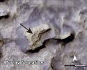
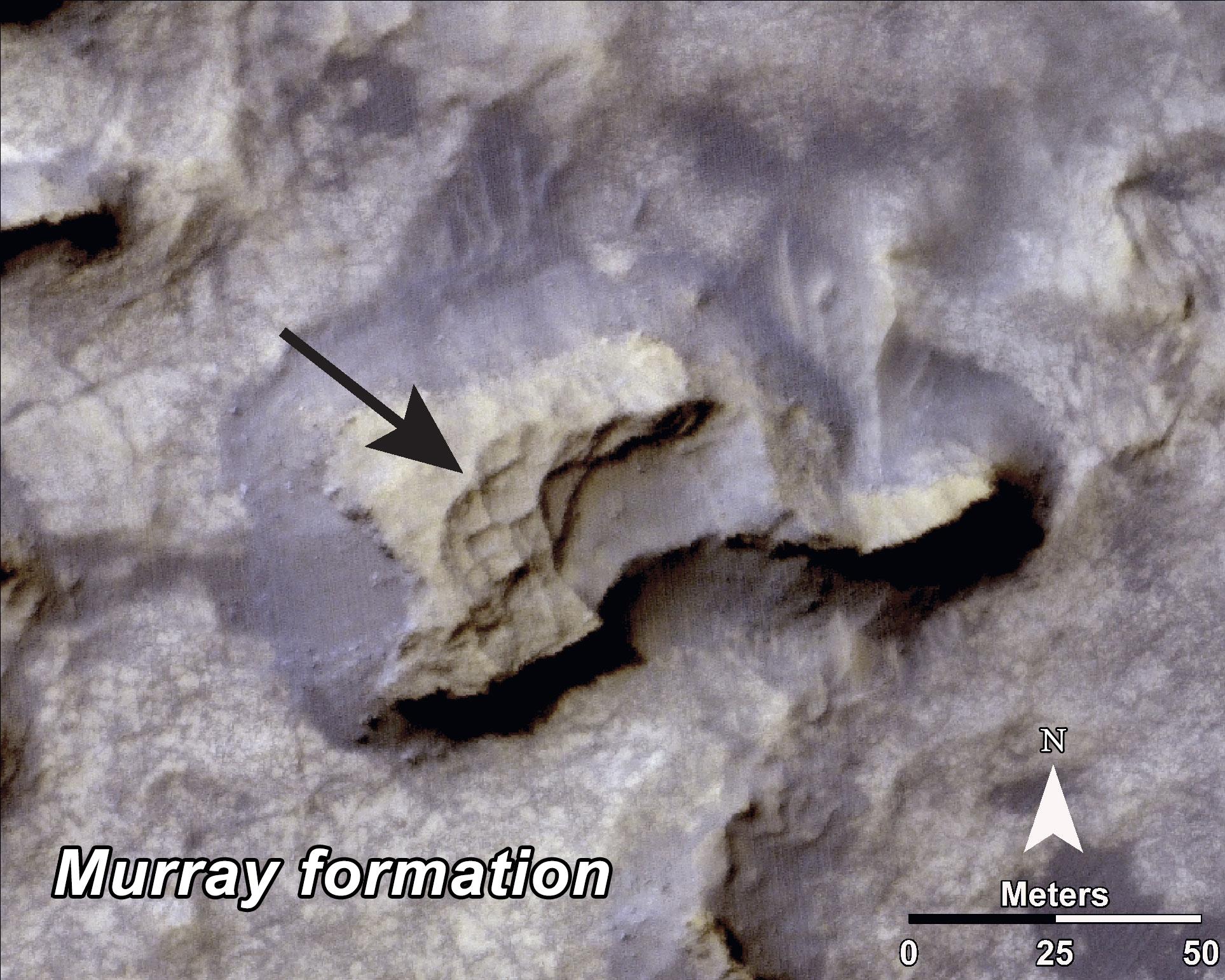
Bands on the 'Murray Formation'
Full Resolution:
TIFF
(8.918 MB)
JPEG
(563 kB)
|
|
|
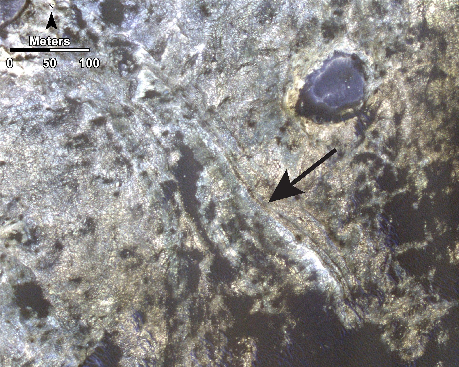
2014-09-11 |
Mars
|
Mars Reconnaissance Orbiter (MRO)
Mars Science Laboratory (MSL)
|
HiRISE
|
3000x2400x3 |
|
-
PIA18785:
-
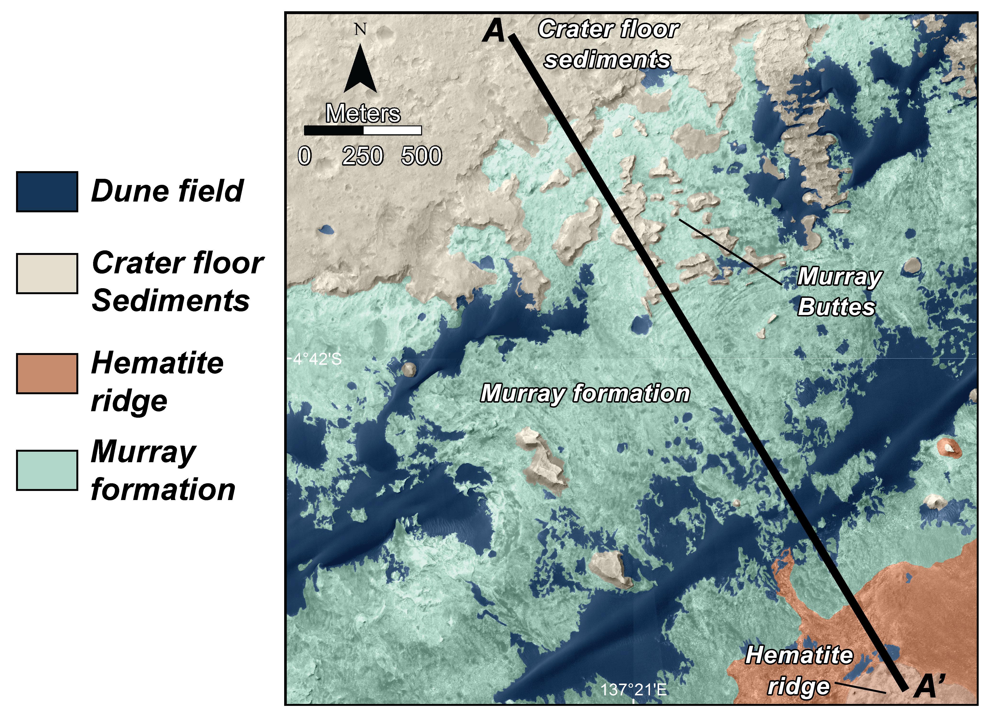
Geological Transition
Full Resolution:
TIFF
(21.61 MB)
JPEG
(2.032 MB)
|
|
|
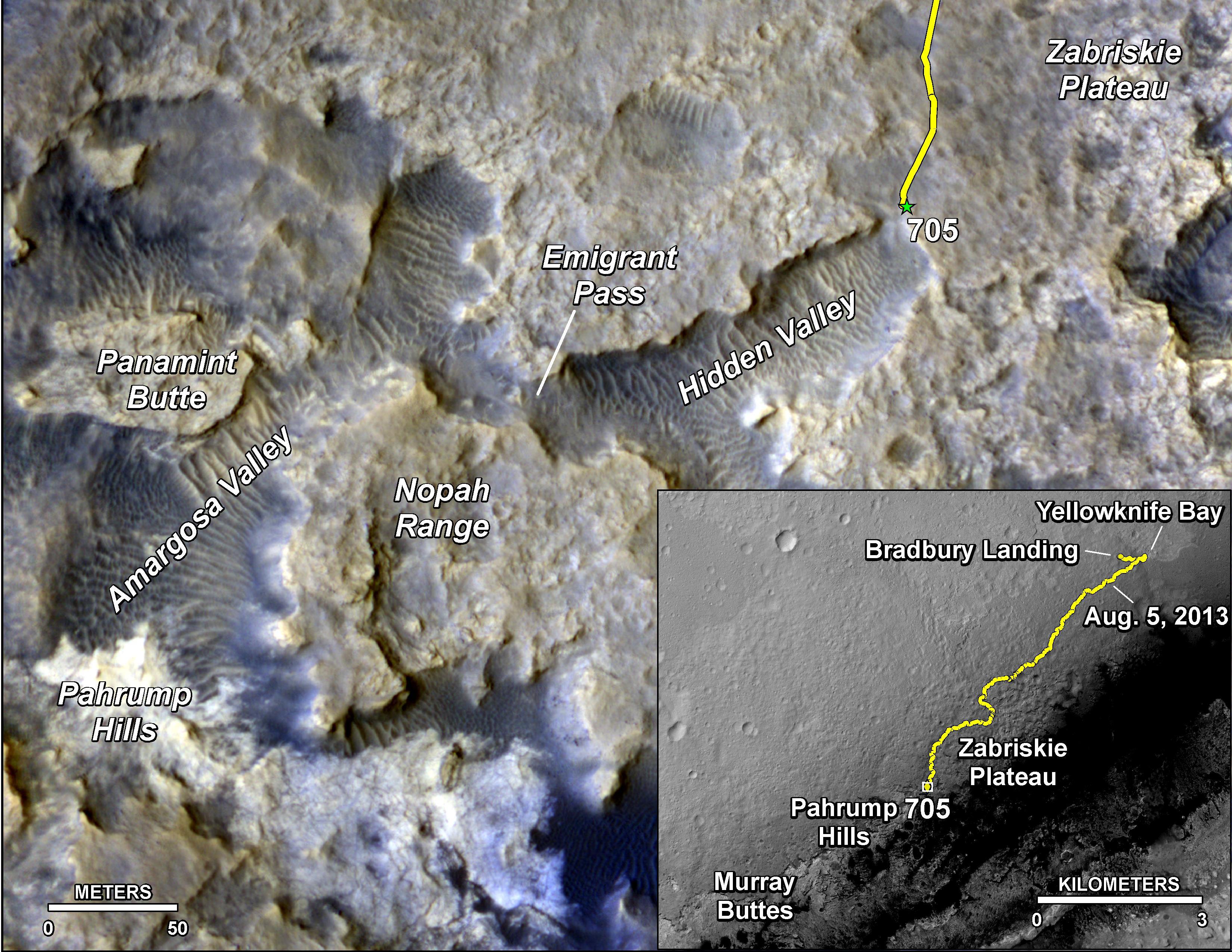
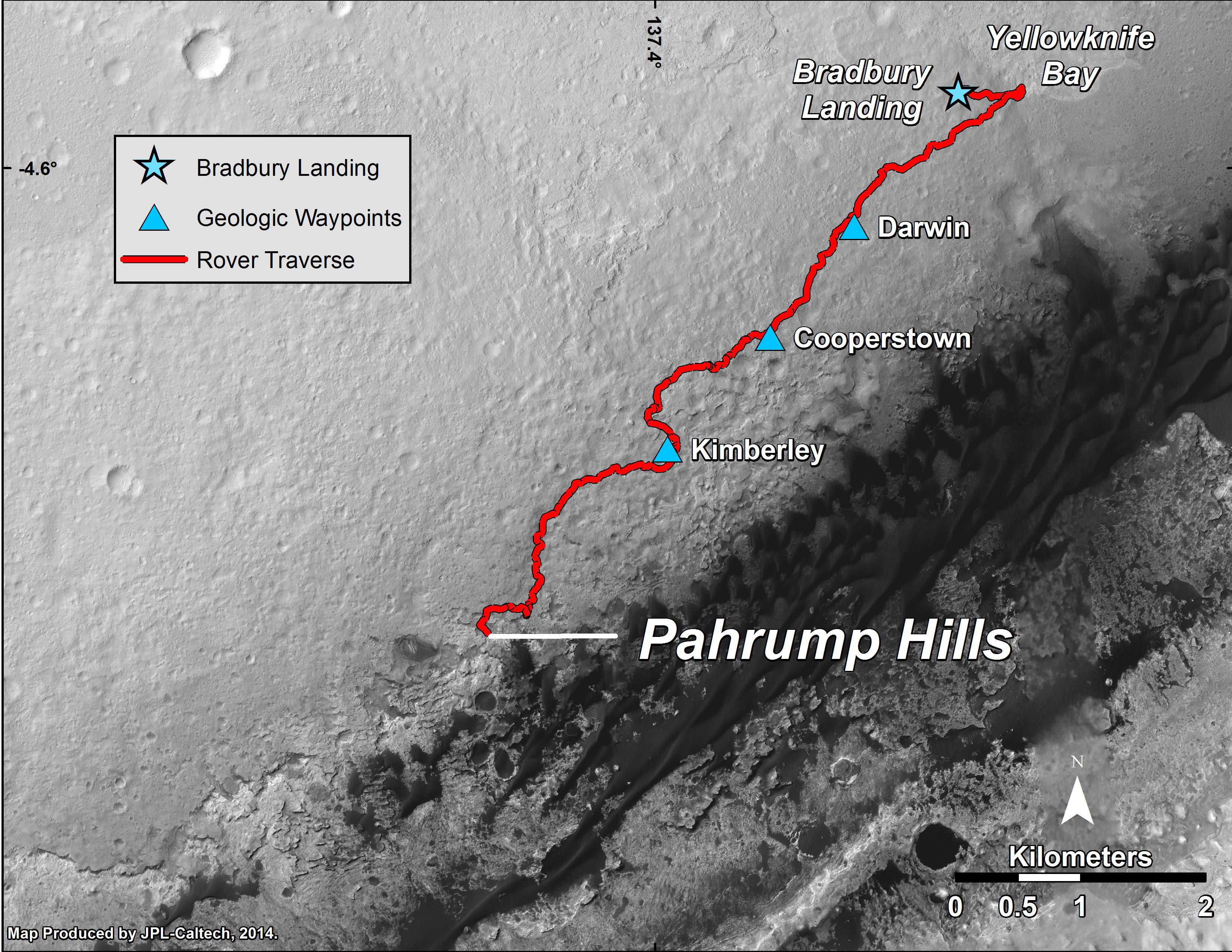
2014-09-25 |
Mars
|
Mars Reconnaissance Orbiter (MRO)
Mars Science Laboratory (MSL)
|
HiRISE
|
3300x2550x3 |
|
-
PIA18607:
-
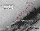
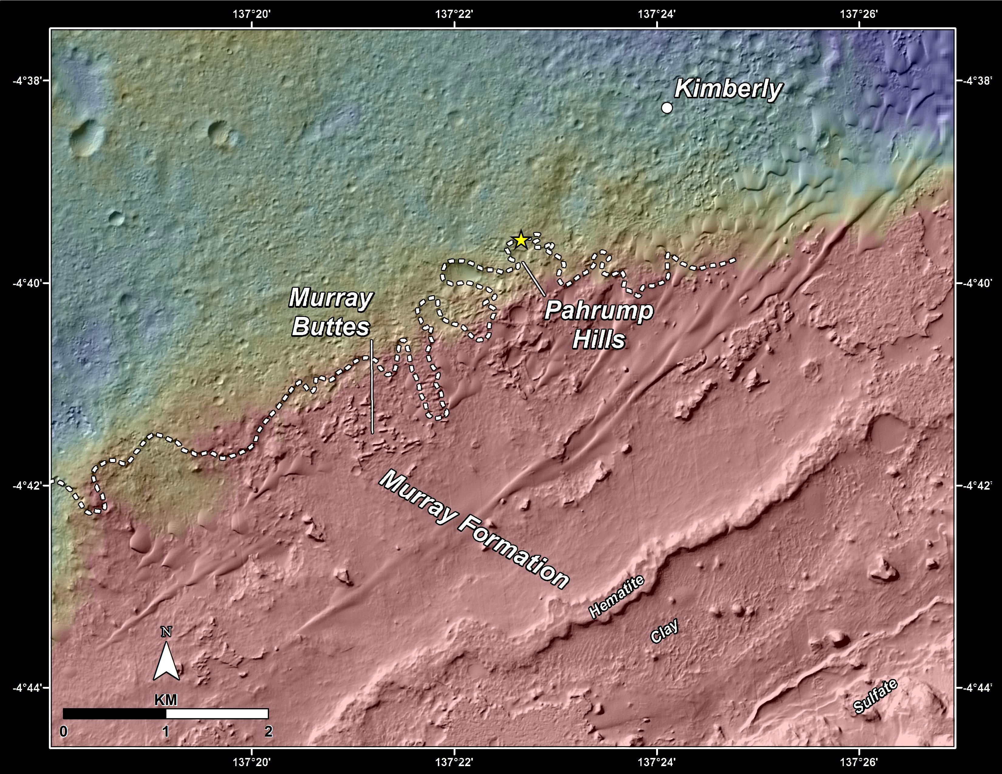
Curiosity Mars Rover's Route from Landing to 'Pahrump Hills'
Full Resolution:
TIFF
(25.26 MB)
JPEG
(1.571 MB)
|
|
|
2015-04-16 |
Mars
|
Mars Science Laboratory (MSL)
|
HiRISE
|
3300x2550x3 |
|
-
PIA19390:
-
Curiosity's Position After 10 Kilometers
Full Resolution:
TIFF
(25.26 MB)
JPEG
(1.777 MB)
|
|
|
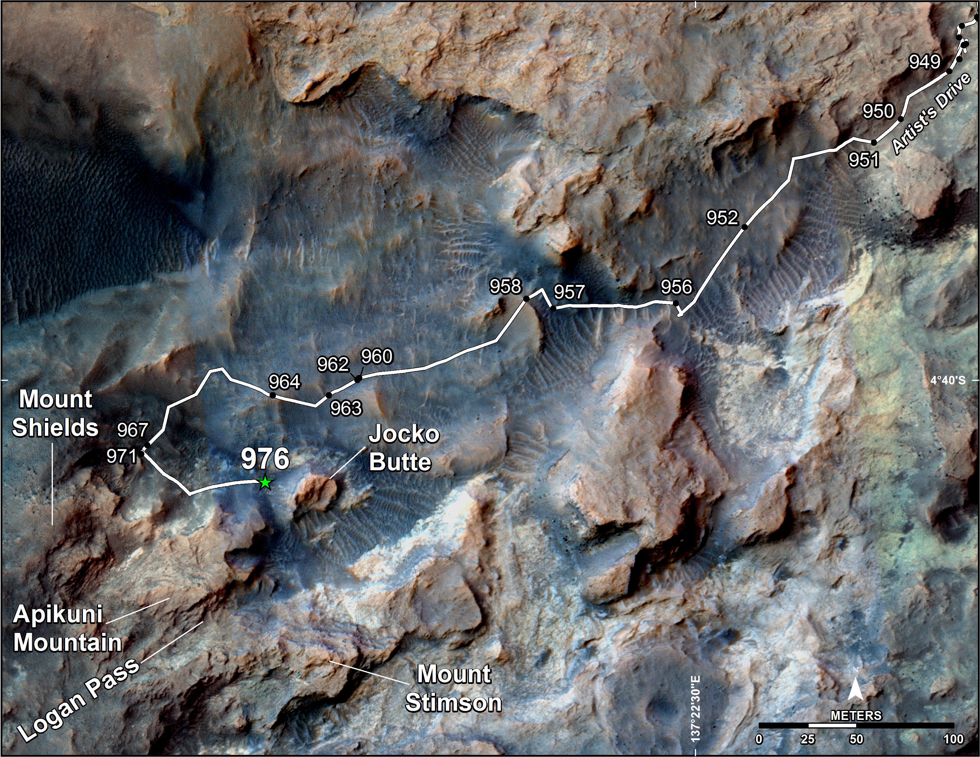
2015-04-22 |
Mars
|
Mars Reconnaissance Orbiter (MRO)
Mars Science Laboratory (MSL)
|
HiRISE
|
2286x1510x3 |
|
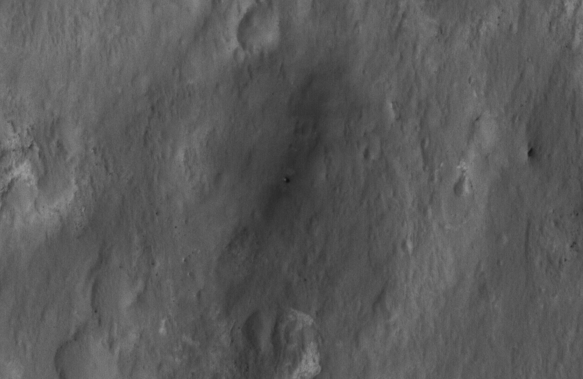
-
PIA19392:
-
Mars Orbiter Sees Curiosity Rover in 'Artist's Drive'
Full Resolution:
TIFF
(10.36 MB)
JPEG
(527.1 kB)
|
|
|
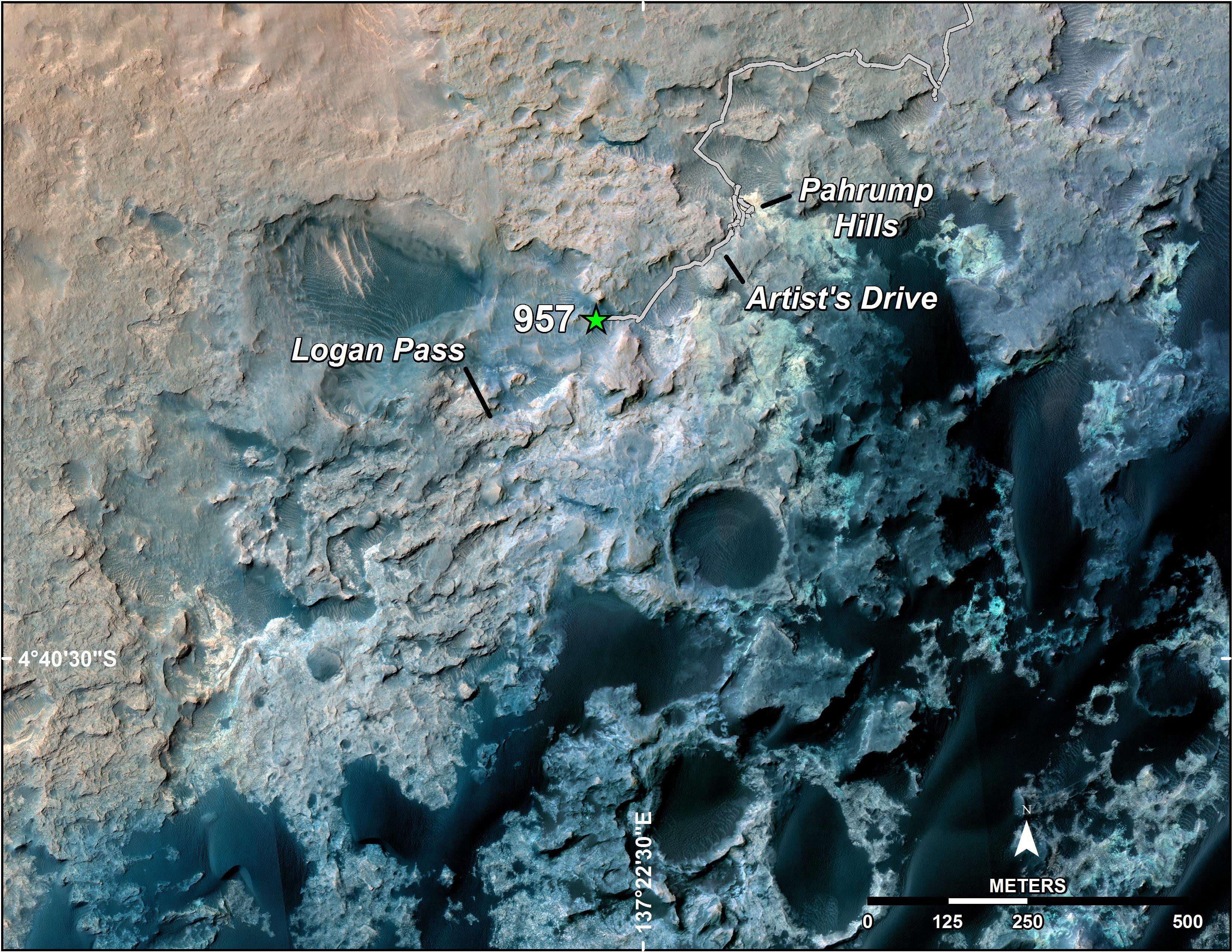
2015-05-08 |
Mars
|
Mars Science Laboratory (MSL)
|
HiRISE
|
3300x2550x3 |

|
-
PIA19399:
-
Curiosity's Path to Some Spring 2015 Study Sites
Full Resolution:
TIFF
(25.26 MB)
JPEG
(1.318 MB)
|
|
|
2016-10-03 |
Mars
|
Mars Science Laboratory (MSL)
|
HiRISE
|
3300x2550x3 |
|
-
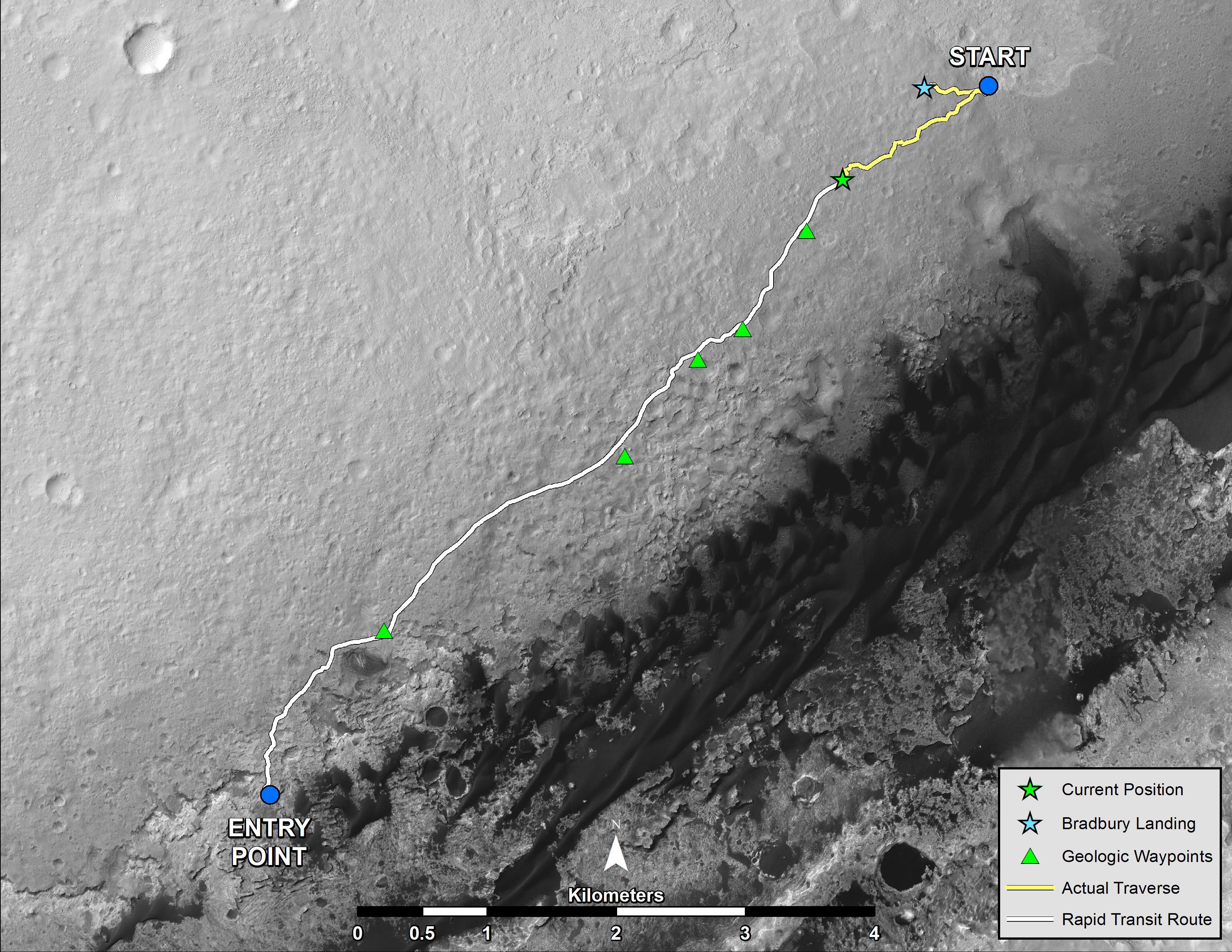
PIA20846:
-
Curiosity Destinations for Second Extended Mission
Full Resolution:
TIFF
(13.9 MB)
JPEG
(1.797 MB)
|
|
|
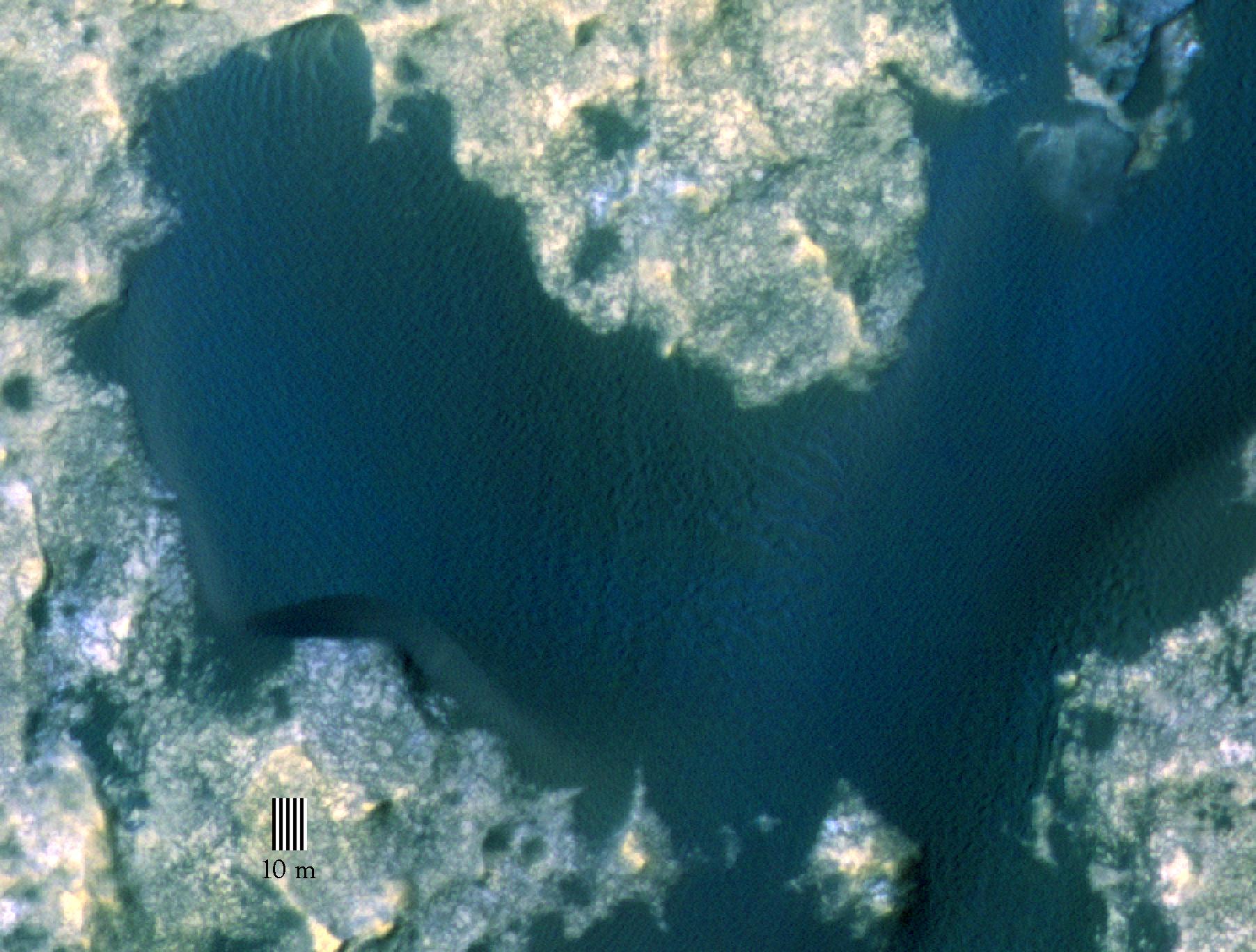
2015-11-16 |
Mars
|
Mars Science Laboratory (MSL)
|
HiRISE
|
1804x1368x3 |

|
-
PIA19930:
-
Orbital View of Dune That Curiosity Will Visit
Full Resolution:
TIFF
(7.407 MB)
JPEG
(306 kB)
|
|
|
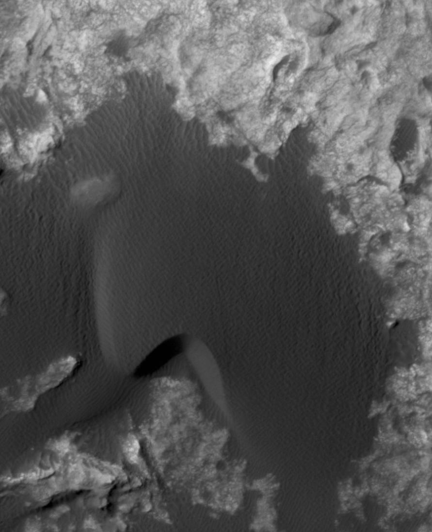
2015-11-16 |
Mars
|
Mars Science Laboratory (MSL)
|
HiRISE
|
891x1095x1 |

|
-
PIA20161:
-
Change Observed in Martian Sand Dune
Full Resolution:
TIFF
(875.3 kB)
JPEG
(87.75 kB)
|
|
|
2015-11-16 |
Mars
|
Mars Science Laboratory (MSL)
|
HiRISE
|
3300x2550x3 |
|
-
PIA20162:
-
Curiosity Rover's Traverse, First 1,163 Sols on Mars
Full Resolution:
TIFF
(12.23 MB)
JPEG
(1.431 MB)
|
|
|
2015-12-17 |
Mars
|
Mars Reconnaissance Orbiter (MRO)
Mars Science Laboratory (MSL)
|
HiRISE
|
3300x2550x3 |
|
-
PIA20172:
-
Curiosity Rover's Traverse, First 1,185 Sols on Mars
Full Resolution:
TIFF
(13.35 MB)
JPEG
(1.533 MB)
|
|
|
2015-12-17 |
Mars
|
Mars Reconnaissance Orbiter (MRO)
Mars Science Laboratory (MSL)
|
HiRISE
|
3300x2550x3 |
|
-
PIA20173:
-
Curiosity's Path During 2015 Studies of Silica-Rich Rocks
Full Resolution:
TIFF
(25.26 MB)
JPEG
(1.372 MB)
|
|
|
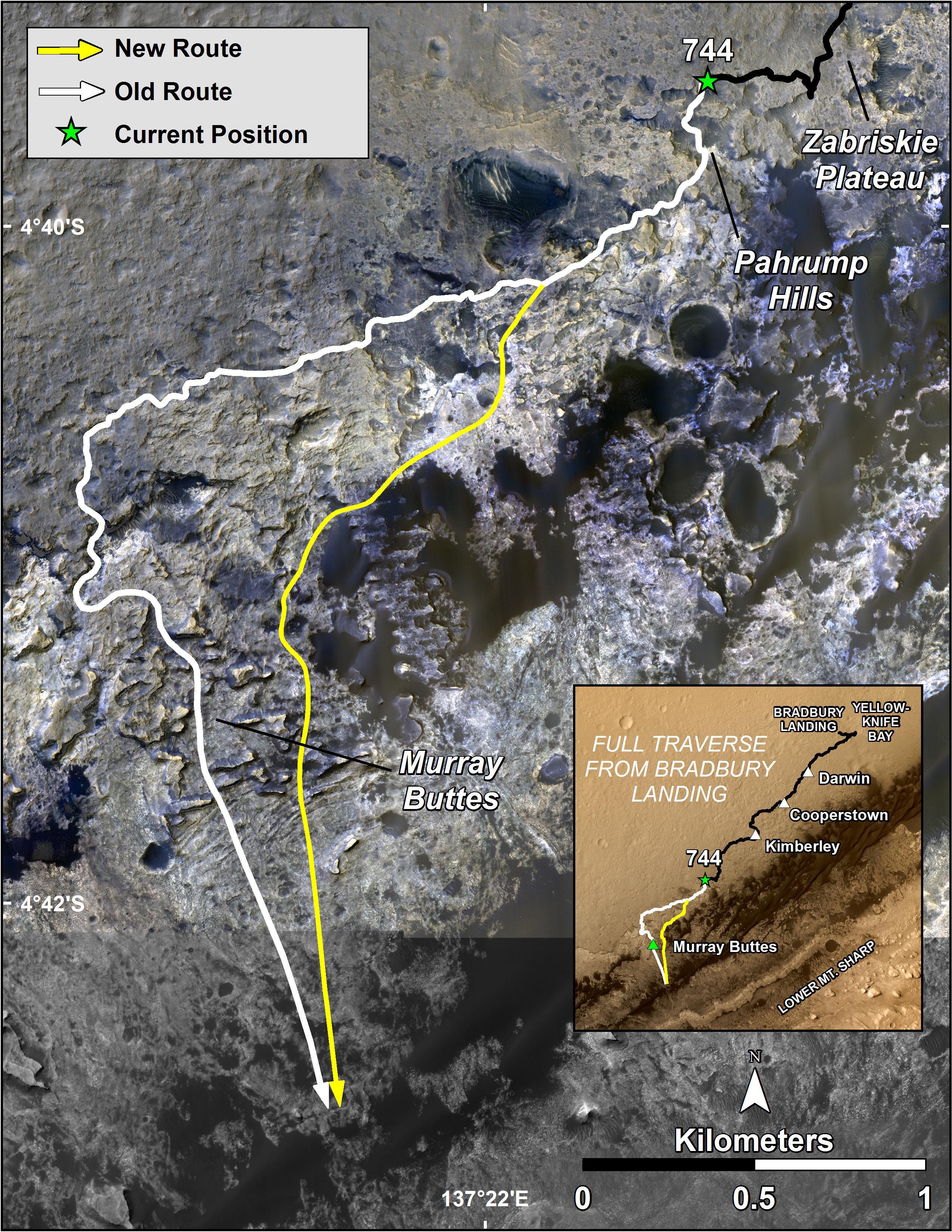
2016-03-11 |
Mars
|
Mars Science Laboratory (MSL)
|
HiRISE
|
3300x2550x3 |
|
-
PIA20166:
-
New Waypoint, Science Team Newcomers for Curiosity
Full Resolution:
TIFF
(12.44 MB)
JPEG
(1.458 MB)
|
|
|
2016-06-29 |
Mars
|
Mars Reconnaissance Orbiter (MRO)
|
HiRISE
|
2880x1800x3 |
|
-
PIA20735:
-
Martian Morse Code
Full Resolution:
TIFF
(15.56 MB)
JPEG
(1.195 MB)
|
|
|
2016-06-29 |
Mars
|
Mars Reconnaissance Orbiter (MRO)
|
HiRISE
|
2880x1800x3 |
|
-
PIA20737:
-
Bedrock North of Terby Crater
Full Resolution:
TIFF
(15.56 MB)
JPEG
(775.2 kB)
|
|
|
2016-06-29 |
Mars
|
Mars Reconnaissance Orbiter (MRO)
|
HiRISE
|
2880x1800x3 |
|
-
PIA20740:
-
Dreaming of Graben in the Labyrinth of the Night
Full Resolution:
TIFF
(15.56 MB)
JPEG
(765.6 kB)
|
|
|
2016-06-29 |
Mars
|
Mars Reconnaissance Orbiter (MRO)
|
HiRISE
|
2880x1800x3 |
|
-
PIA20736:
-
Glowing Gullies in Kaiser Crater Dunes
Full Resolution:
TIFF
(15.11 MB)
JPEG
(766.1 kB)
|
|
|
2017-02-27 |
Mars
|
Mars Reconnaissance Orbiter (MRO)
Mars Science Laboratory (MSL)
|
HiRISE
|
825x1118x3 |
|
-
PIA21269:
-
Curiosity's Bagnold Dunes Campaign: Two Types of Dunes
Full Resolution:
TIFF
(1.475 MB)
JPEG
(200.6 kB)
|
|
|
2017-06-20 |
Mars
|
Mars Reconnaissance Orbiter (MRO)
Mars Science Laboratory (MSL)
|
HiRISE
|
1403x789x3 |

|
-
PIA21710:
-
Curiosity Rover on Mount Sharp, Seen from Mars Orbit
Full Resolution:
TIFF
(3.322 MB)
JPEG
(215.9 kB)
|
|
|
2017-07-11 |
Mars
|
Mars Science Laboratory (MSL)
|
HiRISE
|
3300x2550x3 |
|
-
PIA21720:
-
Mid-2017 Map of NASA's Curiosity Mars Rover Mission
Full Resolution:
TIFF
(14.25 MB)
JPEG
(1.627 MB)
|
|
|
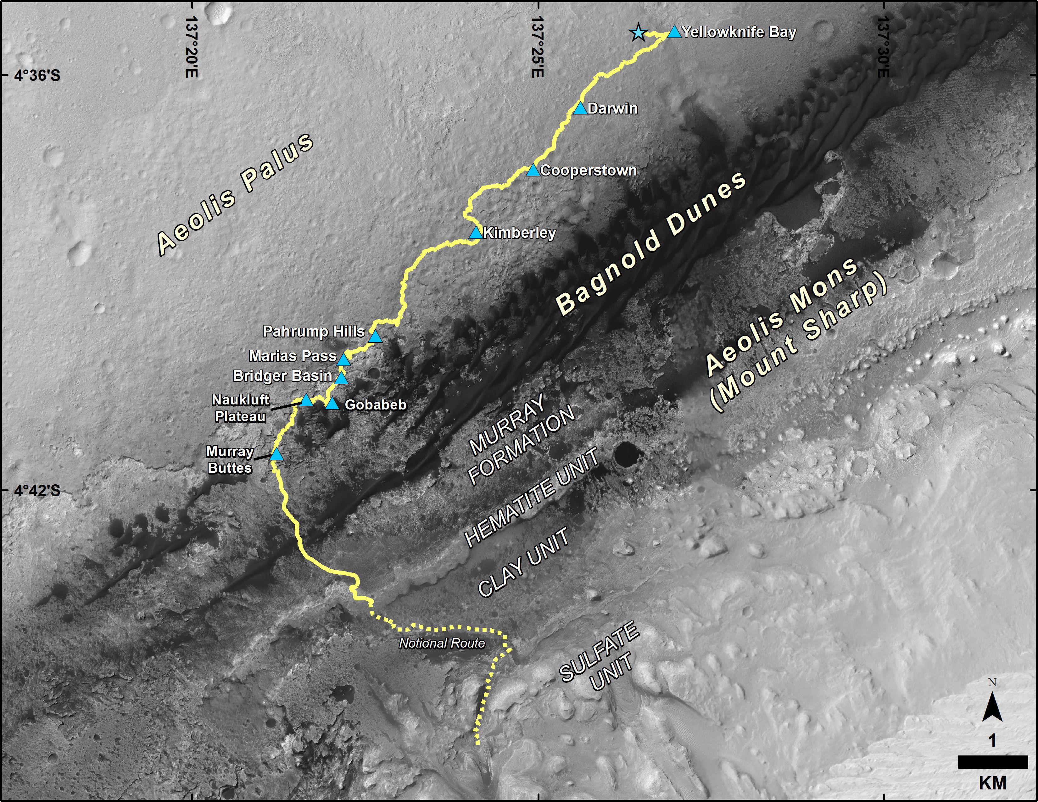
2019-08-22 |
Mars
|
Mars Science Laboratory (MSL)
|
HiRISE
|
3300x2550x3 |
|
-
PIA23412:
-
Mid-2019 Map of NASA's Curiosity Rover Mission
Full Resolution:
TIFF
(13.3 MB)
JPEG
(1.669 MB)
|
|
|
2012-08-07 |
Mars
|
Mars Science Laboratory (MSL)
|
HiRISE
Mars Descent Imager
|
9000x6750x3 |

|
-
PIA15996:
-
Nailing Down Curiosity's Landing Site
Full Resolution:
TIFF
(182.3 MB)
JPEG
(6.01 MB)
|
|
|
2012-08-08 |
Mars
|
Mars Reconnaissance Orbiter (MRO)
Mars Science Laboratory (MSL)
|
HiRISE
MARDI
|
1665x1174x3 |
|
-
PIA16019:
-
A Better Look of the Martian Surface
Full Resolution:
TIFF
(5.867 MB)
JPEG
(153.7 kB)
|
|
|
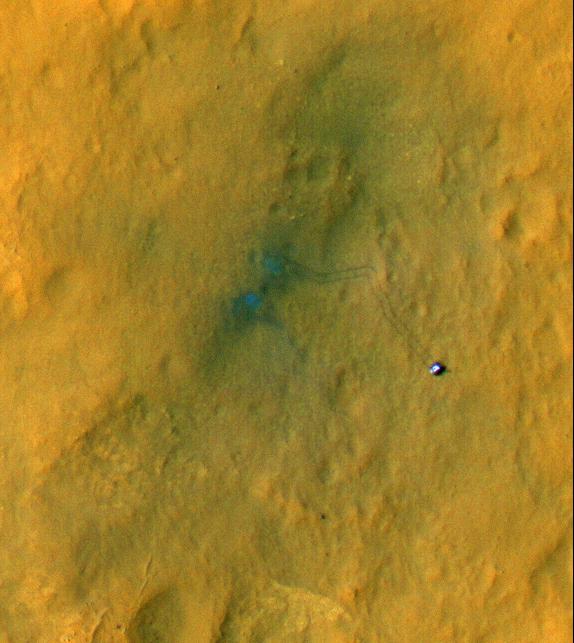
2016-10-03 |
Mars
|
Mars Science Laboratory (MSL)
|
HiRISE
MAHLI
|
3300x2550x3 |
|
-
PIA20845:
-
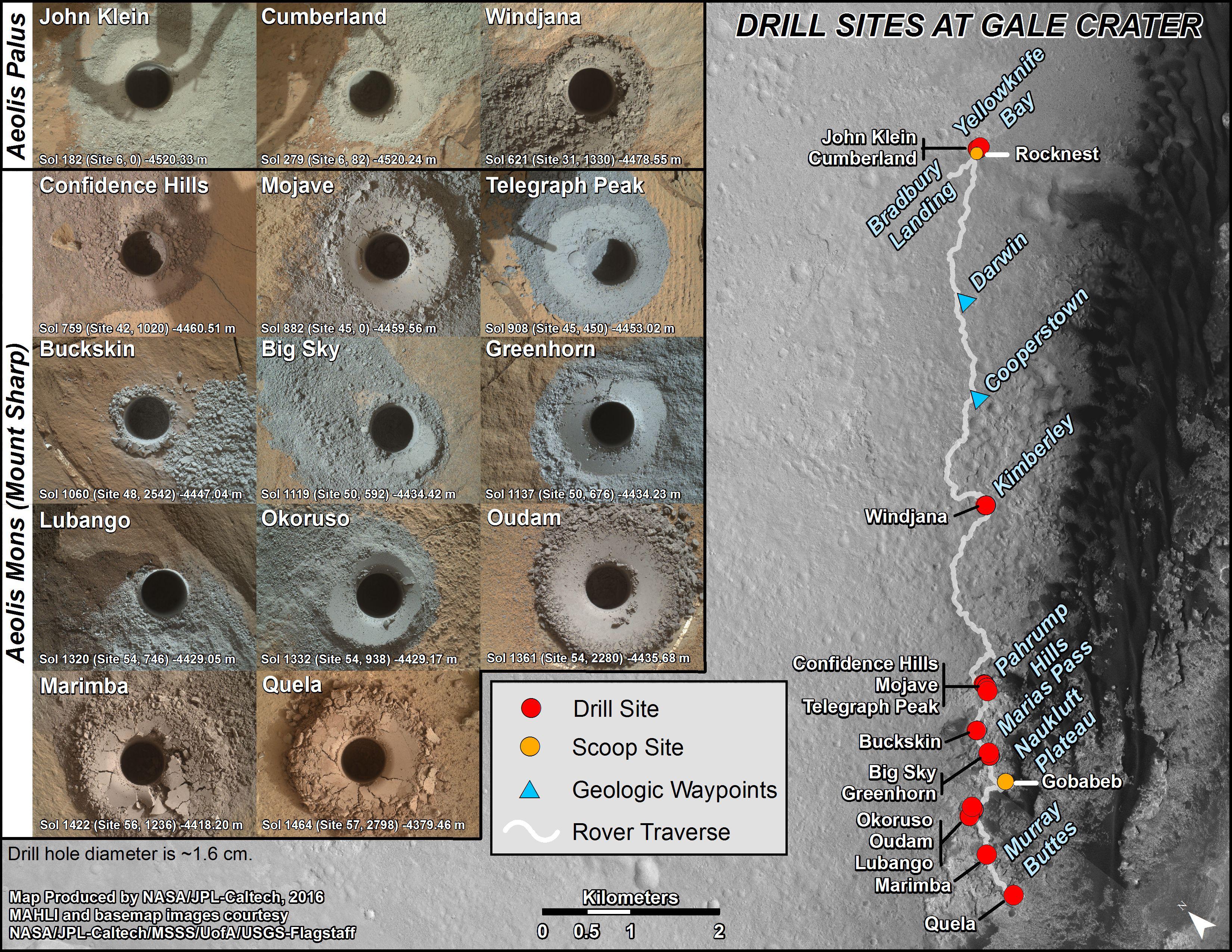
Curiosity's First 16 Rock or Soil Sampling Sites on Mars
Full Resolution:
TIFF
(20.59 MB)
JPEG
(2.195 MB)
|
|
|
2016-12-13 |
Mars
|
Mars Reconnaissance Orbiter (MRO)
Mars Science Laboratory (MSL)
|
HiRISE
MAHLI
|
3300x2550x3 |
|
-
PIA21254:
-
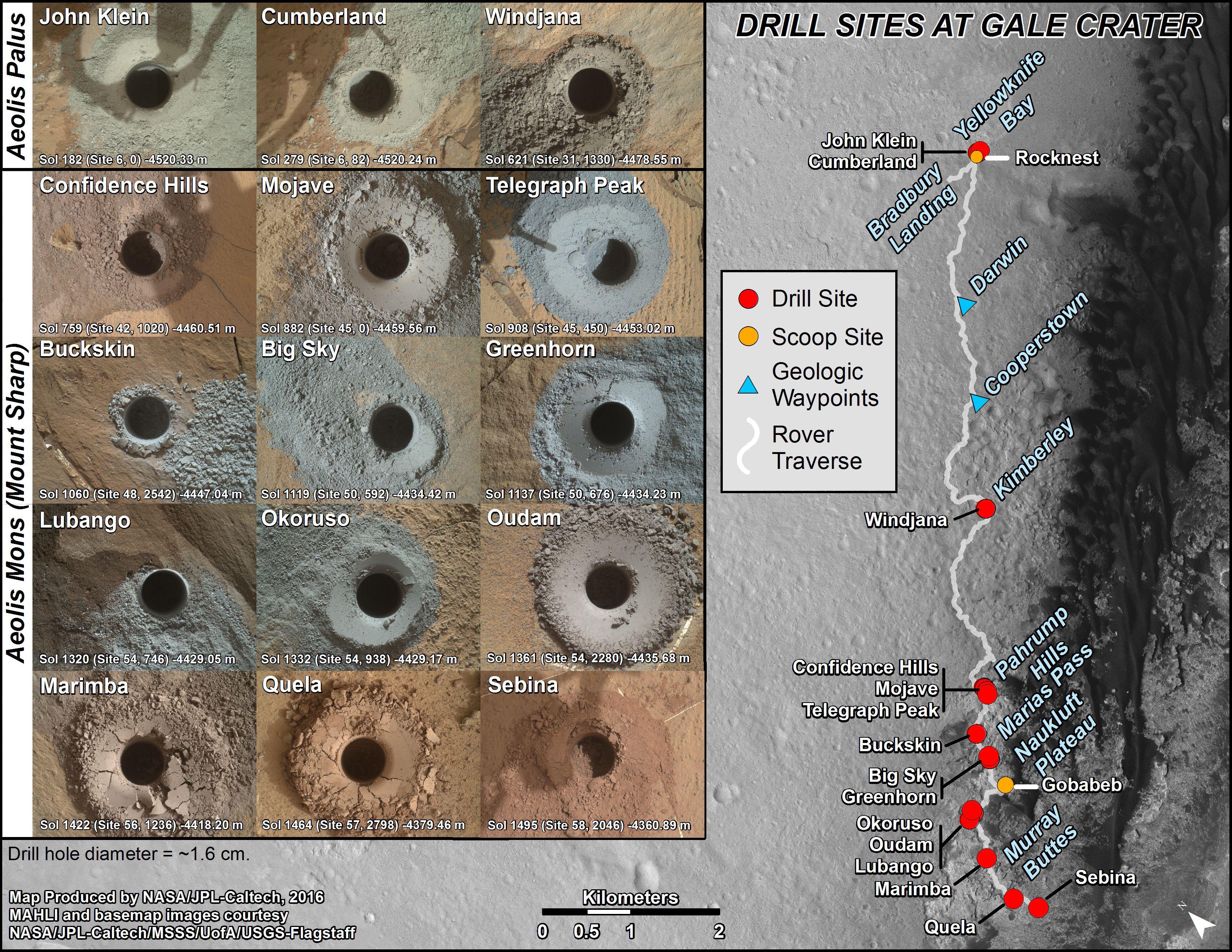
Curiosity's Rock or Soil Sampling Sites on Mars, Through November 2016
Full Resolution:
TIFF
(21.14 MB)
JPEG
(2.213 MB)
|
|
|
2019-08-22 |
Mars
|
Mars Science Laboratory (MSL)
|
HiRISE
MAHLI
|
4200x2550x3 |
|
-
PIA23413:
-
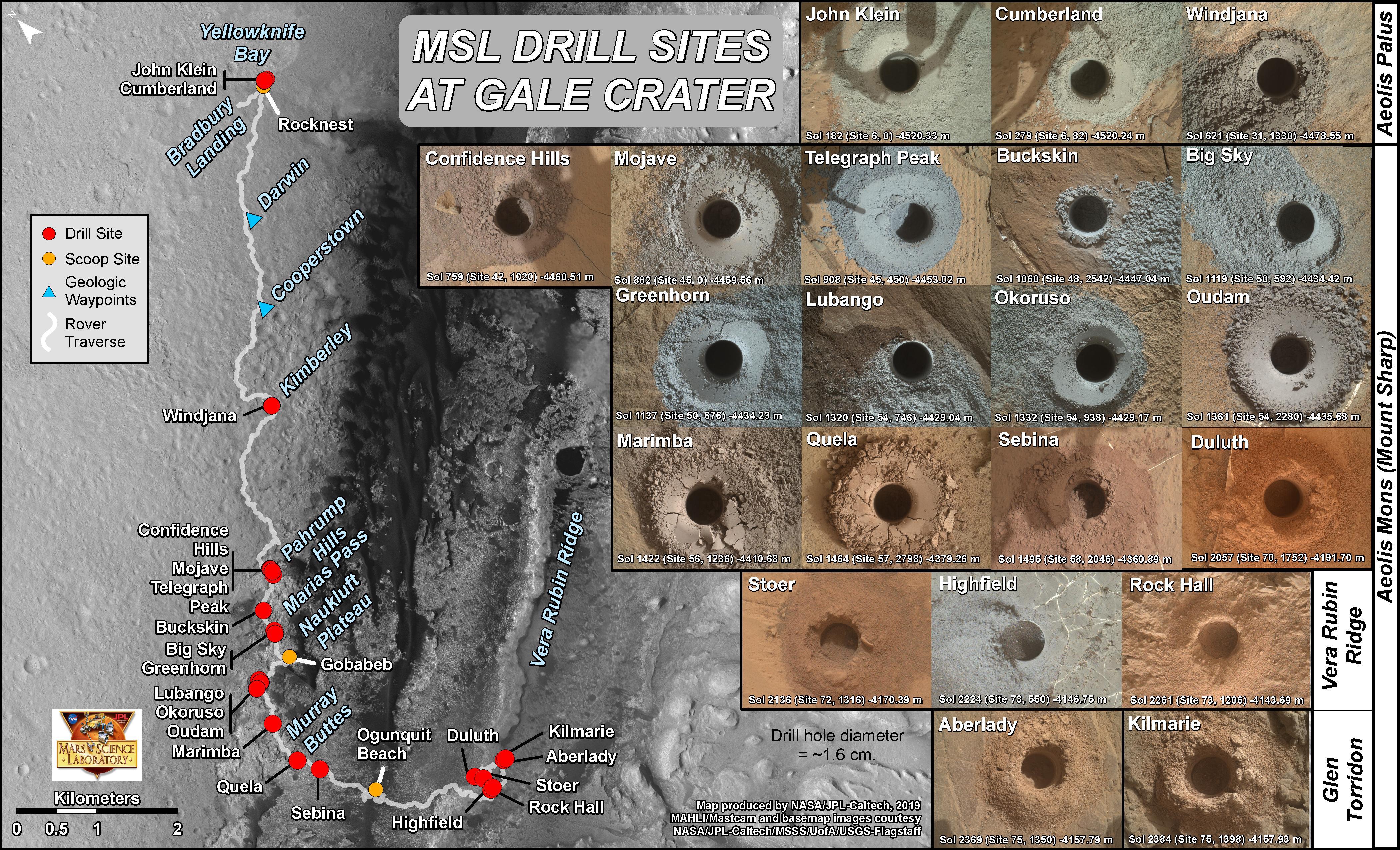
Curiosity's 21 Drill Holes on Mars
Full Resolution:
TIFF
(25.48 MB)
JPEG
(2.573 MB)
|
|
|
2012-08-10 |
Mars
|
Mars Reconnaissance Orbiter (MRO)
Mars Science Laboratory (MSL)
|
MARCI
|
1449x1087x3 |
|
-
PIA16037:
-
Mars Weather Map, Aug. 5
Full Resolution:
TIFF
(4.727 MB)
JPEG
(123.9 kB)
|
|
|
2012-08-07 |
Mars
|
Mars Science Laboratory (MSL)
|
MARDI
|
9000x6750x3 |
|
-
PIA15995:
-
Narrowing in on Curiosity's Landing Site
Full Resolution:
TIFF
(182.3 MB)
JPEG
(2.007 MB)
|
|
|
2012-08-08 |
Mars
|
Mars Science Laboratory (MSL)
|
MARDI
|
2108x1533x3 |

|
-
PIA16021:
-
Curiosity's Heat Shield in Detail
Full Resolution:
TIFF
(9.699 MB)
JPEG
(144.8 kB)
|
|
|
2012-08-08 |
Mars
|
Mars Science Laboratory (MSL)
|
MARDI
|
2108x1533x3 |
|
-
PIA16018:
-
Gravel-Covered Martian Surface
Full Resolution:
TIFF
(3.237 MB)
JPEG
(198.7 kB)
|
|
|
2013-01-15 |
Mars
|
Mars Science Laboratory (MSL)
|
MARDI
|
615x458x3 |
|
-
PIA16618:
-
Texture of 'Gillespie Lake' Rock
Full Resolution:
TIFF
(845.5 kB)
JPEG
(62.47 kB)
|
|
|
2017-02-27 |
Mars
|
Mars Science Laboratory (MSL)
|
MARDI
|
2108x1533x3 |
|
-
PIA21143:
-
Sand Moving Under Curiosity, One Day to Next
Full Resolution:
TIFF
(7.113 MB)
JPEG
(214.8 kB)
|
|
|
2010-11-16 |
|
Mars Science Laboratory (MSL)
|
MAHLI
|
1925x1845x3 |
|
-
PIA13581:
-
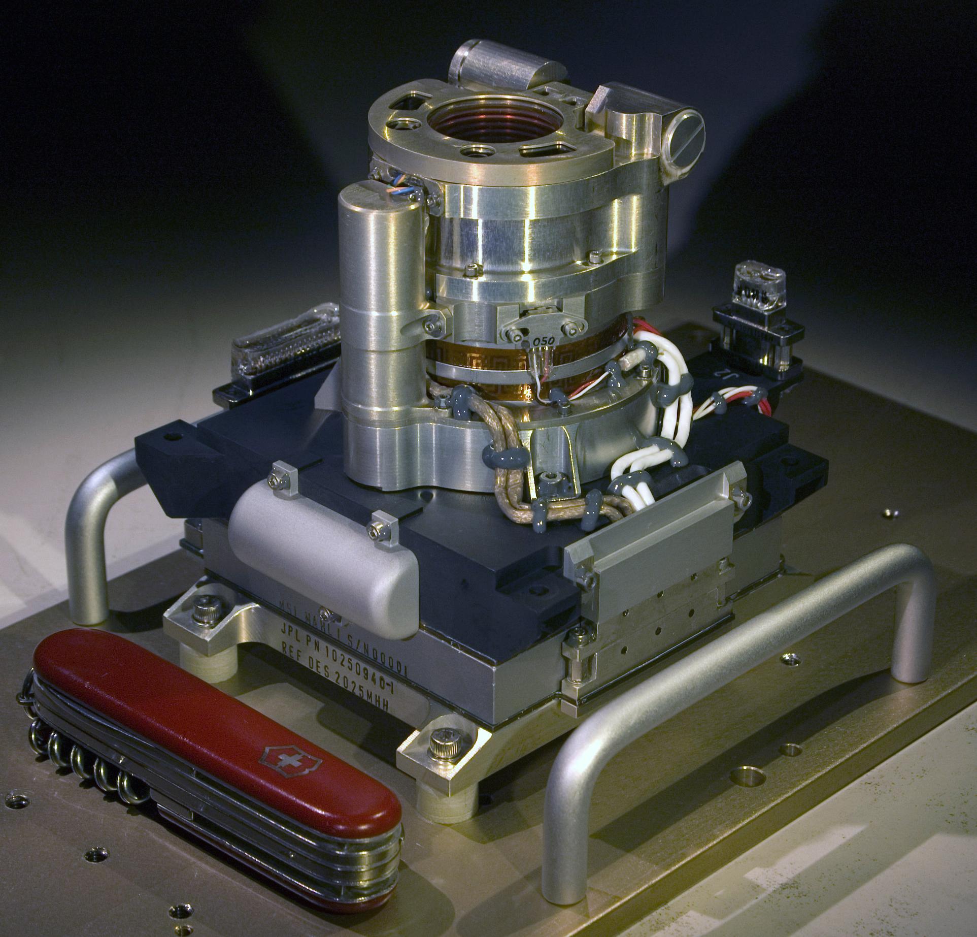
Color Camera for Curiosity's Robotic Arm
Full Resolution:
TIFF
(10.67 MB)
JPEG
(379.3 kB)
|
|
|
2012-02-07 |
|
Mars Science Laboratory (MSL)
|
MAHLI
|
4597x2391x3 |
|
-
PIA15289:
-
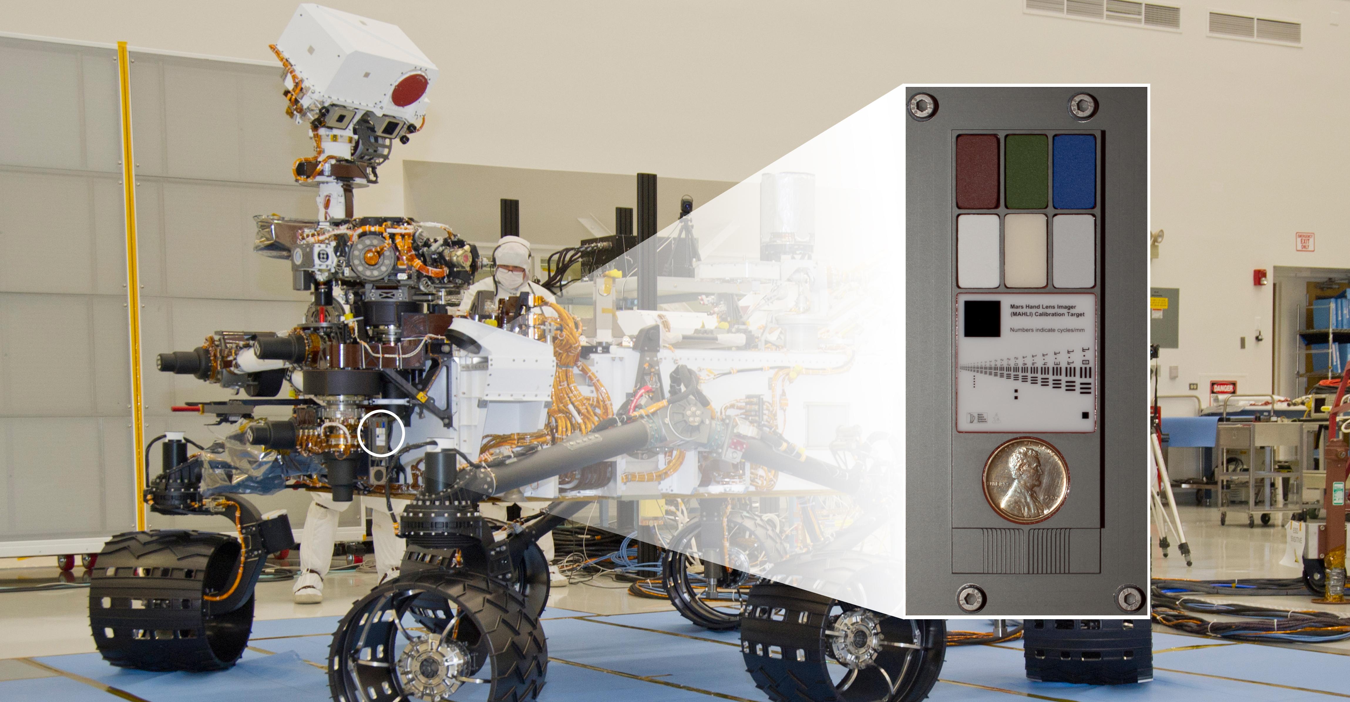
Calibration Target on Curiosity for Camera on Rover's Arm
Full Resolution:
TIFF
(32.97 MB)
JPEG
(1.049 MB)
|
|
|
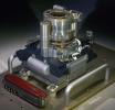
2012-05-07 |
|
Mars Science Laboratory (MSL)
|
MAHLI
|
1600x1200x3 |
|
-
PIA15294:
-
Camera Test on Curiosity During Flight to Mars
Full Resolution:
TIFF
(5.77 MB)
JPEG
(63.46 kB)
|


