PDS logoPlanetary Data System
PDS Information
Find a Node - Use these links to navigate to any of the 8 publicly accessible PDS Nodes.

This bar indicates that you are within the PDS enterprise which includes 6 science discipline nodes and 2 support nodes which are overseen by the Project Management Office at NASA's Goddard Space Flight Center (GSFC). Each node is led by an expert in the subject discipline, supported by an advisory group of other practitioners of that discipline, and subject to selection and approval under a regular NASA Research Announcement.
Click here to return to the Photojournal Home Page Click here to view a list of Photojournal Image Galleries Photojournal_inner_header
Latest Images  |  Spacecraft & Technology  |  Animations  |  Space Images App  |  Feedback  |  Photojournal Search  
Your search criteria found 3 images
Spacecraft
Go to PIAxxxxx:
Click on an image for detailed information
Click on a column heading to sort in ascending or descending order
My
List
Addition DateSort Ascending Target Mission Instrument Size
Add Image to Favorite List 2012-06-12 Earth Aquarius
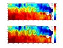
Aquarius
3300x2550x3
NASA's Aquarius instrument on the Aquarius/SAC-D observatory gives an unprecedented look at a key factor involved in the formation of an oceanic wave feature in the tropical Pacific and Atlantic Oceans that influences global climate patterns.
PIA15799:
NASA's Aquarius Maps Ocean Salinity Structure
Full Resolution:     TIFF (8.427 MB)     JPEG (1.08 MB)
Add Image to Favorite List 2011-12-07 Earth Aquarius
Aquarius
980x1558x3
Tropical Storm Lee made landfall over New Orleans on Sept. 2-3, 2011, with predicted rainfall of 15 to 20 inches (38 to 51 centimeters) over southern Louisiana. These charts are from NASA's Aquarius spacecraft.
PIA15185:
NASA's Aquarius Detects Possible Effects of Tropical Storm Lee in Gulf
Full Resolution:     TIFF (4.587 MB)     JPEG (186.8 kB)
Add Image to Favorite List 2011-09-22 Earth Aquarius
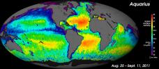
Aquarius
2340x1024x3
NASA's Aquarius instrument has produced its first global map of the salinity, or saltiness, of Earth's ocean surface, providing an early glimpse of the mission's anticipated discoveries.
PIA14786:
NASA's "Salt of the Earth" Aquarius Reveals First Map
Full Resolution:     TIFF (7.197 MB)     JPEG (439.4 kB)
Currently displaying images: 1 - 3 of 3