Click on an image for detailed information
Click on a column heading to sort in ascending or descending order

My
List |
Addition Date
|
Target
|
Mission
|
Instrument
|
Size
|

|
2024-07-25 |
Mars
|
Mars 2020 Rover
|
Scanning Habitable Environments with Raman & Luminescence for Organics and Chemicals (SHERLOC)
|
1648x1200x3 |

|
-
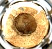
PIA26368:
-
Perseverance Finds a Rock With 'Leopard Spots'
Full Resolution:
TIFF
(5.935 MB)
JPEG
(324.1 kB)
|
|
|
2024-07-25 |
Mars
|
Mars 2020 Rover
|
Mastcam-Z
|
4000x978x3 |

|
-
PIA26369:
Perseverance Captures 'Bright Angel' in 360 Degrees
Full Resolution:
TIFF
(8.594 MB)
JPEG
(666.7 kB)
|
|
|
2024-07-25 |
Mars
|
Mars 2020 Rover
|
Mastcam-Z
|
1471x1400x3 |
|
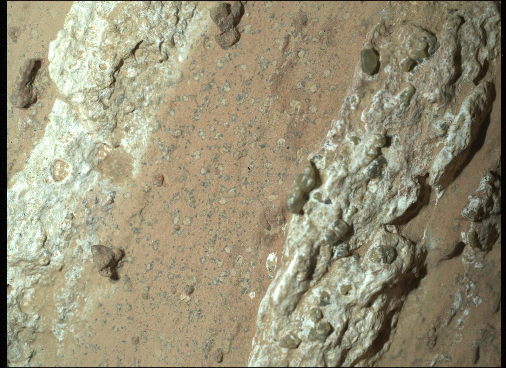
-
PIA26370:
-
Mastcam-Z Views 'Leopard Spots' in Perseverance's Drill Bit
Full Resolution:
TIFF
(6.181 MB)
JPEG
(222.4 kB)
|
|
|
2024-07-25 |
Mars
|
Mars 2020 Rover
|
Mastcam-Z
|
14444x6175x3 |
|
-
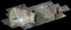
PIA26401:
-
Mastcam-Z Views the 'Cheyava Falls' Workspace
Full Resolution:
TIFF
(160.2 MB)
JPEG
(10.14 MB)
|
|
|
2024-07-25 |
Mars
|
Mars 2020 Rover
|
Scanning Habitable Environments with Raman & Luminescence for Organics and Chemicals (SHERLOC)
|
10502x7458x3 |
|
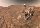
-
PIA26344:
-
Perseverance's Selfie With 'Cheyava Falls'
Full Resolution:
TIFF
(189.5 MB)
JPEG
(7.951 MB)
|