PDS logoPlanetary Data System
PDS Information
Find a Node - Use these links to navigate to any of the 8 publicly accessible PDS Nodes.

This bar indicates that you are within the PDS enterprise which includes 6 science discipline nodes and 2 support nodes which are overseen by the Project Management Office at NASA's Goddard Space Flight Center (GSFC). Each node is led by an expert in the subject discipline, supported by an advisory group of other practitioners of that discipline, and subject to selection and approval under a regular NASA Research Announcement.
Click here to return to the Photojournal Home Page Click here to view a list of Photojournal Image Galleries Photojournal_inner_header
Latest Images  |  Spacecraft & Technology  |  Animations  |  Space Images App  |  Feedback  |  Photojournal Search  
Your search criteria found 309 images
Mission
Go to PIAxxxxx:
Refine this list of images by:
Target:
Click on an image for detailed information
Click on a column heading to sort in ascending or descending order
My
List
Addition DateSort Ascending Target Mission Instrument Size
Add Image to Favorite List 2000-07-19 Earth Terra
MISR
1149x668x3
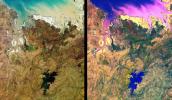
These images from NASA's Terra satellite are of tropical northern Australia acquired on June 1, 2000 (Terra orbit 2413) during the long dry season.
PIA02614:
MISR Views Northern Australia
Full Resolution:     TIFF (2.837 MB)     JPEG (182.9 kB)
Add Image to Favorite List 2000-07-08 Earth Terra
MISR
584x900x3
This anaglyph from NASA's Terra satellite's vertical (nadir) camera, shows Hurricane Carlotta's location in the eastern Pacific Ocean, about 500 km south of Puerto Vallarta, Mexico in 2000. 3D glasses are necessary to view this image.
PIA02611:
MISR Views Hurricane Carlotta
Full Resolution:     TIFF (1.25 MB)     JPEG (76.02 kB)
Add Image to Favorite List 2000-06-20 Earth Terra
MISR
2548x3800x3
A plume from a large brush fire that burned about 15,000 acres in 2000 is visible at the western edge of the Big Cypress Swamp in southern Florida. NASA's Terra satellite captured acquired this image on April 9, 2000. 3D glasses are necessary.
PIA02610:
MISR Views Florida
Full Resolution:     TIFF (19.67 MB)     JPEG (1.364 MB)
Add Image to Favorite List 2000-06-20 Earth Terra
MISR
2220x2048x3
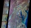
These multi-angle images of Delaware Bay, Chesapeake Bay, and the Appalachian Mountains, acquired 24 March 2000 from NASA's Terra spacecraft, come from the downward-looking (nadir) camera on the MISR instrument onboard NASA's Terra satellite.
PIA02609:
MISR Views Delaware Bay, Chesapeake Bay, and the Appalachian Mountains
Full Resolution:     TIFF (12.73 MB)     JPEG (862.5 kB)
Add Image to Favorite List 2000-04-19 Earth Terra
MISR
1520x1264x3
These multi-angle images of Hudson Bay and James Bay, Canada, taken 24 February 2000 from NASA's Terra spacecraft, come from the downward-looking (nadir) camera on the MISR instrument onboard NASA's Terra satellite.
PIA02603:
Multi-angle Images of Hudson Bay and James Bay, Canada, 24 February 2000
Full Resolution:     TIFF (4.927 MB)     JPEG (370.2 kB)
Add Image to Favorite List 2000-04-19 Earth Terra
MISR
2536x800x3
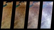
A multi-angle view of the Canary Islands in a dust storm, 29 February 2000. At left is a true-color image taken by the Multi-angle Imaging SpectroRadiometer (MISR) instrument on NASA's Terra satellite.
PIA02602:
Multi-Angle View of the Canary Islands
Full Resolution:     TIFF (3.681 MB)     JPEG (169 kB)
Add Image to Favorite List 2000-04-19 Earth Terra
MISR
1920x1079x3
These images from NASA's Terra spacecraft show the (nadir) view of the eastern United States, stretching from Lake Ontario to northern Georgia, and spanning the Appalachian Mountains.
PIA02601:
Multi-Angle Views of the Appalachian Mountains, 6 March 2000
Full Resolution:     TIFF (5.067 MB)     JPEG (244.4 kB)
Add Image to Favorite List 2000-04-19 Earth Terra
MISR
1906x981x3
The stereo image at right is a downward-looking (nadir) view of the area around the San Cristobal volcano in Nicaragua taken by NASA's Terra satellite. 3D glasses are necessary to view this image.
PIA02600:
Nicaraguan Volcanoes, 26 February 2000
Full Resolution:     TIFF (4.239 MB)     JPEG (194.3 kB)
Add Image to Favorite List 2000-03-11 Earth Terra
MISR
1383x512x3
The first images taken by NASA's Multi-angle Imaging SpectroRadiometer (MISR) on February 24, 2000, show the winter landscape of James Bay, Ontario, Canada from three of the instrument's nine cameras.
PIA02450:
MISR's First Views of James Bay, Canada
Full Resolution:     TIFF (1.916 MB)     JPEG (146.1 kB)
Retrieve Previous Set  Jump to a Previous Set   Jump to a Previous Set   Jump to a Previous Set   Current Set 
 1-100   101-200   201-300   301-400 
Currently displaying images: 301 - 309 of 309