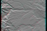
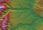
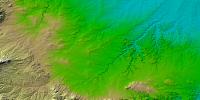
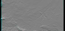
Your search criteria found 251 images
Mission
Go to PIAxxxxx:
Refine this list of images by:
Spacecraft:
Instrument:
Click on an image for detailed information
Click on a column heading to sort in ascending or descending order
My
List
Addition Date Target Mission InstrumentSort Descending Size
Add Image to Favorite List 2012-02-06 Earth Shuttle Radar Topography Mission (SRTM)
1024x576x3
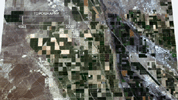
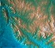
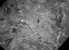
This frame from an animation depicts ground subsidence resulting from the extraction of oil. The oil fields are located near the community of Lost Hills, California, approximately 100 km northwest of Bakersfield.
PIA13204:
Lost Hills Subsidence Animation Animation Icon
Full Resolution:     TIFF (1.772 MB)     JPEG (116.7 kB)
Add Image to Favorite List 2002-11-01 Earth Shuttle Radar Topography Mission (SRTM)
Terra
ASTER
C-Band Interferometric Radar
1152x870x3
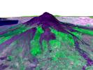
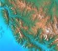
Italy's Mount Etna is the focus of this perspective from NASA's Terra spacecraft. The city of Catania is barely visible behind Etna on the bay at the upper left.
PIA03371:
Perspective View, Mt. Etna, Italy
Full Resolution:     TIFF (2.617 MB)     JPEG (148.7 kB)
Add Image to Favorite List 2002-11-01 Earth Shuttle Radar Topography Mission (SRTM)
Terra
ASTER
C-Band Interferometric Radar
1152x870x3
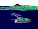
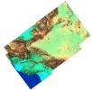
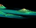
Italy's Mount Etna and the Aeolian Islands are the focus of this perspective view from NASA's Terra spacecraft. The image is looking south with the islands of Lipari and Vulcano in the foreground and Etna with its dark lava flows on the skyline.
PIA03370:
Perspective View, Mt. Etna, Italy & the Aeolian Islands
Full Resolution:     TIFF (1.534 MB)     JPEG (86.35 kB)
Add Image to Favorite List 2000-08-10 Earth Shuttle Radar Topography Mission (SRTM)
Terra
ASTER
C-Band Interferometric Radar
1866x605x3
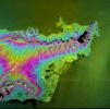
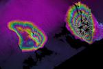
This image from NASA's Terra spacecraft shows Mount Oyama, an 820-meter-high (2,700 feet) volcano on the island of Miyake-Jima, Japan.
PIA02771:
ASTER-SRTM Perspective of Mount Oyama Volcano, Miyake-Jima Island, Japan
Full Resolution:     TIFF (1.26 MB)     JPEG (101 kB)
Add Image to Favorite List 2005-01-14 Earth Shuttle Radar Topography Mission (SRTM)
Terra
ASTER
SIR-C/X-SAR
1987x1840x3
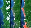
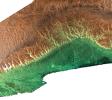
This image from NASA's Terra spacecraft shows the Indian Ocean coastline north of Phuket, Thailand is a major tourist destination that was in the path of the tsunami produced by a giant offshore earthquake on December 26, 2004.
PIA06671:
Tsunami Inundation, North of Phuket, Thailand
ASTER Images and SRTM Elevation Model

Full Resolution:     TIFF (10.98 MB)     JPEG (737.4 kB)
Add Image to Favorite List 2005-09-22 Earth Shuttle Radar Topography Mission (SRTM)
C-Band Imaging Radar
X-Band Imaging Radar
3621x1525x3
The Gulf Coast from the Mississippi Delta through the Texas coast is shown in this satellite image from NASA's Terra spacecraft, and the predicted storm track for Hurricane Rita acquired in February, 2000.
PIA06674:
Hurricane Rita Track
Radar Image with Topographic Overlay
Animation Icon
Full Resolution:     TIFF (16.57 MB)     JPEG (452.1 kB)
Add Image to Favorite List 2004-10-01 Earth Shuttle Radar Topography Mission (SRTM)
C-Band Imaging Radar
X-Band Radar
2300x1730x3
NASA's Shuttle Radar Topography Mission shows Mount Saint Helens, one of several prominent volcanoes of the Cascade Range that stretches from British Columbia, Canada, southward through Washington, Oregon, and into northern California.
PIA06668:
Mount Saint Helens, Washington, USA, SRTM Perspective: Shaded Relief and Colored Height
Full Resolution:     TIFF (10.69 MB)     JPEG (580.4 kB)
Add Image to Favorite List 2005-03-16 Earth Shuttle Radar Topography Mission (SRTM)
C-Band Imaging Radar
X-Band Radar
6587x8336x3
The island of Ireland comprises a large central lowland of limestone with a relief of hills surrounded by a discontinuous border of coastal mountains which vary greatly in geological structure as seen by NASA's Shuttle Radar Topography Mission.
PIA06672:
Ireland, Shaded Relief and Colored Height
Full Resolution:     TIFF (96.97 MB)     JPEG (6.802 MB)
Add Image to Favorite List 2005-08-29 Earth Shuttle Radar Topography Mission (SRTM)
C-Band Imaging Radar
X-Band Radar
3000x2519x3
The city of New Orleans, situated on the southern shore of Lake Pontchartrain, is shown in this radar image from NASA's Shuttle Radar Topography Mission. In this image bright areas show regions of high radar reflectivity, such as from urban areas.
PIA04174:
New Orleans Topography, Radar Image with Colored Height Animation Icon
Full Resolution:     TIFF (22.67 MB)     JPEG (1.437 MB)
Add Image to Favorite List 2005-08-29 Earth Shuttle Radar Topography Mission (SRTM)
C-Band Imaging Radar
X-Band Radar
1800x2061x3
The geography of the New Orleans and Mississippi delta region is well shown in this radar image from NASA's Shuttle Radar Topography Mission. In this image, bright areas show regions of high radar reflectivity, such as from urban areas.
PIA04175:
Mississippi Delta, Radar Image with Colored Height Animation Icon
Full Resolution:     TIFF (11.15 MB)     JPEG (781.5 kB)
Add Image to Favorite List 2006-01-25 Earth Shuttle Radar Topography Mission (SRTM)
C-Band Imaging Radar
X-Band Radar
1586x1965x3
NASA's Shuttle Radar Topography Mission shows the Crater Highlands of Tanzania rising far above the adjacent savannas.
PIA06669:
Crater Highlands, Tanzania
Full Resolution:     TIFF (9.365 MB)     JPEG (540.6 kB)
Add Image to Favorite List 2002-10-25 Earth Shuttle Radar Topography Mission (SRTM)
C-Band Interferometric Radar
1152x870x3
This perspective view from NASA's Shuttle Radar Topography Mission, acquired on February 2000, shows central Panama, with the remnants of the extinct volcano El Valle in the foreground and the Caribbean Sea in the distance.
PIA03369:
Perspective View with Color-Coded Shaded Relief, Central Panama
Full Resolution:     TIFF (2.588 MB)     JPEG (192.8 kB)
Add Image to Favorite List 2002-10-25 Earth Shuttle Radar Topography Mission (SRTM)
C-Band Interferometric Radar
1152x870x3
This perspective view from NASA's Shuttle Radar Topography Mission, acquired on February 2000, shows the Panama Canal with the Gulf of Panama in the foreground and the Caribbean Sea in the distance.
PIA03368:
Perspective View with Color-Coded Shaded Relief, Panama Canal
Full Resolution:     TIFF (1.584 MB)     JPEG (141.6 kB)
Add Image to Favorite List 2000-02-14 Earth Shuttle Radar Topography Mission (SRTM)
C-Band Interferometric Radar
2400x2781x3
This topographic image acquired in February 2000 by NASA's Shuttle Radar Topography Mission shows an area south of the Sao Francisco River in Brazil.
PIA02700:
Shaded Relief of Rio Sao Francisco, Brazil
Full Resolution:     TIFF (22.27 MB)     JPEG (1.606 MB)
Add Image to Favorite List 2000-02-14 Earth Shuttle Radar Topography Mission (SRTM)
C-Band Interferometric Radar
1890x2270x1
This radar image acquired in February 2000 by NASA's Shuttle Radar Topography Mission shows an area south of the Sao Francisco River in Brazil.
PIA02701:
Radar Image of Rio Sao Francisco, Brazil
Full Resolution:     TIFF (4.91 MB)     JPEG (828.3 kB)
Add Image to Favorite List 2000-02-14 Earth Shuttle Radar Topography Mission (SRTM)
C-Band Interferometric Radar
2257x2887x1
This image acquired by NASA's Shuttle Radar Topography Mission from data collected on February 12, 2000 shows two islands, Miquelon and Saint Pierre, located south of Newfoundland, Canada.
PIA02703:
Shaded Relief Image of Saint Pierre and Miquelon
Full Resolution:     TIFF (633 kB)     JPEG (328.2 kB)
Add Image to Favorite List 2000-02-15 Earth Shuttle Radar Topography Mission (SRTM)
C-Band Interferometric Radar
2056x1194x3
This topographic image acquired in February 2000 by NASA's Shuttle Radar Topography Mission shows an area in the state of Bahia in Brazil.
PIA02704:
Shaded Relief of Bahia State, Brazil
Full Resolution:     TIFF (8.391 MB)     JPEG (1.179 MB)
Add Image to Favorite List 2000-02-15 Earth Shuttle Radar Topography Mission (SRTM)
C-Band Interferometric Radar
2062x1194x3
This radar image acquired in February 2000 by NASA's Shuttle Radar Topography Mission shows an area in the state of Bahia in Brazil.
PIA02705:
Radar Image with Color as Height, Bahia State, Brazil
Full Resolution:     TIFF (7.958 MB)     JPEG (497.6 kB)
Add Image to Favorite List 2000-02-15 Earth Shuttle Radar Topography Mission (SRTM)
C-Band Interferometric Radar
2400x2938x3
This radar image acquired in February 2000 by NASA's Shuttle Radar Topography Mission shows an area in the state of Bahia in Brazil.
PIA02706:
Shaded Relief of South Africa, Northern Cape Province
Full Resolution:     TIFF (24.95 MB)     JPEG (2.451 MB)
Add Image to Favorite List 2000-02-16 Earth Shuttle Radar Topography Mission (SRTM)
C-Band Interferometric Radar
1383x962x3
This perspective view acquired by NASA's Shuttle Radar Topography Mission from data collected on February 12, 2000 shows the western side of the volcanically active Kamchatka Peninsula, Russia.
PIA02707:
Perspective View, Kamchatka Peninsula, Russia
Full Resolution:     TIFF (2.612 MB)     JPEG (219.9 kB)
Add Image to Favorite List 2000-02-16 Earth Shuttle Radar Topography Mission (SRTM)
C-Band Interferometric Radar
2384x3021x3
This topographic map acquired by NASA's Shuttle Radar Topography Mission from data collected on February 12, 2000 shows the western side of the volcanically active Kamchatka Peninsula, Russia.
PIA02708:
Shaded Relief, Kamchatka Peninsula, Russia
Full Resolution:     TIFF (20.34 MB)     JPEG (1.485 MB)
Add Image to Favorite List 2000-02-16 Earth Shuttle Radar Topography Mission (SRTM)
C-Band Interferometric Radar
1881x2650x3
This shaded relief topographic acquired by NASA's Shuttle Radar Topography Mission image from data collected on February 12, 2000 shows the western side of the volcanically active Kamchatka Peninsula, Russia.
PIA02710:
Shaded Relief Color Wrapped, Kamchatka Peninsula, Russia
Full Resolution:     TIFF (2.271 MB)     JPEG (868.8 kB)
Add Image to Favorite List 2000-02-17 Earth Shuttle Radar Topography Mission (SRTM)
C-Band Interferometric Radar
1059x722x3
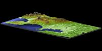
This perspective view acquired by NASA's Shuttle Radar Topography Mission from data collected on February 16, 2000 shows an area of Ventura County, California, including Simi Valley in the center of the image.
PIA02711:
Simi Valley, California, Perspective View of Shaded Relief, Color as Height
Full Resolution:     TIFF (2.166 MB)     JPEG (207.8 kB)
Add Image to Favorite List 2000-02-17 Earth Shuttle Radar Topography Mission (SRTM)
C-Band Interferometric Radar
1749x4787x3
This topographic map acquired by NASA's Shuttle Radar Topography Mission from data collected on February 16, 2000 vividly displays California's famous San Andreas Fault along the southwestern edge of the Mojave Desert, Calif.
PIA02712:
San Andreas Fault, Southern California, Shaded Relief, Wrapped Color as Height
Full Resolution:     TIFF (6.467 MB)     JPEG (2.572 MB)
Add Image to Favorite List 2000-02-17 Earth Shuttle Radar Topography Mission (SRTM)
C-Band Interferometric Radar
1357x982x3
This topographic radar image acquired by NASA's Shuttle Radar Topography Mission in Feb. 2000 shows the relationships of the dense urban development of Los Angeles, Calif. and the natural contours of the land.
PIA02713:
Los Angeles, California, Radar Image, Wrapped Color as Height
Full Resolution:     TIFF (1.232 MB)     JPEG (587.3 kB)
Add Image to Favorite List 2000-02-17 Earth Shuttle Radar Topography Mission (SRTM)
C-Band Interferometric Radar
1749x4787x3
This topographic map acquired by NASA's Shuttle Radar Topography Mission from data collected on February 16, 2000 vividly displays California's famous San Andreas Fault along the southwestern edge of the Mojave Desert, Calif.
PIA02714:
San Andreas Fault, Southern California , Radar Image, Wrapped Color as Height
Full Resolution:     TIFF (7.228 MB)     JPEG (3.292 MB)
Add Image to Favorite List 2000-02-17 Earth Shuttle Radar Topography Mission (SRTM)
C-Band Interferometric Radar
1228x1093x3
This topographic radar image acquired by NASA's Shuttle Radar Topography Mission from data collected on February 16, 2000 shows the relationship of the urban area of Pasadena, California to the natural contours of the land.
PIA02715:
San Gabriel Mountains, California, Radar Image, Color as Height
Full Resolution:     TIFF (3.906 MB)     JPEG (326.9 kB)
Add Image to Favorite List 2000-02-17 Earth Shuttle Radar Topography Mission (SRTM)
C-Band Interferometric Radar
1228x1093x3
This topographic acquired by NASA's Shuttle Radar Topography Mission from data collected on February 16, 2000 shows the relationship of the urban area of Pasadena, California to the natural contours of the land.
PIA02716:
San Gabriel Mountains, California, Shaded relief, Color as Height
Full Resolution:     TIFF (4.009 MB)     JPEG (232.8 kB)
Add Image to Favorite List 2000-03-13 Earth Shuttle Radar Topography Mission (SRTM)
C-Band Interferometric Radar
2496x2447x3
'From the desert to the mountains to the sea,' this image acquired by NASA's Shuttle Radar Topography Mission in Feb. 2000, shows in striking detail the varied topography of Southern California.
PIA02719:
Southern California Shaded Relief, Color as Height
Full Resolution:     TIFF (8.636 MB)     JPEG (654 kB)
Add Image to Favorite List 2000-02-18 Earth Shuttle Radar Topography Mission (SRTM)
C-Band Interferometric Radar
1856x1852x3
This topographic radar image acquired by NASA's Shuttle Radar Topography Mission in Feb. 2000 shows the city of Honolulu, Hawaii and adjacent areas on the island of Oahu. Honolulu lies on the south shore of the island.
PIA02720:
Honolulu, Hawaii Radar Image, Wrapped Color as Height
Full Resolution:     TIFF (2.443 MB)     JPEG (1.319 MB)
Add Image to Favorite List 2000-02-18 Earth Shuttle Radar Topography Mission (SRTM)
C-Band Interferometric Radar
737x797x3
This anaglyph shows NASA's Jet Propulsion Laboratory (JPL) in Pasadena, California as seen by the instrument onboard NASA's Shuttle Radar Topography Mission. 3D glasses are necessary to view this image.
PIA02721:
Pasadena, California Anaglyph with Aerial Photo Overlay
Full Resolution:     TIFF (1.749 MB)     JPEG (218.8 kB)
Add Image to Favorite List 2000-02-19 Earth Shuttle Radar Topography Mission (SRTM)
C-Band Interferometric Radar
1793x1314x1
This radar image acquired by NASA's Shuttle Radar Topography Mission from data collected on February 18, 2000 shows the Dallas-Fort Worth metropolitan area in Texas.
PIA02722:
C-Band Radar Imagery, Dallas-Fort Worth, Texas
Full Resolution:     TIFF (2.885 MB)     JPEG (804.4 kB)
Add Image to Favorite List 2000-02-19 Earth Shuttle Radar Topography Mission (SRTM)
C-Band Interferometric Radar
2273x1515x3
This topographic radar image acquired by NASA's Shuttle Radar Topography Mission in Feb. 2000 shows the Lanai (left) and western Maui (right) islands of Hawaii.
PIA02723:
Radar Image, Wrapped Color as Height, Lanai and West Maui, Hawaii
Full Resolution:     TIFF (1.881 MB)     JPEG (676.5 kB)
Add Image to Favorite List 2000-02-19 Earth Shuttle Radar Topography Mission (SRTM)
C-Band Interferometric Radar
1319x1062x3
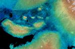
This perspective view acquired by NASA's Shuttle Radar Topography Mission from data collected on February 18, 2000 shows three Hawaiian islands: Molokai (lower left), Lanai (right), and the northwest tip of Maui (upper left).
PIA02724:
Perspective View, Radar Image, Color as Height, Molokai, Lanai and Maui, Hawaii
Full Resolution:     TIFF (1.541 MB)     JPEG (141.2 kB)
Add Image to Favorite List 2000-02-19 Earth Shuttle Radar Topography Mission (SRTM)
C-Band Interferometric Radar
1877x1676x3
This radar image acquired by NASA's Shuttle Radar Topography Mission from data collected on February 15, 2000 includes the city of Salalah, the second largest city in Oman.
PIA02725:
Radar Image, Color as Height , Salalah, Oman
Full Resolution:     TIFF (6.929 MB)     JPEG (809.5 kB)
Add Image to Favorite List 2000-02-20 Earth Shuttle Radar Topography Mission (SRTM)
C-Band Interferometric Radar
1965x1347x3
This topographic image acquired by NASA's Shuttle Radar Topography Mission from data collected on February 15, 2000, of Patagonia, Argentina shows a spectacular landscape formed by volcanoes, rivers, and wind.
PIA02726:
Shaded relief, color as height Patagonia, Argentina
Full Resolution:     TIFF (9.036 MB)     JPEG (857.3 kB)
Add Image to Favorite List 2000-02-20 Earth Shuttle Radar Topography Mission (SRTM)
C-Band Interferometric Radar
1634x1072x3
This perspective view acquired by NASA's Shuttle Radar Topography Mission from data collected in the year 2000 shows Patagonia, Argentina, a spectacular landscape formed by volcanoes, rivers, and wind.
PIA02729:
Perspective view of shaded relief, color as height, Patagonia, Argentina
Full Resolution:     TIFF (5.989 MB)     JPEG (459.9 kB)
Add Image to Favorite List 2000-02-21 Earth Shuttle Radar Topography Mission (SRTM)
C-Band Interferometric Radar
1252x2352x1
This radar image acquired by NASA's Shuttle Radar Topography Mission from data collected on February 16, 2000 shows the San Francisco Bay Area in California. Bay, lakes, roads and airport runways appear dark; buildings and trees appear bright.
PIA02730:
Radar image San Francisco Bay Area, California
Full Resolution:     TIFF (3.475 MB)     JPEG (874.5 kB)
Add Image to Favorite List 2000-02-21 Earth Shuttle Radar Topography Mission (SRTM)
C-Band Interferometric Radar
1929x1800x3
This anaglyph, from NASA's Shuttle Radar Topography Mission, is of Pasadena, California, looking north toward the San Gabriel Mountains. 3D glasses are necessary to view this image.
PIA02731:
Anaglyph of Perspective View with Aerial Photo Overlay Pasadena, California
Full Resolution:     TIFF (6.552 MB)     JPEG (663.3 kB)
Add Image to Favorite List 2000-02-21 Earth Shuttle Radar Topography Mission (SRTM)
C-Band Interferometric Radar
1603x1181x3
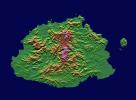
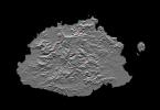
This image from NASA's Shuttle Radar Topography Mission shows Viti Levu, in the Sovereign Democratic Republic of the Fiji Islands, an independent nation consisting of some 332 islands surrounding the Koro Sea in the South Pacific Ocean.
PIA02732:
Shaded relief, color as height, Fiji
Full Resolution:     TIFF (1.396 MB)     JPEG (328.6 kB)
Add Image to Favorite List 2000-03-10 Earth Shuttle Radar Topography Mission (SRTM)
C-Band Interferometric Radar
2482x661x3
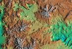
This elevation map shows a part of the southern coast of the Arabian Peninsula including parts of the countries of Oman and Yemen as seen by NASA's Shuttle Radar Topography Mission.
PIA02735:
Shaded Relief, Color as Height, Salalah, Oman
Full Resolution:     TIFF (2.65 MB)     JPEG (458.7 kB)
Add Image to Favorite List 2000-03-28 Earth Shuttle Radar Topography Mission (SRTM)
C-Band Interferometric Radar
1176x710x3
These two images of the eastern part of the island of Oahu, Hawaii provide information on regional topography and show the relationship between urban development and sensitive ecosystems as seen by NASA's Shuttle Radar Topography Mission.
PIA02741:
SRTM Radar Image, Wrapped Color as Height/EarthKam Optical Honolulu, Hawaii
Full Resolution:     TIFF (2.756 MB)     JPEG (178.6 kB)
Add Image to Favorite List 2000-04-06 Earth Shuttle Radar Topography Mission (SRTM)
C-Band Interferometric Radar
2197x2400x3
The topography of New Zealand's North Island is rich in seismic features: the sharp line cutting through the city of Wellington is the active Wellington Fault as seen by NASA's Shuttle Radar Topography Mission.
PIA02742:
Shaded relief with Color as Height, Wellington, New Zealand
Full Resolution:     TIFF (11.9 MB)     JPEG (1.063 MB)
Add Image to Favorite List 2000-05-18 Earth Shuttle Radar Topography Mission (SRTM)
C-Band Interferometric Radar
1416x2113x3
The southeast part of the island of Hokkaido, Japan, is an area dominated by volcanoes and volcanic caldera. The active Usu Volcano is at the lower right edge of the circular Lake Toya-Ko as seen by NASA's Shuttle Radar Topography Mission.
PIA02751:
Radar Image, Hokkaido, Japan
Full Resolution:     TIFF (7.544 MB)     JPEG (1.125 MB)
Add Image to Favorite List 2000-06-01 Earth Shuttle Radar Topography Mission (SRTM)
C-Band Interferometric Radar
1353x2000x3
From Lake Ontario and the St. Lawrence River extending to Long Island this image from NASA's Shuttle Radar Topography Mission shows the varied topography of eastern New York State and parts of Massachusetts, Connecticut, Pennsylvania and New Jersey.
PIA02752:
Stereo Pair of Height as Color & Shaded Relief, New York State, Lake Ontario to Long Island
Full Resolution:     TIFF (5.123 MB)     JPEG (546.7 kB)
Add Image to Favorite List 2000-06-01 Earth Shuttle Radar Topography Mission (SRTM)
C-Band Interferometric Radar
669x1427x3
This anaglyph, from NASA's Shuttle Radar Topography Mission, shows the varied topography of eastern New York State and parts of Massachusetts, Connecticut, Pennsylvania and New Jersey. 3D glasses are necessary.
PIA02753:
Anaglyph of Shaded Relief New York State, Lake Ontario to Long Island
Full Resolution:     TIFF (1.849 MB)     JPEG (193.7 kB)
Add Image to Favorite List 2000-06-15 Earth Shuttle Radar Topography Mission (SRTM)
C-Band Interferometric Radar
2336x3229x3
This image shows the northern part of central New York State, a landscape sculpted by the ice sheets of the last ice age. Lake Ontario runs across the top of the image as seen by NASA's Shuttle Radar Topography Mission.
PIA02754:
Radar with Color-wrapped Height Fringes, Syracuse and vicinity, New York State
Full Resolution:     TIFF (19.24 MB)     JPEG (3.371 MB)
Add Image to Favorite List 2000-08-10 Earth Shuttle Radar Topography Mission (SRTM)
C-Band Interferometric Radar
1431x911x3
This 3D perspective view shows the Japanese island called Miyake-Jima viewed from the northeast as seen by NASA's Shuttle Radar Topography Mission.
PIA02769:
Perspective View of Shaded Relief with Color as Height, Miyake-Jima, Japan
Full Resolution:     TIFF (3.176 MB)     JPEG (185.8 kB)
Add Image to Favorite List 2000-11-02 Earth Shuttle Radar Topography Mission (SRTM)
C-Band Interferometric Radar
1703x1181x3
This anaglyph, from NASA's Shuttle Radar Topography Mission, shows Viti Levu, the largest island in the group some 332 islands commonly known as Fiji. 3D glasses are necessary to view this image.
PIA02784:
SRTM Anaglyph: Fiji Islands
Full Resolution:     TIFF (1.719 MB)     JPEG (232.7 kB)
Add Image to Favorite List 2000-11-02 Earth Shuttle Radar Topography Mission (SRTM)
C-Band Interferometric Radar
1118x718x3
The Sovereign Democratic Republic of the Fiji Islands, commonly known as Fiji, is shown in this image acquired by NASA's Shuttle Radar Topography Mission on February 19, 2000.
PIA02785:
SRTM Stereo Pair: Fiji Islands
Full Resolution:     TIFF (753.3 kB)     JPEG (106.5 kB)
Add Image to Favorite List 2000-12-21 Earth Shuttle Radar Topography Mission (SRTM)
C-Band Interferometric Radar
3463x4313x3
Much of Honshu, Japan's largest island, is seen in this image generated from NASA's Shuttle Radar Topography Mission data on February 19, 2000.
PIA02791:
Radar Image with Color as Height: Tokyo, Honshu, Japan
Full Resolution:     TIFF (26.5 MB)     JPEG (2.534 MB)
Add Image to Favorite List 2000-12-21 Earth Shuttle Radar Topography Mission (SRTM)
C-Band Interferometric Radar
3000x1500x3
Tokyo, located on the island of Honshu, with Mt. Fuji in the background as seen in this image generated from NASA's Shuttle Radar Topography Mission data on February 21, 2000.
PIA02792:
Perspective View with Radar Image Overlaid, Color as Height: Mt. Fuji and Tokyo, Japan
Full Resolution:     TIFF (4.121 MB)     JPEG (441.5 kB)
Add Image to Favorite List 2000-12-21 Earth Shuttle Radar Topography Mission (SRTM)
C-Band Interferometric Radar
1109x777x3
Japan's Mt. Fuji presents a beautiful backdrop for the city of Tokyo as seen in this image generated from NASA's Shuttle Radar Topography Mission data on February 21, 2000.
PIA02793:
Perspective View with Radar Image Overlaid, Color as Height: Mt. Fuji and Tokyo, Japan
Full Resolution:     TIFF (3.256 MB)     JPEG (320.8 kB)
Add Image to Favorite List 2001-04-05 Earth Shuttle Radar Topography Mission (SRTM)
C-Band Interferometric Radar
2400x1593x3
This image shows the area around the January 26, 2001, earthquake in western India, the deadliest in the country's history with some 20,000 fatalities as seen by NASA's Shuttle Radar Topography Mission.
PIA02799:
SRTM Radar Image with Color as Height: Kachchh, Gujarat, India
Full Resolution:     TIFF (10.14 MB)     JPEG (1.086 MB)
Add Image to Favorite List 2001-04-12 Earth Shuttle Radar Topography Mission (SRTM)
C-Band Interferometric Radar
875x552x3
On January 26, 2001, the Kachchh region in western India suffered the most deadly earthquake in India's history. The Haro Hills are on left and the Kas Hills are on right in this image from NASA's Shuttle Radar Topography Mission.
PIA03300:
SRTM Colored and Shaded Topography: Haro and Kas Hills, India
Full Resolution:     TIFF (1.369 MB)     JPEG (117.1 kB)
Add Image to Favorite List 2001-06-14 Earth Shuttle Radar Topography Mission (SRTM)
C-Band Interferometric Radar
1835x1240x3
This depiction of an area south of San Martin de Los Andes, Argentina, is the first Shuttle Radar Topography Mission view of the Andes Mountains, the tallest mountain chain in the western hemisphere.
PIA03310:
SRTM Colored Height and Shaded Relief: Laguna Mellquina, Andes Mountains, Argentina
Full Resolution:     TIFF (7.319 MB)     JPEG (503.6 kB)
Add Image to Favorite List 2001-06-14 Earth Shuttle Radar Topography Mission (SRTM)
C-Band Interferometric Radar
1935x1240x3
This anaglyph, from the instrument onboard NASA's Shuttle Radar Topography Mission, shows an area south of San Martin de Los Andes, Argentina. 3D glasses are necessary to view this image.
PIA03311:
SRTM Anaglyph: Laguna Mellquina, Andes Mountains, Argentina
Full Resolution:     TIFF (6.146 MB)     JPEG (457 kB)
Add Image to Favorite List 2001-06-22 Earth Shuttle Radar Topography Mission (SRTM)
C-Band Interferometric Radar
1240x900x3
This depiction of an area south of San Martin de Los Andes, Argentina, is the first Shuttle Radar Topography Mission view of the Andes Mountains, the tallest mountain chain in the western hemisphere.
PIA03312:
SRTM Perspective of Colored Height and Shaded Relief Laguna Mellquina, Andes Mountains, Argentina
Full Resolution:     TIFF (2.869 MB)     JPEG (204.6 kB)
Add Image to Favorite List 2001-07-05 Earth Shuttle Radar Topography Mission (SRTM)
C-Band Interferometric Radar
1600x1763x3
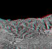
This anaglyph, from NASA's Shuttle Radar Topography Mission, shows the Kamchatka Peninsula in eastern Russia. Sredinnyy Khrebet, the mountain range that makes up the spine of the peninsula. 3D glasses are necessary to view this image.
PIA03313:
SRTM Anaglyph: Sredinnyy Khrebet, Kamchatka Peninsula, Russia
Full Resolution:     TIFF (7.882 MB)     JPEG (667.8 kB)
Add Image to Favorite List 2001-07-05 Earth Shuttle Radar Topography Mission (SRTM)
C-Band Interferometric Radar
1550x1763x3
The Kamchatka Peninsula in eastern Russia is shown in this scene created from a preliminary elevation model derived from the first data collected during NASA's Shuttle Radar Topography Mission on February 12, 2000.
PIA03314:
SRTM Colored Height and Shaded Relief: Sredinnyy Khrebet, Kamchatka Peninsula, Russia
Full Resolution:     TIFF (9.862 MB)     JPEG (695.8 kB)
Add Image to Favorite List 2001-07-26 Earth Shuttle Radar Topography Mission (SRTM)
C-Band Interferometric Radar
2020x1350x3
This anaglyph, from NASA's Shuttle Radar Topography Mission, shows the eastern flank of the Andes Mountains, southeast of San Martin de Los Andes, Argentina. 3D glasses are necessary to view this image.
PIA03317:
SRTM Anaglyph: Corral de Piedra, Argentina
Full Resolution:     TIFF (6.425 MB)     JPEG (486.8 kB)
Add Image to Favorite List 2001-07-26 Earth Shuttle Radar Topography Mission (SRTM)
C-Band Interferometric Radar
1920x1350x3
Volcanism and erosion are prominently seen in this view of the eastern flank of the Andes Mountains taken by NASA's Shuttle Radar Topography Mission.
PIA03318:
SRTM Colored Height and Shaded Relief: Corral de Piedra, Argentina
Full Resolution:     TIFF (7.61 MB)     JPEG (513.7 kB)
Add Image to Favorite List 2001-08-03 Earth Shuttle Radar Topography Mission (SRTM)
C-Band Interferometric Radar
7201x3601x3
Erosional features are prominent in this view of southern Colorado taken NASA's Shuttle Radar Topography Mission. The area covers about 20,000 square kilometers and is located about 50 kilometers south of Pueblo, Colorado.
PIA03319:
SRTM Colored Height and Shaded Relief: Piñon Canyon region, Colorado
Full Resolution:     TIFF (77.4 MB)     JPEG (8.04 MB)
Add Image to Favorite List 2001-08-03 Earth Shuttle Radar Topography Mission (SRTM)
C-Band Interferometric Radar
2501x1201x3
This anaglyph, from NASA's Shuttle Radar Topography Mission, shows the city of Bhuj, India. 3D glasses are necessary to view this image.
PIA03320:
SRTM Anaglyph: Piñon Canyon region, Colorado
Full Resolution:     TIFF (5.238 MB)     JPEG (349.1 kB)
Add Image to Favorite List 2001-08-16 Earth Shuttle Radar Topography Mission (SRTM)
C-Band Interferometric Radar
1040x1480x3
All of the major landforms relate to volcanism and/or erosion in NASA's Shuttle Radar Topography Mission scene of Patagonia, near La Esperanza, Argentina.
PIA03322:
SRTM Colored Height and Shaded Relief: Lava plateaus in Argentina
Full Resolution:     TIFF (5.596 MB)     JPEG (432.4 kB)
Add Image to Favorite List 2001-08-16 Earth Shuttle Radar Topography Mission (SRTM)
C-Band Interferometric Radar
1090x1480x3
This anaglyph, from NASA's Shuttle Radar Topography Mission, is of Patagonia, near La Esperanza, Argentina. 3D glasses are necessary to view this image.
PIA03323:
SRTM Anaglyph: Lava plateaus, Argentina
Full Resolution:     TIFF (3.841 MB)     JPEG (284.2 kB)
Add Image to Favorite List 2001-08-24 Earth Shuttle Radar Topography Mission (SRTM)
C-Band Interferometric Radar
1530x1200x3
Topographic data provided by NASA's Shuttle Radar Topography Mission shows the area southwest of Zapala, Argentina. The highest peaks (left) appear to be massive (un-layered) crystalline rocks, perhaps granites.
PIA03324:
SRTM Colored Height and Shaded Relief: Near Zapala, Argentina
Full Resolution:     TIFF (5.421 MB)     JPEG (378.9 kB)
Add Image to Favorite List 2001-08-24 Earth Shuttle Radar Topography Mission (SRTM)
C-Band Interferometric Radar
1630x1200x3
This anaglyph, from NASA's Shuttle Radar Topography Mission, is of an area southwest of Zapala, Argentina, showing a wide diversity of geologic features. 3D glasses are necessary to view this image.
PIA03325:
SRTM Anaglyph: Near Zapala, Argentina
Full Resolution:     TIFF (4.867 MB)     JPEG (318.9 kB)
Add Image to Favorite List 2001-09-01 Earth Shuttle Radar Topography Mission (SRTM)
C-Band Interferometric Radar
1910x1215x3
This anaglyph, from NASA's Shuttle Radar Topography Mission, is of the Andes Mountains, southeast of San Carlos de Bariloche, Argentina. 3D glasses are necessary to view this image.
PIA03326:
SRTM Anaglyph: Las Bayas, Argentina
Full Resolution:     TIFF (5.28 MB)     JPEG (429.3 kB)
Add Image to Favorite List 2001-09-01 Earth Shuttle Radar Topography Mission (SRTM)
C-Band Interferometric Radar
1810x1215x3
The interplay of volcanism, stream erosion and landslides is evident in this image from NASA's Shuttle Radar Topography Mission of the eastern flank of the Andes Mountains, southeast of San Carlos de Bariloche, Argentina.
PIA03327:
SRTM Colored Height and Shaded Relief: Las Bayas, Argentina
Full Resolution:     TIFF (6.56 MB)     JPEG (495.3 kB)
Add Image to Favorite List 2002-10-22 Earth Shuttle Radar Topography Mission (SRTM)
C-Band Interferometric Radar
9600x9000x3
Panama, Costa Rica, Nicaragua, El Salvador, Honduras, Guatemala, Belize, southern Mexico and parts of Cuba and Jamaica are all seen in this image from NASA's Shuttle Radar Topography Mission.
PIA03364:
Colored Height and Shaded Relief, Central America
Full Resolution:     TIFF (84.57 MB)     JPEG (8.603 MB)
Add Image to Favorite List 2002-01-22 Earth Shuttle Radar Topography Mission (SRTM)
C-Band Interferometric Radar
2640x3000x3
The diversity of landforms that make up the state of California is evident in this rendition of the 3-D topography of the state from NASA's Shuttle Radar Topography Mission.
PIA03333:
Shaded Relief with Color as Height, California Mosaic
Full Resolution:     TIFF (14.08 MB)     JPEG (1.228 MB)
Add Image to Favorite List 2002-03-29 Earth Shuttle Radar Topography Mission (SRTM)
C-Band Interferometric Radar
7200x7200x3
The confluence of the Mississippi, Missouri and Illinois rivers are shown in this view of the St. Louis area from NASA's Shuttle Radar Topography Mission.
PIA03346:
Shaded Relief with Color as Height, St. Louis, Missouri
Full Resolution:     TIFF (173.3 MB)     JPEG (15.1 MB)
Add Image to Favorite List 2002-04-04 Earth Shuttle Radar Topography Mission (SRTM)
C-Band Interferometric Radar
6000x8000x3
The diversity of landforms that make up the state of California is evident in this rendition of the 3-D topography of the state from NASA's Shuttle Radar Topography Mission.
PIA03347:
Shaded Relief with Color as Height, California Mosaic with Insets
Full Resolution:     TIFF (87.66 MB)     JPEG (6.901 MB)
Add Image to Favorite List 2002-04-22 Earth Shuttle Radar Topography Mission (SRTM)
C-Band Interferometric Radar
7200x7200x3
The Bosporus (also spelled Bosphorus) is a strait that connects the Black Sea with the Sea of Marmara in the center of this view of northwest Turkey, taken during NASA's Shuttle Radar Topography Mission.
PIA03349:
Shaded Relief and Radar Image with Color as Height, Bosporus Strait and Istanbul, Turkey
Full Resolution:     TIFF (88.77 MB)     JPEG (9.383 MB)
Add Image to Favorite List 2002-07-11 Earth Shuttle Radar Topography Mission (SRTM)
C-Band Interferometric Radar
7200x3600x3
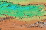
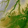
These two images show exactly the same area, Lake Balbina near Manaus, Brazil as seen by NASA's Shuttle Radar Topography Mission.
PIA03350:
Shaded Relief with Height as Color, Lake Balbina, near Manaus, Brazil
Full Resolution:     TIFF (71.37 MB)     JPEG (5.478 MB)
Add Image to Favorite List 2002-07-11 Earth Shuttle Radar Topography Mission (SRTM)
C-Band Interferometric Radar
7200x3601x3
Volcanic, tectonic, erosional and sedimentary landforms are all evident in these images from NASA's Shuttle Radar Topography Mission of a region along the East African Rift at Lake Kivu. The area shown covers parts of Congo, Rwanda and Uganda.
PIA03351:
Shaded Relief with Height as Color, Virunga and Nyiragongo Volcanoes and the East African Rift Valley
Full Resolution:     TIFF (78.98 MB)     JPEG (5.492 MB)
Add Image to Favorite List 2002-07-11 Earth Shuttle Radar Topography Mission (SRTM)
C-Band Interferometric Radar
7200x3600x3
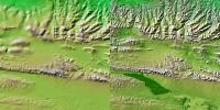
These two images show exactly the same area, part of the Kunlun fault in northern Tibet as seen by NASA's Shuttle Radar Topography Mission.
PIA03352:
Shaded Relief with Height as Color, Kunlun fault, east-central Tibet
Full Resolution:     TIFF (74.87 MB)     JPEG (5.561 MB)
Add Image to Favorite List 2002-07-11 Earth Shuttle Radar Topography Mission (SRTM)
C-Band Interferometric Radar
7200x3600x3
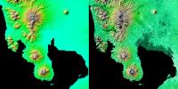
These two images show exactly the same area, Manila Bay and nearby volcanoes on Luzon Island in the Philippines as seen by NASA's Shuttle Radar Topography Mission.
PIA03353:
Shaded Relief with Height as Color, Manila Bay, Philippines
Full Resolution:     TIFF (53.59 MB)     JPEG (4.092 MB)
Add Image to Favorite List 2002-07-11 Earth Shuttle Radar Topography Mission (SRTM)
C-Band Interferometric Radar
7200x3410x3
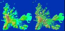
These two images show exactly the same area, Kerguelen Island in the southern Indian Ocean as seen by NASA's Shuttle Radar Topography Mission.
PIA03354:
Shaded Relief with Height as Color, Kerguelen Island, south Indian Ocean
Full Resolution:     TIFF (32.41 MB)     JPEG (2.381 MB)
Add Image to Favorite List 2002-08-29 Earth Shuttle Radar Topography Mission (SRTM)
C-Band Interferometric Radar
688x550x3
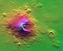
NASA's Shuttle Radar Topography Mission shows Mount Meru, an active volcano located just 70 kilometers (44 miles) west of Mount Kilimanjaro.
PIA03356:
Shaded Relief with Height as Color, Mount Meru, Tanzania
Full Resolution:     TIFF (1.264 MB)     JPEG (99.88 kB)
Add Image to Favorite List 2002-09-13 Earth Shuttle Radar Topography Mission (SRTM)
C-Band Interferometric Radar
3601x3601x3
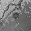
An 8-kilometer (5-mile) wide crater of possible impact origin is shown in this view of an isolated part of the Bolivian Amazon from NASA's Shuttle Radar Topography Mission.
PIA03359:
Shaded Relief with Height as Color, Iturralde Structure, Bolivia
Full Resolution:     TIFF (38.9 MB)     JPEG (3.517 MB)
Add Image to Favorite List 2002-09-26 Earth Shuttle Radar Topography Mission (SRTM)
C-Band Interferometric Radar
1200x1200x3
This anaglyph, from NASA's Shuttle Radar Topography Mission, is of the Iturralde Structure, Bolivia, a possible impact crater. 3D glasses are necessary to view this image.
PIA03362:
Anaglyph: Shaded Relief and Height as Brightness, Iturralde Structure, Bolivia
Full Resolution:     TIFF (3.729 MB)     JPEG (366.1 kB)
Add Image to Favorite List 2002-09-26 Earth Shuttle Radar Topography Mission (SRTM)
C-Band Interferometric Radar
1016x865x3
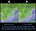
An 8-kilometer (5-mile) wide crater of possible impact origin is shown in this stereoscopic view of an isolated part of the Bolivian Amazon from NASA's Shuttle Radar Topography Mission.
PIA03363:
Stereo Pair with ASTER Image, Iturralde Structure, Bolivia
Full Resolution:     TIFF (2.168 MB)     JPEG (186.8 kB)
Add Image to Favorite List 2002-11-14 Earth Shuttle Radar Topography Mission (SRTM)
C-Band Interferometric Radar
9000x15666x3
Russia's Kamchatka Peninsula, lying between the Sea of Okhotsk to the west and the Bering Sea and Pacific Ocean to the east, is one of the most active volcanic regions along the Pacific Ring of Fire as seen by NASA's Shuttle Radar Topography Mission.
PIA03374:
Colored Height and Shaded Relief, Kamchatka Peninsula
Full Resolution:     TIFF (233.5 MB)     JPEG (9.626 MB)
Add Image to Favorite List 2002-12-12 Earth Shuttle Radar Topography Mission (SRTM)
C-Band Interferometric Radar
2500x2000x3
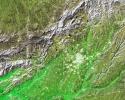
The white, mottled area in the right-center of this image from NASA's Shuttle Radar Topography Mission is Madrid, the capital of Spain.
PIA03375:
Shaded Relief and Radar Image with Color as Height, Madrid, Spain
Full Resolution:     TIFF (15.02 MB)     JPEG (1.897 MB)
Add Image to Favorite List 2003-03-06 Earth Shuttle Radar Topography Mission (SRTM)
C-Band Interferometric Radar
9600x7240x3
This image of North America was generated with data from NASA's Shuttle Radar Topography Mission.
PIA03377:
Shaded Relief with Height as Color, North America
Full Resolution:     TIFF (130.7 MB)     JPEG (56.09 MB)
Add Image to Favorite List 2003-03-06 Earth Shuttle Radar Topography Mission (SRTM)
C-Band Interferometric Radar
9600x7240x3
This anaglyph, from NASA's Shuttle Radar Topography Mission, is of the Iturralde Structure, Bolivia, a possible impact crater. 3D glasses are necessary to view this image.
PIA03378:
Anaglyph, North America
Full Resolution:     TIFF (94.73 MB)     JPEG (9.055 MB)
Add Image to Favorite List 2003-03-06 Earth Shuttle Radar Topography Mission (SRTM)
C-Band Interferometric Radar
18001x11438x3
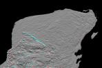
This shaded relief image of Mexico's Yucatan Peninsula show a subtle, but unmistakable, indication of the Chicxulub impact crater as seen by NASA's Shuttle Radar Topography Mission.
PIA03379:
Shaded Relief with Height as Color, Yucatan Peninsula, Mexico
Full Resolution:     TIFF (395.4 MB)     JPEG (50.01 MB)
Add Image to Favorite List 2003-03-06 Earth Shuttle Radar Topography Mission (SRTM)
C-Band Interferometric Radar
1600x1080x3
This anaglyph of Mexico's Yucatan Peninsula was generated from NASA's Shuttle Radar Topography Mission data, and shows a subtle but distinctive indication of the Chicxulub impact crater. 3D glasses are necessary to view this image.
PIA03380:
Anaglyph, Yucatan Peninsula, Mexico
Full Resolution:     TIFF (2.651 MB)     JPEG (362 kB)
Add Image to Favorite List 2003-03-06 Earth Shuttle Radar Topography Mission (SRTM)
C-Band Interferometric Radar
3010x3416x3
The top picture is a shaded relief image of the northwest corner of Mexico's Yucatan Peninsula generated from NASA's Shuttle Radar Topography Mission data, and shows a subtle, but unmistakable, indication of the Chicxulub impact crater.
PIA03381:
Shaded Relief with Height as Color and Landsat, Yucatan Peninsula, Mexico
Full Resolution:     TIFF (30.85 MB)     JPEG (2.545 MB)
Add Image to Favorite List 2003-03-13 Earth Shuttle Radar Topography Mission (SRTM)
C-Band Interferometric Radar
1587x1536x3
This anaglyph, from NASA's Shuttle Radar Topography Mission, is of Massanutten Mountain in the Shenandoah Valley of northern Virginia. 3D glasses are necessary to view this image.
PIA03382:
Massanutten Mountain, Virginia, USA (Anaglyph)
Full Resolution:     TIFF (6.914 MB)     JPEG (527.2 kB)
Add Image to Favorite List 2003-03-13 Earth Shuttle Radar Topography Mission (SRTM)
C-Band Interferometric Radar
628x801x3
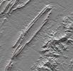
Shenandoah National Park lies astride part of the Blue Ridge Mountains, which form the southeastern range of the greater Appalachian Mountains in Virginia as seen by NASA's Shuttle Radar Topography Mission.
PIA03383:
Shenandoah National Park, Virginia, Shaded Relief with Height as Color
Full Resolution:     TIFF (1.511 MB)     JPEG (152.9 kB)
Add Image to Favorite List 2003-03-27 Earth Shuttle Radar Topography Mission (SRTM)
C-Band Interferometric Radar
3200x3400x3
NASA's Shuttle Radar Topography Mission shows Manicouagan Crater, one of the world's largest and oldest known impact craters and perhaps the one most readily apparent to astronauts in orbit.
PIA03384:
Stereo Pair, with Topographic Height as Color, Manicouagan Crater, Quebec, Canada
Full Resolution:     TIFF (23.78 MB)     JPEG (2.177 MB)
Add Image to Favorite List 2003-03-27 Earth Shuttle Radar Topography Mission (SRTM)
C-Band Interferometric Radar
1573x2401x3
Manicouagan Crater is one of the world's largest and oldest known impact craters and perhaps the one most readily apparent to astronauts in orbit. This anaglyph is from the instrument onboard NASA's Shuttle Radar Topography Mission. 3D glasses needed.
PIA03385:
Anaglyph, Manicouagan Crater, Quebec, Canada
Full Resolution:     TIFF (9.691 MB)     JPEG (826 kB)
Add Image to Favorite List 2003-06-19 Earth Shuttle Radar Topography Mission (SRTM)
C-Band Interferometric Radar
7200x10886x3
This image of South America was generated with data from NASA's Shuttle Radar Topography Mission.
PIA03388:
South America, Shaded Relief and Colored Height
Full Resolution:     TIFF (69.52 MB)     JPEG (8.202 MB)
Add Image to Favorite List 2003-06-19 Earth Shuttle Radar Topography Mission (SRTM)
C-Band Interferometric Radar
7200x10886x3
This anaglyph, from NASA's Shuttle Radar Topography Mission, in South America is dominated by the Andes Mountains, which extend all along the Pacific Coast. 3D glasses are necessary to view this image.
PIA03389:
Anaglyph, South America
Full Resolution:     TIFF (50.13 MB)     JPEG (6.633 MB)
Add Image to Favorite List 2003-06-19 Earth Shuttle Radar Topography Mission (SRTM)
C-Band Interferometric Radar
960x725x3
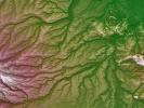
Pando Province, Bolivia, and adjacent parts of Brazil and Peru are seen in this visualization of NASA's Shuttle Radar Topography Mission elevation data covering part of the Amazon Basin.
PIA03390:
Pando Province, Northern Bolivia, Shaded Relief and Colored Height
Full Resolution:     TIFF (2.091 MB)     JPEG (172.2 kB)
Add Image to Favorite List 2003-07-03 Earth Landsat
Shuttle Radar Topography Mission (SRTM)
C-Band Interferometric Radar
1025x577x3
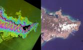
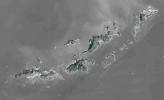
St. Thomas, St. John, Tortola, and Virgin Gorda are the four main islands in this view of the U.S. Virgin Islands and British Virgin Islands, along the perimeter of the Caribbean Sea. This image is from NASA's Shuttle Radar Topography Mission.
PIA03391:
SRTM Perspective with Landsat Virgin Islands, Caribbean
Full Resolution:     TIFF (1.777 MB)     JPEG (89.61 kB)
Add Image to Favorite List 2003-07-03 Earth Landsat
Shuttle Radar Topography Mission (SRTM)
C-Band Interferometric Radar
2805x1705x3
St. Thomas, St. John, Tortola, and Virgin Gorda are the four main islands (lower left to upper right) of this map-view anaglyph of the U.S. Virgin Islands and British Virgin Islands from NASA's Shuttle Radar Topography Mission. 3D glasses are necessary.
PIA03392:
Anaglyph with Landsat Virgin Islands, Caribbean
Full Resolution:     TIFF (7.529 MB)     JPEG (737 kB)
 Current Set   Jump to a Following Set   Jump to a Following Set   Retrieve Next Set 
 1-100   101-200   201-300 
Currently displaying images: 1 - 100 of 251