Click on an image for detailed information
Click on a column heading to sort in ascending or descending order

My
List |
Addition Date
|
Target
|
Mission
|
Instrument
|
Size
|

|
2014-12-08 |
Mars
|
Mars Science Laboratory (MSL)
|
|
2560x1600x3 |
|
-
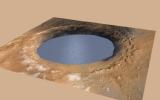
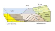
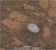
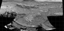
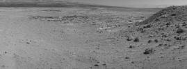
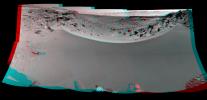
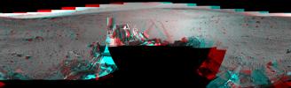
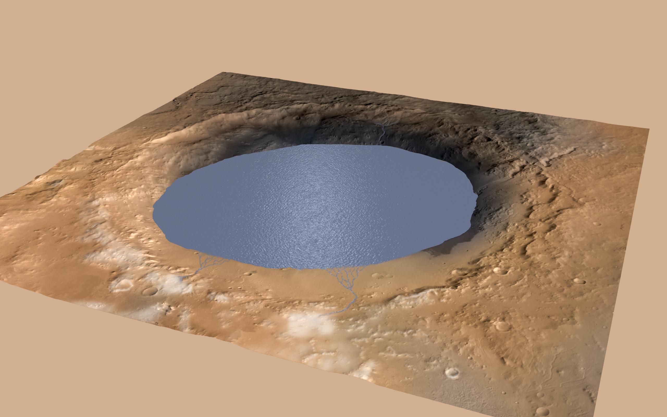
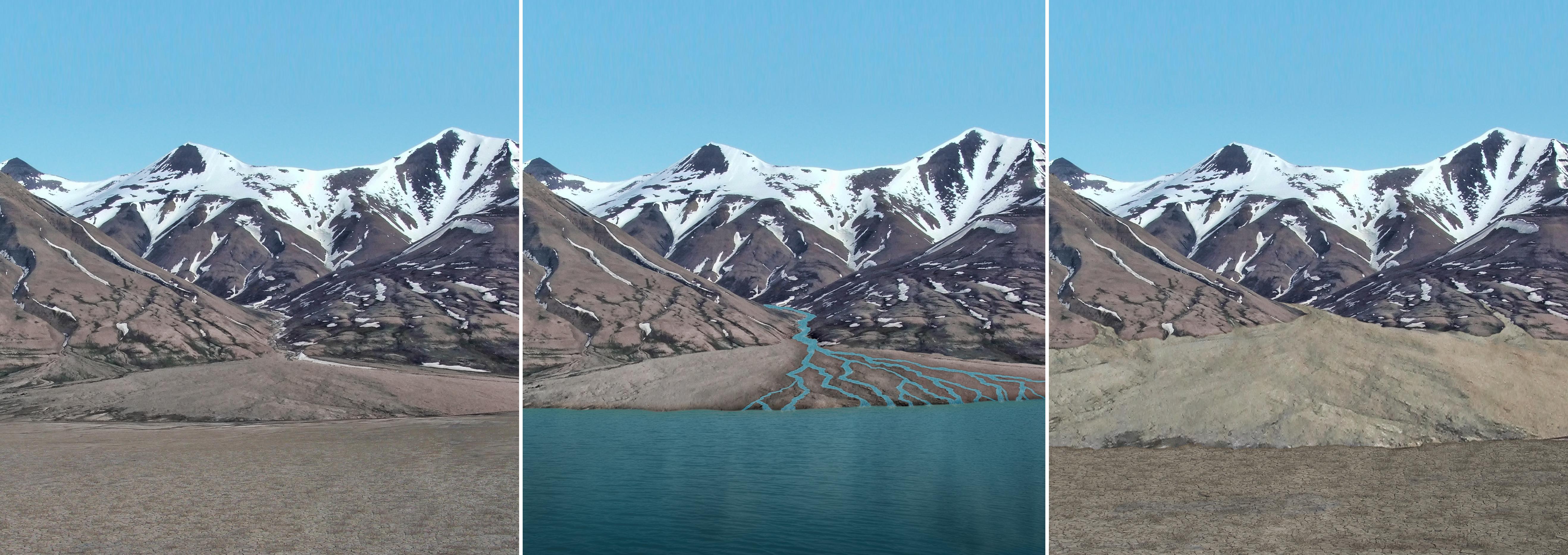
PIA19080:
-
Simulated View of Gale Crater Lake on Mars
Full Resolution:
TIFF
(12.29 MB)
JPEG
(271.9 kB)
|
|
|
2014-12-08 |
Mars
|
Mars Science Laboratory (MSL)
|
|
4030x1275x3 |
|
-
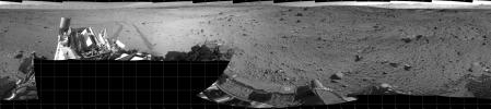
PIA19079:
-
Sedimentation and Erosion in Gale Crater, Mars
Full Resolution:
TIFF
(15.42 MB)
JPEG
(190.5 kB)
|
|
|
2014-12-08 |
Earth
|
Mars Science Laboratory (MSL)
|
|
5271x1865x3 |
|
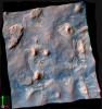
-
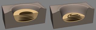
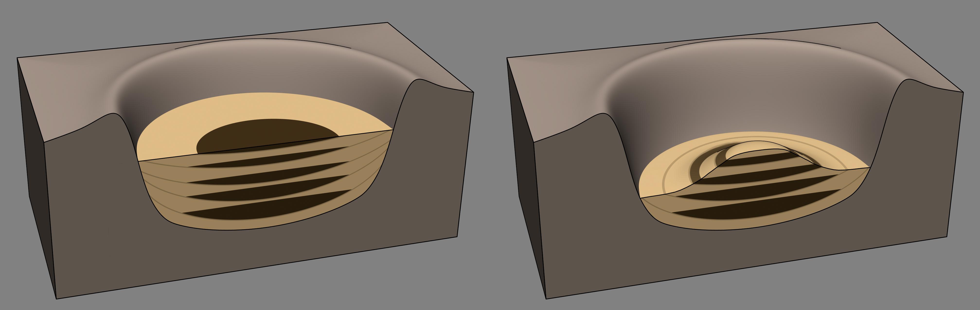
PIA19078:
-
Sediment Accumulation in Dry and Wet Periods
Full Resolution:
TIFF
(29.51 MB)
JPEG
(1.212 MB)
|
|
|
2014-12-08 |
Mars
|
Mars Science Laboratory (MSL)
|
MAHLI
|
2876x3014x3 |
|
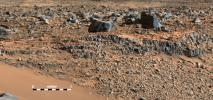
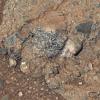
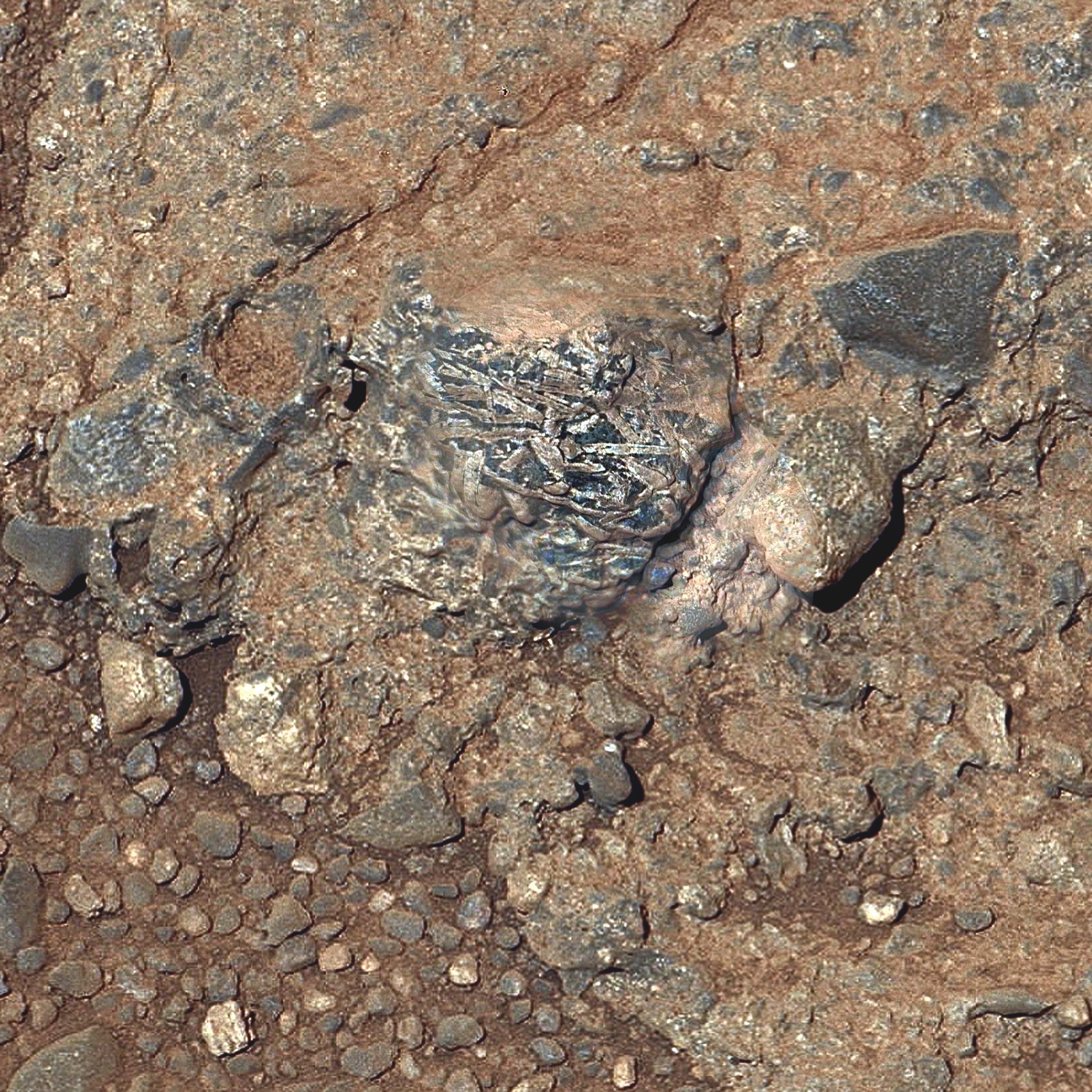
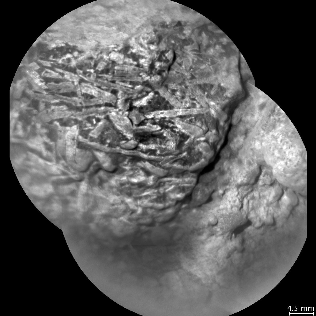
-
PIA19077:
-
Crystals May Have Formed in Drying Martian Lake
Full Resolution:
TIFF
(26.02 MB)
JPEG
(1.59 MB)
|
|
|
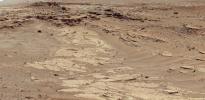
2014-12-08 |
Mars
|
Mars Science Laboratory (MSL)
|
Mastcam
|
4006x1929x3 |
|
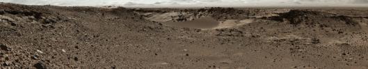
-
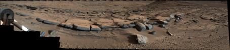
PIA19076:
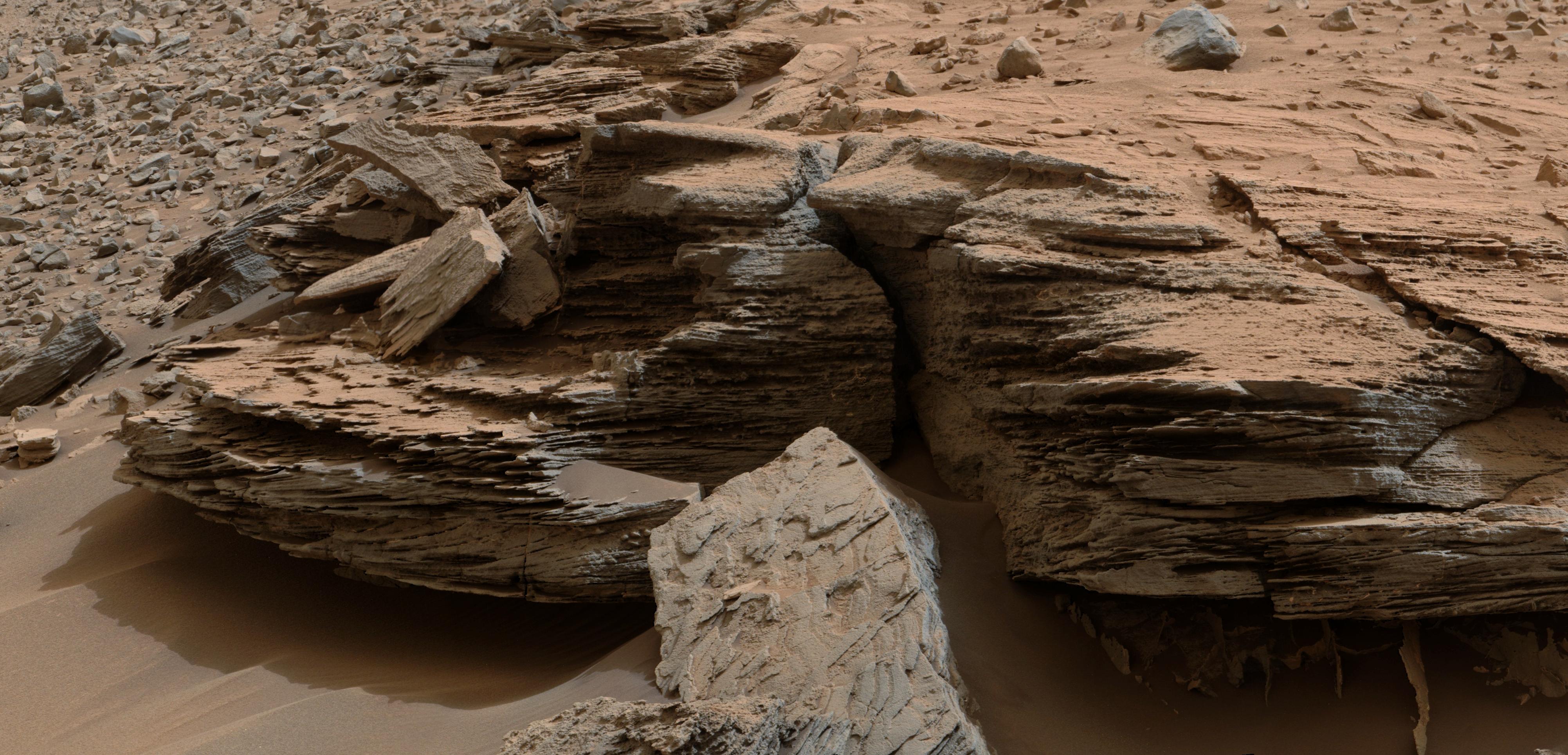
-
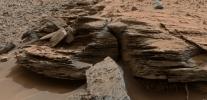
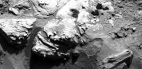
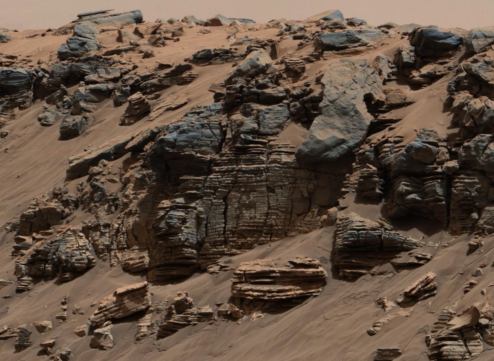
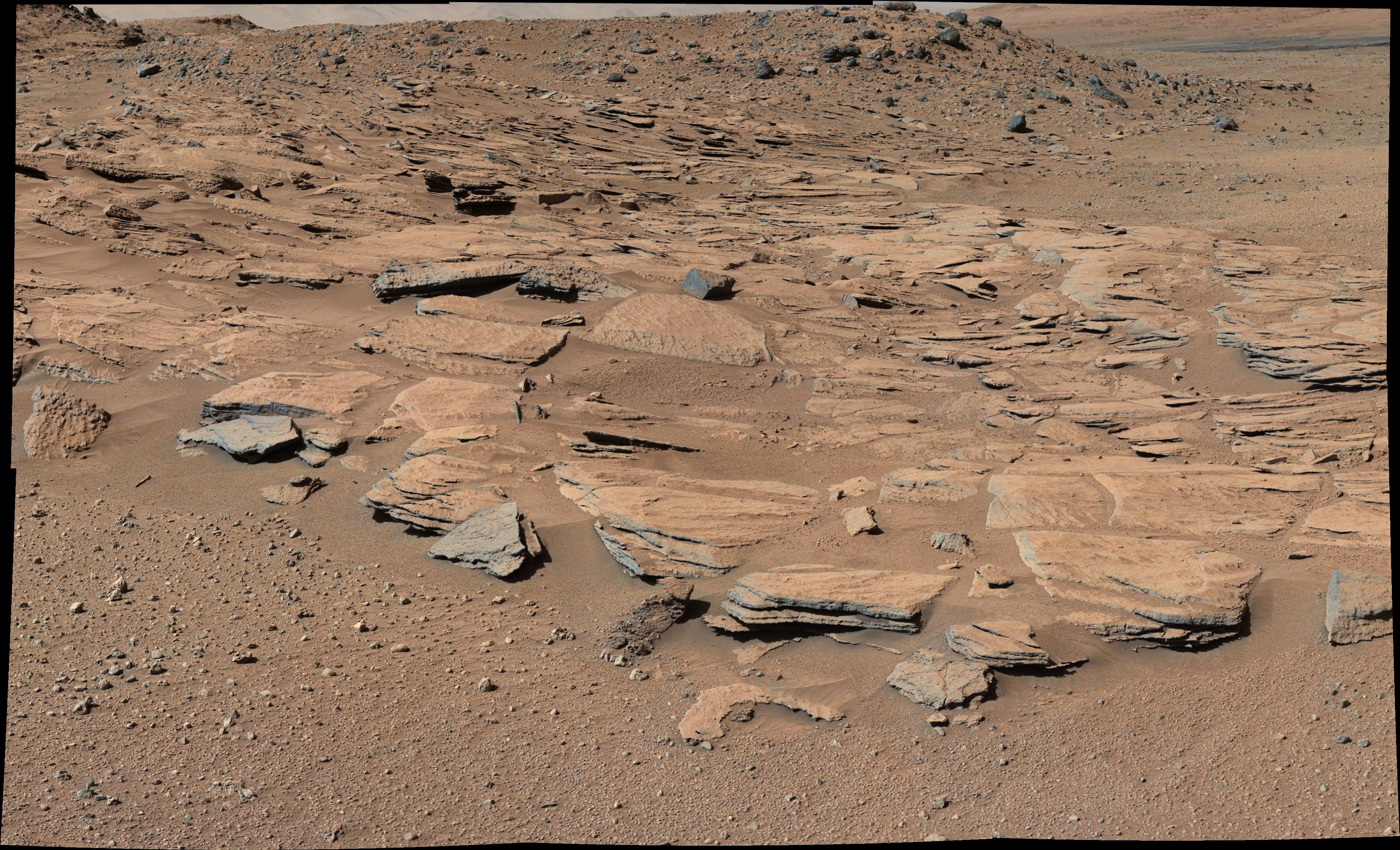
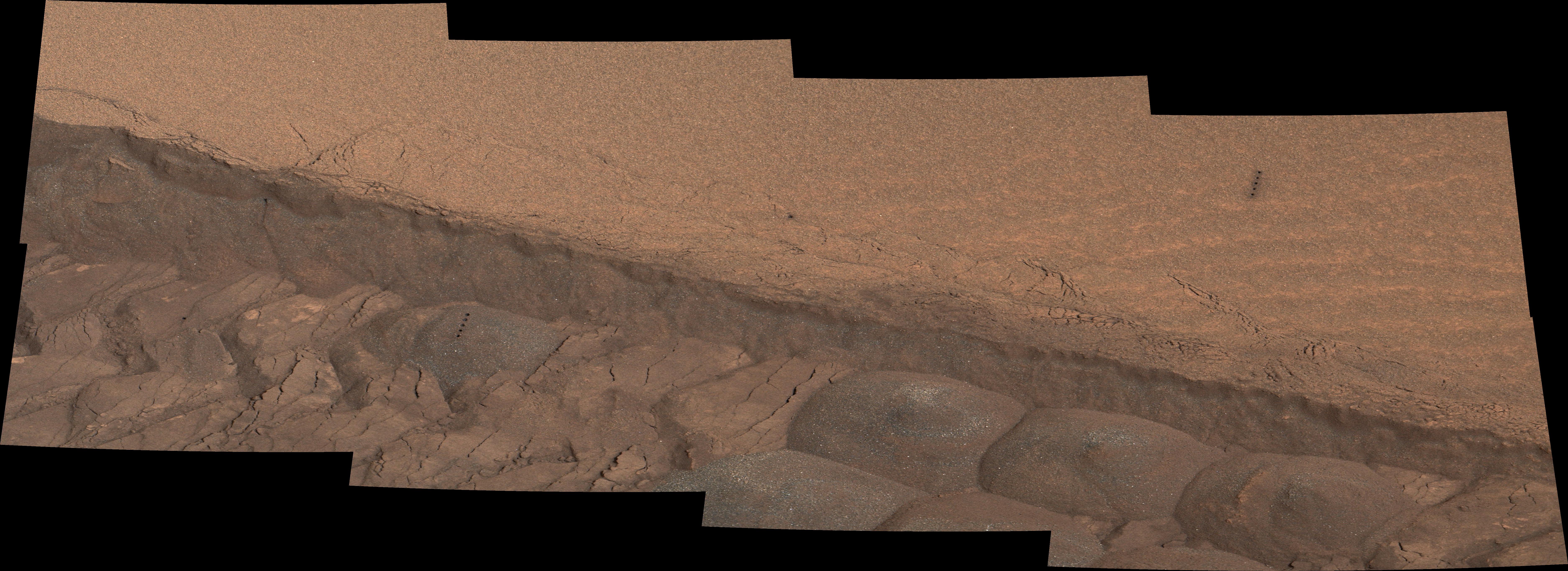
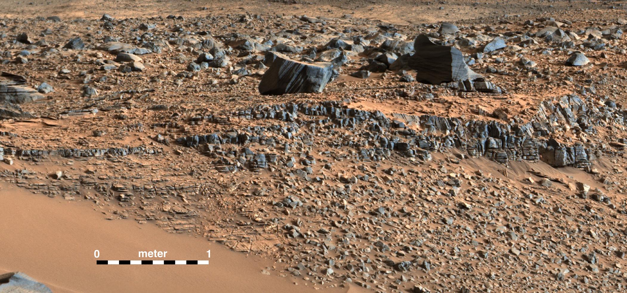
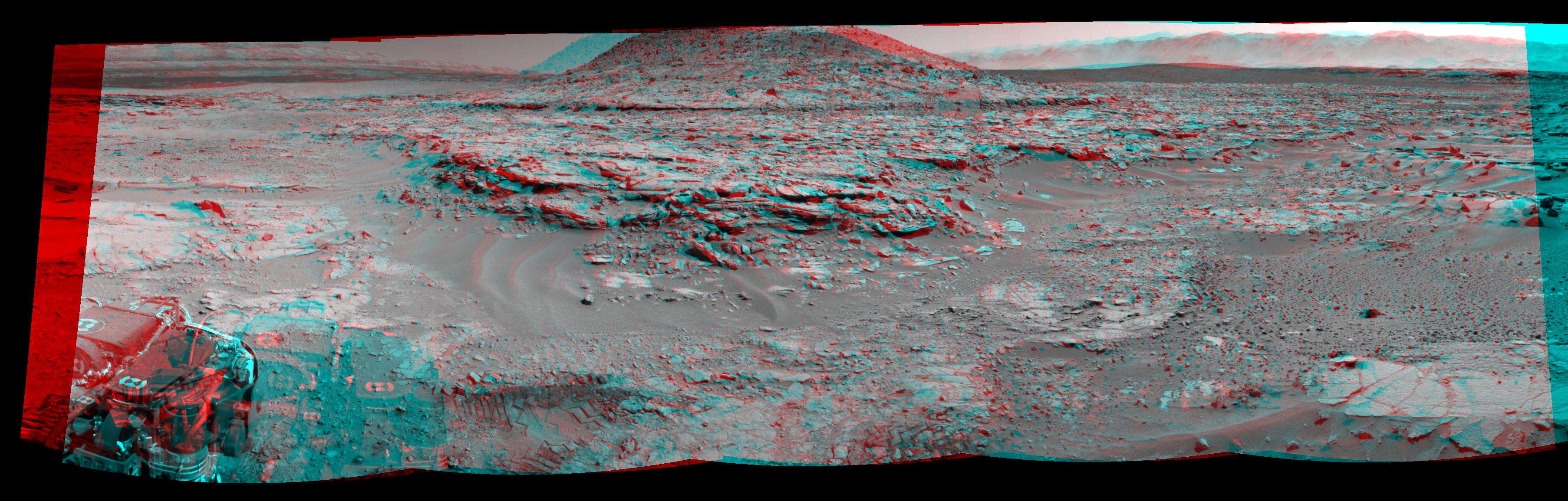
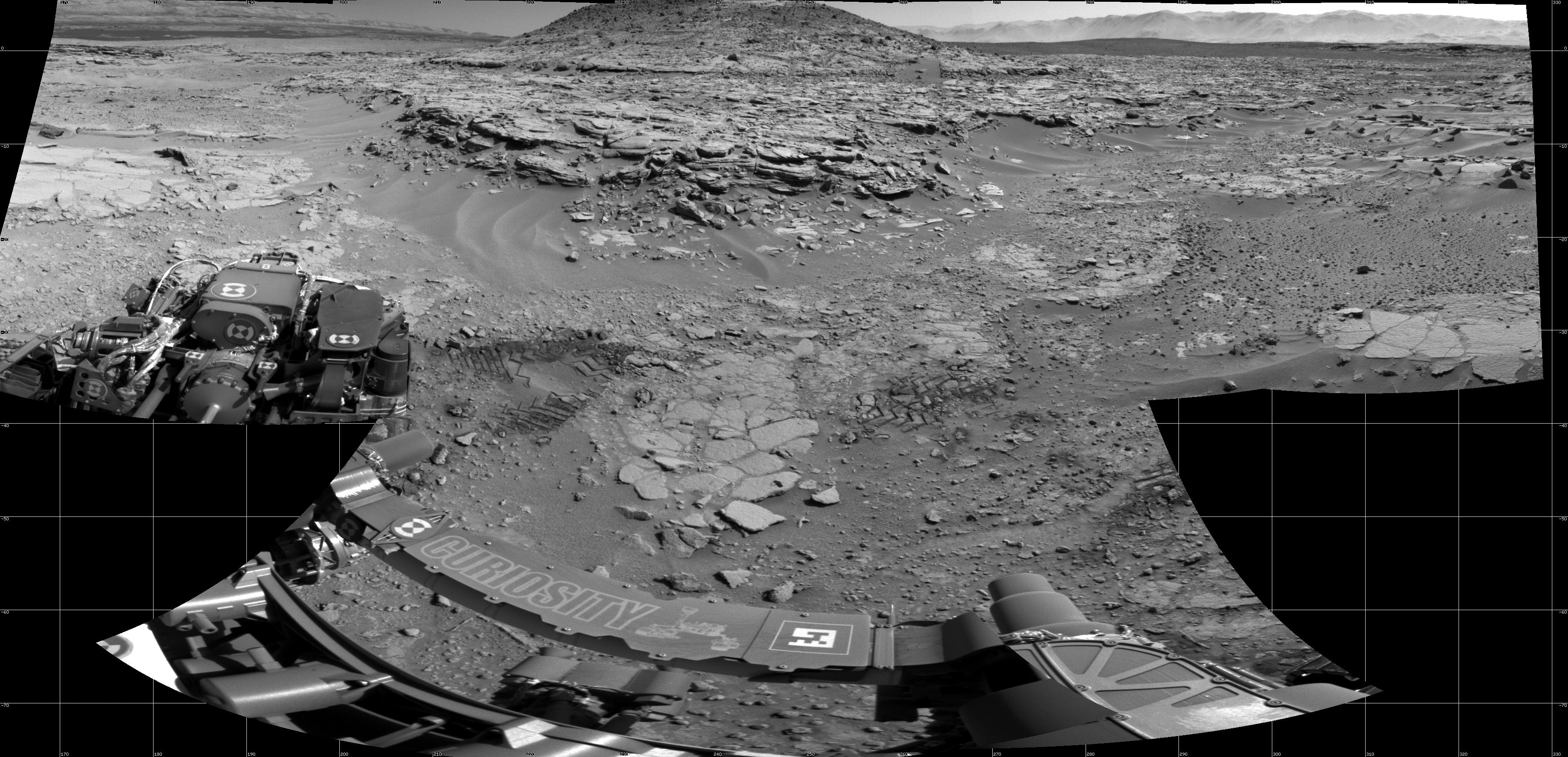
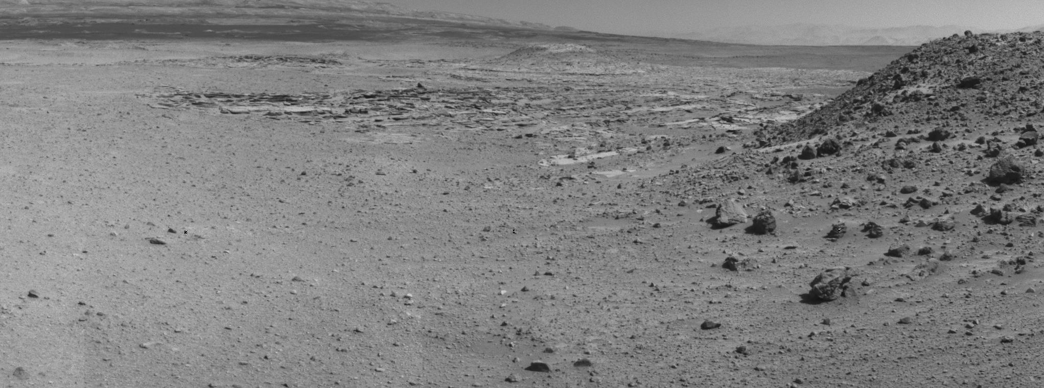
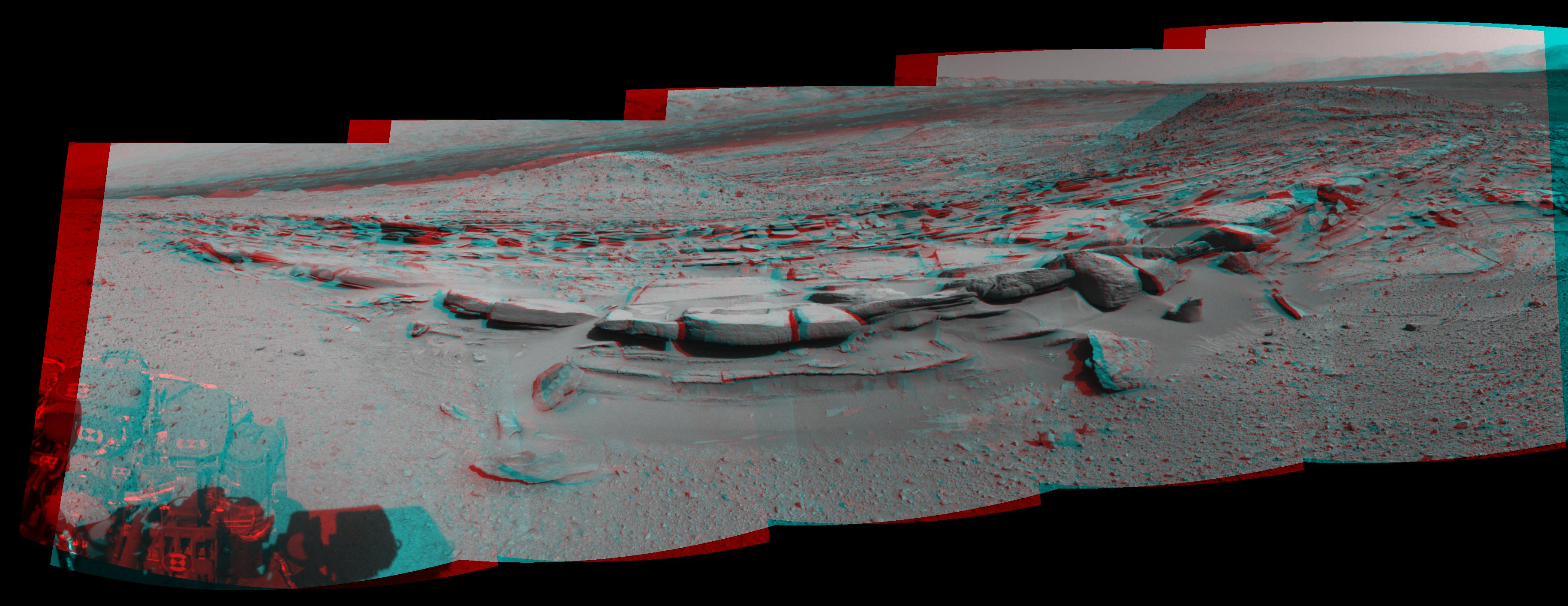
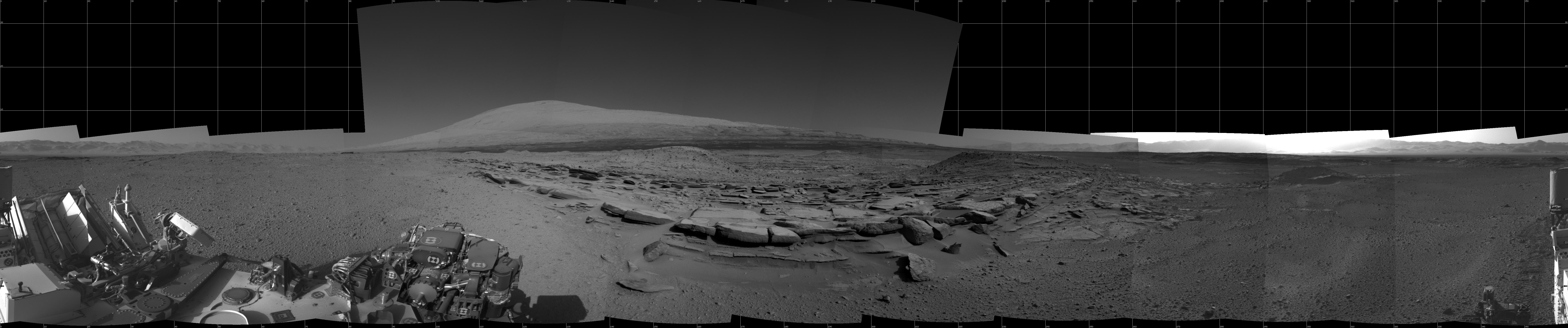
Cross-Bedding at 'Whale Rock'
Full Resolution:
TIFF
(23.19 MB)
JPEG
(1.06 MB)
|
|
|
2014-12-08 |
Mars
|
Mars Science Laboratory (MSL)
|
Mastcam
|
2011x1198x3 |

|
-
PIA19075:
-
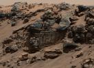
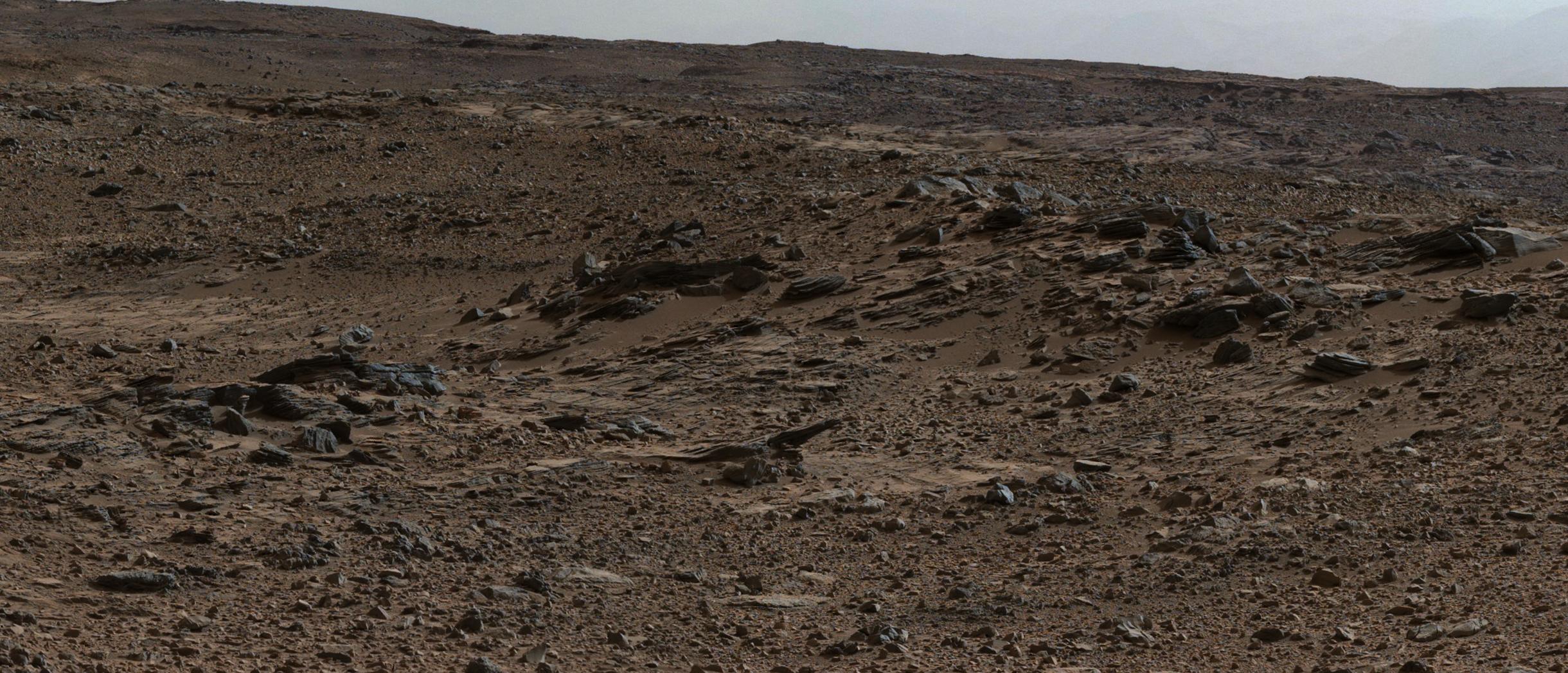
Thin-Laminated Rock in 'Pahrump Hills' Outcrop
Full Resolution:
TIFF
(7.23 MB)
JPEG
(448.2 kB)
|
|
|
2014-12-08 |
Mars
|
Mars Science Laboratory (MSL)
|
Mastcam
|
1588x1160x3 |
|
-
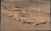
PIA19074:
-
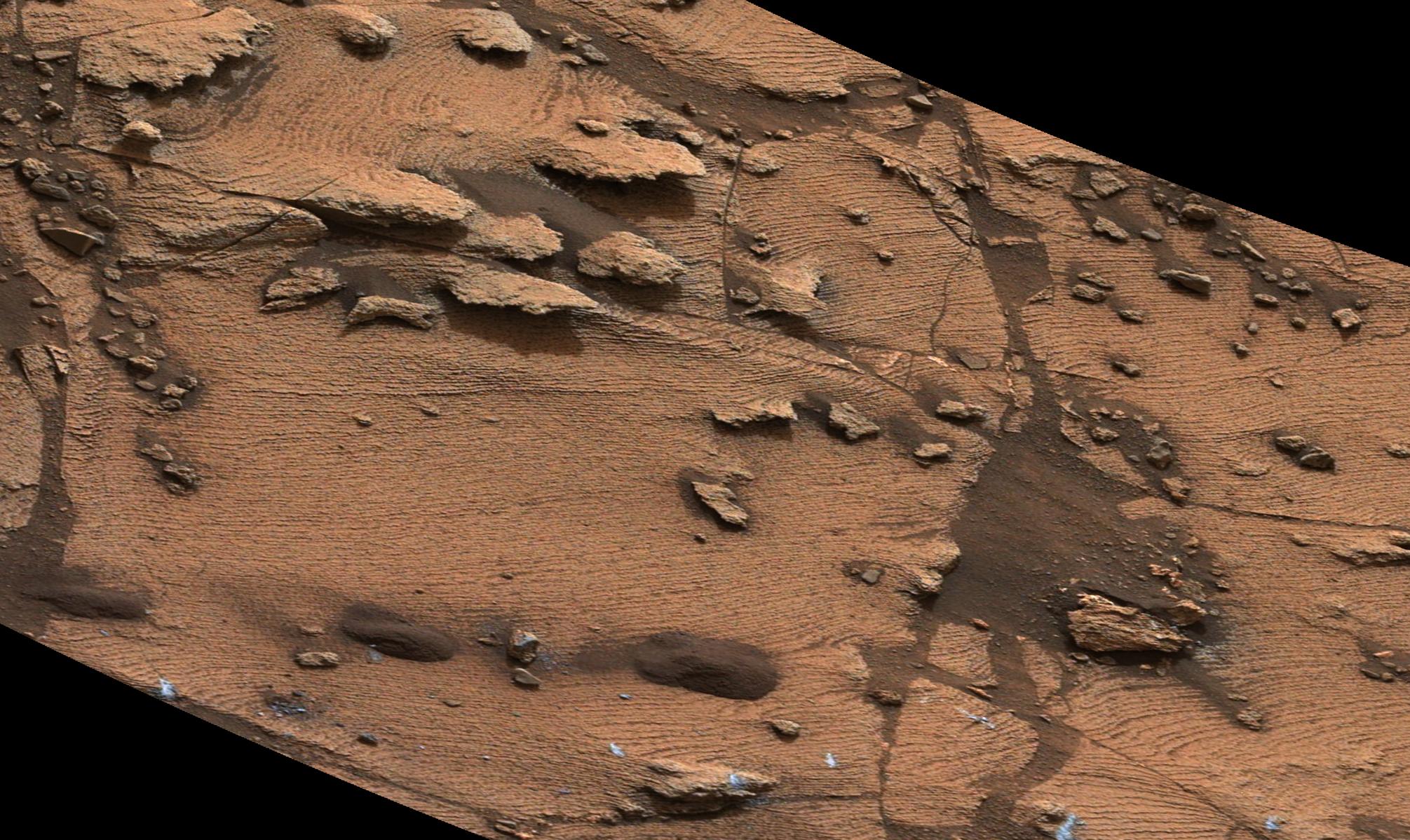
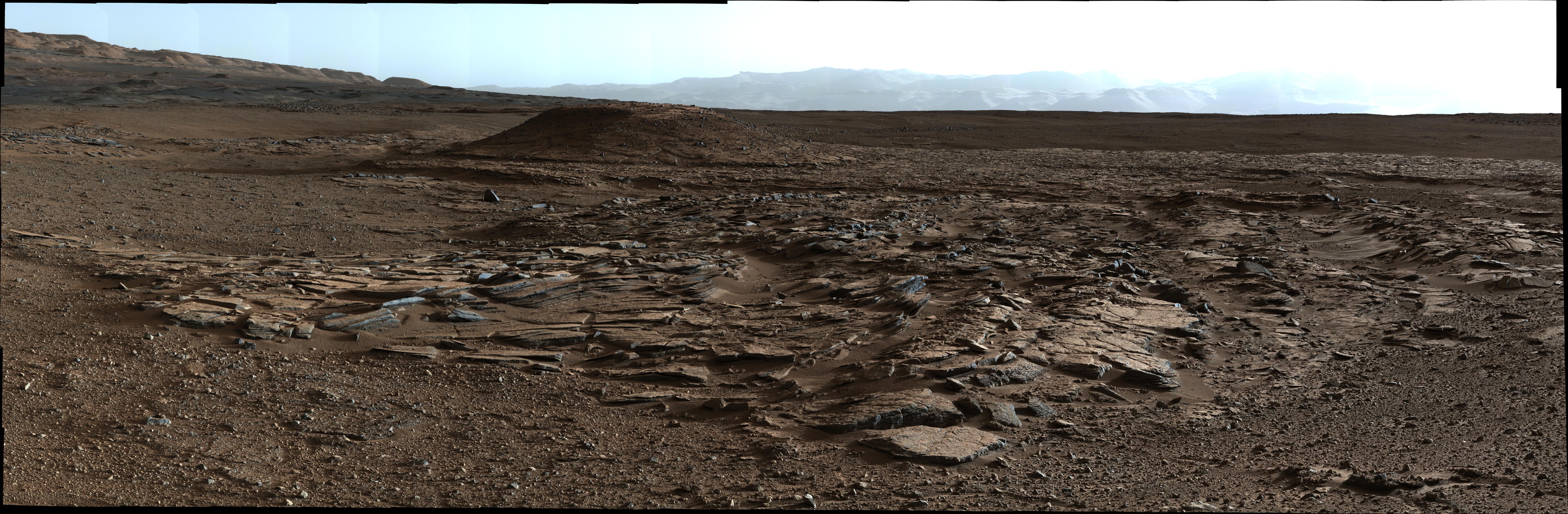
Sedimentary Signs of a Martian Lakebed
Full Resolution:
TIFF
(5.528 MB)
JPEG
(276.3 kB)
|
|
|
2014-12-08 |
|
Mars Science Laboratory (MSL)
|
|
1391x467x3 |
|
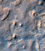
-
PIA19073:
-
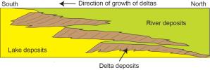
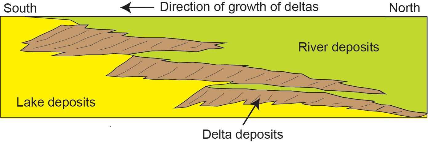
Multiple Deltas Built Out Over Time
Full Resolution:
TIFF
(1.95 MB)
JPEG
(69.82 kB)
|
|
|
2014-12-08 |
Mars
|
Mars Science Laboratory (MSL)
|
Mastcam
|
2440x1049x3 |
|
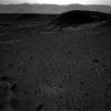
-
PIA19072:
-
Sol 696 (July 22, 2014), Left
Full Resolution:
TIFF
(7.682 MB)
JPEG
(515.2 kB)
|
|
|
2014-12-08 |
Mars
|
Mars Science Laboratory (MSL)
|
|
1931x1078x3 |
|
-
PIA19071:
-
How a Delta Forms Where River Meets Lake
Full Resolution:
TIFF
(6.247 MB)
JPEG
(112.7 kB)
|
|
|
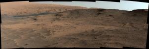
2014-12-08 |
Mars
|
Mars Science Laboratory (MSL)
|
Mastcam
|
6246x2048x3 |

|
-
PIA19070:
-
Sets of Beds Inclined Toward Mount Sharp
Full Resolution:
TIFF
(38.39 MB)
JPEG
(2.709 MB)
|
|
|
2014-12-08 |
Mars
|
Mars Science Laboratory (MSL)
|
Mastcam
|
4657x1024x3 |
|
-
PIA19069:
Bedding Pattern Interpreted as Martian Delta Deposition
Full Resolution:
TIFF
(14.31 MB)
JPEG
(1.16 MB)
|
|
|
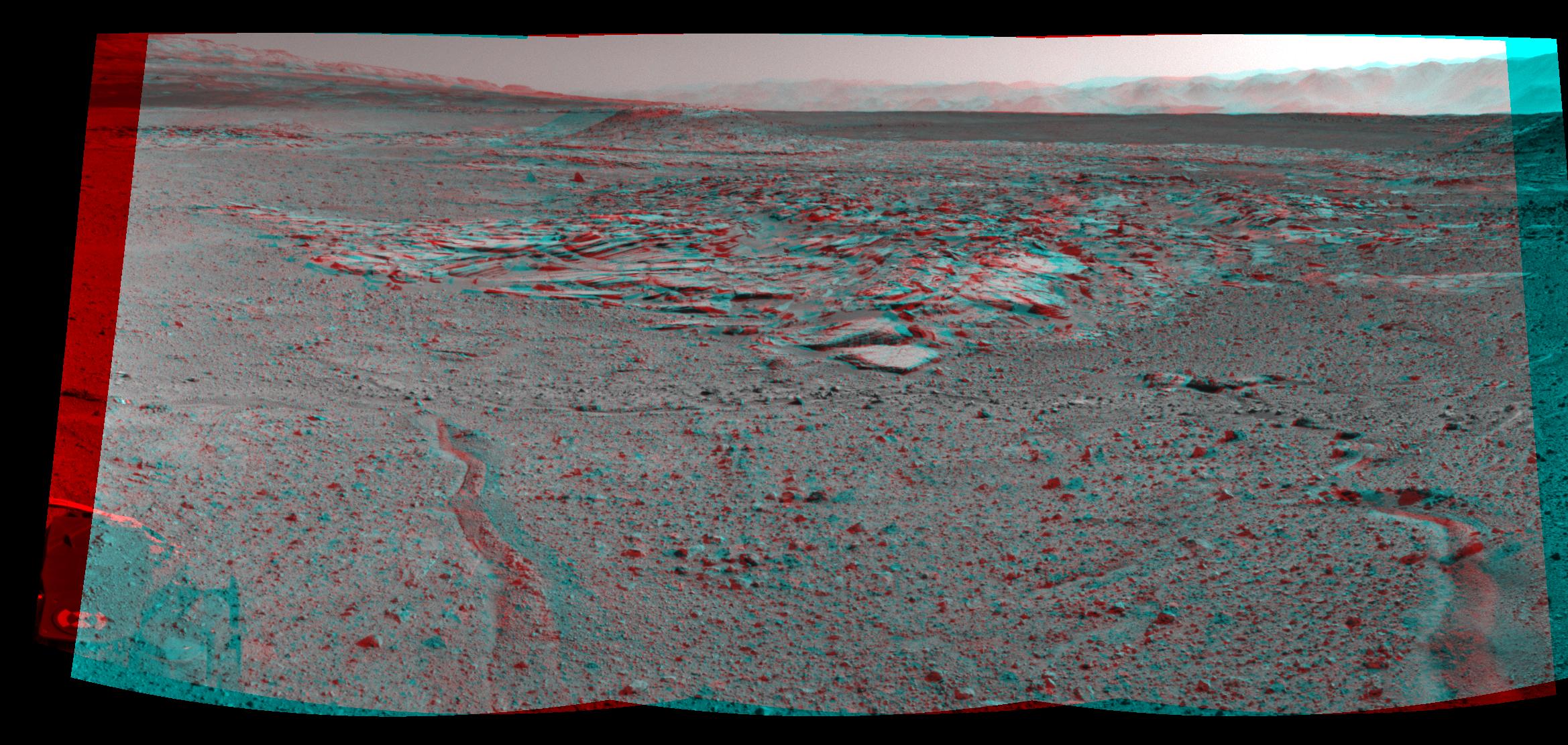
2014-12-08 |
Mars
|
Mars Science Laboratory (MSL)
|
Mastcam
|
3619x2196x3 |
|
-
PIA19068:
-
Inclined Martian Sandstone Beds Near 'Kimberley'
Full Resolution:
TIFF
(23.85 MB)
JPEG
(1.665 MB)
|
|
|
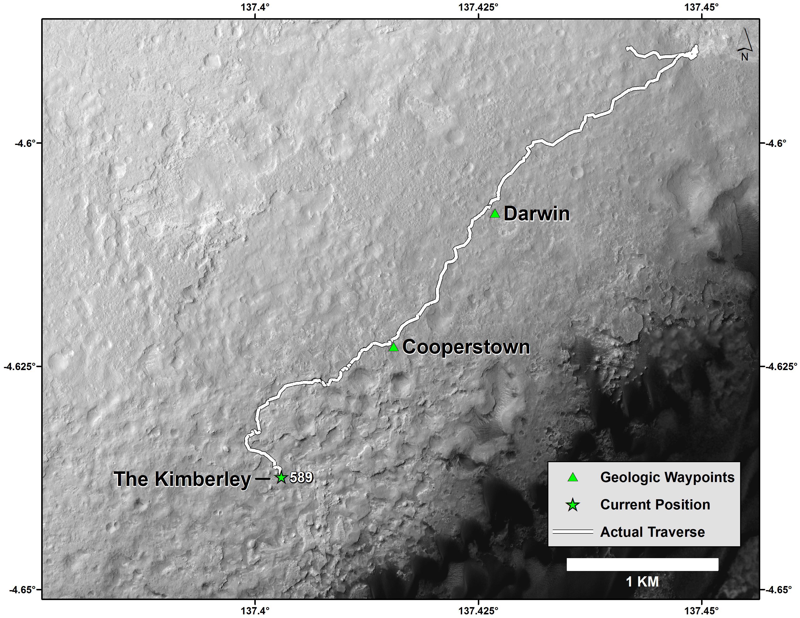
2014-12-08 |
Mars
|
Mars Reconnaissance Orbiter (MRO)
Mars Science Laboratory (MSL)
|
HiRISE
|
3300x2550x3 |
|
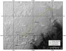
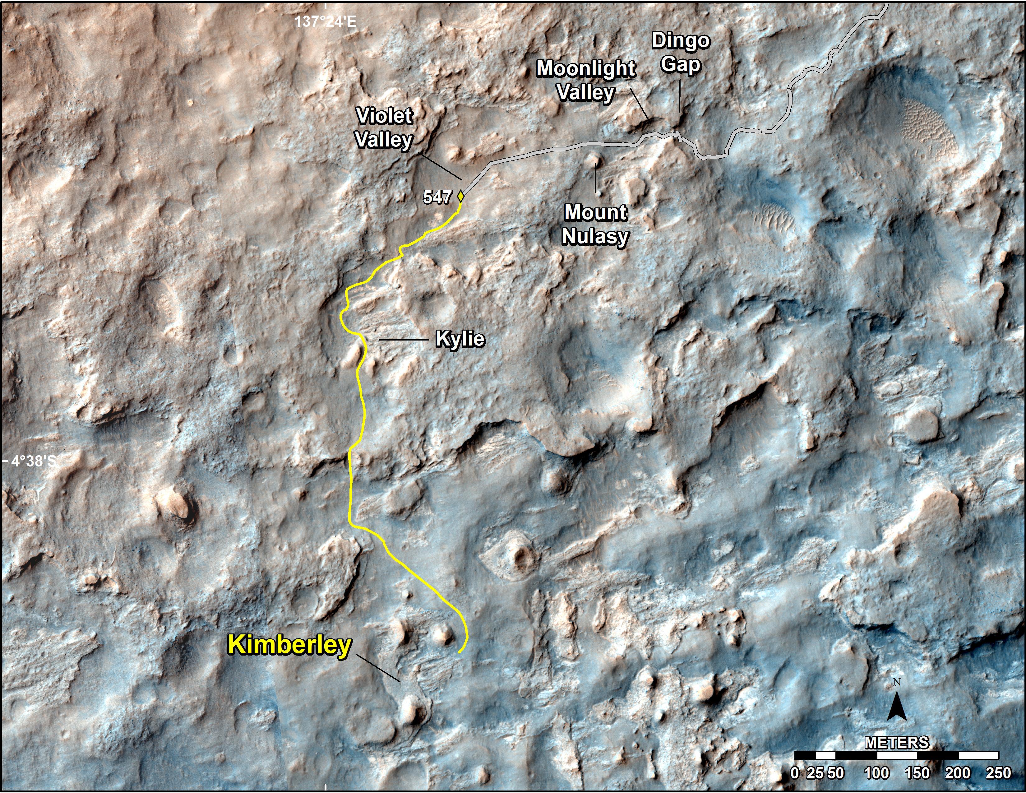
-
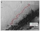
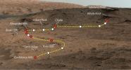
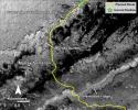
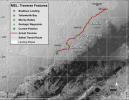
PIA19067:
-
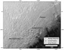
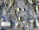
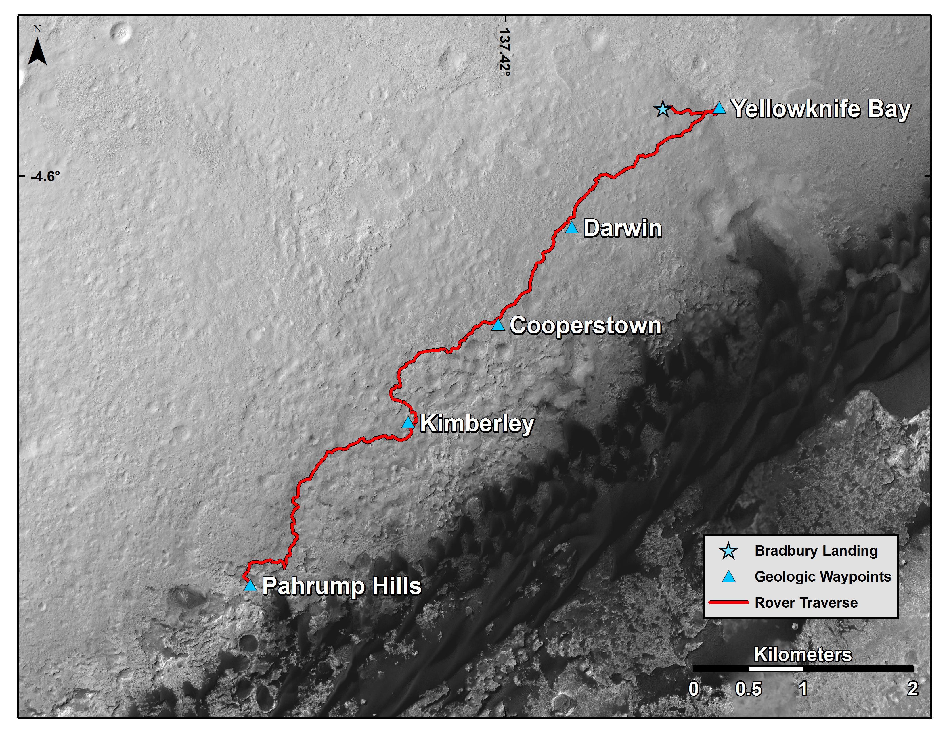
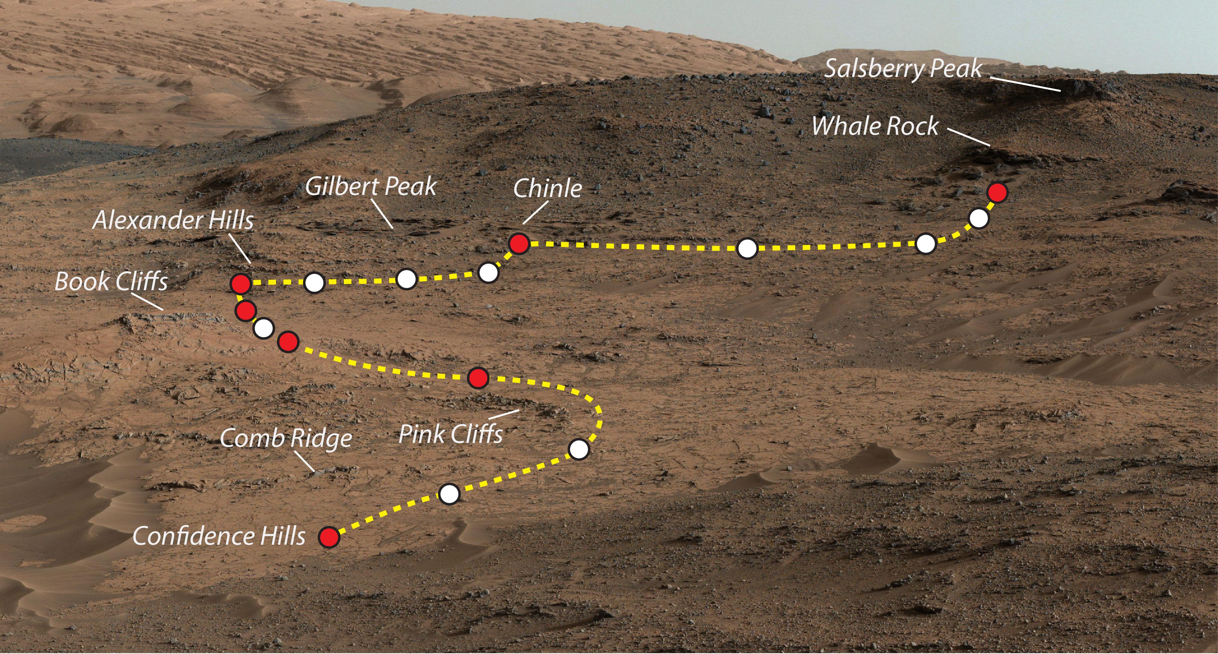
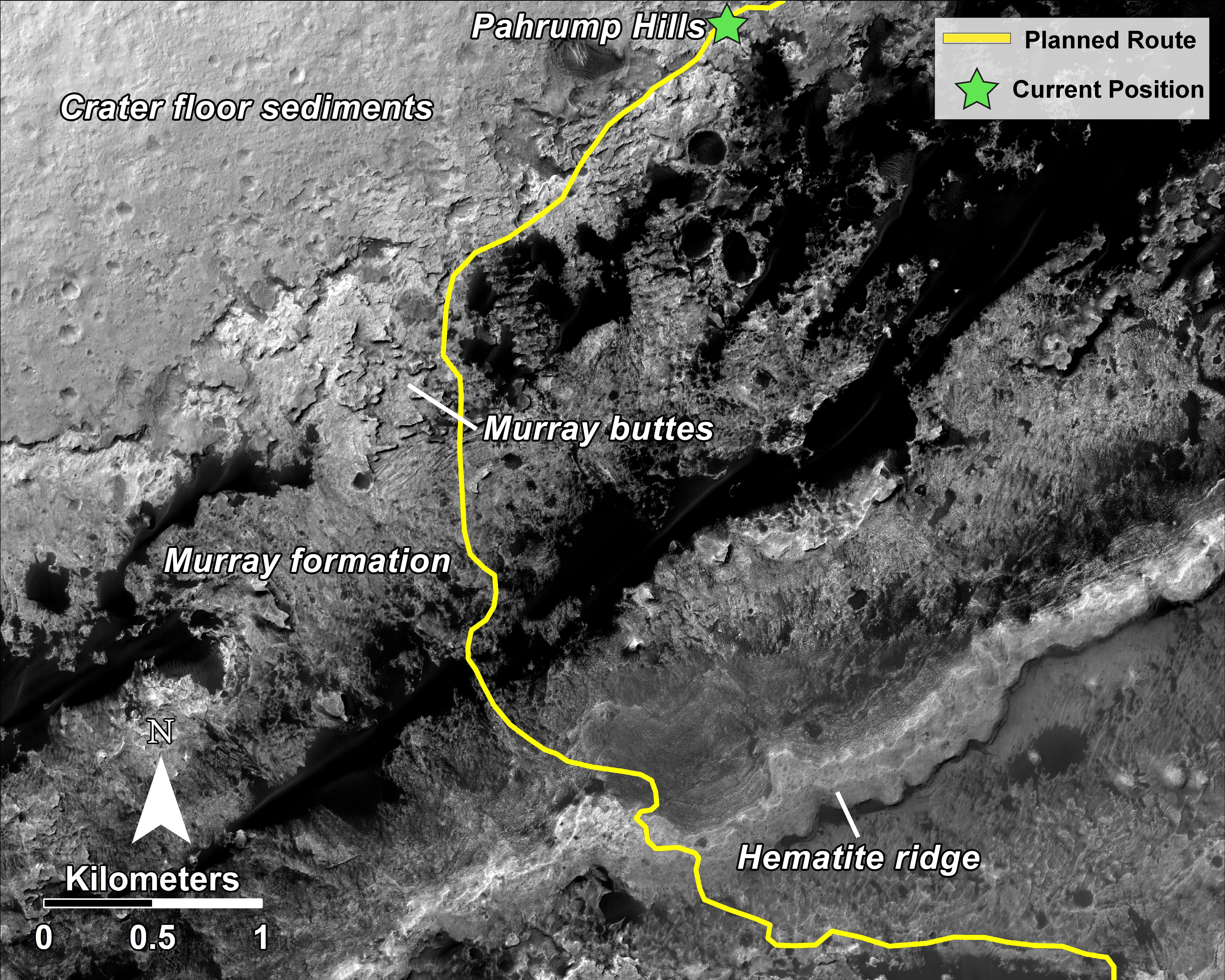
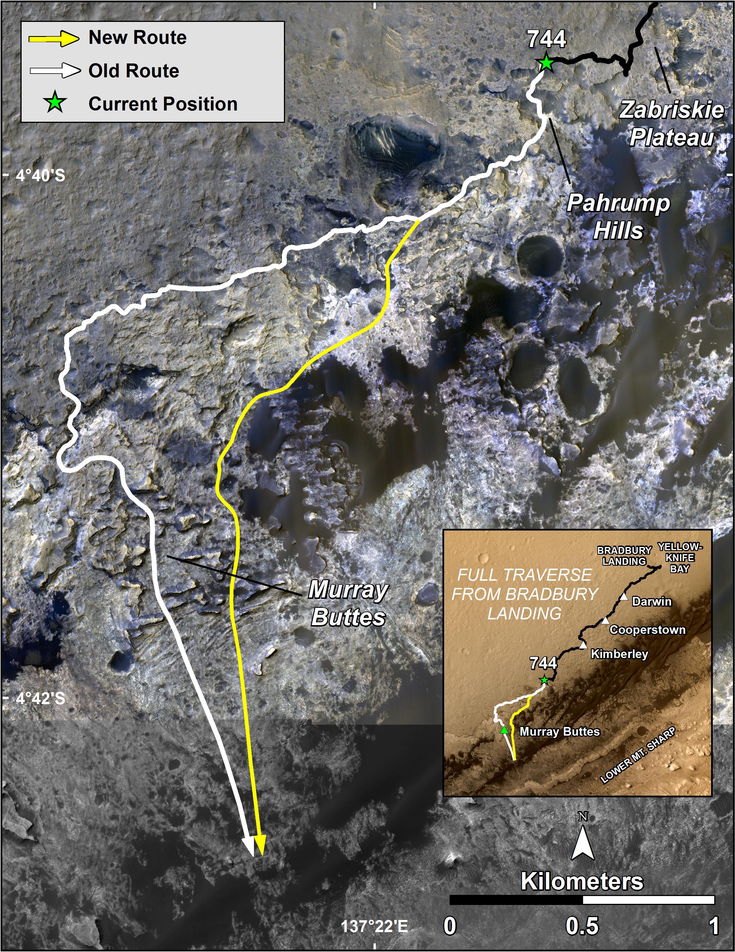
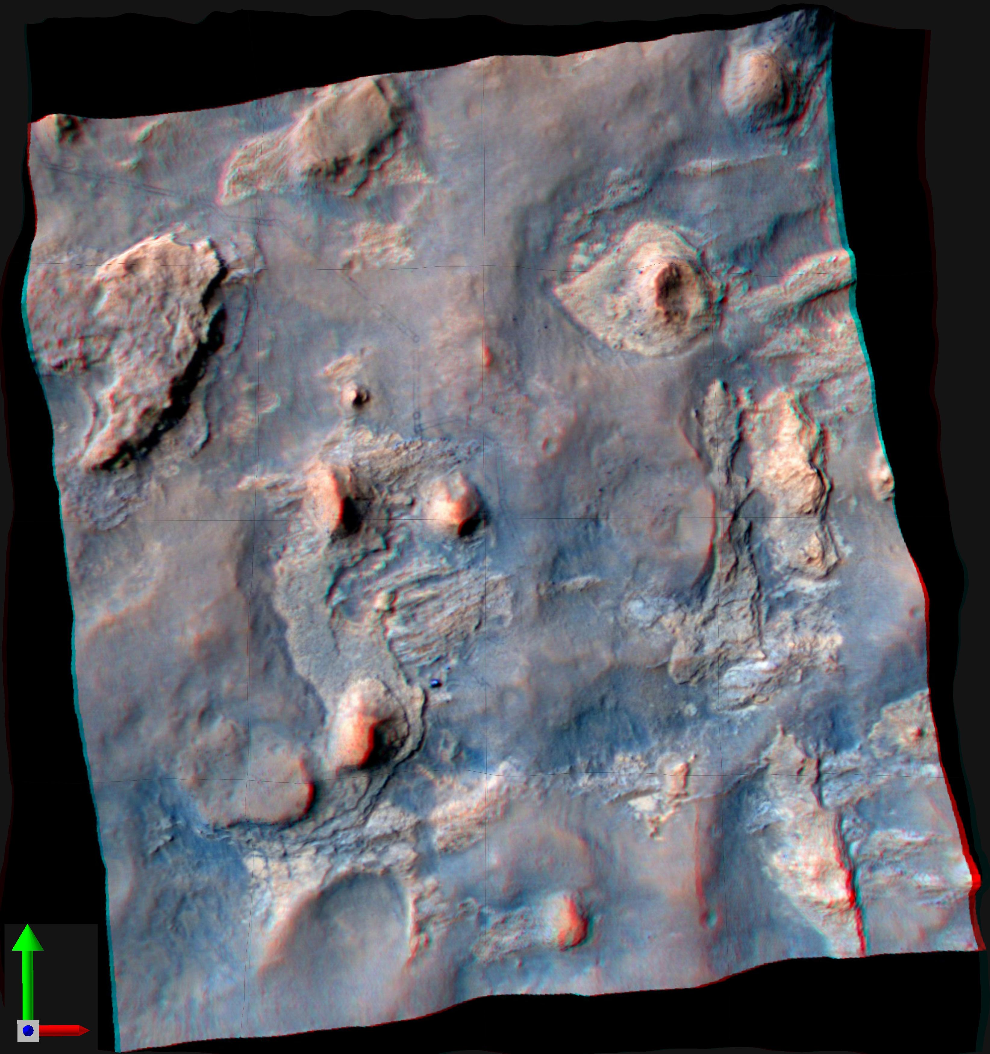
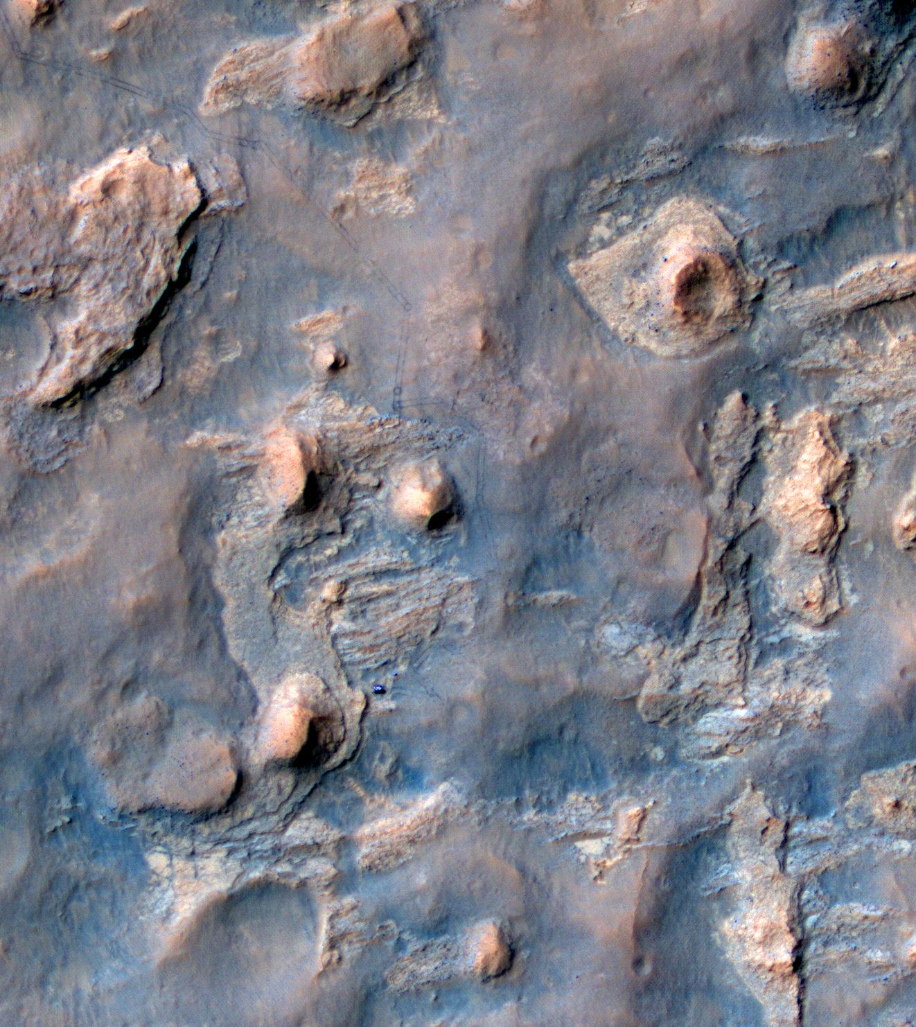
Curiosity Mars Rover's Route from Landing to Base of Mount Sharp
Full Resolution:
TIFF
(25.26 MB)
JPEG
(1.381 MB)
|
|
|
2014-11-25 |
Mars
|
Mars Science Laboratory (MSL)
|
Mastcam
|
4188x2799x3 |
|
-
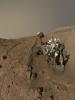
PIA19066:
-
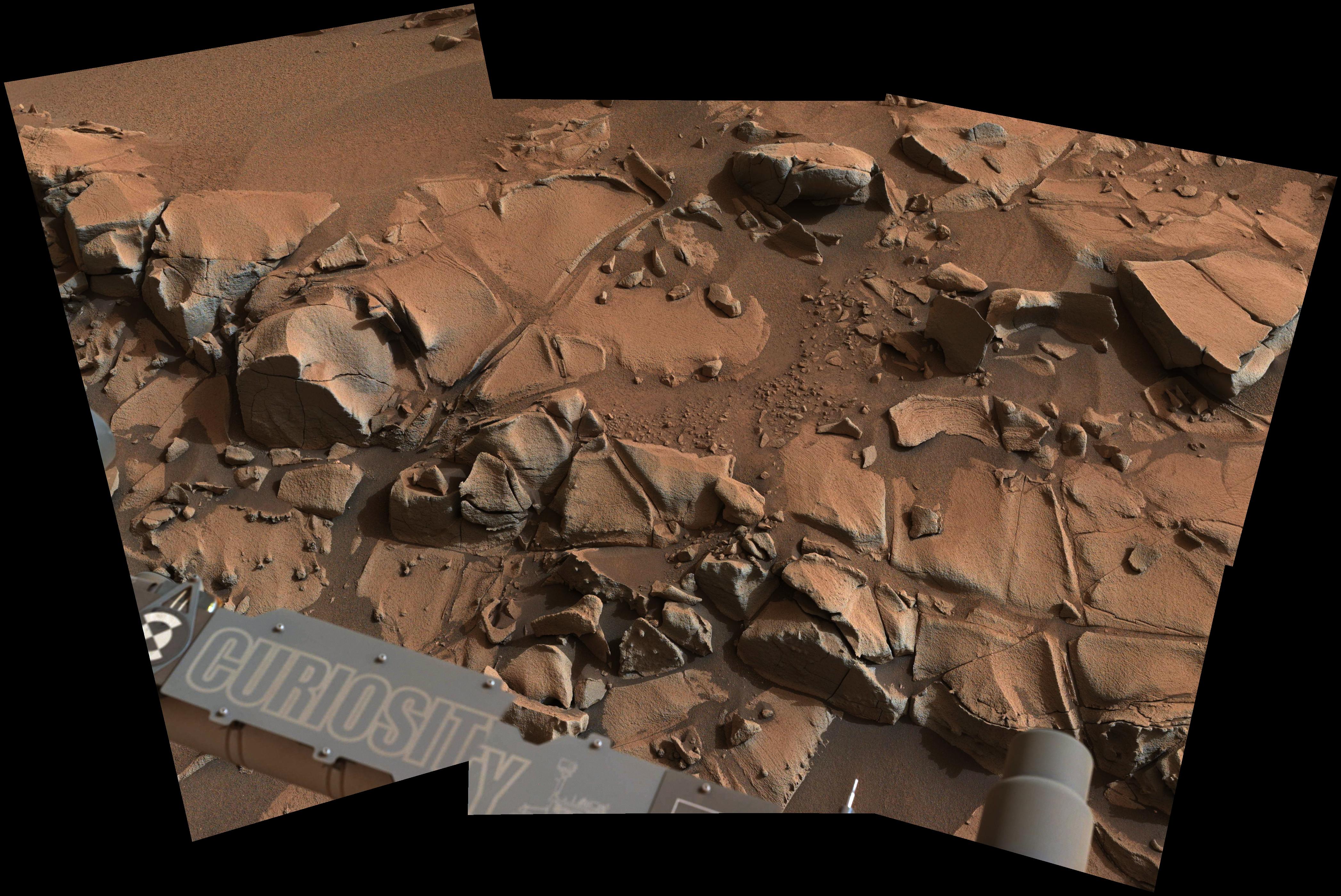
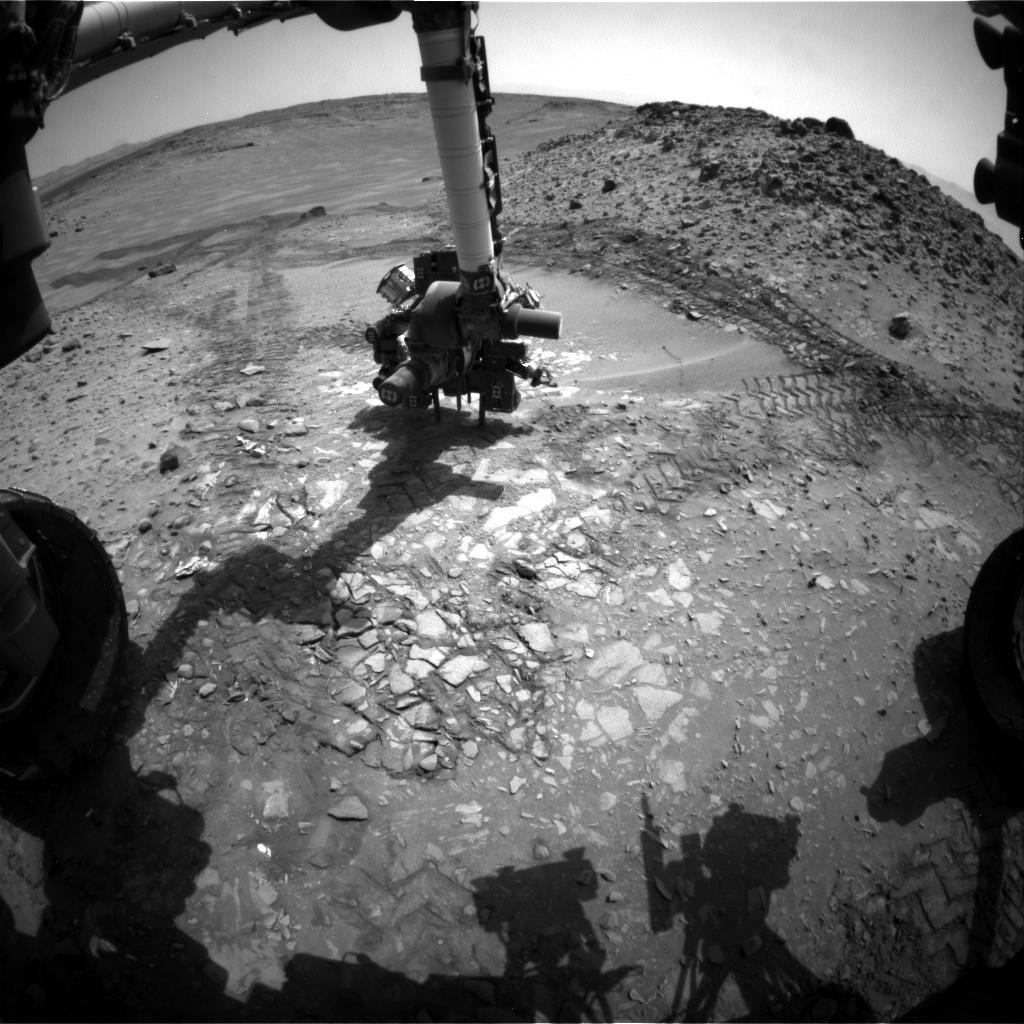
Within Rover's Reach at Mars Target Area 'Alexander Hills'
Full Resolution:
TIFF
(35.19 MB)
JPEG
(1.442 MB)
|
|
|
2014-11-18 |
Mars
|
Mars Science Laboratory (MSL)
|
Navcam (MSL)
|
1024x1024x1 |

|
-
PIA18883:
-
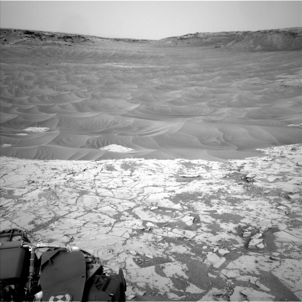
Ripples Beside 'Pahrump Hills' Outcrop at Base of Mount Sharp
Full Resolution:
TIFF
(1.05 MB)
JPEG
(179.2 kB)
|
|
|
2014-11-18 |
Mars
|
Mars Science Laboratory (MSL)
|
Mastcam
|
7501x2733x3 |
|
-
PIA18882:
-
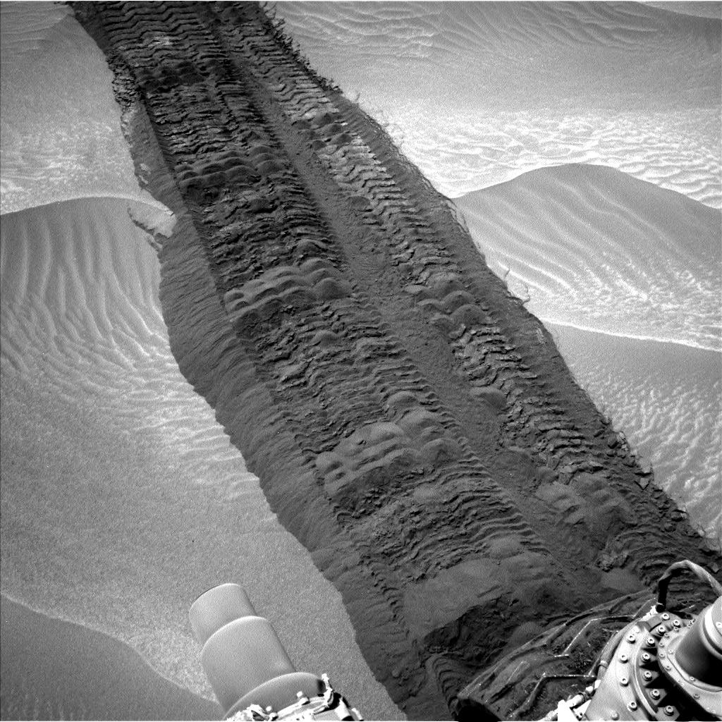
Ripple's Interior Exposed by Rover Wheel Track
Full Resolution:
TIFF
(61.52 MB)
JPEG
(2.514 MB)
|
|
|
2014-11-18 |
Mars
|
Mars Science Laboratory (MSL)
|
Mastcam
|
4185x2801x3 |
|
-
PIA18881:
-
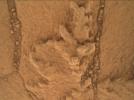
Fine-Grained, Finely Layered Rock at Base of Martian Mount Sharp
Full Resolution:
TIFF
(35.19 MB)
JPEG
(1.45 MB)
|
|
|
2014-11-18 |
Mars
|
Mars Science Laboratory (MSL)
|
Mastcam
|
3528x1304x3 |
|
-
PIA18880:
-
Erosion Resistance at 'Pink Cliffs' at Base of Martian Mount Sharp
Full Resolution:
TIFF
(13.81 MB)
JPEG
(1.094 MB)
|
|
|
2014-11-06 |
Mars
|
Mars Science Laboratory (MSL)
|
Mastcam
|
2040x1200x1 |

|
-
PIA19043:
-
Mars Curiosity Rover Views Comet Siding Spring

Full Resolution:
TIFF
(2.451 MB)
JPEG
(339.8 kB)
|
|
|
2014-11-04 |
Mars
|
Mars Science Laboratory (MSL)
|
Mastcam
|
4067x2184x3 |
|
-
PIA19039:
-
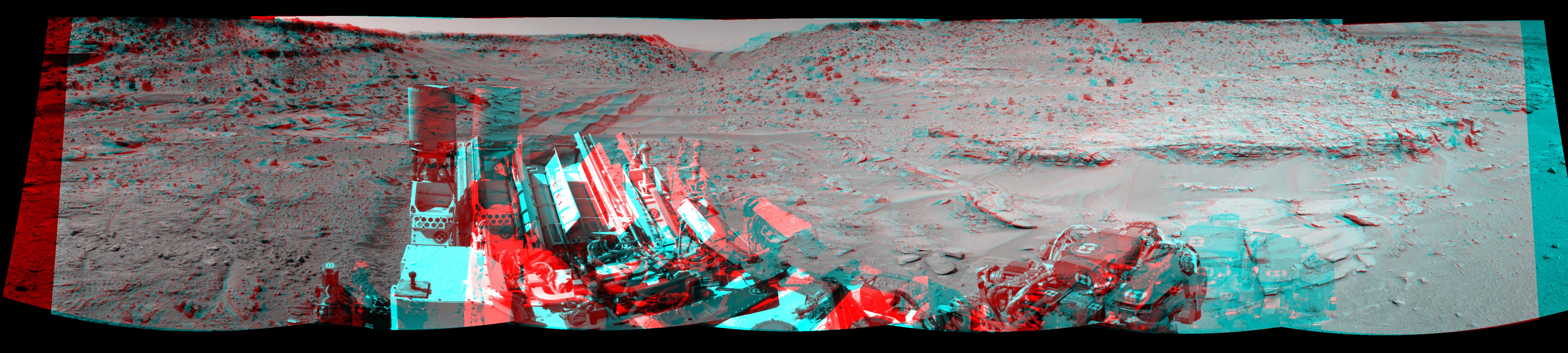
Mars Rover Curiosity's Walkabout at 'Pahrump Hills'
Full Resolution:
TIFF
(26.66 MB)
JPEG
(1.645 MB)
|
|
|
2014-11-04 |
Mars
|
Mars Science Laboratory (MSL)
|
CheMin
|
912x498x3 |
|
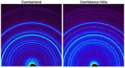
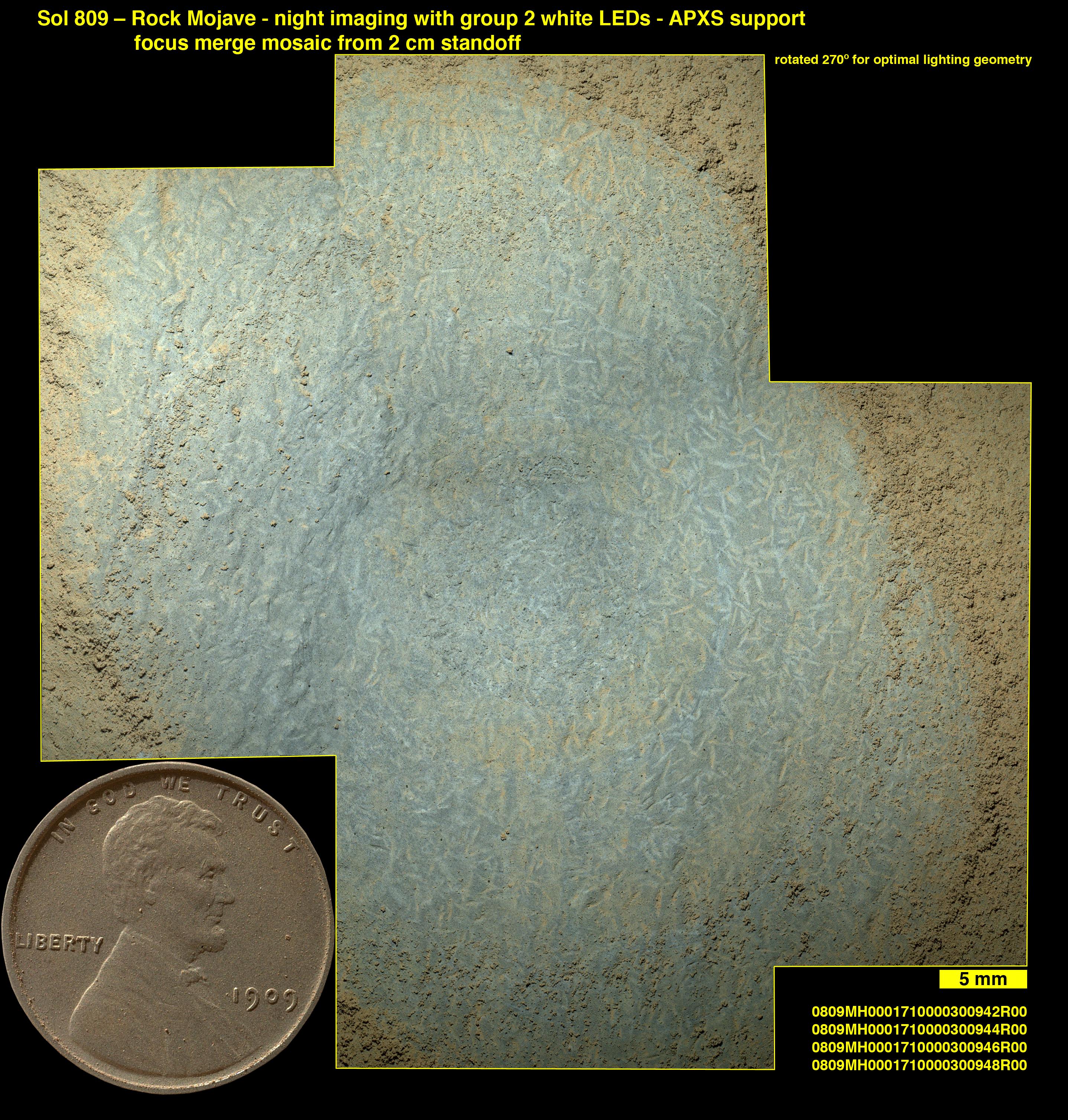
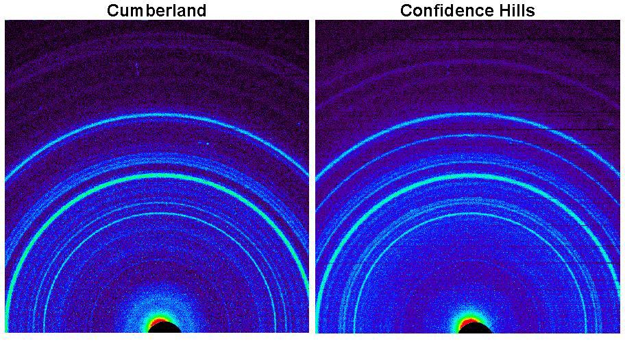
-
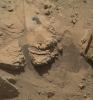
PIA19038:
-
Signature of Hematite in 'Confidence Hills' Martian Rock
Full Resolution:
TIFF
(1.363 MB)
JPEG
(142.3 kB)
|
|
|
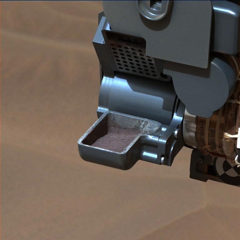
2014-11-04 |
Mars
|
Mars Science Laboratory (MSL)
|
Mastcam
|
768x768x3 |
|
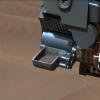
-
PIA19037:
-
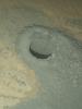
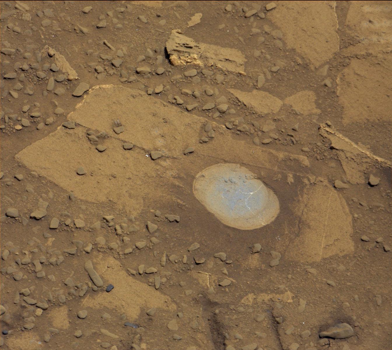
'Confidence Hills' Drill Powder in Scoop
Full Resolution:
TIFF
(1.77 MB)
JPEG
(48.85 kB)
|
|
|
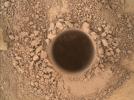
2014-11-04 |
Mars
|
Mars Science Laboratory (MSL)
|
Mastcam
|
1344x1200x3 |
|
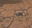
-
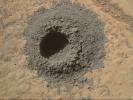
PIA19036:
-
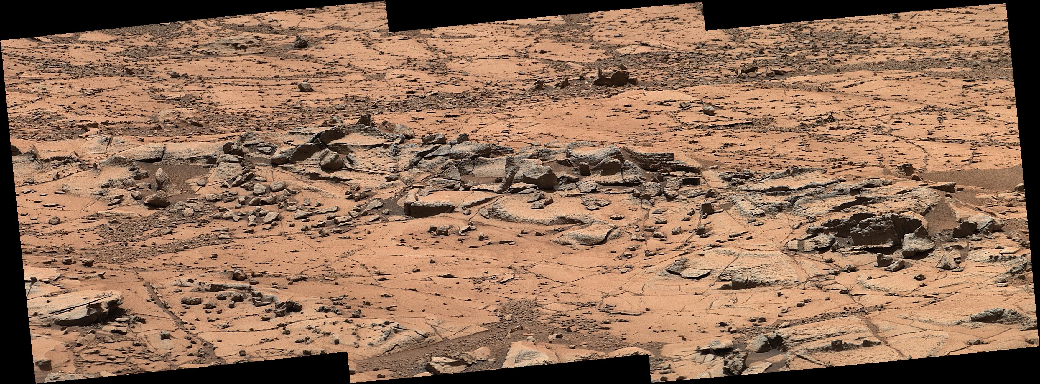
'Confidence Hills' -- The First Mount Sharp Drilling Site
Full Resolution:
TIFF
(4.84 MB)
JPEG
(233.4 kB)
|
|
|
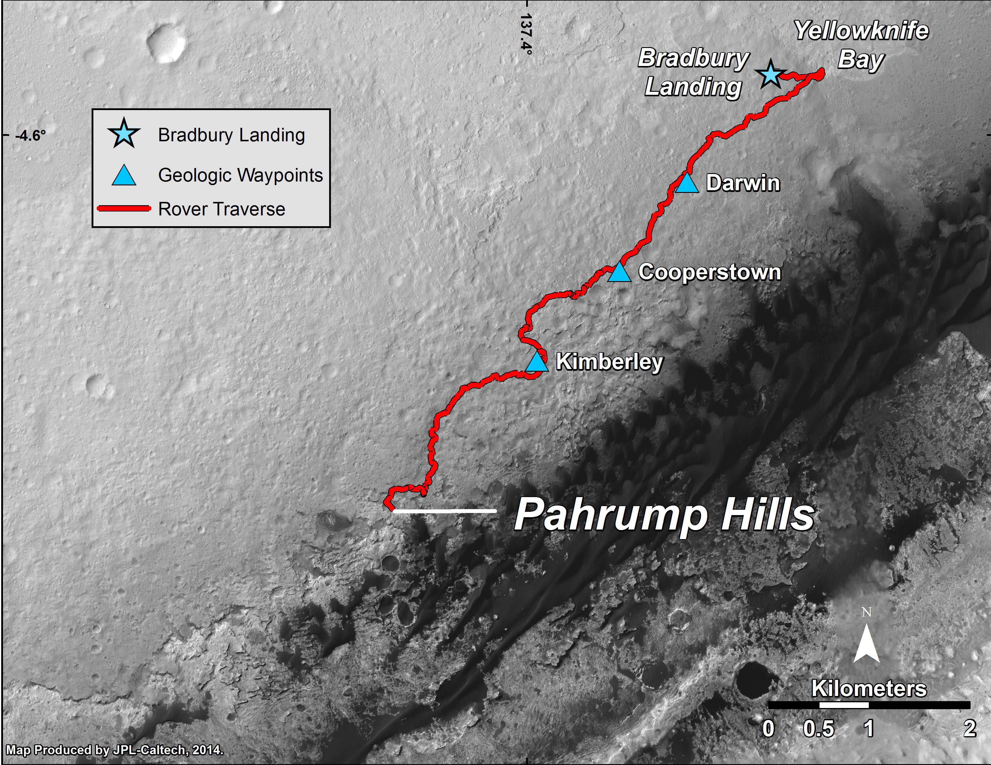
2014-09-25 |
Mars
|
Mars Science Laboratory (MSL)
|
MAHLI
|
1584x1184x3 |
|
-
PIA18610:
-
Resistant Features in 'Pahrump Hills' Outcrop
Full Resolution:
TIFF
(5.628 MB)
JPEG
(345.3 kB)
|
|
|
2014-09-25 |
Mars
|
Mars Science Laboratory (MSL)
|
MAHLI
|
1569x1170x3 |
|
-
PIA18609:
-
First Sampling Hole in Mount Sharp
Full Resolution:
TIFF
(5.509 MB)
JPEG
(530.7 kB)
|
|
|
2014-09-25 |
Mars
|
Mars Science Laboratory (MSL)
|
Mastcam
|
6886x2279x3 |
|
-
PIA18608:
-
Curiosity Mars Rover's Approach to 'Pahrump Hills'
Full Resolution:
TIFF
(47.1 MB)
JPEG
(2.455 MB)
|
|
|
2014-09-25 |
Mars
|
Mars Reconnaissance Orbiter (MRO)
Mars Science Laboratory (MSL)
|
HiRISE
|
3300x2550x3 |
|
-
PIA18607:
-
Curiosity Mars Rover's Route from Landing to 'Pahrump Hills'
Full Resolution:
TIFF
(25.26 MB)
JPEG
(1.571 MB)
|
|
|
2014-09-11 |
Mars
|
Mars Reconnaissance Orbiter (MRO)
Mars Science Laboratory (MSL)
|
HiRISE
|
3000x2400x3 |
|
-
PIA18785:
-
Geological Transition
Full Resolution:
TIFF
(21.61 MB)
JPEG
(2.032 MB)
|
|
|
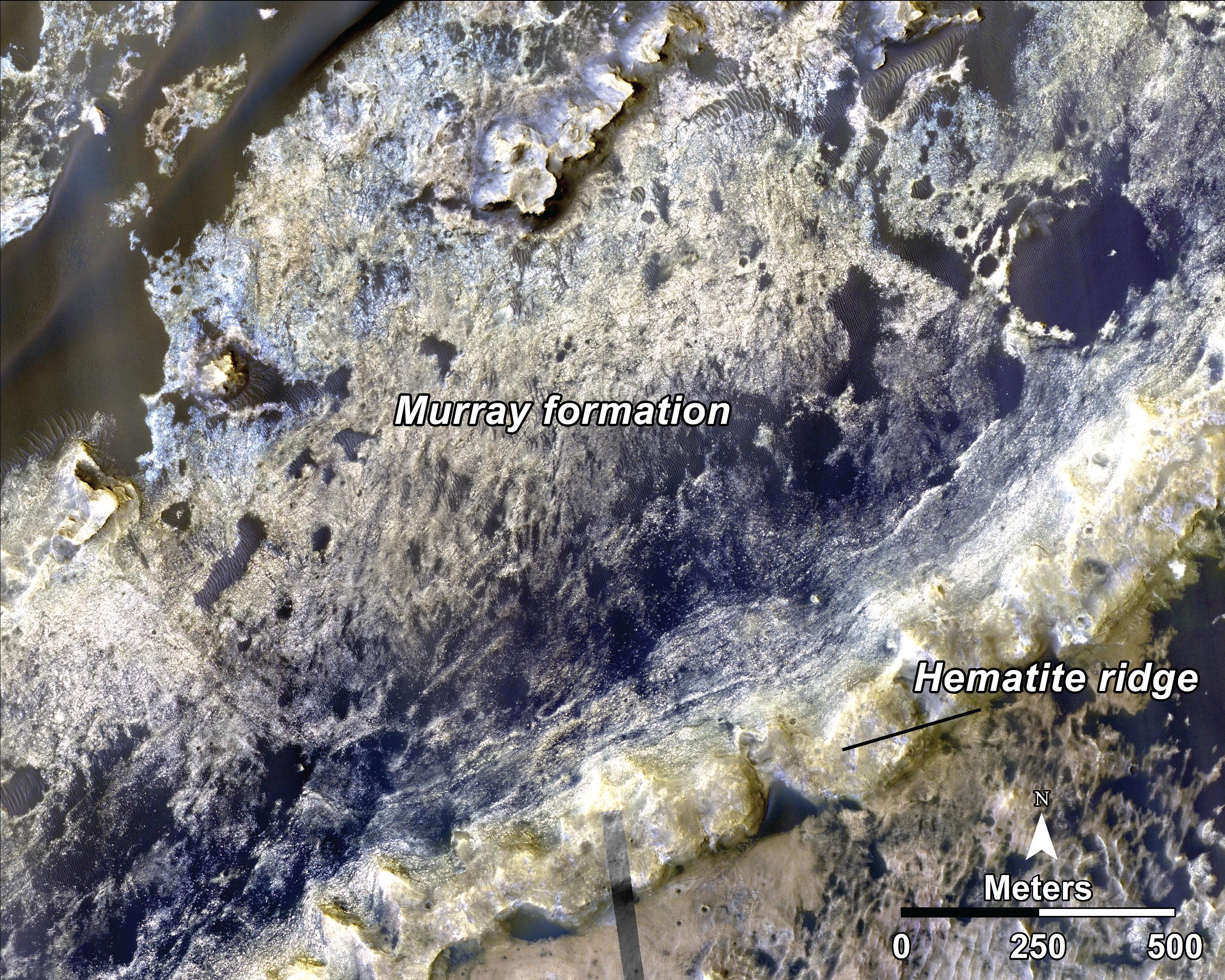
2014-09-11 |
Mars
|
Mars Reconnaissance Orbiter (MRO)
Mars Science Laboratory (MSL)
|
HiRISE
|
1927x1542x3 |

|
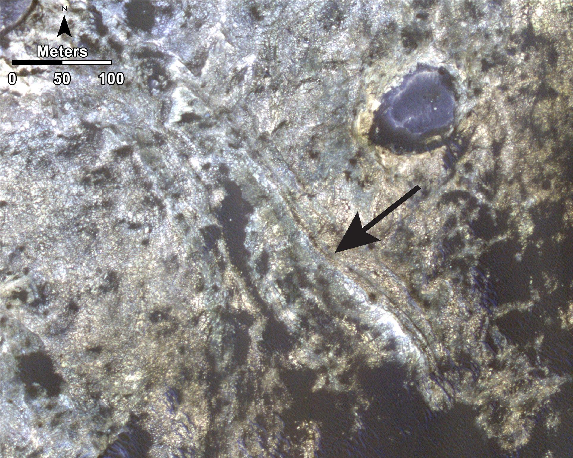
-
PIA18784:
-
Bands on the 'Murray Formation'
Full Resolution:
TIFF
(8.918 MB)
JPEG
(563 kB)
|
|
|
2014-09-11 |
Mars
|
Mars Reconnaissance Orbiter (MRO)
Mars Science Laboratory (MSL)
|
HiRISE
|
1927x1542x3 |
|
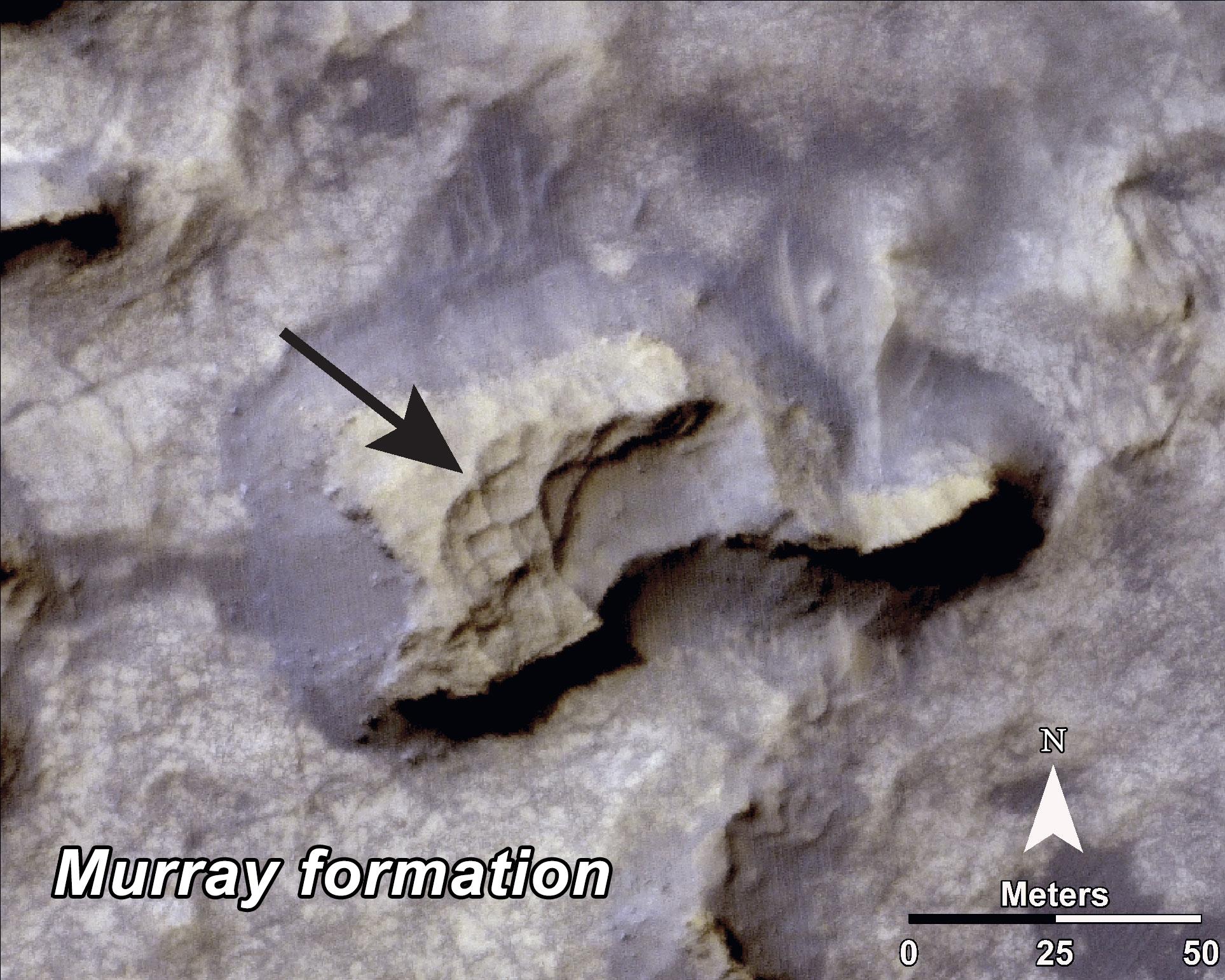
-
PIA18783:
-
'Murray Buttes' Mesa
Full Resolution:
TIFF
(8.918 MB)
JPEG
(471.3 kB)
|
|
|
2014-09-11 |
Mars
|
Mars Science Laboratory (MSL)
|
|
4200x1759x3 |
|
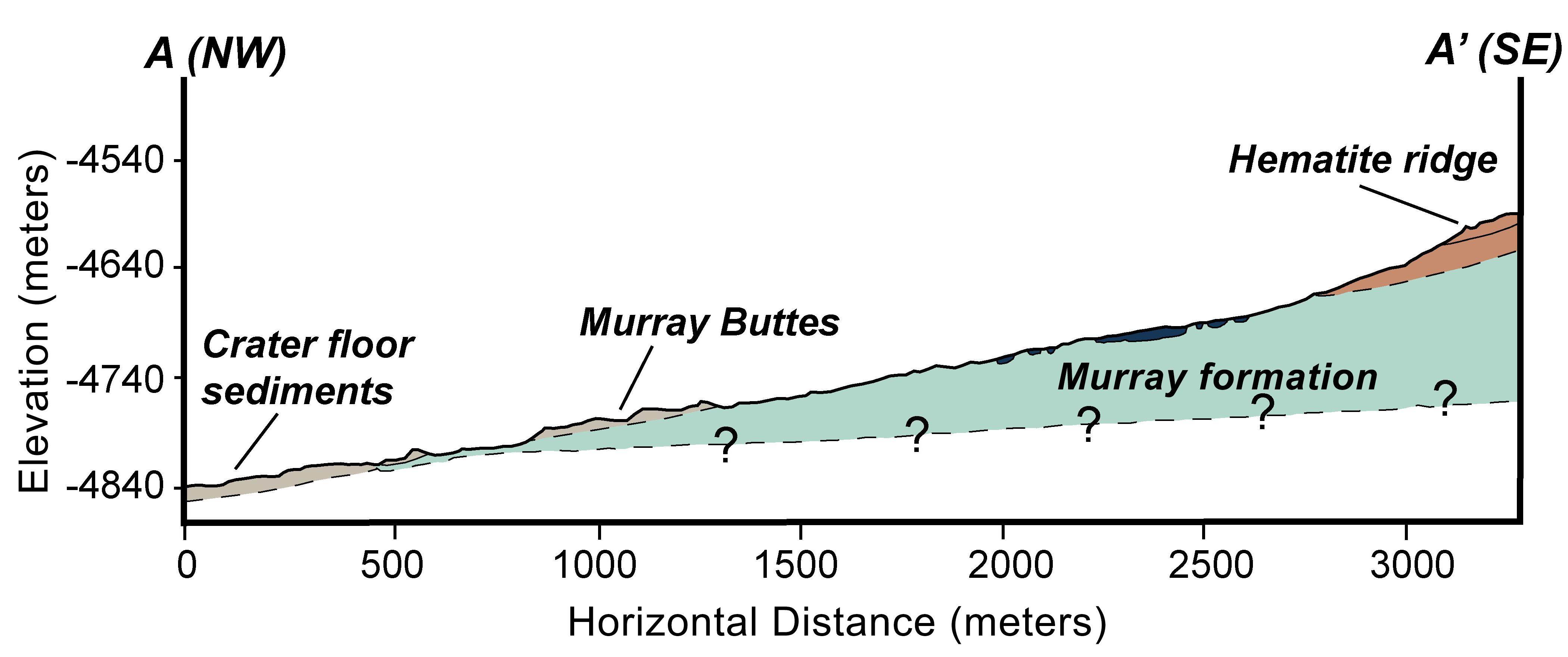
-
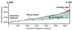
PIA18782:
-
Geologic Cross-Section
Full Resolution:
TIFF
(22.18 MB)
JPEG
(366.6 kB)
|
|
|
2014-09-11 |
Mars
|
Mars Reconnaissance Orbiter (MRO)
Mars Science Laboratory (MSL)
|
HiRISE
|
4173x3008x3 |
|
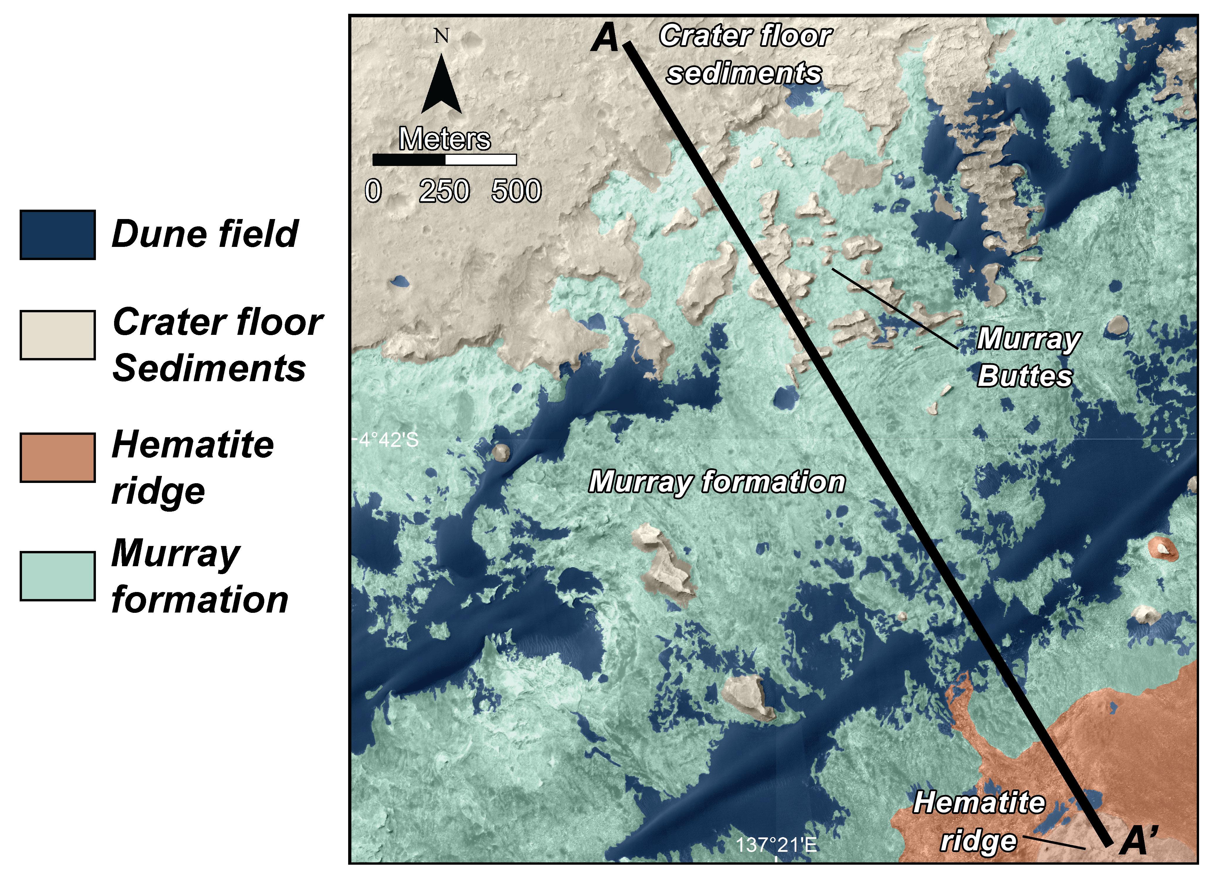
-
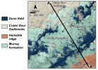
PIA18781:
-
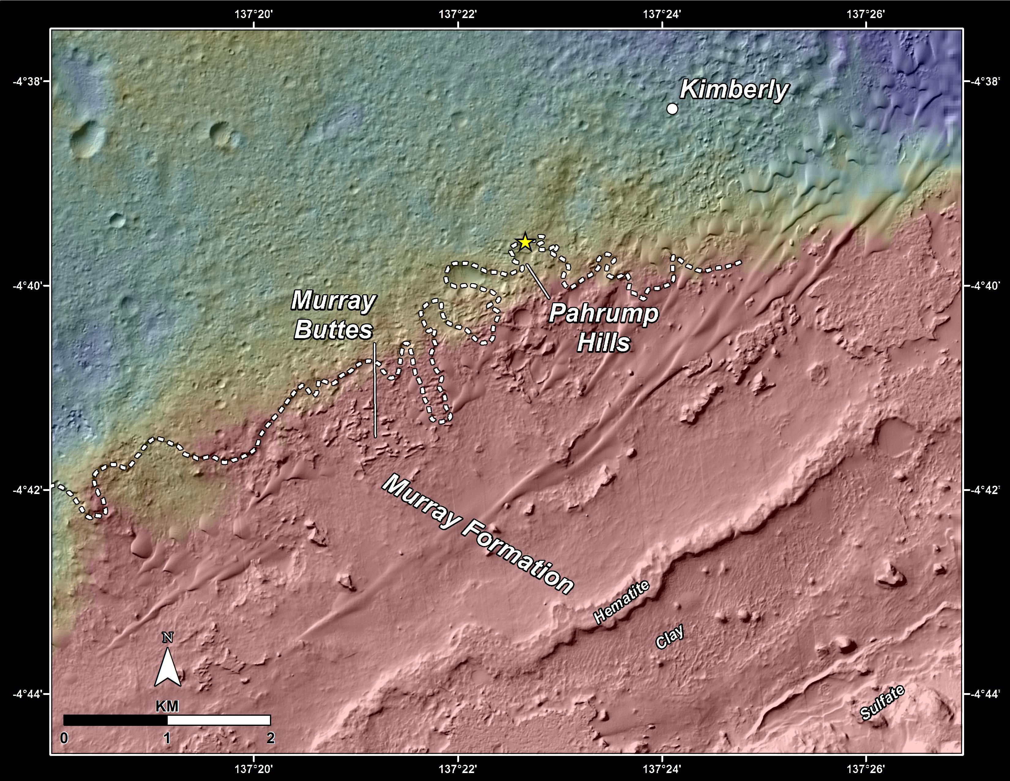
Map of Lower Mount Sharp
Full Resolution:
TIFF
(37.68 MB)
JPEG
(1.64 MB)
|
|
|
2014-09-11 |
Mars
|
Mars Reconnaissance Orbiter (MRO)
Mars Science Laboratory (MSL)
|
HiRISE
|
4890x3912x3 |
|
-
PIA18780:
-
Curiosity Rover Planned Route
Full Resolution:
TIFF
(57.42 MB)
JPEG
(3.739 MB)
|
|
|
2014-09-11 |
Mars
|
Mars Science Laboratory (MSL)
|
Alpha Particle X-ray Spectrometer
|
1530x1032x3 |
|
-
PIA18479:
-
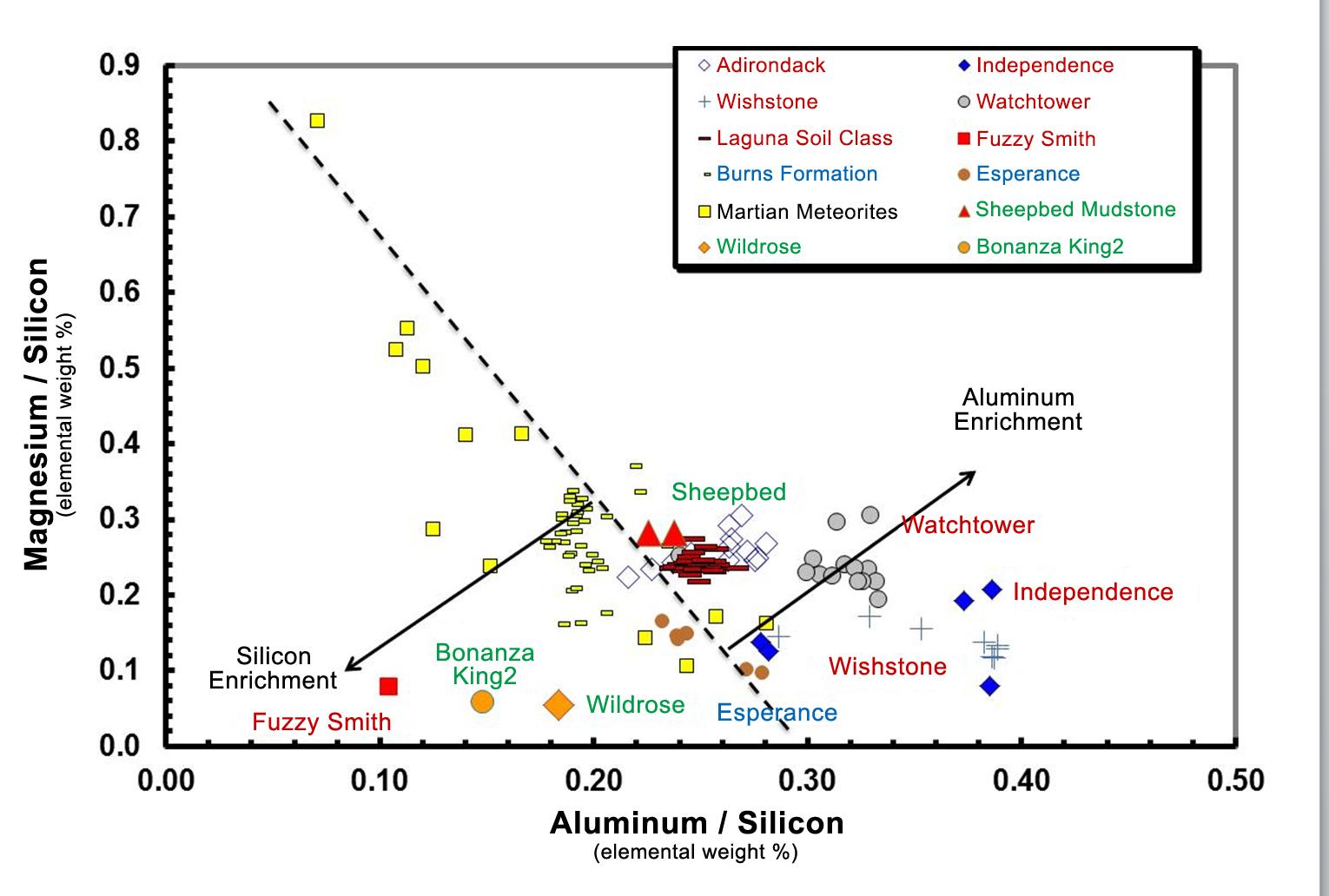
Martian Rocks Rich in Silicon
Full Resolution:
TIFF
(4.739 MB)
JPEG
(134.6 kB)
|
|
|
2014-09-11 |
Mars
|
Mars Science Laboratory (MSL)
|
Mastcam
|
1319x1187x3 |

|
-
PIA18478:
-
Loose Rock Leads to Incomplete Drilling
Full Resolution:
TIFF
(4.699 MB)
JPEG
(278.6 kB)
|
|
|
2014-09-11 |
Mars
|
Mars Science Laboratory (MSL)
|
Mastcam
|
1315x1179x3 |
|
-
PIA18477:
-
A Bonanza of Clues About Mars
Full Resolution:
TIFF
(4.653 MB)
JPEG
(253.2 kB)
|
|
|
2014-09-11 |
Mars
|
Mars Science Laboratory (MSL)
|
Mastcam
|
2102x984x3 |
|
-
PIA18476:
-
Martian Layers Thicker on Top
Full Resolution:
TIFF
(6.208 MB)
JPEG
(479.9 kB)
|
|
|
2014-09-11 |
Mars
|
Mars Reconnaissance Orbiter (MRO)
Mars Science Laboratory (MSL)
|
HiRISE
|
2550x3300x3 |
|
-
PIA18475:
-
Curiosity's Next Steps
Full Resolution:
TIFF
(25.25 MB)
JPEG
(1.735 MB)
|
|
|
2014-09-11 |
Mars
|
Mars Reconnaissance Orbiter (MRO)
Mars Science Laboratory (MSL)
|
HiRISE
|
3300x2550x3 |

|
-
PIA18474:
-
Slopes of Mount Sharp
Full Resolution:
TIFF
(25.26 MB)
JPEG
(1.023 MB)
|
|
|
2014-09-11 |
Mars
|
Mars Science Laboratory (MSL)
|
Mastcam
|
6612x1241x3 |

|
-
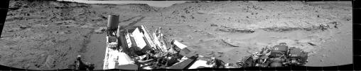
PIA18473:
Curiosity Marches Onward and Upward
Full Resolution:
TIFF
(24.63 MB)
JPEG
(1.424 MB)
|
|
|
2014-08-22 |
Mars
|
Mars Science Laboratory (MSL)
|
Hazcam (MSL)
|
1024x1024x1 |
|
-
PIA18603:
-
Candidate Drilling Target on Mars Doesn't Pass Exam
Full Resolution:
TIFF
(1.05 MB)
JPEG
(156.7 kB)
|
|
|
2014-08-18 |
Mars
|
Mars Science Laboratory (MSL)
|
Mastcam
|
1344x1200x3 |
|
-
PIA18602:
-
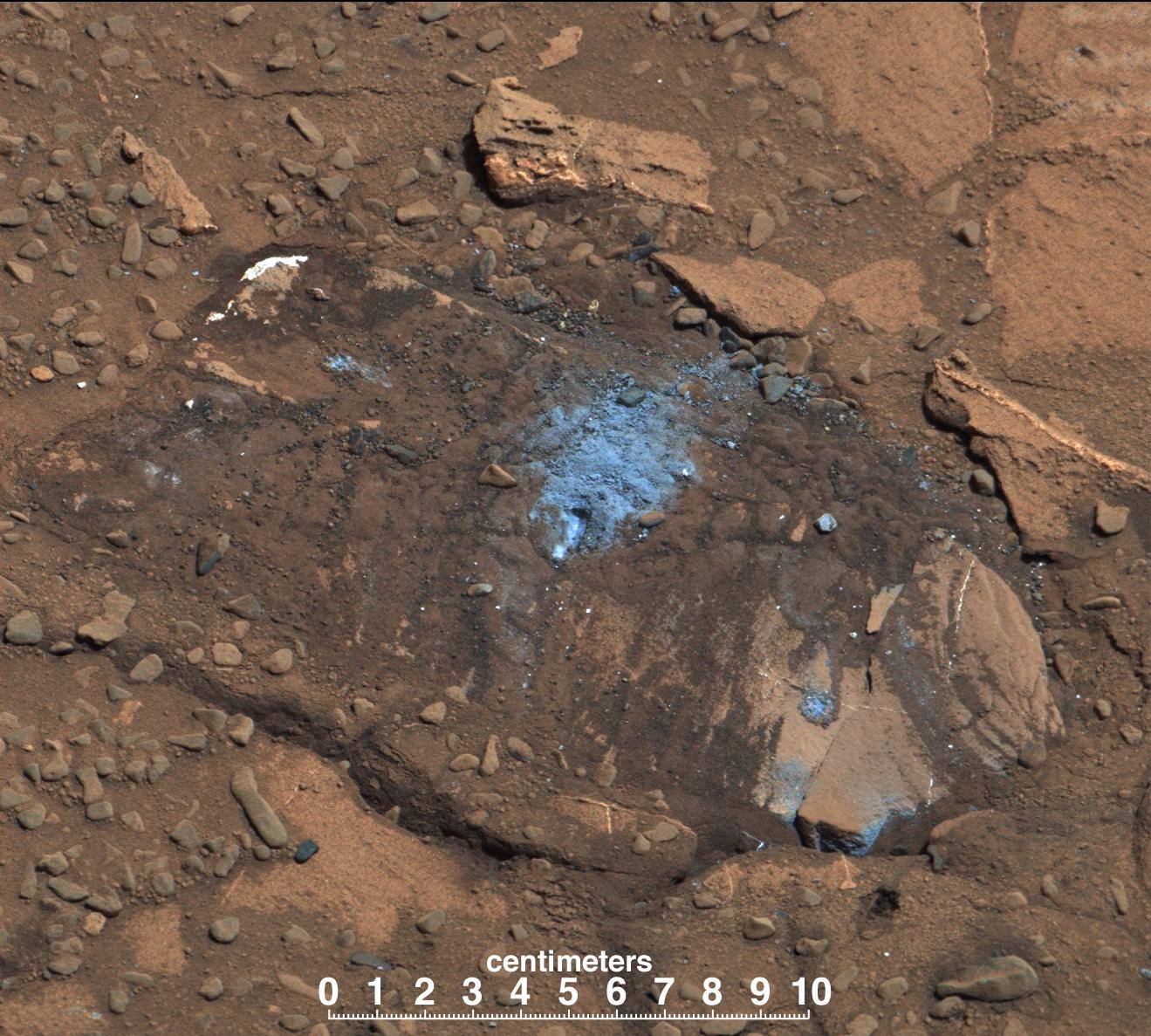
Curiosity's Brushwork on Martian 'Bonanza King' Target
Full Resolution:
TIFF
(4.84 MB)
JPEG
(259.3 kB)
|
|
|
2014-08-15 |
Mars
|
Mars Science Laboratory (MSL)
|
Mastcam
|
1344x804x3 |
|
-
PIA18601:
-
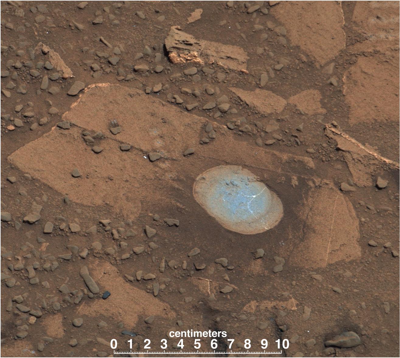
Drilling Candidate Site 'Bonanza King' on Mars
Full Resolution:
TIFF
(3.243 MB)
JPEG
(167.7 kB)
|
|
|
2014-08-15 |
Mars
|
Mars Science Laboratory (MSL)
|
Navcam (MSL)
|
1024x1024x1 |
|
-
PIA18600:
-
View Down 'Hidden Valley' Ramp at 'Bonanza King' on Mars
Full Resolution:
TIFF
(1.05 MB)
JPEG
(151.1 kB)
|
|
|
2014-08-15 |
Mars
|
Mars Science Laboratory (MSL)
|
Navcam (MSL)
|
1024x1024x1 |

|
-
PIA18599:
-
Down Northeastern Ramp into 'Hidden Valley' on Mars
Full Resolution:
TIFF
(1.05 MB)
JPEG
(210.8 kB)
|
|
|
2014-08-15 |
Mars
|
Mars Science Laboratory (MSL)
|
Navcam (MSL)
|
1024x448x1 |
|
-
PIA18597:
-
Looking Up the Ramp Holding 'Bonanza King' on Mars
Full Resolution:
TIFF
(459.4 kB)
JPEG
(112 kB)
|
|
|
2014-08-05 |
Mars
|
Mars Science Laboratory (MSL)
|
Navcam (MSL)
|
1024x1024x1 |

|
-
PIA18590:
-
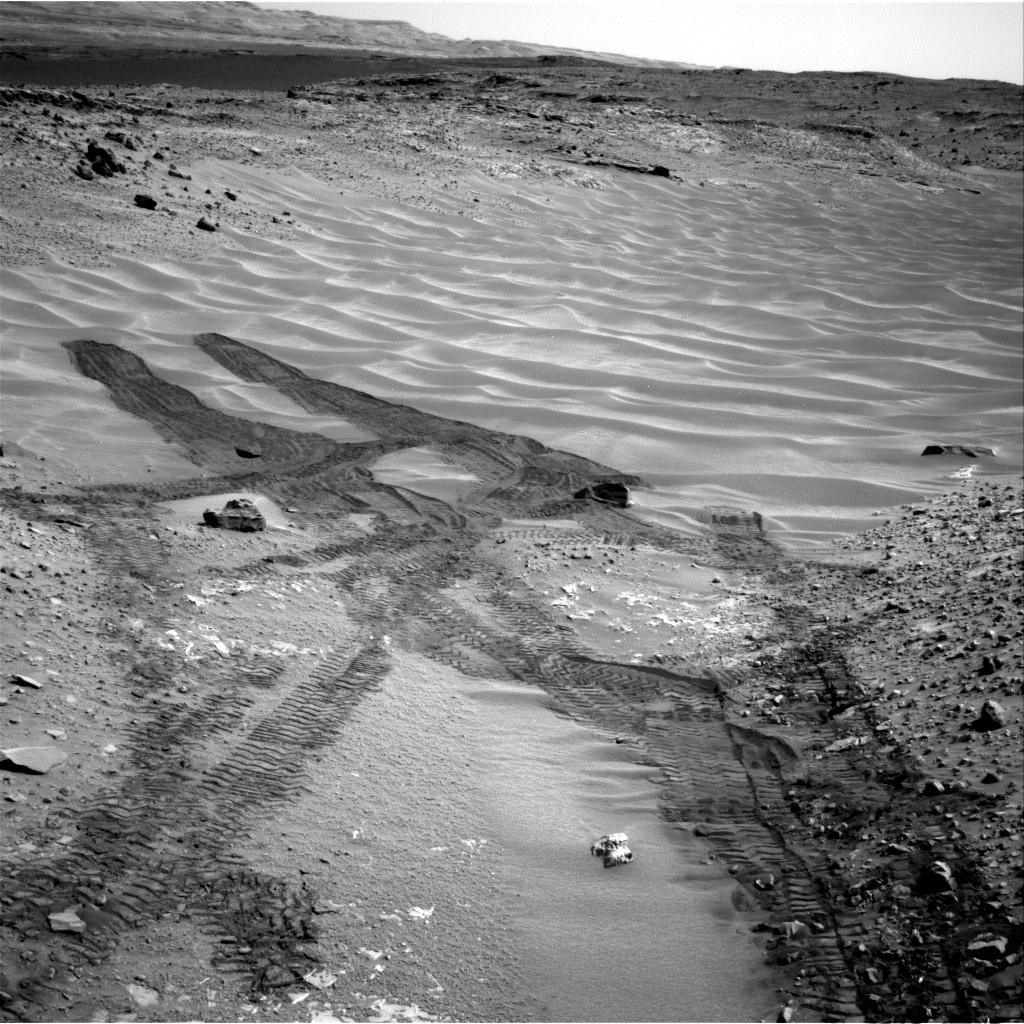
Curiosity Tracks in 'Hidden Valley' on Mars
Full Resolution:
TIFF
(1.05 MB)
JPEG
(233 kB)
|
|
|
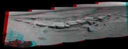
2014-08-01 |
Mars
|
Mars Science Laboratory (MSL)
|
Panoramic Camera
|
7696x1750x1 |
|
-
PIA18409:
Curiosity's 360-Degree View Before Entering 'Hidden Valley'
Full Resolution:
TIFF
(13.48 MB)
JPEG
(1.506 MB)
|
|
|
2014-08-01 |
Mars
|
Mars Reconnaissance Orbiter (MRO)
Mars Science Laboratory (MSL)
|
HiRISE
|
3300x2550x3 |
|
-
PIA18408:
-
Sandy Martian Valleys in Curiosity's Near Future
Full Resolution:
TIFF
(25.26 MB)
JPEG
(1.213 MB)
|
|
|
2014-07-16 |
Mars
|
Mars Science Laboratory (MSL)
|
MAHLI
|
744x540x3 |
|
-
PIA18401:
-
First Imaging of Laser-Induced Spark on Mars
Full Resolution:
TIFF
(1.206 MB)
JPEG
(114.6 kB)
|
|
|
2014-07-16 |
Mars
|
Mars Science Laboratory (MSL)
|
ChemCam
MAHLI
|
1590x1060x3 |
|
-
PIA18388:
-
Curiosity's ChemCam Examines Mars Rock Target 'Nova'
Full Resolution:
TIFF
(5.058 MB)
JPEG
(162.9 kB)
|
|
|
2014-07-15 |
Mars
|
Mars Science Laboratory (MSL)
|
ChemCam
Mastcam
|
8830x4230x3 |
|
-
PIA18387:
-
Curiosity Finds Iron Meteorite on Mars
Full Resolution:
TIFF
(112.1 MB)
JPEG
(3.279 MB)
|
|
|
2014-07-09 |
Mars
|
Mars Science Laboratory (MSL)
|
ChemCam
|
3235x2842x3 |
|
-
PIA18396:
-
Martian Rock and Dust Filling Studied with Laser and Camera
Full Resolution:
TIFF
(27.59 MB)
JPEG
(821.6 kB)
|
|
|
2014-06-23 |
Mars
|
Mars Science Laboratory (MSL)
|
HiRISE
|
3300x2550x3 |
|
-
PIA18392:
-
Curiosity Rover's Traverse, First 663 Sols on Mars
Full Resolution:
TIFF
(25.26 MB)
JPEG
(1.455 MB)
|
|
|
2014-06-23 |
Mars
|
Mars Science Laboratory (MSL)
|
HiRISE
|
3300x2550x3 |

|
-
PIA18391:
-
Curiosity's Progress on Route to Mount Sharp
Full Resolution:
TIFF
(25.26 MB)
JPEG
(1.565 MB)
|
|
|
2014-06-23 |
Mars
|
Mars Science Laboratory (MSL)
|
MAHLI
|
7072x9424x3 |
|
-
PIA18390:
-
Curiosity Self-Portrait at 'Windjana' Drilling Site
Full Resolution:
TIFF
(200 MB)
JPEG
(5.43 MB)
|
|
|
2014-06-10 |
Mercury
|
Mars Science Laboratory (MSL)
|
Mastcam
|
1280x256x1 |
|
-
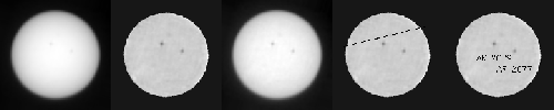
PIA18389:
Mercury Transit of the Sun, Seen From Mars
Full Resolution:
TIFF
(328.2 kB)
JPEG
(21.61 kB)
|
|
|
2014-05-15 |
Mars
|
Mars Science Laboratory (MSL)
|
MAHLI
|
1184x1272x3 |
|
-
PIA18092:
-
Mars Rock 'Windjana' After Examination
Full Resolution:
TIFF
(4.52 MB)
JPEG
(331 kB)
|
|
|
2014-05-15 |
Mars
|
Mars Science Laboratory (MSL)
|
MAHLI
|
1181x1580x3 |
|
-
PIA18091:
-
Nighttime Image of Laser Sharpshooting on Mars
Full Resolution:
TIFF
(5.6 MB)
JPEG
(418.9 kB)
|
|
|
2014-05-06 |
Mars
|
Mars Science Laboratory (MSL)
|
Navigation Camera
|
598x293x1 |
|
-
PIA18090:
-
Sample-Collection Drill Hole on Martian Sandstone Target 'Windjana'
Full Resolution:
TIFF
(175.6 kB)
JPEG
(42.97 kB)
|
|
|
2014-04-30 |
Mars
|
Mars Science Laboratory (MSL)
|
MAHLI
|
1593x1200x3 |
|
-
PIA18089:
-
Preparatory Drilling Test on Martian Target 'Windjana'
Full Resolution:
TIFF
(5.737 MB)
JPEG
(401.4 kB)
|
|
|
2014-04-29 |
Mars
|
Mars Science Laboratory (MSL)
|
MAHLI
|
1588x1184x3 |
|
-
PIA18088:
-
Martian Sandstone Target "Windjana" Before and After Brushing
Full Resolution:
TIFF
(1.884 MB)
JPEG
(741.4 kB)
|
|
|
2014-04-25 |
Mars
|
Mars Science Laboratory (MSL)
|
Mastcam
|
2724x2031x3 |
|
-
PIA18087:
-
Sandstone Target 'Windjana' May Be Next Martian Drilling Site
Full Resolution:
TIFF
(16.6 MB)
JPEG
(899.8 kB)
|
|
|
2014-04-25 |
Mars
|
Mars Science Laboratory (MSL)
|
Navcam (MSL)
|
1024x892x1 |
|
-
PIA18086:
-
Curiosity Mars Rover Beside Sandstone Target 'Windjana'
Full Resolution:
TIFF
(914.5 kB)
JPEG
(171.2 kB)
|
|
|
2014-04-24 |
Ceres
|
Mars Science Laboratory (MSL)
|
Mastcam
|
768x576x1 |
|
-
PIA17937:
-
First Asteroid Image from the Surface of Mars
Full Resolution:
TIFF
(443 kB)
JPEG
(121.2 kB)
|
|
|
2014-04-16 |
Mars
|
Mars Science Laboratory (MSL)
|
Navcam (MSL)
|
3612x1155x3 |
|
-
PIA18084:
-
Stereo View of 'Mount Remarkable' and Surrounding Outcrops at Mars Rover's Waypoint
Full Resolution:
TIFF
(12.52 MB)
JPEG
(697.9 kB)
|
|
|
2014-04-16 |
Mars
|
Mars Science Laboratory (MSL)
|
Navcam (MSL)
|
3595x1737x1 |
|
-
PIA18083:
-
'Mount Remarkable' and Surrounding Outcrops at Mars Rover's Waypoint
Full Resolution:
TIFF
(6.252 MB)
JPEG
(882.7 kB)
|
|
|
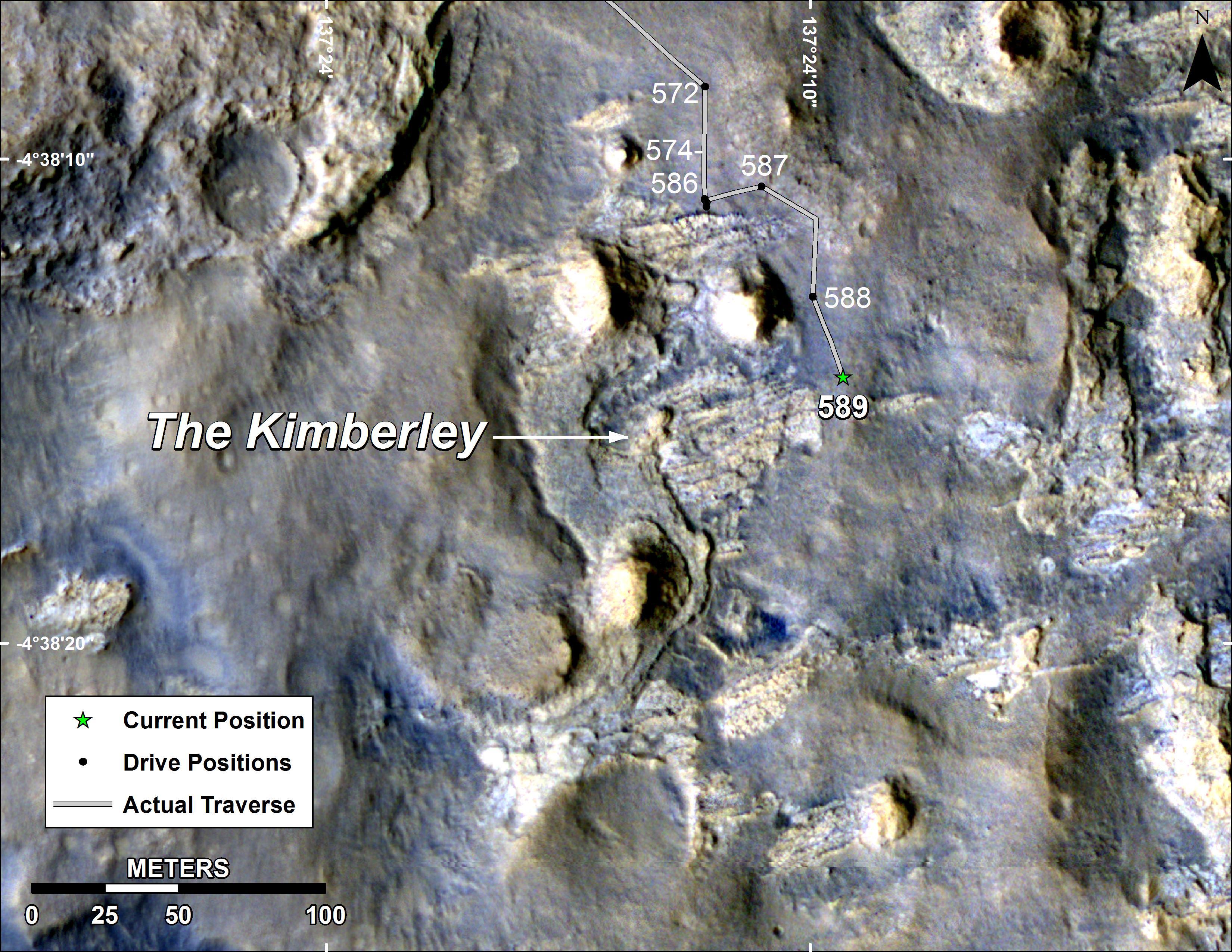
2014-04-16 |
Mars
|
Mars Reconnaissance Orbiter (MRO)
Mars Science Laboratory (MSL)
|
HiRISE
|
3287x3497x3 |
|
-
PIA18082:
-
Stereo View of Curiosity and Rover Tracks at 'the Kimberley,' April 2014
Full Resolution:
TIFF
(34.5 MB)
JPEG
(791.9 kB)
|
|
|
2014-04-16 |
Mars
|
Mars Reconnaissance Orbiter (MRO)
Mars Science Laboratory (MSL)
|
HiRISE
|
1322x1482x3 |
|
-
PIA18081:
-
Curiosity and Rover Tracks at 'the Kimberley,' April 2014
Full Resolution:
TIFF
(5.88 MB)
JPEG
(347.6 kB)
|
|
|
2014-04-08 |
Mars
|
Mars Science Laboratory (MSL)
|
Navcam (MSL)
|
1024x1024x1 |
|
-
PIA18077:
-
Bright Spot Toward Sun in Image from NASA's Curiosity Mars Rover
Full Resolution:
TIFF
(1.05 MB)
JPEG
(152.5 kB)
|
|
|
2014-04-03 |
Mars
|
Mars Science Laboratory (MSL)
|
HiRISE
|
3300x2550x3 |
|
-
PIA18076:
-
Curiosity Mars Rover's Route from Landing to 'The Kimberley' Waypoint
Full Resolution:
TIFF
(25.26 MB)
JPEG
(1.23 MB)
|
|
|
2014-04-03 |
Mars
|
Mars Science Laboratory (MSL)
|
HiRISE
|
3300x2550x3 |
|
-
PIA18075:
-
Map of Curiosity Mars Rover's Drives to 'the Kimberley' Waypoint
Full Resolution:
TIFF
(25.26 MB)
JPEG
(1.265 MB)
|
|
|
2014-04-03 |
Mars
|
Mars Science Laboratory (MSL)
|
Navcam (MSL)
|
2338x1111x3 |
|
-
PIA18074:
-
Curiosity's View From Arrival Point at 'The Kimberley' Waypoint (Stereo)
Full Resolution:
TIFF
(7.796 MB)
JPEG
(446.6 kB)
|
|
|
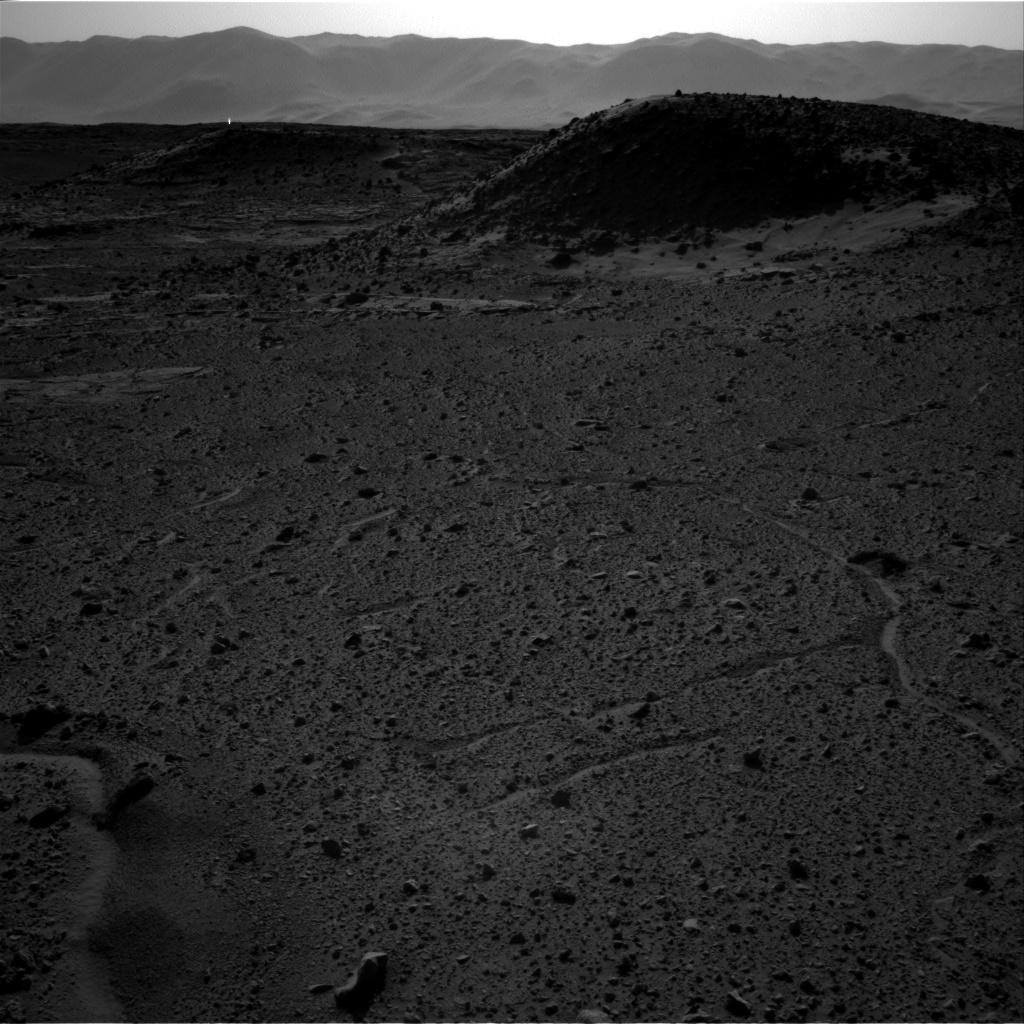
2014-04-03 |
Mars
|
Mars Science Laboratory (MSL)
|
Navcam (MSL)
|
2307x956x1 |
|
-
PIA18073:
-
Curiosity's View From Arrival Point at 'The Kimberley' Waypoint
Full Resolution:
TIFF
(2.208 MB)
JPEG
(393.1 kB)
|
|
|
2014-04-03 |
Mars
|
Mars Science Laboratory (MSL)
|
Navcam (MSL)
|
2043x759x1 |
|
-
PIA18072:
-
Curiosity's View From Before Final Approach to 'The Kimberley' Waypoint
Full Resolution:
TIFF
(1.552 MB)
JPEG
(258.1 kB)
|
|
|
2014-03-24 |
Mars
|
Mars Science Laboratory (MSL)
|
Navcam (MSL)
|
3657x1414x3 |
|
-
PIA18070:
-
Panorama With Sandstone Outcrop Near 'The Kimberley' Waypoint (Stereo)
Full Resolution:
TIFF
(15.52 MB)
JPEG
(573.6 kB)
|
|
|
2014-03-24 |
Mars
|
Mars Science Laboratory (MSL)
|
Navcam (MSL)
|
7696x1609x1 |

|
-
PIA18069:
Panorama With Sandstone Outcrop Near 'The Kimberley' Waypoint
Full Resolution:
TIFF
(12.4 MB)
JPEG
(1.052 MB)
|
|
|
2014-03-24 |
Mars
|
Mars Science Laboratory (MSL)
|
Mastcam
|
2340x1143x3 |
|
-
PIA17959:
-
Differential Erosion at Work on Martian Sandstones
Full Resolution:
TIFF
(8.027 MB)
JPEG
(556.2 kB)
|
|
|
2014-02-27 |
Mars
|
Mars Science Laboratory (MSL)
|
Navcam (MSL)
|
5015x1132x3 |
|
-
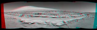
PIA17951:
Panoramic View From West of 'Dingo Gap' (Stereo)
Full Resolution:
TIFF
(17.04 MB)
JPEG
(954 kB)
|
|
|
2014-02-27 |
Mars
|
Mars Science Laboratory (MSL)
|
Navcam (MSL)
|
4945x973x1 |
|
-
PIA17950:
Panoramic View From West of 'Dingo Gap'
Full Resolution:
TIFF
(4.819 MB)
JPEG
(818.6 kB)
|
|
|
2014-02-27 |
Mars
|
Mars Science Laboratory (MSL)
|
Navcam (MSL)
|
1024x1024x1 |

|
-
PIA17949:
-
Curiosity's View Back After Passing 'Junda' Striations
Full Resolution:
TIFF
(1.05 MB)
JPEG
(240.6 kB)
|
|
|
2014-02-27 |
Mars
|
Mars Science Laboratory (MSL)
|
Navcam (MSL)
|
3563x1131x3 |
|
-
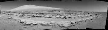
PIA17948:
-
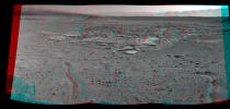
Martian Landscape With Rock Rows and Mount Sharp (Stereo)
Full Resolution:
TIFF
(12.09 MB)
JPEG
(503.8 kB)
|
|
|
2014-02-27 |
Mars
|
Mars Science Laboratory (MSL)
|
Navcam (MSL)
|
3482x972x1 |
|
-
PIA17947:
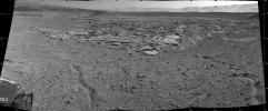
Martian Landscape with Rock Rows and Mount Sharp
Full Resolution:
TIFF
(3.389 MB)
JPEG
(476.3 kB)
|
|
|
2014-02-19 |
Mars
|
Mars Science Laboratory (MSL)
|
|
3300x2550x3 |

|
-
PIA17946:
-
Map of Recent and Planned Driving by Curiosity as of Feb. 18, 2014
Full Resolution:
TIFF
(25.26 MB)
JPEG
(1.704 MB)
|
|
|
2014-02-19 |
Mars
|
Mars Science Laboratory (MSL)
|
Navcam (MSL)
|
1011x868x1 |
|
-
PIA17945:
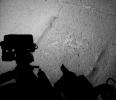
-
Curiosity Mars Rover's Shadow After Long Backward Drive
Full Resolution:
TIFF
(878.6 kB)
JPEG
(175 kB)
|
|
|
2014-02-19 |
Mars
|
Mars Science Laboratory (MSL)
|
Mastcam
|
4890x3361x3 |
|
-
PIA17944:
-
Curiosity's Color View of Martian Dune After Crossing It
Full Resolution:
TIFF
(49.33 MB)
JPEG
(2.485 MB)
|
|
|
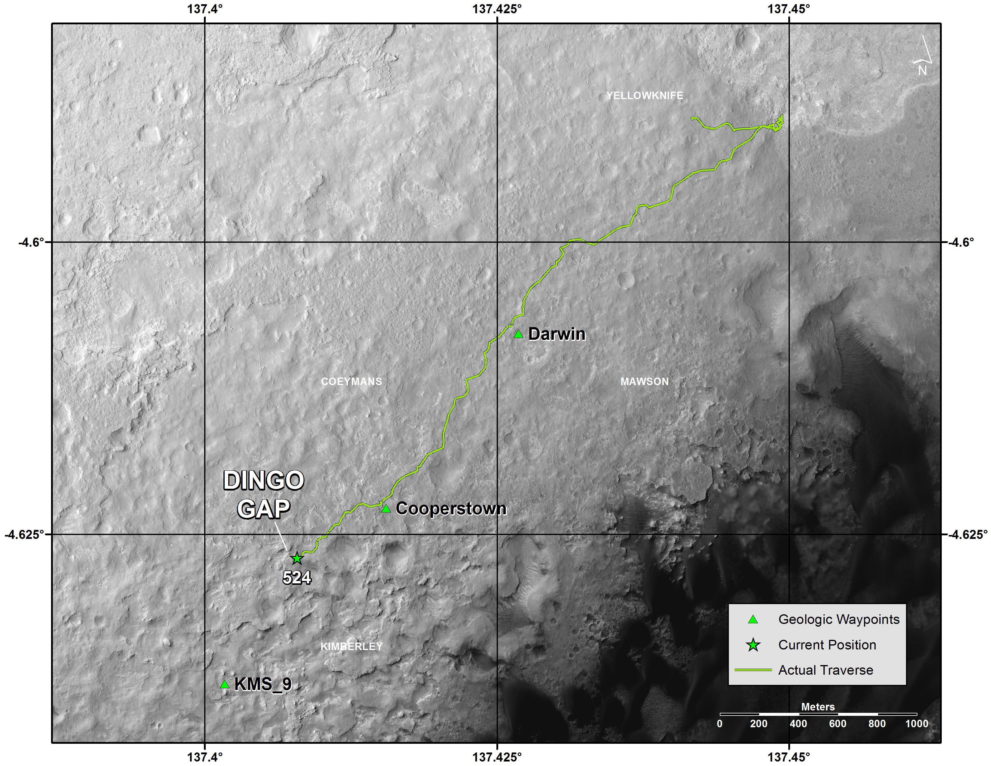
2014-02-11 |
Mars
|
Mars Science Laboratory (MSL)
|
Hazcam (MSL)
|
1024x1024x1 |

|
-
PIA17939:
-
Curiosity Making Headway West of 'Dingo Gap'
Full Resolution:
TIFF
(1.05 MB)
JPEG
(165.9 kB)
|
|
|
2014-02-11 |
Mars
|
Mars Science Laboratory (MSL)
|
Hazcam (MSL)
|
1024x1024x1 |

|
-
PIA17938:
-
Movie of Curiosity's View Backwards While Crossing Dune
Full Resolution:
TIFF
(1.05 MB)
JPEG
(122 kB)
|
|
|
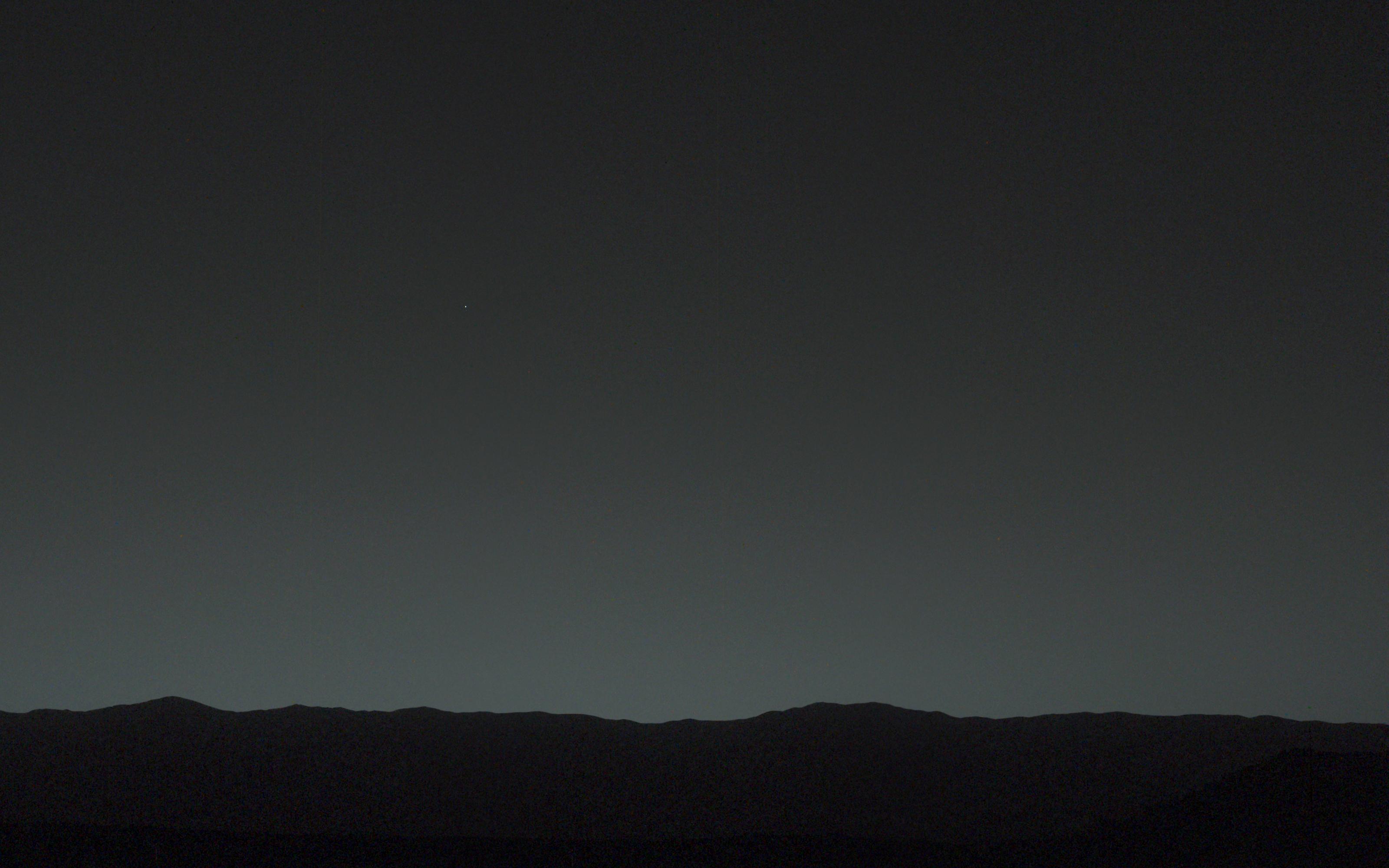
2014-02-06 |
Earth
|
Mars Science Laboratory (MSL)
|
Mastcam
|
3200x2000x3 |
|
-
PIA17936:
-
Bright 'Evening Star' Seen from Mars is Earth
Full Resolution:
TIFF
(19.21 MB)
JPEG
(389.6 kB)
|
|
|
2014-02-06 |
Earth
|
Mars Science Laboratory (MSL)
|
Mastcam
|
78x168x3 |
|
-
PIA17935:
-
Curiosity Mars Rover's First Image of Earth and Earth's Moon
Full Resolution:
TIFF
(39.55 kB)
JPEG
(1.009 kB)
|
|
|
2014-02-03 |
Mars
|
Mars Science Laboratory (MSL)
|
Mastcam
|
9074x2287x3 |
|
-
PIA17931:
Martian Valley May Be Curiosity's Route
Full Resolution:
TIFF
(62.28 MB)
JPEG
(4.277 MB)
|
|
|
2014-01-31 |
Mars
|
Mars Science Laboratory (MSL)
|
Navcam (MSL)
|
4127x1993x3 |
|
-
PIA17769:
-
Curiosity's View Past Dune at 'Dingo Gap' (Stereo)
Full Resolution:
TIFF
(24.69 MB)
JPEG
(1.066 MB)
|
|
|
2014-01-31 |
Mars
|
Mars Science Laboratory (MSL)
|
Navcam (MSL)
|
4075x1439x1 |

|
-
PIA17930:
-
Curiosity's View Past Dune at 'Dingo Gap'
Full Resolution:
TIFF
(5.87 MB)
JPEG
(876.4 kB)
|
|
|
2014-01-29 |
Mars
|
Mars Science Laboratory (MSL)
|
ChemCam
Mastcam
|
3272x3272x3 |
|
-
PIA17768:
-
Martian Rock 'Harrison' in Color, Showing Crystals
Full Resolution:
TIFF
(32.13 MB)
JPEG
(1.484 MB)
|
|
|
2014-01-29 |
Mars
|
Mars Science Laboratory (MSL)
|
ChemCam
|
1320x1320x1 |

|
-
PIA17767:
-
Crystal-Laden Martian Rock Examined by Curiosity's Laser Instrument
Full Resolution:
TIFF
(1.744 MB)
JPEG
(145.7 kB)
|
|
|
2014-01-29 |
Mars
|
Mars Science Laboratory (MSL)
|
Mastcam
|
5544x1047x3 |
|
-
PIA17766:
Curiosity Mars Rover Approaches 'Dingo Gap,' Mastcam View
Full Resolution:
TIFF
(17.42 MB)
JPEG
(1.284 MB)
|
|
|
2014-01-29 |
Mars
|
Mars Reconnaissance Orbiter (MRO)
Mars Science Laboratory (MSL)
|
HiRISE
|
3300x2550x3 |
|
-
PIA17765:
-
Traverse Map for Mars Rover Curiosity as of Jan. 26, 2014
Full Resolution:
TIFF
(25.26 MB)
JPEG
(1.211 MB)
|
|
|
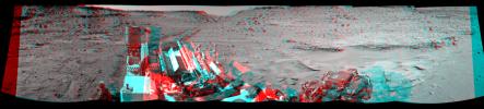
2014-01-29 |
Mars
|
Mars Science Laboratory (MSL)
|
Navcam (MSL)
|
7733x2357x3 |
|
-
PIA17764:
-
Full-Circle Vista During Curiosity's Approach to 'Dingo Gap' (Stereo)
Full Resolution:
TIFF
(54.7 MB)
JPEG
(2.399 MB)
|
|
|
2014-01-29 |
Mars
|
Mars Science Laboratory (MSL)
|
Navcam (MSL)
|
7696x1717x1 |
|
-
PIA17763:
Full-Circle Vista During Curiosity's Approach to 'Dingo Gap'
Full Resolution:
TIFF
(13.23 MB)
JPEG
(1.852 MB)
|


