Your search criteria found 1046 images
Mission
Go to PIAxxxxx:
Refine this list of images by:
Target:
Spacecraft:
Instrument:
Click on an image for detailed information
Click on a column heading to sort in ascending or descending order
My
List
Addition DateSort Ascending Target Mission Instrument Size
Add Image to Favorite List 2019-01-28 Mars Mars Science Laboratory (MSL)
MAHLI
10758x10008x3
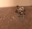
This image shows a selfie taken by NASA's Curiosity Mars rover on Sol 2291 (January 15) at the 'Rock Hall' drill site, located on Vera Rubin Ridge.
PIA22960:
Curiosity's Selfie at Rock Hall
Full Resolution:     TIFF (268.3 MB)     JPEG (11.55 MB)
Add Image to Favorite List 2018-09-06 Mars Mars Science Laboratory (MSL)
Mastcam
10000x2886x3
NASA's Curiosity rover surveyed its surroundings on Aug. 9, 2018, showing its current location on Mars' Vera Rubin Ridge. The panorama includes skies darkened by a fading global dust storm and a rare view of the rover itself.
PIA22545:
Panorama of Vera Rubin Ridge
Full Resolution:     TIFF (67.34 MB)     JPEG (3.445 MB)
Add Image to Favorite List 2018-06-20 Mars Mars Science Laboratory (MSL)
Mastcam
2374x1083x3
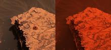
Two images from the Mast Camera onboard NASA's Curiosity rover depict the change in the color of light illuminating the Martian surface since a dust storm engulfed Gale Crater. At left shows the 'Duluth' drill site on May 21, 2018; at right from June 17.
PIA22330:
Duluth After Dust Storm
Full Resolution:     TIFF (7.17 MB)     JPEG (332.7 kB)
Add Image to Favorite List 2018-06-20 Mars Mars Science Laboratory (MSL)
MAHLI
18033x10144x3
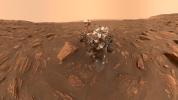
A self-portrait of NASA's Curiosity rover taken on Sol 2082 (June 15, 2018). A Martian dust storm has reduced sunlight and visibility at the rover's location in Gale Crater.
PIA22486:
Curiosity's Dusty Selfie
Full Resolution:     TIFF (400.4 MB)     JPEG (13.25 MB)
Add Image to Favorite List 2018-06-13 Mars Mars Science Laboratory (MSL)
Mastcam
4054x1808x3
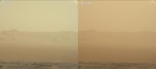
These two views from NASA's Curiosity rover, acquired specifically to measure the amount of dust inside Gale Crater, show that dust has increased over three days from a major Martian dust storm.
PIA22520:
Curiosity's View of the June 2018 Dust Storm
Full Resolution:     TIFF (6.58 MB)     JPEG (235 kB)
Add Image to Favorite List 2018-06-07 Mars Mars Science Laboratory (MSL)
SAM
1920x1080x3
NASA's Curiosity rover used its Sample Analysis at Mars to detect seasonal changes in atmospheric methane in Gale Crater. The methane signal has been observed for nearly three Martian years (nearly six Earth years), peaking each summer.
PIA22328:
Mars' Mysterious Methane
Full Resolution:     TIFF (4.777 MB)     JPEG (303.1 kB)
Add Image to Favorite List 2018-06-04 Mars Mars Science Laboratory (MSL)
Mastcam
1600x1200x3
The drill bit of NASA's Curiosity Mars rover over one of the sample inlets on the rover's deck. The inlets lead to Curiosity's onboard laboratories.
PIA22327:
Inlet Cover On the Curiosity Rover
Full Resolution:     TIFF (5.638 MB)     JPEG (242.7 kB)
Add Image to Favorite List 2018-05-23 Mars Mars Science Laboratory (MSL)
Mastcam
1328x1184x3
A close-up image of a 2-inch-deep hole produced using a new drilling technique for NASA's Curiosity rover. Curiosity drilled this hole in a target called 'Duluth' on May 20, 2018.
PIA22326:
Curiosity Successfully Drills "Duluth"
Full Resolution:     TIFF (4.719 MB)     JPEG (316.6 kB)
Add Image to Favorite List 2018-05-23 Mars Mars Science Laboratory (MSL)
Mastcam
1328x1184x3
NASA's Curiosity rover successfully drilled a 2-inch-deep hole in a target called 'Duluth' on May 20, 2018. It was the first rock sample captured by the drill since October 2016.
PIA22325:
First Drilled Sample on Mars Since 2016
Full Resolution:     TIFF (4.719 MB)     JPEG (321.8 kB)
Add Image to Favorite List 2018-05-17 Mars Science Laboratory (MSL)
1280x716x3
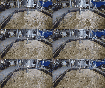
A test of a new percussive drilling technique at NASA's Jet Propulsion Laboratory in Pasadena, California. NASA's Curiosity rover will test percussive drilling on Mars for the first time since December 2016.
PIA22324:
Percussive Drill Test at JPL Animation Icon
Full Resolution:     TIFF (2.751 MB)     JPEG (206.9 kB)
Add Image to Favorite List 2018-03-22 Mars Mars Science Laboratory (MSL)
Mastcam
8000x2583x3
This mosaic taken by NASA's Mars Curiosity rover looks uphill at Mount Sharp. The scene has been white-balanced so the colors of the rock materials resemble how they would appear under daytime lighting conditions on Earth.
PIA22313:
Curiosity is Ready for Clay
Full Resolution:     TIFF (52.28 MB)     JPEG (3.6 MB)
Add Image to Favorite List 2018-03-22 Mars Mars Science Laboratory (MSL)
Mastcam
9216x2976x3
This mosaic taken by NASA's Mars Curiosity rover looks uphill at Mount Sharp. Highlighted is an area in white with clay-bearing rocks that scientists are eager to explore.
PIA22312:
Curiosity is Ready for Clay (Highlighted)
Full Resolution:     TIFF (65.5 MB)     JPEG (5.146 MB)
Add Image to Favorite List 2018-02-28 Mars Mars Science Laboratory (MSL)
Mastcam
1328x1184x3
NASA's Curiosity Mars rover used a new drill method to produce a hole on Feb. 26, 2018, in a target named Lake Orcadie. The hole marks the first operation of the rover's drill since a motor problem began acting up more than a year ago.
PIA22224:
Curiosity Tests a New Drill Method on Mars
Full Resolution:     TIFF (4.605 MB)     JPEG (285.8 kB)
Add Image to Favorite List 2018-02-08 Mars Mars Science Laboratory (MSL)
MAHLI
1544x887x3
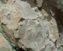
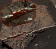
This image from NASA's Mars Science Laboratory Curiosity rover shows a mineral vein with bright and dark portions dominating this image of a Martian rock target called 'Rona,' which is near the southern, upper edge of 'Vera Rubin Ridge' on Mount Sharp.
PIA22214:
Brushed Vein in 'Rona' on 'Vera Rubin Ridge'
Full Resolution:     TIFF (4.11 MB)     JPEG (304.6 kB)
Add Image to Favorite List 2018-02-08 Mars Mars Science Laboratory (MSL)
MAHLI
1584x1184x3
This image from NASA's Mars Science Laboratory Curiosity rover shows dark, stick-shaped features clustered on this Martian rock about the size of grains of rice.
PIA22213:
Stick-Shape, Rice-Size Features on Martian Rock "Haroldswick"
Full Resolution:     TIFF (5.628 MB)     JPEG (361.3 kB)
Add Image to Favorite List 2018-02-08 Mars Mars Science Laboratory (MSL)
MAHLI
1451x1160x3
The surface of the Martian rock target in this stereo image includes small hollows with a 'swallowtail' shape characteristic of some gypsum crystals.This image was taken by NASA's Mars Science Laboratory Curiosity rover.
PIA22212:
Stereo View of Martian Rock Target 'Funzie'
Full Resolution:     TIFF (5.052 MB)     JPEG (241 kB)
Add Image to Favorite List 2018-02-08 Mars Mars Science Laboratory (MSL)
MAHLI
3273x2884x3
This exposure of finely laminated bedrock on Mars includes tiny crystal-shaped bumps, plus mineral veins with both bright and dark material as seen by NASA's Mars Science Laboratory Curiosity rover.
PIA22211:
Crystal Shapes and Two-Toned Veins on Martian Ridge
Full Resolution:     TIFF (15.51 MB)     JPEG (809.6 kB)
Add Image to Favorite List 2018-01-31 Mars Mars Science Laboratory (MSL)
MAHLI
14000x10000x3
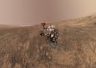
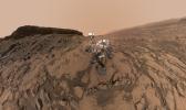
This self-portrait of NASA's Curiosity Mars, taken on Jan 23, 2018, rover shows the vehicle on Vera Rubin Ridge, which it's been investigating for the past several months.
PIA22207:
Mount Sharp 'Photobombs' Curiosity
Full Resolution:     TIFF (337.3 MB)     JPEG (12.27 MB)
Add Image to Favorite List 2018-01-30 Mars Mars Science Laboratory (MSL)
Mastcam
17478x1369x3
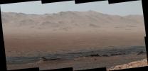
Climbing 'Vera Rubin Ridge' provided NASA's Curiosity Mars rover this sweeping vista of the interior and rim of Gale Crater, including much of the rover's route during its first five-and-a-half years on Mars.
PIA22210:
Wide-Angle Panorama from Ridge in Mars' Gale Crater
Full Resolution:     TIFF (48.73 MB)     JPEG (2.447 MB)
Add Image to Favorite List 2018-01-30 Mars Mars Science Laboratory (MSL)
Mastcam
4697x2263x3
A vantage point on 'Vera Rubin Ridge' provided NASA's Curiosity Mars rover this detailed look back over the area where it began its mission inside Gale Crater, plus more-distant features of the crater.
PIA22209:
Telephoto Vista from Ridge in Mars' Gale Crater
Full Resolution:     TIFF (23.4 MB)     JPEG (1.283 MB)
Add Image to Favorite List 2018-01-30 Mars Mars Science Laboratory (MSL)
2550x3300x3
This image of the northwestern portion of Mars' Gale Crater and terrain north of it, from the ESA's Mars Express orbiter, provides a locator map for some features visible in an October 2017 panorama from NASA's Curiosity Mars rover.
PIA22208:
Locator Map for Features in Curiosity Panorama
Full Resolution:     TIFF (11.68 MB)     JPEG (916.2 kB)
Add Image to Favorite List 2017-11-01 Mars Mars Science Laboratory (MSL)
ChemCam
3075x2233x3
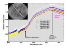
The Chemistry and Camera instrument on NASA's Curiosity Mars rover examined a freshly brushed area on target rock 'Christmas Cove' and found spectral evidence of hematite, an iron-oxide mineral.
PIA22068:
Curiosity's ChemCam Checks 'Christmas Cove' Colors
Full Resolution:     TIFF (3.576 MB)     JPEG (458.1 kB)
Add Image to Favorite List 2017-11-01 Mars Mars Science Laboratory (MSL)
Mastcam
1328x1184x3
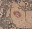
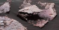
On a part of 'Vera Rubin Ridge,' NASA's Curiosity Mars rover took this image of a rock surface that had been brushed with the rover's Dust Removal Tool.
PIA22067:
Curiosity Checks Under the Dust on a Martian Rock
Full Resolution:     TIFF (4.719 MB)     JPEG (179.5 kB)
Add Image to Favorite List 2017-11-01 Mars Mars Science Laboratory (MSL)
Mastcam
1260x1123x3
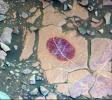
This false-color image shows how special filters of NASA's Curiosity Mars rover's Mastcam can help reveal certain minerals in target rocks. It is a composite of images taken Sept. 17, 2017.
PIA22066:
Science-Filters Study of Martian Rock Sees Hematite
Full Resolution:     TIFF (4.247 MB)     JPEG (266.4 kB)
Add Image to Favorite List 2017-11-01 Mars Mars Science Laboratory (MSL)
Mastcam
6690x3024x3
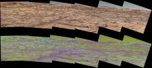
This pair of images from the Mast Camera on NASA's Curiosity rover illustrates how special filters are used to scout terrain ahead for variations in the local bedrock.
PIA22065:
Mastcam Special Filters Help Locate Variations Ahead
Full Resolution:     TIFF (53.49 MB)     JPEG (4.335 MB)
Add Image to Favorite List 2017-11-01 Mars Mars Science Laboratory (MSL)
MAHLI
1198x1609x3
This image from NASA's Curiosity Mars rover shows effects of using the rover's wire-bristled Dust Removal Tool (DRT) on a rock target called 'Christmas Cove'.
PIA22064:
Dust Removal Target on 'Vera Rubin Ridge'
Full Resolution:     TIFF (5.785 MB)     JPEG (400.9 kB)
Add Image to Favorite List 2017-10-23 Mars Mars Science Laboratory (MSL)
1024x512x1
NASA's Curiosity Mars rover conducted a test on Oct. 17, 2017, as part of the rover team's development of a new way to use the rover's drill.
PIA22063:
Mars Rover Step Toward Possible Resumption of Drilling
Full Resolution:     TIFF (525 kB)     JPEG (84.28 kB)
Add Image to Favorite List 2017-10-23 Mars Science Laboratory (MSL)
2294x2554x3
This photo taken in the Mars Yard at NASA's JPL, Pasadena, California, on Aug. 1, 2017, shows a step in development of possible alternative techniques that NASA's Curiosity Mars rover might be able to use to resume drilling into rocks on Mars.
PIA22062:
New Rock-Drilling Method in 'Mars Yard' Test
Full Resolution:     TIFF (16.37 MB)     JPEG (603 kB)
Add Image to Favorite List 2017-10-23 Mars Science Laboratory (MSL)
2481x3657x3
The team operating NASA's Curiosity Mars rover is developing techniques that the rover might be able to use to resume drilling into rocks on Mars in this June 2017 photo taken at JPL's Mars Yard.
PIA22061:
Testing New Techniques for Mars Rover Rock-Drilling
Full Resolution:     TIFF (21.99 MB)     JPEG (1.032 MB)
Add Image to Favorite List 2017-09-13 Mars Science Laboratory (MSL)
ChemCam
4623x1369x1
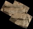
This view of 'Vera Rubin Ridge' from the ChemCam instrument on NASA's Curiosity Mars rover shows sedimentary layers, mineral veins and effects of wind erosion.
PIA21853:
Erosion Effects on 'Vera Rubin Ridge,' Mars
Full Resolution:     TIFF (4.676 MB)     JPEG (638.5 kB)
Add Image to Favorite List 2017-09-13 Mars Mars Science Laboratory (MSL)
ChemCam
2615x1557x1
This view of 'Vera Rubin Ridge' from the ChemCam instrument on NASA's Curiosity Mars rover shows multiple sedimentary layers and fracture-filling deposits of minerals.
PIA21852:
Micro-imager View: Layers in 'Vera Rubin Ridge,' Mars
Full Resolution:     TIFF (3.738 MB)     JPEG (490.9 kB)
Add Image to Favorite List 2017-09-13 Mars Mars Science Laboratory (MSL)
Mastcam
13333x1925x3
The Mastcam on NASA's Curiosity Mars rover captured this view of 'Vera Rubin Ridge' about two weeks before the rover started ascending this steep ridge on lower Mount Sharp.
PIA21851:
Looking Up at Layers of 'Vera Rubin Ridge' on Sol 1790
Full Resolution:     TIFF (43.18 MB)     JPEG (3.654 MB)
Add Image to Favorite List 2017-09-13 Mars Mars Science Laboratory (MSL)
Mastcam
11829x2500x3
Researchers used the Mastcam on NASA's Curiosity Mars rover to gain this detailed view of layers in 'Vera Rubin Ridge' from just below the ridge.
PIA21850:
Martian Ridge Looming Above Curiosity Prior to Ascent
Full Resolution:     TIFF (37.28 MB)     JPEG (3.092 MB)
Add Image to Favorite List 2017-09-13 Mars Mars Science Laboratory (MSL)
Mastcam
15270x2348x3
'Vera Rubin Ridge,' a favored destination for NASA's Curiosity Mars rover even before the rover landed in 2012, rises near the rover nearly five years later in this panorama from Curiosity's Mastcam.
PIA21849:
Curiosity View of 'Vera Rubin Ridge' From Below, Sol 1734
Full Resolution:     TIFF (79.96 MB)     JPEG (5.458 MB)
Add Image to Favorite List 2017-08-09 Mars Mars Science Laboratory (MSL)
Navcam (MSL)
511x510x1
Wispy clouds float across the Martian sky in this frame from an unehanced accelerated sequence of early-morning images taken on July 17, 2017, by the Navcam on NASA's Curiosity Mars rover.
PIA21842:
Clouds Sailing Overhead on Mars, Unenhanced Animation Icon
Full Resolution:     TIFF (261.1 kB)     JPEG (15.55 kB)
Add Image to Favorite List 2017-08-09 Mars Mars Science Laboratory (MSL)
Navcam (MSL)
511x511x1
Wispy clouds float across the Martian sky in this frame from an accelerated sequence of enhanced images taken on July 17, 2017, by the Navcam on NASA's Curiosity Mars rover.
PIA21841:
Clouds Sailing Overhead on Mars, Enhanced Animation Icon
Full Resolution:     TIFF (261.6 kB)     JPEG (91.08 kB)
Add Image to Favorite List 2017-08-09 Mars Mars Science Laboratory (MSL)
Navcam (MSL)
511x511x1
Clouds drift across the sky above a Martian horizon in this frame from an accelerated sequence of enhanced images taken on July 17, 2017, by the Navcam on NASA's Curiosity Mars rover.
PIA21840:
Clouds Sailing Above Martian Horizon, Enhanced Animation Icon
Full Resolution:     TIFF (261.6 kB)     JPEG (89.02 kB)
Add Image to Favorite List 2017-07-11 Mars Mars Science Laboratory (MSL)
HiRISE
3300x2550x3
This map shows the route driven by NASA's Curiosity Mars rover, from the location where it landed in August 2012 to its location in July 2017, and its planned path to additional geological layers of lower Mount Sharp.
PIA21720:
Mid-2017 Map of NASA's Curiosity Mars Rover Mission
Full Resolution:     TIFF (14.25 MB)     JPEG (1.627 MB)
Add Image to Favorite List 2017-07-11 Mars Mars Science Laboratory (MSL)
Mastcam
5000x1210x3
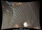
A rippled linear dune of dark Martian sand, 'Nathan Bridges Dune,' dominates this full-circle panorama from NASA's Curiosity Mars rover.
PIA21719:
'Nathan Bridges Dune' on a Martian Mountain
Full Resolution:     TIFF (10.71 MB)     JPEG (669.7 kB)
Add Image to Favorite List 2017-07-11 Mars Mars Science Laboratory (MSL)
Mastcam
6720x1795x3
This dark mound, called 'Ireson Hill,' rises about 16 feet (5 meters) above redder layered outcrop material of the Murray formation on lower Mount Sharp, Mars, near a location where NASA's Curiosity rover examined a linear sand dune in February 2017.
PIA21718:
'Ireson Hill' on Mount Sharp, Mars
Full Resolution:     TIFF (23.06 MB)     JPEG (1.461 MB)
Add Image to Favorite List 2017-07-11 Mars Mars Science Laboratory (MSL)
Mastcam
10000x727x3
This panorama from the Mast Camera (Mastcam) of NASA's Curiosity Mars rover shows details of 'Vera Rubin Ridge,' which stretches about 4 miles (6.5 kilometers), end-to-end, on the northwestern flank of lower Mount Sharp.
PIA21717:
Wide 'Vera Rubin Ridge' Ahead of Curiosity Mars Rover
Full Resolution:     TIFF (13.46 MB)     JPEG (936 kB)
Add Image to Favorite List 2017-07-11 Mars Mars Science Laboratory (MSL)
Mastcam
6828x1323x3
This look ahead from NASA's Curiosity Mars rover includes four geological layers to be examined by the mission, and higher reaches of Mount Sharp beyond the planned study area.
PIA21716:
View Toward 'Vera Rubin Ridge' on Mount Sharp, Mars
Full Resolution:     TIFF (21.93 MB)     JPEG (1.269 MB)
Add Image to Favorite List 2017-06-20 Mars Mars Reconnaissance Orbiter (MRO)
Mars Science Laboratory (MSL)
HiRISE
1403x789x3
The feature that appears bright blue at the center of this scene is NASA's Curiosity Mars rover on the northwestern flank of Mount Sharp, viewed by NASA's Mars Reconnaissance Orbiter.
PIA21710:
Curiosity Rover on Mount Sharp, Seen from Mars Orbit
Full Resolution:     TIFF (3.322 MB)     JPEG (215.9 kB)
Add Image to Favorite List 2017-06-09 Mars Mars Science Laboratory (MSL)
Mastcam
2550x1364x3
NASA's Curiosity Mars rover examined a mudstone outcrop area called 'Pahrump Hills' on lower Mount Sharp, in 2014 and 2015. Blue dots indicate where drilled samples of powdered rock were collected for analysis.
PIA21709:
Key Locations Studied at 'Pahrump Hills' on Mars
Full Resolution:     TIFF (10.29 MB)     JPEG (738.2 kB)
Add Image to Favorite List 2017-06-01 Mars Mars Science Laboratory (MSL)
2858x1213x3
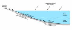
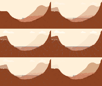
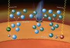
This diagram presents some of the processes and clues related to a long-ago lake on Mars that became stratified, with the shallow water richer in oxidants than deeper water was.
PIA21500:
Diagram of Lake Stratification on Mars
Full Resolution:     TIFF (469.2 kB)     JPEG (191.1 kB)
Add Image to Favorite List 2017-05-30 Mars Mars Science Laboratory (MSL)
Navcam (MSL)
1607x1000x1
Pale zones called 'halos' border bedrock fractures visible in this 2015 image from NASA's Curiosity Mars rover. The location is on the lower slope of Mars' Mount Sharp.
PIA21649:
Halos in Martian Sandstone
Full Resolution:     TIFF (1.532 MB)     JPEG (199.6 kB)
Add Image to Favorite List 2017-05-04 Mars Mars Science Laboratory (MSL)
Mastcam
4336x2224x3
This view from the NASA's Curiosity Mars rover shows two scales of ripples, plus other textures, in an area where the mission examined a linear-shaped dune in the Bagnold dune field on lower Mount Sharp.
PIA11242:
Textures Where Curiosity Rover Studied a Martian Dune
Full Resolution:     TIFF (28.61 MB)     JPEG (1.904 MB)
Add Image to Favorite List 2017-05-04 Mars Mars Science Laboratory (MSL)
Mastcam
8776x2000x3
This 360-degree mosaic from the Mastcam on NASA's Curiosity Mars rover looks out over a portion of the Bagnold Dunes, which stretch for several miles.
PIA11241:
Panorama with Active Linear Dune in Gale Crater, Mars
Full Resolution:     TIFF (35.9 MB)     JPEG (2.349 MB)
Add Image to Favorite List 2017-03-21 Mars Mars Science Laboratory (MSL)
MAHLI
1446x825x3
Two of the raised treads, called grousers, on the left middle wheel of NASA's Curiosity Mars rover broke during the first quarter of 2017, seen is the partially detached at the top of the wheel in this image from the MAHLI camera on the rover's arm.
PIA21486:
Break in Raised Tread on Curiosity Wheel
Full Resolution:     TIFF (2.727 MB)     JPEG (101 kB)
Add Image to Favorite List 2017-02-27 Mars Mars Science Laboratory (MSL)
Navcam (MSL)
1650x550x1
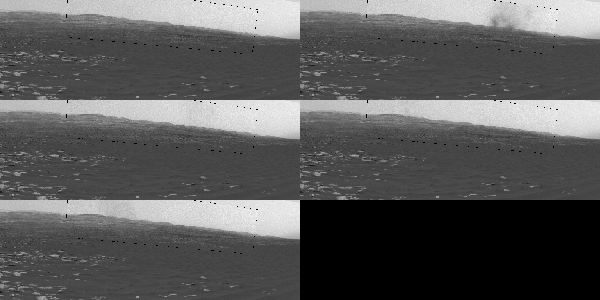
This frame from a sequence of images shows a dust-carrying whirlwind, called a dust devil, on lower Mount Sharp inside Gale Crater, as viewed by NASA's Curiosity Mars Rover during the summer afternoon of Feb. 18, 2017.
PIA21483:
Swirling Dust in Gale Crater, Mars, Sol 1613 Animation Icon
Full Resolution:     TIFF (673.4 kB)     JPEG (80.89 kB)
Add Image to Favorite List 2017-02-27 Mars Mars Science Laboratory (MSL)
Navcam (MSL)
1650x550x1
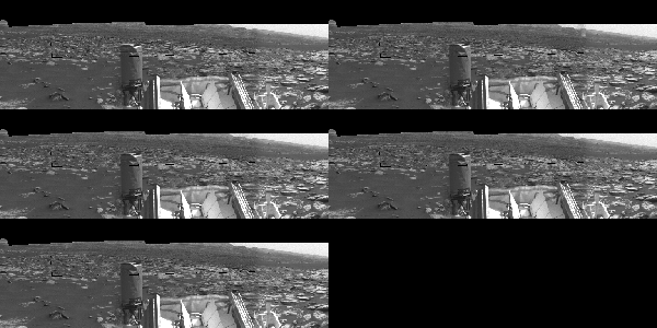
Dust devils dance in the distance in this frame from a sequence of images taken by the Navigation Camera on NASA's Curiosity Mars rover on Feb. 12, 2017, during the summer afternoon.
PIA21482:
Curiosity Observes Whirlwinds Carrying Martian Dust Animation Icon
Full Resolution:     TIFF (691 kB)     JPEG (105.6 kB)
Add Image to Favorite List 2017-02-27 Mars Mars Science Laboratory (MSL)
Navcam (MSL)
1650x550x1
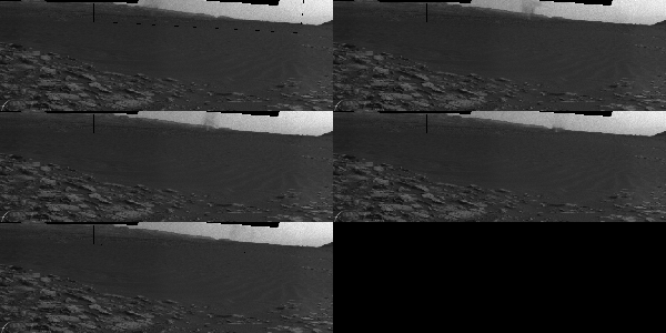
Beyond a dark sand dune closer to the rover, a Martian dust devil passes in front of the horizon in this frame from an animation from NASA's Curiosity Mars rover.
PIA21481:
Dust Devil Passes Near Martian Sand Dune Animation Icon
Full Resolution:     TIFF (664.3 kB)     JPEG (66.26 kB)
Add Image to Favorite List 2017-02-27 Mars Mars Science Laboratory (MSL)
Navcam (MSL)
1650x550x1
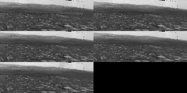
This frame from an animation shows a dust-carrying whirlwind, called a dust devil, scooting across the ground inside Gale Crater, as observed on the local summer afternoon of NASA's Curiosity Mars Rover's on Feb. 1, 2017.
PIA21270:
Martian Dust Devil Action in Gale Crater, Sol 1597 Animation Icon
Full Resolution:     TIFF (809.6 kB)     JPEG (114.5 kB)
Add Image to Favorite List 2017-02-27 Mars Mars Reconnaissance Orbiter (MRO)
Mars Science Laboratory (MSL)
HiRISE
825x1118x3
This map shows the two locations of a research campaign by NASA's Curiosity Mars rover mission to investigate active sand dunes inside Gale Crater on Mars.
PIA21269:
Curiosity's Bagnold Dunes Campaign: Two Types of Dunes
Full Resolution:     TIFF (1.475 MB)     JPEG (200.6 kB)
Add Image to Favorite List 2017-02-27 Mars Mars Science Laboratory (MSL)
Navcam (MSL)
7696x1669x1
The left side of this 360-degree panorama from NASA's Curiosity Mars rover shows the long rows of ripples on a linear shaped dune in the Bagnold Dune Field on the northwestern flank of Mount Sharp.
PIA21268:
Full-Circle Vista With a Linear Shaped Martian Sand Dune
Full Resolution:     TIFF (6.643 MB)     JPEG (788.3 kB)
Add Image to Favorite List 2017-02-27 Mars Mars Science Laboratory (MSL)
MARDI
2108x1533x3
This image from an animation shows wind blowing sand underneath NASA's Curiosity Mars rover on a non-driving day for the rover.
PIA21143:
Sand Moving Under Curiosity, One Day to Next
Full Resolution:     TIFF (7.113 MB)     JPEG (214.8 kB)
Add Image to Favorite List 2017-01-17 Mars Mars Science Laboratory (MSL)
Mastcam
4229x2149x3
A grid of small polygons on the Martian rock surface near the right edge of this view may have originated as cracks in drying mud more than 3 billion years ago. Multiple images of this view were combined for this view from NASA's Curiosity Mars rover.
PIA21263:
Possible Signs of Ancient Drying in Martian Rock
Full Resolution:     TIFF (27.28 MB)     JPEG (1.565 MB)
Add Image to Favorite List 2017-01-17 Mars Mars Science Laboratory (MSL)
Mastcam
3705x1230x3
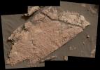
This view of a Martian rock slab called 'Old Soaker,' which has a network of cracks that may have originated in drying mud, comes from the Mast Camera (Mastcam) on NASA's Curiosity Mars rover.
PIA21262:
Mars Rover's Mastcam View of Possible Mud Cracks
Full Resolution:     TIFF (10.7 MB)     JPEG (635.8 kB)
Add Image to Favorite List 2017-01-17 Mars Mars Science Laboratory (MSL)
MAHLI
2954x2063x3
The network of cracks in this Martian rock slab called 'Old Soaker' may have formed from the drying of a mud layer more than 3 billion years ago. The view combines three images taken by NASA's Curiosity Mars rover on Dec. 31, 2016.
PIA21261:
Possible Mud Cracks Preserved in Martian Rock
Full Resolution:     TIFF (13.89 MB)     JPEG (809.2 kB)
Add Image to Favorite List 2016-12-13 Mars Mars Science Laboratory (MSL)
Mastcam
3480x1252x3
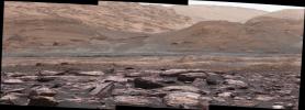
The foreground of this scene from NASA's Curiosity Mars rover shows purple-hued rocks near the rover's late-2016 location on lower Mount Sharp. Variations in color of the rocks hint at the diversity of their composition.
PIA21256:
Color Variations on Mount Sharp, Mars (White Balanced)
Full Resolution:     TIFF (12.05 MB)     JPEG (631.9 kB)
Add Image to Favorite List 2016-12-13 Mars Mars Science Laboratory (MSL)
1920x1080x3
This graphic illustration shows NASA's Curiosity Mars rover in Gale Crater, near the Red Planet's equator.
PIA21255:
Now and Long Ago at Gale Crater, Mars (Illustration) Animation Icon
Full Resolution:     TIFF (491.6 kB)     JPEG (77.52 kB)
Add Image to Favorite List 2016-12-13 Mars Mars Reconnaissance Orbiter (MRO)
Mars Science Laboratory (MSL)
HiRISE
MAHLI
3300x2550x3
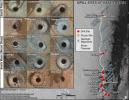
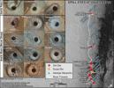
This graphic maps locations of the sites where NASA's Curiosity collected its first 19 rock or soil samples for analysis by laboratory instruments inside the vehicle. It also presents images of the drilled holes where 15 rock-powder samples were acquired.
PIA21254:
Curiosity's Rock or Soil Sampling Sites on Mars, Through November 2016
Full Resolution:     TIFF (21.14 MB)     JPEG (2.213 MB)
Add Image to Favorite List 2016-12-13 Mars Mars Science Laboratory (MSL)
2969x1612x3
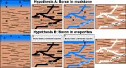
This graphic portrays two hypotheses about how the element boron ended up in calcium sulfate veins found within mudstone layers of the Murray formation on Mars' lower Mount Sharp.
PIA21253:
Two Possible Ways Boron Got into Veins on Mount Sharp
Full Resolution:     TIFF (1.52 MB)     JPEG (540.5 kB)
Add Image to Favorite List 2016-12-13 Mars Mars Science Laboratory (MSL)
ChemCam
Mastcam
2399x974x3
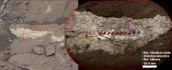
Examination of a calcium sulfate vein called 'Diyogha' by the Chemical and ChemCam instrument on NASA's Curiosity Mars rover found boron, sodium and chlorine.
PIA21252:
Boron, Sodium and Chlorine in Mineral Vein 'Diyogha,' Mars
Full Resolution:     TIFF (6.453 MB)     JPEG (339.6 kB)
Add Image to Favorite List 2016-12-13 Mars Mars Science Laboratory (MSL)
ChemCam
Mastcam
1996x1758x3
This two-part illustration shows the context of the erosion-resistant, raised vein, called 'Catabola,' in an image from NASA's Curiosity's Mast Camera. The highest concentration of boron measured on Mars.
PIA21251:
Boron in Calcium Sulfate Vein at 'Catabola,' Mars
Full Resolution:     TIFF (9.623 MB)     JPEG (465.6 kB)
Add Image to Favorite List 2016-12-13 Mars Mars Reconnaissance Orbiter (MRO)
Mars Science Laboratory (MSL)
ChemCam
HiRISE
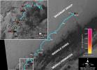
2809x2025x3
This map shows the route driven by NASA's Curiosity Mars rover (blue line) and locations where the rover's ChemCam instrument detected the element boron (dots, colored by abundance of boron according to the key at right).
PIA21150:
Where's Boron? Mars Rover Detects It
Full Resolution:     TIFF (7.738 MB)     JPEG (838.4 kB)
Add Image to Favorite List 2016-12-13 Mars Mars Science Laboratory (MSL)
CheMin
583x583x3
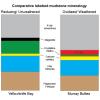
This graphic shows proportions of minerals identified in mudstone exposures at the 'Yellowknife Bay' location where NASA's Curiosity Mars rover first analyzed bedrock, in 2013, and at the 'Murray Buttes' area investigated in 2016.
PIA21149:
Mineral Content Comparison at Two Gale Crater Sites
Full Resolution:     TIFF (178.4 kB)     JPEG (34.83 kB)
Add Image to Favorite List 2016-12-13 Mars Mars Science Laboratory (MSL)
CheMin
534x391x3
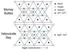
This diagram illustrates how the dimensions of clay minerals' crystal structure are affected by which ions are present in the composition of the mineral. Different clay minerals were identified this way at two sites, 'Yellowknife Bay' and 'Murray Buttes'
PIA21148:
Clay Mineral Crystal Structure Tied to Composition
Full Resolution:     TIFF (131.6 kB)     JPEG (35.44 kB)
Add Image to Favorite List 2016-12-13 Mars Mars Science Laboratory (MSL)
CheMin
660x424x3
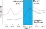
Data graphed here from the CheMin instrument on NASA's Mars Curiosity rover show a difference between clay minerals in powder drilled from mudstone outcrops at two locations, 'Yellowknife Bay' and 'Murray Buttes' in Mars' Gale Crater.
PIA21147:
Detecting a Difference in Clay Minerals at Two Gale Crater Sites
Full Resolution:     TIFF (216.5 kB)     JPEG (30.38 kB)
Add Image to Favorite List 2016-12-13 Mars Mars Science Laboratory (MSL)
CheMin
1708x982x3
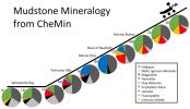
This series of pie charts shows similarities and differences in the mineral compositions of mudstones at 10 sites where NASA's Curiosity Mars rover collected rock-powder samples and analyzed them with the rover's Chemistry and Mineralogy instrument.
PIA21146:
Mudstone Mineralogy from Curiosity's CheMin, 2013 to 2016
Full Resolution:     TIFF (796.4 kB)     JPEG (126.5 kB)
Add Image to Favorite List 2016-12-13 Mars Mars Science Laboratory (MSL)
1490x804x3
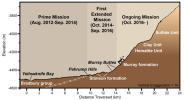
This graphic depicts aspects of the driving distance, elevation, geological units and time intervals of NASA's Curiosity Mars rover mission, as of late 2016.
PIA21145:
Curiosity Rover's Martian Mission, Exaggerated Cross Section
Full Resolution:     TIFF (994.6 kB)     JPEG (101.3 kB)
Add Image to Favorite List 2016-12-13 Mars Mars Reconnaissance Orbiter (MRO)
Mars Science Laboratory (MSL)
HiRISE
1456x1125x3
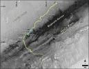
This map shows the route driven by NASA's Curiosity Mars rover from the location where it landed in August 2012 to its location in December 2016, which is in the upper half of a geological unit called the Murray formation, on lower Mount Sharp.
PIA21144:
Late 2016 Map of NASA's Curiosity Mars Rover Mission
Full Resolution:     TIFF (2.946 MB)     JPEG (288 kB)
Add Image to Favorite List 2016-12-05 Mars Mars Science Laboratory (MSL)
Navcam (MSL)
1024x1024x1
This Dec. 2, 2016, view from the Navcam on the mast of NASA's Curiosity Mars Rover shows rocky ground within view while the rover was working at an intended drilling site called 'Precipice' on lower Mount Sharp.
PIA21140:
Martian Terrain Near Curiosity's 'Precipice' Target
Full Resolution:     TIFF (1.019 MB)     JPEG (167.9 kB)
Add Image to Favorite List 2016-11-02 Mars Science Laboratory (MSL)
Mastcam
1344x1200x3
The dark, smooth-surfaced object at the center of this Oct. 30, 2016, image from the Mast Camera (Mastcam) on NASA's Curiosity Mars rover was examined with laser pulses and confirmed to be an iron-nickel meteorite.
PIA21134:
Curiosity Rover Finds and Examines a Meteorite on Mars
Full Resolution:     TIFF (4.84 MB)     JPEG (282.5 kB)
Add Image to Favorite List 2016-11-02 Mars Science Laboratory (MSL)
ChemCam
1169x1154x3
The dark, golf-ball-size object in this composite, colorized view from NASA's Curiosity Mars rover shows a grid of shiny dots where ChemCam had fired laser pulses used for determining the chemical elements in the target's composition.
PIA21133:
Iron-Nickel Meteorite Zapped by Mars Rover's Laser
Full Resolution:     TIFF (2.749 MB)     JPEG (78.2 kB)
Add Image to Favorite List 2016-10-03 Mars Mars Science Laboratory (MSL)
HiRISE
3300x2550x3
This map shows the route driven by NASA's Curiosity Mars rover from the location where it landed in August 2012 to its location in September 2016 at 'Murray Buttes', and the path planned for reaching destination at lower Mount Sharp.
PIA20846:
Curiosity Destinations for Second Extended Mission
Full Resolution:     TIFF (13.9 MB)     JPEG (1.797 MB)
Add Image to Favorite List 2016-10-03 Mars Mars Science Laboratory (MSL)
HiRISE
MAHLI
3300x2550x3
This graphic maps the first 16 sites where NASA's Curiosity Mars rover collected rock or soil samples for analysis by laboratory instruments inside the vehicle. It also presents images of the drilled holes where 14 rock-powder samples were acquired.
PIA20845:
Curiosity's First 16 Rock or Soil Sampling Sites on Mars
Full Resolution:     TIFF (20.59 MB)     JPEG (2.195 MB)
Add Image to Favorite List 2016-10-03 Mars Mars Science Laboratory (MSL)
MAHLI
8000x4769x3
This self-portrait of NASA's Curiosity Mars rover shows the vehicle at the 'Quela' drilling location in the 'Murray Buttes' area on lower Mount Sharp.
PIA20844:
Curiosity Self-Portrait at 'Murray Buttes'
Full Resolution:     TIFF (83.67 MB)     JPEG (3.836 MB)
Add Image to Favorite List 2016-10-03 Mars Mars Science Laboratory (MSL)
Mastcam
10000x5027x3
The top of the butte in this scene from NASA's Curiosity Mars rover is known as 'M9a' in the 'Murray Buttes' area, where individual buttes and mesas were assigned numbers.
PIA20843:
Butte 'M9a' in 'Murray Buttes' on Mars
Full Resolution:     TIFF (122 MB)     JPEG (6.811 MB)
Add Image to Favorite List 2016-10-03 Mars Mars Science Laboratory (MSL)
Mastcam
10000x1441x3
This panorama combines sets of images taken by NASA's Curiosity Mars rover from the 'Murray Buttes' area on Mars' lower Mount Sharp.
PIA20842:
Cluster of Martian Mesas on Lower Mount Sharp, Sols 1438 and 1439
Full Resolution:     TIFF (30.84 MB)     JPEG (2.17 MB)
Add Image to Favorite List 2016-10-03 Mars Mars Science Laboratory (MSL)
Mastcam
10000x2086x3
The two prominent mesas in this view of Mars' 'Murray Buttes' region from NASA's Curiosity Mars rover are about 260 feet (about 80 meters) apart. Upper Mount Sharp is the salmon-hued mound dominating the horizon between the scene's two prominent mesas.
PIA20841:
Martian Mesas in 'Murray Buttes' Area, Sol 1434
Full Resolution:     TIFF (40.52 MB)     JPEG (2.487 MB)
Add Image to Favorite List 2016-10-03 Mars Mars Science Laboratory (MSL)
Mastcam
10000x2848x3
This 360-degree panorama was acquired NASA's Curiosity Mars rover while the rover was in an area called 'Murray Buttes' on lower Mount Sharp, one of the most scenic landscapes yet visited by any Mars rover.
PIA20840:
Rover's Panorama Taken Amid 'Murray Buttes' on Mars
Full Resolution:     TIFF (56.19 MB)     JPEG (3.787 MB)
Add Image to Favorite List 2016-09-29 Mars Science Laboratory (MSL)
SAM
1280x888x3
NASA's Sample Analysis at Mars (SAM) laboratory suite inside NASA's Curiosity Mars rover has measured the isotope ratios of xenon and krypton in Mars' atmosphere and can explain why they are more abundant in the Martian atmosphere than expected.
PIA20847:
Isotopic Clues to Mars' Crust-Atmosphere Interactions
Full Resolution:     TIFF (1.889 MB)     JPEG (92.72 kB)
Add Image to Favorite List 2016-09-09 Mars Mars Science Laboratory (MSL)
Mastcam
1344x1200x3
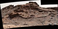
This view from the Mast Camera (Mastcam) in NASA's Curiosity Mars rover shows a hillside outcrop with layered rocks within the 'Murray Buttes' region on lower Mount Sharp.
PIA21045:
Farewell to Murray Buttes (Image 5)
Full Resolution:     TIFF (3.097 MB)     JPEG (140.9 kB)
Add Image to Favorite List 2016-09-09 Mars Mars Science Laboratory (MSL)
Mastcam
1344x1200x3
This view from the Mast Camera (Mastcam) in NASA's Curiosity Mars rover shows an outcrop with finely layered rocks within the 'Murray Buttes' region on lower Mount Sharp.
PIA21044:
Farewell to Murray Buttes (Image 4)
Full Resolution:     TIFF (4.439 MB)     JPEG (225.6 kB)
Add Image to Favorite List 2016-09-09 Mars Mars Science Laboratory (MSL)
Mastcam
1344x1200x3
This view from the Mast Camera (Mastcam) in NASA's Curiosity Mars rover shows finely layered rocks within the 'Murray Buttes' region on lower Mount Sharp.
PIA21043:
Farewell to Murray Buttes (Image 3)
Full Resolution:     TIFF (4.415 MB)     JPEG (226.6 kB)
Add Image to Favorite List 2016-09-09 Mars Mars Science Laboratory (MSL)
Mastcam
1344x1200x3
This view from the Mast Camera (Mastcam) in NASA's Curiosity Mars rover shows sloping buttes and layered outcrops within the 'Murray Buttes' region on lower Mount Sharp.
PIA21042:
Farewell to Murray Buttes (Image 2)
Full Resolution:     TIFF (3.002 MB)     JPEG (140.9 kB)
Add Image to Favorite List 2016-09-09 Mars Mars Science Laboratory (MSL)
Mastcam
1344x1200x3
The rim of Gale Crater is visible in the distance, through the dusty haze, in this view of NASA's Curiosity rover of a sloping hillside on Mount Sharp.
PIA21041:
Farewell to Murray Buttes (Image 1)
Full Resolution:     TIFF (3.732 MB)     JPEG (200.2 kB)
Add Image to Favorite List 2016-08-19 Mars Mars Science Laboratory (MSL)
Mastcam
4893x2642x3
The rock in the foreground at right in this 3D scene is informally named 'Balombo.' The group of boulders is at a site called 'Bimbe.' NASA's Curiosity Mars Rover shows boulders composed of pebble-size and larger rock fragments.
PIA20836:
Breccia-Conglomerate Rocks on Lower Mount Sharp, Mars (Stereo)
Full Resolution:     TIFF (18.52 MB)     JPEG (976.6 kB)
Add Image to Favorite List 2016-08-19 Mars Mars Science Laboratory (MSL)
Mastcam
10253x2500x3
This 360-degree panorama was acquired by the Mast Camera (Mastcam) on NASA's Curiosity Mars rover as the rover neared features called 'Murray Buttes' on lower Mount Sharp.
PIA20765:
Rover's Panorama of Entrance to 'Murray Buttes' on Mars
Full Resolution:     TIFF (46.47 MB)     JPEG (2.912 MB)
Add Image to Favorite List 2016-08-04 Mars Mars Science Laboratory (MSL)
Navcam (MSL)
982x726x1
NASA's Curiosity Mars rover began close-up investigation of a target called 'Marimba,' on lower Mount Sharp, during the week preceding the fourth anniversary of the mission's dramatic sky-crane landing.
PIA20764:
Curiosity's Arm Over 'Marimba' Target on Mount Sharp
Full Resolution:     TIFF (713.9 kB)     JPEG (138.6 kB)
Add Image to Favorite List 2016-07-21 Mars Mars Science Laboratory (MSL)
ChemCam
Navcam (MSL)
1570x859x3
NASA's Curiosity Mars rover autonomously selects some of the targets for the laser and telescopic camera of the rover's Chemistry and Camera (ChemCam) instrument.
PIA20762:
Autonomous Selection of a Rover's Laser Target on Mars
Full Resolution:     TIFF (1.823 MB)     JPEG (184.7 kB)
Add Image to Favorite List 2016-06-30 Mars Mars Science Laboratory (MSL)
Mastcam
9091x1089x3
Two sizes of wind-sculpted ripples are evident in this view from NASA's Curiosity of the top surface of 'Namib Dune' in the Bagnold Dune Field. The larger ripples are a type not seen on Earth nor previously recognized as a distinct type on Mars.
PIA20755:
Two Sizes of Ripples on Surface of Martian Sand Dune
Full Resolution:     TIFF (23.73 MB)     JPEG (1.353 MB)
Add Image to Favorite List 2016-06-27 Mars Mars Science Laboratory (MSL)
MAHLI
3744x4003x3
This scene shows NASA's Curiosity Mars rover at a location called 'Windjana,' where the rover found rocks containing manganese-oxide minerals.
PIA20752:
NASA's Curiosity at Site of Clues About Ancient Oxygen
Full Resolution:     TIFF (30.84 MB)     JPEG (1.236 MB)
Add Image to Favorite List 2016-06-13 Mars Mars Science Laboratory (MSL)
MAHLI
4400x3400x3
This graphic maps locations of the first 14 sites where NASA's Curiosity Mars rover collected rock or soil samples for analysis by laboratory instruments inside the vehicle.
PIA20748:
Curiosity's First 14 Rock or Soil Sampling Sites on Mars
Full Resolution:     TIFF (32.94 MB)     JPEG (3.357 MB)
Add Image to Favorite List 2016-06-13 Mars Mars Science Laboratory (MSL)
MAHLI
5000x6414x3
This self-portrait of NASA's Curiosity Mars rover shows the vehicle at a drilled sample site called 'Okoruso,' on the 'Naukluft Plateau' of lower Mount Sharp.
PIA20603:
Curiosity Self-Portrait at 'Okoruso' Drill Hole
Full Resolution:     TIFF (81.41 MB)     JPEG (22.92 MB)
Add Image to Favorite List 2016-06-13 Mars Mars Science Laboratory (MSL)
MAHLI
5000x6710x3
This self-portrait of NASA's Curiosity Mars rover shows the vehicle at a drilled sample site called 'Okoruso,' on the 'Naukluft Plateau' of lower Mount Sharp.
PIA20602:
Curiosity Self-Portrait at 'Okoruso' Drill Hole
Full Resolution:     TIFF (83.61 MB)     JPEG (21.83 MB)
Add Image to Favorite List 2016-05-11 Mars Mars Science Laboratory (MSL)
SAM
926x919x3
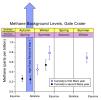
By repeated measurements of the concentration of methane in the atmosphere at Gale Crater, NASA's Curiosity Mars rover has detected long-term variation in background levels below one part per billion.
PIA20601:
Methane Background Levels at Gale Crater, Mars
Full Resolution:     TIFF (242.8 kB)     JPEG (79.46 kB)
Add Image to Favorite List 2016-05-11 Mars Mars Science Laboratory (MSL)
REMS
4167x9010x3
By monitoring weather throughout two Martian years since landing in Gale Crater in 2012, NASA's Curiosity Mars rover has documented seasonal patterns such as shown in these graphs of temperature, water-vapor content and air pressure.
PIA20600:
Seasonal Cycles in Curiosity's First Two Martian Years
Full Resolution:     TIFF (47.52 MB)     JPEG (2.638 MB)
Add Image to Favorite List 2016-04-27 Mars Mars Science Laboratory (MSL)
MAHLI
1603x1122x3
The team operating NASA's Curiosity Mars rover uses the Mars Hand Lens Imager (MAHLI) camera on the rover's arm to check the condition of the wheels at routine intervals.
PIA20334:
Routine Inspection of Rover Wheel Wear and Tear
Full Resolution:     TIFF (4.6 MB)     JPEG (196.9 kB)
Retrieve Previous Set  Jump to a Previous Set   Current Set   Jump to a Following Set   Jump to a Following Set   Jump to a Following Set   Jump to a Following Set   Jump to a Following Set   Jump to a Following Set   Jump to a Following Set   Jump to a Following Set   Retrieve Next Set 
 1-100   101-200   201-300   301-400   401-500   501-600   601-700   701-800   801-900   901-1000 
Currently displaying images: 101 - 200 of 1046