Your search criteria found
1717
images
Mission
Go to PIAxxxxx:
Refine this list of images by:
Target:
Deimos
Earth
Mars
Moon
Phobos
Vesta
Spacecraft:
Curiosity
Mars Reconnaissance Orbiter (MRO)
Mars Science Laboratory (MSL)
Opportunity
Phoenix Lander
Instrument:
Compact Reconnaissance Imaging Spectrometer for Mars (CRISM)
Context Camera (CTX)
High Resolution Imaging Science Experiment (HiRISE)
Mars Climate Sounder (MCS)
Mars Color Imager (MARCI)
Mars Orbiter Laser Altimeter
Optical Navigation Camera
Shallow Subsurface Radar (SHARAD)
Click on an image for detailed information
Click on a column heading to sort in ascending or descending order
My
List
Addition Date
Target
Mission
Instrument
Size
2016-04-21
Mars
Mars Reconnaissance Orbiter (MRO)
HiRISE
2880x1800x3
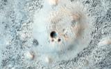
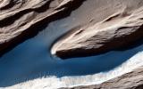
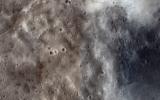
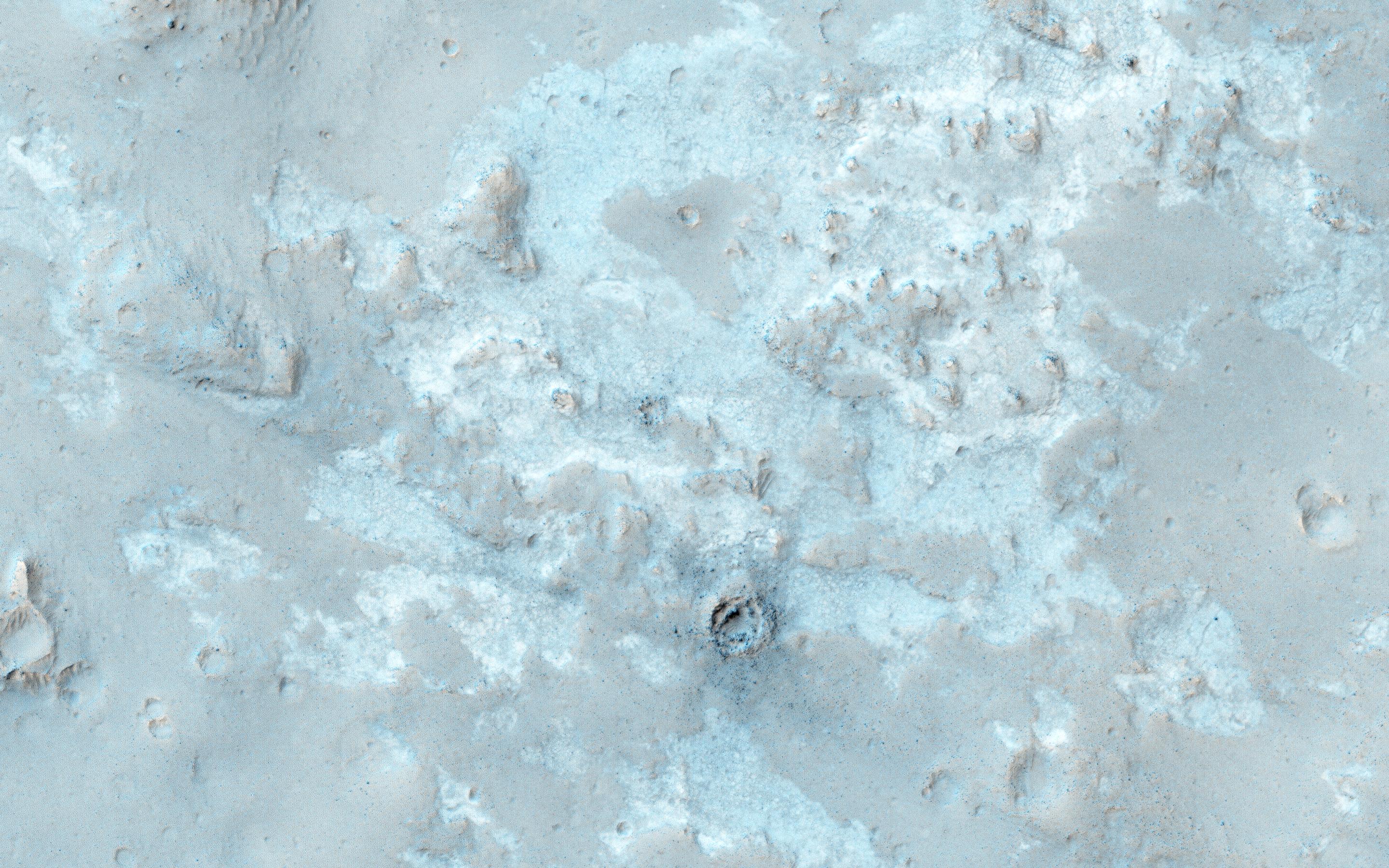
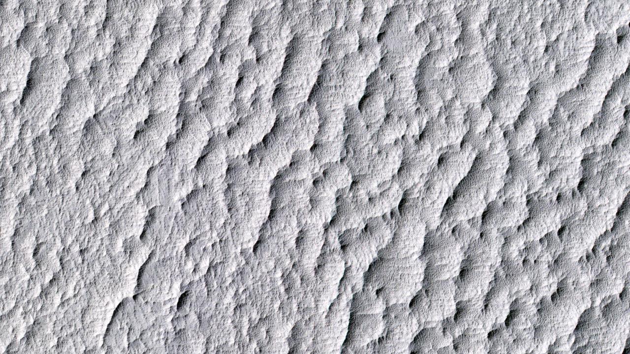
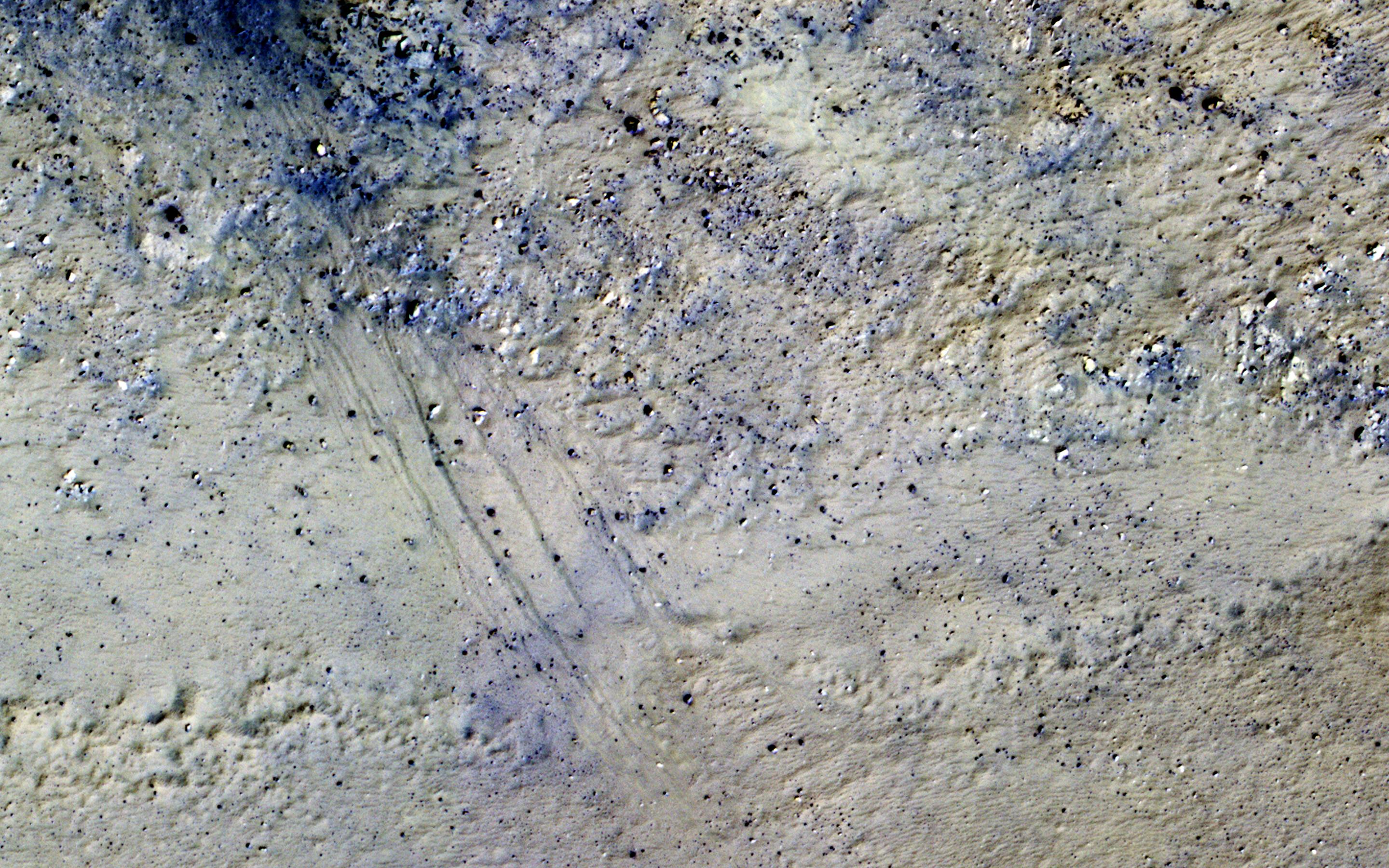
PIA20655:
Cratered Cones in Acidalia Planitia
Full Resolution:
TIFF
(15.56 MB)
JPEG
(876.1 kB)
2016-04-21
Mars
Mars Reconnaissance Orbiter (MRO)
HiRISE
2880x1800x3
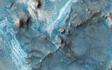
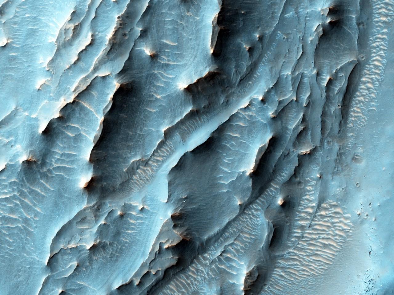
PIA20644:
Many Fantastic Colors
Full Resolution:
TIFF
(15.56 MB)
JPEG
(978.6 kB)
2016-04-21
Mars
Mars Reconnaissance Orbiter (MRO)
HiRISE
2880x1800x3
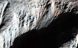
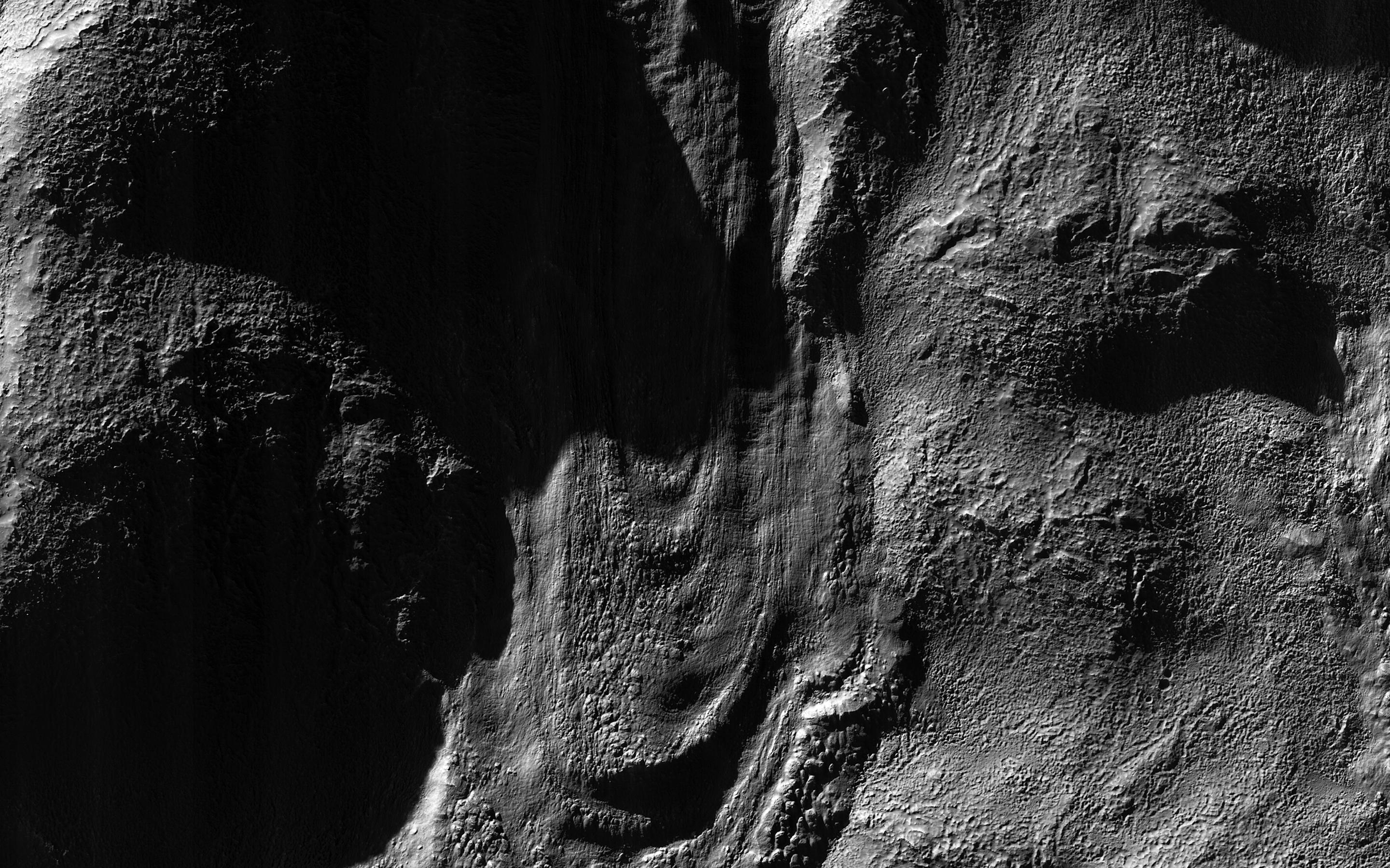
PIA20643:
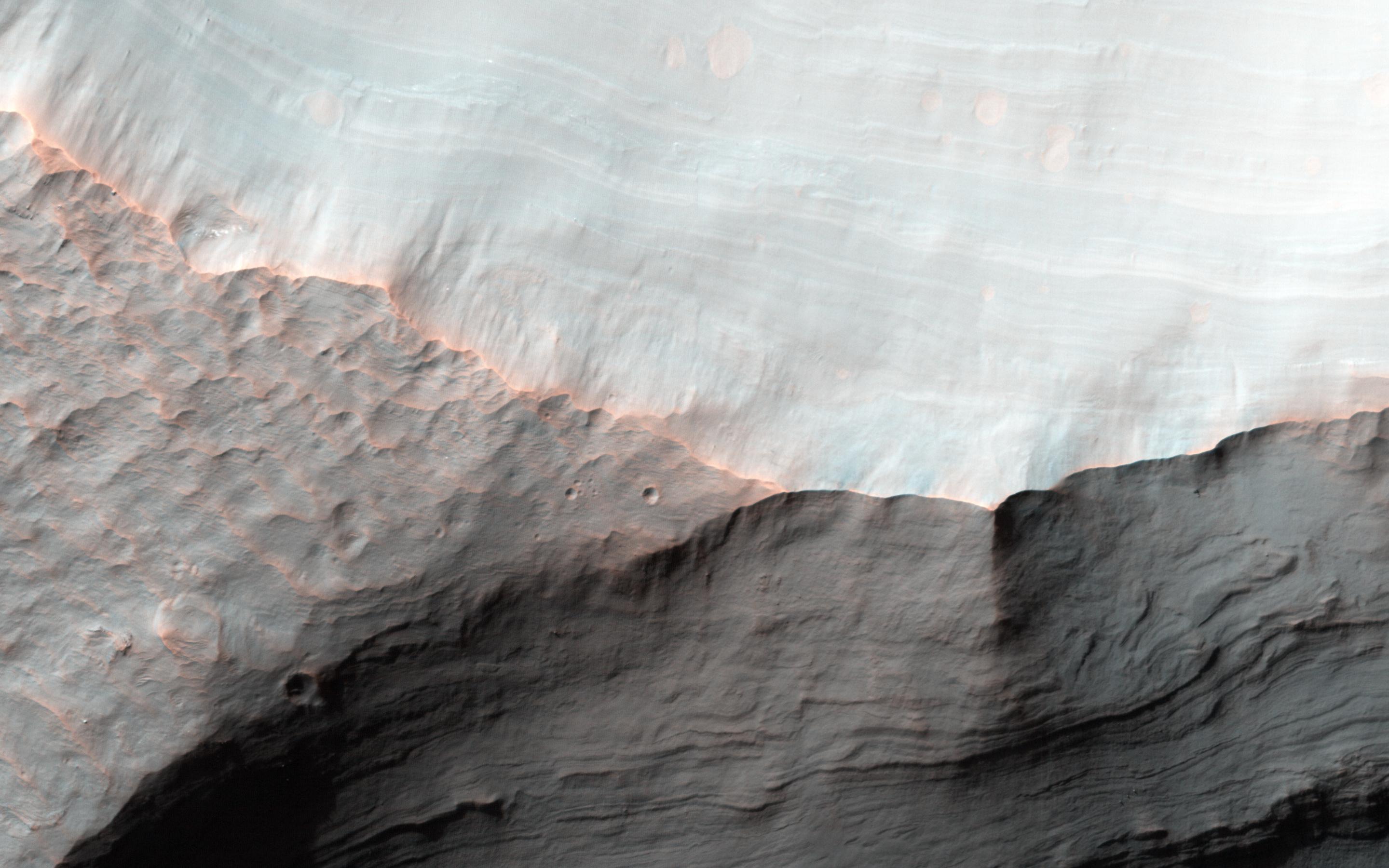
Gullies with Dramatic Lighting
Full Resolution:
TIFF
(13.67 MB)
JPEG
(685 kB)
2016-04-21
Mars
Mars Reconnaissance Orbiter (MRO)
HiRISE
2880x1800x3
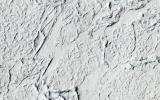
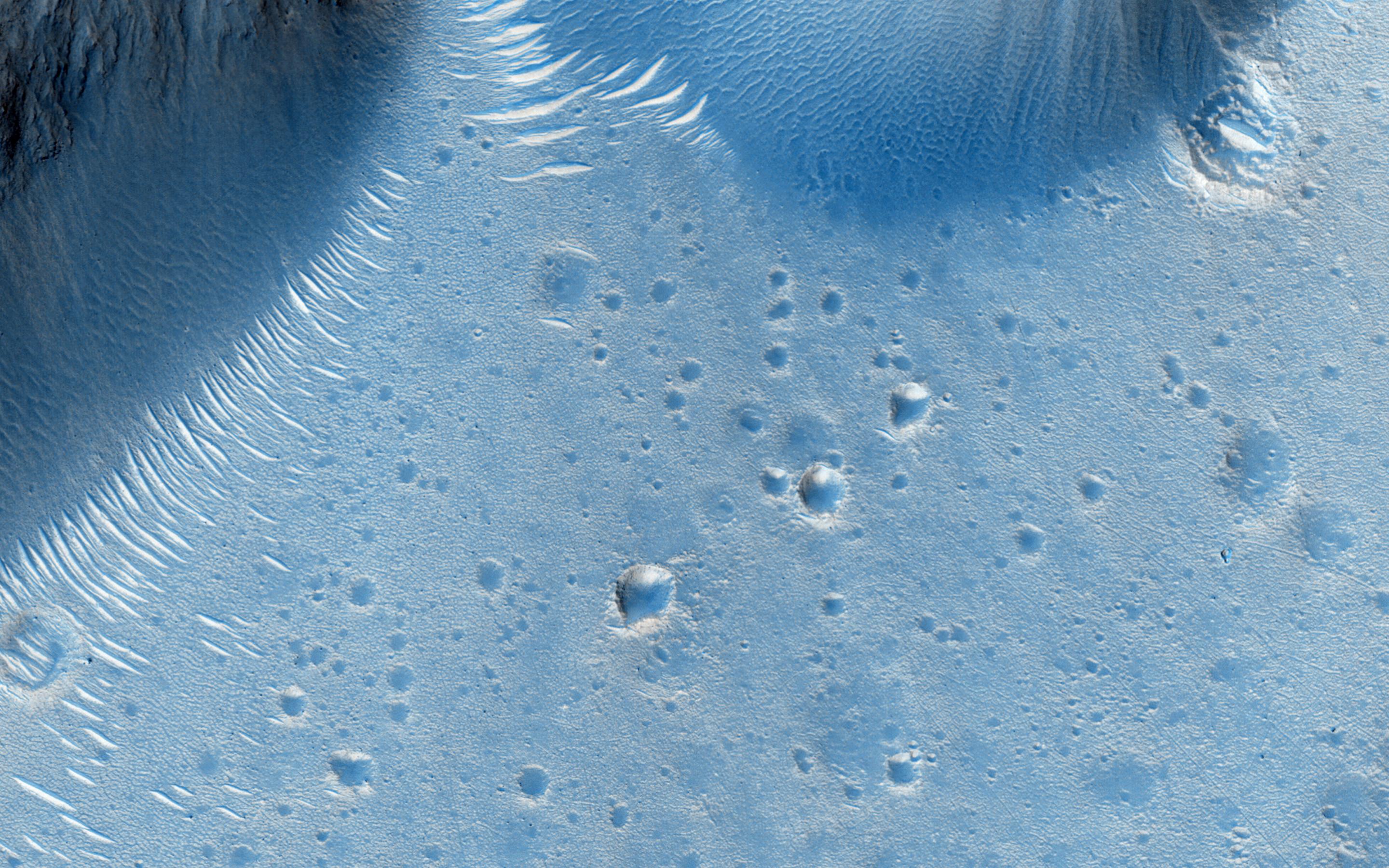
PIA20642:
Flood Lavas and Mass Extinctions
Full Resolution:
TIFF
(15.56 MB)
JPEG
(1.093 MB)
2016-04-06
Mars Reconnaissance Orbiter (MRO)
HiRISE
2880x1800x3
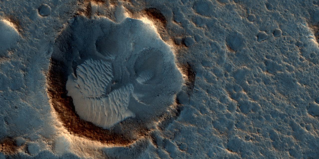
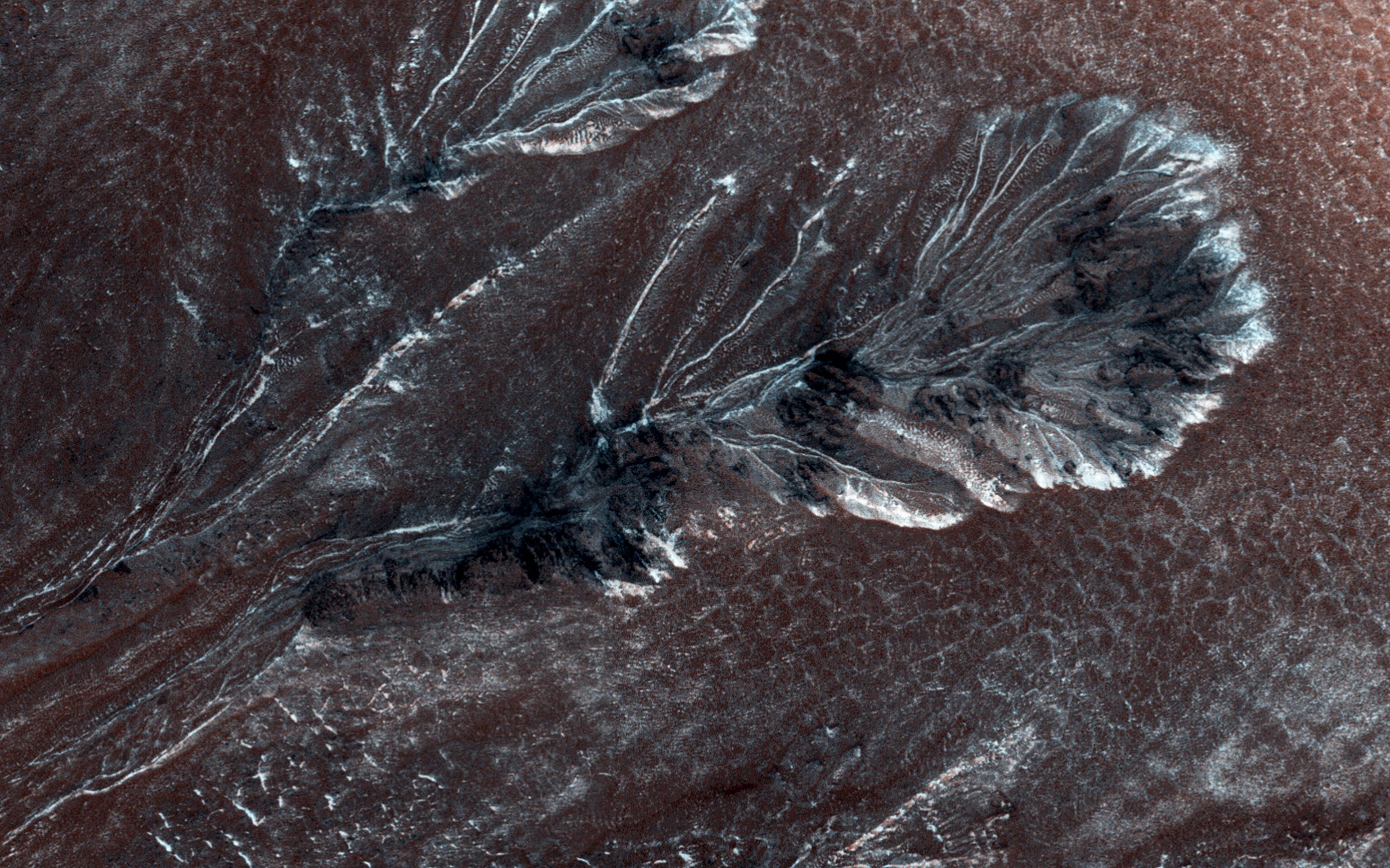
PIA20550:
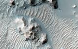
A Boulder Festival in Masursky Crater
Full Resolution:
TIFF
(14.47 MB)
JPEG
(791.1 kB)
2016-04-06
Mars Reconnaissance Orbiter (MRO)
HiRISE
2880x1800x3
PIA20549:
An East Watershed for Jezero Crater
Full Resolution:
TIFF
(15.56 MB)
JPEG
(972.6 kB)
2016-04-06
Mars Reconnaissance Orbiter (MRO)
HiRISE
2880x1800x3
PIA20548:
Cubism in the Western Rim of Holden Crater
Full Resolution:
TIFF
(15.56 MB)
JPEG
(790.7 kB)
2016-04-06
Mars Reconnaissance Orbiter (MRO)
HiRISE
2880x1800x3
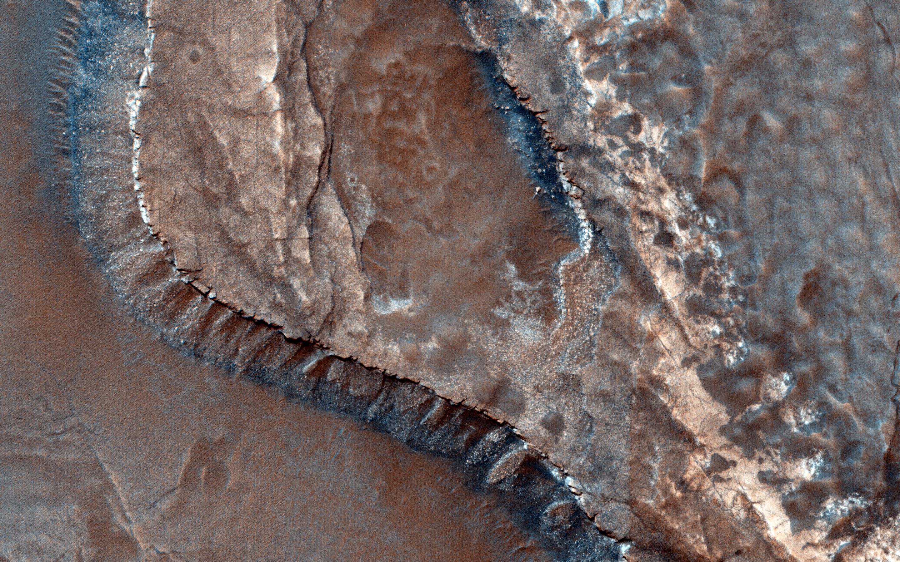
PIA20547:
Faulted Layers in Collapse Pits
Full Resolution:
TIFF
(15.05 MB)
JPEG
(584.2 kB)
2016-03-23
Mars
Mars Reconnaissance Orbiter (MRO)
HiRISE
2880x1800x3
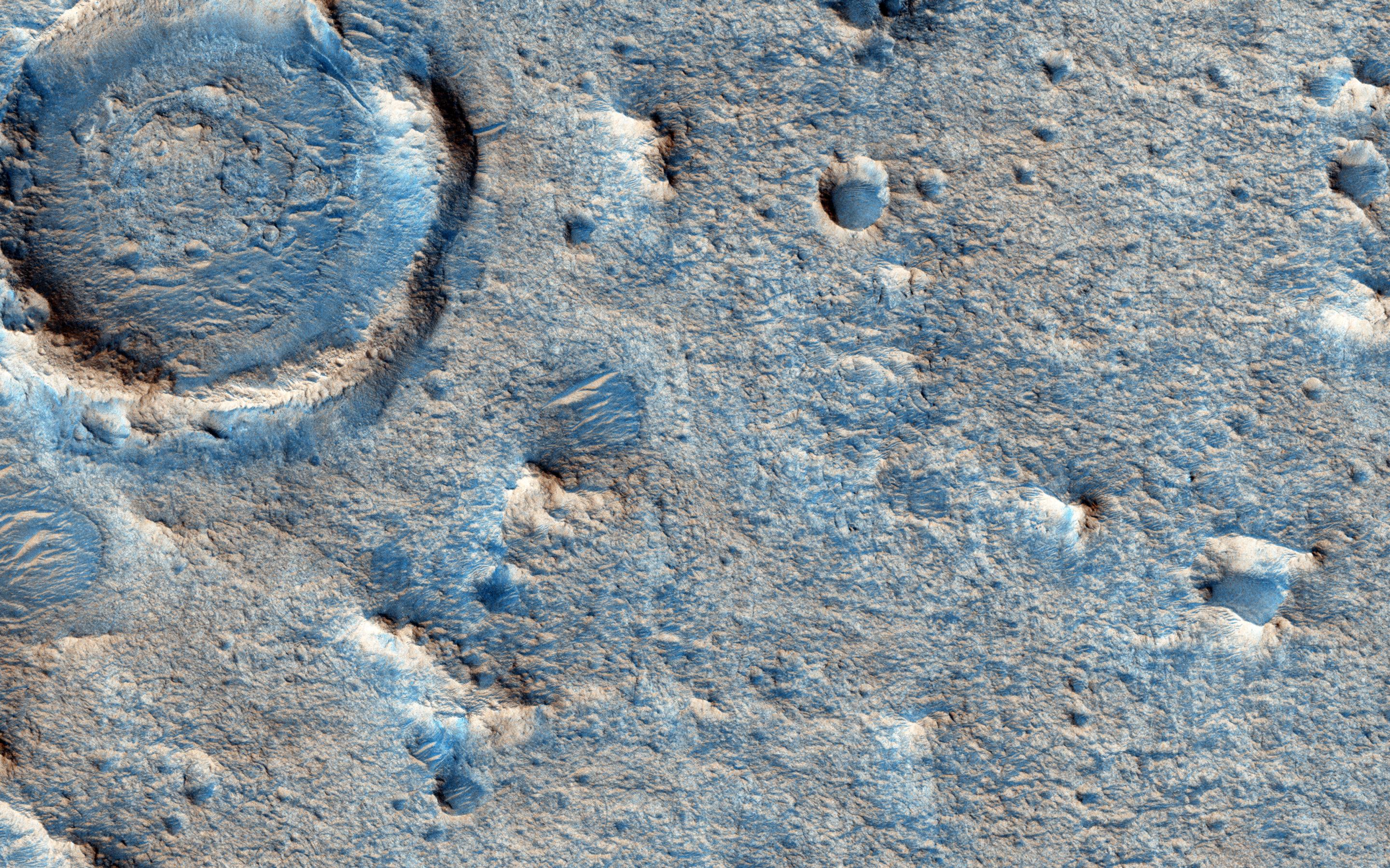
PIA20541:
Colorful Polar Layered Deposits
Full Resolution:
TIFF
(15.56 MB)
JPEG
(1.428 MB)
2016-03-23
Mars
Mars Reconnaissance Orbiter (MRO)
HiRISE
2880x1800x3
PIA20540:
Looking for Ice
Full Resolution:
TIFF
(15.56 MB)
JPEG
(1.829 MB)
2016-03-23
Mars
Mars Reconnaissance Orbiter (MRO)
HiRISE
2880x1800x3
PIA20539:
Old Salt
Full Resolution:
TIFF
(15.56 MB)
JPEG
(803.7 kB)
2016-03-23
Mars
Mars Reconnaissance Orbiter (MRO)
HiRISE
2880x1800x3
PIA20538:
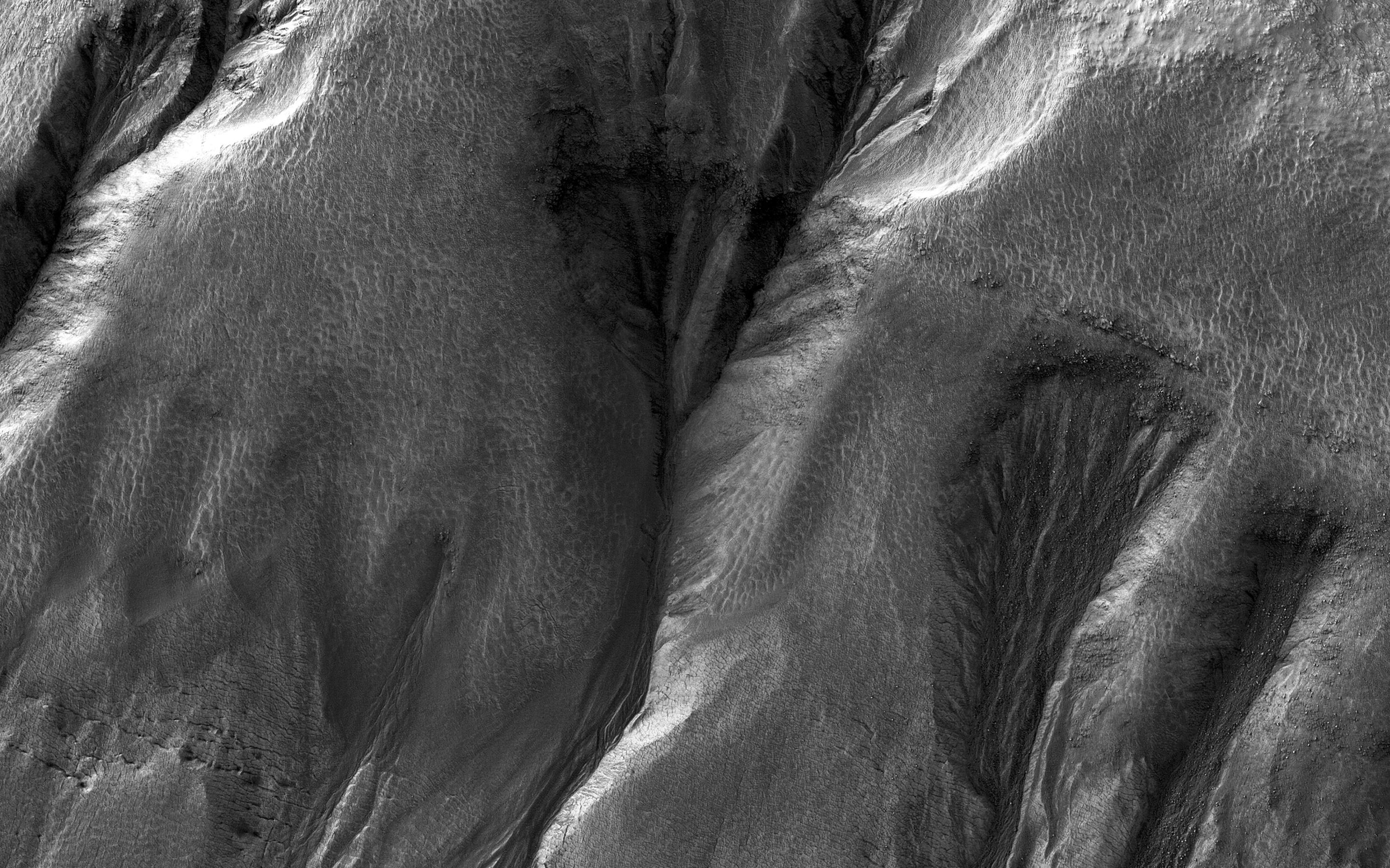
Stratigraphy of Alluvial Fans in Saheki Crater
Full Resolution:
TIFF
(13.24 MB)
JPEG
(436.8 kB)
2016-03-21
Mars
2001 Mars Odyssey
Mars Global Surveyor (MGS)
Mars Reconnaissance Orbiter (MRO)
MOLA
2400x2400x3
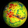
PIA20327:
Local Variations in the Gravitational Pull of Mars
Full Resolution:
TIFF
(11.91 MB)
JPEG
(443.7 kB)
2016-03-21
Mars
2001 Mars Odyssey
Mars Global Surveyor (MGS)
Mars Reconnaissance Orbiter (MRO)
MOLA
2400x2400x3
PIA20326:
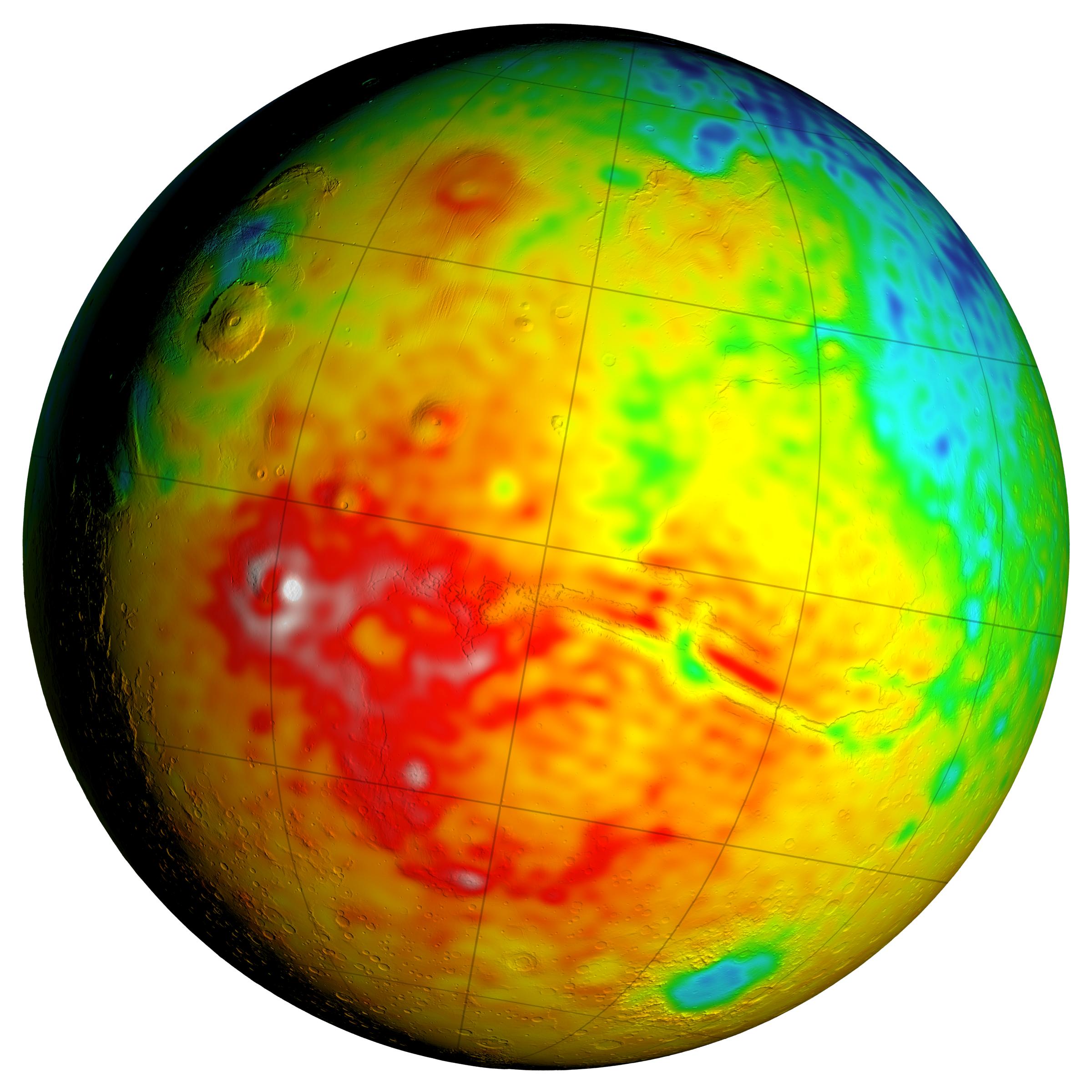
Newly Detailed Map of Mars' Crustal Thickness
Full Resolution:
TIFF
(10.76 MB)
JPEG
(398.9 kB)
2016-03-21
Mars
2001 Mars Odyssey
Mars Global Surveyor (MGS)
Mars Reconnaissance Orbiter (MRO)
MOLA
3200x1500x3
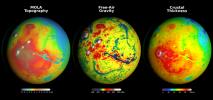
PIA20277:
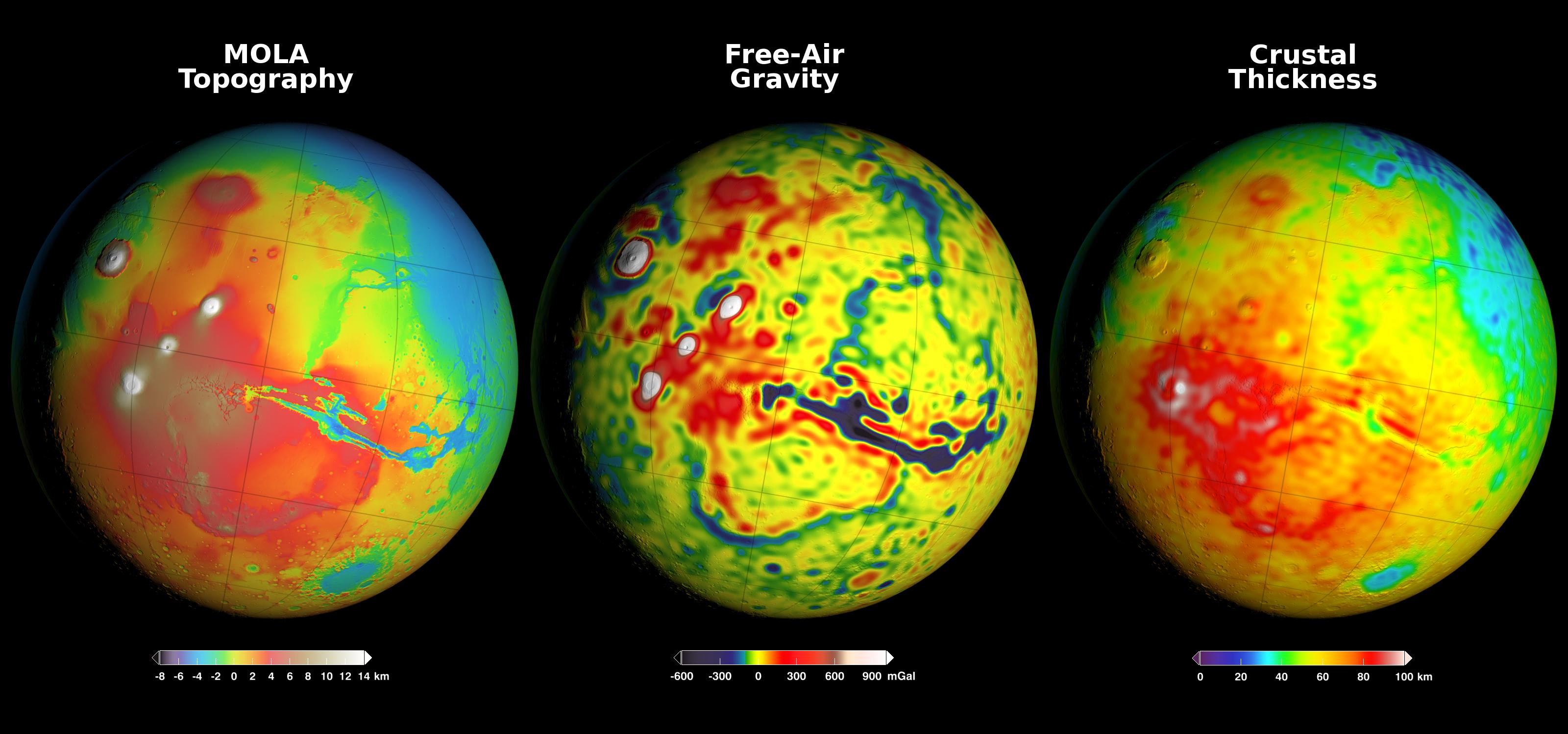
Using Gravity and Topography to Map Mars' Crustal Thickness
Full Resolution:
TIFF
(7.902 MB)
JPEG
(358.2 kB)
2016-03-10
Mars
Mars Reconnaissance Orbiter (MRO)
HiRISE
2880x1800x1
PIA20480:
Night Vision
Full Resolution:
TIFF
(5.191 MB)
JPEG
(985.4 kB)
2016-03-10
Mars
Mars Reconnaissance Orbiter (MRO)
HiRISE
2880x1800x3
PIA20479:
The Northwest Floor of Gale Crater
Full Resolution:
TIFF
(15.56 MB)
JPEG
(973.1 kB)
2016-03-10
Mars
Mars Reconnaissance Orbiter (MRO)
HiRISE
2880x1800x1
PIA20478:
The Dune Sea of Ganges Chasma
Full Resolution:
TIFF
(5.191 MB)
JPEG
(788.9 kB)
2016-03-09
Mars
Mars Reconnaissance Orbiter (MRO)
HiRISE
1280x960x3
PIA20167:
For a Decade Orbiting Mars: One Recent View
Full Resolution:
TIFF
(3.688 MB)
JPEG
(200.3 kB)
2016-02-24
Mars
Mars Reconnaissance Orbiter (MRO)
HiRISE
2880x1800x3
PIA20472:
Frosted Gully Slopes in Shadows
Full Resolution:
TIFF
(15.56 MB)
JPEG
(966.2 kB)
2016-02-24
Mars
Mars Reconnaissance Orbiter (MRO)
HiRISE
2880x1800x3
PIA20471:
Colorful Hargraves
Full Resolution:
TIFF
(15.56 MB)
JPEG
(974.5 kB)
2016-02-24
Mars
Mars Reconnaissance Orbiter (MRO)
HiRISE
2880x1800x1
PIA20470:
Dramatic Shadows over a Fossil Glacier
Full Resolution:
TIFF
(4.997 MB)
JPEG
(993.7 kB)
2016-02-24
Mars
Mars Reconnaissance Orbiter (MRO)
HiRISE
2880x1800x3
PIA20469:
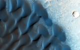
Summer Sand Dunes
Full Resolution:
TIFF
(15.56 MB)
JPEG
(996.1 kB)
2016-02-11
Mars
Mars Reconnaissance Orbiter (MRO)
HiRISE
2880x1800x3
PIA20463:
A Possible Alluvial Fan
Full Resolution:
TIFF
(15.56 MB)
JPEG
(869 kB)
2016-02-11
Mars
Mars Reconnaissance Orbiter (MRO)
HiRISE
2880x1800x3
PIA20462:
Rounded Mounds in Northern Arabia Terra
Full Resolution:
TIFF
(13.56 MB)
JPEG
(657.9 kB)
2016-02-11
Mars
Mars Reconnaissance Orbiter (MRO)
HiRISE
2880x1800x3
PIA20461:
Wind at Work
Full Resolution:
TIFF
(15 MB)
JPEG
(554.4 kB)
2016-02-11
Mars
Mars Reconnaissance Orbiter (MRO)
HiRISE
2880x1800x3
PIA20379:
Inverted Terrain in Eridania
Full Resolution:
TIFF
(15.56 MB)
JPEG
(768 kB)
2016-01-27
Mars
Mars Reconnaissance Orbiter (MRO)
HiRISE
2880x1800x3
PIA20371:
Jarosite in Noctis Labyrinthus
Full Resolution:
TIFF
(15.56 MB)
JPEG
(642.5 kB)
2016-01-27
Mars
Mars Reconnaissance Orbiter (MRO)
HiRISE
2880x1800x3
PIA20370:
A Tale of Two Flows
Full Resolution:
TIFF
(15.56 MB)
JPEG
(982.3 kB)
2016-01-27
Mars
Mars Reconnaissance Orbiter (MRO)
HiRISE
2880x1800x3
PIA20369:
The Changing Sands
Full Resolution:
TIFF
(15.56 MB)
JPEG
(771.5 kB)
2016-01-27
Mars
Mars Reconnaissance Orbiter (MRO)
HiRISE
2880x1800x3
PIA20368:
Pit Crater near Elysium Mons
Full Resolution:
TIFF
(11.19 MB)
JPEG
(553.7 kB)
2016-01-14
Mars
Mars Reconnaissance Orbiter (MRO)
HiRISE
2880x1800x1
PIA20340:
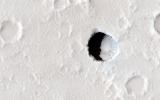
A Young, Fresh Crater in Hellespontus
Full Resolution:
TIFF
(4.722 MB)
JPEG
(525 kB)
2016-01-14
Mars
Mars Reconnaissance Orbiter (MRO)
HiRISE
2880x1800x3
PIA20339:
Erosion and Deposition in Schaeberle Crater
Full Resolution:
TIFF
(15.56 MB)
JPEG
(820.8 kB)
2016-01-14
Mars
Mars Reconnaissance Orbiter (MRO)
HiRISE
2880x1800x3
PIA20338:
Mars 2020 Candidate Landing Site in McLaughlin Crater
Full Resolution:
TIFF
(15.56 MB)
JPEG
(1.247 MB)
2016-01-14
Mars
Mars Reconnaissance Orbiter (MRO)
HiRISE
2880x1800x3
PIA20337:
Ancient Rivers
Full Resolution:
TIFF
(15.56 MB)
JPEG
(1.353 MB)
2015-12-23
Mars
Mars Reconnaissance Orbiter (MRO)
HiRISE
2880x1800x1
PIA20290:
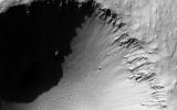
Boulders on a Landslide
Full Resolution:
TIFF
(5.191 MB)
JPEG
(1.134 MB)
2015-12-23
Mars
Mars Reconnaissance Orbiter (MRO)
HiRISE
2880x1800x3
PIA20289:
A Frost Enhanced Landscape
Full Resolution:
TIFF
(15.56 MB)
JPEG
(1.378 MB)
2015-12-23
Mars
Mars Reconnaissance Orbiter (MRO)
HiRISE
2880x1800x3
PIA20288:
Icy Erosion
Full Resolution:
TIFF
(15.14 MB)
JPEG
(754.4 kB)
2015-12-17
Mars
Mars Reconnaissance Orbiter (MRO)
Mars Science Laboratory (MSL)
HiRISE
3300x2550x3
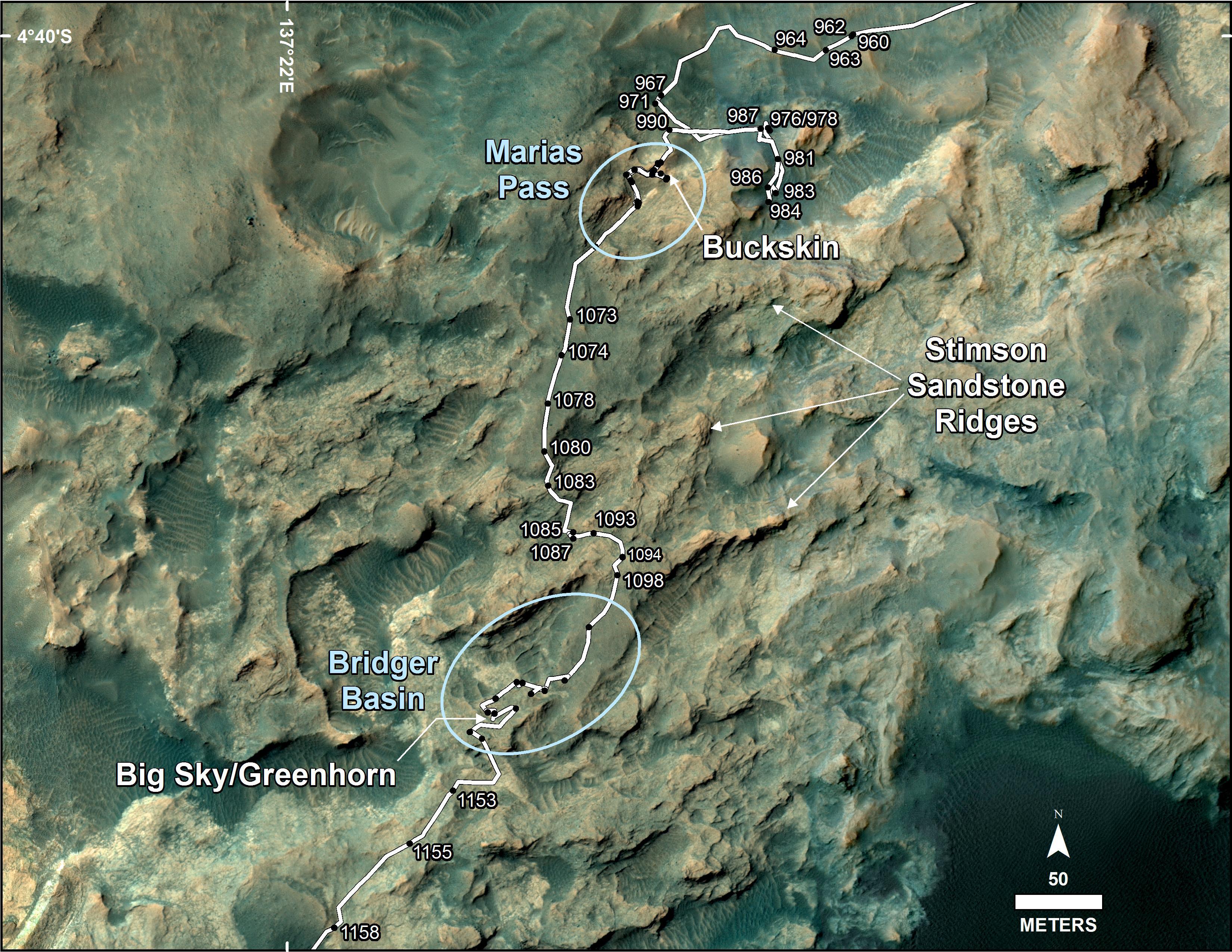
PIA20173:
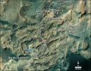
Curiosity's Path During 2015 Studies of Silica-Rich Rocks
Full Resolution:
TIFF
(25.26 MB)
JPEG
(1.372 MB)
2015-12-17
Mars
Mars Reconnaissance Orbiter (MRO)
Mars Science Laboratory (MSL)
HiRISE
3300x2550x3
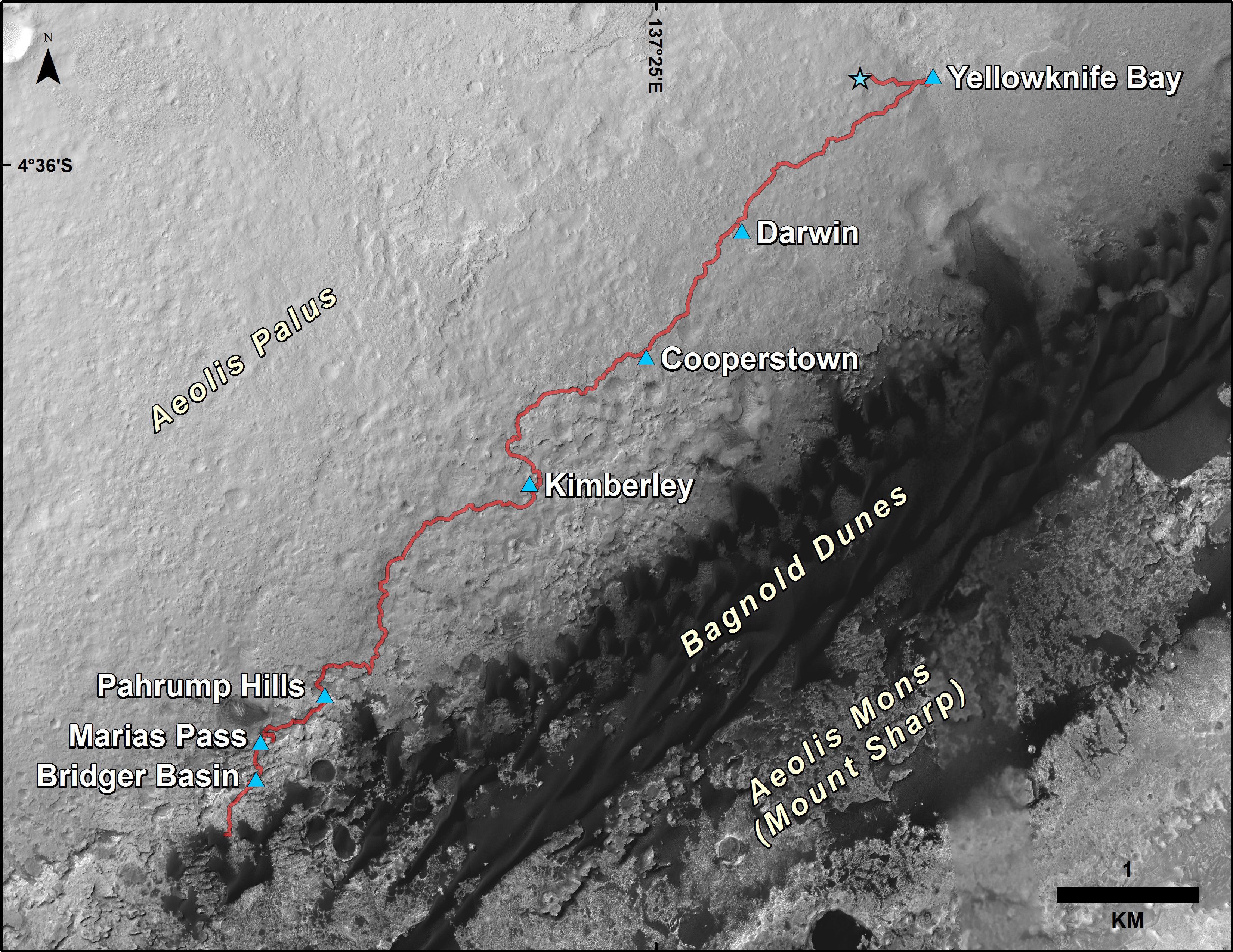
PIA20172:
Curiosity Rover's Traverse, First 1,185 Sols on Mars
Full Resolution:
TIFF
(13.35 MB)
JPEG
(1.533 MB)
2015-12-10
Mars
Mars Reconnaissance Orbiter (MRO)
HiRISE
2880x1800x3
PIA20211:
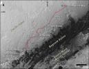
Curiosity Trek
Full Resolution:
TIFF
(15.56 MB)
JPEG
(873.1 kB)
2015-12-10
Mars
Mars Reconnaissance Orbiter (MRO)
HiRISE
2880x1800x3
PIA20210:
Inverted Streams in the Aeolis Region
Full Resolution:
TIFF
(15.56 MB)
JPEG
(902.3 kB)
2015-12-10
Mars
Mars Reconnaissance Orbiter (MRO)
HiRISE
2880x1800x3
PIA20209:
Strange Patterns in Echus Chasma
Full Resolution:
TIFF
(15.56 MB)
JPEG
(1.477 MB)
2015-12-10
Mars
Mars Reconnaissance Orbiter (MRO)
HiRISE
2880x1800x3
PIA20208:
The Coming and Going of Ice
Full Resolution:
TIFF
(15.56 MB)
JPEG
(898.6 kB)
2015-11-27
Mars
Mars Reconnaissance Orbiter (MRO)
HiRISE
2880x1800x1
PIA20160:
Inverted Meandering Rivers at a Possible Future Mars Landing Site
Full Resolution:
TIFF
(5.055 MB)
JPEG
(832.6 kB)
2015-11-27
Mars
Mars Reconnaissance Orbiter (MRO)
HiRISE
2880x1800x3
PIA20159:
A Landing Site for ExoMars 2016
Full Resolution:
TIFF
(15.56 MB)
JPEG
(1.932 MB)
2015-11-27
Mars
Mars Reconnaissance Orbiter (MRO)
HiRISE
2880x1800x1
PIA20158:
A Youthful Crater in the Cydonia Colles Region
Full Resolution:
TIFF
(5.191 MB)
JPEG
(819.4 kB)
2015-11-27
Mars
Mars Reconnaissance Orbiter (MRO)
HiRISE
2880x1800x3
PIA20157:
Down in the Paleochannels
Full Resolution:
TIFF
(15.56 MB)
JPEG
(1.072 MB)
2015-11-05
Mars
Mars Reconnaissance Orbiter (MRO)
HiRISE
2880x1800x3
PIA20047:
Meanders in Ridge Form in the Zephyria Region
Full Resolution:
TIFF
(13.52 MB)
JPEG
(673.1 kB)
2015-11-05
Mars
Mars Reconnaissance Orbiter (MRO)
HiRISE
2880x1800x3
PIA20046:
Small Channels and a Rocky Patch in the Cydonia Region
Full Resolution:
TIFF
(15.56 MB)
JPEG
(1.167 MB)
2015-11-05
Mars
Mars Reconnaissance Orbiter (MRO)
HiRISE
2880x1800x1
PIA20045:
Marching Dust Devils
Full Resolution:
TIFF
(5.191 MB)
JPEG
(1.254 MB)
2015-11-05
Mars
Mars Reconnaissance Orbiter (MRO)
HiRISE
2880x1800x3
PIA20044:
Layers and Fractures in Ophir Chasma
Full Resolution:
TIFF
(15.56 MB)
JPEG
(815.3 kB)
2015-10-14
Mars
Mars Reconnaissance Orbiter (MRO)
HiRISE
2880x1800x3
PIA20006:
Fine-Branched Ridges
Full Resolution:
TIFF
(15.56 MB)
JPEG
(1.099 MB)
2015-10-14
Mars
Mars Reconnaissance Orbiter (MRO)
HiRISE
2880x1800x3
PIA20005:
Gullies in a Central Pit Crater
Full Resolution:
TIFF
(15.56 MB)
JPEG
(885.4 kB)
2015-10-14
Mars
Mars Reconnaissance Orbiter (MRO)
HiRISE
2880x1800x3
PIA20004:
Kasei Valles
Full Resolution:
TIFF
(5.191 MB)
JPEG
(987.8 kB)
2015-10-14
Mars
Mars Reconnaissance Orbiter (MRO)
HiRISE
2880x1800x3
PIA20003:
A Cone Shaped Hill
Full Resolution:
TIFF
(14.25 MB)
JPEG
(766.5 kB)
2015-10-05
Mars
Mars Reconnaissance Orbiter (MRO)
HiRISE
1280x720x1
PIA19915:
Western Edge of Mars' Marth Crater, a Movie Location
Full Resolution:
TIFF
(922.8 kB)
JPEG
(106.5 kB)
2015-10-05
Mars
Mars Reconnaissance Orbiter (MRO)
HiRISE
1280x720x3
PIA19914:
'The Martian' Story's Ares 4 Landing Site
Full Resolution:
TIFF
(2.766 MB)
JPEG
(280.8 kB)
2015-10-05
Mars
Mars Reconnaissance Orbiter (MRO)
HiRISE
1280x640x3
PIA19913:
The Ares 3 Landing Site: Where Science Fact Meets Fiction
Full Resolution:
TIFF
(2.459 MB)
JPEG
(139.8 kB)
2015-09-30
Mars
Mars Reconnaissance Orbiter (MRO)
HiRISE
2880x1800x3
PIA19962:
Aeolian Features of Scandia Cavi
Full Resolution:
TIFF
(13.56 MB)
JPEG
(693.2 kB)
2015-09-30
Mars
Mars Reconnaissance Orbiter (MRO)
HiRISE
2880x1800x3
PIA19961:
Dynamic Mars
Full Resolution:
TIFF
(14.28 MB)
JPEG
(457.8 kB)
2015-09-30
Mars
Mars Reconnaissance Orbiter (MRO)
HiRISE
2880x1800x3
PIA19960:
Nested Channels near Hellas
Full Resolution:
TIFF
(14.91 MB)
JPEG
(850.1 kB)
2015-09-30
Mars
Mars Reconnaissance Orbiter (MRO)
HiRISE
2880x1800x3
PIA19959:
Western Edge of Marth Crater
Full Resolution:
TIFF
(15.56 MB)
JPEG
(1.029 MB)
2015-09-30
Mars
Mars Reconnaissance Orbiter (MRO)
HiRISE
2880x1800x3
PIA19958:
All Along the Fractures
Full Resolution:
TIFF
(15.56 MB)
JPEG
(907.6 kB)
2015-09-28
Mars
Mars Reconnaissance Orbiter (MRO)
HiRISE
1241x845x3
PIA19919:
Animation of Site of Seasonal Flows in Hale Crater, Mars
Full Resolution:
TIFF
(3.094 MB)
JPEG
(85.26 kB)
2015-09-28
Mars
Mars Reconnaissance Orbiter (MRO)
HiRISE
1920x997x1
PIA19918:
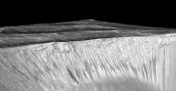
Recurring "Lineae" on Slopes at Horowitz Crater
Full Resolution:
TIFF
(1.334 MB)
JPEG
(238.8 kB)
2015-09-28
Mars
Mars Reconnaissance Orbiter (MRO)
HiRISE
1920x997x1
PIA19917:
Dark, Recurring Streaks on Walls of Garni Crater
Full Resolution:
TIFF
(1.532 MB)
JPEG
(296.4 kB)
2015-09-28
Mars
Mars Reconnaissance Orbiter (MRO)
HiRISE
1920x997x3
PIA19916:
Recurring 'Lineae' on Slopes at Hale Crater, Mars
Full Resolution:
TIFF
(3.078 MB)
JPEG
(403.4 kB)
2015-09-16
Mars
Mars Reconnaissance Orbiter (MRO)
HiRISE
2880x1800x3
PIA19942:
Bizarre TARs
Full Resolution:
TIFF
(15.56 MB)
JPEG
(1.195 MB)
2015-09-16
Mars
Mars Reconnaissance Orbiter (MRO)
HiRISE
2880x1800x3
PIA19941:
Which Came First?
Full Resolution:
TIFF
(15.56 MB)
JPEG
(1.241 MB)
2015-09-16
Mars
Mars Reconnaissance Orbiter (MRO)
HiRISE
2880x1800x3
PIA19940:
Possible Sulfates in the Northeast Syrtis Major Region
Full Resolution:
TIFF
(15.56 MB)
JPEG
(881.1 kB)
2015-09-16
Mars
Mars Reconnaissance Orbiter (MRO)
HiRISE
2880x1800x3
PIA19939:
Western Medusa Fossae Formation: Dust and Dunes
Full Resolution:
TIFF
(15.56 MB)
JPEG
(734.2 kB)
2015-09-02
Mars
Mars Reconnaissance Orbiter (MRO)
CRISM
HiRISE
801x1280x3
PIA19817:
Rocks Here Sequester Some of Mars' Early Atmosphere
Full Resolution:
TIFF
(3.077 MB)
JPEG
(333.9 kB)
2015-09-02
Mars
2001 Mars Odyssey
Mars Reconnaissance Orbiter (MRO)
CRISM
THEMIS
1234x616x3
PIA19816:
Multiple Instruments Used for Mars Carbon Estimate
Full Resolution:
TIFF
(2.281 MB)
JPEG
(155.9 kB)
2015-08-12
Mars
Mars Reconnaissance Orbiter (MRO)
HiRISE
2880x1800x3
PIA19870:
Ridge and Talus in Lycus Sulci
Full Resolution:
TIFF
(15.32 MB)
JPEG
(861.2 kB)
2015-08-12
Mars
Mars Reconnaissance Orbiter (MRO)
HiRISE
2880x1800x3
PIA19869:
Yardang-Sculpted Deposits from Apollonaris Patera
Full Resolution:
TIFF
(15.56 MB)
JPEG
(1.067 MB)
2015-08-12
Mars
Mars Reconnaissance Orbiter (MRO)
HiRISE
2880x1800x3
PIA19868:
Light-Toned Layers in Tithonium Chasma
Full Resolution:
TIFF
(15.56 MB)
JPEG
(939.3 kB)
2015-08-10
Mars
Mars Reconnaissance Orbiter (MRO)
HiRISE
975x1023x3
PIA19805:
For Anniversary of Orbiter's Launch: Seasonal Flows in Mars' Valles Marineris
Full Resolution:
TIFF
(2.994 MB)
JPEG
(109.6 kB)
2015-07-29
Mars
Mars Reconnaissance Orbiter (MRO)
HiRISE
2880x1800x3
PIA19862:
Gullies on the Wall of an Unnamed Crater in Utopia Planitia
Full Resolution:
TIFF
(15.56 MB)
JPEG
(1.375 MB)
2015-07-29
Mars
Mars Reconnaissance Orbiter (MRO)
HiRISE
2880x1800x3
PIA19861:
A Fresh Shallow Valley Transitions to an Inverted Channel
Full Resolution:
TIFF
(15.56 MB)
JPEG
(1.045 MB)
2015-07-29
Mars
Mars Reconnaissance Orbiter (MRO)
HiRISE
2880x1800x3
PIA19860:
Diverse Deposits in Melas Chasma
Full Resolution:
TIFF
(15.56 MB)
JPEG
(835.8 kB)
2015-07-29
Mars
Mars Reconnaissance Orbiter (MRO)
HiRISE
2880x1800x3
PIA19859:
A Possible Landing Site for the ExoMars Rover in Aram Dorsum
Full Resolution:
TIFF
(15.56 MB)
JPEG
(1.177 MB)
2015-07-22
Mars
Mars Reconnaissance Orbiter (MRO)
CTX
HiRISE
1920x1080x3
PIA19823:
Volunteers Help Decide Where to Point Mars Camera
Full Resolution:
TIFF
(6.223 MB)
JPEG
(386.9 kB)
2015-07-15
Mars
Mars Reconnaissance Orbiter (MRO)
HiRISE
2880x1800x3
PIA19855:
Sedimentary Deposits within Ius Chasma
Full Resolution:
TIFF
(15.56 MB)
JPEG
(1.057 MB)
2015-07-15
Mars
Mars Reconnaissance Orbiter (MRO)
HiRISE
2880x1800x3
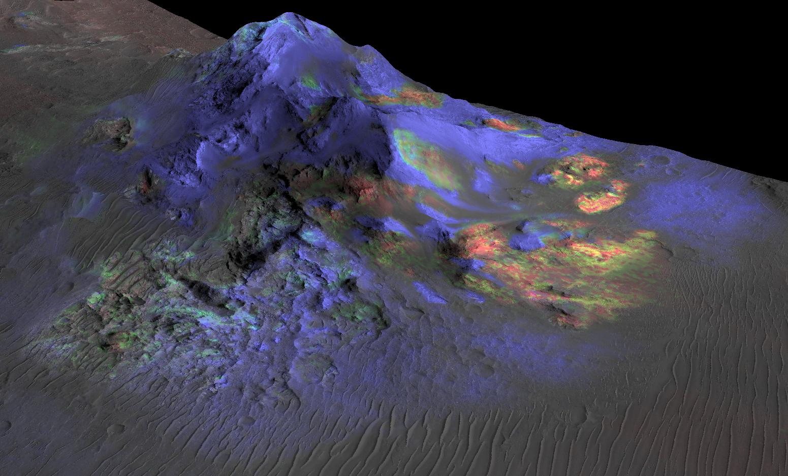
PIA19854:
Purple Mountain's Majesty
Full Resolution:
TIFF
(15.56 MB)
JPEG
(731.7 kB)
2015-07-15
Mars
Mars Reconnaissance Orbiter (MRO)
HiRISE
2880x1800x3
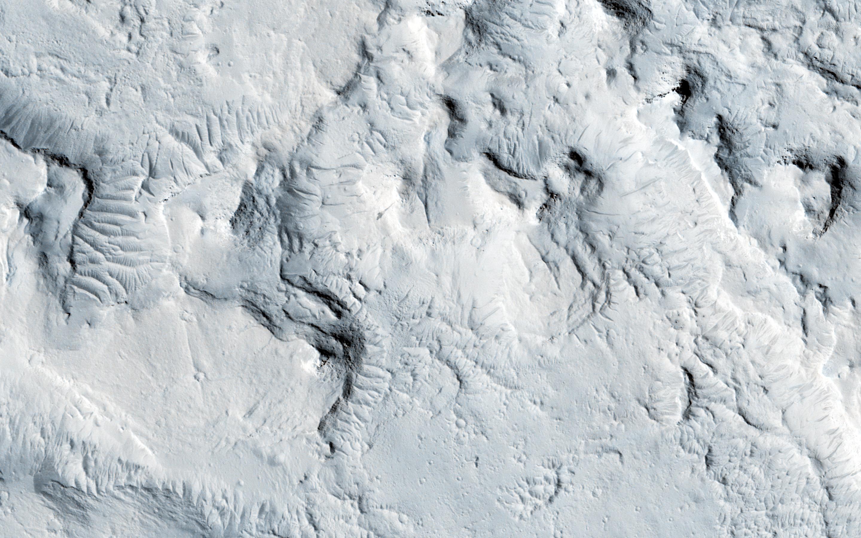
PIA19853:
Potential Active Processes in Porter Crater
Full Resolution:
TIFF
(15.56 MB)
JPEG
(976.9 kB)
2015-07-15
Mars
Mars Reconnaissance Orbiter (MRO)
HiRISE
2880x1800x3
PIA19852:
Frosty Gullies on the Northern Plains
Full Resolution:
TIFF
(15.56 MB)
JPEG
(857.7 kB)
2015-07-01
Mars
Mars Reconnaissance Orbiter (MRO)
HiRISE
2880x1800x3
PIA19851:
Clay-Rich Terrain in Oxia Planum: A Proposed ExoMars Landing Site
Full Resolution:
TIFF
(15.56 MB)
JPEG
(1.42 MB)
2015-07-01
Mars
Mars Reconnaissance Orbiter (MRO)
HiRISE
2880x1800x3
PIA19850:
A Channel System and Patterned Ground near Hellas Basin
Full Resolution:
TIFF
(15.56 MB)
JPEG
(1.198 MB)
2015-07-01
Mars
Mars Reconnaissance Orbiter (MRO)
HiRISE
2880x1800x3
PIA19849:
Pedestal Crater Development
Full Resolution:
TIFF
(15.56 MB)
JPEG
(764.6 kB)
2015-07-01
Mars
Mars Reconnaissance Orbiter (MRO)
HiRISE
2880x1800x3
PIA19848:
Searching for Clinoforms in a Possible Delta
Full Resolution:
TIFF
(15.56 MB)
JPEG
(693.4 kB)
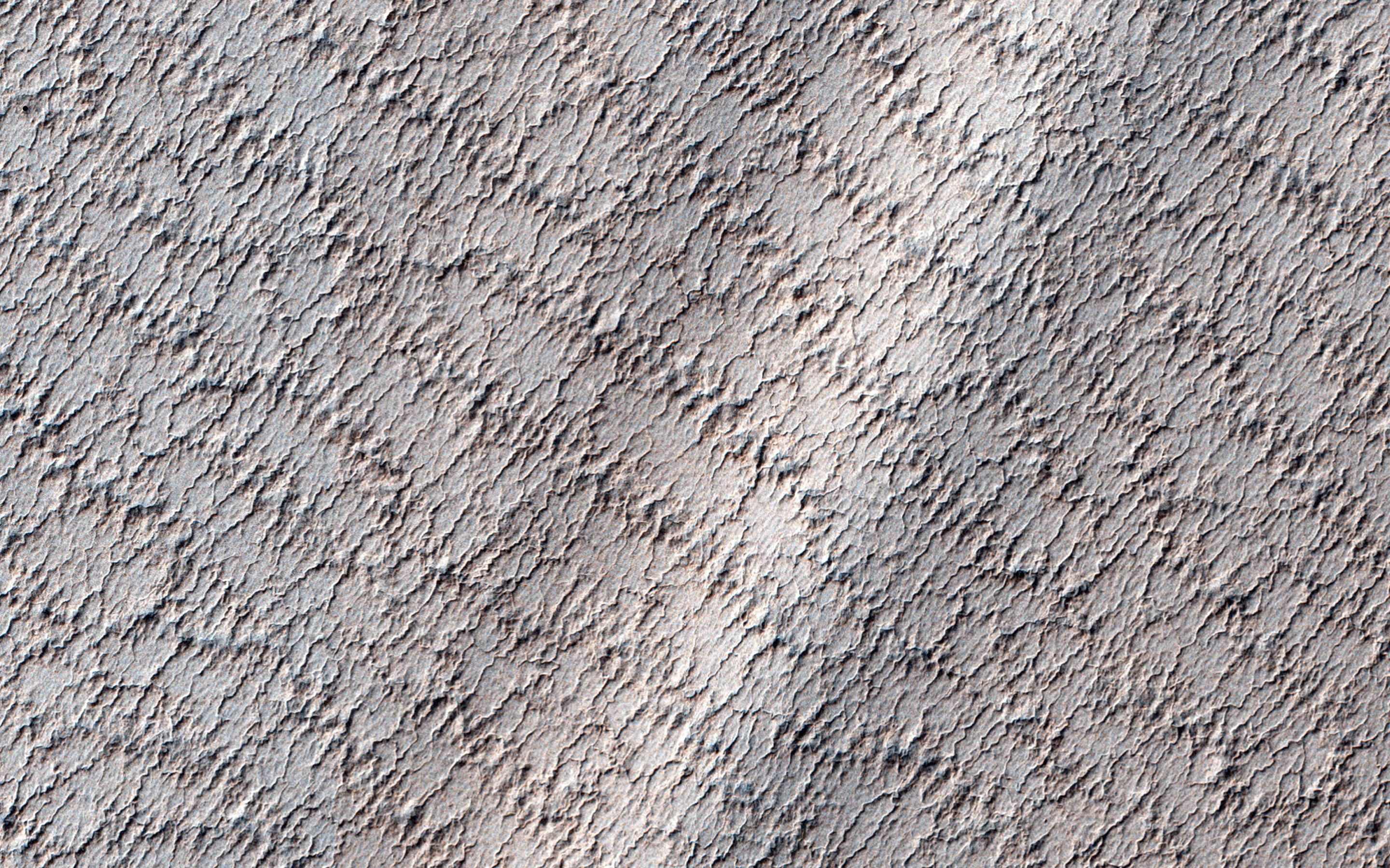
2015-06-17
Mars
Mars Reconnaissance Orbiter (MRO)
HiRISE
2880x1800x3
PIA19846:
Cloudy Skies over Hypanis Vallis
Full Resolution:
TIFF
(15.56 MB)
JPEG
(733.3 kB)
2015-06-17
Mars
Mars Reconnaissance Orbiter (MRO)
HiRISE
2880x1800x3
PIA19845:
A Fan-Shaped Landform and Nearby Light-Toned Material
Full Resolution:
TIFF
(15.56 MB)
JPEG
(1.015 MB)
2015-06-17
Mars
Mars Reconnaissance Orbiter (MRO)
HiRISE
2880x1800x3
PIA19844:
A Light Toned Deposit in Aureum Chaos
Full Resolution:
TIFF
(15.56 MB)
JPEG
(831 kB)
2015-06-17
Mars
Mars Reconnaissance Orbiter (MRO)
HiRISE
2880x1800x3
PIA19843:
Active High-Latitude Dune-Gullies
Full Resolution:
TIFF
(15.56 MB)
JPEG
(1.001 MB)
2015-06-08
Mars
Mars Reconnaissance Orbiter (MRO)
CRISM
1551x938x3
PIA19673:
Spectral Signals Indicating Impact Glass on Mars
Full Resolution:
TIFF
(4.366 MB)
JPEG
(201.2 kB)
2015-06-03
Mars
Mars Reconnaissance Orbiter (MRO)
HiRISE
2880x1800x3
PIA11778:
Gigas Sulci
Full Resolution:
TIFF
(15.56 MB)
JPEG
(675.6 kB)
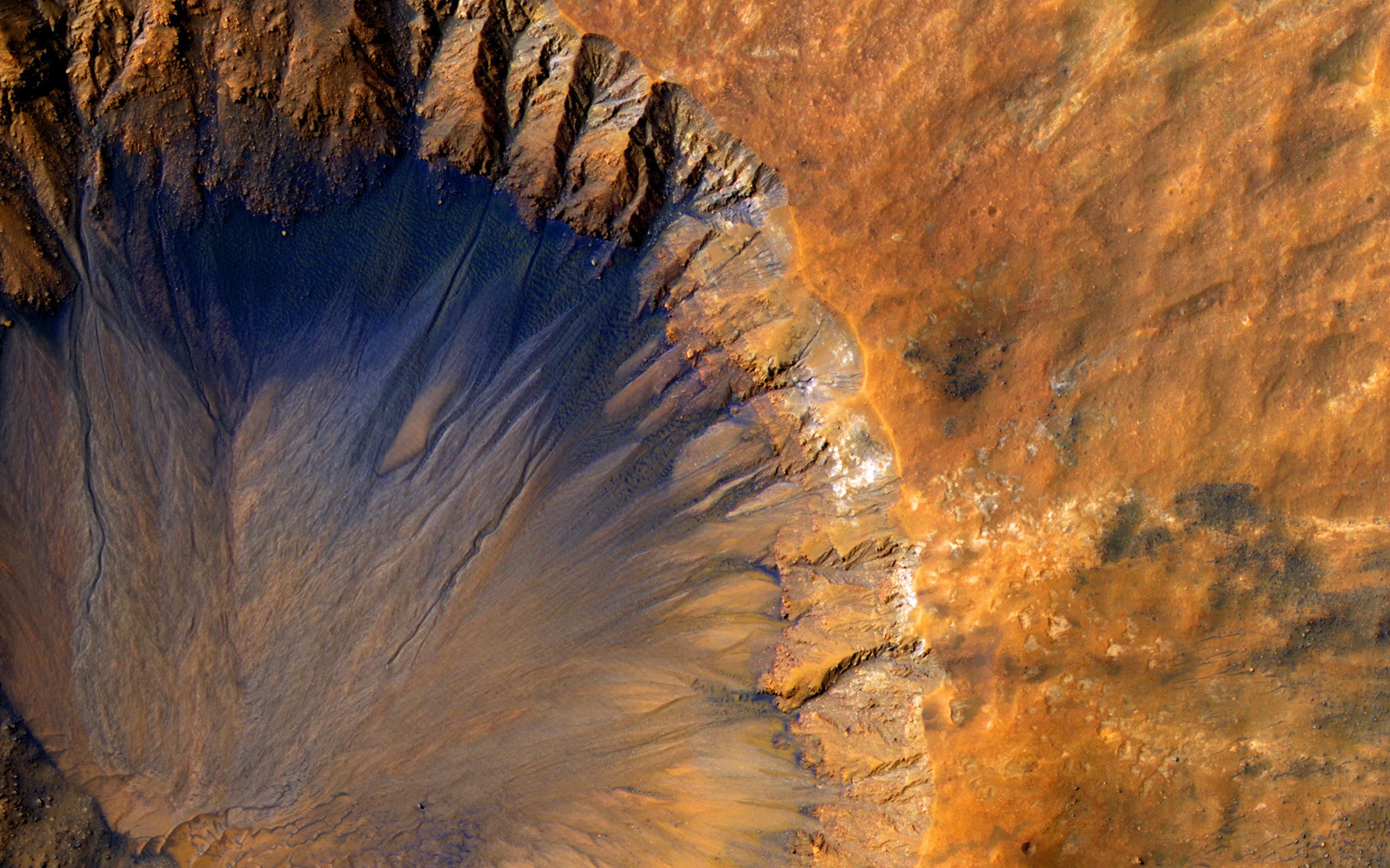
2015-06-03
Mars
Mars Reconnaissance Orbiter (MRO)
HiRISE
2880x1800x3
PIA11777:
A Fresh Crater near Sirenum Fossae
Full Resolution:
TIFF
(15.56 MB)
JPEG
(750.4 kB)
2015-06-03
Mars
Mars Reconnaissance Orbiter (MRO)
HiRISE
2880x1800x3
PIA11776:
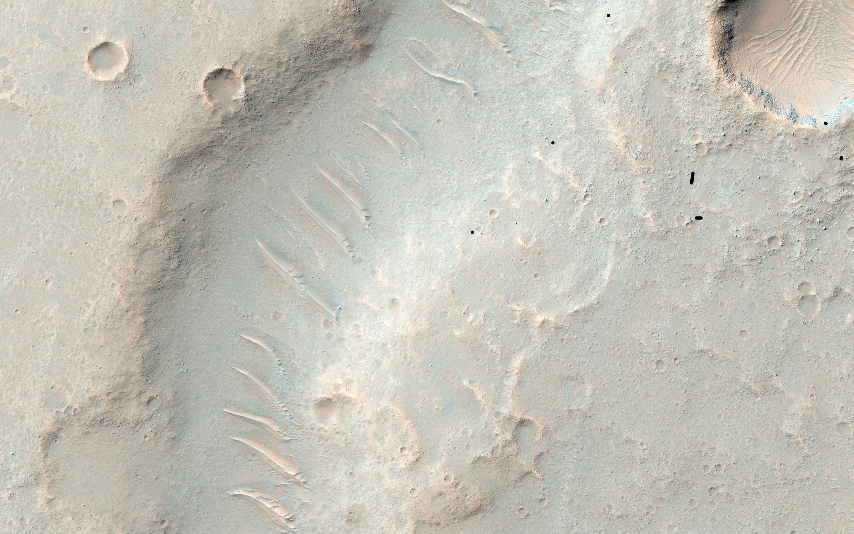
A Mysterious Bright Streak on the South Polar Layered Deposits
Full Resolution:
TIFF
(15.56 MB)
JPEG
(1.307 MB)
2015-06-03
Mars
Mars Reconnaissance Orbiter (MRO)
HiRISE
2880x1800x3
PIA11775:
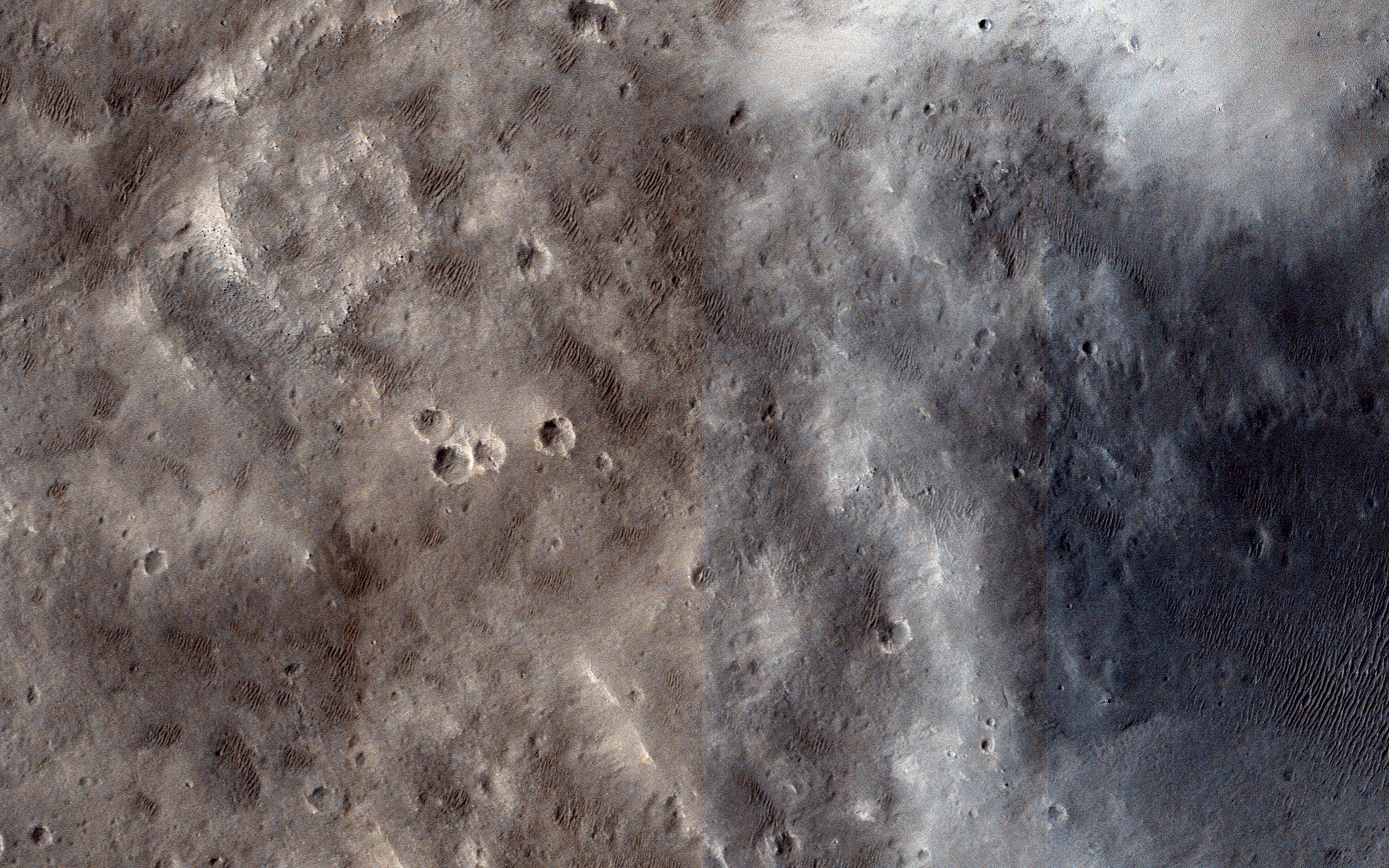
Fill or Mantling Material in a Crater
Full Resolution:
TIFF
(15.56 MB)
JPEG
(1.086 MB)
1-100
101-200
201-300
301-400
401-500
501-600
601-700
701-800
801-900
901-1000
Currently displaying images:
601 - 700
of 1717


