Your search criteria found
1717
images
Mission
Go to PIAxxxxx:
Refine this list of images by:
Target:
Deimos
Earth
Mars
Moon
Phobos
Vesta
Spacecraft:
Curiosity
Mars Reconnaissance Orbiter (MRO)
Mars Science Laboratory (MSL)
Opportunity
Phoenix Lander
Instrument:
Compact Reconnaissance Imaging Spectrometer for Mars (CRISM)
Context Camera (CTX)
High Resolution Imaging Science Experiment (HiRISE)
Mars Climate Sounder (MCS)
Mars Color Imager (MARCI)
Mars Orbiter Laser Altimeter
Optical Navigation Camera
Shallow Subsurface Radar (SHARAD)
Click on an image for detailed information
Click on a column heading to sort in ascending or descending order
My
List
Addition Date
Target
Mission
Instrument
Size
2017-01-25
Mars
Mars Reconnaissance Orbiter (MRO)
HiRISE
1062x1855x3
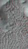
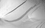
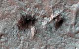
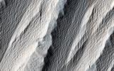
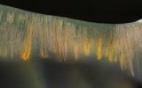
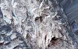
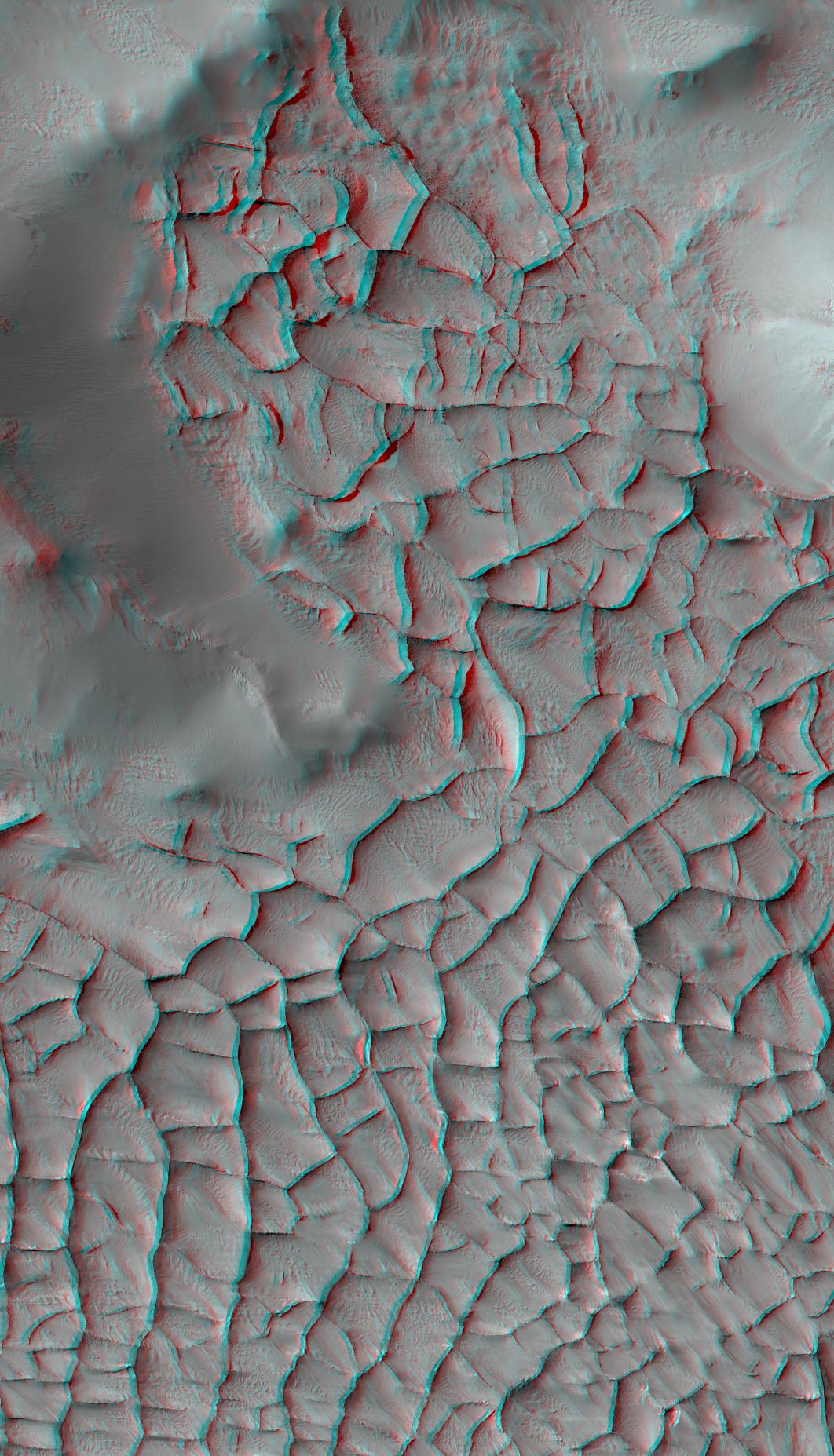
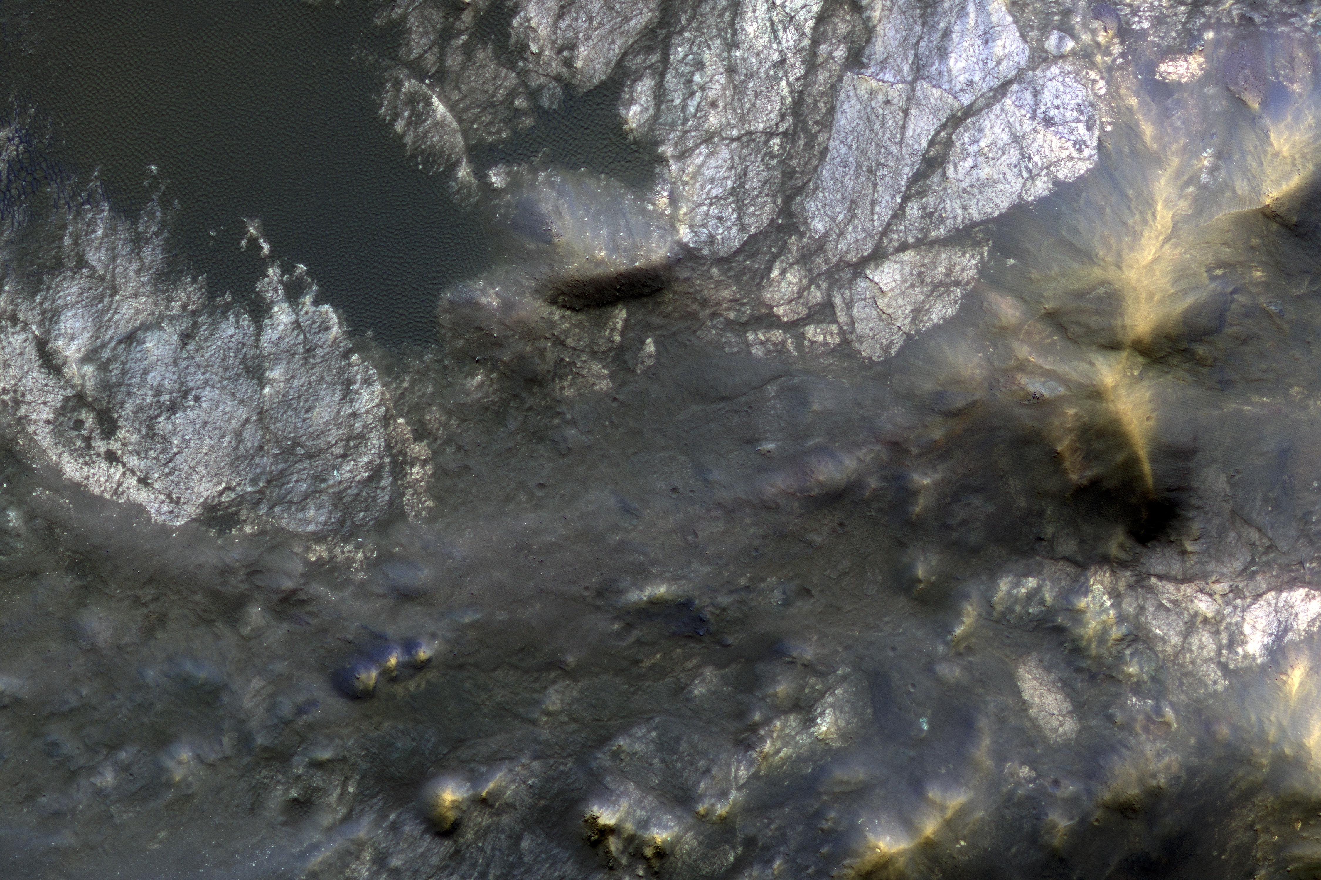
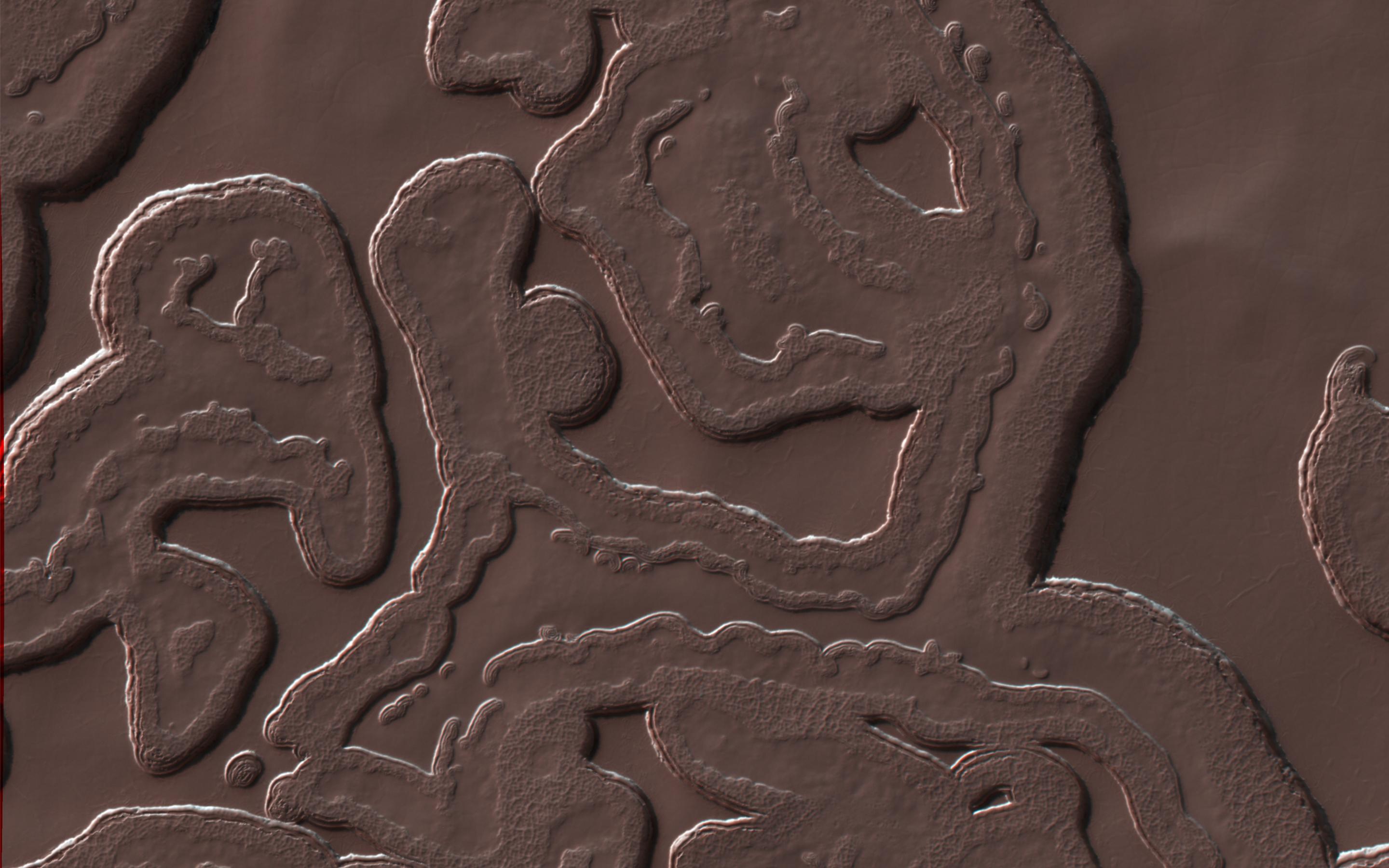
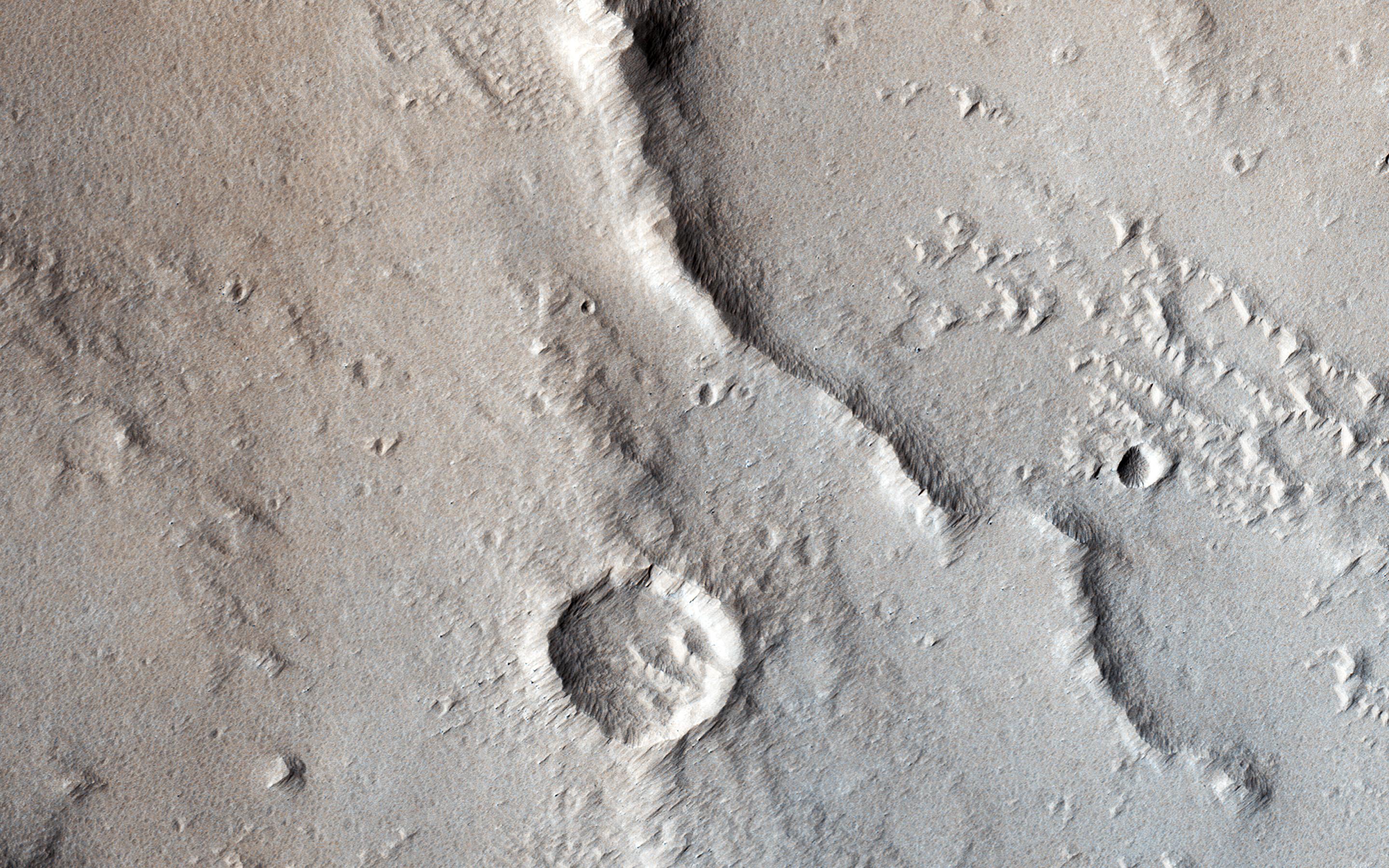
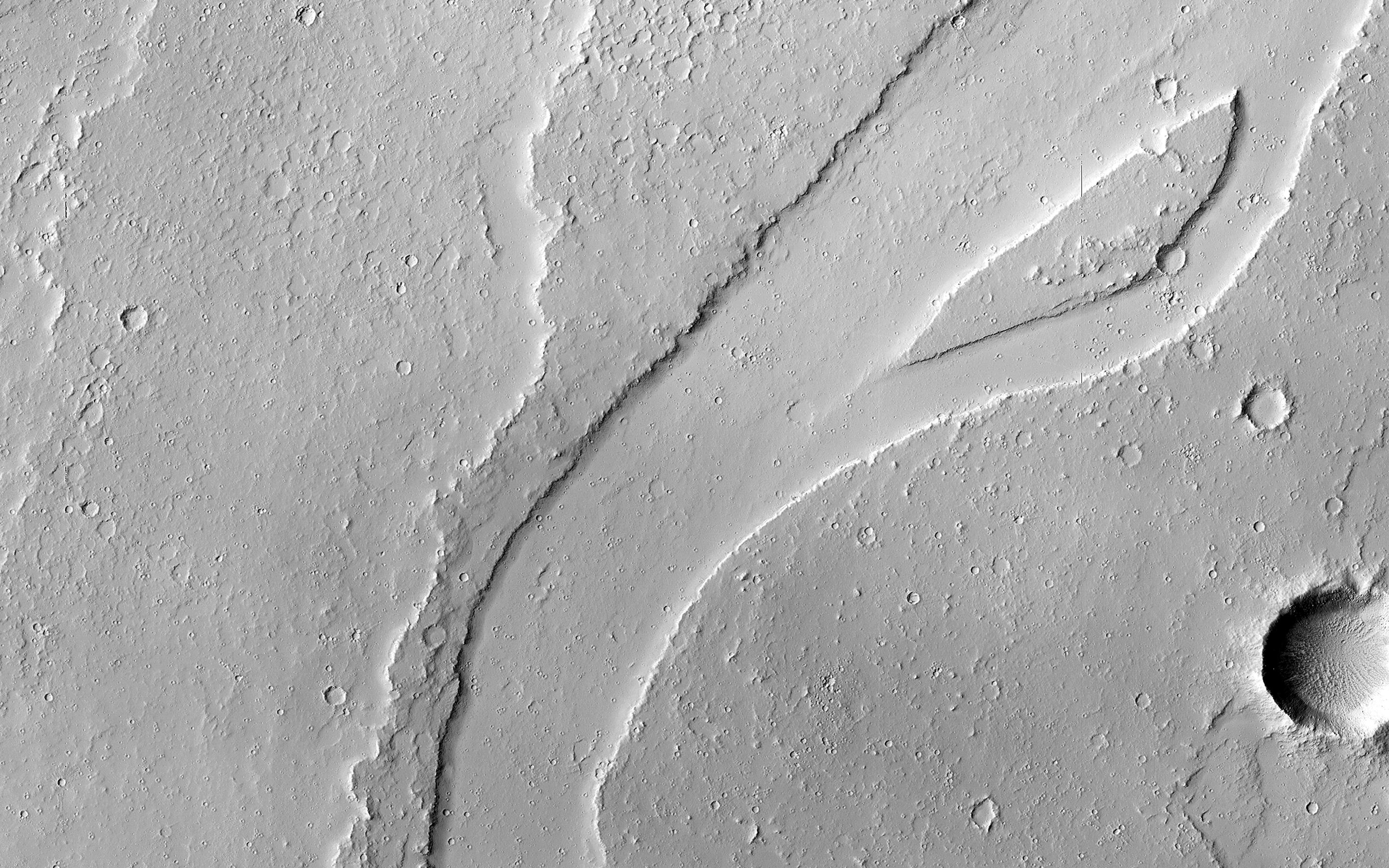
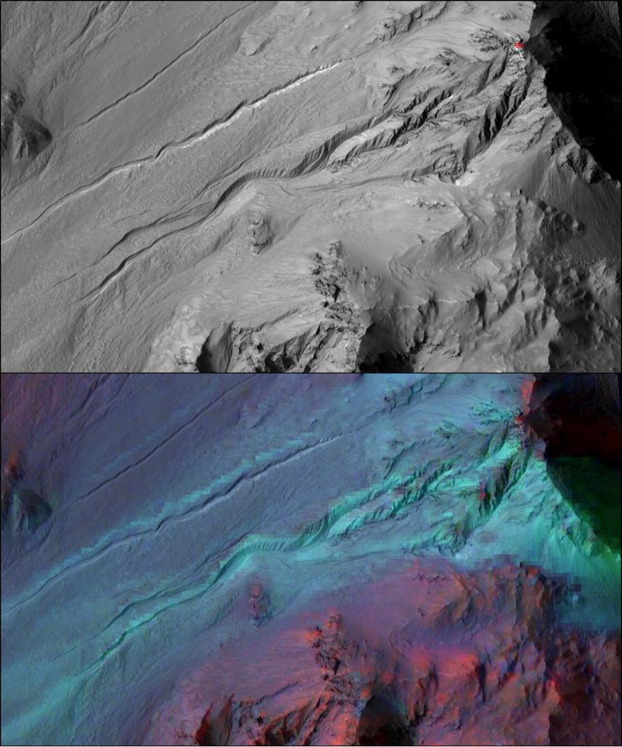
PIA21265:
Blade-Like Martian Walls Outline Polygons (Stereo)
Full Resolution:
TIFF
(5.31 MB)
JPEG
(331.2 kB)
2017-01-25
Mars
Mars Reconnaissance Orbiter (MRO)
HiRISE
2159x1056x3
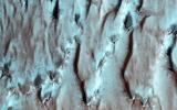
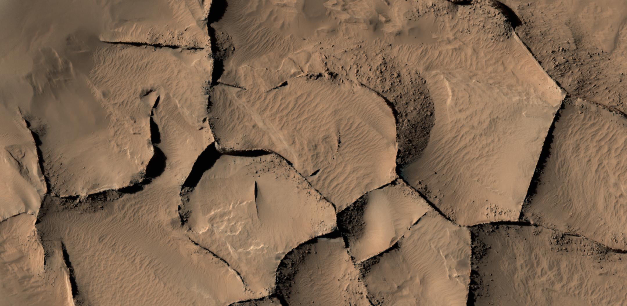
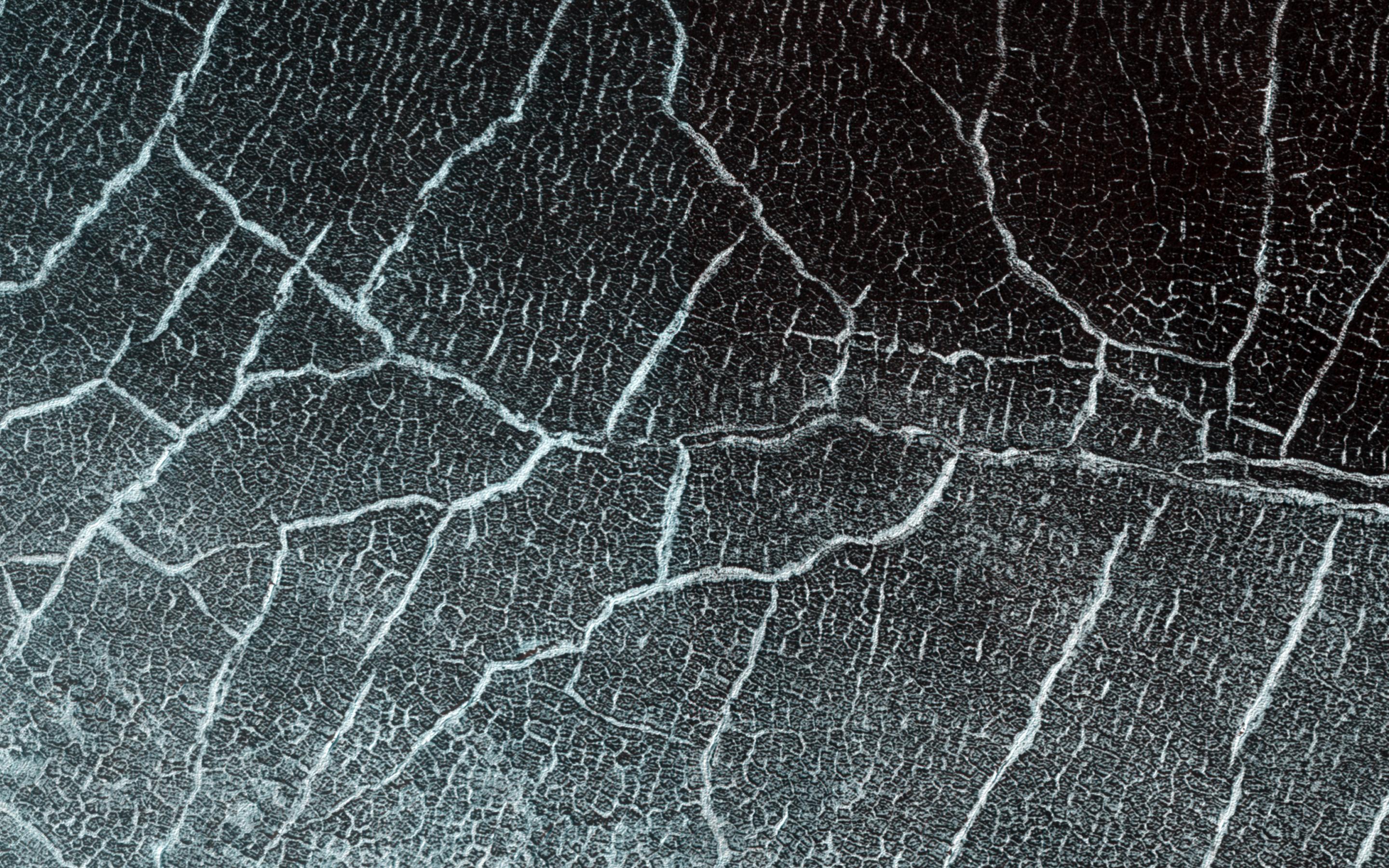
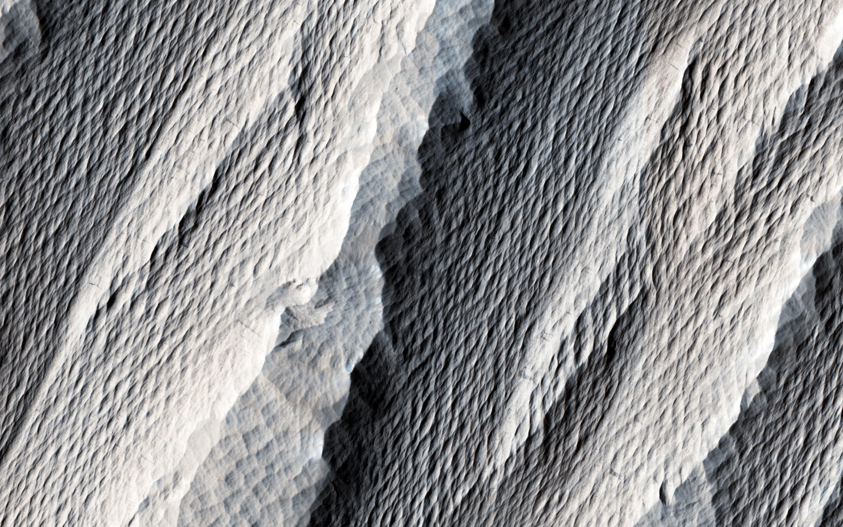
PIA21264:
Blade-Like Martian Walls Outline Polygons
Full Resolution:
TIFF
(5.927 MB)
JPEG
(271.4 kB)
2017-01-25
Mars
Mars Reconnaissance Orbiter (MRO)
HiRISE
2880x1800x3
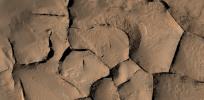
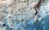
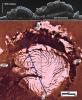
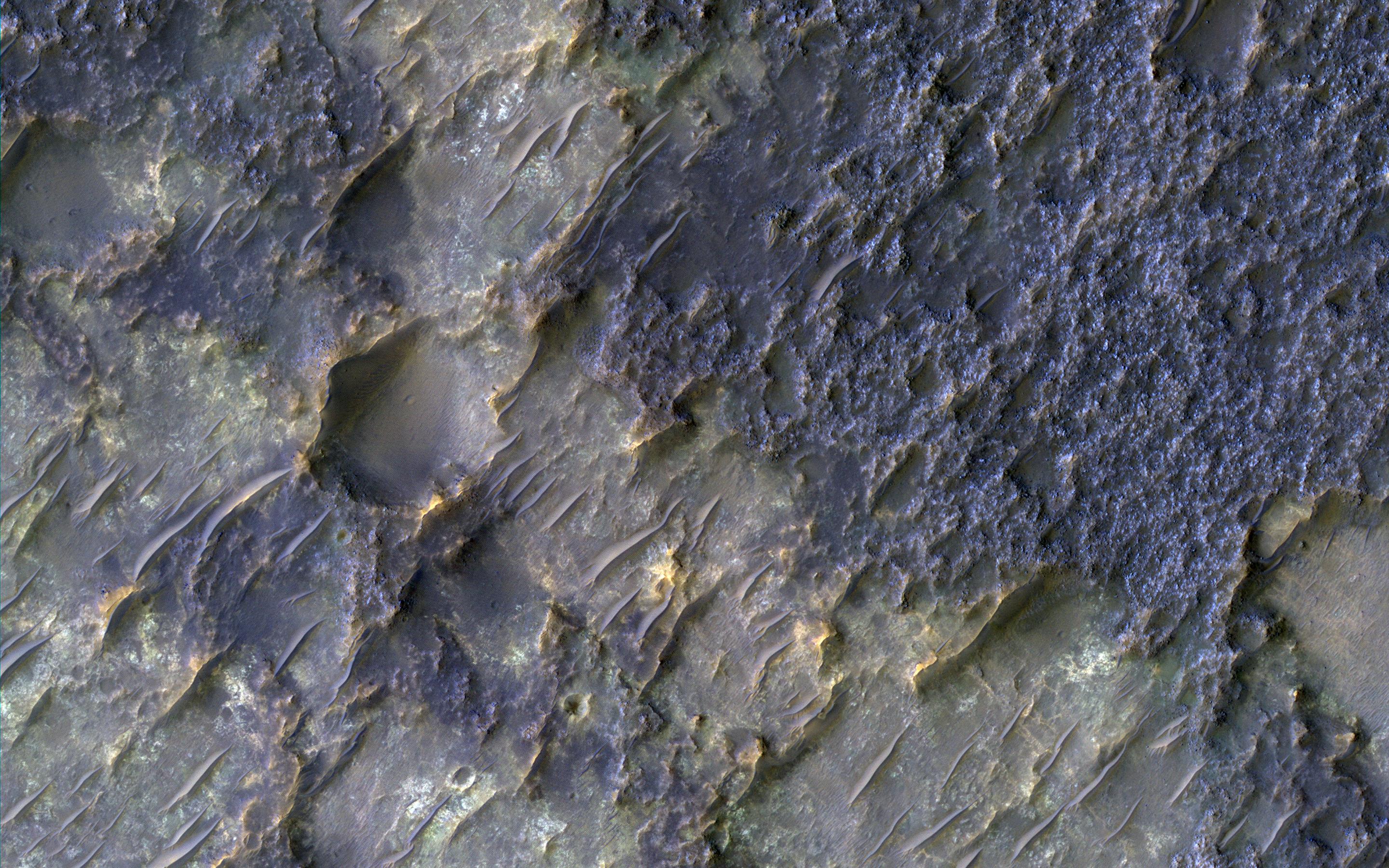
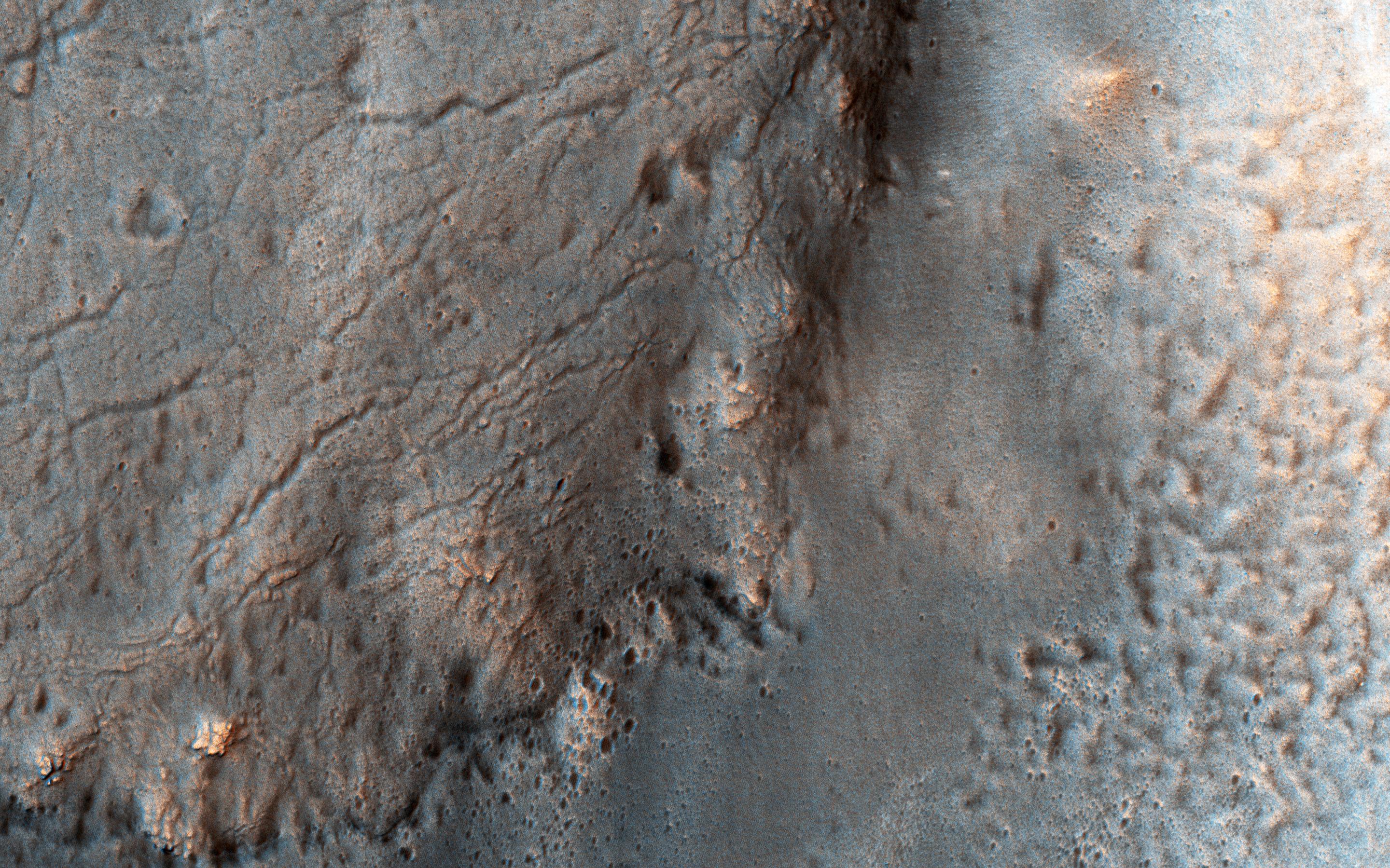
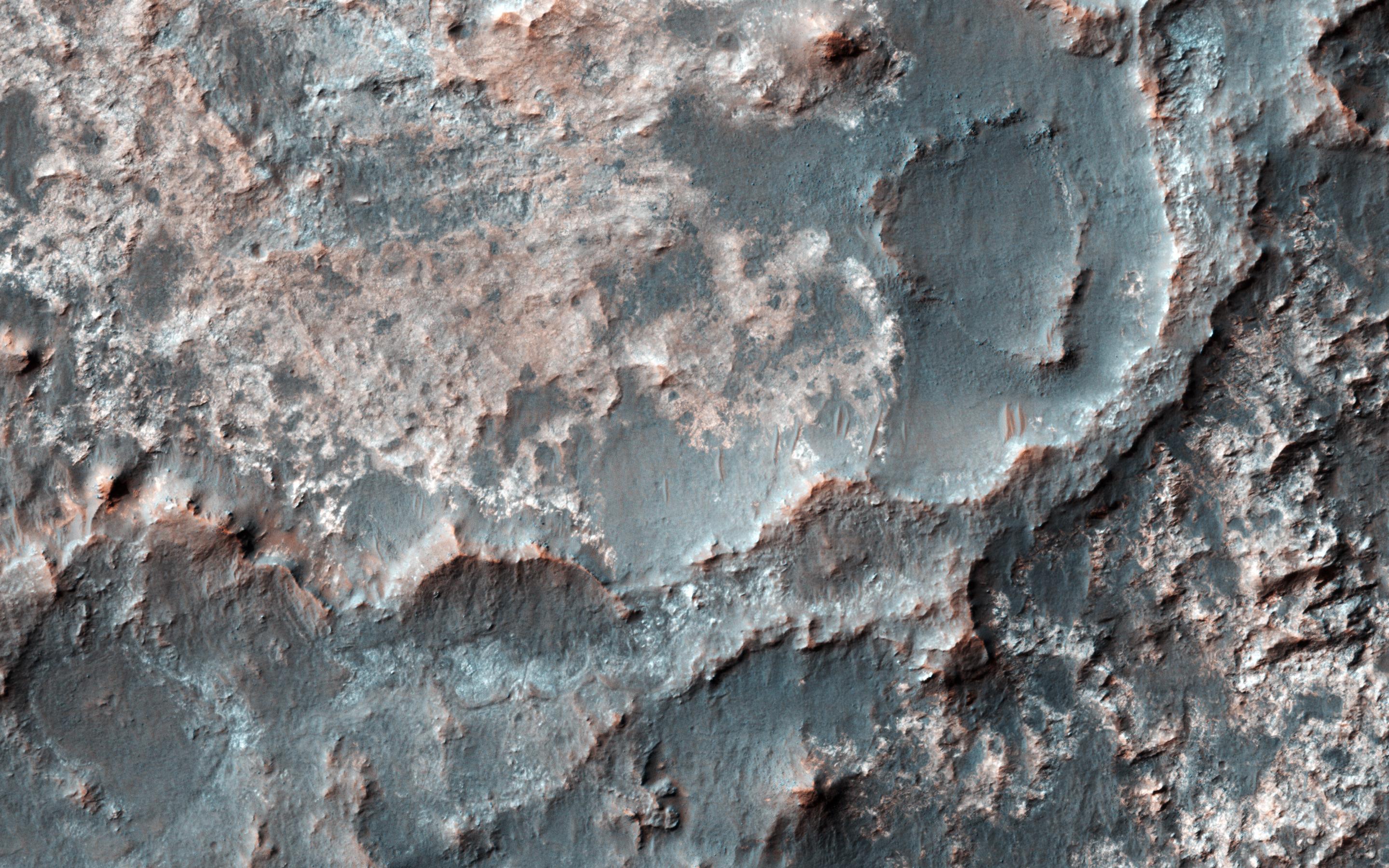
PIA11705:
Contact between Two Distinct Types of Bedrock Northwest of Hellas Planitia
Full Resolution:
TIFF
(15.56 MB)
JPEG
(998.8 kB)
2017-01-24
Mars
Mars Reconnaissance Orbiter (MRO)
HiRISE
4500x3000x3
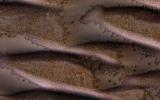
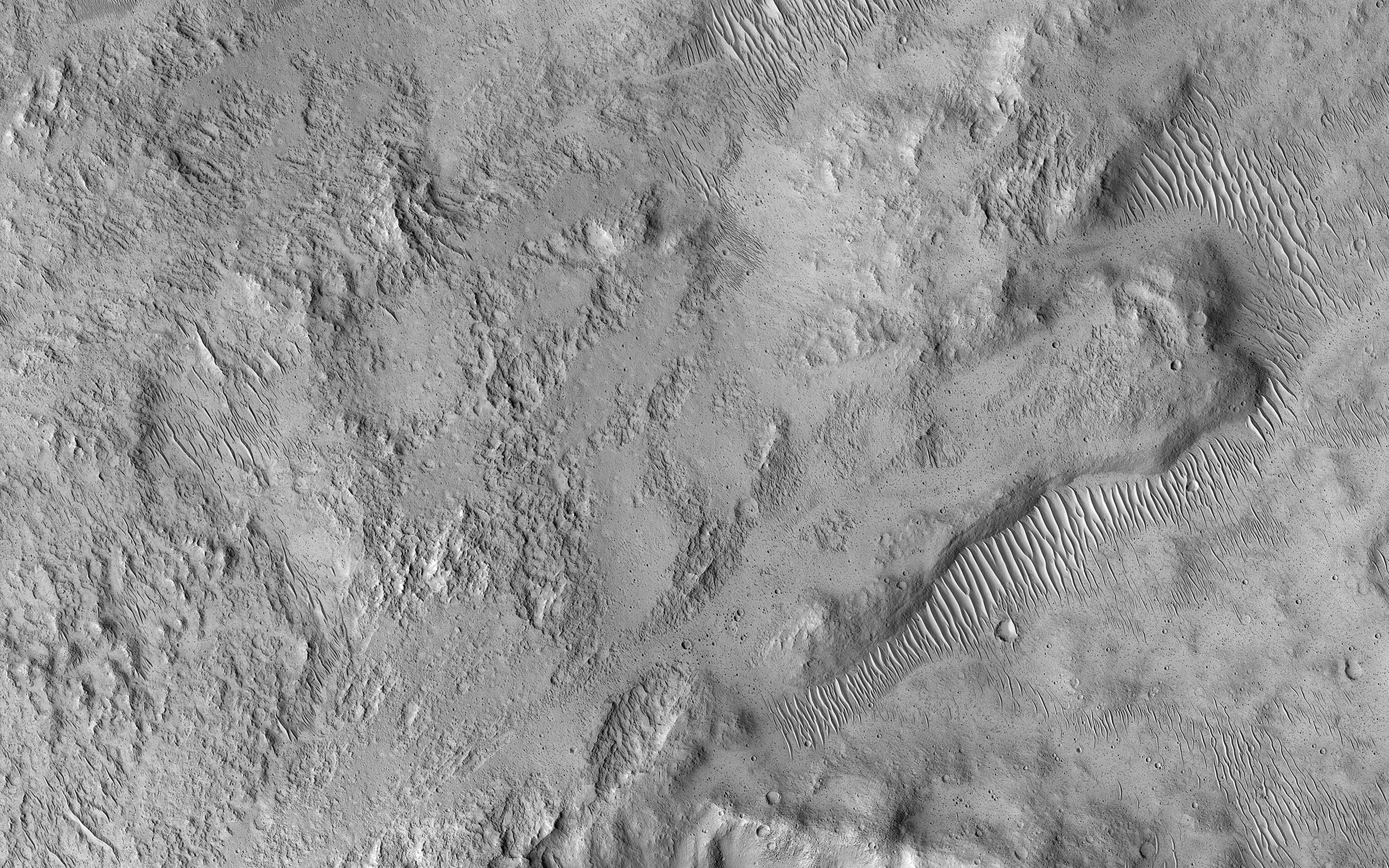
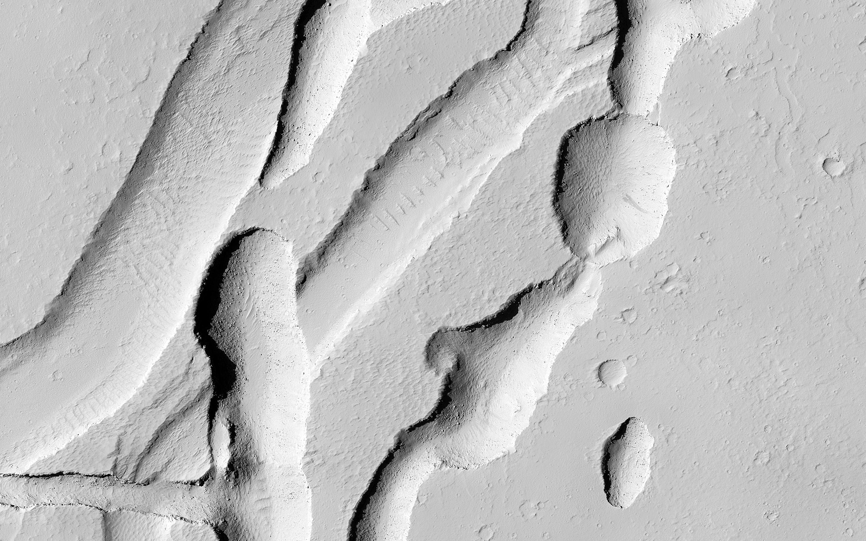
PIA11706:
How Gas Carves Channels
Full Resolution:
TIFF
(40.52 MB)
JPEG
(2.754 MB)
2017-01-20
Mars
Mars Reconnaissance Orbiter (MRO)
HiRISE
4500x3000x3
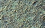
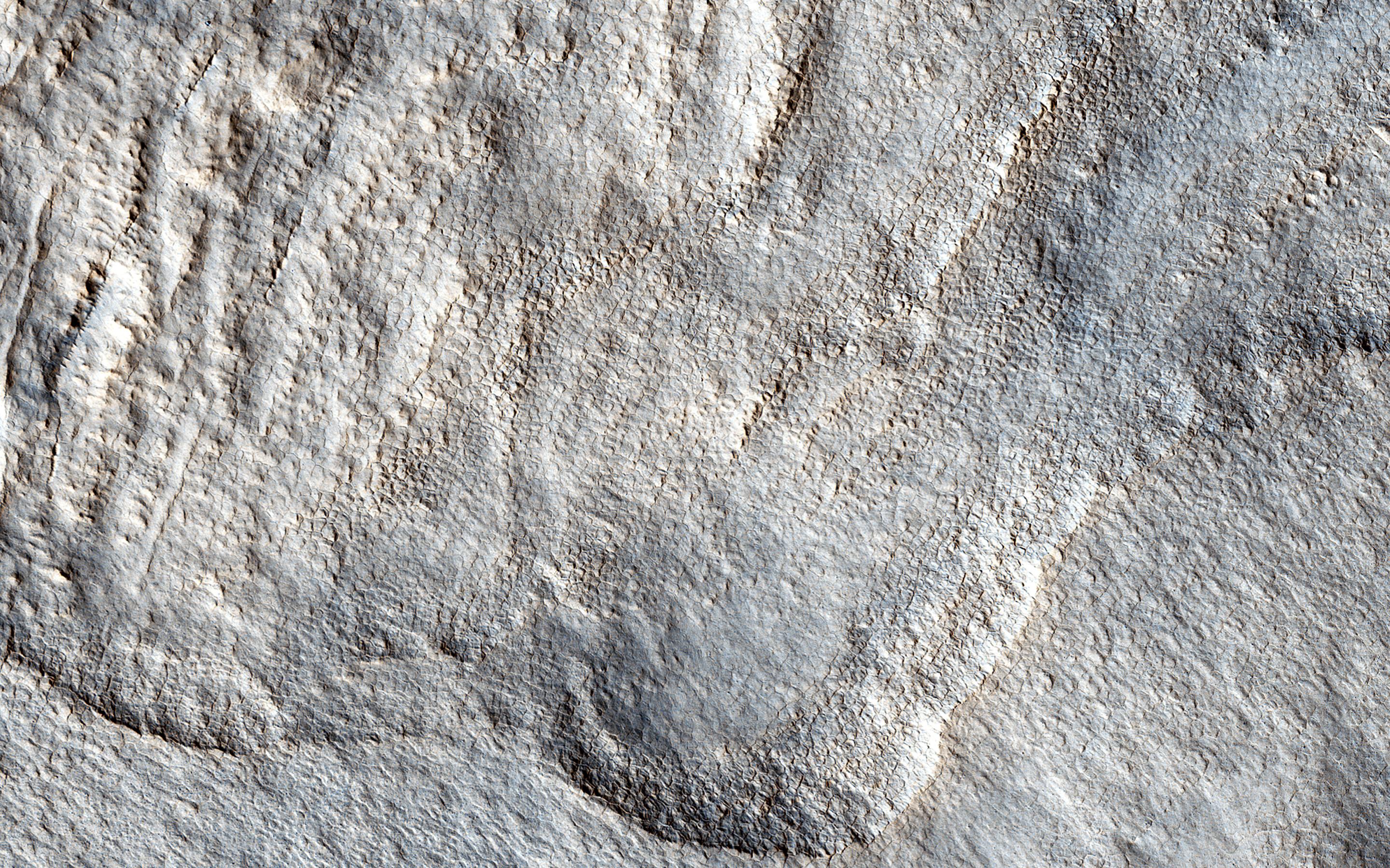
PIA12178:
The Beauty of Layered Stratigraphy
Full Resolution:
TIFF
(40.52 MB)
JPEG
(2.705 MB)
2017-01-19
Mars
Mars Reconnaissance Orbiter (MRO)
HiRISE
4500x3000x3
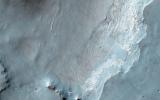
PIA12289:
The Changing Dunes of Wirtz Crater
Full Resolution:
TIFF
(40.52 MB)
JPEG
(2.437 MB)
2017-01-18
Mars
Mars Reconnaissance Orbiter (MRO)
HiRISE
4500x3000x3
PIA12291:
Bedrock Exhumed from the Deep
Full Resolution:
TIFF
(38.2 MB)
JPEG
(2.161 MB)
2017-01-17
Mars
Mars Reconnaissance Orbiter (MRO)
HiRISE
4500x3000x3
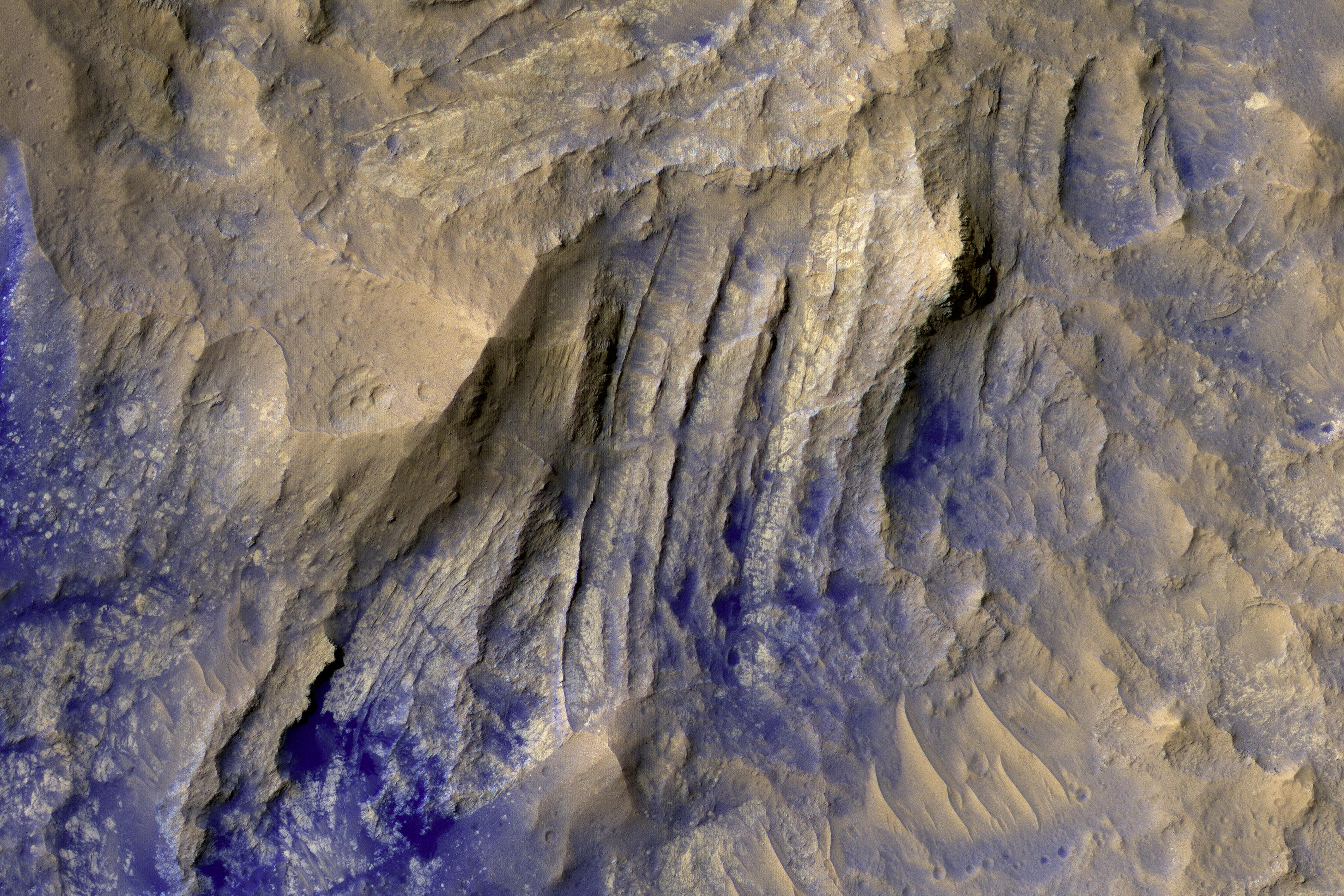
PIA12328:
Crater with Exposed Layers
Full Resolution:
TIFF
(40.16 MB)
JPEG
(2.299 MB)
2017-01-13
Mars
Mars Reconnaissance Orbiter (MRO)
HiRISE
2880x1800x3
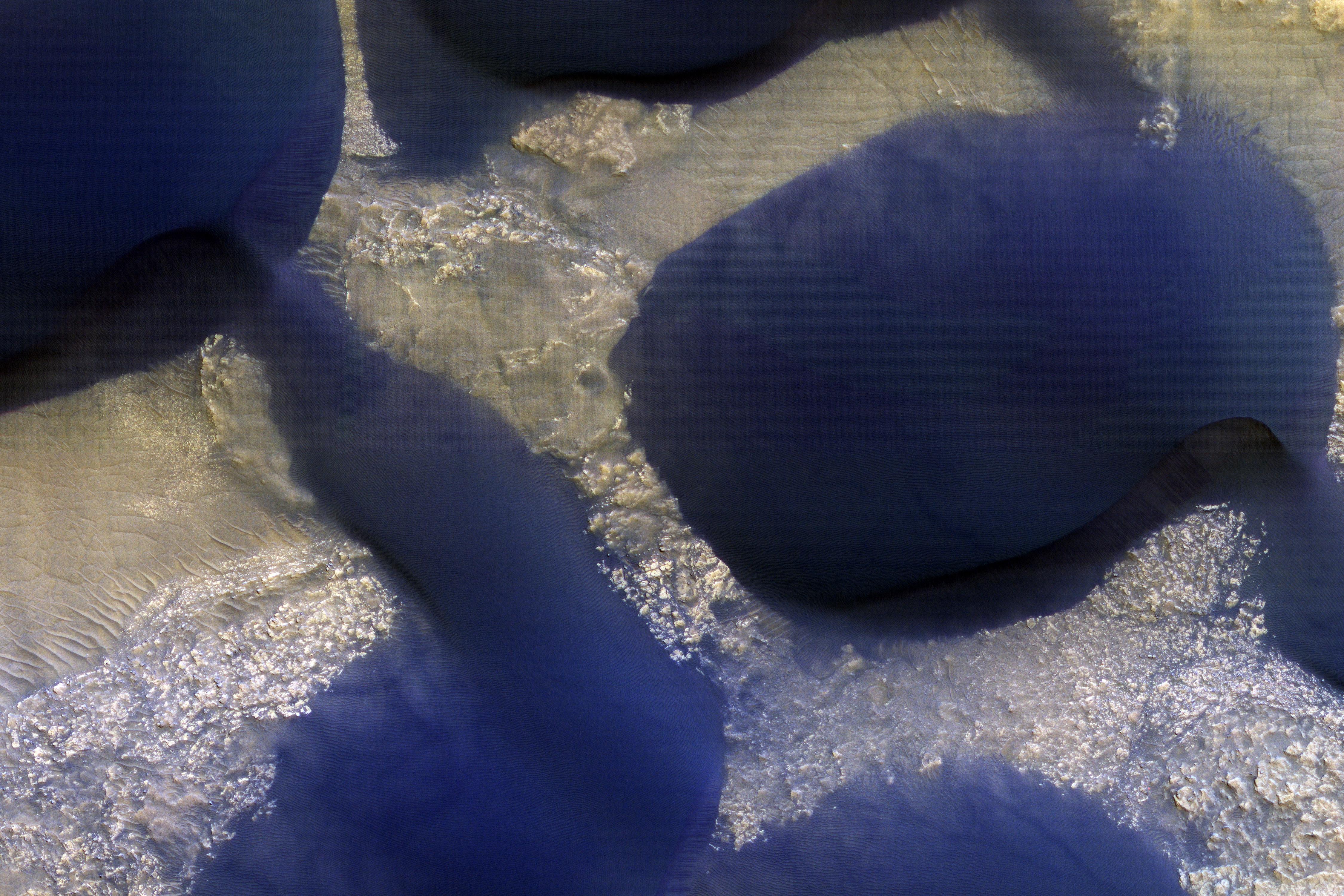
PIA12968:
Smooth and Fractured Deposits in Eridania Valleys
Full Resolution:
TIFF
(15.56 MB)
JPEG
(1.203 MB)
2017-01-12
Mars
Mars Reconnaissance Orbiter (MRO)
HiRISE
2880x1800x3
PIA13078:
Well-Preserved Impact Ejecta and Impact Melt-Rich Deposits in Terra Sabaea
Full Resolution:
TIFF
(15.02 MB)
JPEG
(785.4 kB)
2017-01-11
Mars
Mars Reconnaissance Orbiter (MRO)
HiRISE
2880x1800x3
PIA13151:
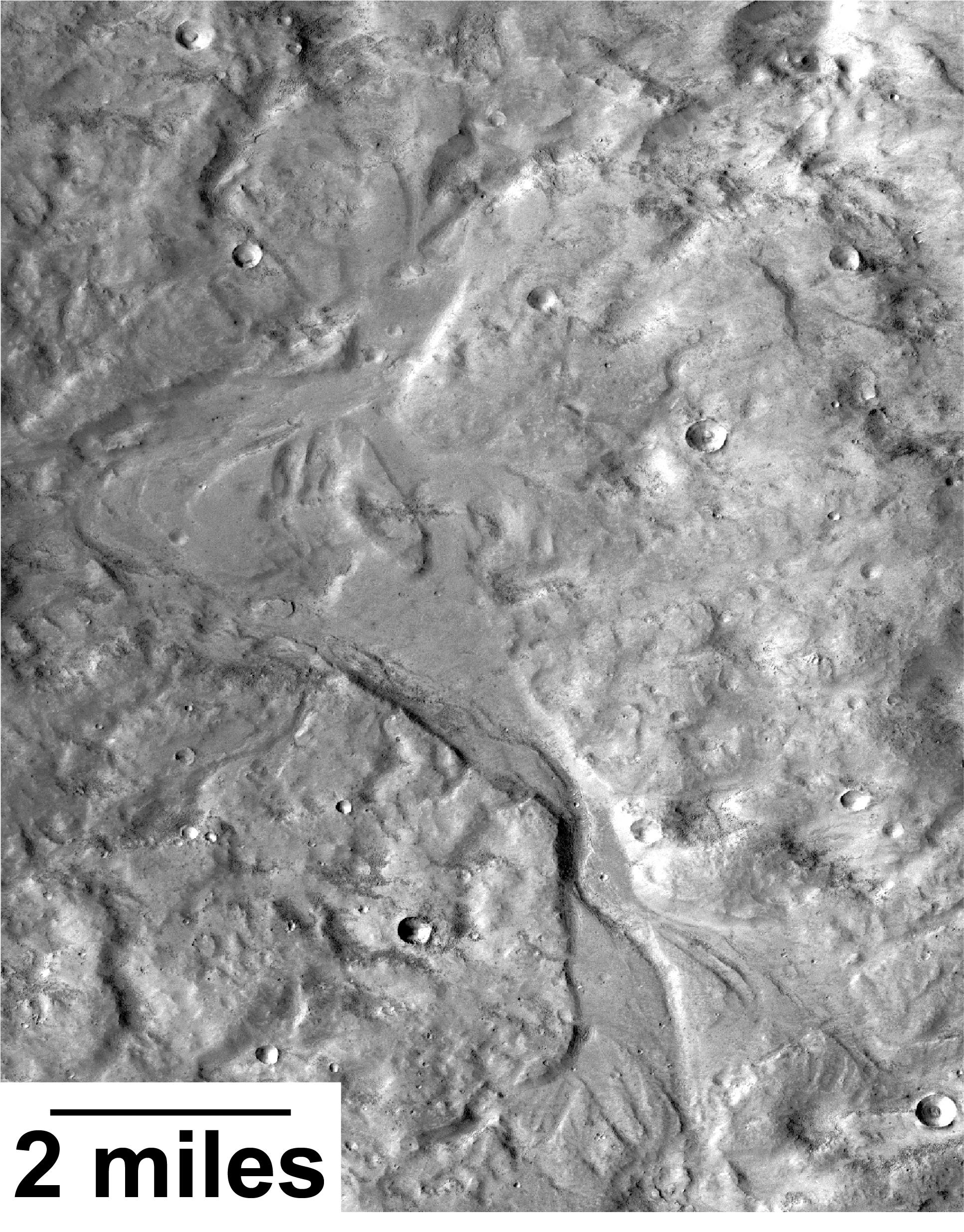
Wide, Branching Channels
Full Resolution:
TIFF
(15.56 MB)
JPEG
(1.306 MB)
2017-01-10
Mars
Mars Reconnaissance Orbiter (MRO)
HiRISE
2880x1800x1
PIA13181:
Muddy Ejecta Flow
Full Resolution:
TIFF
(5.191 MB)
JPEG
(1.387 MB)
2017-01-09
Mars
Mars Reconnaissance Orbiter (MRO)
HiRISE
2880x1800x3
PIA13485:
Eroded Scallops with Layers
Full Resolution:
TIFF
(15.56 MB)
JPEG
(1.153 MB)
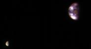
2017-01-06
Earth
Mars Reconnaissance Orbiter (MRO)
HiRISE
657x358x3
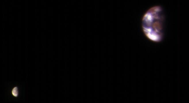
PIA21260:
Earth and Its Moon, as Seen From Mars
Full Resolution:
TIFF
(213.9 kB)
JPEG
(7.02 kB)
2017-01-05
Mars
Mars Reconnaissance Orbiter (MRO)
HiRISE
2880x1800x3
PIA15149:
Raised Bedrock in Terra Cimmeria
Full Resolution:
TIFF
(15.56 MB)
JPEG
(734 kB)
2017-01-03
Mars
Mars Reconnaissance Orbiter (MRO)
HiRISE
2880x1800x3
PIA14455:
Light-Toned Layering in a Labyrinthus Noctis Pit
Full Resolution:
TIFF
(15.56 MB)
JPEG
(1.026 MB)
2017-01-02
Mars
Mars Reconnaissance Orbiter (MRO)
HiRISE
2880x1800x3
PIA14454:
Hues in a Crater Slope
Full Resolution:
TIFF
(15.56 MB)
JPEG
(743.1 kB)
2016-12-21
Mars
Mars Reconnaissance Orbiter (MRO)
HiRISE
2880x1800x3
PIA14453:
Soffen Crater Floor
Full Resolution:
TIFF
(15.56 MB)
JPEG
(692.6 kB)
2016-12-21
Mars
Mars Reconnaissance Orbiter (MRO)
HiRISE
2880x1800x3
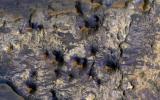
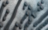
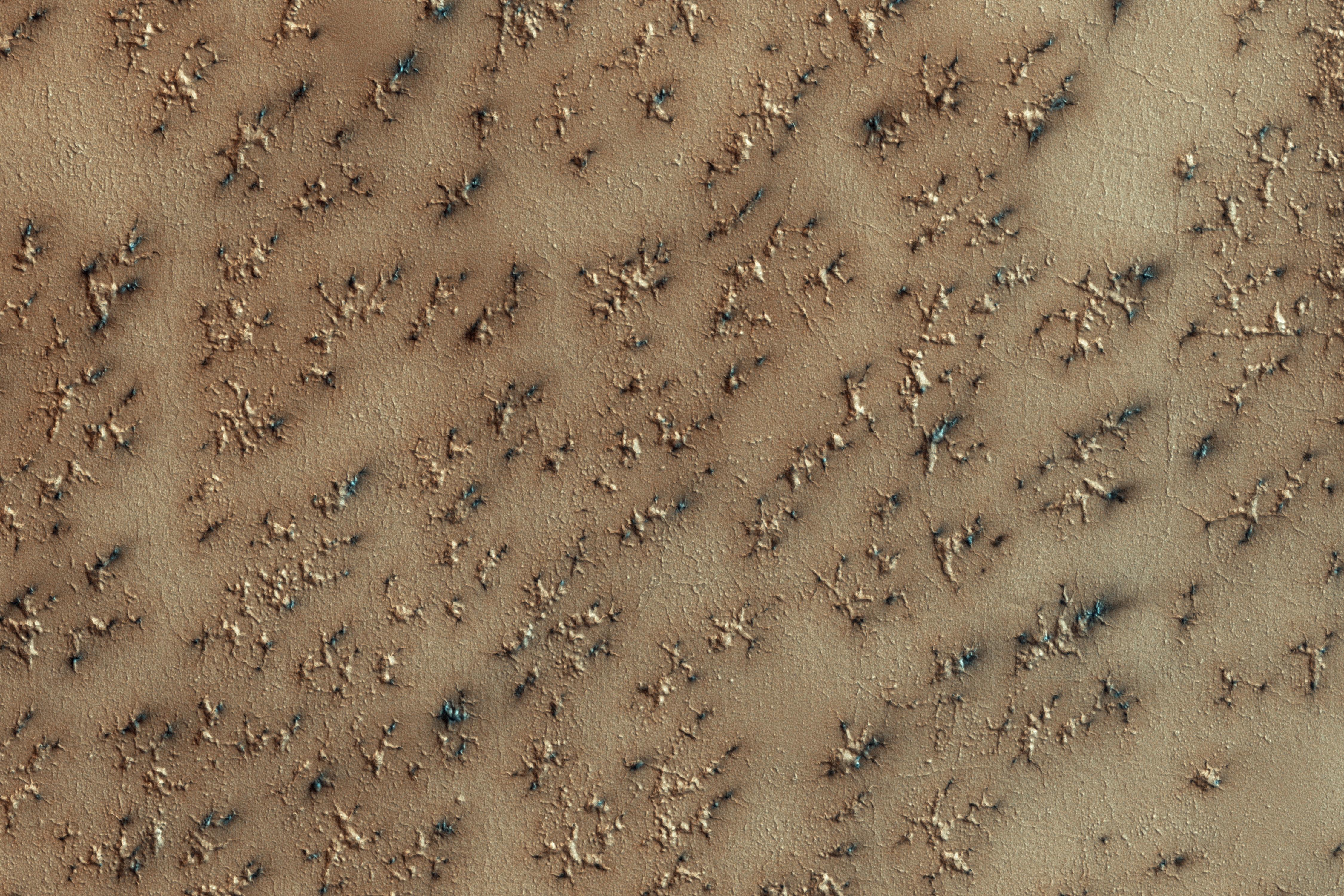
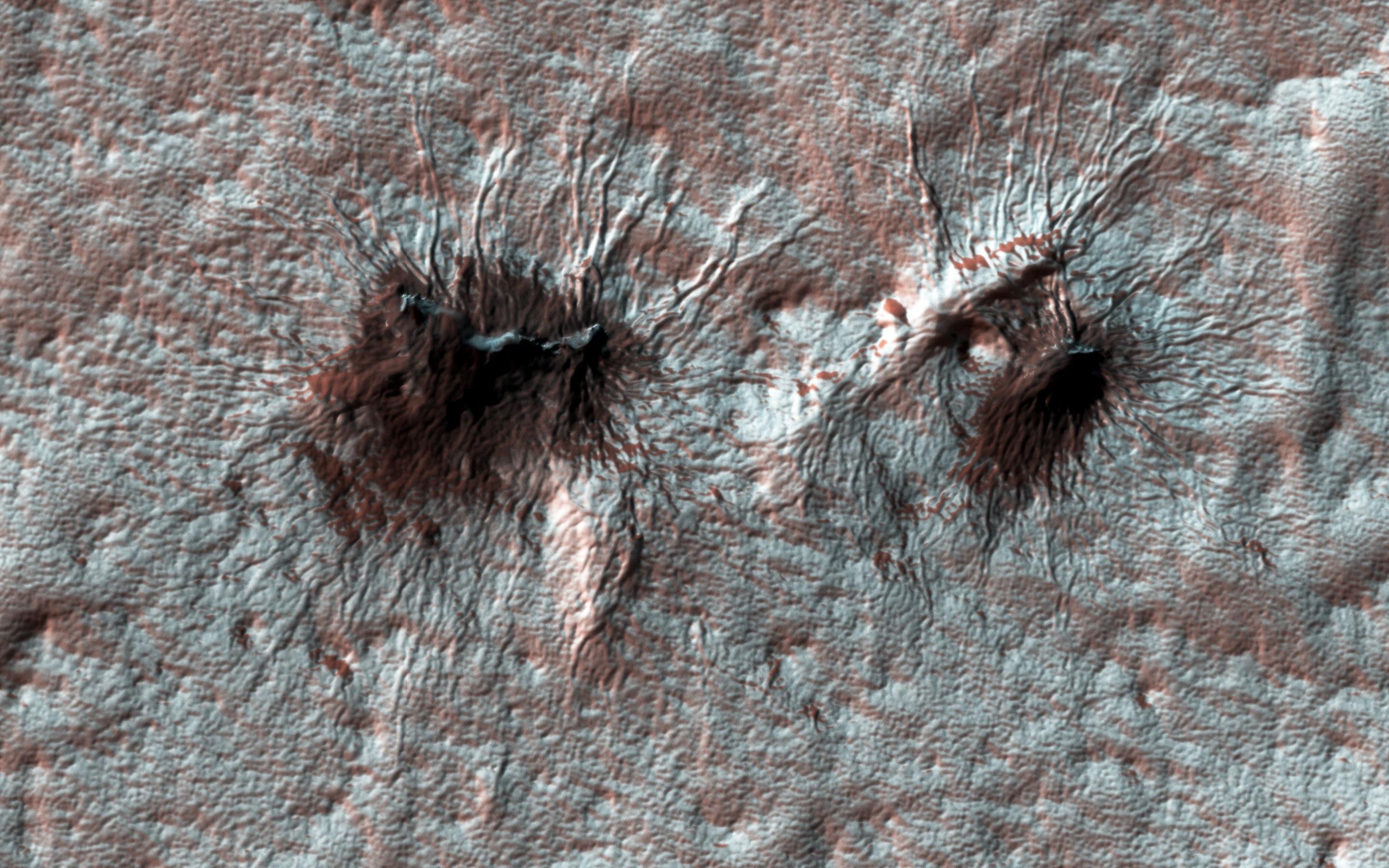
PIA14452:
Spiders on Mounds
Full Resolution:
TIFF
(15.56 MB)
JPEG
(1.445 MB)
2016-12-21
Mars
Mars Reconnaissance Orbiter (MRO)
HiRISE
2880x1800x1
PIA14451:
Lace on Mars
Full Resolution:
TIFF
(5.191 MB)
JPEG
(1.415 MB)
2016-12-21
Mars
Mars Reconnaissance Orbiter (MRO)
HiRISE
2880x1800x3
PIA14450:
Secondary Craters
Full Resolution:
TIFF
(13.96 MB)
JPEG
(384.2 kB)
2016-12-20
Mars
Mars Reconnaissance Orbiter (MRO)
HiRISE
2110x1745x3
PIA21258:
Possible Development Stages of Martian 'Spiders'
Full Resolution:
TIFF
(5.708 MB)
JPEG
(557 kB)
2016-12-20
Mars
Mars Reconnaissance Orbiter (MRO)
HiRISE
369x302x1
PIA21257:
'Baby Spider': Growth of a Martian Trough Network
Full Resolution:
TIFF
(111.8 kB)
JPEG
(24.75 kB)
2016-12-14
Mars
Mars Reconnaissance Orbiter (MRO)
HiRISE
2880x1800x3
PIA21274:
Hematite-Rich Deposits in Capri Chasma
Full Resolution:
TIFF
(13.86 MB)
JPEG
(446.5 kB)
2016-12-14
Mars
Mars Reconnaissance Orbiter (MRO)
HiRISE
2880x1800x3
PIA21273:
Possible Layers on Floor of Suzhi Crater
Full Resolution:
TIFF
(15.56 MB)
JPEG
(998.8 kB)
2016-12-14
Mars
Mars Reconnaissance Orbiter (MRO)
HiRISE
2880x1800x1
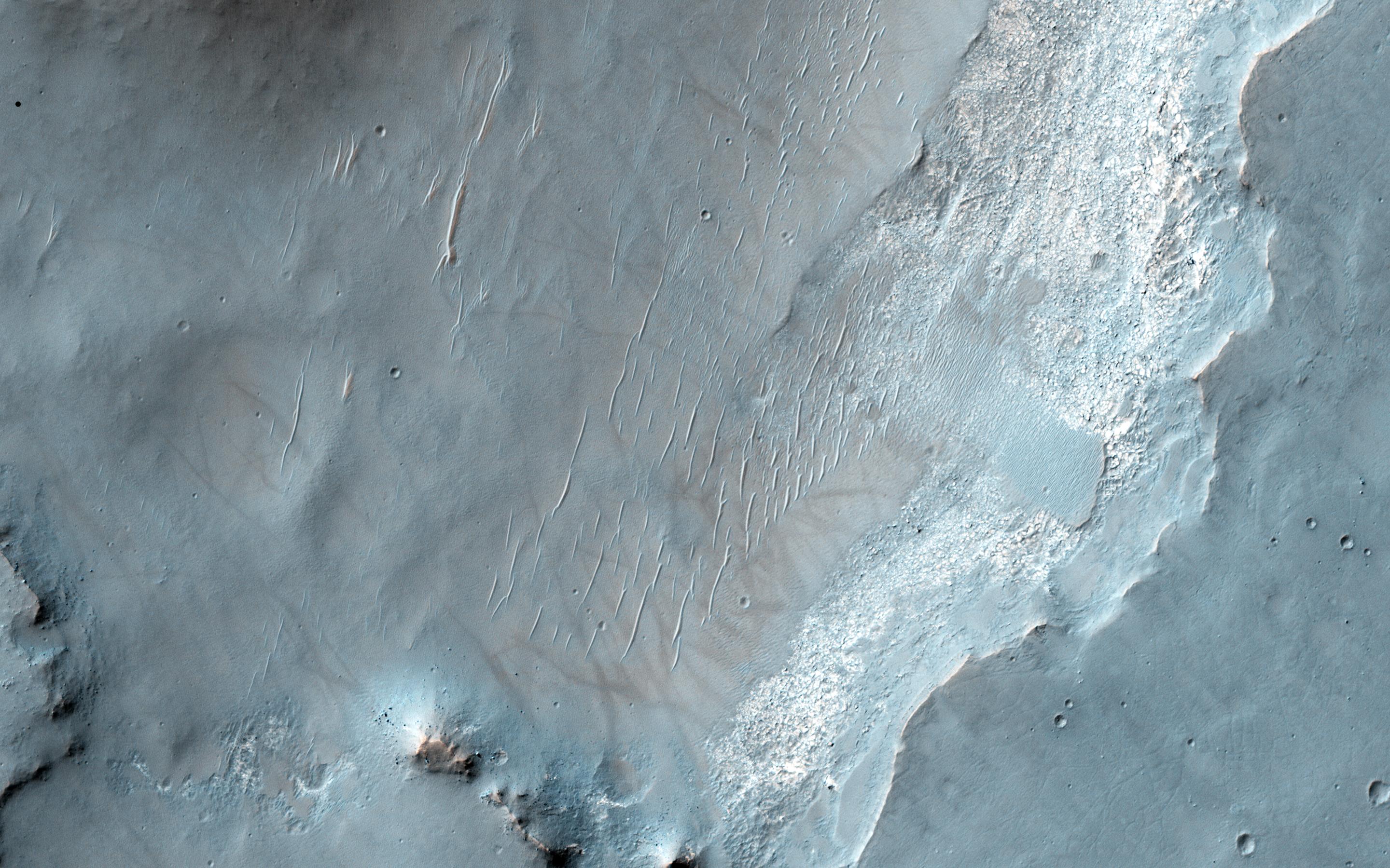
PIA21272:
Slope Streaks or RSL?
Full Resolution:
TIFF
(4.836 MB)
JPEG
(569.6 kB)
2016-12-14
Mars
Mars Reconnaissance Orbiter (MRO)
HiRISE
2880x1800x1
PIA21271:
Fans on Crater Rims
Full Resolution:
TIFF
(5.191 MB)
JPEG
(1.075 MB)
2016-12-13
Mars
Mars Reconnaissance Orbiter (MRO)
Mars Science Laboratory (MSL)
HiRISE
MAHLI
3300x2550x3
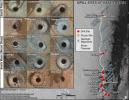
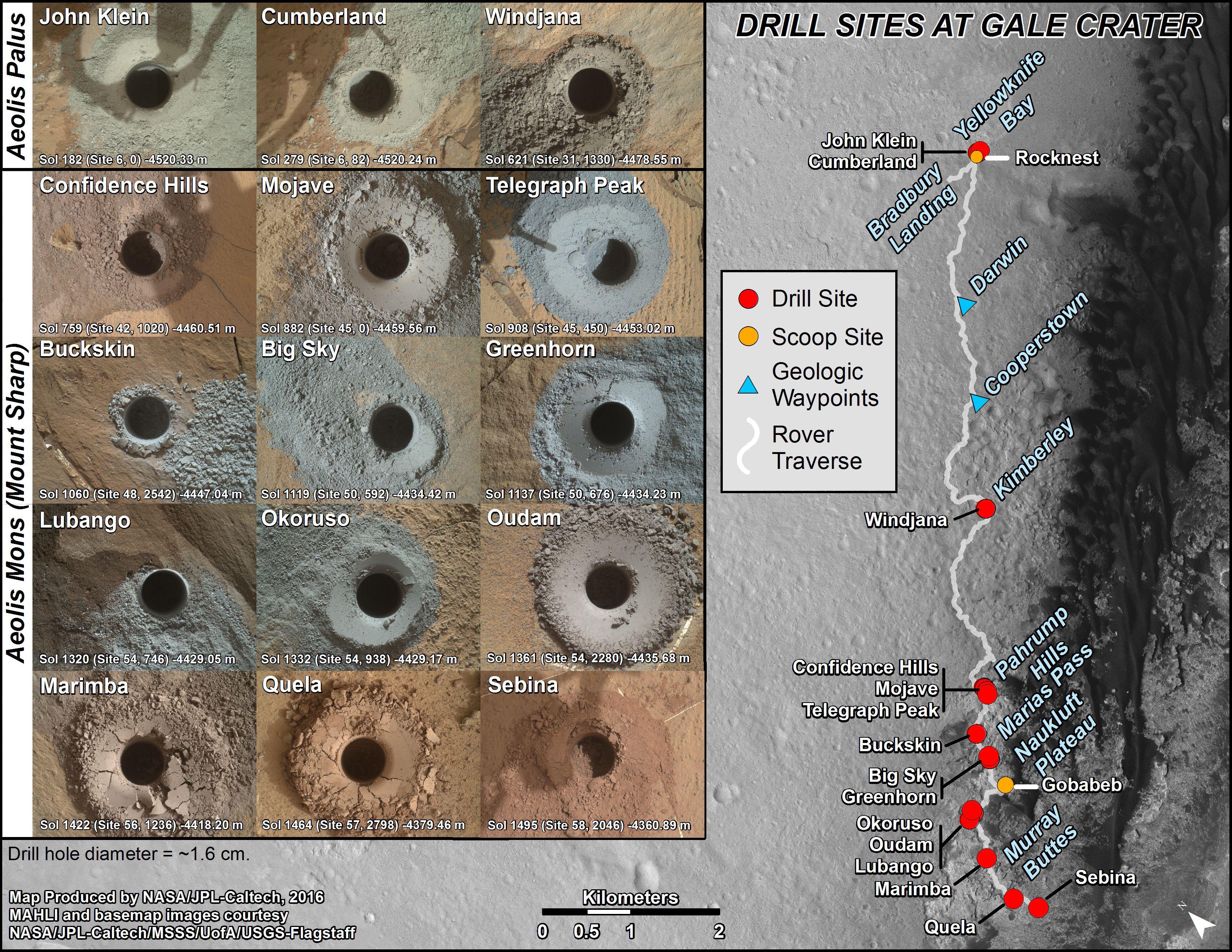
PIA21254:
Curiosity's Rock or Soil Sampling Sites on Mars, Through November 2016
Full Resolution:
TIFF
(21.14 MB)
JPEG
(2.213 MB)
2016-12-13
Mars
Mars Reconnaissance Orbiter (MRO)
Mars Science Laboratory (MSL)
ChemCam
HiRISE
2809x2025x3
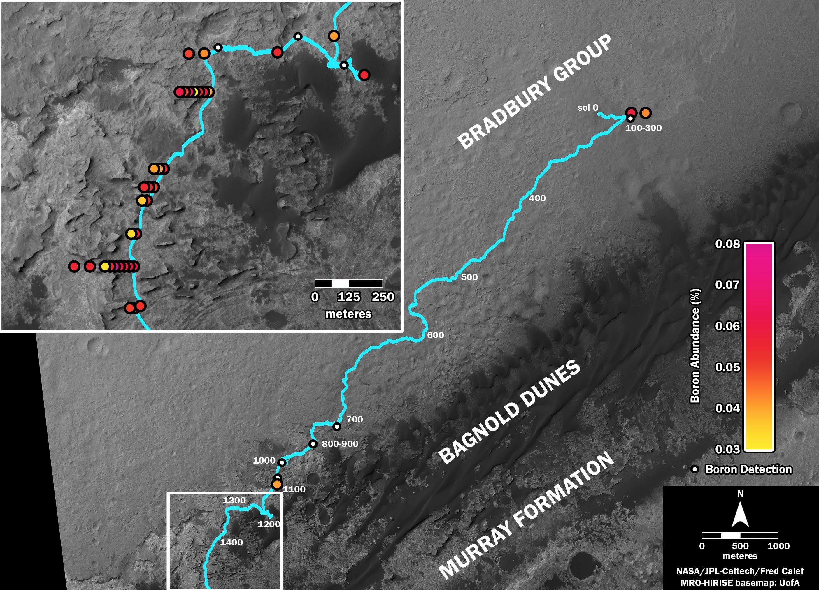
PIA21150:
Where's Boron? Mars Rover Detects It
Full Resolution:
TIFF
(7.738 MB)
JPEG
(838.4 kB)
2016-12-13
Mars
Mars Reconnaissance Orbiter (MRO)
Mars Science Laboratory (MSL)
HiRISE
1456x1125x3
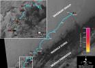
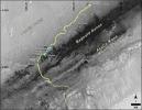
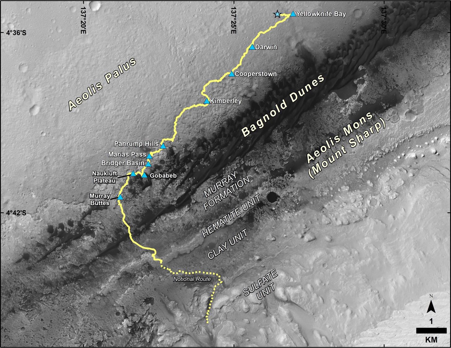
PIA21144:
Late 2016 Map of NASA's Curiosity Mars Rover Mission
Full Resolution:
TIFF
(2.946 MB)
JPEG
(288 kB)
2016-12-07
Mars
Mars Reconnaissance Orbiter (MRO)
HiRISE
2880x1800x3
PIA21217:
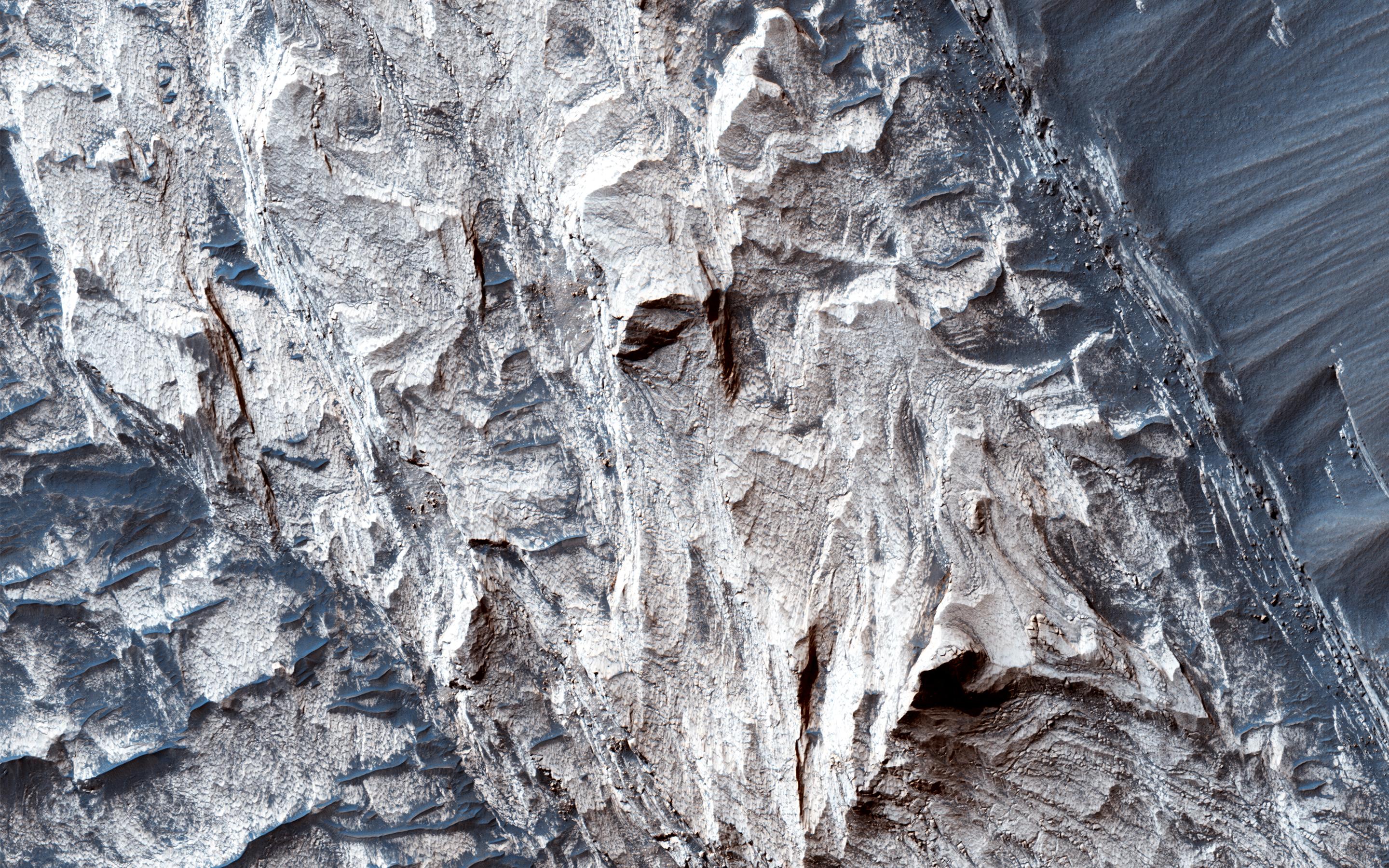
Colorful Bedrock Exposed in a Landslide Scarp
Full Resolution:
TIFF
(15.56 MB)
JPEG
(892.3 kB)
2016-12-07
Mars
Mars Reconnaissance Orbiter (MRO)
HiRISE
2880x1800x3
PIA21216:
The Coolest Landscape on Mars (or Earth)
Full Resolution:
TIFF
(10.51 MB)
JPEG
(375.8 kB)
2016-12-07
Mars
Mars Reconnaissance Orbiter (MRO)
HiRISE
2880x1800x3
PIA21215:
Cracks in a Crater's Ice
Full Resolution:
TIFF
(15.56 MB)
JPEG
(1.168 MB)
2016-12-07
Mars
Mars Reconnaissance Orbiter (MRO)
HiRISE
2880x1800x3
PIA21214:
Painting with Frost
Full Resolution:
TIFF
(15.56 MB)
JPEG
(806.3 kB)
2016-11-22
Mars
Mars Reconnaissance Orbiter (MRO)
Shallow Subsurface Radar (SHARAD)
596x286x3
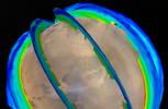
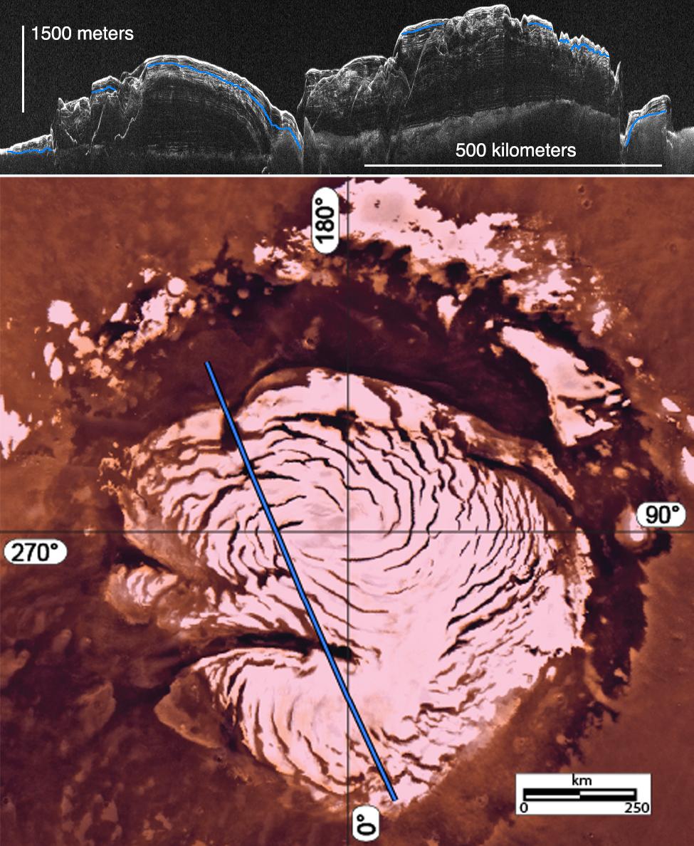
PIA21138:
Location of Large Subsurface Water-Ice Deposit in Utopia Planitia, Mars
Full Resolution:
TIFF
(322.1 kB)
JPEG
(44.46 kB)
2016-11-22
Mars
Mars Reconnaissance Orbiter (MRO)
Shallow Subsurface Radar (SHARAD)
602x122x1
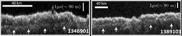
PIA21137:
Radargrams Indicating Ice-Rich Subsurface Deposit
Full Resolution:
TIFF
(73.74 kB)
JPEG
(21.33 kB)
2016-11-22
Mars
Mars Reconnaissance Orbiter (MRO)
HiRISE
640x398x1
PIA21136:
Scalloped Terrain Led to Finding of Buried Ice on Mars
Full Resolution:
TIFF
(255.2 kB)
JPEG
(57.89 kB)
2016-11-15
Mars
Mars Reconnaissance Orbiter (MRO)
HiRISE
763x968x3
PIA21135:
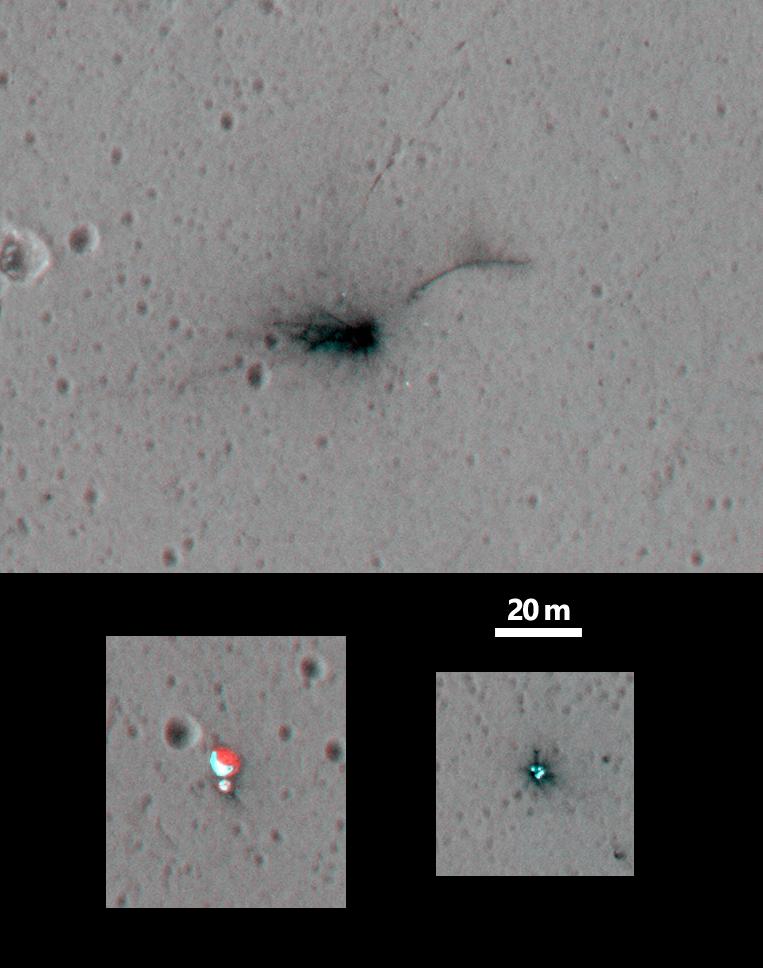
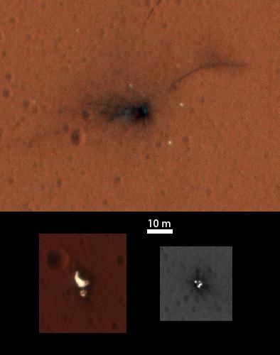
Schiaparelli Impact Site on Mars, Stereo
Full Resolution:
TIFF
(1.385 MB)
JPEG
(70.24 kB)
2016-11-09
Mars
Mars Reconnaissance Orbiter (MRO)
HiRISE
2048x1536x3
PIA21206:
A Glimpse into History
Full Resolution:
TIFF
(9.44 MB)
JPEG
(889.5 kB)
2016-11-09
Mars
Mars Reconnaissance Orbiter (MRO)
HiRISE
2048x1536x3
PIA21205:
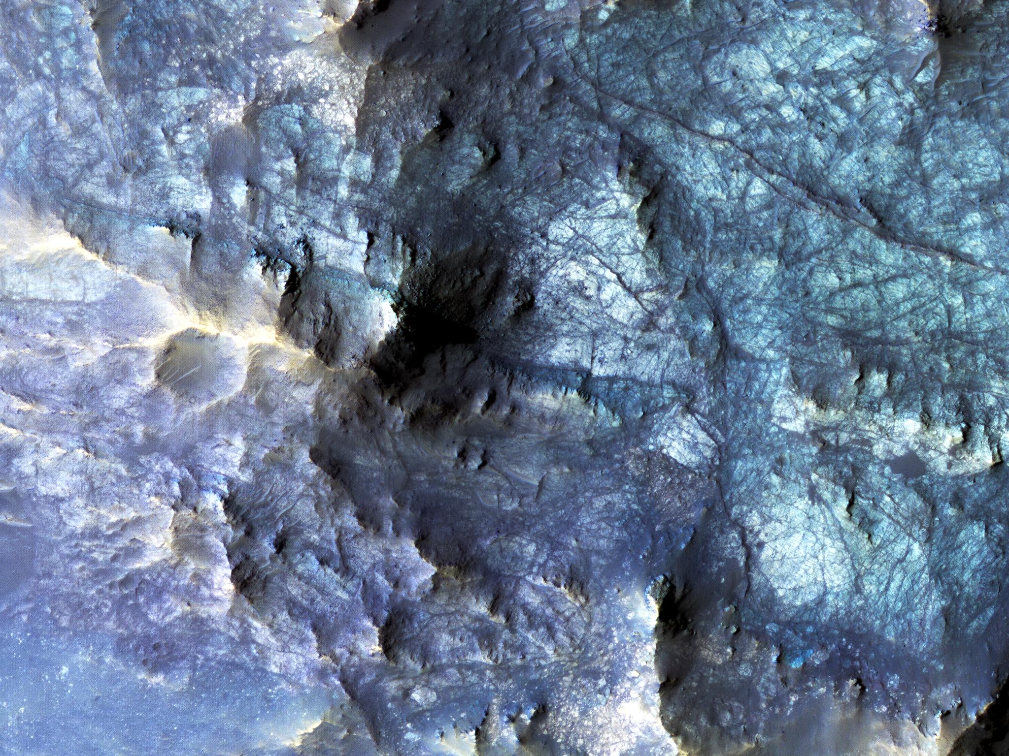
Exposed Fractured Bedrock in the Central Pit of a Crater
Full Resolution:
TIFF
(9.44 MB)
JPEG
(711.7 kB)
2016-11-09
Mars
Mars Reconnaissance Orbiter (MRO)
HiRISE
2048x1536x3
PIA21204:
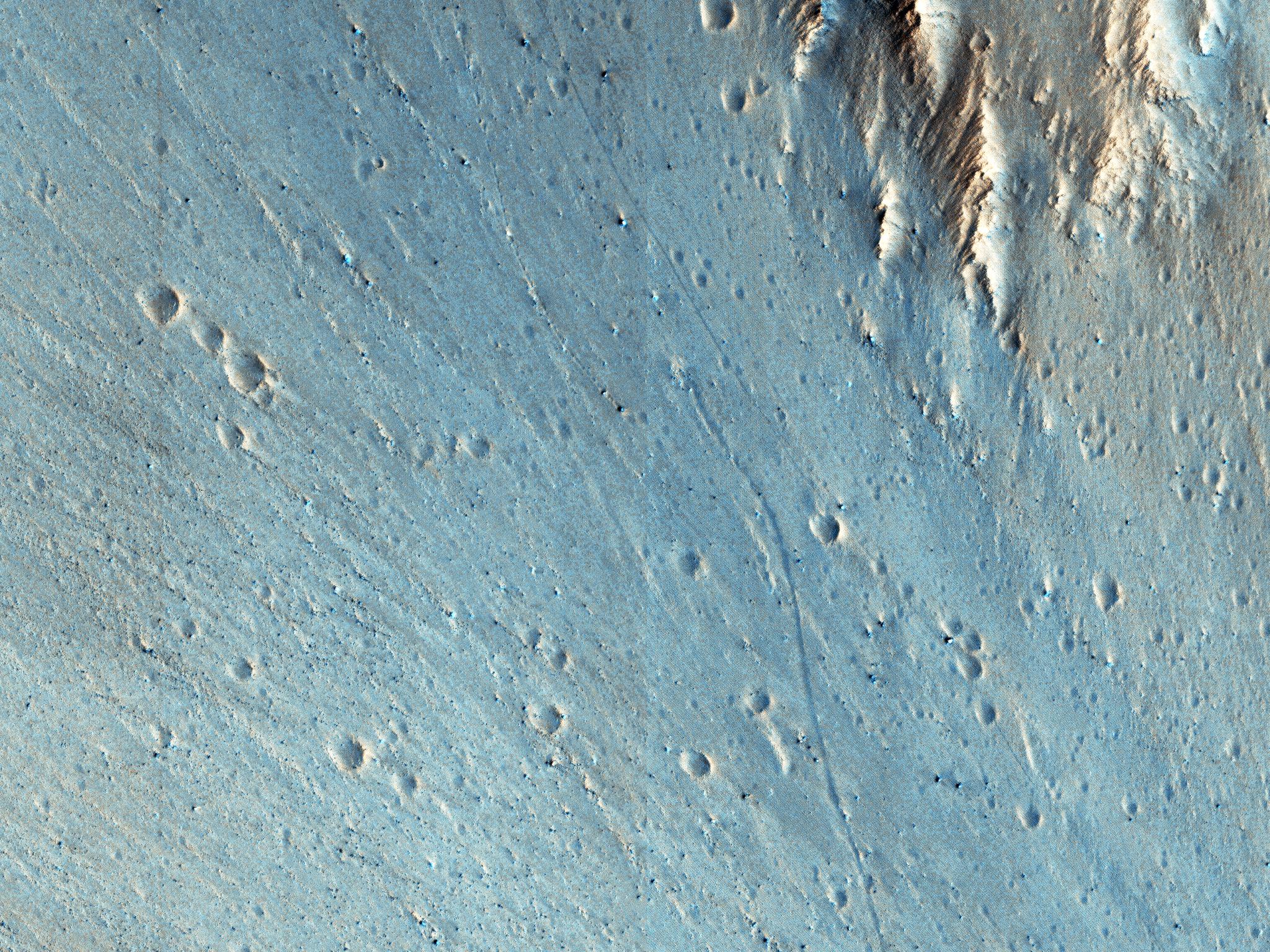
Rafted Rock
Full Resolution:
TIFF
(9.44 MB)
JPEG
(713.5 kB)
2016-11-09
Mars
Mars Reconnaissance Orbiter (MRO)
HiRISE
2048x1536x3
PIA21203:
Trundling Boulders
Full Resolution:
TIFF
(9.44 MB)
JPEG
(995.7 kB)
2016-11-03
Mars
Mars Reconnaissance Orbiter (MRO)
HiRISE
394x500x3
PIA21132:
Schiaparelli Impact Site on Mars, in Color
Full Resolution:
TIFF
(311.1 kB)
JPEG
(20.66 kB)
2016-10-27
Mars
Mars Reconnaissance Orbiter (MRO)
HiRISE
4875x5243x1
PIA21131:
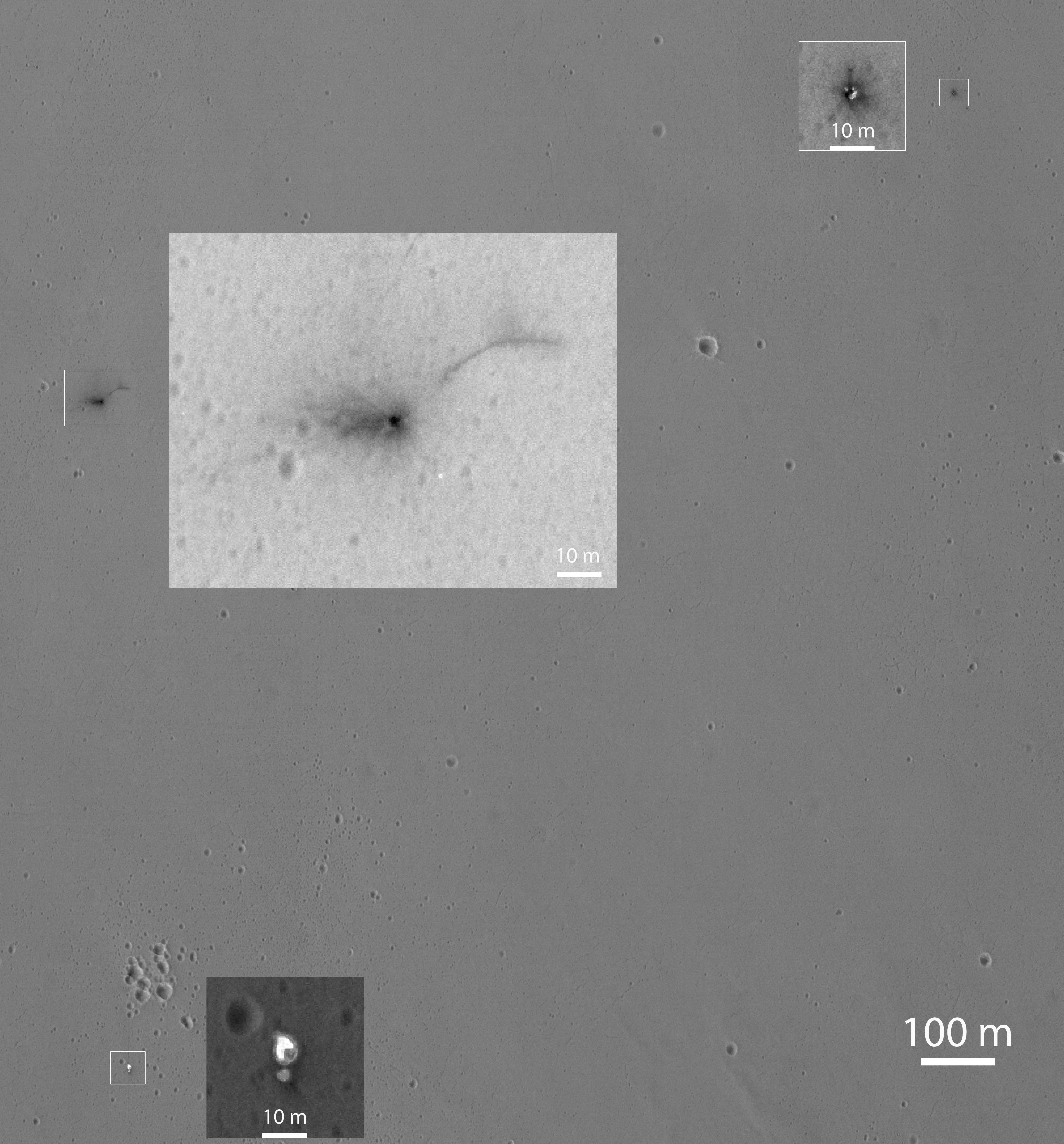
Closer Look at Schiaparelli Impact Site on Mars
Full Resolution:
TIFF
(20.38 MB)
JPEG
(2.661 MB)
2016-10-21
Mars
Mars Reconnaissance Orbiter (MRO)
CTX
1400x788x1
PIA21130:
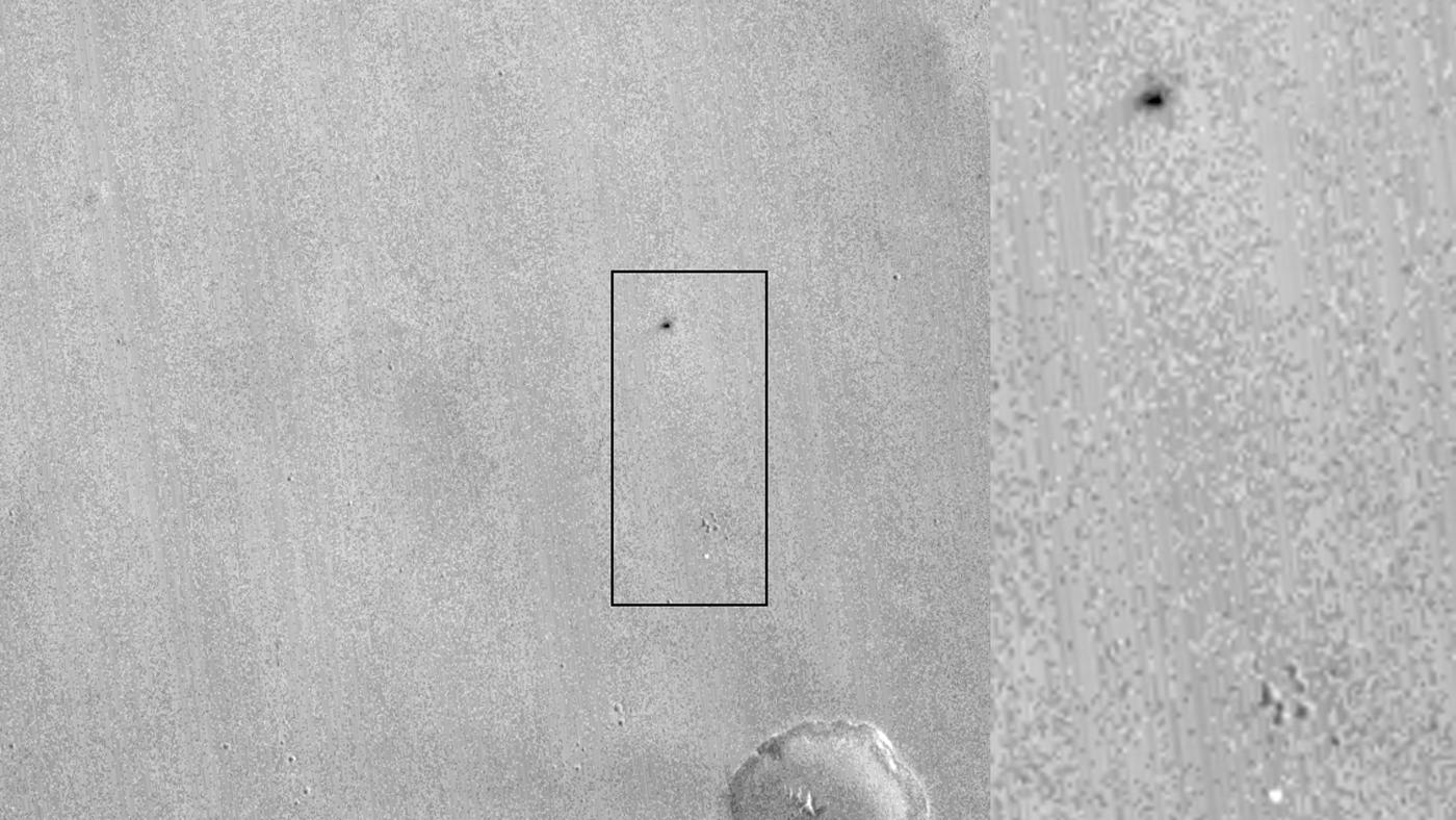
Signs of Schiaparelli Test Lander Seen From Orbit
Full Resolution:
TIFF
(1.057 MB)
JPEG
(162.8 kB)
2016-10-20
Mars
Mars Reconnaissance Orbiter (MRO)
HiRISE
1359x804x3
PIA21126:
Martian 'Spiders' in Sharper Look, Thanks to Volunteers
Full Resolution:
TIFF
(3.218 MB)
JPEG
(232.4 kB)
2016-10-19
Mars
Mars Reconnaissance Orbiter (MRO)
HiRISE
2880x1800x1
PIA21113:
Lava That Once Flowed
Full Resolution:
TIFF
(5.191 MB)
JPEG
(1.387 MB)
2016-10-19
Mars
Mars Reconnaissance Orbiter (MRO)
HiRISE
2880x1800x3
PIA21112:
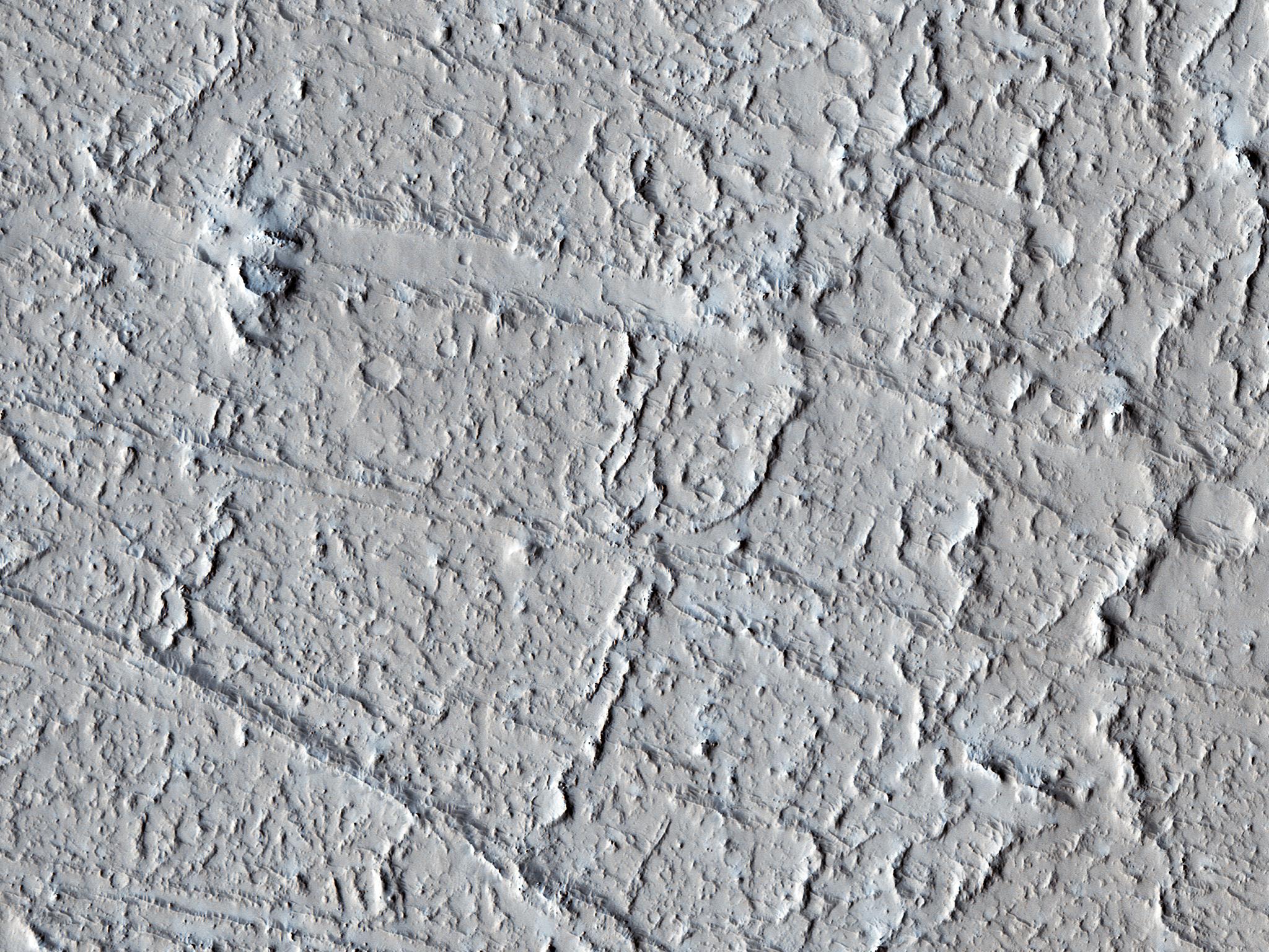
Wrinkle Ridges and Pit Craters
Full Resolution:
TIFF
(15.56 MB)
JPEG
(1.001 MB)
2016-10-19
Mars
Mars Reconnaissance Orbiter (MRO)
HiRISE
2880x1800x3
PIA21111:
Wind Carved Rock
Full Resolution:
TIFF
(15.56 MB)
JPEG
(873.1 kB)
2016-10-19
Mars
Mars Reconnaissance Orbiter (MRO)
HiRISE
2880x1800x1
PIA21110:
Spider Webs
Full Resolution:
TIFF
(5.191 MB)
JPEG
(1.679 MB)
2016-10-07
Mars
Mars Exploration Rover (MER)
Mars Reconnaissance Orbiter (MRO)
HiRISE
3200x4880x3
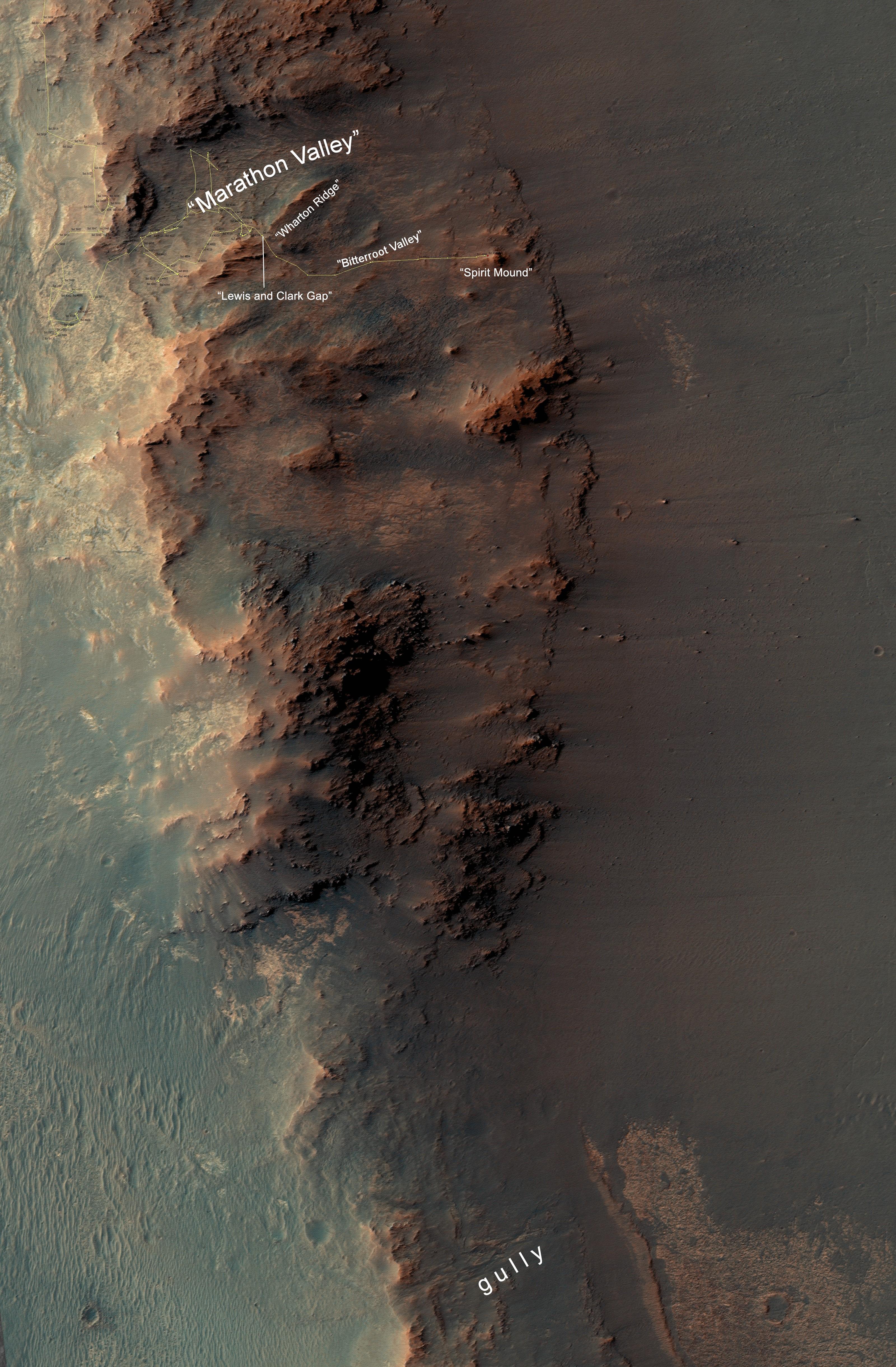
PIA20854:
From 'Marathon Valley' to Gully on Endeavour Rim
Full Resolution:
TIFF
(41.84 MB)
JPEG
(2.035 MB)
2016-10-05
Mars
Mars Reconnaissance Orbiter (MRO)
HiRISE
2880x1800x3
PIA21105:
On the Edge of the South Pole Layered Deposit
Full Resolution:
TIFF
(15.56 MB)
JPEG
(795.1 kB)
2016-10-05
Mars
Mars Reconnaissance Orbiter (MRO)
HiRISE
2880x1800x1
PIA21104:
A Long and Winding Channel in Tharsis
Full Resolution:
TIFF
(5.191 MB)
JPEG
(944.1 kB)
2016-10-05
Mars
Mars Reconnaissance Orbiter (MRO)
HiRISE
2880x1800x3
PIA21103:
A Transition from Depressed to Inverted Channels in Gorgonum Basin
Full Resolution:
TIFF
(15.56 MB)
JPEG
(896.6 kB)
2016-10-05
Mars
Mars Reconnaissance Orbiter (MRO)
HiRISE
2880x1800x3
PIA21102:
Deposits along the Northern Wall of Melas Chasma
Full Resolution:
TIFF
(15.56 MB)
JPEG
(1.168 MB)
2016-09-21
Mars
Mars Reconnaissance Orbiter (MRO)
HiRISE
2880x1800x1
PIA21066:
Intersecting Channels near Olympica Fossae
Full Resolution:
TIFF
(5.087 MB)
JPEG
(853.2 kB)
2016-09-21
Mars
Mars Reconnaissance Orbiter (MRO)
HiRISE
2880x1800x3
PIA21065:
What Lies Beneath: Surface Patterns of Glacier-Like Landforms
Full Resolution:
TIFF
(15.56 MB)
JPEG
(1.393 MB)
2016-09-21
Mars
Mars Reconnaissance Orbiter (MRO)
HiRISE
2880x1800x3
PIA21064:
The Wind-Scoured Lava Flows of Pavonis Mons
Full Resolution:
TIFF
(15.4 MB)
JPEG
(549.7 kB)
2016-09-21
Mars
Mars Reconnaissance Orbiter (MRO)
HiRISE
2880x1800x3
PIA21063:
River of Sand
Full Resolution:
TIFF
(15.56 MB)
JPEG
(972.4 kB)
2016-09-15
Mars
Mars Reconnaissance Orbiter (MRO)
CTX
1934x2471x1
PIA20837:
Outflow Stream from Relatively Recent Martian Lake
Full Resolution:
TIFF
(4.784 MB)
JPEG
(973.5 kB)
2016-09-08
Mars
Mars Reconnaissance Orbiter (MRO)
HiRISE
2880x1800x3
PIA21040:
A Human Bird's Eye View of Mars
Full Resolution:
TIFF
(15.56 MB)
JPEG
(986.1 kB)
2016-09-08
Mars
Mars Reconnaissance Orbiter (MRO)
HiRISE
2880x1800x1
PIA21039:
A Streamlined Form in Lethe Vallis
Full Resolution:
TIFF
(5.191 MB)
JPEG
(1.19 MB)
2016-09-08
Mars
Mars Reconnaissance Orbiter (MRO)
HiRISE
2880x1800x3
PIA21038:
Frosty Alcoves on Kaiser Crater Dunes
Full Resolution:
TIFF
(12.95 MB)
JPEG
(549.2 kB)
2016-09-08
Mars
Mars Reconnaissance Orbiter (MRO)
HiRISE
2880x1800x3
PIA21029:
The Color Wonderland of Mawrth Vallis
Full Resolution:
TIFF
(15.56 MB)
JPEG
(1.019 MB)
2016-08-24
Mars
Mars Reconnaissance Orbiter (MRO)
HiRISE
2880x1800x1
PIA21023:
Ancient Streamlined Islands of the Palos Outflow Channel
Full Resolution:
TIFF
(5.191 MB)
JPEG
(1.097 MB)
2016-08-24
Mars
Mars Reconnaissance Orbiter (MRO)
HiRISE
2880x1800x3
PIA21022:
North Polar Cap Layers and Ledges
Full Resolution:
TIFF
(15.56 MB)
JPEG
(1.169 MB)
2016-08-24
Mars
Mars Reconnaissance Orbiter (MRO)
HiRISE
2880x1800x3
PIA21021:
Small Expanded Craters in the Northern Lowlands
Full Resolution:
TIFF
(15.56 MB)
JPEG
(1.068 MB)
2016-07-29
Mars
Mars Reconnaissance Orbiter (MRO)
HiRISE
900x1080x3
PIA20763:
Adding Composition Data About Mars Gullies
Full Resolution:
TIFF
(2.43 MB)
JPEG
(137.9 kB)
2016-07-15
Mars
Mars Reconnaissance Orbiter (MRO)
HiRISE
2880x1800x1
PIA20815:
A Meandering Channel on Hellas' Rim
Full Resolution:
TIFF
(5.191 MB)
JPEG
(1.547 MB)
2016-07-15
Mars
Mars Reconnaissance Orbiter (MRO)
HiRISE
2880x1800x3
PIA20814:
Colorful Bedrock in the Central Uplift of an Impact Crater
Full Resolution:
TIFF
(15.56 MB)
JPEG
(737.1 kB)
2016-07-15
Mars
Mars Reconnaissance Orbiter (MRO)
HiRISE
2880x1800x3
PIA20813:
Faulting Mars
Full Resolution:
TIFF
(15.56 MB)
JPEG
(1.093 MB)
2016-07-15
Mars
Mars Reconnaissance Orbiter (MRO)
HiRISE
2880x1800x3
PIA20812:
Mesas and Pits
Full Resolution:
TIFF
(15.56 MB)
JPEG
(922 kB)
2016-07-15
Mars
Mars Reconnaissance Orbiter (MRO)
HiRISE
2880x1800x3
PIA20811:
Einstein and Mars
Full Resolution:
TIFF
(15.56 MB)
JPEG
(774.3 kB)
2016-07-15
Mars
Mars Reconnaissance Orbiter (MRO)
HiRISE
2880x1800x3
PIA20745:
Glorious Glacier
Full Resolution:
TIFF
(15.56 MB)
JPEG
(1.259 MB)
2016-07-15
Mars
Mars Reconnaissance Orbiter (MRO)
HiRISE
2880x1800x1
PIA20744:
Slope Instability
Full Resolution:
TIFF
(5.191 MB)
JPEG
(922.9 kB)
2016-07-15
Mars
Mars Reconnaissance Orbiter (MRO)
HiRISE
2880x1800x3
PIA20743:
North Polar Gypsum Dunes in Olympia Undae
Full Resolution:
TIFF
(15.56 MB)
JPEG
(1.106 MB)
2016-07-08
Mars
Mars Reconnaissance Orbiter (MRO)
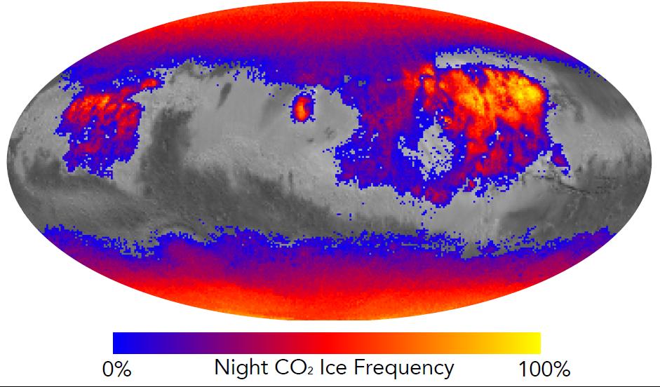
MCS
941x552x3
PIA20758:
Where on Mars Does Carbon Dioxide Frost Form Often?
Full Resolution:
TIFF
(620.9 kB)
JPEG
(77.94 kB)
2016-07-07
Mars
Mars Reconnaissance Orbiter (MRO)
HiRISE
1581x1283x1
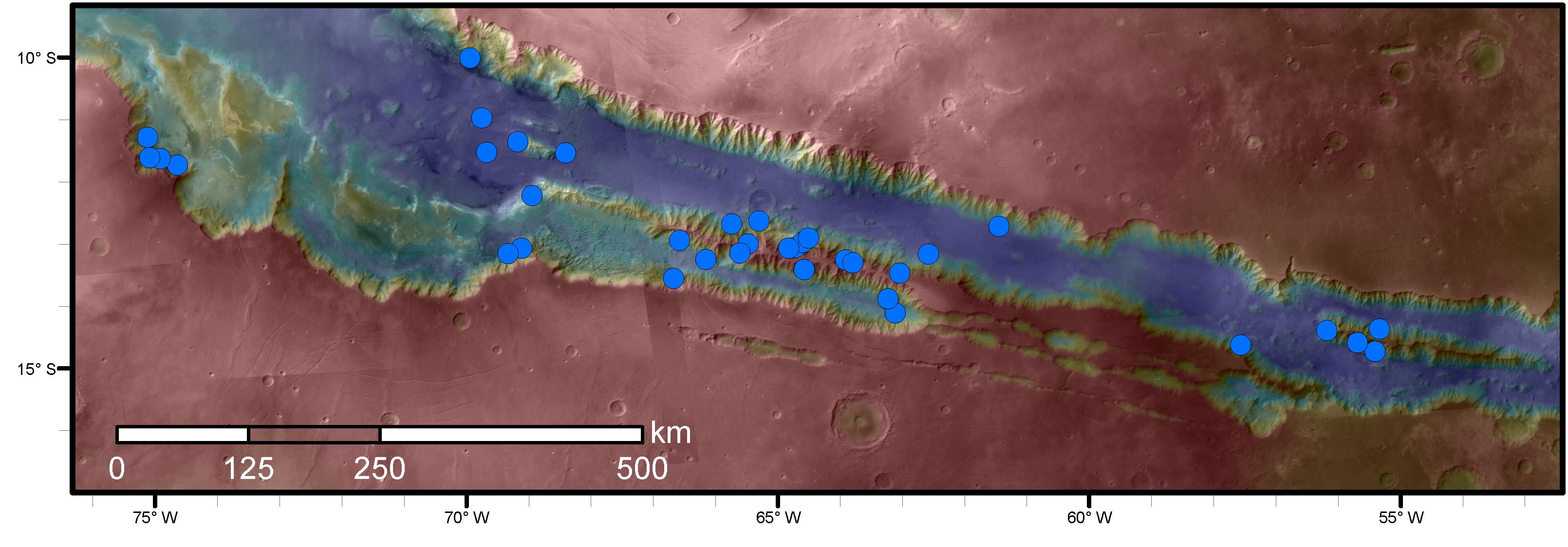
PIA20757:
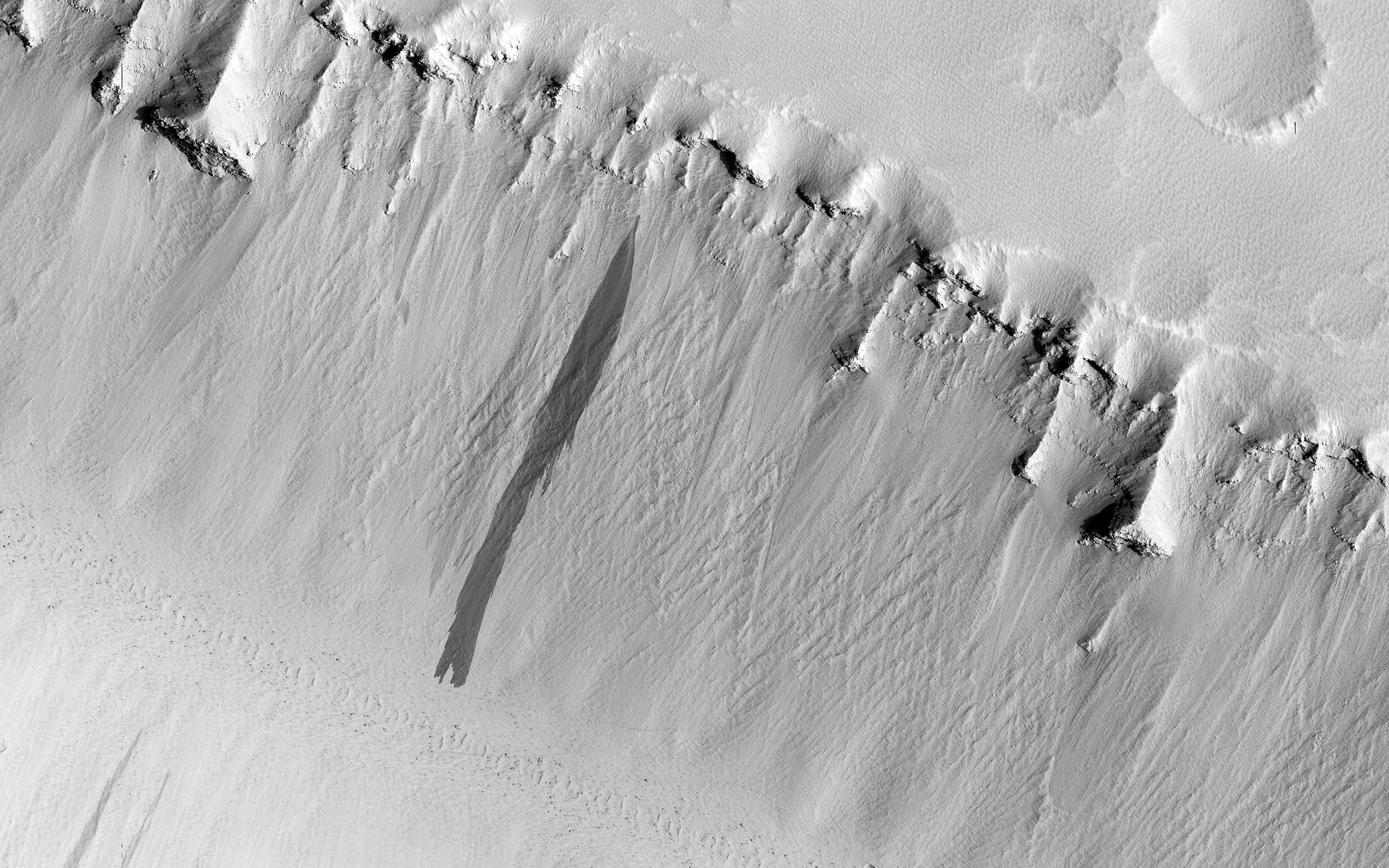
Numerous Seasonal 'Lineae' on Coprates Montes, Mars
Full Resolution:
TIFF
(1.915 MB)
JPEG
(217.1 kB)
2016-07-07
Mars
Mars Reconnaissance Orbiter (MRO)
HiRISE
3220x1125x3
PIA20756:
Sites with Seasonal Streaks on Slopes in Mars Canyons
Full Resolution:
TIFF
(6.927 MB)
JPEG
(320.1 kB)
2016-06-29
Mars
Mars Reconnaissance Orbiter (MRO)
HiRISE
2880x1800x3
PIA20740:
Dreaming of Graben in the Labyrinth of the Night
Full Resolution:
TIFF
(15.56 MB)
JPEG
(765.6 kB)
2016-06-29
Mars
Mars Reconnaissance Orbiter (MRO)
HiRISE
2880x1800x3
PIA20737:
Bedrock North of Terby Crater
Full Resolution:
TIFF
(15.56 MB)
JPEG
(775.2 kB)
2016-06-29
Mars
Mars Reconnaissance Orbiter (MRO)
HiRISE
2880x1800x3
PIA20736:
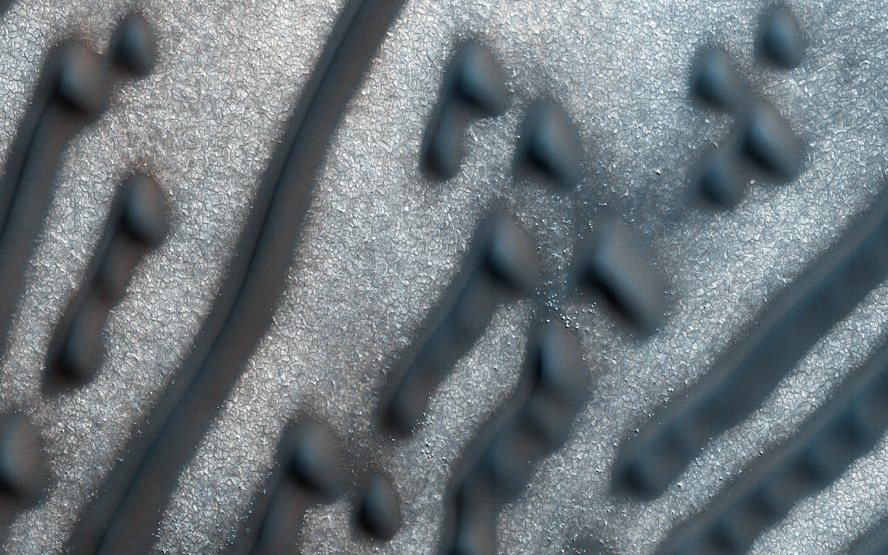
Glowing Gullies in Kaiser Crater Dunes
Full Resolution:
TIFF
(15.11 MB)
JPEG
(766.1 kB)
2016-06-29
Mars
Mars Reconnaissance Orbiter (MRO)
HiRISE
2880x1800x3
PIA20735:
Martian Morse Code
Full Resolution:
TIFF
(15.56 MB)
JPEG
(1.195 MB)
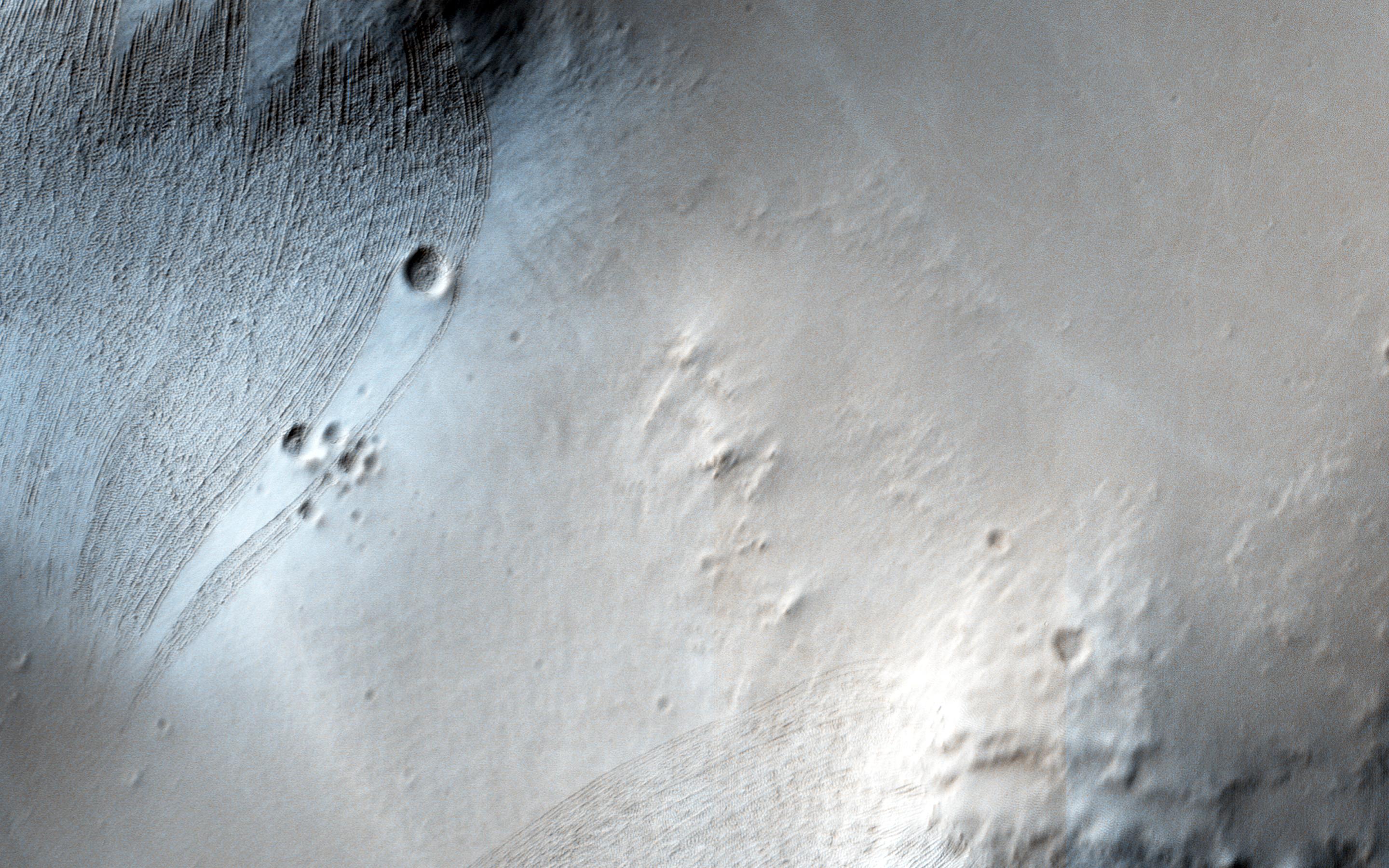
2016-06-22
Mars
Mars Reconnaissance Orbiter (MRO)
HiRISE
2880x1800x3
PIA20738:
Curiosity on the Naukluft Plateau
Full Resolution:
TIFF
(15.56 MB)
JPEG
(826.9 kB)
2016-06-09
Mars
Mars Reconnaissance Orbiter (MRO)
MCS
MARCI
4800x3142x3
PIA20747:
Mars Atmospheric Temperature and Dust Storm Tracking
Full Resolution:
TIFF
(29.8 MB)
JPEG
(632.6 kB)
2016-06-09
Mars
Mars Reconnaissance Orbiter (MRO)
MCS
1006x505x3
PIA20746:
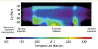
Seasonal Temperature Pattern Indicating Martian Dust Storms
Full Resolution:
TIFF
(432.2 kB)
JPEG
(55.66 kB)
2016-06-01
Mars
Mars Reconnaissance Orbiter (MRO)
HiRISE
2880x1800x3
PIA20731:
Drag Folds in the North Polar Layered Deposits
Full Resolution:
TIFF
(15.56 MB)
JPEG
(1.33 MB)
2016-06-01
Mars
Mars Reconnaissance Orbiter (MRO)
HiRISE
2880x1800x3
PIA20730:
The Plains are Not Plain
Full Resolution:
TIFF
(15.56 MB)
JPEG
(1.024 MB)
2016-06-01
Mars
Mars Reconnaissance Orbiter (MRO)
HiRISE
2880x1800x3
PIA20729:
An Inverted Crater
Full Resolution:
TIFF
(15.56 MB)
JPEG
(956.6 kB)
2016-06-01
Mars
Mars Reconnaissance Orbiter (MRO)
HiRISE
2880x1800x3
PIA20728:
Beautiful Blocks of Bedrock
Full Resolution:
TIFF
(15.56 MB)
JPEG
(1.313 MB)
2016-05-26
Mars
Mars Reconnaissance Orbiter (MRO)
Viking
Shallow Subsurface Radar (SHARAD)
975x1188x3
PIA20029:
Signs of a Martian Ice Age
Full Resolution:
TIFF
(2.95 MB)
JPEG
(190.7 kB)
2016-05-18
Mars
Mars Reconnaissance Orbiter (MRO)
HiRISE
2880x1800x3
PIA15881:
Frosted Dunes
Full Resolution:
TIFF
(15.56 MB)
JPEG
(950.9 kB)
2016-05-18
Mars
Mars Reconnaissance Orbiter (MRO)
HiRISE
2880x1800x3
PIA15880:
Valley Networks in the Ancient Martian Highlands
Full Resolution:
TIFF
(15.56 MB)
JPEG
(1.328 MB)
2016-05-18
Mars
Mars Reconnaissance Orbiter (MRO)
HiRISE
2880x1800x3
PIA20588:
Bedrock Exposures on the Floor of Bakhuysen Crater
Full Resolution:
TIFF
(15.56 MB)
JPEG
(787 kB)
2016-05-18
Mars
Mars Reconnaissance Orbiter (MRO)
HiRISE
2880x1800x1
PIA20587:
On the Shape of Impact Craters
Full Resolution:
TIFF
(5.191 MB)
JPEG
(860.9 kB)
2016-05-04
Mars
Mars Reconnaissance Orbiter (MRO)
HiRISE
2880x1800x3
PIA20662:
A One-Kilometer Crater on the Floor of Saheki Crater
Full Resolution:
TIFF
(15.56 MB)
JPEG
(691.9 kB)
2016-05-04
Mars
Mars Reconnaissance Orbiter (MRO)
HiRISE
2880x1800x3
PIA20661:
Southern Winter Frost Accumulations
Full Resolution:
TIFF
(15.4 MB)
JPEG
(546.5 kB)
2016-05-04
Mars
Mars Reconnaissance Orbiter (MRO)
HiRISE
2880x1800x1
PIA20660:
Troughs in Elysium Fossae
Full Resolution:
TIFF
(5.191 MB)
JPEG
(935.9 kB)
2016-05-04
Mars
Mars Reconnaissance Orbiter (MRO)
HiRISE
2880x1800x3
PIA20659:
Possible Sulfate Deposits in West Melas Chasma
Full Resolution:
TIFF
(15.56 MB)
JPEG
(1.297 MB)
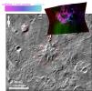
2016-05-03
Mars
2001 Mars Odyssey
Mars Reconnaissance Orbiter (MRO)
CRISM
THEMIS
758x747x3
PIA20335:
Evidence Builds for Old Under-Ice Volcanoes on Mars
Full Resolution:
TIFF
(943.9 kB)
JPEG
(110 kB)
1-100
101-200
201-300
301-400
401-500
501-600
601-700
701-800
801-900
901-1000
Currently displaying images:
501 - 600
of 1717


