My
List |
Addition Date
|
Target
|
Mission
|
Instrument
|
Size
|

|
2005-10-03 |
Mars
|
Mars Global Surveyor (MGS)
|
Mars Orbiter Camera (MOC)
|
672x957x1 |
|
-
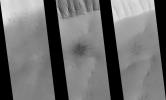
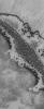
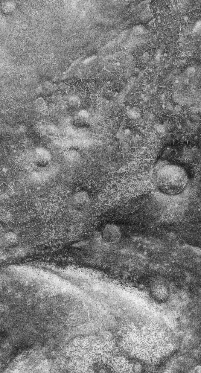
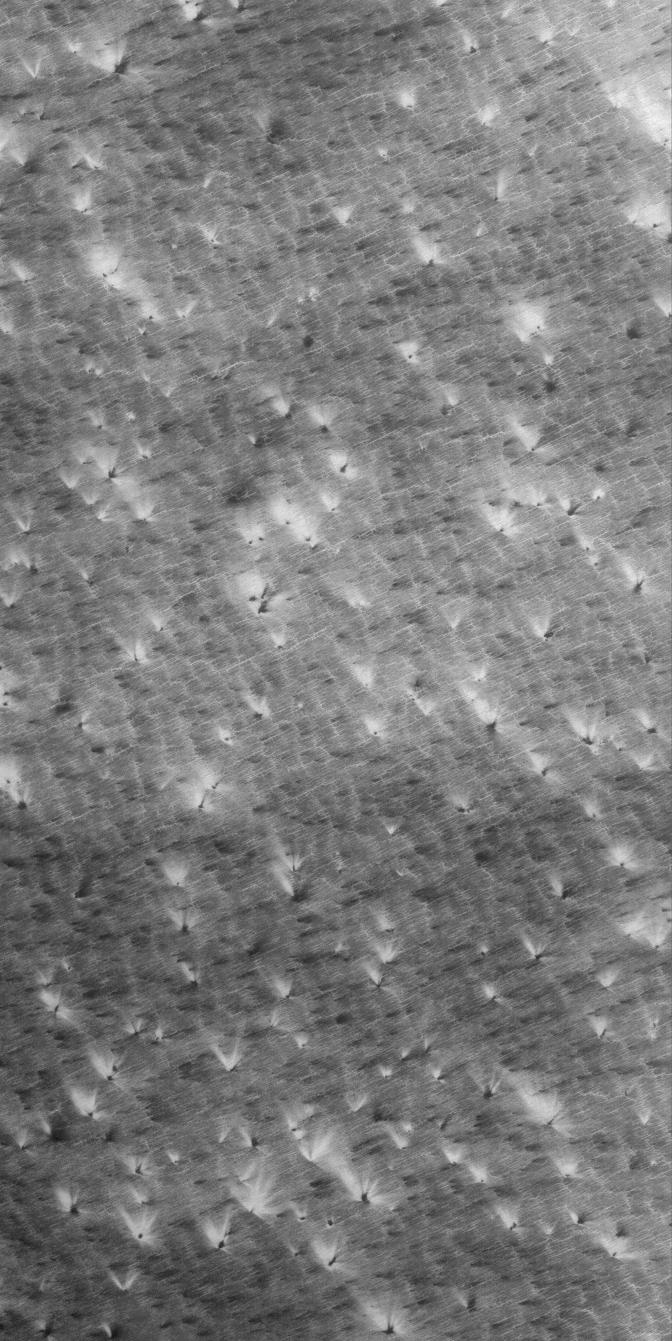
PIA03009:
-
Defrosting Spots
Full Resolution:
TIFF
(644 kB)
JPEG
(180.1 kB)
|
|
|
2005-10-02 |
Mars
|
Mars Global Surveyor (MGS)
|
Mars Orbiter Camera (MOC)
|
2048x2944x1 |
|
-
PIA03008:
-
Frozen Frozen CO2
Full Resolution:
TIFF
(6.035 MB)
JPEG
(1.576 MB)
|
|
|
2005-10-01 |
Mars
|
Mars Global Surveyor (MGS)
|
Mars Orbiter Camera (MOC)
|
672x1580x1 |
|
-
PIA03007:
-
Defrosting South #2
Full Resolution:
TIFF
(1.063 MB)
JPEG
(351.9 kB)
|
|
|
2005-09-30 |
Mars
|
Mars Global Surveyor (MGS)
|
Mars Orbiter Camera (MOC)
|
672x2432x1 |
|
-
PIA03006:
-
Enhanced by Frost
Full Resolution:
TIFF
(1.636 MB)
JPEG
(284.8 kB)
|
|
|
2005-09-29 |
Mars
|
Mars Global Surveyor (MGS)
|
Mars Orbiter Camera (MOC)
|
2048x5042x1 |

|
-
PIA06416:
-
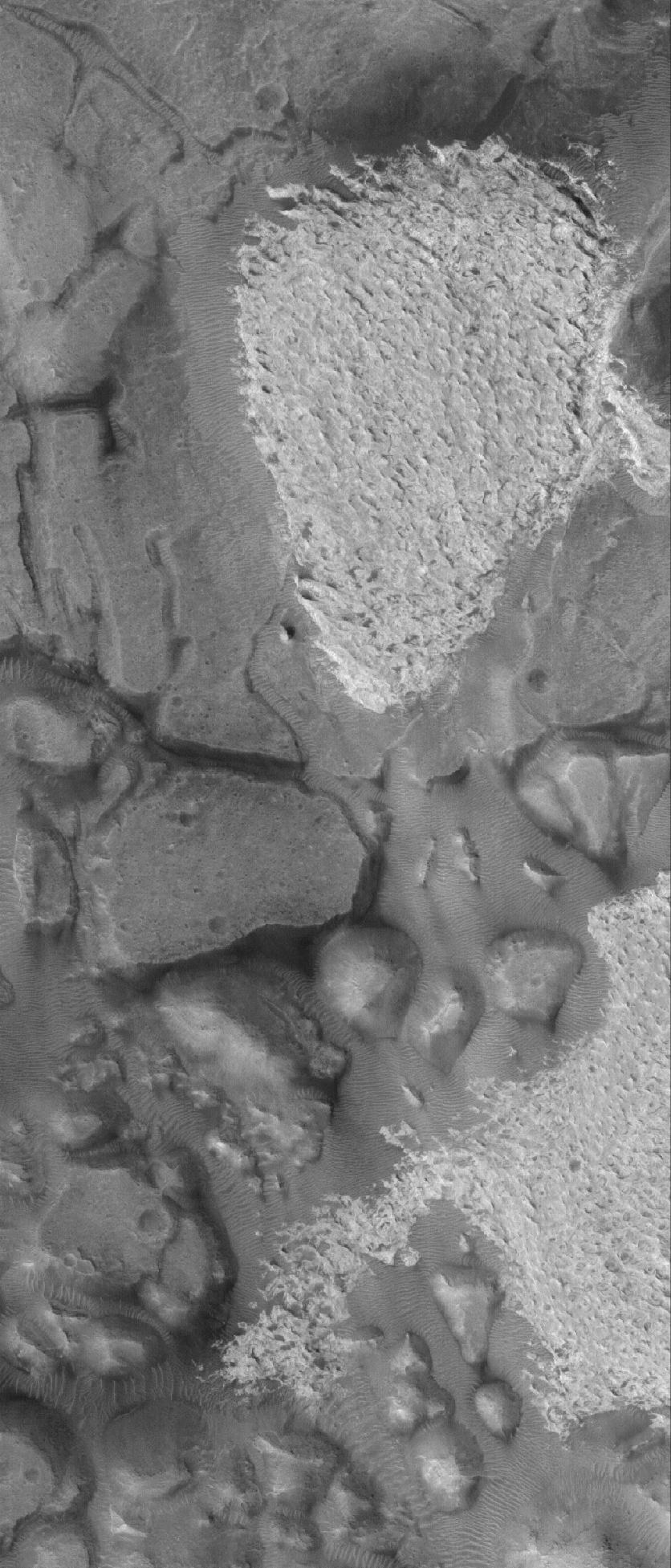
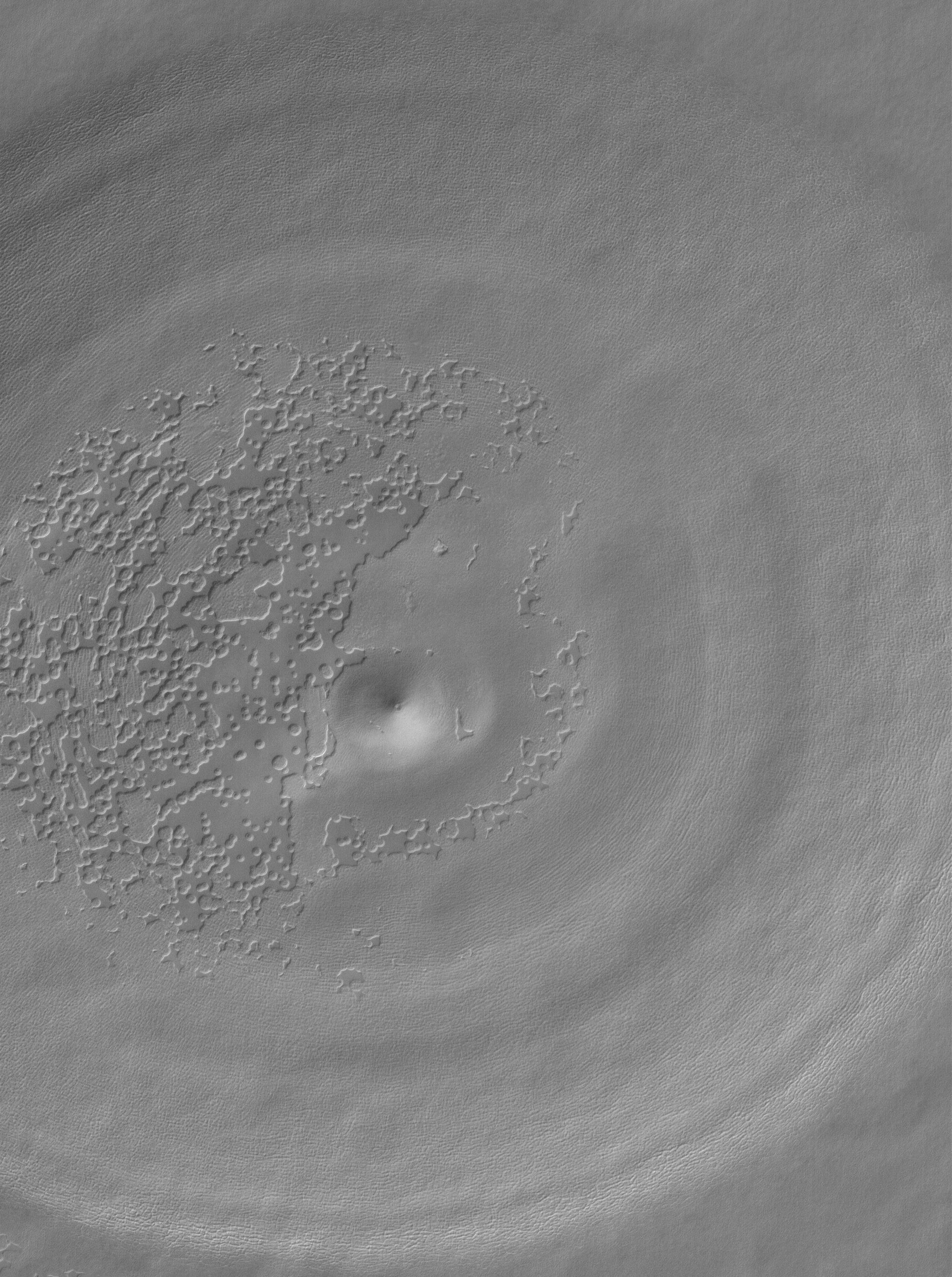
Collapse Pit
Full Resolution:
TIFF
(10.34 MB)
JPEG
(2.481 MB)
|
|
|
2005-09-28 |
Mars
|
Mars Global Surveyor (MGS)
|
Mars Orbiter Camera (MOC)
|
836x2351x1 |

|
-
PIA06413:
-
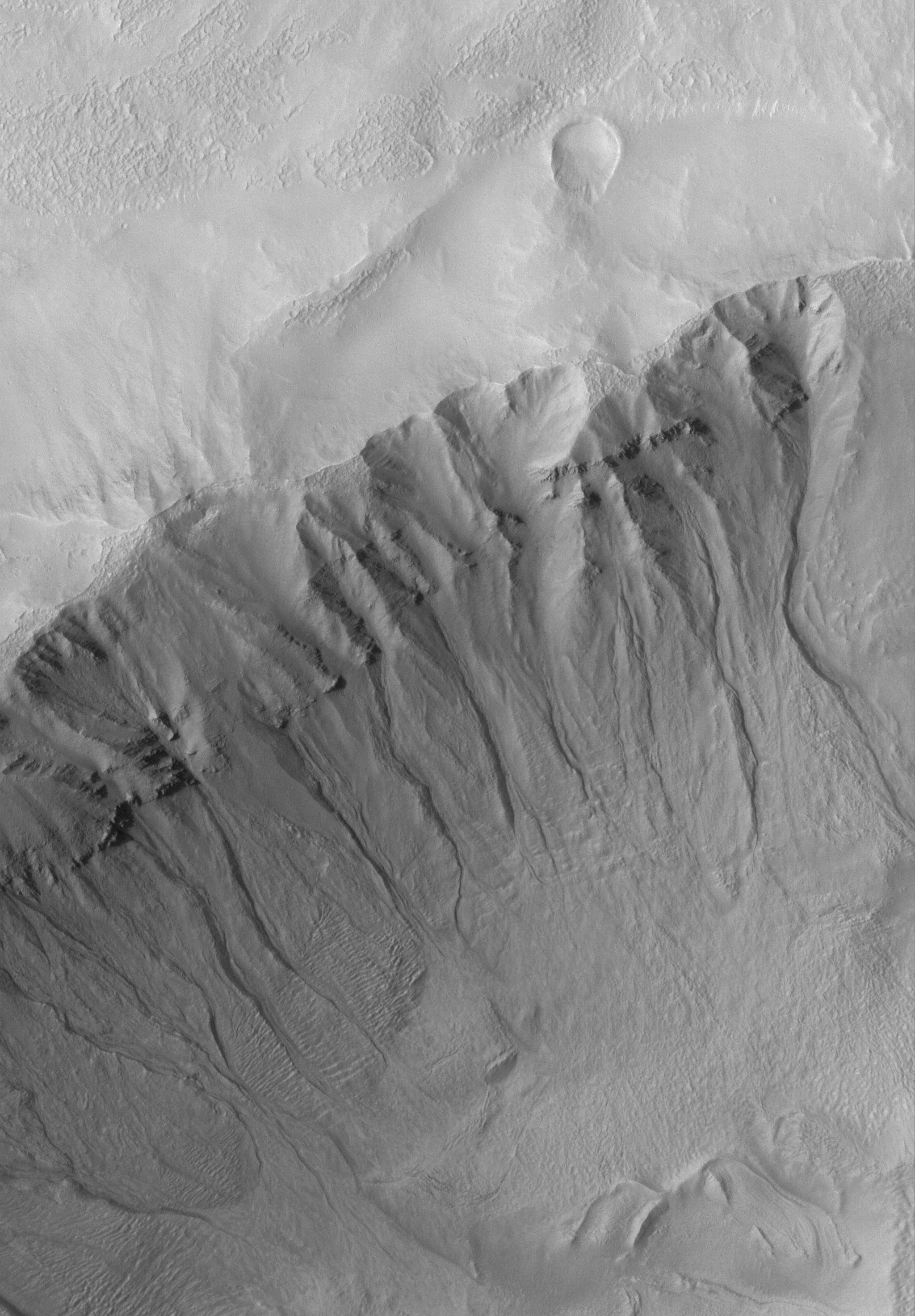
Gully in the North
Full Resolution:
TIFF
(1.968 MB)
JPEG
(216.2 kB)
|
|
|
2005-09-27 |
Mars
|
Mars Global Surveyor (MGS)
|
Mars Orbiter Camera (MOC)
|
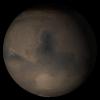
640x640x3 |
|
-
PIA06408:
-
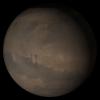
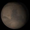
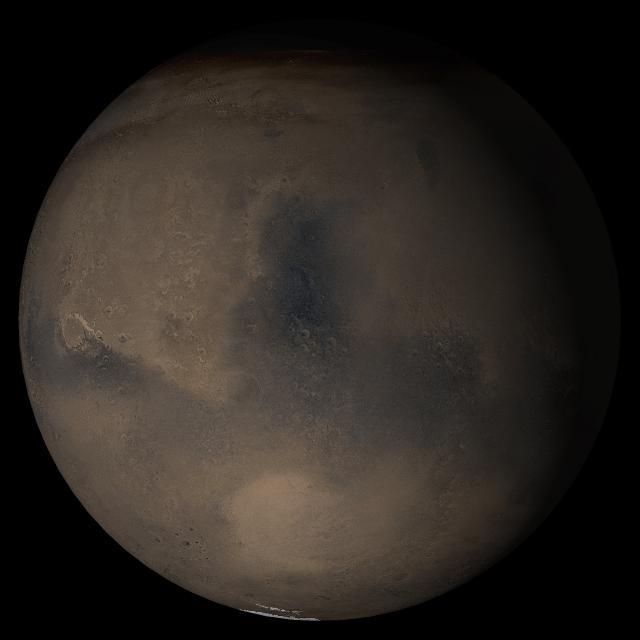
Mars at Ls 288°: Elysium/Mare Cimmerium
Full Resolution:
TIFF
(411.8 kB)
JPEG
(20.5 kB)
|
|
|
2005-09-26 |
Mars
|
Mars Global Surveyor (MGS)
|
Mars Orbiter Camera (MOC)
|
512x826x1 |

|
-
PIA06376:
-
High Latitude Polygons
Full Resolution:
TIFF
(423.6 kB)
JPEG
(105.2 kB)
|
|
|
2005-09-25 |
Mars
|
Mars Global Surveyor (MGS)
|
Mars Orbiter Camera (MOC)
|
836x1635x1 |
|
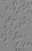
-
PIA06354:
-
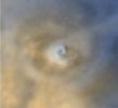
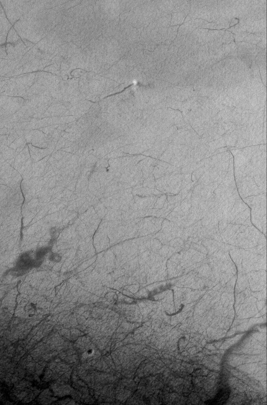
Loire Dust Devil
Full Resolution:
TIFF
(1.369 MB)
JPEG
(192.3 kB)
|
|
|
2005-09-24 |
Mars
|
Mars Global Surveyor (MGS)
|
Mars Orbiter Camera (MOC)
|
836x2822x1 |

|
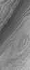
-
PIA06353:
-
Pits on Ascraeus
Full Resolution:
TIFF
(2.362 MB)
JPEG
(339.7 kB)
|
|
|
2005-09-23 |
Mars
|
Mars Global Surveyor (MGS)
|
Mars Orbiter Camera (MOC)
|
672x977x1 |
|
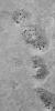
-
PIA06352:
-
Devilish Details
Full Resolution:
TIFF
(657.4 kB)
JPEG
(116 kB)
|
|
|
2005-09-22 |
Mars
|
Mars Global Surveyor (MGS)
|
Mars Orbiter Camera (MOC)
|
836x2217x1 |
|
-
PIA06344:
-
South Polar Details
Full Resolution:
TIFF
(1.856 MB)
JPEG
(536.8 kB)
|
|
|
2005-09-21 |
Mars
|
Mars Global Surveyor (MGS)
|
Mars Orbiter Camera (MOC)
|
640x640x3 |
|
-
PIA06343:
-
Mars at Ls 288°: Syrtis Major
Full Resolution:
TIFF
(411.8 kB)
JPEG
(21.79 kB)
|
|
|
2005-09-20 |
Mars
|
Mars Global Surveyor (MGS)
|
Mars Orbiter Camera (MOC)
|
10413x9194x1 |

|
-
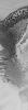
PIA04296:
-
Scarp at Head of Chasma Boreale
Full Resolution:
TIFF
(95.74 MB)
JPEG
(5.089 MB)
|
|
|
2005-09-20 |
Mars
|
Mars Global Surveyor (MGS)
|
Mars Orbiter Camera (MOC)
|
968x1756x1 |
|
-
PIA04295:
-
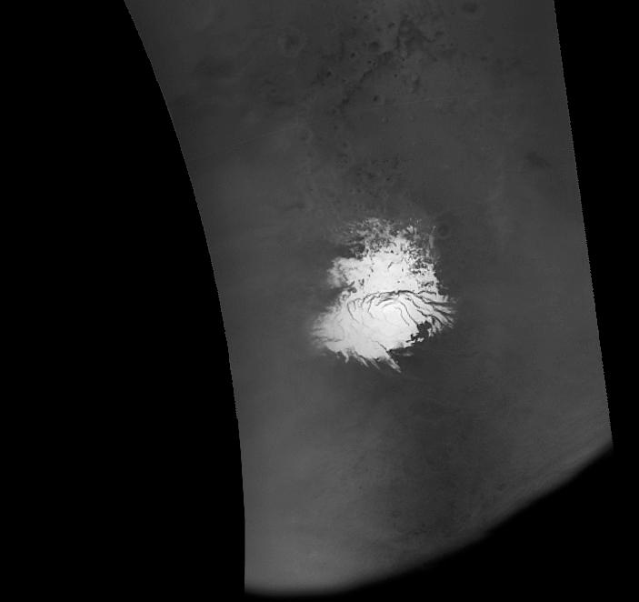
Four Mars Years of South Polar Changes

Full Resolution:
TIFF
(1.702 MB)
JPEG
(158.1 kB)
|
|
|
2005-09-20 |
Mars
|
Mars Global Surveyor (MGS)
|
Mars Orbiter Camera (MOC)
|
328x300x3 |
|
-
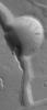
PIA04294:
-
Repeated Clouds over Arsia Mons
Full Resolution:
TIFF
(295.7 kB)
JPEG
(5.9 kB)
|
|
|
2005-09-20 |
Mars
|
Mars Global Surveyor (MGS)
|
Mars Orbiter Camera (MOC)
|
4405x4976x3 |
|
-
PIA04293:
-
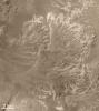
Eberswalde Delta in High Resolution
Full Resolution:
TIFF
(65.76 MB)
JPEG
(4.641 MB)
|
|
|
2005-09-20 |
Mars
|
Mars Global Surveyor (MGS)
|
Mars Orbiter Camera (MOC)
|
2531x1529x1 |
|
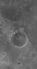
-
PIA04292:
-
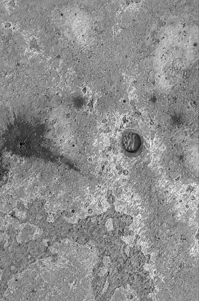
Recently-Formed Impact Crater
Full Resolution:
TIFF
(3.874 MB)
JPEG
(445.3 kB)
|
|
|
2005-09-20 |
Mars
|
Mars Global Surveyor (MGS)
|
Mars Orbiter Camera (MOC)
|
3871x1860x1 |

|
-
PIA04291:
-
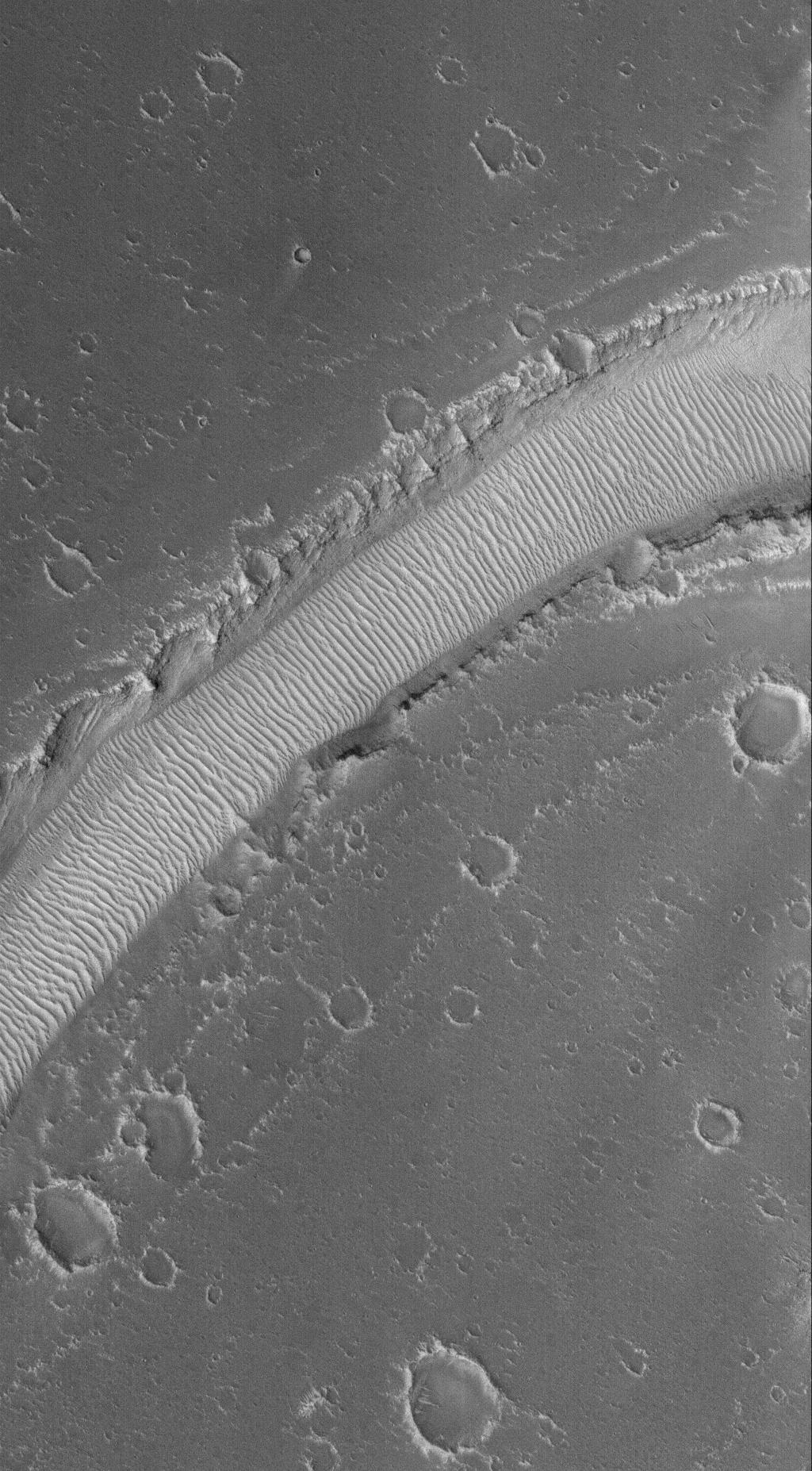
Rolling Stones Make New Boulder Tracks
Full Resolution:
TIFF
(7.208 MB)
JPEG
(1.359 MB)
|
|
|
2005-09-20 |
Mars
|
Mars Global Surveyor (MGS)
|
Mars Orbiter Camera (MOC)
|
596x550x1 |

|
-
PIA04290:
-
New Gullies on Martian Sand Dune
Full Resolution:
TIFF
(328.4 kB)
JPEG
(48.5 kB)
|
|
|
2005-09-19 |
Mars
|
Mars Global Surveyor (MGS)
|
Mars Orbiter Camera (MOC)
|
1024x3441x1 |
|
-
PIA03005:
-
Huygens Wind Streak
Full Resolution:
TIFF
(3.527 MB)
JPEG
(588 kB)
|
|
|
2005-09-18 |
Mars
|
Mars Global Surveyor (MGS)
|
Mars Orbiter Camera (MOC)
|
836x1520x1 |
|
-
PIA03004:
-
Inverted Channels
Full Resolution:
TIFF
(1.272 MB)
JPEG
(354 kB)
|
|
|
2005-09-17 |
Mars
|
Mars Global Surveyor (MGS)
|
Mars Orbiter Camera (MOC)
|
672x1410x1 |
|
-
PIA03003:
-
Wind-Eroded Terrain
Full Resolution:
TIFF
(948.7 kB)
JPEG
(167.5 kB)
|
|
|
2005-09-16 |
Mars
|
Mars Global Surveyor (MGS)
|
Mars Orbiter Camera (MOC)
|
672x1014x1 |

|
-
PIA06078:
-
Meridiani Rocks
Full Resolution:
TIFF
(682.3 kB)
JPEG
(219.9 kB)
|
|
|
2005-09-15 |
Mars
|
Mars Global Surveyor (MGS)
|
Mars Orbiter Camera (MOC)
|
1024x1854x1 |

|
-
PIA06008:
-
Rippled Valley Floor
Full Resolution:
TIFF
(1.901 MB)
JPEG
(341.9 kB)
|
|
|
2005-09-14 |
Mars
|
Mars Global Surveyor (MGS)
|
Mars Orbiter Camera (MOC)
|
1024x2002x1 |
|
-
PIA05258:
-
Lonely Butte
Full Resolution:
TIFF
(2.052 MB)
JPEG
(385 kB)
|
|
|
2005-09-13 |
Mars
|
Mars Global Surveyor (MGS)
|
Mars Orbiter Camera (MOC)
|
640x640x3 |
|
-
PIA05217:
-
Mars at Ls 288°: Acidalia/Mare Erythraeum
Full Resolution:
TIFF
(411.8 kB)
JPEG
(22.06 kB)
|
|
|
2005-09-12 |
Mars
|
Mars Global Surveyor (MGS)
|
Mars Orbiter Camera (MOC)
|
967x979x3 |
|
-
PIA05079:
-
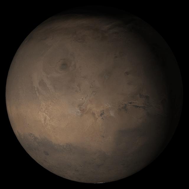
Celebrating 8 Years at Mars: Repeated Weather Events
Full Resolution:
TIFF
(2.844 MB)
JPEG
(123.5 kB)
|
|
|
2005-09-11 |
Mars
|
Mars Global Surveyor (MGS)
|
Mars Orbiter Camera (MOC)
|
672x1790x1 |
|
-
PIA04289:
-
Flows of Ascraeus
Full Resolution:
TIFF
(1.204 MB)
JPEG
(252 kB)
|
|
|
2005-09-10 |
Mars
|
Mars Global Surveyor (MGS)
|
Mars Orbiter Camera (MOC)
|
672x2327x1 |

|
-
PIA04288:
-
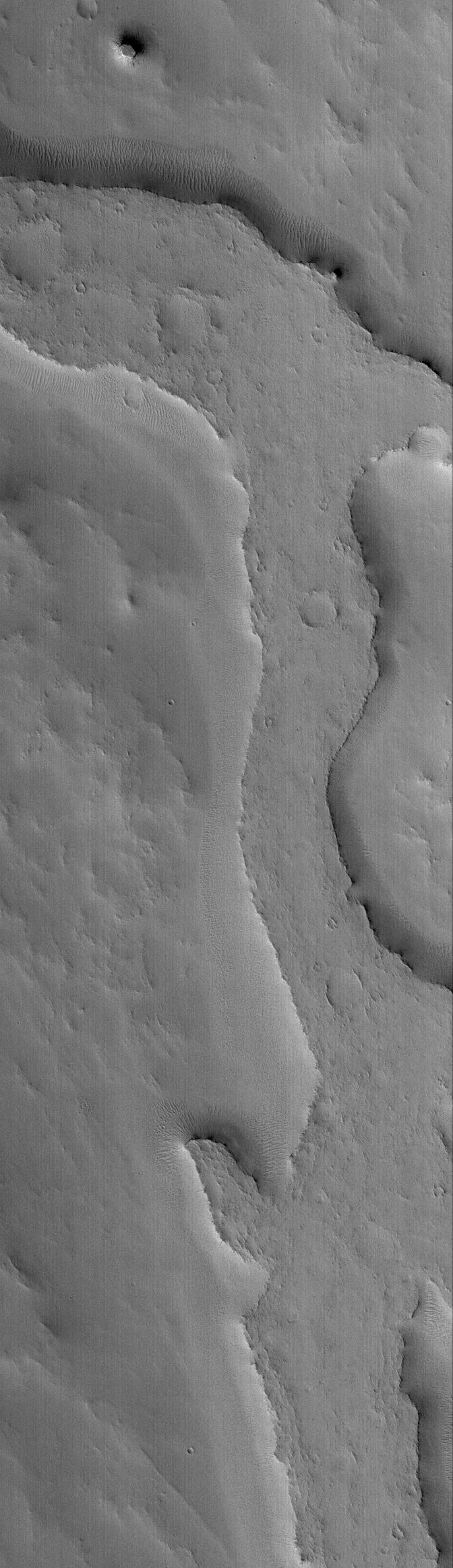
Inverted Valley
Full Resolution:
TIFF
(1.566 MB)
JPEG
(224.5 kB)
|
|
|
2005-09-09 |
Mars
|
Mars Global Surveyor (MGS)
|
Mars Orbiter Camera (MOC)
|
703x662x1 |

|
-
PIA04287:
-
MOC Imaging Resumes
Full Resolution:
TIFF
(466.1 kB)
JPEG
(20.13 kB)
|
|
|
2005-09-08 |
Mars
|
Mars Global Surveyor (MGS)
|
Mars Orbiter Camera (MOC)
|
836x1953x1 |

|
-
PIA04286:
-
Aram Chaos Rocks
Full Resolution:
TIFF
(1.635 MB)
JPEG
(252.2 kB)
|
|
|
2005-09-07 |
Mars
|
Mars Global Surveyor (MGS)
|
Mars Orbiter Camera (MOC)
|
1542x1892x3 |
|
-
PIA04285:
-
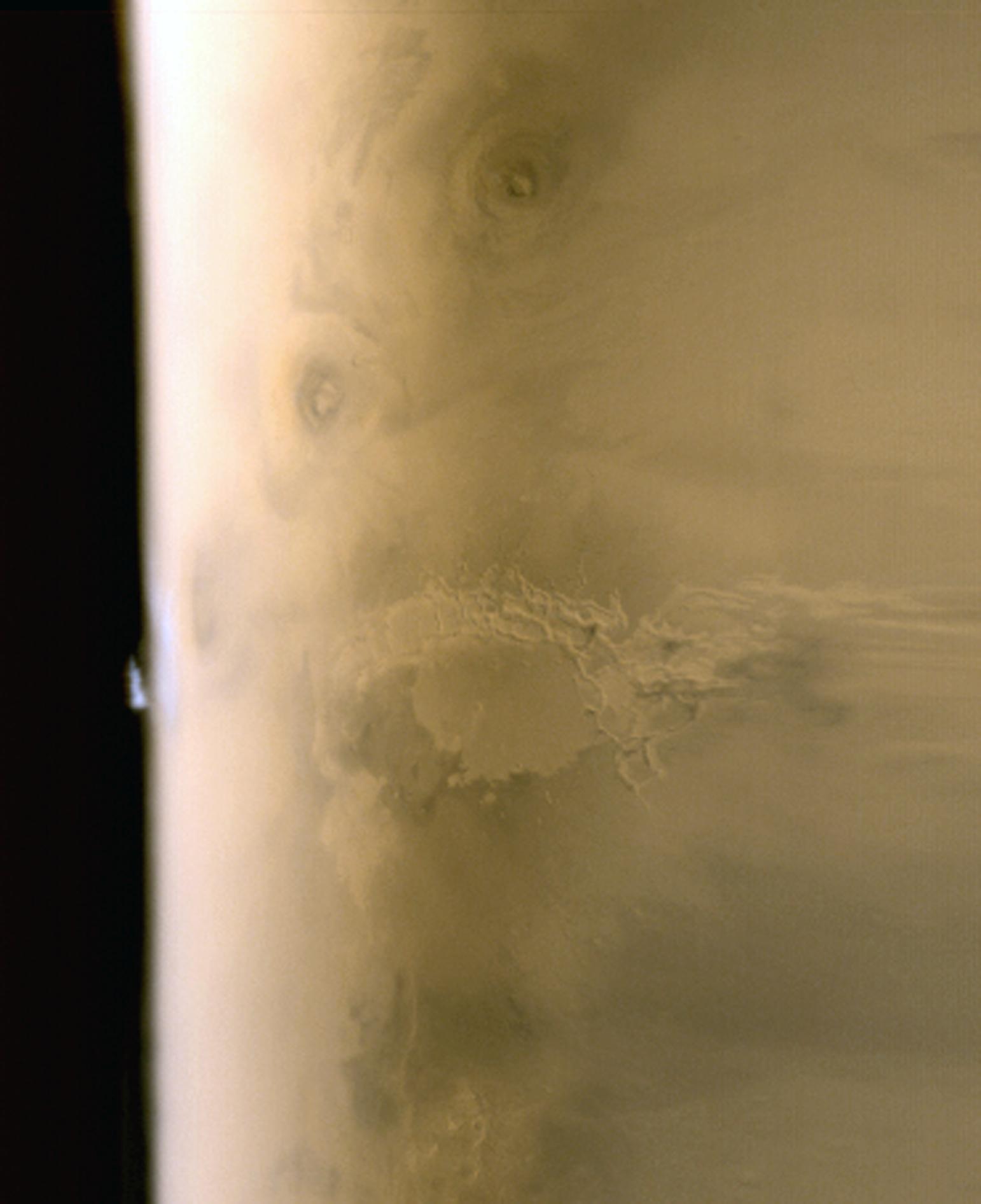
Tharsis Limb Cloud
Full Resolution:
TIFF
(8.768 MB)
JPEG
(121.5 kB)
|
|
|
2005-09-06 |
Mars
|
Mars Global Surveyor (MGS)
|
Mars Orbiter Camera (MOC)
|
640x640x3 |
|
-
PIA04284:
-
Mars at Ls 288°: Tharsis
Full Resolution:
TIFF
(411.8 kB)
JPEG
(21.63 kB)
|
|
|
2005-09-05 |
Mars
|
Mars Global Surveyor (MGS)
|
Mars Orbiter Camera (MOC)
|
1024x1552x1 |
|
-
PIA04283:
-
Caught in the Act
Full Resolution:
TIFF
(1.591 MB)
JPEG
(327.3 kB)
|
|
|
2005-09-04 |
Mars
|
Mars Global Surveyor (MGS)
|
Mars Orbiter Camera (MOC)
|
1024x2480x1 |
|
-
PIA04259:
-
Sediments of Terby
Full Resolution:
TIFF
(2.542 MB)
JPEG
(411 kB)
|
|
|
2005-09-03 |
Mars
|
Mars Global Surveyor (MGS)
|
Mars Orbiter Camera (MOC)
|
672x1247x1 |

|
-
PIA04212:
-
Polygons and Craters
Full Resolution:
TIFF
(839 kB)
JPEG
(248.8 kB)
|
|
|
2005-09-02 |
Mars
|
Mars Global Surveyor (MGS)
|
Mars Orbiter Camera (MOC)
|
836x3188x1 |
|
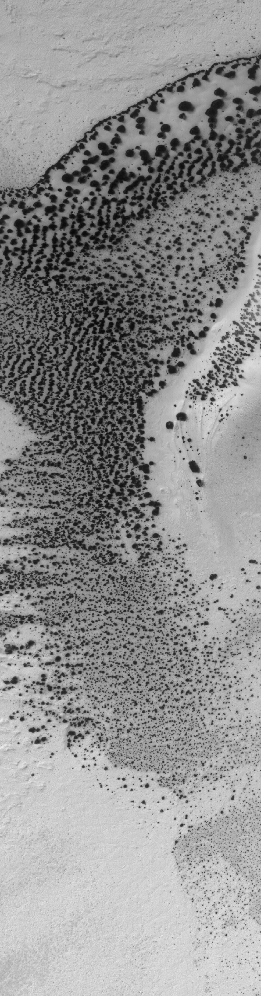
-
PIA04199:
-
Defrosting Sand
Full Resolution:
TIFF
(2.668 MB)
JPEG
(473.1 kB)
|
|
|
2005-09-01 |
Mars
|
Mars Global Surveyor (MGS)
|
Mars Orbiter Camera (MOC)
|
836x1937x1 |
|
-
PIA04198:
-
Cut By Troughs
Full Resolution:
TIFF
(1.621 MB)
JPEG
(156.3 kB)
|
|
|
2005-08-31 |
Mars
|
Mars Global Surveyor (MGS)
|
Mars Orbiter Camera (MOC)
|
836x1547x1 |
|
-
PIA04197:
-
Meridiani Crater
Full Resolution:
TIFF
(1.295 MB)
JPEG
(152.2 kB)
|
|
|
2005-08-30 |
Mars
|
Mars Global Surveyor (MGS)
|
Mars Orbiter Camera (MOC)
|
640x640x3 |
|
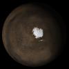
-
PIA04177:
-
Mars at Ls 269°: South Polar Region
Full Resolution:
TIFF
(411.8 kB)
JPEG
(26.14 kB)
|
|
|
2005-08-29 |
Mars
|
Mars Global Surveyor (MGS)
|
Mars Orbiter Camera (MOC)
|
512x1298x1 |
|
-
PIA04173:
-
Frosty Dunes
Full Resolution:
TIFF
(665.5 kB)
JPEG
(171.3 kB)
|
|
|
2005-08-28 |
Mars
|
Mars Global Surveyor (MGS)
|
Mars Orbiter Camera (MOC)
|
836x1940x1 |
|
-
PIA04172:
-
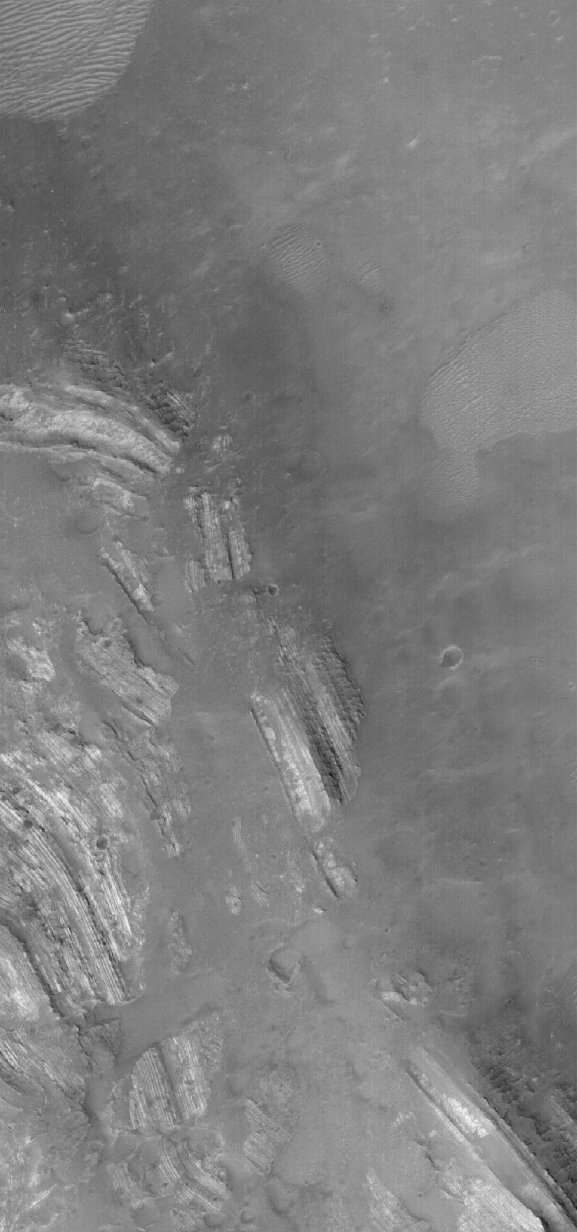
Layered Slope
Full Resolution:
TIFF
(1.624 MB)
JPEG
(252.2 kB)
|
|
|
2005-08-27 |
Mars
|
Mars Global Surveyor (MGS)
|
Mars Orbiter Camera (MOC)
|
2048x4240x1 |
|
-
PIA04171:
-
East Candor's Rocks
Full Resolution:
TIFF
(8.692 MB)
JPEG
(1.842 MB)
|
|
|
2005-08-26 |
Mars
|
Mars Global Surveyor (MGS)
|
Mars Orbiter Camera (MOC)
|
836x4389x1 |
|
-
PIA04170:
-
Amazonis Yardangs
Full Resolution:
TIFF
(3.673 MB)
JPEG
(673.2 kB)
|
|
|
2005-08-25 |
Mars
|
Mars Global Surveyor (MGS)
|
Mars Orbiter Camera (MOC)
|
836x2865x1 |
|
-
PIA04167:
-
Terby's Rocks
Full Resolution:
TIFF
(2.398 MB)
JPEG
(431.6 kB)
|
|
|
2005-08-24 |
Mars
|
Mars Global Surveyor (MGS)
|
Mars Orbiter Camera (MOC)
|
836x3868x1 |
|
-
PIA04166:
-
Valley Crossing
Full Resolution:
TIFF
(3.237 MB)
JPEG
(623.8 kB)
|
|
|
2005-08-23 |
Mars
|
Mars Global Surveyor (MGS)
|
Mars Orbiter Camera (MOC)
|
640x640x3 |
|
-
PIA04165:
-
Mars at Ls 269°: Elysium/Mare Cimmerium
Full Resolution:
TIFF
(411.8 kB)
JPEG
(21.56 kB)
|
|
|
2005-08-22 |
Mars
|
Mars Global Surveyor (MGS)
|
Mars Orbiter Camera (MOC)
|
836x1828x1 |
|
-
PIA04164:
-
West Argyre
Full Resolution:
TIFF
(1.53 MB)
JPEG
(220.4 kB)
|
|
|
2005-08-21 |
Mars
|
Mars Global Surveyor (MGS)
|
Mars Orbiter Camera (MOC)
|
836x1554x1 |

|
-
PIA04163:
-
Sediments of Arabia
Full Resolution:
TIFF
(1.301 MB)
JPEG
(159.4 kB)
|
|
|
2005-08-20 |
Mars
|
Mars Global Surveyor (MGS)
|
Mars Orbiter Camera (MOC)
|
672x1624x1 |
|
-
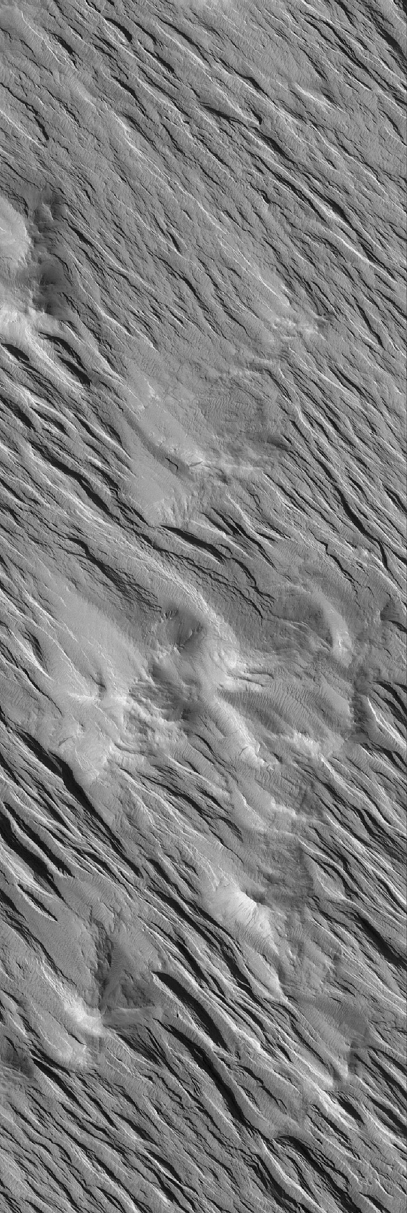
PIA04162:
-
The Defrosting South
Full Resolution:
TIFF
(1.093 MB)
JPEG
(194.2 kB)
|
|
|
2005-08-19 |
Mars
|
Mars Global Surveyor (MGS)
|
Mars Orbiter Camera (MOC)
|
672x1524x1 |
|
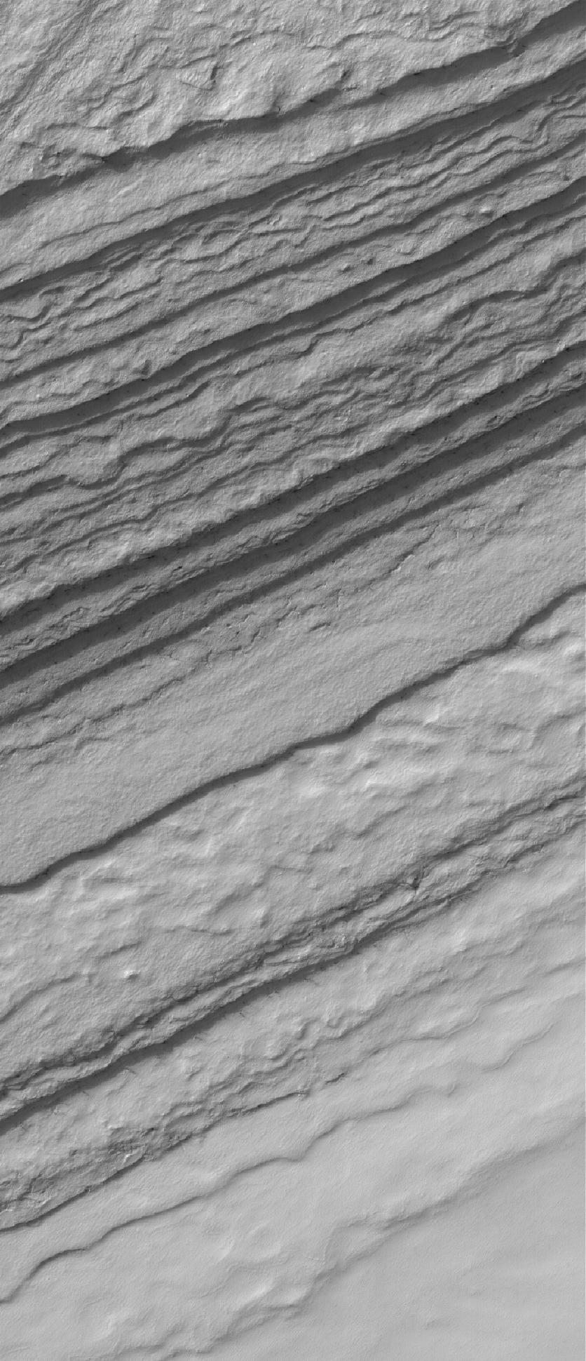
-
PIA04161:
-
South Polar Layers
Full Resolution:
TIFF
(1.025 MB)
JPEG
(325.5 kB)
|
|
|
2005-08-18 |
Mars
|
Mars Global Surveyor (MGS)
|
Mars Orbiter Camera (MOC)
|
836x1659x1 |
|
-
PIA04151:
-
Polar Polygons
Full Resolution:
TIFF
(1.389 MB)
JPEG
(247.4 kB)
|
|
|
2005-08-17 |
Mars
|
Mars Global Surveyor (MGS)
|
Mars Orbiter Camera (MOC)
|
2048x3243x1 |
|
-
PIA04150:
-
Polar Cap Pits
Full Resolution:
TIFF
(6.648 MB)
JPEG
(549.9 kB)
|
|
|
2005-08-16 |
Mars
|
Mars Global Surveyor (MGS)
|
Mars Orbiter Camera (MOC)
|
640x640x3 |
|
-
PIA04149:
-
Mars at Ls 269°: Syrtis Major
Full Resolution:
TIFF
(411.8 kB)
JPEG
(22.99 kB)
|
|
|
2005-08-15 |
Mars
|
Mars Global Surveyor (MGS)
|
Mars Orbiter Camera (MOC)
|
672x1397x1 |
|
-
PIA04148:
-
Rugged Terrain
Full Resolution:
TIFF
(940 kB)
JPEG
(165.4 kB)
|
|
|
2005-08-14 |
Mars
|
Mars Global Surveyor (MGS)
|
Mars Orbiter Camera (MOC)
|
2048x2748x1 |
|
-
PIA04147:
-
South Polar Depression
Full Resolution:
TIFF
(5.634 MB)
JPEG
(888 kB)
|
|
|
2005-08-13 |
Mars
|
Mars Global Surveyor (MGS)
|
Mars Orbiter Camera (MOC)
|
2048x2944x1 |

|
-
PIA04146:
-
Martian Gullies
Full Resolution:
TIFF
(6.035 MB)
JPEG
(761.6 kB)
|
|
|
2005-08-12 |
Mars
|
Mars Global Surveyor (MGS)
|
Mars Orbiter Camera (MOC)
|
672x1248x1 |
|
-
PIA04145:
-
Polar Layers
Full Resolution:
TIFF
(839.7 kB)
JPEG
(100.1 kB)
|
|
|
2005-08-11 |
Mars
|
Mars Global Surveyor (MGS)
|
Mars Orbiter Camera (MOC)
|
836x1783x1 |

|
-
PIA04140:
-
Severely-Dipping Layers
Full Resolution:
TIFF
(1.492 MB)
JPEG
(157.8 kB)
|
|
|
2005-08-10 |
Mars
|
Mars Global Surveyor (MGS)
|
Mars Orbiter Camera (MOC)
|
2048x3200x1 |
|
-
PIA04139:
-
Polar Landforms
Full Resolution:
TIFF
(6.56 MB)
JPEG
(928 kB)
|
|
|
2005-08-09 |
Mars
|
Mars Global Surveyor (MGS)
|
Mars Orbiter Camera (MOC)
|
640x640x3 |
|
-
PIA04138:
-
Mars at Ls 269°: Acidalia/Mare Erythraeum
Full Resolution:
TIFF
(411.8 kB)
JPEG
(23.68 kB)
|
|
|
2005-08-08 |
Mars
|
Mars Global Surveyor (MGS)
|
Mars Orbiter Camera (MOC)
|
672x1341x1 |
|
-
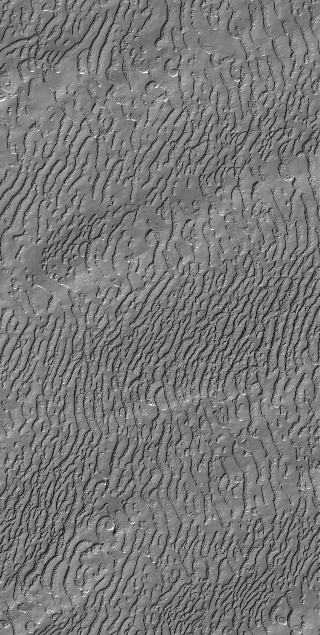
PIA04137:
-
Defrosting Patterns
Full Resolution:
TIFF
(902.3 kB)
JPEG
(160 kB)
|
|
|
2005-08-07 |
Mars
|
Mars Global Surveyor (MGS)
|
Mars Orbiter Camera (MOC)
|
672x1766x1 |
|
-
PIA04136:
-
Mid-latitude Dunes
Full Resolution:
TIFF
(1.188 MB)
JPEG
(143.8 kB)
|
|
|
2005-08-06 |
Mars
|
Mars Global Surveyor (MGS)
|
Mars Orbiter Camera (MOC)
|
1024x1661x1 |
|
-
PIA04135:
-
Windblown Dunes
Full Resolution:
TIFF
(1.703 MB)
JPEG
(103.8 kB)
|
|
|
2005-08-05 |
Mars
|
Mars Global Surveyor (MGS)
|
Mars Orbiter Camera (MOC)
|
2048x4864x1 |
|
-
PIA04134:
-
Wind-Eroded Landscape
Full Resolution:
TIFF
(9.971 MB)
JPEG
(1.095 MB)
|
|
|
2005-08-04 |
Mars
|
Mars Global Surveyor (MGS)
|
Mars Orbiter Camera (MOC)
|
836x2083x1 |
|
-
PIA04133:
-
Dunes of Herschel
Full Resolution:
TIFF
(1.743 MB)
JPEG
(156 kB)
|
|
|
2005-08-03 |
Mars
|
Mars Global Surveyor (MGS)
|
Mars Orbiter Camera (MOC)
|
836x2491x1 |
|
-
PIA04132:
-
Wind-Eroded Terrain
Full Resolution:
TIFF
(2.085 MB)
JPEG
(613.5 kB)
|
|
|
2005-08-02 |
Mars
|
Mars Global Surveyor (MGS)
|
Mars Orbiter Camera (MOC)
|
640x640x3 |
|
-
PIA04131:
-
Mars at Ls 269°: Tharsis
Full Resolution:
TIFF
(411.8 kB)
JPEG
(22.57 kB)
|
|
|
2005-08-01 |
Mars
|
Mars Global Surveyor (MGS)
|
Mars Orbiter Camera (MOC)
|
1024x2027x1 |
|
-
PIA04130:
-
Frozen Carbon Dioxide
Full Resolution:
TIFF
(2.078 MB)
JPEG
(430.3 kB)
|
|
|
2005-07-31 |
Mars
|
Mars Global Surveyor (MGS)
|
Mars Orbiter Camera (MOC)
|
836x2248x1 |
|
-
PIA04129:
-
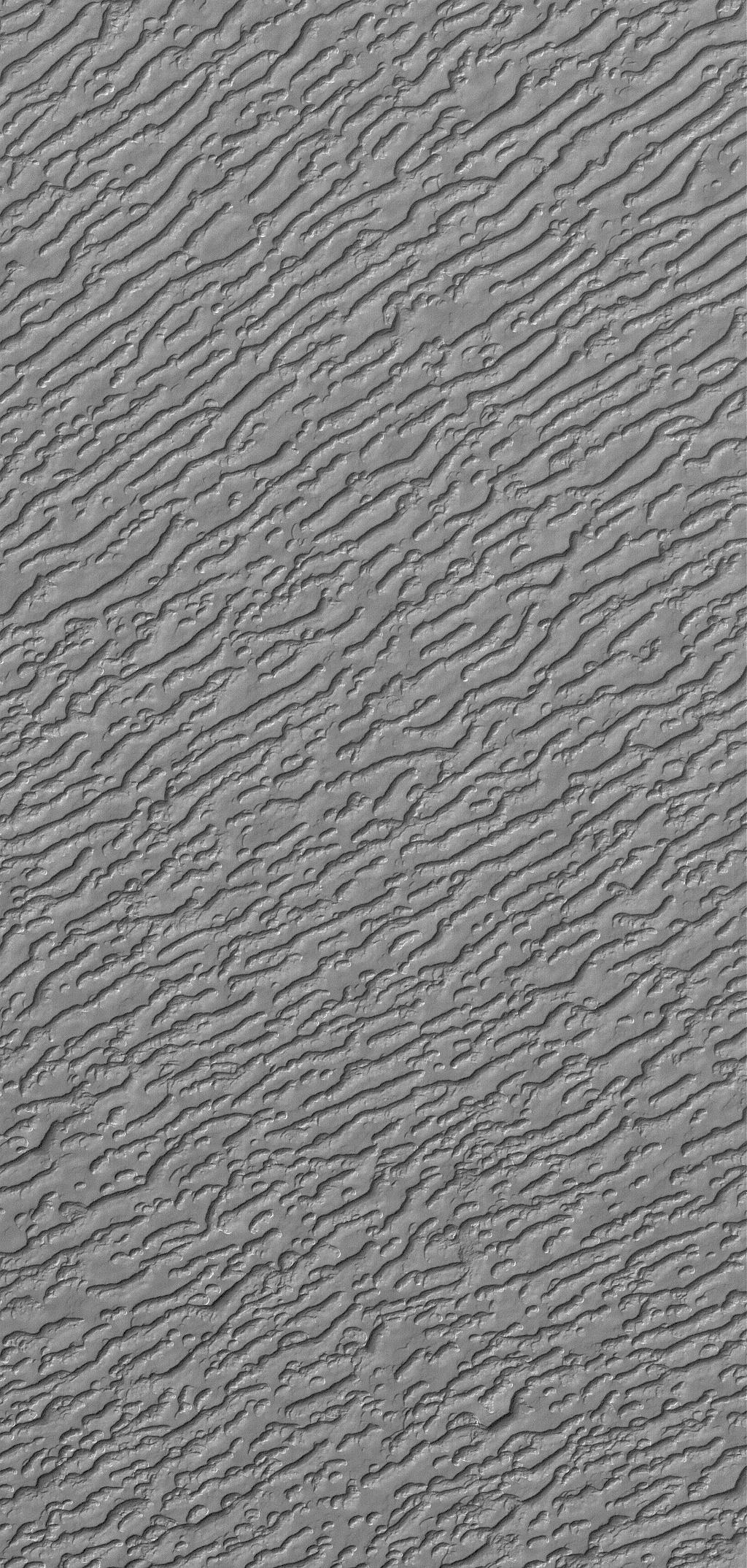
Nilosyrtis Dunes
Full Resolution:
TIFF
(1.882 MB)
JPEG
(209.7 kB)
|
|
|
2005-07-30 |
Mars
|
Mars Global Surveyor (MGS)
|
Mars Orbiter Camera (MOC)
|
672x1285x1 |
|
-
PIA04128:
-
Exhuming Craters
Full Resolution:
TIFF
(864.6 kB)
JPEG
(258.2 kB)
|
|
|
2005-07-29 |
Mars
|
Mars Global Surveyor (MGS)
|
Mars Orbiter Camera (MOC)
|
2048x3239x1 |

|
-
PIA04125:
-
Sedimentary Rock Remnants
Full Resolution:
TIFF
(6.64 MB)
JPEG
(838.7 kB)
|
|
|
2005-07-28 |
Mars
|
Mars Global Surveyor (MGS)
|
Mars Orbiter Camera (MOC)
|
1024x2149x1 |
|
-
PIA04124:
-
South Polar Variety
Full Resolution:
TIFF
(2.203 MB)
JPEG
(536.5 kB)
|
|
|
2005-07-27 |
Mars
|
Mars Global Surveyor (MGS)
|
Mars Orbiter Camera (MOC)
|
2048x4144x1 |
|
-
PIA04122:
-
Collapse Pits
Full Resolution:
TIFF
(8.495 MB)
JPEG
(816.3 kB)
|
|
|
2005-07-26 |
Mars
|
Mars Global Surveyor (MGS)
|
Mars Orbiter Camera (MOC)
|
640x640x3 |
|
-
PIA04117:
-
Mars at Ls 249°: Elysium/Mare Cimmerium
Full Resolution:
TIFF
(411.8 kB)
JPEG
(20.17 kB)
|
|
|
2005-07-25 |
Mars
|
Mars Global Surveyor (MGS)
|
Mars Orbiter Camera (MOC)
|
2048x3500x1 |
|
-
PIA04116:
-
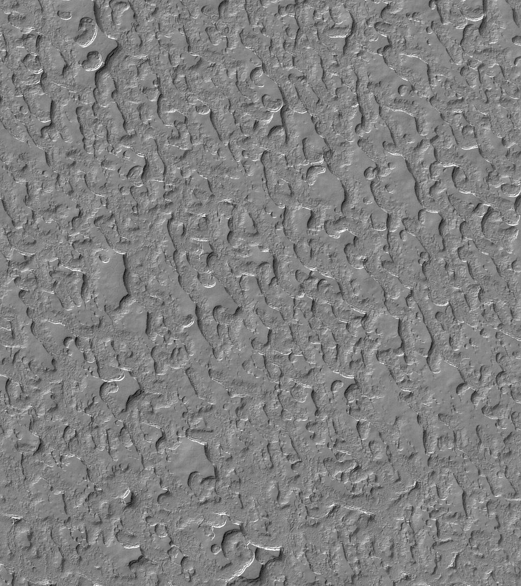
Martian Gullies
Full Resolution:
TIFF
(7.175 MB)
JPEG
(1.556 MB)
|
|
|
2005-07-24 |
Mars
|
Mars Global Surveyor (MGS)
|
Mars Orbiter Camera (MOC)
|
2048x2944x1 |

|
-
PIA04115:
-
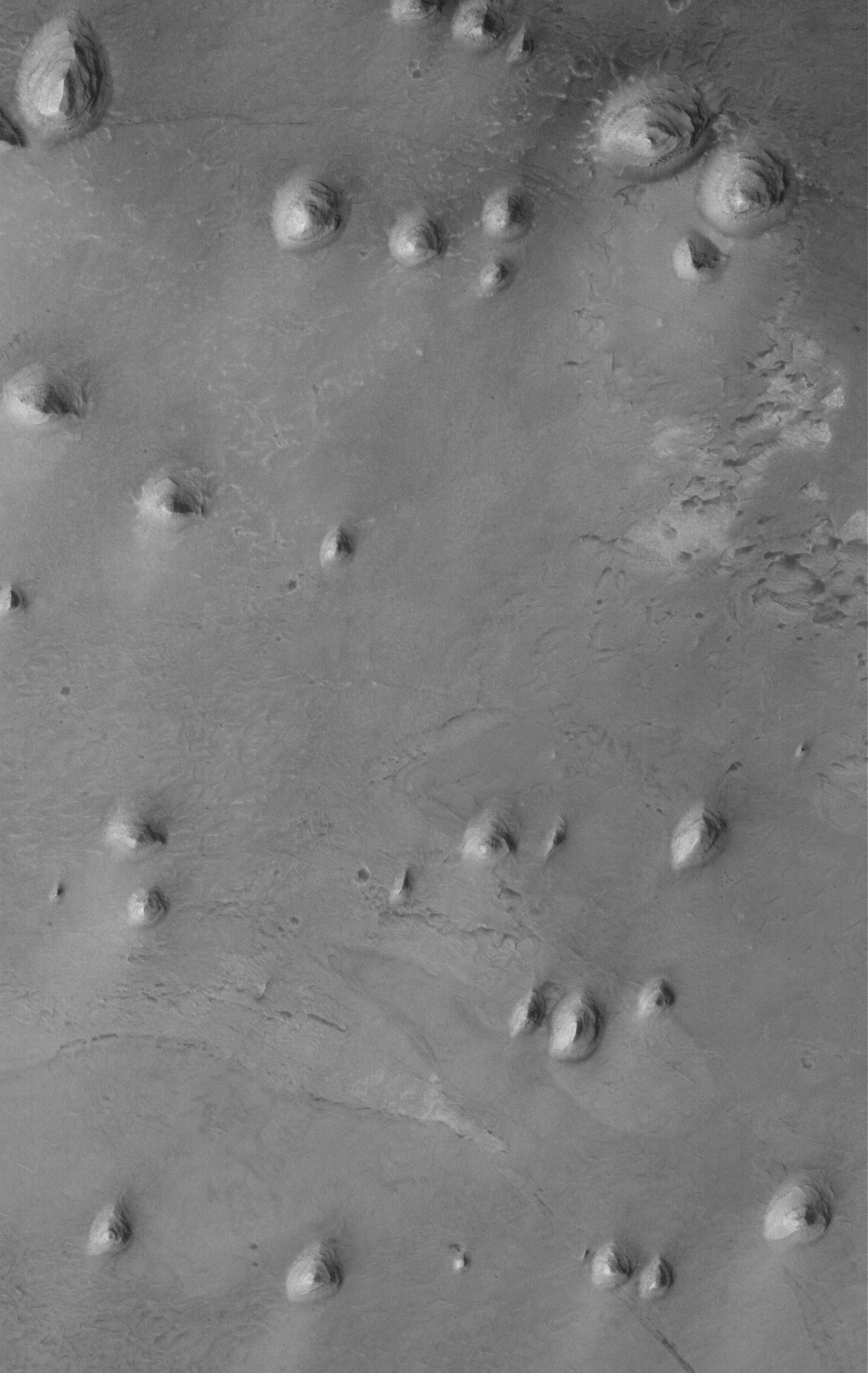
Triple Impact
Full Resolution:
TIFF
(6.035 MB)
JPEG
(1.022 MB)
|
|
|
2005-07-23 |
Mars
|
Mars Global Surveyor (MGS)
|
Mars Orbiter Camera (MOC)
|
1024x1152x1 |
|
-
PIA04114:
-
Carbon Dioxide Landscape
Full Resolution:
TIFF
(1.181 MB)
JPEG
(271.9 kB)
|
|
|
2005-07-22 |
Mars
|
Mars Global Surveyor (MGS)
|
Mars Orbiter Camera (MOC)
|
2048x4144x1 |

|
-
PIA04113:
-
Bouldery Trough
Full Resolution:
TIFF
(8.495 MB)
JPEG
(1.362 MB)
|
|
|
2005-07-21 |
Mars
|
Mars Global Surveyor (MGS)
|
Mars Orbiter Camera (MOC)
|
1024x2514x1 |
|
-
PIA04112:
-
Polygon-Cracked Plain
Full Resolution:
TIFF
(2.577 MB)
JPEG
(538.9 kB)
|
|
|
2005-07-20 |
Mars
|
Mars Global Surveyor (MGS)
|
Mars Orbiter Camera (MOC)
|
2048x3582x1 |
|
-
PIA04110:
-
Crater in Daedalia
Full Resolution:
TIFF
(7.343 MB)
JPEG
(1.638 MB)
|
|
|
2005-07-19 |
Mars
|
Mars Global Surveyor (MGS)
|
Mars Orbiter Camera (MOC)
|
640x640x3 |

|
-
PIA04109:
-
Mars at Ls 249°: Syrtis Major
Full Resolution:
TIFF
(411.8 kB)
JPEG
(21.37 kB)
|
|
|
2005-07-18 |
Mars
|
Mars Global Surveyor (MGS)
|
Mars Orbiter Camera (MOC)
|
836x3194x1 |
|
-
PIA04103:
-
Cerberus Troughs
Full Resolution:
TIFF
(2.673 MB)
JPEG
(267.1 kB)
|
|
|
2005-07-17 |
Mars
|
Mars Global Surveyor (MGS)
|
Mars Orbiter Camera (MOC)
|
836x2567x1 |

|
-
PIA04102:
-
Tharsis Flood Features
Full Resolution:
TIFF
(2.149 MB)
JPEG
(380.4 kB)
|
|
|
2005-07-16 |
Mars
|
Mars Global Surveyor (MGS)
|
Mars Orbiter Camera (MOC)
|
1672x3398x1 |

|
-
PIA04101:
-
West Arabia Barchans
Full Resolution:
TIFF
(5.688 MB)
JPEG
(589.6 kB)
|
|
|
2005-07-15 |
Mars
|
Mars Global Surveyor (MGS)
|
Mars Orbiter Camera (MOC)
|
836x1871x1 |
|
-
PIA03999:
-
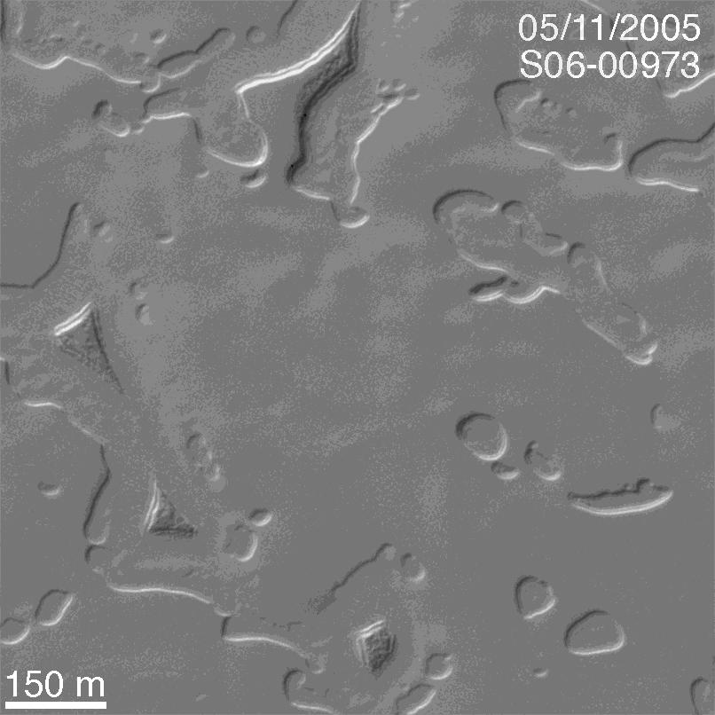
Curved and Pitted Ridge
Full Resolution:
TIFF
(1.566 MB)
JPEG
(402.3 kB)
|
|
|
2005-07-14 |
Mars
|
Mars Global Surveyor (MGS)
|
Mars Orbiter Camera (MOC)
|
2048x3968x1 |

|
-
PIA03998:
-
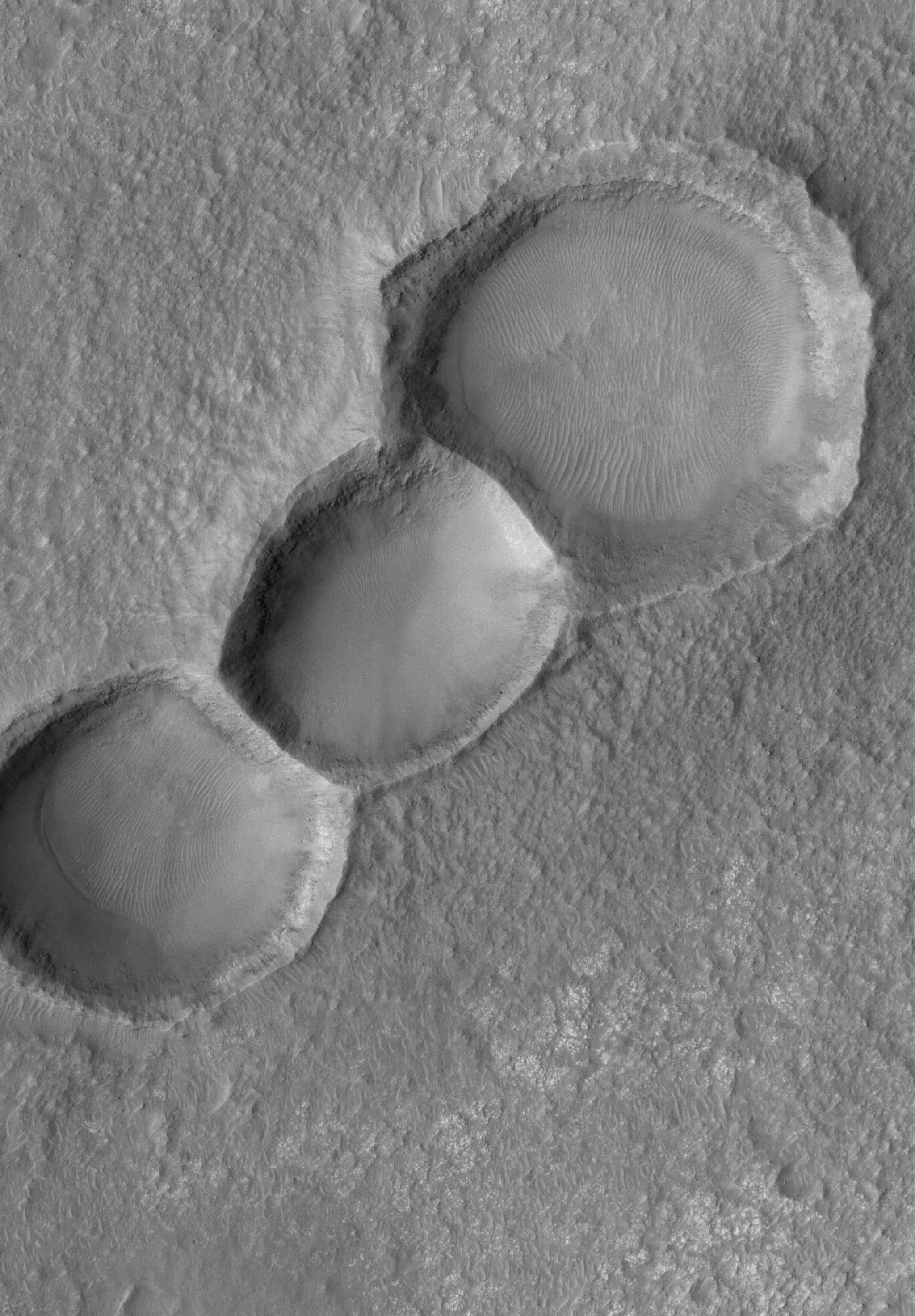
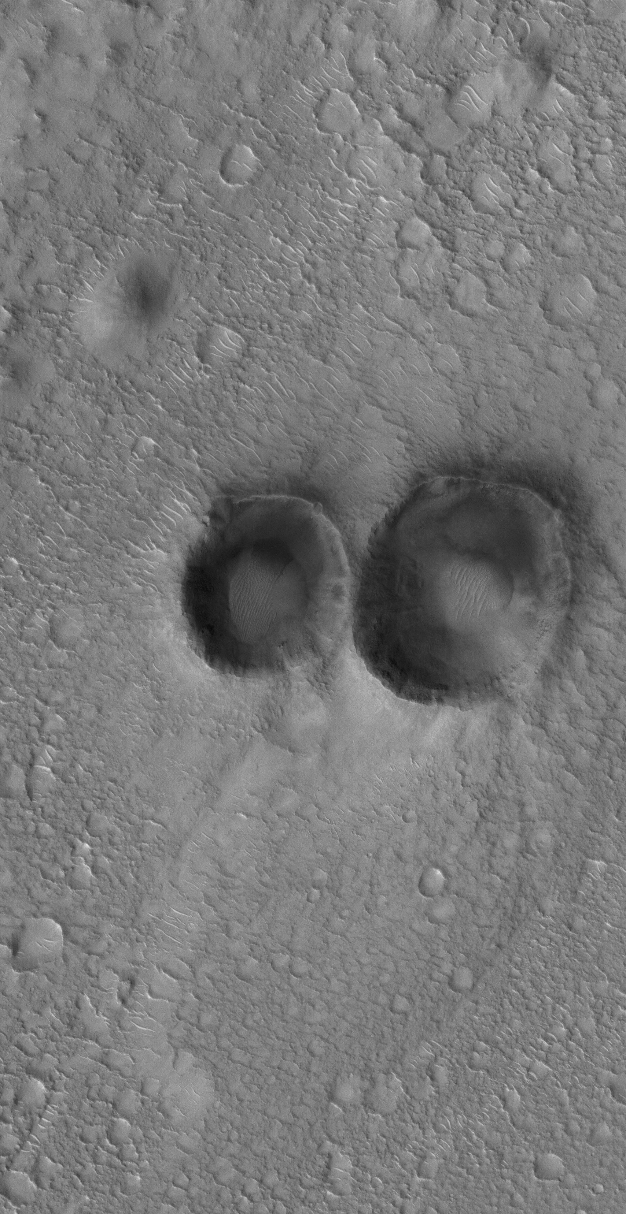
Pair of Craters
Full Resolution:
TIFF
(8.135 MB)
JPEG
(1.184 MB)
|
|
|
2005-07-13 |
Mars
|
Mars Global Surveyor (MGS)
|
Mars Orbiter Camera (MOC)
|
806x806x16 |
|
-
PIA03997:
-
The Changing South Polar Cap of Mars: 1999-2005
Full Resolution:
TIFF
(650.5 kB)
JPEG
(70.56 kB)
|
|
|
2005-07-12 |
Mars
|
Mars Global Surveyor (MGS)
|
Mars Orbiter Camera (MOC)
|
640x640x3 |
|
-
PIA03996:
-
Mars at Ls 249°: Acidalia/Mare Erythraeum
Full Resolution:
TIFF
(411.8 kB)
JPEG
(22.25 kB)
|
|
|
2005-07-11 |
Mars
|
Mars Global Surveyor (MGS)
|
Mars Orbiter Camera (MOC)
|
601x1291x1 |

|
-
PIA03994:
-
Troughs in Tharsis
Full Resolution:
TIFF
(776.9 kB)
JPEG
(138.2 kB)
|
|
|
2005-07-10 |
Mars
|
Mars Global Surveyor (MGS)
|
Mars Orbiter Camera (MOC)
|
672x1694x1 |
|
-
PIA03993:
-
Melas Layers
Full Resolution:
TIFF
(1.14 MB)
JPEG
(309.3 kB)
|
|
|
2005-07-09 |
Mars
|
Mars Global Surveyor (MGS)
|
Mars Orbiter Camera (MOC)
|
2048x3260x1 |
|
-
PIA03992:
-
Rugged Olympus Mons
Full Resolution:
TIFF
(6.683 MB)
JPEG
(1.363 MB)
|
|
|
2005-07-08 |
Mars
|
Mars Global Surveyor (MGS)
|
Mars Orbiter Camera (MOC)
|
836x1582x1 |

|
-
PIA03990:
-
Ganges Chasma Sands
Full Resolution:
TIFF
(1.324 MB)
JPEG
(140 kB)
|
|
|
2005-07-07 |
Mars
|
Mars Global Surveyor (MGS)
|
Mars Orbiter Camera (MOC)
|
2048x2816x1 |
|
-
PIA03987:
-
East Tharsis Pit Chain
Full Resolution:
TIFF
(5.773 MB)
JPEG
(916.4 kB)
|
|
|
2005-07-06 |
Mars
|
Mars Global Surveyor (MGS)
|
Mars Orbiter Camera (MOC)
|
2048x4992x1 |
|
-
PIA03986:
-
Nili Patera Dunes
Full Resolution:
TIFF
(10.23 MB)
JPEG
(1.353 MB)
|
|
|
2005-07-05 |
Mars
|
Mars Global Surveyor (MGS)
|
Mars Orbiter Camera (MOC)
|
640x640x3 |
|
-
PIA03985:
-
Mars at Ls 249°: Tharsis
Full Resolution:
TIFF
(411.8 kB)
JPEG
(22 kB)
|
|
|
2005-07-04 |
Mars
|
Mars Global Surveyor (MGS)
|
Mars Orbiter Camera (MOC)
|
1024x2506x1 |

|
-
PIA03980:
-
South Polar Polygons
Full Resolution:
TIFF
(2.569 MB)
JPEG
(228.2 kB)
|
|
|
2005-07-03 |
Mars
|
Mars Global Surveyor (MGS)
|
Mars Orbiter Camera (MOC)
|
1024x2275x1 |
|
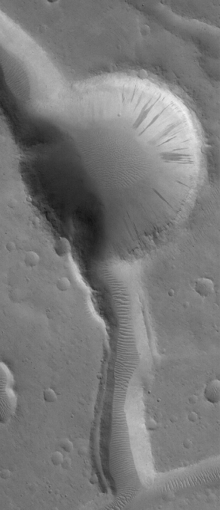
-
PIA03979:
-
Small Dusty Volcano
Full Resolution:
TIFF
(2.332 MB)
JPEG
(400.9 kB)
|
|
|
2005-07-02 |
Mars
|
Mars Global Surveyor (MGS)
|
Mars Orbiter Camera (MOC)
|
1024x1781x1 |
|
-
PIA03978:
-
Knobby Eastern Arabia
Full Resolution:
TIFF
(1.826 MB)
JPEG
(382.3 kB)
|
 Planetary Data System


