Your search criteria found 1931 images
Mission
Go to PIAxxxxx:
Refine this list of images by:
Target:
Mission:
Spacecraft:
Instrument:
Click on an image for detailed information
Click on a column heading to sort in ascending or descending order
My
List
Addition Date Target MissionSort Descending Instrument Size
Add Image to Favorite List 2004-02-09 Mars 2001 Mars Odyssey
Mars Exploration Rover (MER)
1000x750x3
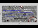
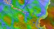
This map of NASA's Mars Exploration Rover Opportunity's new neighborhood at Meridiani Planum, Mars, demonstrates how engineers honed in on the location of the rover. The larger blue ellipse shows the projected landing area just before arriving at Mars.
PIA05224:
Found You!
Full Resolution:     TIFF (768.7 kB)     JPEG (101.3 kB)
Add Image to Favorite List 2008-09-22 Mars 2001 Mars Odyssey
Mars Exploration Rover (MER)
THEMIS
1830x1857x1
Victoria Crater is the most prominent circle near the upper left corner of this image from NASA's Mar Odyssey spacecraft.
PIA11185:
Bigger Crater Farther South of 'Victoria' on Mars
Full Resolution:     TIFF (3.402 MB)     JPEG (478.3 kB)
Add Image to Favorite List 2004-01-13 Mars 2001 Mars Odyssey
Mars Global Surveyor (MGS)
Mars Exploration Rover (MER)
Mars Orbiter Camera (MOC)
Thermal Emission Imaging System
720x540x3
This map shows the estimated location of NASA's Mars Exploration Rover Spirit within Gusev Crater, Mars. Engineers targeted Spirit for the center of the blue ellipse.
PIA05055:
Right on Target
Full Resolution:     TIFF (337.8 kB)     JPEG (41.77 kB)
Add Image to Favorite List 2004-01-13 Mars 2001 Mars Odyssey
Mars Global Surveyor (MGS)
Mars Exploration Rover (MER)
Mars Orbiter Camera (MOC)
Thermal Emission Imaging System
720x540x3
This map shows a close-up look at the estimated location of NASA's Mars Exploration Rover Spirit within Gusev Crater, Mars. Measurements taken during the rover's descent by the DSN predicted its landing site to be the spot marked with a black dot.
PIA05056:
Right on Target-2
Full Resolution:     TIFF (302 kB)     JPEG (36.3 kB)
Add Image to Favorite List 2004-01-23 Mars 2001 Mars Odyssey
Mars Global Surveyor (MGS)
Mars Exploration Rover (MER)
THEMIS
THEMIS
640x480x3
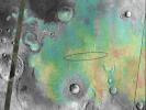
This image shows the abundance and location of the mineral grey hematite at NASA's Mars Exploration Rover Opportunity's landing site, Meridiani Planum, Mars.
PIA05154:
Targeting a Hematite-rich Terrain
Full Resolution:     TIFF (922.8 kB)     JPEG (52.31 kB)
Add Image to Favorite List 2004-02-09 Mars 2001 Mars Odyssey
Mars Global Surveyor (MGS)
Mars Exploration Rover (MER)
Descent Image Motion Estimation System (DIMES)
Mars Orbiter Camera (MOC)
Thermal Emission Imaging System
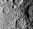
4000x5308x3
This map of NASA's Mars Exploration Rover Opportunity's new neighborhood at Meridiani Planum, Mars, shows the surface features used to locate the rover. The rover's precise location was determined by imaging the 'bumps' on the horizon.
PIA05228:
"X" Marks the Spot
Full Resolution:     TIFF (11.63 MB)     JPEG (2.084 MB)
Add Image to Favorite List 2004-03-18 Mars 2001 Mars Odyssey
Mars Global Surveyor (MGS)
Mars Exploration Rover (MER)
Mars Orbiter Camera (MOC)
Thermal Emission Imaging System
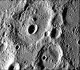
1051x681x3
The route of NASA's Mars Exploration Rover Spirit, from its landing site to its location on sol 72 (March 16, 2004) near the rim of the large crater dubbed 'Bonneville' is pictured here on this traverse map.
PIA05581:
To 'Bonneville' and Beyond
Full Resolution:     TIFF (2.15 MB)     JPEG (98.5 kB)
Add Image to Favorite List 2004-03-19 Mars 2001 Mars Odyssey
Mars Global Surveyor (MGS)
Mars Exploration Rover (MER)
Mars Orbiter Camera (MOC)
Thermal Emission Imaging System
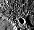
1920x1080x3
This still from an animation shows the geography of Ma'adim Vallis, a valley or channel that enters Gusev Crater. The view of the crater is from the northwest, which is not the direction from which NASA's Spirit rover approached the crater as it landed.
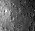
PIA05590:
Ma'adim Vallis From the Top
Full Resolution:     TIFF (1.295 MB)     JPEG (85.07 kB)
Add Image to Favorite List 2004-04-28 Mars 2001 Mars Odyssey
Mars Global Surveyor (MGS)
Mars Exploration Rover (MER)
Mars Orbiter Camera (MOC)
Thermal Emission Imaging System
647x485x3
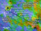
This map illustrates NASA's Mars Exploration Rover Spirit's position as of April 26, 2004, near the crater called 'Missoula.' Like a train on a tight schedule, Spirit made regular stops along the way to its ultimate destination, the 'Columbia Hills.'
PIA05834:
Spirit's Express Route to 'Columbia Hills'
Full Resolution:     TIFF (942.6 kB)     JPEG (81.41 kB)
Add Image to Favorite List 2004-04-29 Mars 2001 Mars Odyssey
Mars Global Surveyor (MGS)
Mars Exploration Rover (MER)
Mars Orbiter Camera (MOC)
Thermal Emission Imaging System
671x455x3
This map highlights the path that NASA's Mars Exploration Rover Spirit had traveled on April 28, 2004 toward the 'Columbia Hills.'
PIA05836:
Confirming Predictions
Full Resolution:     TIFF (917.1 kB)     JPEG (56.25 kB)
Add Image to Favorite List 2004-07-16 Mars 2001 Mars Odyssey
Mars Global Surveyor (MGS)
Mars Exploration Rover (MER)
Mars Orbiter Camera (MOC)
Thermal Emission Spectrometer
1183x638x3
The red dot labeled 'Sol 134-141' in this map illustrates when and where NASA's Mars Exploration Rover Spirit acquired the 'Santa Anita Panorama.'
PIA06688:
Spirit Traverse Map
Full Resolution:     TIFF (2.267 MB)     JPEG (102.9 kB)
Add Image to Favorite List 2005-12-05 Mars 2001 Mars Odyssey
Mars Global Surveyor (MGS)
Mars Exploration Rover (MER)
Descent Image Motion Estimation System (DIMES)
Mars Orbiter Camera
Thermal Emission Imaging System
1411x2043x3
This combined image taken by NASA's 2001 Mars Odyssey, and Mars Global Surveyor, shows the route that Mars Exploration Rover Opportunity had taken its landing site inside 'Victoria Crater' to its position on Dec. 1, 2005.
PIA03616:
Partway to 'Victoria'
Full Resolution:     TIFF (8.665 MB)     JPEG (265.7 kB)
Add Image to Favorite List 2011-09-26 Mercury Clementine
MESSENGER
Mariner Venus Mercury (Mariner 10)
1248x624x1
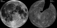
The image of the Moon (left) is a mosaic of images from NASA's Clementine. The Mercury image (right) is a NASA Mariner 10 mosaic.
PIA14823:
The Whole of the Moon
Full Resolution:     TIFF (779.8 kB)     JPEG (103.9 kB)
Add Image to Favorite List 1996-09-19 Mercury Mariner Venus Mercury (Mariner 10)
9999x4000x1
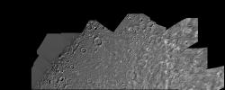
This image, from NASA's Mariner 10 spacecraft which launched in 1974, is of the northern half of Mercury's Shakespeare Quadrangle.
PIA00066:
Mercury: Photomosaic of the Shakespeare Quadrangle (Northern Half) H-3
Full Resolution:     TIFF (22.21 MB)     JPEG (3.949 MB)
Add Image to Favorite List 1996-09-23 Mercury Mariner Venus Mercury (Mariner 10)
9999x4000x1
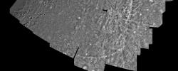
This computer generated photomosaic from NASA's Mariner 10 is of the southern half of Mercury's Shakespeare Quadrangle, named for the ancient Shakespeare crater located on the upper edge to the left of center.
PIA00067:
Mercury: Photomosaic of the Shakespeare Quadrangle of Mercury (Southern Half) H-3
Full Resolution:     TIFF (23.99 MB)     JPEG (3.867 MB)
Add Image to Favorite List 1996-09-23 Mercury Mariner Venus Mercury (Mariner 10)
7200x5000x1
This computer generated mosaic from NASA's Mariner 10 is of Mercury's Tolstoj Quadrangle, named for the ancient Tolstoj crater located in the lower center of the image.
PIA00068:
Mercury: Photomosaic of the Tolstoj Quadrangle H-8
Full Resolution:     TIFF (28.77 MB)     JPEG (4.313 MB)
Add Image to Favorite List 1999-06-12 Mercury Mariner Venus Mercury (Mariner 10)
2599x4878x1
The first image of Mercury acquired by NASA's Mariner 10 in 1974. Mariner 10's trajectory brought it behind the lighted hemisphere of Mercury in order to acquire important measurements with other instruments.
PIA00437:
Planet Mercury
Full Resolution:     TIFF (6.034 MB)     JPEG (1.056 MB)
Add Image to Favorite List 2000-01-19 Mercury Mariner Venus Mercury (Mariner 10)
7200x5000x1
The Kuiper Quadrangle was named in memory of Dr. Gerard Kuiper, an imaging team member, and well-known astronomer, of NASA's Mariner 10 Venus/Mercury. The Kuiper crater is seen left of center in this image.
PIA02236:
Mercury: Photomosaic of the Kuiper Quadrangle H-6
Full Resolution:     TIFF (34.03 MB)     JPEG (5.16 MB)
Add Image to Favorite List 2000-01-26 Mercury Mariner Venus Mercury (Mariner 10)
7200x5000x1
This image, from NASA's Mariner 10 spacecraft which launched in 1974, is of the Michelangelo Quadrangle, which lies in Mercury's southern polar region. The Mercurian surface is heavily marred by numerous impact craters.
PIA02237:
Mercury: Photomosaic of the Michelangelo Quadrangle H-12
Full Resolution:     TIFF (33.55 MB)     JPEG (6.082 MB)
Add Image to Favorite List 2000-02-10 Mercury Mariner Venus Mercury (Mariner 10)
5990x4162x1
This image, from NASA's Mariner 10 spacecraft which launched in 1974, is of the Borealis area H-1, located in Mercury's northern hemisphere. The north pole is visible at the top of the image.
PIA02243:
Mercury: Photomosaic of Borealis Quadrangle H-1
Full Resolution:     TIFF (18.07 MB)     JPEG (3.134 MB)
Add Image to Favorite List 2000-04-01 Mercury Mariner Venus Mercury (Mariner 10)
7200x5000x1
This image, from NASA's Mariner 10 spacecraft which launched in 1974, is of the H-7 Beethoven Quadrangle, and lies in Mercury's Equatorial Mercator. NASA's Mariner 10 spacecraft imaged the region during its initial flyby of the planet.
PIA02255:
Mercury: Beethoven Quadrangle, H-7
Full Resolution:     TIFF (34.98 MB)     JPEG (7.329 MB)
Add Image to Favorite List 1999-10-07 Mercury Mariner Venus Mercury (Mariner 10)
356x311x1
As NASA's Mariner 10 approached Mercury at nearly seven miles per second on March 29, 1974, its TV camera took this picture from an altitude of 35,000 kilometers (21,700 miles) The picture shows a heavily-cratered surface with many low hills.
PIA02407:
Mercury's Heavily Cratered Surface
Full Resolution:     TIFF (122.7 kB)     JPEG (27.52 kB)
Add Image to Favorite List 1999-10-08 Mercury Mariner Venus Mercury (Mariner 10)
356x311x1
Cratered terrain very similar to that on the Moon is shown in this TV photo of Mercury taken by NASA's Mariner 10. Numerous small craters and linear grooves radial to the crater can be seen.
PIA02408:
Mercury's Cratered Terrain
Full Resolution:     TIFF (132 kB)     JPEG (39.23 kB)
Add Image to Favorite List 1999-10-08 Mercury Mariner Venus Mercury (Mariner 10)
356x311x1
A fresh new crater in the center of an older crater basin is shown in this picture of the surface of Mercury taken March 29, 1974 by NASA's Mariner 10.
PIA02409:
Fresh Crater in Center of Older Crater Basin
Full Resolution:     TIFF (122.4 kB)     JPEG (33.28 kB)
Add Image to Favorite List 1999-10-08 Mercury Mariner Venus Mercury (Mariner 10)
356x311x1
NASA's Mariner 10 took this picture of the densely cratered surface of Mercury when the spacecraft was 18,200 kilometers (8085 miles) from the planet on March 29, 1974.
PIA02410:
Mercury's Densely Cratered Surface
Full Resolution:     TIFF (114.2 kB)     JPEG (35.76 kB)
Add Image to Favorite List 1999-10-08 Mercury Mariner Venus Mercury (Mariner 10)
356x311x1
NASA's Mariner 10 took this picture some 2 1/2 hours before it passed Mercury on March 29, 1974. The bright-floored crater is the center of a very large bright area which could be seen in pictures from more than two million miles distant
PIA02411:
Kuiper Crater
Full Resolution:     TIFF (119.4 kB)     JPEG (24.06 kB)
Add Image to Favorite List 1999-10-08 Mercury Mariner Venus Mercury (Mariner 10)
356x311x1
A dark, smooth, relatively uncratered area on Mercury was photographed two hours after NASA's Mariner 10 flew by the planet. The prominent, sharp crater with a central peak is 30 kilometers (19 miles) across.
PIA02412:
Uncratered Area on Mercury
Full Resolution:     TIFF (111.4 kB)     JPEG (22.98 kB)
Add Image to Favorite List 1999-10-07 Mercury Mariner Venus Mercury (Mariner 10)
300x352x1
After passing Mercury the first time and making a trip around the Sun, NASA's Mariner 10 again flew by Mercury on Sept. 21, 1974. This encounter brought the spacecraft in front of Mercury in the southern hemisphere.
PIA02413:
Hero Rupes Scarp
Full Resolution:     TIFF (84.82 kB)     JPEG (25.27 kB)
Add Image to Favorite List 1999-10-08 Mercury Mariner Venus Mercury (Mariner 10)
348x302x1
After passing Mercury the first time and making a trip around the Sun, NASA's Mariner 10 again flew by Mercury on Sept. 21, 1974. This encounter brought the spacecraft in front of Mercury in the southern hemisphere.
PIA02414:
Similarities to Lunar Highlands
Full Resolution:     TIFF (103.2 kB)     JPEG (29.14 kB)
Add Image to Favorite List 1999-10-08 Mercury Mariner Venus Mercury (Mariner 10)
335x250x1
After passing Mercury the first time and making a trip around the Sun, NASA's Mariner 10 again flew by Mercury on Sept. 21, 1974. The south pole is located on the right hand edge of Chao Meng Fu crater that has only its rim sticking up into the light.
PIA02415:
Mercury's South Pole
Full Resolution:     TIFF (68.84 kB)     JPEG (18.31 kB)
Add Image to Favorite List 1999-10-07 Mercury Mariner Venus Mercury (Mariner 10)
208x655x1
NASA's Mariner 10 spacecraft was coaxed into a third and final encounter with Mercury in March of 1975. This is one of the highest resolution images of Mercury acquired by the spacecraft.
PIA02416:
High Resolution View of Mercury
Full Resolution:     TIFF (82.71 kB)     JPEG (29.06 kB)
Add Image to Favorite List 1999-10-08 Mercury Mariner Venus Mercury (Mariner 10)
220x700x1
NASA's Mariner 10 spacecraft was coaxed into a third and final encounter with Mercury in March of 1975. This is one of the highest resolution images of Mercury acquired by the spacecraft. The prominent scarp snaking up the image was named Discovery Rupes.
PIA02417:
Discovery Rupes Scarp
Full Resolution:     TIFF (157.3 kB)     JPEG (33.2 kB)
Add Image to Favorite List 1999-10-07 Mercury Mariner Venus Mercury (Mariner 10)
775x1023x1
This mosaic, made from over 140 individual TV frames taken about two hours after encounter, shows the planet Mercury as seen by NASA's Mariner 10 as it sped away from the planet on March 29, 1974.
PIA02418:
Outgoing Hemisphere
Full Resolution:     TIFF (243.7 kB)     JPEG (87.01 kB)
Add Image to Favorite List 2000-01-14 Mercury Mariner Venus Mercury (Mariner 10)
356x311x1
This image, from NASA's Mariner 10 spacecraft which launched in 1974, shows a crater just north of the Caloris Planitia displays interior and central peaks rising up from a hilly floor.
PIA02419:
Interior Peaks and Hilly Floored Crater
Full Resolution:     TIFF (111.5 kB)     JPEG (30.81 kB)
Add Image to Favorite List 2000-01-14 Mercury Mariner Venus Mercury (Mariner 10)
356x311x1
This crater illustrates the narrow hummocky rim facies, radial ridges, and surrounding extensive field of secondary craters. This image of Mercury was taken by NASA's Mariner 10.
PIA02420:
Terraced Craters
Full Resolution:     TIFF (110.3 kB)     JPEG (30.23 kB)
Add Image to Favorite List 2000-01-15 Mercury Mariner Venus Mercury (Mariner 10)
356x311x1
This image, from NASA's Mariner 10 spacecraft which launched in 1974, is located about 500 km east of the Caloris basin and shows hummocky plains interpreted as Caloris ejecta in the upper half of the picture and smooth plains in the lower half.
PIA02421:
Hummocky and Smooth Plains
Full Resolution:     TIFF (94.22 kB)     JPEG (23.27 kB)
Add Image to Favorite List 2000-01-15 Mercury Mariner Venus Mercury (Mariner 10)
356x311x1
This image, from NASA's Mariner 10 spacecraft which launched in 1974, includes part of the floor of the Caloris basin showing the ridges and fractures.
PIA02422:
Ridges and Fractures on Floor of Caloris Basin
Full Resolution:     TIFF (105.2 kB)     JPEG (27.98 kB)
Add Image to Favorite List 2000-01-14 Mercury Mariner Venus Mercury (Mariner 10)
356x311x1
The craters in this image NASA's Mariner 10 spacecraft, which launched in 1974, have interior rings of mountains and ejecta deposits which are scarred by deep secondary crater chain groves.
PIA02423:
Crater Chain Groves Inside Larger Craters
Full Resolution:     TIFF (113.7 kB)     JPEG (30.62 kB)
Add Image to Favorite List 2000-01-15 Mercury Mariner Venus Mercury (Mariner 10)
356x311x1
This image, from NASA's Mariner 10 spacecraft which launched in 1974, features a 140 kilometer diameter crater and its surrounding zone of secondary craters. T
PIA02424:
Large Mercurian Crater
Full Resolution:     TIFF (125.8 kB)     JPEG (37.24 kB)
Add Image to Favorite List 2000-01-15 Mercury Mariner Venus Mercury (Mariner 10)
356x311x1
This image, from NASA's Mariner 10 spacecraft which launched in 1974, shows young craters superposed on smooth plains. Larger young craters have central peaks, flat floors, terraced walls, and radial ejecta deposits.
PIA02425:
Young Craters on Smooth Plains
Full Resolution:     TIFF (117 kB)     JPEG (28.4 kB)
Add Image to Favorite List 2000-01-15 Mercury Mariner Venus Mercury (Mariner 10)
356x311x1
This image, from NASA's Mariner 10 spacecraft which launched in 1974, shows that several west-facing lobate scarps occur in the hummocky plains interpreted as Caloris ejecta.
PIA02426:
Lobate Scarps within the Hummocky Plains East of Caloris Basin
Full Resolution:     TIFF (98.12 kB)     JPEG (23.91 kB)
Add Image to Favorite List 2000-01-14 Mercury Mariner Venus Mercury (Mariner 10)
356x311x1
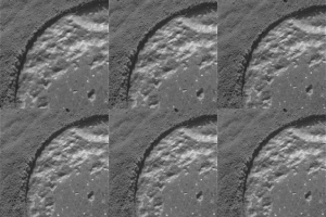
This image, from NASA's Mariner 10 spacecraft which launched in 1974, is of the northeastern quadrant of the Caloris basin showig the smooth hills and domes between the inner and outer scarps and the well-developed radial system east of the outer scarp.
PIA02427:
Northeastern Quadrant of the Caloris Basin
Full Resolution:     TIFF (113.1 kB)     JPEG (29.34 kB)
Add Image to Favorite List 2000-01-14 Mercury Mariner Venus Mercury (Mariner 10)
356x311x1
This image, from NASA's Mariner 10 spacecraft which launched in 1974, was taken during the spacecraft's first encounter with Mercury.
PIA02428:
Lineated Terrain
Full Resolution:     TIFF (101.8 kB)     JPEG (24.36 kB)
Add Image to Favorite List 2000-01-14 Mercury Mariner Venus Mercury (Mariner 10)
356x311x1
This photograph of Mercury, taken by NASA's Mariner 10, shows two prominent rayed craters. Bright halos extend as far as 2 crater diameters beyond crater rims. Individual rays extend from halo.
PIA02429:
Prominent Rayed Craters
Full Resolution:     TIFF (88.45 kB)     JPEG (21.94 kB)
Add Image to Favorite List 2000-01-15 Mercury Mariner Venus Mercury (Mariner 10)
356x311x1
Antoniadi Ridge, over 450 kilometers long, runs along the right side of this acquired image during NASA's Mariner 10's first encounter with Mercury after its launch in 1974.
PIA02430:
Antoniadi Ridge
Full Resolution:     TIFF (104.4 kB)     JPEG (22.63 kB)
Add Image to Favorite List 2000-01-15 Mercury Mariner Venus Mercury (Mariner 10)
356x311x1
This image, from NASA's Mariner 10 spacecraft which launched in 1974, shows a broadly curved lobate scarp running from left to right in the large crater to the right of center in this image.
PIA02431:
Curved Lobate Scarp on Crater Floor
Full Resolution:     TIFF (115.2 kB)     JPEG (31.98 kB)
Add Image to Favorite List 2000-01-15 Mercury Mariner Venus Mercury (Mariner 10)
356x311x1
This image, from NASA's Mariner 10 spacecraft which launched in 1974, shows a scarp (upper left corner of the image) about 130 kilometers long cutting two craters (older crater is at extreme left corner, younger is diagonally below).
PIA02432:
Crater Rim Offset 10 Kilometers by Scarp
Full Resolution:     TIFF (102.4 kB)     JPEG (29.09 kB)
Add Image to Favorite List 2000-01-15 Mercury Mariner Venus Mercury (Mariner 10)
356x311x1
This image, from NASA's Mariner 10 spacecraft which launched in 1974, shows several scarps, which appear to be confined to crater floors. The scarp in the crater at the upper left of the image has been diverted by the central peaks.
PIA02433:
Scarps Confined to Crater Floors
Full Resolution:     TIFF (122.9 kB)     JPEG (40.7 kB)
Add Image to Favorite List 2000-01-15 Mercury Mariner Venus Mercury (Mariner 10)
356x311x1
This image, from NASA's Mariner 10 spacecraft which launched in 1974, is a high-resolution picture of a 65-kilometer diameter crater and the scarp transecting its floor.
PIA02434:
Crater Rim Offset 10 kilometers by Scarp-High Resolution
Full Resolution:     TIFF (102.7 kB)     JPEG (33.59 kB)
Add Image to Favorite List 1999-12-07 Mercury Mariner Venus Mercury (Mariner 10)
356x311x1
This photograph of Mercury was taken by NASA's Mariner 10 spacecraft shows smooth plains areas on Mercury that are thought to be volcanic in origin with lava flows filling in heavily cratered areas.
PIA02438:
Heavily Cratered Terrain and Smooth Plain
Full Resolution:     TIFF (118.4 kB)     JPEG (25.16 kB)
Add Image to Favorite List 1999-12-07 Mercury Mariner Venus Mercury (Mariner 10)
1780x2414x1
Caloris Basin on Mercury, is one of the largest basins in the solar system, its diameter exceeds 1300 kilometers and is in many ways similar to the great Imbrium basin on the Moon. This image is from NASA's Mariner 10 spacecraft which launched in 1974.
PIA02439:
Caloris Basin
Full Resolution:     TIFF (4.033 MB)     JPEG (822.8 kB)
Add Image to Favorite List 1999-12-07 Mercury Mariner Venus Mercury (Mariner 10)
213x275x3
Updated calibration and subsequent mosaicing led to substantial improvements in NASA's Mariner 10 color image data; the spacecraft launched in 1974.
PIA02440:
Incoming Hemisphere - Enhanced Color
Full Resolution:     TIFF (224.1 kB)     JPEG (15.87 kB)
Add Image to Favorite List 1999-12-21 Earth Mariner Venus Mercury (Mariner 10)
922x749x3
The Earth and Moon were imaged by NASA's Mariner 10, launched on November 3, 1973, from 2.6 million km while completing the first ever Earth-Moon encounter by a spacecraft capable of returning high resolution digital color image data.
PIA02441:
Earth and Moon as Viewed by Mariner 10
Full Resolution:     TIFF (388.4 kB)     JPEG (32.07 kB)
Add Image to Favorite List 1999-12-21 Moon Mariner Venus Mercury (Mariner 10)
900x900x1
This view from NASA's Mariner 10 is of eastern Mare Frigor near the center, while Mare Crisiumis the large circular feature near the lower right. The heavily cratered region shown in the top of the mosaic shows portions of the Moon not seen from the Earth
PIA02442:
Moon's North Pole
Full Resolution:     TIFF (449.8 kB)     JPEG (101 kB)
Add Image to Favorite List 2000-01-18 Mercury Mariner Venus Mercury (Mariner 10)
356x311x1
This image, from NASA's Mariner 10 spacecraft which launched in 1974, shows plains filling this basin are uniformly brighter and slightly redder than the surrounding cratered terrain.
PIA02443:
Smooth Volcanic Plains
Full Resolution:     TIFF (111.1 kB)     JPEG (25.89 kB)
Add Image to Favorite List 2000-01-18 Mercury Mariner Venus Mercury (Mariner 10)
356x311x1
Intercrater plains and heavily cratered terrain typical of much of Mercury outside the area affected by the formation of the Caloris basin are shown in this image taken during the NASA's Mariner 10's first encounter with Mercury in 1974.
PIA02444:
Intercrater Plains and Heavily Cratered Terrain - First Encounter
Full Resolution:     TIFF (132.2 kB)     JPEG (33.46 kB)
Add Image to Favorite List 2000-01-18 Mercury Mariner Venus Mercury (Mariner 10)
356x311x1
This image, from NASA's Mariner 10 spacecraft which launched in 1974, shows hilly and lineated terrain and a patch of smooth plains in a large degraded crater.
PIA02445:
Hilly and Lineated Terrain
Full Resolution:     TIFF (132.5 kB)     JPEG (35.07 kB)
Add Image to Favorite List 2000-01-18 Mercury Mariner Venus Mercury (Mariner 10)
450x300x1
One of the most prominent lobate scarps (Discovery Scarp), photographed by NASA's Mariner 10 during it's first encounter with Mercury, is located at the center of this image (extending from the top to near bottom).
PIA02446:
Discovery Scarp
Full Resolution:     TIFF (151.6 kB)     JPEG (32.39 kB)
Add Image to Favorite List 2000-01-18 Mercury Mariner Venus Mercury (Mariner 10)
356x311x1
This image was taken by NASA's Mariner 10 during it's first encounter with Mercury in 1974. The scarp forms a broad lobe whose southern end abuts against and follows closely the irregular contour of the crater wall.
PIA02447:
Scarps Confined to Crater Floors - High Resolution
Full Resolution:     TIFF (123 kB)     JPEG (27.34 kB)
Add Image to Favorite List 2000-08-05 Mercury Mariner Venus Mercury (Mariner 10)
356x311x1
A faint double ring crater is seen at upper right in this picture of Mercury taken one hour and 40 minutes before NASA's Mariner 10's second rendezvous with the planet Sept. 21, 1975
PIA02936:
Double Ring Craters
Full Resolution:     TIFF (113.5 kB)     JPEG (22.84 kB)
Add Image to Favorite List 2000-08-05 Mercury Mariner Venus Mercury (Mariner 10)
356x311x1
NASA's Mariner 10 photo reveals a heavily cratered terrain on Mercury with a prominent scrap extending several hundred kilometers across the upper left. A crater, nested in a larger crater, is at top center.
PIA02937:
Heavily Cratered Terrain at South Pole
Full Resolution:     TIFF (113.5 kB)     JPEG (30.36 kB)
Add Image to Favorite List 2000-08-05 Mercury Mariner Venus Mercury (Mariner 10)
311x356x1
A field of bright rays, created by ejecta from a crater, radiating to the north (top) from off camera (lower right) is seen in this view of Mercury taken Sept. 21, 1974 by NASA's Mariner 10.
PIA02938:
Field of Bright Rays
Full Resolution:     TIFF (111.9 kB)     JPEG (27.13 kB)
Add Image to Favorite List 2000-08-05 Mercury Mariner Venus Mercury (Mariner 10)
311x356x1
NASA's Mariner 10 took this picture about an hour after it passed under the South Pole of Mercury in 1974.
PIA02939:
Dark-rimmed Crater and Extensive Ejecta Blanket
Full Resolution:     TIFF (99.5 kB)     JPEG (29.08 kB)
Add Image to Favorite List 2000-08-05 Mercury Mariner Venus Mercury (Mariner 10)
311x356x1
One of NASA's Mariner 10's two TV cameras took this picture of a densely cratered region of Mercury on Sept. 21, 1974, 80 minutes prior to the spacecraft's second close encounter with the planet.
PIA02940:
Densely Cratered Region
Full Resolution:     TIFF (109.1 kB)     JPEG (27.48 kB)
Add Image to Favorite List 2000-08-05 Mercury Mariner Venus Mercury (Mariner 10)
356x311x1
Mercury's south pole was photographed by one of NASA's Mariner 10's TV cameras; the pole is located inside the large crater on Mercury's limb (lower center).
PIA02941:
Mercury's South Pole
Full Resolution:     TIFF (77.98 kB)     JPEG (20.02 kB)
Add Image to Favorite List 2000-08-05 Mercury Mariner Venus Mercury (Mariner 10)
311x356x1
Taken about 40 minutes before NASA's Mariner 10 made its close approach to Mercury on Sept. 21,1974, this picture shows a large double-ringed basin (center of picture) located in the planet's south polar region
PIA02942:
Large Double-ringed Basin
Full Resolution:     TIFF (117.7 kB)     JPEG (34.08 kB)
Add Image to Favorite List 2000-08-06 Mercury Mariner Venus Mercury (Mariner 10)
356x311x1
A scarp, or cliff, extends diagonally from upper left to lower right in this picture of Mercury taken by NASA's Mariner 10. The structures are believed to be formed by the compressive forces due to crustal shortening.
PIA02943:
300 Kilometer Long Scarp
Full Resolution:     TIFF (113.5 kB)     JPEG (27.96 kB)
Add Image to Favorite List 2000-08-05 Mercury Mariner Venus Mercury (Mariner 10)
311x356x1
During its second encounter with Mercury on Sept. 21, 1974, NASA's Mariner 10 took this picture of the planet's South Polar Region. Many of the craters have denuded rims peppered by smaller craters.
PIA02944:
Small Craters Peppering South Polar Region
Full Resolution:     TIFF (96.85 kB)     JPEG (28.49 kB)
Add Image to Favorite List 2000-08-05 Mercury Mariner Venus Mercury (Mariner 10)
311x356x1
A cratered area near Mercury's South Pole was photographed by NASA's Mariner 10 during its second flyby of the planet of Sept. 21, 1974 (the spacecraft made its first encounter with Mercury on March 19, 1974).
PIA02945:
South Pole - Ridges, Scarps, Craters
Full Resolution:     TIFF (104.6 kB)     JPEG (28.32 kB)
Add Image to Favorite List 2000-08-05 Mercury Mariner Venus Mercury (Mariner 10)
311x356x1
As NASA's Mariner 10 passed by Mercury on its second encounter with the planet on Sept. 21, 1974, this picture of a large circular (350 kilometer, 220 mile diameter) basin was obtained near the morning terminator.
PIA02946:
Large Circular Basin Flooded and then Cratered
Full Resolution:     TIFF (63.02 kB)     JPEG (21.13 kB)
Add Image to Favorite List 2000-08-05 Mercury Mariner Venus Mercury (Mariner 10)
356x311x1
This image, from NASA's Mariner 10 spacecraft which launched in 1974, shows intercrater plains and heavily cratered terrain typical of much of Mercury outside the area affected by the formation of the Caloris basin.
PIA02947:
Intercrater Plains and Heavily Cratered Terrain
Full Resolution:     TIFF (105.1 kB)     JPEG (24.31 kB)
Add Image to Favorite List 2000-08-05 Mercury Mariner Venus Mercury (Mariner 10)
356x311x1
This image, from NASA's Mariner 10 spacecraft which launched in 1974, shows an old basin's hummocky rim is partly degraded and cratered by later events.
PIA02948:
Old Basin Filled by Smooth Plains
Full Resolution:     TIFF (103.3 kB)     JPEG (24.26 kB)
Add Image to Favorite List 2000-08-05 Mercury Mariner Venus Mercury (Mariner 10)
356x311x1
This double ring basin (top center of image) was photographed during NASA's Mariner 10's second encounter and shows two craters about 30 km in diameter which have been engulfed by smooth plains on the floor of the inner ring.
PIA02949:
Small Craters Engulfed by Smooth Plains
Full Resolution:     TIFF (96.03 kB)     JPEG (31.69 kB)
Add Image to Favorite List 2000-08-24 Mercury Mariner Venus Mercury (Mariner 10)
1000x778x1
This picture, taken only minutes after NASA's Mariner 10 made its closest approach to Mercury, is one of the highest resolution pictures obtained. Abundant craters in various stages of degradation dot the surface.
PIA02961:
Mercury at First Encounter Closest Approach
Full Resolution:     TIFF (917.1 kB)     JPEG (162 kB)
Add Image to Favorite List 2000-08-24 Mercury Mariner Venus Mercury (Mariner 10)
981x792x1
NASA's Mariner 10 shows a close-up view of one-half of a circular basin the largest observed on Mercury. Hills and valleys extend in a radial fashion outward from the main ring.
PIA02962:
Large Circular Basin - 1300-km diameter
Full Resolution:     TIFF (609.1 kB)     JPEG (154.3 kB)
Add Image to Favorite List 2001-01-11 Mercury Mariner Venus Mercury (Mariner 10)
2743x2086x1
This image, from NASA's Mariner 10 spacecraft which launched in 1974, is of the southern hemisphere of Mercury.
PIA03101:
Mercury's Southern Hemisphere
Full Resolution:     TIFF (4.839 MB)     JPEG (1.288 MB)
Add Image to Favorite List 2001-01-11 Mercury Mariner Venus Mercury (Mariner 10)
2463x3457x1
This computer photomosaic is of the Caloris Basin, the largest basin on Mercury. NASA's Mariner 10 spacecraft imaged the region during its initial flyby of the planet after its launch in 1974.
PIA03102:
Mercury's Caloris Basin
Full Resolution:     TIFF (7.069 MB)     JPEG (1.353 MB)
Add Image to Favorite List 2001-01-17 Mercury Mariner Venus Mercury (Mariner 10)
2158x3300x1
This computer generated photomosaic from NASA's Mariner 10 is of the southern half of Mercury's Shakespeare Quadrangle, named for the ancient Shakespeare crater located on the upper edge to the left of center.
PIA03103:
Photomosaic of Mercury - Inbound View
Full Resolution:     TIFF (4.475 MB)     JPEG (885.4 kB)
Add Image to Favorite List 2001-01-18 Mercury Mariner Venus Mercury (Mariner 10)
2209x3303x1
After passing on the darkside of the planet, NASA's Mariner 10 photographed the other, somewhat more illuminated hemisphere of Mercury. The north pole is at the top, two-thirds down from which is the equator.
PIA03104:
Photomosaic of Mercury - Outbound View
Full Resolution:     TIFF (6.432 MB)     JPEG (1.187 MB)
Add Image to Favorite List 2004-03-10 Mars Mars Exploration Rover (MER)
Navigation Camera
2132x1052x1
This pair of pieced-together images was taken by the Mars Exploration Rover, Spirit, looking aft on March 6, 2004. It reveals the long and rocky path of nearly 787 feet that Spirit had traveled since safely arriving at Gusev Crater on Jan. 3, 2004.
PIA05525:
A Long Way From Home
Full Resolution:     TIFF (1.478 MB)     JPEG (390.3 kB)
Add Image to Favorite List 2004-03-10 Mars Mars Exploration Rover (MER)
Navigation Camera
5784x2892x1
This 360-degree navigation camera mosaic was taken by Mars Exploration Rover Spirit on March 9, 2004, after a drive that brought the rover to less than 20 meters (66 feet) from the rim of the crater nicknamed 'Bonneville.'
PIA05524:
A Glimpse of What's to Come
Full Resolution:     TIFF (4.584 MB)     JPEG (838.1 kB)
Add Image to Favorite List 2004-03-09 Mars Mars Exploration Rover (MER)
Microscopic Imager
Rock Abrasion Tool (RAT)
1934x1862x1
The holes seen here were created by NASA's Mars Exploration Rover Spirit's rock abrasion tool. The mosaic, created on March 7, 2004, is the first of its kind of an abraded surface on Mars.
PIA05523:
The Biggest Microscopic Image Ever
Full Resolution:     TIFF (3.56 MB)     JPEG (602.5 kB)
Add Image to Favorite List 2002-12-21 Mars Exploration Rover (MER)
1024x768x3
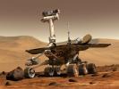
Artist's concept of NASA's Artist's concept of Mars Exploration Rover (MER) from December, 2002.
PIA04239:
Artist's Concept of Mars Exploration Rover
Full Resolution:     TIFF (2.363 MB)     JPEG (149.3 kB)
Add Image to Favorite List 2002-12-21 Mars Exploration Rover (MER)
1024x768x3
Artist's concept of NASA's Artist's concept of Mars Exploration Rover (MER) from December, 2002.
PIA04240:
Artist's Concept of Mars Exploration Rover
Full Resolution:     TIFF (1.61 MB)     JPEG (84.21 kB)
Add Image to Favorite List 2004-02-28 Mars Mars Exploration Rover (MER)
Navigation Camera
600x600x1
This image of a rock called 'Humphrey' was taken by the NASA's Mars Exploration Rover Spirit on Mars. Likely a basaltic rock, the fractures are thought to have been caused by the impact as it was hurled from the crater to its current resting place.
PIA05466:
Heading for Humphrey
Full Resolution:     TIFF (358 kB)     JPEG (50.53 kB)
Add Image to Favorite List 2004-03-09 Mars Mars Exploration Rover (MER)
Microscopic Imager
Rock Abrasion Tool (RAT)
1024x1024x8
This image shows a zoomed-in views of the rock dubbed 'Humphrey' following its successful grinding with NASA's Mars Exploration Rover Spirit's rock abrasion tool.
PIA05522:
Focus on "Humphrey" Animation Icon
Full Resolution:
Add Image to Favorite List 2003-02-26 Mars Exploration Rover (MER)
3000x2400x3
An artist's concept portrays a NASA Mars Exploration Rover on the surface of Mars. Two rovers were launched in 2003 and arrived at sites on Mars in January 2004.
PIA04413:
Artist's Concept of Rover on Mars
Full Resolution:     TIFF (11.77 MB)     JPEG (877.8 kB)
Add Image to Favorite List 2003-02-26 Mars Exploration Rover (MER)
1960x3008x3
NASA's Rover 1 sits atop the deployed lander with its solar arrays and wheels stowed.
PIA04414:
Rover 1 in Cruise Stage
Full Resolution:     TIFF (17.71 MB)     JPEG (747.5 kB)
Add Image to Favorite List 2003-02-26 Mars Exploration Rover (MER)
1307x1149x3
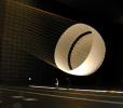
NASA's Mars Exploration Rover parachute deployment testing in the world's largest wind tunnel at NASA's Ames Research Center, Moffet Field, Calif.
PIA04415:
Parachute Test
Full Resolution:     TIFF (3.227 MB)     JPEG (145.3 kB)
Add Image to Favorite List 2003-02-26 Mars Exploration Rover (MER)
3008x1960x3
A 'Martian mechanic' checks beneath the completely deployed NASA's Rover 1 lander. Atop the lander is Rover 1 with its wheels and solar arrays in the stowed position.
PIA04416:
Rover 1 and Lander
Full Resolution:     TIFF (17.69 MB)     JPEG (847.1 kB)
Add Image to Favorite List 2003-02-26 Mars Exploration Rover (MER)
3008x1960x3
NASA's Rover 1 sits atop the deployed lander with its solar arrays and wheels stowed.
PIA04417:
Rover 1 and Lander
Full Resolution:     TIFF (17.69 MB)     JPEG (956.1 kB)
Add Image to Favorite List 2003-02-26 Mars Exploration Rover (MER)
3008x1960x3
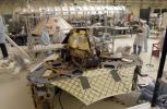
NASA's Rover 2 equipment deck, with solar arrays partially deployed, in NASA's JPL's Spacecraft Assembly Facility's cleanroom.
PIA04418:
Rover 2 Assembly
Full Resolution:     TIFF (17.69 MB)     JPEG (821.7 kB)
Add Image to Favorite List 2003-02-26 Mars Exploration Rover (MER)
1849x2598x3
NASA's Rover 1 in the cruise configuration in Jet Propulsion Laboratory's 25-ft Solar Thermal Vacuum Chamber where it underwent environmental testing.
PIA04419:
Environmental Testing
Full Resolution:     TIFF (13.88 MB)     JPEG (727.4 kB)
Add Image to Favorite List 2003-02-26 Mars Exploration Rover (MER)
3008x1960x3
NASA's Rover 2 is driven over staggered ramps to test the suspension's range of motion.
PIA04420:
Rover 2 Driving Test
Full Resolution:     TIFF (16.73 MB)     JPEG (605.7 kB)
Add Image to Favorite List 2003-02-26 Mars Exploration Rover (MER)
3008x1960x3
Members of the Mars Exploration Rovers Assembly, Test and Launch Operations team gather around NASA's Rover 2 and its predecessor, a flight spare of the Pathfinder mission's Sojourner rover, named 'Marie Curie.'
PIA04421:
Rover Family Photo
Full Resolution:     TIFF (17.11 MB)     JPEG (647.3 kB)
Add Image to Favorite List 2003-02-26 Mars Exploration Rover (MER)
3008x1960x3
The twin rovers of NASA'a Mars Exploration Rover Mission pose with their groundbreaking predecessor, the flight spare of the Sojourner rover from NASA's 1997 Pathfinder mission.
PIA04422:
Rovers and Sojourner
Full Resolution:     TIFF (16.51 MB)     JPEG (629.1 kB)
Add Image to Favorite List 2003-02-26 Mars Exploration Rover (MER)
3008x1960x3
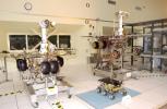
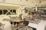
The twin rovers sit side-by-side in different stages of deployment. NASA's Rover 2's (left) front wheels are stowed, while NASA's Rover 1's front wheels are deployed.
PIA04424:
2 Stages of Deployment
Full Resolution:     TIFF (17.34 MB)     JPEG (722.3 kB)
Add Image to Favorite List 2003-02-26 Mars Exploration Rover (MER)
752x478x3
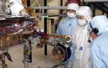
JPL engineers examine the robotic arm of NASA's Mars Exploration Rover 1.
PIA04425:
Robotic Arm of Rover 1
Full Resolution:     TIFF (1.08 MB)     JPEG (76.43 kB)
Add Image to Favorite List 2003-02-26 Mars Exploration Rover (MER)
3008x1960x3
JPL engineers hand-deploying the solar arrays that provide the electrical power on NASA's Mars Exploration Rover 1.
PIA04426:
Rover 1 Solar Arrays
Full Resolution:     TIFF (16.76 MB)     JPEG (652.8 kB)
Add Image to Favorite List 2003-02-26 Mars Exploration Rover (MER)
3008x1960x3
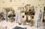
JPL engineers making adjustments to NASA's Mars Exploration Rover 1.
PIA04427:
Adjustments to Rover 1
Full Resolution:     TIFF (16.42 MB)     JPEG (628.6 kB)
 Current Set   Jump to a Following Set   Jump to a Following Set   Jump to a Following Set   Jump to a Following Set   Jump to a Following Set   Jump to a Following Set   Jump to a Following Set   Jump to a Following Set   Jump to a Following Set   Retrieve Next Set 
 1-100   101-200   201-300   301-400   401-500   501-600   601-700   701-800   801-900   901-1000 
Currently displaying images: 1 - 100 of 1931