Your search criteria found
1894
images
Mission
Go to PIAxxxxx:
Refine this list of images by:
Target:
Earth
Jupiter
Mars
Phobos
Spacecraft:
Mars Global Surveyor Orbiter
Mars Pathfinder Lander
Opportunity
Phoenix Mars Lander
Spirit
Instrument:
Magnetometer
Mars Horizon Sensor Assembly
Mars Orbiter Camera (MOC)
Mars Orbiter Laser Altimeter
Microscopic Imager
Miniature Thermal Emission Spectrometer
Navigation Camera
Panoramic Camera
Radar System
Radio Science Subsystem
Thermal Emission Spectrometer
Click on an image for detailed information
Click on a column heading to sort in ascending or descending order
My
List
Addition Date
Target
Mission
Instrument
Size
2005-05-19
2001 Mars Odyssey
Mars Global Surveyor (MGS)
Mars Orbiter Camera (MOC)
627x393x1
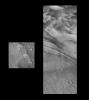
PIA07941:
Mars Odyssey from Two Distances in One Image
Full Resolution:
TIFF
(246.9 kB)
JPEG
(14 kB)
2005-05-19
2001 Mars Odyssey
Mars Global Surveyor (MGS)
Mars Orbiter Camera (MOC)
350x350x3
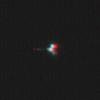
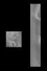
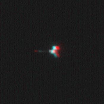
PIA07943:
Mars Odyssey Seen by Mars Global Surveyor (3-D)
Full Resolution:
TIFF
(368.1 kB)
JPEG
(8.865 kB)
2005-05-19
2001 Mars Odyssey
Mars Global Surveyor (MGS)
Mars Orbiter Camera (MOC)
488x513x1
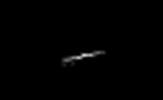
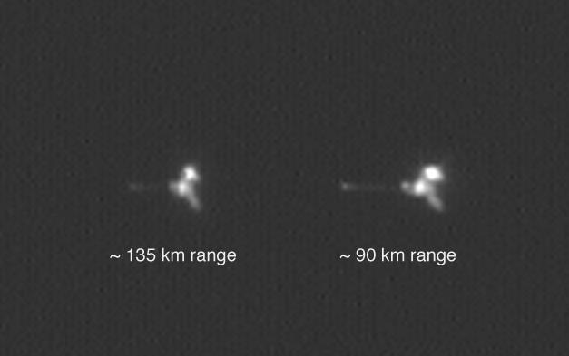
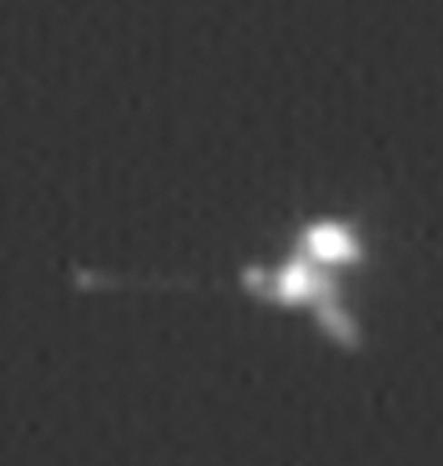
PIA07942:
Mars Odyssey Seen by Mars Global Surveyor
Full Resolution:
TIFF
(250.8 kB)
JPEG
(7.568 kB)
2005-05-19
Mars Global Surveyor (MGS)
Mars Express (MEX)
Mars Orbiter Camera (MOC)
254x156x1
PIA07944:
Mars Express Seen by Mars Global Surveyor
Full Resolution:
TIFF
(39.89 kB)
JPEG
(1.044 kB)
2003-05-22
Earth
Mars Global Surveyor (MGS)
Mars Orbiter Camera (MOC)
1068x3151x3
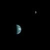
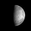
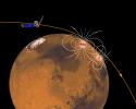
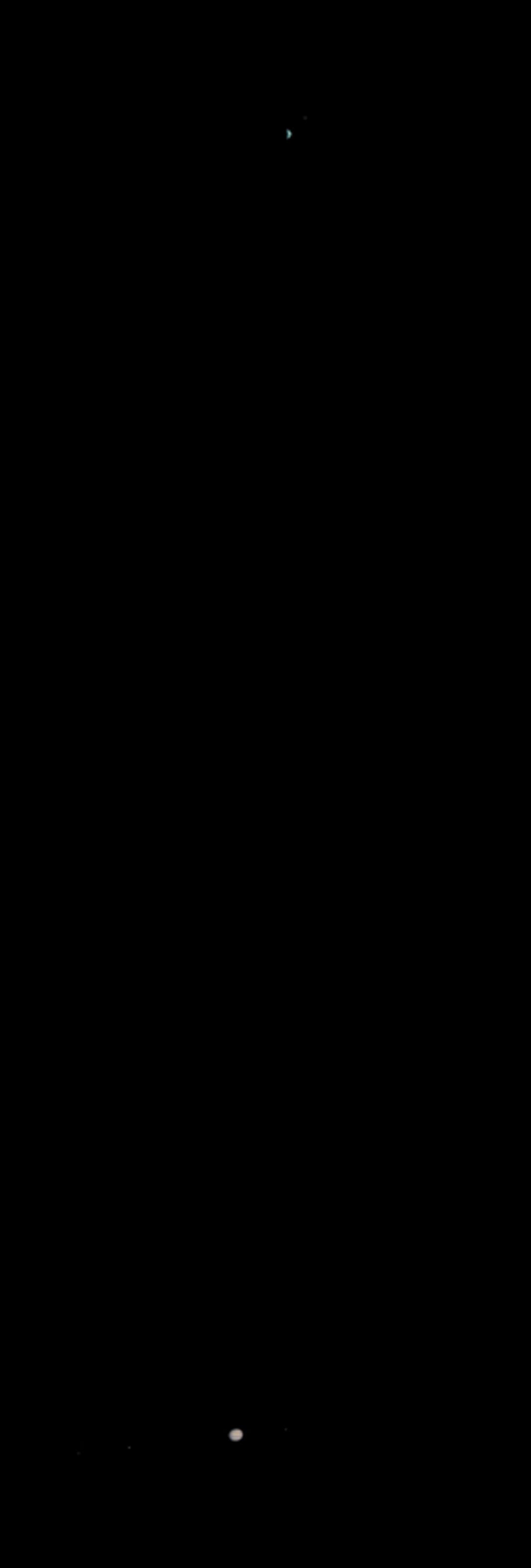
PIA04530:
Earth and Jupiter as viewed from Mars
Full Resolution:
TIFF
(325.7 kB)
JPEG
(53.78 kB)
2003-05-22
Earth
Mars Global Surveyor (MGS)
Mars Orbiter Camera (MOC)
961x961x3
PIA04531:
Earth and Moon as viewed from Mars
Full Resolution:
TIFF
(197.6 kB)
JPEG
(17.52 kB)
2003-05-22
Jupiter
Mars Global Surveyor (MGS)
Mars Orbiter Camera (MOC)
4655x961x3
PIA04532:
Jupiter and its Galilean Satellites as viewed from Mars
Full Resolution:
TIFF
(416.5 kB)
JPEG
(76.11 kB)
1997-07-04
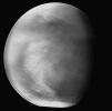
Mars
Mars Global Surveyor (MGS)
Mars Orbiter Camera (MOC)
512x512x1
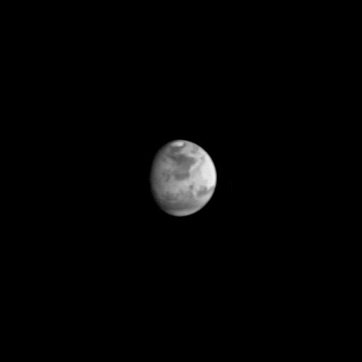
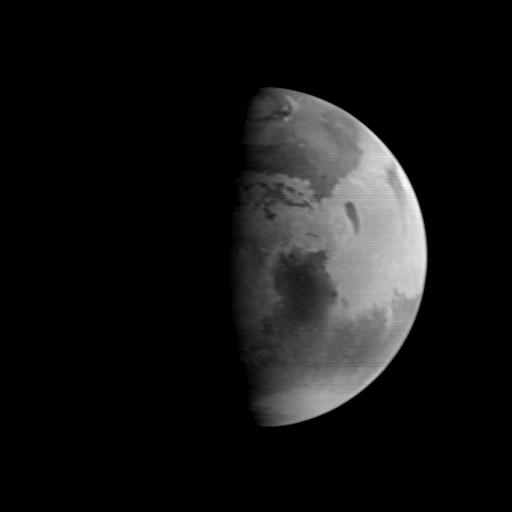
PIA00606:
Mars Global Surveyor Approach Image
Full Resolution:
TIFF
(8.131 kB)
JPEG
(4.696 kB)
1997-07-04
Mars
Mars Global Surveyor (MGS)
Mars Orbiter Camera (MOC)
640x480x1
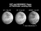
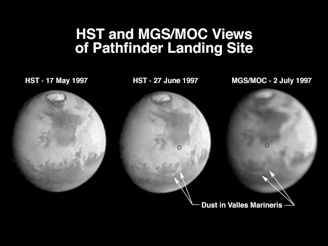
PIA00607:
Hubble and Mars Global Surveyor Views of Dust Storm on Mars
Full Resolution:
TIFF
(86.26 kB)
JPEG
(27.45 kB)
1998-03-13
Mars
Mars Global Surveyor (MGS)
Mars Orbiter Camera (MOC)
573x906x1
PIA00800:
Medusae Fossae #1
Full Resolution:
TIFF
(291.2 kB)
JPEG
(136.8 kB)
1998-03-13
Mars
Mars Global Surveyor (MGS)
Mars Orbiter Camera (MOC)
573x906x1
PIA00801:
Medusae Fossae #2
Full Resolution:
TIFF
(280.2 kB)
JPEG
(129.4 kB)
1998-03-13
Mars
Mars Global Surveyor (MGS)
Mars Orbiter Camera (MOC)
450x699x1
PIA00802:
Hebes Chasma #1
Full Resolution:
TIFF
(155.5 kB)
JPEG
(72.56 kB)
1998-03-13
Mars
Mars Global Surveyor (MGS)
Mars Orbiter Camera (MOC)
450x699x1
PIA00803:
Hebes Chasma #2
Full Resolution:
TIFF
(160 kB)
JPEG
(71.49 kB)
1998-03-13
Mars
Mars Global Surveyor (MGS)
Mars Orbiter Camera (MOC)
645x701x1
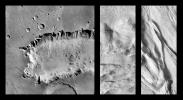
PIA00804:
Crommelin Crater #1
Full Resolution:
TIFF
(201.9 kB)
JPEG
(78.6 kB)
1998-03-13
Mars
Mars Global Surveyor (MGS)
Mars Orbiter Camera (MOC)
645x701x1
PIA00805:
Crommelin Crater #2
Full Resolution:
TIFF
(224.5 kB)
JPEG
(87.85 kB)
1998-03-13
Mars
Mars Global Surveyor (MGS)
Mars Orbiter Camera (MOC)
477x441x1
PIA00806:
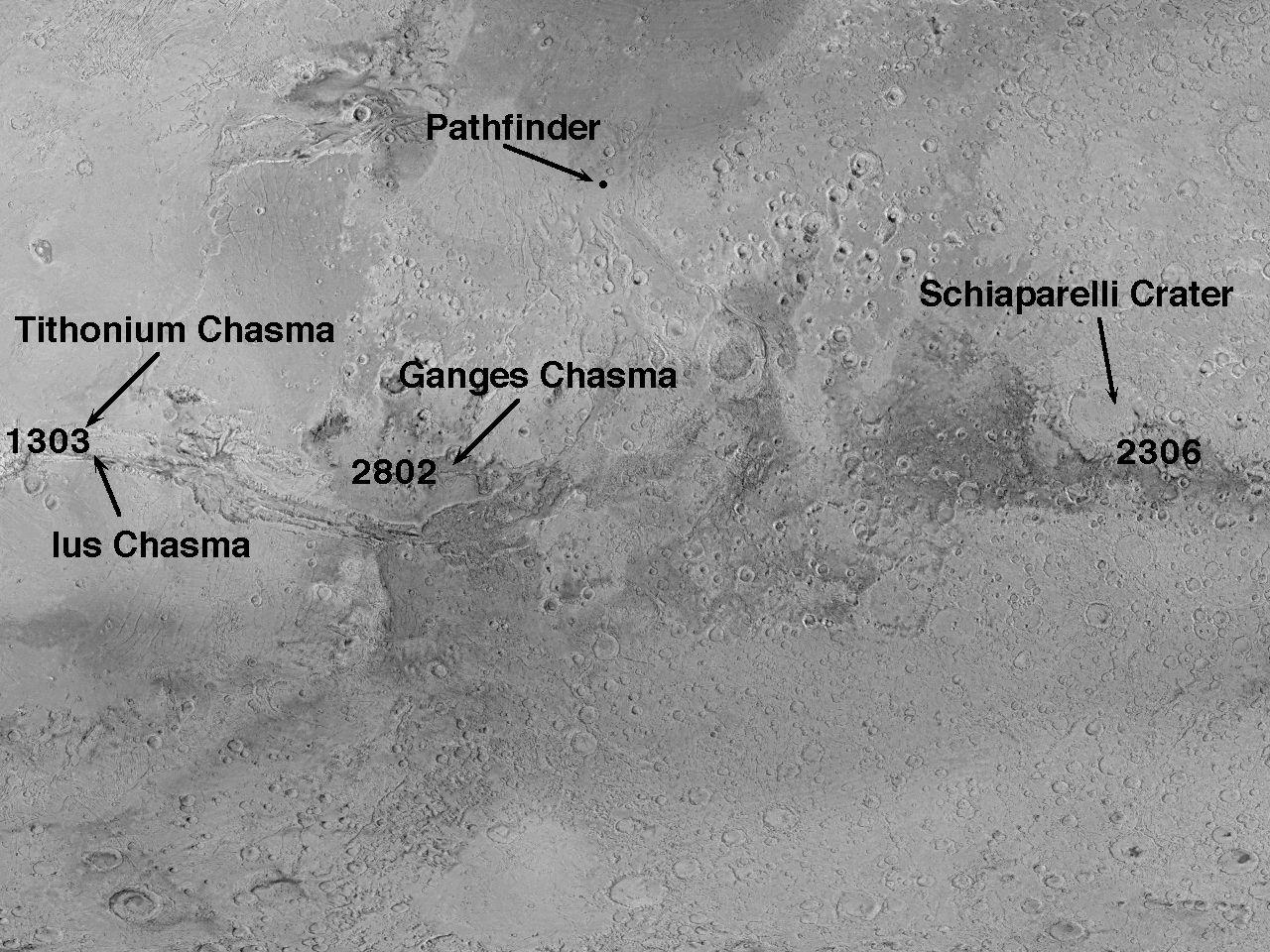
Tithonium Chasma/Ius Chasma
Full Resolution:
TIFF
(110.4 kB)
JPEG
(46.77 kB)
1998-03-13
Mars
Mars Global Surveyor (MGS)
Mars Orbiter Camera (MOC)
477x441x1
PIA00807:
Candor Chasma
Full Resolution:
TIFF
(109.9 kB)
JPEG
(47.99 kB)
1998-03-13
Mars
Mars Global Surveyor (MGS)
Mars Orbiter Camera (MOC)
855x616x1
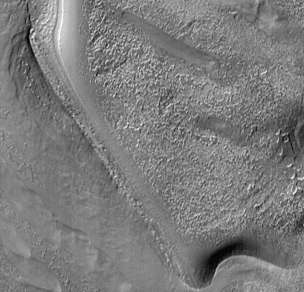
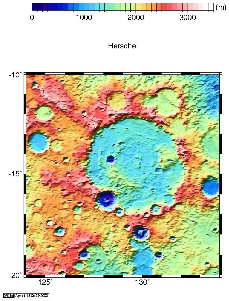
PIA00808:
Ridges in Mars' South Polar Region
Full Resolution:
TIFF
(227.3 kB)
JPEG
(73.71 kB)
1998-03-13
Mars
Mars Global Surveyor (MGS)
Mars Orbiter Camera (MOC)
592x568x1
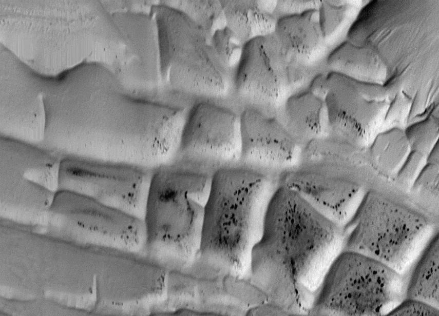
PIA00809:
Textures in South Polar Ice Cap #1
Full Resolution:
TIFF
(173.4 kB)
JPEG
(76.65 kB)
1998-03-13
Mars
Mars Global Surveyor (MGS)
Mars Orbiter Camera (MOC)
592x568x1
PIA00810:
Textures in South Polar Ice Cap #2
Full Resolution:
TIFF
(147.8 kB)
JPEG
(52.01 kB)
1998-03-13
Mars
Mars Global Surveyor (MGS)
Mars Orbiter Camera (MOC)
1200x1194x1
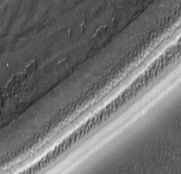
PIA00811:
South Polar Region
Full Resolution:
TIFF
(402.9 kB)
JPEG
(109.9 kB)
1998-03-13
Mars
Mars Global Surveyor (MGS)
Mars Orbiter Camera (MOC)
1200x1194x3
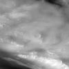
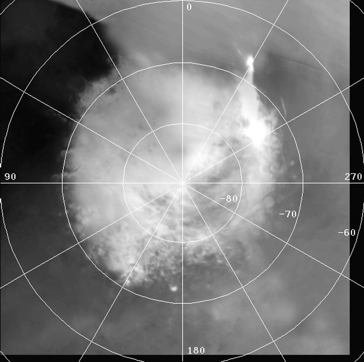
PIA00812:
Clouds over Tharsis
Full Resolution:
TIFF
(439 kB)
JPEG
(75.45 kB)
1998-03-13
Mars
Mars Global Surveyor (MGS)
Mars Orbiter Camera (MOC)
1200x1194x1
PIA00813:
1997 Martian Dust Storm
Full Resolution:
TIFF
(310.8 kB)
JPEG
(77.07 kB)
1998-03-13
Mars
Mars Global Surveyor (MGS)
Mars Orbiter Camera (MOC)
1356x9216x3
PIA00814:
Coprates Chasma
Full Resolution:
TIFF
(23.13 MB)
JPEG
(1.279 MB)
1997-08-22
Mars
Mars Global Surveyor (MGS)
Mars Orbiter Camera (MOC)
512x512x1
PIA00910:
MGS Approach Image - Syrtis Major Region
Full Resolution:
TIFF
(54.19 kB)
JPEG
(9.769 kB)
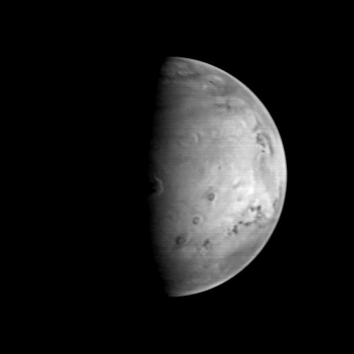
1997-08-22
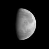
Mars
Mars Global Surveyor (MGS)
Mars Orbiter Camera (MOC)
512x512x1
PIA00911:
MGS Approach Image - Chryse Planitia
Full Resolution:
TIFF
(52.54 kB)
JPEG
(9.599 kB)
1997-08-22
Mars
Mars Global Surveyor (MGS)
Mars Orbiter Camera (MOC)
512x512x1
PIA00912:
MGS Approach Image - Elysium Region
Full Resolution:
TIFF
(54.8 kB)
JPEG
(9.524 kB)
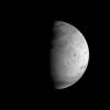
1997-09-10
Mars
Mars Global Surveyor (MGS)
Mars Orbiter Camera (MOC)
512x512x1
PIA00929:
MGS Approach Image - 172.4� W Longitude
Full Resolution:
TIFF
(42.96 kB)
JPEG
(8.111 kB)
1997-09-10
Mars
Mars Global Surveyor (MGS)
Mars Orbiter Camera (MOC)
512x512x1
PIA00930:
MGS Approach Image - 262.3� W Longitude
Full Resolution:
TIFF
(42.21 kB)
JPEG
(8.863 kB)
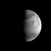
1997-09-10
Mars
Mars Global Surveyor (MGS)
Mars Orbiter Camera (MOC)
512x512x1
PIA00931:
MGS Approach Image - 352.2� W Longitude
Full Resolution:
TIFF
(44.39 kB)
JPEG
(9.87 kB)
1997-09-10
Mars
Mars Global Surveyor (MGS)
Mars Orbiter Camera (MOC)
512x512x1
PIA00932:
MGS Approach Image - 82.1� W Longitude
Full Resolution:
TIFF
(44.85 kB)
JPEG
(9.484 kB)
1997-09-10
Mars
Mars Global Surveyor (MGS)
Mars Orbiter Camera (MOC)
512x512x1
PIA00933:
MGS Approach Image - 217.4� W Longitude
Full Resolution:
TIFF
(45.74 kB)
JPEG
(9.268 kB)
1997-09-10
Mars
Mars Global Surveyor (MGS)
Mars Orbiter Camera (MOC)
512x512x1
PIA00934:
MGS Approach Image - 307.3� W Longitude
Full Resolution:
TIFF
(46.05 kB)
JPEG
(9.347 kB)
1997-09-10
Mars
Mars Global Surveyor (MGS)
Mars Orbiter Camera (MOC)
512x512x1
PIA00935:
MGS Approach Image - 37.2� W Longitude
Full Resolution:
TIFF
(47.3 kB)
JPEG
(9.643 kB)
1997-09-10
Mars
Mars Global Surveyor (MGS)
Mars Orbiter Camera (MOC)
512x512x1
PIA00936:
MGS Approach Image - 127.2� W Longitude
Full Resolution:
TIFF
(48.34 kB)
JPEG
(9.972 kB)
1997-09-24
Mars
Mars Global Surveyor (MGS)
Thermal Emission Spectrometer
554x553x3
PIA00937:
MGS Thermal Emission Spectrometer Image
Full Resolution:
TIFF
(90.26 kB)
JPEG
(80.87 kB)
1997-10-02
Mars
Mars Global Surveyor (MGS)
Mars Orbiter Camera (MOC)
2198x1328x1
PIA00941:
MGS Views of Labyrinthus Noctis
Full Resolution:
TIFF
(1.163 MB)
JPEG
(260.3 kB)
1997-10-02
Mars
Mars Global Surveyor (MGS)
Mars Orbiter Camera (MOC)
2637x1686x1
PIA00942:
MGS Views of Nirgal Vallis
Full Resolution:
TIFF
(2.573 MB)
JPEG
(722.7 kB)
1997-10-02
Mars
Mars Global Surveyor (MGS)
Mars Orbiter Camera (MOC)
630x504x1
PIA00943:
Subsection of Nirgal Vallis Image
Full Resolution:
TIFF
(325.3 kB)
JPEG
(101.6 kB)
1997-10-02
Mars
Mars Global Surveyor (MGS)
Mars Orbiter Camera (MOC)
1024x768x1
PIA00944:
Rotated Perspective View of Nirgal Vallis
Full Resolution:
TIFF
(625.1 kB)
JPEG
(193.6 kB)
1997-10-02
Mars
Mars Global Surveyor (MGS)
Mars Orbiter Camera (MOC)
1024x1024x1
PIA00945:
MGS Views of Labyrinthus Noctis
Full Resolution:
TIFF
(588.8 kB)
JPEG
(124.5 kB)
1997-10-13
Mars
Mars Global Surveyor (MGS)
Magnetometer
762x609x3
PIA00946:
Orientation and Magnitude of Mars' Magnetic Field
Full Resolution:
TIFF
(178.7 kB)
JPEG
(31.52 kB)
1997-10-13
Mars
Mars Global Surveyor (MGS)
Magnetometer
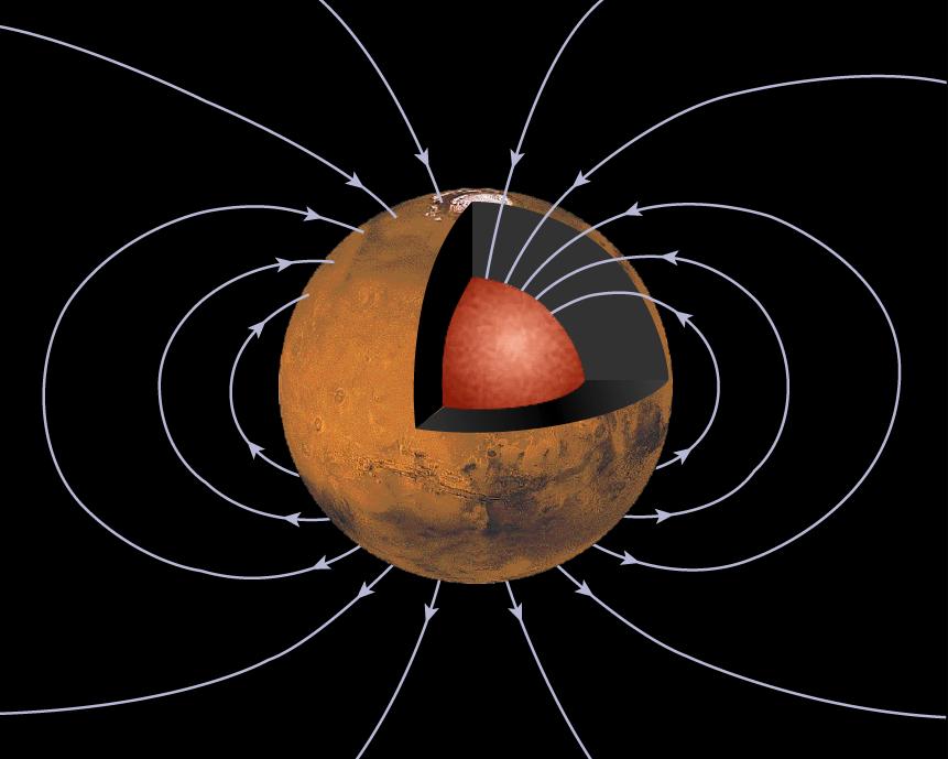
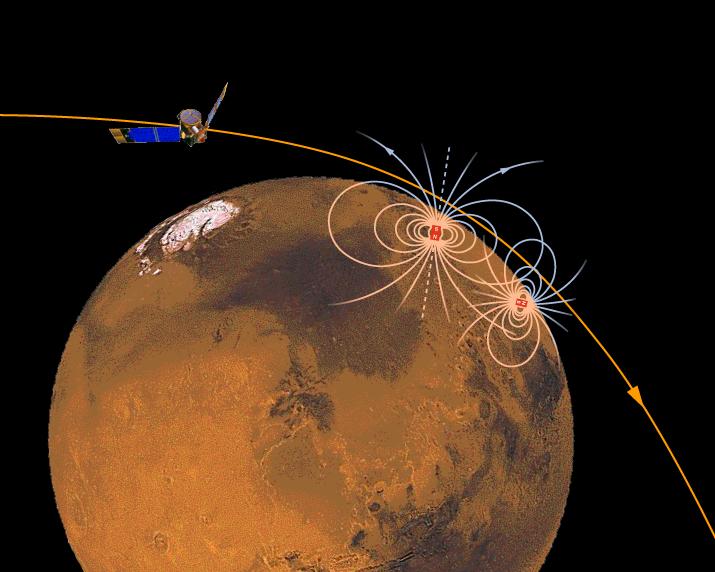
861x689x3
PIA00947:
Mars' Inner Core
Full Resolution:
TIFF
(232.6 kB)
JPEG
(51.04 kB)
1997-10-13
Mars
Mars Global Surveyor (MGS)
Magnetometer
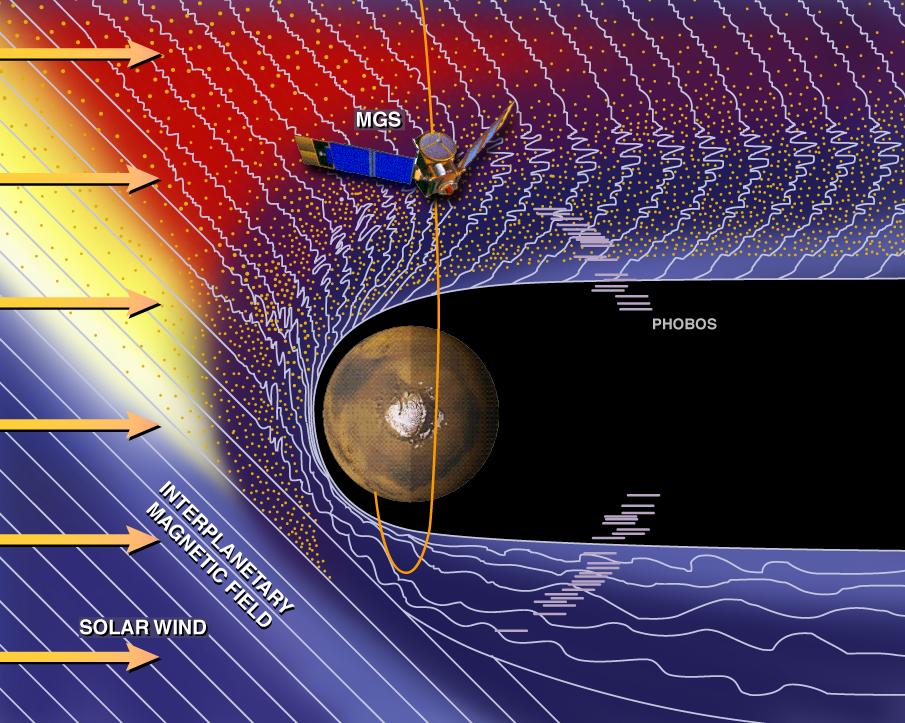
905x723x3
PIA00948:
Mars and the Solar Wind
Full Resolution:
TIFF
(1.197 MB)
JPEG
(146.1 kB)
1997-10-13
Mars
Mars Global Surveyor (MGS)
Magnetometer
715x572x3
PIA00949:
Magnetic Sources in the Crust of Mars
Full Resolution:
TIFF
(360.8 kB)
JPEG
(50.93 kB)
1997-10-13
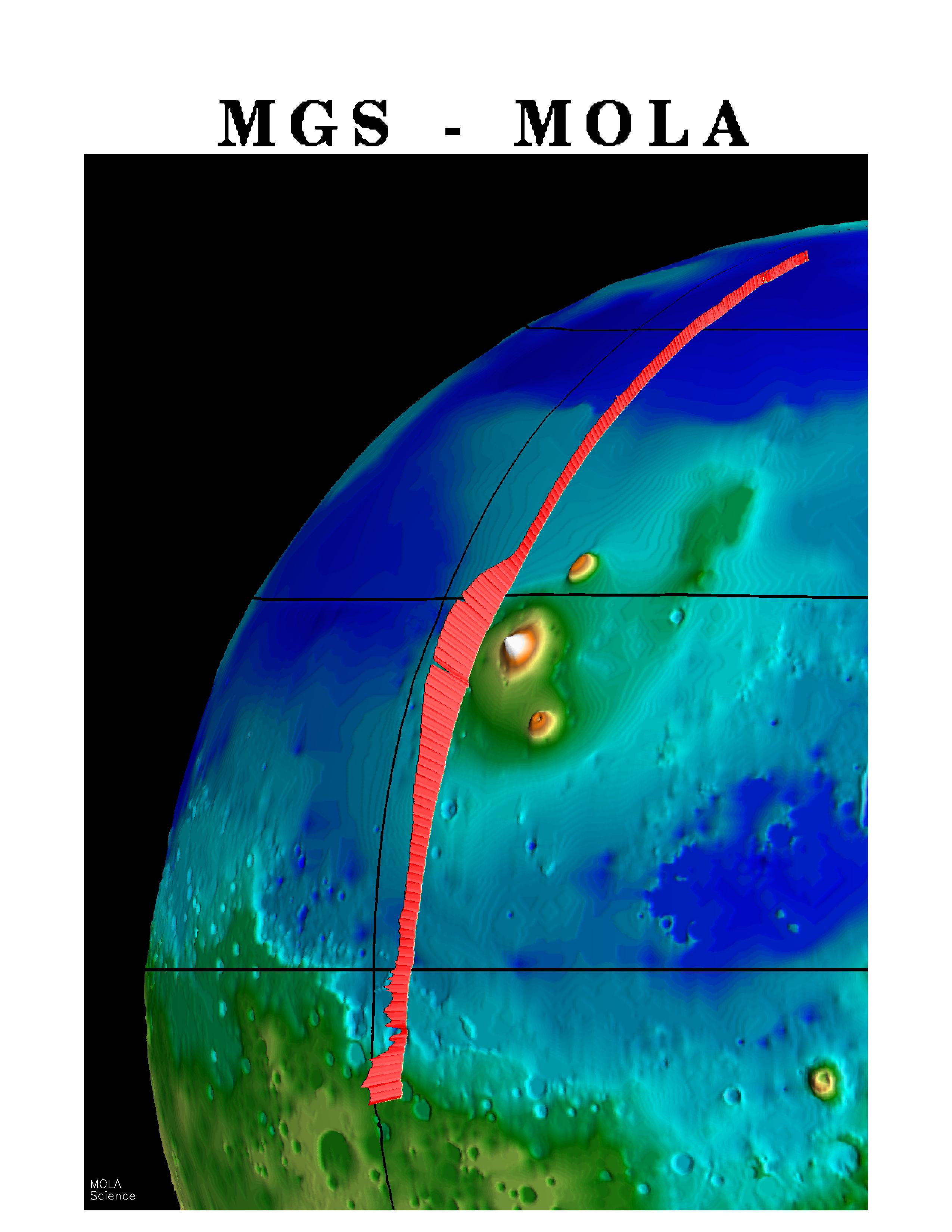
Mars
Mars Global Surveyor (MGS)
MOLA
2550x3300x3
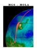
PIA00957:
MGS Mars Orbiter Laser (MOLA) Surface Topography of Northern Hemisphere
Full Resolution:
TIFF
(8.502 MB)
JPEG
(439.4 kB)
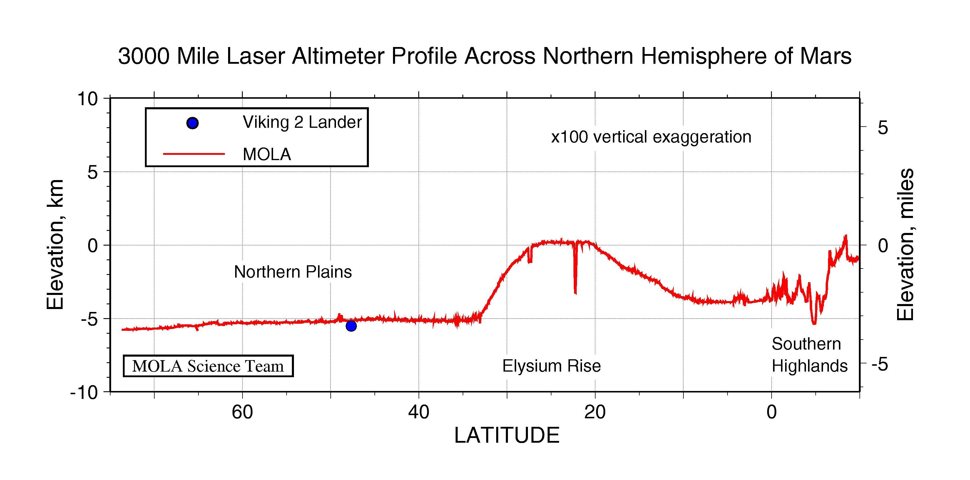
1997-10-13
Mars
Mars Global Surveyor (MGS)
MOLA
3300x1634x3
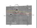
PIA00958:
3000 Mile Laser Altimeter Profile Across Northern Hemisphere of Mars
Full Resolution:
TIFF
(730.3 kB)
JPEG
(341 kB)
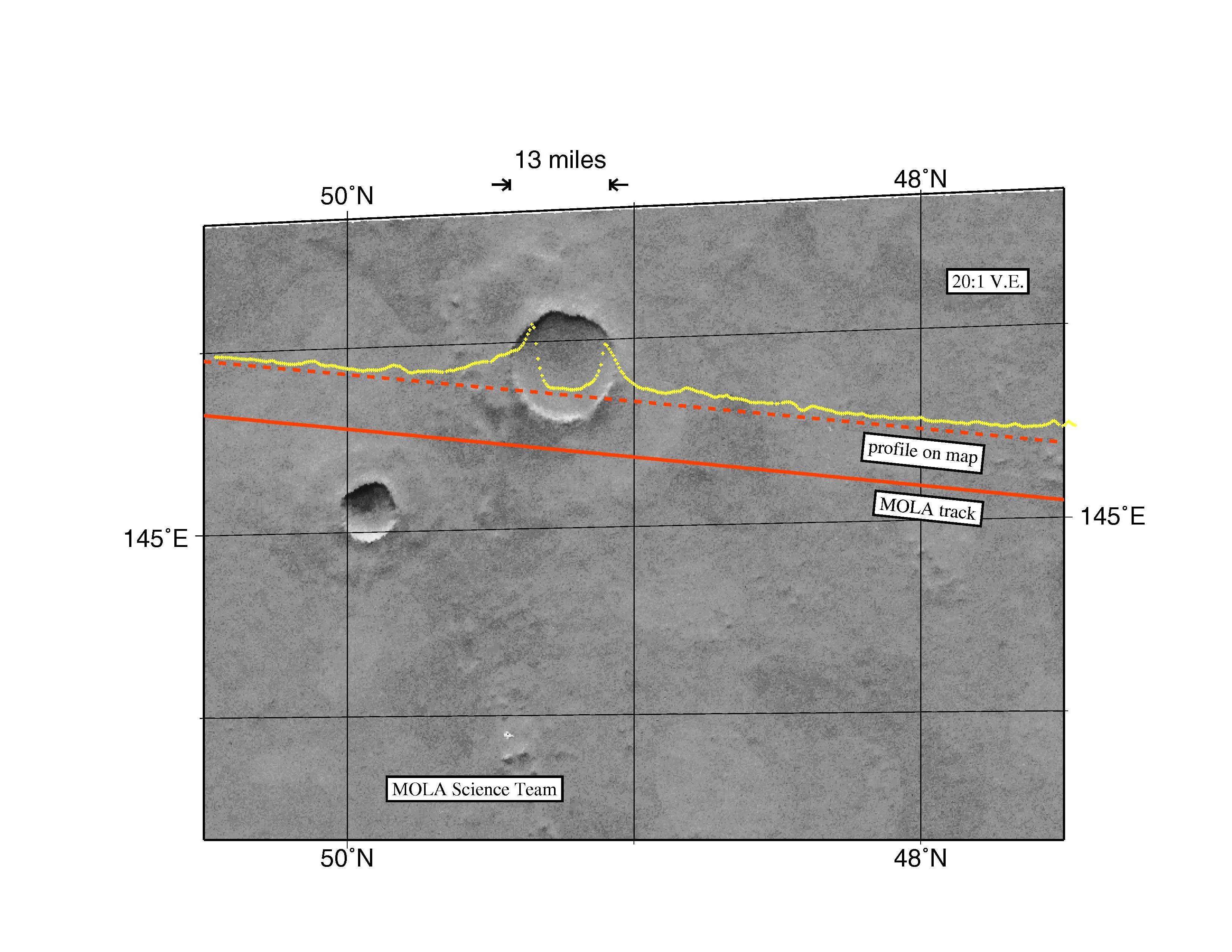
1997-10-13
Mars
Mars Global Surveyor (MGS)
MOLA
3300x2550x3
PIA00959:
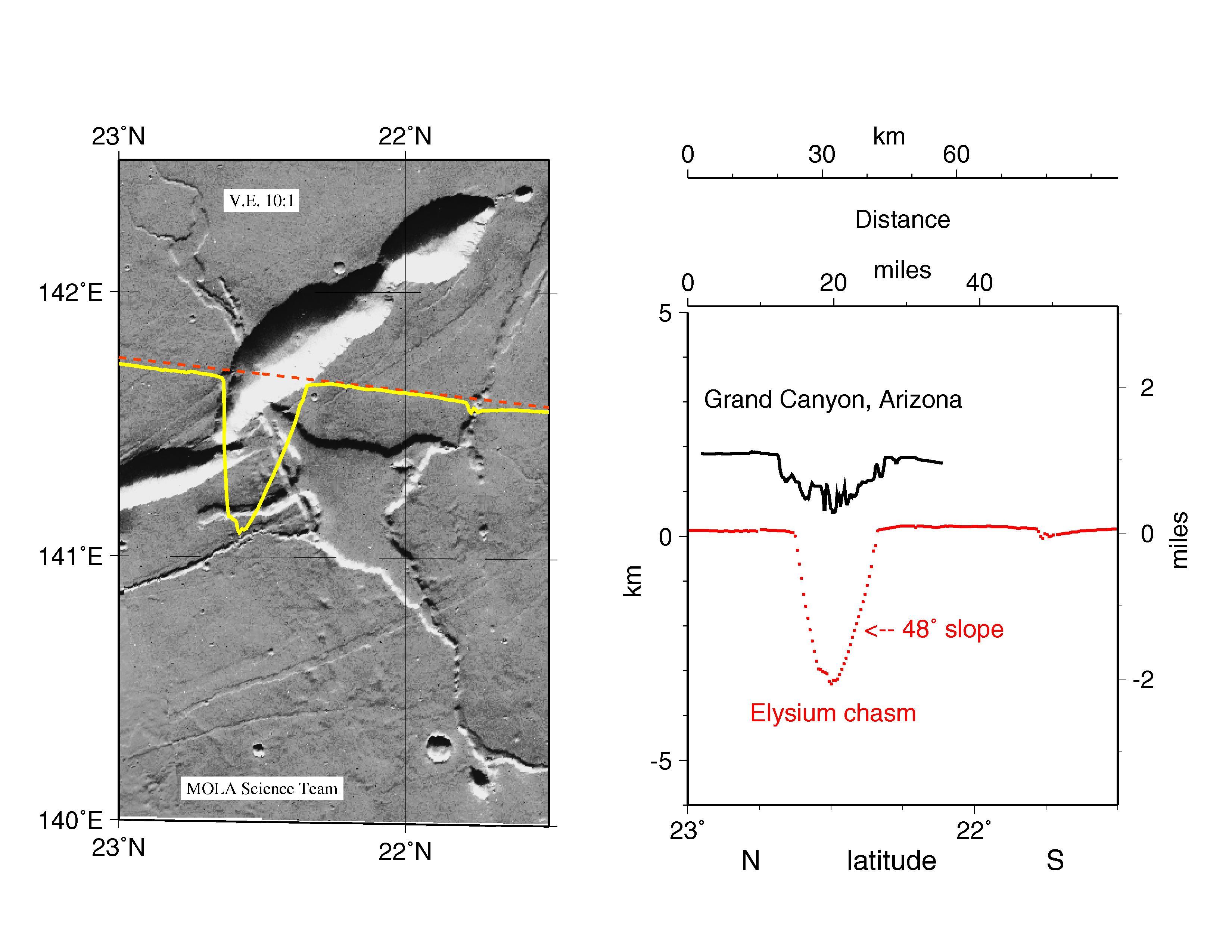
MGS Mars Orbiter Laser Altimeter Topographic Profile of Impact Crater
Full Resolution:
TIFF
(5.47 MB)
JPEG
(741 kB)
1997-10-13
Mars
Mars Global Surveyor (MGS)
MOLA
3300x2550x3
PIA00960:
MGS Mars Orbiter Laser Altimeter (MOLA) - Mars/Earth Relief Comparison
Full Resolution:
TIFF
(3.639 MB)
JPEG
(615.3 kB)
1997-10-15
Mars
Mars Global Surveyor (MGS)
Mars Orbiter Camera (MOC)
928x1552x3
PIA00991:
Valles Marineris
Full Resolution:
TIFF
(3.993 MB)
JPEG
(82.71 kB)
1997-10-15
Mars
Mars Global Surveyor (MGS)
Mars Orbiter Camera (MOC)
1023x608x3
PIA00992:
Valles Marineris
Full Resolution:
TIFF
(956.1 kB)
JPEG
(68.46 kB)
1998-04-23
Mars
Mars Global Surveyor (MGS)
Mars Orbiter Camera (MOC)
834x834x3
PIA00993:
Olympus Mons in Color
Full Resolution:
TIFF
(1.23 MB)
JPEG
(35.04 kB)
1997-11-10
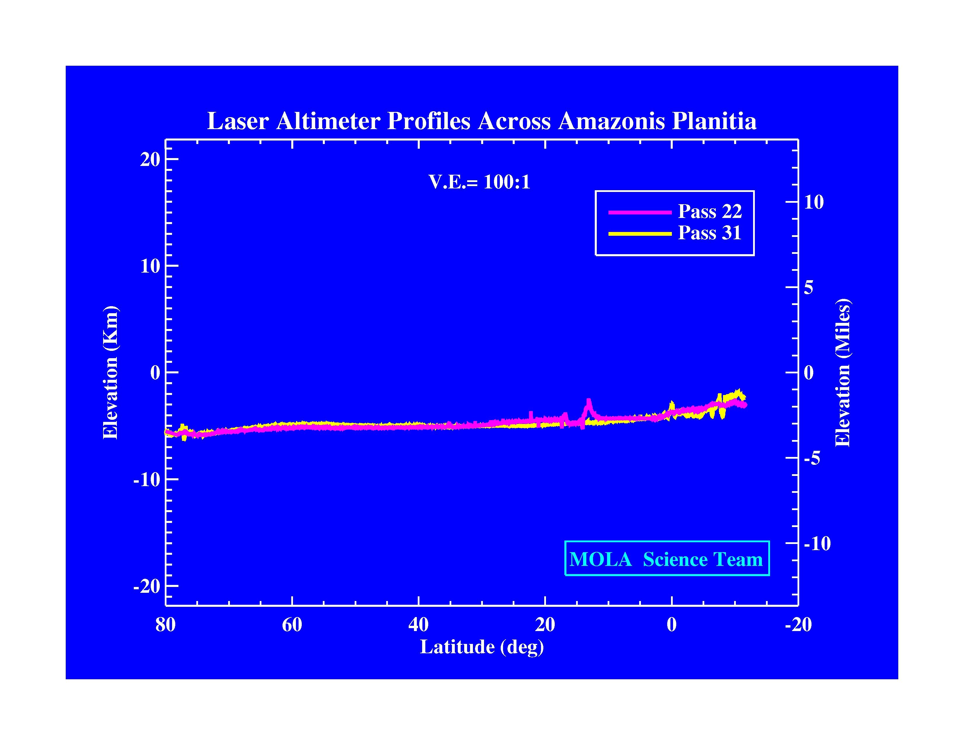
Mars
Mars Global Surveyor (MGS)
MOLA
3300x2550x3
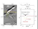
PIA01009:
Laser Altimeter Profiles Across Amazonis Planitia
Full Resolution:
TIFF
(530.8 kB)
JPEG
(371.9 kB)
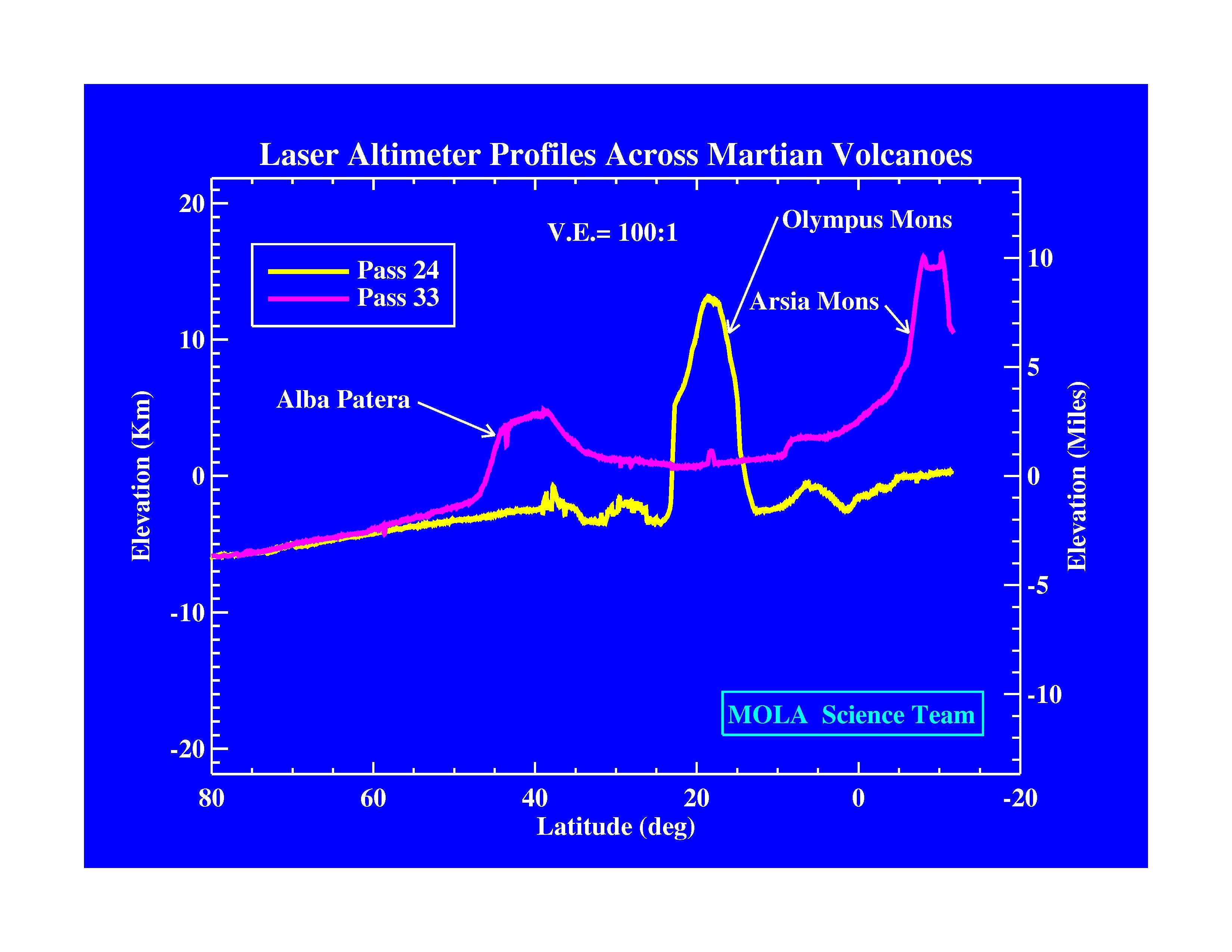
1997-11-10
Mars
Mars Global Surveyor (MGS)
MOLA
3300x2550x3
PIA01010:
Laser Altimeter Profiles Across Martian Volcanoes
Full Resolution:
TIFF
(677.9 kB)
JPEG
(424.4 kB)
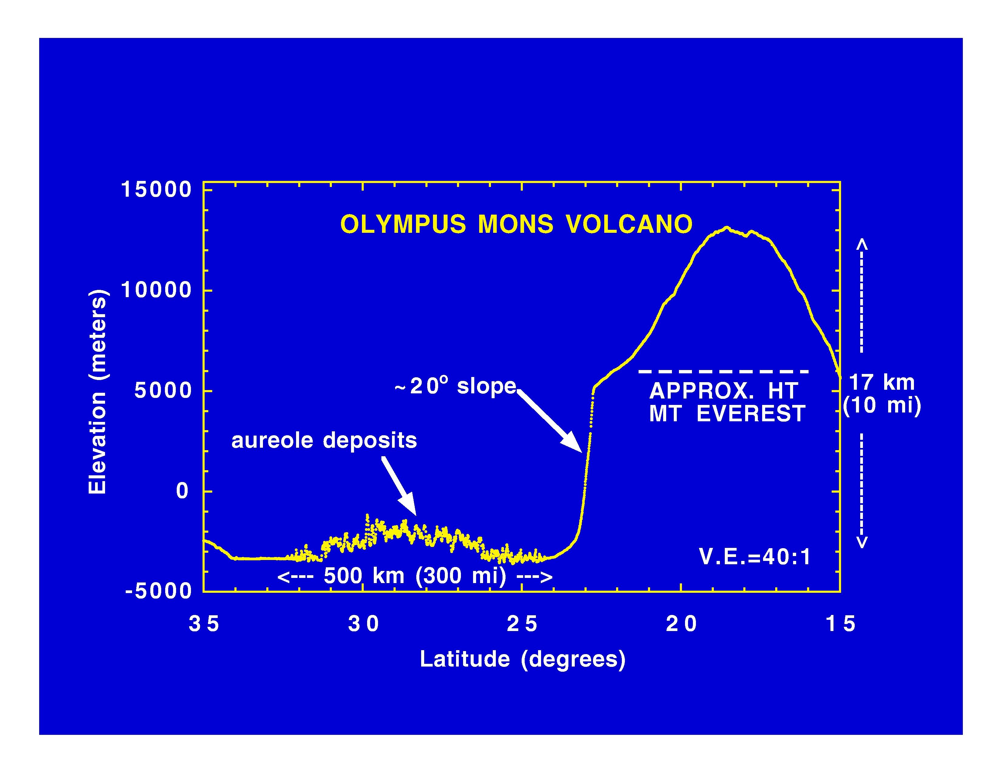
1997-11-10
Mars
Mars Global Surveyor (MGS)
MOLA
3300x2550x3
PIA01011:
Olympus Mons Volcano
Full Resolution:
TIFF
(625.4 kB)
JPEG
(414.7 kB)
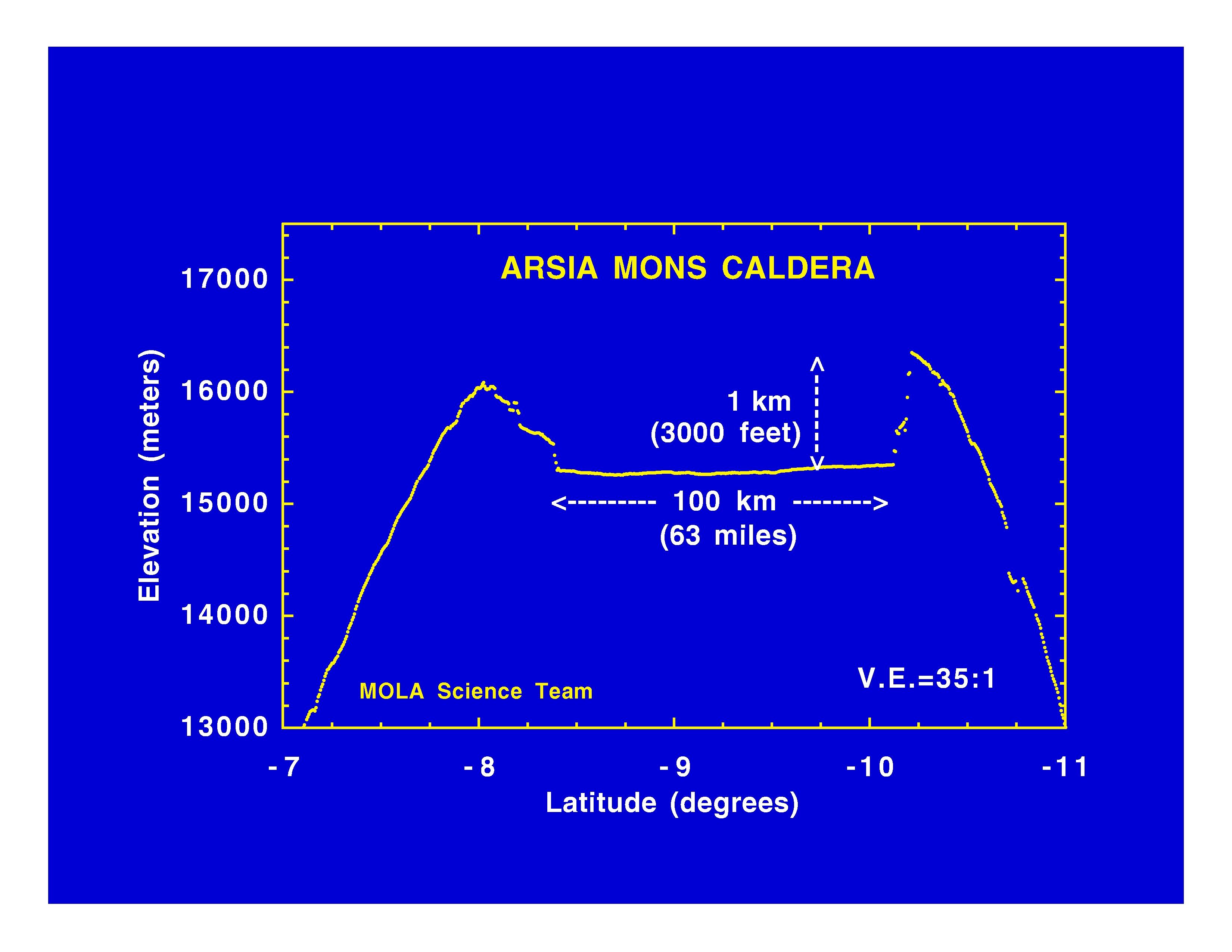
1997-11-10
Mars
Mars Global Surveyor (MGS)
MOLA
3300x2550x3
PIA01012:
Arsia Mons Caldera
Full Resolution:
TIFF
(534.1 kB)
JPEG
(365.8 kB)
1997-11-10
Mars
Mars Global Surveyor (MGS)
MOLA
3300x2550x3
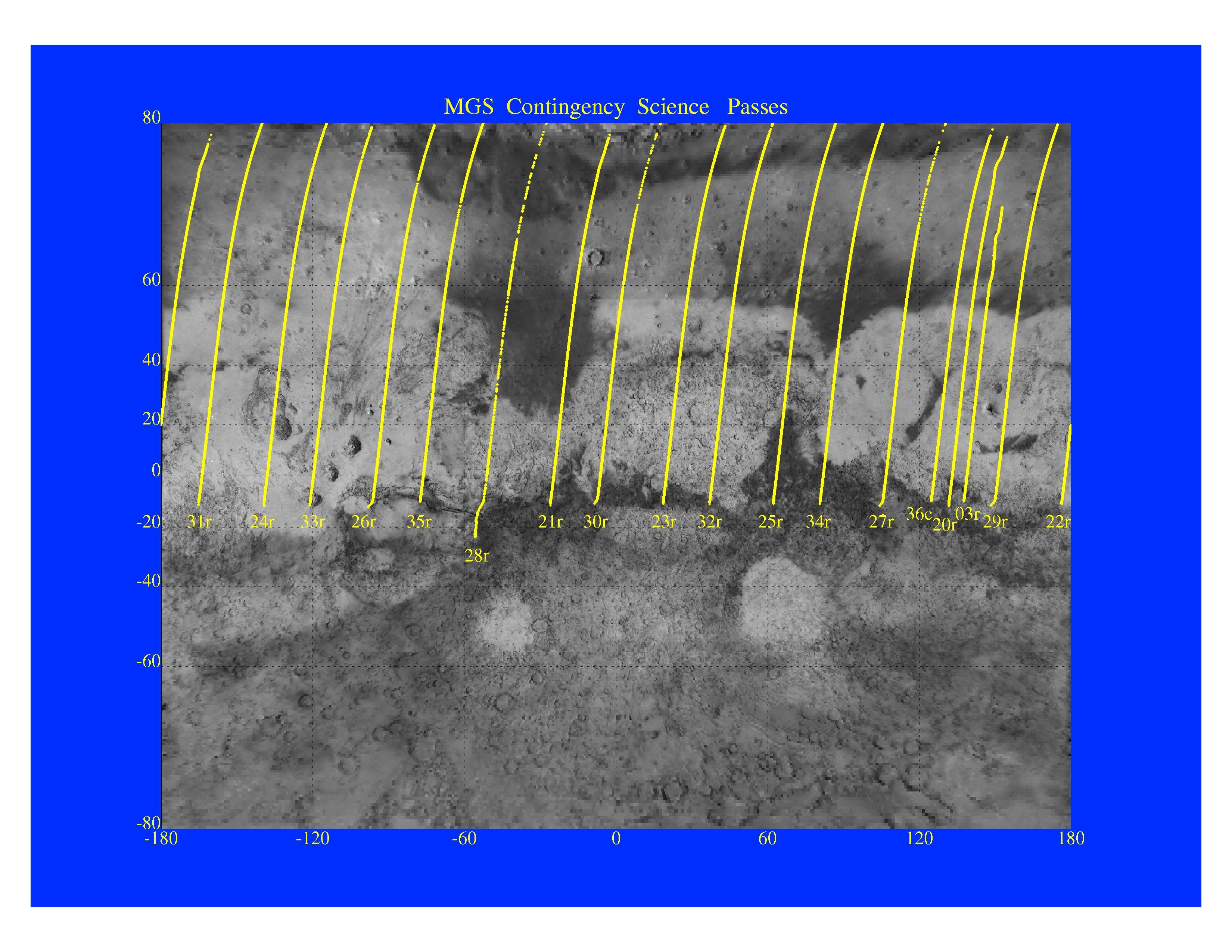
PIA01013:
MGS Contingency Science Passes
Full Resolution:
TIFF
(4.409 MB)
JPEG
(879.4 kB)
1997-11-10
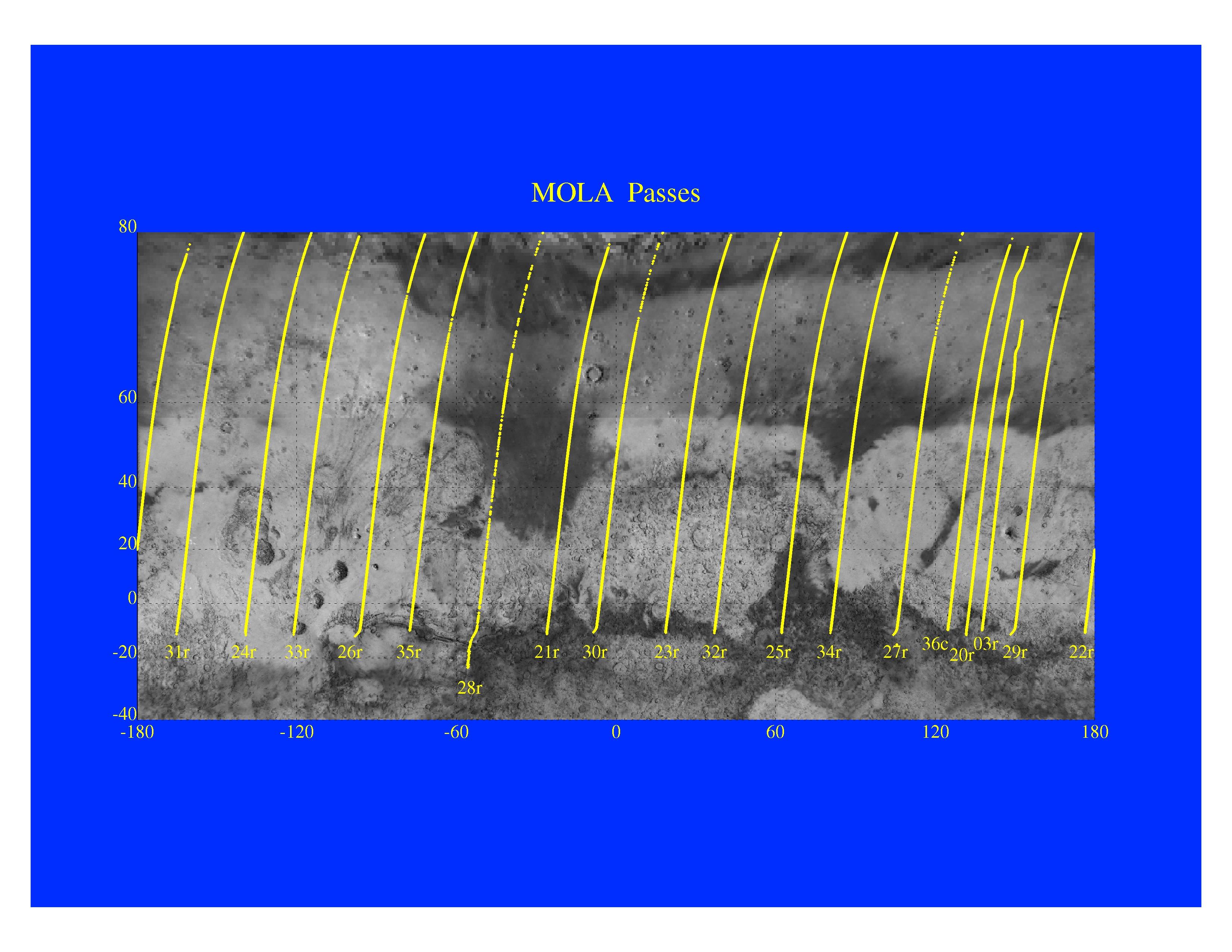
Mars
Mars Global Surveyor (MGS)
MOLA
3300x2550x3
PIA01014:
Mars Orbiter Laser Altimeter Passes
Full Resolution:
TIFF
(3.582 MB)
JPEG
(723.3 kB)
1997-11-10
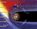
Mars
Mars Global Surveyor (MGS)
Magnetometer
996x746x3
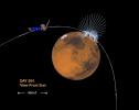
PIA01015:
Martian Ionosphere
Full Resolution:
TIFF
(567.3 kB)
JPEG
(56.81 kB)
1997-11-10
Mars
Mars Global Surveyor (MGS)
Magnetometer
972x744x3
PIA01016:
Magnetic Anomalies on Mars
Full Resolution:
TIFF
(1.073 MB)
JPEG
(78.09 kB)
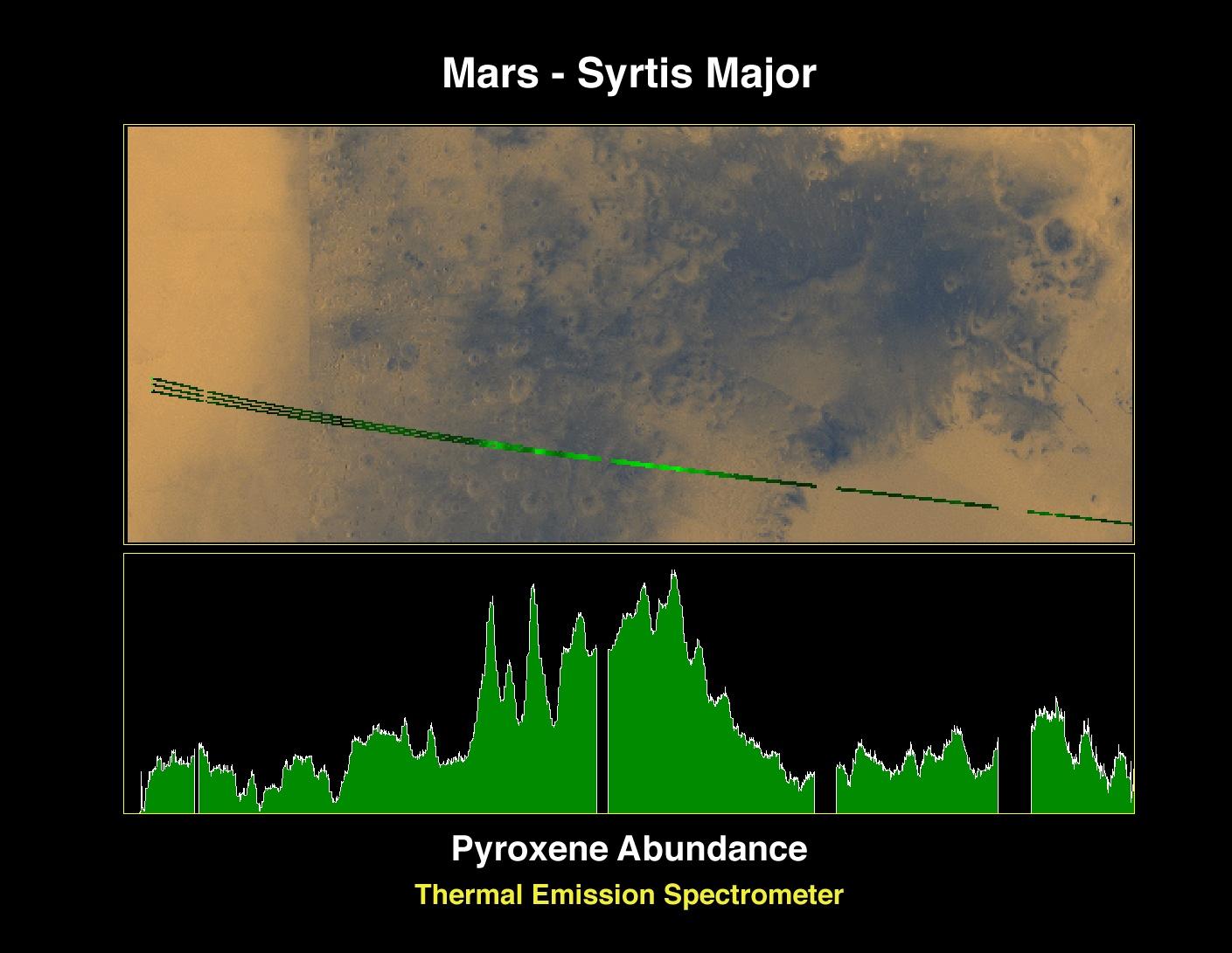
1997-11-10
Mars
Mars Global Surveyor (MGS)
Thermal Emission Spectrometer
1409x1091x3
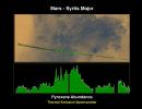
PIA01017:
Pyroxene at Syrtis Major
Full Resolution:
TIFF
(1.821 MB)
JPEG
(127.5 kB)
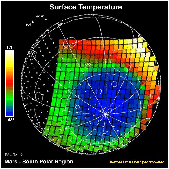
1997-11-10
Mars
Mars Global Surveyor (MGS)
Thermal Emission Spectrometer
1872x1224x3
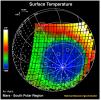
PIA01018:
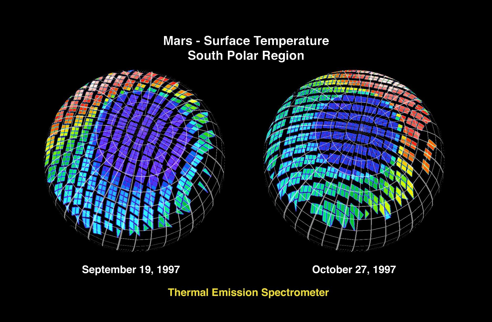
Mars - Surface Temperature South Polar Region
Full Resolution:
TIFF
(2.253 MB)
JPEG
(360.5 kB)
1997-11-10
Mars
Mars Global Surveyor (MGS)
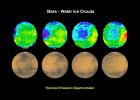
Thermal Emission Spectrometer
1400x1000x3
PIA01019:
Mars - Water Ice Clouds
Full Resolution:
TIFF
(1.695 MB)
JPEG
(147.2 kB)
1997-11-10
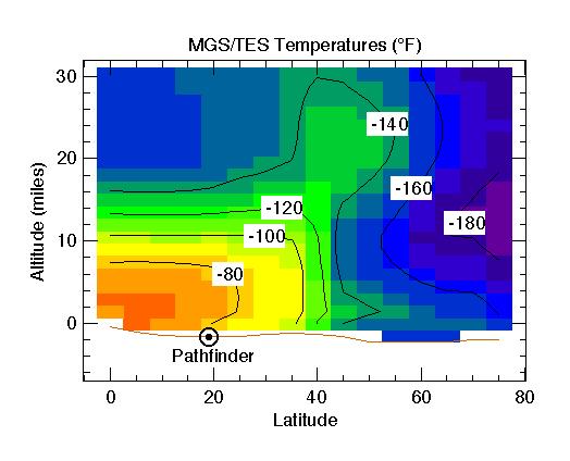
Mars
Mars Global Surveyor (MGS)
Thermal Emission Spectrometer
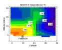
524x424x3
PIA01020:
MGS/TES Temperatures
Full Resolution:
TIFF
(17.04 kB)
JPEG
(32.43 kB)
1997-11-10
Mars
Mars Global Surveyor (MGS)
Mars Orbiter Camera (MOC)
2880x2880x1
PIA01021:
Western Tithonium Chasma/Ius Chasma, Valles Marineris
Full Resolution:
TIFF
(5.33 MB)
JPEG
(771.9 kB)
1997-11-10
Mars
Mars Global Surveyor (MGS)
Mars Orbiter Camera (MOC)
1024x1728x1
PIA01022:
Western Tithonium Chasma/Ius Chasma, Valles Marineris - High Resolution Image
Full Resolution:
TIFF
(1.698 MB)
JPEG
(268.3 kB)
1997-11-10
Mars
Mars Global Surveyor (MGS)
Mars Orbiter Camera (MOC)
1706x1280x1
PIA01023:
Western Tithonium Chasma/Ius Chasma, Valles Marineris - High Resolution Image
Full Resolution:
TIFF
(1.89 MB)
JPEG
(259.4 kB)
1997-11-10
Mars
Mars Global Surveyor (MGS)
Mars Orbiter Camera (MOC)
2023x996x1
PIA01024:
Valley and Surrounding Terrain Adjacent to Schiaparelli Crater
Full Resolution:
TIFF
(1.266 MB)
JPEG
(185.7 kB)
1997-11-10
Mars
Mars Global Surveyor (MGS)
Mars Orbiter Camera (MOC)
1024x2688x1
PIA01025:
Valley and Surrounding Terrain Adjacent to Schiaparelli Crater - High Resolution Image
Full Resolution:
TIFF
(1.424 MB)
JPEG
(197 kB)
1997-11-10
Mars
Mars Global Surveyor (MGS)
Mars Orbiter Camera (MOC)
2048x2048x1
PIA01026:
Valley and Surrounding Terrain Adjacent to Schiaparelli Crater - High Resolution Image
Full Resolution:
TIFF
(2.249 MB)
JPEG
(297.8 kB)
1997-11-10
Mars
Mars Global Surveyor (MGS)
Mars Orbiter Camera (MOC)
1640x900x1
PIA01027:
Complex Floor Deposits Within Western Ganges Chasma, Valles Marineris
Full Resolution:
TIFF
(1.183 MB)
JPEG
(230.3 kB)
1997-11-10
Mars
Mars Global Surveyor (MGS)
Mars Orbiter Camera (MOC)
512x1280x1
PIA01028:
Complex Floor Deposits Within Western Ganges Chasma, Valles Marineris - High Resolution Image
Full Resolution:
TIFF
(635.6 kB)
JPEG
(139 kB)
1997-11-10
Mars
Mars Global Surveyor (MGS)
Mars Orbiter Camera (MOC)
512x1280x1
PIA01029:
Complex Floor Deposits Within Western Ganges Chasma, Valles Marineris - High Resolution Image
Full Resolution:
TIFF
(738.5 kB)
JPEG
(174.5 kB)
1997-11-10
Mars
Mars Global Surveyor (MGS)
Mars Orbiter Camera (MOC)
1280x960x1
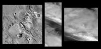
PIA01030:
Mars Orbiter Camera High Resolution Images: Some Results From The First 6 Weeks In Orbit
Full Resolution:
TIFF
(1.248 MB)
JPEG
(298.2 kB)
2000-06-22
Mars
Mars Global Surveyor (MGS)
Mars Orbiter Camera (MOC)
892x668x3
PIA01031:
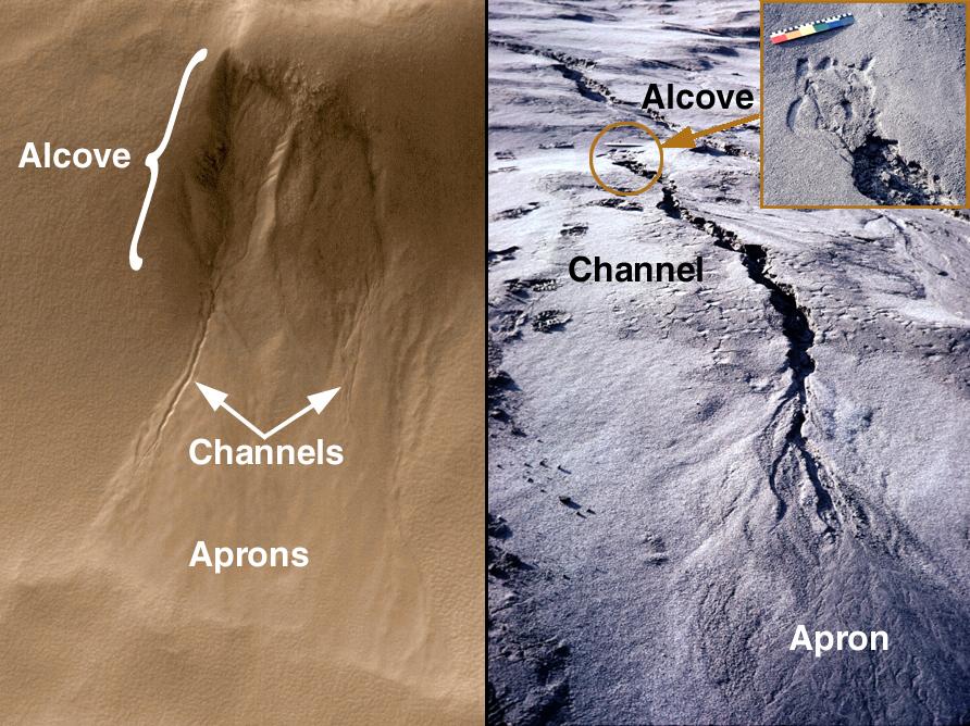
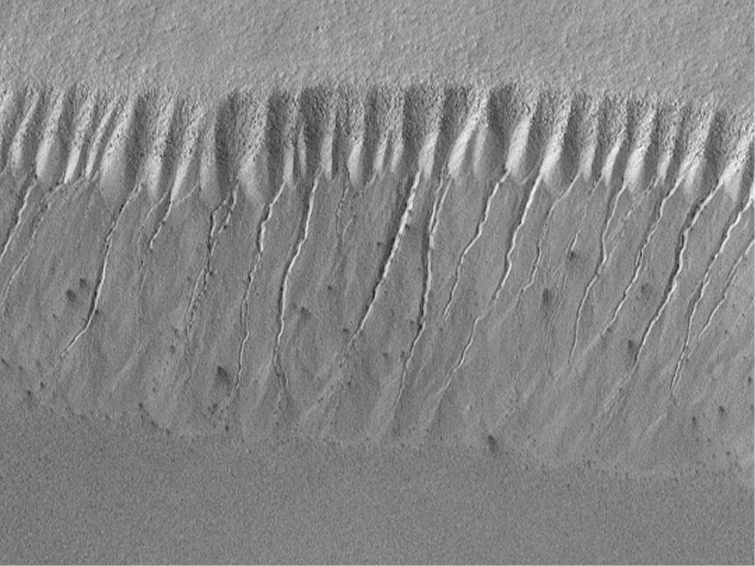
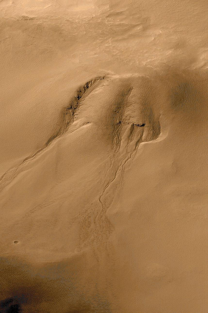
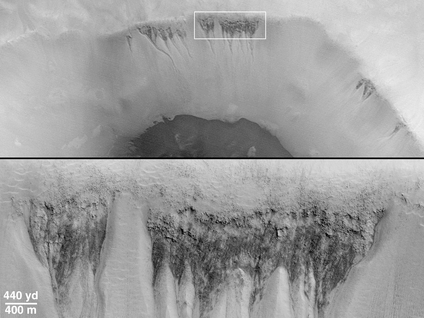
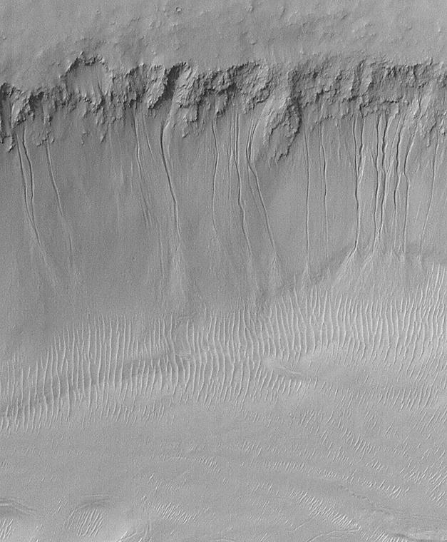
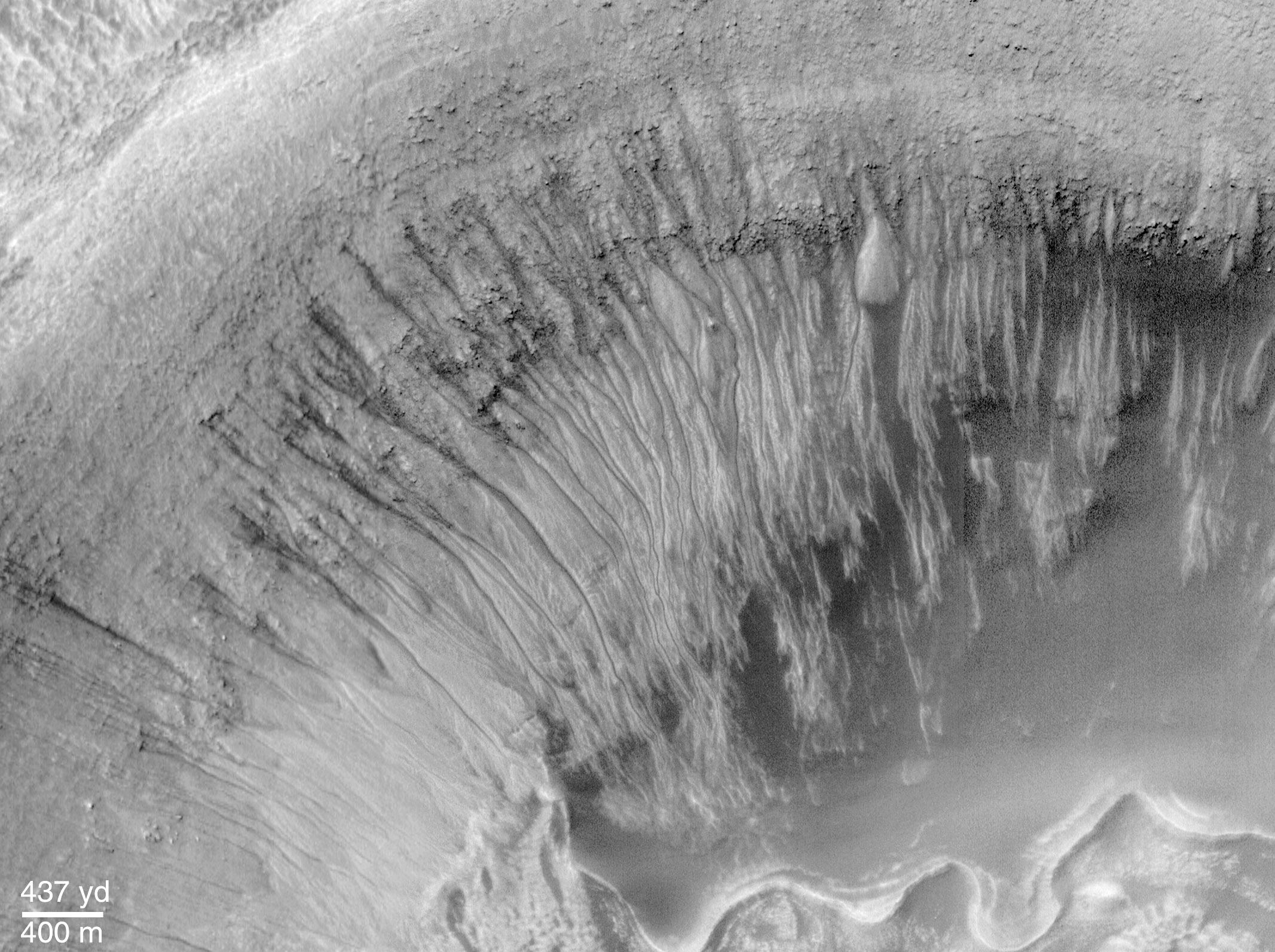
Evidence for Recent Liquid Water on Mars: Basic Features of Martian Gullies
Full Resolution:
TIFF
(1.896 MB)
JPEG
(136.2 kB)
2000-06-22
Mars
Mars Global Surveyor (MGS)
Mars Orbiter Camera (MOC)
712x534x1
PIA01032:
Evidence for Recent Liquid Water on Mars:"Weeping" Layer in Gorgonum Chaos
Full Resolution:
TIFF
(301.9 kB)
JPEG
(51.97 kB)
2000-06-22
Mars
Mars Global Surveyor (MGS)
Mars Orbiter Camera (MOC)
1424x1233x3
PIA01033:
Evidence for Recent Liquid Water on Mars: Gullies in Gorgonum Chaos
Full Resolution:
TIFF
(3.675 MB)
JPEG
(186.3 kB)
2000-06-22
Mars
Mars Global Surveyor (MGS)
Mars Orbiter Camera (MOC)
1080x810x1
PIA01034:
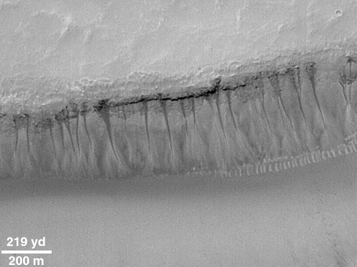
Evidence for Recent Liquid Water on Mars: Gullies at 70�S in Polar Pit Walls
Full Resolution:
TIFF
(765.9 kB)
JPEG
(134.8 kB)
2000-06-22
Mars
Mars Global Surveyor (MGS)
Mars Orbiter Camera (MOC)
857x1285x3
PIA01035:
Evidence for Recent Liquid Water on Mars: Gullies in Crater Wall, Noachis Terra
Full Resolution:
TIFF
(2.867 MB)
JPEG
(152.3 kB)
2000-06-22
Mars
Mars Global Surveyor (MGS)
Mars Orbiter Camera (MOC)
1613x1210x1
PIA01036:
Evidence for Recent Liquid Water on Mars: Seepage Sites in "Aerobraking Crater" Revisited
Full Resolution:
TIFF
(1.626 MB)
JPEG
(301.9 kB)
2000-06-22
Mars
Mars Global Surveyor (MGS)
Mars Orbiter Camera (MOC)
627x760x1
PIA01037:
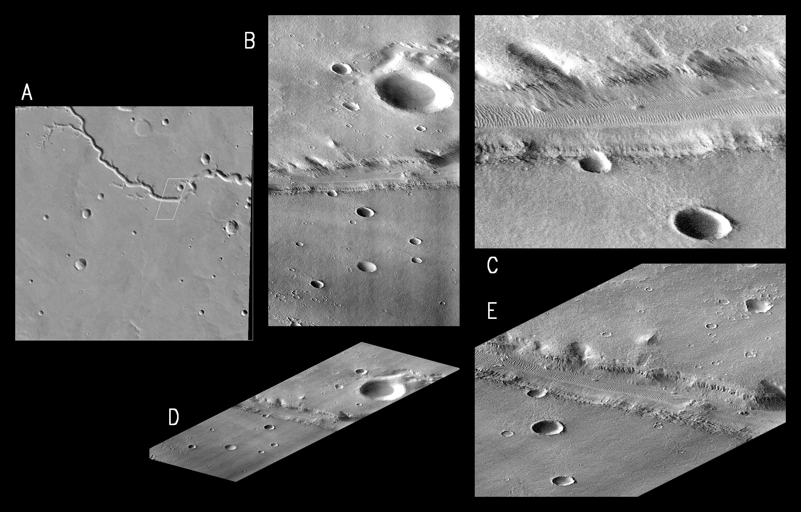
Evidence for Recent Liquid Water on Mars: South-facing Walls of Nirgal Vallis
Full Resolution:
TIFF
(404.8 kB)
JPEG
(84.61 kB)
2000-06-22
Mars
Mars Global Surveyor (MGS)
Mars Orbiter Camera (MOC)
2382x1788x1
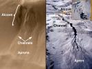
PIA01038:
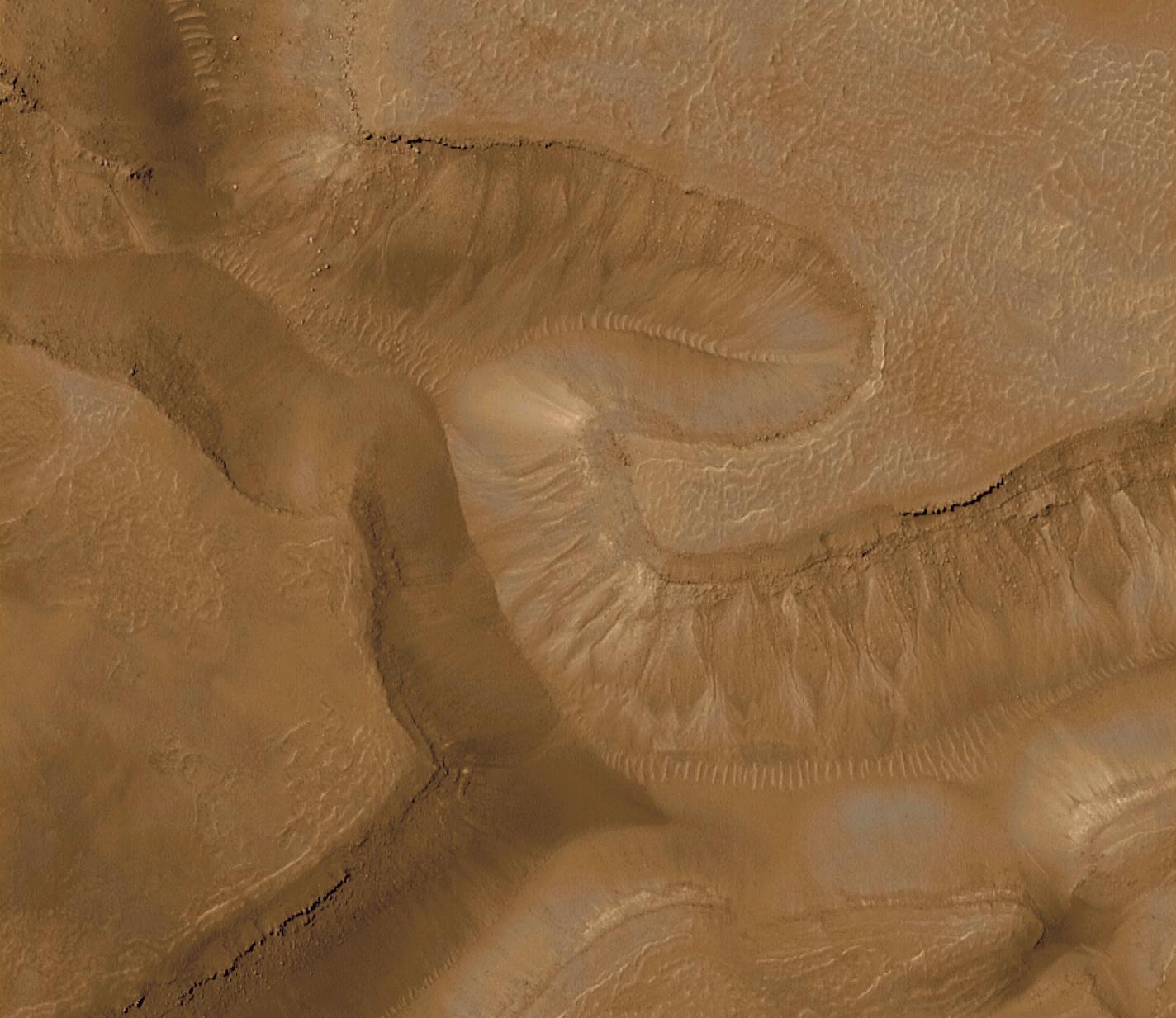
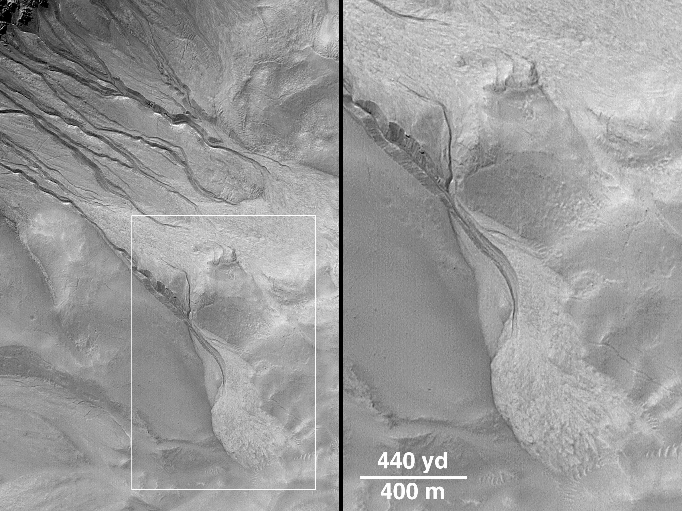
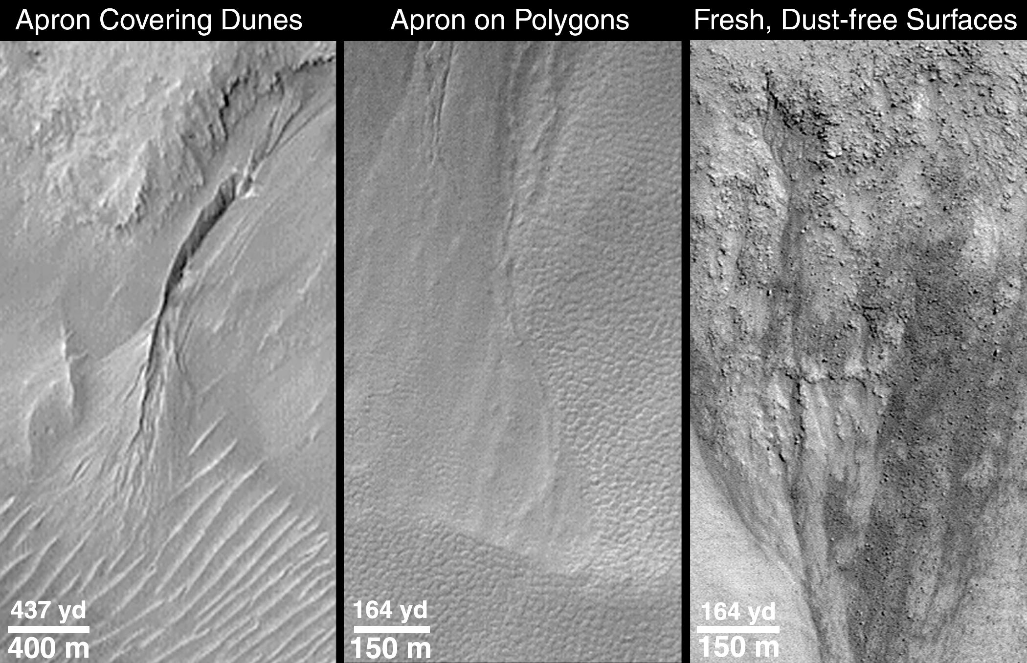
Evidence for Recent Liquid Water on Mars: Channels and Aprons in East Gorgonum Crater
Full Resolution:
TIFF
(3.538 MB)
JPEG
(610 kB)
2000-06-22
Mars
Mars Global Surveyor (MGS)
Mars Orbiter Camera (MOC)
2133x1593x1
PIA01039:
Evidence for Recent Liquid Water on Mars: Channeled Aprons in a Small Crater within Newton Crater
Full Resolution:
TIFF
(3.16 MB)
JPEG
(523.8 kB)
2000-06-22
Mars
Mars Global Surveyor (MGS)
Mars Orbiter Camera (MOC)
2609x2346x3
PIA01040:
Evidence for Recent Liquid Water on Mars: Gullies in Sirenum Fossae Trough
Full Resolution:
TIFF
(11.75 MB)
JPEG
(702.4 kB)
2000-06-22
Mars
Mars Global Surveyor (MGS)
Mars Orbiter Camera (MOC)
2100x1357x1
PIA01041:
Evidence for Recent Liquid Water on Mars: Clues Regarding the Relative Youth of Martian Gullies
Full Resolution:
TIFF
(2.211 MB)
JPEG
(379.4 kB)
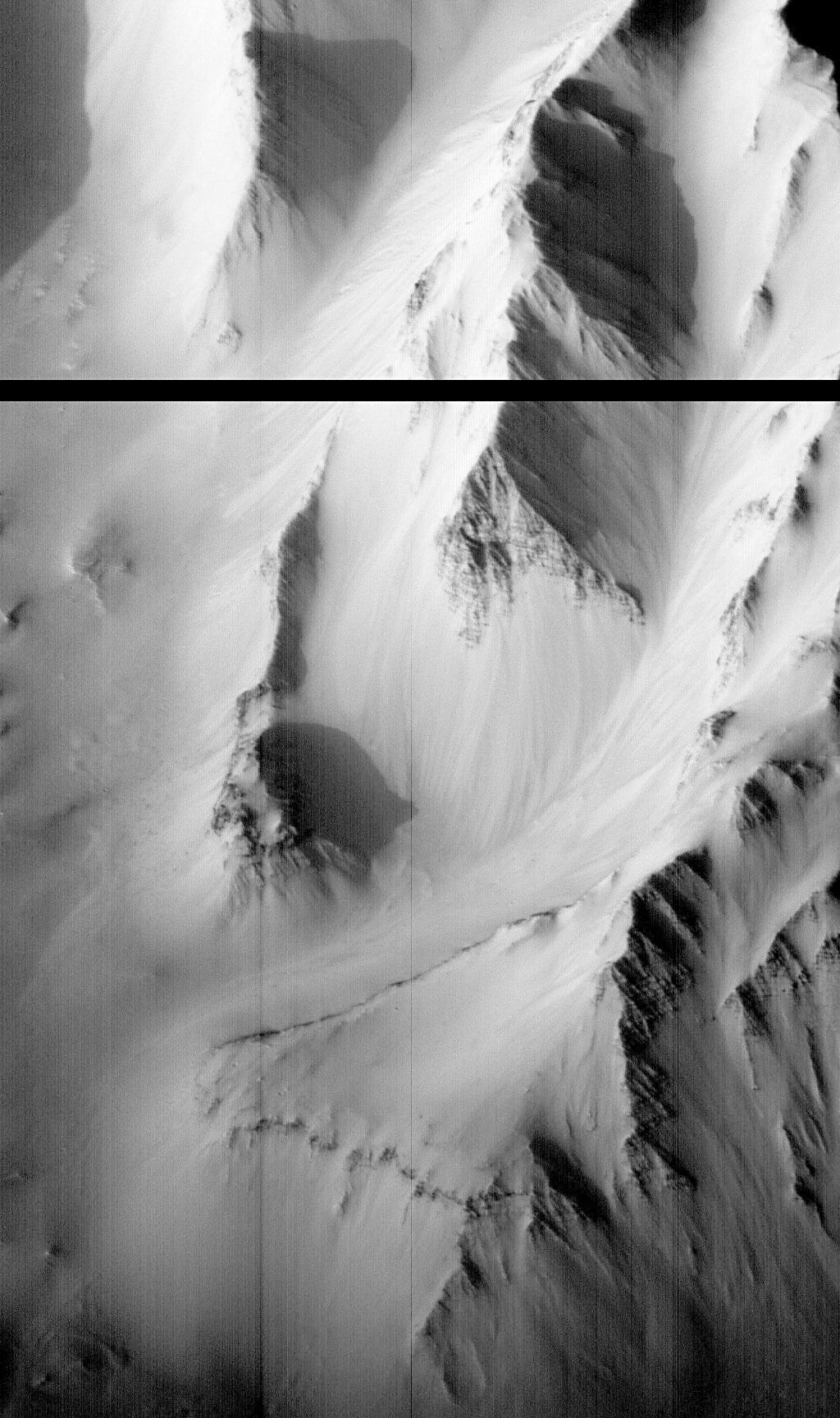
2000-06-22
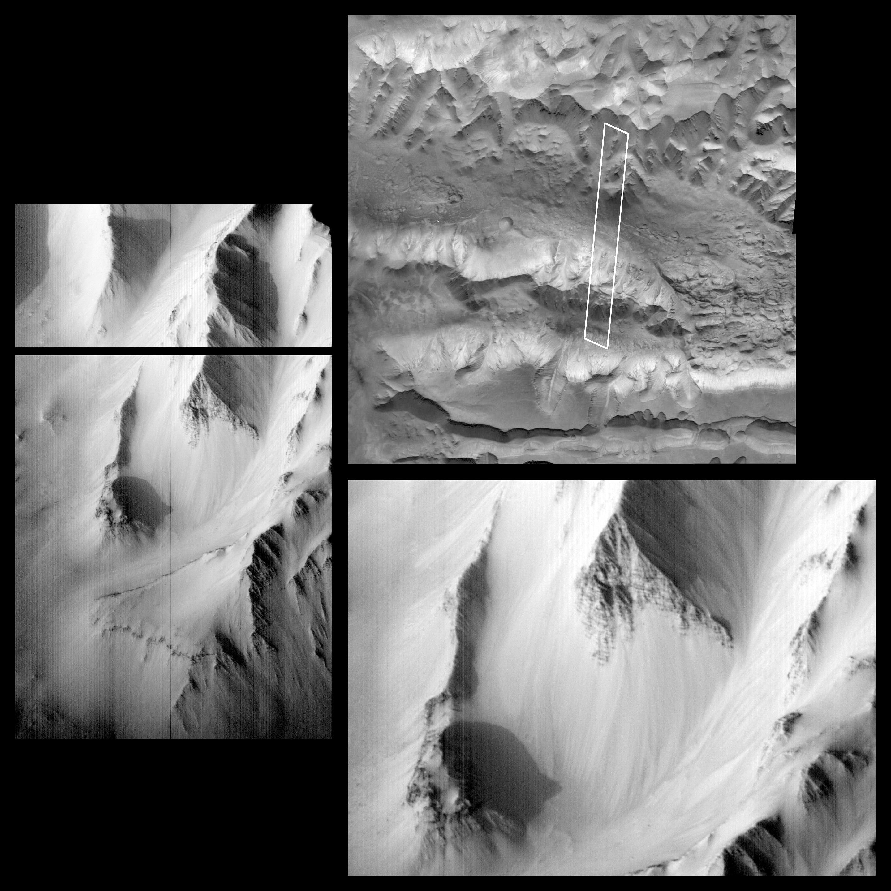
Mars
Mars Global Surveyor (MGS)
Mars Orbiter Camera (MOC)
858x643x1
PIA01042:
Evidence for Recent Liquid Water on Mars: "Dry" Processes on One Slope; "Wet" Processes on Another
Full Resolution:
TIFF
(528.3 kB)
JPEG
(87.08 kB)
2000-08-02
Mars
Mars Global Surveyor (MGS)
Mars Orbiter Camera (MOC)
512x1279x1
PIA01043:
MGS MOC Returns to Service Following Solar Conjunction Hiatus
Full Resolution:
TIFF
(620.3 kB)
JPEG
(148.4 kB)
2000-08-02
Mars
Mars Global Surveyor (MGS)
Mars Orbiter Camera (MOC)
512x1279x1
PIA01044:
MGS MOC Returns to Service Following Solar Conjunction Hiatus
Full Resolution:
TIFF
(462.1 kB)
JPEG
(78.99 kB)
2000-08-02
Mars
Mars Global Surveyor (MGS)
Mars Orbiter Camera (MOC)
768x2556x1
PIA01045:
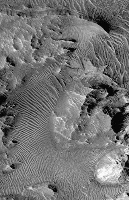
Frosted North Polar Sand Dunes in Early Spring
Full Resolution:
TIFF
(1.581 MB)
JPEG
(238.6 kB)
2000-08-02
Mars
Mars Global Surveyor (MGS)
Mars Orbiter Camera (MOC)
768x1536x1
PIA01046:
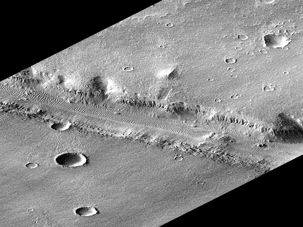
Sirenum Fossae Trough
Full Resolution:
TIFF
(1.072 MB)
JPEG
(130.6 kB)
2000-09-08
Mars
Mars Global Surveyor (MGS)
MOLA
757x995x3
PIA01049:
Regional Topographic Views of Mars from MOLA
Full Resolution:
TIFF
(1.717 MB)
JPEG
(157.5 kB)
1998-02-12
Mars
Mars Global Surveyor (MGS)
Mars Orbiter Camera (MOC)
1536x2304x1
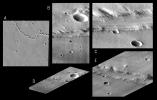
PIA01155:
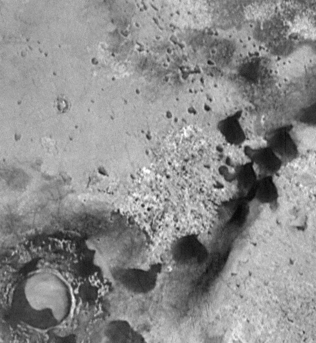
Flow Ejecta and Slope Landslides in Small Crater
Full Resolution:
TIFF
(561.2 kB)
JPEG
(117.8 kB)
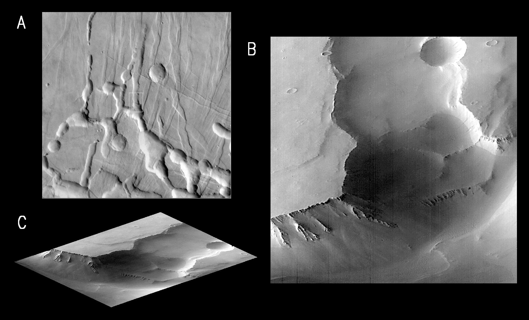
1998-02-12
Mars
Mars Global Surveyor (MGS)
Mars Orbiter Camera (MOC)
295x4988x1
PIA01156:
Flow Ejecta and Slope Landslides in Small Crater - High Resolution Image
Full Resolution:
TIFF
(1.57 MB)
JPEG
(390 kB)
1998-02-12
Mars
Mars Global Surveyor (MGS)
Mars Orbiter Camera (MOC)
2048x2304x1
PIA01157:
Schiaparelli Crater Rim and Interior Deposits
Full Resolution:
TIFF
(1.754 MB)
JPEG
(278 kB)
1998-02-12
Mars
Mars Global Surveyor (MGS)
Mars Orbiter Camera (MOC)
1024x2688x1
PIA01158:
Schiaparelli Crater Rim and Interior Deposits - High Resolution Image
Full Resolution:
TIFF
(1.78 MB)
JPEG
(277.8 kB)
1998-02-12
Mars
Mars Global Surveyor (MGS)
Mars Orbiter Camera (MOC)
1536x2304x1
PIA01159:
Medusae Fossae Formation
Full Resolution:
TIFF
(1.031 MB)
JPEG
(242 kB)
1998-02-12
Mars
Mars Global Surveyor (MGS)
Mars Orbiter Camera (MOC)
1024x6144x1
PIA01160:
Medusae Fossae Formation - High Resolution Image
Full Resolution:
TIFF
(5.934 MB)
JPEG
(1.246 MB)
1998-02-12
Mars
Mars Global Surveyor (MGS)
Mars Orbiter Camera (MOC)
1536x2304x1
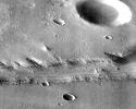
PIA01161:
Flow-ejecta Crater in Icaria Planum
Full Resolution:
TIFF
(949.5 kB)
JPEG
(177.6 kB)
1998-02-12
Mars
Mars Global Surveyor (MGS)
Mars Orbiter Camera (MOC)
1024x6378x1
PIA01162:
Flow-ejecta Crater in Icaria Planum - High Resolution Image
Full Resolution:
TIFF
(6.383 MB)
JPEG
(1.424 MB)
1998-02-12
Mars
Mars Global Surveyor (MGS)
Mars Orbiter Camera (MOC)
1100x1100x3
PIA01163:
A Regional View of Mars on Orbit 63
Full Resolution:
TIFF
(1.748 MB)
JPEG
(66.47 kB)
1-100
101-200
201-300
301-400
401-500
501-600
601-700
701-800
801-900
901-1000
Currently displaying images:
1 - 100
of 1894


