Your search criteria found
1894
images
Mission
Go to PIAxxxxx:
Refine this list of images by:
Target:
Earth
Jupiter
Mars
Phobos
Spacecraft:
Mars Global Surveyor Orbiter
Mars Pathfinder Lander
Opportunity
Phoenix Mars Lander
Spirit
Instrument:
Magnetometer
Mars Horizon Sensor Assembly
Mars Orbiter Camera (MOC)
Mars Orbiter Laser Altimeter
Microscopic Imager
Miniature Thermal Emission Spectrometer
Navigation Camera
Panoramic Camera
Radar System
Radio Science Subsystem
Thermal Emission Spectrometer
Click on an image for detailed information
Click on a column heading to sort in ascending or descending order
My
List
Addition Date
Target
Mission
Instrument
Size
1997-09-24
Mars
Mars Global Surveyor (MGS)
Thermal Emission Spectrometer
554x553x3
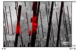
PIA00937:
MGS Thermal Emission Spectrometer Image
Full Resolution:
TIFF
(90.26 kB)
JPEG
(80.87 kB)
1997-11-10
Mars
Mars Global Surveyor (MGS)
Thermal Emission Spectrometer
1409x1091x3
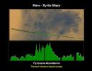
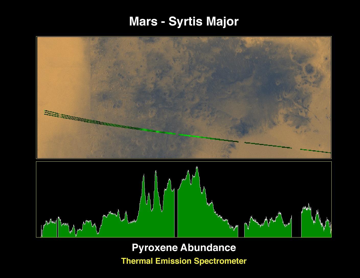
PIA01017:
Pyroxene at Syrtis Major
Full Resolution:
TIFF
(1.821 MB)
JPEG
(127.5 kB)
1997-11-10
Mars
Mars Global Surveyor (MGS)
Thermal Emission Spectrometer
1872x1224x3
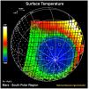
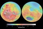
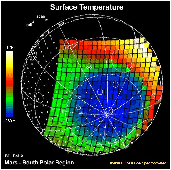
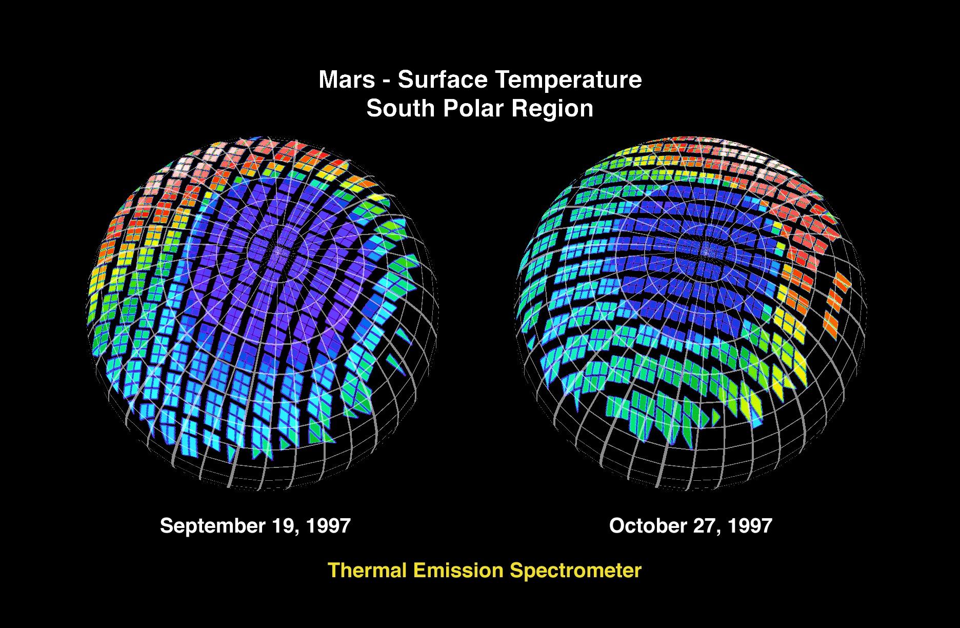
PIA01018:
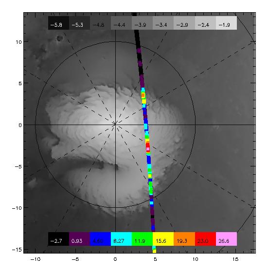
Mars - Surface Temperature South Polar Region
Full Resolution:
TIFF
(2.253 MB)
JPEG
(360.5 kB)
1997-11-10
Mars
Mars Global Surveyor (MGS)
Thermal Emission Spectrometer
1400x1000x3
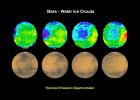
PIA01019:
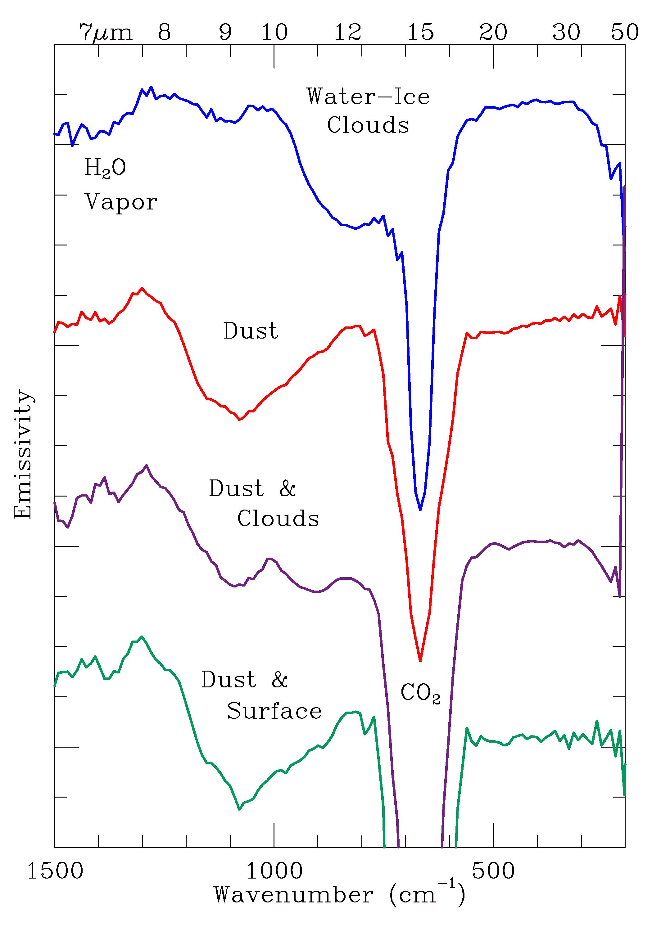
Mars - Water Ice Clouds
Full Resolution:
TIFF
(1.695 MB)
JPEG
(147.2 kB)
1997-11-10
Mars
Mars Global Surveyor (MGS)
Thermal Emission Spectrometer
524x424x3
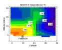
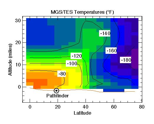
PIA01020:
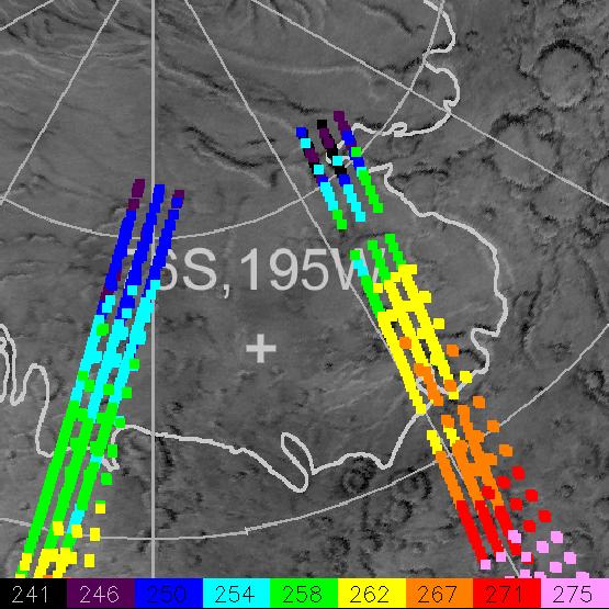
MGS/TES Temperatures
Full Resolution:
TIFF
(17.04 kB)
JPEG
(32.43 kB)
1999-01-07
Mars
Mars Global Surveyor (MGS)
Thermal Emission Spectrometer
2967x2382x3
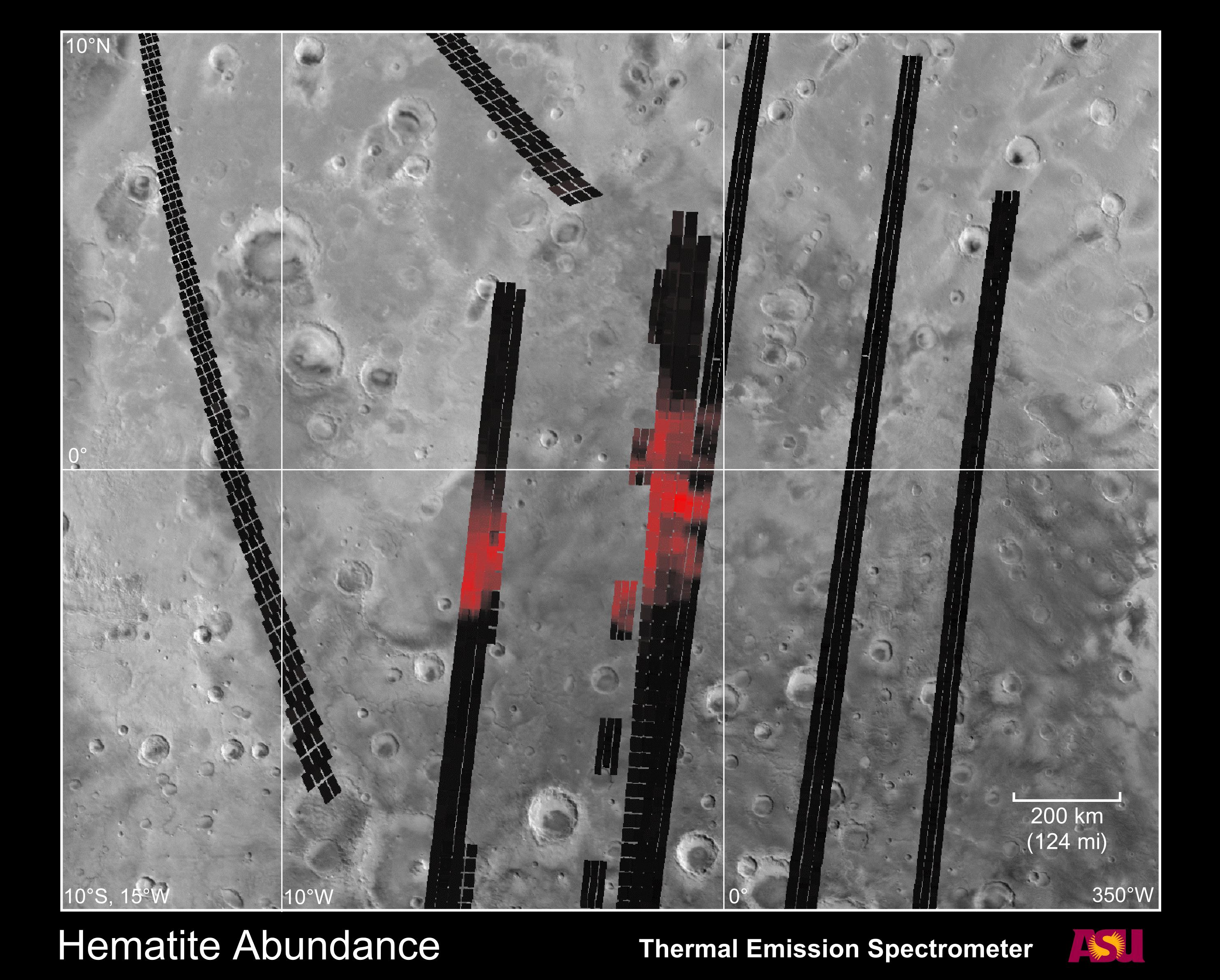
PIA01339:
Hematite Abundance on Martian Surface
Full Resolution:
TIFF
(2.506 MB)
JPEG
(846.8 kB)
1999-01-07
Mars
Mars Global Surveyor (MGS)
Thermal Emission Spectrometer
2183x3033x3
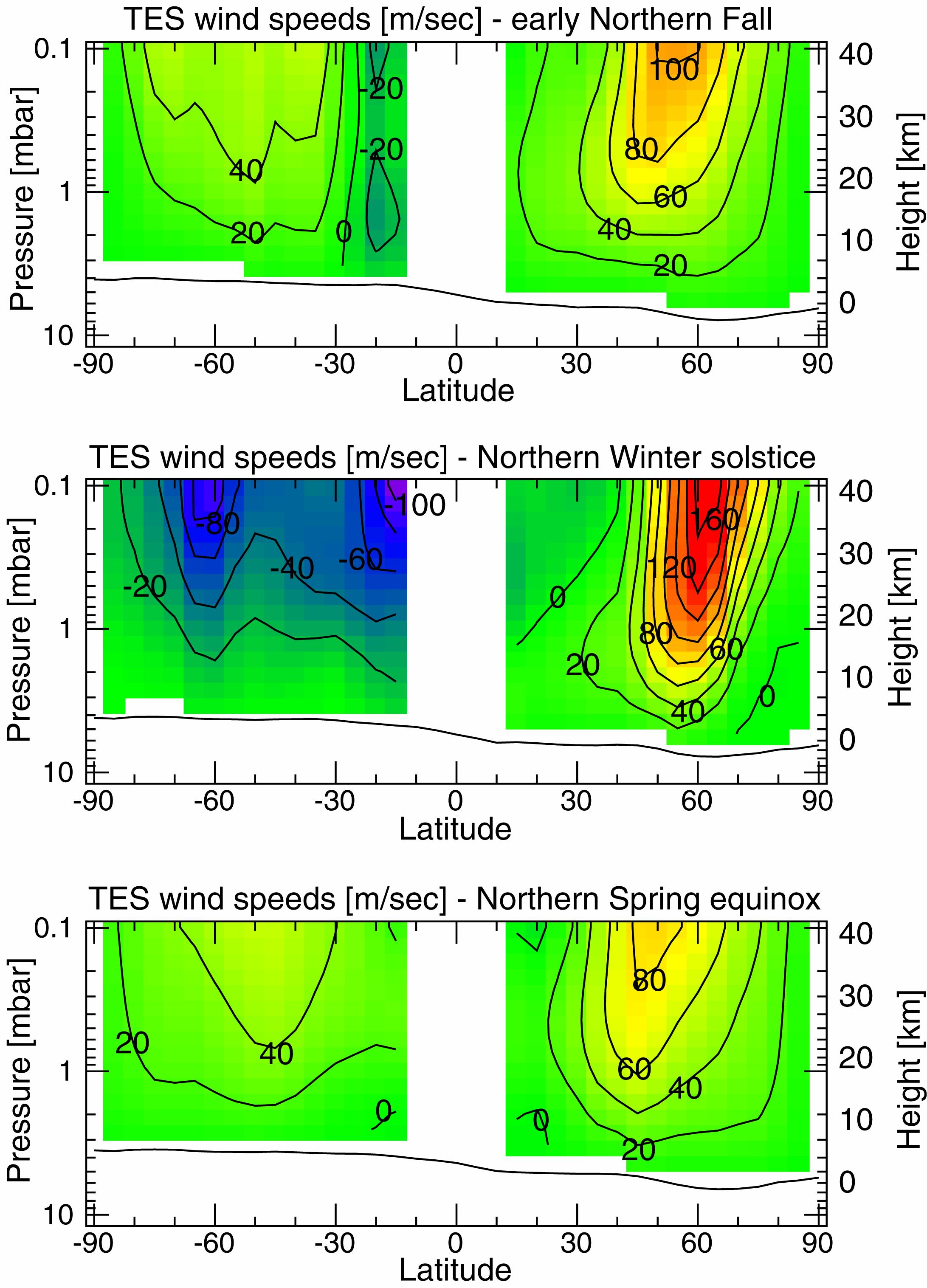
PIA01340:
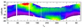
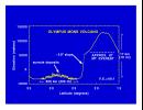
Measurements of the Martian Winds for Three Seasons
Full Resolution:
TIFF
(1.057 MB)
JPEG
(602.2 kB)
1999-05-06
Mars
Mars Global Surveyor (MGS)
Thermal Emission Spectrometer
2362x1667x3
PIA02014:
Temperature of the Martian Surface
Full Resolution:
TIFF
(1.195 MB)
JPEG
(434.8 kB)
1999-05-06
Mars
Mars Global Surveyor (MGS)
Thermal Emission Spectrometer
300x300x3
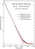
PIA02015:
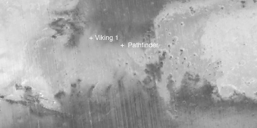
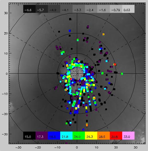
Martian Temperatures Measured by the Thermal Emission Spectrometer (TES). Pathfinder Landing Aite View
Full Resolution:
TIFF
(32.88 kB)
JPEG
(23.63 kB)
1999-05-06
Mars
Mars Global Surveyor (MGS)
Thermal Emission Spectrometer
300x300x3
PIA02016:
Martian Temperatures Measured by the Thermal Emission Spectrometer (TES). Isidis Planitia View
Full Resolution:
TIFF
(30.37 kB)
JPEG
(23.21 kB)
1999-06-23
Mars
Mars Global Surveyor (MGS)
Thermal Emission Spectrometer
2700x1760x3
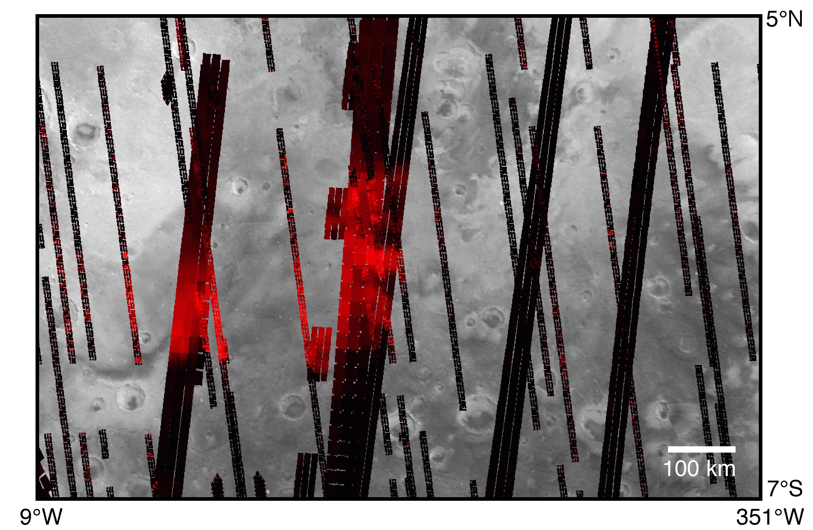
PIA02056:
Hematite Map (TES)
Full Resolution:
TIFF
(1.342 MB)
JPEG
(592.3 kB)
1999-06-23
Mars
Mars Global Surveyor (MGS)
Thermal Emission Spectrometer
1836x2376x3
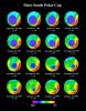
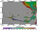
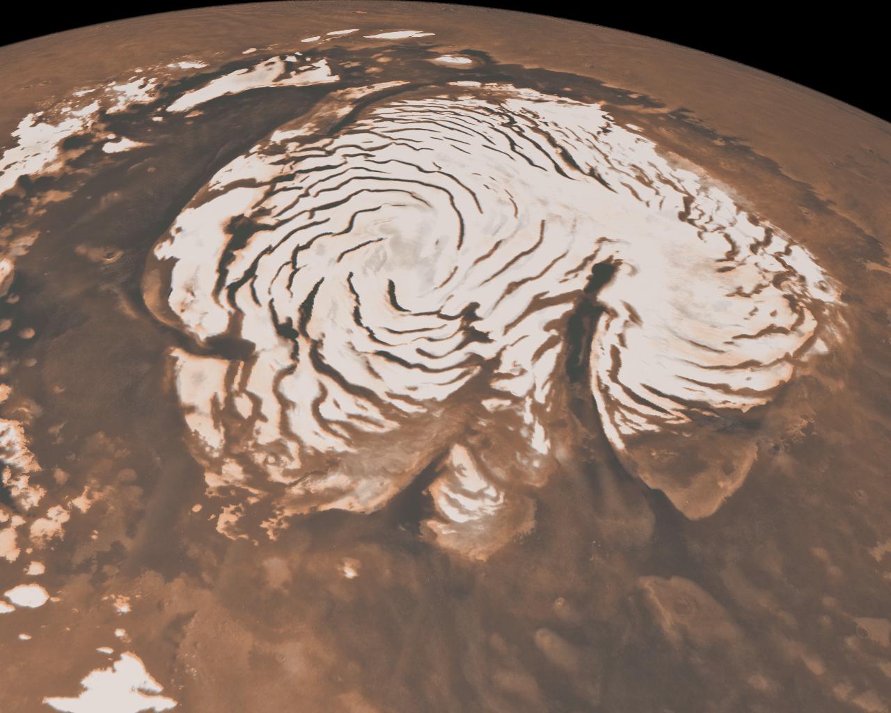
PIA02057:
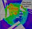
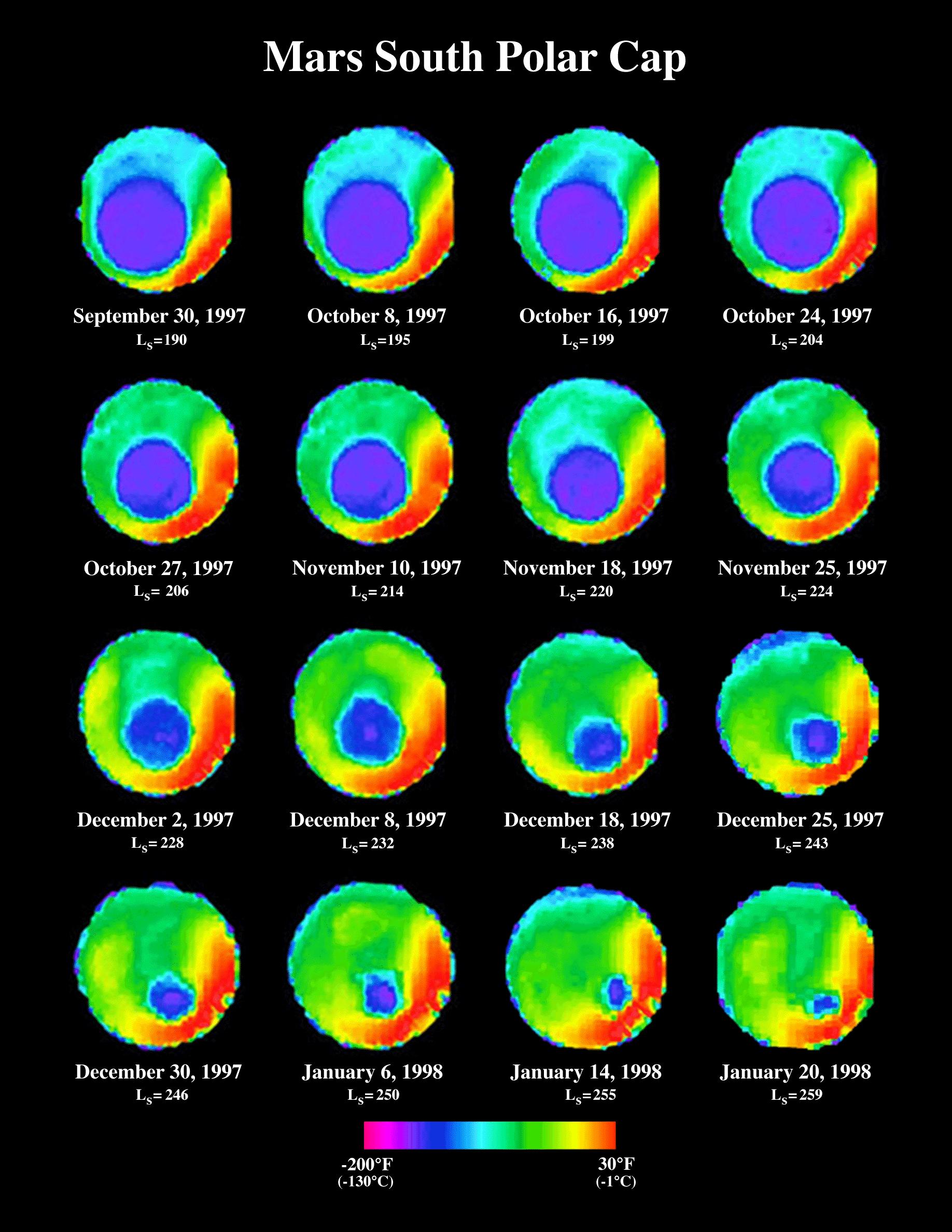
South Polar Cap Thermal Retreat (TES)
Full Resolution:
TIFF
(901.7 kB)
JPEG
(397.6 kB)
1999-06-23
Mars
Mars Global Surveyor (MGS)
Thermal Emission Spectrometer
1700x2200x3
PIA02061:
Growth of a Dust Storm (TES)
Full Resolution:
TIFF
(233.5 kB)
JPEG
(390.2 kB)
1999-06-23
Mars
Mars Global Surveyor (MGS)
Thermal Emission Spectrometer
2100x3000x3
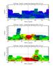
PIA02062:
Observed Spectral Classes (TES)
Full Resolution:
TIFF
(213.4 kB)
JPEG
(355.4 kB)
1999-08-17
Mars
Mars Global Surveyor (MGS)
Thermal Emission Spectrometer
551x561x3
PIA02307:
TES overlayed on MOLA DEM
Full Resolution:
TIFF
(119.9 kB)
JPEG
(34.92 kB)
1999-08-31
Mars
Mars Global Surveyor (MGS)
Thermal Emission Spectrometer
874x436x1
PIA02320:
New Views of Mars from the Thermal Emission Spectrometer Instrument
Full Resolution:
TIFF
(254.5 kB)
JPEG
(34.33 kB)
1999-09-18
Mars
Mars Global Surveyor (MGS)
Thermal Emission Spectrometer
555x555x3
PIA02327:
Mars Polar Lander Landing Site Noon-time Temperatures
Full Resolution:
TIFF
(210.4 kB)
JPEG
(69.04 kB)
1999-09-18
Mars
Mars Global Surveyor (MGS)
Thermal Emission Spectrometer
516x529x3
PIA02328:
Slab Ice and Snow Flurries in the Mars Northern Polar Night
Full Resolution:
TIFF
(102.1 kB)
JPEG
(46.41 kB)
1999-09-18
Mars
Mars Global Surveyor (MGS)
Thermal Emission Spectrometer
500x500x3
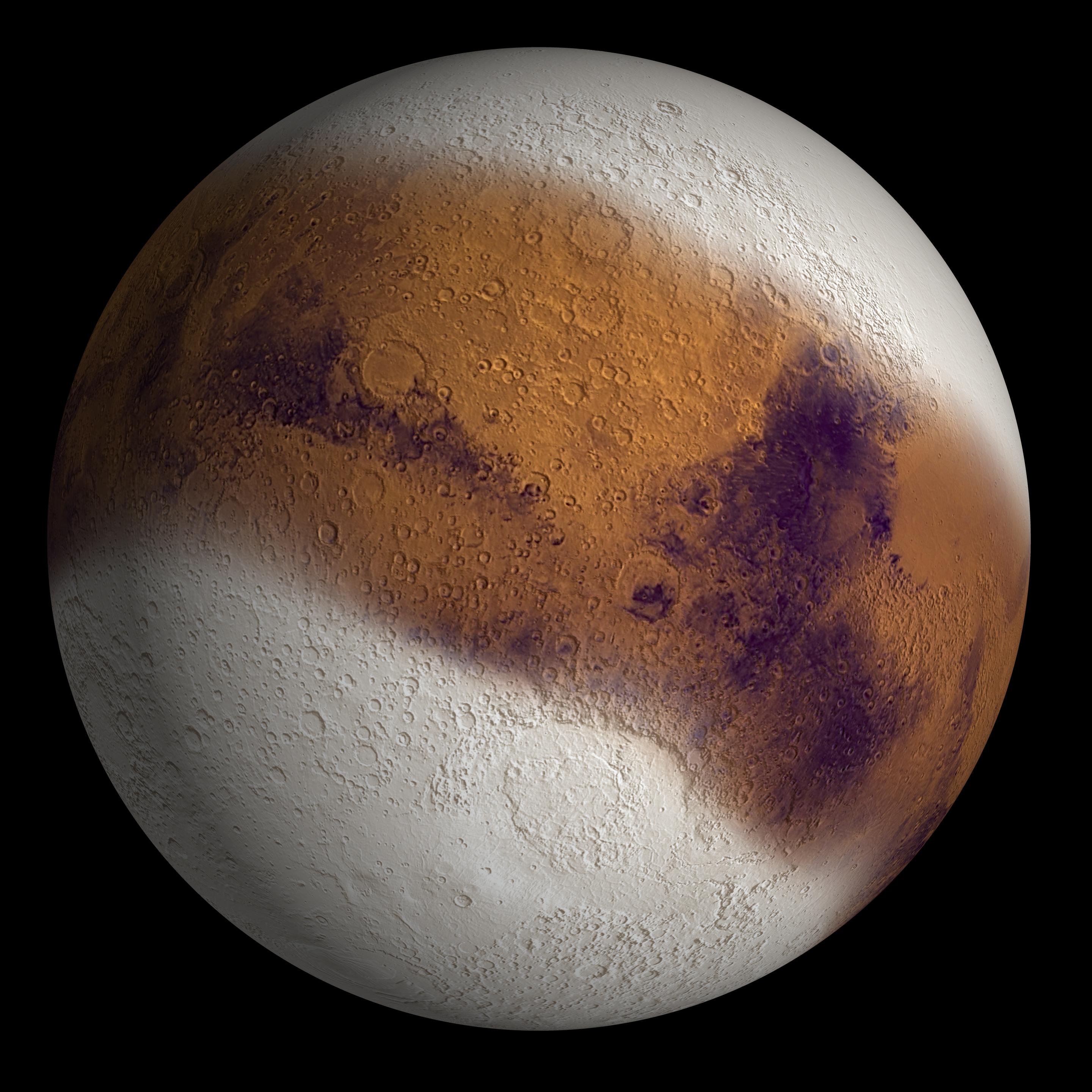
PIA02332:
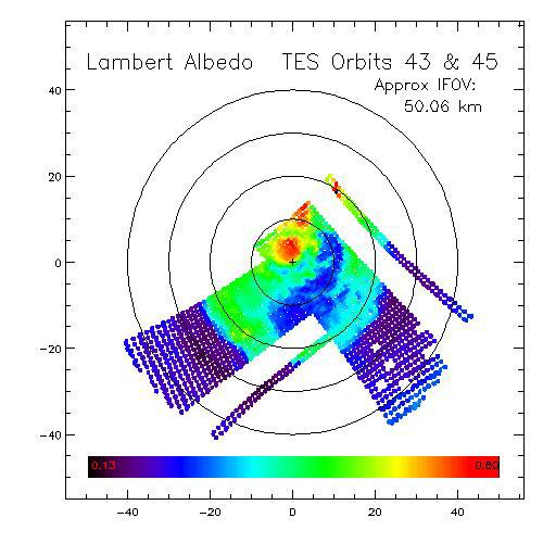
Dark Dry Ice on Southern Cap - Lambert Albedo Image
Full Resolution:
TIFF
(201.7 kB)
JPEG
(46.54 kB)
1999-09-18
Mars
Mars Global Surveyor (MGS)
Thermal Emission Spectrometer
500x500x3
PIA02333:
Dark Dry Ice on Southern Cap - Thermal Image
Full Resolution:
TIFF
(199.5 kB)
JPEG
(44.24 kB)
2001-01-17
Mars
Mars Global Surveyor (MGS)
Thermal Emission Spectrometer
4000x2769x3
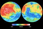
PIA02816:
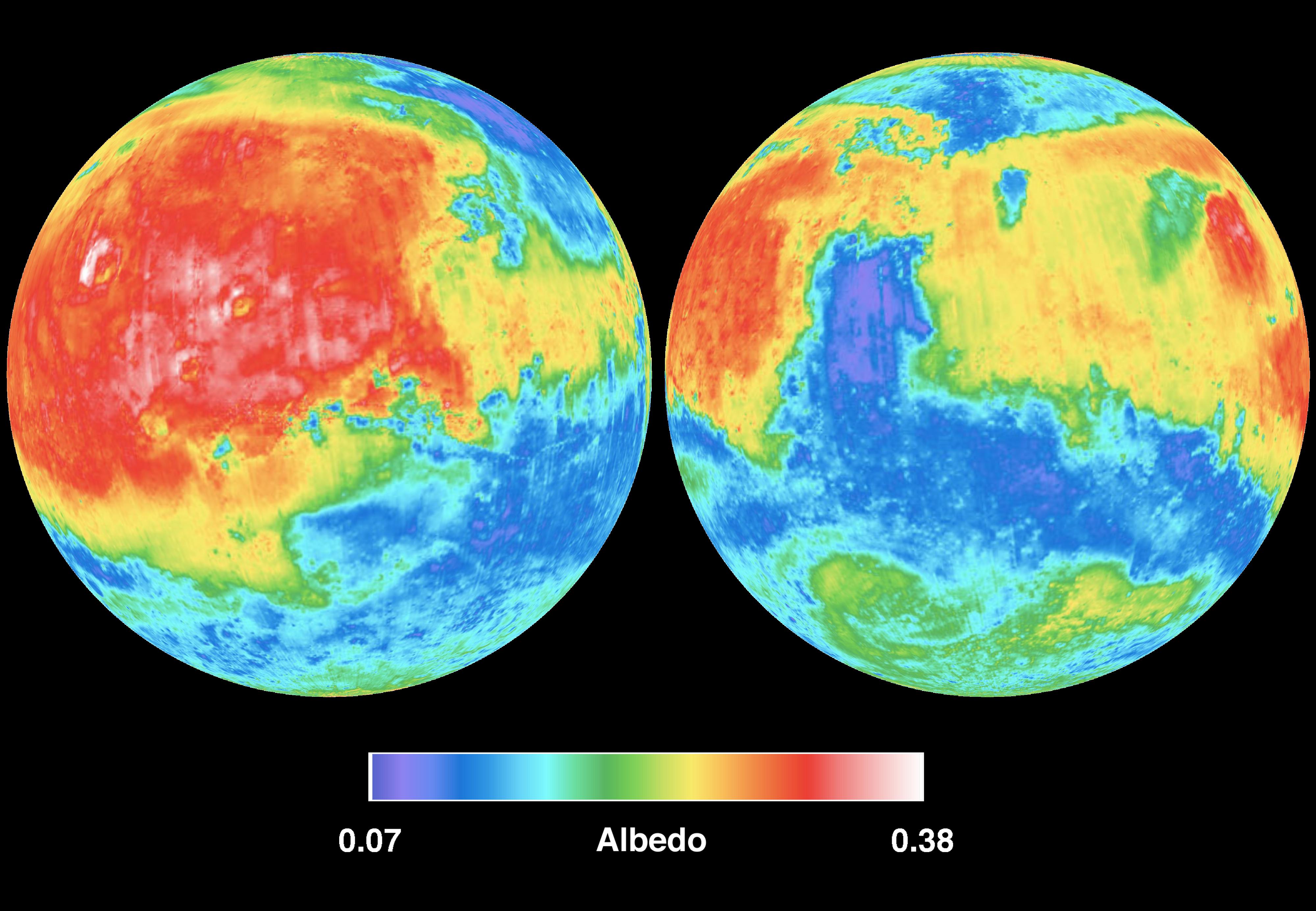
Mars Albedo
Full Resolution:
TIFF
(20.01 MB)
JPEG
(715.4 kB)
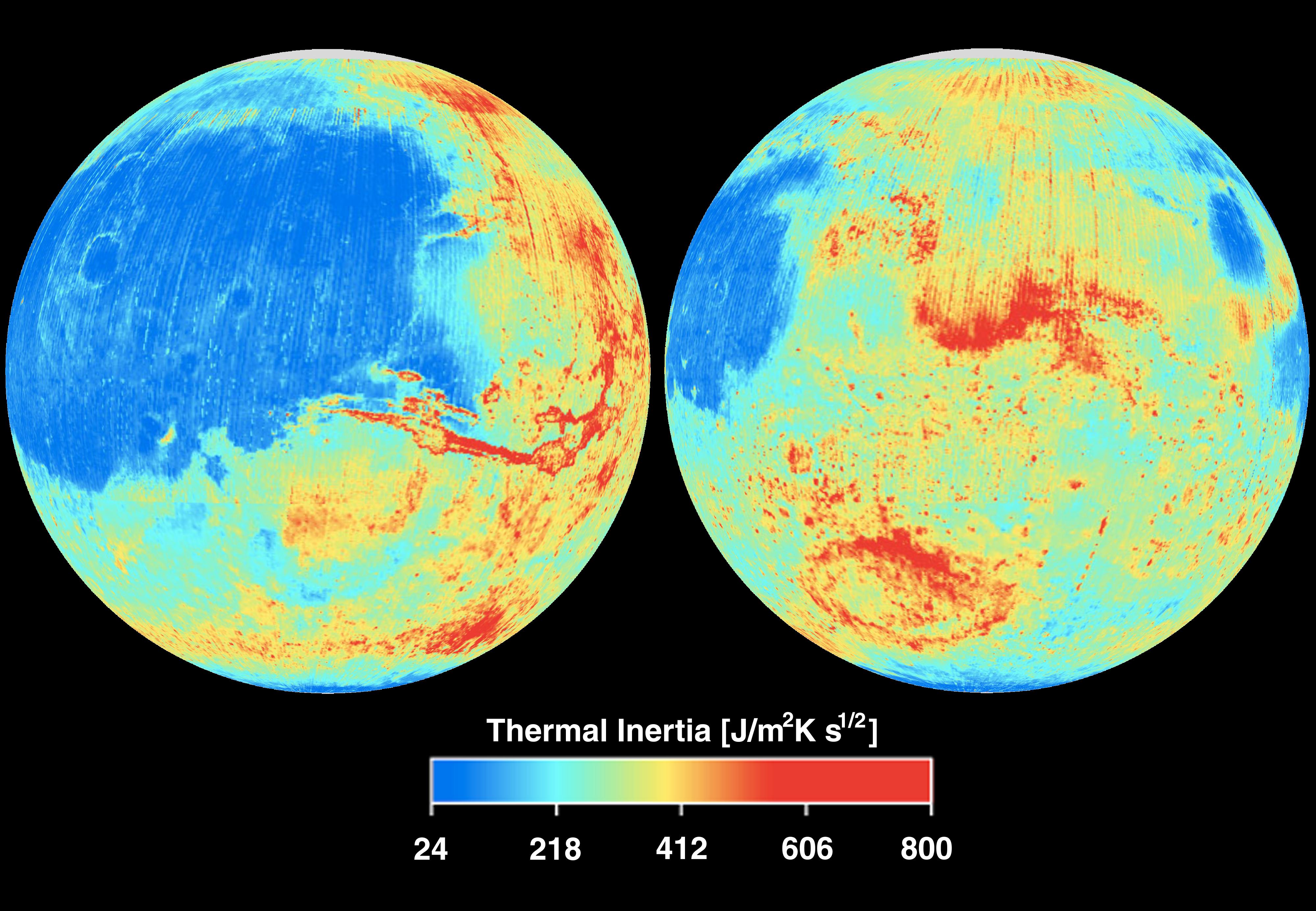
2001-01-17
Mars
Mars Global Surveyor (MGS)
Thermal Emission Spectrometer
4000x2769x3
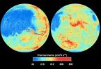
PIA02818:
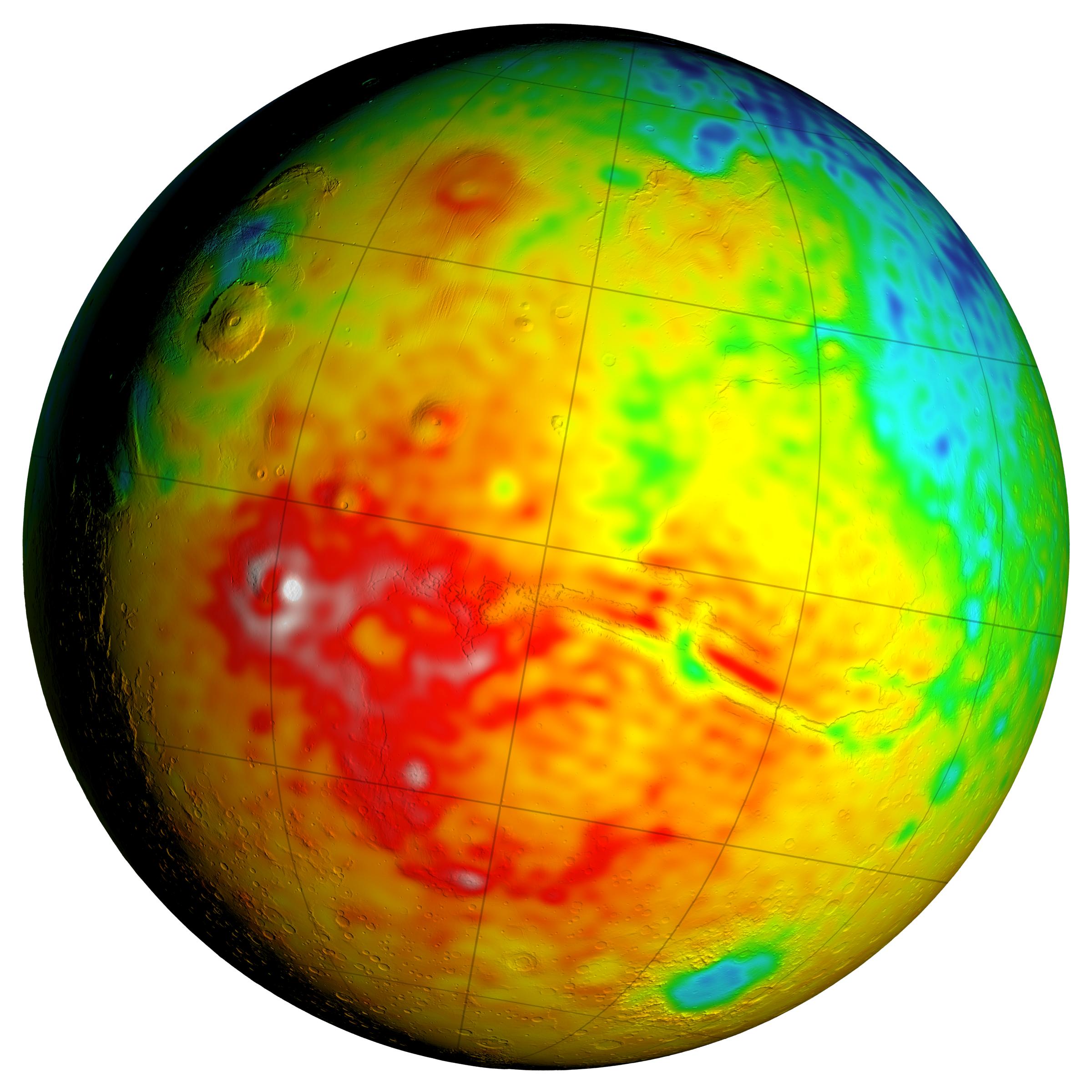
Mars Thermal Inertia
Full Resolution:
TIFF
(21.3 MB)
JPEG
(883.2 kB)
2004-01-07
Mars
Mars Global Surveyor (MGS)
Thermal Emission Spectrometer
3168x2448x3
PIA05010:
Dust in the Wind
Full Resolution:
TIFF
(70.56 kB)
JPEG
(243.3 kB)
2004-01-10
Mars
Mars Global Surveyor (MGS)
Thermal Emission Spectrometer
583x468x3
PIA05035:
Lessons from Spirit's Landing
Full Resolution:
TIFF
(70.86 kB)
JPEG
(41.5 kB)
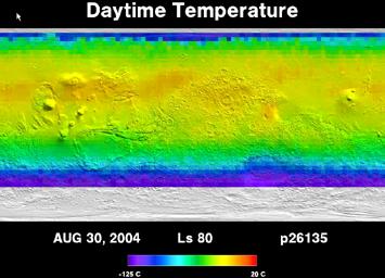
2004-12-13
Mars
Mars Global Surveyor (MGS)
Mars Exploration Rover (MER)
Thermal Emission Spectrometer
794x274x3
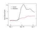
PIA07102:
Seasonal Trend in Water Vapor Seen from Orbit
Full Resolution:
TIFF
(262.8 kB)
JPEG
(35.92 kB)
2005-09-19
Mars
Mars Global Surveyor (MGS)
Thermal Emission Spectrometer
355x256x3
PIA04297:
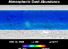
Three Years of Monitoring Mars' Atmospheric Dust (Animation)
Full Resolution:
TIFF
(273.2 kB)
JPEG
(16.88 kB)
2005-09-19
Mars
Mars Global Surveyor (MGS)
Thermal Emission Spectrometer
355x256x3
PIA04298:
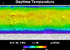
Five Years of Monitoring Mars' Daytime Surface Temperatures (Animation)
Full Resolution:
TIFF
(273.2 kB)
JPEG
(19.58 kB)
2004-01-23
Mars
2001 Mars Odyssey
Mars Global Surveyor (MGS)
Mars Exploration Rover (MER)
THEMIS
THEMIS
640x480x3
PIA05154:
Targeting a Hematite-rich Terrain
Full Resolution:
TIFF
(922.8 kB)
JPEG
(52.31 kB)
1999-06-23
Mars
Mars Global Surveyor (MGS)
Radio Science Subsystem
1700x2200x3
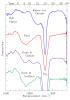
PIA02060:
Radio-Occultation Profiles (RS)
Full Resolution:
TIFF
(109.9 kB)
JPEG
(175.3 kB)
1999-06-23
Mars
Mars Global Surveyor (MGS)
Imaging Radar
2871x2520x3
PIA02054:
Mars Gravity Map (RS)
Full Resolution:
TIFF
(4.572 MB)
JPEG
(618.1 kB)
2006-06-28
Mars
Mars Global Surveyor (MGS)
Panoramic Camera
3868x2369x1
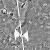
PIA08565:
Stretched View Showing 'Beagle Crater'
Full Resolution:
TIFF
(9.173 MB)
JPEG
(567 kB)
2006-06-28
Mars
Mars Global Surveyor (MGS)
Panoramic Camera
1021x1024x3
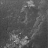
PIA08567:
Spirit Examines Light-Toned 'Halley' (False Color)
Full Resolution:
TIFF
(3.141 MB)
JPEG
(178.8 kB)
2004-10-20
Mars
Mars Global Surveyor (MGS)
Navigation Camera
4000x4000x1
PIA06955:
Full-Circle View from Near 'Tetl' (Vertical)
Full Resolution:
TIFF
(11.74 MB)
JPEG
(1.417 MB)
2004-03-13
Mars
Mars Global Surveyor (MGS)
Mars Exploration Rover (MER)
Miniature Thermal Emission Spectrometer
640x640x1
PIA05558:
Footprints from Above
Full Resolution:
TIFF
(299.9 kB)
JPEG
(90.98 kB)
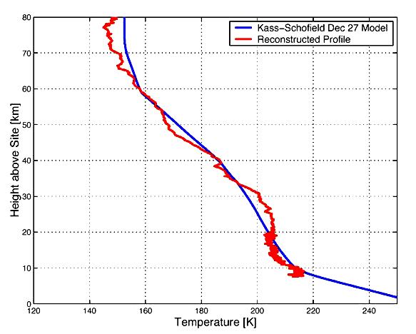
2004-03-13
Mars
Mars Global Surveyor (MGS)
Mars Exploration Rover (MER)
Miniature Thermal Emission Spectrometer
797x1126x3
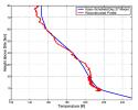
PIA05559:
A Full Profile on Mars Temperature
Full Resolution:
TIFF
(415.1 kB)
JPEG
(240.3 kB)
2006-06-28
Mars
Mars Global Surveyor (MGS)
Microscopic Imager
1024x1024x1
PIA08566:
Spirit Examines Light-Toned 'Halley' (Microscopic Image)
Full Resolution:
TIFF
(1.05 MB)
JPEG
(175.5 kB)
2011-03-08
Mars
2001 Mars Odyssey
Mars Global Surveyor (MGS)
MOLA
THEMIS
708x605x3
PIA13801:
Nature's Drilling Exposes Deeply Buried Minerals
Full Resolution:
TIFF
(1.287 MB)
JPEG
(85.93 kB)
2011-07-06
Mars
2001 Mars Odyssey
Mars Global Surveyor (MGS)
Mars Science Laboratory (MSL)
MOLA
THEMIS
1920x1080x3
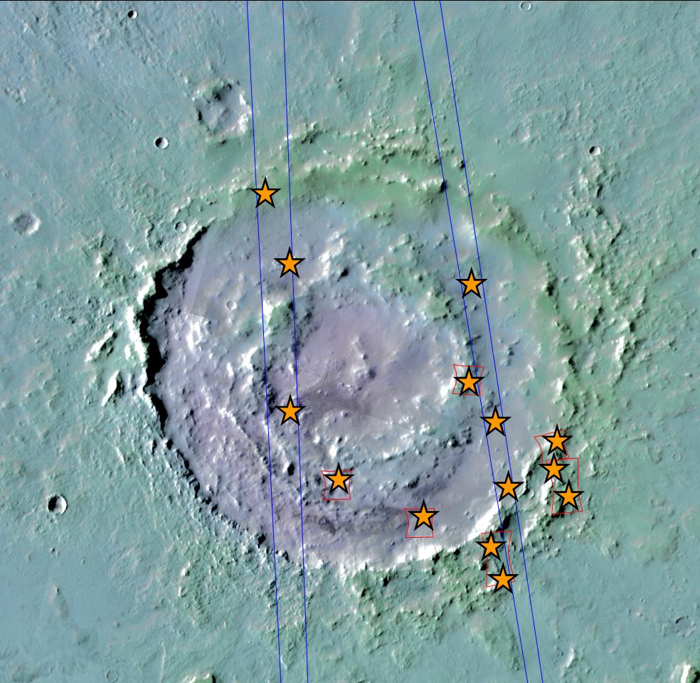
PIA14291:
Oblique view of Gale Crater from the North
Full Resolution:
TIFF
(6.23 MB)
JPEG
(170.8 kB)
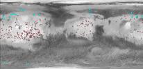
2013-12-10
Mars
2001 Mars Odyssey
Mars Global Surveyor (MGS)
MOLA
THEMIS
960x665x3
PIA17607:
Maps of Recurrent Slope Linea Markings on Mars
Full Resolution:
TIFF
(1.916 MB)
JPEG
(143.3 kB)
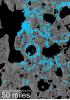
2013-12-10
Mars
2001 Mars Odyssey
Mars Global Surveyor (MGS)
MOLA
THEMIS
989x481x3
PIA17609:
Locations of Ice-Exposing Fresh Craters on Mars
Full Resolution:
TIFF
(1.428 MB)
JPEG
(82.32 kB)
2016-09-15
Mars
2001 Mars Odyssey
Mars Global Surveyor (MGS)
MOLA
THEMIS
1316x1840x3
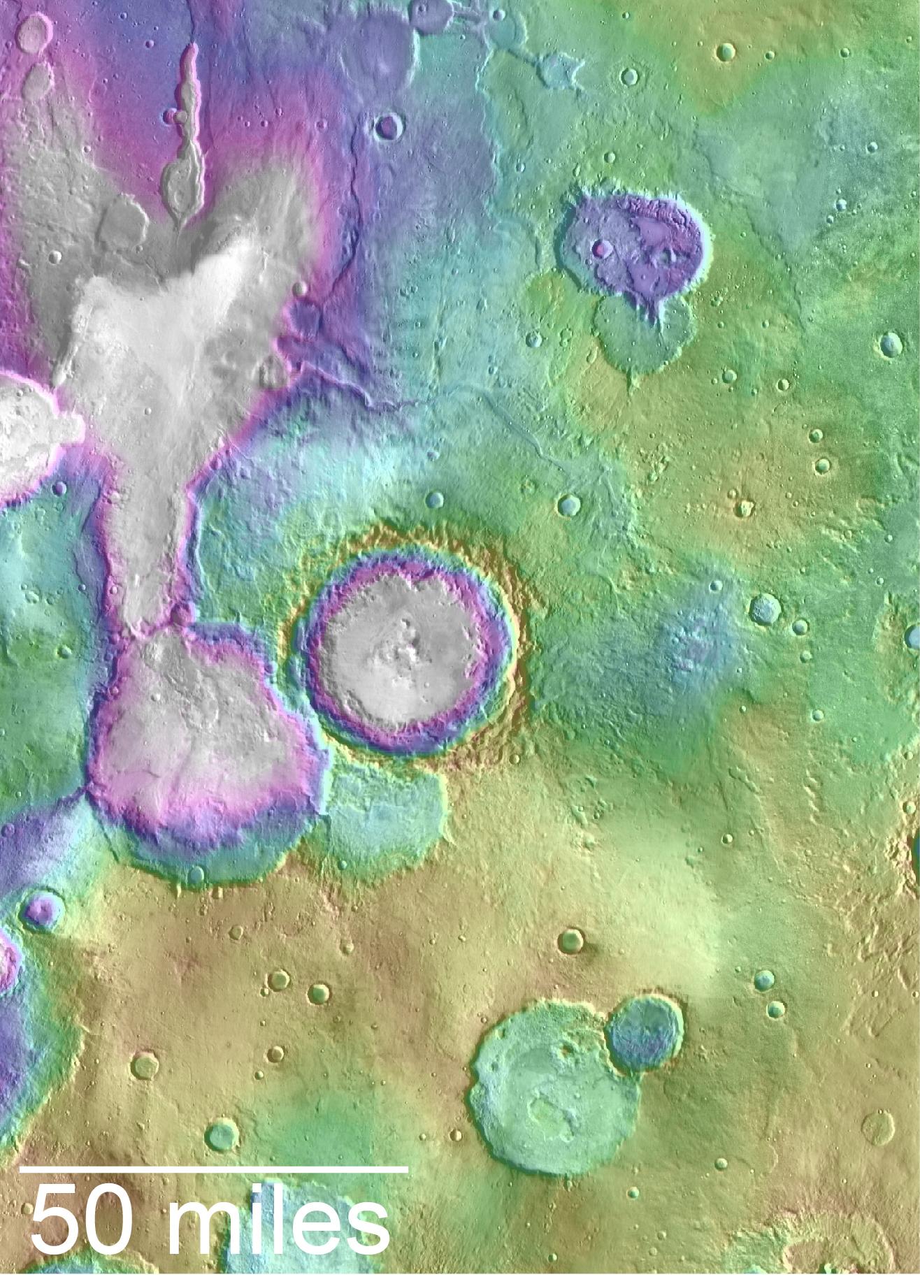
PIA20838:
Landscape of Former Lakes and Streams on Northern Mars
Full Resolution:
TIFF
(7.267 MB)
JPEG
(409.9 kB)
2016-09-15
Mars
2001 Mars Odyssey
Mars Global Surveyor (MGS)
MOLA
THEMIS
1726x2453x3
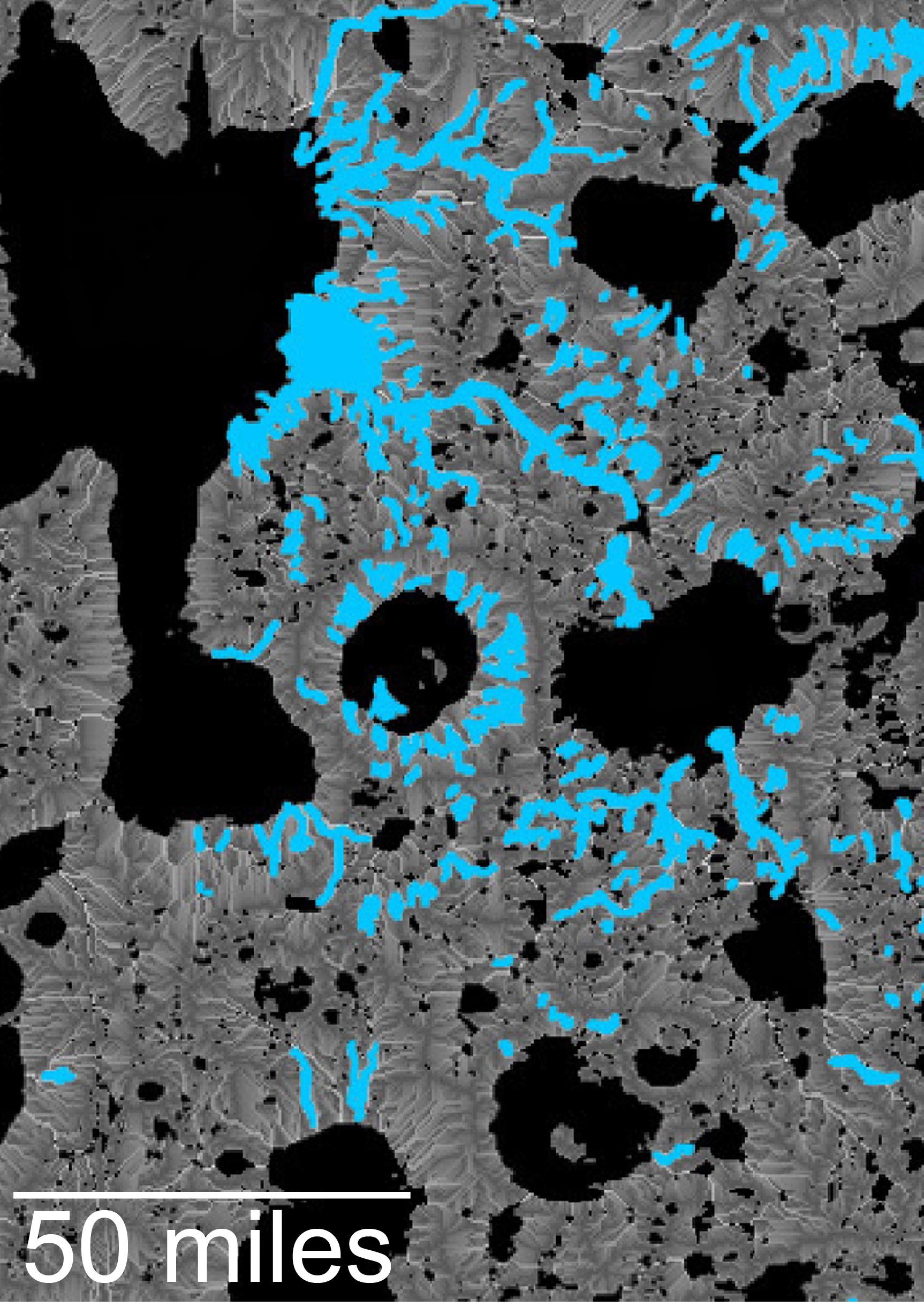
PIA20839:
Hydrologic Modeling of Relatively Recent Martian Streams and Lake
Full Resolution:
TIFF
(7.388 MB)
JPEG
(549.4 kB)
2007-12-11
Mars
Mars Global Surveyor (MGS)
MOLA
Thermal Emission Spectrometer
753x697x3
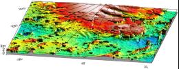
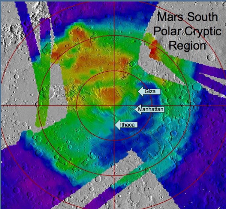
PIA10138:
Location of Sites Within 'Cryptic Terrain'
Full Resolution:
TIFF
(1.577 MB)
JPEG
(111.7 kB)
1997-10-13
Mars
Mars Global Surveyor (MGS)
MOLA
2550x3300x3
PIA00957:
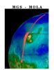
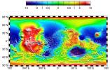
MGS Mars Orbiter Laser (MOLA) Surface Topography of Northern Hemisphere
Full Resolution:
TIFF
(8.502 MB)
JPEG
(439.4 kB)
1997-10-13
Mars
Mars Global Surveyor (MGS)
MOLA
3300x1634x3
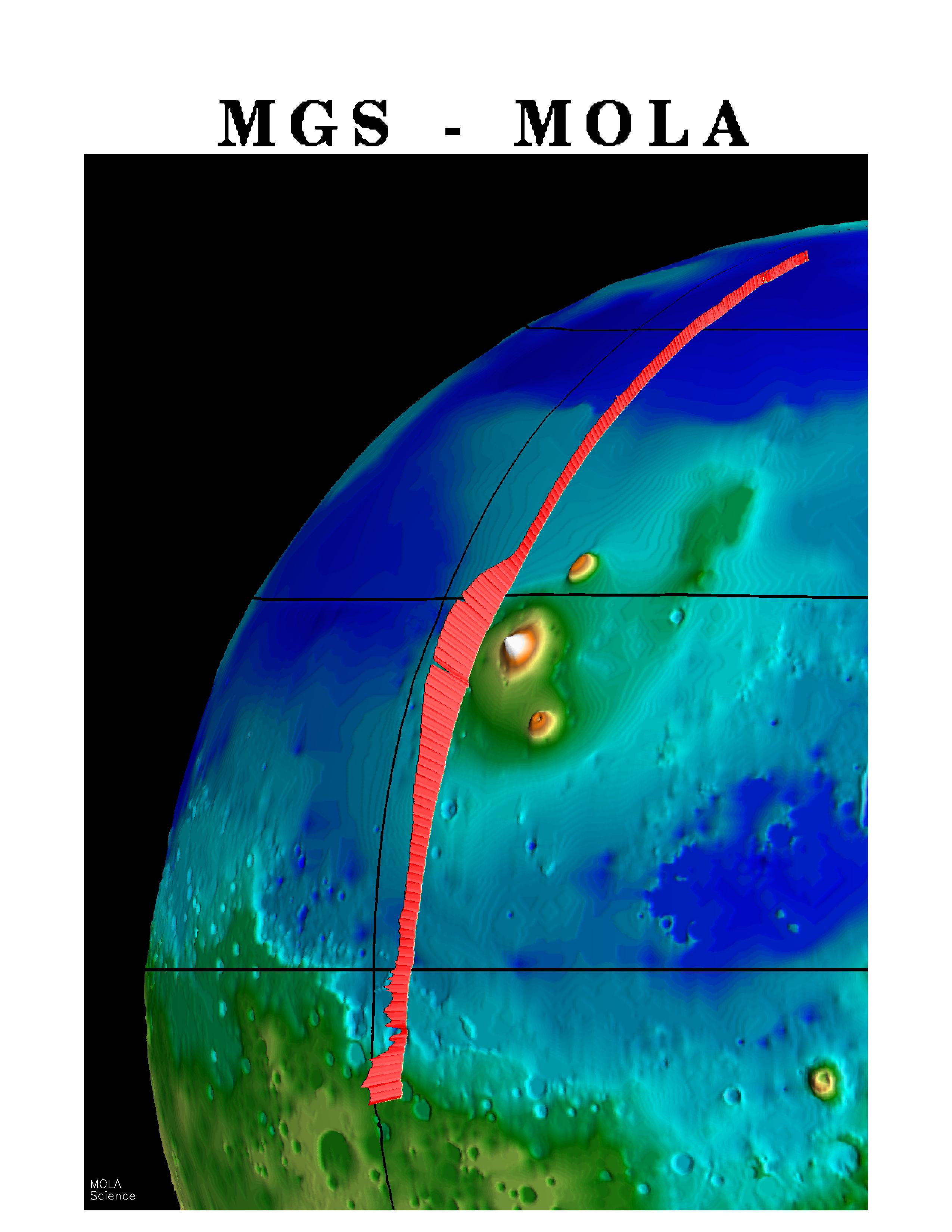
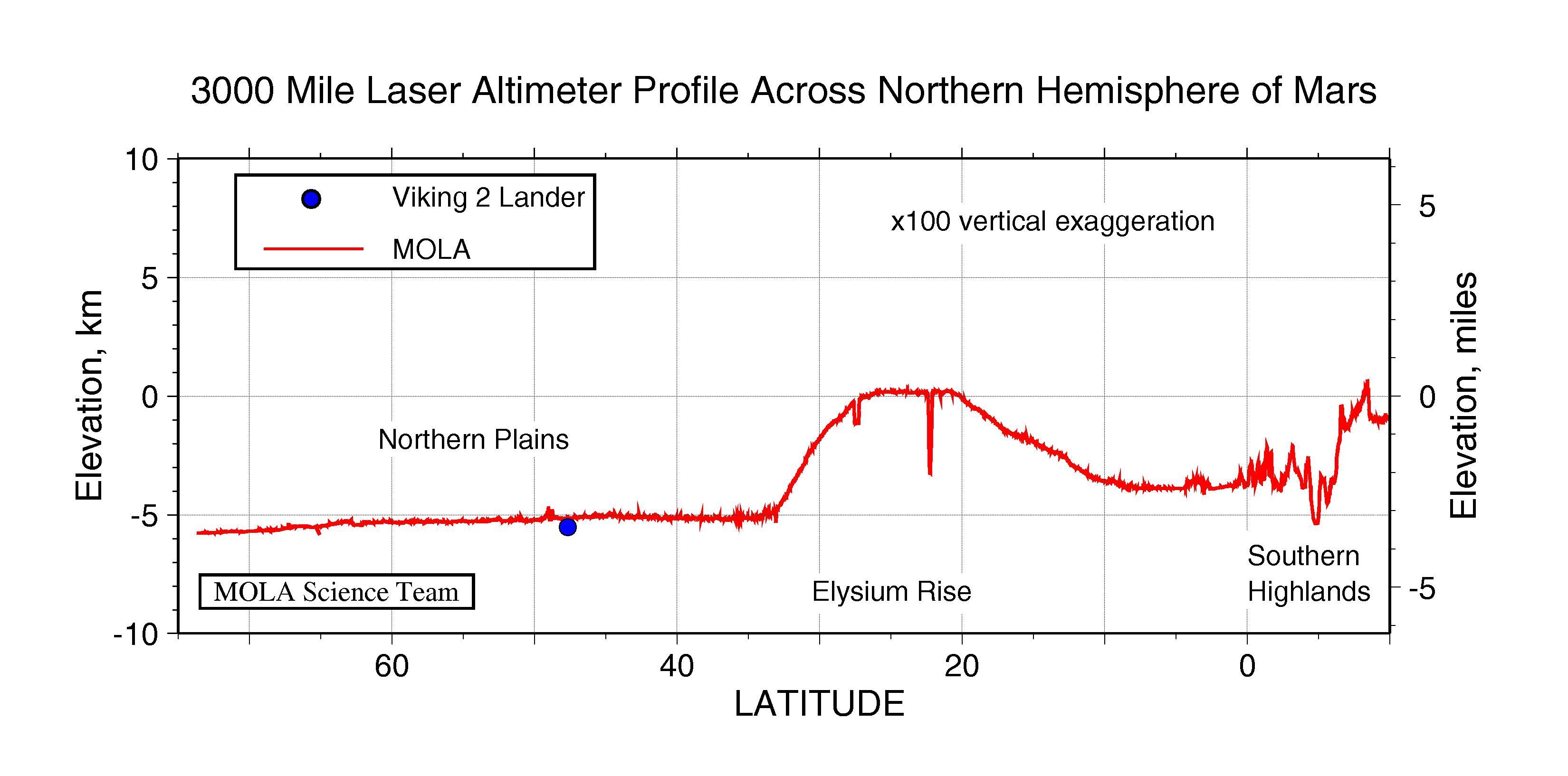
PIA00958:
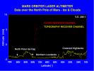
3000 Mile Laser Altimeter Profile Across Northern Hemisphere of Mars
Full Resolution:
TIFF
(730.3 kB)
JPEG
(341 kB)
1997-10-13
Mars
Mars Global Surveyor (MGS)
MOLA
3300x2550x3
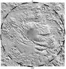
PIA00959:
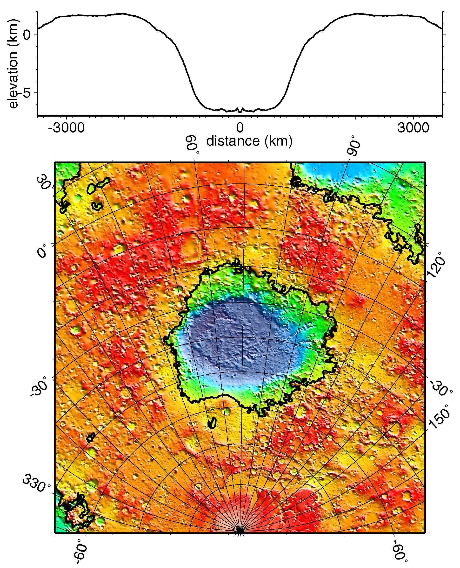
MGS Mars Orbiter Laser Altimeter Topographic Profile of Impact Crater
Full Resolution:
TIFF
(5.47 MB)
JPEG
(741 kB)
1997-10-13
Mars
Mars Global Surveyor (MGS)
MOLA
3300x2550x3
PIA00960:
MGS Mars Orbiter Laser Altimeter (MOLA) - Mars/Earth Relief Comparison
Full Resolution:
TIFF
(3.639 MB)
JPEG
(615.3 kB)
1997-11-10
Mars
Mars Global Surveyor (MGS)
MOLA
3300x2550x3
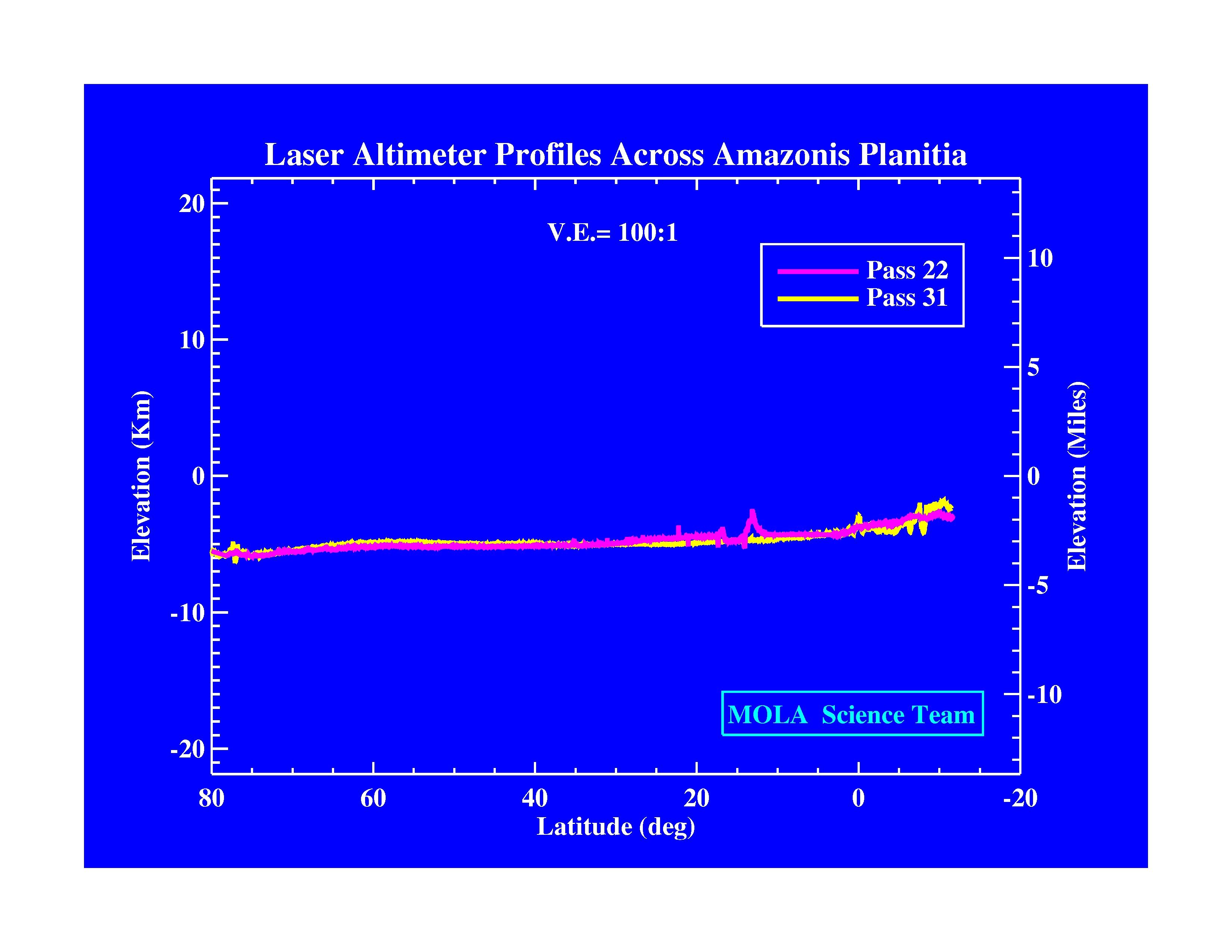
PIA01009:
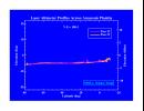
Laser Altimeter Profiles Across Amazonis Planitia
Full Resolution:
TIFF
(530.8 kB)
JPEG
(371.9 kB)
1997-11-10
Mars
Mars Global Surveyor (MGS)
MOLA
3300x2550x3
PIA01010:
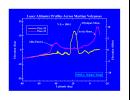
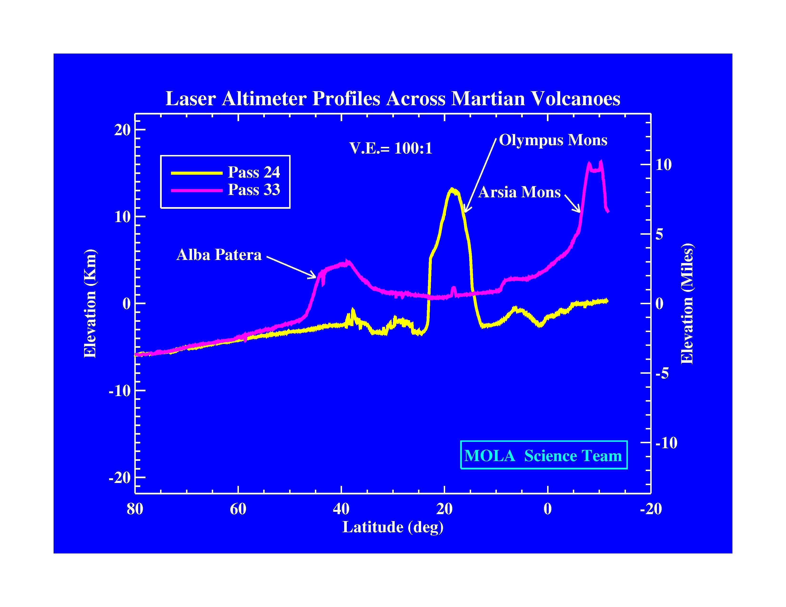
Laser Altimeter Profiles Across Martian Volcanoes
Full Resolution:
TIFF
(677.9 kB)
JPEG
(424.4 kB)
1997-11-10
Mars
Mars Global Surveyor (MGS)
MOLA
3300x2550x3
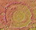
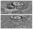
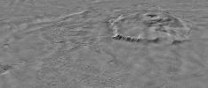
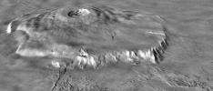
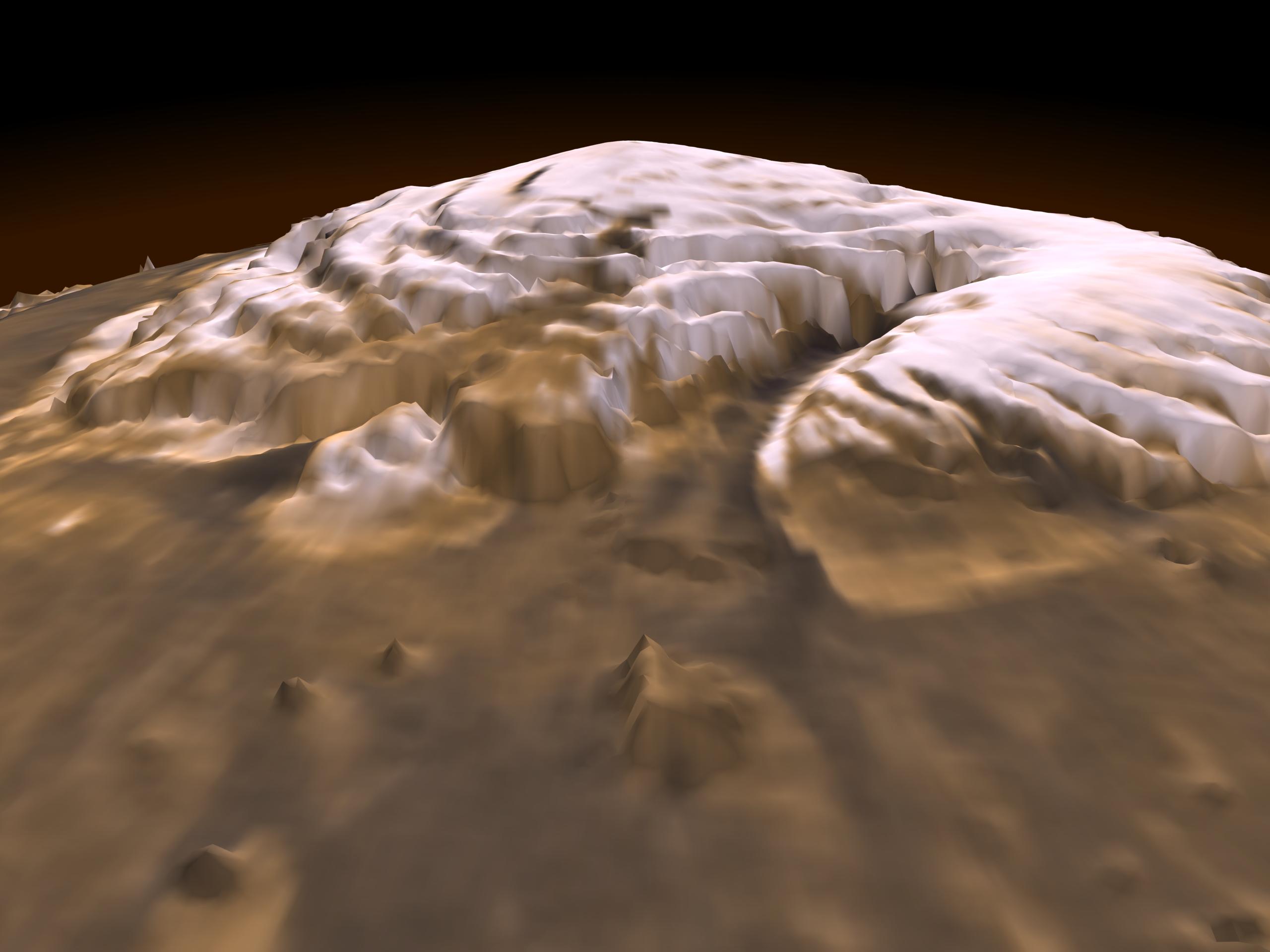
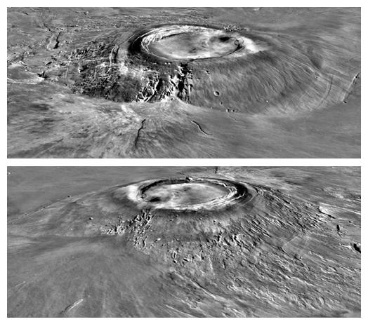
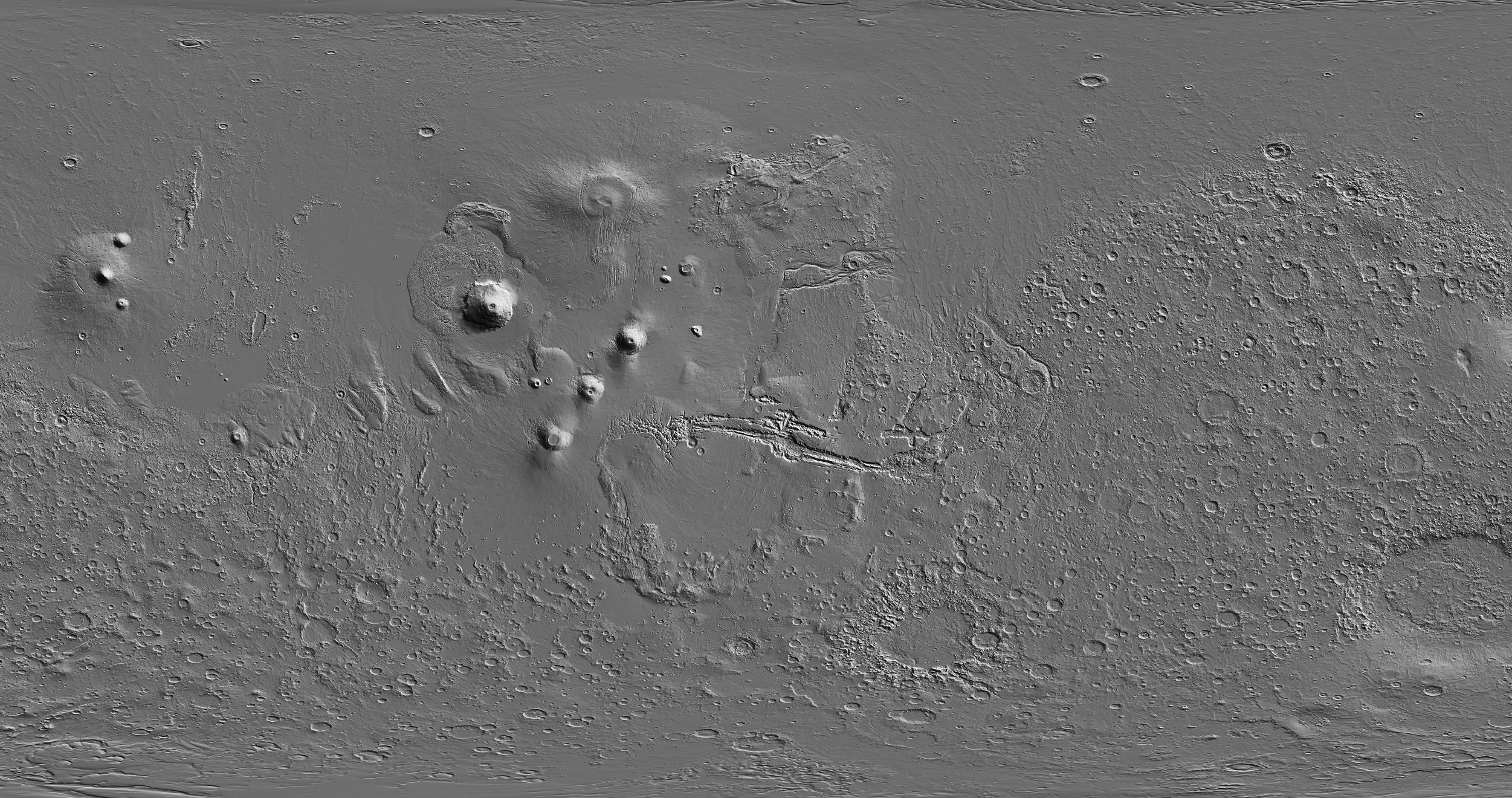
PIA01011:
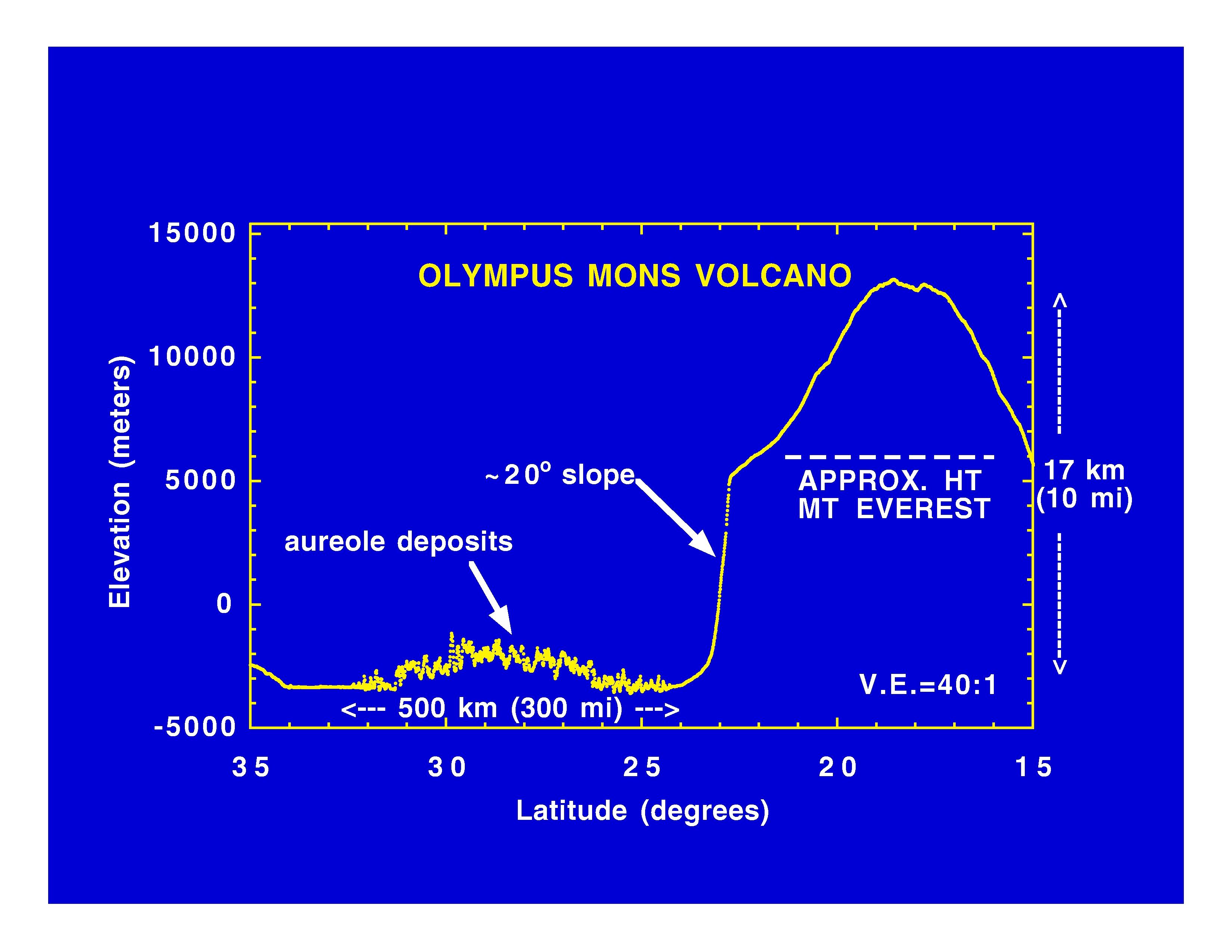
Olympus Mons Volcano
Full Resolution:
TIFF
(625.4 kB)
JPEG
(414.7 kB)
1997-11-10
Mars
Mars Global Surveyor (MGS)
MOLA
3300x2550x3
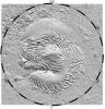
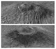
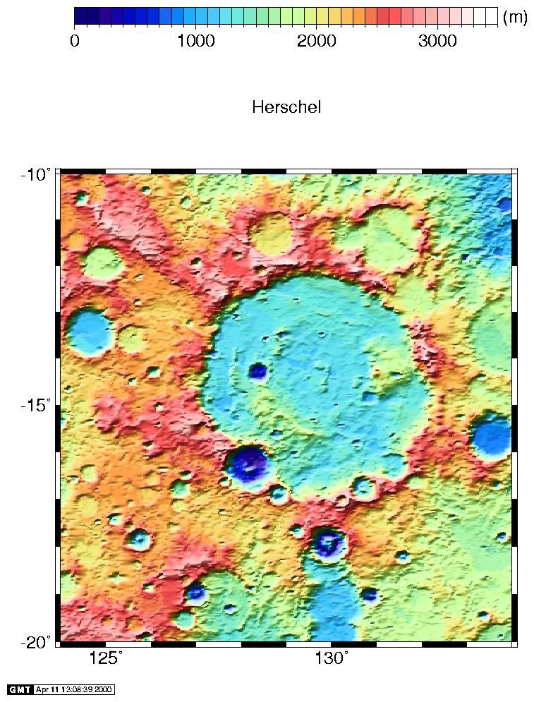
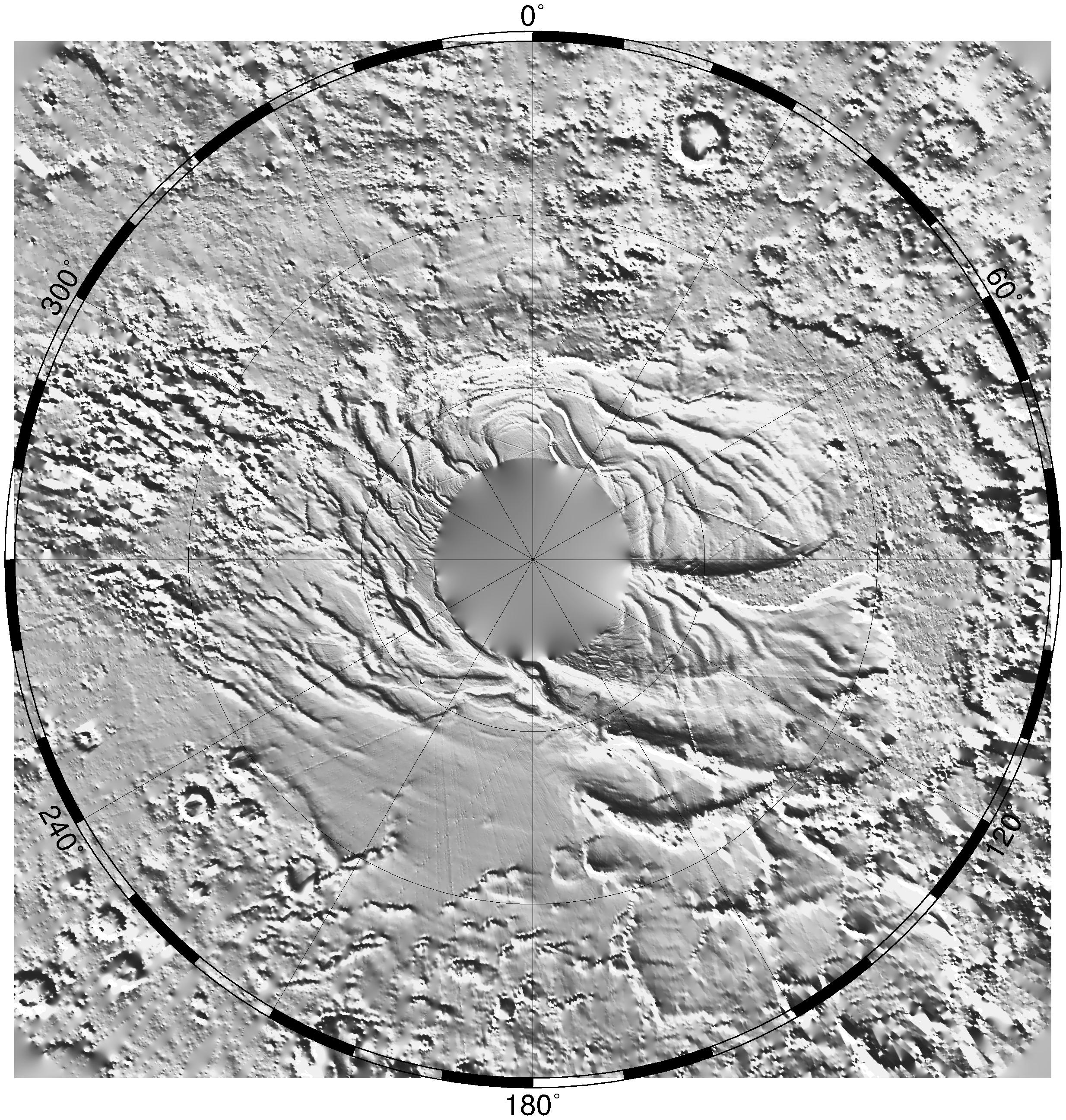
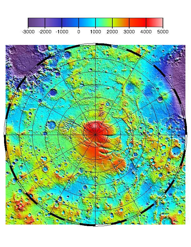
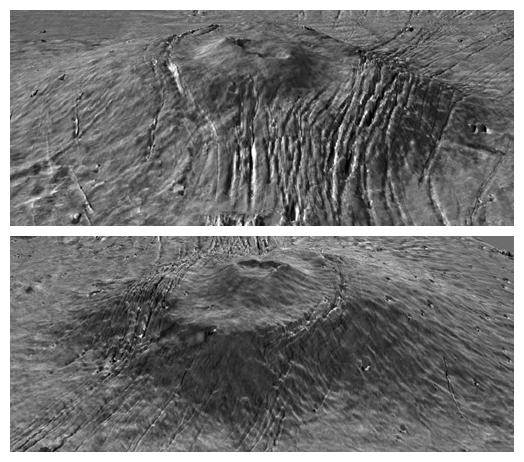
PIA01012:
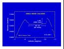
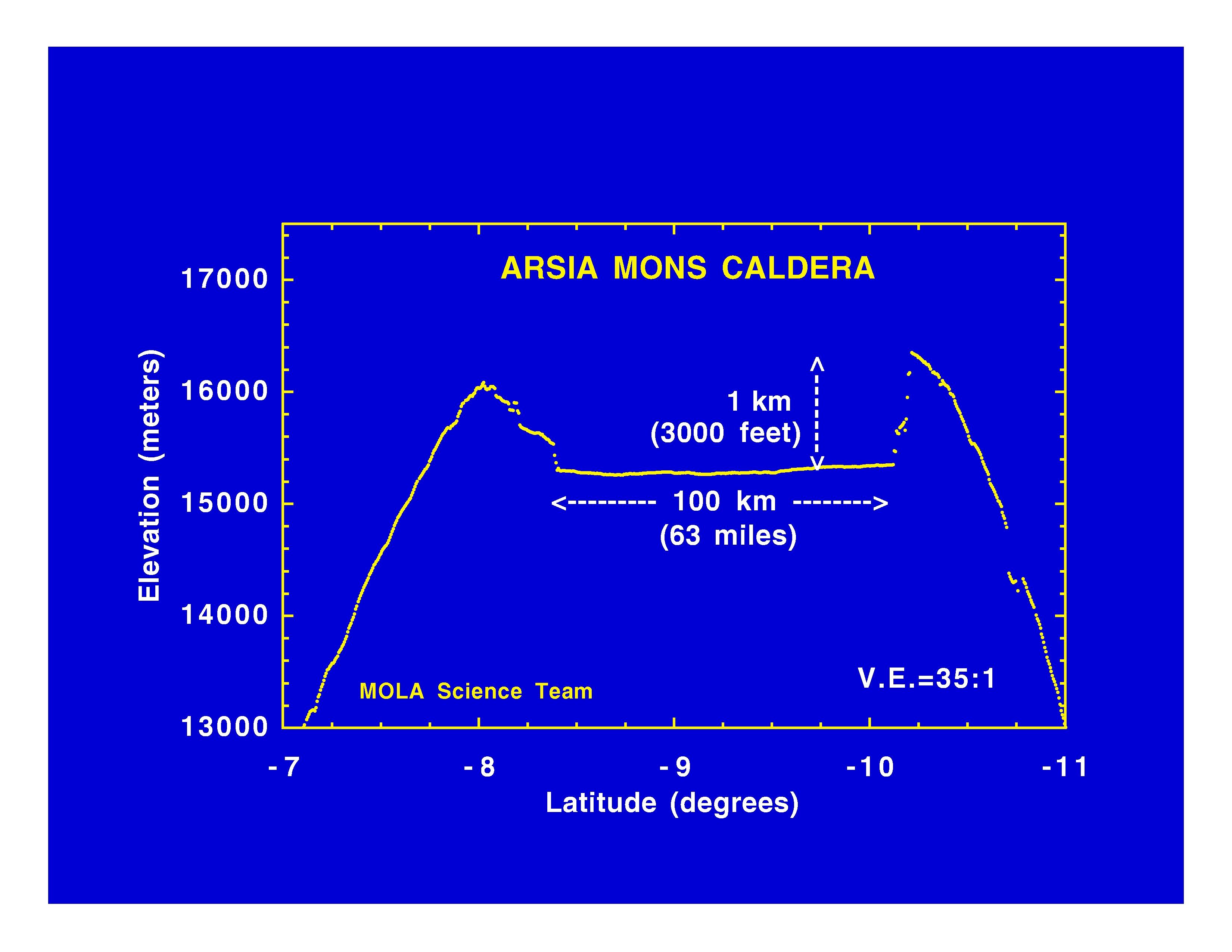
Arsia Mons Caldera
Full Resolution:
TIFF
(534.1 kB)
JPEG
(365.8 kB)
1997-11-10
Mars
Mars Global Surveyor (MGS)
MOLA
3300x2550x3
PIA01013:
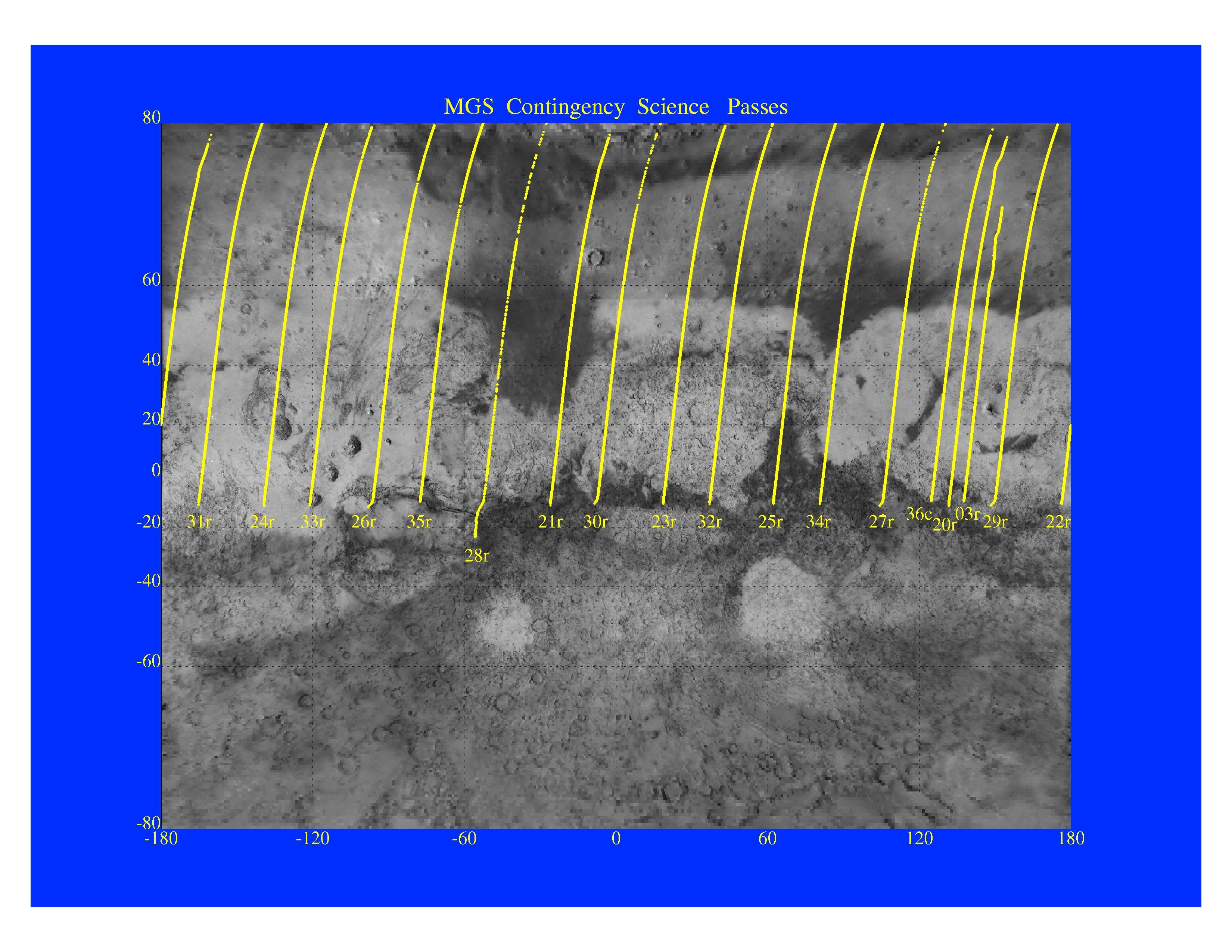
MGS Contingency Science Passes
Full Resolution:
TIFF
(4.409 MB)
JPEG
(879.4 kB)
1997-11-10
Mars
Mars Global Surveyor (MGS)
MOLA
3300x2550x3
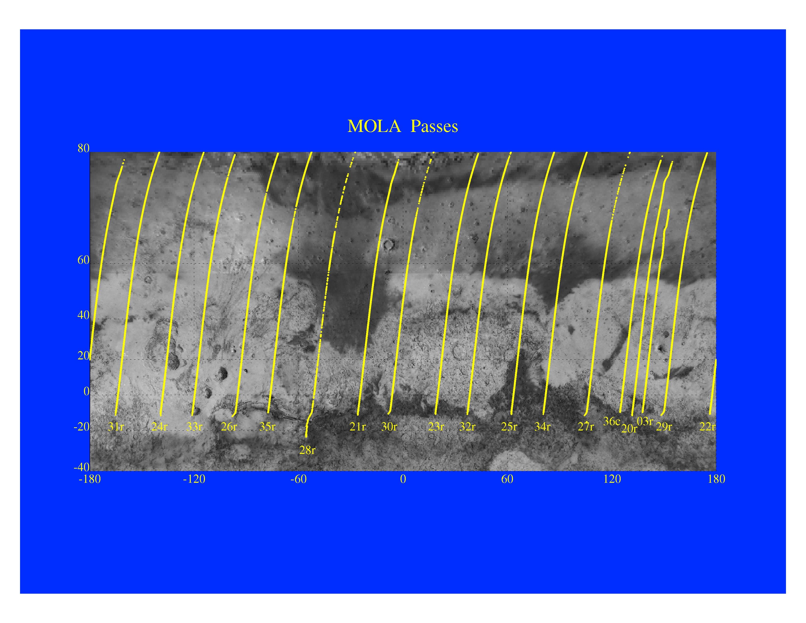
PIA01014:
Mars Orbiter Laser Altimeter Passes
Full Resolution:
TIFF
(3.582 MB)
JPEG
(723.3 kB)
2000-09-08
Mars
Mars Global Surveyor (MGS)
MOLA
757x995x3
PIA01049:
Regional Topographic Views of Mars from MOLA
Full Resolution:
TIFF
(1.717 MB)
JPEG
(157.5 kB)
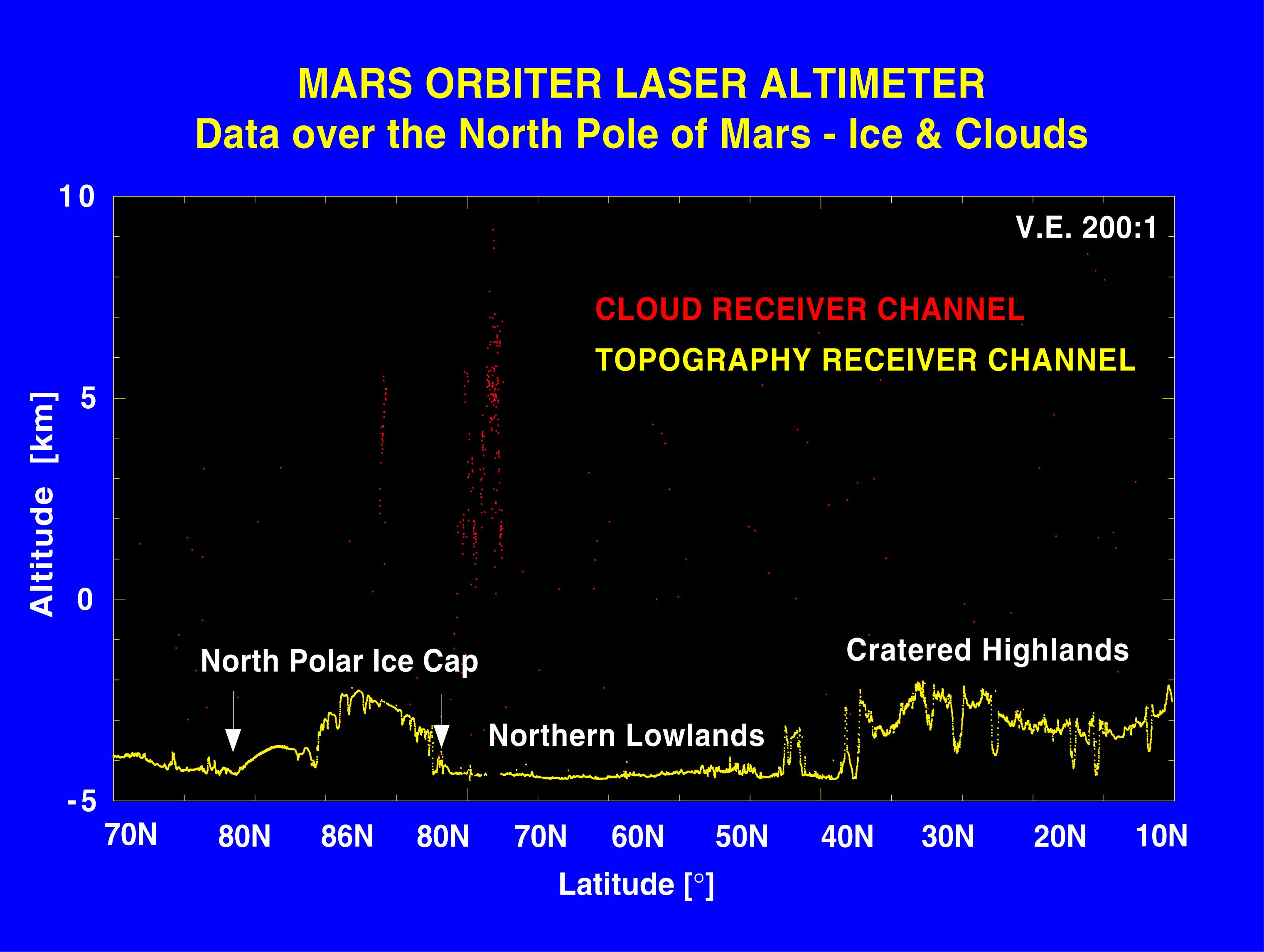
1999-01-07
Mars
Mars Global Surveyor (MGS)
MOLA
2560x1920x3
PIA01337:
Laser Provides First 3-D View of Mars' North Pole
Full Resolution:
TIFF
(8.414 MB)
JPEG
(200.6 kB)
1999-01-07
Mars
Mars Global Surveyor (MGS)
MOLA
3042x2292x3
PIA01338:
Elevation Measurement Profile of Mars
Full Resolution:
TIFF
(142 kB)
JPEG
(406.8 kB)
1999-05-27
Mars
Mars Global Surveyor (MGS)
MOLA
2497x2221x3
PIA02031:
Maps of Mars Global Topography
Full Resolution:
TIFF
(11.74 MB)
JPEG
(1.145 MB)
1999-05-27
Mars
Mars Global Surveyor (MGS)
MOLA
1909x2353x3
PIA02033:
Regional Topographic Model of the Hellas Basin
Full Resolution:
TIFF
(8.461 MB)
JPEG
(901.7 kB)
1999-05-27
Mars
Mars Global Surveyor (MGS)
MOLA
2761x1759x3
PIA02035:
Map of Mars' Topography
Full Resolution:
TIFF
(10.08 MB)
JPEG
(1.115 MB)
1999-05-27
Mars
Mars Global Surveyor (MGS)
MOLA
2335x2617x3
PIA02036:
Lambert Equal-Area Projection of Pole-to-Equator
Full Resolution:
TIFF
(12.39 MB)
JPEG
(1.28 MB)
1999-05-27
Mars
Mars Global Surveyor (MGS)
MOLA
2257x2719x3
PIA02037:
Polar Stereographic Projection
Full Resolution:
TIFF
(13.35 MB)
JPEG
(1.042 MB)
1999-05-27
Mars
Mars Global Surveyor (MGS)
MOLA
2545x2023x3
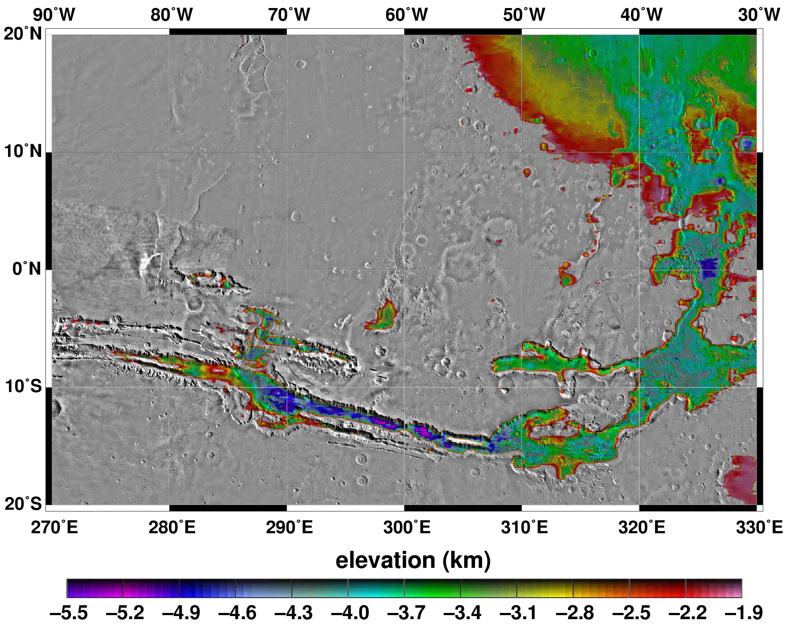
PIA02039:
Elevations Within the Floor of the Valles Marineris
Full Resolution:
TIFF
(7.378 MB)
JPEG
(1.035 MB)
1999-05-27
Mars
Mars Global Surveyor (MGS)
MOLA
2700x3075x3
PIA02040:
Science Magazine Cover Image
Full Resolution:
TIFF
(12.35 MB)
JPEG
(948.9 kB)
1999-06-23
Mars
Mars Global Surveyor (MGS)
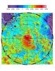
MOLA
2468x2592x1
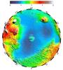
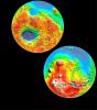
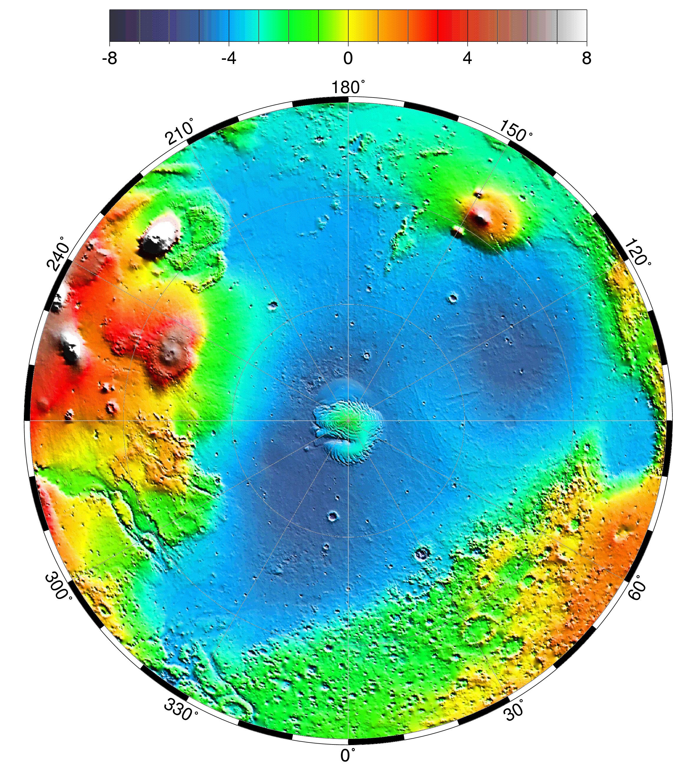
PIA02052:
South Polar Topography (MOLA)
Full Resolution:
TIFF
(5.391 MB)
JPEG
(1.241 MB)
1999-06-23
Mars
Mars Global Surveyor (MGS)
MOLA
2468x2592x1
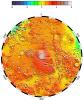
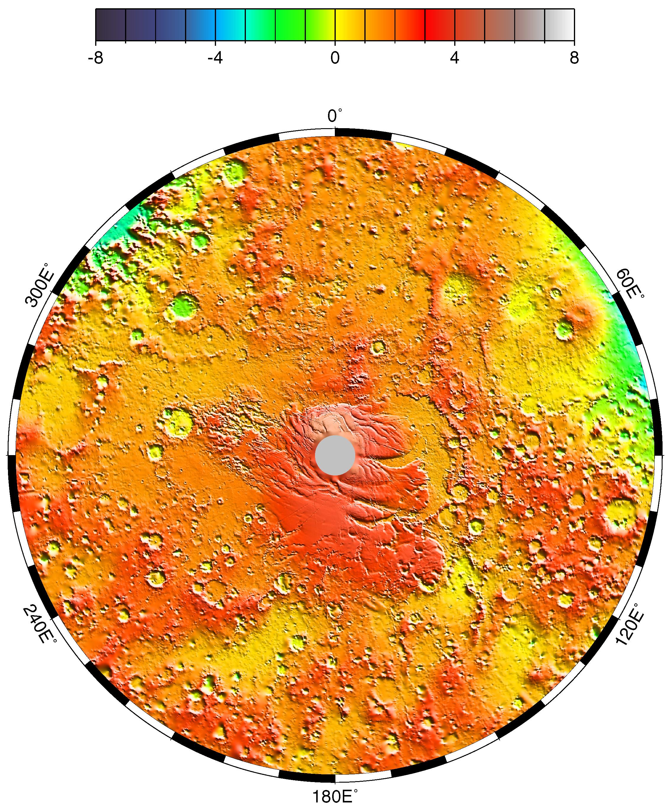
PIA02053:
North Polar Topography (MOLA)
Full Resolution:
TIFF
(5.755 MB)
JPEG
(1.378 MB)
1999-07-06
Mars
Mars Global Surveyor (MGS)
MOLA
612x792x3
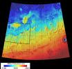
PIA02088:
MOLA TOPOGRAPHIC MAP
Full Resolution:
TIFF
(1.326 MB)
JPEG
(182.1 kB)
1999-07-06
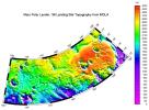
Mars
Mars Global Surveyor (MGS)
MOLA
910x670x3
PIA02089:
MPL LANDING SITE - DEM
Full Resolution:
TIFF
(172.2 kB)
JPEG
(111.2 kB)
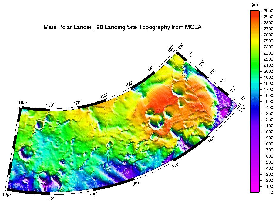
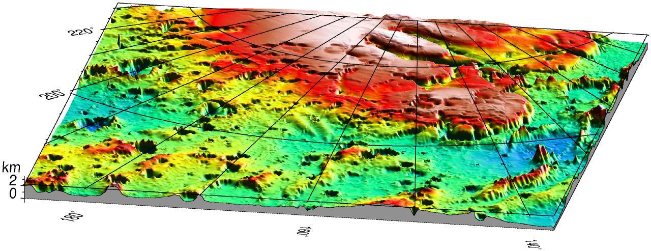
1999-07-06
Mars
Mars Global Surveyor (MGS)
MOLA
910x685x3
PIA02090:
MPL LANDING SITE CORRIDOR
Full Resolution:
TIFF
(151.7 kB)
JPEG
(86.71 kB)
1999-07-06
Mars
Mars Global Surveyor (MGS)
MOLA
1280x493x3
PIA02091:
Mars '98 Polar landing site
Full Resolution:
TIFF
(1.607 MB)
JPEG
(150 kB)
2000-09-07
Mars
Mars Global Surveyor (MGS)
MOLA
524x462x1
PIA02803:
Major Martian Volcanoes from MOLA - Alba Patera
Full Resolution:
TIFF
(239.9 kB)
JPEG
(52.87 kB)
2000-09-07
Mars
Mars Global Surveyor (MGS)
MOLA
524x462x1
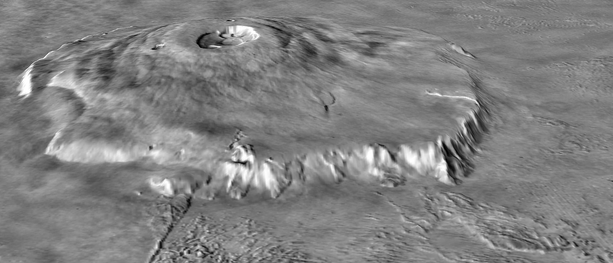
PIA02804:
Major Martian Volcanoes from MOLA - Arsia Mons
Full Resolution:
TIFF
(231.1 kB)
JPEG
(52.9 kB)
2000-09-07
Mars
Mars Global Surveyor (MGS)
MOLA
2100x900x1
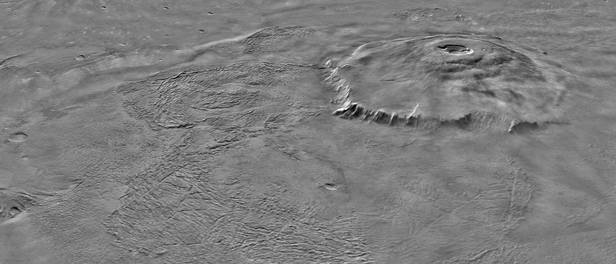
PIA02805:
Major Martian Volcanoes from MOLA - Olympus Mons
Full Resolution:
TIFF
(1.538 MB)
JPEG
(270.9 kB)
2000-09-07
Mars
Mars Global Surveyor (MGS)
MOLA
2100x900x1
PIA02806:
Major Martian Volcanoes from MOLA - Olympus Mons
Full Resolution:
TIFF
(1.451 MB)
JPEG
(205 kB)
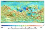
2000-10-06
Mars
Mars Global Surveyor (MGS)
MOLA
669x441x3
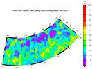
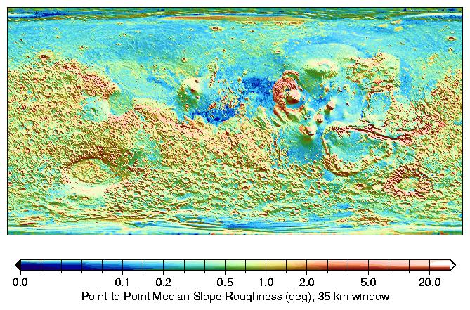
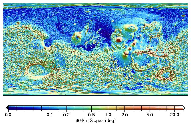
PIA02808:
MOLA Global Roughness Map of Mars
Full Resolution:
TIFF
(248.3 kB)
JPEG
(114.3 kB)
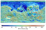
2000-10-06
Mars
Mars Global Surveyor (MGS)
MOLA
669x441x3
PIA02809:
MOLA Global Map of Surface Gradients on Mars
Full Resolution:
TIFF
(254.8 kB)
JPEG
(128.2 kB)
2001-01-17
Mars
Mars Global Surveyor (MGS)
MOLA
4000x2769x3
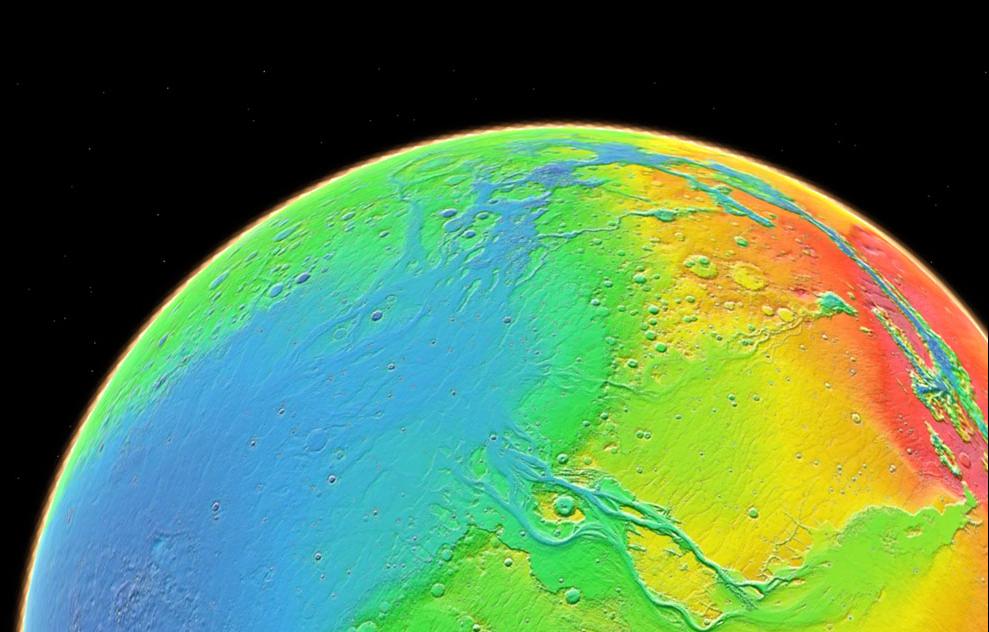
PIA02820:
Mars Topography
Full Resolution:
TIFF
(21.78 MB)
JPEG
(1.109 MB)
2000-11-10
Mars
Mars Global Surveyor (MGS)
MOLA
11649x5723x3
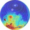
PIA02993:
Mars Orbiter Laser Altimiter (MOLA) Globe
Full Resolution:
TIFF
(158.6 MB)
JPEG
(11 MB)
2007-08-02
Mars
Mars Global Surveyor (MGS)
Phoenix
MOLA
1127x1125x3
PIA09944:
Far-Northern Destination for Phoenix Mars Lander
Full Resolution:
TIFF
(3.808 MB)
JPEG
(244.1 kB)
2007-08-02
Mars
Mars Global Surveyor (MGS)
Phoenix
MOLA
1019x985x3
PIA09945:
Topographical Context of Phoenix Landing Region
Full Resolution:
TIFF
(3.015 MB)
JPEG
(137 kB)
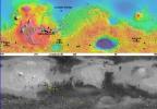
2007-12-11
Mars
Mars Global Surveyor (MGS)
MOLA
2502x1320x1
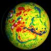
PIA10132:
Global View of Mars Topography
Full Resolution:
TIFF
(3.306 MB)
JPEG
(791.3 kB)
2008-05-22
Mars
Mars Global Surveyor (MGS)
Phoenix
MOLA
720x486x3
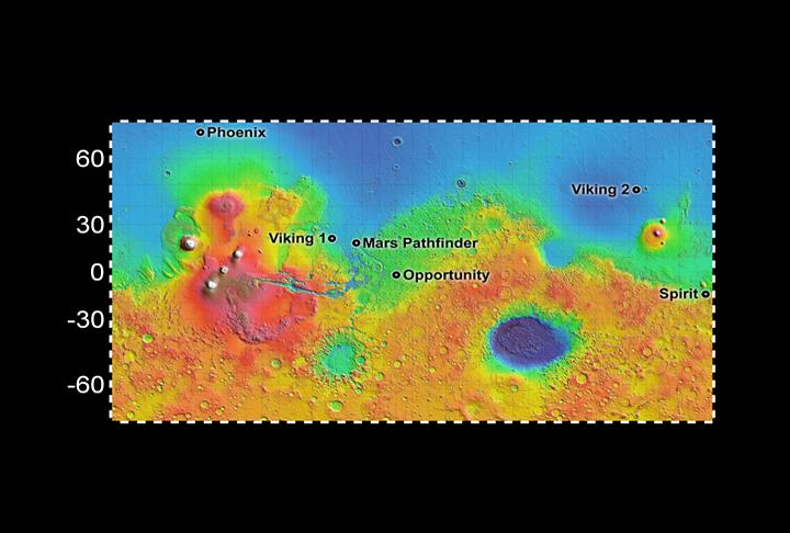
PIA10656:
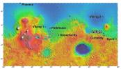
Six Landing Sites on Mars
Full Resolution:
TIFF
(1.051 MB)
JPEG
(44.63 kB)
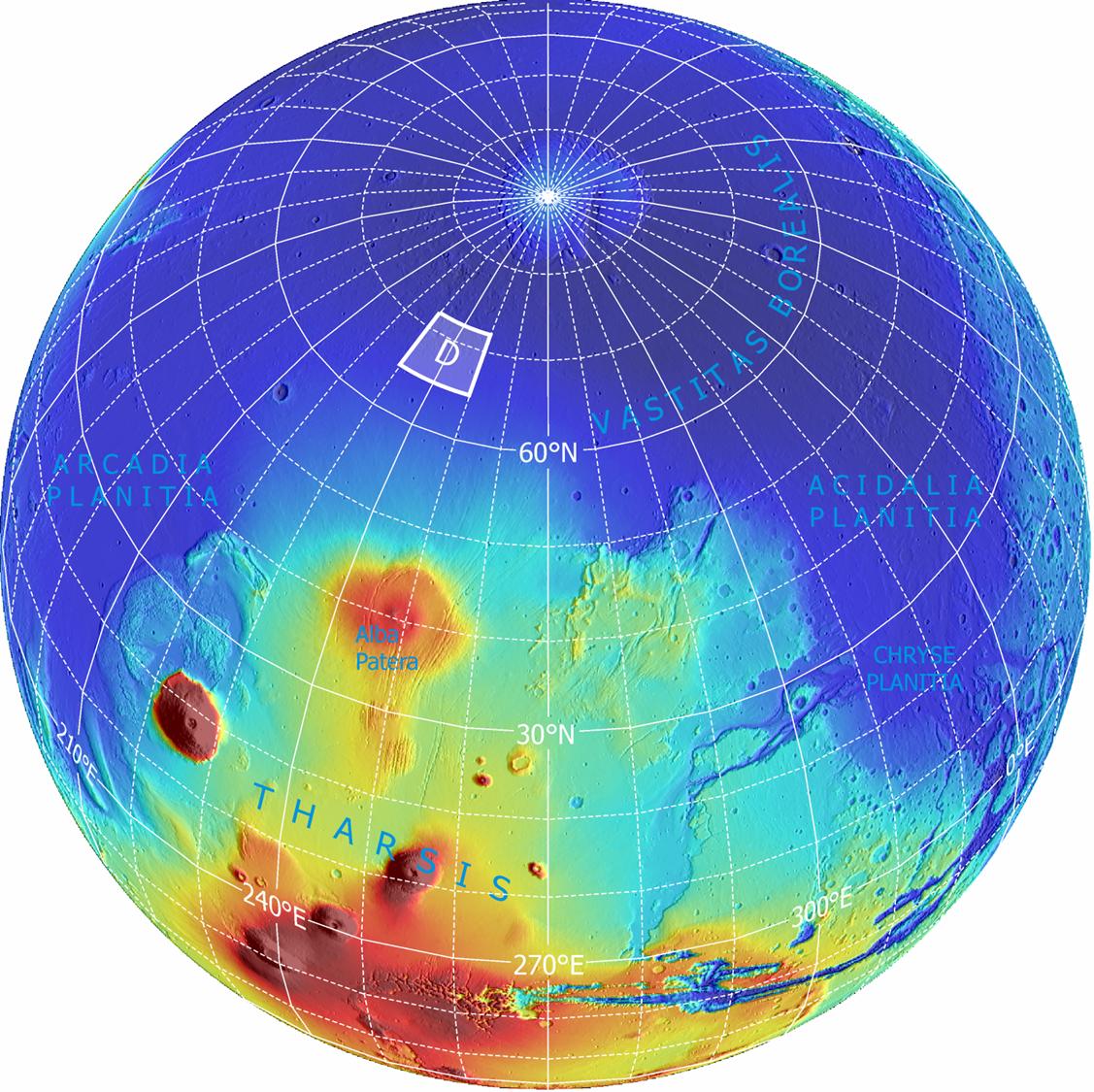
2008-08-04
Mars
Mars Global Surveyor (MGS)
Phoenix
MOLA
640x360x3
PIA11029:
Wind-Related Topography in Phoenix's Region of Mars (Animation)
Full Resolution:
TIFF
(692.2 kB)
JPEG
(12.34 kB)
2010-06-24
Mars
Viking
Mars Global Surveyor (MGS)
MOLA
984x960x3
PIA13215:
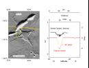
Hydrated Minerals Exposed at Lyot, Northern Mars
Full Resolution:
TIFF
(2.838 MB)
JPEG
(153.2 kB)
2011-11-21
Mars
Mars Global Surveyor (MGS)
MOLA
989x632x3
PIA15094:
Topography of Mars
Full Resolution:
TIFF
(1.878 MB)
JPEG
(81.25 kB)
2013-09-04
Mars
InSight
Mars Global Surveyor (MGS)
MOLA
4000x2298x3
PIA17357:
NASA's Mars Landing Sites, including InSight
Full Resolution:
TIFF
(27.59 MB)
JPEG
(2.27 MB)
2016-03-21
Mars
2001 Mars Odyssey
Mars Global Surveyor (MGS)
Mars Reconnaissance Orbiter (MRO)
MOLA
3200x1500x3
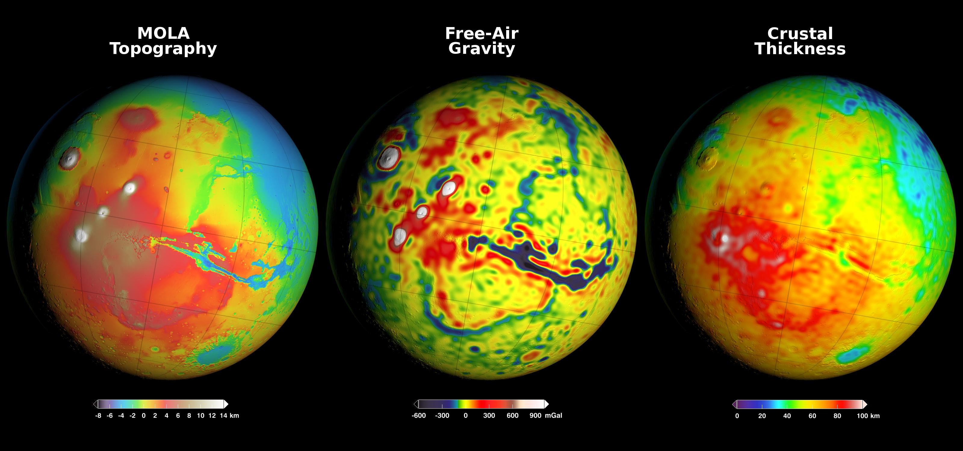
PIA20277:
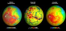
Using Gravity and Topography to Map Mars' Crustal Thickness
Full Resolution:
TIFF
(7.902 MB)
JPEG
(358.2 kB)
2016-03-21
Mars
2001 Mars Odyssey
Mars Global Surveyor (MGS)
Mars Reconnaissance Orbiter (MRO)
MOLA
2400x2400x3
PIA20326:
Newly Detailed Map of Mars' Crustal Thickness
Full Resolution:
TIFF
(10.76 MB)
JPEG
(398.9 kB)
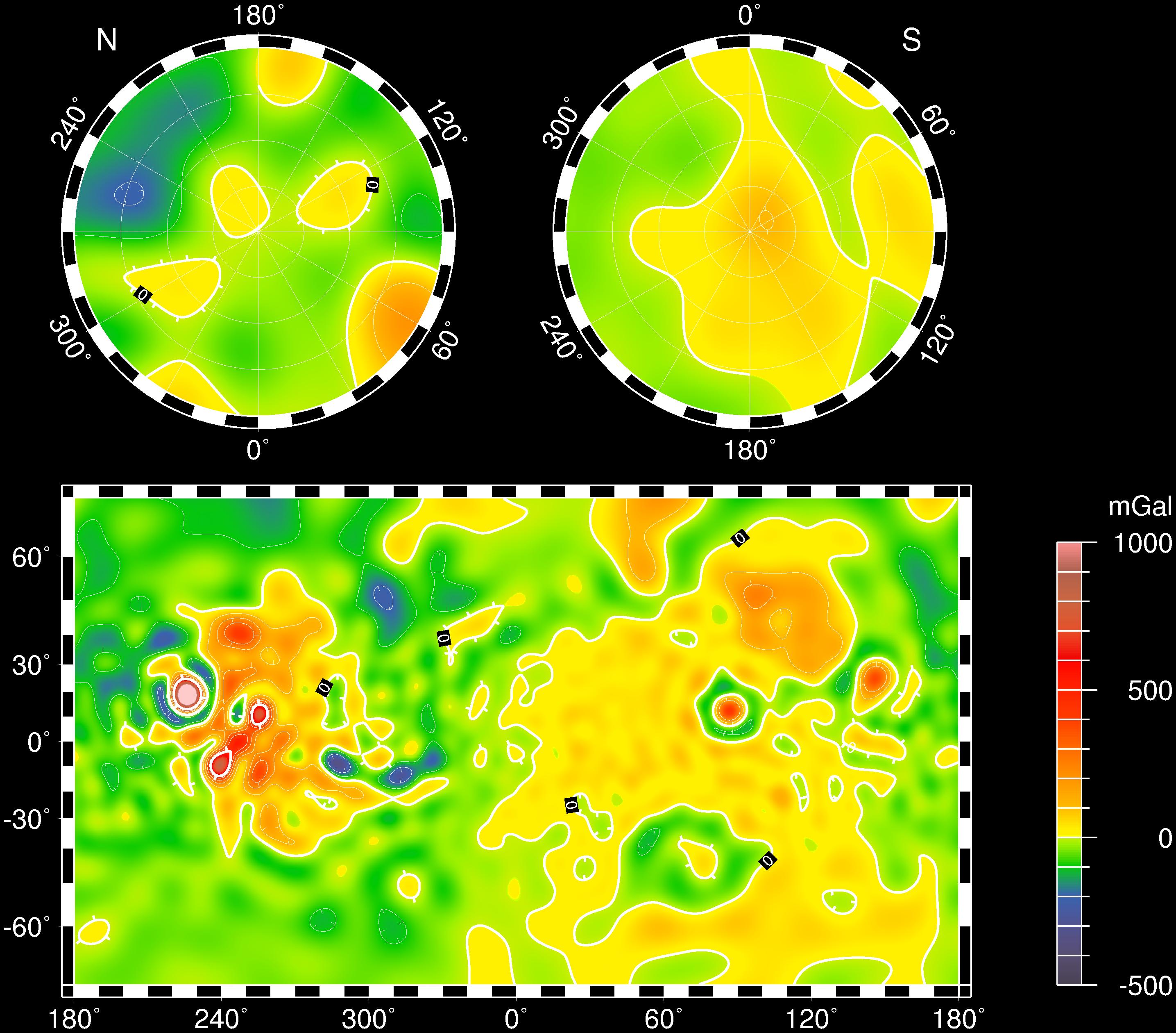
2016-03-21
Mars
2001 Mars Odyssey
Mars Global Surveyor (MGS)
Mars Reconnaissance Orbiter (MRO)
MOLA
2400x2400x3
PIA20327:
Local Variations in the Gravitational Pull of Mars
Full Resolution:
TIFF
(11.91 MB)
JPEG
(443.7 kB)
2000-11-03
Mars
Galileo
Mars Global Surveyor (MGS)
Mars Orbiter Camera (MOC)
Solid-State Imaging
2800x1824x3
PIA02570:
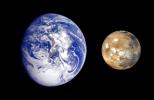
Earth Mars Comparison
Full Resolution:
TIFF
(5.946 MB)
JPEG
(269.4 kB)
2010-05-26
Mars
Mars Global Surveyor (MGS)
Mars Orbiter Camera (MOC)
MOLA
1280x1024x3
PIA13163:
Northern Ice Cap of Mars
Full Resolution:
TIFF
(3.936 MB)
JPEG
(141.1 kB)
2004-07-16
Mars
2001 Mars Odyssey
Mars Global Surveyor (MGS)
Mars Exploration Rover (MER)
Mars Orbiter Camera (MOC)
Thermal Emission Spectrometer
1183x638x3
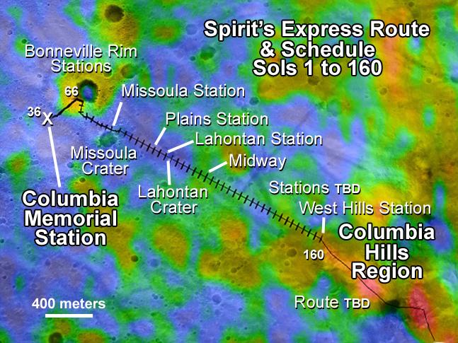
PIA06688:
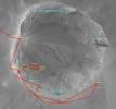
Spirit Traverse Map
Full Resolution:
TIFF
(2.267 MB)
JPEG
(102.9 kB)
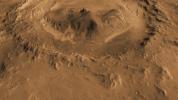
2003-12-18
Mars
2001 Mars Odyssey
Mars Global Surveyor (MGS)
Mars Orbiter Camera (MOC)
Thermal Emission Imaging System
Visual Imaging Subsystem
2880x2880x3
PIA04933:
Mars Ice Age, Simulated
Full Resolution:
TIFF
(15.45 MB)
JPEG
(717.5 kB)
2004-01-13
Mars
2001 Mars Odyssey
Mars Global Surveyor (MGS)
Mars Exploration Rover (MER)
Mars Orbiter Camera (MOC)
Thermal Emission Imaging System
720x540x3
PIA05055:
Right on Target
Full Resolution:
TIFF
(337.8 kB)
JPEG
(41.77 kB)
2004-01-13
Mars
2001 Mars Odyssey
Mars Global Surveyor (MGS)
Mars Exploration Rover (MER)
Mars Orbiter Camera (MOC)
Thermal Emission Imaging System
720x540x3
PIA05056:
Right on Target-2
Full Resolution:
TIFF
(302 kB)
JPEG
(36.3 kB)
2004-03-18
Mars
2001 Mars Odyssey
Mars Global Surveyor (MGS)
Mars Exploration Rover (MER)
Mars Orbiter Camera (MOC)
Thermal Emission Imaging System
1051x681x3
PIA05581:
To 'Bonneville' and Beyond
Full Resolution:
TIFF
(2.15 MB)
JPEG
(98.5 kB)
2004-03-19
Mars
2001 Mars Odyssey
Mars Global Surveyor (MGS)
Mars Exploration Rover (MER)
Mars Orbiter Camera (MOC)
Thermal Emission Imaging System
1920x1080x3
PIA05590:
Ma'adim Vallis From the Top
Full Resolution:
TIFF
(1.295 MB)
JPEG
(85.07 kB)
2004-04-28
Mars
2001 Mars Odyssey
Mars Global Surveyor (MGS)
Mars Exploration Rover (MER)
Mars Orbiter Camera (MOC)
Thermal Emission Imaging System
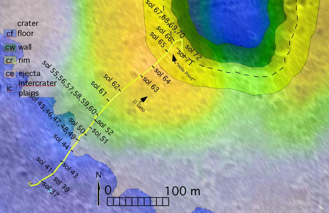
647x485x3
PIA05834:
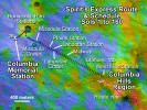
Spirit's Express Route to 'Columbia Hills'
Full Resolution:
TIFF
(942.6 kB)
JPEG
(81.41 kB)
2004-04-29
Mars
2001 Mars Odyssey
Mars Global Surveyor (MGS)
Mars Exploration Rover (MER)
Mars Orbiter Camera (MOC)
Thermal Emission Imaging System
671x455x3
PIA05836:
Confirming Predictions
Full Resolution:
TIFF
(917.1 kB)
JPEG
(56.25 kB)
2004-01-27
Mars
Mars Global Surveyor (MGS)
Mars Exploration Rover (MER)
Mars Orbiter Camera (MOC)
Panoramic Camera
5172x1385x3
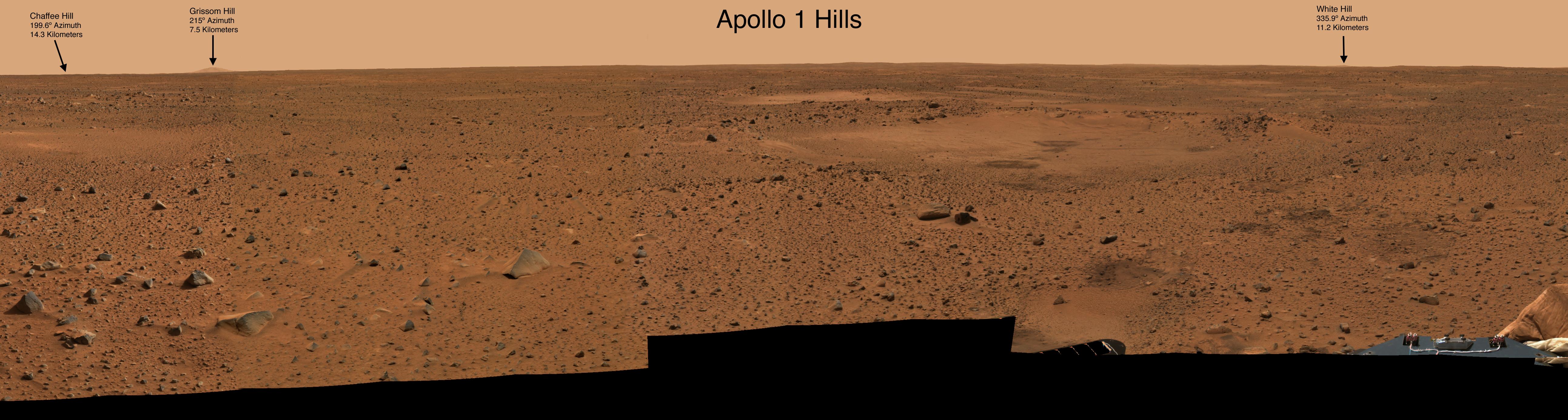
PIA05155:
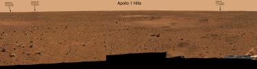
NASA Dedicates Martian Landmarks To Apollo 1 Crew
Full Resolution:
TIFF
(13.49 MB)
JPEG
(902.3 kB)
2004-09-11
Mars
Mars Exploration Rover (MER)
Mars Global Surveyor (MGS)
Mars Orbiter Camera (MOC)
Panorama Camera
872x814x3
PIA06865:
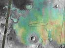
'Endurance Crater' Overview
Full Resolution:
TIFF
(870.7 kB)
JPEG
(66.8 kB)
1-100
101-200
201-300
301-400
401-500
501-600
601-700
701-800
801-900
901-1000
Currently displaying images:
1 - 100
of 1894


