Your search criteria found
1039
images
Mission
Go to PIAxxxxx:
Refine this list of images by:
Target:
Mars
Phobos
Sun
Instrument:
Alpha Particle X-ray Spectrometer
Capture Magnet
Context Camera (CTX)
Descent Image Motion Estimation System (DIMES)
Hazard Avoidance Camera
High Resolution Imaging Science Experiment (HiRISE)
High Resolution Instrument (HRI)
Mars Color Imager (MARCI)
Mars Orbiter Camera (MOC)
Microscopic Imager
Miniature Thermal Emission Spectrometer
Moessbauer Spectrometer
Navigation Camera
Panoramic Camera
Rock Abrasion Tool (RAT)
Click on an image for detailed information
Click on a column heading to sort in ascending or descending order
My
List
Addition Date
Target
Mission
Instrument
Size
2004-01-30
Mars
Mars Exploration Rover (MER)
Hazcam
1024x1024x3
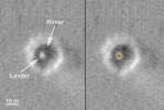
PIA05169:
Opportunity Lowers for Egress (animation)
Full Resolution:
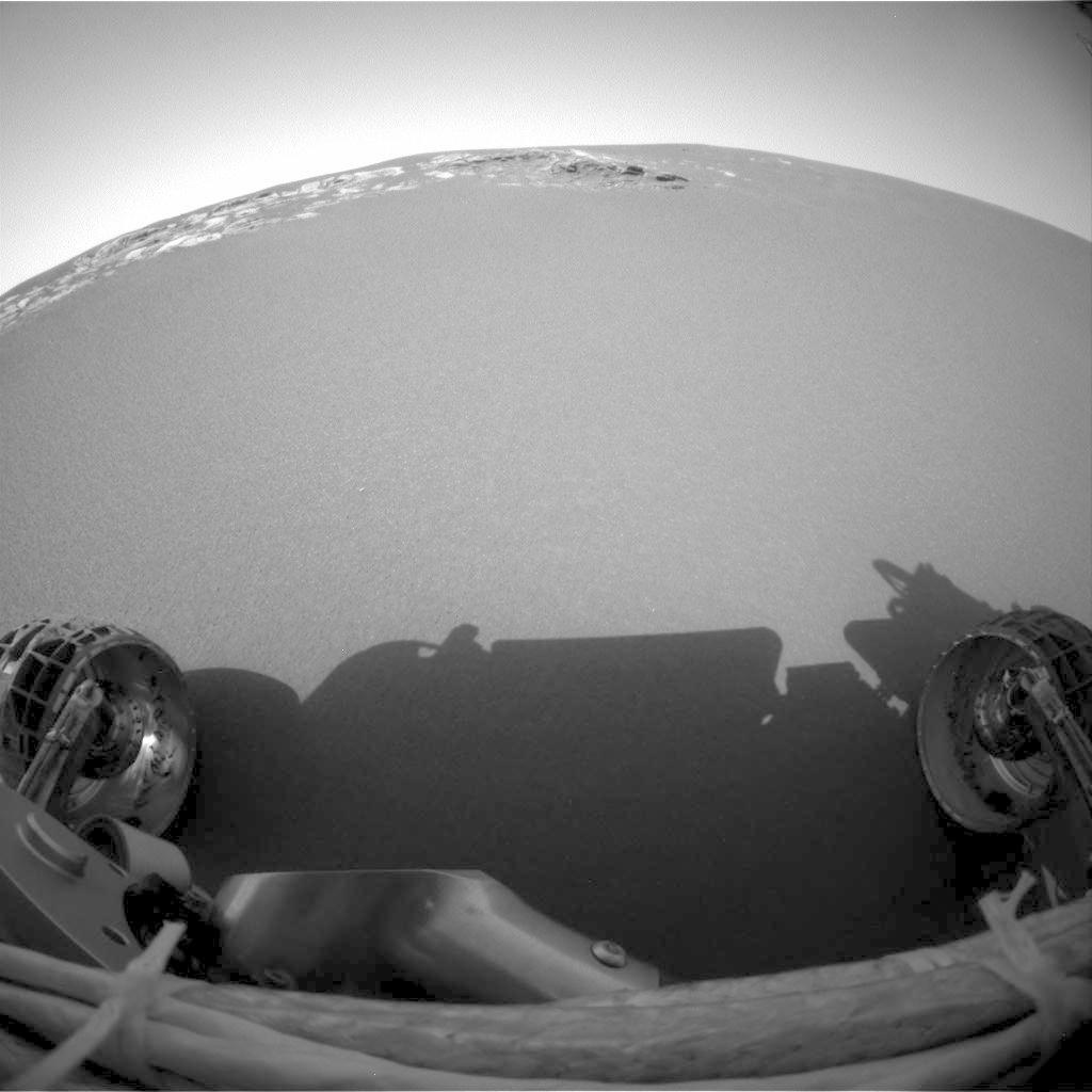
2004-01-30
Mars
Mars Exploration Rover (MER)
Navigation Camera
1024x1024x1
PIA05170:
Opportunity Egress Aid Contacts Soil
Full Resolution:
TIFF
(863.1 kB)
JPEG
(108 kB)
2004-01-31
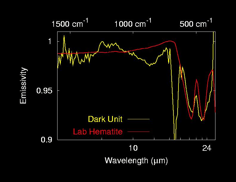
Mars
Mars Exploration Rover (MER)
Miniature Thermal Emission Spectrometer
792x612x3
PIA05179:
Hematite on Mars!
Full Resolution:
TIFF
(1.458 MB)
JPEG
(42.56 kB)
2004-01-31
Mars
Mars Exploration Rover (MER)
Navigation Camera
4444x1755x1
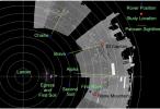
PIA05180:
Opportunity and Its Mother Ship
Full Resolution:
TIFF
(3.959 MB)
JPEG
(610.7 kB)
2004-01-31
Mars
Mars Exploration Rover (MER)
Hazcam
1024x1024x1
PIA05181:
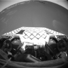
No Looking Back
Full Resolution:
TIFF
(864.8 kB)
JPEG
(83.69 kB)
2004-01-31
Mars
Mars Exploration Rover (MER)
Hazcam
1024x1024x1
PIA05182:
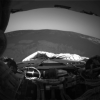
Opportunity on Its Own
Full Resolution:
TIFF
(831.9 kB)
JPEG
(89.71 kB)
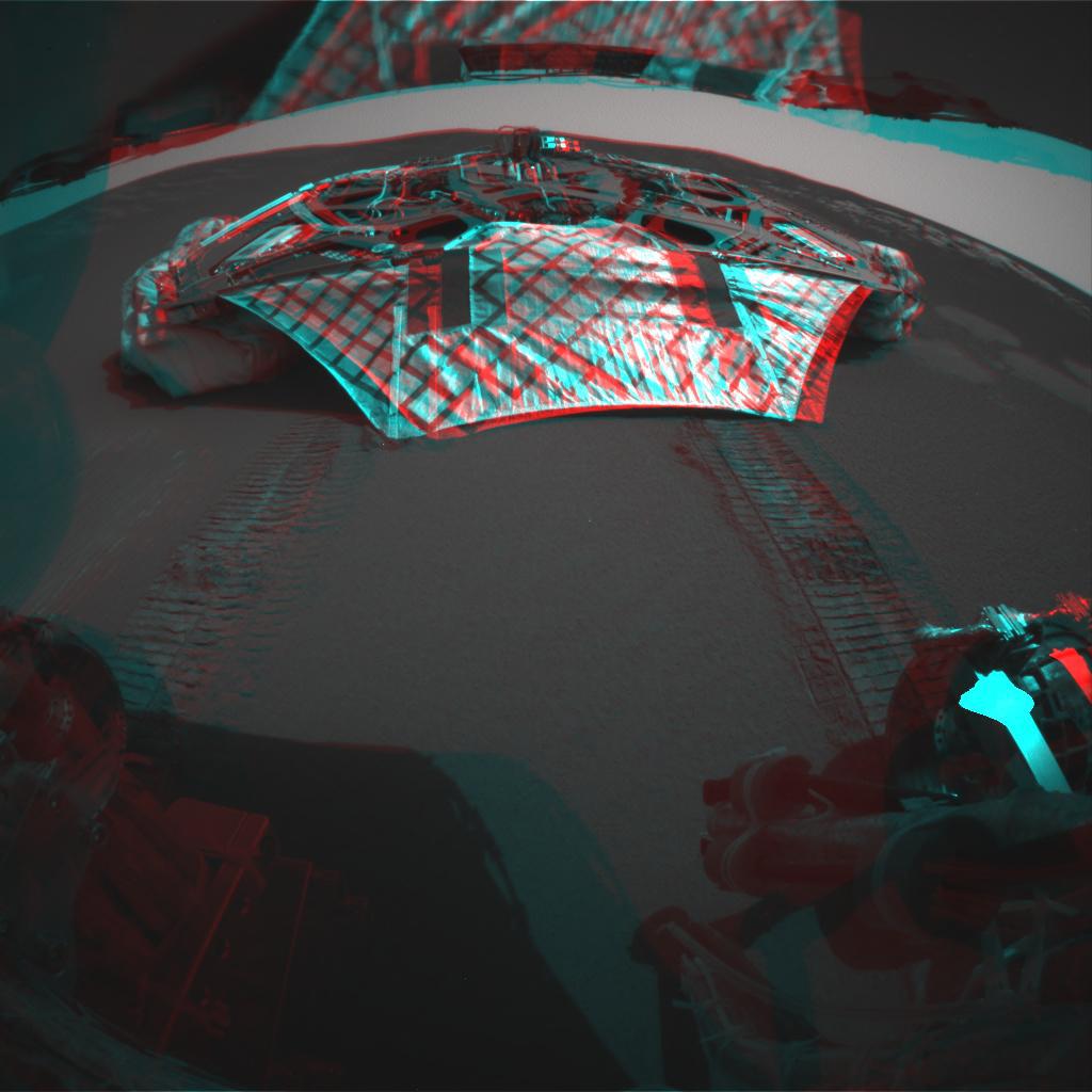
2004-01-31
Mars
Mars Exploration Rover (MER)
Hazcam
1024x1024x3
PIA05183:
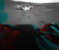
Vacant Lander in 3-D
Full Resolution:
TIFF
(2.145 MB)
JPEG
(89.33 kB)
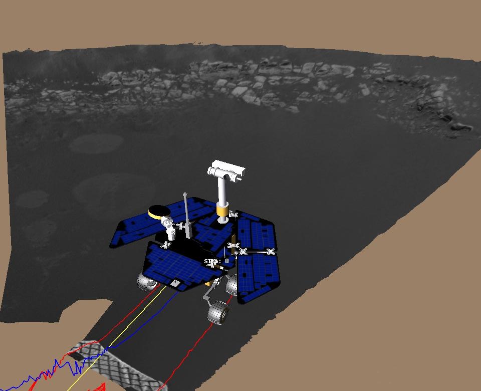
2004-01-31
Mars
Mars Exploration Rover (MER)
Navigation Camera
960x780x3
PIA05184:
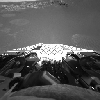
Virtual Rover on Its Own
Full Resolution:
TIFF
(773.8 kB)
JPEG
(55.49 kB)
2004-02-02
Mars
Mars Exploration Rover (MER)
Panoramic Camera
1065x789x3
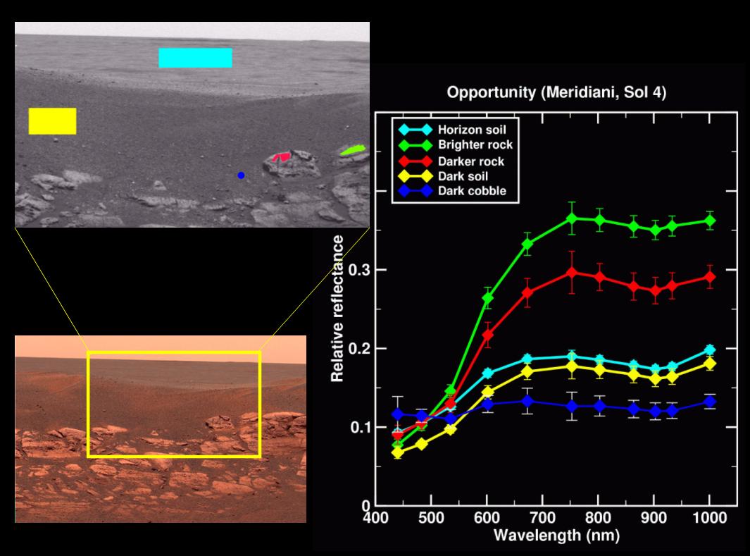
PIA05190:
Rock Outcrop Spectra
Full Resolution:
TIFF
(881 kB)
JPEG
(95.54 kB)
2004-02-02
Mars
Mars Exploration Rover (MER)
Panoramic Camera
1059x797x3
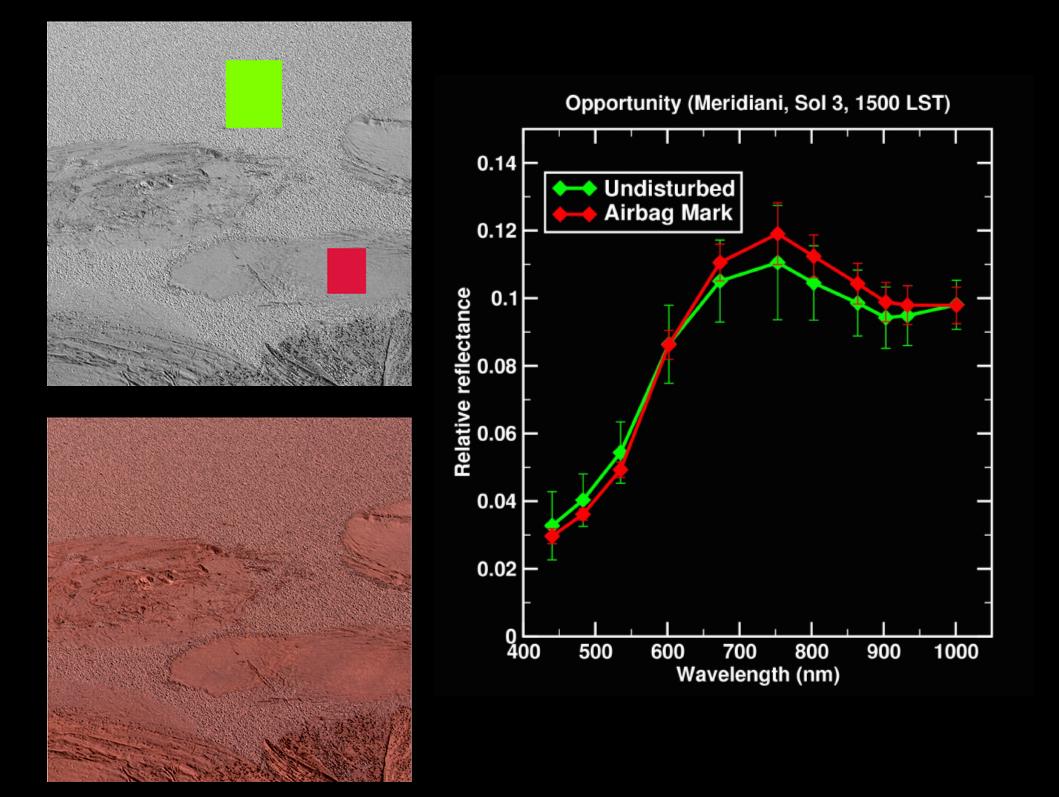
PIA05192:
Lily Pad Spectra
Full Resolution:
TIFF
(916.3 kB)
JPEG
(109.4 kB)
2004-02-02
Mars
Mars Exploration Rover (MER)
Hazcam
512x512x1
PIA05193:
Opportunity Stretches Out
Full Resolution:
TIFF
(203.2 kB)
JPEG
(19.26 kB)
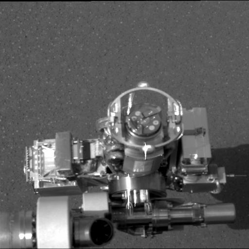
2004-02-02
Mars
Mars Exploration Rover (MER)
Panoramic Camera
512x512x1
PIA05194:
Rat on Mars
Full Resolution:
TIFF
(235.1 kB)
JPEG
(31.83 kB)
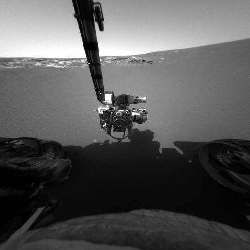
2004-02-02
Mars
Mars Exploration Rover (MER)
Panoramic Camera
Microscopic Imager
512x512x1
PIA05195:
Microscope on Mars
Full Resolution:
TIFF
(232.6 kB)
JPEG
(31.36 kB)
2004-02-02
Mars
Mars Exploration Rover (MER)
Alpha Particle X-ray Spectrometer
Panoramic Camera
512x512x1
PIA05196:
X-ray Machine on Mars
Full Resolution:
TIFF
(219.7 kB)
JPEG
(28.59 kB)
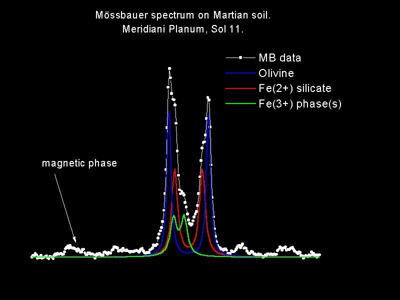
2004-02-02
Mars
Mars Exploration Rover (MER)
Moessbauer Spectrometer
Panoramic Camera
512x512x1
PIA05197:
Moessbauer on Mars
Full Resolution:
TIFF
(226.8 kB)
JPEG
(28.86 kB)
2004-02-02
Mars
Mars Exploration Rover (MER)
Hazcam
954x1024x3
PIA05198:
Opportunity Stretches Out (3-D)
Full Resolution:
TIFF
(1.857 MB)
JPEG
(74.63 kB)
2004-02-02
Mars
Mars Exploration Rover (MER)
Panoramic Camera
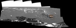
11388x1406x3
PIA05199:
As Far as Opportunity's Eye Can See
Full Resolution:
TIFF
(21.86 MB)
JPEG
(1.176 MB)
QTVR
(1.336 MB)
2004-02-04
Mars
Mars Exploration Rover (MER)
Moessbauer Spectrometer
800x600x3
PIA05203:
Meridiani's Autograph
Full Resolution:
TIFF
(173 kB)
JPEG
(38.87 kB)
2004-02-04
Mars
Mars Exploration Rover (MER)
Miniature Thermal Emission Spectrometer
Panoramic Camera
1319x722x3
PIA05204:
Thar be Hematite!
Full Resolution:
TIFF
(1.897 MB)
JPEG
(127.9 kB)
2004-02-04
Mars
Mars Exploration Rover (MER)
Hazcam
512x512x1
PIA05205:
Poised for Discovery
Full Resolution:
TIFF
(245.4 kB)
JPEG
(27.37 kB)
2004-02-04
Mars
Mars Exploration Rover (MER)
Microscopic Imager
Navigation Camera
Panoramic Camera
1127x1111x1
PIA05206:
Mars in a Grain of Sand
Full Resolution:
TIFF
(951.3 kB)
JPEG
(143.8 kB)
2004-02-04
Mars
Mars Exploration Rover (MER)
Microscopic Imager
1024x1024x1
PIA05207:
Mars Under the Microscope
Full Resolution:
TIFF
(1.05 MB)
JPEG
(374.5 kB)
2004-02-04
Mars
Mars Exploration Rover (MER)
Microscopic Imager
1016x1021x3
PIA05208:
Mars Under the Microscope (color)
Full Resolution:
TIFF
(3.116 MB)
JPEG
(233.7 kB)
2004-02-04
Mars
Mars Exploration Rover (MER)
Microscopic Imager
1016x1021x3
PIA05209:
Mars Under the Microscope (stretched)
Full Resolution:
TIFF
(3.116 MB)
JPEG
(339.7 kB)
2004-02-06
Mars
Mars Exploration Rover (MER)
Hazcam
1024x865x3
PIA05212:
Traversing Martian Terrain
Full Resolution:
TIFF
(1.379 MB)
JPEG
(71.74 kB)
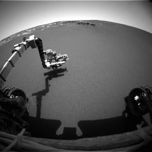
2004-02-06
Mars
Mars Exploration Rover (MER)
Hazcam
1024x1024x6
PIA05211:
Forging Ahead (linearized)
Full Resolution:
2004-02-06
Mars
Mars Exploration Rover (MER)
Microscopic Imager
1024x1024x2
PIA05213:
Now You See Them, Now You Don't
Full Resolution:
2004-02-06
Mars
Mars Exploration Rover (MER)
Hazcam
1024x1024x5
PIA05214:
Rear View of Opportunity's Drive
Full Resolution:
2004-02-06
Mars
Mars Exploration Rover (MER)
Hazcam
1024x1024x6
PIA05215:
Forging Ahead
Full Resolution:
2004-02-09
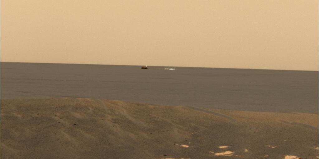
Mars
2001 Mars Odyssey
Mars Exploration Rover (MER)
1000x750x3
PIA05224:
Found You!
Full Resolution:
TIFF
(768.7 kB)
JPEG
(101.3 kB)
2004-02-09
Mars
Mars Exploration Rover (MER)
Descent Image Motion Estimation System (DIMES)
878x774x3
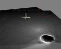
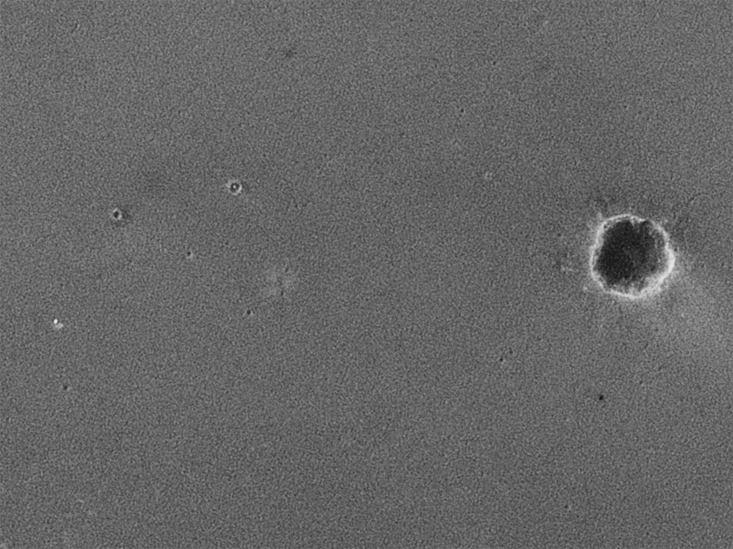
PIA05225:
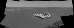
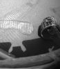
Opportunity's Hole in One
Full Resolution:
TIFF
(2.042 MB)
JPEG
(67.66 kB)
2004-02-09
Mars
Mars Exploration Rover (MER)
Descent Image Motion Estimation System (DIMES)
764x614x3
PIA05226:
Opportunity's Hole in One (Side View)
Full Resolution:
TIFF
(1.41 MB)
JPEG
(40.31 kB)
2004-02-09
Mars
Mars Exploration Rover (MER)
Descent Image Motion Estimation System (DIMES)
875x345x3
PIA05227:
Opportunity Bounces to a Stop
Full Resolution:
TIFF
(907.7 kB)
JPEG
(18.23 kB)
2004-02-09
Mars
2001 Mars Odyssey
Mars Global Surveyor (MGS)
Mars Exploration Rover (MER)
Descent Image Motion Estimation System (DIMES)
Mars Orbiter Camera (MOC)
Thermal Emission Imaging System
4000x5308x3
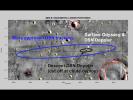
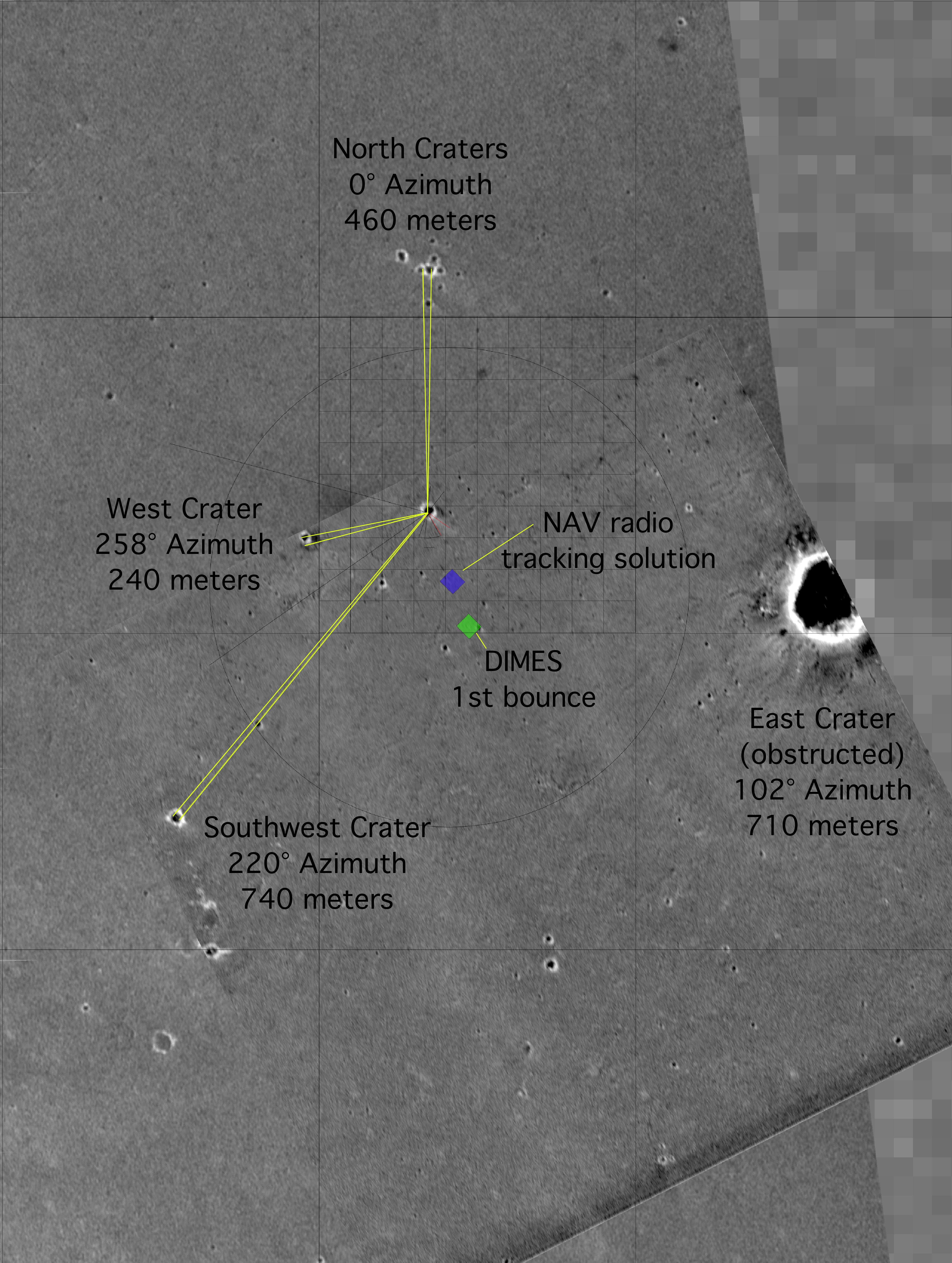
PIA05228:
"X" Marks the Spot
Full Resolution:
TIFF
(11.63 MB)
JPEG
(2.084 MB)
2004-02-09
Mars
Mars Global Surveyor (MGS)
Mars Exploration Rover (MER)
Mars Orbiter Camera (MOC)
1446x1084x1
PIA05229:
Reconstructing the Scene of Landing
Full Resolution:
TIFF
(1.506 MB)
JPEG
(240.2 kB)
2004-02-09
Mars
Mars Global Surveyor (MGS)
Mars Exploration Rover (MER)
Mars Orbiter Camera (MOC)
1200x900x1
PIA05230:
'You Are Here'
Full Resolution:
TIFF
(671.3 kB)
JPEG
(44.86 kB)
2004-02-09
Mars
Mars Global Surveyor (MGS)
Mars Exploration Rover (MER)
Mars Orbiter Camera (MOC)
1024x768x3
PIA05232:
An Old Friend
Full Resolution:
TIFF
(1.234 MB)
JPEG
(79.05 kB)
2004-02-09
Mars
Mars Exploration Rover (MER)
Panoramic Camera
1024x512x3
PIA05233:
Opportunity Spies Its Backshell
Full Resolution:
TIFF
(1.105 MB)
JPEG
(34.25 kB)
2004-02-09
Mars
Mars Exploration Rover (MER)
Panoramic Camera
5989x2270x3
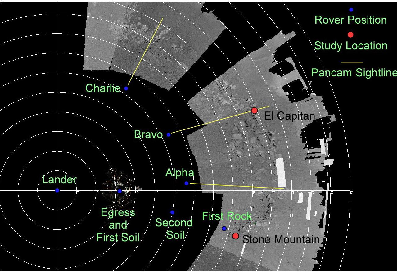
PIA05234:
Stone Mountain in Context
Full Resolution:
TIFF
(9.509 MB)
JPEG
(1.106 MB)
2004-02-09
Mars
Mars Exploration Rover (MER)
Panoramic Camera
1025x1025x3
PIA05235:
Stone Mountain
Full Resolution:
TIFF
(2.578 MB)
JPEG
(145.9 kB)
2004-02-09
Mars
Mars Exploration Rover (MER)
Panoramic Camera
1025x1025x3
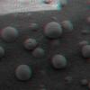
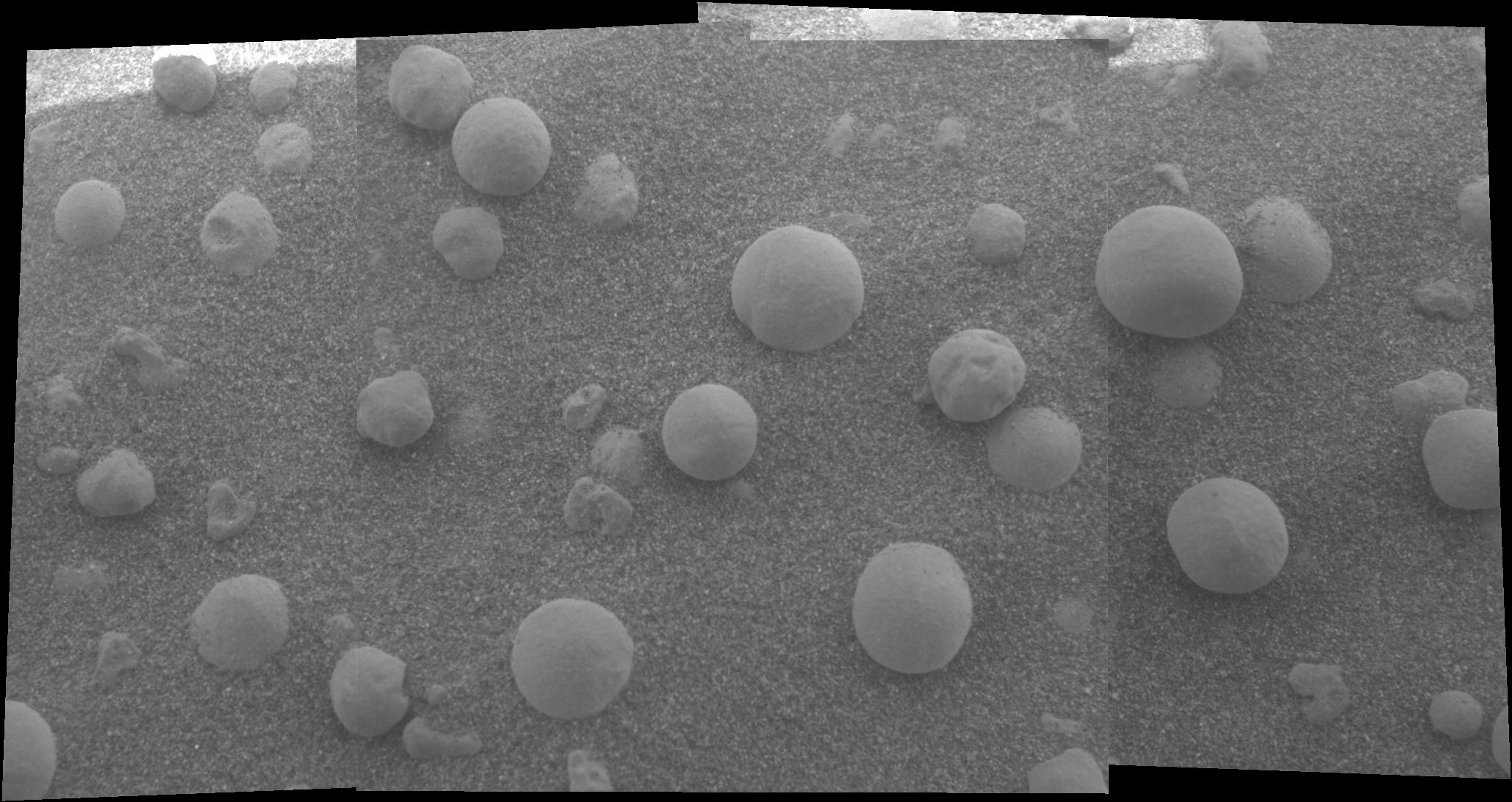
PIA05236:
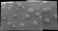
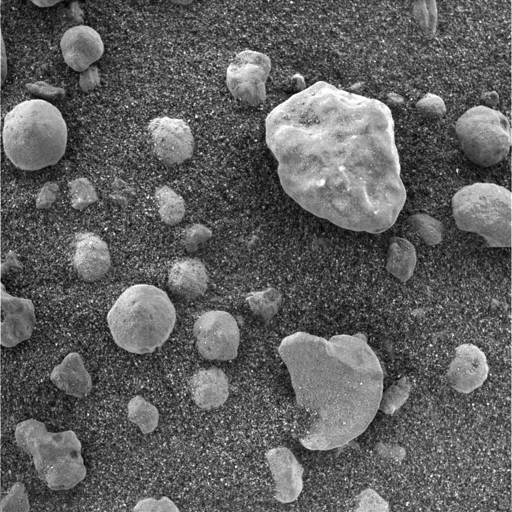
Speckled with Spherules
Full Resolution:
TIFF
(3.156 MB)
JPEG
(239.7 kB)
2004-02-09
Mars
Mars Exploration Rover (MER)
Microscopic Imager
1024x1024x1
PIA05237:
Mars Rock Formation Poses Mystery
Full Resolution:
TIFF
(966.3 kB)
JPEG
(144.9 kB)
2004-02-09
Mars
Mars Exploration Rover (MER)
Microscopic Imager
1024x1024x1
PIA05238:
Mars Rock Formation Poses Mystery-2
Full Resolution:
TIFF
(616.2 kB)
JPEG
(85.78 kB)
2004-02-09
Mars
Mars Global Surveyor (MGS)
Mars Exploration Rover (MER)
5440x5400x3
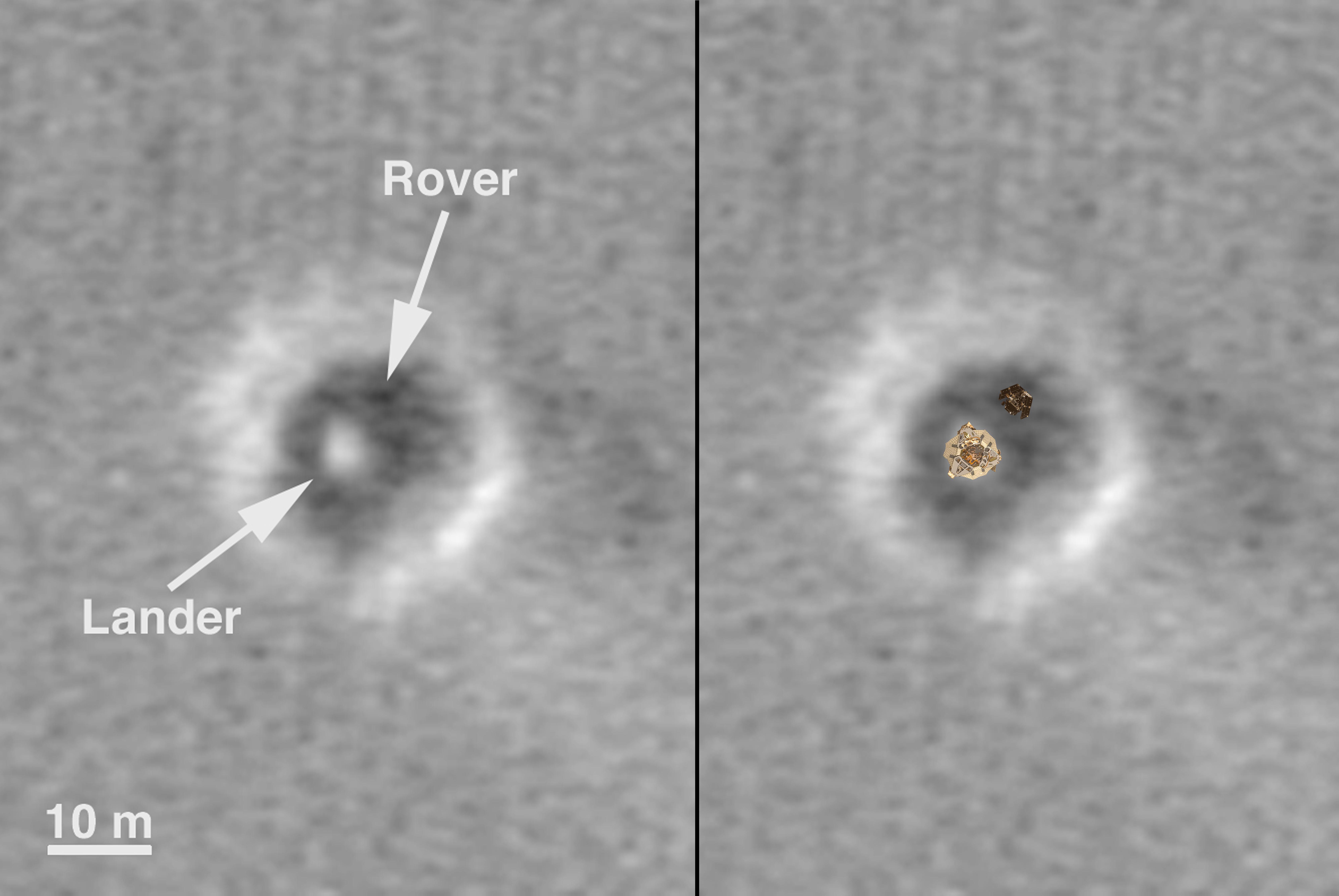
PIA05231:
Top View of a Computer Graphic Model of the Opportunity Lander and Rover
Full Resolution:
TIFF
(12.76 MB)
JPEG
(723 kB)
2004-02-09
Mars
Mars Exploration Rover (MER)
Mars Orbiter Camera (MOC)
6725x4500x3
PIA05265:
Comparison of a Computer Graphic Model of the Opportunity Lander and Rover with MOC Orbital Image
Full Resolution:
TIFF
(12.66 MB)
JPEG
(825.1 kB)
2004-02-11
Mars
Mars Exploration Rover (MER)
Navigation Camera
1279x876x3
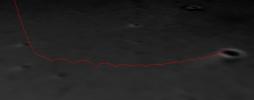
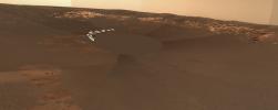
PIA05260:
Opportunity's Path
Full Resolution:
TIFF
(1.047 MB)
JPEG
(187.6 kB)
2004-02-12
Mars
Mars Exploration Rover (MER)
720x480x3
PIA05269:
Inspector Gadget
Full Resolution:
TIFF
(431.5 kB)
JPEG
(27.24 kB)
2004-02-12
Mars
Mars Exploration Rover (MER)
Microscopic Imager
1024x1024x3
PIA05270:
Martian Microscope
Full Resolution:
TIFF
(2.388 MB)
JPEG
(91.29 kB)
2004-02-12
Mars
Mars Exploration Rover (MER)
Microscopic Imager
2058x1092x1
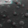
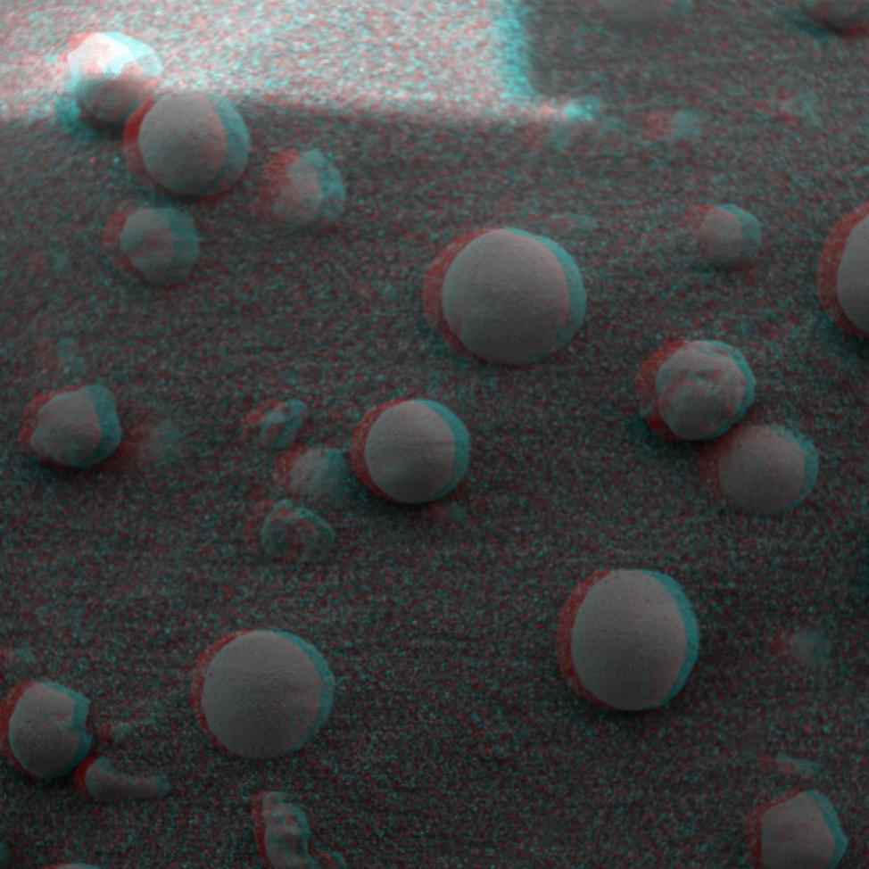
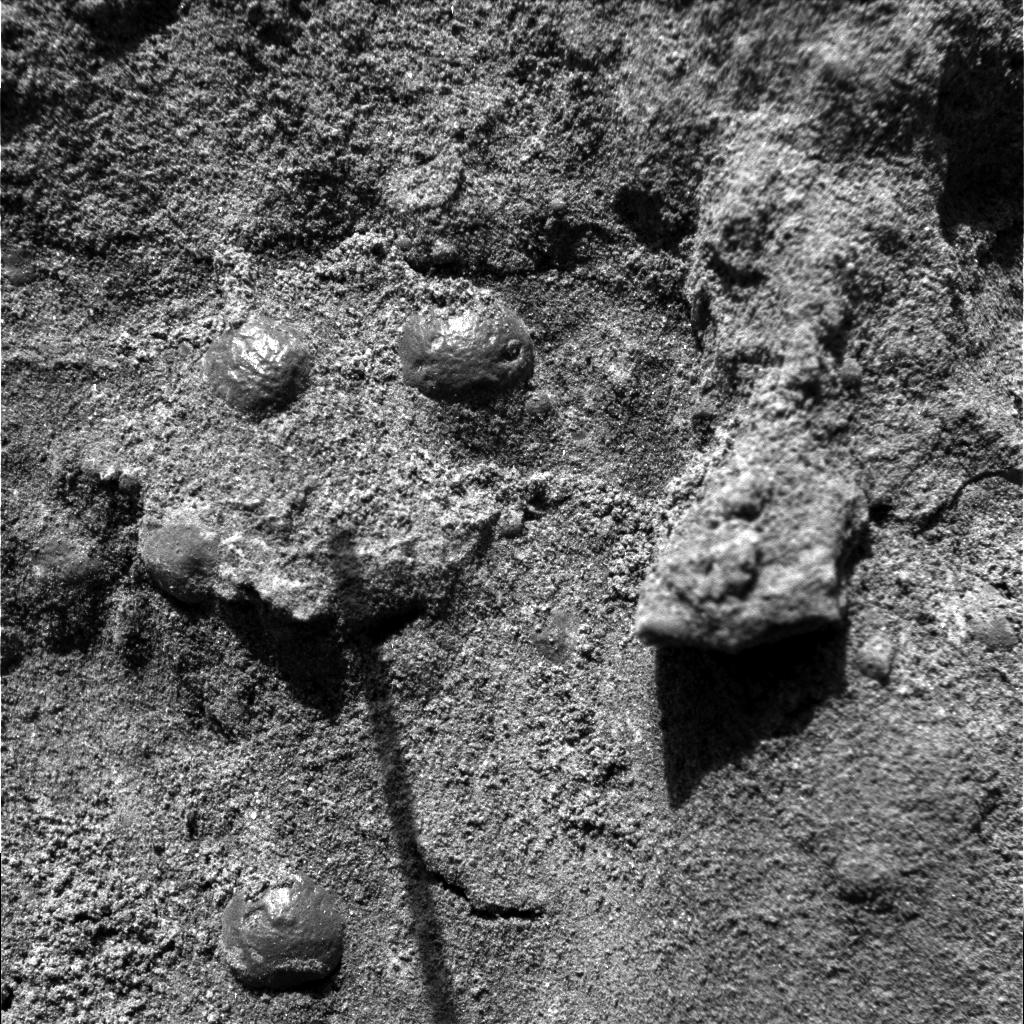
PIA05273:
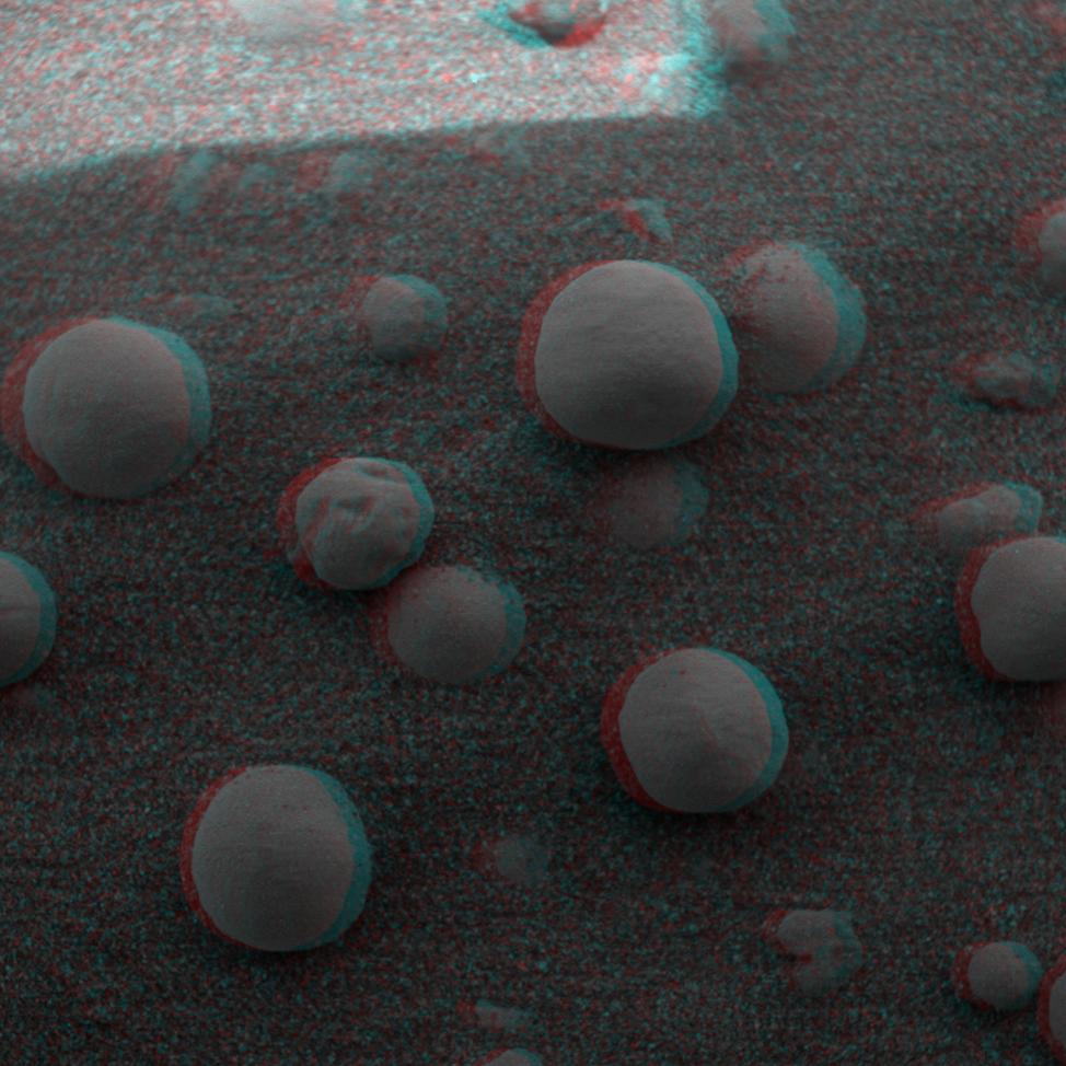
"Berries" on the Ground
Full Resolution:
TIFF
(1.894 MB)
JPEG
(275.8 kB)
2004-02-12
Mars
Mars Exploration Rover (MER)
Moessbauer Spectrometer
974x974x3
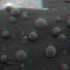
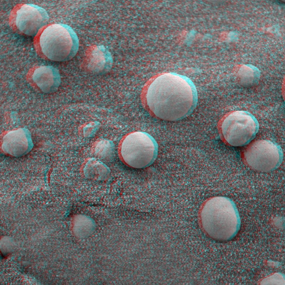
PIA05274:
"Berries" on the Ground 2 (3-D)
Full Resolution:
TIFF
(2.211 MB)
JPEG
(107.9 kB)
2004-02-12
Mars
Mars Exploration Rover (MER)
Moessbauer Spectrometer
974x974x3
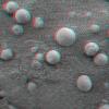
PIA05275:
"Berries" on the Ground 2 (3-D)
Full Resolution:
TIFF
(2.621 MB)
JPEG
(190.1 kB)
2004-02-12
Mars
Mars Exploration Rover (MER)
Microscopic Imager
1920x1080x1
PIA05276:
A Sharp Look at Robert E
Full Resolution:
TIFF
(817.1 kB)
JPEG
(109.9 kB)
2004-02-13
Mars
Mars Exploration Rover (MER)
Microscopic Imager
974x974x3
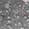
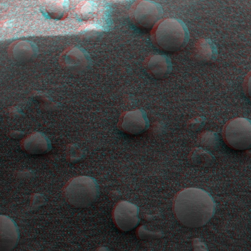
PIA05284:
Eye-popping 'Berries'
Full Resolution:
TIFF
(2.339 MB)
JPEG
(117.8 kB)
2004-02-13
Mars
Mars Exploration Rover (MER)
Microscopic Imager
974x974x3
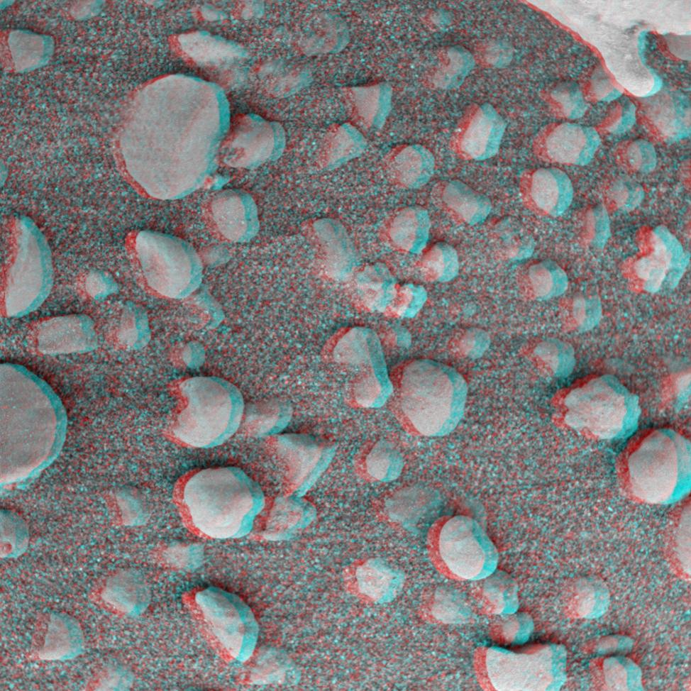
PIA05285:
More Eye-popping 'Berries'
Full Resolution:
TIFF
(2.385 MB)
JPEG
(130.6 kB)
2004-02-13
Mars
Mars Exploration Rover (MER)
Microscopic Imager
974x974x3
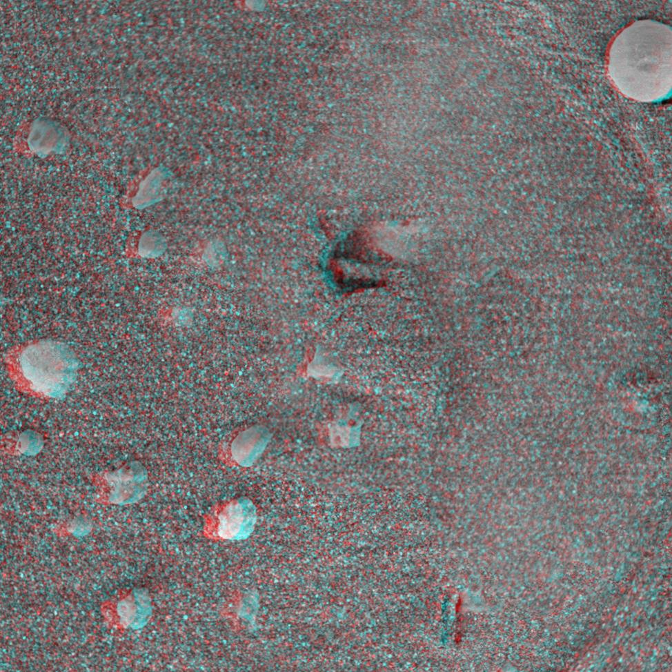
PIA05286:
Even More Eye-popping 'Berries'
Full Resolution:
TIFF
(2.674 MB)
JPEG
(204.2 kB)
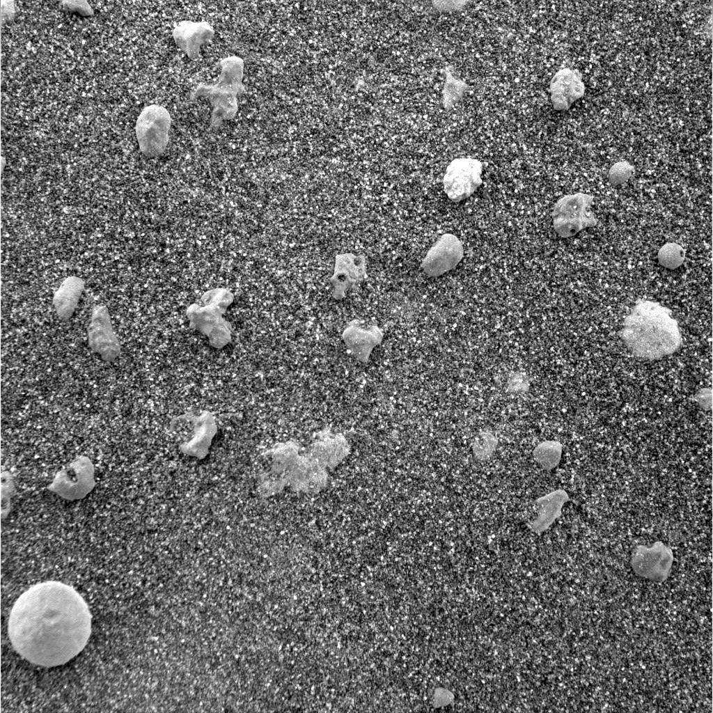
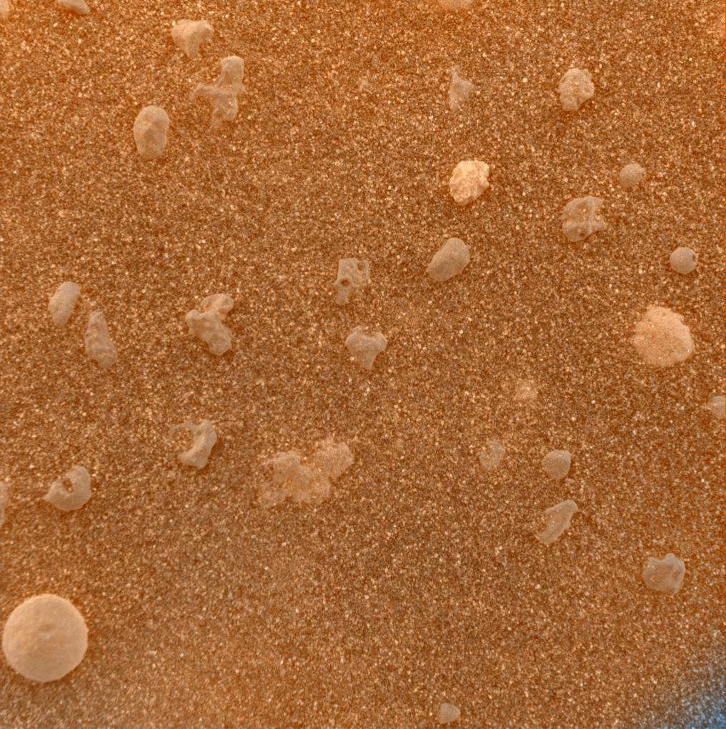
2004-02-14
Mars
Mars Exploration Rover (MER)
Microscopic Imager
Moessbauer Spectrometer
974x974x3
PIA05287:
Moessbauer Footprint in the Soil
Full Resolution:
TIFF
(2.636 MB)
JPEG
(227.1 kB)
2004-02-14
Mars
Mars Exploration Rover (MER)
Microscopic Imager
512x512x1
PIA05288:
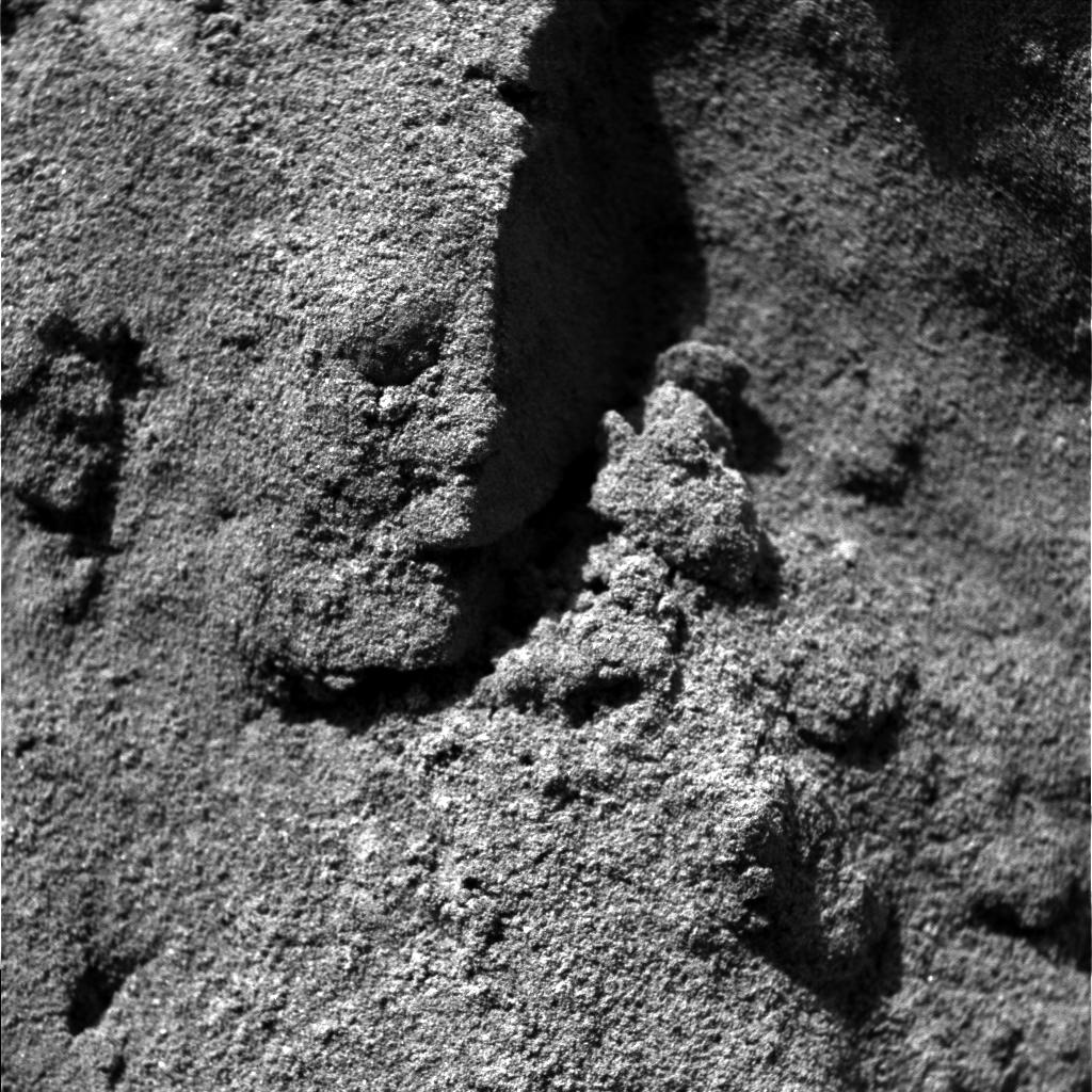
Ground Inspection
Full Resolution:
TIFF
(262.6 kB)
JPEG
(57.54 kB)
2004-02-14
Mars
Mars Exploration Rover (MER)
Miniature Thermal Emission Spectrometer
Panoramic Camera
5781x731x3
PIA05289:
Red Marks the Spot
Full Resolution:
TIFF
(3.704 MB)
JPEG
(299.6 kB)
2004-02-16
Mars
Mars Exploration Rover (MER)
Hazcam
1024x1024x1
PIA05291:
After a U-Turn
Full Resolution:
TIFF
(930.2 kB)
JPEG
(115.3 kB)
2004-02-17
Mars
Mars Exploration Rover (MER)
Hazcam
Navigation Camera
2000x2000x1
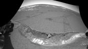
PIA05300:
Track-and-Trench
Full Resolution:
TIFF
(1.403 MB)
JPEG
(198.3 kB)
2004-02-17
Mars
Mars Exploration Rover (MER)
Hazcam
Navigation Camera
5405x5405x1
PIA05301:
Track-and-Trench 2
Full Resolution:
TIFF
(10.22 MB)
JPEG
(1.208 MB)
2004-02-18
Mars
Mars Global Surveyor (MGS)
Mars Exploration Rover (MER)
Hazcam
Mars Orbiter Camera (MOC)
Panoramic Camera
2014x1482x1
PIA05304:
Dragging Its Foot
Full Resolution:
TIFF
(2.505 MB)
JPEG
(202.4 kB)
2004-02-17
Mars
Mars Exploration Rover (MER)
Hazcam
1025x947x1
PIA05305:
Fresh Soil for Inspection
Full Resolution:
TIFF
(811.3 kB)
JPEG
(89.32 kB)
2004-02-17
Mars
Mars Exploration Rover (MER)
Hazcam
1431x953x1
PIA05306:
Peeling Back the Layers of Mars
Full Resolution:
TIFF
(1.184 MB)
JPEG
(140.7 kB)
2004-02-17
Mars
Mars Exploration Rover (MER)
Hazcam
1022x624x1
PIA05307:
What Lies Beneath
Full Resolution:
TIFF
(566.1 kB)
JPEG
(67.3 kB)
2004-02-17
Mars
Mars Exploration Rover (MER)
692x609x3
PIA05309:
Opportunity Digs
Full Resolution:
TIFF
(340 kB)
JPEG
(31.04 kB)
2004-02-17
Mars
Mars Exploration Rover (MER)
904x469x3
PIA05310:
The Road Less Traveled
Full Resolution:
TIFF
(394 kB)
JPEG
(36.64 kB)
2004-02-17
Mars
Mars Exploration Rover (MER)
Hazcam
Navigation Camera
5087x2160x1
PIA05311:
Opportunity Trenches Martian Soil
Full Resolution:
TIFF
(6.251 MB)
JPEG
(739.6 kB)
2004-02-17
Mars
Mars Exploration Rover (MER)
Navigation Camera
4476x1734x1
PIA05312:
At Home in the Crater
Full Resolution:
TIFF
(3.667 MB)
JPEG
(423.4 kB)
2004-02-18
Mars
Mars Exploration Rover (MER)
Hazcam
544x624x7
PIA05308:
Dragging Its Foot
Full Resolution:
2004-02-19
Mars
Mars Exploration Rover (MER)
Microscopic Imager
1024x1024x1
PIA05324:
Tiny Pebbles
Full Resolution:
TIFF
(1.05 MB)
JPEG
(288.2 kB)
2004-02-19
Mars
Mars Exploration Rover (MER)
Microscopic Imager
Navigation Camera
1508x853x1
PIA05325:
Taking a Deeper Look
Full Resolution:
TIFF
(861.1 kB)
JPEG
(132.6 kB)
2004-02-19
Mars
Mars Exploration Rover (MER)
Microscopic Imager
1024x1024x1
PIA05326:
The Mystery of the Sparkling Spheres
Full Resolution:
TIFF
(1.05 MB)
JPEG
(317.9 kB)
2004-02-19
Mars
Mars Exploration Rover (MER)
Microscopic Imager
Moessbauer Spectrometer
1024x1024x1
PIA05327:
Moessbauer Nose Print
Full Resolution:
TIFF
(913.4 kB)
JPEG
(146.4 kB)
2004-02-19
Mars
Mars Exploration Rover (MER)
Microscopic Imager
1735x2272x1
PIA05331:
"Stucco" Walls
Full Resolution:
TIFF
(2.167 MB)
JPEG
(443.7 kB)
2004-02-19
Mars
Mars Exploration Rover (MER)
Microscopic Imager
1024x1024x1
PIA05332:
"Stucco" Walls-2
Full Resolution:
TIFF
(1.05 MB)
JPEG
(232.7 kB)
2004-02-19
Mars
Mars Exploration Rover (MER)
Alpha Particle X-ray Spectrometer
1092x724x3
PIA05322:
Grooving in Trenchtown (computer animation)
Full Resolution:
TIFF
(1.137 MB)
JPEG
(77.74 kB)
2004-02-19
Mars
Mars Exploration Rover (MER)
Hazcam
512x512x9
PIA05323:
Grooving in Trenchtown
Full Resolution:
2004-02-19
Mars
Mars Exploration Rover (MER)
Panoramic Camera
13884x3356x1
PIA05328:
Charlie Flats and El Capitan
Full Resolution:
TIFF
(25.4 MB)
JPEG
(6.156 MB)
2004-02-20
Mars
Mars Exploration Rover (MER)
Panoramic Camera
Rock Abrasion Tool (RAT)
1274x896x3
PIA05338:
Plotting and Scheming
Full Resolution:
TIFF
(2.938 MB)
JPEG
(208 kB)
2004-02-24
Mars
Mars Exploration Rover (MER)
Hazcam
Rock Abrasion Tool (RAT)
512x512x1
PIA05442:
Opportunity at El Capitan
Full Resolution:
TIFF
(262.6 kB)
JPEG
(38.01 kB)
2004-02-25
Mars
Mars Exploration Rover (MER)
Microscopic Imager
Rock Abrasion Tool (RAT)
963x963x1
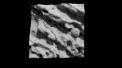
PIA05445:
Opportunity Slices into the Surface of Mars
Full Resolution:
TIFF
(928.6 kB)
JPEG
(207.1 kB)
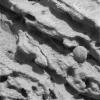
2004-02-25
Mars
Mars Exploration Rover (MER)
Microscopic Imager
Rock Abrasion Tool (RAT)
965x965x3
PIA05446:
Grinding Wheel Profile
Full Resolution:
TIFF
(1.878 MB)
JPEG
(226.9 kB)
2004-02-26
Mars
Mars Exploration Rover (MER)
Panoramic Camera
360x240x101
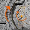
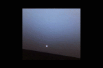
PIA05343:
The Sun Sets on Mars
Full Resolution:
2004-02-26
Mars
Mars Exploration Rover (MER)
Panoramic Camera
2560x1022x3
PIA05451:
Opportunity Landing Spot Panorama (3-D Model)
Full Resolution:
TIFF
(4.896 MB)
JPEG
(191 kB)
2004-02-26
Mars
Mars Exploration Rover (MER)
Panoramic Camera
512x512x3
PIA05456:
Charlie Flats
Full Resolution:
TIFF
(787.5 kB)
JPEG
(66.55 kB)
2004-02-26
Mars
Mars Exploration Rover (MER)
Panoramic Camera
1661x1400x3
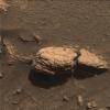
PIA05457:
El Capitan
Full Resolution:
TIFF
(5.975 MB)
JPEG
(551.8 kB)
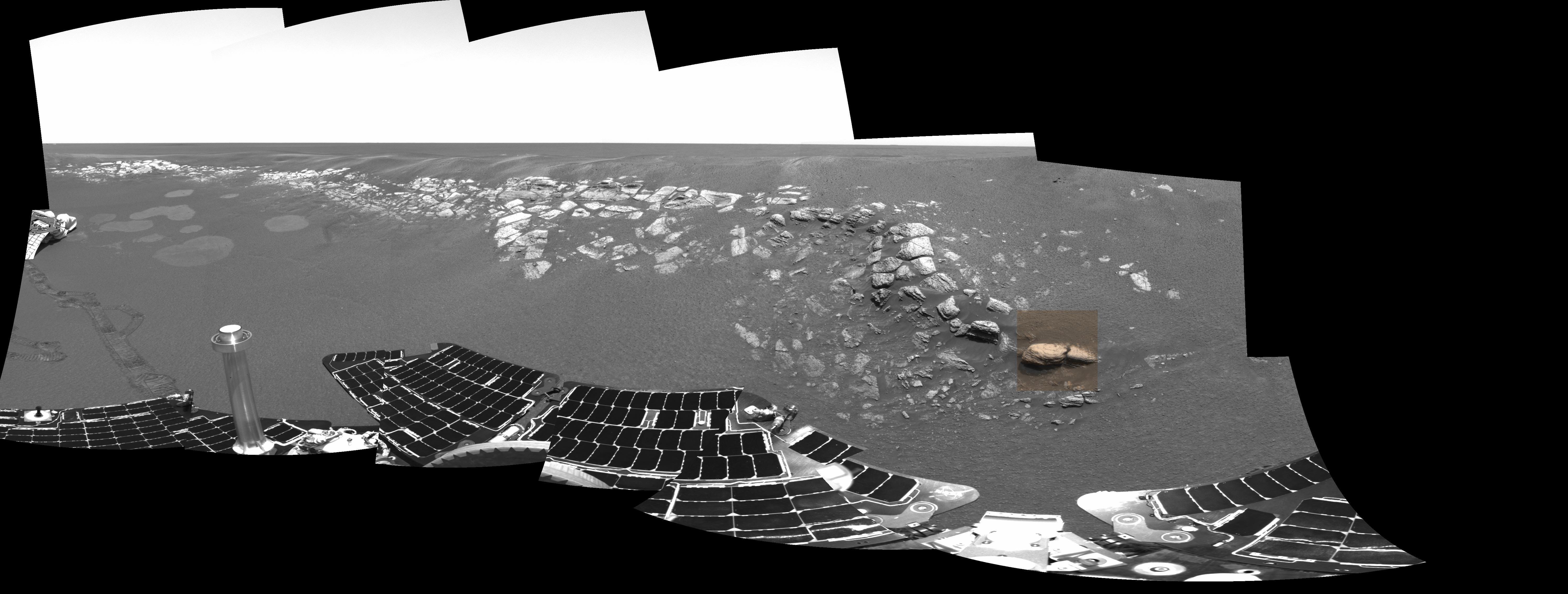
2004-02-27
Mars
Mars Exploration Rover (MER)
Hazcam
Rock Abrasion Tool (RAT)
1024x1024x1
PIA05459:
Circular Signs of the Rock Abrasion Tool
Full Resolution:
TIFF
(1.023 MB)
JPEG
(133.8 kB)
2004-02-27
Mars
Mars Exploration Rover (MER)
Panoramic Camera
4367x2997x3
PIA05460:
Opportunity's Empty Nest
Full Resolution:
TIFF
(24.87 MB)
JPEG
(741.8 kB)
2004-02-27
Mars
Mars Exploration Rover (MER)
Panoramic Camera
1113x731x3
PIA05461:
Pre-Planning the "Last Chance"
Full Resolution:
TIFF
(852.1 kB)
JPEG
(152.5 kB)
2004-03-02
Mars
Mars Exploration Rover (MER)
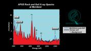
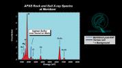
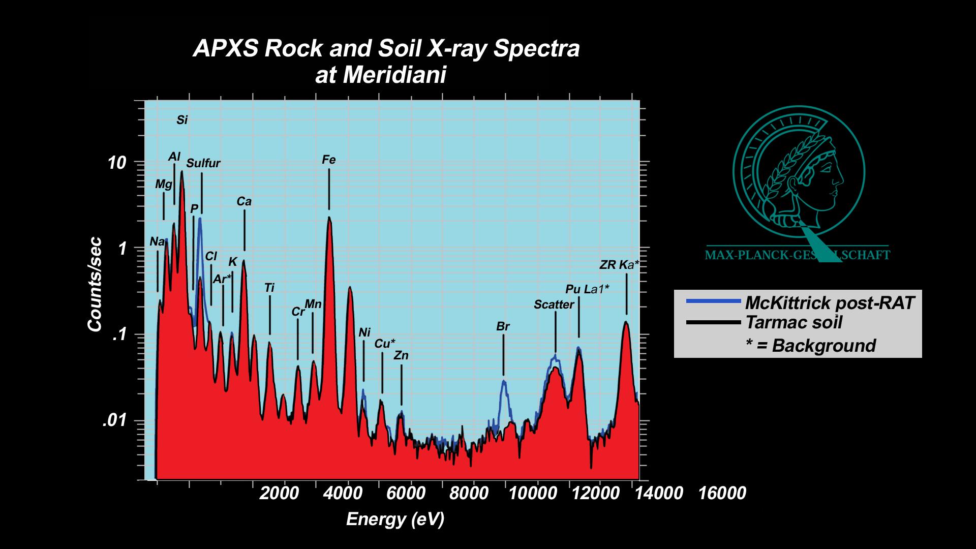
Alpha Particle X-ray Spectrometer
1920x1080x3
PIA05467:
History Leaves Salts Behind
Full Resolution:
TIFF
(600.3 kB)
JPEG
(143.3 kB)
2004-03-02
Mars
Mars Exploration Rover (MER)
Alpha Particle X-ray Spectrometer
Rock Abrasion Tool (RAT)
1920x1080x3
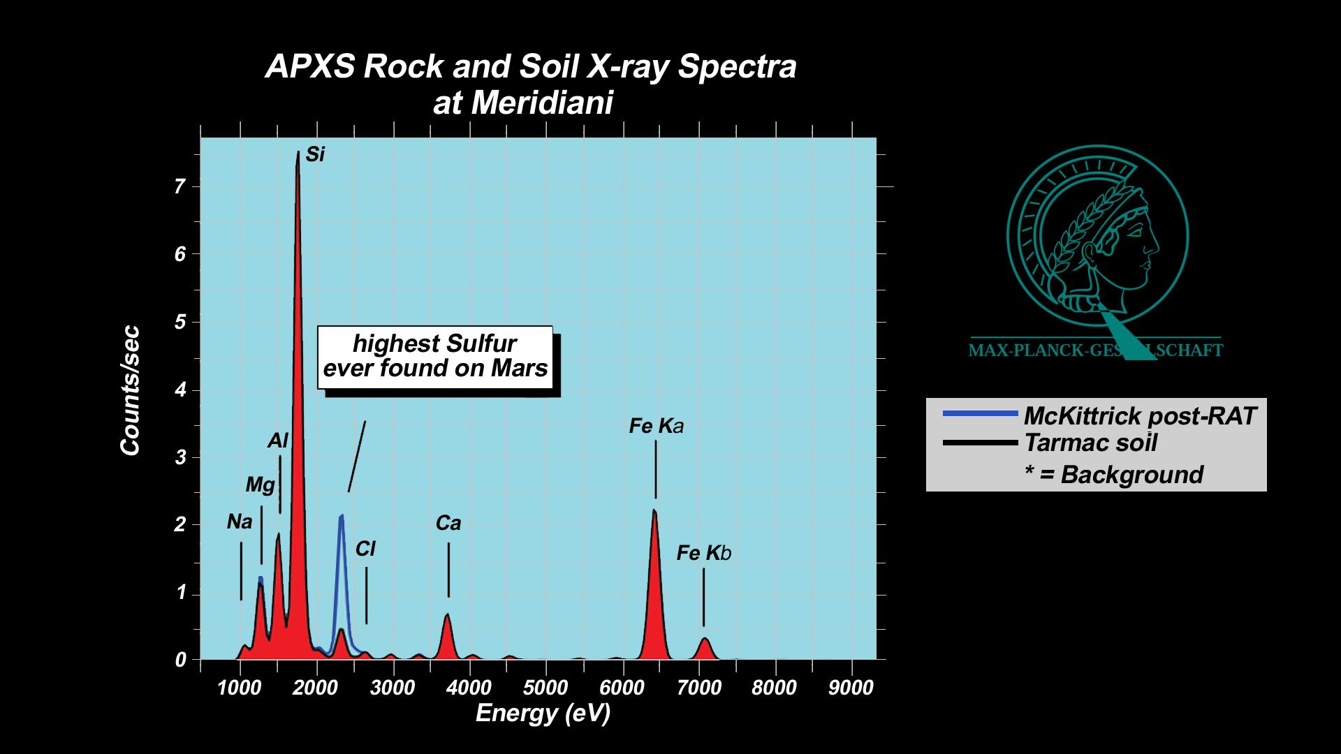
PIA05468:
"McKittrick" Rich in Sulfur
Full Resolution:
TIFF
(546.9 kB)
JPEG
(137.5 kB)
2004-03-02
Mars
Mars Exploration Rover (MER)
Alpha Particle X-ray Spectrometer
Rock Abrasion Tool (RAT)
1920x1080x3
PIA05469:
Salty Martian Rock
Full Resolution:
TIFF
(597 kB)
JPEG
(161.6 kB)
2004-03-02
Mars
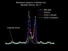
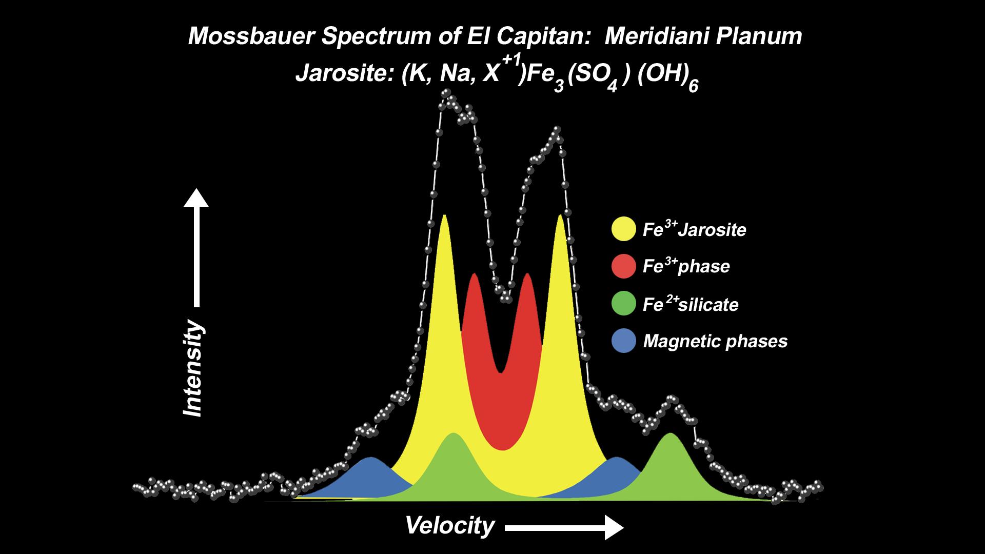
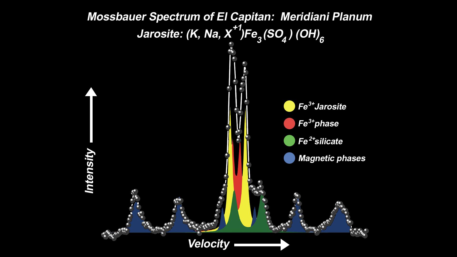
Mars Exploration Rover (MER)
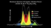
Moessbauer Spectrometer
1920x1080x3
PIA05470:
Mineral Tells Tale of Watery Past
Full Resolution:
TIFF
(427.8 kB)
JPEG
(118.6 kB)
2004-03-02
Mars
Mars Exploration Rover (MER)
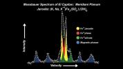
Moessbauer Spectrometer
1920x1080x3
PIA05471:
Mineral Tells Tale of Watery Past-2
Full Resolution:
TIFF
(402.9 kB)
JPEG
(116.1 kB)
2004-03-02
Mars
Mars Exploration Rover (MER)
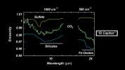
Miniature Thermal Emission Spectrometer
1920x1080x3
PIA05472:
"El Capitan" Exposed!
Full Resolution:
TIFF
(436.2 kB)
JPEG
(107.3 kB)
2004-03-02
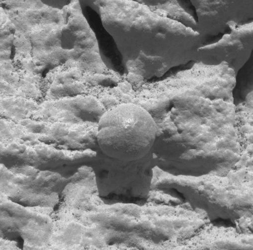
Mars
Mars Exploration Rover (MER)
Microscopic Imager
732x733x1
PIA05473:
Focused on Robert E
Full Resolution:
TIFF
(462.5 kB)
JPEG
(43.92 kB)
2004-03-02
Mars
Mars Exploration Rover (MER)
Microscopic Imager
431x428x1
PIA05474:
Focus on El Capitan
Full Resolution:
TIFF
(184.9 kB)
JPEG
(31.96 kB)
2004-03-02
Mars
Mars Exploration Rover (MER)
Microscopic Imager
509x503x1
PIA05475:
Focus on El Capitan-2
Full Resolution:
TIFF
(256.5 kB)
JPEG
(41.59 kB)
2004-03-02
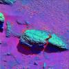
Mars
Mars Exploration Rover (MER)
Microscopic Imager
1021x1024x1
PIA05476:
Focus on El Capitan-3
Full Resolution:
TIFF
(1.047 MB)
JPEG
(208.7 kB)
1-100
101-200
201-300
301-400
401-500
501-600
601-700
701-800
801-900
901-1000
Currently displaying images:
101 - 200
of 1039


