|
Your search criteria found 817 images Collection Type |
| My List |
Addition Date | Target | Mission |
Instrument
|
Size |

|
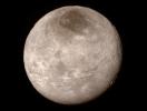
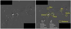
2015-07-15 | Charon |
New Horizons |
LORRI |
1050x794x3 |
|
|||||
|
|
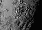
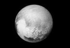
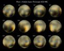
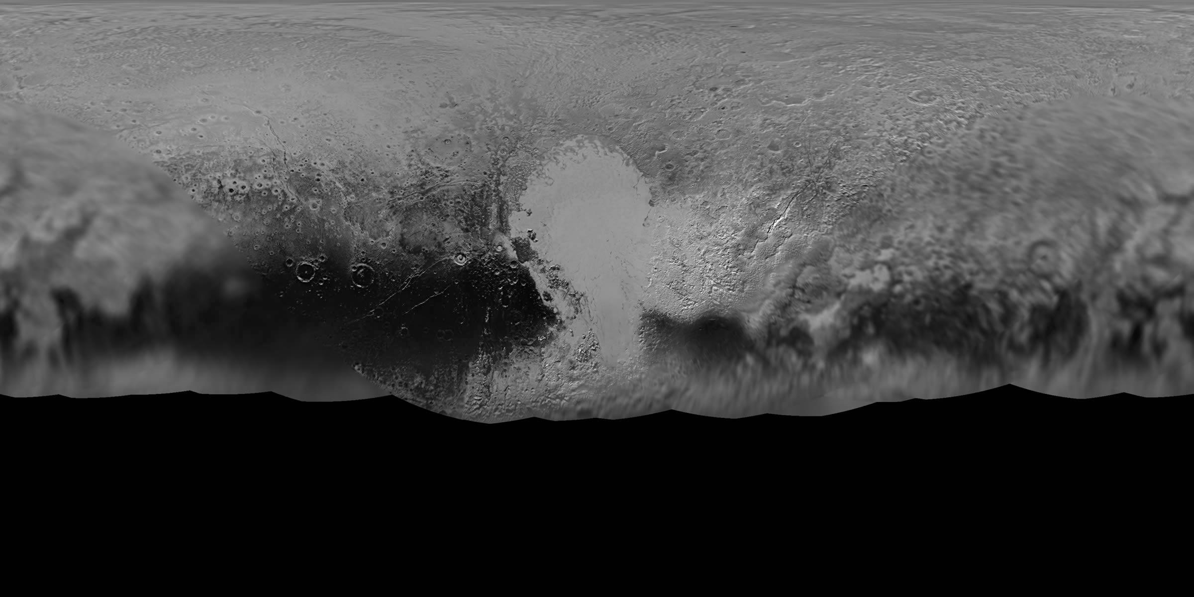
2015-07-15 | Pluto |
New Horizons |
LORRI |
1041x742x1 |
|
|||||
|
|
2015-07-15 | Hydra |
New Horizons |
LORRI |
1050x704x1 |
|
|||||
|
|
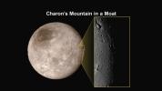
2015-07-16 | Charon |
New Horizons |
LORRI |
1920x1080x3 |
|
|||||
|
|
2015-07-17 | Pluto |
New Horizons |
LORRI |
1280x720x3 |
|
|||||
|
|
2015-07-17 | Pluto |
New Horizons |
LORRI |
1280x720x3 |
|
|||||
|
|
2015-07-17 | Pluto |
New Horizons |
LORRI |
1280x720x3 |

|
|||||
|
|
2015-07-21 | Pluto |
New Horizons |
LORRI |
1041x1039x1 |
|
|||||
|
|
2015-07-25 | Pluto |
New Horizons |
LORRI |
1920x1080x3 |

|
|||||
|
|
2015-07-27 | Pluto |
New Horizons |
LORRI |
18630x9315x1 |
|
|||||
|
|
2015-07-30 | Charon |
New Horizons |
LORRI |
9520x4760x1 |

|
|||||
|
|
2015-07-29 | Pluto |
New Horizons |
LORRI |
3600x1800x3 |
|
|||||
|
|
2015-07-29 | Pluto |
New Horizons |
LORRI |
3600x1800x3 |
|
|||||
|
|
2015-07-29 | Pluto |
New Horizons |
LORRI |
2000x3000x3 |
|
|||||
|
|
2015-08-12 | Pluto |
New Horizons |
LORRI |
1920x1080x3 |
|
|||||
|
|
2015-08-28 | Pluto |
New Horizons |
LORRI |
1912x1077x3 |

|
|||||
|
|
2015-09-10 | Pluto |
New Horizons |
LORRI |
1600x798x1 |
|
|||||
|
|
2015-09-10 | Pluto |
New Horizons |
LORRI |
1500x1286x3 |
|
|||||
|
|
2015-09-10 | Charon |
New Horizons |
LORRI |
1250x1250x1 |
|
|||||
|
|
2015-09-10 | Pluto |
New Horizons |
LORRI |
919x828x1 |
|
|||||
|
|
2015-09-10 | Pluto |
New Horizons |
LORRI |
1217x1105x1 |
|
|||||
|
|
2015-09-10 | Pluto |
New Horizons |
LORRI |
3446x2558x1 |

|
|||||
|
|
2015-09-10 | Pluto |
New Horizons |
LORRI |
3446x2558x1 |

|
|||||
|
|
2015-09-10 | Pluto |
New Horizons |
LORRI |
2475x1605x1 |
|
|||||
|
|
2015-09-21 | Pluto |
New Horizons |
LORRI |
1795x1011x1 |
|
|||||
|
|
2015-09-24 | Pluto |
New Horizons |
LORRI |
1083x1007x3 |
|
|||||
|
|
2015-09-24 | Pluto |
New Horizons |
LORRI |
3600x969x3 |
|
|||||
|
|
2015-10-23 | Pluto |
New Horizons |
LORRI |
1436x1350x3 |
|
|||||
|
|
2015-10-23 | Pluto |
New Horizons |
LORRI |
1920x1080x1 |
|
|||||
|
|
2015-10-23 | Pluto |
New Horizons |
LORRI |
1320x1277x1 |
|
|||||
|
|
2015-10-29 | Pluto |
New Horizons |
LORRI |
1041x717x1 |
|
|||||
|
|
2015-11-10 | Pluto |
New Horizons |
LORRI |
974x1859x3 |
|
|||||
|
|
2015-11-10 | Pluto |
New Horizons |
LORRI |
2200x1480x1 |
|
|||||
|
|
2015-11-10 | Pluto |
New Horizons |
LORRI |
3000x1500x3 |
|
|||||
|
|
2015-11-10 | Pluto |
New Horizons |
LORRI |
903x471x3 |
|
|||||
|
|
2015-11-10 | Pluto |
New Horizons |
LORRI |
879x906x1 |
|
|||||
|
|
2015-12-05 | Pluto |
New Horizons |
LORRI |
2520x2720x1 |
|
|||||
|
|
2015-12-05 | Pluto |
New Horizons |
LORRI |
4976x4492x3 |
|
|||||
|
|
2015-12-05 | Pluto |
New Horizons |
LORRI |
5087x4632x3 |
|
|||||
|
|
2015-12-05 | Pluto |
New Horizons |
LORRI |
1350x6929x1 |
|
|
|||||
|
|
2015-12-05 | Pluto |
New Horizons |
LORRI |
1280x720x3 |
|
|||||
|
|
2015-12-31 | Pluto |
New Horizons |
LORRI |
1024x1024x3 |
|
|||||
|
|
2015-12-31 | Pluto |
New Horizons |
LORRI |
1920x1080x3 |
|
|||||
|
|
2015-12-31 | Pluto |
New Horizons |
LORRI |
1749x707x3 |
|
|||||
|
|
2016-01-08 | Pluto |
New Horizons |
LORRI |
664x3800x1 |
|
|
|||||
|
|
2016-01-29 | Pluto |
New Horizons |
LORRI |
-1x-1x3 |
|
|||||
|
|
2016-02-11 | Pluto |
New Horizons |
LORRI |
5485x3185x3 |
|
|||||
|
|
2016-02-11 | Pluto |
New Horizons |
LORRI |
5616x3384x3 |
|
|||||
|
|
2016-02-18 | Charon |
New Horizons |
LORRI |
3600x1951x3 |
|
|||||
|
|
2016-03-24 | Pluto |
New Horizons |
LORRI |
344x348x1 |

|
|||||
|
|
2016-04-21 | Pluto |
New Horizons |
LORRI |
2523x3368x3 |
|
|||||
|
|
2016-05-02 | Pluto |
New Horizons |
LORRI |
1403x1555x3 |
|
|||||
|
|
2016-05-02 | Pluto |
New Horizons |
LORRI |
2400x1200x1 |

|
|||||
|
|
2016-05-18 | Pluto |
New Horizons |
LORRI |
1024x768x3 |
|
|||||
|
|
2016-05-27 | Pluto |
New Horizons |
LORRI |
640x360x3 |
|
|||||
|
|
2016-05-27 | Pluto |
New Horizons |
LORRI |
971x855x1 |
|
|||||
|
|
2016-08-31 |
New Horizons |
LORRI |
2250x2250x3 | |
|
|||||
|
|
2016-10-18 | Charon |
New Horizons |
LORRI |
617x342x1 |
|
|||||
|
|
2015-10-08 | Pluto |
New Horizons |
LEISA MVIC |
2707x1072x3 |
|
|||||
|
|
2015-10-16 | Pluto |
New Horizons |
LEISA MVIC |
3300x4200x3 |
|
|||||
|
|
2015-09-24 | Pluto |
New Horizons |
LEISA LORRI |
2592x1296x3 |
|
|||||
|
|
2015-10-29 | Charon |
New Horizons |
LEISA LORRI |
2416x1266x3 |
|
|||||
|
|
2015-12-16 | Pluto |
New Horizons |
LEISA LORRI |
1058x654x1 |
|
|||||
|
|
2015-07-15 | Pluto |
New Horizons |
LEISA |
1041x583x3 |
|
|||||
|
|
2016-01-29 | Pluto |
New Horizons |
LEISA |
841x473x3 |
|
|||||
|
|
2016-01-29 | Pluto |
New Horizons |
LEISA |
2700x1350x3 |

|
|||||
|
|
2016-03-10 | Pluto |
New Horizons |
LEISA |
2400x970x3 |
|
|||||
|
|
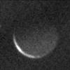
2015-07-16 | Pluto |
Cassini-Huygens |
ISS - Narrow Angle |
1024x1024x1 |

|
|||||
|
|
2010-02-04 | Pluto |
Hubble Space Telescope |
Hubble Space Telescope |
3000x2400x3 |
|
|||||
|
|
2016-03-22 | Ceres |
Dawn |
Gamma Ray Spectrometer Suite |
2011x1132x3 |

|
|||||
|
|
2016-08-15 | Ceres |
Dawn |
Framing Camera |
1024x1024x1 |
|
|||||
|
|
2016-08-08 | Ceres |
Dawn |
Framing Camera |
1024x1024x1 |
|
|||||
|
|
2014-12-05 | Ceres |
Dawn |
Framing Camera |
1571x1028x1 |
|
|||||
|
|
2014-12-05 | Ceres |
Dawn |
Framing Camera |
1024x1024x1 |

|
|||||
|
|
2015-01-19 | Ceres |
Dawn |
Framing Camera |
1024x1024x1 |

|
|||||
|
|
2015-01-19 | Ceres |
Dawn |
Framing Camera |
500x500x1 |
|
|||||
|
|
2015-01-19 | Ceres |
Dawn |
Framing Camera |
381x384x1 |

|
|||||
|
|
2015-01-27 | Ceres |
Dawn |
Framing Camera |
600x600x1 |

|
|||||
|
|
2015-01-27 | Ceres |
Dawn |
Framing Camera |
600x600x1 |

|
|||||
|
|
2015-01-27 | Ceres |
Dawn |
Framing Camera |
1024x1024x1 |

|
|||||
|
|
2015-02-05 | Ceres |
Dawn |
Framing Camera |
638x476x1 |
|
|||||
|
|
2015-02-05 | Ceres |
Dawn |
Framing Camera |
833x787x1 |
|
|||||
|
|
2015-02-06 | Ceres |
Dawn |
Framing Camera |
441x417x1 |
|
|||||
|
|
2015-02-12 | Ceres |
Dawn |
Framing Camera |
1024x1024x1 |

|
|||||
|
|
2015-02-17 | Ceres |
Dawn |
Framing Camera |
2763x1335x1 |
|
|||||
|
|
2015-02-04 | Ceres |
Dawn |
Framing Camera |
613x604x1 |
|
|||||
|
|
2015-02-25 | Ceres |
Dawn |
Framing Camera |
1873x1044x1 |
|
|||||
|
|
2015-02-25 | Ceres |
Dawn |
Framing Camera |
1243x654x1 |
|
|||||
|
|
2015-02-25 | Ceres |
Dawn |
Framing Camera |
533x553x1 |

|
|||||
|
|
2015-03-02 | Ceres |
Dawn |
Framing Camera |
488x488x1 |
|
|||||
|
|
2015-03-02 | Ceres |
Dawn |
Framing Camera |
739x369x1 |
|
|||||
|
|
2015-03-02 | Ceres |
Dawn |
Framing Camera |
1280x721x1 |
|
|||||
|
|
2015-03-02 | Ceres |
Dawn |
Framing Camera |
1280x720x1 |

|
|||||
|
|
2015-03-02 | Ceres |
Dawn |
Framing Camera |
1280x720x1 |

|
|||||
|
|
2015-03-06 | Ceres |
Dawn |
Framing Camera |
1000x1000x1 |
|
|||||
|
|
2015-03-06 | Ceres |
Dawn |
Framing Camera |
1000x1000x1 |

|
|||||
|
|
2016-08-12 | Ceres |
Dawn |
Framing Camera |
1024x1024x1 |
|
|||||
|
|
2016-08-11 | Ceres |
Dawn |
Framing Camera |
1024x1024x1 |
|
|||||
|
|
2016-08-10 | Ceres |
Dawn |
Framing Camera |
1024x1024x1 |
|
|||||
|
|
2016-08-09 | Ceres |
Dawn |
Framing Camera |
1024x1024x1 |
|
|||||

|
 |
 |
 |
|
|
|
|
|
|

|
| 1-100 | 101-200 | 201-300 | 301-400 | 401-500 | 501-600 | 601-700 | 701-800 | 801-900 |
| Currently displaying images: 101 - 200 of 817 |