PDS logoPlanetary Data System
PDS Information
Find a Node - Use these links to navigate to any of the 8 publicly accessible PDS Nodes.

This bar indicates that you are within the PDS enterprise which includes 6 science discipline nodes and 2 support nodes which are overseen by the Project Management Office at NASA's Goddard Space Flight Center (GSFC). Each node is led by an expert in the subject discipline, supported by an advisory group of other practitioners of that discipline, and subject to selection and approval under a regular NASA Research Announcement.
Click here to return to the Photojournal Home Page Click here to view a list of Photojournal Image Galleries Photojournal_inner_header
Latest Images  |  Spacecraft & Technology  |  Animations  |  Space Images App  |  Feedback  |  Photojournal Search  
Your search criteria found 3 images
Instrument
Go to PIAxxxxx:
Click on an image for detailed information
Click on a column heading to sort in ascending or descending order
My
List
Addition DateSort Ascending Target Mission Instrument Size
Add Image to Favorite List 2013-05-13 Earth Aqua
OSCAT
MODIS
OSCAT Scatterometer
1034x1692x3
Extensive and persistent rains between Jan. 24 and Jan. 27, 2013, significantly increased soil moisture and enhanced vegetation growth in Southern California based on data from NASA's Aqua spacecraft and ISRO's Oceansat-2 satellite.
PIA17052:
Satellites See Double Jeopardy for Socal Fire Season
Full Resolution:     TIFF (5.251 MB)     JPEG (212.1 kB)
Add Image to Favorite List 2012-10-30 Earth OSCAT
OSCAT Scatterometer
447x337x3
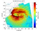
This image shows ocean surface winds for Hurricane Sandy observed by the OSCAT radar scatterometer on the Indian Space Research Organization's (ISRO) OceanSat-2 satellite. Colors indicate wind speed and arrows indicate direction.
PIA16219:
OSCAT Eyes Hurricane Sandy
Full Resolution:     TIFF (452.3 kB)     JPEG (43.27 kB)
Add Image to Favorite List 2011-08-27 Earth OSCAT
OSCAT Scatterometer
1201x900x3
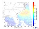
This ISRO-NASA-JPL-Caltech collaborative image shows ocean wind vector data from ISRO's OceanSat 2 spacecraft of Hurricane Irene which made landfall early Saturday morning, Aug. 27, just west of Cape Lookout, NC.
PIA14742:
NASA/ISRO Image Shows Irene's Winds Before Landfall
Full Resolution:     TIFF (3.247 MB)     JPEG (233.9 kB)
Currently displaying images: 1 - 3 of 3