My
List |
Addition Date
|
Target
|
Mission
|
Instrument
|
Size
|

|
2012-09-12 |
Mars
|
Mars Science Laboratory (MSL)
|
Navcam (MSL)
|
1024x1024x1 |

|
-
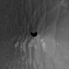
PIA16164:
-
Opening and Closing SAM

Full Resolution:
TIFF
(1.05 MB)
JPEG
(101.4 kB)
|
|
|
2012-09-07 |
Mars
|
Mars Exploration Rover (MER)
|
Navigation Camera
|
4000x4000x1 |
|
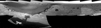
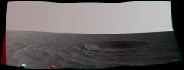
-
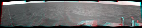
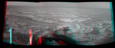
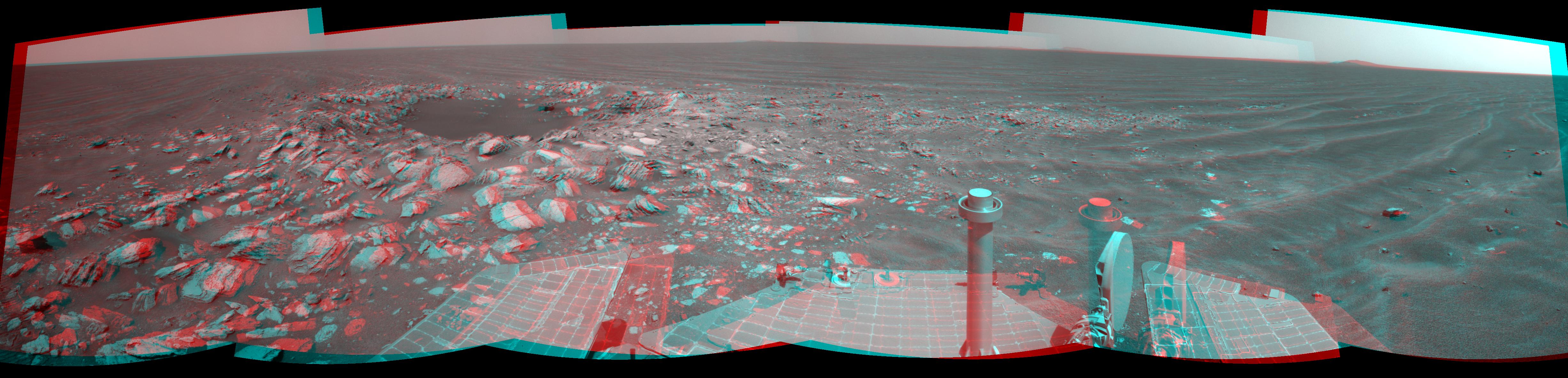
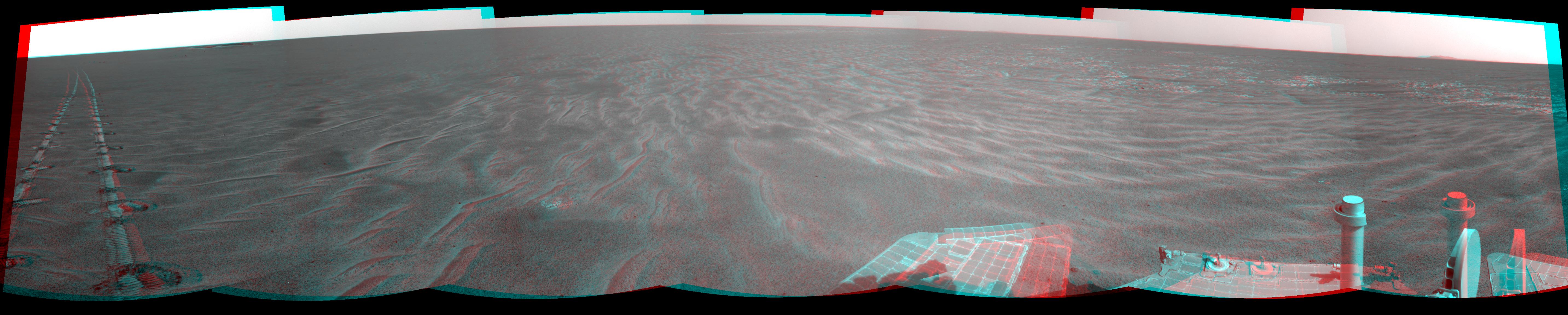
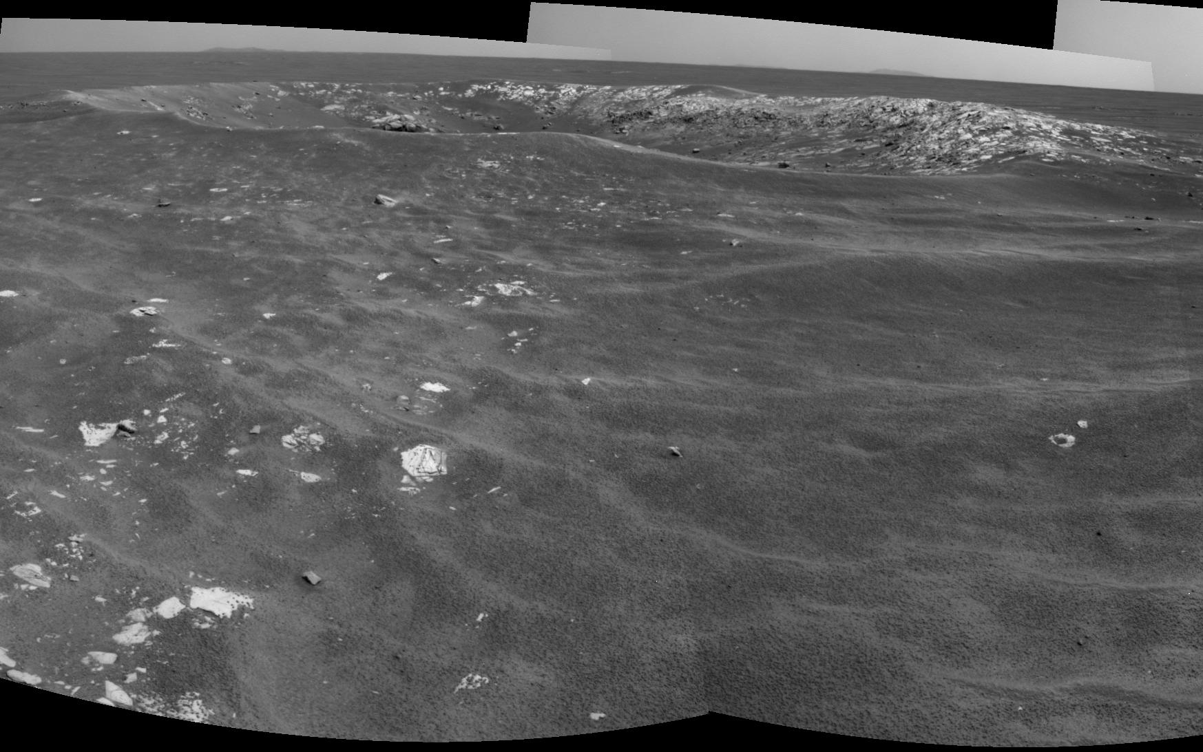
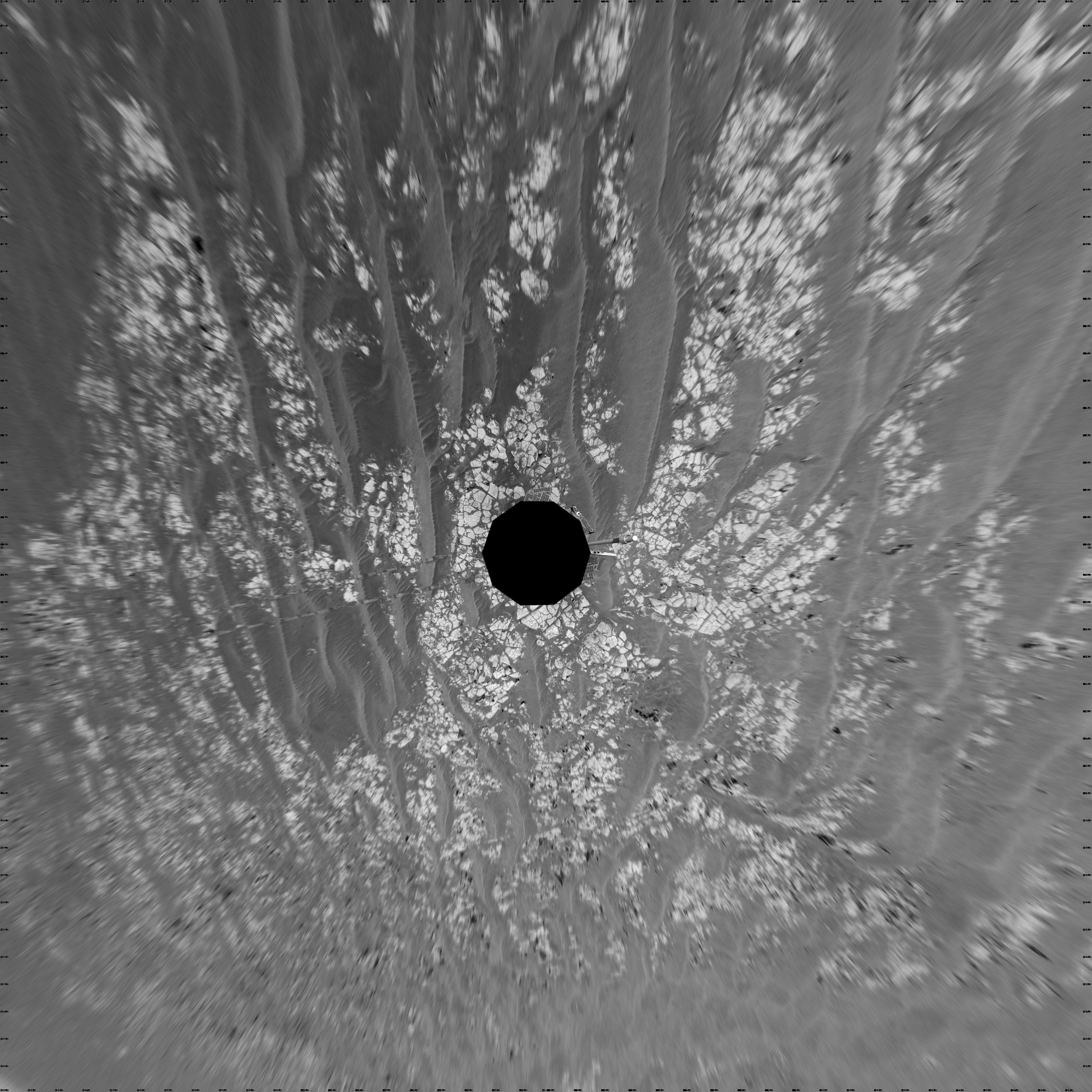
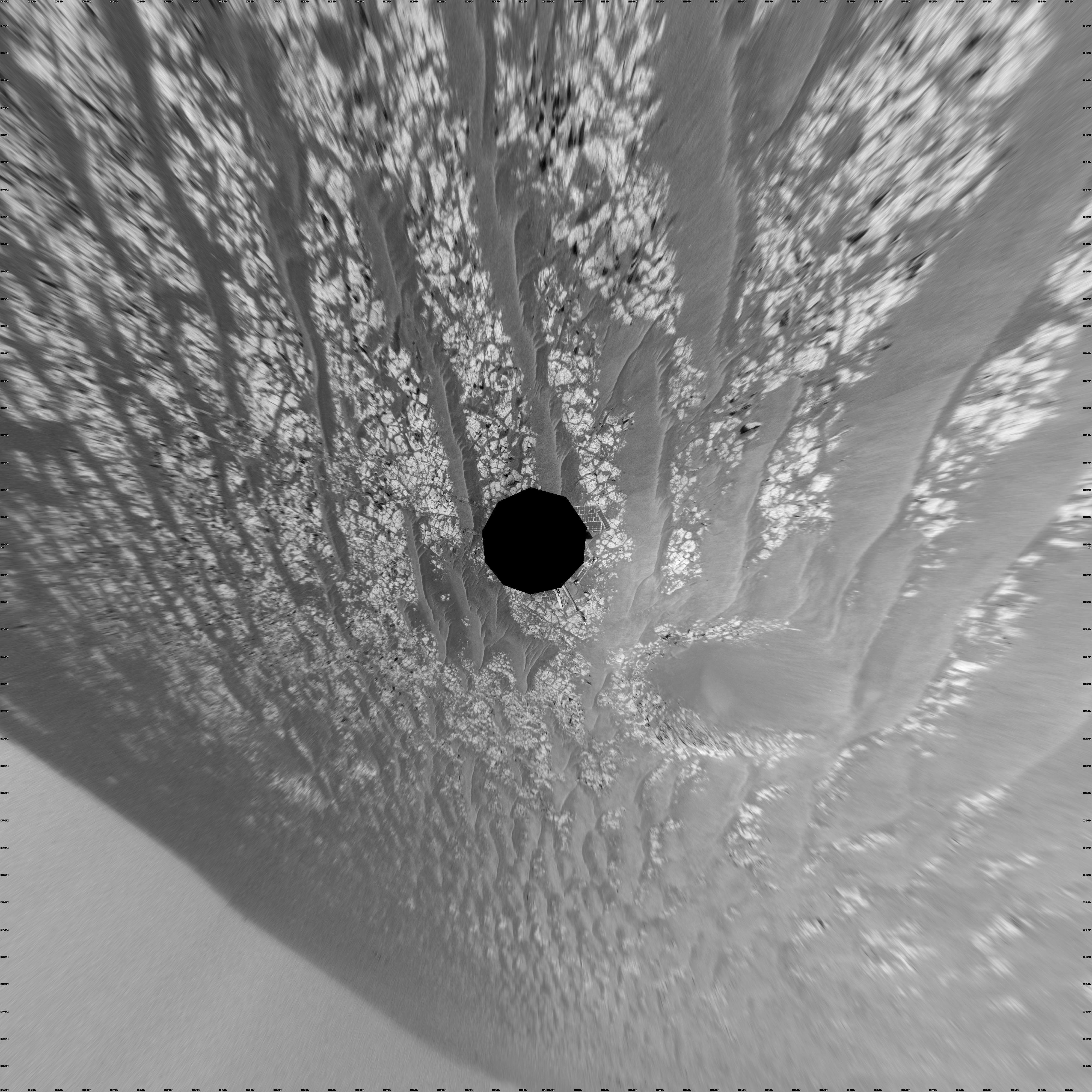
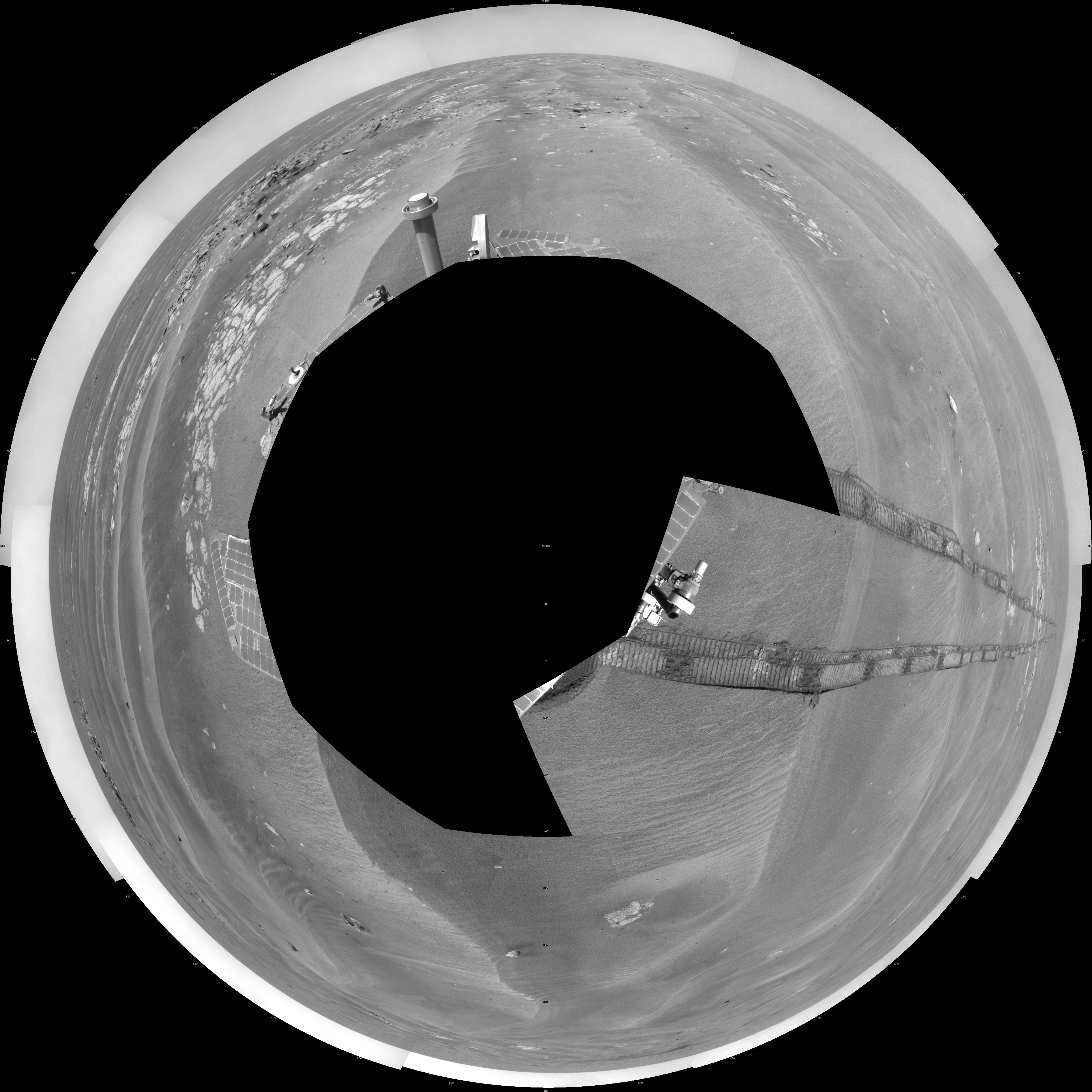
PIA16125:
-
Opportunity's Surroundings on 3,000th Sol, Vertical Projection
Full Resolution:
TIFF
(16.02 MB)
JPEG
(1.55 MB)
|
|
|
2012-09-07 |
Mars
|
Mars Exploration Rover (MER)
|
Navigation Camera
|
4111x4111x1 |

|
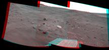
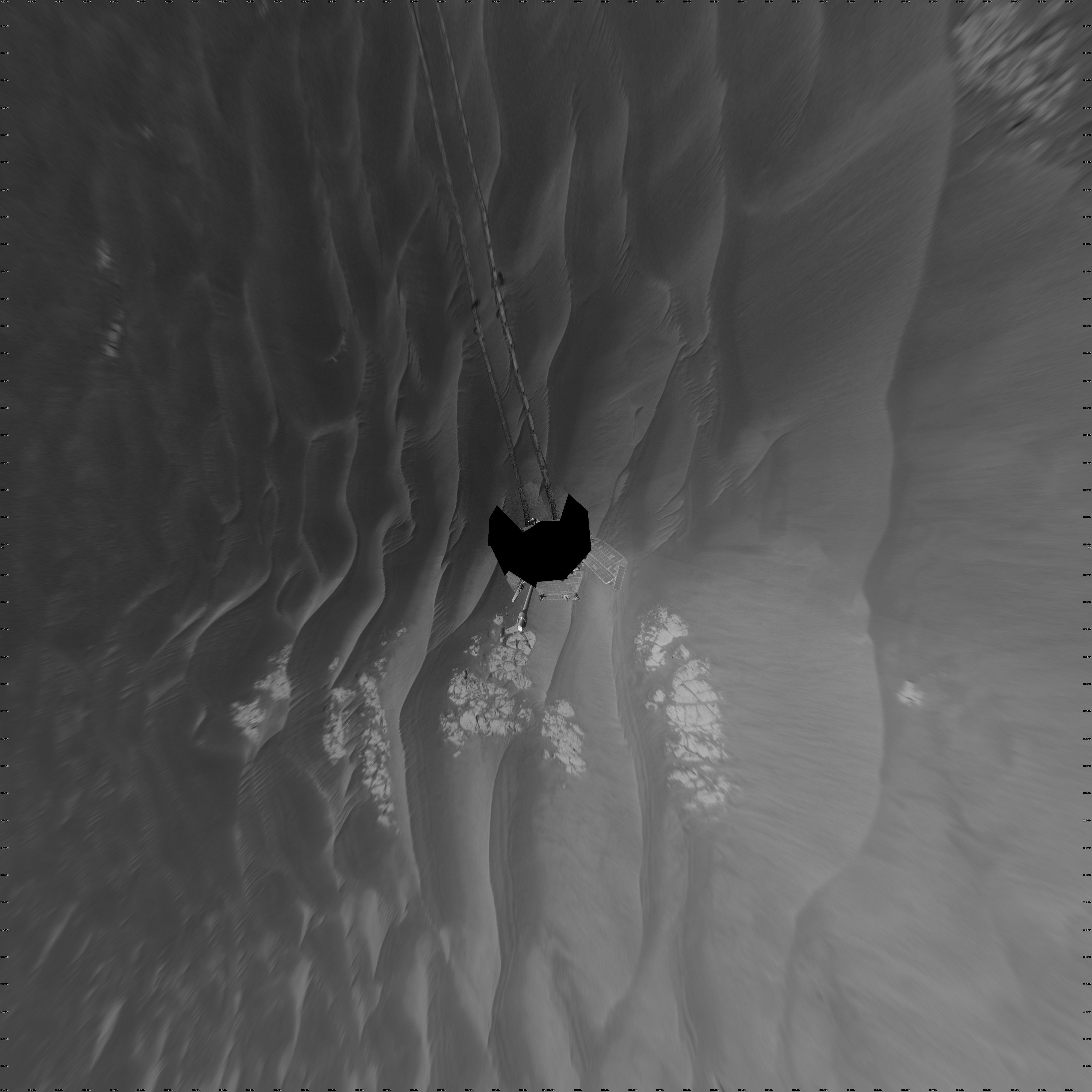
-
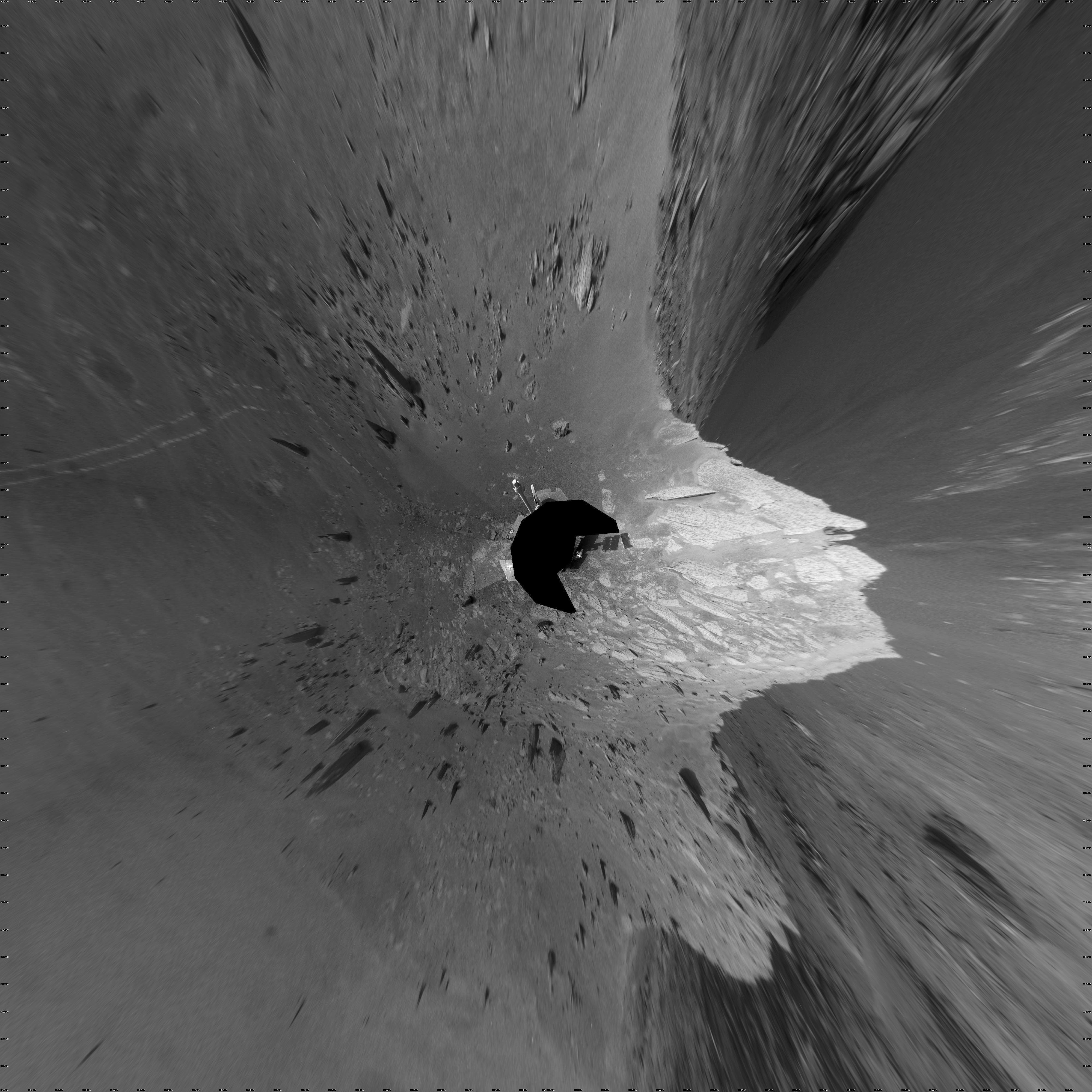
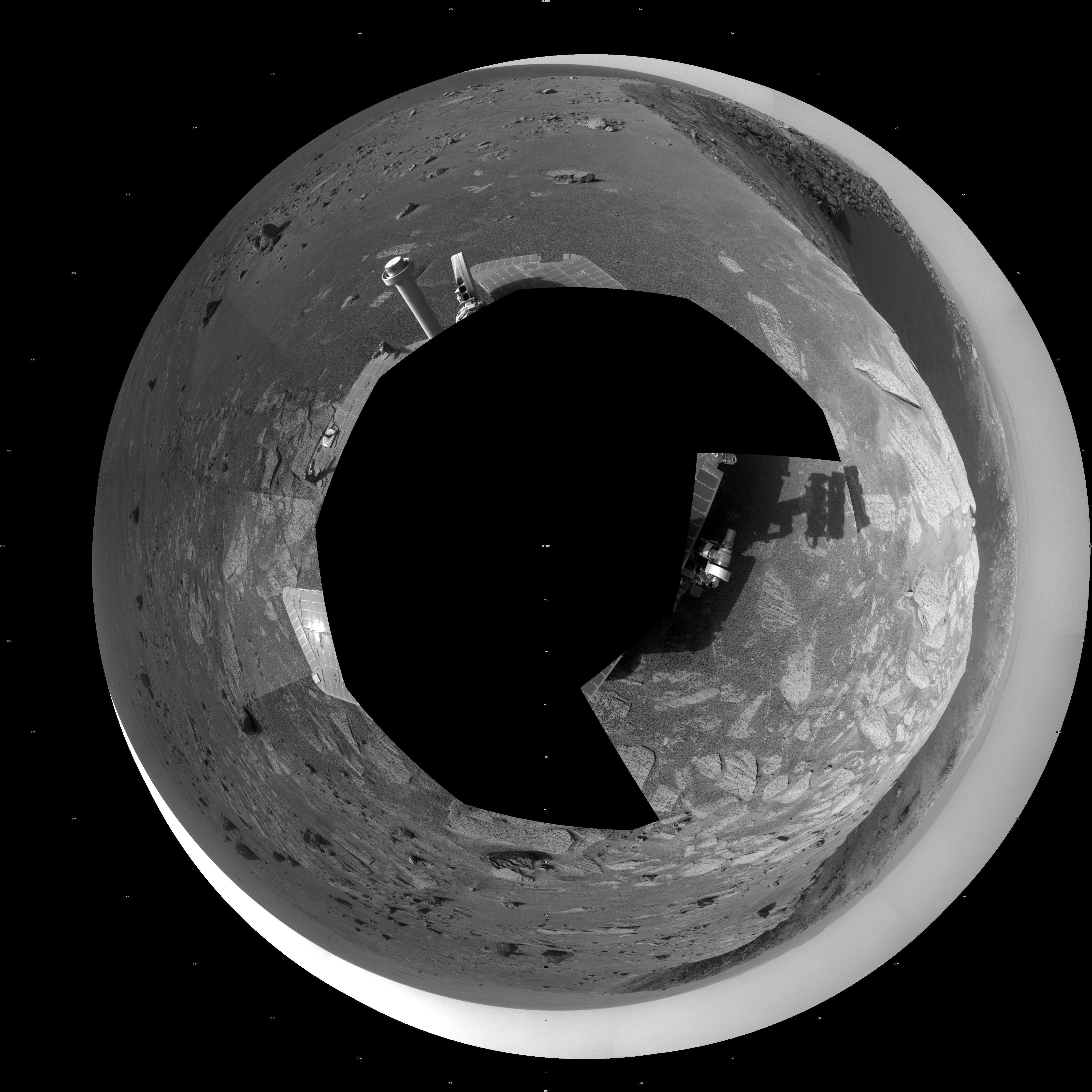
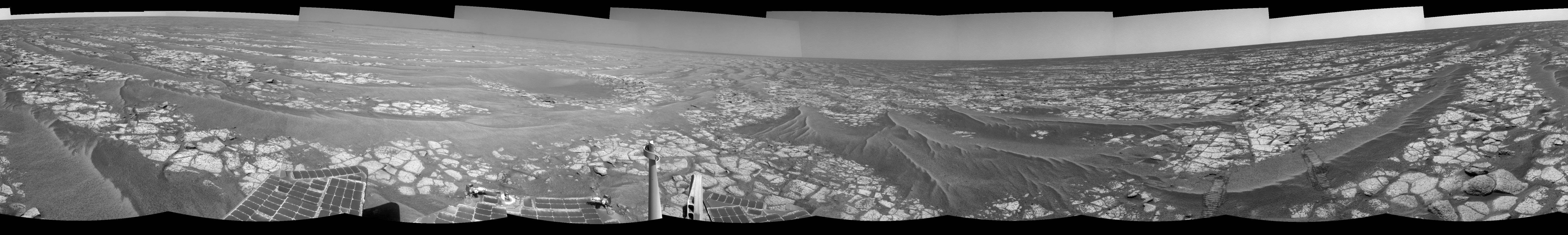
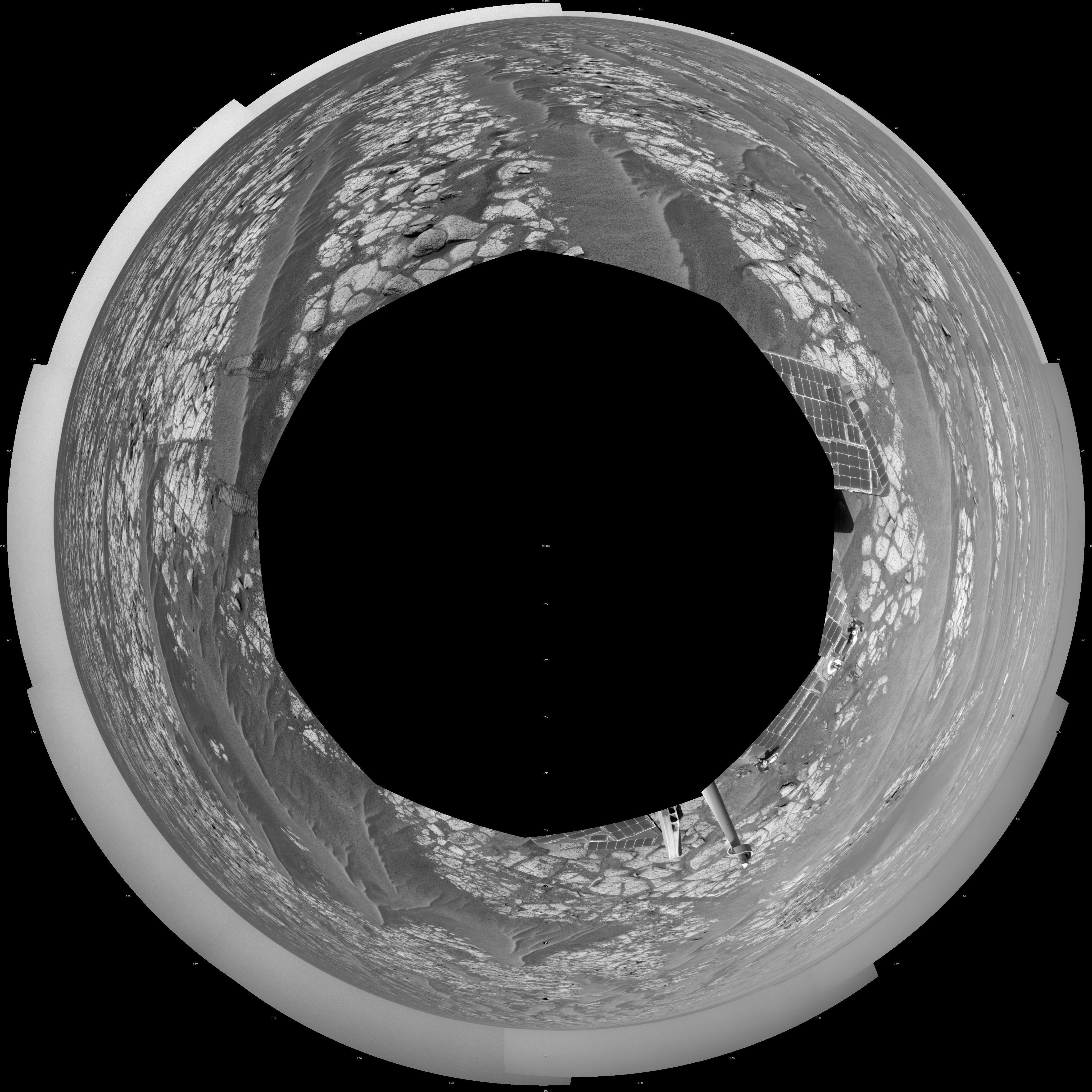
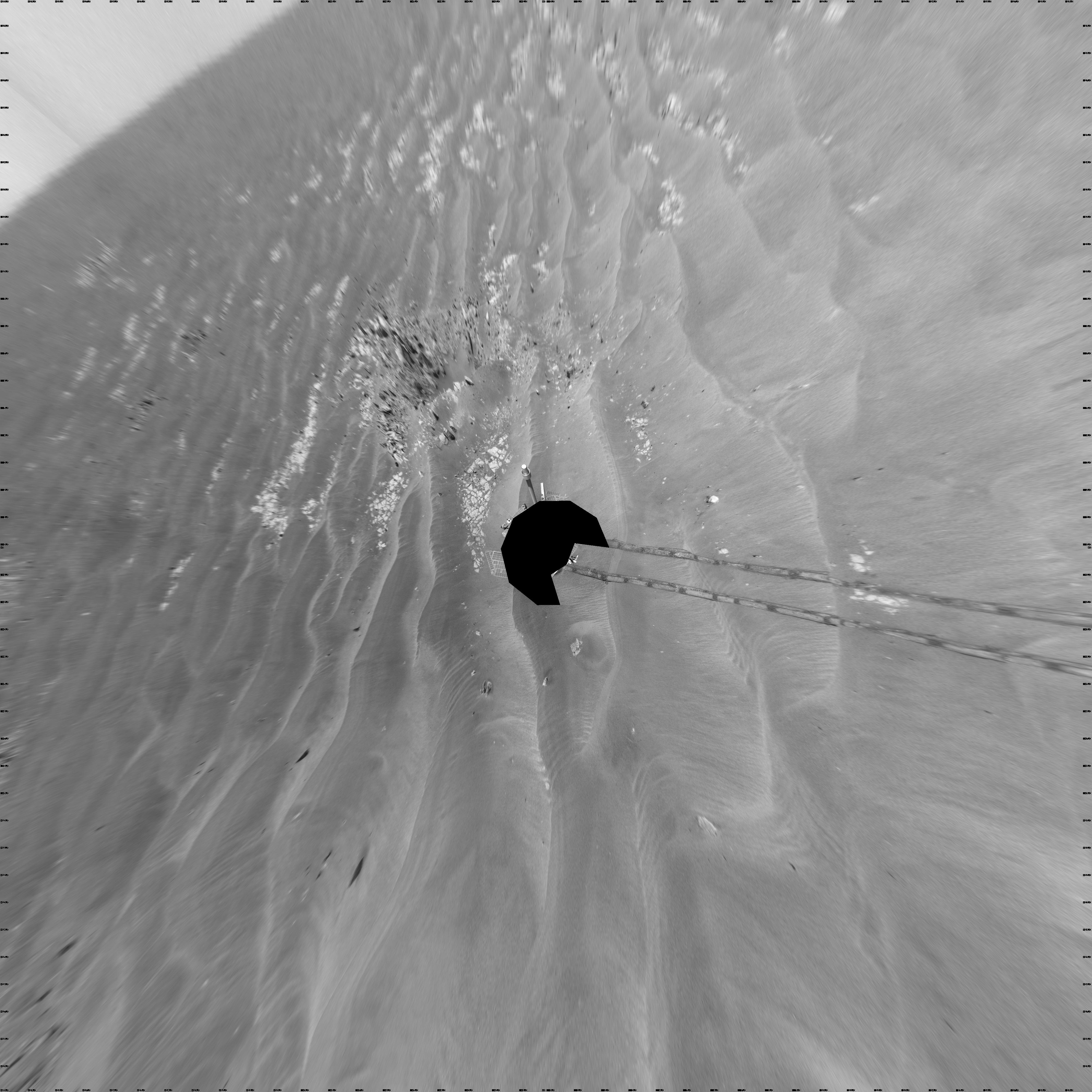
PIA16124:
-
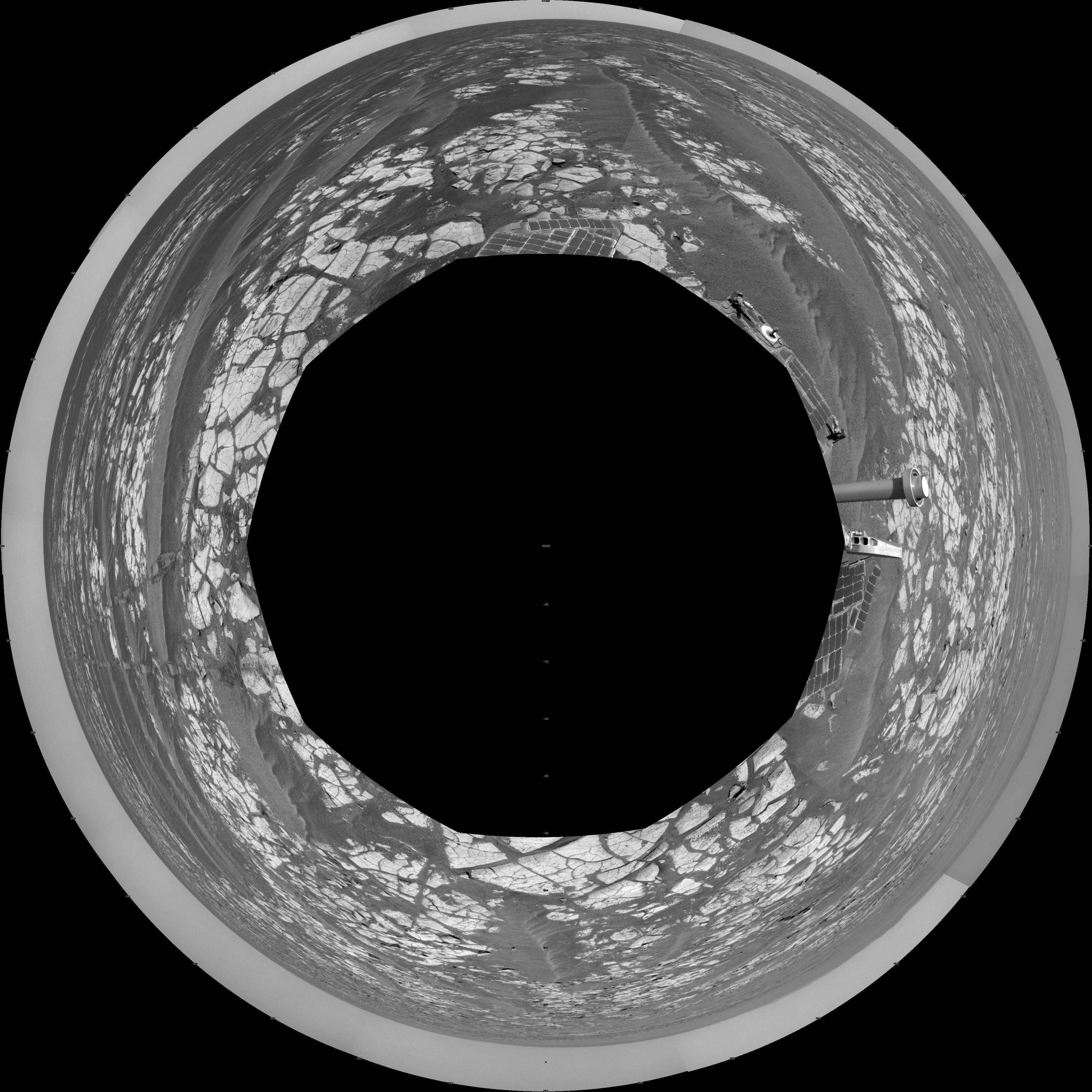
Opportunity's Surroundings on 3,000th Sol, Polar Projection
Full Resolution:
TIFF
(16.93 MB)
JPEG
(1.518 MB)
|
|
|
2012-09-07 |
Mars
|
Mars Exploration Rover (MER)
|
Navigation Camera
|
7753x1152x3 |

|
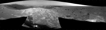
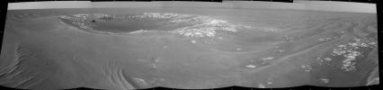
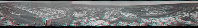
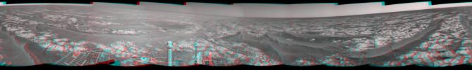
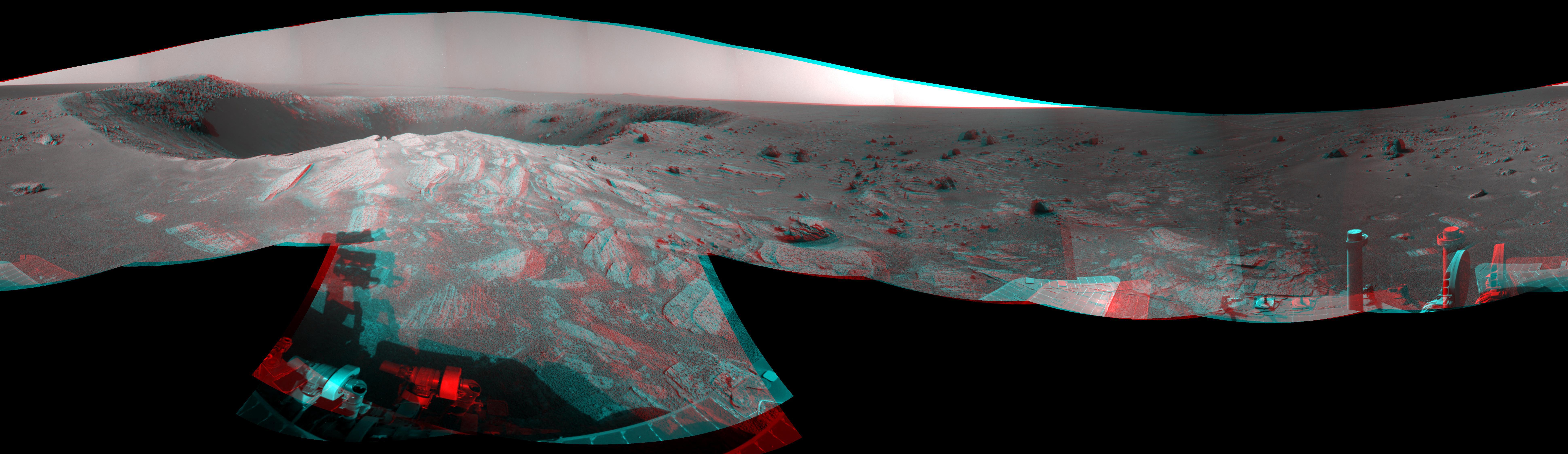
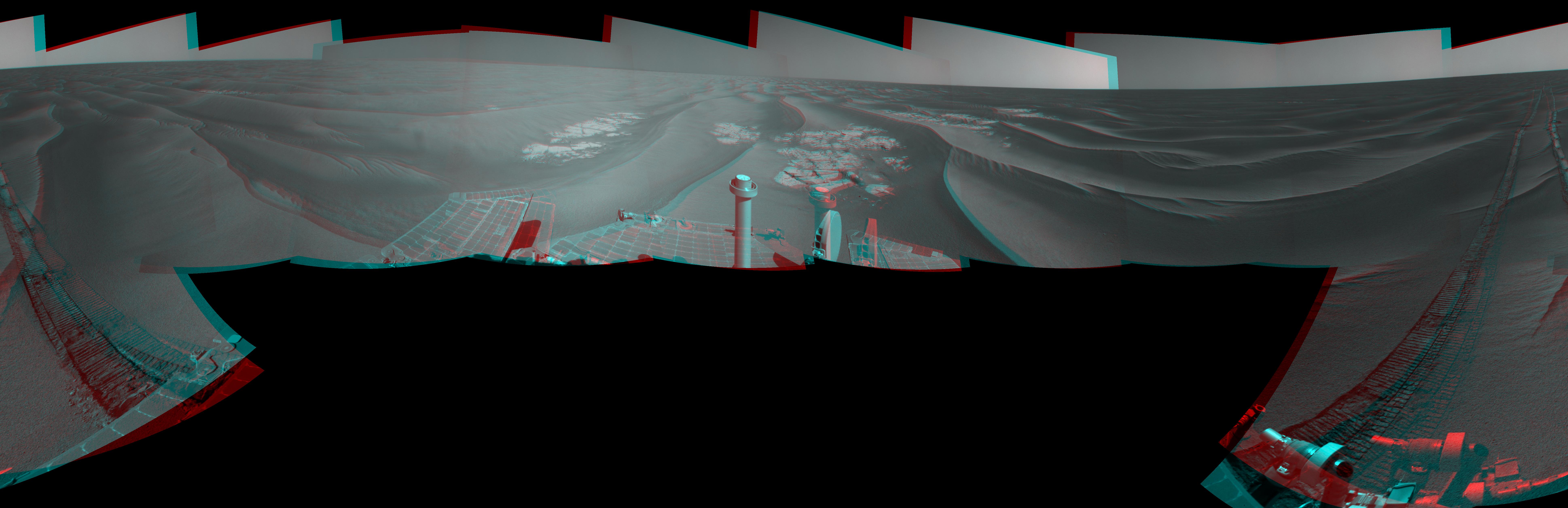
-
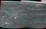
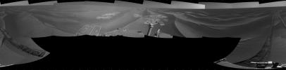
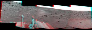
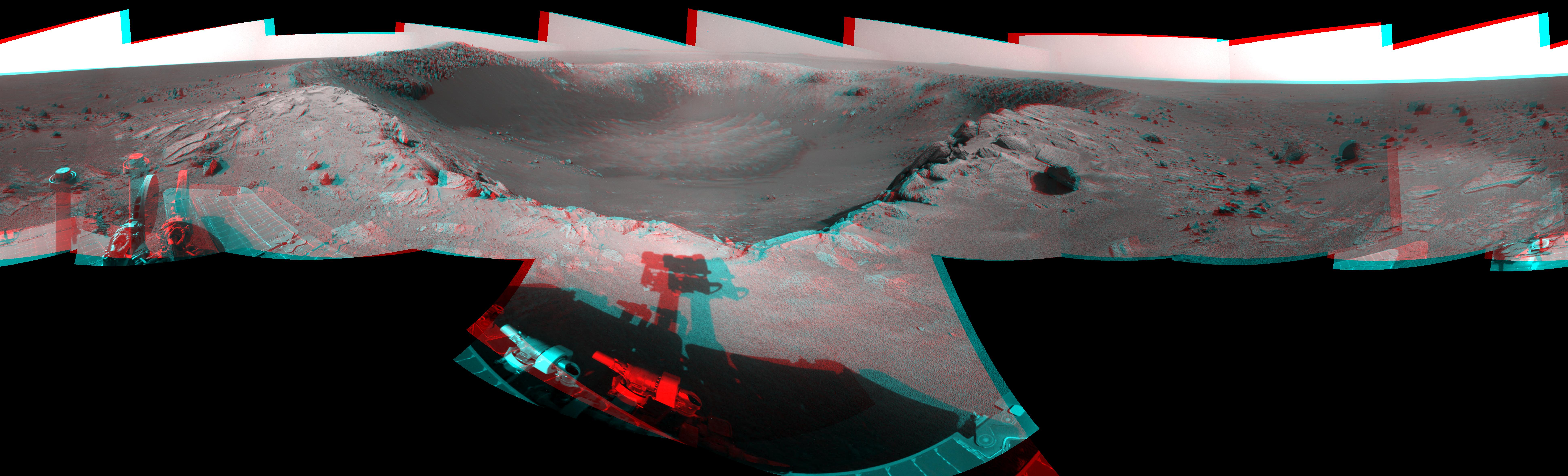
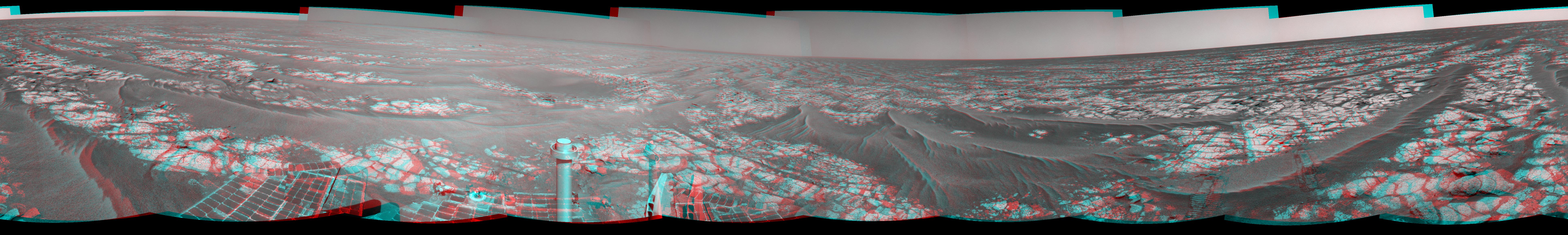
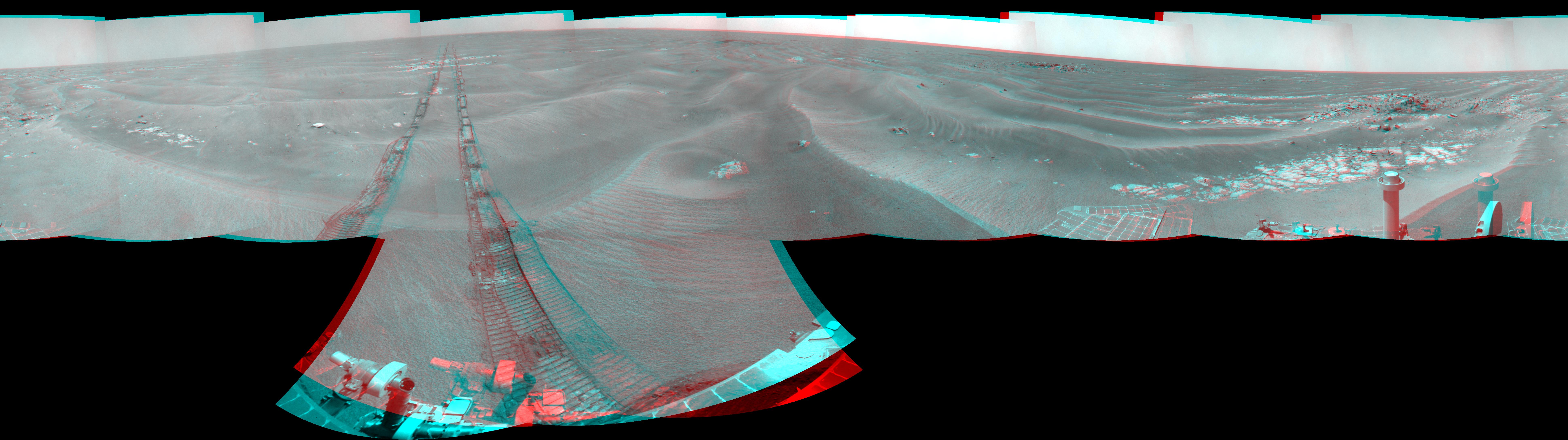
PIA16123:
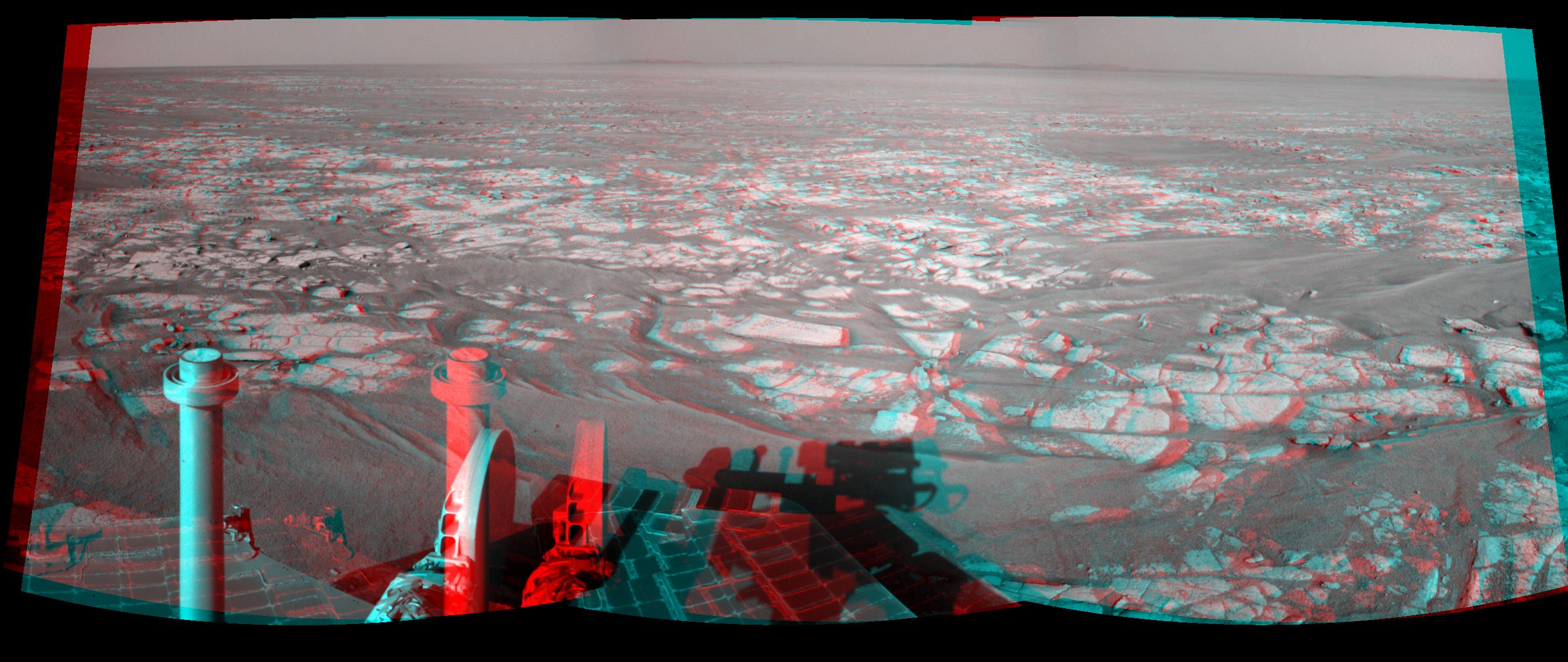
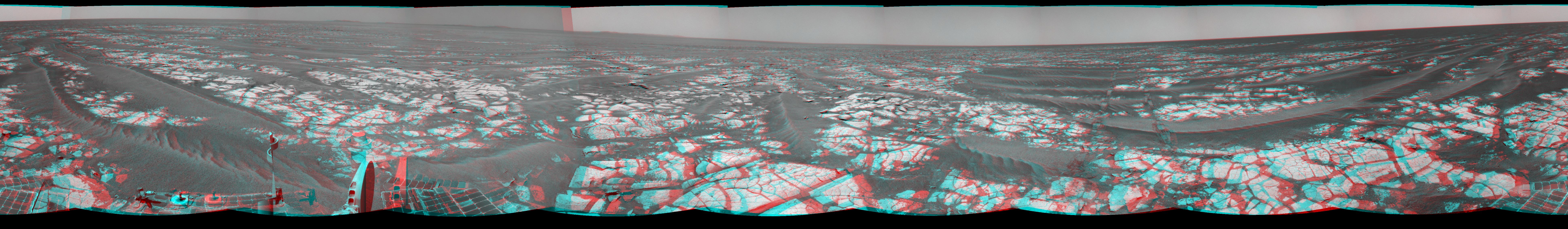
Opportunity's Surroundings on 3,000th Sol, in 3-D
Full Resolution:
TIFF
(26.8 MB)
JPEG
(1.421 MB)
|
|
|
2012-09-07 |
Mars
|
Mars Exploration Rover (MER)
|
Navigation Camera
|
7688x987x1 |
|
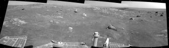
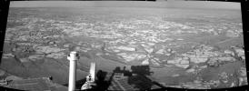
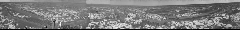
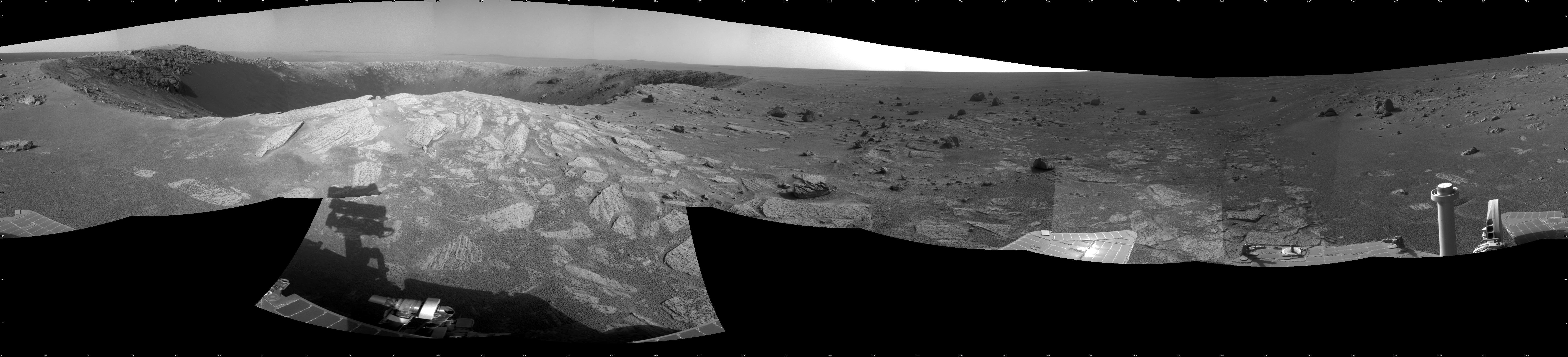
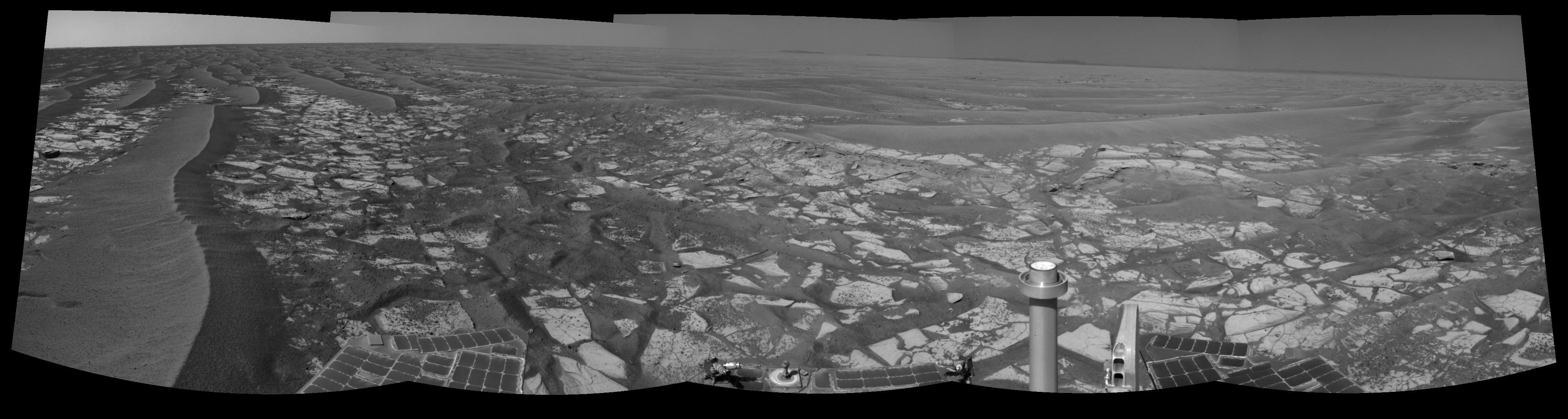
-
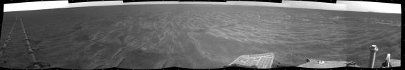
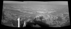
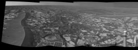
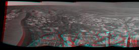
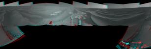
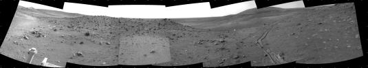
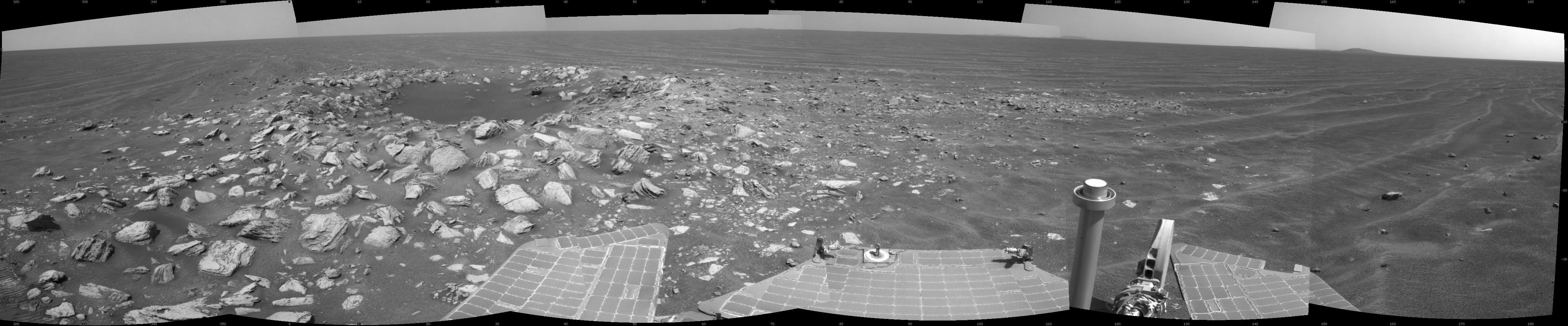
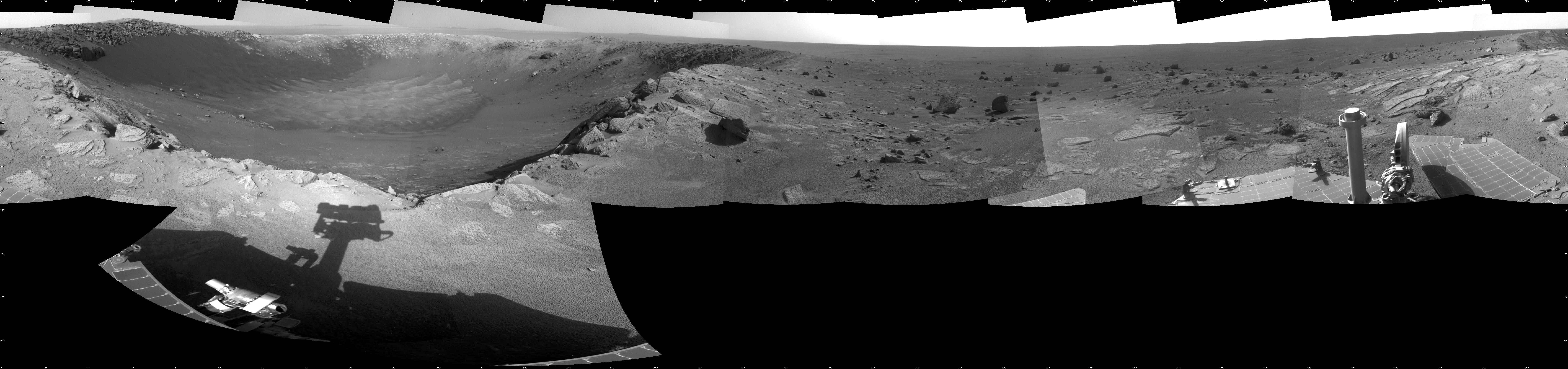
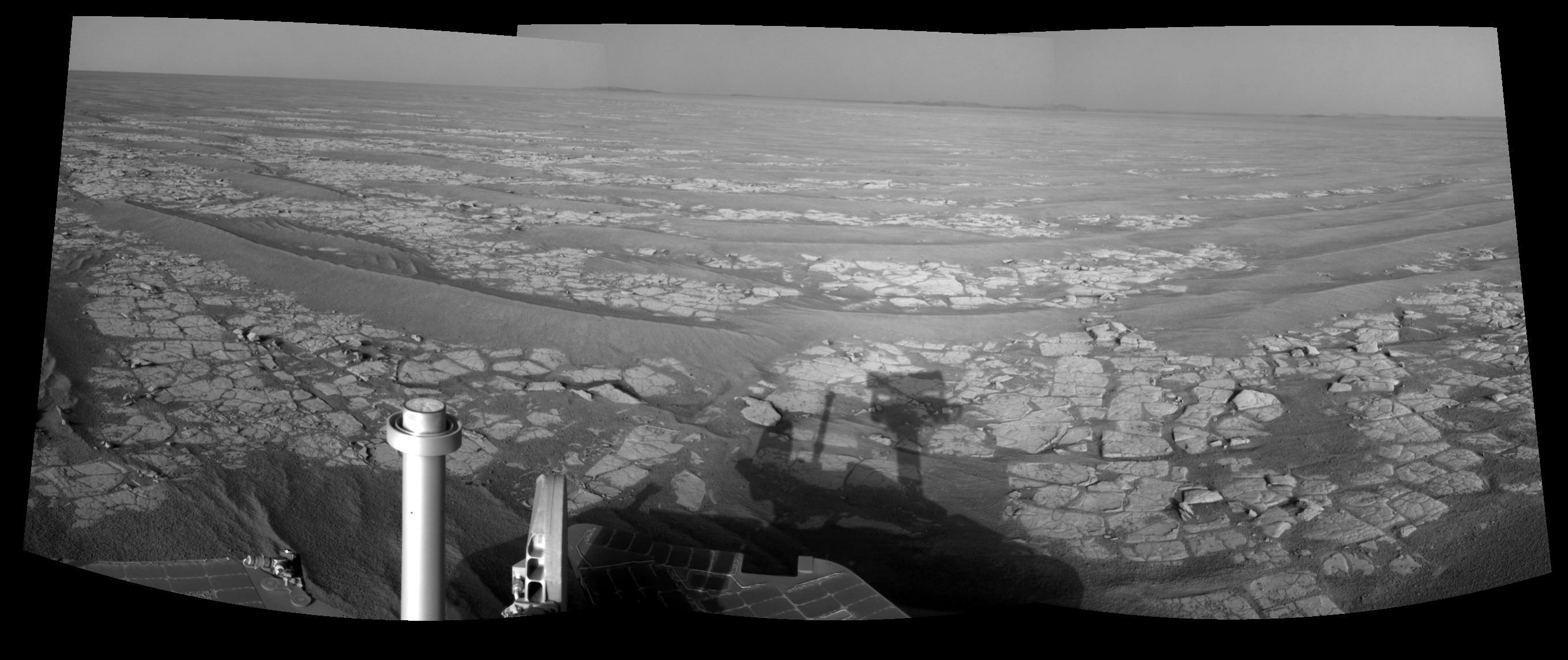
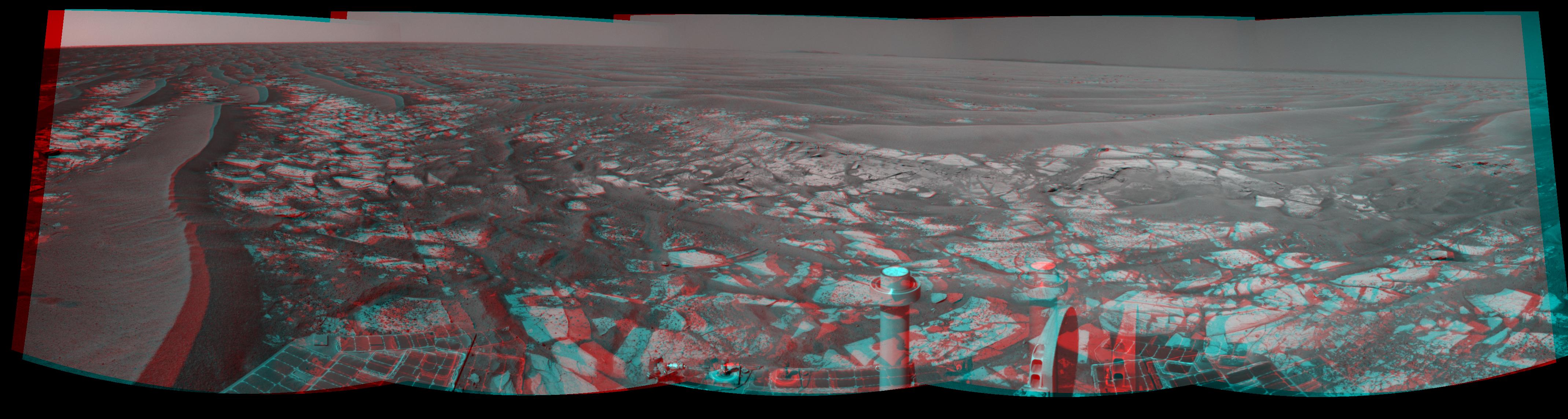
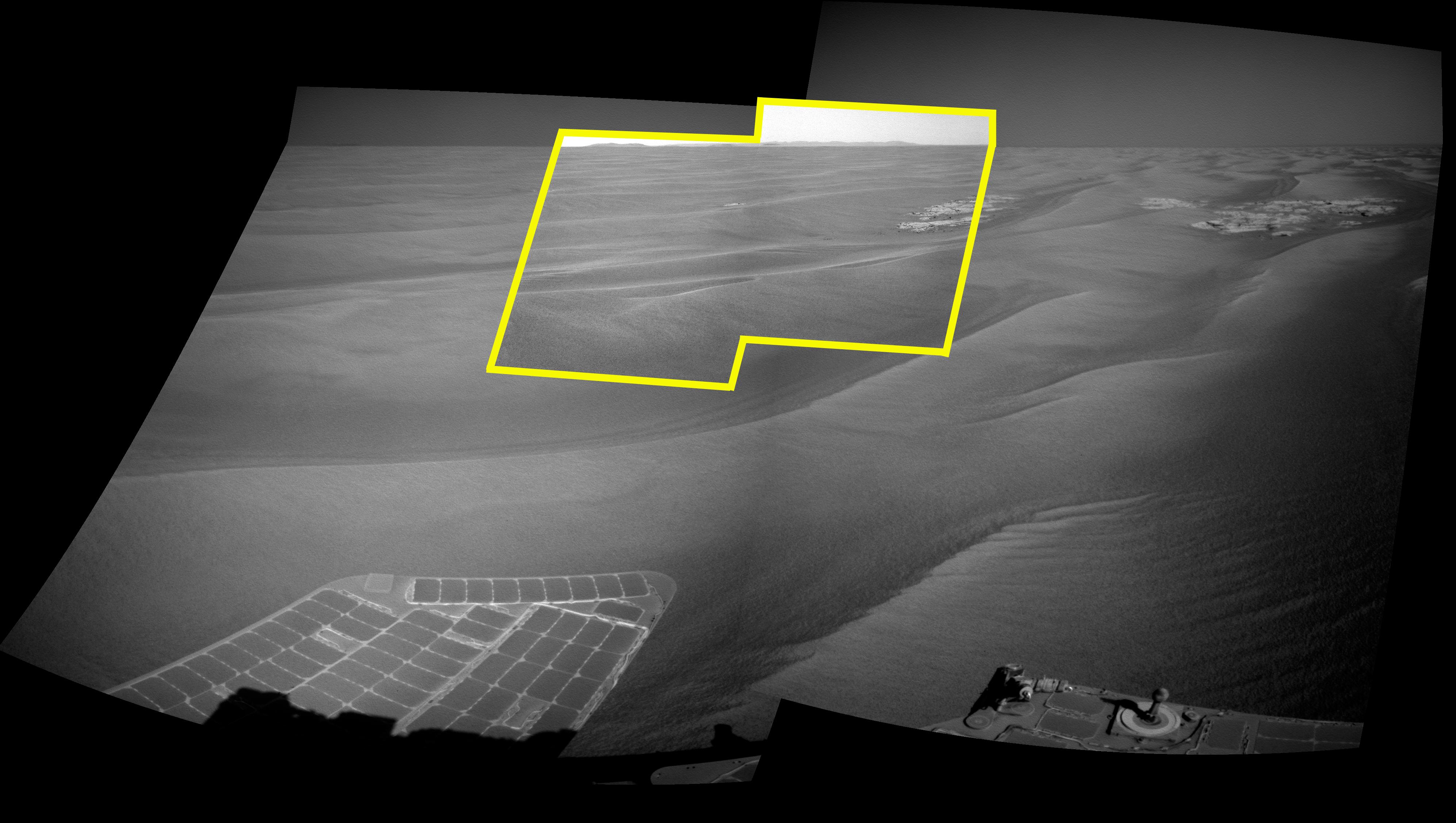
PIA16122:
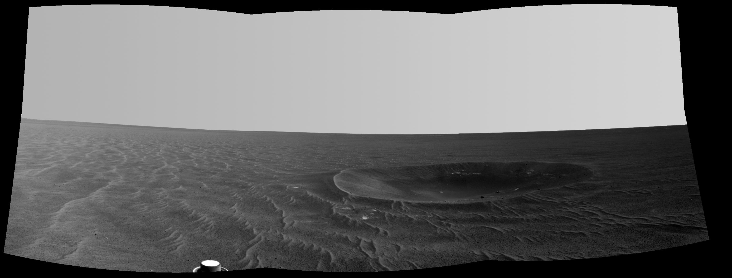
Opportunity's Surroundings on 3,000th Sol
Full Resolution:
TIFF
(7.596 MB)
JPEG
(1.148 MB)
|
|
|
2012-09-07 |
Mars
|
Mars Exploration Rover (MER)
|
Navigation Camera
|
1024x1024x1 |
|
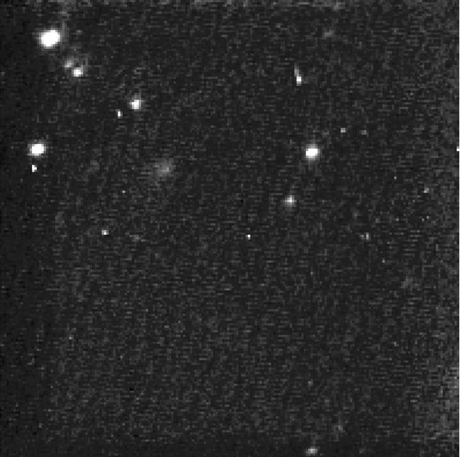
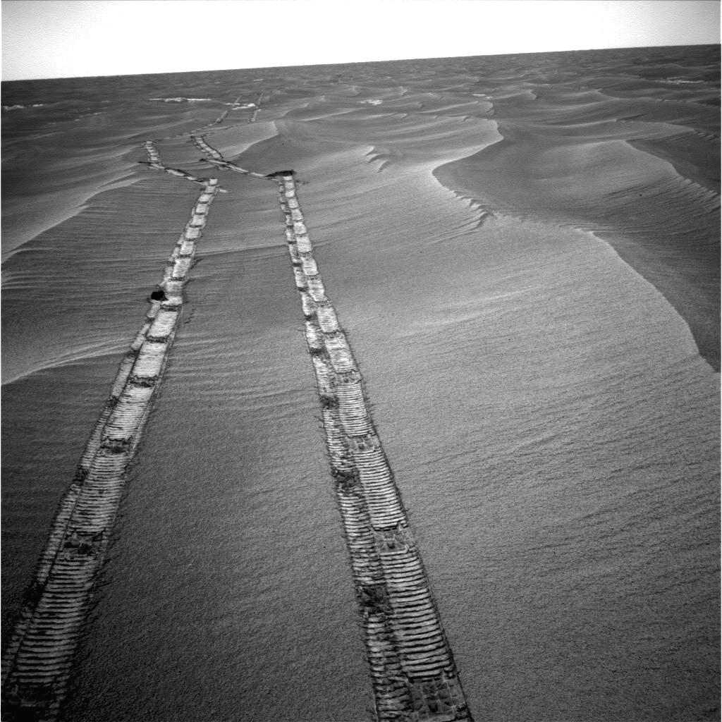
-
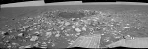
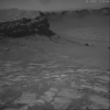
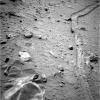
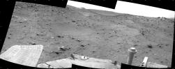
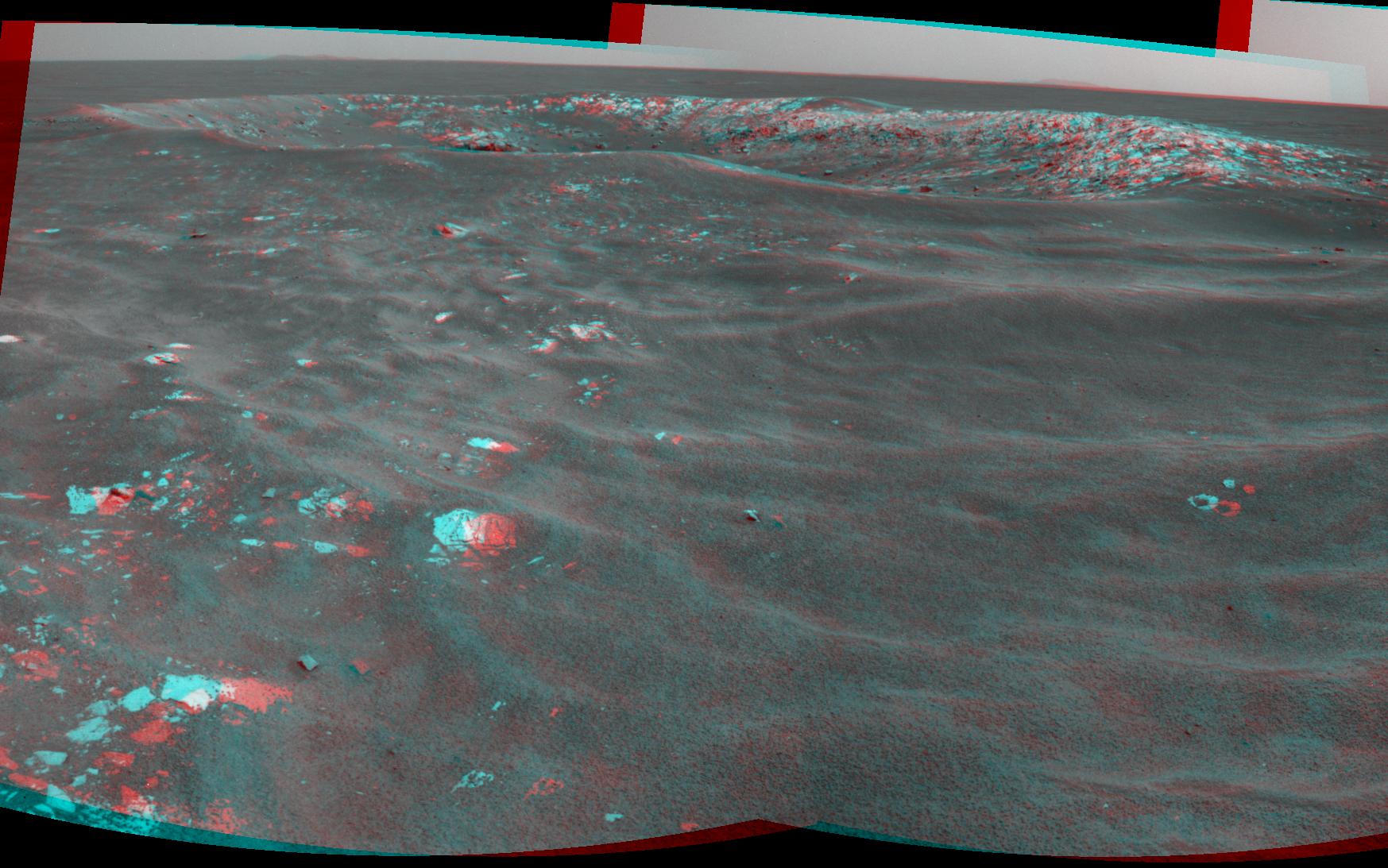
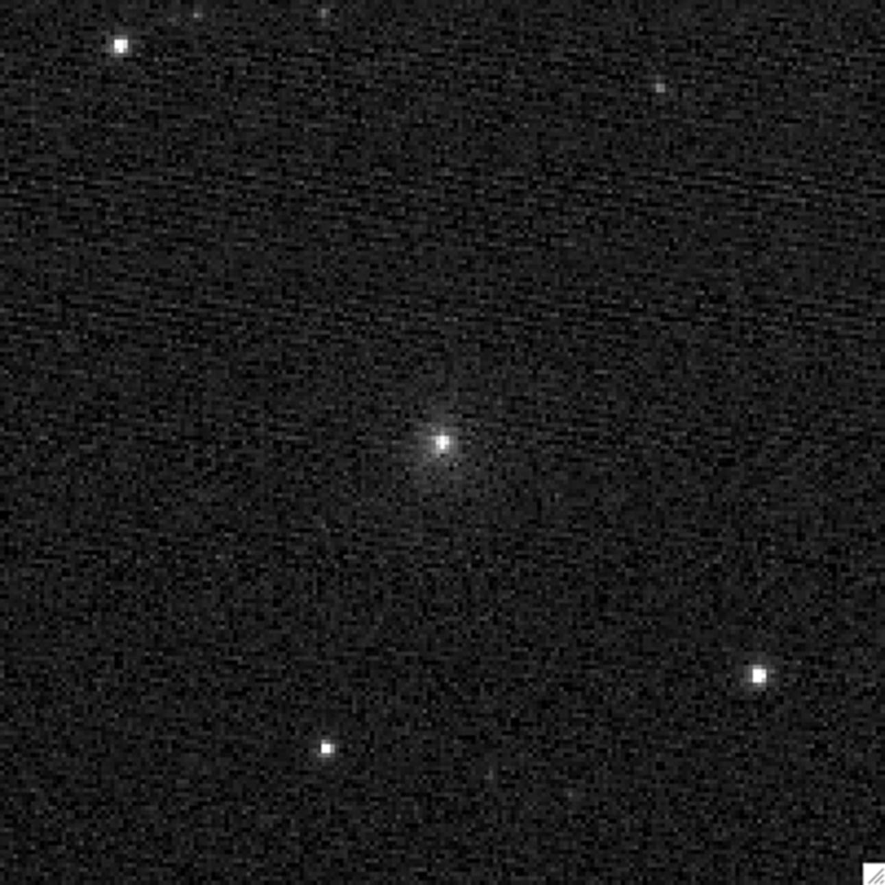
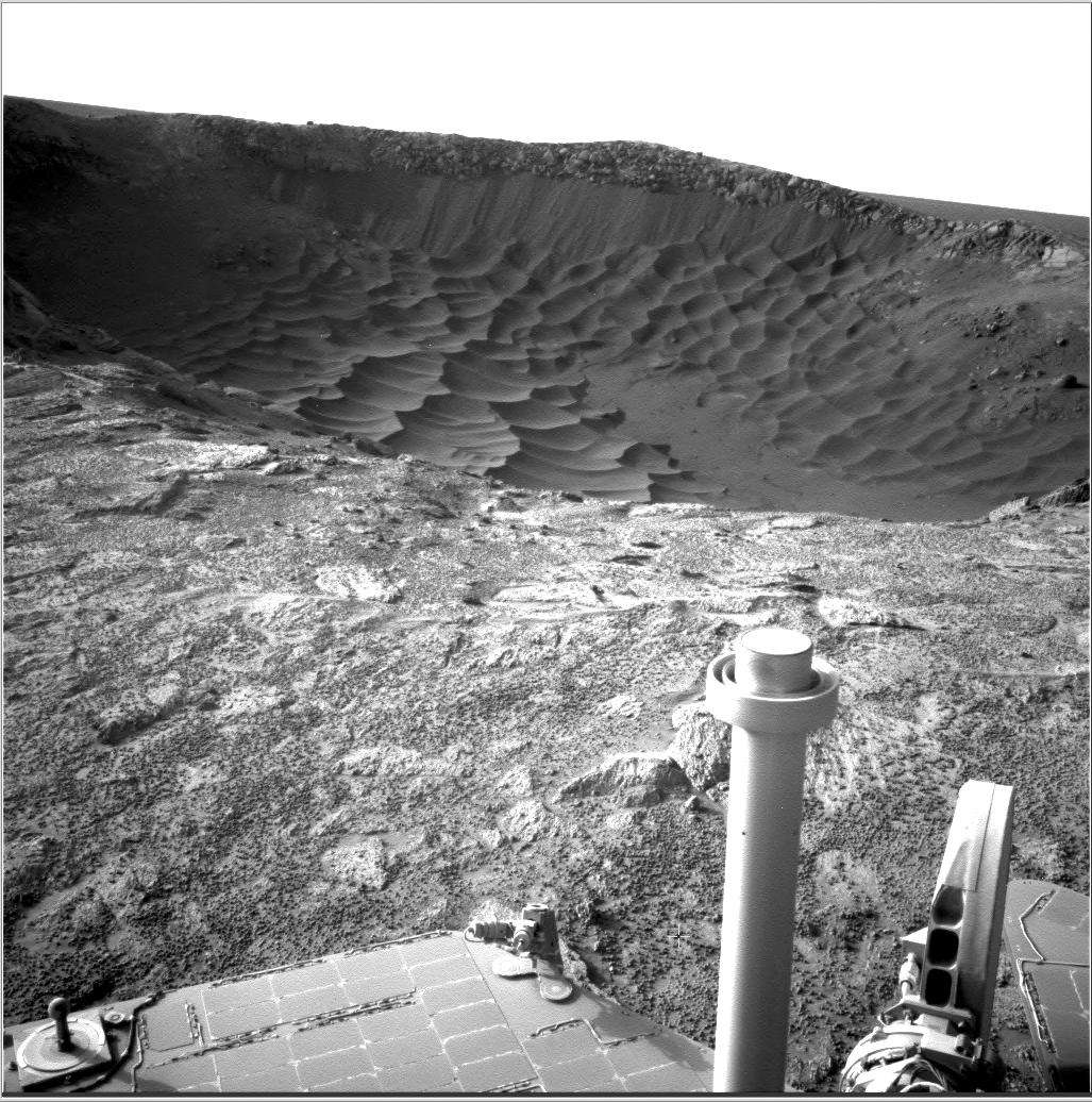
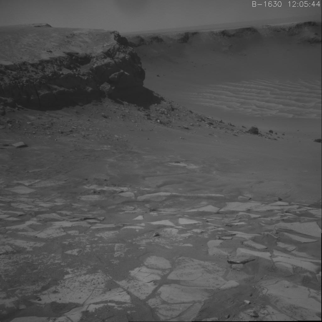
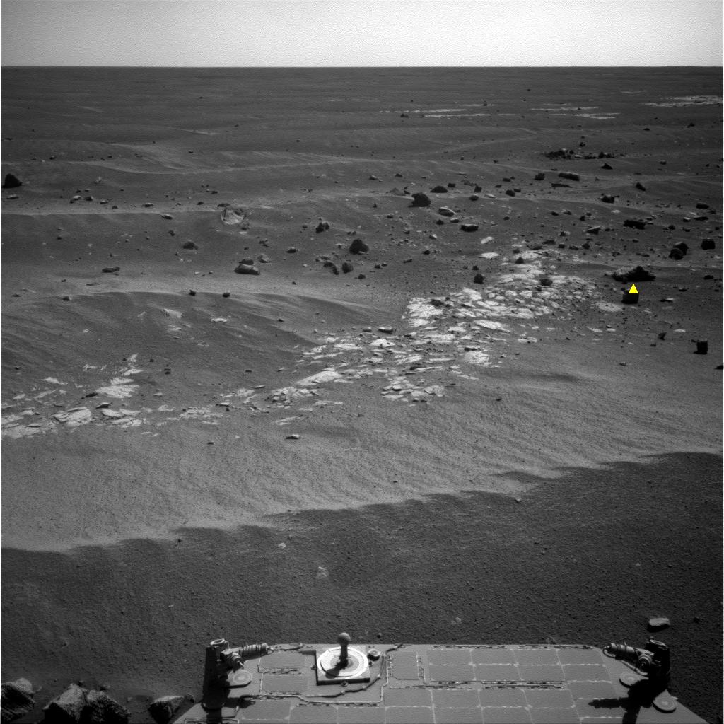
PIA16121:
-
Outcrop Beckoning Opportunity, Sol 3057
Full Resolution:
TIFF
(1.05 MB)
JPEG
(218.8 kB)
|
|
|
2012-09-06 |
Mars
|
Mars Science Laboratory (MSL)
|
Navcam (MSL)
|
7703x1749x1 |

|
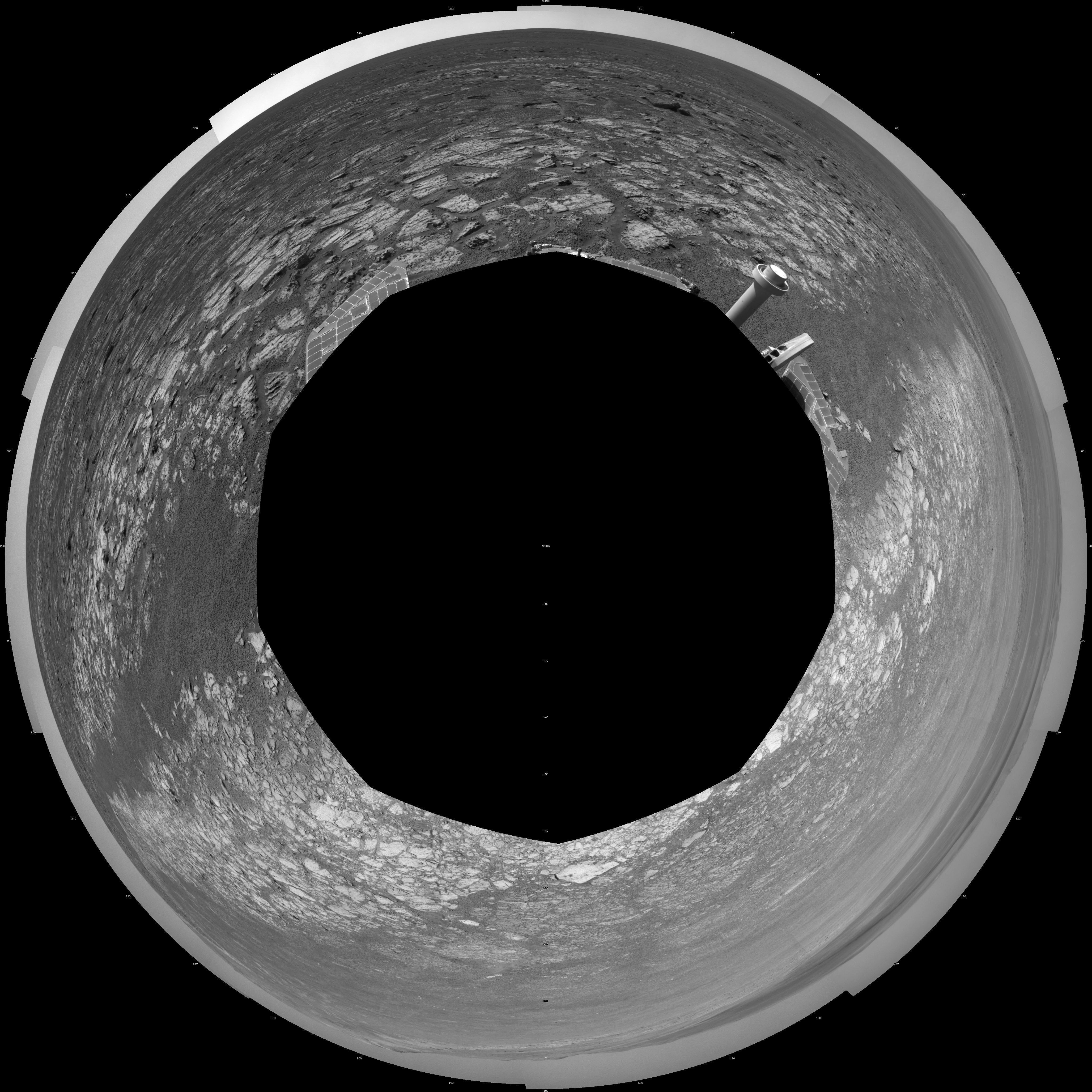
-
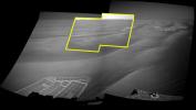
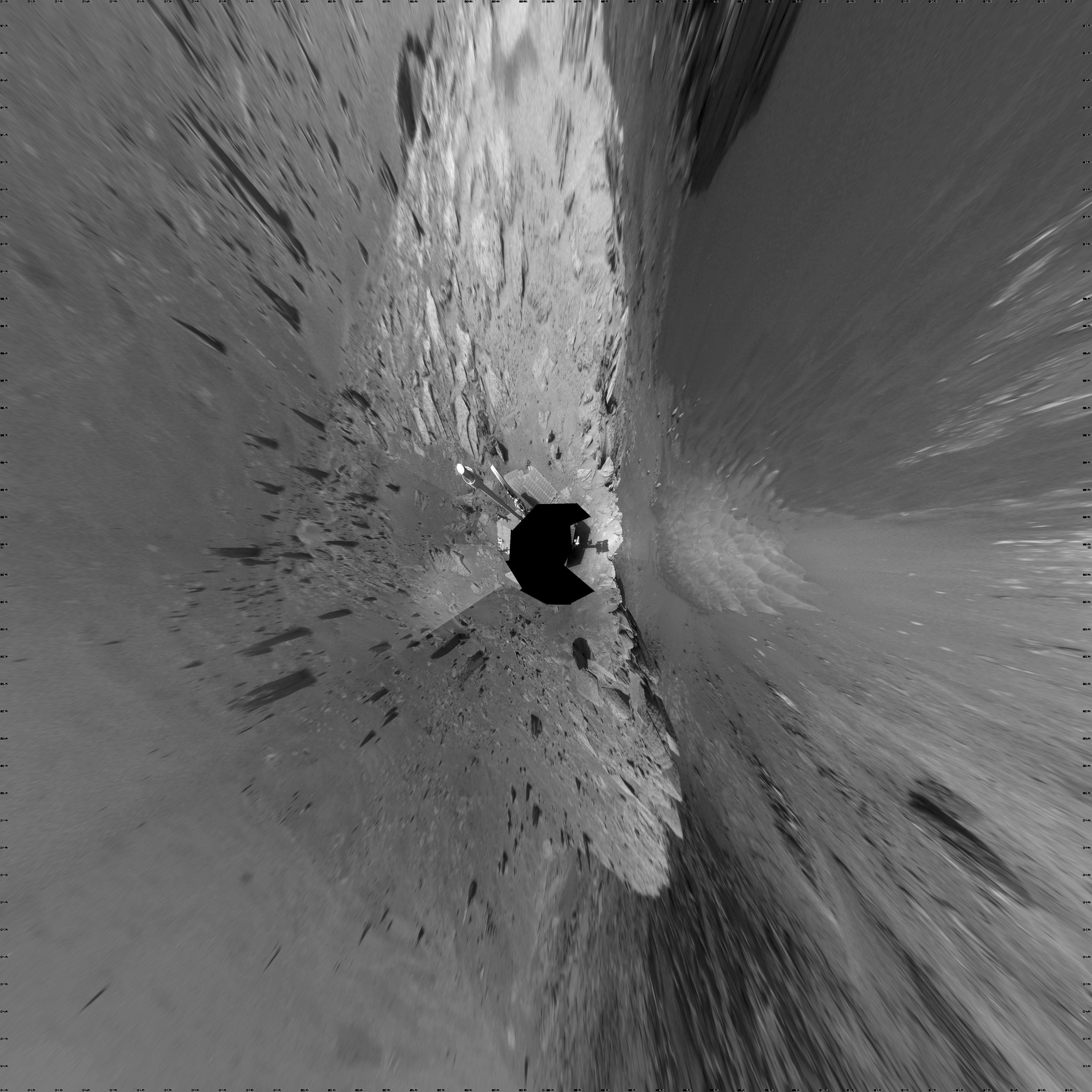
PIA15698:
Curiosity's Location During Arm Checkouts
Full Resolution:
TIFF
(13.49 MB)
JPEG
(1.578 MB)
|
|
|
2012-08-29 |
Mars
|
Mars Science Laboratory (MSL)
|
Navcam (MSL)
|
1024x1024x1 |
|
-
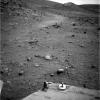
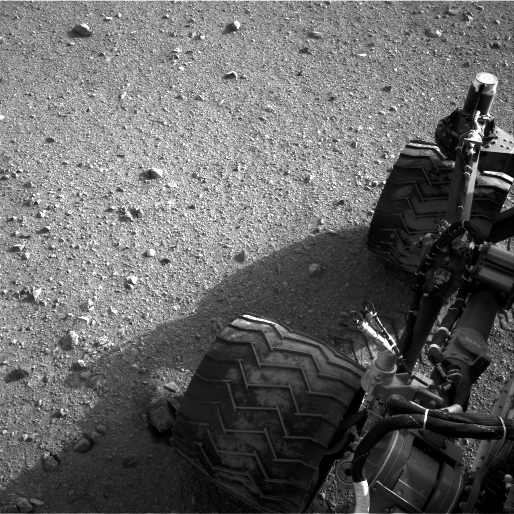
PIA15693:
-
Martian Soil on Curiosity's Wheels After Sol 22 Drive
Full Resolution:
TIFF
(1.05 MB)
JPEG
(247.4 kB)
|
|
|
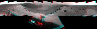
2012-08-22 |
Mars
|
Mars Science Laboratory (MSL)
|
Navcam (MSL)
Robotic Arm (MSL)
|
2089x2074x1 |
|
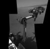
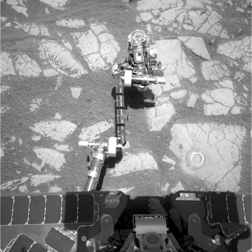
-
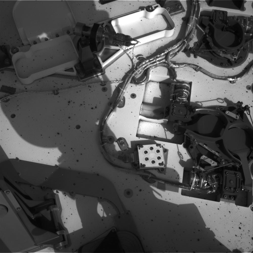
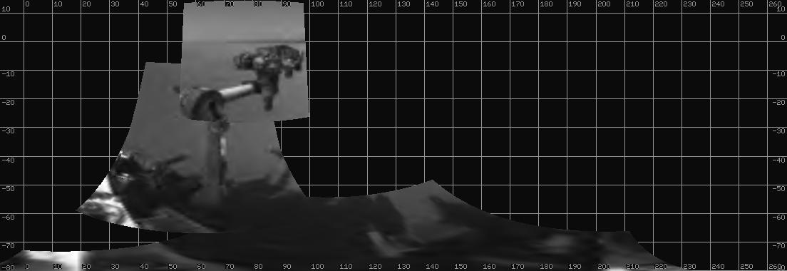
PIA16096:
-
Curiosity's First Arm Extension, Full Resolution
Full Resolution:
TIFF
(4.338 MB)
JPEG
(262 kB)
|
|
|
2012-08-20 |
Mars
|
Mars Science Laboratory (MSL)
|
Navcam (MSL)
Robotic Arm (MSL)
|
1104x380x1 |
|
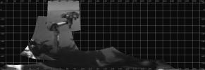
-
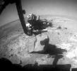
PIA15692:
-
Curiosity Extends Arm for First Time on Mars
Full Resolution:
TIFF
(420.2 kB)
JPEG
(46.28 kB)
|
|
|
2012-08-20 |
Mars
|
Mars Science Laboratory (MSL)
|
Navcam (MSL)
|
7703x2253x1 |

|
-
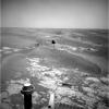
PIA16077:
-
The Heights of Mount Sharp
Full Resolution:
TIFF
(17.37 MB)
JPEG
(1.363 MB)
|
|
|
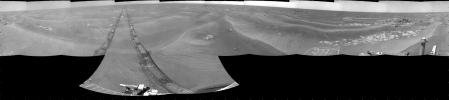
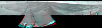
2012-08-17 |
Mars
|
Mars Science Laboratory (MSL)
|
Navcam (MSL)
|
5341x5301x1 |
|
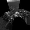
-
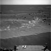
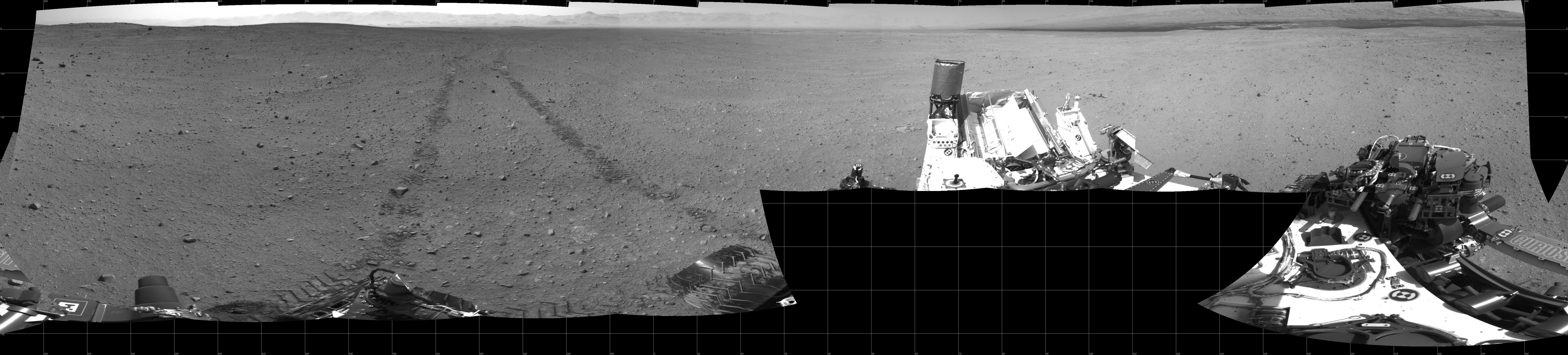
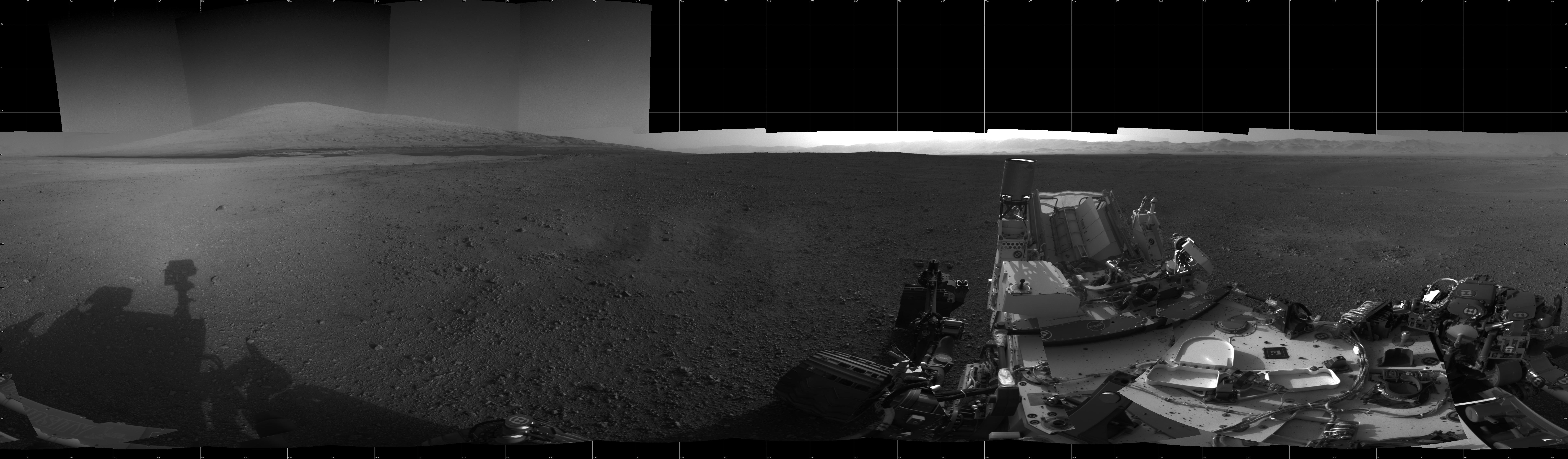
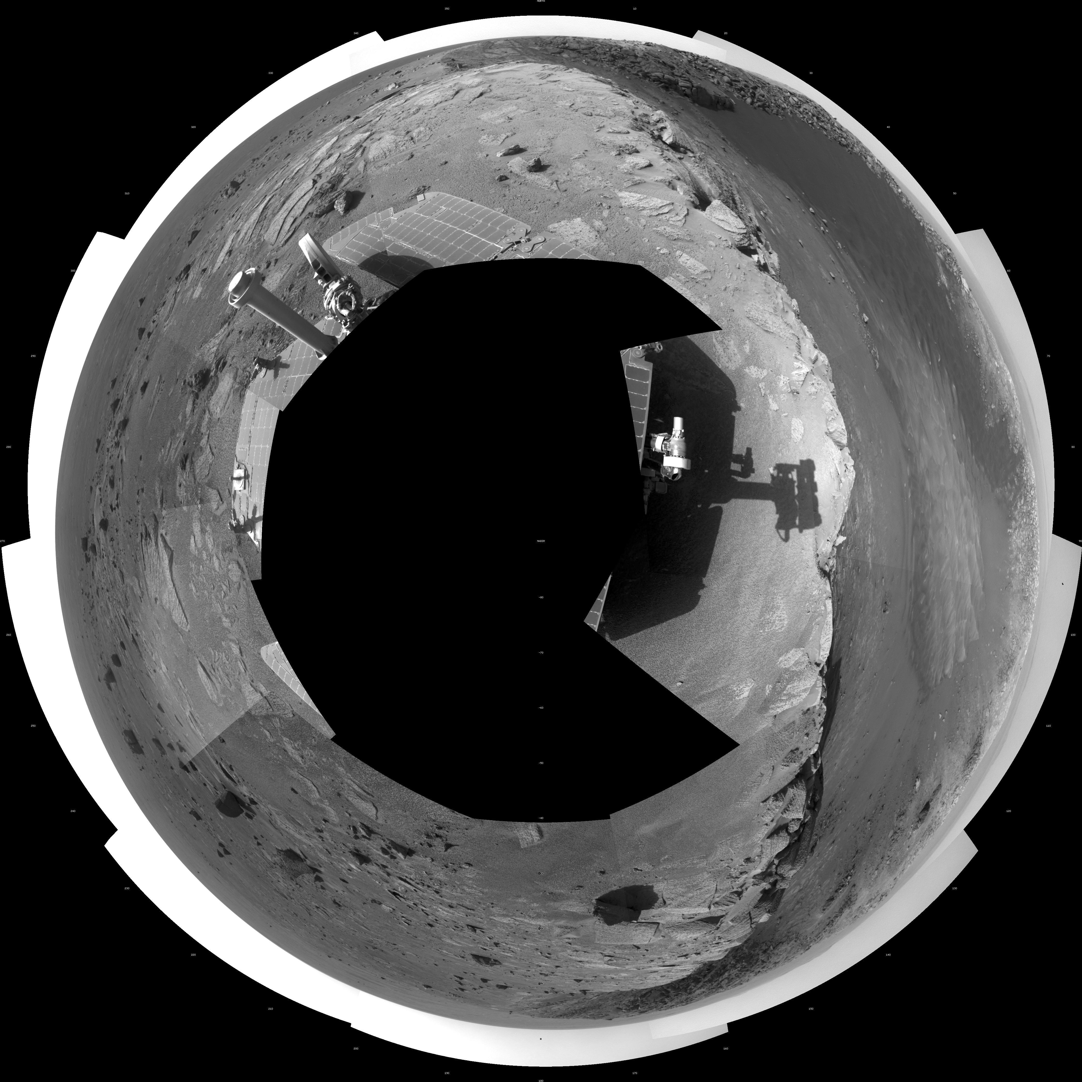
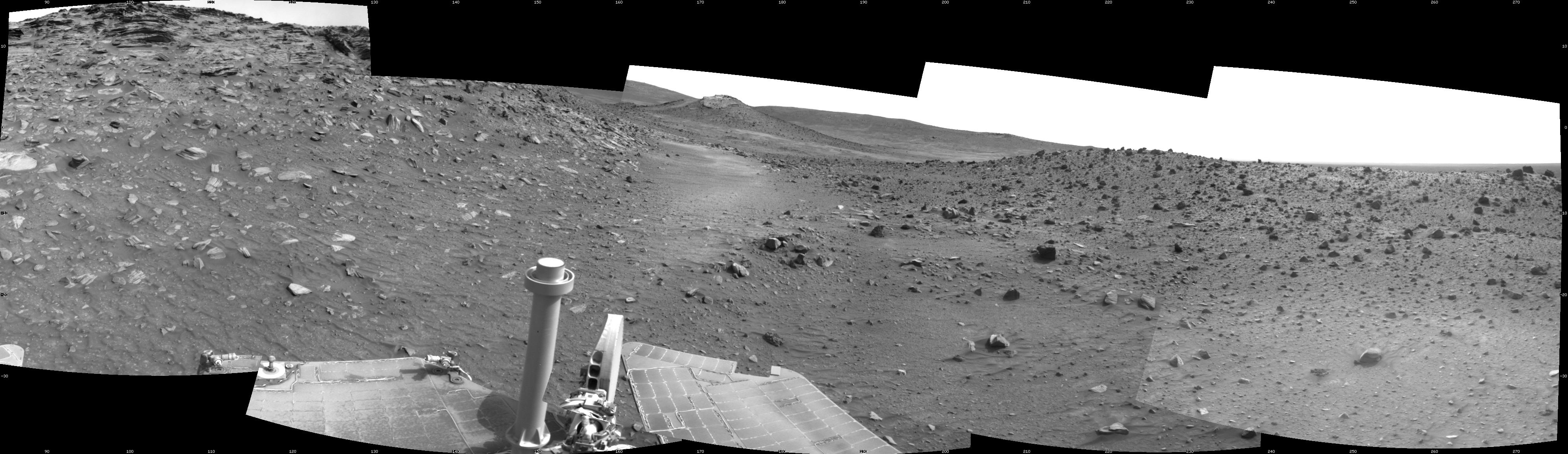
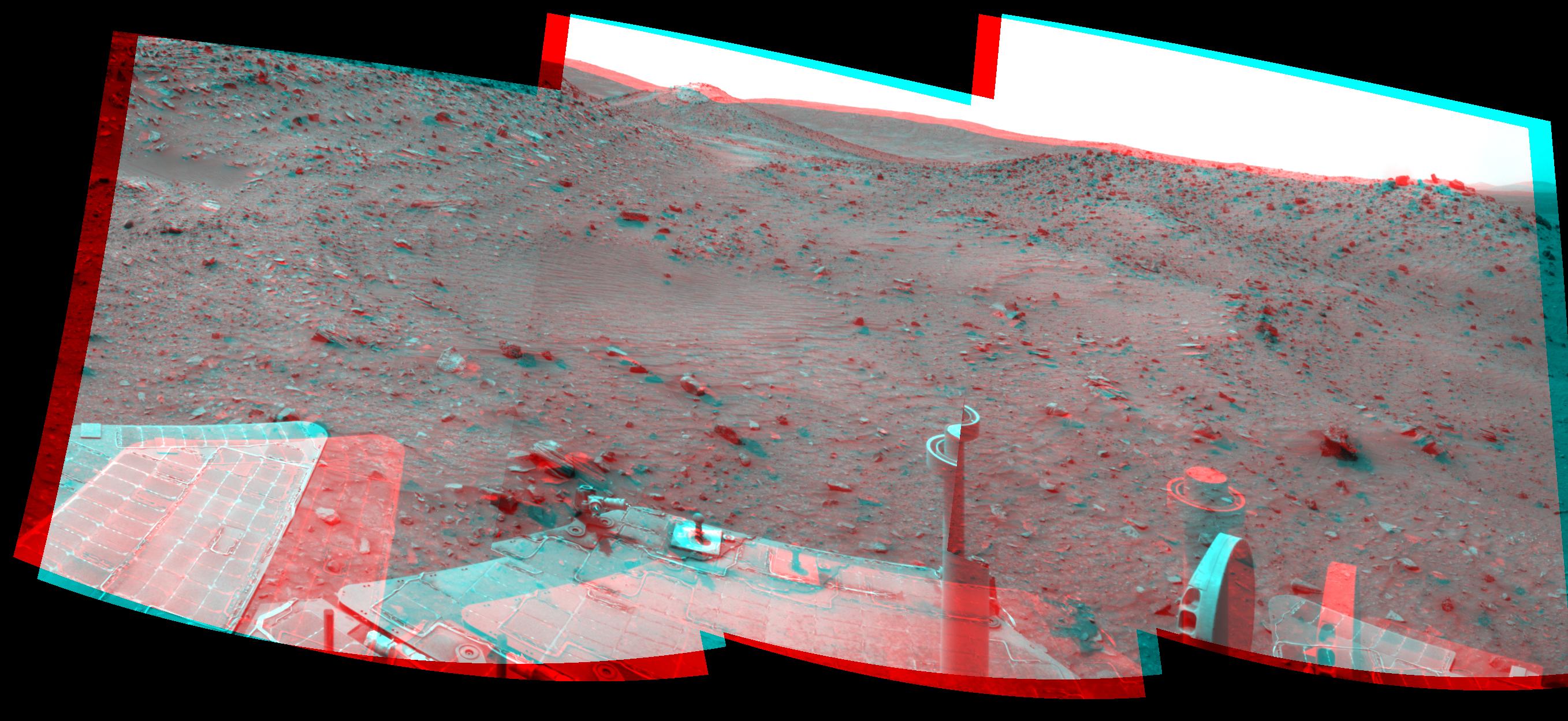
PIA16063:
-
Still Life with Rover
Full Resolution:
TIFF
(28.36 MB)
JPEG
(1.591 MB)
|
|
|
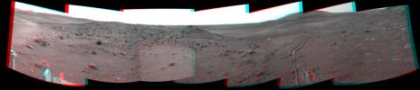
2012-08-09 |
Mars
|
Mars Science Laboratory (MSL)
|
Navcam (MSL)
|
4313x4281x1 |
|
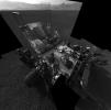
-
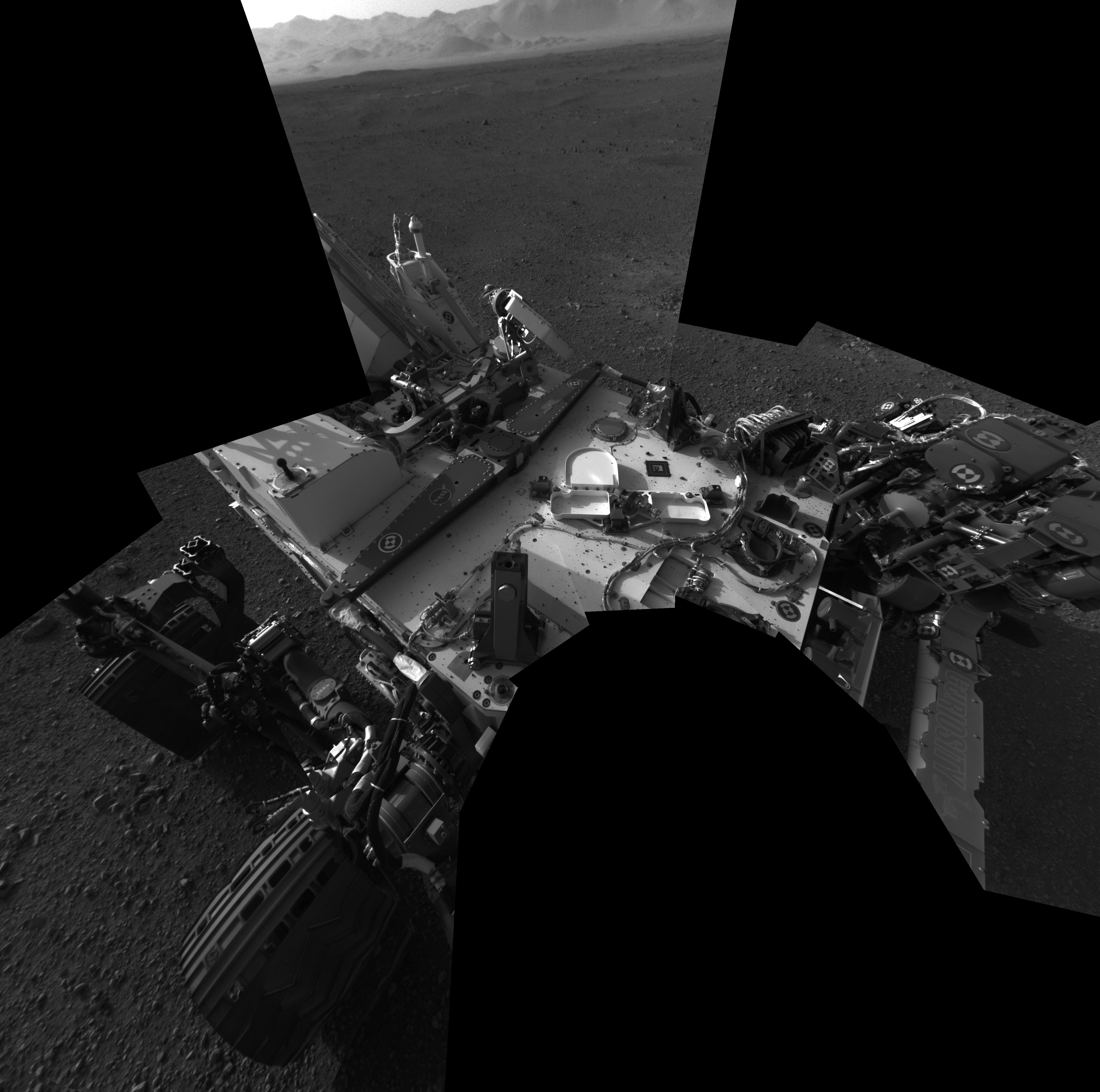
PIA16027:
-
Checking out the Rover Deck in Full Resolution
Full Resolution:
TIFF
(18.5 MB)
JPEG
(935.7 kB)
|
|
|
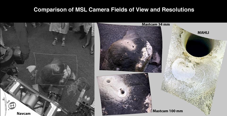
2012-08-02 |
|
Mars Science Laboratory (MSL)
|
Navcam (MSL)
|
962x493x3 |
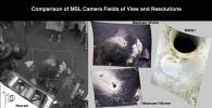
|
-
PIA15951:
-
Comparison of Curiosity Camera Fields of View
Full Resolution:
TIFF
(1.424 MB)
JPEG
(81.84 kB)
|
|
|
2012-01-05 |
Mars
|
Mars Exploration Rover (MER)
|
Navigation Camera
|
1024x1024x1 |

|
-
PIA15118:
-
Approaching 'Greeley Haven' on Endeavour Rim
Full Resolution:
TIFF
(1.05 MB)
JPEG
(212.1 kB)
|
|
|
2011-12-07 |
Mars
|
Mars Exploration Rover (MER)
|
Navigation Camera
|
1024x1024x1 |
|
-
PIA15036:
-
Western Edge of 'Cape York,' with Bright Vein
Full Resolution:
TIFF
(1.05 MB)
JPEG
(297.5 kB)
|
|
|
2011-10-10 |
Mars
|
Mars Exploration Rover (MER)
|
Navigation Camera
|
1024x1024x1 |
|
-
PIA14759:
-
Approaching Endeavour Crater, Sol 2,680
Full Resolution:
TIFF
(1.05 MB)
JPEG
(204.5 kB)
|
|
|
2011-09-12 |
Mars
|
Mars Exploration Rover (MER)
|
Navigation Camera
Panoramic Camera
|
3072x3072x3 |

|
-
PIA14750:
-
Memorial Image Taken on Mars on Sept. 11, 2011
Full Resolution:
TIFF
(28.31 MB)
JPEG
(1.098 MB)
|
|
|
2011-09-01 |
Mars
|
Mars Exploration Rover (MER)
|
Navigation Camera
|
1024x1024x1 |
|
-
PIA14748:
-
Approaching 'Tisdale 2' Rock on Rim of Endeavour Crater, Sol 2690
Full Resolution:
TIFF
(1.05 MB)
JPEG
(192.7 kB)
|
|
|
2011-09-01 |
Mars
|
Mars Exploration Rover (MER)
|
Navigation Camera
|
8192x4809x1 |
|
-
PIA14539:
-
Bright Veins in 'Botany Bay' on rim of Endeavour Crater on Mars
Full Resolution:
TIFF
(39.43 MB)
JPEG
(3.268 MB)
|
|
|
2011-09-01 |
Mars
|
Mars Exploration Rover (MER)
|
Navigation Camera
|
8192x4843x1 |

|
-
PIA14538:
-
Opportunity's View Across 'Botany Bay' and Endeavour on Sol 2678
Full Resolution:
TIFF
(39.71 MB)
JPEG
(3.319 MB)
|
|
|
2011-08-15 |
Mars
|
Mars Exploration Rover (MER)
|
Navigation Camera
|
6767x1169x3 |
|
-
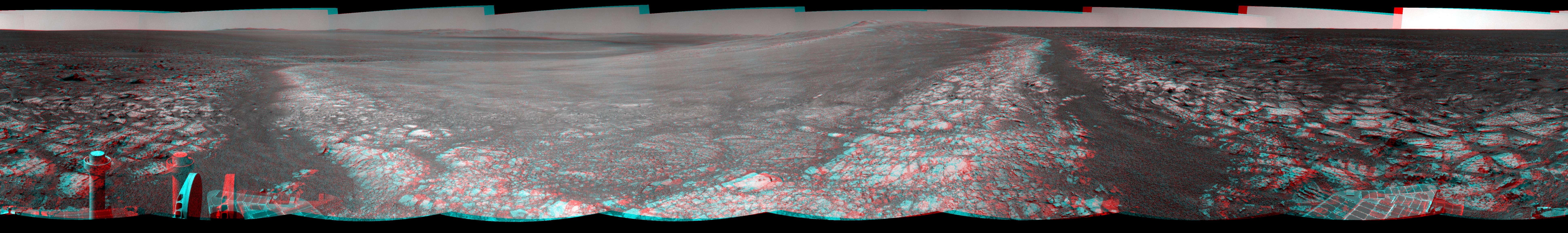
PIA14531:
'Spirit Point' Vista from Opportunity, in Stereo
Full Resolution:
TIFF
(23.73 MB)
JPEG
(1.008 MB)
|
|
|
2011-07-19 |
Mars
|
Mars Exploration Rover (MER)
|
Navigation Camera
|
1024x1024x1 |
|
-
PIA14269:
-
Drive Direction Image by Opportunity After Surpassing 20 Miles
Full Resolution:
TIFF
(1.05 MB)
JPEG
(189.9 kB)
|
|
|
2011-06-02 |
Mars
|
Mars Exploration Rover (MER)
|
Navigation Camera
|
4905x1182x3 |
|
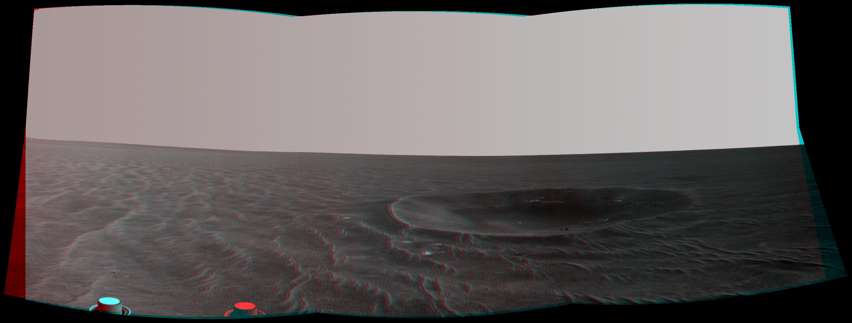
-
PIA14133:
-
Opportunity Beside a Small, Young Crater (Stereo)
Full Resolution:
TIFF
(17.39 MB)
JPEG
(702.3 kB)
|
|
|
2011-06-02 |
Mars
|
Mars Exploration Rover (MER)
|
Navigation Camera
|
4865x1013x1 |
|
-
PIA14132:
-
Opportunity Beside a Small, Young Crater
Full Resolution:
TIFF
(4.937 MB)
JPEG
(609.6 kB)
|
|
|
2011-05-18 |
Mars
|
Mars Exploration Rover (MER)
|
Navigation Camera
|
5733x1153x3 |
|
-
PIA14130:
Autonomous Hazard Checks Leave Patterned Rover Tracks on Mars (Stereo)
Full Resolution:
TIFF
(19.83 MB)
JPEG
(736.2 kB)
|
|
|
2011-05-18 |
Mars
|
Mars Exploration Rover (MER)
|
Navigation Camera
|
5685x989x1 |
|
-
PIA14129:
Autonomous Hazard Checks Leave Patterned Rover Tracks on Mars
Full Resolution:
TIFF
(5.631 MB)
JPEG
(692.8 kB)
|
|
|
2011-05-04 |
Mars
|
Mars Exploration Rover (MER)
|
Navigation Camera
|
1747x1093x3 |
|
-
PIA13989:
-
Martian 'Freedom 7' Crater 50 Years After Freedom 7 Flight (Stereo)
Full Resolution:
TIFF
(5.737 MB)
JPEG
(245.7 kB)
|
|
|
2011-05-04 |
Mars
|
Mars Exploration Rover (MER)
|
Navigation Camera
|
1747x1093x1 |
|
-
PIA13988:
-
Martian 'Freedom 7' Crater 50 Years After Freedom 7 Flight
Full Resolution:
TIFF
(1.912 MB)
JPEG
(239.2 kB)
|
|
|
2011-04-08 |
Mars
|
Mars Exploration Rover (MER)
|
Navigation Camera
Rock Abrasion Tool (RAT)
|
1024x1024x1 |

|
-
PIA13982:
-
Opportunity's Arm and 'Gagarin' Rock, Sol 405
Full Resolution:
TIFF
(1.05 MB)
JPEG
(169 kB)
|
|
|
2011-03-24 |
Annefrank
|
Stardust
|
Stardust Navigation Camera
|
3000x2400x3 |

|
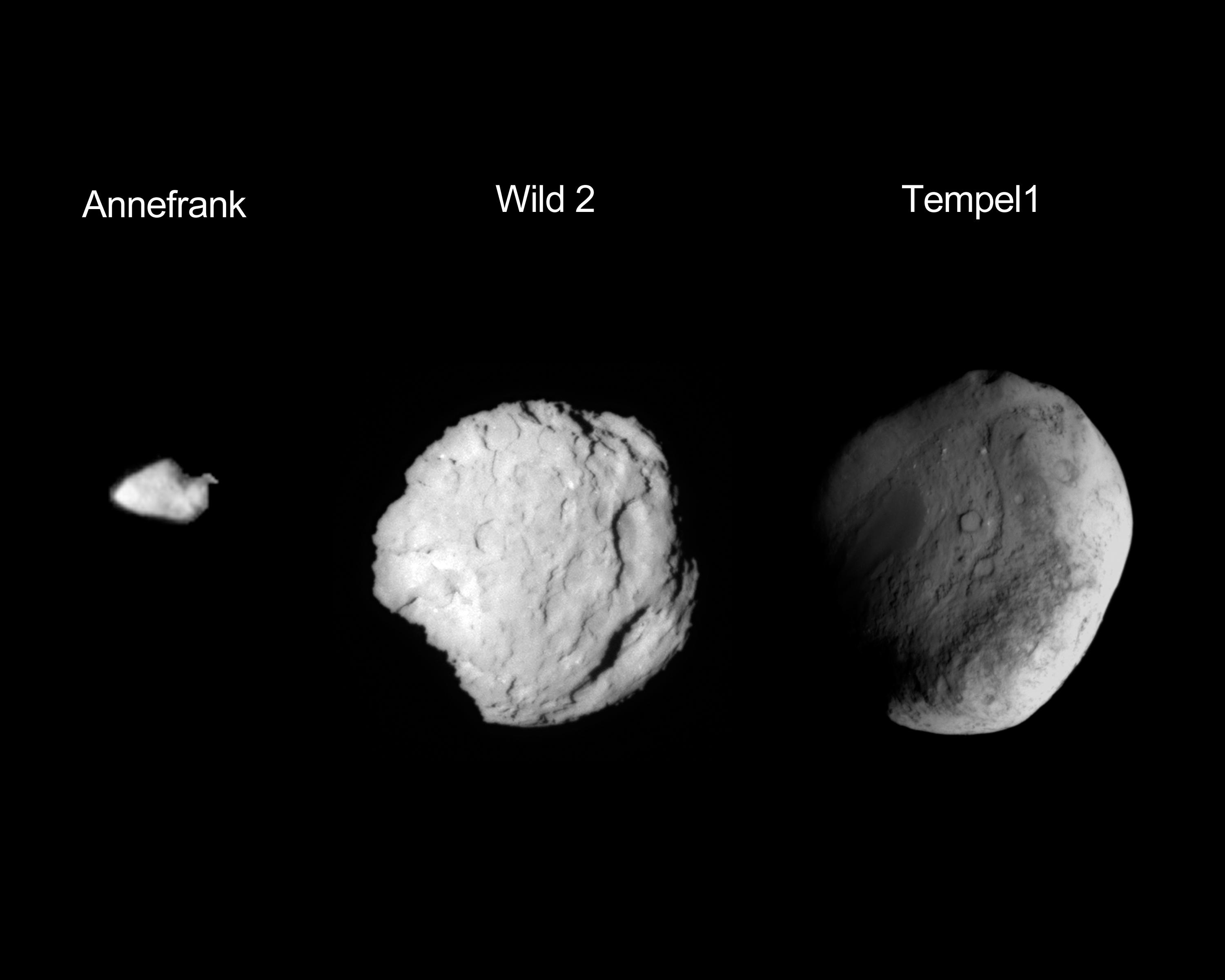
-
PIA13943:
-
Stardust's Worlds
Full Resolution:
TIFF
(7.21 MB)
JPEG
(180.3 kB)
|
|
|
2011-02-18 |
Tempel 1
|
StardustNExT
|
Stardust Navigation Camera
|
1271x837x1 |
|
-
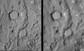
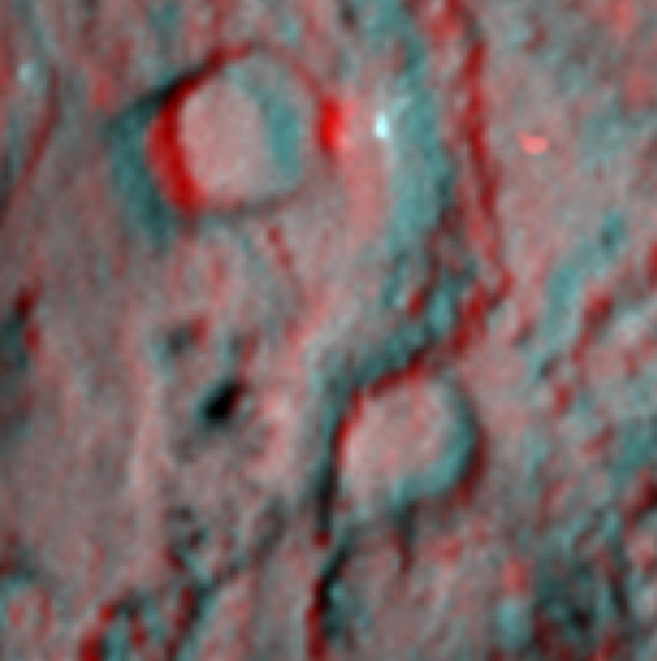
PIA13873:
-
Tempel 1 Impact Site (unannotated)
Full Resolution:
TIFF
(1.065 MB)
JPEG
(75.39 kB)
|
|
|
2011-02-18 |
Tempel 1
|
StardustNExT
|
Stardust Navigation Camera
|
942x947x3 |
|
-
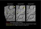
PIA13872:
-
Deep Impact Site in 3-D
Full Resolution:
TIFF
(2.68 MB)
JPEG
(58.62 kB)
|
|
|
2011-02-18 |
Tempel 1
|
StardustNExT
|
Stardust Navigation Camera
|
1121x683x1 |
|
-
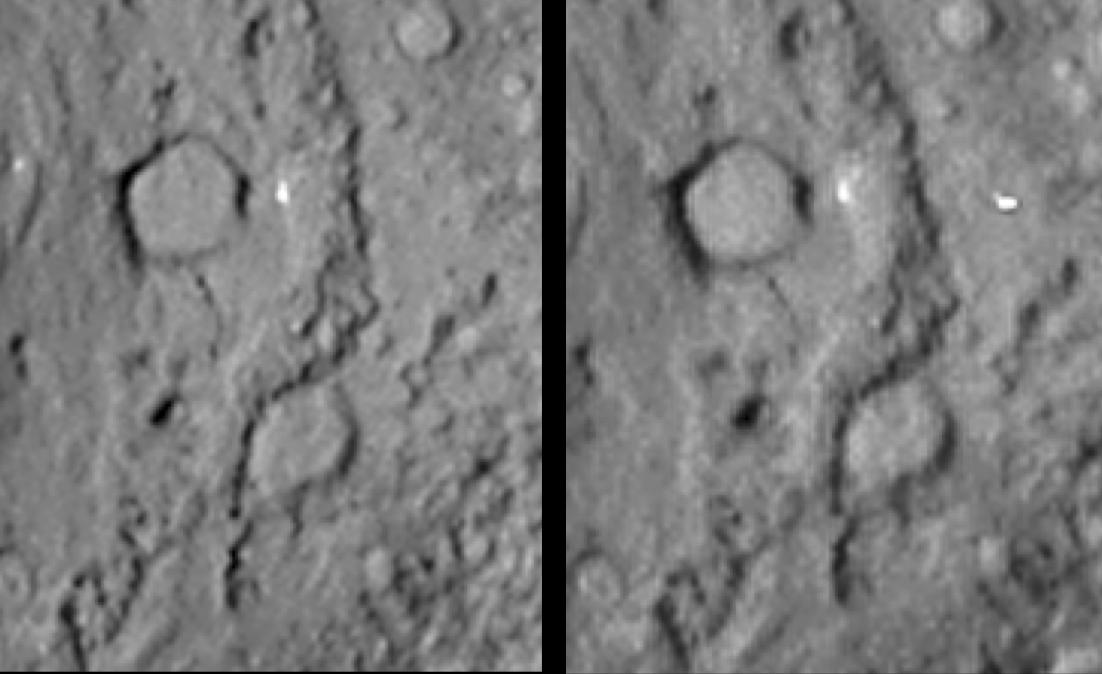
PIA13871:
-
Comet Tempel 1 in Stereo
Full Resolution:
TIFF
(766.7 kB)
JPEG
(59.05 kB)
|
|
|
2011-02-18 |
Tempel 1
|
StardustNExT
|
Stardust Navigation Camera
|
1102x674x1 |
|
-
PIA13870:
-
Comet Tempel 1 in Stereo (reversed)
Full Resolution:
TIFF
(743.8 kB)
JPEG
(58.37 kB)
|
|
|
2011-02-18 |
Tempel 1
|
StardustNExT
|
Stardust Navigation Camera
|
1434x1012x3 |
|
-
PIA13869:
-
Comet Tempel 1 Six Years Later
Full Resolution:
TIFF
(4.362 MB)
JPEG
(113.8 kB)
|
|
|
2011-02-18 |
Tempel 1
|
StardustNExT
|
Stardust Navigation Camera
|
1487x1117x1 |
|
-
PIA13868:
-
Before the Deep Impact Collision
Full Resolution:
TIFF
(1.663 MB)
JPEG
(86.61 kB)
|
|
|
2011-02-17 |
Tempel 1
|
StardustNExT
|
Stardust Navigation Camera
|
1276x716x1 |

|
-
PIA13867:
-
Stardust Swoops by Tempel 1
Full Resolution:
TIFF
(914.8 kB)
JPEG
(17.87 kB)
|
|
|
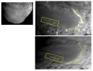
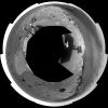
2011-02-16 |
Tempel 1
|
StardustNExT
|
Medium Resolution Instrument (MRI)
Stardust Navigation Camera
|
890x680x1 |
|
-
PIA13863:
-
Changes to Smooth Terrain (Unannotated)
Full Resolution:
TIFF
(606 kB)
JPEG
(43.76 kB)
|
|
|
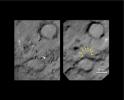
2011-02-16 |
Tempel 1
|
StardustNExT
|
Medium Resolution Instrument (MRI)
Stardust Navigation Camera
|
890x680x3 |
|
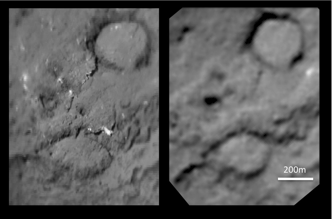
-
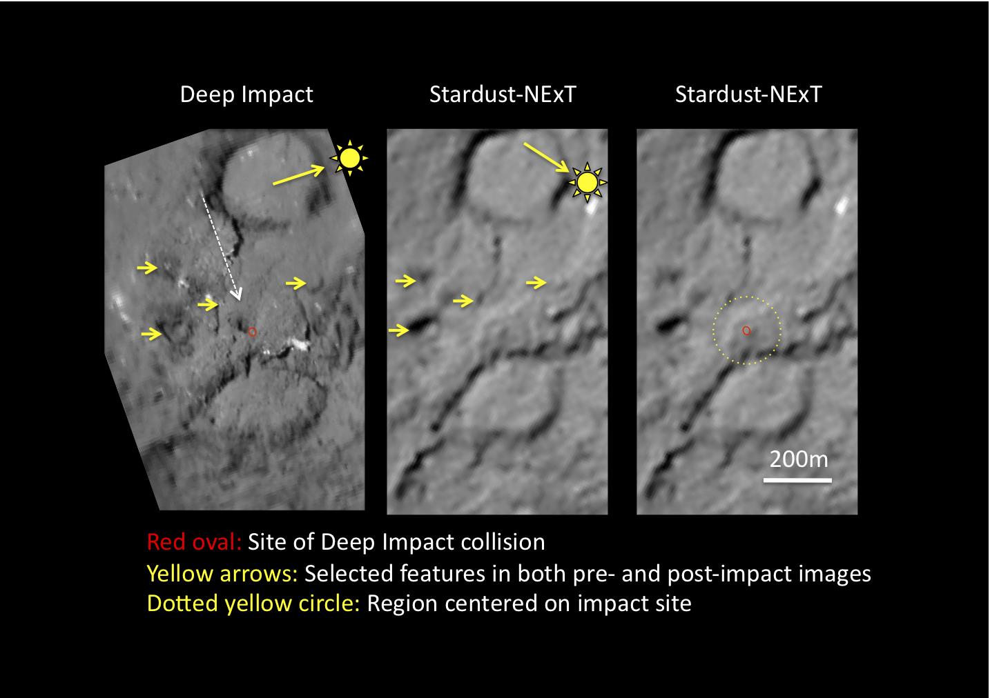
PIA13862:
-
Changes to Smooth Terrain (Annotated)
Full Resolution:
TIFF
(1.818 MB)
JPEG
(53.38 kB)
|
|
|
2011-02-16 |
Tempel 1
|
StardustNExT
|
Stardust Navigation Camera
|
1500x1125x1 |

|
-
PIA13861:
-
New Territory on Tempel 1
Full Resolution:
TIFF
(1.69 MB)
JPEG
(77.51 kB)
|
|
|
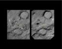
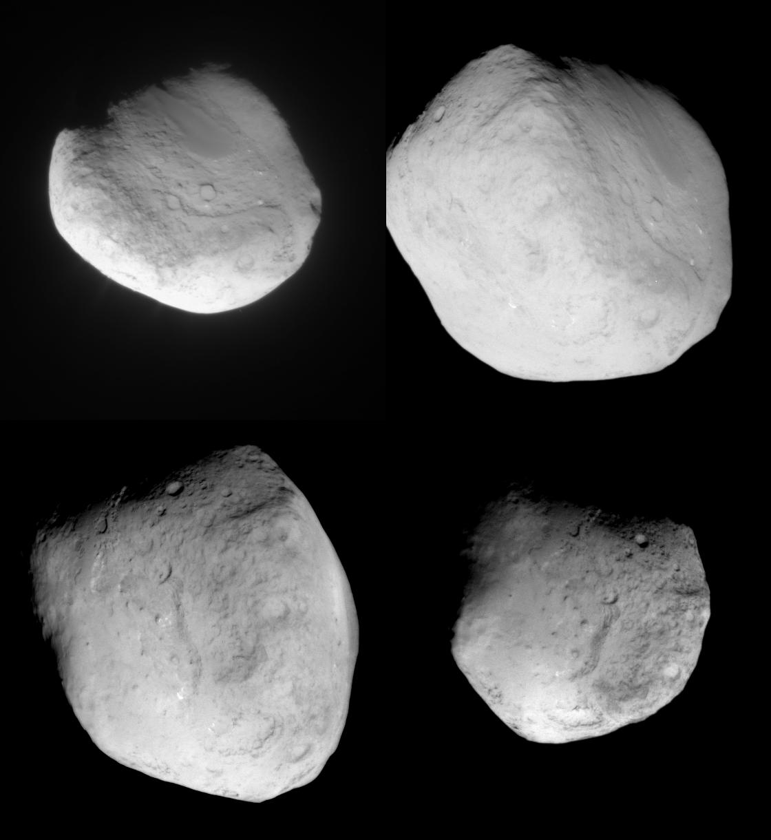
2011-02-16 |
Tempel 1
|
StardustNExT
|
Stardust Navigation Camera
|
1120x1220x1 |
|
-
PIA13860:
-
Four Views of Comet Tempel 1
Full Resolution:
TIFF
(1.368 MB)
JPEG
(79.08 kB)
|
|
|
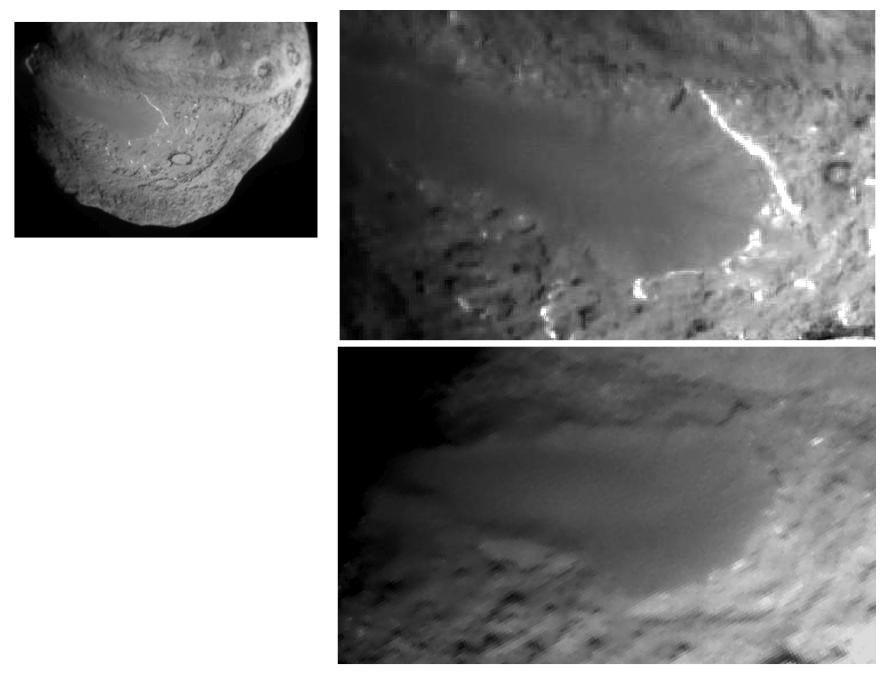
2011-02-16 |
Tempel 1
|
StardustNExT
|
Stardust Navigation Camera
|
1565x1252x3 |
|
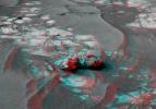
-
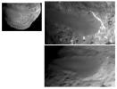
PIA13856:
-
Tempel 1 Impact Site
Full Resolution:
TIFF
(5.888 MB)
JPEG
(98.12 kB)
|
|
|
2011-02-16 |
Tempel 1
|
StardustNExT
|
Stardust Navigation Camera
|
1556x1253x3 |
|
-
PIA13855:
-
Tempel 1 Impact Site
Full Resolution:
TIFF
(5.859 MB)
JPEG
(98.48 kB)
|
|
|
2011-02-15 |
Tempel 1
|
StardustNExT
|
Stardust Navigation Camera
|
1024x1024x1 |

|
-
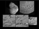
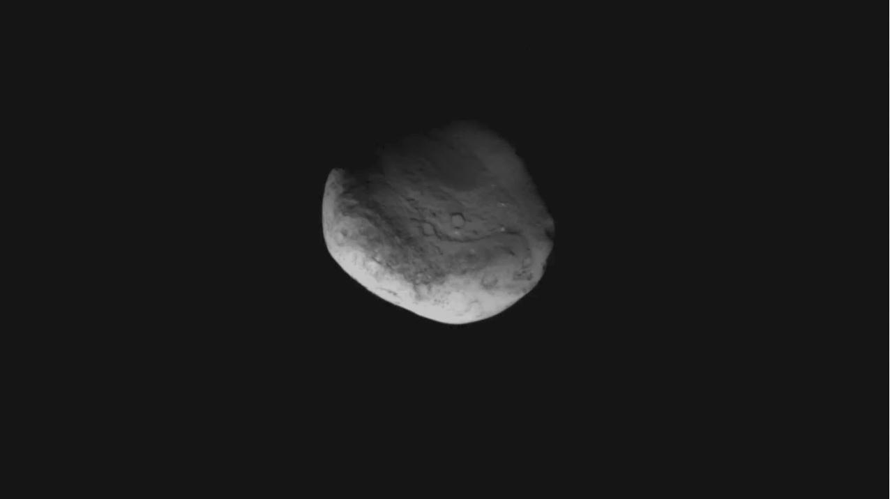
PIA13853:
-
Comet Tempel 1 as Seen by NASA's Stardust
Full Resolution:
TIFF
(1.05 MB)
JPEG
(12.94 kB)
|
|
|
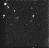
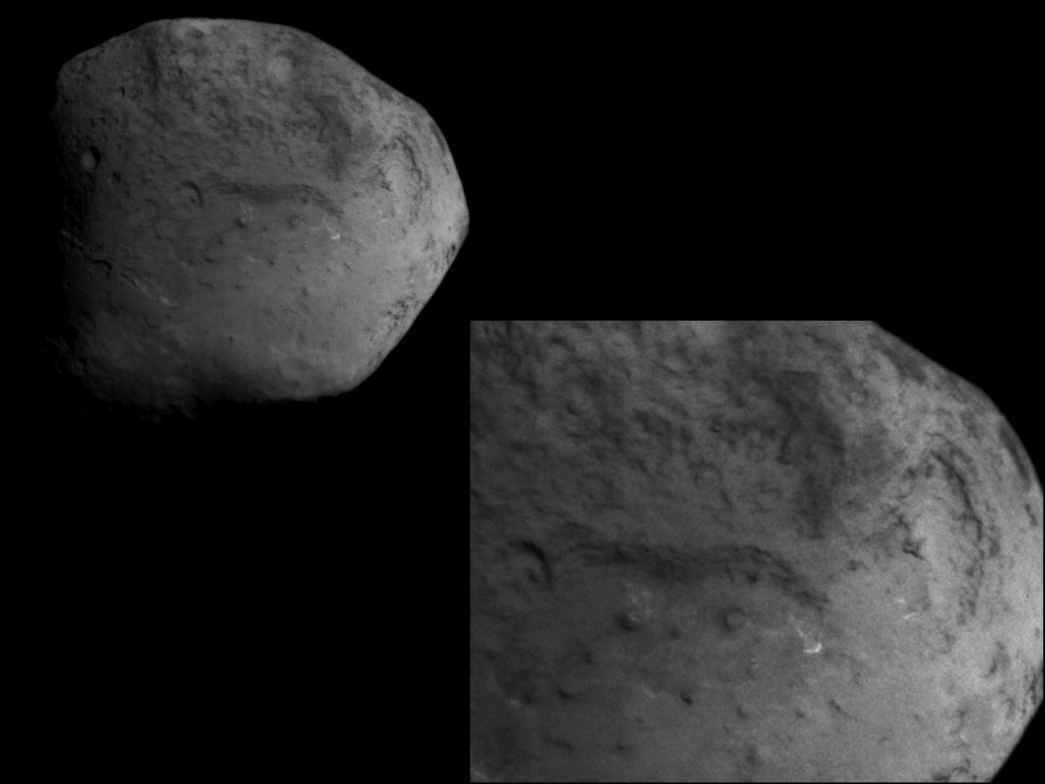
2011-02-14 |
Tempel 1
|
StardustNExT
|
Stardust Navigation Camera
|
1291x1291x1 |
|
-
PIA13851:
-
NASA Spacecraft Hours from Comet Encounter
Full Resolution:
TIFF
(1.669 MB)
JPEG
(156.6 kB)
|
|
|
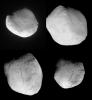
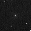
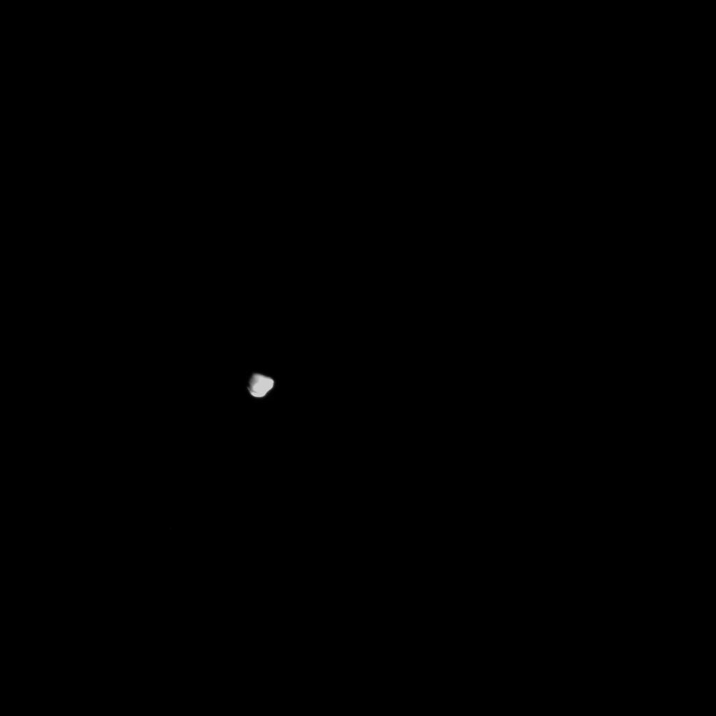
2011-01-27 |
Tempel 1
|
StardustNExT
|
Stardust Navigation Camera
|
649x644x1 |
|
-
PIA13829:
-
NASA Comet Hunter Spots its Valentine
Full Resolution:
TIFF
(418.6 kB)
JPEG
(54.69 kB)
|
|
|
2011-01-13 |
Mars
|
Mars Exploration Rover (MER)
|
Navigation Camera
|
4000x4000x1 |

|
-
PIA13759:
-
View of 'Santa Maria' Crater from Western Rim, Sol 2454 (Vertical)
Full Resolution:
TIFF
(16.02 MB)
JPEG
(1.38 MB)
|
|
|
2011-01-13 |
Mars
|
Mars Exploration Rover (MER)
|
Navigation Camera
|
4187x4187x1 |
|
-
PIA13758:
-
View of 'Santa Maria' Crater from Western Rim, Sol 2454 (Polar)
Full Resolution:
TIFF
(17.56 MB)
JPEG
(1.44 MB)
|
|
|
2011-01-13 |
Mars
|
Mars Exploration Rover (MER)
|
Navigation Camera
|
7753x2352x3 |
|
-
PIA13757:
-
View of 'Santa Maria' Crater from Western Rim, Sol 2454 (Stereo)
Full Resolution:
TIFF
(54.71 MB)
JPEG
(1.487 MB)
|
|
|
2011-01-13 |
Mars
|
Mars Exploration Rover (MER)
|
Navigation Camera
|
7688x1812x1 |
|
-
PIA13756:
-
View of 'Santa Maria' Crater from Western Rim, Sol 2454
Full Resolution:
TIFF
(13.95 MB)
JPEG
(1.253 MB)
|
|
|
2011-01-13 |
Mars
|
Mars Exploration Rover (MER)
|
Navigation Camera
|
1027x1036x1 |

|
-
PIA13755:
-
Textures of 'Santa Maria' Crater, Sol 2476
Full Resolution:
TIFF
(1.065 MB)
JPEG
(226.6 kB)
|
|
|
2011-01-03 |
Mars
|
Mars Exploration Rover (MER)
|
Navigation Camera
|
4000x4000x1 |

|
-
PIA13753:
-
'Santa Maria' Crater in 360-Degree View, Sol 2451 (Vertical)
Full Resolution:
TIFF
(16.02 MB)
JPEG
(1.289 MB)
|
|
|
2011-01-03 |
Mars
|
Mars Exploration Rover (MER)
|
Navigation Camera
|
4443x4443x1 |
|
-
PIA13752:
-
'Santa Maria' Crater in 360-Degree View, Sol 2451 (Polar)
Full Resolution:
TIFF
(19.78 MB)
JPEG
(1.462 MB)
|
|
|
2011-01-03 |
Mars
|
Mars Exploration Rover (MER)
|
Navigation Camera
|
7753x2243x3 |

|
-
PIA13751:
-
'Santa Maria' Crater in 360-Degree View, Sol 2451 (Stereo)
Full Resolution:
TIFF
(52.17 MB)
JPEG
(1.44 MB)
|
|
|
2011-01-03 |
Mars
|
Mars Exploration Rover (MER)
|
Navigation Camera
|
7688x1752x1 |
|
-
PIA13750:
-
'Santa Maria' Crater in 360-Degree View, Sol 2451
Full Resolution:
TIFF
(13.48 MB)
JPEG
(1.236 MB)
|
|
|
2010-12-16 |
Mars
|
Mars Exploration Rover (MER)
|
Navigation Camera
|
3451x1001x1 |
|
-
PIA13707:
-
Opportunity's View of Santa Maria Crater, Sol 2450
Full Resolution:
TIFF
(3.459 MB)
JPEG
(464.5 kB)
|
|
|
2010-11-18 |
Mars
|
Mars Exploration Rover (MER)
|
Navigation Camera
|
2777x1055x3 |
|
-
PIA13597:
-
'Yankee Clipper' Crater on Mars (Stereo)
Full Resolution:
TIFF
(8.789 MB)
JPEG
(184.1 kB)
|
|
|
2010-11-18 |
Mars
|
Mars Exploration Rover (MER)
|
Navigation Camera
|
2777x1055x1 |

|
-
PIA13596:
-
'Yankee Clipper' Crater on Mars
Full Resolution:
TIFF
(2.934 MB)
JPEG
(180.2 kB)
|
|
|
2010-11-12 |
Mars
|
Mars Exploration Rover (MER)
|
Navigation Camera
|
4176x980x1 |
|
-
PIA13592:
'Intrepid' Crater on Opportunity's Martian Trek
Full Resolution:
TIFF
(4.101 MB)
JPEG
(439.6 kB)
|
|
|
2010-11-12 |
Mars
|
Mars Exploration Rover (MER)
|
Navigation Camera
|
2659x971x1 |
|
-
PIA13586:
-
Opportunity's Eastward View After Sol 2401 Drive
Full Resolution:
TIFF
(2.585 MB)
JPEG
(348.3 kB)
|
|
|
2010-11-12 |
Mars
|
Mars Exploration Rover (MER)
|
Navigation Camera
|
2681x1133x3 |

|
-
PIA13587:
-
Opportunity's Eastward View After Sol 2401 Drive (Stereo)
Full Resolution:
TIFF
(9.122 MB)
JPEG
(390.4 kB)
|
|
|
2010-11-12 |
Mars
|
Mars Exploration Rover (MER)
|
Navigation Camera
|
7688x970x1 |
|
-
PIA13588:
Opportunity's Surroundings After Sol 2393 Drive
Full Resolution:
TIFF
(7.465 MB)
JPEG
(1.064 MB)
|
|
|
2010-11-12 |
Mars
|
Mars Exploration Rover (MER)
|
Navigation Camera
|
7753x1131x3 |
|
-
PIA13589:
Opportunity's Surroundings After Sol 2393 Drive (Stereo)
Full Resolution:
TIFF
(26.31 MB)
JPEG
(1.238 MB)
|
|
|
2010-11-12 |
Mars
|
Mars Exploration Rover (MER)
|
Navigation Camera
|
4077x4077x1 |
|
-
PIA13590:
-
Opportunity's Surroundings After Sol 2393 Drive (Polar)
Full Resolution:
TIFF
(16.64 MB)
JPEG
(1.452 MB)
|
|
|
2010-11-12 |
Mars
|
Mars Exploration Rover (MER)
|
Navigation Camera
|
4000x4000x1 |

|
-
PIA13591:
-
Opportunity's Surroundings After Sol 2393 Drive (Vertical)
Full Resolution:
TIFF
(16.02 MB)
JPEG
(1.529 MB)
|
|
|
2010-10-19 |
Mars
|
Mars Exploration Rover (MER)
|
Navigation Camera
|
2719x1145x1 |
|
-
PIA13492:
-
Opportunity's Eastward View After Sol 2382 Drive
Full Resolution:
TIFF
(3.117 MB)
JPEG
(308.4 kB)
|
|
|
2010-10-19 |
Mars
|
Mars Exploration Rover (MER)
|
Navigation Camera
|
2719x1145x3 |
|
-
PIA13491:
-
Opportunity's Eastward View After Sol 2382 Drive (Stereo)
Full Resolution:
TIFF
(9.349 MB)
JPEG
(332.7 kB)
|
|
|
2010-09-29 |
Mars
|
Mars Exploration Rover (MER)
|
Navigation Camera
|
912x639x3 |
|
-
PIA13417:
-
Opportunity's Close-up of 'Oileán Ruaidh' (Stereo)
Full Resolution:
TIFF
(1.751 MB)
JPEG
(91.42 kB)
|
|
|
2010-09-29 |
Mars
|
Mars Exploration Rover (MER)
|
Navigation Camera
|
7753x1161x1 |

|
-
PIA13416:
Opportunity's Surroundings After Sol 2363 Drive
Full Resolution:
TIFF
(9.011 MB)
JPEG
(1.171 MB)
|
|
|
2010-09-29 |
Mars
|
Mars Exploration Rover (MER)
|
Navigation Camera
|
7753x1161x3 |
|
-
PIA13415:
Opportunity's Surroundings After Sol 2363 Drive (Stereo)
Full Resolution:
TIFF
(27 MB)
JPEG
(1.221 MB)
|
|
|
2010-09-29 |
Mars
|
Mars Exploration Rover (MER)
|
Navigation Camera
|
4127x4127x1 |

|
-
PIA13414:
-
Opportunity's Surroundings After Sol 2363 Drive (Polar)
Full Resolution:
TIFF
(17.07 MB)
JPEG
(1.483 MB)
|
|
|
2010-09-29 |
Mars
|
Mars Exploration Rover (MER)
|
Navigation Camera
|
4000x4000x1 |

|
-
PIA13413:
-
Opportunity's Surroundings After Sol 2363 Drive (Vertical)
Full Resolution:
TIFF
(16.02 MB)
JPEG
(1.586 MB)
|
|
|
2010-09-09 |
Mars
|
Mars Exploration Rover (MER)
|
Navigation Camera
|
1024x1024x1 |
|
-
PIA13375:
-
View from Halfway Through Multi-Year Trek
Full Resolution:
TIFF
(1.05 MB)
JPEG
(196 kB)
|
|
|
2010-09-07 |
Mars
|
Mars Exploration Rover (MER)
|
Navigation Camera
|
4278x1143x1 |
|
-
PIA13372:
-
'Cambridge Bay' Outcrop Examined by Opportunity
Full Resolution:
TIFF
(4.899 MB)
JPEG
(522.6 kB)
|
|
|
2010-09-07 |
Mars
|
Mars Exploration Rover (MER)
|
Navigation Camera
|
4278x1143x3 |
|
-
PIA13371:
-
'Cambridge Bay' Outcrop Examined by Opportunity (Stereo)
Full Resolution:
TIFF
(14.67 MB)
JPEG
(549.4 kB)
|
|
|
2010-06-25 |
Mars
|
Mars Exploration Rover (MER)
|
Navigation Camera
|
7688x1896x1 |
|
-
PIA13222:
Opportunity's Surroundings After Sol 2220 Drive
Full Resolution:
TIFF
(14.59 MB)
JPEG
(846.1 kB)
|
|
|
2010-06-25 |
Mars
|
Mars Exploration Rover (MER)
|
Navigation Camera
|
7753x2513x3 |
|
-
PIA13221:
-
Opportunity's Surroundings After Sol 2220 Drive (Stereo)
Full Resolution:
TIFF
(58.45 MB)
JPEG
(1.074 MB)
|
|
|
2010-06-25 |
Mars
|
Mars Exploration Rover (MER)
|
Navigation Camera
|
4205x4205x1 |
|
-
PIA13220:
-
Opportunity's Surroundings After Sol 2220 Drive (Polar)
Full Resolution:
TIFF
(17.72 MB)
JPEG
(892.6 kB)
|
|
|
2010-06-25 |
Mars
|
Mars Exploration Rover (MER)
|
Navigation Camera
|
4000x4000x1 |
|
-
PIA13219:
-
Opportunity's Surroundings After Sol 2220 Drive (Vertical)
Full Resolution:
TIFF
(16.02 MB)
JPEG
(669 kB)
|
|
|
2010-05-19 |
Mars
|
Mars Exploration Rover (MER)
|
Navigation Camera
|
1024x1024x1 |

|
-
PIA13147:
-
Opportunity Looks Back After Hop to a New Pad
Full Resolution:
TIFF
(1.05 MB)
JPEG
(164.8 kB)
|
|
|
2010-05-03 |
Mars
|
Mars Exploration Rover (MER)
|
Navigation Camera
|
1024x1024x43 |
|
-
PIA13088:
-
Opportunity's Wheel Tracks at Victoria Crater
Full Resolution:
TIFF
(1.05 MB)
JPEG
(76.85 kB)
|
|
|
2010-04-30 |
Mars
|
Mars Exploration Rover (MER)
|
Navigation Camera
|
3988x2253x3 |
|
-
PIA13084:
-
Endeavour on the Horizon (Context View)
Full Resolution:
TIFF
(26.96 MB)
JPEG
(784.3 kB)
|
|
|
2010-03-23 |
Mars
|
Mars Exploration Rover (MER)
|
Navigation Camera
|
1024x1024x3 |
|
-
PIA12973:
-
Image Analyzed by Mars Rover for Selection of Target
Full Resolution:
TIFF
(1.051 MB)
JPEG
(166.4 kB)
|
|
|
2009-12-01 |
Mars
|
Mars Exploration Rover (MER)
|
Navigation Camera
|
707x649x1 |
|
-
PIA12475:
-
Examining 'Marquette Island'
Full Resolution:
TIFF
(459.5 kB)
JPEG
(61.24 kB)
|
|
|
2009-12-01 |
Mars
|
Mars Exploration Rover (MER)
|
Navigation Camera
|
1024x1024x1 |
|
-
PIA12474:
-
Approaching 'Marquette Island'
Full Resolution:
TIFF
(1.05 MB)
JPEG
(224.9 kB)
|
|
|
2009-12-01 |
Mars
|
Mars Exploration Rover (MER)
|
Navigation Camera
|
1024x1024x1 |
|
-
PIA12473:
-
Tracks in, Path out?
Full Resolution:
TIFF
(1.05 MB)
JPEG
(251.1 kB)
|
|
|
2009-11-12 |
Mars
|
Mars Exploration Rover (MER)
|
Navigation Camera
|
1024x1024x1 |
|
-
PIA12357:
-
View in Travel Direction, Sol 1870, with 'Rock Garden'
Full Resolution:
TIFF
(1.05 MB)
JPEG
(197 kB)
|
|
|
2009-10-03 |
Mars
|
Mars Exploration Rover (MER)
|
Navigation Camera
|
1024x1024x1 |
|
-
PIA12254:
-
Opportunity Finds Another Meteorite
Full Resolution:
TIFF
(1.05 MB)
JPEG
(96.74 kB)
|
|
|
2009-07-23 |
Mars
|
Mars Exploration Rover (MER)
|
Navigation Camera
|
7688x1715x1 |
|
-
PIA12155:
Opportunity's Surroundings on Sol 1950
Full Resolution:
TIFF
(13.2 MB)
JPEG
(1.089 MB)
|
|
|
2009-07-23 |
Mars
|
Mars Exploration Rover (MER)
|
Navigation Camera
|
7753x2178x3 |
|
-
PIA12154:
Opportunity's Surroundings on Sol 1950 (Stereo)
Full Resolution:
TIFF
(50.66 MB)
JPEG
(1.35 MB)
|
|
|
2009-07-23 |
Mars
|
Mars Exploration Rover (MER)
|
Navigation Camera
|
4000x4000x1 |

|
-
PIA12153:
-
Opportunity's Surroundings on Sol 1950 (Vertical)
Full Resolution:
TIFF
(16.02 MB)
JPEG
(1.143 MB)
|
|
|
2009-07-23 |
Mars
|
Mars Exploration Rover (MER)
|
Navigation Camera
|
4103x4103x1 |

|
-
PIA12152:
-
Opportunity's Surroundings on Sol 1950 (Polar)
Full Resolution:
TIFF
(16.87 MB)
JPEG
(1.262 MB)
|
|
|
2009-07-16 |
Mars
|
Mars Exploration Rover (MER)
|
Navigation Camera
|
5894x1270x3 |
|
-
PIA12143:
Spirit's View from "Troy" (Stereo)
Full Resolution:
TIFF
(22.46 MB)
JPEG
(822.4 kB)
|
|
|
2009-07-16 |
Mars
|
Mars Exploration Rover (MER)
|
Navigation Camera
|
5712x1067x1 |
|
-
PIA12142:
Spirit's View from "Troy"
Full Resolution:
TIFF
(6.103 MB)
JPEG
(694.8 kB)
|
|
|
2009-07-16 |
Mars
|
Mars Exploration Rover (MER)
|
Navigation Camera
|
4115x1385x3 |
|
-
PIA12141:
-
Spirit Close to "Troy," Sol 1871 (Stereo)
Full Resolution:
TIFF
(17.1 MB)
JPEG
(692.3 kB)
|
|
|
2009-07-16 |
Mars
|
Mars Exploration Rover (MER)
|
Navigation Camera
|
3988x1156x1 |

|
-
PIA12140:
-
Spirit Close to "Troy," Sol 1871
Full Resolution:
TIFF
(4.615 MB)
JPEG
(578.2 kB)
|
|
|
2009-07-16 |
Mars
|
Mars Exploration Rover (MER)
|
Navigation Camera
|
2715x1249x3 |

|
-
PIA12139:
-
Spirit's Look Ahead on Sol 1869 (Stereo)
Full Resolution:
TIFF
(10.18 MB)
JPEG
(436.8 kB)
|
|
|
2009-07-16 |
Mars
|
Mars Exploration Rover (MER)
|
Navigation Camera
|
2631x1050x1 |
|
-
PIA12138:
-
Spirit's Look Ahead on Sol 1869
Full Resolution:
TIFF
(2.766 MB)
JPEG
(360.6 kB)
|
|
|
2009-07-16 |
Mars
|
Mars Exploration Rover (MER)
|
Navigation Camera
|
2722x1265x3 |
|
-
PIA12137:
-
Spirit's Look Ahead After Sol 1866 Drive (Stereo)
Full Resolution:
TIFF
(10.34 MB)
JPEG
(366.5 kB)
|
 Planetary Data System


