Your search criteria found
179
images
Feature Name
Go to PIAxxxxx:
Refine this list of images by:
Spacecraft:
Curiosity
Mars Reconnaissance Orbiter (MRO)
Click on an image for detailed information
Click on a column heading to sort in ascending or descending order
My
List
Addition Date
Target
Mission
Instrument
Size
2006-11-29
Mars
Mars Reconnaissance Orbiter (MRO)
HiRISE
2048x1505x1
PIA09370:
North Polar Layered Deposits
Full Resolution:
TIFF
(3.085 MB)
JPEG
(292.4 kB)
2007-01-10
Mars
Mars Reconnaissance Orbiter (MRO)
HiRISE
600x400x3
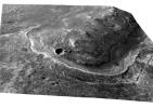
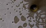
PIA09557:
Stereo Anaglyphs of Ada Crater
Full Resolution:
TIFF
(721 kB)
JPEG
(26.64 kB)
2008-12-04
Mars
Mars Reconnaissance Orbiter (MRO)
HiRISE
962x747x1
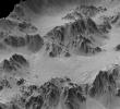
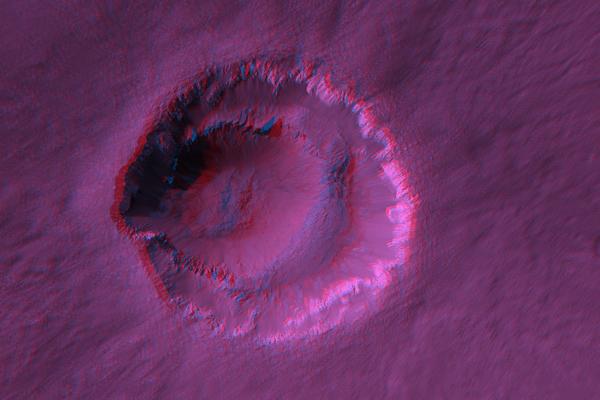
PIA11441:
Periodic Layering in Martian Sedimentary Rocks
Full Resolution:
TIFF
(719.6 kB)
JPEG
(115.1 kB)
2008-12-04
Mars
Mars Reconnaissance Orbiter (MRO)
HiRISE
1416x998x1
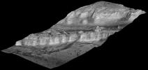
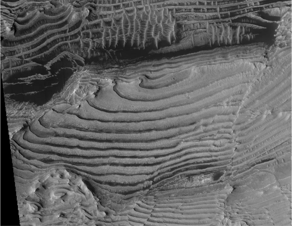
PIA11442:
Periodic Layering in Martian Sedimentary Rocks, Oblique View
Full Resolution:
TIFF
(1.415 MB)
JPEG
(246.9 kB)
2008-12-04
Mars
Mars Reconnaissance Orbiter (MRO)
HiRISE
2024x2572x3
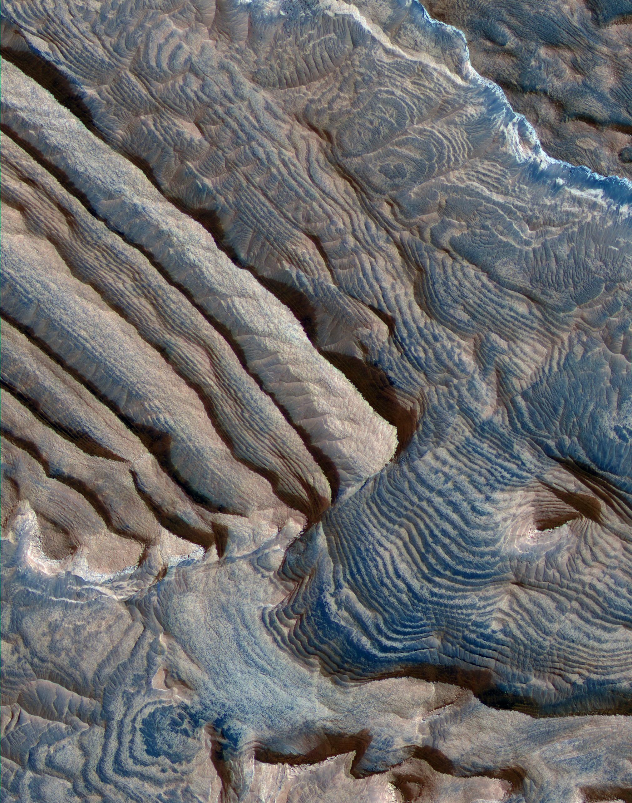
PIA11443:
Periodic Layering in Becquerel Crater, Mars
Full Resolution:
TIFF
(15.64 MB)
JPEG
(1.002 MB)
2008-12-04
Mars
Mars Reconnaissance Orbiter (MRO)
HiRISE
1278x719x3
PIA11444:
Flyover Animation of Becquerel Crater on Mars
Full Resolution:
TIFF
(2.76 MB)
JPEG
(73.52 kB)
2010-01-11
Mars
Mars Reconnaissance Orbiter (MRO)
HiRISE
1000x1000x3
PIA12488:
Turbulent Lava Flow in Mars' Athabasca Valles
Full Resolution:
TIFF
(3.004 MB)
JPEG
(152.9 kB)
2010-02-11
Mars
Mars Reconnaissance Orbiter (MRO)
CRISM
HiRISE
1500x709x1
PIA12507:
Perspective View of Layered Mound in Gale Crater, Mars
Full Resolution:
TIFF
(1.065 MB)
JPEG
(89.06 kB)
2010-02-17
Mars
Mars Reconnaissance Orbiter (MRO)
HiRISE
1676x1519x1
PIA12840:
Terrain Model of Mars' Mojave Crater
Full Resolution:
TIFF
(2.549 MB)
JPEG
(380.7 kB)
2011-06-08
Mars
Mars Exploration Rover (MER)
Mars Reconnaissance Orbiter (MRO)
HiRISE
8192x5789x3
PIA14134:
Opportunity's First Goal at Endeavour Crater: 'Spirit Point'
Full Resolution:
TIFF
(47.47 MB)
JPEG
(3.48 MB)
2011-12-07
Mars
Mars Reconnaissance Orbiter (MRO)
HiRISE
8192x4774x3
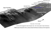
PIA15111:
West Rim of Endeavour with Vertical Exaggeration
Full Resolution:
TIFF
(117.3 MB)
JPEG
(3.007 MB)
2011-12-07
Mars
Mars Reconnaissance Orbiter (MRO)
HiRISE
960x720x3
PIA15112:
'Botany Bay' and 'Cape York' with Vertical Exaggeration
Full Resolution:
TIFF
(2.077 MB)
JPEG
(144.3 kB)
2012-03-29
Mars
Mars Reconnaissance Orbiter (MRO)
HiRISE
2560x1920x3
PIA14432:
Cratered Dune Forms
Full Resolution:
TIFF
(14.76 MB)
JPEG
(645.6 kB)
2012-08-14
Mars
Mars Reconnaissance Orbiter (MRO)
Mars Science Laboratory (MSL)
HiRISE
1511x13401x3
PIA16056:
A Whole New World for Curiosity
Full Resolution:
TIFF
(60.77 MB)
JPEG
(2.358 MB)
2012-08-14
Mars
Mars Reconnaissance Orbiter (MRO)
Mars Science Laboratory (MSL)
HiRISE
3022x2515x3
PIA16057:
Curiosity in Exaggerated Color
Full Resolution:
TIFF
(22.81 MB)
JPEG
(1.151 MB)
2013-08-28
Mars
Mars Reconnaissance Orbiter (MRO)
HiRISE
2880x1800x3
PIA17645:
Breaching a Crater Rim in Tartarus Montes
Full Resolution:
TIFF
(15.56 MB)
JPEG
(538.9 kB)
2013-08-28
Mars
Mars Reconnaissance Orbiter (MRO)
HiRISE
2880x1800x3
PIA17646:
Migrating and Static Sand Ripples on Mars
Full Resolution:
TIFF
(15.56 MB)
JPEG
(820.1 kB)
2013-09-03
Mars
Mars Reconnaissance Orbiter (MRO)
HiRISE
2880x1800x3
PIA17648:
Slope Lineae along Coprates Chasma Ridge
Full Resolution:
TIFF
(15.56 MB)
JPEG
(862.3 kB)
2013-10-17
Mars
Mars Reconnaissance Orbiter (MRO)
HiRISE
1920x1080x3
PIA17447:
Mountainous Crater Rim on Mars
Full Resolution:
TIFF
(6.223 MB)
JPEG
(169.6 kB)
2014-02-22
Mars
Mars Reconnaissance Orbiter (MRO)
HiRISE
2880x1800x3
PIA17927:
Light-Toned Deposits along Coprates Chasma Slopes
Full Resolution:
TIFF
(15.56 MB)
JPEG
(607.3 kB)
2014-04-09
Mars
Mars Reconnaissance Orbiter (MRO)
HiRISE
2880x1800x3
PIA18119:
Recurring Slope Lineae in Coprates Chasma
Full Resolution:
TIFF
(15.56 MB)
JPEG
(572.3 kB)
2014-04-09
Mars
Mars Reconnaissance Orbiter (MRO)
HiRISE
2880x1800x1
PIA18120:
Finding Faults in Melas Chasma
Full Resolution:
TIFF
(5.191 MB)
JPEG
(747.3 kB)
2014-05-21
Mars
Mars Reconnaissance Orbiter (MRO)
HiRISE
840x333x1
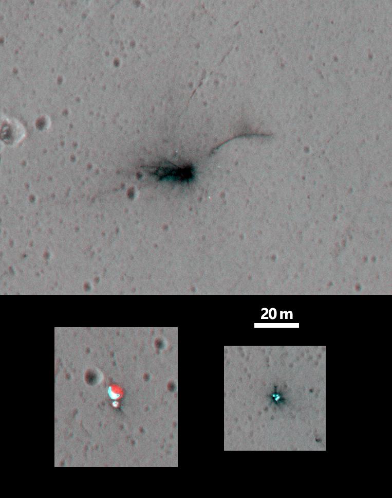
PIA17482:
New Impact Site
Full Resolution:
TIFF
(280.2 kB)
JPEG
(95.43 kB)
2014-05-22
Mars
Mars Reconnaissance Orbiter (MRO)
HiRISE
2880x1800x3
PIA18771:
At the Edge of a Polar Cap
Full Resolution:
TIFF
(15.56 MB)
JPEG
(796.4 kB)
2014-07-16
Mars
Mars Reconnaissance Orbiter (MRO)
HiRISE
2880x1800x3
PIA18625:
Ancient Lake Sediments in a Crater
Full Resolution:
TIFF
(15.56 MB)
JPEG
(768 kB)
2014-08-13
Mars
Mars Reconnaissance Orbiter (MRO)
HiRISE
2880x1800x3
PIA18646:
The Side of Chasma Boreale
Full Resolution:
TIFF
(15.56 MB)
JPEG
(1.215 MB)
2014-08-27
Mars
Mars Reconnaissance Orbiter (MRO)
HiRISE
2880x1800x3
PIA18773:
A Possible Landing Site in Aram Dorsum for the ExoMars Rover
Full Resolution:
TIFF
(15.56 MB)
JPEG
(608.6 kB)
2014-09-10
Mars
Mars Reconnaissance Orbiter (MRO)
HiRISE
2880x1800x3
PIA18805:
Mysterious Light-Toned Deposit in Vinogradov Crater
Full Resolution:
TIFF
(15.56 MB)
JPEG
(1.01 MB)
2014-09-10
Mars
Mars Reconnaissance Orbiter (MRO)
HiRISE
2880x1800x3
PIA18806:
Banded TARs in Iapygia
Full Resolution:
TIFF
(15.56 MB)
JPEG
(738.2 kB)
2014-10-29
Mars
Mars Reconnaissance Orbiter (MRO)
HiRISE
2880x1800x1
PIA18887:
Which Way is Up?
Full Resolution:
TIFF
(5.191 MB)
JPEG
(506.4 kB)
2015-03-04
Mars
Mars Reconnaissance Orbiter (MRO)
HiRISE
2880x1800x3
PIA19303:
A Possible Landing Site for the 2020 Mission: Jezero Crater
Full Resolution:
TIFF
(15.56 MB)
JPEG
(1.099 MB)
2015-03-25
Mars
Mars Reconnaissance Orbiter (MRO)
HiRISE
2880x1800x3
PIA19351:
At the Head of a Kasei Valles Cataract
Full Resolution:
TIFF
(15.56 MB)
JPEG
(1.409 MB)
2015-03-25
Mars
Mars Reconnaissance Orbiter (MRO)
HiRISE
2880x1800x3
PIA19352:
The Lowest Point of Osuga Valles
Full Resolution:
TIFF
(15.56 MB)
JPEG
(718.2 kB)
2015-03-25
Mars
Mars Reconnaissance Orbiter (MRO)
HiRISE
2880x1800x3
PIA19353:
Possible Fluvial Features in Golden Crater
Full Resolution:
TIFF
(15.56 MB)
JPEG
(715.3 kB)
2015-05-06
Mars
Mars Reconnaissance Orbiter (MRO)
HiRISE
840x333x1
PIA19459:
Darn Dust!
Full Resolution:
TIFF
(280.2 kB)
JPEG
(41.45 kB)
2015-05-20
Mars
Mars Reconnaissance Orbiter (MRO)
HiRISE
2880x1800x3
PIA18562:
Sedimentary Rock Layers on a Crater Floor
Full Resolution:
TIFF
(15.56 MB)
JPEG
(773.6 kB)
2015-05-20
Mars
Mars Reconnaissance Orbiter (MRO)
HiRISE
2880x1800x3
PIA18563:
Alluvial Fans in Mojave Crater
Full Resolution:
TIFF
(15.56 MB)
JPEG
(898.5 kB)
2015-06-03
Mars
Mars Reconnaissance Orbiter (MRO)
HiRISE
2880x1800x3
PIA11776:
A Mysterious Bright Streak on the South Polar Layered Deposits
Full Resolution:
TIFF
(15.56 MB)
JPEG
(1.307 MB)
2015-07-01
Mars
Mars Reconnaissance Orbiter (MRO)
HiRISE
2880x1800x3
PIA19850:
A Channel System and Patterned Ground near Hellas Basin
Full Resolution:
TIFF
(15.56 MB)
JPEG
(1.198 MB)
2015-09-16
Mars
Mars Reconnaissance Orbiter (MRO)
HiRISE
2880x1800x3
PIA19940:
Possible Sulfates in the Northeast Syrtis Major Region
Full Resolution:
TIFF
(15.56 MB)
JPEG
(881.1 kB)
2015-10-14
Mars
Mars Reconnaissance Orbiter (MRO)
HiRISE
2880x1800x3
PIA20004:
Kasei Valles
Full Resolution:
TIFF
(5.191 MB)
JPEG
(987.8 kB)
2015-10-14
Mars
Mars Reconnaissance Orbiter (MRO)
HiRISE
2880x1800x3
PIA20006:
Fine-Branched Ridges
Full Resolution:
TIFF
(15.56 MB)
JPEG
(1.099 MB)
2015-11-05
Mars
Mars Reconnaissance Orbiter (MRO)
HiRISE
2880x1800x3
PIA20046:
Small Channels and a Rocky Patch in the Cydonia Region
Full Resolution:
TIFF
(15.56 MB)
JPEG
(1.167 MB)
2015-11-05
Mars
Mars Reconnaissance Orbiter (MRO)
HiRISE
2880x1800x3
PIA20047:
Meanders in Ridge Form in the Zephyria Region
Full Resolution:
TIFF
(13.52 MB)
JPEG
(673.1 kB)
2015-11-27
Mars
Mars Reconnaissance Orbiter (MRO)
HiRISE
2880x1800x1
PIA20158:
A Youthful Crater in the Cydonia Colles Region
Full Resolution:
TIFF
(5.191 MB)
JPEG
(819.4 kB)
2015-11-27
Mars
Mars Reconnaissance Orbiter (MRO)
HiRISE
2880x1800x3
PIA20159:
A Landing Site for ExoMars 2016
Full Resolution:
TIFF
(15.56 MB)
JPEG
(1.932 MB)
2015-12-10
Mars
Mars Reconnaissance Orbiter (MRO)
HiRISE
2880x1800x3
PIA20210:
Inverted Streams in the Aeolis Region
Full Resolution:
TIFF
(15.56 MB)
JPEG
(902.3 kB)
2015-12-23
Mars
Mars Reconnaissance Orbiter (MRO)
HiRISE
2880x1800x1
PIA20290:
Boulders on a Landslide
Full Resolution:
TIFF
(5.191 MB)
JPEG
(1.134 MB)
2016-02-11
Mars
Mars Reconnaissance Orbiter (MRO)
HiRISE
2880x1800x3
PIA20462:
Rounded Mounds in Northern Arabia Terra
Full Resolution:
TIFF
(13.56 MB)
JPEG
(657.9 kB)
2016-02-11
Mars
Mars Reconnaissance Orbiter (MRO)
HiRISE
2880x1800x3
PIA20463:
A Possible Alluvial Fan
Full Resolution:
TIFF
(15.56 MB)
JPEG
(869 kB)
2016-03-23
Mars
Mars Reconnaissance Orbiter (MRO)
HiRISE
2880x1800x3
PIA20539:
Old Salt
Full Resolution:
TIFF
(15.56 MB)
JPEG
(803.7 kB)
2016-03-23
Mars
Mars Reconnaissance Orbiter (MRO)
HiRISE
2880x1800x3
PIA20541:
Colorful Polar Layered Deposits
Full Resolution:
TIFF
(15.56 MB)
JPEG
(1.428 MB)
2016-04-21
Mars
Mars Reconnaissance Orbiter (MRO)
HiRISE
2880x1800x3
PIA20644:
Many Fantastic Colors
Full Resolution:
TIFF
(15.56 MB)
JPEG
(978.6 kB)
2016-05-18
Mars
Mars Reconnaissance Orbiter (MRO)
HiRISE
2880x1800x3
PIA15881:
Frosted Dunes
Full Resolution:
TIFF
(15.56 MB)
JPEG
(950.9 kB)
2016-06-01
Mars
Mars Reconnaissance Orbiter (MRO)
HiRISE
2880x1800x3
PIA20728:
Beautiful Blocks of Bedrock
Full Resolution:
TIFF
(15.56 MB)
JPEG
(1.313 MB)
2016-06-01
Mars
Mars Reconnaissance Orbiter (MRO)
HiRISE
2880x1800x3
PIA20731:
Drag Folds in the North Polar Layered Deposits
Full Resolution:
TIFF
(15.56 MB)
JPEG
(1.33 MB)
2016-06-29
Mars
Mars Reconnaissance Orbiter (MRO)
HiRISE
2880x1800x3
PIA20735:
Martian Morse Code
Full Resolution:
TIFF
(15.56 MB)
JPEG
(1.195 MB)
2016-07-07
Mars
Mars Reconnaissance Orbiter (MRO)
HiRISE
1581x1283x1
PIA20757:
Numerous Seasonal 'Lineae' on Coprates Montes, Mars
Full Resolution:
TIFF
(1.915 MB)
JPEG
(217.1 kB)
2016-07-15
Mars
Mars Reconnaissance Orbiter (MRO)
HiRISE
2880x1800x3
PIA20813:
Faulting Mars
Full Resolution:
TIFF
(15.56 MB)
JPEG
(1.093 MB)
2016-09-08
Mars
Mars Reconnaissance Orbiter (MRO)
HiRISE
2880x1800x1
PIA21039:
A Streamlined Form in Lethe Vallis
Full Resolution:
TIFF
(5.191 MB)
JPEG
(1.19 MB)
2016-09-08
Mars
Mars Reconnaissance Orbiter (MRO)
HiRISE
2880x1800x3
PIA21040:
A Human Bird's Eye View of Mars
Full Resolution:
TIFF
(15.56 MB)
JPEG
(986.1 kB)
2016-09-21
Mars
Mars Reconnaissance Orbiter (MRO)
HiRISE
2880x1800x1
PIA21066:
Intersecting Channels near Olympica Fossae
Full Resolution:
TIFF
(5.087 MB)
JPEG
(853.2 kB)
2016-10-05
Mars
Mars Reconnaissance Orbiter (MRO)
HiRISE
2880x1800x1
PIA21104:
A Long and Winding Channel in Tharsis
Full Resolution:
TIFF
(5.191 MB)
JPEG
(944.1 kB)
2016-11-15
Mars
Mars Reconnaissance Orbiter (MRO)
HiRISE
763x968x3
PIA21135:
Schiaparelli Impact Site on Mars, Stereo
Full Resolution:
TIFF
(1.385 MB)
JPEG
(70.24 kB)
2016-11-22
Mars
Mars Reconnaissance Orbiter (MRO)
HiRISE
640x398x1
PIA21136:
Scalloped Terrain Led to Finding of Buried Ice on Mars
Full Resolution:
TIFF
(255.2 kB)
JPEG
(57.89 kB)
2016-12-07
Mars
Mars Reconnaissance Orbiter (MRO)
HiRISE
2880x1800x3
PIA21216:
The Coolest Landscape on Mars (or Earth)
Full Resolution:
TIFF
(10.51 MB)
JPEG
(375.8 kB)
2017-01-02
Mars
Mars Reconnaissance Orbiter (MRO)
HiRISE
2880x1800x3
PIA14454:
Hues in a Crater Slope
Full Resolution:
TIFF
(15.56 MB)
JPEG
(743.1 kB)
2017-01-03
Mars
Mars Reconnaissance Orbiter (MRO)
HiRISE
2880x1800x3
PIA14455:
Light-Toned Layering in a Labyrinthus Noctis Pit
Full Resolution:
TIFF
(15.56 MB)
JPEG
(1.026 MB)
2017-01-05
Mars
Mars Reconnaissance Orbiter (MRO)
HiRISE
2880x1800x3
PIA15149:
Raised Bedrock in Terra Cimmeria
Full Resolution:
TIFF
(15.56 MB)
JPEG
(734 kB)
2017-01-09
Mars
Mars Reconnaissance Orbiter (MRO)
HiRISE
2880x1800x3
PIA13485:
Eroded Scallops with Layers
Full Resolution:
TIFF
(15.56 MB)
JPEG
(1.153 MB)
2017-01-10
Mars
Mars Reconnaissance Orbiter (MRO)
HiRISE
2880x1800x1
PIA13181:
Muddy Ejecta Flow
Full Resolution:
TIFF
(5.191 MB)
JPEG
(1.387 MB)
2017-01-18
Mars
Mars Reconnaissance Orbiter (MRO)
HiRISE
4500x3000x3
PIA12291:
Bedrock Exhumed from the Deep
Full Resolution:
TIFF
(38.2 MB)
JPEG
(2.161 MB)
2017-01-19
Mars
Mars Reconnaissance Orbiter (MRO)
HiRISE
4500x3000x3
PIA12289:
The Changing Dunes of Wirtz Crater
Full Resolution:
TIFF
(40.52 MB)
JPEG
(2.437 MB)
2017-01-20
Mars
Mars Reconnaissance Orbiter (MRO)
HiRISE
4500x3000x3
PIA12178:
The Beauty of Layered Stratigraphy
Full Resolution:
TIFF
(40.52 MB)
JPEG
(2.705 MB)
2017-02-10
Mars
Mars Reconnaissance Orbiter (MRO)
HiRISE
2880x1800x1
PIA21454:
A Dragonfly-Shaped Crater
Full Resolution:
TIFF
(4.23 MB)
JPEG
(565.9 kB)
2017-02-13
Mars
Mars Reconnaissance Orbiter (MRO)
HiRISE
2880x1800x3
PIA21455:
Better Preserved on Mars than on Earth
Full Resolution:
TIFF
(15.56 MB)
JPEG
(770.8 kB)
2017-02-16
Mars
Mars Reconnaissance Orbiter (MRO)
HiRISE
2880x1800x3
PIA21458:
Scars of Erosion
Full Resolution:
TIFF
(12.9 MB)
JPEG
(489.1 kB)
2017-02-23
Mars
Mars Reconnaissance Orbiter (MRO)
HiRISE
2880x1800x3
PIA21463:
Layers and Dark Dunes
Full Resolution:
TIFF
(15.56 MB)
JPEG
(931.6 kB)
2017-02-27
Mars
Mars Reconnaissance Orbiter (MRO)
HiRISE
2880x1800x3
PIA21464:
Polar Pits: Are They Active?
Full Resolution:
TIFF
(15.56 MB)
JPEG
(1.068 MB)
2017-03-01
Mars
Mars Reconnaissance Orbiter (MRO)
HiRISE
4016x3543x3
PIA21551:
Martian Meanders and Scroll-Bars
Full Resolution:
TIFF
(42.7 MB)
JPEG
(2.967 MB)
2017-03-06
Mars
Mars Reconnaissance Orbiter (MRO)
HiRISE
2880x1800x3
PIA21554:
A Mass of Viscous Flow Features
Full Resolution:
TIFF
(15.56 MB)
JPEG
(924.8 kB)
2017-03-07
Mars
Mars Reconnaissance Orbiter (MRO)
HiRISE
2880x1800x3
PIA21555:
The Entrance to Mawrth Vallis
Full Resolution:
TIFF
(15.56 MB)
JPEG
(597.1 kB)
2017-03-13
Mars
Mars Reconnaissance Orbiter (MRO)
HiRISE
2880x1800x3
PIA21559:
Bedrock Outcrops in Kaiser Crater
Full Resolution:
TIFF
(15.56 MB)
JPEG
(1.028 MB)
2017-03-16
Mars
Mars Reconnaissance Orbiter (MRO)
HiRISE
2880x1800x3
PIA21563:
Layered Deposits in Uzboi Vallis
Full Resolution:
TIFF
(15.56 MB)
JPEG
(662.6 kB)
2017-03-27
Mars
Mars Reconnaissance Orbiter (MRO)
HiRISE
2880x1800x3
PIA21572:
The Splitting of the Dunes
Full Resolution:
TIFF
(15.56 MB)
JPEG
(902 kB)
2017-03-29
Mars
Mars Reconnaissance Orbiter (MRO)
HiRISE
1650x1275x3
PIA21489:
Advance Inspection of NASA's Next Mars Landing Site
Full Resolution:
TIFF
(2.287 MB)
JPEG
(273.9 kB)
2017-03-30
Mars
Mars Reconnaissance Orbiter (MRO)
HiRISE
2880x1800x3
PIA21574:
Distinctive Brightness
Full Resolution:
TIFF
(13.99 MB)
JPEG
(694.8 kB)
2017-03-31
Mars
Mars Reconnaissance Orbiter (MRO)
HiRISE
2880x1800x3
PIA21575:
Layers in Galle Crater
Full Resolution:
TIFF
(15.56 MB)
JPEG
(1.236 MB)
2017-04-04
Mars
Mars Reconnaissance Orbiter (MRO)
HiRISE
2880x1800x3
PIA21577:
A Sneak Peek into Saheki's Secret Layers
Full Resolution:
TIFF
(15.56 MB)
JPEG
(1.07 MB)
2017-04-10
Mars
Mars Reconnaissance Orbiter (MRO)
HiRISE
2880x1800x3
PIA21580:
Clinoforms in Melas Chasma
Full Resolution:
TIFF
(15.56 MB)
JPEG
(1.148 MB)
2017-04-17
Mars
Mars Reconnaissance Orbiter (MRO)
HiRISE
2048x1256x1
PIA21591:
Secondary Craters in Bas Relief
Full Resolution:
TIFF
(2.575 MB)
JPEG
(570.4 kB)
2017-04-26
Mars
Mars Reconnaissance Orbiter (MRO)
HiRISE
2880x1800x3
PIA21601:
A Volcanic Fissure
Full Resolution:
TIFF
(12.62 MB)
JPEG
(494.3 kB)
2017-04-27
Mars
Mars Reconnaissance Orbiter (MRO)
HiRISE
3543x2024x3
PIA21602:
Gullies with Color Anomalies
Full Resolution:
TIFF
(21.52 MB)
JPEG
(1.557 MB)
2017-05-08
Mars
Mars Reconnaissance Orbiter (MRO)
HiRISE
2880x1800x3
PIA21609:
Colorful Impact Ejecta from Hargraves Crater
Full Resolution:
TIFF
(15.56 MB)
JPEG
(918.7 kB)
2017-05-12
Mars
Mars Reconnaissance Orbiter (MRO)
HiRISE
2880x1800x3
PIA21633:
Landslide!
Full Resolution:
TIFF
(15.56 MB)
JPEG
(1.122 MB)
2017-05-22
Mars
Mars Reconnaissance Orbiter (MRO)
HiRISE
2699x2024x3
PIA21637:
Erosion of the Edge of the South Polar Layered Deposits
Full Resolution:
TIFF
(16.39 MB)
JPEG
(985.1 kB)
2017-05-23
Mars
Mars Reconnaissance Orbiter (MRO)
HiRISE
2880x1800x3
PIA21639:
Erosion of the Edge of the South Polar Layered Deposits
Full Resolution:
TIFF
(15.56 MB)
JPEG
(705.3 kB)
2017-05-24
Mars
Mars Reconnaissance Orbiter (MRO)
HiRISE
2880x1800x3
PIA21640:
An Oblique View of Uplifted Rocks
Full Resolution:
TIFF
(15.56 MB)
JPEG
(820.7 kB)
2017-05-25
Mars
Mars Reconnaissance Orbiter (MRO)
HiRISE
2880x1800x3
PIA21648:
Flow on the Rim of Tooting Crater
Full Resolution:
TIFF
(15.36 MB)
JPEG
(815.9 kB)
2017-05-30
Mars
Mars Reconnaissance Orbiter (MRO)
HiRISE
2880x1800x3
PIA21636:
A South Polar Pit or an Impact Crater?
Full Resolution:
TIFF
(12.79 MB)
JPEG
(515.3 kB)
1-100
101-200
Currently displaying images:
1 - 100
of 179


