PDS logoPlanetary Data System
PDS Information
Find a Node - Use these links to navigate to any of the 8 publicly accessible PDS Nodes.

This bar indicates that you are within the PDS enterprise which includes 6 science discipline nodes and 2 support nodes which are overseen by the Project Management Office at NASA's Goddard Space Flight Center (GSFC). Each node is led by an expert in the subject discipline, supported by an advisory group of other practitioners of that discipline, and subject to selection and approval under a regular NASA Research Announcement.
Click here to return to the Photojournal Home Page Click here to view a list of Photojournal Image Galleries Photojournal_inner_header
Latest Images  |  Spacecraft & Technology  |  Animations  |  Space Images App  |  Feedback  |  Photojournal Search  
Your search criteria found 4 images
Feature Name
Go to PIAxxxxx:
Click on an image for detailed information
Click on a column heading to sort in ascending or descending order
My
List
Addition DateSort Ascending Target Mission Instrument Size
Add Image to Favorite List 2022-07-22 Mars Mars Reconnaissance Orbiter (MRO)
HiRISE
2880x1800x3
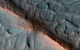
This image acquired on March 28, 2022 by NASA's Mars Reconnaissance Orbiter shows a ridge standing prominently in this scene, left behind as the surroundings were eroded, perhaps marking inverted erosion of an ancient fluvial channel.
PIA25448:
Ridges in Cydonia Mensae
Full Resolution:     TIFF (15.56 MB)     JPEG (890 kB)
Add Image to Favorite List 2015-11-27 Mars Mars Reconnaissance Orbiter (MRO)
HiRISE
2880x1800x1
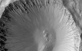
The central portion of this image is dominated by a sharp-rimmed crater that is roughly 5 kilometers in diameter. On its slopes, gullies show young (geologically recent) headward erosion, which is the lengthening of the gully in the upslope direction.
PIA20158:
A Youthful Crater in the Cydonia Colles Region
Full Resolution:     TIFF (5.191 MB)     JPEG (819.4 kB)
Add Image to Favorite List 2015-11-05 Mars Mars Reconnaissance Orbiter (MRO)
HiRISE
2880x1800x3
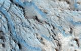
The southern section of Cydonia Region is dominated by both a series of craters and the remnants of channels that may be from a past fluvial system as seen by NASA's Mars Reconnaissance Orbiter spacecraft.
PIA20046:
Small Channels and a Rocky Patch in the Cydonia Region
Full Resolution:     TIFF (15.56 MB)     JPEG (1.167 MB)
Add Image to Favorite List 2007-04-11 Mars Mars Reconnaissance Orbiter (MRO)
HiRISE
2048x1532x1
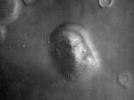
Popular Landform in Cydonia Region
PIA09654:
Popular Landform in Cydonia Region
Full Resolution:     TIFF (3.141 MB)     JPEG (386.7 kB)
Currently displaying images: 1 - 4 of 4