PDS logoPlanetary Data System
PDS Information
Find a Node - Use these links to navigate to any of the 8 publicly accessible PDS Nodes.

This bar indicates that you are within the PDS enterprise which includes 6 science discipline nodes and 2 support nodes which are overseen by the Project Management Office at NASA's Goddard Space Flight Center (GSFC). Each node is led by an expert in the subject discipline, supported by an advisory group of other practitioners of that discipline, and subject to selection and approval under a regular NASA Research Announcement.
Click here to return to the Photojournal Home Page Click here to view a list of Photojournal Image Galleries Photojournal_inner_header
Latest Images  |  Spacecraft & Technology  |  Animations  |  Space Images App  |  Feedback  |  Photojournal Search  
Your search criteria found 4 images
Feature Name
Go to PIAxxxxx:
Refine this list of images by:
Mission:
Spacecraft:
Click on an image for detailed information
Click on a column heading to sort in ascending or descending order
My
List
Addition DateSort Ascending Target Mission Instrument Size
Add Image to Favorite List 2024-08-08 NEOWISE
2784x2784x3
This final image captured by NASA's NEOWISE shows part of the Fornax constellation in the Southern Hemisphere. It was taken by the spacecraft just before midnight Pacific Time on July 31, 2024, when the mission's survey ended.
PIA26385:
NASA's NEOWISE Captures Final Image Moments Before End of Mission
Full Resolution:     TIFF (17.92 MB)     JPEG (782.4 kB)
Add Image to Favorite List 2013-08-21 Wide-field Infrared Survey Explorer (WISE)
5334x3000x3
This artist's concept shows the NASA's WISE spacecraft, in its orbit around Earth. In September of 2013, engineers will attempt to bring the mission out of hibernation to hunt for more asteroids and comets in a project called NEOWISE.
PIA17254:
NEOWISE: Back to Hunt More Asteroids (Artist Concept)
Full Resolution:     TIFF (48.03 MB)     JPEG (1.66 MB)
Add Image to Favorite List 2012-03-14 Wide-field Infrared Survey Explorer (WISE)
WISE Telescope
10000x5000x3
This mosaic of images covering the entire sky was observed by NASA's WISE telescope and is part of its All-Sky Data Release. The projection used in this image of the sky is called an 'equirectangular.'
PIA15482:
Mapping the Infrared Universe: The Entire WISE Sky -- Rectangular Format
Full Resolution:     TIFF (150 MB)     JPEG (7.365 MB)
Add Image to Favorite List 2012-03-14 Wide-field Infrared Survey Explorer (WISE)
WISE Telescope
10000x5030x3
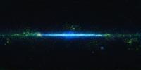
This is a mosaic of the images covering the entire sky as observed by NASA's Wide-field Infrared Survey Explorer (WISE), part of its All-Sky Data Release. In this mosaic, the Milky Way Galaxy runs horizontally across the map.
PIA15481:
Mapping the Infrared Universe: The Entire WISE Sky
Full Resolution:     TIFF (150.9 MB)     JPEG (6.828 MB)
Currently displaying images: 1 - 4 of 4