PDS logoPlanetary Data System
PDS Information
Find a Node - Use these links to navigate to any of the 8 publicly accessible PDS Nodes.

This bar indicates that you are within the PDS enterprise which includes 6 science discipline nodes and 2 support nodes which are overseen by the Project Management Office at NASA's Goddard Space Flight Center (GSFC). Each node is led by an expert in the subject discipline, supported by an advisory group of other practitioners of that discipline, and subject to selection and approval under a regular NASA Research Announcement.
Click here to return to the Photojournal Home Page Click here to view a list of Photojournal Image Galleries Photojournal_inner_header
Latest Images  |  Spacecraft & Technology  |  Animations  |  Space Images App  |  Feedback  |  Photojournal Search  
My Favorite Images from the Planetary Photojoural
I have 6 images in my list


The first time you select an image to My List, a separate browser window will open. This page will list the set of images you have selected as favorites from the Photojournal. This list is kept for a short period of time, approximately 60 days. The way we associate you with your list is through a persistent cookie left on your computer. This cookie is nothing more than a unique key that allows the Photojournal to make this association. Once created, this list is only modifiable from the same computer. Information stored in the cookie on your computer is used by the Photojournal server only during your session. If you configure your Web browser not to use cookies, you will not be able to create and refer back to a personal list of favorite images. To view your current list, click on a marked entry for your list from the catalog page, or add another favorite. For more information, see JPL's Privacy Policy.
My
List
Catalog # Target Mission Instrument Addition Date Size
Remove Image from Favorite List PIA20839 Mars 2001 Mars Odyssey
Mars Global Surveyor (MGS)
MOLA
THEMIS
2016-09-15 1726x2453x3
This map of an area within the Arabia Terra region on Mars shows where hydrologic modeling predicts locations of depressions that would have been lakes (black), overlaid with a map of the preserved valleys (blue lines) that would have been streams.
Title:
Hydrologic Modeling of Relatively Recent Martian Streams and Lake
Remove Image from Favorite List PIA12859 Mars Mars Reconnaissance Orbiter (MRO)
HiRISE
2010-03-04 630x512x3
Two pairs of side-by-side, before and after images from NASA's Mars Reconnaissance Orbiter illustrate changes in the shape of edges of dark sand dunes in the Nili Patera region of Mars.
Title:
Changes at Edges of Dark Dunes in Nili Patera, Mars
Remove Image from Favorite List PIA00967 Mars Mars Pathfinder (MPF)
Imager for Mars Pathfinder
1997-10-14 256x248x3
This color image shows NASA's Mars Pathfinder (MPF) Sojourner rover's Alpha Proton X-ray Spectrometer (APXS) deployed against the rock 'Moe' on the morning of Sol 65. This image was taken by NASA's Mars Pathfinder (MPF).
Title:
Sojourner at "Moe" - Color
Remove Image from Favorite List PIA04893 Mars Science Laboratory (MSL)
2003-12-01 5200x3300x3
Sunset on Mars catches NASA's Mars Science Laboratory in the foreground in this artist's concept. The mission is under development for launch in 2009 and a precision landing on Mars in 2010.
Title:
Mars Science Laboratory at Sunset (Artist's Concept)
Remove Image from Favorite List PIA05657 Mars Mars Exploration Rover (MER)
Hazcam
2004-03-30 1014x1014x1
NASA's Mars Exploration Rover Opportunity focuses on the rock dubbed 'Bounce,' which the rover's airbag-wrapped lander hit upon landing in Meridiani Planum, Mars in 2004.
Title:
Visiting the Scene of Landing
Remove Image from Favorite List PIA24810 Mars Mars Helicopter
2021-09-17 4208x3120x3
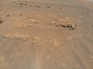
This image of an area the Mars Perseverance rover team calls Faillefeu was captured by NASA's Ingenuity Mars Helicopter during its 13th flight at Mars on September 4, 2021.
Title:
Mars Mound from Ingenuity Helicopter's Perspective