PDS logoPlanetary Data System
PDS Information
Find a Node - Use these links to navigate to any of the 8 publicly accessible PDS Nodes.

This bar indicates that you are within the PDS enterprise which includes 6 science discipline nodes and 2 support nodes which are overseen by the Project Management Office at NASA's Goddard Space Flight Center (GSFC). Each node is led by an expert in the subject discipline, supported by an advisory group of other practitioners of that discipline, and subject to selection and approval under a regular NASA Research Announcement.
Click here to return to the Photojournal Home Page Click here to view a list of Photojournal Image Galleries Photojournal_inner_header
Latest Images  |  Spacecraft & Technology  |  Animations  |  Space Images App  |  Feedback  |  Photojournal Search  
My Favorite Images from the Planetary Photojoural
I have 6 images in my list


The first time you select an image to My List, a separate browser window will open. This page will list the set of images you have selected as favorites from the Photojournal. This list is kept for a short period of time, approximately 60 days. The way we associate you with your list is through a persistent cookie left on your computer. This cookie is nothing more than a unique key that allows the Photojournal to make this association. Once created, this list is only modifiable from the same computer. Information stored in the cookie on your computer is used by the Photojournal server only during your session. If you configure your Web browser not to use cookies, you will not be able to create and refer back to a personal list of favorite images. To view your current list, click on a marked entry for your list from the catalog page, or add another favorite. For more information, see JPL's Privacy Policy.
My
List
Catalog # Target Mission Instrument Addition Date Size
Remove Image from Favorite List PIA02578 Ganymede Galileo
Solid-State Imaging
2000-12-16 1228x512x3
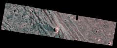
The boundary between the bright terrain of Harpagia Sulcus and dark terrain of Nicholson Regio areas of Jupiter's moon Ganymede springs out when viewed through red/blue 3-D glasses, in this image taken by NASA's Galileo spacecraft as it flew by Ganymede.
Title:
Bright-Dark Terrain Boundary in stereo
Remove Image from Favorite List PIA23639 Mars 2001 Mars Odyssey
THEMIS
2020-01-16 597x2698x1
This image from NASA's Mars Odyssey shows a large volcanic crater, known as a caldera, located at the summit of all of the Tharsis volcanoes.
Title:
Arsia Mons Summit
Remove Image from Favorite List PIA20173 Mars Mars Reconnaissance Orbiter (MRO)
Mars Science Laboratory (MSL)
HiRISE
2015-12-17 3300x2550x3
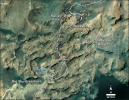
This map shows the route on lower Mount Sharp that NASA's Curiosity followed between April 19, 2015, and Nov. 5, 2015.
Title:
Curiosity's Path During 2015 Studies of Silica-Rich Rocks
Remove Image from Favorite List PIA08425 Titan Cassini-Huygens
Radar Mapper
2006-05-03 2070x1244x1
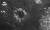
This image of Saturn's moon Titan from the Synthetic Aperture Radar instrument on NASA's Cassini spacecraft shows the southwestern area of a feature called Xanadu (bottom right of the image).
Title:
Radar Images the Margin of Xanadu
Remove Image from Favorite List PIA00920 Mars Mars Pathfinder (MPF)
Imager for Mars Pathfinder
1997-08-28 248x240x3
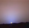
This is a close-up of the sunset on Sol 24 as seen by NASA's Imager for Mars Pathfinder (IMP). The red sky in the background and the blue around the Sun are approximately as they would appear to the human eye. Sol 1 began on July 4, 1997.
Title:
Close-Up of Sol 24 Sunset
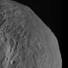
Remove Image from Favorite List PIA14791 Vesta Dawn
Framing Camera
2011-09-28 1024x1024x1
NASA's Dawn spacecraft obtained this image of asteroid Vesta with its framing camera on Aug. 26, 2011 at a distance of 1,700 miles (2,740 kilometers). The image has a resolution of about 260 meters per pixel.
Title:
Mountains Rising Over Vesta's Equatorial Region