PDS logoPlanetary Data System
PDS Information
Find a Node - Use these links to navigate to any of the 8 publicly accessible PDS Nodes.

This bar indicates that you are within the PDS enterprise which includes 6 science discipline nodes and 2 support nodes which are overseen by the Project Management Office at NASA's Goddard Space Flight Center (GSFC). Each node is led by an expert in the subject discipline, supported by an advisory group of other practitioners of that discipline, and subject to selection and approval under a regular NASA Research Announcement.
Click here to return to the Photojournal Home Page Click here to view a list of Photojournal Image Galleries Photojournal_inner_header
Latest Images  |  Spacecraft & Technology  |  Animations  |  Space Images App  |  Feedback  |  Photojournal Search  

PIA24863: Intersecting Fractures
 Target Name:  Mars
 Is a satellite of:  Sol (our sun)
 Mission:  Mars Reconnaissance Orbiter (MRO)
 Spacecraft:  Mars Reconnaissance Orbiter (MRO)
 Instrument:  HiRISE
 Product Size:  2880 x 1800 pixels (w x h)
 Produced By:  University of Arizona/HiRISE-LPL
 Other  
Information: 
Other products from ESP_069621_1975
 Full-Res TIFF:  PIA24863.tif (4.948 MB)
 Full-Res JPEG:  PIA24863.jpg (901.4 kB)

Click on the image above to download a moderately sized image in JPEG format (possibly reduced in size from original)

Original Caption Released with Image:

Click here for larger image of PIA24863
Map Projected Browse Image
Click on image for larger version

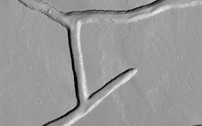
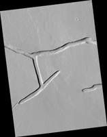
These intersecting troughs, or fractures, cut across geologically young volcanic terrain in the Tharsis volcanic province. In many locations near where this image was taken, material has erupted from similar features.

However, it does not appear that material erupted from these particular fractures. Instead, they appear to crosscut material that flowed across the surface, indicating that the fractures are younger than the flows. The widths of the troughs at their rims are about 200 to 250 meters across.

This image is an example of how the surface can provide information about the processes happening in Mars' interior.

The map is projected here at a scale of 25 centimeters (9.8 inches) per pixel. (The original image scale is 27.6 centimeters [10.7 inches] per pixel [with 1 x 1 binning]; objects on the order of 83 centimeters [32.7 inches] across are resolved.) North is up.

The University of Arizona, in Tucson, operates HiRISE, which was built by Ball Aerospace & Technologies Corp., in Boulder, Colorado. NASA's Jet Propulsion Laboratory, a division of Caltech in Pasadena, California, manages the Mars Reconnaissance Orbiter Project for NASA's Science Mission Directorate, Washington.

Image Credit:
NASA/JPL-Caltech/University of Arizona

Image Addition Date:
2021-08-20